ON THE EVOLUTION OF A HOLOCENE BARRIER COAST
|
|
|
- Penelope Bradford
- 6 years ago
- Views:
Transcription


1 ON THE EVOLUTION OF A HOLOCENE BARRIER COAST Response to sea-level change and sediment supply DANCORE Seminar 2014 COADAPT - Danish Coasts and Climate Adaptation Flooding Risk and Coastal Protection Mikkel Fruergaard Department of Geosciences and Natural Ressource Management Copenhagen, December 3th 2014
2 Presentation outline Acknowledgement Introduction The study area Research methodology and approach Long-term barrier system evolution in respons to sea-level and sediment supply changes Barrier system respond to an extreme storm event Conclusions
")

3 Acknowledgement Primary financing and partners: Danish Council for Strategic Research (COADAPT) DHI Danish Coastal Authority Department of Geosciences and Natural Resource Management Geocenter Denmark (REFLEKS) Department of Geosciences and Natural Resource Management, University of Copenhagen GEUS - The Geological Survey of Denmark and Greenland Department of Geosciences and Natural Resources Management, University of Copenhagen


 (1992) Tidal inlets/channels Tidal deltaes SE Australian")
 Barrier platform Schiermonnikoog, The Netherlands")

4 Department of Geosciences and Natural Resources Management Barrier systems definition, morphology and distribution Barrier island definition Wadden Sea coast Elongated Essential shore-parallel Separated from the mainland Consist mostly of unconsolidated sediments Protects the adjacent mainland coast US Atlantic and Gulf coasts Main sedimentary environments Mainland Lea-Hutaff Island, North Carolina Back-barrier basin Barrier island After Reinson (1992) in Walker and James (ed.) (1992) Tidal inlets/channels Tidal deltaes SE Australian coast McBride et al. (2013) Barrier platform Schiermonnikoog, The Netherlands Mainly found along trailing edge coasts Shoreface Comprises about 13% of the world s coastlines Bird Key, St. Armands Key, Lido Key and Longboat Key, Florida Important components of stratigraphic record of the Earth
5 Barrier system evolution Large-scale morphology Sediment supply Sea-level rise Storms Modified from Masselink and Hughes (2003)


6 Relevance Church et al. (2013) (IPCC) Blue: RCP2.6 Red: RCP8.5 Increasing sea-level rise and accelerating rise One way to predict how barrier systems develops during a rising sealevel is to reconstruct how barrier systems have developed under similar conditions Dias 6
 Dias")
7 Post-glacial sea-level rise Last Glacial Maximum Modified after Streif (2004) Dias 7

")
8 Introduction to the study area Modified after Hofstede (2005)

9 Introduction to the study area Skallingen- Langli Fanø Mandø Rømø Sylt Large-scale morphology Convex-concave-convex form Sedimentary environments Barrier islands and high-lying sand flats Back-barrier basins Tidal inlets and deltaes Salt marshes


10 Introduction to the study area Tide and wave parameters Mean tidal range: ~1.5 2 m Predominant winds from west and south-west Mean offshore wave height: ~1 m Storm surges +2 m to the astronomical high tide Modified after Davis and Hayes (1984) and Hofstede (2005)


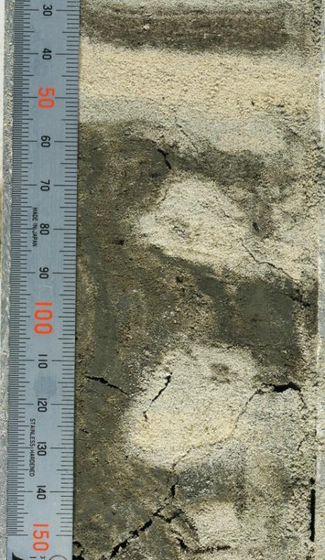


11 Research methodology Coring (core well drilling, vibracoring, hand bore drilling) Core logging and intrepretation of depositional environments Ground-penetrating radar (GPR) imaging Optically stimulated luminescence (OSL) and radiocarbon datings Age-dept / sediment sea-level (SSL) diagram Coring and GPR Depositional environment Absolute chronology SSL diagram Dias 11
12 Skallingen-Langli Skallingen- Langli Main objectives Reconstruct the stratigraphic and chronological evolution of the Skallingen-Langli barrier system Evaluate accumulation rates within sedimentary environments of the BS Determine how depositional environments within the CBS have responded to changes in RSL
13 Study site 5 cores (10-22 m) 3 GEUS cores 92 OSL-ages 4 C-14 ages


14 Stratigraphy of Skallingen Marine sand shoal Wave ravinement surface ~4.7 ka Transgressive surface ~7.5 ka Flood tidal-delta sand and mud Back-barrier flooding surface ~3.4 ka Pleistocene sand

15 Chronology Transgression of seaward Rapid part infilling of barrier of system back-barrier Back-barrier ~4.7 basin ka ~5.5 ka Initial marine deposition flooding begins in the study ~6.6 area ka ~7.5 ka Sea-level rise > ~1.8 mm yr -1 = transgression Sea-level rise < ~1.8 mm yr -1 = regression and aggradation


16 Holocene evolution Pleistocene deposits ~8.4 kyr ago Freshwater/brackish reed swamp Marine flooding 7.5 ka Embryonic barrier island? Back-barrier basin ~6.6 kyr ago ~5.5 kyr ago Flood tidal-delta Formation of WRS ~4.7 ka End of transgressive stage Beginning of highstand stage ~4.5 kyr ago Sea Beach ridge sand


17 Holocene evolution Aeolian dunes Salt marsh Mudflat ~2.5 kyr ago ~1.4 kyr ago ka mainly stable period ~0.4 kyr ago ~0.3 kyr ago The 1634 AD storm

18 Holocene evolution ~0.2 kyr ago ~0.2 kyr ago Present Supporting data from: Jacobsen, 1937 Aagaard et al., 1995 Clemmensen et al., 1996 Davis et al., 1997 Davis et al., 2001 Madsen, 2005 Gehrels et al., 2006 Aagaard et al., 2007 Madsen et al., 2007b Szkornik et al., 2008 Bartholdy, 2012 Fruergaard et al., 2013
19 Fanø Main objectives Reconstruct the Holocene depositional history of the central part of the Fanø CBS Assess the response of Fanø to different rates of Holocene sea-level rise
 ~14 km GPR sections 53 OSL-ages Dias 20")
20 Study site Different study site but similar Holocene sea-level history Differences in depositional evolution may be explained by differences in sediment supply 4 cores (12-25 m) ~14 km GPR sections 53 OSL-ages Dias 20

21 Chronology Age range of Second period Initial marine Back-barrier marine transgression of regression flooding in the deposition study area begins 0.52 kyr ago ~7.0 ~6.2 kyr ago progradation kyr ago begins 4.9 kyr ago Sea-level rise Shoreface > ~1.8 and mm Between beach yr -1 = transgression kyr ago Sea-level rise < ~1.7 mm yr -1 = regression
22 Rømø Department of Geosciences and Natural Resources Management

23 The development of a barrier coast Transgressive - regressive Transgressive - Regressive Aggradational Aggradational-regressive Transgressive?

24 Storm induced coastal response Large-scale morphology Sediment supply Sea-level rise Storms Modified from Masselink and Hughes (2003)


25 Department of Geosciences and Natural Ressource Management The 1634 AD storm The 1634 AD storm The Second Grote Mandrenke people drowned Highest recorded sea-level in Denmark ~6.10 m Classifies at least as a 1000-year event

26 The 1634 AD storm ~6.0
27 Study site Department of Geosciences and Natural Resources Management


28 Department of Geosciences and Natural Ressource Management Core stratigraphy Position of core S5


29 Barrier island formation Storm related vertical deposition 7 8 m. O = overestimated ages Barrier island formation The 1634 AD storm


30 Historic validation 1612 map Open water condition at the present position of Skallingen Only very northern part of Skallingen is on the map Langli forms a barrier spit Willem Janszoon Blaeu 1650 map High-lying sand shoal at the present location of Skallingen - Schallingsand Langli is represented as an island New exposed coastline Barrier breach Johannes Mejer


31 Department of Geosciences and Natural Ressource Management Sediment source NW Inner Horns Reef SW Aagaard (2011) estimated Ulven to be 300 years old
32 Conclusions Long-term barrier coast development Same sea-level forcing different coastal respond The reason is differences in sediment supply This is mainly controlled by the largescale morphology of the coast At Skallingen-Langli and Fanø transgression occurred until sea-level rise became lower than 2 mm yr -1 Short-term barrier island formation A single extreme storm can induce large scale regional morphological changes Control both short-term (<10 yr) and long-term (>100 yr) coastal evolution The effect of the sea-level rise has been insignificant compared to the effect of the storm
33 Thank you for your attention
2.2.7 Backbarrier flats
 FIGURE 24. VERTICAL PHOTOGRAPH SHOWING THE DEVELOPMENT OF SMALL PARABOLIC DUNES FROM BLOWOUTS IN A LARGE RELICT FOREDUNE NORTHWEST OF HUNTER'S CREEK. PHOTOGRAPH COURTESY OF CAR'T'ER HOLT HARVEY FORESTS
The Coast: Beaches and Shoreline Processes
 1 2 3 4 5 6 7 8 9 The Coast: es and Shoreline Processes Trujillo & Thurman, Chapter 10 Oceanography 101 Chapter Objectives Recognize the various landforms characteristic of beaches and coastal regions.
The Coast: Beaches and Shoreline Processes Trujillo & Thurman, Chapter 10
 The Coast: es and Shoreline Processes Trujillo & Thurman, Chapter 10 Oceanography 101 Chapter Objectives Recognize the various landforms characteristic of beaches and coastal regions. Identify seasonal
Facies Reconstruction of a Late Pleistocene Cypress Forest Discovered on the Northern Gulf of Mexico Continental Shelf
 Facies Reconstruction of a Late Pleistocene Cypress Forest Discovered on the Northern Gulf of Mexico Continental Shelf Suyapa Gonzalez 1, Samuel J. Bentley, Sr. 1, Kristine L. DeLong 3, Kehui Xu 2, Jeffrey
Geol 117 Lecture 18 Beaches & Coastlines. I. Types of Coastlines A. Definition:
 I. Types of Coastlines A. Definition: 1. Shore = narrow zone where ocean meets land (e.g. beach) 2. Coast is a broad area where both ocean and land processes act a. Includes onshore marshes, dunes, sea
1 Shoreline Landforms 2. 2 Emergent v. Submergent 2. 3 Wavecutting 3. 4 Planview 4. 5 Marine Terraces 5. 6 California 7. 7 Tombolos, Sea Stacks 8
 Shorelines November 9, 2008 Contents 1 Shoreline Landforms 2 2 Emergent v. Submergent 2 3 Wavecutting 3 4 Planview 4 5 Marine Terraces 5 6 California 7 7 Tombolos, Sea Stacks 8 8 Active Processes 9 9 Emergence
CHAPTER 1 INTRODUCTION
 1 CHAPTER 1 INTRODUCTION 1.1 GENERAL Washover sandsheets are often found in low-lying coastal embayment s (Sedgwick and Davis 2003). Washover deposition of marine sand is usually attributed to storm activity
DANCORE-Day. Master s Thesis
 DANCORE-Day Master s Thesis Interpretation of Shallow Seismic and Sediment Cores from the Area stretching from the Southern Part of Kattegat to the Great Belt in the Period Late-Weichselian to Early Holocene.
The Systems Approach. Alun Williams, ABPmer
 The Systems Approach Alun Williams, ABPmer Overview What is A Systems Approach? Behavioural / Qualitative Modelling? System Definition / Mapping (Behavioural Statements Objective) What is a Systems Approach?
Regional-scale understanding of the geologic character and sand resources of the Atlantic inner continental shelf, Maine to Virginia
 Regional-scale understanding of the geologic character and sand resources of the Atlantic inner continental shelf, Maine to Virginia Workshop on Dredging, Beach Nourishment and Bird Conservation Atlantic
APPLICATION OF GPR AND OSL IN INTERPRETATION OF DEPOSITIONAL HISTORY OF WESTERN PART OF FIRE ISLAND, NY By Vesna Kundic and Dan M.
 APPLICATION OF GPR AND OSL IN INTERPRETATION OF DEPOSITIONAL HISTORY OF WESTERN PART OF FIRE ISLAND, NY By Vesna Kundic and Dan M. Davis Coastal areas are important sedimentary environments as they are
Erosion and Accretion Patterns along the Danish Shores
 Department of Geosciences and Natural Resource Management rosion and Accretion Patterns along the Danish Shores Aart Kroon Danish Coasts and Climate Adaptation (COADAPT) Climate Change and Coastal Adaptation
L7/ Historical Perspec=ve, Deltas
 Colin Woodroffe (2002) Coasts: Form, Process and Evolu=on, Outline of Chapter 7: L7/1 L7/2 7.1. Historical Perspec=ve, 7.1.1. Deltas Herodotus (450, B.C.) delta = Shape of Nile River Delta = Δ Gilbert
Holocene Carbonate-Siliciclastic Shoreline and Ravinement Stratigraphy of the Belize Lagoon: a Mixed-System Model
 Holocene CarbonateSiliciclastic Shoreline and Ravinement Stratigraphy of the Belize Lagoon: a MixedSystem Model DONALD F. MCNEILL AND CLINTON A. COWAN Key findings o Mixedsystem facies heterogeneity during
Geology Setting Management Options Management Structure
 Geology Setting Management Options Management Structure WFF = Wallops Flight Facility LST = Longshore sediment transport SLR = Sea level rise September 29, 2015 Accomack County/Accomack Northampton County
Past, present and future
 Southern New Jersey and Delaware sea levels: Past, present and future Benjamin P. Horton Sea Level Research Department of Marine and Coastal Science Rutgers University bphorton@marine.rutgers.edu DRIVERS
The use of MIKE21 to study the. barrier beach system of Inner Dingle Bay, Co. Kerry, Ireland. Dr. Michael O Shea Malachy Walsh and Partners
 The use of MIKE21 to study the morphodynamic evolution of the mid-bay barrier beach system of Inner Dingle Bay, Co. Kerry, Ireland Dr. Michael O Shea Malachy Walsh and Partners Contents Why Study Morphodynamics
Australian Coastal Councils Conference
 Australian Coastal Councils Conference 11 March 2015 Estimating Future Coastal Inundation and Erosion Hazards Dr Andrew McCowan Dr Christine Lauchlan-Arrowsmith Warwick Bishop Background Victorian Future
Developed in Consultation with Florida Educators
 Developed in Consultation with Florida Educators Table of Contents Next Generation Sunshine State Standards Correlation Chart... 7 Benchmarks Chapter 1 The Practice of Science...................... 11
Supplemental Slides. Shore: Junction of Land & Water. Junction of Land & Water. Sea Level Variations. Shore vs. Coast. Sea Level Variations
 Shore: Junction of Land & Water Supplemental Slides Sediments come off land Most get dumped at the beach Sediment interacts with ocean waves and currents Junction of Land & Water Features: Breaking waves,
Shore: Junction of Land & Water. Sediments come off land Most get dumped at the beach Sediment interacts with ocean waves and currents
 Shore: Junction of Land & Water Supplemental Slides Sediments come off land Most get dumped at the beach Sediment interacts with ocean waves and currents Junction of Land & Water Features: Breaking waves,
Geological record of severe storm impacts along the Texas Coast. Davin Wallace 1, John Anderson 1, Winnie Yu 1 and Antonio Rodriguez 2
 Geological record of severe storm impacts along the Texas Coast Davin Wallace 1, John Anderson 1, Winnie Yu 1 and Antonio Rodriguez 2 1 2 Motivation Understand natural evolution of stressed barrier island
NAME: GEL 109 Final Winter 2010
 GEL 109 Final Winter 2010 1. The following stratigraphic sections represents a single event followed by the slow accumulation of background sedimentation of shale. Describe the flows that produced the
Holocene dune reactivation along the northern Curonian Spit: geological, paleoecological, and archaeological implications
 Holocene dune reactivation along the northern Curonian Spit: geological, paleoecological, and archaeological implications Ilya Buynevich Temple University (USA) Collaborators: Albertas Bitinas Donatas
Dunes Growth Estimation for Coastal Protection
 Dunes Growth Estimation for Coastal Protection Muhammad Zikra Department of Ocean Engineering, Faculty of Marine Technology, ITS, Kampus ITS Keputih Sukolilo, Surabaya 60111 Abstract: This paper describes
EARTH SURFACE PROCESSES AND SEDIMENTATION!
 Sed and Strat EARTH SURFACE PROCESSES AND SEDIMENTATION! 2/27 Lecture 7- Exposure: Weathering and the Sediment Factory 3/04 Lecture 8 - Rivers and Landscapes 3/06 Lecture 9 - Waves (not Tides) 3/11 Lecture
Classification of geodiversity in a natural tidal inlet system based on topobathymetric LiDAR data
 Classification of geodiversity in a natural tidal inlet system based on topobathymetric LiDAR data MSc Thesis, September 2015 Mikkel Skovgaard Andersen DANCORE, 2/10-2015, Copenhagen Content 1. Motivation
Michael Walsworth, Ryan Sullivan, Simi Odueyungbo, William Budd
 Michael Walsworth, Ryan Sullivan, Simi Odueyungbo, William Budd Estuarine Environment At first (Pritchard, 1967), an estuary was defined by the salinity of the water. Then by Clifton (1982) as an inlet
The Marine Environment
 The Marine Environment SECTION 16.1 Shoreline Features In your textbook, read about erosional landforms, beaches, estuaries, longshore currents, and rip currents. For each statement below, write or. 1.
Sea-level Rise on Cape Cod: How Vulnerable Are We? Rob Thieler U.S. Geological Survey Woods Hole, MA
 Sea-level Rise on Cape Cod: How Vulnerable Are We? Rob Thieler U.S. Geological Survey Woods Hole, MA Outline Sea-level and coastal processes Past sea-level change Predictions for the future Coastal responses
GLY Coastal Geomorphology Notes
 GLY 4734 - Coastal Geomorphology Notes Dr. Peter N. Adams Spring 2011 2 Coastal Classification In this lecture, we discuss some successful classification schemes of the coastal landscape, and pay particular
Diagnostic Characteristics of Extreme Events in South East Coast of India
 Diagnostic Characteristics of Extreme Events in South East Coast of India Rajesh R.Nair 1, Ilya Buynevich 2, Ron J Goble 3, P.Srinivasan 4, S.G.N.Murthy 4, C.S.Vijayalekshmi 1, Deshraj Trivedi 1 and S.C.Kandpal
II Why study coastal landforms?
 COASTAL LANDFORMS (32) I Main topics A Why study coastal landforms? B Sediment budget and system response C Coastal landforms 3/26/15 GG454 1 II Why study coastal landforms? A Dynamic systems B Reflect
Viking Lowstand Deposits in West Central Saskatchewan: Depositional Model for the Reservoir Units in Dodsland-Hoosier Area, Saskatchewan, Canada
 Viking Lowstand Deposits in West Central Saskatchewan: Depositional Model for the Reservoir Units in Dodsland-Hoosier Area, Saskatchewan, Canada Hasan Ferdous* PetroSed Geoconsulting Resources, Calgary,
Primer on Coastal Erosion And Habitat Creation
 2 nd Regional Conference Dredging, Beach Nourishment & Bird Conservation Primer on Coastal Erosion And Habitat Creation Timothy Kana Ph.D Source: Newsday 1962 Photo by Kelsey Aerials 1978 Source: U Mass
Active Coastal Processes in the Lubec Embayment
 The Lubec Embayment Maine Geologic Facts and Localities August, 1998 Active Coastal Processes in the Lubec Embayment 44 49 50.51 N, 66 59 34.16 W Text by Joseph T. Kelley, Department of Agriculture, Conservation
Importance of Understanding Coastal Landforms
 Importance of Understanding Coastal Landforms Costa Concordia Shipwreck, Isola del Giglio, Italy Depositional Coastal Landforms Can interpret landforms in light of geomorphic processes, both terrestrial
Weathering of Rocks. Weathering - Breakdown of rocks into pieces (sediment) 2 main types of weathering to rocks
 2 main types of weathering to rocks") Weathering of Rocks Weathering - Breakdown of rocks into pieces (sediment) 2 main types of weathering to rocks Mechanical weathering requires physical forces to break rocks into smaller pieces. Chemical
Weathering of Rocks Weathering - Breakdown of rocks into pieces (sediment) 2 main types of weathering to rocks Mechanical weathering requires physical forces to break rocks into smaller pieces. Chemical
Donald K. Stauble and Bill Birkemeier Coastal and Hydraulics Laboratory US Army Corps of Engineers
 Donald K. Stauble and Bill Birkemeier Coastal and Hydraulics Laboratory US Army Corps of Engineers Define the Problem Navigation Shore Protection Environmental Political So what is the problem? Management
ΛTKINS. Applications of Regional Sediment Management Concepts in Texas Estuarine Restoration Projects. Riparian Workshop Fort Worth, October 17, 2012
 Juan C Moya, PhD., PG Coastal Planning and Restoration Applications of Regional Sediment Management Concepts in Texas Estuarine Restoration Projects Riparian Workshop Fort Worth, October 17, 2012 West
Sediment Connectivity and Exchange in Ameland Inlet
 Sediment Connectivity and Exchange in Ameland Inlet Stuart G. Pearson, Bram C. van Prooijen, Zheng Bing Wang, and Jasper P. Bak January 11 th, 2017 NCK Symposium on Sediment Sorting Study Site: Ameland
Resilient deltas. Dr. Irina Overeem 1,2)
") Resilient deltas a case-study report on the Volga and Ganges delta systems Dr. Irina Overeem 1,2) 1) CSDMS, INSTAAR, University of Colorado, CO, Boulder, USA 2) Delft University of Technology, The Netherlands
Resilient deltas a case-study report on the Volga and Ganges delta systems Dr. Irina Overeem 1,2) 1) CSDMS, INSTAAR, University of Colorado, CO, Boulder, USA 2) Delft University of Technology, The Netherlands
Tony Pratt, DNREC to The Center for the Inland Bays Scientific and Technical Advisory Committee. August 21, 2009
 Sea Level Rise in Delaware Presented by Tony Pratt, DNREC to The Center for the Inland Bays Scientific and Technical Advisory Committee August 21, 2009 Sea level has been fluctuating ever since there have
MORPHOLOGICAL DEVELOPMENT OF THE RIF AND THE ENGELSMANPLAAT, AN INTERTIDAL FLAT COMPLEX IN THE FRISIAN INLET, DUTCH WADDEN SEA
 MORPHOLOGICAL DEVELOPMENT OF THE RIF AND THE ENGELSMANPLAAT, AN INTERTIDAL FLAT COMPLEX IN THE FRISIAN INLET, DUTCH WADDEN SEA Z.B. Wang 1 and A.P. Oost 2 The Rif and the Engelsmanplaat form together a
Integrated geological approach to the study of coastal subsidence in Emilia-Romagna. Luisa PERINI Calabrese Lorenzo, Luciani Paolo, Severi Paolo,
 Integrated geological approach to the study of coastal subsidence in Emilia-Romagna Luisa PERINI Calabrese Lorenzo, Luciani Paolo, Severi Paolo, Subsidence hazard of Emilia-Romagna coastal plain Caputo
RESULTS FROM THE TEXAS COASTAL SEDIMENT SOURCES: A GENERAL EVALUATION STUDY
 RESULTS FROM THE TEXAS COASTAL SEDIMENT SOURCES: A GENERAL EVALUATION STUDY JUAN MOYA KELSEY CALVEZ CRIS WEBER ANTHONY RISKO *KEVIN FRENZEL FREESE AND NICHOLS, INC. COASTAL AND WATERWAYS GROUP OBJECTIVES
SEGMENTED BREAKWATERS AND THEIR USE IN COASTAL LOUISIANA
 SEGMENTED BREAKWATERS AND THEIR USE IN COASTAL LOUISIANA Prepared by: Louisiana Coastal Protection and Restoration Authority Engineering Division March 2016 The geology of Louisiana s coastal zone is intimately
Winfried Siefert ; Volker Barthel**' and
 CHAPTER 176 THE GERMAN "MORAN" PROJECT by Winfried Siefert ; Volker Barthel**' and Abstract The project "MORAN" (Morphological Analyses of the North- Sea-Coast) is an extensive program in order to try
The Marine Environment
 The Marine Environment SECTION 16.1 Shoreline Features In your textbook, read about erosional landforms, beaches, estuaries, longshore currents, and rip currents. For each statement below, write true or
THE INFLUENCE OF WASHOVER DIMENSIONS AND BEACH CHARACTERISTICS ON THE SEDIMENT TRANSPORT DURING INUNDATION. Abstract
 THE INFLUENCE OF WASHOVER DIMENSIONS AND BEACH CHARACTERISTICS ON THE SEDIMENT TRANSPORT DURING INUNDATION Daan Wesselman 1, Maarten van der Vegt 1 and Renske de Winter 1 Abstract Barrier islands need
Holocene Lower Mississippi River Avulsions: Autogenic Versus Allogenic Forcing*
 Holocene Lower Mississippi River Avulsions: Autogenic Versus Allogenic Forcing* Eric Prokocki 1,2 Search and Discovery Article #50330 (2010) Posted October 14, 2010 *Adapted from oral presentation at AAPG
Scenarios for the NI coast in the 21 st Century
 Scenarios for the NI coast in the 21 st Century Prof Julian Orford Geography, Archaeology & Palaeoecology Queen s University, Belfast Challenging perspective Living by the coast is good for your health!
Jasper Beach, Machiasport, Maine
 Maine Geologic Facts and Localities June, 2000 Jasper Beach, Machiasport, Maine 44 o 38 30.28 N, 67 o 22 31.96 W Text by Joesph T. Kelley, Department of Agriculture, Conservation & Forestry 1 Map by USGS
Adaptation to Sea Level Rise A Regional Approach
 Adaptation to Sea Level Rise A Regional Approach Project Partners: in Saco Bay, ME Peter Slovinsky, Marine Geologist Maine Geological Survey, Department of Conservation Project Funding from: Saco Bay Hazards
Holderness Erosion and Evolution of the Spurn Peninsula
 Holderness Erosion and Evolution of the Spurn Peninsula Prof. Ken Pye and Dr. Simon Blott Kenneth Pye Associates Ltd. Outline of the Presentation Overview of historical erosion trends Effects of coast
In 1990, 50% of the U.S. population lived within 75 km of a coast. By 2010, 75% of the U.S. population will live within 75 km of a coast.
 In 1990, 50% of the U.S. population lived within 75 km of a coast. By 2010, 75% of the U.S. population will live within 75 km of a coast. High Tech Methods for Surveying the Deep Sea Floor Fig. 20.18 1
Journal of Earth Sciences and Geotechnical Engineering, vol. 4, no. 1, 2014, ISSN: (print), (online) Scienpress Ltd, 2014
, (online) Scienpress Ltd, 2014") Journal of Earth Sciences and Geotechnical Engineering, vol. 4, no. 1, 2014, 17-24 ISSN: 1792-9040 (print), 1792-9660 (online) Scienpress Ltd, 2014 Reconstruction of Relative Tectonic Movements Using Transgressive
Journal of Earth Sciences and Geotechnical Engineering, vol. 4, no. 1, 2014, 17-24 ISSN: 1792-9040 (print), 1792-9660 (online) Scienpress Ltd, 2014 Reconstruction of Relative Tectonic Movements Using Transgressive
South Texas Holocene climate reconstructed from O18 measurements of ostracods and
 Daniel Livsey received his undergraduate degree from Oklahoma State University and is now working on his dissertation at the University of California, Santa Barbara. South Texas Holocene climate reconstructed
MISSISSIPPI RIVER DELTA OVERVIEW
 MISSISSIPPI RIVER DELTA OVERVIEW Science and Engineering Special Team Conference Louisiana State University October 9, 2012 Introduction Basics of the Mississippi Delta Natural and Human-Induced Land Loss
West Galveston Bay Regional Sediment Management Plan (An Eco-geomorphologic Approach)
") West Galveston Bay Regional Sediment Management Plan (An Eco-geomorphologic Approach) Juan Moya, Matthew Mahoney and Mike Smith Restore America s Estuaries Conference Tampa, FL, October 23, 2012 Atkins
West Galveston Bay Regional Sediment Management Plan (An Eco-geomorphologic Approach) Juan Moya, Matthew Mahoney and Mike Smith Restore America s Estuaries Conference Tampa, FL, October 23, 2012 Atkins
Coasts Key Word Glossary
 Coasts Key Word Glossary Abrasion Also known as corrosion. It is the wearing away of the cliff by sand, fragments of rock and boulders that are being hurled at the cliff by the waves. It causes grinding
Quantifying effects of oil on coastal dune vegetation. Thomas Miller and Elise Gornish Biological Science, Florida State University
 Quantifying effects of oil on coastal dune vegetation Thomas Miller and Elise Gornish Biological Science, Florida State University Natural History of Barrier Islands in the Northern Gulf Make up ~70% of
The Montauk Peninsula: Data and Preliminary Interpretations of the Ditch Plains Area Introduction
 The Montauk Peninsula: Data and Preliminary Interpretations of the Ditch Plains Area John A. Black GSI Patchogue, New York R.S. Welch Suffolk Community College Selden, New York Introduction Sirkin, (1982)
The boundary between two formations (or any distinct layers) is called a contact. Sedimentary rocks cover 75% of continents.
 is called a contact. Sedimentary rocks cover 75% of continents.") Sedimentary Rocks Sedimentary rocks form at the Earth s surface through interactions of the hydrologic system and the crust. Fortunately, many of these processes are in operation today, and geologists
Sedimentary Rocks Sedimentary rocks form at the Earth s surface through interactions of the hydrologic system and the crust. Fortunately, many of these processes are in operation today, and geologists
Lab 12 Coastal Geology
 Lab 12 Coastal Geology I. Fluvial Systems Hydrologic Cycle Runoff that flows into rivers = precipitation (rain and snowmelt) [infiltration (loss to groundwater) + evaporation (loss to atmosphere) + transpiration
WP4: COASTAL PROCESSES
 WP4: COASTAL PROCESSES Coordinator: G. EBERHARDS Faculty of Geography and Earth Sciences, University of Latvia Daugavpils, 2008 Goal: The objective of this study is analysis of coastal changes and forecast
DATA REPOSITORY MATERIAL: PALEOCHANNEL GROUP MAPPING DESCRIPTIONS
 Data Repository item 2695 DATA REPOSITORY MATERIAL: PALEOCHANNEL GROUP MAPPING DESCRIPTIONS Groups 1 (North Myrtle Beach) and 2 (Atlantic Beach) Channel Groups 1 (North Myrtle Beach) and 2 (Atlantic Beach)
Semi-enclosed seas. Estuaries are only a particular type of semi-enclosed seas which are influenced by tides and rivers
 Semi-enclosed seas Estuaries are only a particular type of semi-enclosed seas which are influenced by tides and rivers Other semi-enclosed seas vary from each other, mostly by topography: Separated from
The Science of Sea Level Rise and the Impact of the Gulf Stream
 Old Dominion University ODU Digital Commons July 29, 2016: The Latest in Sea Level Rise Science Hampton Roads Sea Level Rise/Flooding Adaptation Forum 7-29-2016 The Science of Sea Level Rise and the Impact
Coastal Processes 101 & The Regs. Greg Berman (Woods Hole Sea Grant & Cape Cod Cooperative Extension)
") Coastal Processes 101 & The Regs Greg Berman (Woods Hole Sea Grant & Cape Cod Cooperative Extension) March 26, 2019 Coastal Processes 101 & The Regs Outline: ~15 min talk Coastal Processes What is Erosion?
Coastal Processes 101 & The Regs Greg Berman (Woods Hole Sea Grant & Cape Cod Cooperative Extension) March 26, 2019 Coastal Processes 101 & The Regs Outline: ~15 min talk Coastal Processes What is Erosion?
Chapter 17. Ocean and Coastal Processes
 Chapter 17 Ocean and Coastal Processes Ocean Basins and Plates Ocean Basins Ocean Basins are profoundly different from the continents. Ocean crust is thin and dense and young. New ocean crust is generated
Numerical models in context of coastal climate change, adaptation and protection schemes. Nils Drønen Head of Innovation, CED, DHI
 Numerical models in context of coastal climate change, adaptation and protection schemes Nils Drønen Head of Innovation, CED, DHI Agenda Introduction How can we quantify coastal response to climate change
MEMORANDUM FOR SWG
 MEMORANDUM FOR SWG-2007-1623 Subject: Jurisdictional Determination (JD) for SWG-2007-1623 on Interdunal Wetlands Adjacent to Traditional Navigable Waters (TNWs) Summary The U.S. Environmental Protection
Expanding the western Mediterranean Holocene relative sea-level records: new data from Balearic, Corsica and Sardinia Islands
 Expanding the western Mediterranean Holocene relative sea-level records: new data from Balearic, Corsica and Sardinia Islands Roma, 05-07-2018 Matteo Vacchi Lecturer at the College of Life and Environmental
Map Introduction: South Uist Map 6
 6 Map Introduction: Map 6 This map section covers part of the west coast of. It extends from Cill Donnain to Ardvule and onwards to Ormacleit. There is no modern settlement within the coastal zone but
Coastal Processes 101. Greg Berman (Woods Hole Sea Grant & Cape Cod Cooperative Extension)
") Coastal Processes 101 Greg Berman (Woods Hole Sea Grant & Cape Cod Cooperative Extension) January 23, 2019 Coastal Processes 101 Outline: ~30 min talk Coastal Processes What is Erosion? Value of the Ecosystem
Coastal Processes 101 Greg Berman (Woods Hole Sea Grant & Cape Cod Cooperative Extension) January 23, 2019 Coastal Processes 101 Outline: ~30 min talk Coastal Processes What is Erosion? Value of the Ecosystem
Sedimentary Basins. Gerhard Einsele. Springer-Verlag Berlin Heidelberg New York London Paris Tokyo Hong Kong Barcelona Budapest
 Gerhard Einsele Sedimentary Basins Evolution, Facies, and Sediment Budget With 269 Figures Springer-Verlag Berlin Heidelberg New York London Paris Tokyo Hong Kong Barcelona Budapest Contents Part I Types
Ocean and Coastal Processes. Ocean Basins. Chapter 20. Ocean Basins and Plates. Ocean Terms. Sea Arch Bay-mouth Bar Spit Tombolo Coast.
 Chapter 20 Ocean Basins and Plates Ocean and Coastal Processes Tide Wave Height Length Period Base Refraction Tsunami Beach Sea stack Ocean Terms Sea Arch Bay-mouth Bar Spit Tombolo Coast Emergent Submergent
OUTCROP! CHARACTERISATION! OF! TRANSGRESSIVE! SANDSTONE! RESERVOIRS:! QUANTITATIVE!COMPARISON!OF!OUTCROP!ANALOGUES!
 OUTCROP CHARACTERISATION OF TRANSGRESSIVE SANDSTONE RESERVOIRS: QUANTITATIVECOMPARISONOFOUTCROPANALOGUES OLIVER D. JORDAN 1, PETER J. SIXSMITH 2, GARY J. HAMPSON, SANJEEV GUPTA & HOWARDD.JOHNSON DepartmentofEarthScienceandEngineering,ImperialCollegeLondon,SouthKensington
Holocene evolution of Dahab coastline Gulf of Aqaba, Sinai Peninsula, Egypt 1
 Holocene evolution of Dahab coastline Gulf of Aqaba, Sinai Peninsula, Egypt 1 Magdy Torab* 2 * Prof. of Geomorphology, Department of Geography, Damanhour University, Egypt 3 E-mail: magdytorab@hotmail.com.
Should (R)SET-MH data be used to forecast the effects of sea level rise on wetland resilience and carbon sequestration?
SET-MH data be used to forecast the effects of sea level rise on wetland resilience and carbon sequestration?") Should (R)SET-MH data be used to forecast the effects of sea level rise on wetland resilience and carbon sequestration? Randall W. Parkinson, Ph.D., P.G. Institute for Water and Environment Florida International
Should (R)SET-MH data be used to forecast the effects of sea level rise on wetland resilience and carbon sequestration? Randall W. Parkinson, Ph.D., P.G. Institute for Water and Environment Florida International
BYPASS IN GROYNE FIELDS: CASE STUDY ALONG THE LOBITO SPIT
 BYPASS IN GROYNE FIELDS: CASE STUDY ALONG THE LOBITO SPIT Sten Esbjørn Kristensen 1, Nils Drønen 2, Rolf Deigaard 3, Berry Elfrink 4 Abstract The Lobito spit, in Angola, is fronted by a groyne field along
Last Time. Submarine Canyons and Fans. Turbidites. MAS 603: Geological Oceanography. Lecture 16: Greenhouse vs. Icehouse Earths
 UNIVERSITY OF SOUTH ALABAMA Last Time MAS 603: Geological Oceanography Lecture 16: Greenhouse vs. Icehouse Earths Submarine Fans Definition and morphology Transport mechanisms (density currents) Submarine
2013 SCEC Annual Report
 2013 SCEC Annual Report Collaborative research: Documentation of Tsunami Deposits in the Carpinteria Estuary: A signal of Great Earthquakes on the Pitas Point Thrust L. Reynolds, A. Simms, T.K. Rockwell,
TECHNIQUES FOR ASSESSING COASTAL HAZARD AREAS FOR THE GISBORNE DISTRICT COAST
 TECHNIQUES FOR ASSESSING COASTAL HAZARD AREAS FOR THE GISBORNE DISTRICT COAST July 1994 C.R. 1994/12 Jeremy G Gibb 2009 All rights reserved. This work is entitled to the full protection given by the Copyright
L Joumalof CoastalResearch Fort Lauderdale, Florida Winter 1997
 L Joumalof CoastalResearch 155-163 Fort Lauderdale, Florida Winter 1997, Migration of Intertidal Sandbanks, Bahia Blanca Estuary, Argentina Diana G. Cuadrado'[ and Gerardo M.E. Perillof tlnstituto Argentino
SUPPLEMENTARY INFORMATION
 SUPPLEMENTARY INFORMATION DOI: 10.1038/NCLIMATE1664 Climate-change impact assessment for inlet-interrupted coastlines ROSHANKA RANASINGHE 1,2,3*, TRANG MINH DUONG 1,3, STEFAN UHLENROOK 1,2, DANO ROELVINK
South Carolina Coastal Habitats
 South Carolina Coastal Habitats By C. Livingston, 2009 Earth Where is South Carolina? North America United States of America SC Here we are! South Carolina borders the Atlantic Ocean. Did you know? South
Mudanças paleo-hidrológicas, cronologia de eventos e dinâmica sedimentar no Quaternário da Bacia do Pantanal
 UNIVERSIDADE ESTADUAL PAULISTA INSTITUTO DE GEOCIÊNCIAS E CIÊNCIAS EXATAS CAMPUS DE RIO CLARO FAPESP 2014/06889-2 Mudanças paleo-hidrológicas, cronologia de eventos e dinâmica sedimentar no Quaternário
 ~3.6 6 D AVID S. W OODDRUFF AND K AT HRYN A. W OODDR UFF Figure 2. Map of Sundaland during the last glacial maximum about 20,000 yea rs ago when sea levels, relative to today's, were at - 120 m. From SATI-1\
Bulletin of Earth Sciences of Thailand
 Depositional Environments and Stratigraphic Development of the Grand Taman Sari Circuit Outcrop: an Analogue for Transgressive Mahakam Delta Successions Ridha Santika Riadi Petroleum Geoscience Program,
Introduction to sequence stratigraphy and its application to reservoir geology
 Introduction to sequence stratigraphy and its application to reservoir geology Massimo Zecchin Istituto Nazionale di Oceanografia e di Geofisica Sperimentale - OGS Historical development Definitions Systems
Rockall Plateau. OCN 201: Shelf Sediments
 Rockall Plateau OCN 201: Shelf Sediments Classification by Size Classification by Mode of Formation Detrital sediments Transported and deposited as particles Derived from weathering of pre-existing rocks
Effects of Tides on Deltaic Deposition: Causes and Responses*
 Effects of Tides on Deltaic Deposition: Causes and Responses* Piret Plink-Bjorklund 1 Search and Discovery Article #50626 (2012)** Posted June 25, 2012 *Adapted from oral presentation at AAPG Annual Convention
NOTICE AND DISCLAIMER
 NOTICE AND DISCLAIMER The information contained herein and/or these workshop/seminar proceedings (WORK) was prepared by or contributed to by various parties in support of professional continuing education.
Process-based Long Term Morphological Modelling the present state-of-the-art and the way ahead. Dirk-Jan Walstra
 Process-based Long Term Morphological Modelling the present state-of-the-art and the way ahead Dirk-Jan Walstra Deltares Delft Hydraulics Delft University of Technology Les littoraux à l heure du changement
Field Trip #2 - Creating a Model for a Progradational Barrier Island System Field Area: Shackleford Banks, North Carolina.
 Field Trip #2 - Creating a Model for a Progradational Barrier Island System Field Area: Shackleford Banks, North Carolina Introduction Nearshore systems are common in many parts of the geologic record.
EXTERNAL LAND FORMING PROCESSES
 NAME SCHOOL INDEX NUMBER DATE EXTERNAL LAND FORMING PROCESSES WEATHERING 1 1998 Q 7 (a) (i) What is the difference between weathering and mass wasting (ii) List five processes involved in chemical weathering
Coastal Evolution in Sedimentary Areas in Greenland
 Coastal Evolution in Sedimentary Areas in Greenland Mette Bendixen P h D s t u d e n t DANCORE Young Professionals Day Dias 1 Outline Motivation State of the art on Arctic coasts Purpose of my Phd Presentation
Understanding and Managing Morphological Change in Estuaries
 PRESENTATION OF FINDINGS This chapter: Explores ways in which the findings from coastal studies can be communicated to others and provides a number of worked examples of the techniques outlined; Reviews