OUTCROP! CHARACTERISATION! OF! TRANSGRESSIVE! SANDSTONE! RESERVOIRS:! QUANTITATIVE!COMPARISON!OF!OUTCROP!ANALOGUES!
|
|
|
- Dorothy Townsend
- 5 years ago
- Views:
Transcription
1 OUTCROP CHARACTERISATION OF TRANSGRESSIVE SANDSTONE RESERVOIRS: QUANTITATIVECOMPARISONOFOUTCROPANALOGUES OLIVER D. JORDAN 1, PETER J. SIXSMITH 2, GARY J. HAMPSON, SANJEEV GUPTA & HOWARDD.JOHNSON DepartmentofEarthScienceandEngineering,ImperialCollegeLondon,SouthKensington Campus,LondonSW72AZ,UK. 1 presentaddress:statoilhydro,bergen,norway. 2 presentaddress:chevrontexaco,sanramon,california,usa. Ourrecentlycompletedstudyofoutcropreservoiranalogueshashighlightedtheimportance of shoreline trajectory in controlling the stratigraphic architecture of transgressive shallow" marine deposits. Shoreline trajectory plays such a major role because it controls the preservationpotentialofbothshorefaceandback"barrierdeposits,whichcanberemovedby erosion due to waves and tides during shoreline retreat. Here we analyse net"transgressive successions showing variable shoreline trajectories to investigate variations in sandbody dimensions,distributionsandarchitecture. TheCretaceousCliffhouseandHostaSandstonesexhibitarangeoftransgressiveshoreline trajectoriesatoutcropinthesanjuanbasin,southwesternus.threedetaileddatasetshave beencollected,andfaciesarchitectureandsandbodydistributionshavebeencorrelated withinthenet"transgressivesandstonecomplexoverdipextentsofc.10kmineachdataset. Theunitexhibitsacomplexarrangementof(1)stackedwave"dominatedshoreface sandstones,(2)tide"dominatedsheetandchannelsandstones,(3)lagoonalsandstones, siltstonesandmudstones,and(4)coastalplainsandstonesandsiltstones.thesefaciesare separatedintodistinctstratalpackagesbyahierarchyoferosionalboundingsurfaces(wave andtidalravinementsurfaces)whichcontrolsandbodyconnectivityandmayalsoactas barriersorbafflestoflow.thewaveandtidalravinementsurfacesarecontemporaneous,and preservationofunderlyingstrataisdependantontherelationshipbetweenthe stepup and the stepback oftheshorelinethroughtime.waveravinementsurfacesmarkedbylarge landwardfaciesdislocationsareassociatedwithgreaterpreservationpotential,andnear" completeregressivesuccessionsarepreservedbeneaththem.waveravinementsurfaceswith smallerfaciesdislocationsexhibitgreatertruncationoftheunderlyingsuccession(e.g. foreshoreanduppershorefacefaciesareabsent).thegeometryanddistributionofthese surfacesthereforedeterminesreservoirthickness,dipextent,anddegreeof compartmentalisationbyshaletongues. Theresultsofouroutcrop"basedworkprovideinsightsintoreservoircharacterand architectureinthemiddle"to"upperjurassictransgressivereservoirplaysofthecentraland northernnorthsea,includingthetarbertformation(brentgroup)andfulmarformation (HumberGroup).

2 Outcrop characterisation of transgressive sandstone reservoirs: quantitative comparison of outcrop analogues Oliver Jordan 1,2, Peter Sixsmith 1,3, Gary Hampson 1, Sanjeev Gupta 1 & Howard Johnson 1 1 Department of Earth Science and Engineering, Imperial College London 2 StatoilHydro Research Labs, Bergen, Norway 3 Chevron Energy Technology Company, San Ramon g.j.hampson@imperial.ac.uk Outcrop datasets (after Molenaar et al. 2002) 1

3 facies architecture: Hosta Sandstone Sedimentary facies: - wave-dominated shoreface and tide-dominated backbarrier deposits - interfinger with coastal plain (up-dip) and offshore shales (down-dip) Complex internal stratigraphy: - partitioning of wave-dominated and tide-dominated deposits - facies architecture defined by distribution of wave ravinement surfaces, controlled by shoreline trajectory Outcrop datasets: stratigraphic surfaces 2
 medium-term transgressive shoreline trajectories: - poor preservation of tide-dominated backbarrier sandstones - thin (<3 m) wave-dominated shoreface sandstones, laterally stacked - High-angle (0.")
4 facies architecture: Hosta Sandstone Overall long-term transgressive shoreline trajectory: Low-angle (0-0.2 ) medium-term transgressive shoreline trajectories: - poor preservation of tide-dominated backbarrier sandstones - thin (<3 m) wave-dominated shoreface sandstones, laterally stacked - High-angle ( ) medium-term transgressive shoreline trajectories: - thick accumulations of tide-dominated backbarrier sandstones - thick (3-8 m) wave-dominated shoreface sandstones, vertically stacked facies architecture: Cliff House Sandstone Complex internal stratigraphy: - variable thickness of net-transgressive shallow marine sandstone (0-120 m) - thicker sections characterised by multiple stacked shallow-marine units, separated by intercalations of offshore and/or lagoonal and coastal-plain shales - partitioning of wave-dominated shoreface and tide-dominated back-barrier deposits within each shallow-marine unit - fluvial influence: wave-dominated mouth bars and estuarine deposits - upper Cliff House Sandstone: Chaco Canyon - lower Cliff House Sandstone: Mesa Verde National Park 3
5 facies architecture: upper Cliff House Sst Complex internal stratigraphy: - partitioning of wave-dominated and tide-dominated sandstones - facies architecture defined by distribution of tidal ravinement surfaces, wave ravinement surfaces and flooding surfaces - gross architecture is controlled by shoreline trajectory - stratigraphy is more layer cake than in the Hosta Sandstone; wavedominated sandstones have greater dip extent and are more fully preserved facies architecture: upper Cliff House Sst Shoreline trajectories observed at three-scales: - vertical stacking of multiple thick (3-10 m) wave-dominated shoreface sandstone tongues (cf. transgressively-truncated parasequences) - within each tongue, short-term trajectories are estimated to be low (<<0.1 ) - between successive tongues, medium-term trajectories vary from (net-regressive) and (net-transgressive) - overall long-term transgressive shoreline trajectory:
6 facies architecture: lower Cliff House Sst Sedimentary facies: - wave-dominated shoreface and tide-dominated backbarrier deposits - interfinger with lagoonal and coastal plain heteroliths (up-dip) and offshore shales (down-dip) Stratigraphic partitioning similar to the upper Cliff House Sandstone facies architecture: lower Cliff House Sst Overall long-term transgressive shoreline trajectory: vertical stacking of multiple thick (3-20 m) wave-dominated shoreface sandstones separated down-dip by thin, extensive offshore-shale tongues 5

7 Summary of outcrop analogues A range of facies architectures are documented from the three outcrop examples, all associated with thick (>50 m) net-transgressive sandstones. Medium and long term shoreline trajectories controls: - preserved thickness of shoreface sandstone tongues - vertical and lateral stacking of shoreface sandstone tongues - preservation, vertical and lateral stacking of back-barrier sandstones Degree of direct fluvial sediment input controls: - dip extent of individual shoreface sandstone tongues (cf. short-term shoreline trajectory) - local facies character of wave-dominated sandstones (e.g. mouth bars vs. lower shoreface; along-strike variability) - facies character and geometry of marginal-marine sandstones ( clean tidal inlet sandstones forming shoreline-parallel belt vs. dirty estuarine sandstones forming shoreline-normal belt) Mid-to-late Jurassic transgression (after Partington et al. 1993) 6


8 Tarbert Formation, East Shetland Basin Tarbert Formation, East Shetland Basin Transect 1 Transect 2 - N to S retreat (axial) - hangingwall depocentre - NE to SW retreat (transverse) - stable platform 7


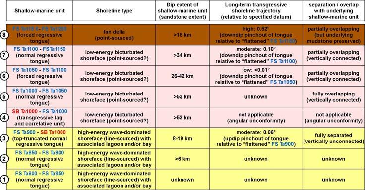
9 Tarbert Formation, East Shetland Basin high-energy, wavedominated shoreface low-energy, bioturbated shoreface fan delta Tarbert Formation, East Shetland Basin 8
10 Application to subsurface examples Shoreline trajectories can be measured in dense subsurface datasets: - requires robust understanding of underlying sedimentology, facies models - requires careful use of (geometrical) assumptions - provides quantitative framework to analyse reservoir distribution and character Application to mid-to-late Jurassic transgressive plays in North Sea rift: - shoreline type and facies character controlled by tectono-stratigraphic evolution of rift - two classes of sandstone tongue: shoreface (sub-regional extent, marine sediment supply) and deltaic-to-estuarine (localised extent, direct fluvial sediment supply) - shoreface tongues have variable dip extent, small thickness, and low-tomoderate long-term transgressive trajectories (limited vertical stacking) - deltaic-to-estuarine tongues have small dip extent, variable thickness, and moderate-to-very high long-term transgressive trajectories (pronounced vertical stacking) 9
Depositional Sequences Sequences
 Depositional Sequences Transgressive and Regressive packages can be bound by unconformities Because sediment can only be preserved during net aggradation and progradation All other times there is either
Accommodation. Tectonics (local to regional) Subsidence Uplift
 Subsidence Uplift") Accommodation Accommodation varies over time; it is the distance between a reference horizon and the sea surface (i.e. relative sea level). The space to be filled in with sediments or water What are the
Accommodation Accommodation varies over time; it is the distance between a reference horizon and the sea surface (i.e. relative sea level). The space to be filled in with sediments or water What are the
CLASTICS FIELD TRIP. Dynamic stratigraphy, facies, architecture and fracture analysis of coastal depositional systems
 CLASTICS FIELD TRIP Dynamic stratigraphy, facies, architecture and fracture analysis of coastal depositional systems MAY 2-5 SEPTEMBER 17-20, 2018 Appraisal and development of clastic reservoirs rely on
The Impact of Parasequence Stacking Patterns on Vertical Connectivity Between Wave-Dominated, Shallow Marine Parasequences, Book Cliffs, Eastern Utah
 The Impact of Parasequence Stacking Patterns on Vertical Connectivity Between Wave-Dominated, Shallow Marine Parasequences, Book Cliffs, Eastern Utah MALCOLM J. ARNOT and TIMOTHY R. GOOD* MALCOLM J. ARNOT
Fluid-Mud Deposits of the Lower Jurassic Tilje Formation, Offshore Mid-Norway By Aitor A. Ichaso and Robert W. Dalrymple 1
 Fluid-Mud Deposits of the Lower Jurassic Tilje Formation, Offshore Mid-Norway By Aitor A. Ichaso and Robert W. Dalrymple 1 Search and Discovery Article #50107 (2008) Posted August 10, 2008 *Adapted from
Bulletin of Earth Sciences of Thailand
 Depositional Environments and Stratigraphic Development of the Grand Taman Sari Circuit Outcrop: an Analogue for Transgressive Mahakam Delta Successions Ridha Santika Riadi Petroleum Geoscience Program,
EARTH SURFACE PROCESSES AND SEDIMENTATION!
 Sed and Strat EARTH SURFACE PROCESSES AND SEDIMENTATION! 2/27 Lecture 7- Exposure: Weathering and the Sediment Factory 3/04 Lecture 8 - Rivers and Landscapes 3/06 Lecture 9 - Waves (not Tides) 3/11 Lecture
Sequence Stratigraphy: An Applied Workshop
 Sequence Stratigraphy: An Applied Workshop Instructor: Prof. Octavian Catuneanu Level: Intermediate Duration: 5 days Course Description and Objectives This workshop presents the concepts and practical
Introduction to sequence stratigraphy and its application to reservoir geology
 Introduction to sequence stratigraphy and its application to reservoir geology Massimo Zecchin Istituto Nazionale di Oceanografia e di Geofisica Sperimentale - OGS Historical development Definitions Systems
Sequence Stratigraphy as a tool for water resources management in alluvial coastal aquifers: application to the Llobregat delta (Barcelona, Spain)
") Sequence Stratigraphy as a tool for water resources management in alluvial coastal aquifers: application to the Llobregat delta (Barcelona, Spain) Desiré Gàmez Torrent December 2007 CHAPTER 1: Introduction
Sequence Stratigraphy as a tool for water resources management in alluvial coastal aquifers: application to the Llobregat delta (Barcelona, Spain) Desiré Gàmez Torrent December 2007 CHAPTER 1: Introduction
Viking Lowstand Deposits in West Central Saskatchewan: Depositional Model for the Reservoir Units in Dodsland-Hoosier Area, Saskatchewan, Canada
 Viking Lowstand Deposits in West Central Saskatchewan: Depositional Model for the Reservoir Units in Dodsland-Hoosier Area, Saskatchewan, Canada Hasan Ferdous* PetroSed Geoconsulting Resources, Calgary,
Facies Analysis Of The Reservoir Rocks In The. Sylhet Trough, Bangladesh. Abstract
 Facies Analysis Of The Reservoir Rocks In The Sylhet Trough, Bangladesh Joyanta Dutta Petroleum Geoscience Program, Department of Geology, Faculty of Science, Chulalongkorn University, Bangkok 10330, Thailand
Effects of Tides on Deltaic Deposition: Causes and Responses*
 Effects of Tides on Deltaic Deposition: Causes and Responses* Piret Plink-Bjorklund 1 Search and Discovery Article #50626 (2012)** Posted June 25, 2012 *Adapted from oral presentation at AAPG Annual Convention
Shallow-Marine Research Group
 Principal aim: to conduct cutting-edge research into the application of shallow-marine sedimentology for developing a better understanding of issues relating to hydrocarbon systems, mining and mineral
3rd-order sequence stratigraphy and lithostratigraphy of the Bearpaw Horseshoe Canyon transition, Alberta plains
 3rd-order sequence stratigraphy and lithostratigraphy of the Bearpaw Horseshoe Canyon transition, Alberta plains Ben Hathway, Alberta Geological Survey, Alberta Energy Regulator, Edmonton, Alberta, ben.hathway@aer.ca
Controls on clastic systems in the Angoche basin, Mozambique: tectonics, contourites and petroleum systems
 P2-2-13 Controls on clastic systems in the Angoche basin, Mozambique: tectonics, contourites and petroleum systems Eva Hollebeek, Olivia Osicki, Duplo Kornpihl Schlumberger, London, UK Introduction Offshore
Sedimentary Cycle Best Practice: Potential Eo-Oligocene Sediments in Western Indonesia*
 Sedimentary Cycle Best Practice: Potential Eo-Oligocene Sediments in Western Indonesia* Mellinda Arisandy 1 and I Wayan Darma 1 Search and Discovery Article #11008 (2017)** Posted November 6, 2017 *Adapted
SEQUENCE STRATIGRAPHY
 SEQUENCE STRATIGRAPHY Course of Stratigraphy G301 Second semester (February-June2014) Department of Geology College of Science/University of Basrah Instructor:Dr. Nawrast S. Abd Alwahab Lecture 4 & 5 1
Michael Walsworth, Ryan Sullivan, Simi Odueyungbo, William Budd
 Michael Walsworth, Ryan Sullivan, Simi Odueyungbo, William Budd Estuarine Environment At first (Pritchard, 1967), an estuary was defined by the salinity of the water. Then by Clifton (1982) as an inlet
3D geological model for a gas-saturated reservoir based on simultaneous deterministic partial stack inversion.
 first break volume 28, June 2010 special topic A New Spring for Geoscience 3D geological model for a gas-saturated reservoir based on simultaneous deterministic partial stack inversion. I. Yakovlev, Y.
Aptian/Albian Reservoir Development in the Jeanne d Arc Basin, Offshore Eastern Canada
 Aptian/Albian Reservoir Development in the Jeanne d Arc Basin, Offshore Eastern Canada Jonathan Marshall, Statoil Canada Ltd. Calgary, Alberta, Canada. jomars@statoil.com Introduction: The Jeanne d Arc
DATA REPOSITORY MATERIAL: PALEOCHANNEL GROUP MAPPING DESCRIPTIONS
 Data Repository item 2695 DATA REPOSITORY MATERIAL: PALEOCHANNEL GROUP MAPPING DESCRIPTIONS Groups 1 (North Myrtle Beach) and 2 (Atlantic Beach) Channel Groups 1 (North Myrtle Beach) and 2 (Atlantic Beach)
Sup. Mat. 1. Figure DR1. Map showing the distribution of the Vanrhynsdorp Group. 02
 GSA DATA REPOSITORY 2013142 Buatois, Almond and Germs Treptichnus pedum - List of supplementary materials: Sup. Mat. 1. Figure DR1. Map showing the distribution of the Vanrhynsdorp Group. 02 Sup. Mat.
Sequence Stratigraphic Analysis of Mixed, Reefal Carbonate and Siliciclastic Systems. Ashton Embry. Geological Survey of Canada.
 Sequence Stratigraphic Analysis of Mixed, Reefal Carbonate and Siliciclastic Systems Ashton Embry Geological Survey of Canada Outline Sequence Stratigraphy Sequence Surfaces and Sequence Boundaries for
PLATEAU UPLIFT, EPEIROGENEY AND CLIMATE CHANGES The KALAHARI PLATEAU, a world class laboratory
 PLATEAU UPLIFT, EPEIROGENEY AND CLIMATE CHANGES The KALAHARI PLATEAU, a world class laboratory F. Guillocheau M. De Wit G. Dubois B. Linol F. Eckardt W. Cotterill D. Rouby C. Robin Géosciences-Rennes Université
4.1 Sediment accommodation space principles and controls
 58 The sedimentary record of sea-level change 4. Sediment accommodation space principles and controls Sequence stratigraphy emphasizes the importance of the space that is made available within a basin
 Tutors: Huw Williams & Paul Davies (Reservoir Geology Consultants Limited) Duration: A six day field and classroom-based reservoir geology and modelling course in Grand Junction, Colorado and Green River,
Dakota Sandstone. of the Moxa Arch and Surrounding Green River Basin
 Dakota Sandstone of the Moxa Arch and Surrounding Green River Basin Dakota Sandstones of the Green River Basin Overview The Dakota sandstones of the Moxa Arch and surrounding Green River Basin remain attractive
Holocene Carbonate-Siliciclastic Shoreline and Ravinement Stratigraphy of the Belize Lagoon: a Mixed-System Model
 Holocene CarbonateSiliciclastic Shoreline and Ravinement Stratigraphy of the Belize Lagoon: a MixedSystem Model DONALD F. MCNEILL AND CLINTON A. COWAN Key findings o Mixedsystem facies heterogeneity during
Bulletin of Earth Sciences of Thailand. Evaluation of the Petroleum Systems in the Lanta-Similan Area, Northern Pattani Basin, Gulf of Thailand
 Evaluation of the Petroleum Systems in the Lanta-Similan Area, Northern Pattani Basin, Gulf of Thailand Sirajum Munira Petroleum Geoscience Program, Department of Geology, Faculty of Science, Chulalongkorn
IMPERIAL COLLEGE LONDON
 IMPERIAL COLLEGE LONDON Department of Earth Science and Engineering Centre for Petroleum Studies UNDERSTANDING FLUID FLOW IN COMPLEX, FLUVIAL-DELTAIC RESERVOIRS By Charles Faure-Llorens A report submitted
Sequence Stratigraphy. Historical Perspective
 Sequence Stratigraphy Historical Perspective Sequence Stratigraphy Sequence Stratigraphy is the subdivision of sedimentary basin fills into genetic packages bounded by unconformities and their correlative
Sequence Stratigraphic Framework and Reservoir Architecture of the Lingshui-3 Member, Yacheng 13-1 Gas Field, South China Sea
 Sequence Stratigraphic Framework and Reservoir Architecture of the Lingshui-3 Member, Yacheng 13-1 Gas Field, South China Sea David Z. Tang BP China Exploration and Production Company 17/F, Finance Centre,
Appraising a late-middle-aged Brent Group field
 Appraising a late-middle-aged Brent Group field Reservoir learnings after nearly 20 years of Pelican field production Jill Marriott The Pelican Field The Pelican oil field is nearly 20 years old It is
Sedimentary Basins. Gerhard Einsele. Springer-Verlag Berlin Heidelberg New York London Paris Tokyo Hong Kong Barcelona Budapest
 Gerhard Einsele Sedimentary Basins Evolution, Facies, and Sediment Budget With 269 Figures Springer-Verlag Berlin Heidelberg New York London Paris Tokyo Hong Kong Barcelona Budapest Contents Part I Types
Understanding Earth Fifth Edition
 Understanding Earth Fifth Edition Grotzinger Jordan Press Siever Chapter 5: SEDIMENTATION: Rocks Formed by Surface Processes Lecturer: H Mohammadzadeh Assistant professors, Department of Geology, FUM Copyright
Dalhousie University- Petroleum Geoscience Field Methods- Trinidad Summary Report
 Dalhousie University- Petroleum Geoscience Field Methods- Trinidad Summary Report Submitted to: Offshore Energy Research Association of Nova Scotia (OERA) To fulfill requirements of the Undergraduate Student
GEOLOGY MEDIA SUITE Chapter 8
 UNDERSTANDING EARTH, SIXTH EDITION GROTZINGER JORDAN GEOLOGY MEDIA SUITE Chapter 8 Clocks in Rocks Timing the Geologic Record 2010 W.H. Freeman and Company Stratigraphy and fossils Figure 8.4 (page 172)
Porosity partitioning in sedimentary cycles: implications for reservoir modeling
 Porosity partitioning in sedimentary cycles: implications for reservoir modeling Gregor P. Eberli 1), Langhorne B. Smith 2), Elena Morettini 3), Layaan Al-Kharusi 1) 1) Comparative Sedimentology Laboratory,
Bulletin of Earth Sciences of Thailand. Controls on Reservoir Geometry and Distribution, Tantawan Field, Gulf of Thailand.
 Controls on Reservoir Geometry and Distribution, Tantawan Field, Gulf of Thailand Atchara Praidee Petroleum Geoscience Program, Department of Geology, Faculty of Science, Chulalongkorn University, Bangkok
Regional Paleogeography and Implications for Petroleum Prospectivity, Taranaki Basin, New Zealand*
 Regional Paleogeography and Implications for Petroleum Prospectivity, Taranaki Basin, New Zealand* Dominic P. Strogen 1, Kyle J. Bland 1, Jan R. Baur 1,2, and Peter R. King 1 Search and Discovery Article
FORMATION OF DEEP INCISIONS INTO TIDE-DOMINATED RIVER DELTAS: IMPLICATIONS FOR THE STRATIGRAPHY OF THE SEGO SANDSTONE, BOOK CLIFFS, UTAH, U.S.A.
 FORMATION OF DEEP INCISIONS INTO TIDE-DOMINATED RIVER DELTAS: IMPLICATIONS FOR THE STRATIGRAPHY OF THE SEGO SANDSTONE, BOOK CLIFFS, UTAH, U.S.A. BRIAN J. WILLIS 1 AND SHARON L. GABEL 2 1 Department of
PECIKO GEOLOGICAL MODELING: POSSIBLE AND RELEVANT SCALES FOR MODELING A COMPLEX GIANT GAS FIELD IN A MUDSTONE DOMINATED DELTAIC ENVIRONMENT
 IATMI 2005-29 PROSIDING, Simposium Nasional Ikatan Ahli Teknik Perminyakan Indonesia (IATMI) 2005 Institut Teknologi Bandung (ITB), Bandung, 16-18 November 2005. PECIKO GEOLOGICAL MODELING: POSSIBLE AND
The boundary between two formations (or any distinct layers) is called a contact. Sedimentary rocks cover 75% of continents.
 is called a contact. Sedimentary rocks cover 75% of continents.") Sedimentary Rocks Sedimentary rocks form at the Earth s surface through interactions of the hydrologic system and the crust. Fortunately, many of these processes are in operation today, and geologists
Sedimentary Rocks Sedimentary rocks form at the Earth s surface through interactions of the hydrologic system and the crust. Fortunately, many of these processes are in operation today, and geologists
RWE Dea UK SNS Limited (50%), Faroe Petroleum (UK) Limited
, Faroe Petroleum (UK) Limited") 1. Licence information Licence Number P1975 Licence Round 27 th (2012) Licence Type Traditional Blocks 3/28c & 9/3e Licensees Work Programme 2. Synopsis RWE Dea UK SNS Limited (50%), Faroe Petroleum (UK)
1. Licence information Licence Number P1975 Licence Round 27 th (2012) Licence Type Traditional Blocks 3/28c & 9/3e Licensees Work Programme 2. Synopsis RWE Dea UK SNS Limited (50%), Faroe Petroleum (UK)
Case Study of the Structural and Depositional-Evolution Interpretation from Seismic Data*
 Case Study of the Structural and Depositional-Evolution Interpretation from Seismic Data* Yun Ling 1, Xiangyu Guo 1, Jixiang Lin 1, and Desheng Sun 1 Search and Discovery Article #20143 (2012) Posted April
PROCEEDINGS, INDONESIAN PETROLEUM ASSOCIATION Forty-First Annual Convention & Exhibition, May 2017
 IPA17-369-SG PROCEEDINGS, INDONESIAN PETROLEUM ASSOCIATION Forty-First Annual Convention & Exhibition, May 2017 FACIES ANALYSIS OF LATE NEOGENE DEPOSIT: MARINE TO CONTINENTAL ENVIRONMENT OF THE MERAPI
EGAS. Ministry of Petroleum
 EGAS Ministry of Petroleum EGAS Ministry of Petroleum About The Block Location: N. El Arish offshore block is located in the extreme eastern part of the Egypt s economic water border and bounded from the
REGIONAL GEOLOGY IN KHMER BASIN
 CONTENTS 1-Khmere Basin 2-Regional Geology Khmer Basin 3-Regime Tectonic 4-Seismic Database -a/ Acquisition Data -b/ Prospect Angkor -C/ Cross Section Seismic 5-Play Type -a/ Play Schematic -b/ Structure
Bulletin of Earth Sciences of Thailand
 Quantitative Seismic Geomorphology of Early Miocene to Pleistocene Fluvial System of Northern Songkhla Basin, Gulf of Thailand Oanh Thi Tran Petroleum Geoscience Program, Department of Geology, Faculty
Triassic of the Barents Sea shelf: depositional environments and hydrocarbon potential. Daria A. Norina 1,2
 Triassic of the Barents Sea shelf: depositional environments and hydrocarbon potential Daria A. Norina 1,2 1 TOTAL (Paris, France) 2 The work is a part of PhD thesis conducted in Petroleum Department,
The importance of stratigraphic plays in the undiscovered resources of the UKCS
 The importance of stratigraphic plays in the undiscovered resources of the UKCS Sue Stoker 1, Joy Gray 2, Peter Haile 2, Ian Andrews 1 & Don Cameron 1 1 British Geological Survey 2 Department of Trade
Journal of Earth Sciences and Geotechnical Engineering, vol. 4, no. 1, 2014, ISSN: (print), (online) Scienpress Ltd, 2014
, (online) Scienpress Ltd, 2014") Journal of Earth Sciences and Geotechnical Engineering, vol. 4, no. 1, 2014, 17-24 ISSN: 1792-9040 (print), 1792-9660 (online) Scienpress Ltd, 2014 Reconstruction of Relative Tectonic Movements Using Transgressive
Journal of Earth Sciences and Geotechnical Engineering, vol. 4, no. 1, 2014, 17-24 ISSN: 1792-9040 (print), 1792-9660 (online) Scienpress Ltd, 2014 Reconstruction of Relative Tectonic Movements Using Transgressive
LOWER GRAND RAPIDS BITUMEN POOLS AT COLD LAKE, ALBERTA VARIATIONS IN STRATIGRAPHIC SETTING AND DEPOSITIONAL ENVIRONMENTS
 RAPIDS BITUMEN POOLS AT COLD LAKE, ALBERTA VARIATIONS IN STRATIGRAPHIC SETTING AND DEPOSITIONAL ENVIRONMENTS Brad J. Hayes, Petrel Robertson Consulting Ltd. Garrett M. Quinn, OSUM Oil Sands Corp. Summary
Depositional History and Petroleum Potential of Ombilin Basin, West Sumatra - Indonesia, Based on Surface Geological Data*
 Depositional History and Petroleum Potential of Ombilin Basin, West Sumatra - Indonesia, Based on Surface Geological Data* Yahdi Zaim 1, Litto Habrianta 2, Chalid I. Abdullah 1, Aswan 1, Yan Rizal 1, Nurcahyo
Quantitative Seismic Geomorphology of Fluvial Systems of the Pleistocene to Recent in the Malay Basin, Southeast Asia*
 Quantitative Seismic Geomorphology of Fluvial Systems of the Pleistocene to Recent in the Malay Basin, Southeast Asia* Faisal Alqahtani 1, Christopher Jackson 1, Howard Johnson 1, Alex Davis 2, and Ammar
SAND DISTRIBUTION AND RESERVOIR CHARACTERISTICS NORTH JAMJUREE FIELD, PATTANI BASIN, GULF OF THAILAND
 SAND DISTRIBUTION AND RESERVOIR CHARACTERISTICS NORTH JAMJUREE FIELD, PATTANI BASIN, GULF OF THAILAND Benjawan KIinkaew Petroleum Geoscience Program, Department of Geology, Faculty of Science, Chulalongkorn
Sedimentary and Stratigraphic Analysis of the Viking Sand in the Edgerton/Wainwright Area, Central Alberta* By Russell Walz 1
 Sedimentary and Stratigraphic Analysis of the Viking Sand in the Edgerton/Wainwright Area, Central Alberta* By Russell Walz 1 Search and Discovery Article #50030 (2006) Posted June 25, 2006 *Extended abstract
EGAS. Ministry of Petroleum
 EGAS Ministry of Petroleum EGAS Ministry of Petroleum About The Block Location: N. Thekah offshore block is located at about 56 km to the north of the Mediterranean shore line, 85 km to the north west
Sequence stratigraphy and coastal-plain channel architecture of the Cretaceous Blackhawk Formation, Wasatch Plateau, Utah
 Hiranya Sahoo Hiranya Sahoo is currently a Ph.D. candidate at the University of New Orleans. After receiving his M.S. degree in geology, he attended IIT, Bombay, receiving a Master in Technology degree
Southern Songkhla Basin, Gulf of Thailand
 Architecture and Depositional Environment of Fluvial Systems of Southern Songkhla Basin, Gulf of Thailand Toan Manh Do Petroleum Geoscience Program, Department of Geology, Faculty of Science, Chulalongkorn
Search and Discovery Article #20097 (2011) Posted January 31, 2011
 Posted January 31, 2011") Integrated Geological and Engineering Studies in Support of Producing Light Oil from a Frozen Reservoir: A Case Study from Umiat Oil Field, Northern Alaska* C. Hanks 1, J. Mongrain 2, A. Dandekar 2, P.
Integrated Geological and Engineering Studies in Support of Producing Light Oil from a Frozen Reservoir: A Case Study from Umiat Oil Field, Northern Alaska* C. Hanks 1, J. Mongrain 2, A. Dandekar 2, P.
Depositional Environments. Depositional Environments
 Depositional Environments Geographic area in which sediment is deposited Characterized by a combination of geological process & environmental conditions Depositional Environments Geological processes:
Meandering Miocene Deep Sea Channel Systems Offshore Congo, West Africa
 Meandering Miocene Deep Sea Channel Systems Offshore Congo, West Africa S. Baer* (PGS), J. E. Comstock (PGS), K. Vrålstad (PGS), R. Borsato (PGS), M. Martin (PGS), J.P. Saba (SNPC), B. Débi-Obambé (SNPC)
GEOLOGY MEDIA SUITE Chapter 5
 UNDERSTANDING EARTH, SIXTH EDITION GROTZINGER JORDAN GEOLOGY MEDIA SUITE Chapter 5 Sedimentation Rocks Formed by Surface Processes 2010 W.H. Freeman and Company Mineralogy of sandstones Key Figure 5.12
Relinquishment Report
 Relinquishment Report Licence P1403 Block 13/22d Chevron North Sea Limited Korean National Oil Company Chevron North Sea Limited December 2009 1 SYNOPSIS... 3 2 INTRODUCTION. 3 2.1 Licence Terms.. 3 2.2
BALOCHISTAN FOLDBELT BASIN
 INTRODUCTION BALOCHISTAN FOLDBELT BASIN The Kharan-3 block is located in the Kharan Trough of Balochistan Basin. GEOLOGICAL SETTING The Balochistan Province is an Upper Cretaceous to Recent structurally
The 3-D Seismic Geomorphology of Deep-Water Slope Channel Systems A Case Study from the Deep Water Nile Delta
 Geological Society of Trinidad & Tobago The 3-D Seismic Geomorphology of Deep-Water Slope Channel Systems A Case Study from the Deep Water Nile Delta Nigel E. Cross Presentation Outline Introduction Deep
Glauconitic Oil Reservoirs in Southern Alberta Creating the Correct Geological Model to Guide Development Drilling
 Glauconitic Oil Reservoirs in Southern Alberta Creating the Correct Geological Model to Guide Development Drilling Brad Hayes* Petrel Robertson Consulting Ltd, Calgary, AB bhayes@petrelrob.com Lisa Griffith
Holocene Sediments of the Rhine-Meuse-Scheldt Estuaries as Aids to Interpret Tidal and Fluvial-Tidal Deposits in Outcrop and Core*
 Holocene Sediments of the Rhine-Meuse-Scheldt Estuaries as Aids to Interpret Tidal and Fluvial-Tidal Deposits in Outcrop and Core* Allard W. Martinius 1 and J.H. (Janrik) van den Berg 2 Search and Discovery
Core Examples from Modern Estuarine Tidal Bars, Tillamook Bay, Oregon
 Core Examples from Modern Estuarine Tidal Bars, Tillamook Bay, Oregon Rares Bistran* University of Alberta, Edmonton, Alberta, Canada rares.bistran@ualberta.ca David Herbers, Murray Gingras, John-Paul
OIL INDIA LIMITED, GEOPHYSICS DEPARTMENT, DULIAJAN, ASSAM.
 J. P. Singh, M. K. Gupta & Akshaya Kumar, Oil India Limited, Duliajan. jpsingh@oilindia.in Summary Oil exploration in Upper Assam commenced with the discovery of the Digboi oilfield more than 100 years
Carboniferous Stoddart Group: An integrated approach
 Carboniferous Stoddart Group: An integrated approach Abu Yousuf*, Department of Geoscience, University of Calgary, Calgary, Alberta yousufabu@hotmail.com and Charles M. Henderson, Department of Geoscience,
Outcrops from Every Continent and 20 Countries in 140 Contributions. Tor H. Nilsen, Roger D. Shew, Gary S. Steffens, and Joseph R.J. Studlick.
 Paper VIII Tor H. Nilsen, Roger D. Shew, Gary S. Steffens, and Joseph R.J. Studlick Editors Outcrops from Every Continent and 20 Countries in 140 Contributions http://bookstore.aapg.org Length ~ 23 m (75.5
NAME: GEL 109 Final Winter 2010
 GEL 109 Final Winter 2010 1. The following stratigraphic sections represents a single event followed by the slow accumulation of background sedimentation of shale. Describe the flows that produced the
Can low permeable rocks be used for storing CO 2? The potential Longyearbyen CO 2 reservoir
 Trondheim Can low permeable rocks be used for storing CO 2? The potential Longyearbyen CO 2 reservoir By Atle Mørk, Raheleh Farokhpoor, Mai Britt Mørk, Snorre Olaussen, Jan Tveranger & Rita Sande Rød Trondheim,
Modeling Lateral Accretion in McMurray Formation Fluvial- Estuarine Channel Systems: Grizzly Oil Sands May River SAGD Project, Athabasca
 Modeling Lateral Accretion in McMurray Formation Fluvial- Estuarine Channel Systems: Grizzly Oil Sands May River SAGD Project, Athabasca Duncan Findlay, Thomas Nardin, Alex Wright, Raheleh Salehi Mojarad
The unknown giants - low-permeability shallow gas reservoirs of southern Alberta and Saskatchewan, Canada.
 The unknown giants - low-permeability shallow gas reservoirs of southern Alberta and Saskatchewan, Canada. Shaun O'Connell* Belfield Resources Inc., Calgary belfield@shaw.ca ABSTRACT The gas reserves contained
Geol 117 Lecture 18 Beaches & Coastlines. I. Types of Coastlines A. Definition:
 I. Types of Coastlines A. Definition: 1. Shore = narrow zone where ocean meets land (e.g. beach) 2. Coast is a broad area where both ocean and land processes act a. Includes onshore marshes, dunes, sea
Chapter 3 Sedimentation of clay minerals
 Chapter 3 Sedimentation of clay minerals 3.1 Clay sedimentation on land 3.2 From land to sea 3.3 Clay sedimentation in the sea 1 3.1 Clay sedimentation on land Deserts Glaciers Rivers Lacustrine 2 University
MUHAMMAD S TAMANNAI, DOUGLAS WINSTONE, IAN DEIGHTON & PETER CONN, TGS Nopec Geological Products and Services, London, United Kingdom
 Geological and Geophysical Evaluation of Offshore Morondava Frontier Basin based on Satellite Gravity, Well and regional 2D Seismic Data Interpretation MUHAMMAD S TAMANNAI, DOUGLAS WINSTONE, IAN DEIGHTON
Marine Depositional Environments Basics Marine Shelf and Deepwater. (Last Updated 28 December 2015) COPYRIGHT
 COPYRIGHT") Marine Depositional Environments Basics (Last Updated 28 December 2015) NOTICE AND DISCLAIMER The information contained herein and/or these workshop/seminar proceedings (WORK) was prepared by or contributed
Marine Depositional Environments Basics (Last Updated 28 December 2015) NOTICE AND DISCLAIMER The information contained herein and/or these workshop/seminar proceedings (WORK) was prepared by or contributed
Cretaceous USM Reservoir, F-O Gas Field, Offshore South Africa: Sedimentological Factors Affecting Economic Viability*
 Cretaceous USM Reservoir, F-O Gas Field, Offshore South Africa: Sedimentological Factors Affecting Economic Viability* Roger Higgs 1 Search and Discovery Article #20072 (2009) Posted May 20, 2009 *Adapted
Lithology Distribution in the Zechstein Supergroup and Controls on Rift Structure: Greater South Viking Graben, Northern North Sea
 Lithology Distribution in the Zechstein Supergroup and Controls on Rift Structure: Greater South Viking Graben, Northern North Sea Christopher Jackson 1, Elisabeth Evrard 1, Gavin Elliott 1, Robert Gawthorpe
Outline. Introduction The 8th Licensing Round Overview of significant plays in the Danish Central Graben
 Outline Introduction The 8th Licensing Round Overview of significant plays in the Danish Central Graben Important Milestones in 2017 New Strategy for the Future of the Danish Oil and Gas Sector New North
Clastic Sedimentology
 EAS 465/565 2010, Winter Term (3-0-0): Clastic Sedimentology Instructor: Dr. Octavian Catuneanu Office: HMT (Tory) 3-117 Department of Earth and Atmospheric Sciences Phone: (780) 492-6569 University of
Lab 8: Facies Analysis and Correlations: Sequence Stratigraphy in the Book Cliffs, Utah
 Geology 109L Lab 8: Facies Analysis and Correlations: Sequence Stratigraphy in the Book Cliffs, Utah Goal: In this lab, you will put together your knowledge of near-shore facies and sequence stratigraphy
Integrated geological approach to the study of coastal subsidence in Emilia-Romagna. Luisa PERINI Calabrese Lorenzo, Luciani Paolo, Severi Paolo,
 Integrated geological approach to the study of coastal subsidence in Emilia-Romagna Luisa PERINI Calabrese Lorenzo, Luciani Paolo, Severi Paolo, Subsidence hazard of Emilia-Romagna coastal plain Caputo
River and Plume Deposition Ocean Storm Reworking
 River and Plume Deposition Ocean Storm Reworking Irina Overeem Community Surface Dynamics Modeling System University of Colorado at Boulder September 2008 1 Course outline 1 Lectures by Irina Overeem:
Jesse D. Thompson. Dr. Diane Kamola Chairperson. Dr. Anthony W. Walton. Dr. Ross A. Black. Date defended:
 SEQUENCE STRATIGRAPHY AND FACIES ANALYSIS OF THE ROLLINS SANDSTONE MEMBER (MOUNT GARFIELD FORMATION) AND RE- EXAMINATION OF THE CONTACT BETWEEN THE MOUNT GARFIELD AND WILLIAMS FORK FORMATIONS (LATE CRETACEOUS)
GEOL 440 Sedimentology and stratigraphy: processes, environments and deposits Lectures 16 & 17: Deltaic Facies
 GEOL 440 Sedimentology and stratigraphy: processes, environments and deposits Lectures 16 & 17: Deltaic Facies What controls morphology and facies of the Nile Delta? Basic processes Classification Facies
DATA ANALYSIS AND INTERPRETATION
 III. DATA ANALYSIS AND INTERPRETATION 3.1. Rift Geometry Identification Based on recent analysis of modern and ancient rifts, many previous workers concluded that the basic structural unit of continental
AAPG Search and Discovery Article #90173 CSPG/CSEG/CWLS GeoConvention 2011, Calgary, Alberta, Canada, May 9-11, 2011
 Use of Image Logs in Differentiating Point Bar and Tidal Bar Deposits in the Leismer Area: Implications for SAGD Reservoir Definition in the Athabasca Oilsands Howard Brekke and Andrew Couch Introduction
Geology & Geophysics Applied in Industry. EXERCISE 2: A Quick-Look Evaluation
 EXERCISE 2: A Quick-Look Evaluation You have been asked to perform a quick back-of-the-envelope evaluation of the blocks being offered off of Somewhereia. Is there enough potential that our company should
Th P4 07 Seismic Sequence Stratigraphy Analysis Using Signal Mode Decomposition
 Th P4 07 Seismic Sequence Stratigraphy Analysis Using Signal Mode Decomposition F. Li (University of Olahoma), R. Zhai (University of Olahoma), K.J. Marfurt* (University of Olahoma) Summary Reflecting
Sequence stratigraphy and basin analysis of the Meso- to Cenozoic Tarfaya- Laayoune Basins, on- and offshore Morocco
 Sequence stratigraphy and basin analysis of the Meso- to Cenozoic Tarfaya- Laayoune Basins, on- and offshore Morocco INAUGURAL-DISSERTATION zur Erlangung der Doktorwtirde der Naturwissenschaftlich-Mathematischen
UK Field Training Courses
 UK Field Training Courses Bespoke courses for E&P companies For individual companies and/or partnerships Reservoir and exploration sedimentology oriented Integrated with company sedimentologist if desired
Seismic stratigraphy, some examples from Indian Ocean, interpretation of reflection data in interactive mode
 Seismic stratigraphy, some examples from Indian Ocean, interpretation of reflection data in interactive mode K. S. Krishna National Institute of Oceanography, Dona Paula, Goa-403 004. krishna@nio.org Seismic
Offshore Neogene Plays, Salina del Istmo Basin, Southeast of Mexico
 Offshore Neogene Plays, Salina del Istmo Basin, Southeast of Mexico ROBLES-NOLASCO, J.; PLIEGO-VIDAL, E.; TOLEDO-BANTE, C.; PIMIENTA-LUGO, M.; ORTEGA-GONZALEZ, V.; MARTINEZ-PEÑA, B. and HEREDIA-CERVANTES,
Anatomy of a Fluvial to Estuarine Valley Fill, North Cactus Lake McLaren Reservoir
 Anatomy of a Fluvial to Estuarine Valley Fill, North Cactus Lake McLaren Reservoir J. Edward Mathison Alethia Geologica, Filling of the north Cactus Lake post Waseca paleovalley, during McLaren sea level