Mudanças paleo-hidrológicas, cronologia de eventos e dinâmica sedimentar no Quaternário da Bacia do Pantanal
|
|
|
- Abraham Jayson Newton
- 5 years ago
- Views:
Transcription


1 UNIVERSIDADE ESTADUAL PAULISTA INSTITUTO DE GEOCIÊNCIAS E CIÊNCIAS EXATAS CAMPUS DE RIO CLARO FAPESP 2014/ Mudanças paleo-hidrológicas, cronologia de eventos e dinâmica sedimentar no Quaternário da Bacia do Pantanal Pesquisador Responsável: Mario Luis Assine
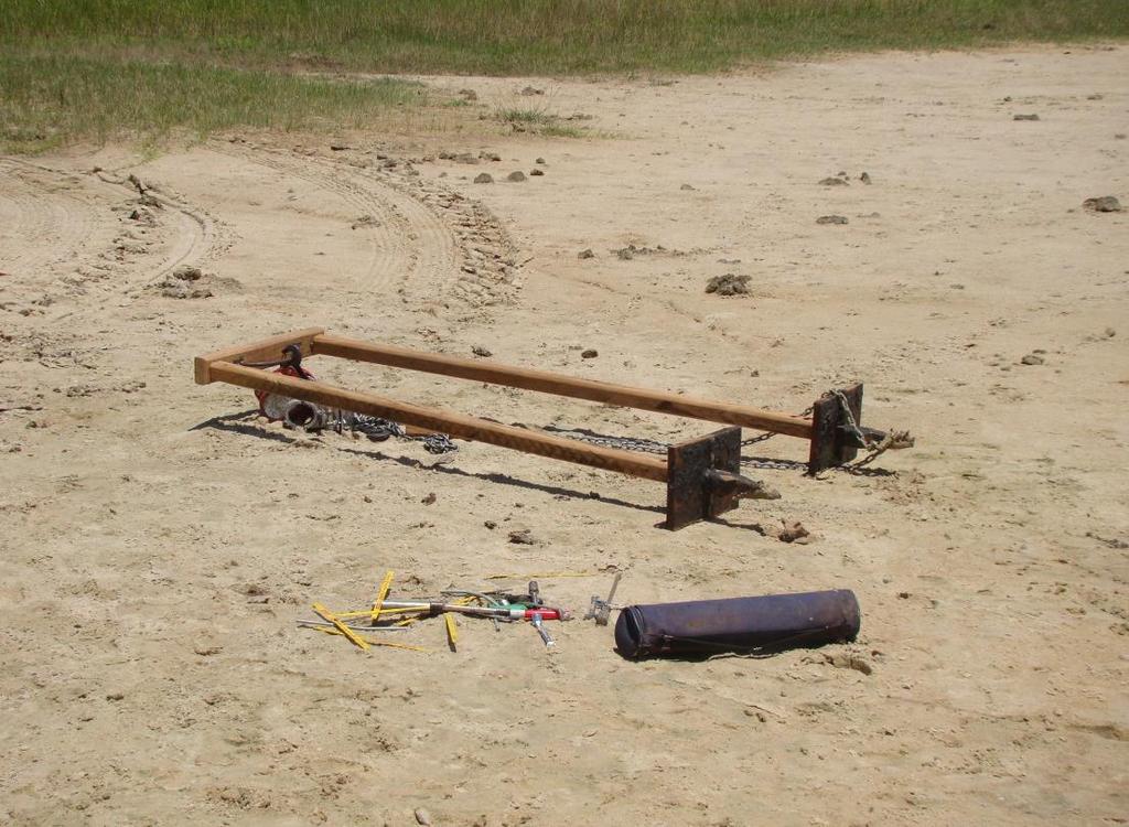
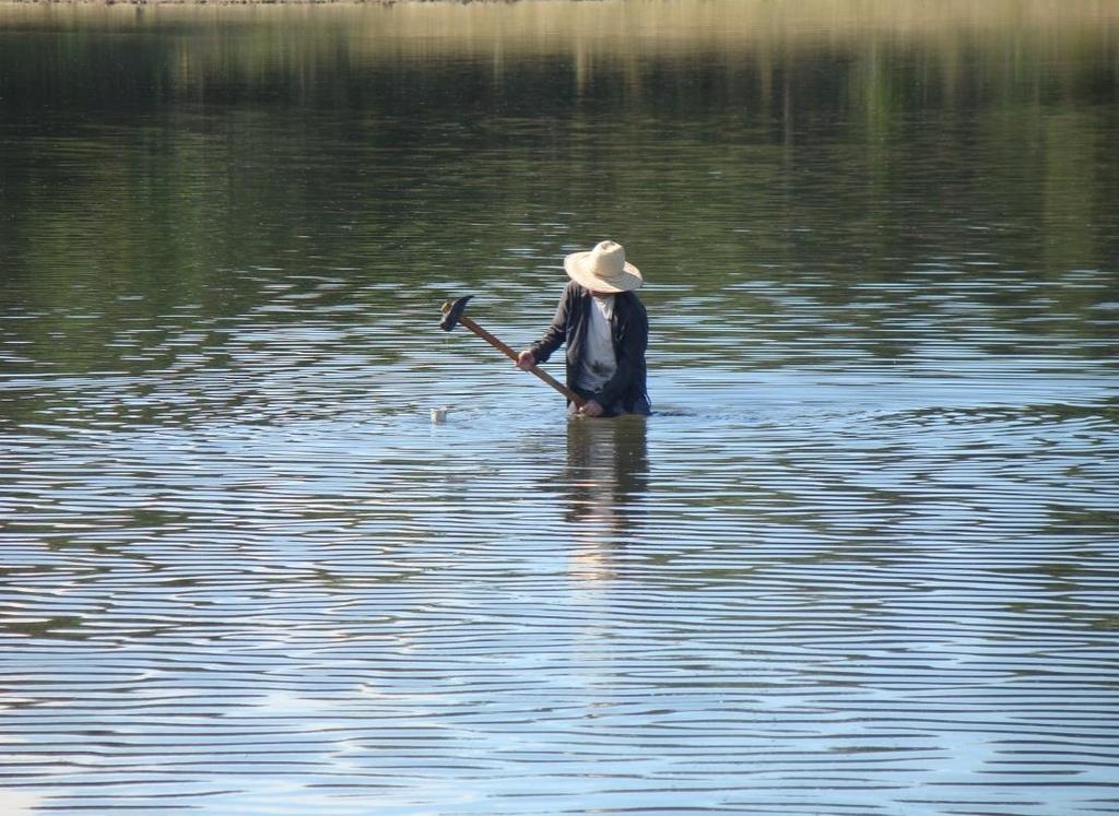
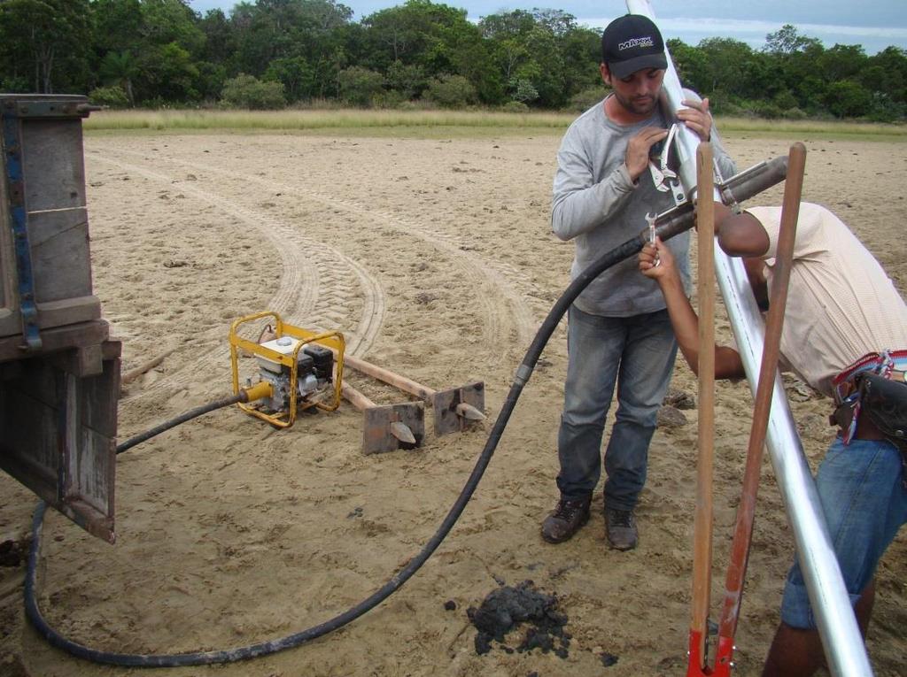
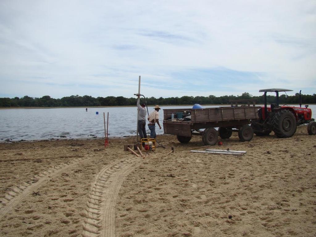
2 PALEOHYDROLOGICAL CHANGES, CHRONOLOGY OF EVENTS AND SEDIMENT DYNAMICS IN THE QUATERNARY OF THE PANTANAL WETLAND Late Pleistocene to Holocene paleo-hydrologic changes are imprint in the landscape and sedimentary record of the Pantanal wetlands, central-west Brazil. Environmental changes are mainly controlled by climatic events that took place since the aridity during the Last Glacial Maximum to more humid conditions prevailing during the Holocene and by structural factors related to the tectonic regime that operates in the sedimentary basin. Although allogenic factors related to climate and neotectonics strongly control the morphological evolution and landforms, many changes in the physical properties of sediments and sites of deposition have resulted from autogenic fluvial processes, particularly those related to avulsive river systems. In many important rivers of Pantanal fluvial plain, modern shifts in the fluvial channels have been causing great consternation of the local population. In this context, the main objectives of this project are the recognition of paleodrainage patterns, the reconstruction of Quaternary geologic and climatic events, the understanding of the hydro-sedimentary dynamics and evidences of paleohydrological changes and the establishment of relationships between allogenic and autogenic factors in the depositional setting. Many methods and techniques will be used to achieve these objectives, such as interpretation of orbital data (sattelite images and SRTM), data bank organized and processed with GIS, subsurface investigation using ground penetrating radar (GPR), surface and subsurface sampling (vibrocoring and percussion devices), facies analysis in outcrops and cores, granulometric analysis, absolute dating using Carbon-14 and optically stimulated luminescence methods, analysis of proxy data (sponge spicules, phytoliths and palynomorfs), paleopedology investigation in river terraces, hydrosedimentary surveys with acoustic Doppler current profiler (ADCP). The available information will be integrated in order to understand the role of alogenic and autogenic factors, to define the hierarchy of landforms and its sedimentary deposits, and to establish the succession of geologic events that occurred in the Pantanal since the late Pleistocene.
")


3 The Pantanal wetland is an immense lowland of approximately 150,000 km 2 (altitudes < 200 m) located in the Upper Paraguay Basin. The landscape and sedimentary deposits of Pantanal Basin are living geologic records of changing rivers, avulsions, floods, and climate changes that occurred in the last several thousand years


4 WET SEASON DRY SEASON


5 MODERN DEPOSITIONAL SYSTEMS TRACT

6 The Taquari megafan: focus on the Nhecolandia abandoned depositional lobe. We investigated the stratigraphic records of three saline lakes from Nhecolândia to explore their potential as Quaternary hydroclimate archives


7 NM1 NM3 NM4

8
9 Environmental changes during the late Holocene # A basal sandy unit and an upper muddy unit comprise the shallow stratigraphy of each lake # Radiocarbon data indicate that accumulation at two lakes was approximately continuous # A pronounced change in depositional environment from freshwater wetlands to saline lakes # Lake s evolution is a response to climate change from arid Mid to humid Late Holocene NM1 NM3 NM4
; Gemoscleres of T. variabilis (G); Diatom frustule and fragmente of megasclere (H).")
10 Sponge spicules: Microscleres (A and C) e gemoscleres (B end D) of Corvoheteromeyenia spp.; Gemoscleres of R. amazonensis (E and F); Gemoscleres of T. variabilis (G); Diatom frustule and fragmente of megasclere (H). Scale: 25 µm.
11 NM1

12 SALINE/ALKALINE LAKE Craticula sp. e Anomoeoneis sp. The lake became highly saline and alkaline after ~900 yr BP FRESHWATER TO SALINE LAKE Corvoheteromeyenia spp. A pronounced change in depositional environment from freshwater to saline lakes from ~3300 to ~900 yr BP FRESHWATER LAKE H. Fistula Ephemeral freshwater wetlands formed on the abandoned megafan lobe, which was molded by deflation in the arid early to mid-holocene

13 WATER TABLE RISE IN RESPONSE TO A CLIMATE CHANGE FROM SEMI-ARID CONDITIONS DURING EARLY/MIDDLE HOLOCENE TO A HUMID CLIMATE IN THE LATE HOLOCENE
Holocene Lower Mississippi River Avulsions: Autogenic Versus Allogenic Forcing*
 Holocene Lower Mississippi River Avulsions: Autogenic Versus Allogenic Forcing* Eric Prokocki 1,2 Search and Discovery Article #50330 (2010) Posted October 14, 2010 *Adapted from oral presentation at AAPG
Evidence for tectonic reactivations in the Marajó Island (northern Brazil) during the Quaternary: integrating remote sensing and sedimentological data
 during the Quaternary: integrating remote sensing and sedimentological data") Evidence for tectonic reactivations in the Marajó Island (northern Brazil) during the Quaternary: integrating remote sensing and sedimentological data Dilce F. Rossetti 1 Ana M. Góes 2 Márcio M. Valeriano
Evidence for tectonic reactivations in the Marajó Island (northern Brazil) during the Quaternary: integrating remote sensing and sedimentological data Dilce F. Rossetti 1 Ana M. Góes 2 Márcio M. Valeriano
The Overall Objectives of Proposed Study
 Eric Prokocki is currently working on a Ph.D. degree at The University of Illinois. His advisor is Dr. Gary Proctor. His research project is related to Holocene evolution and avulsion dynamics of the lower
Decoupling Allogenic Forcing from Autogenic Processes: Experimental Stratigraphy. Wonsuck Kim
 Decoupling Allogenic Forcing from Autogenic Processes: Experimental Stratigraphy Wonsuck Kim Department of Geological Sciences and Institute for Geophysics, Jackson School of Geosciences, University of
Lake Levels and Climate Change in Maine and Eastern North America during the last 12,000 years
 Maine Geologic Facts and Localities December, 2000 Lake Levels and Climate Change in Maine and Eastern North America during the last 12,000 years Text by Robert A. Johnston, Department of Agriculture,
South Texas Holocene climate reconstructed from O18 measurements of ostracods and
 Daniel Livsey received his undergraduate degree from Oklahoma State University and is now working on his dissertation at the University of California, Santa Barbara. South Texas Holocene climate reconstructed
APPENDIX G GLOSSARY. Mn/DOT/WR-0200
 APPENDIX G GLOSSARY Mn/DOT/WR-0200 Alluvial - comprised of clay, silt, sand, gravel, and/or other detritus deposited by water. Usually refers to accretionary overbank, floodplain or levee deposits. Biomantling
MISSISSIPPI RIVER DELTA OVERVIEW
 MISSISSIPPI RIVER DELTA OVERVIEW Science and Engineering Special Team Conference Louisiana State University October 9, 2012 Introduction Basics of the Mississippi Delta Natural and Human-Induced Land Loss
Sequence Stratigraphy: An Applied Workshop
 Sequence Stratigraphy: An Applied Workshop Instructor: Prof. Octavian Catuneanu Level: Intermediate Duration: 5 days Course Description and Objectives This workshop presents the concepts and practical
Moosehead Lake and the Tale of Two Rivers
 Maine Geologic Facts and Localities June, 2005 45 o 53 5.09 N, 69 o 42 14.54 W Text by Kelley, A.R.; Kelley, J.T.; Belknap, D.F.; and Gontz, A.M. Department of Earth Sciences, University of Maine, Orono,
Megafans in younger orogens
 Megafans in younger orogens Ralf Dedow 1 1 Institute of Geology, TU Bergakademie Freiberg, Germany Abstract. Fluvial megafans are unusually large fan-shaped bodies of sediment, whose formation is primarily
Geomorphology for Engineers
 Geomorphology for Engineers Edited by P. G. Fookes, E. M. Lee and G. Milligan Whittles Publishing CRC PRESS Contents Foreword Preface Dedication Biographies 1. Introduction to Engineering Geomorphology
ON THE EVOLUTION OF A HOLOCENE BARRIER COAST
 ON THE EVOLUTION OF A HOLOCENE BARRIER COAST Response to sea-level change and sediment supply DANCORE Seminar 2014 COADAPT - Danish Coasts and Climate Adaptation Flooding Risk and Coastal Protection Mikkel
The Impact of Changing Winds on Estuarine Evolution, Copano Bay, TX
 The Impact of Changing Winds on Estuarine Evolution, Copano Bay, TX Purpose: The fulfillment of partial requirements for the Degree of Master of Science in Geology Oklahoma State University, Stillwater
Laboratory Exercise #4 Geologic Surface Processes in Dry Lands
 Page - 1 Laboratory Exercise #4 Geologic Surface Processes in Dry Lands Section A Overview of Lands with Dry Climates The definition of a dry climate is tied to an understanding of the hydrologic cycle
Lecture Outlines PowerPoint. Chapter 6 Earth Science 11e Tarbuck/Lutgens
 Lecture Outlines PowerPoint Chapter 6 Earth Science 11e Tarbuck/Lutgens 2006 Pearson Prentice Hall This work is protected by United States copyright laws and is provided solely for the use of instructors
The potential of fjord sediment geochemistry for high-resolution paleohydrological reconstructions
 The potential of fjord sediment geochemistry for high-resolution paleohydrological reconstructions Sebastien Bertrand (UGent, Belgium) In collaboration with: Silvio Pantoja (UdeC, Chile), Konrad Hughen
UNIVERSITY OF SZEGED Faculty of Science Doctorate School of Earth Sciences Department of Physical Geography and Geoinformatics
 UNIVERSITY OF SZEGED Faculty of Science Doctorate School of Earth Sciences Department of Physical Geography and Geoinformatics INVESTIGATION OF PAST AND PRESENT FLUVIAL FORMS AND PROCESSES ALONG THE LOWLAND
Lab 7: Sedimentary Structures
 Name: Lab 7: Sedimentary Structures Sedimentary rocks account for a negligibly small fraction of Earth s mass, yet they are commonly encountered because the processes that form them are ubiquitous in the
Chapter 3 Sedimentation of clay minerals
 Chapter 3 Sedimentation of clay minerals 3.1 Clay sedimentation on land 3.2 From land to sea 3.3 Clay sedimentation in the sea 1 3.1 Clay sedimentation on land Deserts Glaciers Rivers Lacustrine 2 University
Sequence Stratigraphy as a tool for water resources management in alluvial coastal aquifers: application to the Llobregat delta (Barcelona, Spain)
") Sequence Stratigraphy as a tool for water resources management in alluvial coastal aquifers: application to the Llobregat delta (Barcelona, Spain) Desiré Gàmez Torrent December 2007 CHAPTER 1: Introduction
Sequence Stratigraphy as a tool for water resources management in alluvial coastal aquifers: application to the Llobregat delta (Barcelona, Spain) Desiré Gàmez Torrent December 2007 CHAPTER 1: Introduction
Final Report on Development of Deep Aquifer Database and Preliminary Deep Aquifer Map
 4 CHAPTER Final Report on Development of Deep Aquifer Database and Preliminary Deep Aquifer Map 31 Chronostragraphic Mapping 4.1 Introduction The analysis of geological logs was conducted during the project
ADDRESSING GEOMORPHIC AND HYDRAULIC CONTROLS IN OFF-CHANNEL HABITAT DESIGN
 ADDRESSING GEOMORPHIC AND HYDRAULIC CONTROLS IN OFF-CHANNEL HABITAT DESIGN Conor Shea - Hydrologist U.S. Fish and Wildlife Service Conservation Partnerships Program Arcata, CA Learning Objectives Examine
Loess and dust. Jonathan A. Holmes Environmental Change Research Centre
 Loess and dust Jonathan A. Holmes Environmental Change Research Centre Why is dust important? Mineral dust is an important constituent of the solid load in Earth's atmosphere, the total atmospheric aerosol
Referee Comments by M. Strasser, MARUM, Univ. Bremen, June 2010
 Referee Comments by M. Strasser, MARUM, Univ. Bremen, June 2010 of Discussion Paper entitled: Stratigraphic analysis of lake level fluctuations in Lake Ohrid: an integration of high resolution hydro-acoustic
The Geology of Sebago Lake State Park
 Maine Geologic Facts and Localities September, 2002 43 55 17.46 N, 70 34 13.07 W Text by Robert Johnston, Department of Agriculture, Conservation & Forestry 1 Map by Robert Johnston Introduction Sebago
Bulletin of Earth Sciences of Thailand
 Depositional Environments and Stratigraphic Development of the Grand Taman Sari Circuit Outcrop: an Analogue for Transgressive Mahakam Delta Successions Ridha Santika Riadi Petroleum Geoscience Program,
A SURVEY OF HYDROCLIMATE, FLOODING, AND RUNOFF IN THE RED RIVER BASIN PRIOR TO 1870
 A SURVEY OF HYDROCLIMATE, FLOODING, AND RUNOFF IN THE RED RIVER BASIN PRIOR TO 1870 W. F. RANNIE (UNIVERSITY OF WINNIPEG) Prepared for the Geological Survey of Canada September, 1998 TABLE OF CONTENTS
We recommend you cite the published version. The publisher s URL is
 Bridle, A. (2012) The mid-to-late pleistocene palaeos of the Gordano Valley, North Somerset. PhD, University of the West of England. We recommend you cite the published version. The publisher s URL is
Diagnostic Characteristics of Extreme Events in South East Coast of India
 Diagnostic Characteristics of Extreme Events in South East Coast of India Rajesh R.Nair 1, Ilya Buynevich 2, Ron J Goble 3, P.Srinivasan 4, S.G.N.Murthy 4, C.S.Vijayalekshmi 1, Deshraj Trivedi 1 and S.C.Kandpal
Holocene dune reactivation along the northern Curonian Spit: geological, paleoecological, and archaeological implications
 Holocene dune reactivation along the northern Curonian Spit: geological, paleoecological, and archaeological implications Ilya Buynevich Temple University (USA) Collaborators: Albertas Bitinas Donatas
4.3. Geomorphologic route along the Urasalakh River
 The Expedition Lena-Anabar 2003 4 Periglacial studies around Cape Mamontov Klyk 4.3. Geomorphologic route along the Urasalakh River Dimitri Bolshiyanov and Alexander Makarov 4.3.1 Structure of Quaternary
Pacific Northwest Quaternary Climate History: Very Short Version 2:00
 Pacific Northwest Quaternary Climate History: Very Short Version 2:00 Glacial Maximum North America Major Effects: 1. Great Lakes 2. Missouri River Drainage 3. Upper Mississippi River Drainage 3. Ohio
Introduction to sequence stratigraphy and its application to reservoir geology
 Introduction to sequence stratigraphy and its application to reservoir geology Massimo Zecchin Istituto Nazionale di Oceanografia e di Geofisica Sperimentale - OGS Historical development Definitions Systems
Dead Sea Deep Drilling Project
 Dead Sea Deep Drilling Project DSDDP Ein Gedi 1 st workshop 8-12 November 2014 Saturday November 8 Hotel in Jerusalem for those from overseas Sunday November 9 Travel by bus to Kibbutz Ein Gedi (8:30
River floodplain regime and stratigraphy. Drs. Nanette C. Kingma.
 River floodplain regime and stratigraphy. Drs. Nanette C. Kingma. Formation of floodplain. Formation of floodplains: lateral channel migration in channel deposition suspended-load fall out during higher
EARTH SURFACE PROCESSES AND SEDIMENTATION!
 Sed and Strat EARTH SURFACE PROCESSES AND SEDIMENTATION! 2/27 Lecture 7- Exposure: Weathering and the Sediment Factory 3/04 Lecture 8 - Rivers and Landscapes 3/06 Lecture 9 - Waves (not Tides) 3/11 Lecture
U.S. Continental Scientific Drilling and Coring Science Plan Paleorecords community - Highlights
 U.S. Continental Scientific Drilling and Coring Science Plan 2018-2028 Paleorecords community - Highlights Earth systems across time Sediment records in mud and rock on the Earth s continents offer an
QUATERNARY AND GLACIAL GEOLOGY
 QUATERNARY AND GLACIAL GEOLOGY JURGEN EHLERS Geologisches Landesamt, Germany Translated from Allgemeine und historische Quartdrgeologie English version by Philip L. Gibbard JOHN WILEY & SONS Chichester
Fluvial Reservoirs: Using the Right Architectural Models*
 Fluvial Reservoirs: Using the Right Architectural Models* G.J. Nichols 1, A.J. Hartley 2, G.S. Weissmann 3, L.A. Scuderi 3, and S.K. Davidson 2 Search and Discovery Article #50571 (2012) Posted February
Geology and New England Landscapes
 Geology and New England Landscapes Jim Turenne, CPSS USDA-NRCS Warwick, RI. http://nesoil.com Why Geology? Provides the big picture of site conditions. Major part of soil formation (parent material and
Study on the Fluvial Geomorphological Meanings of Valley Plain in the River and Estimation of the Extreme River Discharge
 12th International Conference on Hydroscience & Engineering Study on the Fluvial Geomorphological Meanings of Valley Plain in the River and Estimation of the Extreme River Discharge Masaki Wakui, Shoji
Neogene Stratigraphic Development of the Arabian (Persian) Gulf
 Gulf") Neogene Stratigraphic Development of the Arabian (Persian) Gulf Stephen A. Swift and David A. Ross Dept. of Geology and Geophysics Woods Hole Oceanographic Institution Woods Hole, MA 02543 Swift: ph: 508-289-2626
Neogene Stratigraphic Development of the Arabian (Persian) Gulf Stephen A. Swift and David A. Ross Dept. of Geology and Geophysics Woods Hole Oceanographic Institution Woods Hole, MA 02543 Swift: ph: 508-289-2626
PHASE 1 STUDIES UPDATE EROSION WORKING GROUP
 PHASE 1 STUDIES UPDATE EROSION WORKING GROUP Presented By MICHAEL WOLFF, PG Erosion Study Area Manager West Valley Demonstration Project Quarterly Public Meeting February 24, 2016 OUTLINE Study 1 Terrain
Alluvial Stratigraphy in Otsego County
 Alluvial Stratigraphy in Otsego County Butternut Creek, 10/1/2010 A view from the river Les Hasbargen October 14, 2010 Overview Acknowledgements: Damon Matteson, Emily Carroll, Cindy Klink, Emmon Johnson
The Late Quaternary Rio Grande Delta A Distinctive, Underappreciated Geologic System
 The Late Quaternary Rio Grande Delta A Distinctive, Underappreciated Geologic System Thomas E. Ewing 1 and Juan L. Gonzalez 2 1 Frontera Exploration Consultants, 19240 Redland Rd., Ste. 250, San Antonio,
Depositional Environments. Depositional Environments
 Depositional Environments Geographic area in which sediment is deposited Characterized by a combination of geological process & environmental conditions Depositional Environments Geological processes:
Listing of Sessions per INQUA Commission
 Listing of Sessions per INQUA Commission Coastal and Marine Processes Arctic landscape evolution and long-term coastal change (Poster only) Back to the future: Submerged shorelines on the shelf as tools
Addressing water quantity and quality concerns in the Peace-Athabasca Delta, northern Alberta, from perspectives of the past
 Addressing water quantity and quality concerns in the Peace-Athabasca Delta, northern Alberta, from perspectives of the past Brent Wolfe, PhD Associate Professor Department of Geography and Environmental
THE QUATERNARY GEOLOGY OF NEWARK BAY AND KILL VAN KULL CHANNEL, NEW YORK AND NEW JERSEY. and
 THE QUATERNARY GEOLOGY OF NEWARK BAY AND KILL VAN KULL CHANNEL, NEW YORK AND NEW JERSEY Stephanie Beda, W. Bruce Ward, William Murphy, Robert Fleming, Gary Fleming, Beckett Boyd Earthworks LLC 27 Glen
Facies Reconstruction of a Late Pleistocene Cypress Forest Discovered on the Northern Gulf of Mexico Continental Shelf
 Facies Reconstruction of a Late Pleistocene Cypress Forest Discovered on the Northern Gulf of Mexico Continental Shelf Suyapa Gonzalez 1, Samuel J. Bentley, Sr. 1, Kristine L. DeLong 3, Kehui Xu 2, Jeffrey
The Tswaing Impact Crater, South Africa: derivation of a long terrestrial rainfall record for the southern mid-latitudes
 The Tswaing Impact Crater, South Africa: derivation of a long terrestrial rainfall record for the southern mid-latitudes T.C. PARTRIDGE Climatology Research Group, University of the Witwatersrand, Johannesburg,
Program, SEPM Research Conference, Autogenic Dynamics in Sedimentary Systems August 3-6, 2014, Grand Junction, Colorado
 Program, SEPM Research Conference, Autogenic Dynamics in Sedimentary Systems August 3-6, 2014, Grand Junction, Colorado August 3 rd Sunday Morning TIME SPEAKER TITLE Welcome 8:30-8:45 Budd, Hajek, Purkis
ENVIRONMENTAL GEOSCIENCE UNIFORM SYLLABUS
 ENVIRONMENTAL GEOSCIENCE UNIFORM SYLLABUS The Association of Professional Engineers and Geoscientists of the Province of British Columbia Note: 1. This Syllabus May Be Subject To Change 2. These Courses
' International Institute for Land Reclamation and Improvement. 2 Groundwater Investigations. N.A. de Ridder'? 2.1 Introduction. 2.
 2 Groundwater Investigations N.A. de Ridder'? 2.1 Introduction Successful drainage depends largely on a proper diagnosis of the causes of the excess water. For this diagnosis, one must consider: climate,
Permafrost-influenced Geomorphic Processes
 Section 4 Permafrost-influenced Geomorphic Processes Geomorphic processes vary greatly among ecoregions in northern Alaska, extending from the Beaufort Sea coast to the Brooks Range (Figure 4.1). Regional
ON THE ORIGIN AND HYDROGEOLOGY OF NATRON LAKES IN THE SOUTHERN GREAT HUNGARIAN PLAIN. by BÉLA MOLNÁR (Szeged, Geological Institut of University)
") Móra Ferenc Múzeum Évkönyve 1970/1 ON THE ORIGIN AND HYDROGEOLOGY OF NATRON LAKES IN THE SOUTHERN GREAT HUNGARIAN PLAIN by BÉLA MOLNÁR (Szeged, Geological Institut of University) Investigations for the
Móra Ferenc Múzeum Évkönyve 1970/1 ON THE ORIGIN AND HYDROGEOLOGY OF NATRON LAKES IN THE SOUTHERN GREAT HUNGARIAN PLAIN by BÉLA MOLNÁR (Szeged, Geological Institut of University) Investigations for the
Case Study of the Structural and Depositional-Evolution Interpretation from Seismic Data*
 Case Study of the Structural and Depositional-Evolution Interpretation from Seismic Data* Yun Ling 1, Xiangyu Guo 1, Jixiang Lin 1, and Desheng Sun 1 Search and Discovery Article #20143 (2012) Posted April
11/22/2010. Groundwater in Unconsolidated Deposits. Alluvial (fluvial) deposits. - consist of gravel, sand, silt and clay
 deposits. - consist of gravel, sand, silt and clay") Groundwater in Unconsolidated Deposits Alluvial (fluvial) deposits - consist of gravel, sand, silt and clay - laid down by physical processes in rivers and flood plains - major sources for water supplies
Groundwater in Unconsolidated Deposits Alluvial (fluvial) deposits - consist of gravel, sand, silt and clay - laid down by physical processes in rivers and flood plains - major sources for water supplies
The Nature of the Sedimentary Record
 The Nature of the Sedimentary Record Andrew D. Miall, Department of Geology, University of Toronto, Toronto, ON M5S 3B1 miall@geology.utoronto.ca Summary It has long been understood that the stratigraphic
Evidence for distribution and thickness of Athens Sub-episode and older sediments in Ottawa County, Michigan
 Evidence for distribution and thickness of Athens Sub-episode and older sediments in Ottawa County, Michigan Patrick M. Colgan Department of Geology Grand Valley State University With thanks to Al Kehew
OBSERVATIONS OF PERMAFROST-LANDSCAPE DYNAMICS RELATED TO ANTHROPOGENIC DISTURBANCES, YUKECHI STUDY SITE, CENTRAL YAKUTIA
 OBSERVATIONS OF PERMAFROST-LANDSCAPE DYNAMICS RELATED TO ANTHROPOGENIC DISTURBANCES, YUKECHI STUDY SITE, CENTRAL YAKUTIA A.N. Fedorov, P.Ya. Konstantinov, I.S. Vassiliev, N.P. Bosikov, Ya.I. Torgovkin,
Appendix D. Sediment Texture and Other Soil Data
 5 6 7 8 Appendix D. Sediment Texture and Other Soil Data This appendix describes the sediment texture of the aquifer system in the Restoration Area. The contents of this appendix describe the: Importance
Chapter 5: Glaciers and Deserts
 I. Glaciers and Glaciation Chapter 5: Glaciers and Deserts A. A thick mass of ice that forms over land from the compaction and recrystallization of snow and shows evidence of past or present flow B. Types
Surface Processes Focus on Mass Wasting (Chapter 10)
") Surface Processes Focus on Mass Wasting (Chapter 10) 1. What is the distinction between weathering, mass wasting, and erosion? 2. What is the controlling force in mass wasting? What force provides resistance?
Surface Processes Focus on Mass Wasting (Chapter 10) 1. What is the distinction between weathering, mass wasting, and erosion? 2. What is the controlling force in mass wasting? What force provides resistance?
Altered morphodynamics in tidallyinfluenced rivers: re-thinking catchment management, flood risk & material fluxes
 Altered morphodynamics in tidallyinfluenced rivers: re-thinking catchment management, flood risk & material fluxes Paul A. Brewer, Mark G. Macklin, Marc Huband and Sara Rassner Centre for Catchment and
Long-Term Patterns of Coastal Response to Changing Land Use and Climate: Examples from the Atlantic and Gulf Coastal Plains
 Long-Term Patterns of Coastal Response to Changing Land Use and Climate: Examples from the Atlantic and Gulf Coastal Plains Debra Willard, Christopher Bernhardt, and Miriam Jones U.S. Geological Survey,
Kigoma Bay bathymetry, sediment distribution, and acoustic mapping
 Kigoma Bay bathymetry, sediment distribution, and acoustic mapping Student: Gwynneth Smith Mentor: Kiram Lezzar Introduction Echosounding is a method commonly employed for determining the bathymetry of
ΛTKINS. Applications of Regional Sediment Management Concepts in Texas Estuarine Restoration Projects. Riparian Workshop Fort Worth, October 17, 2012
 Juan C Moya, PhD., PG Coastal Planning and Restoration Applications of Regional Sediment Management Concepts in Texas Estuarine Restoration Projects Riparian Workshop Fort Worth, October 17, 2012 West
Dalhousie University- Petroleum Geoscience Field Methods- Trinidad Summary Report
 Dalhousie University- Petroleum Geoscience Field Methods- Trinidad Summary Report Submitted to: Offshore Energy Research Association of Nova Scotia (OERA) To fulfill requirements of the Undergraduate Student
Bell Ringer. Are soil and dirt the same material? In your explanation be sure to talk about plants.
 Bell Ringer Are soil and dirt the same material? In your explanation be sure to talk about plants. 5.3 Mass Movements Triggers of Mass Movements The transfer of rock and soil downslope due to gravity is
GLG362/GLG598 Geomorphology K. Whipple October, 2009 I. Characteristics of Alluvial Channels
 I. Characteristics of Alluvial Channels Self-formed morphology set by entrainment, transport, and deposition They move unconsolidated sedimentary materials present in the valley fill flood plain/bank flow
Prentice Hall EARTH SCIENCE
 Prentice Hall EARTH SCIENCE Tarbuck Lutgens Chapter 7 Glaciers, Desert, and Wind 7.1 Glaciers Types of Glaciers A glacier is a thick ice mass that forms above the snowline over hundreds or thousands of
Description DESCRIPTION
 DESCRIPTION The location of the Upper James Watershed is located in northeastern South Dakota as well as southeastern North Dakota. It includes the following counties located in North Dakota Barnes, Dickey,
Accommodation. Tectonics (local to regional) Subsidence Uplift
 Subsidence Uplift") Accommodation Accommodation varies over time; it is the distance between a reference horizon and the sea surface (i.e. relative sea level). The space to be filled in with sediments or water What are the
Accommodation Accommodation varies over time; it is the distance between a reference horizon and the sea surface (i.e. relative sea level). The space to be filled in with sediments or water What are the
CLIMATE FORCING OF PALEOFLOODS IN THE SWISS ALPS. Forzamiento climático de paleoinundaciones en los Alpes Suizos
 CLIMATE FORCING OF PALEOFLOODS IN THE SWISS ALPS Forzamiento climático de paleoinundaciones en los Alpes Suizos L. Schulte 1, J.C. Peña 2, R. Julià 3, F. Carvalho 4, J. Llorca 4, J. Losada 4, F. Burjachs
Lab Final Review 4/16/18
 Lab Final Review 4/16/18 Overall goals from lab Think about geology on recent timescales, predict the direction change Be able to identify how different landforms or patterns (e.g. drainage patterns, dune
Determination of uplift rates of fluvial terraces across the Siwaliks Hills, Himalayas of central Nepal
 Determination of uplift rates of fluvial terraces across the Siwaliks Hills, Himalayas of central Nepal Martina Böhme Institute of Geology, University of Mining and Technology, Freiberg, Germany Abstract.
FLUVIAL LANDFORMS. Floodplains
 FLUVIAL LANDFORMS Floodplains fairly flat & continuous surface occupying much of a valley bottom normally underlain by unconsolidated sediments subject to periodic flooding (usually once every year or
Sedimentation Dynamics and Stratigraphy of the Middle Breton Sound Estuary, Southeastern Louisiana: Spatiotemporal Evidence for Subdeltaic Evolution
 Sedimentation Dynamics and Stratigraphy of the Middle Breton Sound Estuary, Southeastern Louisiana: Spatiotemporal Evidence for Subdeltaic Evolution Edwin J. Bomer IV 1, Samuel J. Bentley 1,2, Kehui Xu
Records of climate and vegetation change over time in an area are found from many
 Laser Diffraction Particle Size Analysis of Little Lake, Oregon By: Rebecca A Puta, Advisor J Elmo Rawling III Paleolimnology is the study of ancient lake sediments and the significant paleoenvironmental
B13 SSS2.5/GM6.10/HS8.3.7/SSP3.1.20
 SSP Stratigraphy, Sedimentology & Palaeontology Orals Monday, 28 April MO1, 08:30 10:00 MO2, 10:30 12:00 MO3, 13:30 15:00 MO4, 15:30 17:00 TU1, 08:30 10:00 TU2, 10:30 12:00 GM1.7, Non-continuous palaeoenvironmental
Research Report Man and Biosphere Young Scientist Award. Abstract
 Research Report Man and Biosphere Young Scientist Award By Juan Carlos Silva Tamayo Assistant Professor, Universidad de Caldas Marie Curie Fellow, Stanford University Abstract Stalagmites and organic rich
Michael Walsworth, Ryan Sullivan, Simi Odueyungbo, William Budd
 Michael Walsworth, Ryan Sullivan, Simi Odueyungbo, William Budd Estuarine Environment At first (Pritchard, 1967), an estuary was defined by the salinity of the water. Then by Clifton (1982) as an inlet
Water Science and Application 7. A Peculiar River. Geology, Geomorphology, and Hydrology of the Deschutes River, Oregon
 Water Science and Application 7 A Peculiar River Geology, Geomorphology, and Hydrology of the Deschutes River, Oregon Water Science and Application 7 A Peculiar River Geology, Geomorphology, and Hydrology
DETECTION OF SALINE AND NON-SALINE LAKES ON THE PANTANAL OF NHECOLÂNDIA (BRAZIL) USING OBJECT-BASED IMAGE ANALYSIS
 USING OBJECT-BASED IMAGE ANALYSIS") DETECTION OF SALINE AND NON-SALINE LAKES ON THE PANTANAL OF NHECOLÂNDIA (BRAZIL) USING OBJECT-BASED IMAGE ANALYSIS T. C. Bertani *, T. Novack, E. H. Hayakawa, H. Zani National Institute for Space Research
DETECTION OF SALINE AND NON-SALINE LAKES ON THE PANTANAL OF NHECOLÂNDIA (BRAZIL) USING OBJECT-BASED IMAGE ANALYSIS T. C. Bertani *, T. Novack, E. H. Hayakawa, H. Zani National Institute for Space Research
Lecture 19: Fluvial Facies
 GEOL 440 Sedimentology and stratigraphy: processes, environments and deposits Lecture 19: Fluvial Facies Aims Examine controls on alluvial channel pattern List the types of channel pattern Examine meandering
GY 402: Sedimentary Petrology
 UNIVERSITY OF SOUTH ALABAMA GY 402: Sedimentary Petrology Lecture 13: Immature Siliciclastic Sedimentary Environments Alluvial Fans, Braided Streams Instructor: Dr. Douglas W. Haywick Last Time Immature
Aeolian Environments. And Controls on Sedimentation. John Luchok, Kyle Balling, Cristopher Alvarez
 Aeolian Environments And Controls on Sedimentation John Luchok, Kyle Balling, Cristopher Alvarez The Aeolian Environment Aeolian Processes - geologic activity with regards to wind Desert Environments (Hyper-Arid,
RIVERS, GROUNDWATER, AND GLACIERS
 RIVERS, GROUNDWATER, AND GLACIERS Delta A fan-shaped deposit that forms when a river flows into a quiet or large body of water, such as a lake, an ocean, or an inland sea. Alluvial Fan A sloping triangle
SUPPLEMENTAL INFORMATION DELFT 3-D MODELING: MODEL DESIGN, SETUP, AND ANALYSIS
 GSA DATA REPOSITORY 2014069 Hajek and Edmonds SUPPLEMENTAL INFORMATION DELFT 3-D MODELING: MODEL DESIGN, SETUP, AND ANALYSIS Each experiment starts from the initial condition of a straight channel 10 km
GEOCHRONOLOGICAL AND SEDIMENTOLOGICAL INTERPRETATION OF INTERGLACIAL AQUATIC SEDIMENTS BASED ON TL DATING
 GEOCHRONOMETRIA (2), pp 7-83 DOI.2478/v3--3-7 Available online at versita.metapress.com and www.geochronometria.pl GEOCHRONOLOGICAL AND SEDIMENTOLOGICAL INTERPRETATION OF INTERGLACIAL AQUATIC SEDIMENTS
A MULTI-CRITERIA APPROACH SUPPORTING THE INVESTIGATION OF A FLOODPLAIN POTENTIALLY CONTAMINATED BY PESTICIDES
 A MULTI-CRITERIA APPROACH SUPPORTING THE INVESTIGATION OF A FLOODPLAIN POTENTIALLY CONTAMINATED BY PESTICIDES L ZILIANI, B GROPPELLI, S CECCON, F COLOMBO (RAMBOLL ENVIRON) D BOCCHIOLA, M C RULLI, G RAVAZZANI,
What is the future of Amazon
 What is the future of Amazon forests under climate change? -Increase in temperatures of ~3C -20% reduction in precipitation over 21 st cent. Two kinds of philosophy in predicting Amazon future Similar
K&C Science Report Phase 2 Mapping Paleo-Drainage Systems in Northern China using PALSAR
 K&C Science Report Phase 2 Mapping Paleo-Drainage Systems in Northern China using PALSAR Philippe Paillou OASU, University of Bordeaux, France (philippe.paillou@obs.u-bordeaux1.fr) Sylvia Lopez OASU, University
FAILURES IN THE AMAZON RIVERBANKS, IQUITOS, PERU
 FAILURES IN THE AMAZON RIVERBANKS, IQUITOS, PERU A.Carrillo-Gil University of Engineering & A.Carrillo Gil S.A.,Consulting Engineering,Lima,Peru L. Dominguez University of Engineering,Lima & The Maritime
16 AUGUST (Monday) Glacial Sediment
 Glacial Sediment") Presented By: U.S. Army Corps of Engineers, Detroit District Great Lakes Hydraulics and Hydrology Office With Support from the Great Lakes Commission 16 AUGUST (Monday) Glacial Sediment 9:00 9:30 Introduction
Presented By: U.S. Army Corps of Engineers, Detroit District Great Lakes Hydraulics and Hydrology Office With Support from the Great Lakes Commission 16 AUGUST (Monday) Glacial Sediment 9:00 9:30 Introduction
Source- to- Sink in the Stra/graphic Record
 Source- to- Sink in the Stra/graphic Record Capturing the Long-Term, Deep-Time Evolution of Sedimentary Systems Stephan A. Graham Stanford University Brian W. Romans Chevron Energy Technology Co. Jacob
UNRAVELING THE HISTORY OF A LANDSCAPE: Using geomorphology, tephrochronology, and stratigraphy. Photo by: Josh Roering
 UNRAVELING THE HISTORY OF A LANDSCAPE: Using geomorphology, tephrochronology, and stratigraphy Photo by: Josh Roering Photo: Eric Bilderback Photo by: Josh Roering Goal 1. Reconstruct the paleo-landscape
An analysis on the relationship between land subsidence and floods at the Kujukuri Plain in Chiba Prefecture, Japan
 doi:10.5194/piahs-372-163-2015 Author(s) 2015. CC Attribution 3.0 License. An analysis on the relationship between land subsidence and floods at the Kujukuri Plain in Chiba Prefecture, Japan Y. Ito 1,