OFFSHORE SAND PROSPECTING IN HAWAII
|
|
|
- Damian Singleton
- 5 years ago
- Views:
Transcription
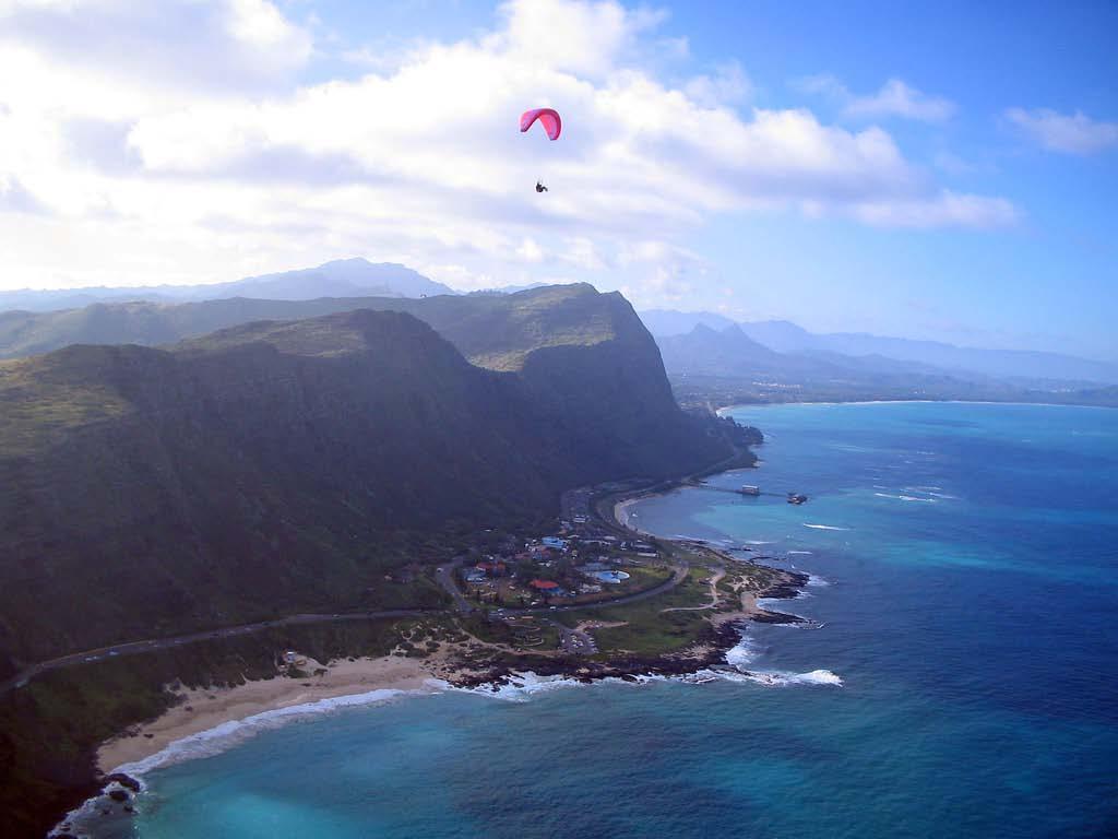
1 OFFSHORE SAND PROSPECTING IN HAWAII James H. Barry Sea Engineering, Inc. Waimanalo, HI Honolulu, Hawaii Makai Research Pier, Waimanalo, Hawaii Santa Cruz and Santa Barbara, California

 AND RESEARCH")
2 ABOUT US Coastal & Ocean Engineering, Marine Construction, Diving Huki Pono Huki Pau SEA ENGINEERING, INC. WAS FOUNDED IN 1973 BY UNIVERSITY OF HAWAII GRADUATE STUDENTS TO PROVIDE MARINE-RELATED ENGINEERING, CONSTRUCTION AND DIVING SERVICES. TODAY, WE HAVE FOUR OFFICE LOCATIONS IN HAWAII AND CALIFORNIA AND OVER 80 EMPLOYEES. OUR CLIENTS INCLUDE PROFESSIONAL, BUSINESS AND INDUSTRIAL FIRMS; MARINE CONTRACTORS; GOVERNMENT AGENCIES (STATE, FEDERAL, COUNTY) AND RESEARCH INSTITUTIONS. Honolulu, Hawaii Makai Research Pier, Waimanalo, Hawaii Santa Cruz, California


3 Why Offshore Sand Prospecting? Ka`anapali, Maui 2003 Kuhio Beach, Waikiki HAWAII BEACH SAND IS VIRTUALLY ALL CARBONATE DERIVED FROM OFFSHORE SOURCES ON-LAND SOURCES EXIST, BUT ARE LIMITED OR NOT AVAILABLE COASTAL EROSION IS A GROWING CONCERN AND CERTAIN AREAS HAVE CRITICAL NEEDS
4 EARLY RESEARCH OVERVIEW: Involved Organizations University of Hawaii (HIG) State of Hawaii, Marine Affairs Coordinator Sea Grant (NOAA) USACE Pacific Concrete and Rock Company, Ltd. Ocean Innovators (Fred Casciano) Marine Minerals Technology Center (MMTC - U.S. Bureau of Mines) Edward K. Noda & Associates (State Department of Transportation) Sea Engineering /Precision Signal (CEROS) MMTC USGS/Sea Engineering Present Sea Engineering UH Coastal Geology Group USACE Reconnaissance Sand Surveying and Sampling Surveying of Select Deposits Instrument Development Deposit Mapping and Characterization (Oahu) Deposit Mapping and Characterization (Oahu and Outer Islands)
5 EARLY RESEARCH: Offshore Sand Mapped Around Oahu GENERAL CONCLUSIONS: SAND DEPOSITS OCCUR IN ALLUVIAL CHANNELS AND WAVE-CUT TERRACES GROUND-TRUTH JET PROBES REVEALED THAT DEPOSITS ARE OFTEN THINNER THAN SHOWN BY GEOPHYSICS OFFSHORE SAND IS GENERALLY TOO FINE FOR BEACH NOURISHMENT, BUT SELECT LOCATIONS HAVE REASONABLE GRAIN SIZE CHARACTERISTICS OFFSHORE SAND IS GENERALLY GRAY IN COLOR PROSPECTING: 1. LOCATE SAND: SIDE SCAN AND MULTIBEAM SONAR, GEOLOGICAL INSIGHT, DIRECT OBSERVATION 2. DETERMINE SAND THICKNESS: SUB-BOTTOM PROFILING AND PROBING 3. DETERMINE GRAIN SIZE CHARACTERISTICS: VIBRACORE SAMPLING


6 EARLY RESEARCH: POOR QUALITY DATA


7 : SEI & PRECISION SIGNAL INSTRUMENT DEVELOPMENT: CHIRP SUB-BOTTOM SONAR FUNDED BY CEROS (CENTER OF EXCELLENCE FOR RESEARCH IN OCEAN SCIENCES) DESIGNED BY STEVE SCHOCK AND LESTER LEBLANC PRECISION SIGNAL, INC. (NOW PART OF EDGETECH) SPECIFICALLY FOR HAWAIIAN SAND DEPOSITS khz VARIABLE PULSE ACOUSTIC BAFFLING TO REDUCE NOISE WIDE 2-CHANNEL RECEIVE ARRAY

8 : USGS OAHU SURVEYS U.S. Geological Survey Open-File Report Geology of Reef-Front Carbonate Sediment Deposits around Oahu, Hawaii by Monty A. Hampton 1, Charles T. Blay 2, Christopher Murray 3, Laura Z. Torresan 1, Cathy S. Frazee 1, Bruce M. Richmond 1, and Charles H. Fletcher 4 1 U.S. Geological Survey, Menlo Park, CA 2 TEOK Investigations, Poipu, HI 3 Battelle Pacific Northwest National Laboratory, Richland, WA 4 University of Hawaii, Honolulu COMPREHENSIVE GEOPHYSICAL SURVEYING AND VIBRACORE SAMPLING AROUND OAHU
; very poor sorting; sand and pebble size clasts rounded to well rounded; composed mainly of a mix of calcareous algae (47.5%), coral fragments (15.")
, calcareous algae (28.5%) and foraminifera (16.0%); common carbonate rock fragments (6.0%), minor echinoid fragments (3.0%), mollusks (2.0%) and Halimeda (2.0%). VIBRACORE 31")
9 : USGS OAHU SURVEYS Vibracore 31V1, north coast Massive-appearing (bioturbated), pebbly, medium- to very coarse-grained, algal/coral/foraminiferal carbonate sand: grayish orange (10YR7/4); very poor sorting; sand and pebble size clasts rounded to well rounded; composed mainly of a mix of calcareous algae (47.5%), coral fragments (15.5%) and foraminifera (11.0%); common carbonate rock fragments (8.5%) and mollusks (11.0%).; light olive gray (5Y6/1);; composed mainly of a mix of coral fragments (38.5%), calcareous algae (28.5%) and foraminifera (16.0%); common carbonate rock fragments (6.0%), minor echinoid fragments (3.0%), mollusks (2.0%) and Halimeda (2.0%). VIBRACORE 31


 TOYO PUMP FOR SAND")
10 REEF TOP SAND: WAIKIKI DRAWING AND NOTES FROM CONSTRUCTION PLANS MAPPED BY UH COASTAL GEOLOGY GROUP (UHCGG) AND SEI USING AERIAL PHOTOGRAPHS, JET PROBES, AND GEOPHYSICS TYPICALLY 4-6 FT IN THICKNESS BEING USED FOR 24,000 CY NOURISHMENT OF KUHIO BEACH (JANUARY 2012) TOYO PUMP FOR SAND RECOVERY
 KAHULUI FOR MOFFETT & NICHOL /")
 WINDWARD AND NORTH SHORE OAHU NEARSHORE REEF CHANNEL")
11 SEI SURVEYS: RECENT WORK KA`ANAPALI SURVEYS FOR KA`ANAPALI OPERATIONS ASSOCIATION (2008) KAHULUI FOR MOFFETT & NICHOL / COUNTY OF MAUI (2008) POIPU / KAPA`A FOR COUNTY OF KAUAI (2011) WINDWARD AND NORTH SHORE OAHU NEARSHORE REEF CHANNEL DEPOSITS (2013)
 COMPREHENSIVE SONAR")


12 SEI SURVEYS: KA`ANAPALI (2008) COMPREHENSIVE SONAR SURVEYS, PROBING, AND VIBRACORE SAMPLING FOUND EXTENSIVE DEPOSITS SUITABLE FOR BEACH NOURISHMENT MOST SAND COMPOSED OF HALIMEDA CALCAREOUS GREEN ALGAE HALIMEDA MEADOW
 TYPICAL SUB-BOTTOM")


13 SEI SURVEYS: KAHULUI (2008) TYPICAL SUB-BOTTOM IMAGE SURVEY CONDUCTED TO PROSPECT FOR SAND SOURCE FOR NORTH SHORE OF MAUI EMERGENCE OF LIMESTONE SUBSTRATE


 VIBRACORING CONDUCTED IN")
14 SEI SURVEYS: POIPU (2011) SURVEY CONDUCTED AS PART OF ON- GOING COMPREHENSIVE STUDY OF POIPU BEACH: POIPU BEACH PARK RESTORATION STUDY (COUNTY OF KAUAI) VIBRACORING CONDUCTED IN NOVEMBER, 2011
")
15 SEI SURVEYS: POIPU (2011)

")
16 SEI SURVEYS: POIPU (2011)
 0.4 0.")
17 SEI SURVEYS: KAANAPALI (2008) Kaanapali Beach Sand vs Vibracore Samples 100 Mean -20% 20% V1BP0-4 V1BP V2BP*0-2 V2BP* V3BP0-2 V3BP2-4 V3BP V3BP6-8 V4BP0-6 % Finer Than by Weight V5BP2-4 V5BP6-8 V6H4-6 V7SW*0-4 V7SW*4-6 V8SW*0-8 V9H0-2 V9H6-8 V10SW0-2 V10SW2-4 V10SW V10SW6-8 V11SW V11SW6-8 V12H0-2 V13BP Size (mm) V14BP*0-2 V15H2-4 V16SW2-4 V16SW4-6 Figure 5-3: Kaanapali Beach Sand vs Vibracore Samples Note: Green = Halimeda sand, Blue = Kekaa Point sand, Red = Sand Wave area sand
18 ALOHA
South Oahu Reeftop Sand Bodies
 South Oahu Reeftop Sand Bodies 625500mE Iroquois Pt. Pearl Harbor Channel Keehi Lagoon 2358500mN Ewa Honolulu Honolulu International Airport Sand Island Figure 3 - Iroquois Pt. No data available (see Future
Regional-scale understanding of the geologic character and sand resources of the Atlantic inner continental shelf, Maine to Virginia
 Regional-scale understanding of the geologic character and sand resources of the Atlantic inner continental shelf, Maine to Virginia Workshop on Dredging, Beach Nourishment and Bird Conservation Atlantic
Wave Erosion. Michael Collier, Image Source: Earth Science World Image Bank
 Oceans Water Wave Erosion Michael Collier, Image Source: Earth Science World Image Bank Waves Michael Collier, Image Source: Earth Science World Image Bank Atlantic Waves Bruce Molnia US Geological Survey,
Task 4 - Reef-top Sand Fields of Maui, Kauai and Oahu
 Task 4 - Reef-top Sand Fields of Maui, Kauai and Oahu Kihei, Kahului, Poipu, Kikiaola, Waikiki, Kailua, Lanikai and Waimanalo United States Army Corps of Engineers, Honolulu Engineering District University
Sediment and Sedimentary rock
 Sediment and Sedimentary rock Sediment: An accumulation of loose mineral grains, such as boulders, pebbles, sand, silt or mud, which are not cemented together. Mechanical and chemical weathering produces
Geology of the Hawaiian Islands
 Geology of the Hawaiian Islands Class 12 19 February 2004 A B C D F 97 94 92 91 88 87 86 85 85 84 82 77 73 73 mean 66 64 60 69 60 57 51 29 Exam Scores Mean = 71 Median = 82/77 Any Questions? Sedimentary
Heather Schlosser Army Corps of Engineers Coastal Studies Group August 28, 2008
 Got sand? Regional Sediment Management in Orange County Heather Schlosser Army Corps of Engineers Coastal Studies Group August 28, 2008 Regional Sediment Management Regional sediment management recognizes
A National Outer Continental Shelf Sand / Sediment Inventory
 A National Outer Continental Shelf Sand / Sediment Inventory Sand Resource Areas Lease Areas Lora Turner December 15, 2016 Restoring and Protecting Our Nation s Coasts through Stewardship of OCS Resources
HAWAII REGIONAL SEDIMENT MANAGEMENT
 HAWAII REGIONAL SEDIMENT MANAGEMENT KAUAI Workshop January 20, 2011 Kauai Veteran s Center Kihei, HI of Engineers, Honolulu District AGENDA 1300-1310 Welcome and Introductions Conger Conant 1310-1330 Regional
A BEACH IS A BEACH. Or Is It? Hawaii. St. Croix, US Virgin Islands
 A BEACH IS A BEACH Or Is It? Pt. Reyes, California Western Florida Hawaii AGI What is a beach? Eastern Maine A beach is a strip of shoreline washed by waves and tides. Crane Key, Florida Bay St. Croix,
Paleo Lab #4 - Sedimentary Environments
 Paleo Lab #4 - Sedimentary Environments page - 1. CHARACTERISTICS OF SEDIMENT Grain size and grain shape: The sizes and shapes of sedimentary particles (grains) are modified considerably during their transportation
GEOLOGY MEDIA SUITE Chapter 5
 UNDERSTANDING EARTH, SIXTH EDITION GROTZINGER JORDAN GEOLOGY MEDIA SUITE Chapter 5 Sedimentation Rocks Formed by Surface Processes 2010 W.H. Freeman and Company Mineralogy of sandstones Key Figure 5.12
Feet. SAND; clayey, fine grained; shells are common; rounded quartz grains. SHELLS; muddy; almost no sand, shells and fragments common
 SAND; clayey, fine grained; shells are common; rounded quartz grains SHELLS; muddy; almost no sand, shells and fragments common SAND; back to medium to fine; has a mottled appearance and looks burrowed;
Sediment and sedimentary rocks Sediment
 Sediment and sedimentary rocks Sediment From sediments to sedimentary rocks (transportation, deposition, preservation and lithification) Types of sedimentary rocks (clastic, chemical and organic) Sedimentary
2013 SCEC Annual Report
 2013 SCEC Annual Report Collaborative research: Documentation of Tsunami Deposits in the Carpinteria Estuary: A signal of Great Earthquakes on the Pitas Point Thrust L. Reynolds, A. Simms, T.K. Rockwell,
The Ocean Floor Chapter 14. Essentials of Geology, 8e. Stan Hatfield and Ken Pinzke Southwestern Illinois College
 The Ocean Floor Chapter 14 Essentials of Geology, 8e Stan Hatfield and Ken Pinzke Southwestern Illinois College The vast world ocean Earth is often referred to as the water planet 71% of Earth s surface
Bathymetry Data and Models: Best Practices
 Bathymetry Data and Models: Best Practices Barry Eakins & Lisa Taylor The NOAA National Geophysical Data Center Over 600 data types - from the core of the Earth to the surface of the Sun NGDC Bathymetry
Dynamic preservation of the coastline
 Dynamic preservation of the coastline Content Introduction The Dutch coastal defence by dynamic processes Data collection Management of the sand resources Growing importance of marine sand and gravel resources
RESULTS FROM THE TEXAS COASTAL SEDIMENT SOURCES: A GENERAL EVALUATION STUDY
 RESULTS FROM THE TEXAS COASTAL SEDIMENT SOURCES: A GENERAL EVALUATION STUDY JUAN MOYA KELSEY CALVEZ CRIS WEBER ANTHONY RISKO *KEVIN FRENZEL FREESE AND NICHOLS, INC. COASTAL AND WATERWAYS GROUP OBJECTIVES
II Why study coastal landforms?
 COASTAL LANDFORMS (32) I Main topics A Why study coastal landforms? B Sediment budget and system response C Coastal landforms 3/26/15 GG454 1 II Why study coastal landforms? A Dynamic systems B Reflect
Reef-Top Sediment Bodies: Windward O ahu, Hawai i 1
 Reef-Top Sediment Bodies: Windward O ahu, Hawai i 1 Christopher Bochicchio, 2,4 Charles Fletcher, 2 Matthew Dyer, 2 and Thomas Smith 3 Abstract: Hawaiian fringing reefs display sand bodies on their surfaces
ST. LUCIE COUNTY, FLORIDA
 ST. LUCIE COUNTY, FLORIDA COASTAL STORM RISK MANAGEMENT PROJECT DRAFT INTEGRATED FEASIBILITY STUDY AND ENVIRONMENTAL ASSESSMENT APPENDIX D Geotechnical APRIL 2016 TABLE OF CONTENTS 1 Background... 3 1.1
Chapter 17. Ocean and Coastal Processes
 Chapter 17 Ocean and Coastal Processes Ocean Basins and Plates Ocean Basins Ocean Basins are profoundly different from the continents. Ocean crust is thin and dense and young. New ocean crust is generated
Appendix D Geotechnical
 USACE JACKSONVIE DISTRICT Appendix D Geotechnical LEE COUNTY GASPARIA SHORE PROTECTION PROJECT 934 REPORT June 216 TABLE OF CONTENTS 1 Background... 1 1.1 Regional Geology... 1 1.2 Local Geology... 2 2
The Coast: Beaches and Shoreline Processes
 1 2 3 4 5 6 7 8 9 The Coast: es and Shoreline Processes Trujillo & Thurman, Chapter 10 Oceanography 101 Chapter Objectives Recognize the various landforms characteristic of beaches and coastal regions.
MISSISSIPPI COASTAL IMPROVEMENTS
 MISSISSIPPI COASTAL IMPROVEMENTS PROGRAM (MsCIP) Comprehensive Barrier 237 27 200 237 27 200 Island 237 Restoration 27 200 Plan 80 9 27 252 74.59 255 255 255 0 0 0 63 63 63 3 32 22 239 65 53 0 35 20 2
Plans & Specs Level Offshore Sand Search Investigation, South Peninsula Volusia County, Florida U.S.A.
 Plans & Specs Level Offshore Sand Search Investigation, South Peninsula Volusia County, Florida U.S.A. Randall W. Parkinson, Ph.D., P.G., and Leighann Budde Coastal Technology Corporation Melbourne, FL
The Coast: Beaches and Shoreline Processes Trujillo & Thurman, Chapter 10
 The Coast: es and Shoreline Processes Trujillo & Thurman, Chapter 10 Oceanography 101 Chapter Objectives Recognize the various landforms characteristic of beaches and coastal regions. Identify seasonal
Geophysical Site Surveys
 Geophysical Site Surveys Simon Oakley Geoscience Team Leader Fugro Survey Limited 16/04/2014 Contents Menu Introduction Section 1 - Geophysical Site Surveys - Seabed Bathymetry - Shallow Geology - Seabed
 UNIT DESCRIPTIONS: Artificial Fill, Undocumented (Afu): Locally derived sandy silt and silty sand, locally with clay and varying amounts of gravel and man-made debris. Abundant concrete rubble, in places
Shoreline Changes in the Hawaiian Islands
 National Assessment of Shoreline Change: Historical Shoreline Changes in the Hawaiian Islands By Charles H. Fletcher 1, Bradley M. Romine 1, Ayesha S. Genz 1, Matthew M. Barbee 1, Matthew Dyer 1, Tiffany
Lab 7: Sedimentary Structures
 Name: Lab 7: Sedimentary Structures Sedimentary rocks account for a negligibly small fraction of Earth s mass, yet they are commonly encountered because the processes that form them are ubiquitous in the
National Marine Sanctuary Program
 National Marine Sanctuary Program NMSP/USGS Joint Seabed Mapping Initiative: September 2004 AA National Ocean Service National Marine Sanctuaries Interim Report September 2004 Background: Since 2002,
Sediment. Weathering: mechanical and chemical decomposition and disintegration of rock and minerals at the surface
 Sediment Some basic terminology Weathering: mechanical and chemical decomposition and disintegration of rock and minerals at the surface Erosion: removal of weathered rock and minerals from one place to
Marine Sediments. Introductory Oceanography. Ray Rector: Instructor
 Marine Sediments Introductory Oceanography Ray Rector: Instructor Ocean Basins are Vast Sinks for Huge Amounts of Sediment from Numerous Different Sources Four Major Types of Seafloor Sediments 1. Lithogenous
Marine Pothole Erosion, Oahu, Hawaii!
 Marine Pothole Erosion, Oahu, Hawaii! THE TERM "pothole" has been applied to a variety of depressions by many writers. The term is used here to describe depressions which are abraded and scoured by water
GLG Chapter 7 Sedimentary Environments & Rocks
 GLG 101 - Chapter 7 Sedimentary Environments & Rocks Name Note, Oct 11: I ll be writing this study sheet over the next few days. Each day I will add questions until the entire chapter is done, hopefully
Sedimentary Rocks. Weathering. Mechanical & Chemical Weathering. Sediments. Lithification. Deposition. Transport. Erosion.
 Lithification Sedimentary Rocks Sediments Deposition Transport Erosion Weathering Weathering The sediments that make up sedimentary rocks are produced by: Mechanical & Chemical Weathering Mechanical Weathering
THE DEPOSITS OF TSUNAMIS WESLEY PESANTEZ, CATHERINE NIELD, COLIN WINTER
 THE DEPOSITS OF TSUNAMIS WESLEY PESANTEZ, CATHERINE NIELD, COLIN WINTER AN OVERVIEW OF OUR SEMINAR WHAT IS A TSUNAMI WHY STUDY TSUNAMIS PROPERTIES OF TSUNAMIS TSUNAMI HYDRODYNAMICS IDEALIZED DEPOSITS SEDIMENT
EPS 50 Lab 4: Sedimentary Rocks
 Name: EPS 50 Lab 4: Sedimentary Rocks Grotzinger and Jordan, Chapter 5 Introduction In this lab we will classify sedimentary rocks and investigate the relationship between environmental conditions and
Investigation of possible tsunami events on the eastern coast of Taiwan: case studies of Lu-Ye, Changping, and Tulan
 Investigation of possible tsunami events on the eastern coast of Taiwan: case studies of Lu-Ye, Changping, and Tulan Speaker : FX. Anjar Tri Laksono Adviser : Louis Loung-Yie Tsai Date : October 19, 2017
CHAPTER 28. PHYSIOGRAPHY Cook Inlet Drainages
 PEBBLE PROJECT ENVIRONMENTAL BASELINE DOCUMENT 2004 through 2008 CHAPTER 28. PHYSIOGRAPHY Cook Inlet Drainages PREPARED BY: Knight Piésold Ltd. PHYSIOGRAPHY COOK INLET DRAINAGES TABLE OF CONTENTS TABLE
Ocean and Coastal Processes. Ocean Basins. Chapter 20. Ocean Basins and Plates. Ocean Terms. Sea Arch Bay-mouth Bar Spit Tombolo Coast.
 Chapter 20 Ocean Basins and Plates Ocean and Coastal Processes Tide Wave Height Length Period Base Refraction Tsunami Beach Sea stack Ocean Terms Sea Arch Bay-mouth Bar Spit Tombolo Coast Emergent Submergent
Sand Distribution and Statistical Spatial Characteristics on Pacific Reef Platforms
 Sand Distribution and Statistical Spatial Characteristics on Pacific Reef Platforms Charles H. Fletcher Geology and Geophysics, School of Ocean and Earth Science and Technology, University of Hawaii, 1680
Sediment Data for the Texas Coast
 Sediment Data for the Texas Coast Ray Newby, P.G. Coastal Geologist Coastal Resources Program Texas General Land Office George P. Bush, Land Commissioner Texas General Land Office (GLO) and the Texas Coast:
Feet CLAY; silty, greenish gray and clayey fine sand; Color: 5Y 3/1
 -. CLAY; silty, greenish gray and clayey fine sand; Color: Y /. -. SAND; fine-medium, clayey, with sandy clay layers; very abundant broken thin, tiny shells; shell hash at several horizons, heavily burrowed;
M14AC00004 Florida Cooperative Agreement:
 M14AC00004 Florida Cooperative Agreement: Synthesis of Existing Geophysical Data from Selected Areas on the Outer Continental Shelf Along Florida s Central East Coast. Florida Sand Management Working Group
Adaptation to Sea Level Rise A Regional Approach
 Adaptation to Sea Level Rise A Regional Approach Project Partners: in Saco Bay, ME Peter Slovinsky, Marine Geologist Maine Geological Survey, Department of Conservation Project Funding from: Saco Bay Hazards
What can I do with a major in Earth Information Science?
 Lewis-Clark State College offers a Bachelor of Arts or Science Degree in Earth Information Science through the Natural Sciences and Mathematics Division. You can learn more about the Natural Sciences and
GLY Coastal Geomorphology Notes
 GLY 4734 - Coastal Geomorphology Notes Dr. Peter N. Adams Spring 2011 2 Coastal Classification In this lecture, we discuss some successful classification schemes of the coastal landscape, and pay particular
Appendix I: Geographic Information System Data Sources
 Appendix I: Geographic Information System Data Sources Draft Environmental Impact Statement/Overseas Environmental Impact Statement Hawaii-Southern California Training and Testing TABLE OF CONTENTS...
Depositional Environment
 Depositional Environment Sedimentary depositional environment describes the combination of physical, chemical and biological processes associated with the deposition of a particular type of sediment. Types
PG&E OFFSHORE CENTRAL COASTAL CALIFORNIA SEISMIC IMAGING PROJECT
 PG&E OFFSHORE CENTRAL COASTAL CALIFORNIA SEISMIC IMAGING PROJECT Public Scoping Meeting California State Lands Commission July 21, 2011 Project Area Project Commitments Assessment of the Hosgri, Shoreline,
BOEM Marine Minerals Program
 BOEM Marine Minerals Program Restoring and Protecting Our Nation s Coasts through Stewardship of OCS Sand Resources SECOORA 2018 Annual Meeting May 22-24 Doug Piatkowski Douglas.piatkowski@boem.gov 703-787-1833
Alexandra Carvalho, Ph.D., GISP Kathy Fitzpatrick, P.E.
 Coastal Data Organization for Project Management and Coastal Planning Martin County, Florida Alexandra Carvalho, Ph.D., GISP Kathy Fitzpatrick, P.E. Outline County Coastal Programs Coastal Geodatabase
transform boundary Photograph by Robert E. Wallace, USGS.
 transform boundary The San Andreas Fault is undoubtedly the most famous transform boundary in the world. To the west of the fault is the Pacific plate, which is moving northwest. To the east is the North
Mechanisms for persistence of Gracilariopsis andersonii in the Elkhorn Slough: links to sediments. Megan Wehrenberg Moss Landing Marine Labs
 Mechanisms for persistence of Gracilariopsis andersonii in the Elkhorn Slough: links to sediments Megan Wehrenberg Moss Landing Marine Labs Gracilariopsis andersonii in Central CA Intertidal Open Coast
An overview of USGS Hurricane Sandy Supplemental Studies along the Delmarva Peninsula
 An overview of USGS Hurricane Sandy Supplemental Studies along the Delmarva Peninsula Neil K. Ganju, Laura L. Brothers, Nathaniel G. Plant, Christopher G. Smith, E. Robert Thieler Coastal and Marine Geology
Although not essential, a good quality hand lens is a valuable addition to your field kit.
 Field Sediment Card Sediment characteristics are an important element in understanding marine and estuarine environments.there are thus a wide range of people (perhaps you!) who regularly use measurements
As compaction and cementation of these sediments eventually occur, which area will become siltstone? A) A B) B C) C D) D
 A B) B C) C D) D") 1. A student obtains a cup of quartz sand from a beach. A saltwater solution is poured into the sand and allowed to evaporate. The mineral residue from the saltwater solution cements the sand grains together,
1. A student obtains a cup of quartz sand from a beach. A saltwater solution is poured into the sand and allowed to evaporate. The mineral residue from the saltwater solution cements the sand grains together,
Laboratory#6 Sediment Particle Size Distribution and Turbidity Flows
 Laboratory#6 Sediment Particle Size Distribution and Turbidity Flows Although this laboratory will pertain to oceanic sediments similar processes can also be observed on land and other aquatic systems
=%REPORT RECONNAISSANCE OF CHISHOLM LAKE PROSPECT. October 25, 1977
 =%REPORT ON FIELD RECONNAISSANCE OF CHISHOLM LAKE PROSPECT October 25, 1977 Bruce D. Vincent Imperial Oil Limited, Minerals - Coal, CALGARY, ALBERTA CHISHOLM LAKE PROSPECT Introduction The Chisholm Lake
Feet. Cape May Core #51 Start depth: 240 ft Stop depth: 245 ft Recovery (ft): 5.1 ft Date: 3/21/94 Described by: JVB, KGM, CL. 5.
: 5.1 ft Date: 3/21/94 Described by: JVB, KGM, CL. 5.") SAND; medium to fine sand with abundant silt, homogenous slightly mottled appearance; mica on outside, mostly quartz; few darks; peat layer.9 - ft; cnv - same as above; the last few cores are all the same;
SAND; medium to fine sand with abundant silt, homogenous slightly mottled appearance; mica on outside, mostly quartz; few darks; peat layer.9 - ft; cnv - same as above; the last few cores are all the same;
13. Sedimentary Rocks I (p )
") 13. Sedimentary Rocks I (p. 194-208) Sediment Deposition Weathering results in rock being broken down into smaller fragments, called regolith. This regolith is then broken down to form soil. The regolith
13. Sedimentary Rocks I (p. 194-208) Sediment Deposition Weathering results in rock being broken down into smaller fragments, called regolith. This regolith is then broken down to form soil. The regolith
Formation Stratigraphy and Interfingering at the Port of Miami
 Formation Stratigraphy and Interfingering at the Port of Miami AUGUST 6, 2012 PROJECT PARTNERS Public Sponsors 90% Equity Partner Contractor 10% Equity Partner VMS Operator Federal Support FUNDING PARTNERS
Aquatic Transfer Facility (ATF) San Pablo Bay (SPB) Proposed Region of ATF. Proposed Seabed Pipeline
 San Pablo Bay (SPB) Proposed Region of ATF. Proposed Seabed Pipeline") Aquatic Transfer Facility (ATF) San Pablo Bay (SPB) Proposed Region of ATF Proposed Seabed Pipeline Technical Studies An Overview Scope: Provide background and new scientific information and analysis for
Aquatic Transfer Facility (ATF) San Pablo Bay (SPB) Proposed Region of ATF Proposed Seabed Pipeline Technical Studies An Overview Scope: Provide background and new scientific information and analysis for
Aim and objectives Components of vulnerability National Coastal Vulnerability Assessment 2
 ASSESSING THE UTILITY OF GEOMORPHIC SENSITIVITY MAPPING ON THE ILLAWARRA COAST Pamela Abuodha, Christina Baker, Chris Sharples, Darren Skene and Colin Woodroffe Geoquest Research Centre, University of
Introduction to Acoustic Remote Sensing and Seafloor Mapping (AE4-E13) May 19, 2010
 May 19, 2010") Introduction to Acoustic Remote Sensing and Seafloor Mapping (AE4-E13) May 19, 2010 1 Delft Vermelding Institute onderdeel of Earth organisatie Observation and Space Systems Why Acoustic Remote Sensing?
Introduction to Acoustic Remote Sensing and Seafloor Mapping (AE4-E13) May 19, 2010 1 Delft Vermelding Institute onderdeel of Earth organisatie Observation and Space Systems Why Acoustic Remote Sensing?
Forecast of Nearshore Wave Parameters Using MIKE-21 Spectral Wave Model
 Forecast of Nearshore Wave Parameters Using MIKE-21 Spectral Wave Model Felix Jose 1 and Gregory W. Stone 2 1 Coastal Studies Institute, Louisiana State University, Baton Rouge, LA 70803 2 Coastal Studies
LIMESTONE POTENTIAL IN CIKATOMAS REGION BASED ON GEOLOGICAL MAPPING AND IT S ROLE TOWARDS DEVELOPMENT OF SOUTHERN PART OF WEST JAVA, INDONESIA
 LIMESTONE POTENTIAL IN CIKATOMAS REGION BASED ON GEOLOGICAL MAPPING AND IT S ROLE TOWARDS DEVELOPMENT OF SOUTHERN PART OF WEST JAVA, INDONESIA Presented at the FIG Working Week 2016, May 2-6, 2016 in Christchurch,
Core Examples from Modern Estuarine Tidal Bars, Tillamook Bay, Oregon
 Core Examples from Modern Estuarine Tidal Bars, Tillamook Bay, Oregon Rares Bistran* University of Alberta, Edmonton, Alberta, Canada rares.bistran@ualberta.ca David Herbers, Murray Gingras, John-Paul
Sedimentology & Stratigraphy. Thanks to Rob Viens for slides
 Sedimentology & Stratigraphy Thanks to Rob Viens for slides Sedimentology The study of the processes that erode, transport and deposit sediments Sedimentary Petrology The study of the characteristics and
PROFESSIONAL-CLERICAL RATIO REPORT
 PROFESSIONAL-CLERICAL RATIO REPORT UNIVERSITY OF HAWAI I FY 2005-06 University Budget Office University of Hawai i September 2006 File Reference: Management and Planning Support Folder, Courses Reports
EMPLOYER SURVEY 2001 of the UNDERGRADUATE PROGRAM DEPARTMENT OF GEOLOGY AND GEOPHYSICS
 EMPLOYER SURVEY 2001 of the UNDERGRADUATE PROGRAM DEPARTMENT OF GEOLOGY AND GEOPHYSICS INTRODUCTION An employer survey was conducted as part of a series of surveys undertaken to meet the accreditation
1 Shoreline Landforms 2. 2 Emergent v. Submergent 2. 3 Wavecutting 3. 4 Planview 4. 5 Marine Terraces 5. 6 California 7. 7 Tombolos, Sea Stacks 8
 Shorelines November 9, 2008 Contents 1 Shoreline Landforms 2 2 Emergent v. Submergent 2 3 Wavecutting 3 4 Planview 4 5 Marine Terraces 5 6 California 7 7 Tombolos, Sea Stacks 8 8 Active Processes 9 9 Emergence
Environmental Geophysics for Coastal Management
 Environmental for Coastal Management Paul Donaldson 1, Dr Douglas Bergersen 2, Dr Matthew Barnes 3, Conor Jones 3 Coast To Coast, Hobart April 2018 1 BMT Newcastle, Australia, 2 Acoustic Imaging, Cooroy,
1 Shoreline Erosion and Deposition
 CHAPTER 12 1 Shoreline Erosion and Deposition SECTION Agents of Erosion and Deposition BEFORE YOU READ After you read this section, you should be able to answer these questions: What is a shoreline? How
Field trip guide to the Marin Headlands (Golden Gate National Recreation Area) and the Point Reyes National Seashore
 and the Point Reyes National Seashore") Name: Field trip guide to the Marin Headlands (Golden Gate National Recreation Area) and the Point Reyes National Seashore Geology of the National Parks San Francisco State University April 20, 2002 DRIVING
Name: Field trip guide to the Marin Headlands (Golden Gate National Recreation Area) and the Point Reyes National Seashore Geology of the National Parks San Francisco State University April 20, 2002 DRIVING
Summer 2014 Reading the Geologic History of Doheny State Beach Rodger More LAYERS LET S TAKE A TOUR THE BLUFFS
 Summer 2014 Reading the Geologic History of Doheny State Beach Rodger More DSBIA Board Officer and Geologist (retired) LAYERS of sediment and rock are like a book. Formations make up chapters and individual
SONGS Seismic Research Projects
 SONGS Seismic Research Projects Energy Division Independent Peer Review Group September 21, 2012 Agenda Background Overview Project Support Permits, Approvals, and Reviews Schedule Use of Advanced Technologies
Cretaceous, Dakota Formation, Terra Cotta Member South Side of I-70, Salina County, Kansas
 Cretaceous, Dakota Formation, Terra Cotta Member South Side of I-70, Salina County, Kansas Written By: Steven D.J. Baumann G-102010-1A Outcrop looking southeast Photo taken by: Steven Baumann on 10-20-2010
Geology 252, Historical Geology, California State University, Los Angeles - professor: Dr. Alessandro Grippo
 LAB # 1 - CLASTIC ROCKS Background: - Mechanical and Chemical Weathering - Production of Clastic Sediment - Classification of Sediment according to size: Gravel, Sand, Silt, Clay - Erosion, Transportation
A Synopsis of the Krakatau 1883 Eruption: The Story Told by The Deposits
 A Synopsis of the Krakatau 1883 Eruption: The Story Told by The Deposits By Dr. Charles W. Mandeville American Museum of Natural History Dr. Steve Carey Dr. Haraldur Sigurdsson, both at Univ. Rhode Island,
Notes and Summary pages:
 Topographic Mapping 8.9C Interpret topographical maps and satellite views to identify land and erosional features and predict how these shapes may be reshaped by weathering ATL Skills: Communication taking
Sedimentary Rocks. Origin, Properties and Identification. Physical Geology GEOL 101 Lab Ray Rector - Instructor
 Sedimentary Rocks Origin, Properties and Identification Physical Geology GEOL 101 Lab Ray Rector - Instructor Sedimentary Rock Origin and Identification Lab Pre-Lab Internet Link Resources 1) http://www.rockhounds.com/rockshop/rockkey/index.html
THE STRUCTURE AND THICKNESS OF THE CLINTON AND BEREA FORMATIONS IN THE VICINITY OF WOOSTER, OHIO
 THE STRUCTURE AND THICKNESS OF THE CLINTON AND BEREA FORMATIONS IN THE VICINITY OF WOOSTER, OHIO KARL VER STEEG College of Wooster INTRODUCTION AND ACKNOWLEDGMENTS The data used in the construction of
ENGINEERING WITH NATURE: NEARSHORE BERM PLACEMENTS AT FORT MYERS BEACH AND PERDIDO KEY, FLORIDA, USA
 1 ENGINEERING WITH NATURE: NEARSHORE BERM PLACEMENTS AT FORT MYERS BEACH AND PERDIDO KEY, FLORIDA, USA KATHERINE E. BRUTSCHÉ 1, PING WANG 2, JULIE D. ROSATI 1, CHERYL E. POLLOCK 1 1. U.S. Army Engineer
Mapping of Future Coastal Hazards. for Southern California. January 7th, David Revell, Ph.D. E.
 Mapping of Future Coastal Hazards for Southern California January 7th, 2014 David Revell, Ph.D. drevell@esassoc.com E. Vandebroek, 2012 Outline Coastal erosion hazard zones Flood hazard zones: Coastal
Amelia Island, Nassau County, FL Marine Geological Field Investigation for Offshore Geologic Model Support
 Amelia Island, Nassau County, FL for Offshore Geologic Model Support BOEM Notice of Scientific Research NA15 001 Submitted to: Bureau of Ocean Energy Management (BOEM) Florida Department of Environmental
Redwood City Harbor, California, Navigation Improvement Feasibility Study. Appendix D. Geotechnical Engineering. DRAFT April 2015
 1 Redwood City Harbor, California, Navigation Improvement Feasibility Study Appendix D Geotechnical Engineering DRAFT April 2015 2 Contents 1 Purposes of Report... 3 2 Background... 3 3 References and
FINMARINET: Inventories and Planning for the Marine Natura 2000 Network in Finland. A.2 Geological inventories of the seafloor Final Report
 LIFE07 NAT/FIN/000151 FINMARINET: Inventories and Planning for the Marine Natura 2000 Network in Finland A.2 Geological inventories of the seafloor Final Report Geological Survey of Finland, GTK 1. Introduction
Hiking the Bold Coast, Cutler, Maine
 Maine Geologic Facts and Localities June, 2010 Hiking the Bold Coast, Cutler, Maine 44 o 39 36.34 N, 67 o 12 46.99 W Text by Robert A. Johnston, Department of Agriculture, Conservation & Forestry 1 Map
3.1 GEOLOGY AND SOILS Introduction Definition of Resource
 3.1 GEOLOGY AND SOILS 3.1.1 Introduction 3.1.1.1 Definition of Resource The geologic resources of an area consist of all soil and bedrock materials. This includes sediments and rock outcroppings in the
Supplemental Slides. Shore: Junction of Land & Water. Junction of Land & Water. Sea Level Variations. Shore vs. Coast. Sea Level Variations
 Shore: Junction of Land & Water Supplemental Slides Sediments come off land Most get dumped at the beach Sediment interacts with ocean waves and currents Junction of Land & Water Features: Breaking waves,
Shore: Junction of Land & Water. Sediments come off land Most get dumped at the beach Sediment interacts with ocean waves and currents
 Shore: Junction of Land & Water Supplemental Slides Sediments come off land Most get dumped at the beach Sediment interacts with ocean waves and currents Junction of Land & Water Features: Breaking waves,
Small area of the ocean that is partially surrounded by land. The Ocean Basins. Three Major Oceans. Three Major Oceans. What is a SEA?
 The Ocean Basins How Deep is the Ocean? 1 2 Three Major Oceans Three Major Oceans Pacific Atlantic the shallowest ocean (3.3km average depth) Indian second shallowest ocean (3.8km average depth) Pacific
Geology and Natural Resources
 Geology and Natural Resources Brought to you by: Western Michigan University Department of Geosciences and The Michigan Geological Repository for Research and Education s K-12 Outreach Program Core Kids
Department of Geosciences. Geology Meteorology Oceanography
 Department of Geosciences Geology Meteorology Oceanography Geoscientists study the earth Rivers Soils Lake sediments Evidence of ancient oceans Maps Volcanoes Fence offset by San Andreas fault Water quality
The Marine Environment
 The Marine Environment SECTION 16.1 Shoreline Features In your textbook, read about erosional landforms, beaches, estuaries, longshore currents, and rip currents. For each statement below, write true or