An overview of USGS Hurricane Sandy Supplemental Studies along the Delmarva Peninsula
|
|
|
- Percival Dennis
- 5 years ago
- Views:
Transcription


1 An overview of USGS Hurricane Sandy Supplemental Studies along the Delmarva Peninsula Neil K. Ganju, Laura L. Brothers, Nathaniel G. Plant, Christopher G. Smith, E. Robert Thieler Coastal and Marine Geology Program U.S. Department of the Interior U.S. Geological Survey
2 Science for a Stormy World USGS Science Supporting the Department of Interior s Response Wetland Physical Change (Plant, Smith) - Quantify estuarine and wetland shoreline change - Construct statistical models of change - Evaluate wetland vulnerability Estuarine Physical Response (Ganju, Smith) - Quantify estuarine response to storm forcing - Develop numerical models of estuarine physics - Evaluate future responses to storm forcing Offshore geological framework (Brothers, Thieler) - Describe sediment sources, pathways, sinks - Map geologic framework - Understand geologic influence on coastal evolution
3 Science for a Stormy World USGS Science Supporting the Department of Interior s Response Wetland Physical Change (Plant, Smith) - Quantify estuarine and wetland shoreline change - Construct statistical models of change - Evaluate wetland vulnerability Estuarine Physical Response (Ganju, Smith) - Quantify estuarine response to storm forcing - Develop numerical models of estuarine physics - Evaluate future responses to storm forcing Offshore geological framework (Brothers, Thieler) - Describe sediment sources, pathways, sinks - Map geologic framework - Understand geologic influence on coastal evolution

 Gieder et al.")
4 Wetland Physical Change Statistical approach to quantify estuarine shoreline change Prior examples Gutierrez et al (shoreline change) Fienen et al (ground water) Gieder et al (piping plover success)

 Conversion to open water (interior and marsh islands) Impact")
5 Wetland Physical Change Before H. Sandy After H. Sandy Wetland burial by overwash Mode of change Burial Erosion Collapse Examples Overwash, dune formation (estuarine shoreline, open coast, barrier islands) Undercutting, bank erosion, slumping (estuarine shoreline, open coast) Conversion to open water (interior and marsh islands) Impact Duration Ephemeral to permanent Permanent Permanent


6 Wetland Physical Change Remote sensing to quantify geomorphic change: LiDAR


7 Wetland Physical Change Sampling to constrain origins of event layers and vertical change

8 Wetland Physical Change Integration into Bayesian statistical model
9 Science for a Stormy World USGS Science Supporting the Department of Interior s Response Wetland Physical Change (Plant, Smith) - Quantify estuarine and wetland shoreline change - Construct statistical models of change - Evaluate wetland vulnerability Estuarine Physical Response (Ganju, Smith) - Quantify estuarine response to storm forcing - Develop numerical models of estuarine physics - Evaluate future responses to storm forcing Offshore geological framework (Brothers, Thieler) - Describe sediment sources, pathways, sinks - Map geologic framework - Understand geologic influence on coastal evolution


10 Tidal wetland response: a 3D process

11 Modeling wetland response: wave attack WAVES CONTROL EROSION Along Marsh Boundaries INHERENTLY UNSTABLE Horizontal Direction Modified after Tonelli et al. (2010)

12 Modeling wetland response: wave attack Assessment of shoreline during Sandy using COAWST* model *Coupled Ocean Atmosphere Wave Sediment Transport Model High wave attack Low wave attack Forsythe NWR, NJ 5 miles


13 Modeling seagrass response SAV density in Chincoteague Bay, MD/VA Data from Orth et al., VIMS ( Maps generated by Casey Hodgkins, CBL

14 Measuring light climate for seagrass Critical input for biogeochemical models - Nortek ADCP - RBR D wave - YSI EXO2 - Pair of WetLabs ECO-PARSB
15 Measuring light climate for seagrass Time-series data from Barnegat Bay: sharp N-S gradients


16 Modeling seagrass response to light climate ROMS 3D Circulation Model Fasham NPZD model. Gallegos spectral irradiance model Zimmerman bio-optical model

 1.13 Outer Snug 1.10 1.08 1.05 P/R 1.03 1.00 0.98 0.95 0.93 0.")
 0 10 25 50 75 94 del Barrio et al., 2014 Sea level rise (m) 0 0.")
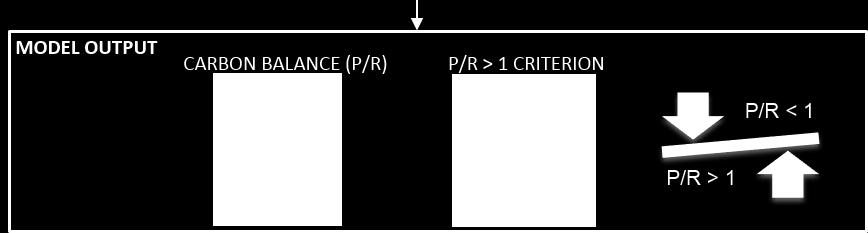
17 Modeling seagrass response to light climate COMBINED SCENARIOS Lat (º) The combined scenarios show an increase of the P/R ratio at both sites Seagrass recovery possible in inner harbor In the long term, SLR effect will be stronger and P/R will decrease in Outer Harbor Lon (º) 1.13 Outer Snug P/R CS_0 CS_1 CS_2 CS_3 CS_4 CS_5 Scenarios Combined Scenario (CS) CS_0 CS_1 CS_2 CS_3 CS_4 CS_5 Nitrate reduction (%) del Barrio et al., 2014 Sea level rise (m)


18 Measuring influence of breaches on estuary Balancing flood protection with natural processes in bays Barrier-island breach at Fire Island, NY 05 May 2009 Study showed that small breaches did not increase mainland vulnerability to storm flooding 05 Nov 2012
19 Modeling influence of breaches on estuary Testing landscape configurations: new breaches

")
 Bottom platform (waves,")
 Assateague Island NS,")
20 Measurements describe physical processes Measuring storm surge, waves, and landscape change Rapid deployment gage (waves, water level) Acoustic altimeter (seabed elevation) Bottom platform (waves, water level, sediment movement, water quality) Assateague Island NS, MD Chincoteague NWR, VA
21 Science for a Stormy World USGS Science Supporting the Department of Interior s Response Wetland Physical Change (Plant, Smith) - Quantify estuarine and wetland shoreline change - Construct statistical models of change - Evaluate wetland vulnerability Estuarine Physical Response (Ganju, Smith) - Quantify estuarine response to storm forcing - Develop numerical models of estuarine physics - Evaluate future responses to storm forcing Offshore geological framework (Brothers, Thieler) - Describe sediment sources, pathways, sinks - Map geologic framework - Understand geologic influence on coastal evolution

22 Maximizing effort by collaboration and combining datasets NOAA NOS collected bathymetry Twenty-three hydrographic surveys create a regional bathymetry map over 4100 km 2. (Pendelton et al., 2014)

23 Regional backscatter mosaic. (Pendelton et al., 2014)

24 USGS Geophysical mapping of the inner continental shelf 2014 tracklines and sample sites km of tracklines -133 grab samples and photos/videos Another 37 days of ship time in Survey efforts will likely continue to the southern tip of the Delmarva peninsula

25 5-meter bathymetric data collected using a Swathplus Interferometric Sidescan Sonar234 khz.

26 1-meter sidescan sonar mosaic image collected using a Klein 3000 Sidescan sonar 100 & 500 khz.

27 2014 Chirp Seismic Reflection Profile Data -Resolve subsurface units/characteristics -Aid in constructing sediment budgets -Insight into coastal system s response to sea-level rise Seafloor Barrier Island lithosomes Channel Natural gas Channel

28 Chirp seismic reflection profile with interpretation

29 Boomer system resolves deeper geologic strata
30 Products: open-file reports and journals Interpreted sediment texture map using published backscatter and grab samples from Maryland Geological Survey, NOAA-NOS and USGS. Difference analysis between bathy and backscatter datasets collected during different years Isopach maps of mobile sediment availability. Integration of sub-bottom data with other data types to better resolve inner continental shelf evolution.
31 Science for a Stormy World USGS Science Supporting the Department of Interior s Response Wetland Physical Change (Plant, Smith) - Quantify estuarine and wetland shoreline change - Construct statistical models of change - Evaluate wetland vulnerability Estuarine Physical Response (Ganju, Smith) - Quantify estuarine response to storm forcing - Develop numerical models of estuarine physics - Evaluate future responses to storm forcing Offshore geological framework (Brothers, Thieler) - Describe sediment sources, pathways, sinks - Map geologic framework - Understand geologic influence on coastal evolution
Mapping, monitoring, and modeling: USGS Coastal and Marine Geology activities along the Northeast coast
 Mapping, monitoring, and modeling: USGS Coastal and Marine Geology activities along the Northeast coast Coastal and Marine Geology Program Woods Hole Coastal and Marine Science Center St. Petersburg Coastal
Regional-scale understanding of the geologic character and sand resources of the Atlantic inner continental shelf, Maine to Virginia
 Regional-scale understanding of the geologic character and sand resources of the Atlantic inner continental shelf, Maine to Virginia Workshop on Dredging, Beach Nourishment and Bird Conservation Atlantic
The Use of Geographic Information Systems to Assess Change in Salt Marsh Ecosystems Under Rising Sea Level Scenarios.
 The Use of Geographic Information Systems to Assess Change in Salt Marsh Ecosystems Under Rising Sea Level Scenarios Robert Hancock The ecological challenges presented by global climate change are vast,
Summary Visualizations for Coastal Spatial Temporal Dynamics
 Summary Visualizations for Coastal Spatial Temporal Dynamics October 24 2011 Providence, RI Sidharth Thakur 1, Laura Tateosian 2, Helena Mitasova, Eric Hardin, and Margery Overton 1. sthakur@renci.org,
A National Outer Continental Shelf Sand / Sediment Inventory
 A National Outer Continental Shelf Sand / Sediment Inventory Sand Resource Areas Lease Areas Lora Turner December 15, 2016 Restoring and Protecting Our Nation s Coasts through Stewardship of OCS Resources
Coastal Inlets Research Program US Army Corps of Engineers Engineering Research and Development Center
 Coastal Inlets Research Program US Army Corps of Engineers Engineering Research and Development Center Site of Moriches Inlet Nov. 1951 Julie Dean Rosati and Nicholas C. Kraus, CIRP Program Manager Shinnecock
9 th INTECOL Orlando, Florida June 7, 2012
 Restoration of the Everglades Saline Wetlands and Florida Bay: Responses Driven from Land and Sea David Rudnick 1, Colin Saunders 2, Carlos Coronado 2, Fred Sklar 2 Erik Stabenau 1, Vic Engel 1, Rene Price
Current and Future Technology Applications for Coastal Zone Management. Bruce K. Carlisle, Acting Director Office of Coastal Zone Management
 Current and Future Technology Applications for Coastal Zone Management Bruce K. Carlisle, Acting Director Office of Coastal Zone Management The Massachusetts Coastal Zone Management Program Approved in
Introduction to Acoustic Remote Sensing and Seafloor Mapping (AE4-E13) May 19, 2010
 May 19, 2010") Introduction to Acoustic Remote Sensing and Seafloor Mapping (AE4-E13) May 19, 2010 1 Delft Vermelding Institute onderdeel of Earth organisatie Observation and Space Systems Why Acoustic Remote Sensing?
Introduction to Acoustic Remote Sensing and Seafloor Mapping (AE4-E13) May 19, 2010 1 Delft Vermelding Institute onderdeel of Earth organisatie Observation and Space Systems Why Acoustic Remote Sensing?
Tony Pratt, DNREC to The Center for the Inland Bays Scientific and Technical Advisory Committee. August 21, 2009
 Sea Level Rise in Delaware Presented by Tony Pratt, DNREC to The Center for the Inland Bays Scientific and Technical Advisory Committee August 21, 2009 Sea level has been fluctuating ever since there have
Geology Setting Management Options Management Structure
 Geology Setting Management Options Management Structure WFF = Wallops Flight Facility LST = Longshore sediment transport SLR = Sea level rise September 29, 2015 Accomack County/Accomack Northampton County
USING MIKE TO MODEL COASTAL CATASTROPHE RISK
 USING MIKE TO MODEL COASTAL CATASTROPHE RISK Nicola Howe, Christopher Thomas, Joss Matthewman, John Maskell* 1 SUMMARY About RMS Who are we and what do we do? How do we use MIKE in our workflow? Case study:
Donald K. Stauble and Bill Birkemeier Coastal and Hydraulics Laboratory US Army Corps of Engineers
 Donald K. Stauble and Bill Birkemeier Coastal and Hydraulics Laboratory US Army Corps of Engineers Define the Problem Navigation Shore Protection Environmental Political So what is the problem? Management
Australian Coastal Councils Conference
 Australian Coastal Councils Conference 11 March 2015 Estimating Future Coastal Inundation and Erosion Hazards Dr Andrew McCowan Dr Christine Lauchlan-Arrowsmith Warwick Bishop Background Victorian Future
Importance of Understanding Coastal Landforms
 Importance of Understanding Coastal Landforms Costa Concordia Shipwreck, Isola del Giglio, Italy Depositional Coastal Landforms Can interpret landforms in light of geomorphic processes, both terrestrial
Sea-level Rise and Storm Effects on Coastal Systems under Changing Global Climate. Cape May, NJ 12 January 2009
 Sea-level Rise and Storm Effects on Coastal Systems under Changing Global Climate 2009 Delaware Estuary Science Summit Cape May, NJ 12 January 2009 S. Jeffress Williams Senior Coastal Marine Geologist
Some Thoughts on the Role of Elevation
 Some Thoughts on the Role of Elevation Data in Sea-level Rise Impact Assessments Rob Thieler* U.S. Geological Survey Coastal and Marine Geology Program Woods Hole, MA *i l d t i l d f D C h D G h *includes
Sediment Management in the Coastal Bays
 Sediment Management in the Coastal Bays Introduction Need for ecosystem view of sediment management in Coastal Bays Island loss and restoration Navigation needs Habitat Trade offs Living Shoreline Requirements
Coastal and Marine Ecological Classification Standard (CMECS)
") Coastal and Marine Ecological Classification Standard (CMECS) Mark Finkbeiner NOAA Coastal Services Center Presented at the International Workshop on Seabed Mapping Methods and Technology 18 October 2012
Coastal and Marine Ecological Classification Standard (CMECS) Mark Finkbeiner NOAA Coastal Services Center Presented at the International Workshop on Seabed Mapping Methods and Technology 18 October 2012
COASTAL EVOLUTION AND CLIMATE CHANGE: CHALLENGES OF MULTI-SCALE SPATIAL AND TEMPORAL VARIABILITY
 COASTAL EVOLUTION AND CLIMATE CHANGE: CHALLENGES OF MULTI-SCALE SPATIAL AND TEMPORAL VARIABILITY Dr. Jennifer L. Miselis Naval Research Laboratory Stennis Space Center, MS jmiselis@nrlssc.navy.mil 1 PRIMARY
Sea-level Rise on Cape Cod: How Vulnerable Are We? Rob Thieler U.S. Geological Survey Woods Hole, MA
 Sea-level Rise on Cape Cod: How Vulnerable Are We? Rob Thieler U.S. Geological Survey Woods Hole, MA Outline Sea-level and coastal processes Past sea-level change Predictions for the future Coastal responses
PRESENTATION TITLE. Regional Sediment Management Application of a Coastal Model at the St. Johns River Entrance BUILDING STRONG
 PRESENTATION TITLE Regional Sediment Management Application of a Coastal Model at the St. Johns River Entrance Steven Bratos Senior Coastal Engineer U.S. Army Corps of Engineers Jacksonville District February
COASTAL DATA APPLICATION
 2015 Coastal GeoTools Proactive By Design. Our Company Commitment COASTAL DATA APPLICATION Projecting Future Coastal Flood Risk for Massachusetts Bay Bin Wang, Tianyi Liu, Daniel Stapleton & Michael Mobile
Sea Level Rise in Miami-Dade County Florida Implications for Management of Coastal Wetlands and the Everglades
 Sea Level Rise in Miami-Dade County Florida Implications for Management of Coastal Wetlands and the Everglades Peter W. Harlem Dr. John F. Meeder Florida International University Southeast Environmental
Subaqueous Soils A A New Frontier in Soil Survey. By Jim Turenne
 Subaqueous Soils A A New Frontier in Soil Survey By Jim Turenne http://nesoil.com.sas Subaqueous History Traditional soil survey conducted on land. Not a lot of work in wetlands and tidal marshes until
Coastal Storms of the New Jersey Shore
 Coastal Storms of the New Jersey Shore Dr. Steven G. Decker Dept. of Environmental Sciences School of Environmental and Biological Sciences Rutgers University May 25, 2011 Overview Threats Historical Examples
Field and Numerical Study of the Columbia River Mouth
 DISTRIBUTION STATEMENT A. Approved for public release; distribution is unlimited. Field and Numerical Study of the Columbia River Mouth Guy Gelfenbaum 400 Natural Bridges Dr. Santa Cruz, CA 95060 Phone:
Everglades National Park
 National Park Service U.S. Department of the Interior Climate Variability and the Coastal Physical Environment (Florida Bay) Presented by: Erik Stabenau - National Park Service Contributions from: Christina
The use of MIKE21 to study the. barrier beach system of Inner Dingle Bay, Co. Kerry, Ireland. Dr. Michael O Shea Malachy Walsh and Partners
 The use of MIKE21 to study the morphodynamic evolution of the mid-bay barrier beach system of Inner Dingle Bay, Co. Kerry, Ireland Dr. Michael O Shea Malachy Walsh and Partners Contents Why Study Morphodynamics
Coastal Barrier Island Network (CBIN): Management strategies for the future
: Management strategies for the future") Coastal Barrier Island Network (CBIN): Management strategies for the future Heather Joesting*, Amy Williams**, Rusty Feagin**, and William K. Smith* *Department of Biology, Wake Forest University, Winston
Coastal Barrier Island Network (CBIN): Management strategies for the future Heather Joesting*, Amy Williams**, Rusty Feagin**, and William K. Smith* *Department of Biology, Wake Forest University, Winston
Forecast of Nearshore Wave Parameters Using MIKE-21 Spectral Wave Model
 Forecast of Nearshore Wave Parameters Using MIKE-21 Spectral Wave Model Felix Jose 1 and Gregory W. Stone 2 1 Coastal Studies Institute, Louisiana State University, Baton Rouge, LA 70803 2 Coastal Studies
Stratigraphic and Geoacoustic Characterization of the Outer New Jersey Shelf
 Stratigraphic and Geoacoustic Characterization of the Outer New Jersey Shelf John A. Goff Institute for Geophysics, Jackson School of Geoscience University of Texas at Austin JJ Pickle Research Campus,
2) re-positioning of the SSS data, 3) individuation of geomorphological features and morphometrical parameters correlated to instability phenomena.
 re-positioning of the SSS data, 3) individuation of geomorphological features and morphometrical parameters correlated to instability phenomena.") HIGH-RESOLUTION SIDE SCAN SONAR AND MULTIBEAM DATA PROCESSING AND MERGING TO STUDY SUBMARINE INSTABILITY PHENOMENA ON VOLCANIC ISLANDS (PONTINE, CAMPANIAN AND AEOLIAN ARCHIPELAGOS) A. BOSMAN Extended abstract:
HIGH-RESOLUTION SIDE SCAN SONAR AND MULTIBEAM DATA PROCESSING AND MERGING TO STUDY SUBMARINE INSTABILITY PHENOMENA ON VOLCANIC ISLANDS (PONTINE, CAMPANIAN AND AEOLIAN ARCHIPELAGOS) A. BOSMAN Extended abstract:
Dynamics of Ripples on the Sandy Inner Shelf off Martha s Vineyard: Surveys, Field Measurements, and Models
 Dynamics of Ripples on the Sandy Inner Shelf off Martha s Vineyard: Surveys, Field Measurements, and Models Christopher R. Sherwood U.S. Geological Survey, Woods Hole Science Center 384 Woods Hole Road
Primer on Coastal Erosion And Habitat Creation
 2 nd Regional Conference Dredging, Beach Nourishment & Bird Conservation Primer on Coastal Erosion And Habitat Creation Timothy Kana Ph.D Source: Newsday 1962 Photo by Kelsey Aerials 1978 Source: U Mass
Mapping of Future Coastal Hazards. for Southern California. January 7th, David Revell, Ph.D. E.
 Mapping of Future Coastal Hazards for Southern California January 7th, 2014 David Revell, Ph.D. drevell@esassoc.com E. Vandebroek, 2012 Outline Coastal erosion hazard zones Flood hazard zones: Coastal
The Science of Sea Level Rise and the Impact of the Gulf Stream
 Old Dominion University ODU Digital Commons July 29, 2016: The Latest in Sea Level Rise Science Hampton Roads Sea Level Rise/Flooding Adaptation Forum 7-29-2016 The Science of Sea Level Rise and the Impact
Quantifying effects of oil on coastal dune vegetation. Thomas Miller and Elise Gornish Biological Science, Florida State University
 Quantifying effects of oil on coastal dune vegetation Thomas Miller and Elise Gornish Biological Science, Florida State University Natural History of Barrier Islands in the Northern Gulf Make up ~70% of
ANALYSIS OF SEISMIC PROFILES AND SIDE-SCAN SONAR RECORDS FROM LOWER NEW YORK HARBOR, A PROGRESS REPORT. Roger D. Flood Vicki Lynn Ferrini
 45 ANALYSIS OF SISMIC PROFILS AND SID-SCAN SONAR RCORDS FROM LOWR NW YORK HARBOR, A PROGRSS RPORT Roger D. Flood Vicki Lynn Ferrini Marine Sciences Research Center State University of New York, Stony Brook,
Modeling Coastal Change Using GIS Technology
 Emily Scott NRS 509 Final Report December 5, 2013 Modeling Coastal Change Using GIS Technology In the past few decades, coastal communities around the world are being threatened by accelerating rates of
MISSISSIPPI COASTAL IMPROVEMENTS
 MISSISSIPPI COASTAL IMPROVEMENTS PROGRAM (MsCIP) Comprehensive Barrier 237 27 200 237 27 200 Island 237 Restoration 27 200 Plan 80 9 27 252 74.59 255 255 255 0 0 0 63 63 63 3 32 22 239 65 53 0 35 20 2
Development of a coastal modeling system
 Development of a coastal modeling system John Warner US Geological Survey Coastal and Marine Geology Program Woods Hole, MA U.S. Department of the Interior U.S. Geological Survey Jeff List Rob Thieler
Byblos & the Sea - an HFF funded project Summary report: Sea Survey Mission 7 - Sept. 2016
 Byblos & the Sea - an HFF funded project Summary report: Sea Survey Mission 7 - Sept. 2016 In the framework of the research program Byblos and the Sea a marine remote sensing and sampling survey was carried
Changes in bottom morphology of Long Island Sound near Mount Misery Shoal as observed through Repeated Multibeam Surveys
 Changes in bottom morphology of Long Island Sound near Mount Misery Shoal as observed through Repeated Multibeam Surveys Laurie A. Zaleski Laurie.Zaleski@msrc.sunysb.edu Roger D. Flood rflood@notes.cc.sunysb.edu
Impacts of Hurricane Rita on the Beaches of Western Louisiana
 Impacts of Hurricane Rita on the Beaches of Western Louisiana By Hilary F. Stockdon, Laura A. Fauver, Asbury H. Sallenger, Jr., and C. Wayne Wright Hurricane Rita made landfall as a category 3 storm in
Tracking Storm Tide and Coastal Flooding During Hurricane Matthew
 Tracking Storm Tide and Coastal Flooding During Hurricane Matthew Stephen Harden, Jeanne Robbins, and Eric Frantz U.S. Geological Survey, South Atlantic Water Science Center Presented to: WRRI Annual Conference
Erich Gundlach, Ph.D.
 Oil Shoreline Interactions: Deepwater Horizon SETAC Boston, November 2011 Erich Gundlach, Ph.D. E-Tech International Inc. New York, USA ErichEti@ cs.com www.oil-spill-info.com What s Going On Shorelines
SAGE. Systems Approach to Geomorphic Engineering. Barnegat Bay Pilot. Heather Jensen Philadelphia District. US Army Corps of Engineers BUILDING STRONG
 SAGE Systems Approach to Geomorphic Engineering Barnegat Bay Pilot Heather Jensen Philadelphia District US Army Corps of Engineers SAGE Nationwide program with a Regional Approach Innovative approach to
Geological record of severe storm impacts along the Texas Coast. Davin Wallace 1, John Anderson 1, Winnie Yu 1 and Antonio Rodriguez 2
 Geological record of severe storm impacts along the Texas Coast Davin Wallace 1, John Anderson 1, Winnie Yu 1 and Antonio Rodriguez 2 1 2 Motivation Understand natural evolution of stressed barrier island
Potential use of the SWOT satellite to characterize the hydrodynamic of the estuaries and coasts
 WOT Potential use of the SWOT satellite to characterize the hydrodynamic of the estuaries and coasts Laignel B. 1, Turki I. 1, Chevalier L. 1, Salameh E. 1,2, Soloy A. 1, Lyard F. 2, Frappart F. 2, Desroches
Developed in Consultation with Florida Educators
 Developed in Consultation with Florida Educators Table of Contents Next Generation Sunshine State Standards Correlation Chart... 7 Benchmarks Chapter 1 The Practice of Science...................... 11
A process-based approach toward assessing the coastal impact of projected sea level rise and severe storms
 A process-based approach toward assessing the coastal impact of projected sea level rise and severe storms Patrick Barnard 1, Cheryl Hapke 2, Li Erikson 1, Amy Foxgrover 1, and Maarten van Ormondt 3 1
Monitoring Near-Shore Bathymetry Using a Multi- Image Satellite-Derived Bathymetry Approach
 University of New Hampshire University of New Hampshire Scholars' Repository Center for Coastal and Ocean Mapping Center for Coastal and Ocean Mapping 3-2015 Monitoring Near-Shore Bathymetry Using a Multi-
Field and Numerical Study of the Columbia River Mouth
 DISTRIBUTION STATEMENT A. Approved for public release; distribution is unlimited. Field and Numerical Study of the Columbia River Mouth Guy Gelfenbaum 400 Natural Bridges Dr. Santa Cruz, CA 95060 Phone:
Dynamics of Ripples on the Sandy Inner Shelf off Martha s Vineyard: Surveys, Field Measurements, and Models
 Dynamics of Ripples on the Sandy Inner Shelf off Martha s Vineyard: Surveys, Field Measurements, and Models Christopher R. Sherwood U.S. Geological Survey, Woods Hole Science Center 384 Woods Hole Road
Flood and Sea Level Rise Mapping Methodologies: The Way Forward
 Flood and Sea Level Rise Mapping Methodologies: The Way Forward Malcolm L. Spaulding Professor Emeritus, Ocean Engineering University of Rhode Island spaulding@egr.uri.edu Interagency Coordination Meeting
Bathymetry Data and Models: Best Practices
 Bathymetry Data and Models: Best Practices Barry Eakins & Lisa Taylor The NOAA National Geophysical Data Center Over 600 data types - from the core of the Earth to the surface of the Sun NGDC Bathymetry
The Coast: Beaches and Shoreline Processes
 1 2 3 4 5 6 7 8 9 The Coast: es and Shoreline Processes Trujillo & Thurman, Chapter 10 Oceanography 101 Chapter Objectives Recognize the various landforms characteristic of beaches and coastal regions.
Bathymetric Attributed Grids (BAGs): Discovery of Marine Datasets and Geospatial Metadata Visualization
: Discovery of Marine Datasets and Geospatial Metadata Visualization") University of New Hampshire University of New Hampshire Scholars' Repository Center for Coastal and Ocean Mapping Center for Coastal and Ocean Mapping 2010 Bathymetric Attributed Grids (BAGs): Discovery
University of New Hampshire University of New Hampshire Scholars' Repository Center for Coastal and Ocean Mapping Center for Coastal and Ocean Mapping 2010 Bathymetric Attributed Grids (BAGs): Discovery
The Coast: Beaches and Shoreline Processes Trujillo & Thurman, Chapter 10
 The Coast: es and Shoreline Processes Trujillo & Thurman, Chapter 10 Oceanography 101 Chapter Objectives Recognize the various landforms characteristic of beaches and coastal regions. Identify seasonal
Seasonal Changes in the Mekong River Delta's Distributary Channels and Nearshore Sedimentary Environments
 DISTRIBUTION STATEMENT A. Approved for public release; distribution is unlimited. Seasonal Changes in the Mekong River Delta's Distributary Channels and Nearshore Sedimentary Environments Paul Liu & David
Monitoring Shoreline Change along Assateague Barrier Island: The First Trend Report
 Journal of Coastal Research SI 64 8-84 ICS211 (Proceedings) Poland ISSN 749-28 Monitoring Shoreline Change along Assateague Barrier Island: The First Trend Report N. P. Psuty and T. M. Silveira Marine
National Marine Sanctuary Program
 National Marine Sanctuary Program NMSP/USGS Joint Seabed Mapping Initiative: September 2004 AA National Ocean Service National Marine Sanctuaries Interim Report September 2004 Background: Since 2002,
Predicting the Evolution of Tidal Channels in Muddy Coastlines
 Predicting the Evolution of Tidal Channels in Muddy Coastlines Sergio Fagherazzi Address Department of Earth Sciences and Center for Computational Science, Boston University, Boston MA 02215 Phone: 617-353-2092
POLCOMS Metadata for the ARCoES project Keywords: POLCOMS, WAM, residual circulation, waves, Liverpool Bay, UK shelf
 POLCOMS Metadata for the ARCoES project Keywords: POLCOMS, WAM, residual circulation, waves, Liverpool Bay, UK shelf POLCOMS is the Proudman Oceanographic Laboratory Coastal Ocean Modelling System. It
Subaqueous Landforms, Features, and Materials ( much content from Jim Turenne, NRCS, & Mark Stolt, URI )
") Subaqueous Landforms, Features, and Materials ( much content from Jim Turenne, NRCS, & Mark Stolt, URI ) 1) Discrete underwater features or geoforms (that commonly can support rooted plants), and adjacent
Subaqueous Landforms, Features, and Materials ( much content from Jim Turenne, NRCS, & Mark Stolt, URI ) 1) Discrete underwater features or geoforms (that commonly can support rooted plants), and adjacent
SHORELINE AND BEACH PROCESSES: PART 2. Implications for Coastal Engineering
 SHORELINE AND BEACH PROCESSES: PART 2 Implications for Coastal Engineering Objectives of the lecture: Part 2 Show examples of coastal engineering Discuss the practical difficulties of ocean engineering
DUNE EROSION NEAR SEA WALLS: MODEL-DATA COMPARISON
 DUNE EROSION NEAR SEA WALLS: MODEL-DATA COMPARISON Pieter van Geer 1, Bram de Vries 2, Ap van Dongeren 1 and Jaap van Thiel de Vries 1,2 This paper describes the validation of the dune erosion model XBeach
Lab 12 Coastal Geology
 Lab 12 Coastal Geology I. Fluvial Systems Hydrologic Cycle Runoff that flows into rivers = precipitation (rain and snowmelt) [infiltration (loss to groundwater) + evaporation (loss to atmosphere) + transpiration
Nepheloid Layer Measurements and Floc Model for OASIS
 DISTRIBUTION STATEMENT A. Approved for public release; distribution is unlimited. Nepheloid Layer Measurements and Floc Model for OASIS Christopher R. Sherwood U.S. Geological Survey 384 Woods Hole Road
Geophysical and Geological Reconnaissance for the ONR Geoclutter Program
 Geophysical and Geological Reconnaissance for the ONR Geoclutter Program James A. Austin, Jr., John A. Goff University of Texas Institute for Geophysics 4412 Spicewood Springs Rd., Bldg. 600 Austin, TX
THC-T-2013 Conference & Exhibition
 Modeling of Shutter Coastal Protection against Storm Surge for Galveston Bay C. Vipulanandan, Ph.D., P.E., Y. Jeannot Ahossin Guezo and and B. Basirat Texas Hurricane Center for Innovative Technology (THC-IT)
The Arctic - A New Frontier The geological, environmental and engineering challenges for submarine telecommunication cables
 The Arctic - A New Frontier The geological, environmental and engineering challenges for submarine telecommunication cables Ryan Wopschall 5 September 2013 Oceanology International China, Shanghai Fugro
Mapping Coastal Change Using LiDAR and Multispectral Imagery
 Mapping Coastal Change Using LiDAR and Multispectral Imagery Contributor: Patrick Collins, Technical Solutions Engineer Presented by TABLE OF CONTENTS Introduction... 1 Coastal Change... 1 Mapping Coastal
Miami-Dade County Technical Update Meeting South Florida Coastal Study. May 11, 2016
 Miami-Dade County Technical Update Meeting South Florida Coastal Study May 11, 2016 Welcome and Introductions FEMA Region IV Christina Lindemer Technical Lead Production and Technical Services (PTS) Contractor
South Florida Coastal Storm Surge and Mapping Study
 South Florida Coastal Storm Surge and Mapping Study Presented by Christopher Bender, Ph.D., P.E., D.CE June 2, 2015 Presentation Overview FEMA risk studies outline Overview South Florida surge study Work
The 1700/01/26 Cascadia subduction zone Earthquake and Tsunami
 Jason R. Patton GEO 142 1/13/15 Abstract: Cascadia subduction zone earthquakes (CSZ) can generate strong ground shaking and deadly tsunamis. Geologists used sediment cores and stream bank exposures to
Everglades National Park
 National Park Service U.S. Department of the Interior Water Budget, Climate Variability, and Predicting Salinity for Eastern Florida Bay Erik Stabenau and Kevin Kotun National Park Service Erik_Stabenau@nps.gov
Seabed Dynamics in the Adriatic Sea and Western Gulf of Lions
 Seabed Dynamics in the Adriatic Sea and Western Gulf of Lions Robert A. Wheatcroft College of Oceanic & Atmospheric Sciences Oregon State University Corvallis, OR 97331 phone: (541) 737-3891 fax: (541)
Angelica Murdukhayeva NRS509 Report Fall 2010 GIS and Coastal Environments
 Angelica Murdukhayeva NRS509 Report Fall 2010 GIS and Coastal Environments The coastal zone contains unique natural resources that are critical to biological and economic productivity. It is also subject
GIS 2010: Coastal Erosion in Mississippi Delta
 1) Introduction Problem overview To what extent do large storm events play in coastal erosion rates, and what is the rate at which coastal erosion is occurring in sediment starved portions of the Mississippi
Sea Level Rise and Hurricane Florence storm surge research methodology
 Sea Level Rise and Hurricane Florence storm surge research methodology Hurricane Florence storm surge analysis was conducted using a variety of input sources. In order to determine the maximum storm surge
Eco-hydromorphic Characterization of the Louisiana Coastal Region Using Multiple Remotely Sensed Data Sources and Analyses
 National Wetlands Research Center Eco-hydromorphic Characterization of the Louisiana Coastal Region Using Multiple Remotely Sensed Data Sources and Analyses 1Holly Beck, 2 Brady Couvillion, 1 Nadine Trahan
Changes in Geomorphology and Backscatter Patterns in Mount Misery Shoal, Long Island Sound as Revealed through Multiple Multibeam Surveys
 Changes in Geomorphology and Backscatter Patterns in Mount Misery Shoal, Long Island Sound as Revealed through Multiple Multibeam Surveys Laurie A. Zaleski Laurie.Zaleski@msrc.sunysb.edu, Roger D. Flood
Projected Ecosystem Effects of 1 Meter of Sea-Level Rise by 2100 at Chincoteague and Vicinity. Salt marsh. Estuarine beach. Estuarine open water Swamp
 Projected Ecosystem Effects of 1 Meter of Sea-Level Rise by 2100 at Chincoteague and Vicinity Projections for 2050 Developed dry land Salt marsh Riverine tidal Undeveloped dry land Estuarine beach Estuarine
The Marine Environment
 The Marine Environment SECTION 16.1 Shoreline Features In your textbook, read about erosional landforms, beaches, estuaries, longshore currents, and rip currents. For each statement below, write or. 1.
Freshwater-Tidal Gradients: Eco-geomorphology Linkages to Watershed-Estuarine Dynamics
 Freshwater-Tidal Gradients: Eco-geomorphology Linkages to Watershed-Estuarine Dynamics Kathy Boomer (The Nature Conservancy) Scott Ensign (Stroud Research) Greg Noe (USGS) Concluding Speculations: It s
Multiple methods, maps, and management applications: purpose made maps in support of Ocean Management. Craig J. Brown McGregor GeoScience Ltd.
 Multiple methods, maps, and management applications: purpose made maps in support of Ocean Management Craig J. Brown McGregor GeoScience Ltd. International workshop on seabed mapping methods and technology,
Hurricane Harvey: Texas Coastal Erosion Hot Spot Analysis
 Hurricane Harvey: Texas Coastal Erosion Hot Spot Analysis Texas ASBPA Symposium April 24, 2018 Alan Johnson, FEMA Chris Levitz, Compass Agenda Introduction Hurricane Harvey Erosion Hot Spot Analysis Purpose
5. MANY COASTAL COMMUNITIES AND FACILITIES WILL FACE INCREASING EXPOSURE TO STORMS.
 5. MANY COASTAL COMMUNITIES AND FACILITIES WILL FACE INCREASING EXPOSURE TO STORMS. Climate change is altering the Arctic coastline and much greater changes are projected for the future as a result of
NOAA s OCM: Services, tools and collaboration opportunities & Puerto Rico s NE Marine Corridor as a case study
 NOAA s OCM: Services, tools and collaboration opportunities & Puerto Rico s NE Marine Corridor as a case study Dr. Antares Ramos Álvarez NOAA s Office of Coastal Management September 15 th, 2016 Conservation
Robert Weaver, Donald Slinn 1
 1 1 Robert Weaver, Donald Slinn 1 Department of Civil and Coastal Engineering, University of Florida, Gainesville, Florida Supported by the US Office of Naval Research AGU Fall Meeting 2002 Poster OS72A-0342
GSA DATA REPOSITORY
 GSA DATA REPOSITORY 2009206 Miner et al. Supplemental Material Bathymetric Survey Methods The bathymetric data for the area were gathered using a single-beam bathymetric survey rig mounted aboard a 21-foot
Seabed Geoacoustic Structure at the Meso-Scale
 DISTRIBUTION STATEMENT A. Approved for public release; distribution is unlimited. Seabed Geoacoustic Structure at the Meso-Scale Charles W. Holland The Pennsylvania State University Applied Research Laboratory
Shoreline Evolution: Richmond County, Virginia Rappahannock River Shorelines
 Shoreline Evolution: Richmond County, Virginia Rappahannock River Shorelines Virginia Institute of Marine Science College of William & Mary Gloucester Point, Virginia September 2011 Shoreline Evolution:
Shoreline Evolution: Lancaster County, Virginia Rappahannock River and Chesapeake Bay Shorelines
 Shoreline Evolution: Lancaster County, Virginia Rappahannock River and Chesapeake Bay Shorelines Virginia Institute of Marine Science College of William & Mary Gloucester Point, Virginia March 2012 Shoreline
Sand and Oil Agglomerates in the Surf Zone Using Science to Aid Deepwater Horizon Clean-up Efforts
 Sand and Oil Agglomerates in the Surf Zone Using Science to Aid Deepwater Horizon Clean-up Efforts P. Soupy Dalyander St. Petersburg Coastal and Marine Science Center DOI USGS Sand and Oil Agglomerates
The Delaware Environmental Monitoring & Analysis Center
 The Delaware Environmental Monitoring & Analysis Center Tina Callahan Delaware Estuary Science & Environmental Summit 2013 January 27-30, 2013 What is DEMAC? Delaware Environmental Monitoring & Analysis
Charleston to Woods Hole R/V Armstrong Transit: Atlantic Margin Upper Slope Fluid Flow Features, Seafloor and Water Column Surveys
 Charleston to Woods Hole R/V Armstrong Transit: Atlantic Margin Upper Slope Fluid Flow Features, Seafloor and Water Column Surveys Contacts: Carolyn Ruppel (US Geological Survey, cruppel@usgs.gov, 508-457-2339)
The IHPT Marine Spatial Data infrastructure and its contribution to the INSPIRE Directive
 The IHPT Marine Spatial Data infrastructure and its contribution to the INSPIRE Directive INSPIRE - GWF 2015 - Coastal & Marine session Lisbon Congress Center, Portugal - Thursday, 28 May 2015 Summary