Eco-hydromorphic Characterization of the Louisiana Coastal Region Using Multiple Remotely Sensed Data Sources and Analyses
|
|
|
- Fay McDowell
- 5 years ago
- Views:
Transcription
1 National Wetlands Research Center Eco-hydromorphic Characterization of the Louisiana Coastal Region Using Multiple Remotely Sensed Data Sources and Analyses 1Holly Beck, 2 Brady Couvillion, 1 Nadine Trahan USGS National Wetlands Research Center 1 Five Rivers Services, Contracted to USGS NWRC, Lafayette, LA, USA 2 U.S. Geological Survey, Baton Rouge, LA USA U.S. Department of the Interior U.S. Geological Survey

2

3
4 Photo by: Brady Couvillion

5

6

7

8

9

10

11 Land Area Change in Coastal Louisiana

12 1,883 square mile decrease

13

14

15 Hurricane Impacts

16 Hurricane Impacts

17

18
19 Model elements Wetland Morphology Team - Land Change/Relative Elevation Module + - Model/Function Input Output Importance: High thick line Medium med. line Low thin line Understanding: High green line Medium blue line Low Red line Predictability: High solid line Medium dashed line Low dotted line Relationship: Positive Negative Non-linear Background Land Change 2010 Land/Water Base Year Elevation % Time Inundated Fragmentation Operation Order Land Loss Model Time 2 Land/Water (initial) Land Change Rates Avg. Band 5 Reflectance Historic Land Change Vegetation Index Fresh water inflow Sediment Distribution Soils/ Bulk Density Natural Delta Sediment supply Volume of Sediment Retained Avg. fill density Nourishment model Time 2 New deltaic Land area (3 rd Stage LW) Bathymetry Max fill extent Combination Model Compaction Base Year Elevation SLR Eustatic Sea level Water level rise Regional subsidence Relative sea level rise Time 2 LW (2 nd Stage) & Elevation - Inundation model Accretion Look-up table Avg. Elev/Bathy Restoration Measures Shoreline Protection Ridge Restoration Diversions Marsh Creation Benefits Calculation/ Spatial Assign. Shoreline Stabilization Hurricane Protection Time 2 Created land area 4 th Stage LW Quality of the data currently available: Good currently available data / information is acceptable Fair need some additional data Poor- need substantial investments to acquire additional data Wetland Fragmentation Upper trophic model Storm Surge model Final Time 2 Land Area Habitat Switching model
20 Landscape Characterization The work I will describe today aims to describe the biophysical structure and dominant processes of the Louisiana coastal landscape as derived from various sources and analyses of remotely sensed data. This multi-parameter approach enables observation and projection of interrelated and cross-scalar processes.
21 Remote Sensing Remotely sensed data, in combination with ground observations, can provide valuable information with regard to many of these form/process associations. The value of remotely sensed datasets is the spatially variable representation of these parameters.
22 Training Data Training data is the most important part of any remotely sensed assessment. It is of vital importance that the training data is accurate (garbage in/ garbage out) In coastal Louisiana, we are fortunate to have an expansive network of monitoring sites.


23 Coastwide Reference Monitoring System - CRMS funded by CWPPRA CRMS sites established - several thousand environmental monitoring stations - monitoring sites established both inside & outside of CWPPRA project boundaries - many sites serve as control reference areas for projects - system allows for assessments at project, basin, & ecosystem level - system allows for assessments of projects both individually & cumulatively

24 CRMS Website


25 CRMS Website


26 Methodology Generalized diargam of classifcation methodologies utilized. Illustration courtesy of: Joyce Fry - SAIC/USGS EROS Archive and Data Resources Department
27 Ancillary and Remotely Sensed Datasets commonly used as Independent Variables Remotely sensed imagery (e.g. Landsat TM, MODIS) Particular bands (data representative of a specific range of wavelengths light) are often informative about particular parameters as there are distinctive reflection and absorption patterns associated with specific features. Derivations from spectral imagery such as ratios, indices and transformations Elevation data Land Use/Land Cover data Distance to features
28 Landscape Characterization Can include thematic variables such as Land Use/Land Cover, or continuous variable such as bulk density.
29 Landscape Characterization EXAMPLES


30 Landscape Characterization Land Use Land Cover
 7289 points (not including other ) 4289 points excluding water 3914 plots excluding forested")
31 Landscape Characterization Land Use Land Cover Training Data Chabreck/Linscombe Helicopter Surveys (2007) 7289 points (not including other ) 4289 points excluding water 3914 plots excluding forested wetlands

32 Land Use/Land Cover Data

33 Landscape Characterization Elevation Lidar
34 LIDAR


35 Elevation

36 NED (National Elevation Dataset)

37 Classified Topography Results Vermilion Example

38 Classified Topography Results Mississippi River Delta Example

39 Final Coastwide Data Composite DRAFT

40 Topography/Bathymetry


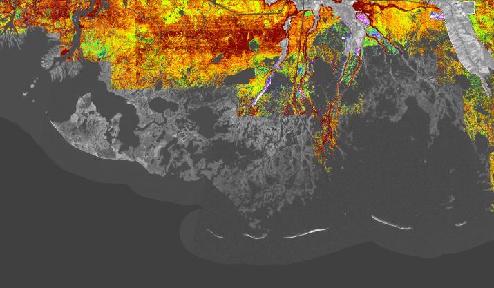
41 Bulk Density


42 Bulk Density

43 Bulk Density


44 Organic Matter Improvements

45 Organic Matter
46 Summary Importance of multi-parameter characterization of the landscape Importance of spatial variability Importance of using training data to the best of your advantage


47
48 Questions

49 Wetting/Drying Cycles evident in multitemporal imagery

50 Wetting/Drying Cycles evident in multitemporal imagery
Monitoring Coastal Marshes for Persistent Saltwater Intrusion
 Monitoring Coastal Marshes for Persistent Saltwater Intrusion Maria Kalcic, 1 Callie Hall, 2 Jeff Russell, 3 and Rose Fletcher 1 1 Science Systems and Applications, Inc., Bldg. 1105, John C. Stennis Space
Amina Rangoonwala and Elijah Ramsey III Wetland and Aquatic Research Center. U.S. Geological Survey. Lafayette, LA
 First I will show examples of radar mapping of hurricane surge extent and duration and optical mapping of the resultant marsh dieback along the Louisiana coast Next we extend these works to hurricane Sandy
MISSISSIPPI RIVER DELTA OVERVIEW
 MISSISSIPPI RIVER DELTA OVERVIEW Science and Engineering Special Team Conference Louisiana State University October 9, 2012 Introduction Basics of the Mississippi Delta Natural and Human-Induced Land Loss
An analysis of storm surge attenuation by wetlands using USGS, FEMA, and NASA data
 An analysis of storm surge attenuation by wetlands using USGS, FEMA, and NASA data Pat Fitzpatrick Geosystems Research Institute Mississippi State University Walter Peterson and Courtney Buckley NASA Marshall
Sea Level Rise and Hurricane Florence storm surge research methodology
 Sea Level Rise and Hurricane Florence storm surge research methodology Hurricane Florence storm surge analysis was conducted using a variety of input sources. In order to determine the maximum storm surge
3Chapter Three: Rescue and Response
 17 16 Report Science Title and the Storms: the USGS Response to the Hurricanes of 2005 3Chapter Three: Rescue and Response This chapter documents the U.S. Geological Survey s (USGS) humanitarian rescue
The Use of Geographic Information Systems to Assess Change in Salt Marsh Ecosystems Under Rising Sea Level Scenarios.
 The Use of Geographic Information Systems to Assess Change in Salt Marsh Ecosystems Under Rising Sea Level Scenarios Robert Hancock The ecological challenges presented by global climate change are vast,
South Florida Coastal Storm Surge and Mapping Study
 South Florida Coastal Storm Surge and Mapping Study Presented by Christopher Bender, Ph.D., P.E., D.CE June 2, 2015 Presentation Overview FEMA risk studies outline Overview South Florida surge study Work
Reducing Nitrogen Removal Uncertainty for Operation of Mississippi River Sediment Diversions: Nitrate Reduction Rates In Turbulent Flow Conditions
 Reducing Nitrogen Removal Uncertainty for Operation of Mississippi River Sediment Diversions: Nitrate Reduction Rates In Turbulent Flow Conditions Nia R. Hurst, John R. White, Kehui Xu, and MingCheng Ren
Mapping Coastal Change Using LiDAR and Multispectral Imagery
 Mapping Coastal Change Using LiDAR and Multispectral Imagery Contributor: Patrick Collins, Technical Solutions Engineer Presented by TABLE OF CONTENTS Introduction... 1 Coastal Change... 1 Mapping Coastal
Monitoring Hurricane Rita Inland Storm Surge
 Monitoring Hurricane Rita Inland Storm Surge By Benton D. McGee, Roland W. Tollett, and Burl B. Goree Pressure transducers (sensors) are accurate, reliable, and cost-effective tools to measure and record
WP4: COASTAL PROCESSES
 WP4: COASTAL PROCESSES Coordinator: G. EBERHARDS Faculty of Geography and Earth Sciences, University of Latvia Daugavpils, 2008 Goal: The objective of this study is analysis of coastal changes and forecast
THE IMPORTANCE OF SCIENCE IN COASTAL RESTORATION IN LOUISIANA
 THE IMPORTANCE OF SCIENCE IN COASTAL RESTORATION IN LOUISIANA Barb Kleiss USACE, Mississippi Valley Division August 3, 2011 LCA S&T Office Authorized under WRDA 2007 Designed to address technical issues
Statewide Topographic Mapping Program
 Statewide Topographic Mapping Program February 28, 2018 www.dotd.la.gov Outline Purpose of the Statewide Topographic Mapping Program History Breakdown of R.S. 48:36 - Topographic Mapping Statewide Topographic
Mississippi River and Tributaries Project Mississippi River Geomorphology and Potamology Program
 Mississippi River and Tributaries Project Mississippi River Geomorphology and Potamology Program Barb Kleiss, Mississippi Valley Division Freddie Pinkard, Vicksburg District June, 2016 Program Objectives
MISSOURI LiDAR Stakeholders Meeting
 MISSOURI LiDAR Stakeholders Meeting East-West Gateway June 18, 2010 Tim Haithcoat Missouri GIO Enhanced Elevation Data What s different about it? Business requirements are changing.fast New data collection
PART 5 MECHANISMS OF GROUND SETTLEMENT IN GREATER NEW ORLEANS
 PART 5 MECHANISMS OF GROUND SETTLEMENT IN GREATER NEW ORLEANS Predicted water depth in New Orleans flood inundation area based on water level of 2.37 ft in Lake Ponchartrain on Sept 2, 2005. Overlay on
Whiskey Island Marsh Creation Rolling with the Punches
 Whiskey Island Marsh Creation Rolling with the Punches Santiago Alfageme, M&N Jerry Carroll, LADNR Brad Miller, LADNR Project Location Historic Island Retreat Previous Restoration Project Whiskey Island
9 th INTECOL Orlando, Florida June 7, 2012
 Restoration of the Everglades Saline Wetlands and Florida Bay: Responses Driven from Land and Sea David Rudnick 1, Colin Saunders 2, Carlos Coronado 2, Fred Sklar 2 Erik Stabenau 1, Vic Engel 1, Rene Price
Sea-level Rise on Cape Cod: How Vulnerable Are We? Rob Thieler U.S. Geological Survey Woods Hole, MA
 Sea-level Rise on Cape Cod: How Vulnerable Are We? Rob Thieler U.S. Geological Survey Woods Hole, MA Outline Sea-level and coastal processes Past sea-level change Predictions for the future Coastal responses
Impact & Recovery of Wetland Plant Communities after the Gulf Oil Spill in 2010 and Hurricane Isaac in 2012
 Impact & Recovery of Wetland Plant Communities after the Gulf Oil Spill in 2010 and Hurricane Isaac in 2012 Introduction: The coastal wetlands, estuaries and lagoon systems of the Gulf Coast are a hotspot
Storm Surge/Coastal Inundation State of the Union. Jamie Rhome Storm Surge Team Lead NOAA/National Hurricane Center
 Storm Surge/Coastal Inundation State of the Union Jamie Rhome Storm Surge Team Lead NOAA/National Hurricane Center 2 Tampa: Cat 5 Scenario 3 4 The Stakes are High Combination of SLR and increasing coastal
Earth Wind & Fire. Game Changing Restoration Options in the Texas Chenier Plain
 Earth Wind & Fire Game Changing Restoration Options in the Texas Chenier Plain EARTH: The Chenier Plain is a 5 million acre coastal region in Southwest Louisiana and Southeast Texas providing landscape
Technical Drafting, Geographic Information Systems and Computer- Based Cartography
 Technical Drafting, Geographic Information Systems and Computer- Based Cartography Project-Specific and Regional Resource Mapping Services Geographic Information Systems - Spatial Analysis Terrestrial
Comparing the Land Use and Land Cover Changes Between the North and South Louisiana Using Data Mining
 Comparing the Land Use and Land Cover Changes Between the North and South Louisiana Using Data Mining Yi Qiang and Nina Lam Department of Environmental Sciences Louisiana State University yqiang1@lsu.edu,
Overview. Gulf of Mexico Alliance Ocean and Coastal Mapping Regional Ecosystem Data Management (REDM) Q2O (QARTOD to OGC) Things to Consider
 Q2O (QARTOD to OGC) Things to Consider") 1 Overview Gulf of Mexico Alliance Ocean and Coastal Mapping Regional Ecosystem Data Management (REDM) Q2O (QARTOD to OGC) Things to Consider 2 Gulf Of Mexico Alliance Partnership of the states of Alabama,
1 Overview Gulf of Mexico Alliance Ocean and Coastal Mapping Regional Ecosystem Data Management (REDM) Q2O (QARTOD to OGC) Things to Consider 2 Gulf Of Mexico Alliance Partnership of the states of Alabama,
The Mississippi River: Its Role in Restoration Efforts and Potential Effects of Climate Change
 The Mississippi River: Its Role in Restoration Efforts and Potential Effects of Climate Change Clinton S. Willson, P.E., Ph.D. Department of Civil & Environmental Engineering Louisiana State University
Name: Date: Class: Louisiana: Our History, Our Home Chapter 1: Louisiana s Geography - Section 2: Natural Regions Guided Reading
 Instructions: Read the section and complete each item with words from the passages in this section. 1. The diversity of Louisiana s can surprise residents and visitors alike. 2. Physical geography is concerned
Sediment Deposition LET THE RIVER RUN T E A C H E R. Activity Overview. Activity at a Glance. Time Required. Level of Complexity.
 Activity at a Glance Grade: 6 9 Subject: Science Category: Physical Science, Earth Science Topic: Deposition, River Systems Time Required Two 45-minute periods Level of Complexity Medium Materials* TI-73
Long-Distance Pumping and Opportunities for Engineering with Nature
 Long-Distance Pumping and Opportunities for Engineering with Nature Tim Welp and Derek Wilson Tim Welp Research Hydraulic Engineer Coastal and Hydraulics Laboratory 23 October 2012 Engineering with Nature
Restored oyster reefs enhance estuarine ecosystem services by altering nearshore salinity
 Restored oyster reefs enhance estuarine ecosystem services by altering nearshore salinity Photo: UF/IFAS David Kaplan, Maitane Olabarrieta, Peter Frederick, and Arnoldo Valle-Levinson Globally: Most Threatened
A Comprehensive Inventory of the Number of Modified Stream Channels in the State of Minnesota. Data, Information and Knowledge Management.
 A Comprehensive Inventory of the Number of Modified Stream Channels in the State of Minnesota Data, Information and Knowledge Management Glenn Skuta Environmental Analysis and Outcomes Division Minnesota
Influence of the Major Drainages to the Mississippi River and Implications for System Level Management
 Influence of the Major Drainages to the Mississippi River and Implications for System Level Management Brian M. Vosburg Geologist Louisiana Coastal Protection and Restoration Authority brian.vosburg@la.gov
Wetland attenuation of Hurricane Rita s storm surge
 Wetland attenuation of Hurricane Rita s storm surge Pat Fitzpatrick, Yee Lau, Yongzuo Li, Nam Tran, Chris Hill, and Suzanne Shean Geosystems Research Institute, Mississippi State University Sponsors: NOAA
SPATIAL AND TEMPORAL MODELLING OF ECOSYSTEM SERVICES
 SPATIAL AND TEMPORAL MODELLING OF ECOSYSTEM SERVICES Solen Le Clec h, T.Decaëns, S. Dufour, M. Grimaldi, N. Jégou and J. Oszwald ACES Conference 2016 Jacksonville, Florida (USA). December, 5-9th : issues
SEGMENTED BREAKWATERS AND THEIR USE IN COASTAL LOUISIANA
 SEGMENTED BREAKWATERS AND THEIR USE IN COASTAL LOUISIANA Prepared by: Louisiana Coastal Protection and Restoration Authority Engineering Division March 2016 The geology of Louisiana s coastal zone is intimately
Overview of Remote Sensing in Natural Resources Mapping
 Overview of Remote Sensing in Natural Resources Mapping What is remote sensing? Why remote sensing? Examples of remote sensing in natural resources mapping Class goals What is Remote Sensing A remote sensing
Impact of Changes in Morphology on Extent and Duration of Inundation during Tropical Cyclones
 DISTRIBUTION STATEMENT A. Approved for public release; distribution is unlimited. Impact of Changes in Morphology on Extent and Duration of Inundation during Tropical Cyclones Jayaram Veeramony Code 7322,
Current and Future Technology Applications for Coastal Zone Management. Bruce K. Carlisle, Acting Director Office of Coastal Zone Management
 Current and Future Technology Applications for Coastal Zone Management Bruce K. Carlisle, Acting Director Office of Coastal Zone Management The Massachusetts Coastal Zone Management Program Approved in
Sea Level Rise in Miami-Dade County Florida Implications for Management of Coastal Wetlands and the Everglades
 Sea Level Rise in Miami-Dade County Florida Implications for Management of Coastal Wetlands and the Everglades Peter W. Harlem Dr. John F. Meeder Florida International University Southeast Environmental
Detecting Landscape Changes in High Latitude Environments Using Landsat Trend Analysis: 2. Classification
 1 Detecting Landscape Changes in High Latitude Environments Using Landsat Trend Analysis: 2. Classification Ian Olthof and Robert H. Fraser Canada Centre for Mapping and Earth Observation Natural Resources
DUC 2017 Fieldwork Overview: Akaitcho Wetland Mapping Project
 DUC 2017 Fieldwork Overview: Akaitcho Wetland Mapping Project Prepared for MobileDemand Project Managers: Kevin Smith, Al Richard Lead Technical Analyst: *Michael Merchant Support Analysts: Becca Warren,
Angelica Murdukhayeva NRS509 Report Fall 2010 GIS and Coastal Environments
 Angelica Murdukhayeva NRS509 Report Fall 2010 GIS and Coastal Environments The coastal zone contains unique natural resources that are critical to biological and economic productivity. It is also subject
Biodiversity Blueprint Overview
 Biodiversity Blueprint Overview Climate Variability Climate projections for the Glenelg Hopkins Regions suggest that the weather will be hotter and drier in the coming years which will impact on land use,
Existing NWS Flash Flood Guidance
 Introduction The Flash Flood Potential Index (FFPI) incorporates physiographic characteristics of an individual drainage basin to determine its hydrologic response. In flash flood situations, the hydrologic
Extreme Weather Events: Infrastructure Damage and Impact on Vulnerable Populations
 Extreme Weather Events: Infrastructure Damage and Impact on Vulnerable Populations Cindy L. Parker MD, MPH Physicians for Social Responsibility Johns Hopkins Bloomberg School of Public Health 1 Climate
Canary in the Coal Mine: Subsidence in Coastal Louisiana Press Conference
 Canary in the Coal Mine: Subsidence in Coastal Louisiana Press Conference Samuel Bentley, LSU Department of Geology & Geophysics professor and Billy and Ann Harrison chair in sedimentary geology Mead Allison,
GIS 2010: Coastal Erosion in Mississippi Delta
 1) Introduction Problem overview To what extent do large storm events play in coastal erosion rates, and what is the rate at which coastal erosion is occurring in sediment starved portions of the Mississippi
Coastal Barrier Island Network (CBIN): Management strategies for the future
: Management strategies for the future") Coastal Barrier Island Network (CBIN): Management strategies for the future Heather Joesting*, Amy Williams**, Rusty Feagin**, and William K. Smith* *Department of Biology, Wake Forest University, Winston
Coastal Barrier Island Network (CBIN): Management strategies for the future Heather Joesting*, Amy Williams**, Rusty Feagin**, and William K. Smith* *Department of Biology, Wake Forest University, Winston
Influence of Marsh Restoration and Degradation on Storm Surge and Waves
 Influence of Marsh Restoration and Degradation on Storm Surge and Waves by Ty V. Wamsley, Mary A. Cialone, Joannes Westerink, and Jane M. Smith PURPOSE: The purpose of this CHETN is to examine storm surge
Australian Coastal Councils Conference
 Australian Coastal Councils Conference 11 March 2015 Estimating Future Coastal Inundation and Erosion Hazards Dr Andrew McCowan Dr Christine Lauchlan-Arrowsmith Warwick Bishop Background Victorian Future
Land Area Changes in Coastal Louisiana After Hurricanes Katrina and Rita
 Land Area Changes in Coastal Louisiana After Hurricanes Katrina and Rita By John A. Barras Comparison of classified Landsat Thematic Mapper (TM) satellite imagery acquired before and after the landfalls
Unchain the River and Allow it to Build a Delta
 Unchain the River and Allow it to Build a Delta Harley S. Winer Atkins Harley.Winer@atkinsglobal.com Mississippi River Drainage Basin Basin Facts Drains 41% of continental U.S. Includes 31 states & 2 Canadian
Tony Pratt, DNREC to The Center for the Inland Bays Scientific and Technical Advisory Committee. August 21, 2009
 Sea Level Rise in Delaware Presented by Tony Pratt, DNREC to The Center for the Inland Bays Scientific and Technical Advisory Committee August 21, 2009 Sea level has been fluctuating ever since there have
Lorna V Inniss, Ph.D SAGE Workshop, New York City
 Lorna V Inniss, Ph.D SAGE Workshop, New York City 2014-05-21 Why me? The globally recognized success of the Barbados ICZM programme has generated requests for technical assistance and CD from many Governments
Regional Geomorphology
 Chapter 2 Environmental Setting Regional Geomorphology The study area is set in the floodplain of the Mississippi River, just south of Plaquemine, Louisiana. The river has occupied its current position
Should (R)SET-MH data be used to forecast the effects of sea level rise on wetland resilience and carbon sequestration?
SET-MH data be used to forecast the effects of sea level rise on wetland resilience and carbon sequestration?") Should (R)SET-MH data be used to forecast the effects of sea level rise on wetland resilience and carbon sequestration? Randall W. Parkinson, Ph.D., P.G. Institute for Water and Environment Florida International
Should (R)SET-MH data be used to forecast the effects of sea level rise on wetland resilience and carbon sequestration? Randall W. Parkinson, Ph.D., P.G. Institute for Water and Environment Florida International
Miami-Dade County Technical Update Meeting South Florida Coastal Study. May 11, 2016
 Miami-Dade County Technical Update Meeting South Florida Coastal Study May 11, 2016 Welcome and Introductions FEMA Region IV Christina Lindemer Technical Lead Production and Technical Services (PTS) Contractor
An overview of USGS Hurricane Sandy Supplemental Studies along the Delmarva Peninsula
 An overview of USGS Hurricane Sandy Supplemental Studies along the Delmarva Peninsula Neil K. Ganju, Laura L. Brothers, Nathaniel G. Plant, Christopher G. Smith, E. Robert Thieler Coastal and Marine Geology
An Integrated Storm Surge, Hurricane Wave, Salinity and Sediment Transport Modeling System for Breton Sound, LA
 An Integrated Storm Surge, Hurricane Wave, Salinity and Sediment Transport Modeling System for Breton Sound, LA Q. Jim Chen Department of Civil and Environmental Engineering qchen@lsu.edu Acknowledgements
Primer on Coastal Erosion And Habitat Creation
 2 nd Regional Conference Dredging, Beach Nourishment & Bird Conservation Primer on Coastal Erosion And Habitat Creation Timothy Kana Ph.D Source: Newsday 1962 Photo by Kelsey Aerials 1978 Source: U Mass
Disturbance, site, and vegetation feedbacks create landscape structure in South Florida coastal wetlands. M Ross, K Zhang, B Thapa, and D Gann
 Disturbance, site, and vegetation feedbacks create landscape structure in South Florida coastal wetlands M Ross, K Zhang, B Thapa, and D Gann Department of Earth & Environment Florida International University
Wetland Sediment Dynamics at Crissy Field Marsh Annual Report
 Wetland Sediment Dynamics at Crissy Field Marsh 27 Annual Report John Callaway Department of Environmental Science University of San Francisco 217 Fulton St. San Francisco, CA 94117 (415) 422-572 callaway@usfca.edu
Descriptions and Performance
 LSU AgCenter Coastal Plants Program Smooth Cordgrass Varieties: Descriptions and Performance Smooth cordgrass (Spartina alterniflora Loisel.) is a perennial grass native to intertidal saline marshes along
MONITORING AND MODELING NATURAL AND ANTHROPOGENIC TERRAIN CHANGE
 MONITORING AND MODELING NATURAL AND ANTHROPOGENIC TERRAIN CHANGE Spatial analysis and simulations of impact on landscape processess Helena MITASOVA, Russell S. HARMON, David BERNSTEIN, Jaroslav HOFIERKA,
Visualizing Upper Trophic and Ecosystem Modeling Outputs with EverVIEW to Inform the Decision Process in Coastal Louisiana.
 Visualizing Upper Trophic and Ecosystem Modeling Outputs with EverVIEW to Inform the Decision Process in Coastal Louisiana 2012 Master Plan Craig Conzelmann Carol Parsons Richards Kevin Suir COMPREHENSIVE
Lab 12 Coastal Geology
 Lab 12 Coastal Geology I. Fluvial Systems Hydrologic Cycle Runoff that flows into rivers = precipitation (rain and snowmelt) [infiltration (loss to groundwater) + evaporation (loss to atmosphere) + transpiration
Considering Nitrogen and Black Mangrove in Context: Lessons Learned
 Considering Nitrogen and Black Mangrove in Context: Lessons Learned Christine N. Pickens 1 Karen L. McKee 2 Mark W. Hester 1 1 Coastal Plant Ecology Laboratory, University of Louisiana at Lafayette 2 US
Modeling Coastal Change Using GIS Technology
 Emily Scott NRS 509 Final Report December 5, 2013 Modeling Coastal Change Using GIS Technology In the past few decades, coastal communities around the world are being threatened by accelerating rates of
Vegetation and Wildlife Habitat Mapping Study in the Upper and Middle Susitna Basin Study Plan Section 11.5
 (FERC No. 14241) Vegetation and Wildlife Habitat Mapping Study in the Upper and Middle Susitna Basin Study Plan Section 11.5 Initial Study Report Part C: Executive Summary and Section 7 Prepared for Prepared
Sea Level Rise and the Scarborough Marsh Scarborough Land Trust Annual Meeting April 24, 2018
 Sea Level Rise and the Scarborough Marsh Scarborough Land Trust Annual Meeting April 24, 2018 Peter A. Slovinsky, Marine Geologist Maine Geological Survey Funded by: 50% 40% Figure modified from Griggs,
Framework for the Basin-Wide Socio-Economic Analysis of Four Proposed Sediment Diversions. August 4, 2015
 Framework for the Basin-Wide Socio-Economic Analysis of Four Proposed Sediment Diversions August 4, 2015 Proposed Sediment Diversions Mid-Breton Mid-Barataria Lower Barataria Lower Breton Overview of Presentation
Coastal Litigation in the Context of Science Literacy
 Coastal Litigation in the Context of Science Literacy Chris McLindon New Orleans Geological Society February 6, 7 Science Literacy The value of community participation in scientific research is widely
Solutions to Flooding on Pescadero Creek Road
 Hydrology Hydraulics Geomorphology Design Field Services Photo courtesy Half Moon Bay Review Solutions to Flooding on Pescadero Creek Road Prepared for: San Mateo County Resource Conservation District
Presentation Outline. Project Overview. Sea Level Rise Assessment & Decision Tools. Community Engagement. Tina Whitman, Friends of the San Juans
 Healthy Beaches for People & Fish Sea Level Rise Adaptation Tools for San Juan County, WA Tina Whitman & Andrea MacLennan December 10, 2015 Presentation Outline Project Overview Tina Whitman, Friends of
 www.ct.gov/opm/cdplan Role of the Locational Guide Map State agencies shall not provide funding for certain growth-related projects unless such projects are located within a priority funding area LGM shall
APPENDIX F SEDIMENT DEPOSITION AND HABITAT CONVERSION ANALYSIS
 APPENDIX F SEDIMENT DEPOSITION AND HABITAT CONVERSION ANALYSIS San Dieguito Lagoon W-19 Restoration Project Draft EIR March 2017 Appendices Introduction: The following is an analysis to provide the volume
Pictorial Account and Landscape Evolution of the Crevasses near Fort St. Philip, Louisiana. MRG&P Report No. 2 January 2014
 Mississippi Valley Division Engineer Research and Development Center Pictorial Account and Landscape Evolution of the Crevasses near Fort St. Philip, Louisiana MRG&P Report No. 2 January 2014 Mississippi
Summary Visualizations for Coastal Spatial Temporal Dynamics
 Summary Visualizations for Coastal Spatial Temporal Dynamics October 24 2011 Providence, RI Sidharth Thakur 1, Laura Tateosian 2, Helena Mitasova, Eric Hardin, and Margery Overton 1. sthakur@renci.org,
Quick Response Report #126 Hurricane Floyd Flood Mapping Integrating Landsat 7 TM Satellite Imagery and DEM Data
 Quick Response Report #126 Hurricane Floyd Flood Mapping Integrating Landsat 7 TM Satellite Imagery and DEM Data Jeffrey D. Colby Yong Wang Karen Mulcahy Department of Geography East Carolina University
Morphological Changes of the Offshore Islands of Western Part of Meghna Estuary over the Years
 Journal of Modern Science and Technology Vol. 6. No. 2. June 2018 Issue. Pp.0-0 Morphological Changes of the Offshore Islands of Western Part of Meghna Estuary over the Years Faisal Mohammad Alvee 1, Sayedul
CAUSES FOR CHANGE IN STREAM-CHANNEL MORPHOLOGY
 CAUSES FOR CHANGE IN STREAM-CHANNEL MORPHOLOGY Chad A. Whaley, Department of Earth Sciences, University of South Alabama, MobileAL, 36688. E-MAIL: caw408@jaguar1.usouthal.edu The ultimate goal of this
The Refugia Concept: Using Watershed Analysis to Prioritize Salmonid Habitat for Conservation and Restoration
 The Refugia Concept: Using Watershed Analysis to Prioritize Salmonid Habitat for Conservation and Restoration Christopher May Battelle & UW Cumulative Impacts of Urbanization Landscape Alterations Loss
Modeling Sea-Level Rise in Coastal Wetlands: Understanding Potential Impacts and Their Implications for Management on Cape Cod
 Modeling Sea-Level Rise in Coastal Wetlands: Understanding Potential Impacts and Their Implications for Management on Cape Cod C a p e C o a s t a l C o n f e r e n c e H y a n n i s R e s o r t a n d
Science & Monitoring to Assess the Success of Restoration Projects related to the DWH Oil Spill & Natural Resource Damage Assessment and Restoration
 Science & Monitoring to Assess the Success of Restoration Projects related to the DWH Oil Spill & Natural Resource Damage Assessment and Restoration Alyssa Dausman & Jo Ellen Hinck U.S. Geological Survey
Geospatial technology for land cover analysis
 Home Articles Application Environment & Climate Conservation & monitoring Published in : Middle East & Africa Geospatial Digest November 2013 Lemenkova Polina Charles University in Prague, Faculty of Science,
DEVELOP National Program
 DEVELOP National Program GLSLCI 2015 Annual Meeting and Conference Sarnia, Ontario 19 June 2015 DEVELOP National Program NASA GLSLCI 2015 June 2015 NASA Earth observations NASA Earth observations include
Ecological Land Cover Classification For a Natural Resources Inventory in the Kansas City Region, USA
 Ecological Land Cover Classification For a Natural Resources Inventory in the Kansas City Region, USA by Applied Ecological Services, Inc. In cooperation with the Mid-America Regional Council 600 Broadway,
South San Francisco Bay Shoreline Studies for EIA 11 with Project Conditions
 South San Francisco Bay Shoreline Studies for EIA 11 with Project Conditions U.S. Army Corps of Engineers San Francisco District Ms. Lisa Andes Mr. Craig Conner Dr. Frank Wu Dr. Jen-Men Lo Dr. Michael
Exposure Disaggregation: Introduction. By Alissa Le Mon
 Exposure Disaggregation: Building Better Loss Estimates 10.2010 Editor s note: In this article, Alissa Le Mon, an analyst in AIR s exposures group, discusses how AIR s innovative disaggregation techniques
Project Leader: Project Partners:
 UTILIZING LIDAR TO MAP HIGH PRIORITY WOODLAND HABITAT IN ARKANSAS DEVELOPING METHODOLOGY AND CONDUCTING A PILOT PROJECT IN THE OZARK HIGHLANDS TO MAP CURRENT EXTENT, SIZE AND CONDITION Project Summary
COASTAL EVOLUTION AND CLIMATE CHANGE: CHALLENGES OF MULTI-SCALE SPATIAL AND TEMPORAL VARIABILITY
 COASTAL EVOLUTION AND CLIMATE CHANGE: CHALLENGES OF MULTI-SCALE SPATIAL AND TEMPORAL VARIABILITY Dr. Jennifer L. Miselis Naval Research Laboratory Stennis Space Center, MS jmiselis@nrlssc.navy.mil 1 PRIMARY
Opportunities to Improve Ecological Functions of Floodplains and Reduce Flood Risk along Major Rivers in the Puget Sound Basin
 Opportunities to Improve Ecological Functions of Floodplains and Reduce Flood Risk along Major Rivers in the Puget Sound Basin Christopher Konrad, US Geological Survey Tim Beechie, NOAA Fisheries Managing
Development of Riparian Maps for Sonoma County Long Term Riparian Corridor Conservation. Mark Tukman & Dylan Loudon Tukman Geospatial
 L A N D F O R Development of Riparian Maps for Sonoma County Long Term Riparian Corridor Conservation Mark Tukman & Dylan Loudon Tukman Geospatial L I F E Mark Background on functional riparian mapping
EAGLES NEST AND PIASA ISLANDS
 EAGLES NEST AND PIASA ISLANDS HABITAT REHABILITATION AND ENHANCEMENT PROJECT MADISON AND JERSEY COUNTIES, ILLINOIS ENVIRONMENTAL MANAGEMENT PROGRAM ST. LOUIS DISTRICT FACT SHEET I. LOCATION The proposed
Advanced Image Analysis in Disaster Response
 Advanced Image Analysis in Disaster Response Creating Geographic Knowledge Thomas Harris ITT The information contained in this document pertains to software products and services that are subject to the
LINKING DOWNSCALED GLOBAL CLIMATE MODELS TO PLANNING LEVEL ECOSYSTEM MODELS
 LINKING DOWNSCALED GLOBAL CLIMATE MODELS TO PLANNING LEVEL ECOSYSTEM MODELS Eric White 1, Ehab Meselhe 1, Angelina Freeman 2, Mandy Green 2, David Lindquist 2, Alaina Grace 1, Denise Reed 1, and Yushi
CHAPTER 1 THE UNITED STATES 2001 NATIONAL LAND COVER DATABASE
 CHAPTER 1 THE UNITED STATES 2001 NATIONAL LAND COVER DATABASE Collin Homer*, Jon Dewitz, Joyce Fry, and Nazmul Hossain *U.S. Geological Survey (USGS) Center for Earth Resources Observation and Science
Sediment Management in the Coastal Bays
 Sediment Management in the Coastal Bays Introduction Need for ecosystem view of sediment management in Coastal Bays Island loss and restoration Navigation needs Habitat Trade offs Living Shoreline Requirements
Introduction: The Gulf of Mexico Alliance. The Gulf GAME project MERMAid and PHINS Results & Conclusions What s next? Examples
 AAG Las Vegas March 25, 2009 Introduction: Ocean governance and Ecosystem-Based Management The Gulf of Mexico Alliance Habitat Identification and Characterization The Gulf GAME project MERMAid and PHINS