Ohio s Linear Based Referencing System (a.k.a. Location Based Response System LBRS), a True State and Local Government Partnership
|
|
|
- Ruth Crawford
- 5 years ago
- Views:
Transcription
, a True State and Local Government")
1 Ohio s Linear Based Referencing System (a.k.a. Location Based Response System LBRS), a True State and Local Government Partnership Ron Cramer Digital Data Technologies, Inc. Joseph Hausman The Ohio Department of Transportation
2 LBRS Concept: Create it once Use it a bunch and maintain it
3 Defining the Problem Create it once Use it a bunch And maintain it
4 Issues at the State DOT Level Every Jurisdiction in the state needs to be on the exact same Linear Referencing System (LRS) using the same Linear Referencing Method (LRM). Integrate a legacy(60+ years) GIS/LRS and create a new system that accurately(+- 1 meter) represents every Public and Private Road in Ohio. Bring mature, effective roadway information standards to this massive road network (125,000 + Centerline Miles) involving all levels of State and Local government. Match Crash data effectively to House Numbers/Addresses, Intersections etc.
5 Standardization of Common Roadway Elements ODOT Road Measurement Conventions When measuring a new road, begin at the centerline of the intersecting road and measure to the end of the new road or to the centerline of the farther intersecting Main road. Cul-de-sacs are measured to their centers unless they have islands, in High Street which case the counter-clockwise distance around the island is measured, also. Street Tie-in points are needed for all roads/streets that intersect main highways. Connector Road Measure from Centerline to Centerline New Road with Dead End Measure from Centerline to End of Road Measure Tie-in Point/Length from Nearest Intersecting Street or some other known reference point. (Record Name/number of the Intersecting Street) Main Intersecting Street New Road with Cul-de-sac Measure to Center of Cul-de-sac Topologically, loop is not completely closed Cul-de-sac with Island Measure to and Around the Island Island

6 Standardization of Ramps and Interchanges including a complete Ramp/Interchange Inventory System (5,000 ramps)
7 Defining Part of the Local Government Problem Point-based addressing ensures jurisdiction s homes, businesses, landmarks and other assets will be accurately located. Most do not have this. Geocoding, a mapping method that approximates address locations based on ranges assigned to a road segment, is unreliable for applications that require accurate locations and it wastes time that could save lives.

8 A Road with Many Names Park Road North Street US40 E. National Road W. National Road Columbia Street E. Main Street
9 To create quality data, some tried to use An orthophoto to create the centerlines Address data from the Assessor and other departments to populate the addresses It became clear that in order to obtain accurate, reliable data, ALL addresses and roads must be field-verified
10 Issues with Local Address Data Analysis of three counties data revealed over 31% of County Assessor s address information is: Incomplete Inaccurate Unreliable databases are often flawed, as well.
11 Field Verification Exposed Non-Matching Address Data Fayette County 4,236 records (37%) did not match 63 % 37% 70% 30% Clark County 30% 16,882 records (30%) did not match City of Gahanna (Franklin County) 4,715 records (31%) did not match 69% 31%

12 Orthophotos prove unreliable for roadway development 37% 25% Road seems passable in orthophoto, but field-verification reveals otherwise

13 It will be difficult to use this road segment for routing purposes 37% 25%

14 Only field-verification would reveal this road segment as impassable

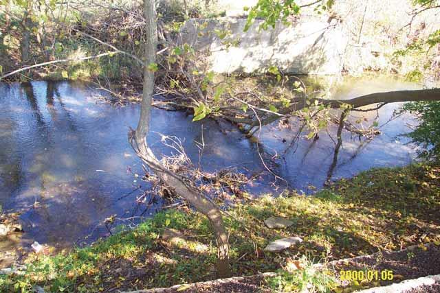
15 A non-existent bridge in Champaign County, Ohio


16 A gated road, blocking travel in Jackson County, Ohio


17 Another dead end road in Champaign County, Ohio


18 An unmarked, unpaved road in Jackson County, Ohio
19 Intelligent Routing Routing Quality Road Network Good routing requirements Good road network data Good routing software Must-haves Proper road names One-way attribute Divided roads have separate lines No intersections at overpasses Speed limits Other traffic related information Nice-to-haves Bridges & culvert locations Traffic signals, stop signs, yield signs Turn arounds School zones Real-time traffic information
20 Routing Example Effect of road network attributes One way Speed Limits
21 Routing Example Effect of road closures

22 Divided Road Tiger ODOT Before LBRS LBRS
23 Standardization of Bi-Directional and Divided Highways
24 CREATE IT ONCE Create it once Use it a bunch And maintain it
25 Create It Once The Solution Location Based Response System (LBRS) State-level plan for every Ohio county Memorandums of Agreement between the Counties and the State Create spatially accurate street centerlines with field verified site-specific address locations, with emphasis on linear referencing/mileposts
26 What is LBRS, cont d. Avoids duplication of efforts Fed, state, county and local levels were creating independent datasets that met their particular needs The challenge for DDTI? Create the initial LBRS pilot project dataset that could meet the unique needs of the DOT with emphasis on linear referencing/milepost, while meeting the needs of county & local GIS, and Emergency Response


27 LBRS Data Input
28 What s so unique? The Next Generation Road Network that supports advanced applications contains these attributes
29 Centerline Address


30 Linking Legacy Data to the LBRS
31 Clark County Deliverables 1, miles of road centerlines 62,152 address locations 45,379 Single family houses 5,015 Duplexes 2,907 Manufactured homes 4,666 Apartments 90 Addressable secondary structures 165 Utility structures (cell/water towers, electric substations, etc.) 3,644 Commercial structures (churches, schools, businesses, etc.) 14 Addresses with no visible structure 272 Apartments (multiple units)
32 Clark deliverables, cont d. 53,899 Address markers 1,333 Alley intersections 525 Bad sign points 199 Jurisdictional Boundary points 2,677 Bridges and culverts 43 Chemical storage 9 Flashing signals and associated control types 30 Gates 480,987 GPS points with attached X, Y, and Z locations 3,554 Fire hydrants 3,216 Landmark points with descriptions 294 Milepost signs and their milepost value
33 Clark deliverables, cont d. 8 CX notes to denote construction 246 MX notes to flag multiple houses sharing a driveway 113 Overpasses 96 Railroad crossings and associated control types 132 School zone points 1,901 Speed limit signs and their value 4,422 Stop signs 455 Traffic signals 173 Turnarounds 106 Underpasses 69 Yield signs
34 ROI: Improving Location Accuracy Each LBRS address point utilizes all three methods for locating an address Situs (house number) Coordinates Milepost/log points/nlfid (LRS Key) Our goal To pinpoint and route distress calls to an exact, field-verified location 100% of the time The LBRS dataset is saving lives
35 ROI: Crash Data Analysis LBRS enables more crash data to be accurately mapped because there are more identifiable locations Prioritizes critical road segment management through collection of various attributes Addresses, landmarks, local roadway network & mileposts Can introduce potential incremental roadway safety funding opportunities and help allocate dollars based on better analysis. Many state DOTs struggle to maintain accurate local roadway inventories Identification of unreported roads Updating of newly created municipal roads DOTs need to locate high hazard locations OFF the state system
36 Crash Study Case Study DOT reported 190 traffic accidents in a county along two major cooridors After comparing crash data with LBRS centerline information, the county was able to locate more than 550 crashes. LBRS road centerline data allowed crashes with incorrect street names or addresses and various other inconsistent reference points to be mapped to the correct, single point Most urban safety studies spend about $2,000 to identify and locate all traffic crashes at a given intersection Cost is associated with trying to find all the crashes based upon multiple location methods (street-intersection, address, route numbermilepost, etc.) When LBRS data is available and used to scrub crash location data, and resolve alternative location methods to a lat-long, the cost to do the same crash study is about $150 cost of intersection analysis reduced by a factor of 10! Leaves more available funds for correcting the problem Also introduces incremental roadway safety funding
37 ODOT Crash Data Analysis Study Intergraph software was used to locate crash locations using two different models Street file from a leading national map data provider Street file DDTI collected for LBRS Street and address file DDTI collected for LBRS 2006 Clark County crash data test set (817 crashes) 709 city or village crashes 108 township crashes Model Used Township City Total National Data Provider 61 of % 450 of % 501 of % LBRS Street 72 of % 675 of % 747 of % LBRS Street & Address 87 of % 687 of % 774 of % Source: Ohio Department of Transportation

38 Why are Private Roads Important?
39 Additional ROI Sales Tax Collection & disbursement of internet sales tax Streamlined Sales Tax Census LUCA Approximately $300 billion in federal grant money distributed to the state & local level Direct tie to annual population estimates Numerous state-level departments Political ROI
40 USE IT A BUNCH (a.k.a. more ROI) Create it once Use it a bunch And maintain it


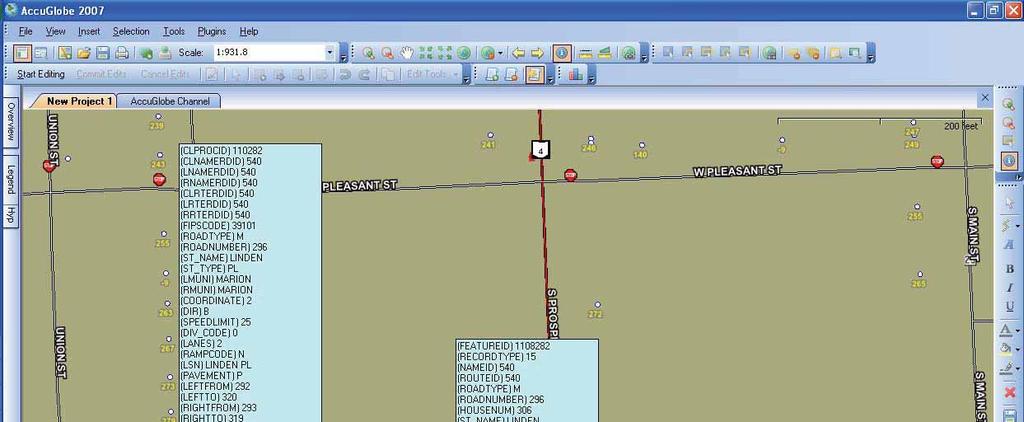
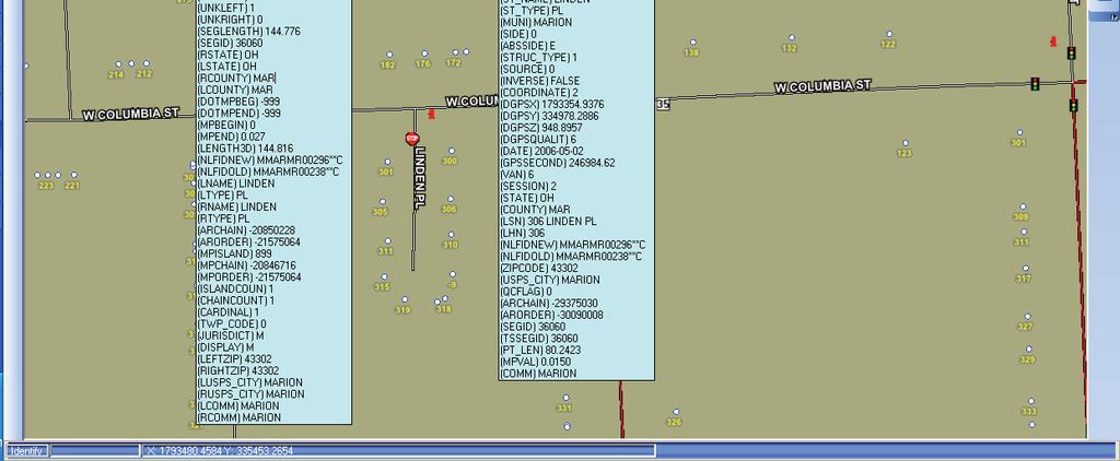
41 Examples of LBRS Users

42 AccuGlobe Extensions AccuGlobe Dispatch/Mobile/Web
43 AND MAINTAIN IT Create it once Use it a bunch And maintain it
44 Example: Issues With Addressing 80%+ of data has a spatial component (address) Maintenance is the key to upholding quality and accuracy of evolving data sets PROBLEM: While parcels may be maintained by one department at the county-level, multiple addressing authorities are scattered throughout local government Data coordination/consolidation across all agencies is needed


45 Data Maintenance Solution Maintenance software local authorities can use to input new roads & addresses

46 Maintenance Data integration and dissemination COUNTY TOWNSHIP CITY/VILLAGE STATE E9-1-1 Planning Trustees E9-1-1 Engineer Health Zoning Engineer Assessor Other/Etc Other/Etc Other/Etc


47 Centralized GIS data maintenance service CLIENT DDTI
48 Centralized GIS data maintenance service Multiple users can edit the GIS data (spatial and attribute) simultaneously via the Internet Full history of edits are saved with audit trail Computed attributes generated on servers User enters only non-computable data QC checks populate the error layer within seconds after the changes are committed for quick feedback Nightly GIS data extract provides fresh data for GIS applications for other agencies
49 AccuGlobe 2007 GIS Application Provides the user interface to view and edit the GIS data Data layers can come from local sources (orthos, water ways, rail road, special layers for the Client, etc.) or remotely (via SQL Portal, etc.) A redraw of the SQL Portal layer displays the latest committed data on the Servers Edits on SQL Portal layers are sent to the SQL Portal server when the user commits them
50 SQL Portal Server Accepts connection requests, enforces account login Verifies that the user has permission to edit an object Communicates with SQL Server Can connect to different databases
51 SQL Server Stores all data Layer information, objects in GIS data layers, QCError data, permission, user administration, settings for GIS data exports
52 QC Server Performs background computations on recently changed data Detects the changes and runs a series of computations and QC checks involving multiple layers (Roads, Addresses, Address Markers, etc.) and populates the QCError layer when the data violates business rules The parity of the house number of the address is incorrect, The address has no matching road name, The house number of an address does not fit that of the neighboring addresses, The road prefix, type or suffix does not follow the abbreviation rules, etc. Errors in the QCError layer can be resolved by correcting the address or road data, or when it is not possible the user can suppress that particular error for future QC checks

53 Ohio LBRS Status
54 Digital Data Technologies, Inc. Ron Cramer Joe Hausman
LBRS Ohio s Location-Based Response System
 LBRS Ohio s Location-Based Response System Comprised of state-level statewide datasets for Ohio, including road centerlines with point-based address locations, parcels, and orthophotography Spatially accurate
Enterprise Linear Referencing at the NYS Department of Transportation
 Enterprise Linear Referencing at the NYS Department of Transportation One Highway Network to Support Many Business Processes May 9, 2018 May 9, 2018 2 Agenda An overview of Linear Referencing How NYSDOT
2006 GIS-T T Symposium Columbus Ohio
 2006 GIS-T T Symposium Columbus Ohio Creating a Location Based Response System Using ESRI Technology Brian Stevens, CP Woolpert, Inc. Agenda Introduction What is LBRS? History Specifications Proposed Method
INDOT Office of Traffic Safety
 Intro to GIS Spatial Analysis INDOT Office of Traffic Safety Intro to GIS Spatial Analysis INDOT Office of Traffic Safety Kevin Knoke Section 130 Program Manager Highway Engineer II Registered Professional
Landmark LRM. MM and RefPts can be same or different
 1 2 This project began in the fall of 2005. At the time CDOT had three different business units maintaining different LRS s. That is, the beginning and ending reference points and the measured length of
Transforming the Maricopa County Department of Transportation (MCDOT) GIS-based Transportation Asset Inventory System June 30, 2016
 GIS-based Transportation Asset Inventory System June 30, 2016") Transforming the Maricopa County Department of Transportation (MCDOT) GIS-based Transportation Asset Inventory System June 30, 2016 Presented By Steve Hossack, GIS Database Administrator 2016 Esri User
Transforming the Maricopa County Department of Transportation (MCDOT) GIS-based Transportation Asset Inventory System June 30, 2016 Presented By Steve Hossack, GIS Database Administrator 2016 Esri User
Utilizing GIS Technology for Rockland County. Rockland County Planning Department Douglas Schuetz & Scott Lounsbury
 Utilizing GIS Technology for Rockland County Rockland County Planning Department Douglas Schuetz & Scott Lounsbury Presentation Agenda Introduction What is GIS What can GIS do GIS Efforts for BOE Resources
GIS-T 2010 Building a Successful Geospatial Data Sharing Framework: A Ohio DOT Success Story
 GIS-T 2010 Building a Successful Geospatial Data Sharing Framework: A Ohio DOT Success Story ODOT District 2 GIS John Puente District 1 GIS Coordinator\ Planning Administrator 2 Interoperability 3 District
Iowa Department of Transportation Office of Transportation Data GIS / CAD Integration
 Iowa Department of Transportation Office of Transportation Data GIS / CAD Integration From GIS data to CAD graphics - Iowa DOT's workflow utilizing GeoMedia and MicroStation to develop map products. Mark
Linear Referencing Systems (LRS) Support for Municipal Asset Management Systems
 Support for Municipal Asset Management Systems") Linear Referencing Systems (LRS) Support for Municipal Asset Management Systems Esri Canada Infrastructure Asset Management Leadership Forum November 1, 2017 Toronto, ON David Loukes, P. Eng., FEC Andy
Linear Referencing Systems (LRS) Support for Municipal Asset Management Systems Esri Canada Infrastructure Asset Management Leadership Forum November 1, 2017 Toronto, ON David Loukes, P. Eng., FEC Andy
GIS ANALYSIS METHODOLOGY
 GIS ANALYSIS METHODOLOGY No longer the exclusive domain of cartographers, computer-assisted drawing technicians, mainframes, and workstations, geographic information system (GIS) mapping has migrated to
GIS in Community & Regional Planning
 GIS in Community & Regional Planning The The role role of of GIS GIS in in Re-writing the the Zoning Bylaw for for the the City City of of Vernon LandInfo Technologies Presentation Overview The GIS Initiative
GIS Monroe Geographic Information System March 14, 2018
 GIS Monroe Geographic Information System March 14, 2018 Goals Maintain Enterprise/County-wide geo-database Increase spatial accuracy of data Build and acquire more data layers Increase use of GIS; as another
Maricopa County Department of Transportation (MCDOT) GIS Innovations in Transportation Asset Management
 GIS Innovations in Transportation Asset Management") Maricopa County Department of Transportation (MCDOT) GIS Innovations in Transportation Asset Management Presented By Steve Hossack, GIS Database Administrator 2018 ITE/IMSA Spring Conference Maricopa County
Maricopa County Department of Transportation (MCDOT) GIS Innovations in Transportation Asset Management Presented By Steve Hossack, GIS Database Administrator 2018 ITE/IMSA Spring Conference Maricopa County
National Park Service Safety Management
 National Park Service Safety Management Locating Crashes Spatially from the National Park Service Service-wide Traffic Accident Reporting System (STARS) Database By Daniel Van Gilder Federal Highway Administration
Linear Referencing in Boulder County, CO. Getting Started
 Linear Referencing in Boulder County, CO Getting Started 1 Authors Janie Pierre GIS Technician, Boulder County Road centerline and storm sewer geodatabases & maps John Mosher GIS Specialist, Boulder County
GIS Needs Assessment. for. The City of East Lansing
 GIS Needs Assessment for The City of East Lansing Prepared by: Jessica Moy and Richard Groop Center for Remote Sensing and GIS, Michigan State University February 24, 2000 Executive Summary At the request
Cobb County GIS: Beyond the Map
 Cobb County GIS: Beyond the Map Charles Fail Tim Scharff Cobb County GIS SERUG 2008 1 Topics Cobb GIS Overview The Early Years Enterprise GIS Transition Putting It Together Looking Ahead SERUG 2008 2 Cobb
GIS Geographical Information Systems. GIS Management
 GIS Geographical Information Systems GIS Management Difficulties on establishing a GIS Funding GIS Determining Project Standards Data Gathering Map Development Recruiting GIS Professionals Educating Staff
Designing GIS Databases to Support Mapping and Map Production Charlie Frye, ESRI Redlands Aileen Buckley, ESRI Redlands
 Designing GIS Databases to Support Mapping and Map Production Charlie Frye, ESRI Redlands Aileen Buckley, ESRI Redlands 1 Designing GIS Databases to Support Mapping and Map Production Charlie Frye, ESRI
Updating the Urban Boundary and Functional Classification of New Jersey Roadways using 2010 Census data
 Updating the Urban Boundary and Functional Classification of New Jersey Roadways using 2010 Census data By: Glenn Locke, GISP, PMP 1 GIS-T May, 2013 Presentation Overview Purpose of Project Methodology
Office of Enterprise Technology
 Office of Enterprise Technology Transforming the Maricopa Department of Transportation (MCDOT) GIS-based Transportation Asset Inventory System January 21, 2016 Presented By Steve Hossack, GIS Database
Why You Should Invest in an Address Point Layer
 A GeoComm White Paper June 6, 2012 601 West Saint Germain St. St. Cloud, MN 56301 1.866.GEO.COMM Identifying 9-1-1 Caller Location By John Brosowsky, GeoComm Product Development Director Nathan Ekdahl,
State GIS Update. Master Address Repository (MAR) IMAGIN 2016 Everett Root May 16, 2016
 IMAGIN 2016 Everett Root May 16, 2016") State GIS Update Master Address Repository (MAR) IMAGIN 2016 Everett Root roote@michigan.gov May 16, 2016 Master Address Repository Mark Holmes GeoSpatial Services Manager (MAR) Josh Ross Framework Manager
State GIS Update Master Address Repository (MAR) IMAGIN 2016 Everett Root roote@michigan.gov May 16, 2016 Master Address Repository Mark Holmes GeoSpatial Services Manager (MAR) Josh Ross Framework Manager
INDIANAMAP VIEWING APPLICATION
 INDIANAMAP VIEWING APPLICATION (VERSION 1.0 ) Based on the 2005 Developed for the Indiana Department of Homeland Security by: IndianaMap Viewing Application Introduction The IndianaMap Viewing Application
Creating a Transportation Database Using a Linear Referencing System(LRS)
") Creating a Transportation Database Using a Linear Referencing System(LRS) Project Overview and Methodology Raja Andela and Sujatha Mohanakrishnan Toledo Metropolitan Area Council of Governments 1 TMACOG
Creating a Transportation Database Using a Linear Referencing System(LRS) Project Overview and Methodology Raja Andela and Sujatha Mohanakrishnan Toledo Metropolitan Area Council of Governments 1 TMACOG
PW 001 SNOW REMOVAL AND SANDING FOR ROADWAYS AND SIDEWALKS October 6, 2014 (#223-14) Original October 19, 2015; October 15, 2018 Public Works
 Original October 19, 2015; October 15, 2018 Public Works") Policy Statement: The Village of Kitscoty will provide snow and ice control on municipal streets and sidewalks according to determined priorities. Purpose: To provide direction and information to employees
Policy Statement: The Village of Kitscoty will provide snow and ice control on municipal streets and sidewalks according to determined priorities. Purpose: To provide direction and information to employees
John Laznik 273 Delaplane Ave Newark, DE (302)
") Office Address: John Laznik 273 Delaplane Ave Newark, DE 19711 (302) 831-0479 Center for Applied Demography and Survey Research College of Human Services, Education and Public Policy University of Delaware
Office Address: John Laznik 273 Delaplane Ave Newark, DE 19711 (302) 831-0479 Center for Applied Demography and Survey Research College of Human Services, Education and Public Policy University of Delaware
why is a national or regional context important?
 The need Accessibility to opportunities, Efficient movement of people and goods, Environmental Health Strength and competitiveness of the economy, Availability and cost of energy, Safety and Security,
Creating a Pavement Management System Using GIS
 Christopher Castruita PPD 631 Prof. Barry Waite & Prof. Bonnie Shrewsbury Creating a Pavement Management System Using GIS Problem Definition As is the case with many cities, the city of La Cañada Flintridge
What is 511? Need for 511 Services. Development & Deployment of Regional Road and Weather Information Supporting 511 Traveler Services
 Development & Deployment of Regional Road and Weather Information Supporting 511 Traveler Services Leon F. Osborne University of North Dakota Regional Weather Information Center Grand Forks, ND David L.
Office of Technology Partnerships GIS Collaboration
 Office of Technology Partnerships GIS Collaboration State GIS Update April 21, 2017 Mark Holmes, GISP Outline MGF Upgrade Project Census Programs Imagery Update LiDAR Update Open Discussion 2 MGF Background
If you aren t familiar with Geographical Information Systems (GIS), you. GIS, when combined with a database that stores response information,
, you. GIS, when combined with a database that stores response information,") Geographical Information Systems in EMS By William E. Ott If you aren t familiar with Geographical Information Systems (GIS), you should take a look at what GIS can offer you as an EMS manager. GIS, when
Geographical Information Systems in EMS By William E. Ott If you aren t familiar with Geographical Information Systems (GIS), you should take a look at what GIS can offer you as an EMS manager. GIS, when
Enhancing Parcel Data In Colleton County. February 10, 2009
 Enhancing Parcel Data In Colleton County GIS & CAMA Conference February 10, 2009 Introductions Bruce T. Harper Technology Director Colleton County, SC Bill Wetzel National GIS Account Manager The Sidwell
E Geographic Information System. Created By: Freda Rocker Pearl River County Mapping
 E-9-1-1 Geographic Information System Created By: Freda Rocker Pearl River County Mapping frocker@pearlrivercounty.net Overview of Pearl River County E-9-1-1 Communications District GIS In 1998 the Pearl
MSAG Synchronization. Patrick McKinney, Cumberland County
 MSAG Synchronization Patrick McKinney, Cumberland County NENA Sync GIS Databases with MSAG & ALI On-going process of syncing MSAG & GIS datasets Recommended minimum match rate of 98% (p. 8) Differences
UTILIZING GIS IN NEXT GENERATION Tennessee Information for Public Safety. Presented by State of TN, OIR-GIS Services
 UTILIZING GIS IN NEXT GENERATION 9-1-1 Tennessee Information for Public Safety Presented by State of TN, OIR-GIS Services Next Generation 9-1-1 WHAT IT IS AND HOW IT WORKS Next Generation 9-1-1 IP (Internet
City of Saginaw Right of Way Division Snow and Ice Removal Policy January 18, 2016
 Snow and Ice Removal Policy January 18, 2016 It is the policy of the to provide snowplowing and ice removal services in order to: Provide safe traveling conditions for motorists and pedestrians Assist
Geographic Information System Services. Strategic Plan FY
 Geographic Information System Services Strategic Plan FY 2011 2012 Drafted by: Gary Palmer, Assistant Town Manager Major Sections: History Mission, Vision, Values Strategic Issues Performance Measurement
Lecture 9: Geocoding & Network Analysis
 Massachusetts Institute of Technology - Department of Urban Studies and Planning 11.520: A Workshop on Geographic Information Systems 11.188: Urban Planning and Social Science Laboratory Lecture 9: Geocoding
Introduction to Ohio Landslide Hazard Rating System and Landslide Risk Management. By Prof. Robert Liang
 Introduction to Ohio Landslide Hazard Rating System and Landslide Risk Management By Prof. Robert Liang Background Landslides cause public risk (accident: injury/loss of life). Impact on regional economy
presents challenges related to utility infrastructure planning. Many of these challenges
 1 Introduction: - a. Purpose According to U.S. Census Bureau the population of stark county was 367,585 in 1990, and in 2000 it was increase to 378,098. Thus County is experiencing a growth that presents
Building a National Data Repository
 Building a National Data Repository Mladen Stojic, Vice President - Geospatial 1/30/2013 2012 Intergraph Corporation 1 Information has meaning and gives power only when shared and distributed. Information,
LRS Task Force June 13, REVISION HISTORY
 North Carolina Department of Transportation Geographic Information Systems (GIS) Unit LINEAR REFERENCING SYSTEM (LRS) PROJECT DEFINITION Version 1.0 REVISION HISTORY Date Document Manager Revision Purpose
Bridging the Gap between Engineering and GIS
 Bridging the Gap between Engineering and GIS Presented by: Karen Stewart, B.Tech, GISP Manager of Geomatics Township of Langley February 13, 2006 Agenda Introduction History Goals Implementation Benefits
Providing Public Access to King County GIS Data. Presented by: Michael Jenkins King County GIS Center Seattle, WA
 Providing Public Access to King County GIS Data Presented by: Michael Jenkins King County GIS Center Seattle, WA King County, Washington Microsoft Boeing Amazon.Com Starbucks Port of Seattle Weyerhauser
A Summary of State DOT GIS Activities. Presented at the 2004 AASHTO GIS-T Symposium Rapid City, SD
 A Summary of State DOT GIS Activities Presented at the 2004 AASHTO GIS-T Symposium Rapid City, SD Information Sources E-mail survey of state DOT GIS managers All 51 State DOTs (and DC) responded in 2004
The 2020 Census Geographic Partnership Opportunities
 The 2020 Census Geographic Partnership Opportunities Web Adams Geographer, U.S. Census Bureau New York Regional Office 1 Geographic Partnership Opportunities The 2020 Census Local Update of Census Addresses
FHWA GIS Outreach Activities. Loveland, Colorado April 17, 2012
 FHWA GIS Outreach Activities Loveland, Colorado April 17, 2012 GIS for Improved Decision Making FHWA believes that geographic information systems and other geospatial technologies (remote sensing and GPS)
Sensitivity of estimates of travel distance and travel time to street network data quality
 Sensitivity of estimates of travel distance and travel time to street network data quality Paul Zandbergen Department of Geography University of New Mexico Outline Street network quality Approaches to
Agenda. Johnson County. Introduction What Is GIS? Needs Assessment Strategic Plan GIS Task force What do we need from you?
 Agenda Introduction What Is GIS? Needs Assessment Strategic Plan GIS Task force What do we need from you? Open Forum 1 Introduction Michael Sudac GIS Director 13 years GIS experience GIS Supervisor for
ADDRESSING GUIDELINES
 Rural Addressing Project December 2004 ADDRESSING GUIDELINES A Municipal Affairs MUNICIPAL ADDRESSING PROJECT : BACKGROUND: Early in 2004, a survey of rural municipalities was conducted by AAMD&C to identify
Geographic Products and Data. Improvements in Spatial Accuracy and Accessing Data
 Geographic Products and Data Improvements in Spatial Accuracy and Accessing Data How it Began TIGER was internally developed to support the 1990 Decennial Census operations Used data sources such as USGS
Application of GIS in Public Transportation Case-study: Almada, Portugal
 Case-study: Almada, Portugal Doutor Jorge Ferreira 1 FSCH/UNL Av Berna 26 C 1069-061 Lisboa, Portugal +351 21 7908300 jr.ferreira@fcsh.unl.pt 2 FSCH/UNL Dra. FCSH/UNL +351 914693843, leite.ines@gmail.com
WELCOME & INTRODUCTIONS
 GIS Monroe Geographic Information System January 31, 2018 WELCOME & INTRODUCTIONS Chip Thomas, Ritter GIS Sarah Schrader, Acct. Mgr., ESRI Chris Beyett, Solutions Engineer, ESRI Colleen Hinzmann, IT Director,
Oklahoma GIS for GeoCIP
 GeoCIP Program Partners Oklahoma GIS for GeoCIP A Center for Spatial Analysis Report to Oklahoma GI Council 6 November 2009 The CSA team Kathy Hines Tran Trung Semiha Caliskan Peter Camili Scott March
2013 NASCIO Award Submission Category: Cross-Boundary Collaboration and Partnerships. Project Title: Public Safety and Enterprise GIS in Tennessee
 2013 NASCIO Award Submission Category: Cross-Boundary Collaboration and Partnerships Project Title: Public Safety and Enterprise GIS in Tennessee State of Tennessee, Board of Parole State of Tennessee,
NJDOT Pedestrian Safety Analysis Tool 2015 GIS T Conference
 NJDOT Pedestrian Safety Analysis Tool 2015 GIS T Conference NJDOT Pedestrian Safety Analysis Tool Justin Furch GIT Department Manager Michael Baker International Pedestrian Safety in NJ: Has the highest
GIS. in the City of Lewiston Maine
 GIS in the City of Lewiston Maine The purpose of this slideshow is to provide an overview of the city GIS and how it is used, maintained and accessed in-house as well as by the public. Please simply hit
Application of Geographic Information Systems to Rail-Highway Grade Crossing Safety
 156 TRANSPORTATION RESEARCH RECORD 1495 Application of Geographic Information Systems to Rail-Highway Grade Crossing Safety ARDESHIR FAGHRI AND 5RIRAM PANCHANATHAN The application of geographic information
Building an All-Roads LRS Network for Alaska
 Building an All-Roads LRS Network for Alaska presented to 2015 AASHTO GIS-T Symposium presented by Bruce Spear Cambridge Systematics, Inc. Kerry Kirkpatrick Alaska DOT&PF April 19, 2015 Transportation
GIS = Geographic Information Systems;
 What is GIS GIS = Geographic Information Systems; What Information are we talking about? Information about anything that has a place (e.g. locations of features, address of people) on Earth s surface,
Nova Scotia Civic Address Best Practice for the Maintenance of Spatial Civic Address Data
 Nova Scotia Civic Address Best Practice for the Maintenance of Spatial Civic Address Data Version 1.1 June 16, 2015 Service Nova Scotia and Municipal Relations Geographic Information Services Operation
ArcGIS for Local Government. Local Government. Title Placed Here
 ArcGIS for ArcGIS for Local Government Local Government Title Placed Here ArcGIS for Local Government solutions.arcgis.com/local-government Copyright 2016 Esri. All rights reserved. 151760 G73000 Address
A Summary of State DOT GIS Activities
 A Summary of State DOT GIS Activities Prepared for the 2006 AASHTO GIS-T Symposium Columbus, OH Introduction This is the 11 th year that the GIS-T Symposium has conducted a survey of GIS activities at
Statewide State Roads Layer Michigan Geographic Framework Field Definitions
 Statewide State Roads Layer Michigan Geographic Framework Field Definitions (Shapefile Attribute Table) (June 1, 2012 Version 12b) The following field definitions make up the shapefile attribute table
Preparing GIS Data for NG9-1-1 in the Commonwealth of Virginia
 Preparing GIS Data for NG9-1-1 in the Commonwealth of Virginia Brian Crumpler Regional Coordinator Virginia Information Technologies Agency (VITA) February 28, 2017 1 1 Overview: Sharing ways Virginia
Summary of Best practices in Linear Referencing Systems (LRS)
") Summary of Best practices in Linear Referencing Systems (LRS) Presented By: Dr. Simon Lewis Delcan Philadelphia Regional ESRI GIS Transportation Special Interest Group February 19, 2008 Chester County
Summary of Best practices in Linear Referencing Systems (LRS) Presented By: Dr. Simon Lewis Delcan Philadelphia Regional ESRI GIS Transportation Special Interest Group February 19, 2008 Chester County
The Use of Geographic Information Systems (GIS) by Local Governments. Giving municipal decision-makers the power to make better decisions
 by Local Governments. Giving municipal decision-makers the power to make better decisions") The Use of Geographic Information Systems (GIS) by Local Governments Giving municipal decision-makers the power to make better decisions Case Study: Examples of GIS Usage by Local Governments in North
The Use of Geographic Information Systems (GIS) by Local Governments Giving municipal decision-makers the power to make better decisions Case Study: Examples of GIS Usage by Local Governments in North
Coconino County Common Snow Plow Questions/Concerns
 Coconino County Common Snow Plow Questions/Concerns I didn t know it snows so much in northern Arizona. Is this normal? According to the National Climatic Data Center, Flagstaff is the eighth snowiest
A Summary of State DOT GIS Activities. Presented at the 2000 AASHTO GIS-T Symposium Minneapolis, MN
 A Summary of State DOT GIS Activities Presented at the 2000 AASHTO GIS-T Symposium Minneapolis, MN Information Sources E-mail survey of state DOT GIS managers 49 State DOTs responded in 2000 Results compared
ArcGIS Pro 3D Workflows. Zena Pelletier
 ArcGIS Pro 3D Workflows Zena Pelletier 3D as a GIS capability Core part of the platform Desktop Web Device Combine 2D and 3D in the same web GIS architecture Reuse dynamic services across clients Securely
Techniques for Science Teachers: Using GIS in Science Classrooms.
 Techniques for Science Teachers: Using GIS in Science Classrooms. After ESRI, 2008 GIS A Geographic Information System A collection of computer hardware, software, and geographic data used together for
Report from the Geographic Information Coordinating Council
 Report from the Geographic Information Coordinating Council Presented by: Dr. Lee Mandell, Chair North Carolina Geographic Information Coordinating Council What is GIS? Geography plays a role in nearly
KING GEORGE COUNTY DEPARTMENT OF COMMUNITY DEVELOPMENT
 GIS REPORT 2017 KING GEORGE COUNTY DEPARTMENT OF COMMUNITY DEVELOPMENT Background The GIS (Geographic Information System) manager was hired in 2001 to develop a GIS for King George County. Prior to 2001,
Road Ahead: Linear Referencing and UPDM
 Road Ahead: Linear Referencing and UPDM Esri European Petroleum GIS Conference November 7, 2014 Congress Centre, London Your Work Making a Difference ArcGIS Is Evolving Your GIS Is Becoming Part of an
Houston Plat Tracker puts the GIS in Land Development
 Houston Plat Tracker puts the GIS in Land Development Abstract: The Plat Tracker supports Houston's land development approval process. This home grown web-based system includes GIS research tools and a
GEOGRAPHIC INFORMATION SYSTEMS Session 8
 GEOGRAPHIC INFORMATION SYSTEMS Session 8 Introduction Geography underpins all activities associated with a census Census geography is essential to plan and manage fieldwork as well as to report results
Are You Maximizing The Value Of All Your Data?
 Are You Maximizing The Value Of All Your Data? Using The SAS Bridge for ESRI With ArcGIS Business Analyst In A Retail Market Analysis SAS and ESRI: Bringing GIS Mapping and SAS Data Together Presented
GIS present situation in Japan
 GIS present situation in Japan September 26, 2006 INTERPREVENT 2006 in Niigata University Geographic Information Analysis Research Div. Geography and Crustal Dynamics Research Senter Geographical Survey
Lesson: Don t Wait For the Storm
 Lesson: Don t Wait For the Storm Developing a GIS for Plaquemines Parish, Louisiana Presented by: Daniel Mellott, GISP Burk Kleinpeter, Inc. Where is Plaquemines Parish? 1998 GIS Feasibility Study User
Internet GIS Sites. 2 OakMapper webgis Application
 Internet GIS Sites # Name URL Description 1 City of Sugar Land http://www.sugarlandtx.gov/index.htm It is a city in Texas with 65,000 Residents. The City of Sugar Land, Texas, provides ArcIMS-based maps
MODERNIZATION OF THE MUNICIPAL MAPPING USING HIGH END GNSS SYSTEM AND GIS SOFTWARE
 MODERNIZATION OF THE MUNICIPAL MAPPING USING HIGH END GNSS SYSTEM AND GIS SOFTWARE Mr. R. A. R. Khan Assistant Engineer, Sewerage Utility Management Centre (SUMC) Municipal Corporation Of Greater Mumbai
STATE GEOGRAPHIC INFORMATION DATABASE
 STATE GEOGRAPHIC INFORMATION DATABASE Data Information and Knowledge Management STATE GEOGRAPHIC INFORMATION DATABASE EXECUTIVE SUMMARY Utah has developed one of the most comprehensive statewide GIS resources
Bentley Map Advancing GIS for the World s Infrastructure
 Bentley Map Advancing GIS for the World s Infrastructure Presentation Overview Why would you need Bentley Map? What is Bentley Map? Where is Bentley Map Used? Why would you need Bentley Map? Because your
City of Milford GIS. Mark Goetz GIS Coordinator City of Milford MIS Department
 City of Milford GIS Mark Goetz GIS Coordinator City of Milford MIS Department Community Statistics Approximately 25 square miles 2000 Population 52,305 Number of Parcels 22,500 Condominiums 3,000 Commercial/Industrial
Susan Clark NRS 509 Nov. 29, 2005
 Susan Clark NRS 509 Nov. 29, 2005 The original intent of this project was to look at the role of GIS in the inventory of bicycle and pedestrian facilities. The research, however, indicates a different
GIS at the Regional District
 GIS at the Regional District Amanda Spendiff Outline Introduction What is a Regional District? Our GIS department What does the GIS department do? Data management & mapping 9-1-1 fire/dispatch support
BROOKINGS May
 Appendix 1. Technical Methodology This study combines detailed data on transit systems, demographics, and employment to determine the accessibility of jobs via transit within and across the country s 100
STEREO ANALYST FOR ERDAS IMAGINE Stereo Feature Collection for the GIS Professional
 STEREO ANALYST FOR ERDAS IMAGINE Stereo Feature Collection for the GIS Professional STEREO ANALYST FOR ERDAS IMAGINE Has Your GIS Gone Flat? Hexagon Geospatial takes three-dimensional geographic imaging
Merging and DOT Data
 Merging 9-1-1 and DOT Data Presented By: Ken Nelson - GIO - State of Kansas Patrick Melancon - Product Manager - GeoComm Date: Wednesday 9/27/2017 @10:30am Primary NG911 project goals Deploy an IP-based
2010 Census Data Release and Current Geographic Programs. Michaellyn Garcia Geographer Seattle Regional Census Center
 2010 Census Data Release and Current Geographic Programs Michaellyn Garcia Geographer Seattle Regional Census Center 2010 Center of Population Located approximately 2.7 miles northeast of Plato, Missouri
About the Presenter. Dr. Nassim Al-Abed. Transport
 1. معلومات أساسية عن الداي رة Abu Dhabi Department of Transport Enterprise GIS Application GeoTRANS Presented by: Dr. Nassim Al-AbedAbed GIS Section March 28, 2011 24th Annual GIS-T Symposium Hershey,
Ohio Geographically Referenced Information Program
 Ohio Geographically Referenced Information Program Jeff Smith, State Geographic Information Officer Ohio Department of Administrative Services Office of Information Technology Email: Jeff.Smith@ohio.gov
Building a GIS with Limited Resources
 Building a GIS with Limited Resources VILLAGE OF LOMBARD Daniel Price, GIS Technician David Dratnol, Village Engineer About Lombard... 22 Miles from downtown Chicago 43,251 Residents (28th among 272 NIPC
Indiana GIS Resources
 Indiana GIS Resources National Association of Water Companies September 21, 2017 Jim Sparks Indiana Geographic Information Officer ABOUT THE INDIANA GEOGRAPHIC INFORMATION OFFICE I.C. 4-23-7.3 Indiana
Management of Geological Information for Mining Sector Development and Investment Attraction Examples from Uganda and Tanzania
 Mineral Wealth Conference 2016 Kampala / Uganda Management of Geological Information for Mining Sector Development and Investment Attraction Examples from Uganda and Tanzania Andreas Barth 1, Andreas Knobloch
Mapping the Road Network. Statewide Roadway Data Modeling: Colorado Case Study
 Mapping the Road Network Statewide Roadway Data Modeling: Colorado Case Study William Johnson GIS Data Management Section Manager, CDOT and Rich Grady President, AppGeo State of Colorado Unified Roadway
GPS to LRM: Integration of Spatial Point Features with Linear Referencing Methods
 GPS to LRM: Integration of Spatial Point Features with Linear Referencing Methods Final Report Sponsored by the Research and Special Programs Administration, U.S. Department of Transportation, University
Construction Project Data Management
 Construction Project Data Management Establishing Foundations for an Asset Database Scot Twining Project Activities Supported by GIS Cadastral Mapping Proposed Pipeline Route Selection Right Of Way Acquisition