INDOT Office of Traffic Safety
|
|
|
- Gertrude Wright
- 5 years ago
- Views:
Transcription
1 Intro to GIS Spatial Analysis INDOT Office of Traffic Safety Intro to GIS Spatial Analysis INDOT Office of Traffic Safety Kevin Knoke Section 130 Program Manager Highway Engineer II Registered Professional Engineer in IN and TX 9 years experience with INDOT with the planning and engineering assessment department Previous experience with Iowa DOT Agenda What is GIS? Introduce GIS Applications used by INDOT Office of Traffic Safety Summary Conclusions
2 GIS is-- A Geographic Information System Data Presentation 1. GIS allows us to view, understand, question, interpret, t and visualize data in many ways that reveal relationships, patterns, and trends in the form of maps, globes, reports, and charts. Data Integration 2 I t t h d ft d 2. Integrates hardware, software, and data for capturing, managing, analyzing, and displaying all forms of geographically referenced information.
3 Problem Solving 3. GIS helps you answer questions and solve problems by looking at your data in a way that is quickly understood and at the same time easily shared. What is GIS? GIS can Help You may wish to present a problem to others Maps and other data stored as layers of information in a GIS makes it possible to perform complex analyses
 New Information")
4 GIS can Help You may wish to present your solution to others Decision makers visualize and thereby understand the results of analyses or simulations of potential events Types of Graphics Wall Maps Internet-ready maps Interactive maps on the computer screen Building a GIS Base Map GIS can use combinations of mapped variables to build and analyze new variables (See Figure 1) New Information Figure 1. GIS Process GIS Information Relates information from different sources Relates different information in a spatial context to reach a conclusion about that relationship. Location Reference Places information at some point on the globe Uses a location reference system, such as longitude and latitude Elevation is sometimes used So--Data Capture is defined as: identifying the objects on the map Define absolute location on the Earth's surface Define spatial relationships
5 Data Capture Data can be directly entered into GIS (Arc/GIS) Federal Agencies State repositories o es such as Indiana a University Tribal Governments Local Governments Private Companies Academia Non-profit organizations ESRI Resource Center Data Capture (con t) For Data not in Digital Form Maps can be digitized by hand-tracing with a computer mouse A digitizing tablet collects the coordinates of features Electronic scanners convert maps to digital Coordinates from Global Positioning System (GPS) receivers are uploaded into a GIS GIS is More than a Map While a computer-aided mapping system might p pp g y g represent a road simply as a line, a GIS may also recognize that same road as the boundary between wetland and urban development between two census statistical areas.

6 Building a GIS Base Map GIS requires training Specific applications must be loaded on your office computer system Must connect to a database and known GIS servers for base map construction. GIS Advantages An Engineer can analyze large amounts of data quickly and with great accuracy With limited manpower and limited funding, this is important INDOT is responsible for state-wide analysis so graphic query tools properly used are very valuable GIS makes it possible to link, or integrate, information that is difficult to associate through any other means. Definitions Grid A pattern of lines representing latitude and longitude Latitude Imaginary lines that cross the surface of the Earth parallel to the Equator, measuring how far north or south of the Equator a place is located. Longitude Imaginary lines that t cross the surface of the Earth, running from north to south, measuring how far east or west of the prime meridian a place is located.
7 Definitions Rail Highway Crossing Location Latitude; Longitude McGalliard Road at NS Railroad Rail-Highway Crossing in Muncie, Delaware County Indiana Lat is Roughly 37.9 to 41.7 deg Indiana Long is Roughly to deg Example- Rail Data Use FRA database FRA Provides the Latitude and Longitude Existing Total DES Projects.CR Comments District RR STREET AADT LATITUDE LONGITUD DOTACPD Crashes OSSING ACCC C NT1 ACCC C NT2 ACCC C NT3 ACCC C NT4 ACCC C NT5 TOTAL LTRN TOTAL LSWT City County Y 5 4Q Gate project in work. NTP and 12 month order La Porte IHB 165TH ST HAMMOND LAKE issued. With lat and long known, the data is now in the form of geographically referenced information INDOT Office of Traffic Safety Mission To Reduce Crash Rates and Crash Severity on both the State and Local Road Network We must- Conduct analysis of data on a statewide basis Programmatic studies require an Engineer to analyze large amounts of data GIS is an convenient tool to do this
8 INDOT Office of Traffic Safety Provides the Engineering Part of the four E s of Safety Engineering Education Enforcement Emergency Services Four More E s of Safety ENOUGH MONEY ROADWAY SAFETY EXEMPLARY LEADERS EVALUATION EFFECTIVE LAWS GIS helps with these! What do we do in Office of Traffic Safety? Reduce the crash or other data to tabular form using Lat and Long to get the spatial relationship Tie the tabular data to a GIS That s all there is to it!
9 The Process in Detail Build a GIS Base Map Input Tabular Data (Access or Excel) Display Tabular Data Distribute the GIS map to those needing the data GIS maps are sometimes placed in reports prepared by the Engineer Example INDOT Analysis RR Safety Annual process of conducting a statewide safety analysis Median Crashes Centerline and Edge Line Rumble Strips Safe Routes to School Program 5% Report Crash Data; Index of crash cost uses TransCAD which is a GIS application Tabular Data Graphic query tools used to present crash data Mouse click on GIS will bring up the data in the form of a Table Every attribute in table can be viewed


10 Allows us to view, understand, question, interpret, and visualize data in many ways GIS So that we can. Reveal relationships, patterns, and trends in the form of maps, reports, and charts. Examples GIS at INDOT INDOT already has many GIS applications available to the public and other agencies (ArcGIS) I ll discuss the INDOT Rail Locator


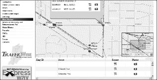
11 INDOT Rail Crossing Locator INDOT Rail Crossing Locator INDOT Rail Crossing Locator

12 INDOT Rail Crossing Locator INDOT Rail Crossing Locator INDOT Rail Crossing Locator or Crash History


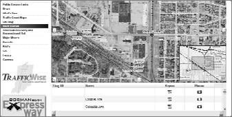
13 INDOT Rail Crossing Locator Note that this FRA data sheet was obtained directly from the GIS map INDOT Rail Crossing Locator So, you can see that one GIS application can give you tremendous amount of data at your fingertips For instance A map Inventory photos Crash records FRA inventory data Aerial Photo Example- Adding Tabular Data to a GIS


14 Example GIS working data Example- Opening the Attribute Table Options for Data Presentation Note you can present the data such as the current status of Public at-grade Crossings As a table As a Pie Chart GIS Note that the Tabular data is already embedded into GIS and you can click on the tables at any time, this is what makes GIS a powerful one stop analysis tool See the following examples--
15 Example- Rail Highway Crashes 16% of crashes occurred in Lake County alone 33% of all crashes occurred in Lake, Porter, La Porte, St. Joseph and Elkhart counties Roughly half of all crashes occurred in just 9 counties This data is displayed as a chart- You judge the impact it might have to an audience Example-Rail Highway Crashes 16% of all crashes were in Lake Co. Denotes Highest crash frequency county GIS is displaying the crash statistics as geographically referenced information Now we can see the nine high frequency counties Example- Current Status of Public at- Grade Crossings Protection Type Qty Crossbucks or Stop Signs 2,694 Other Active Protection ti 77 Flashing Lights 1,317 Flashing Lights plus Gates 1,883 Total 5,971 Data is Displayed as a Table
16 Grade Crossing Protection Type on Public at-grade Example- Current Status of Public at-grade Crossings Crossings as of June % 45% Crossbucks or Stop Signs Other Active Protection Flashing Lights Flashing Lights plus Gates 22% 1% Data is Displayed as a Pie Chart Display Data Now, GIS can display the data as geographically referenced information on various maps Analysis Now, the data is easier to view, understand, question, interpret, and visualize
17 Presentation Now, the data presentation may reveal relationships, patterns, and any trends Current Flashing Lights only Crossings Displayed as geographically referenced information Current Passive Protection Crossings Displayed as geographically referenced information
18 Other Active Device Protection Crossings Displayed as geographically referenced information Recent Section 130 Projects Displayed as geographically referenced information Example 2009 Section 130 Projects Displayed as geographically referenced information
19 Example- Indiana Rail System Map from Report 1. Displays geographically referenced information. 2. Easy to view and visualize data in ways that may reveal relationships, patterns, and trends. 3. Problems are solved by looking at data that is quickly understood and at the same time easily shared. Proposed 4Q Gate Locations Displayed as geographically referenced information Easy to view and visualize data in ways that may reveal relationships, patterns, and trends. Note that 4Q installations are placed in the high volume rail and highway traffic corridors. 4Q Gate Installation


20 Other Examples of GIS in the Office of Traffic Safety Note in all cases, the GIS displays geographically referenced information. Easy to view and visualize data to reveal relationships, patterns, and trends. Data is quickly understood and at the same time easily shared. Example Centerline Crashes Displayed as geographically referenced information Example Candidate Project Locations Displayed as geographically referenced information

21 Example Safe Routes to School Locations Displayed as geographically referenced information TransCAD Example-- TransCAD can be used to display HAT data as geographically referenced information as well as crash frequency Example Cross Median Crash Frequency Displayed as geographically referenced information High Frequency crashes in red; less crashes in green
22 Example-- Cross Median Crash Frequency After locating the crash Hot Spots, actual projects can be programmed where the needs are the greatest GIS allows the Engineer to converge on a possible solution quickly GIS allowed the Engineer to view, understand, question, interpret, and visualize data to reveal relationships, patterns, and trends Example Cross Median Crash Frequency Displayed as geographically referenced information With use of GIS, Project selection is easy Summary GIS displays geographically referenced information. Easy to view and visualize data to reveal relationships, patterns, and trends. Data is quickly understood and at the same time easily shared.
23 Summary (con t) INDOT uses GIS Spatial Analysis tools to display highway crash data GIS can display a project location as a map INDOT uses GIS to analyze Railroad crash data Analyze Railroad Highway Crossing inventory data Plot cross median crash history on the interstate system For example no of crashes per five mile segment of interstate Summary (con t) GIS is a real time saver in the Office of Traffic Safety Data would have to be processed manually and drawn on a map sheet Manual analysis not practical since we need to do reports on an annual basis GIS reduces manpower needed to analyze a dataset Be sure your data table and input is correct Our group foresees more and more applications of GIS Concluding Remarks We encourage local government agencies and MPO's to use GIS Spatial Analysis as a tool to analyze crash data Most local agencies use GIS for utilities so expertise is probably already available This expertise could be tapped and used for crash analysis With proper analysis, the limited highway and infrastructure dollars can be spent wisely on the locations where the most crashes occur It cannot be over emphasized that GIS Spatial Analysis data is quickly understood and at the same time easily shared
24 Concluding Remarks (con t) With GIS, displaying geographically referenced information will help any team to converge on the best possible solution quickly and with less chance for error. So, we recommend any Agency to use GIS Spatial Analysis tools where practicable
Louisiana Transportation Engineering Conference. Monday, February 12, 2007
 Louisiana Transportation Engineering Conference Monday, February 12, 2007 Agenda Project Background Goal of EIS Why Use GIS? What is GIS? How used on this Project Other site selection tools I-69 Corridor
Techniques for Science Teachers: Using GIS in Science Classrooms.
 Techniques for Science Teachers: Using GIS in Science Classrooms. After ESRI, 2008 GIS A Geographic Information System A collection of computer hardware, software, and geographic data used together for
GEOGRAPHIC INFORMATION SYSTEMS
 GEOGRAPHIC INFORMATION SYSTEMS 4-H Round-Up Community Transitions Workshop Daniel Hanselka June 14, 2011 Goals of the Workshop Answer the question: What is GIS? Uses of GIS. Some of the Common Terminology
ENV208/ENV508 Applied GIS. Week 1: What is GIS?
 ENV208/ENV508 Applied GIS Week 1: What is GIS? 1 WHAT IS GIS? A GIS integrates hardware, software, and data for capturing, managing, analyzing, and displaying all forms of geographically referenced information.
Section 2. Indiana Geographic Information Council: Strategic Plan
 Section 2. Indiana Geographic Information Council: Strategic Plan Introduction A geographic information system (GIS) is an automated tool that allows the collection, modification, storage, analysis, and
National Park Service Safety Management
 National Park Service Safety Management Locating Crashes Spatially from the National Park Service Service-wide Traffic Accident Reporting System (STARS) Database By Daniel Van Gilder Federal Highway Administration
Office of Geographic Information Systems
 Office of Geographic Information Systems Print this Page Spring 2009 - Desktop GIS: Dakota County GIS Extensions in ArcMap By Dan Castaneda In the past, the Office of GIS has created desktop extensions
An online data and consulting resource of THE UNIVERSITY OF TOLEDO THE JACK FORD URBAN AFFAIRS CENTER
 An online data and consulting resource of THE JACK FORD URBAN AFFAIRS CENTER THE CENTER FOR GEOGRAPHIC INFORMATION SCIENCE AND APPLIED GEOGRAPHICS DEPARTMENT OF GEOGRAPHY AND PLANNING THE UNIVERSITY OF
The Use of Geographic Information Systems (GIS) by Local Governments. Giving municipal decision-makers the power to make better decisions
 by Local Governments. Giving municipal decision-makers the power to make better decisions") The Use of Geographic Information Systems (GIS) by Local Governments Giving municipal decision-makers the power to make better decisions Case Study: Examples of GIS Usage by Local Governments in North
The Use of Geographic Information Systems (GIS) by Local Governments Giving municipal decision-makers the power to make better decisions Case Study: Examples of GIS Usage by Local Governments in North
E Geographic Information System. Created By: Freda Rocker Pearl River County Mapping
 E-9-1-1 Geographic Information System Created By: Freda Rocker Pearl River County Mapping frocker@pearlrivercounty.net Overview of Pearl River County E-9-1-1 Communications District GIS In 1998 the Pearl
GIS = Geographic Information Systems;
 What is GIS GIS = Geographic Information Systems; What Information are we talking about? Information about anything that has a place (e.g. locations of features, address of people) on Earth s surface,
GIS-T 2010 Building a Successful Geospatial Data Sharing Framework: A Ohio DOT Success Story
 GIS-T 2010 Building a Successful Geospatial Data Sharing Framework: A Ohio DOT Success Story ODOT District 2 GIS John Puente District 1 GIS Coordinator\ Planning Administrator 2 Interoperability 3 District
THE DEVELOPMENT OF ROAD ACCIDENT DATABASE MANAGEMENT SYSTEM FOR ROAD SAFETY ANALYSES AND IMPROVEMENT
 THE DEVELOPMENT OF ROAD ACCIDENT DATABASE MANAGEMENT SYSTEM FOR ROAD SAFETY ANALYSES AND IMPROVEMENT By T. H. Law Radin Umar R. S. (Road Safety Research Center, Faculty of Engineering, University Putra
If you aren t familiar with Geographical Information Systems (GIS), you. GIS, when combined with a database that stores response information,
, you. GIS, when combined with a database that stores response information,") Geographical Information Systems in EMS By William E. Ott If you aren t familiar with Geographical Information Systems (GIS), you should take a look at what GIS can offer you as an EMS manager. GIS, when
Geographical Information Systems in EMS By William E. Ott If you aren t familiar with Geographical Information Systems (GIS), you should take a look at what GIS can offer you as an EMS manager. GIS, when
Ohio s Linear Based Referencing System (a.k.a. Location Based Response System LBRS), a True State and Local Government Partnership
, a True State and Local Government Partnership") Ohio s Linear Based Referencing System (a.k.a. Location Based Response System LBRS), a True State and Local Government Partnership Ron Cramer Digital Data Technologies, Inc. Joseph Hausman The Ohio Department
Ohio s Linear Based Referencing System (a.k.a. Location Based Response System LBRS), a True State and Local Government Partnership Ron Cramer Digital Data Technologies, Inc. Joseph Hausman The Ohio Department
Iowa Department of Transportation Office of Transportation Data GIS / CAD Integration
 Iowa Department of Transportation Office of Transportation Data GIS / CAD Integration From GIS data to CAD graphics - Iowa DOT's workflow utilizing GeoMedia and MicroStation to develop map products. Mark
John Laznik 273 Delaplane Ave Newark, DE (302)
") Office Address: John Laznik 273 Delaplane Ave Newark, DE 19711 (302) 831-0479 Center for Applied Demography and Survey Research College of Human Services, Education and Public Policy University of Delaware
Office Address: John Laznik 273 Delaplane Ave Newark, DE 19711 (302) 831-0479 Center for Applied Demography and Survey Research College of Human Services, Education and Public Policy University of Delaware
GEOFOTO GROUP LTD. Buzinski prilaz 28, Zagreb, Croatia tel.: ,
 GEOFOTO GROUP LTD. Buzinski prilaz 28, 10010 Zagreb, Croatia www.geofoto-group.hr tel.: +385 91 9594 015, email: marketing@geofoto-group.hr, zvonko.biljecki@geofoto-group.hr VAT: HR63385121762, IBAN: HR1824000081110243303,
What is 511? Need for 511 Services. Development & Deployment of Regional Road and Weather Information Supporting 511 Traveler Services
 Development & Deployment of Regional Road and Weather Information Supporting 511 Traveler Services Leon F. Osborne University of North Dakota Regional Weather Information Center Grand Forks, ND David L.
Information. Information Technology. Geographic. Services (GIS) 119 W Indiana Ave Deland, FL 32720
 119 W Indiana Ave Deland, FL 32720") Information Technology Geographic Information Services (GIS) 119 W Indiana Ave Deland, FL 32720 A GIS consists of 5 primary components: Hardware Software People Data Methods or Business Processes --- Hardware
Information Technology Geographic Information Services (GIS) 119 W Indiana Ave Deland, FL 32720 A GIS consists of 5 primary components: Hardware Software People Data Methods or Business Processes --- Hardware
Using ArcGIS Server to Bring Geospatial Analysis
 Using ArcGIS Server to Bring Geospatial Analysis and Mapping to non-gis Analysts ESRI Health User Conference September 22, 2009 Jim Laramie, Altarum Institute Sam Wang, Altarum Institute Agenda Agenda
HIGH RESOLUTION BASE MAP: A CASE STUDY OF JNTUH-HYDERABAD CAMPUS
 HIGH RESOLUTION BASE MAP: A CASE STUDY OF JNTUH-HYDERABAD CAMPUS K.Manjula Vani, Abhinay Reddy, J. Venkatesh, Ballu Harish and R.S. Dwivedi ABSTRACT The proposed work High Resolution Base map: A Case study
Enterprise Linear Referencing at the NYS Department of Transportation
 Enterprise Linear Referencing at the NYS Department of Transportation One Highway Network to Support Many Business Processes May 9, 2018 May 9, 2018 2 Agenda An overview of Linear Referencing How NYSDOT
DATA SOURCES AND INPUT IN GIS. By Prof. A. Balasubramanian Centre for Advanced Studies in Earth Science, University of Mysore, Mysore
 DATA SOURCES AND INPUT IN GIS By Prof. A. Balasubramanian Centre for Advanced Studies in Earth Science, University of Mysore, Mysore 1 1. GIS stands for 'Geographic Information System'. It is a computer-based
Continental Divide National Scenic Trail GIS Program
 CDNST Vision Statement: Provide the most accurate geospatial locational information of the Continental Divide Trail and nearby resources to the public as well as help provide internal management information
GIS Needs Assessment. for. The City of East Lansing
 GIS Needs Assessment for The City of East Lansing Prepared by: Jessica Moy and Richard Groop Center for Remote Sensing and GIS, Michigan State University February 24, 2000 Executive Summary At the request
GIS (GEOGRAPHIC INFORMATION SYSTEMS)
") GIS (GEOGRAPHIC INFORMATION SYSTEMS) 1 1. DEFINITION SYSTEM Any organised assembly of resources and procedures united and regulated by interaction or interdependence to complete a set of specific functions.
GIS (GEOGRAPHIC INFORMATION SYSTEMS) 1 1. DEFINITION SYSTEM Any organised assembly of resources and procedures united and regulated by interaction or interdependence to complete a set of specific functions.
Geographic Systems and Analysis
 Geographic Systems and Analysis New York University Robert F. Wagner Graduate School of Public Service Instructor Stephanie Rosoff Contact: stephanie.rosoff@nyu.edu Office hours: Mondays by appointment
CHAPTER 22 GEOGRAPHIC INFORMATION SYSTEMS
 CHAPTER 22 GEOGRAPHIC INFORMATION SYSTEMS PURPOSE: This chapter establishes the administration and use of to improve the quality and accessibility of Department s spatial information and support graphical
USING GIS IN WATER SUPPLY AND SEWER MODELLING AND MANAGEMENT
 USING GIS IN WATER SUPPLY AND SEWER MODELLING AND MANAGEMENT HENRIETTE TAMAŠAUSKAS*, L.C. LARSEN, O. MARK DHI Water and Environment, Agern Allé 5 2970 Hørsholm, Denmark *Corresponding author, e-mail: htt@dhigroup.com
A case study of Pavement Management in Chelan County
 INTEGRATING PAVEMENT MANAGEMENT AND GIS A case study of Pavement Management in Chelan County Our Road dto Full lladoption of a PMS The evolution of PMS at Chelan County Our current process Use of GIS to
ArcGIS for Desktop. ArcGIS for Desktop is the primary authoring tool for the ArcGIS platform.
 ArcGIS for Desktop ArcGIS for Desktop ArcGIS for Desktop is the primary authoring tool for the ArcGIS platform. Beyond showing your data as points on a map, ArcGIS for Desktop gives you the power to manage
Transportation and Logistics Planning and Development Mapping Tool
 Transportation and Logistics Planning and Development Mapping Tool Doreen Gonzales-Gaboyan Business Development and Outreach Center for Innovation through Visualization and Simulation (CIVS) Purdue University
2018 NASCIO Award Submission Category: Cross-Boundary Collaboration and Partnerships. Project Title: Tennessee Wildfires: A Coordinated GIS Response
 2018 NASCIO Award Submission Category: Cross-Boundary Collaboration and Partnerships Project Title: Tennessee Wildfires: A Coordinated GIS Response Sevier County, Tennessee State of Tennessee, Emergency
High Speed / Commuter Rail Suitability Analysis For Central And Southern Arizona
 High Speed / Commuter Rail Suitability Analysis For Central And Southern Arizona Item Type Reports (Electronic) Authors Deveney, Matthew R. Publisher The University of Arizona. Rights Copyright is held
GIS and Web Technologies to Improve Irrigation Districts
 GIS and Web Technologies to Improve Irrigation Districts Presented To: Montana Association of Dam and Canal Systems Workshop Presented By: Brian Fischer, CFM GIS Manager October 07, 2010 What you won t
How GIS can be used for improvement of literacy and CE programmes
 How GIS can be used for improvement of literacy and CE programmes Training Workshop for Myanmar Literacy Resource Center (MLRC) ( Yangon, Myanmar, 11 20 October 2000 ) Presented by U THEIN HTUT GEOCOMP
Transforming Geospatial Data for Visualization with D3
 Transforming Geospatial Data for Visualization with D3 FOSS4G Boston August 17, 2017 Beatrice Jin and Benjamin Krepp Boston Region Metropolitan Planning Organization Agenda Who we are Project context Implementation
A Summary of State DOT GIS Activities. Presented at the 2000 AASHTO GIS-T Symposium Minneapolis, MN
 A Summary of State DOT GIS Activities Presented at the 2000 AASHTO GIS-T Symposium Minneapolis, MN Information Sources E-mail survey of state DOT GIS managers 49 State DOTs responded in 2000 Results compared
Designing GIS Databases to Support Mapping and Map Production Charlie Frye, ESRI Redlands Aileen Buckley, ESRI Redlands
 Designing GIS Databases to Support Mapping and Map Production Charlie Frye, ESRI Redlands Aileen Buckley, ESRI Redlands 1 Designing GIS Databases to Support Mapping and Map Production Charlie Frye, ESRI
Crime Analysis. GIS Solutions for Intelligence-Led Policing
 Crime Analysis GIS Solutions for Intelligence-Led Policing Applying GIS Technology to Crime Analysis Know Your Community Analyze Your Crime Use Your Advantage GIS aids crime analysis by Identifying and
Pierce Cedar Creek Institute GIS Development Final Report. Grand Valley State University
 Pierce Cedar Creek Institute GIS Development Final Report Grand Valley State University Major Goals of Project The two primary goals of the project were to provide Matt VanPortfliet, GVSU student, the
UTILIZING GIS IN NEXT GENERATION Tennessee Information for Public Safety. Presented by State of TN, OIR-GIS Services
 UTILIZING GIS IN NEXT GENERATION 9-1-1 Tennessee Information for Public Safety Presented by State of TN, OIR-GIS Services Next Generation 9-1-1 WHAT IT IS AND HOW IT WORKS Next Generation 9-1-1 IP (Internet
Texas A&M University
 Texas A&M University CVEN 658 Civil Engineering Applications of GIS Hotspot Analysis of Highway Accident Spatial Pattern Based on Network Spatial Weights Instructor: Dr. Francisco Olivera Author: Zachry
RANGE SUSTAINABILITY GIS APPLICATIONS AND ENTERPRISE IMPLEMENTATIONS
 RANGE SUSTAINABILITY GIS APPLICATIONS AND ENTERPRISE IMPLEMENTATIONS May 4, 2009 Gabe Lovasz, Geospatial Analyst, ManTech SRS Molly Rodriguez, Geospatial Analyst, ManTech SRS -In Support of- The Office
Creating a Pavement Management System Using GIS
 Christopher Castruita PPD 631 Prof. Barry Waite & Prof. Bonnie Shrewsbury Creating a Pavement Management System Using GIS Problem Definition As is the case with many cities, the city of La Cañada Flintridge
Mapping Historical Information Using GIS
 Mapping Historical Information Using GIS David Yun, GISP Troy Lawson ABSTRACT The City of San Luis Obispo, California, is rich with history. It is one of California s oldest communities that began with
NAVAJO NATION PROFILE
 NAVAJO NATION PROFILE Largest land based area and federally recognized tribe in the United States Over 27,000 square miles (or 17.2 million acres with a population of over 300,000 people. Covers Arizona,
2013 NASCIO Award Submission Category: Cross-Boundary Collaboration and Partnerships. Project Title: Public Safety and Enterprise GIS in Tennessee
 2013 NASCIO Award Submission Category: Cross-Boundary Collaboration and Partnerships Project Title: Public Safety and Enterprise GIS in Tennessee State of Tennessee, Board of Parole State of Tennessee,
GIS ANALYSIS METHODOLOGY
 GIS ANALYSIS METHODOLOGY No longer the exclusive domain of cartographers, computer-assisted drawing technicians, mainframes, and workstations, geographic information system (GIS) mapping has migrated to
The Road to Improving your GIS Data. An ebook by Geo-Comm, Inc.
 The Road to Improving your GIS Data An ebook by Geo-Comm, Inc. An individual observes another person that appears to be in need of emergency assistance and makes the decision to place a call to 9-1-1.
The Framework and Application of Geographic Information Systems (GIS)
") The Framework and Application of Geographic Information Systems (GIS) The Framework and Application of Geographic Information Systems (GIS) Part I The Geographic Framework The Geographic Framework Spatial
The Framework and Application of Geographic Information Systems (GIS) The Framework and Application of Geographic Information Systems (GIS) Part I The Geographic Framework The Geographic Framework Spatial
Updating the Urban Boundary and Functional Classification of New Jersey Roadways using 2010 Census data
 Updating the Urban Boundary and Functional Classification of New Jersey Roadways using 2010 Census data By: Glenn Locke, GISP, PMP 1 GIS-T May, 2013 Presentation Overview Purpose of Project Methodology
GIS Resources for Local Governments
 ISSUE PAPER SERIES GIS Resources for Local Governments February 2018 NEW YORK STATE TUG HILL COMMISSION DULLES STATE OFFICE BUILDING 317 WASHINGTON STREET WATERTOWN, NY 13601 (315) 785-2380 WWW.TUGHILL.ORG
Applications of GIS in Electrical Power System
 Applications of GIS in Electrical Power System Abdulrahman M. AL-Sakkaf 201102310 CRP 514 May 2013 Dr. Baqer M. AL-Ramadan Abstract GIS has been widely used in various areas and disciplines. This paper
Are You Maximizing The Value Of All Your Data?
 Are You Maximizing The Value Of All Your Data? Using The SAS Bridge for ESRI With ArcGIS Business Analyst In A Retail Market Analysis SAS and ESRI: Bringing GIS Mapping and SAS Data Together Presented
The 7th Annual SARGIS Workshop and Meeting. Welcome to SARGIS7!
 The 7th Annual SARGIS Workshop and Meeting Welcome to SARGIS7! The National Alliance for Public Safety GIS Foundation is a 501 (C) (3) not-forprofit organization» OUR VISION A Nation of emergency responders
Integrating GIS into West Nile Virus Planning and Surveillance
 Integrating GIS into West Nile Virus Planning and Surveillance Fairfax County Health Department Adrian Joye, Environmental Health Specialist Agenda Background/Benefits Routes/Trap Locations Dead Bird Complaint
Applied Cartography and Introduction to GIS GEOG 2017 EL. Lecture-1 Chapters 1 and 2
 Applied Cartography and Introduction to GIS GEOG 2017 EL Lecture-1 Chapters 1 and 2 What is GIS? A Geographic Information System (GIS) is a computer system for capturing, storing, querying, analyzing and
GIS for the Beginner on a Budget
 GIS for the Beginner on a Budget Andre C. Bally, RLA, GIS Coordinator, Harris County Public Infrastructure Department Engineering Division This presentation, GIS for Beginners on a Budget. will briefly
GIS for Integrated Pest Management. Christina Hailey. Abstract:
 GIS for Integrated Pest Management Christina Hailey Abstract: At its formation in 1965, Harris County Mosquito Control (Houston, Texas) (HCMC) was primarily involved in the prevention and control of mosquito-borne
Map your way to deeper insights
 Map your way to deeper insights Target, forecast and plan by geographic region Highlights Apply your data to pre-installed map templates and customize to meet your needs. Select from included map files
A Comprehensive Inventory of the Number of Modified Stream Channels in the State of Minnesota. Data, Information and Knowledge Management.
 A Comprehensive Inventory of the Number of Modified Stream Channels in the State of Minnesota Data, Information and Knowledge Management Glenn Skuta Environmental Analysis and Outcomes Division Minnesota
BROOKINGS May
 Appendix 1. Technical Methodology This study combines detailed data on transit systems, demographics, and employment to determine the accessibility of jobs via transit within and across the country s 100
GIS Geographical Information Systems. GIS Management
 GIS Geographical Information Systems GIS Management Difficulties on establishing a GIS Funding GIS Determining Project Standards Data Gathering Map Development Recruiting GIS Professionals Educating Staff
Application of Geographic Information Systems to Rail-Highway Grade Crossing Safety
 156 TRANSPORTATION RESEARCH RECORD 1495 Application of Geographic Information Systems to Rail-Highway Grade Crossing Safety ARDESHIR FAGHRI AND 5RIRAM PANCHANATHAN The application of geographic information
Abstract. Keywords: Geographic information systems and digital data model. 1. Introduction
 Abstract GISMO - A Geographical Information System for a Municipality Office Ramzi A. Haraty and Youssef O. Kaddoura Lebanese American University P.O. Box 13-5053 Chouran Beirut, Lebanon 1102 2801 Email:
How GIS Can Help With Tribal Safety Planning
 How GIS Can Help With Tribal Safety Planning Thomas A. Horan, PhD Brian Hilton, PhD Arman Majidi, MAIS Center for Information Systems and Technology Claremont Graduate University Goals & Objectives This
Data Entry. Getting coordinates and attributes into our GIS
 Data Entry Getting coordinates and attributes into our GIS How we used to collect spatial data How we collect spatial data now DATA SOURCES, INPUT, AND OUTPUT Manually digitizing from image or map sources
THE 3D SIMULATION INFORMATION SYSTEM FOR ASSESSING THE FLOODING LOST IN KEELUNG RIVER BASIN
 THE 3D SIMULATION INFORMATION SYSTEM FOR ASSESSING THE FLOODING LOST IN KEELUNG RIVER BASIN Kuo-Chung Wen *, Tsung-Hsing Huang ** * Associate Professor, Chinese Culture University, Taipei **Master, Chinese
GED 554 IT & GIS. Lecture 6 Exercise 5. May 10, 2013
 GED 554 IT & GIS Lecture 6 Exercise 5 May 10, 2013 Free GIS data sources ******************* Mapping numerical data & Symbolization ******************* Exercise: Making maps for presentation GIS DATA SOFTWARE
Introduction to GIS I
 Introduction to GIS Introduction How to answer geographical questions such as follows: What is the population of a particular city? What are the characteristics of the soils in a particular land parcel?
Rural Louisiana. A quarterly publication of the Louisiana Tech Rural Development Center
 Rural Louisiana A quarterly publication of the Louisiana Tech Rural Development Center Volume 4, No. 1, Fall 2009 Editor: Aaron K. Lusby Director, Asst. Professor Newsletter design: Stephanie Tidwell Student
Deploying the Winter Maintenance Support System (MDSS) in Iowa
 in Iowa") Deploying the Winter Maintenance Support System (MDSS) in Iowa Dennis A. Kroeger Center for Transportation Research and Education Iowa State University Ames, IA 50010-8632 kroeger@iastate.edu Dennis Burkheimer
Deploying the Winter Maintenance Support System (MDSS) in Iowa Dennis A. Kroeger Center for Transportation Research and Education Iowa State University Ames, IA 50010-8632 kroeger@iastate.edu Dennis Burkheimer
presents challenges related to utility infrastructure planning. Many of these challenges
 1 Introduction: - a. Purpose According to U.S. Census Bureau the population of stark county was 367,585 in 1990, and in 2000 it was increase to 378,098. Thus County is experiencing a growth that presents
Indiana GIS Resources
 Indiana GIS Resources National Association of Water Companies September 21, 2017 Jim Sparks Indiana Geographic Information Officer ABOUT THE INDIANA GEOGRAPHIC INFORMATION OFFICE I.C. 4-23-7.3 Indiana
why is a national or regional context important?
 The need Accessibility to opportunities, Efficient movement of people and goods, Environmental Health Strength and competitiveness of the economy, Availability and cost of energy, Safety and Security,
IMPLEMENTING GOVERNMENT-WIDE ENTERPRISE GIS; THE FEDERATED MODEL
 IMPLEMENTING GOVERNMENT-WIDE ENTERPRISE GIS; THE FEDERATED MODEL James E. Mitchell, Ph. D. IT GIS Manager Louisiana Department of Transportation and Development presented at the ESRI International Users
Utilization and Provision of Geographical Name Information on the Basic Map of Japan*
 UNITED NATIONS WORKING PAPER GROUP OF EXPERTS NO. 1/9 ON GEOGRAPHICAL NAMES Twenty-eight session 28 April 2 May 2014 Item 9 of the Provisional Agenda Activities relating to the Working Group on Toponymic
Transforming the Maricopa County Department of Transportation (MCDOT) GIS-based Transportation Asset Inventory System June 30, 2016
 GIS-based Transportation Asset Inventory System June 30, 2016") Transforming the Maricopa County Department of Transportation (MCDOT) GIS-based Transportation Asset Inventory System June 30, 2016 Presented By Steve Hossack, GIS Database Administrator 2016 Esri User
Transforming the Maricopa County Department of Transportation (MCDOT) GIS-based Transportation Asset Inventory System June 30, 2016 Presented By Steve Hossack, GIS Database Administrator 2016 Esri User
Gridded Traffic Density Estimates for Southern
 Gridded Traffic Density Estimates for Southern California, 1995-2014 User Notes authored by Beau, 11/28/2017 METADATA: Each raster file contains Traffic Density data for one year (1995, 2000, 2005, 2010,
Oregon Department of Transportation. Geographic Information Systems Strategic Plan
 Oregon Department of Transportation Geographic Information Systems Strategic Plan Adopted May, 2000 By the GIS Steering Committee Last printed 10/2/2012 4:20:00 PM Page Geographic Information Systems Strategic
GIS Integration to Maximo
 GIS Integration to Maximo Tuesday 15 th January 2008 Mahmoud Jaafar Systems Director GISTEC Agenda Introduction Why AMS & GIS Integration? ESRI GIS Enabling Technology. Integrating GIS & Maximo. What do
MODERNIZATION OF THE MUNICIPAL MAPPING USING HIGH END GNSS SYSTEM AND GIS SOFTWARE
 MODERNIZATION OF THE MUNICIPAL MAPPING USING HIGH END GNSS SYSTEM AND GIS SOFTWARE Mr. R. A. R. Khan Assistant Engineer, Sewerage Utility Management Centre (SUMC) Municipal Corporation Of Greater Mumbai
BUILDING AN ASSET MANAGEMENT GEODATABASE FOR RANCHING. Matt Crawford, GISP
 BUILDING AN ASSET MANAGEMENT GEODATABASE FOR RANCHING Matt Crawford, GISP Introduction East Foundation Formed in 2007 Mission Research Education Outreach Properties Six ranches ~ 215,000 acres San Antonio
GEOGRAPHIC INFORMATION SYSTEMS Session 8
 GEOGRAPHIC INFORMATION SYSTEMS Session 8 Introduction Geography underpins all activities associated with a census Census geography is essential to plan and manage fieldwork as well as to report results
Chapter 02 Maps. Multiple Choice Questions
 Chapter 02 Maps Multiple Choice Questions 1. Every projection has some degree of distortion because A. a curved surface cannot be represented on a flat surface without distortion. B. parallels and meridians
e-pathai GIS (Electronic Project, Administration, Traffic, Highway Assets and Information management system) in Tamil Nadu Highways
 in Tamil Nadu Highways") e-pathai GIS (Electronic Project, Administration, Traffic, Highway Assets and Information management system) in Tamil Nadu Highways Er.G.Kumar¹, Er.R.Sendel Raj², Er.P.Eshwarmoorthy³, Dr.P.Rajakumar 4
e-pathai GIS (Electronic Project, Administration, Traffic, Highway Assets and Information management system) in Tamil Nadu Highways Er.G.Kumar¹, Er.R.Sendel Raj², Er.P.Eshwarmoorthy³, Dr.P.Rajakumar 4
Google Maps and Beyond
 Google Maps and Beyond Aaron Paul First American Title apaul@firstam.com 2015 APRA Symposium Association of Professional Reserve Analysts May 2 nd, 2015 Google Maps and Beyond - Overview Business case
Gov 2.0. Encourage citizen engagement, deliver transparency, and foster collaboration with ArcGIS.
 Gov 2.0 Encourage citizen engagement, deliver transparency, and foster collaboration with ArcGIS. F E D E R A L GIS A Platform for Open Government Upon taking office, President Barack Obama issued an open
Your web browser (Safari 7) is out of date. For more security, comfort and. the best experience on this site: Update your browser Ignore
 is out of date. For more security, comfort and. the best experience on this site: Update your browser Ignore") Your web browser (Safari 7) is out of date. For more security, comfort and Activityengage the best experience on this site: Update your browser Ignore Introduction to GIS What is a geographic information
Your web browser (Safari 7) is out of date. For more security, comfort and Activityengage the best experience on this site: Update your browser Ignore Introduction to GIS What is a geographic information
Agenda. Johnson County. Introduction What Is GIS? Needs Assessment Strategic Plan GIS Task force What do we need from you?
 Agenda Introduction What Is GIS? Needs Assessment Strategic Plan GIS Task force What do we need from you? Open Forum 1 Introduction Michael Sudac GIS Director 13 years GIS experience GIS Supervisor for
IMPERIAL COUNTY PLANNING AND DEVELOPMENT
 IMPERIAL COUNTY PLANNING AND DEVELOPMENT GEODATABASE USER MANUAL FOR COUNTY BUSINESS DEVELOPMENT GIS June 2010 Prepared for: Prepared by: County of Imperial Planning and Development 801 Main Street El
Gis Unit TropMed Mahidol U.
 Gis Unit TropMed Mahidol U. Database Information System Database Concepts 1. Non-Spatial Database table, document.. 2. Spatial Database locational databases (geographic) + attribute databases Gis Unit
Regional GIS Initiatives Geospatial Technology Center
 Regional GIS Initiatives Geospatial Technology Center Mr. Bobby Lear GIS Coordinator St. James Parish & Dr. Balaji Ramachandran Contractors Educational Trust Fund Endowed Professor Geomatics Program, Department
ENHANCING ROAD SAFETY MANAGEMENT WITH GIS MAPPING AND GEOSPATIAL DATABASE
 Abstract ENHANCING ROAD SAFETY MANAGEMENT WITH GIS MAPPING AND GEOSPATIAL DATABASE Dr Wei Liu GHD Reliable and accurate data are needed in each stage of road safety management in order to correctly identify
Lauren Jacob May 6, Tectonics of the Northern Menderes Massif: The Simav Detachment and its relationship to three granite plutons
 Lauren Jacob May 6, 2010 Tectonics of the Northern Menderes Massif: The Simav Detachment and its relationship to three granite plutons I. Introduction: Purpose: While reading through the literature regarding
Key Steps for Assessing Mission Critical Data for An ebook by Geo-Comm, Inc.
 Key Steps for Assessing Mission Critical Data for 9-1-1 An ebook by Geo-Comm, Inc. If you re reading this, you probably understand transitioning to Next Generation 9-1-1 (NG9-1-1) means your Geographic
APPLICATION OF GIS IN ELECTRICAL DISTRIBUTION NETWORK SYSTEM
 See discussions, stats, and author profiles for this publication at: https://www.researchgate.net/publication/305263658 APPLICATION OF GIS IN ELECTRICAL DISTRIBUTION NETWORK SYSTEM Article October 2015
Finding Common Ground Through GIS
 Finding Common Ground Through GIS Matthew Stone, MPH Special Unit for Technical Assistance Chronic Disease and Injury Control California Department of Public Health ESRI Health GIS Conference Scottsdale,