Expert Meeting: for Preparedness and Emergency Reponse. Land cover, land grabbing and. crowdsourcing
|
|
|
- Louise Curtis
- 5 years ago
- Views:
Transcription
1 Expert Meeting: Crowdsource Mapping for Preparedness and Emergency Reponse Land cover, land grabbing and drought: opportunities for crowdsourcing
2 Why is it so important to improve global land cover? Originally focus and applications of land cover datasets where inthe field of climatechangechange projections Now increasing demand comes from the integrated assessment community and the global biophysical modelling community Cropland extend has been neglected, but crucial for applicationsin in the field of foodsecurity security, assessing yield and production gaps, Cropland extend dataset is also crucially important for investment decisions both by governments as all as foundations (e.g. Gates) 2


3 Disagreement in Africa in the cropland domain between GLC 2000 and MODIS v. 5
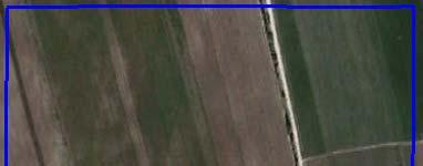
4 Motivation to build GEO Wiki Problems with global land cover When different products are compared, there is a lot of disagreement between them One product might say cropland, another grassland Confusing if you are a user which one is correct? Which is the best product to use? Disagreement overall and/or spatially Google Earth/Bing Maps are still the only very high resolution data available to researchers to collect validation ld points globally ll (examples, GlobCover, latest Chinese product) 4
5


6 Wiki.org og Geo wiki makes GEO data easy to visualize and analyze. Vl Volunteers from around the globe can classify Google Earth imagery, input their agreement/ disagreement with the existing data 6
7
8 Geo Wiki Project: Disagreement
9
10


11 Am example of disagreement in Dimitrovgrad, Chaskowo oblast, Bulgaria 11
12 Geo Wiki Family of Crowdsourcing Tools Contributes to Open Data
13 Map improvement via crowd sourcing More than 1000 users in more than 120 countries > 100, validation i points 13
14 14
15
16
17 `
18
19 Land Acquisition Area + Clear Evidence of Settlements (from Geo Wiki Hackathon) = Areas of Conflict


20
21
22


23
24 Much less marginal land is available Land available (%) Only Land cover based Field size adjusted Human Impact adjusted S1 S2 S3 S4
25
26 Game for Land Cover validation 26


27 Geo Wiki mobile new technologies Geo wiki mobile


28 Disaster Drought, Northern Hemisphere Crop NDVI Anomalies August 13th, 2012 Canada Russia Ukraine Kazakhstan USA China Crop NDVI Anomaly Worse than normal Better than normal normal Non Cropland Not shown India Spring Wheat Spring Wheat Spring Wheat Corn/ Winter Wheat/ Corn anomaly Soy anomaly anomaly anomaly anomaly Current season crop development (2012) Average season development ( )


29 FarmSupport APP: Menue


30 Take a Picture

31 APP: Soil Moisture

32 FarmSupport APP: Sample Question


33 ISPRS Special Issue on: Collaborative Mapping Thematic and geometric accuracy of collaborative mapping (i.e. quality of the information) Development of indicators of robustness of / confidence in the VGI Authoritativeness of collaborative map products, i.e. ideas on how to bring collaborative map products to a level of authority that is not disputed Data harmonization Collaborative mapping and the role of mapping institutions Spatial cognition in collaborative mapping Cost effectiveness and cost benefits of collaborative mapping The use of collaborative mappinginthe areas of biodiversity,landuse science,climateclimate change,emergencyresponse, emergency response, andother relevant applied fields Guest Editors Dr. Linda See Dr. Steffen Fritz Dr. Jan de Leeuw mapping
 or find out more here: http://www.")
34 Participation in a COST Action TD1202: Mapping and the Citizen Sensor Started 28/11/ year action We are co leading Working Group 1 on Acquiring and Managing VGI Three other WGs that may be of interest: WG2: Understanding and influencing contributors WG3: Map production WG4: Mapvalidation activities WG4: Map validation activities us if you want to participate (fritz@iiasa.ac.at) or find out more here:
35 Thank you! Want to collaborate? Send an e mail: fritz@iiasa.ac.at
Generating WUDAPT s Specific Scale-dependent Urban Modelling and Activity Parameters: Collection of Level 1 and Level 2 Data
 ICUC9, Toulouse, France, 2015 Generating WUDAPT s Specific Scale-dependent Urban Modelling and Activity Parameters: Collection of Level 1 and Level 2 Data Linda See, Jason Ching 2, Valéry Masson 3, Johannes
choice have on a particular application? For example, Fritz et al. (2010a) have shown that comparing global land cover (GLC-2000) with the equivalent
 have shown that comparing global land cover (GLC-2000) with the equivalent") Improving Global Land Cover through Crowd-sourcing and Map Integration L. See 1, S. Fritz 1, I. McCallum 1, C. Schill 2, C. Perger 3 and M. Obersteiner 1 1 International Institute for Applied Systems Analysis
Improving Global Land Cover through Crowd-sourcing and Map Integration L. See 1, S. Fritz 1, I. McCallum 1, C. Schill 2, C. Perger 3 and M. Obersteiner 1 1 International Institute for Applied Systems Analysis
Geo-spatial Statistics with Globalland30
 UN International Workshop on Integrating Geospatial and Statistical Information Geo-spatial Statistics with Globalland30 Jun Chen 1,2 Lijun Chen 1, Ran Li 1 1 National Geomatics Center, China 2 International
Assessing and Improving the Reliability of Volunteered Land Cover Reference Data
 remote sensing Article Assessing and Improving the Reliability of Volunteered Land Cover Reference Data Yuanyuan Zhao 1, Duole Feng 1, Le Yu 1 ID, Linda See 2 ID, Steffen Fritz 2, Christoph Perger 2 ID
Enabling Access to Arctic Location Based Information
 Enabling Access to Arctic Location Based Information Jani Kylmäaho Arctic SDI Geoportal WG Lead National Land Survey of Finland INSPIRE Conference 29 September 2016 http://wallpaper.imcphoto.net/animals/polar
Getting Started with Community Maps
 Esri International User Conference San Diego, California Technical Workshops July 24, 2012 Getting Started with Community Maps Shane Matthews and Tamara Yoder Topics for this Session ArcGIS is a complete
Smart Citizens. Maria Antonia Brovelli Politecnico di Milano, Italy
 Smart Citizens Maria Antonia Brovelli Politecnico di Milano, Italy UN-GGIM Academic Network Forum Secure Land Rights and Smart Cities: Making It Work for Sustainable Development New York, 31 July 2017
Access to global land cover reference datasets and their suitability for land cover mapping activities
 Access to global land cover reference datasets and their suitability for land cover mapping activities Brice Mora, N.E.Tsendbazar, M.Herold LPVE meeting, Frascati, January 29, 2014 Outlook 1. Background
Development of a Regional Land Cover Monitoring System In the Lower Mekong Region a Joint Effort Between SERVIR-Mekong and Partners -
 Mekong Development of a Regional Land Cover Monitoring System In the Lower Mekong Region a Joint Effort Between SERVIR-Mekong and Partners - Aekkapol Aekakkararungroj SERVIR-Mekong Asian Disaster Preparedness
World Meteorological Organization
 World Meteorological Organization Opportunities and Challenges for Development of Weather-based Insurance and Derivatives Markets in Developing Countries By Maryam Golnaraghi, Ph.D. Head of WMO Disaster
Land cover validation game
 Land cover validation game Maria Antonia Brovelli1, Irene Celino2, Monia Elisa Molinari1, Vijaycharan Venkatachalam1 1 2 Politecnico di Milano, Como Campus, Via Valleggio 11, 22100, Como, Italy CEFRIEL
LACO-WIKI: AN OPEN ACCESS ONLINE PORTAL FOR LAND COVER VALIDATION
 LACO-WIKI: AN OPEN ACCESS ONLINE PORTAL FOR LAND COVER VALIDATION L. See a, *, C. Perger a, M. Hofer b, J. Weichselbaum b, C. Dresel c, S. Fritz a a Ecosystems Services and Management Program, International
GEOMATICS AND DISASTER MANAGEMENT: Early Impact assessment in Haiti
 GEOMATICS AND DISASTER MANAGEMENT: Early Impact assessment in Haiti We will talk about... Post-disaster response: the main questions to be answered Post-disaster rapid mapping: the role of Geomatics The
Overview on Land Cover and Land Use Monitoring in Russia
 Russian Academy of Sciences Space Research Institute Overview on Land Cover and Land Use Monitoring in Russia Sergey Bartalev Joint NASA LCLUC Science Team Meeting and GOFC-GOLD/NERIN, NEESPI Workshop
Lesson Quizzes (Individual assessments for each lesson) Social Studies Alive! Our Community and Beyond Lesson 1-6
 Social Studies Alive! Our Community and Beyond Lesson 1-6") 7.1 Basic Geographic Literacy 7.1.3.A-Identigy how basic geographic tools are used to organize and interpret information about people, places and environment. 7.3 Human Characteristics of Places and Regions
7.1 Basic Geographic Literacy 7.1.3.A-Identigy how basic geographic tools are used to organize and interpret information about people, places and environment. 7.3 Human Characteristics of Places and Regions
IAEG-SDGs WGGI Task Team Dec. 7, 2017, New York
 IAEG-SDGs WGGI Task Team Dec. 7, 2017, New York Contents What are G/A data? Role of G/A data Utilization Recommendations Outlook National Geospatial Data for SDGs Official data products generated by authoritative
CHALLENGES WITH THE FUNDAMENTAL GEOSPATIAL DATA IN AFRICA
 CHALLENGES WITH THE FUNDAMENTAL GEOSPATIAL DATA IN AFRICA Dr Derek Clarke Chair: UN-GGIM: Africa WG on Fundamental Geospatial Data and Standards derek.clarke.dr@gmail.com International Workshop on Fundamental
Esri and GIS Education
 Esri and GIS Education Organizations Esri Users 1,200 National Government Agencies 11,500 States & Regional Agencies 30,800 Cities & Local Governments 32,000 Businesses 8,500 Utilities 12,600 NGOs 11,000
Geospatial Information and Services for Disasters (GIS4D)
") Geospatial Information and Services for Disasters (GIS4D) 31 July 2017 Tae Hyung KIM ICT and Disaster Risk Reduction Division (IDD) UNESCAP 1 About ESCAP Who is ESCAP? United Nations Economic and Social
Geospatial Information and Services for Disasters (GIS4D) 31 July 2017 Tae Hyung KIM ICT and Disaster Risk Reduction Division (IDD) UNESCAP 1 About ESCAP Who is ESCAP? United Nations Economic and Social
Remote Sensing Geographic Information Systems Global Positioning Systems
 Remote Sensing Geographic Information Systems Global Positioning Systems Assessing Seasonal Vegetation Response to Drought Lei Ji Department of Geography University of Nebraska-Lincoln AVHRR-NDVI: July
Key Points Sharing fosters participation and collaboration Metadata has a big role in sharing Sharing is not always easy
 Sharing Resources Geoff Mortson esri, Inc. SDI Solutions Team Key Points Sharing fosters participation and collaboration Metadata has a big role in sharing Sharing is not always easy Data Sharing is Good
13 June Board on Research Data & Information (BRDI)
") Board on Research Data & Information (BRDI) OUTLINE 2 Challenges of Monitoring Climate Change Recruiting Internet Citizen Scientists Partnering with Citizen Science Alliance Project 1: Data Rescue for
Board on Research Data & Information (BRDI) OUTLINE 2 Challenges of Monitoring Climate Change Recruiting Internet Citizen Scientists Partnering with Citizen Science Alliance Project 1: Data Rescue for
Programme. MC : Byron Anangwe. Morning Session
 Programme MC : Byron Anangwe Morning Session DAY 2 Summary MC : Byron Anangwe The USGS global land cover mapping initiative Land use and land cover mapping at the Joint Research Centre Alan Belward FAO
VGIscience Summer School Interpretation, Visualisation and Social Computing of Volunteered Geographic Information (VGI)
") VGIscience Summer School Interpretation, Visualisation and Social Computing of Volunteered Geographic Information (VGI) TU Dresden, 11.-15. September 2017 Welcome PhD students working on research topics
VGIscience Summer School Interpretation, Visualisation and Social Computing of Volunteered Geographic Information (VGI) TU Dresden, 11.-15. September 2017 Welcome PhD students working on research topics
Evaluation of ESA CCI prototype land cover map at 20m
 Evaluation of ESA CCI prototype land cover map at 20m Lesiv, M., Fritz, S., McCallum, I., Tsendbazar, N., Herold, M., Pekel, J.-F., Buchhorn, M., Smets, B. & Van De Kerchove, R. IIASA Working Paper WP-17-021
A METHODOLOGY FOR ASSESSING OPENSTREETMAP DEGREE OF COVERAGE FOR PURPOSES OF LAND COVER MAPPING
 A METHODOLOGY FOR ASSESSING OPENSTREETMAP DEGREE OF COVERAGE FOR PURPOSES OF LAND COVER MAPPING A. Ribeiro a, b *, C.C. Fonte c a Civil Engineering Department, Coimbra Institute of Engineering, Coimbra,
Enabling Access to Arctic Location Based Information
 Enabling Access to Arctic Location Based Information Kevin Gallagher Arctic SDI Board Chair, United States Geological Survey Alaska Surveying and Mapping Conference, GeoJam 15 February 2017 What is Arctic
Data Fusion and Multi-Resolution Data
 Data Fusion and Multi-Resolution Data Nature.com www.museevirtuel-virtualmuseum.ca www.srs.fs.usda.gov Meredith Gartner 3/7/14 Data fusion and multi-resolution data Dark and Bram MAUP and raster data Hilker
Emerging issues to use geospatial initiatives in the societal context of disaster managing **
 ADVANCE UNEDITED VERSION UNITED NATIONS E/CONF.103/3/Add.1 ECONOMIC AND SOCIAL COUNCIL Tenth United Nations Regional Cartographic Conference for the Americas New York, 19-23, August 2013 Item 6 (a) of
Application of WebGIS and VGI for Community Based Resources Inventory. Jihn-Fa Jan Department of Land Economics National Chengchi University
 Application of WebGIS and VGI for Community Based Resources Inventory Jihn-Fa Jan Department of Land Economics National Chengchi University OUTLINE Introduction Methodology Results Conclusions 2 MOTIVATION
Global Satellite Products & Services for Agricultural and Vegetation Health
 Global Satellite Products & Services for Agricultural and Vegetation Health Presented at the WMO Expert Meeting on National Early Warning System for Agricultural Weather Management George Mason University
Projecting Urban Land Cover on the basis of Population
 Projecting Urban Land Cover on the basis of Population Dan Miller Runfola Postdoctoral Researcher National Center for Atmospheric Research CGD & RAL CU:Boulder Institute of Behavioral Science 1 The Challenge
You are Building Your Organization s Geographic Knowledge
 You are Building Your Organization s Geographic Knowledge And Increasingly Making it Available Sharing Data Publishing Maps and Geo-Apps Developing Collaborative Approaches Citizens Knowledge Workers Analysts
Crowdsourcing Landscape Perceptions to Validate Land Cover Classifications
 K.A. Sparks, A. Klippel, J.O. Wallgrun, D. Mark. (in press) "Crowdsourcing landscape perceptions to validate land cover classifications", In O. Ahlqvist, K. Janowicz, D. Varanka, S. Fritz (Eds.), Land
VISUALIZATION URBAN SPATIAL GROWTH OF DESERT CITIES FROM SATELLITE IMAGERY: A PRELIMINARY STUDY
 CO-439 VISUALIZATION URBAN SPATIAL GROWTH OF DESERT CITIES FROM SATELLITE IMAGERY: A PRELIMINARY STUDY YANG X. Florida State University, TALLAHASSEE, FLORIDA, UNITED STATES ABSTRACT Desert cities, particularly
SDG s and the role of Earth Observation
 SDG s and the role of Earth Observation Christian Heipke IPI - Institute for Photogrammetry and GeoInformation Leibniz Universität Hannover Germany Secretary General, ISPRS 1. No Poverty 2. Zero Hunger
Tools to Assess Local Health Needs. Richard Leadbeater, Esri NACo 2011 Healthy Counties Forum December 1, 2011
 Tools to Assess Local Health Needs Richard Leadbeater, Esri NACo 2011 Healthy Counties Forum December 1, 2011 Richard Leadbeater currently holds the position of Industry Solutions Manager with Esri. He
Sneak Preview of the Saskatchewan Soil Information System (SKSIS)
") Sneak Preview of the Saskatchewan Soil Information System (SKSIS) Angela Bedard-Haughn 1, Ken Van Rees 1, Murray Bentham 1, Paul Krug 1 Kent Walters 1,3, Brandon Heung 2, Tom Jamsrandorj 3 Ralph Deters
Sneak Preview of the Saskatchewan Soil Information System (SKSIS) Angela Bedard-Haughn 1, Ken Van Rees 1, Murray Bentham 1, Paul Krug 1 Kent Walters 1,3, Brandon Heung 2, Tom Jamsrandorj 3 Ralph Deters
Exploratory Hierarchical Clustering for Management Zone Delineation in Precision Agriculture
 Exploratory Hierarchical Clustering for Management Zone Delineation in Precision Agriculture Georg Ruß, Rudolf Kruse Otto-von-Guericke-Universität Magdeburg, Germany {russ,kruse}@iws.cs.uni-magdeburg.de
DROUGHT ASSESSMENT USING SATELLITE DERIVED METEOROLOGICAL PARAMETERS AND NDVI IN POTOHAR REGION
 DROUGHT ASSESSMENT USING SATELLITE DERIVED METEOROLOGICAL PARAMETERS AND NDVI IN POTOHAR REGION Researcher: Saad-ul-Haque Supervisor: Dr. Badar Ghauri Department of RS & GISc Institute of Space Technology
Geospatial framework for monitoring SDGs/Sendai targets By Shimonti Paul Sr. Assistant Editor Geospatial Media & Communications
 Geospatial framework for monitoring SDGs/Sendai targets By Shimonti Paul Sr. Assistant Editor Geospatial Media & Communications Outline 1. Introduction to Geospatial Media and Communications 2. Geospatial
XXIII CONGRESS OF ISPRS RESOLUTIONS
 XXIII CONGRESS OF ISPRS RESOLUTIONS General Resolutions Resolution 0: Thanks to the Czech Society commends: To congratulate The Czech Society, its president and the Congress Director Lena Halounová, the
RiskCity Training package on the Application of GIS for multi- hazard risk assessment in an urban environment.
 RiskCity Training package on the Application of GIS for multi- hazard risk assessment in an urban environment. Cees van Westen (Westen@itc.nl) & Nanette C. Kingma (Kingma@itc.nl) ITC: Training & Research
Building a validation database for land cover products from high spatial resolution images
 Building a validation database for land cover products from high spatial resolution images The Land Cover project of the ESA Climate Change Initiative Bontemps Sophie 1, Achard Frédéric 2, Lamarche Céline
Prof Chryssy Potsiou, FIG President
 THE VALUE OF GEOSPATIAL DATA AND ROLE OF SURVEYORS IN SUSTAINABLE DEVELOPMENT Prof Chryssy Potsiou, FIG President National Technical University of Athens School of Rural and Surveying Engineering, Greece
GEO Geohazards Community of Practice
 GEO Geohazards Community of Practice 1) Co-Chair of GHCP With input from: Stuart Marsh, GHCP Co-Chair Francesco Gaetani, GEO Secretariat and many GHCP contributors 1) Nevada Bureau of Mines and Geology
Enhancement of the U.S. Drought Monitor Through the Integration of NASA Vegetation Index Imagery
 Enhancement of the U.S. Drought Monitor Through the Integration of NASA Vegetation Index Imagery Project and Related Activities at USGS/EROS Jim Verdin, Jesslyn Brown, Yingxin Gu, Gail Schmidt, Troy McVay
Geo-information and Disaster Risk Reduction in the Hindu Kush-Himalayan region
 Geo-information and Disaster Risk Reduction in the Hindu Kush-Himalayan region Basanta Shrestha, Division Head MENRIS, International Centre for Integrated Mountain Development Kathmandu, Nepal The International
Situational Report HOW PLANET MONITORS DEVELOPMENTS IN THE SOUTH CHINA SEA AUGUST 1, 2016 IMAGE ACQUIRED: JULY 22, 2015 PLANET.
 Situational Report IMAGE ACQUIRED: JULY 22, 2015 HOW PLANET MONITORS DEVELOPMENTS IN THE SOUTH CHINA SEA AUGUST 1, 2016 PRESS@PLANET.COM PLANET.COM THE SITUATION An international tribunal in The Hague
Topographic Strategy National Topographic Office March 2015
 www.linz.govt.nz Topographic Strategy National Topographic Office March 2015 >> Foreword Topographic information is vital to understanding our country and its assets, and for supporting economic development.
Monthly overview. Rainfall
 Monthly overview 1-10 August 2018 The month started off with light showers over the Western Cape. A large cold front made landfall around the 5th of the month. This front was responsible for good rainfall
Livingston American School 4 th Quarter Curriculum Map
 Livingston American School 4 th Quarter Curriculum Map Week 1 Week 2 Week 3 Week 4 Concept / Topic To Teach: 1) India 1) Population Explosion 1) Territorial dispute 1) East Asia 2) Pakistan and Bangladesh
UTAH S STATEWIDE GEOGRAPHIC INFORMATION DATABASE
 UTAH S STATEWIDE GEOGRAPHIC INFORMATION DATABASE Data Information and Knowledge Management NASCIO Awards 2009 STATE GEOGRAPHIC INFORMATION DATABASE B. EXECUTIVE SUMMARY Utah has developed one of the most
A Broad View of Geospatial Technology & Systems
 A Broad View of Geospatial Technology & Systems Pete Large Vice President, Trimble On the shoulders of giants 1 Since their time, our ability to generate geospatial information has grown exponentially
Ganbat.B, Agro meteorology Section
 NATIONAL AGENCY FOR METEOROLOGY, HYDROLOGY AND ENVIRONMENT MONITORING OF MONGOLIA Ganbat.B, Agro meteorology Section OF INSTITUTE OF METEOROLOGY AND HYDROLOGY 2009 YEAR Location Climate Northern Asia,
Land Degradation Monitoring Tool
 Land Degradation Monitoring Tool -Guidance Document - Land Degradation Monitoring Tool; Version 1 September 27, 2017 Part of the project Enabling the use of global data sources to assess and monitor land
East Africa: The 2017 Season. Somalia again on the brink of drought
 East Africa: The 2017 Season Somalia again on the brink of drought Bulletin 2017 4, Eastern Africa November 2017 Contents Highlights HIGHLIGHTS...2 MAY TO JUNE 2017...3 JULY TO SEPTEMBER 2017....4 SHORT
Evapotranspiration monitoring with Meteosat Second Generation satellites: method, products and utility in drought detection.
 Evapotranspiration monitoring with Meteosat Second Generation satellites: method, products and utility in drought detection. Nicolas Ghilain Royal Meteorological Institute Belgium EUMeTrain Event week
MDA WEATHER SERVICES AG WEATHER OUTLOOK. Kyle Tapley-Senior Agricultural Meteorologist May 22, 2014 Chicago, IL
 MDA WEATHER SERVICES AG WEATHER OUTLOOK Kyle Tapley-Senior Agricultural Meteorologist May 22, 2014 Chicago, IL GLOBAL GRAIN NORTH AMERICA 2014 Agenda Spring Recap North America Forecast El Niño Discussion
REMOTE SENSING ACTIVITIES. Caiti Steele
 REMOTE SENSING ACTIVITIES Caiti Steele REMOTE SENSING ACTIVITIES Remote sensing of biomass: Field Validation of Biomass Retrieved from Landsat for Rangeland Assessment and Monitoring (Browning et al.,
EuroGEOSS Protected Areas Pilot
 EuroGEOSS Protected Areas Pilot Max Craglia European Commission Joint Research Centre Part 1: the present MyNatura2000 Mobile app. Awareness raising & volunteered data collection. Natura2000 covers 18%
Alleghany County Schools Curriculum Guide GRADE/COURSE: World Geography
 GRADE/COURSE: World 2013-14 GRADING PERIOD: 1 st Six Weeks Time Frame Unit/SOLs SOL # Strand Resource Assessment 8 days* The student will use maps, globes, satellite images, photographs, or diagrams to
Framework Contract for Copernicus Service in Support to EU External Action Geospatial Production
 Framework Contract for Copernicus Service in Support to EU External Action Geospatial Production ANNEX E to the Tender Specifications SEA Portfolio Invitation to tender SATCEN-OP-01/17 Page 1 of 11 1.
Citizens as Sensors: Web 2.0 and the World of Volunteered Geography. Michael F. Goodchild University of California Santa Barbara
 Citizens as Sensors: Web 2.0 and the World of Volunteered Geography Michael F. Goodchild University of California Santa Barbara How is geographic information created? By authorities USGS NGA Ordnance Survey
ASSESSMENT OF DIFFERENT WATER STRESS INDICATORS BASED ON EUMETSAT LSA SAF PRODUCTS FOR DROUGHT MONITORING IN EUROPE
 ASSESSMENT OF DIFFERENT WATER STRESS INDICATORS BASED ON EUMETSAT LSA SAF PRODUCTS FOR DROUGHT MONITORING IN EUROPE G. Sepulcre Canto, A. Singleton, J. Vogt European Commission, DG Joint Research Centre,
El Nino: Outlook VAM-WFP HQ September 2018
 El Nino: Outlook 2018 VAM-WFP HQ September 2018 El Nino Outlook September 2018 2015-16 El Nino Peak Possible evolution of an El Nino indicator (Pacific sea surface temperature anomaly) generated by a diverse
TRAITS to put you on the map
 TRAITS to put you on the map Know what s where See the big picture Connect the dots Get it right Use where to say WOW Look around Spread the word Make it yours Finding your way Location is associated with
UN-GGIM: An Overview Stefan Schweinfest, Director (UNSD) Bangkok, 27 March 2015
 Bangkok, 27 March 2015") UN-GGIM: An Overview Stefan Schweinfest, Director (UNSD) Bangkok, 27 March 2015 ggim.un.org UN-GGIM: A global initiative Formal inter-governmental UN Committee of Experts to: Discuss, enhance and coordinate
UN-GGIM: An Overview Stefan Schweinfest, Director (UNSD) Bangkok, 27 March 2015 ggim.un.org UN-GGIM: A global initiative Formal inter-governmental UN Committee of Experts to: Discuss, enhance and coordinate
[NEACOF] Status Report (Survey)
![[NEACOF] Status Report (Survey)](/thumbs/96/126988285.jpg "[NEACOF] Status Report (Survey)") [NEACOF] Status Report (Survey) Annotated Outline Specific Climate features of concerned region In North Eurasian region, wintertime temperature is mainly a result from interplay of advection of the warm
[NEACOF] Status Report (Survey) Annotated Outline Specific Climate features of concerned region In North Eurasian region, wintertime temperature is mainly a result from interplay of advection of the warm
Land Use / Land Cover Mapping in
 Land Use / Land Cover Mapping in Eastern and Southern African Regions RCMRD Experience by 6/24/2013, Nairobi Kenya Dr. Tesfaye Korme Director of RS, GIS and Mapping, RCMRD I. About RCMRD, Its Vision and
General: Actual barley prices FOB DK/SE. Crop EUR/t 1 H May Crop EUR/t 1 H Oct Crop EUR/t 1 H Oct 2017
 16 May 2016 General: The malting barley on the fields in Europe is developing well - even if in some areas it is getting somewhat dry after the last period of warm weather. Also Finland and Mid Sweden
Spatial Data Science. Soumya K Ghosh
 Workshop on Data Science and Machine Learning (DSML 17) ISI Kolkata, March 28-31, 2017 Spatial Data Science Soumya K Ghosh Professor Department of Computer Science and Engineering Indian Institute of Technology,
EARLY WARNING IN SOUTHERN AFRICA:
 EARLY WARNING IN SOUTHERN AFRICA: Enhancing the Meteorological Early Warning System Eugene Poolman South African Weather Service OUTLINE OF PRESENTATION Impact of Climate Change Meteorological Early Warning
Earth Observations as a Tool To Achieve Sustainable Development Goals
 The image part with relationship ID rid3 was not found in the file. 16/10/2017 Earth Observations as a Tool To Achieve Sustainable Development Goals LI Jing, China GEO On behalf of the Group on Earth Observations
Economic and Social Council 2 July 2015
 ADVANCE UNEDITED VERSION UNITED NATIONS E/C.20/2015/11/Add.1 Economic and Social Council 2 July 2015 Committee of Experts on Global Geospatial Information Management Fifth session New York, 5-7 August
The Kentucky Mesonet: Entering a New Phase
 The Kentucky Mesonet: Entering a New Phase Stuart A. Foster State Climatologist Kentucky Climate Center Western Kentucky University KCJEA Winter Conference Lexington, Kentucky February 9, 2017 Kentucky
P7: Limiting Factors in Ecosystems
 P7: Limiting Factors in Ecosystems Purpose To understand that physical factors temperature and precipitation limit the growth of vegetative ecosystems Overview Students correlate graphs of vegetation vigor
International Journal of Intellectual Advancements and Research in Engineering Computations
 ISSN:2348-2079 Volume-5 Issue-2 International Journal of Intellectual Advancements and Research in Engineering Computations Agricultural land investigation and change detection in Coimbatore district by
STATE GEOGRAPHIC INFORMATION DATABASE
 STATE GEOGRAPHIC INFORMATION DATABASE Data Information and Knowledge Management STATE GEOGRAPHIC INFORMATION DATABASE EXECUTIVE SUMMARY Utah has developed one of the most comprehensive statewide GIS resources
USDA CropScape Data Resources
 USDA CropScape Data Resources Zhengwei Yang, Claire Boryan, Rick Mueller USDA National Agricultural Statistics Service, Washington, DC 20250, USA Collaborators: Liping Di, Weiguo Han Center for Spatial
RESAP Progress Report
 RESAP Progress Report December 2016 to October 2017 Presentation to the Twenty-first session of the Intergovernmental Consultative Committee on the Regional Space Applications Programme for Sustainable
Economic and Social Council
 United Nations Economic and Social Council Distr.: General 2 July 2012 E/C.20/2012/10/Add.1 Original: English Committee of Experts on Global Geospatial Information Management Second session New York, 13-15
Climate Outlook for March August 2018
 The APEC CLIMATE CENTER Climate Outlook for March August 2018 BUSAN, 26 February 2018 The synthesis of the latest model forecasts for March to August 2018 (MAMJJA) from the APEC Climate Center (APCC),
Foundation Geospatial Information to serve National and Global Priorities
 Foundation Geospatial Information to serve National and Global Priorities Greg Scott Inter-Regional Advisor Global Geospatial Information Management United Nations Statistics Division UN-GGIM: A global
What is the IPCC? Intergovernmental Panel on Climate Change
 IPCC WG1 FAQ What is the IPCC? Intergovernmental Panel on Climate Change The IPCC is a scientific intergovernmental body set up by the World Meteorological Organization (WMO) and by the United Nations
Observation (EO) & Geomatics in Canada
 & Geomatics in Canada") Innovating to Increase the Impact of Earth Observation (EO) & Geomatics in Canada Natural Resources Canada February 25, 2014 Prashant Shukle, Director General Canada Centre for Mapping and Earth Observation
Innovating to Increase the Impact of Earth Observation (EO) & Geomatics in Canada Natural Resources Canada February 25, 2014 Prashant Shukle, Director General Canada Centre for Mapping and Earth Observation
Asset Management Planning. GIS and Asset Management Integration Readiness Assessment
 Asset Management Planning GIS and Asset Management Integration Readiness Assessment With too little data, you won t be able to make any conclusions that you trust. With loads of data you will find relationships
Land Cover Project ESA Climate Change Initiative. Processing chain for land cover maps dedicated to climate modellers.
 Land Cover Project ESA Climate Change Initiative Processing chain for land cover maps dedicated to climate modellers land_cover_cci S. Bontemps 1, P. Defourny 1, V. Kalogirou 2, F.M. Seifert 2 and O. Arino
FAO GAEZ Data Portal
 FAO GAEZ Data Portal www.fao.org/nr/gaez Renato Cumani Environment Officer Land and Water Division Natural Resources Management and Environment Department Food and Agriculture Organization of the UN October
International Symposium on Land Cover Mapping for the African Continent. FAO Land Cover Mapping methodology, tools and standards & GLC SHARE database
 International Symposium on Land Cover Mapping for the African Continent June 25-27, 2013 UNEP HQ & RCMRD, Nairobi, Kenya FAO Land Cover Mapping methodology, tools and standards & GLC SHARE database R C
CGMS-45-WMO-WP-05 Monitoring Extreme Weather and Climate from Space. World Meteorological Organization (WMO) Space Programme
 Space Programme") CGMS-45-WMO-WP-05 Monitoring Extreme Weather and Climate from Space World Meteorological Organization (WMO) Space Programme Introduction UNOSAT Report Satellite Detected Waters over Xieng Ngneun District,
CGMS-45-WMO-WP-05 Monitoring Extreme Weather and Climate from Space World Meteorological Organization (WMO) Space Programme Introduction UNOSAT Report Satellite Detected Waters over Xieng Ngneun District,
CWB Weather Outlook & Weather Network Initiative. January 11, 2008
 CWB Weather Outlook & Weather Network Initiative January 11, 2008 Weather Outlook Fall and Winter Situation in Western Canada Global Crop/Weather Situation Strong La Nina off South America Impacts for
Minnesota K-12 Academic Standards in Social Studies. Grade 4: Geography of North America
 Minnesota K-12 Academic s in Social Studies Grade 4: Geography of North America 4 Describe how people take 1. Democratic government action to influence a depends on informed and decision on a specific
Drought Estimation Maps by Means of Multidate Landsat Fused Images
 Remote Sensing for Science, Education, Rainer Reuter (Editor) and Natural and Cultural Heritage EARSeL, 2010 Drought Estimation Maps by Means of Multidate Landsat Fused Images Diego RENZA, Estíbaliz MARTINEZ,
Space Applications for Disaster Risk Reduction and Sustainable Development
 Space Applications for Disaster Risk Reduction and Sustainable Development Space Applications Section (SAS) ICT and Disaster Risk Reduction Division (IDD) UNESCAP Contents I. RESAP Activities 2016-2017
Session 9 Spatial Decision Support Systems (SDSS)
") Session 9 Spatial Decision Support Systems (SDSS) Lead facilitator Dr. Gerard Kelly Learning Objectives The aim of this session is to review and understand the applications of a GIS-based spatial decision
Session 9 Spatial Decision Support Systems (SDSS) Lead facilitator Dr. Gerard Kelly Learning Objectives The aim of this session is to review and understand the applications of a GIS-based spatial decision
Introduction. Elevation Data Strategy. Status and Next Steps
 1 2 Introduction Elevation Data Strategy Status and Next Steps 3 Canada is the 2nd largest country in the world - 9.9 million sq km Surrounded by 3 oceans with 202 000 km of coastline Population over 35
National Remote Sensing Center of China. Space Technology for Sustainable Development in China Status, Achievements and Futures.
 National Remote Sensing Center of China Space Technology for Sustainable Development in China Status, Achievements and Futures Jing Li National Remote Sensing Center of China Ministry of Science and Technology,
The Vegetation Outlook (VegOut): A New Tool for Providing Outlooks of General Vegetation Conditions Using Data Mining Techniques
: A New Tool for Providing Outlooks of General Vegetation Conditions Using Data Mining Techniques") University of Nebraska - Lincoln DigitalCommons@University of Nebraska - Lincoln Drought Mitigation Center Faculty Publications Drought -- National Drought Mitigation Center 2007 The Vegetation Outlook
University of Nebraska - Lincoln DigitalCommons@University of Nebraska - Lincoln Drought Mitigation Center Faculty Publications Drought -- National Drought Mitigation Center 2007 The Vegetation Outlook
South Asian Climate Outlook Forum (SASCOF)- Seasonal and Long-term Risk Scenarios. D. S. Pai Head, Climate Division
- Seasonal and Long-term Risk Scenarios. D. S. Pai Head, Climate Division") South Asian Climate Outlook Forum (SASCOF)- Seasonal and Long-term Risk Scenarios D. S. Pai Head, Climate Division Introduction Enhanced adaptive capacities are required as the impacts of climate variability
South Asian Climate Outlook Forum (SASCOF)- Seasonal and Long-term Risk Scenarios D. S. Pai Head, Climate Division Introduction Enhanced adaptive capacities are required as the impacts of climate variability