Getting Started with Community Maps
|
|
|
- Gerald McKinney
- 6 years ago
- Views:
Transcription
1 Esri International User Conference San Diego, California Technical Workshops July 24, 2012 Getting Started with Community Maps Shane Matthews and Tamara Yoder
2 Topics for this Session ArcGIS is a complete system Overview of basemaps Community Maps tour Goals of the Community Maps Program How to get involved Workflow of the program Online content submission system Benefits of participation User story maps and apps
 Server (on premises or")

3 ArcGIS is a Complete System Managing and working with geographic information Online (public or private cloud) Server (on premises or private cloud) Desktop Mobile/devices Content Web Visualize Create Cloud Collaborate Mobile Discover Manage Desktop Analyze Enterprise Many deployment options


4 Content Powers the ArcGIS System ArcGIS includes a Rich Set of Ready-to-Use Global Geographic Content, which is Available to Users of the System - Basemaps & Imagery - Geocoding & Routing - Location Analytics - Analysis & Reporting
5 Content Published by Esri and Users Built by and for ArcGIS User Community Online Content Esri Users Data Contributions


6 Ready to use Global Content in the ArcGIS System Primary Themes for Global Content Development in 2012 Map Services Image Services Business Basemaps Task Services GeoProcessing Services Elevation Esri and Community Map Data Imagery Popup Services Natural Resources Transportation Geo-Location


7 Community Maps Program Esri-led initiative to supply content from the ArcGIS community to enhance the basemaps Provide useful and reliable basemaps Built with authoritative data from GIS community Provide high quality cartography World World Topographic Street Map Map World Ocean Imagery Basemap Map A

8 A What is a basemap?

9 Basemaps World Topographic Map Flagship Community Map - Most authoritative contributors A basemap that shows: - Multiple scales - Shape of the land - Elevation of the land - Physical and cultural features


10 More Basemaps Ocean Basemap Adds greater detail at large scales to the oceans Reference map Coastal areas have altimetric and bathymetric information Contributed content


11 More Basemaps World Street Map Highway level road data Australia and New Zealand, parts of South America, most of Europe, parts of Southern Africa, parts of Asia, Japan, most of Canada, and the United States all have street level data Accept high- quality road data contributions where the map is lacking


12 More Basemaps World Imagery Map Imagery for the whole world High resolution imagery for the United States and other areas, low resolution for the world Accepting high-quality imagery contributions


13 More Basemaps National Geographic Map Utilized for educational and informational purposes Used as a reference map Uses the National Geographic cartographic style Contributed data will be published in this map in the near future


14 More Basemaps Light Gray Canvas Map Utilized as a reference map Meant for use with operational layers Contributed data will also be published in this map in the near future


15 Community Maps Tour Tamara Yoder

16 Community Maps Program ArcGIS Online Community Maps worldwide participation
17 How do I get involved?
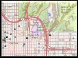
18 Community Maps Workflow Utilize the online content management system Apply Upload Review Contribute
19 Community Maps Workflow Apply Apply to become a Data Steward Provide a signed participation agreement Provide agency information Select geographic area Select data to provide


20 Community Maps participation agreement Form G-181 Provides Esri the permission to publish your content - You retain ownership of your data Must be signed before you can contribute Refer to FAQ document with questions Best to start early
21 Community Maps Workflow Apply Upload Upload via web or request a drive (1gb upload limit) Send zipped FGDB In Local Government Information Model In local projection


22 Local Government Information Model ArcGIS for Local Government is based on a harmonized information model of GIS datasets, web services, and maps that bring your operations to life for your staff and citizens. Basemaps Web Apps Editing Workflows Local Government Information Model Models/Charts Mobile Apps

23 Community Maps Subset Feature datasets used for Community Maps

24 Requested Community Maps layers - Contribute the layers you have or wish to create - Most members contribute a subset of the available layers Data Layer Common Names Polygon Line Point Administrative Boundaries Parcels Water Bodies Land Use Landforms Administrative Boundaries Water Lines Railroads Road Centerlines Points of Interest
25 Community Maps Workflow Apply Upload Review We ll review your data We ll let you know if we find anything You review the map

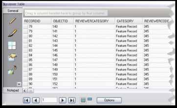
26 Review Data review

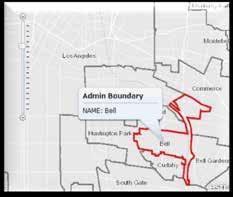
27 Review Map review
28 Community Maps Workflow Apply Upload Review Contribute Contribute your data When you re ready Esri will make the map cache Esri will host the map cache
29 Community Maps Workflow Update Apply Upload Review Contribute Repeat as necessary Keep your map current Update as your data change A


30 Ways to Contribute Three choices - Submit data in Local Government Information Model Schema through online management system - Easiest and preferred method - Submit finished World Topographic Map template and geodatabase - Map package - Cache finished map template and submit cache tiles Data in Local Gov schema Community Maps Program

31 contribution management system Tamara Yoder
32 Benefits of Participation Detailed Basemap for Your Community is Online - High-quality cartography with your accurate data - High-performance and availability service - No hosting costs or support required from provider Basemap is freely available to ArcGIS and Web users - Use in your ArcGIS maps and apps - Use in your public facing Web apps Developer APIs freely available to build Web Apps - JavaScript, Flex, Silverlight APIs available - Combine your map services with community basemap


33 User Story Maps and Apps Shane Matthews
34 Community Maps at the UC Opportunities to learn more and start this week Community Maps Tech Workshops - What s New in the Community Maps Program? - Community Maps Information Model, An Introduction - Get your campus on the map! The Community Maps Program for School Campuses - Creating Basemaps to Manage Buildings and Facilities Demo Theater - Contributing Community Maps Content Online - Migrating data for Community Maps with Custom ETL tools - Using Data Reviewer to validate the quality of your Community Maps content - Using Community Maps in Simple Web Applications
35 Community Maps at the UC Opportunities to learn more and start this week Visit us at Content Island in Showcase - Talk with the Community Maps Team at the Island - Sign up to get started using Online Participation Form Check out the Learning Center Lab - Sign up and take an hour course that gives a more in-depth description of Community Maps
36 Additional Resources Workshops - Free - training.esri.com to learn more ArcGIS Resource Center communitymaps@esri.com


37 Thanks for attending! Please remember to fill out your evaluation Offering ID: 629 and follow us on


38
Creating Basemaps to Manage Buildings and Facilities
 Esri International User Conference San Diego, California Technical Workshops July 26, 2012 Creating Basemaps to Manage Buildings and Facilities Mark Stewart and Tamara Yoder Topics for this Session Overview
SCAUG Community Maps Building a Living Atlas of the World
 SCAUG Community Maps Building a Living Atlas of the World Mark Stewart Topics: SCAUG ArcGIS Online Overview Community Maps Overview Community Maps Workflow Update Process Utilizing Your Contribution Community
Working with ArcGIS Online
 Esri International User Conference San Diego, CA Technical Workshops July 12, 2011 Working with ArcGIS Online Bern Szukalski, Deane Kensok Topics for this Session ArcGIS Online Overview ArcGIS Online Content
Esri s Living Atlas of the World Community Maps
 Esri s Living Atlas of the World Community Maps Seth Sarakaitis Wednesday May 7, 2014 ArcGIS Living Atlas Concept Living Atlas Content Tour Contributing to the Living Atlas (Community Maps) Seth Sarakaitis
An Introduction to the Community Maps Information Model
 Esri International User Conference July 23 27 San Diego Convention Center An Introduction to the Community Maps Information Model Seth Sarakaitis Agenda Overview of Community Maps Program Information Models
Demystifying ArcGIS Online. Karen Lizcano Esri
 Demystifying ArcGIS Online Karen Lizcano Esri An Integrated Web GIS Platform Desktop Web Device Powered by Services Managed via Portal Access from any Device Portal Server Online Content and Services ArcGIS
Esri Defense Mapping: Cartographic Production. Bo King
 Esri Defense Mapping: Cartographic Production Bo King Agenda Esri Defense Mapping: Cartographic Production Solution Overview Desktop Cartographic Production Workflow - Create Rapid Graphic Product On Demand
Portal for ArcGIS: An Introduction
 Portal for ArcGIS: An Introduction Derek Law Esri Product Management Esri UC 2014 Technical Workshop Agenda Web GIS pattern Product overview Installation and deployment Security and groups Configuration
ArcGIS Online and Community Maps. Mike Sweeney Esri-Charlotte
 ArcGIS Online and Community Maps Mike Sweeney Esri-Charlotte Topics for this Session What is ArcGIS Online? ArcGIS Online Maps and Tasks What is ArcGIS.com? The Community Maps Program What is ArcGIS Online?
You are Building Your Organization s Geographic Knowledge
 You are Building Your Organization s Geographic Knowledge And Increasingly Making it Available Sharing Data Publishing Maps and Geo-Apps Developing Collaborative Approaches Citizens Knowledge Workers Analysts
Introduction to ArcGIS Maps for Office. Greg Ponto Scott Ball
 Introduction to ArcGIS Maps for Office Greg Ponto Scott Ball Agenda What is Maps for Office? Platform overview What are Apps for the Office? ArcGIS Maps for Office features - Visualization - Geoenrichment
Local Government Basemaps using ArcGIS
 Local Government Basemaps using ArcGIS Steve Grisé Scott Oppmann Tuesday, July 14, 10:15-11:30am SDCC 30B Topics Basemaps for Local Government Essential Application-Driven New Ideas Design Strategies Discussion
Introduction to Portal for ArcGIS. Hao LEE November 12, 2015
 Introduction to Portal for ArcGIS Hao LEE November 12, 2015 Agenda Web GIS pattern Product overview Installation and deployment Security and groups Configuration options Portal for ArcGIS + ArcGIS for
Web GIS Deployment for Administrators. Vanessa Ramirez Solution Engineer, Natural Resources, Esri
 Web GIS Deployment for Administrators Vanessa Ramirez Solution Engineer, Natural Resources, Esri Agenda Web GIS Concepts Web GIS Deployment Patterns Components of an On-Premises Web GIS Federation of Server
Leveraging ArcGIS Online Elevation and Hydrology Services. Steve Kopp, Jian Lange
 Leveraging ArcGIS Online Elevation and Hydrology Services Steve Kopp, Jian Lange Topics An overview of ArcGIS Online Elevation Analysis Using Elevation Analysis Services in ArcGIS for Desktop Using Elevation
No. of Days. Building 3D cities Using Esri City Engine ,859. Creating & Analyzing Surfaces Using ArcGIS Spatial Analyst 1 7 3,139
 Q3 What s New? Creating and Editing Data with ArcGIS Pro Editing and Maintaining Parcels Using ArcGIS Spatial Analysis Using ArcGIS Pro User Workflows for ArcGIS Online Organizations Q3-2018 ArcGIS Desktop
ArcGIS Online Routing and Network Analysis. Deelesh Mandloi Matt Crowder
 ArcGIS Online Routing and Network Analysis Deelesh Mandloi Matt Crowder Introductions Who are we? - Members of the Network Analyst development team Who are you? - Network Analyst users? - ArcGIS Online
Portal for ArcGIS: An Introduction. Catherine Hynes and Derek Law
 Portal for ArcGIS: An Introduction Catherine Hynes and Derek Law Agenda Web GIS pattern Product overview Installation and deployment Configuration options Security options and groups Portal for ArcGIS
Data Aggregation with InfraWorks and ArcGIS for Visualization, Analysis, and Planning
 Data Aggregation with InfraWorks and ArcGIS for Visualization, Analysis, and Planning Stephen Brockwell President, Brockwell IT Consulting, Inc. Join the conversation #AU2017 KEYWORD Class Summary Silos
Introduction to Portal for ArcGIS
 Introduction to Portal for ArcGIS Derek Law Product Management March 10 th, 2015 Esri Developer Summit 2015 Agenda Web GIS pattern Product overview Installation and deployment Security and groups Configuration
DP Project Development Pvt. Ltd.
 Dear Sir/Madam, Greetings!!! Thanks for contacting DP Project Development for your training requirement. DP Project Development is leading professional training provider in GIS technologies and GIS application
Web GIS: Architectural Patterns and Practices. Shannon Kalisky Philip Heede
 Web GIS: Architectural Patterns and Practices Shannon Kalisky Philip Heede Web GIS Transformation of the ArcGIS Platform Desktop Apps Server GIS Web Maps Web Scenes Layers Web GIS Transformation of the
Leveraging Web GIS: An Introduction to the ArcGIS portal
 Leveraging Web GIS: An Introduction to the ArcGIS portal Derek Law Product Management DLaw@esri.com Agenda Web GIS pattern Product overview Installation and deployment Configuration options Security options
ArcGIS Enterprise: What s New. Philip Heede Shannon Kalisky Melanie Summers Sam Williamson
 ArcGIS Enterprise: What s New Philip Heede Shannon Kalisky Melanie Summers Sam Williamson ArcGIS Enterprise is the new name for ArcGIS for Server What is ArcGIS Enterprise ArcGIS Enterprise is powerful
Network Analysis Services in ArcGIS Enterprise. Deelesh Mandloi
 Network Analysis Services in ArcGIS Enterprise Deelesh Mandloi Slides from this demo theater http://esriurl.com/uc17nas Agenda Network Analyst concepts ArcGIS Enterprise publishing workflow - Geoprocessing
ArcGIS for INSPIRE. Marten Hogeweg
 ArcGIS for INSPIRE Marten Hogeweg Please Take Our Survey on the App Download the Esri Events app and find your event Select the session you attended Scroll down to find the feedback section Complete answers
ArcGIS for Desktop. ArcGIS for Desktop is the primary authoring tool for the ArcGIS platform.
 ArcGIS for Desktop ArcGIS for Desktop ArcGIS for Desktop is the primary authoring tool for the ArcGIS platform. Beyond showing your data as points on a map, ArcGIS for Desktop gives you the power to manage
No. of Days. ArcGIS 3: Performing Analysis ,431. Building 3D cities Using Esri City Engine ,859
 What s New? Creating Story Maps with ArcGIS Field Data Collection and Management Using ArcGIS Get Started with Insights for ArcGIS Introduction to GIS Using ArcGIS & ArcGIS Pro: Essential Workflow Migrating
No. of Days. ArcGIS Pro for GIS Professionals ,431. Building 3D cities Using Esri City Engine ,859
 What s New? Creating Story Maps with ArcGIS Field Data Collection and Management Using ArcGIS Get Started with Insights for ArcGIS Introduction to GIS Using ArcGIS & ArcGIS Pro: Essential Workflow Migrating
Esri Overview for Mentor Protégé Program:
 Agenda Passionate About Helping You Succeed Esri Overview for Mentor Protégé Program: Northrop Grumman CSSS Jeff Dawley 3 September 2010 Esri Overview ArcGIS as a System ArcGIS 10 - Map Production - Mobile
ArcGIS. for Server. Understanding our World
 ArcGIS for Server Understanding our World ArcGIS for Server Create, Distribute, and Manage GIS Services You can use ArcGIS for Server to create services from your mapping and geographic information system
June 19 Huntsville, Alabama 1
 June 19 Huntsville, Alabama 1 Real-Time Geospatial Data: The Fusion of PI and ArcGIS Enabling Smarter Facilities Management OSIsoft and Esri Mapping and Location Analytics Platform Supporting Your Use
DATA APPLIANCE FOR ARCGIS
 DATA APPLIANCE FOR ARCGIS Data Appliance for ArcGIS Provides Access to Multi-Scale Basemaps Down to Medium Scale Levels Worldwide And Large Scale for Most of the World The Data Appliance includes Several
Enabling Web GIS. Dal Hunter Jeff Shaner
 Enabling Web GIS Dal Hunter Jeff Shaner Enabling Web GIS In Your Infrastructure Agenda Quick Overview Web GIS Deployment Server GIS Deployment Security and Identity Management Web GIS Operations Web GIS
Esri UC2013. Technical Workshop.
 Esri International User Conference San Diego, California Technical Workshops July 9, 2013 CAD: Introduction to using CAD Data in ArcGIS Jeff Reinhart & Phil Sanchez Agenda Overview of ArcGIS CAD Support
ArcGIS Enterprise: What s New. Philip Heede Shannon Kalisky Melanie Summers Shreyas Shinde
 ArcGIS Enterprise: What s New Philip Heede Shannon Kalisky Melanie Summers Shreyas Shinde ArcGIS Enterprise is the new name for ArcGIS for Server ArcGIS Enterprise Software Components ArcGIS Server Portal
Esri Production Mapping: Map Automation & Advanced Cartography MADHURA PHATERPEKAR JOE SHEFFIELD
 Esri Production Mapping: Map Automation & Advanced Cartography MADHURA PHATERPEKAR JOE SHEFFIELD Traditional Cartography What you really want Cartographic Workflow Output Cartographic Data Symbology Layout
Network Analysis with ArcGIS Online. Deelesh Mandloi Dmitry Kudinov
 Deelesh Mandloi Dmitry Kudinov Introductions Who are we? - Network Analyst Product Engineers Who are you? - Network Analyst users? - ArcGIS Online users? - Trying to figure out what is ArcGIS Online? Slides
Web GIS Patterns and Practices
 FedGIS Conference February 24 25, 2016 Washington, DC Web GIS Patterns and Practices Philip Heede Jay Theodore Witt Mathot Web GIS Transformation of the ArcGIS Platform Desktop Apps Web Maps Web Scenes
HIGH RESOLUTION BASE MAP: A CASE STUDY OF JNTUH-HYDERABAD CAMPUS
 HIGH RESOLUTION BASE MAP: A CASE STUDY OF JNTUH-HYDERABAD CAMPUS K.Manjula Vani, Abhinay Reddy, J. Venkatesh, Ballu Harish and R.S. Dwivedi ABSTRACT The proposed work High Resolution Base map: A Case study
ArcGIS Runtime: Migrating from ArcGIS Engine. Rex Hansen
 ArcGIS Runtime: Migrating from ArcGIS Engine Rex Hansen Thank You to Our Sponsors Migrating from ArcGIS Engine to ArcGIS Runtime ArcGIS Runtime API: new and evolved workflows on all platforms Windows Linux
Enabling ENVI. ArcGIS for Server
 Enabling ENVI throughh ArcGIS for Server 1 Imagery: A Unique and Valuable Source of Data Imagery is not just a base map, but a layer of rich information that can address problems faced by GIS users. >
ArcGIS for AutoCAD Esri International User Conference July 8 12, 2013 San Diego, California Technical Workshop
 2013 Esri International User Conference July 8 12, 2013 San Diego, California Technical Workshop ArcGIS for AutoCAD Karen Hodge, Lead Developer Don Kuehne, Product Manager ArcGIS for AutoCAD is Free Plug-In
Introduction to ArcGIS Server - Creating and Using GIS Services. Mark Ho Instructor Washington, DC
 Introduction to ArcGIS Server - Creating and Using GIS Services Mark Ho Instructor Washington, DC Technical Workshop Road Map Product overview Building server applications GIS services Developer Help resources
ArcGIS Data Reviewer: Quality Assessment for Elevation Raster Datasets. Roslyn Dunn
 ArcGIS Data Reviewer: Quality Assessment for Elevation Raster Datasets Roslyn Dunn What is ArcGIS Data Reviewer? Data Quality Management for ArcGIS Provides - Rule-based validation - Interactive tools
Base Maps: Creating, Using & Participating
 Base Maps: Creating, Using & Participating Michael Fashoway & Erin Geraghty Montana Base Map Service Center 2010 MAGIP Technical Session October 28, 2010 What is a Base Map? Using a Base Map Creating a
European Location Framework data in the ArcGIS platform
 European Location Framework data in the ArcGIS platform Presentation to: Author: Date: INSPIRE Conference 2016 Clemens Portele 26 September 2016 Why ELF? Global (e.g. UN GGIM) Regional Europe (INSPIRE
What Would John Snow Do (Today)? Part 1
? Part 1") What Would John Snow Do (Today)? Part 1 Tanya Bigos and Derek Law @Tanyabigos @GIS_Bandit Thurs Oct 19 th, 2017 Outline Overview of the ArcGIS Platform Whiteboard discussion Summary Questions A Whole New
What Would John Snow Do (Today)? Part 1 Tanya Bigos and Derek Law @Tanyabigos @GIS_Bandit Thurs Oct 19 th, 2017 Outline Overview of the ArcGIS Platform Whiteboard discussion Summary Questions A Whole New
ELF products in the ArcGIS platform
 ELF products in the ArcGIS platform Presentation to: Author: Date: NMO Summit 2016, Dublin, Ireland Clemens Portele 18 May 2016 The Building Blocks 18 May, 2016 More ELF users through affiliated platforms
Analyzing the Operational Environment
 Esri International User Conference July 23 27 San Diego Convention Center Analyzing the Operational Environment Matthew Funk (Esri) David Mitchell (Esri) Tim Burley (Helyx SIS) Geospatial Enterprise for
Experiences and Directions in National Portals"
 FIG Seminar on e-land Administration Innsbruck/Austria 2-4 June 2004 "ESRI's Experiences and Directions in National Portals" Kevin Daugherty Cadastral/Land Records Manager ESRI Topic Points Technology
ArcGIS Runtime: Migrating Your Apps from ArcGIS Engine. Eric Bader Lucas Danzinger Mike Branscomb
 ArcGIS Runtime: Migrating Your Apps from ArcGIS Engine Eric Bader Lucas Danzinger Mike Branscomb Migrating to ArcGIS Runtime ArcGIS Engine ArcGIS Runtime AppStudio for ArcGIS Apps: Collector, Workforce,
Performing Advanced Cartography with Esri Production Mapping
 Esri International User Conference San Diego, California Technical Workshops July 25, 2012 Performing Advanced Cartography with Esri Production Mapping Tania Pal & Madhura Phaterpekar Agenda Outline generic
OFWIM 2017 Annual Conference What Does Web GIS Really Mean for Fish and Wildlife Agencies?
 Content Open Mapping OFWIM 2017 Annual Conference What Does Web GIS Really Mean for Fish and Wildlife Agencies? Imagery Spatial Analysis Mike Bialousz, Esri 3D Data Exploration Real-Time Apps Visualization
Better Topographic Map Production Using ArcGIS. A Comprehensive Solution for Mapping Organizations
 Better Topographic Map Production Using ArcGIS A Comprehensive Solution for Mapping Organizations The World Is Always Changing As a member of a national mapping organization, you know this is true. You
ArcGIS Maps for Power BI An Introduction. DJ Berry Scott Ball
 ArcGIS Maps for Power BI An Introduction DJ Berry Scott Ball Agenda Introduction to ArcGIS Maps for Power BI ArcGIS Maps for Power BI overview Esri + Microsoft = Better Together Visualizing Power BI data
Esri User Conference 2018 Video Topics
 Esri User Conference 2018 Video Topics 3D GIS 3D Across ArcGIS 3D Analysis Tools in ArcGIS Pro 3D Cartographic Techniques: An Introduction 3D Data: Lidar Point Clouds and 3D Mesh 3D Feature and Sub-Surface
ArcGIS Data Reviewer: Assessing Positional Accuracy. Roslyn Dunn
 ArcGIS Data Reviewer: Assessing Positional Accuracy Roslyn Dunn What is ArcGIS Data Reviewer? Data Quality Management for ArcGIS Provides - Rule-based validation - Interactive tools - Track errors Validate
Using CAD data in ArcGIS
 Using CAD data in ArcGIS Phil Sanchez and Jeff Reinhart Esri UC 2014 Technical Workshop Agenda Overview of ArcGIS CAD Support Using CAD Datasets in ArcMap Georeferencing CAD data for ArcGIS Loading CAD
ArcGIS Pro 3D Workflows. Zena Pelletier
 ArcGIS Pro 3D Workflows Zena Pelletier 3D as a GIS capability Core part of the platform Desktop Web Device Combine 2D and 3D in the same web GIS architecture Reuse dynamic services across clients Securely
Key Points Sharing fosters participation and collaboration Metadata has a big role in sharing Sharing is not always easy
 Sharing Resources Geoff Mortson esri, Inc. SDI Solutions Team Key Points Sharing fosters participation and collaboration Metadata has a big role in sharing Sharing is not always easy Data Sharing is Good
Embracing ArcGIS Server Technology A City s Balanced Approach
 Embracing ArcGIS Server Technology A City s Balanced Approach Sridhar Katragadda Virginia Johnston Esri UC2013. About the City Virginia Beach Metropolitan Statistical Area (MSA) is the 38th largest in
ArcGIS Pro Q&A Session. NWGIS Conference, October 11, 2017 With John Sharrard, Esri GIS Solutions Engineer
 ArcGIS Pro Q&A Session NWGIS Conference, October 11, 2017 With John Sharrard, Esri GIS Solutions Engineer jsharrard@esri.com ArcGIS Desktop The applications ArcGIS Pro ArcMap ArcCatalog ArcScene ArcGlobe
A Geographer s role in a Google Maps World. Jeremy Bartley ESRI
 A Geographer s role in a Google Maps World Jeremy Bartley ESRI 1 It is a good time to be a Geographer. 2 Microsoft, Google, Yahoo, and others are pushing geographic awareness to the general public Providing
Introduction to ArcGIS Server Development
 Introduction to ArcGIS Server Development Kevin Deege,, Rob Burke, Kelly Hutchins, and Sathya Prasad ESRI Developer Summit 2008 1 Schedule Introduction to ArcGIS Server Rob and Kevin Questions Break 2:15
Innovation. The Push and Pull at ESRI. September Kevin Daugherty Cadastral/Land Records Industry Solutions Manager
 Innovation The Push and Pull at ESRI September 2004 Kevin Daugherty Cadastral/Land Records Industry Solutions Manager The Push and The Pull The Push is the information technology that drives research and
ESRI Delivering geographic information systems to millions of users
 Using Web GIS to Track Government Spending and Performance Eric Floss - ESRI April 12, 2010 ESRI Delivering geographic information systems to millions of users GIS Is Changing Everything How We Reason
ArcGIS Earth for Enterprises DARRON PUSTAM ARCGIS EARTH CHRIS ANDREWS 3D
 ArcGIS Earth for Enterprises DARRON PUSTAM ARCGIS EARTH CHRIS ANDREWS 3D ArcGIS Earth is ArcGIS Earth is a lightweight globe desktop application that helps you explore any part of the world and investigate
What s New. August 2013
 What s New. August 2013 Tom Schwartzman Esri tschwartzman@esri.com Esri UC2013. Technical Workshop. What is new in ArcGIS 10.2 for Server ArcGIS 10.2 for Desktop Major Themes Why should I use ArcGIS 10.2
Esri and GIS Education
 Esri and GIS Education Organizations Esri Users 1,200 National Government Agencies 11,500 States & Regional Agencies 30,800 Cities & Local Governments 32,000 Businesses 8,500 Utilities 12,600 NGOs 11,000
Map Application Progression
 Map Application Progression Application Migration with Latest ArcGIS by Dean Chiang California Department of Fish and Wildlife What we do at CDFW Hunting and fishing licensing and regulation Conservation
Road Ahead: Linear Referencing and UPDM
 Road Ahead: Linear Referencing and UPDM Esri European Petroleum GIS Conference November 7, 2014 Congress Centre, London Your Work Making a Difference ArcGIS Is Evolving Your GIS Is Becoming Part of an
Data Aggregation with InfraWorks and ArcGIS for Visualization, Analysis, and Planning
 CI125230 Data Aggregation with InfraWorks and ArcGIS for Visualization, Analysis, and Planning Stephen Brockwell Brockwell IT Consulting Inc. Sean Kinahan Brockwell IT Consulting Inc. Learning Objectives
ArcGIS Pipeline Referencing An Introduction. Anjali Bhangay William Isley
 ArcGIS Pipeline Referencing An Introduction Anjali Bhangay William Isley Pipeline Referencing Overview Information Model Pipeline Referencing Overview Information Model ArcGIS Pro Pipeline Referencing
Steve Pietersen Office Telephone No
 Steve Pietersen Steve.Pieterson@durban.gov.za Office Telephone No. 031 311 8655 Overview Why geography matters The power of GIS EWS GIS water stats EWS GIS sanitation stats How to build a GIS system EWS
The File Geodatabase API. Craig Gillgrass Lance Shipman
 The File Geodatabase API Craig Gillgrass Lance Shipman Schedule Cell phones and pagers Please complete the session survey we take your feedback very seriously! Overview File Geodatabase API - Introduction
What is GIS and How Can It Help Me?
 esri European User Conference Madrid 2011 What is GIS and How Can It Help Me? Jaime Nieves Ignacio Vázquez esri spain «Knowing where things are, and why, is essential to rational decision making.» Jack
Geodatabase An Introduction
 2013 Esri International User Conference July 8 12, 2013 San Diego, California Technical Workshop Geodatabase An Introduction David Crawford and Jonathan Murphy Session Path The Geodatabase What is it?
Discovery and Access of Geospatial Resources using the Geoportal Extension. Marten Hogeweg Geoportal Extension Product Manager
 Discovery and Access of Geospatial Resources using the Geoportal Extension Marten Hogeweg Geoportal Extension Product Manager DISCOVERY AND ACCESS USING THE GEOPORTAL EXTENSION Geospatial Data Is Very
ArcGIS Platform For NSOs
 ArcGIS Platform For NSOs Applying GIS and Spatial Thinking to Official Statistics Esri UC 2014 Demo Theater Applying GIS at the NSO Generic Statistical Business Process Model (GSBPM) 1 Specify Needs 2
Esri WebGIS Highlights of What s New, and the Road Ahead
 West Virginia GIS Conference WVU, Morgantown, WV Esri WebGIS Highlights of What s New, and the Road Ahead Mark Scott, Solutions Engineer, Esri Local Government Team May 5 th, 2016 West Virginia GIS Conference
Living Atlas: Road Ahead. Deane Kensok Sean Breyer
 Living Atlas: Road Ahead Deane Kensok Sean Breyer Workshop Agenda Subhead Here Overview of the Living Atlas Esri Content Portfolio - Overview - Road Map for 2017 and Beyond - Demos: Previews of Online
Web GIS & ArcGIS Pro. Zena Pelletier Nick Popovich
 Web GIS & ArcGIS Pro Zena Pelletier Nick Popovich Web GIS Transformation of the ArcGIS Platform Desktop Apps GIS Web Maps Web Scenes Layers Evolution of the modern GIS Desktop GIS (standalone GIS) GIS
These modules are covered with a brief information and practical in ArcGIS Software and open source software also like QGIS, ILWIS.
 Online GIS Training and training modules covered are: 1. ArcGIS, Analysis, Fundamentals and Implementation 2. ArcGIS Web Data Sharing 3. ArcGIS for Desktop 4. ArcGIS for Server These modules are covered
INSPIRE Shared Service
 INSPIRE Shared Service Creation and operation out of the box Petra Fritz (HZD), Michael Voigtländer (Esri Deutschland GmbH) INSPIRE Shared Service Agenda HZD backbone for a geodata infrastructure Implementing
Designing GIS Databases to Support Mapping and Map Production Charlie Frye, ESRI Redlands Aileen Buckley, ESRI Redlands
 Designing GIS Databases to Support Mapping and Map Production Charlie Frye, ESRI Redlands Aileen Buckley, ESRI Redlands 1 Designing GIS Databases to Support Mapping and Map Production Charlie Frye, ESRI
CAD: Introduction to using CAD Data in ArcGIS. Kyle Williams & Jeff Reinhart
 CAD: Introduction to using CAD Data in ArcGIS Kyle Williams & Jeff Reinhart What we will accomplish today Overview of ArcGIS CAD Support Georeferencing CAD data for ArcGIS How Mapping Specification for
ArcGIS Online Analytics. Mike Flanagan
 ArcGIS Online Analytics Mike Flanagan MFlanagan@esri.com Agenda Introduction to ArcGIS Online Spatial Analysis ArcGIS Online Spatial Analysis Workflow Demos and Examples Wrap-up Q&A ArcGIS A complete web
Service Oriented Mapping: Maps, Apps, Tools and Subscriptions
 Service Oriented Mapping: Maps, Apps, Tools and Subscriptions Paul Hardy, David Watkins Esri, USA : [phardy,dwatkins]@esri.com ABSTRACT This paper reviews the service-oriented mapping capabilities of a
What s New in Collector for ArcGIS (Aurora)
") What s New in Collector for ArcGIS (Aurora) Derek Law (dlaw@esri.com) Esri Apps Product Management @GIS_Bandit Oct 10 th, 2018 Agenda Product overview Use cases Preparing data for Collector for ArcGIS
What s New in Collector for ArcGIS (Aurora) Derek Law (dlaw@esri.com) Esri Apps Product Management @GIS_Bandit Oct 10 th, 2018 Agenda Product overview Use cases Preparing data for Collector for ArcGIS
What is the Living Atlas for ArcGIS and How Can you be Involved?
 Federal GIS Conference February 9 10, 2015 Washington, DC What is the Living Atlas for ArcGIS and How Can you be Involved? Clint Brown Deane Kensok Agenda Introduction to Living Atlas - Transformation
Welcome! Power BI User Group (PUG) Copenhagen
 Copenhagen") Welcome! Power BI User Group (PUG) Copenhagen Making Maps in Power BI Andrea Martorana Tusa BI Specialist Welcome to Making maps in Power BI Who am I? First name: Andrea. Last name: Martorana Tusa. Italian,
Welcome! Power BI User Group (PUG) Copenhagen Making Maps in Power BI Andrea Martorana Tusa BI Specialist Welcome to Making maps in Power BI Who am I? First name: Andrea. Last name: Martorana Tusa. Italian,
Esri Training by Microcenter Prepare to Innovate. Microcenter Course Catalog
 Esri Training by Microcenter Prepare to Innovate 2015 Instructor-Led Courses Microcenter Course Catalog ArcGIS Foundational Courses Designed to meet the learning needs of professionals whose GIS experience
ArcGIS for INSPIRE. Marten Hogeweg Satish Sankaran
 ArcGIS for INSPIRE Marten Hogeweg Satish Sankaran Outline What is ArcGIS ArcGIS for INSPIRE Web GIS Case Studies Roadmap Q&A What is INSPIRE? INSPIRE is the legal framework for a European Spatial Data
ArcGIS for Military: Analyzing the Operational Environment. Matthew Funk Carolyn Fish
 ArcGIS for Military: Analyzing the Operational Environment Matthew Funk Carolyn Fish Geospatial Enterprise for the Military Sensors Operations Server COP Mounted Intelligence Planning Provisioning Dismounted
ArcGIS is Advancing. Both Contributing and Integrating many new Innovations. IoT. Smart Mapping. Smart Devices Advanced Analytics
 ArcGIS is Advancing IoT Smart Devices Advanced Analytics Smart Mapping Real-Time Faster Computing Web Services Crowdsourcing Sensor Networks Both Contributing and Integrating many new Innovations ArcGIS
Web GIS Administration: Tips and Tricks
 EdUC 2017 July 8 th, 2017 Web GIS Administration: Tips and Tricks Geri Miller Agenda Concerns Acknowledged User Management Content Management Monitoring Licensing and logins Sophistication of IT support
Esri Production Mapping: An Introduction
 Esri Production Mapping: An Introduction Amber Bethell & Joseph Sheffield Esri UC 2014 Technical Workshop Your organization s processes Collect Share Manage Produce Your organization s needs Standardization
ArcGIS Data Models: Raster Data Models. Jason Willison, Simon Woo, Qian Liu (Team Raster, ESRI Software Products)
") ArcGIS Data Models: Raster Data Models Jason Willison, Simon Woo, Qian Liu (Team Raster, ESRI Software Products) Overview of Session Raster Data Model Context Example Raster Data Models Important Raster
ArcGIS Data Models: Raster Data Models Jason Willison, Simon Woo, Qian Liu (Team Raster, ESRI Software Products) Overview of Session Raster Data Model Context Example Raster Data Models Important Raster
Customer Premise Information Lookup Mapping With ArcGIS Online Jamie Patterson Senior GIS Technician
 Customer Premise Information Lookup Mapping With ArcGIS Online Jamie Patterson Senior GIS Technician January 19, 2016 Bio Jamie Patterson: ASU M.A. in Geography, 2008 10 years in the GIS industry Sr.