REMOTE SENSING ACTIVITIES. Caiti Steele
|
|
|
- MargaretMargaret Reeves
- 5 years ago
- Views:
Transcription

1 REMOTE SENSING ACTIVITIES Caiti Steele
2 REMOTE SENSING ACTIVITIES Remote sensing of biomass: Field Validation of Biomass Retrieved from Landsat for Rangeland Assessment and Monitoring (Browning et al., 2010) Remote sensing for mapping Ecological States: Spatially-Explicit Representation of State-and- Transition Models (Steele et al., 2012) Malpais Borderland: Changes in NDVI: Vegetation index differencing for broad-scale assessment of productivity under prolonged drought and sequential high rainfall (Browning and Steele, in preparation)
3 REMOTE SENSING OF BIOMASS Can reflectance indices derived from Landsat Thematic Mapper (TM) data provide reliable and accurate estimates for vegetation biomass in the Chihuahuan desert ecosystem? Evaluated the relationship between seasonal field-based estimates of photosynthetic vegetation biomass to enhanced vegetation index (EVI) values Long-term field study of net primary productivity at Jornada LTER sites is conducted at m X 70-m sites that represent three shrubland (mesquite, tarbush, creosote) and two grassland (upland and playa) plant communities. Biomass measurements are made three times annually (winter, spring and fall)

4 REMOTE SENSING OF BIOMASS

5 REMOTE SENSING OF BIOMASS

6 REMOTE SENSING OF BIOMASS
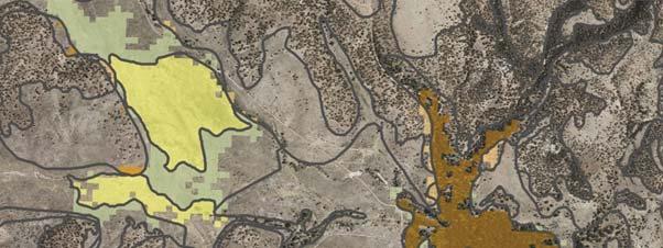
7 REMOTE SENSING FOR MAPPING ECOLOGICAL STATES Creating a spatial representation of generalized ecological state classes for public lands under the jurisdiction of the BLM Las Cruces District Office (Steele et al., 2012) Method: Photo-interpretation of freely available Digital Orthophoto Quarter Quads (DOQQs) and other fine spatial resolution imagery. Interpretation assisted with use of other data sources including field data and expert knowledge of area
8 REMOTE SENSING FOR MAPPING ECOLOGICAL STATES SSURGO: 3 rd order soil map unit (SMU) polygons obtained for study area Ecological site attributes added to SMU polygons SMU polygons overlain on DOQQs / NAIP imagery SMU polygons cut to delineate soil features visible in the imagery at scales between 1:2k - 1:5k Ecological site attributes updated State code assigned by photo-interpretation and reference to other data sources Rapid field traverse to ascertain states of problematic areas
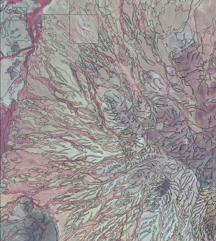
9 REMOTE SENSING FOR MAPPING ECOLOGICAL STATES Using automated image processing techniques to map ecological states in MLRA 42 (Southern Desertic Plains and Mountains) is particularly challenging because of: sparse vegetation, strong soil reflectance landscape complexity indirect/complex relationships between classes and reflectance or spatial variables spectral similarities between different ecological states spectral differences between similar states
10 REMOTE SENSING FOR MAPPING ECOLOGICAL STATES Reflectance (y axis) in Landsat TM Bands 1-5 and 7 (x axis) for: (1) Historic Grasslands; (2) Historic Savanna; (3) Shrub-invaded grassland; (4) Shrub-dominated Savanna (5) Expansion shrubland; (6) Bare Note: TM bands 1-5 and 7 are labeled 1 6, x axis)


11 REMOTE SENSING FOR MAPPING ECOLOGICAL STATES Automated image processing methods can be applied where vegetation is more continuous e.g., Draw, Bottomland ecosites

12 MLRA 25: Owyhee Plateau
13 REMOTE SENSING FOR MAPPING ECOLOGICAL STATES Object-based image analysis, particularly promising for state-mapping: Preserves SMU polygons and attributes Can handle combinations of categorical and continuous data Facilitates generation of textural variables Can be applied with decision tree classifier (computationally efficient and mimics the decision-making process already being used by the analyst) e.g., Laliberte et al. 2007
14 MALPAIS BORDERLAND: CHANGES IN NDVI Hypothesis: Reference, altered, and degraded ecological states respond differently under conditions of drought and moisture abundance Landsat TM imagery acquired for (i) 2003, a year following persistent belowaverage rainfall for the region and (ii) 2009, a year following two historically high rainfall years Examined the difference between pre- and post-growing season NDVI for different ecological sites / states in the Malpais Borderland Region Questions: What ecological states exhibit most positive and negative change in NDVI after periods of above- and below-average rainfall?; What can we infer from the pattern of NDVI responses with respect to statespecific vegetation dynamics?
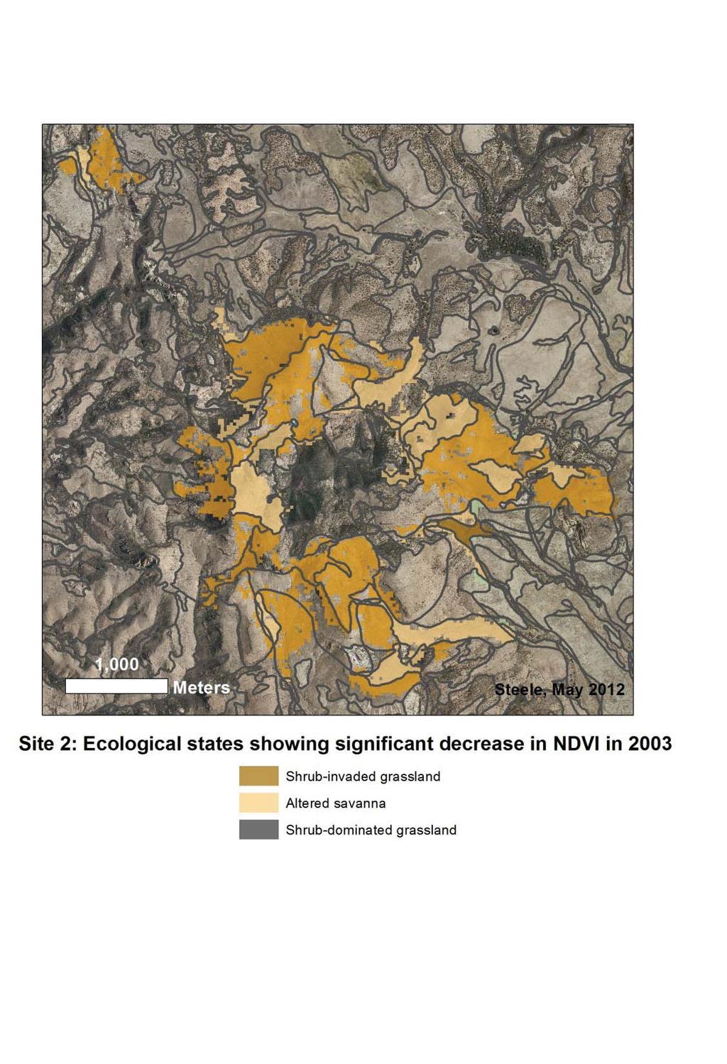
15

16 MALPAIS BORDERLAND: CHANGES IN NDVI

17 MALPAIS BORDERLAND: CHANGES IN NDVI

18 MALPAIS BORDERLAND: CHANGES IN NDVI
ESDs HELPING US BE MORE EFFICIENT. Leticia Lister Supervisory Rangeland Management Specialist BLM, Las Cruces District Office
 ESDs HELPING US BE MORE EFFICIENT Leticia Lister Supervisory Rangeland Management Specialist BLM, Las Cruces District Office 11/2010 Otero Mesa, L. Phillips, 9/2010 BLM, Las Cruces District Office SIERRA
Case Study: Ecological Integrity of Grasslands in the Apache Highlands Ecoregion
 Standard 9: Screen all target/biodiversity element occurrences for viability or ecological integrity. Case Study: Ecological Integrity of Grasslands in the Apache Highlands Ecoregion Summarized from: Marshall,
Lecture Topics. 1. Vegetation Indices 2. Global NDVI data sets 3. Analysis of temporal NDVI trends
 Lecture Topics 1. Vegetation Indices 2. Global NDVI data sets 3. Analysis of temporal NDVI trends Why use NDVI? Normalize external effects of sun angle, viewing angle, and atmospheric effects Normalize
LANDSCAPE CHANGE IN THE SOUTHWEST: Historical changes in selected ecosystems of the southwestern United States
 LANDSCAPE CHANGE IN THE SOUTHWEST: Historical changes in selected ecosystems of the southwestern United States Robert H. Webb U.S. Geological Survey 520 N. Park Avenue Tucson, AZ 85719 rhwebb@usgs.gov
Reinterpreting Historical Data for Evidence-Based Shrubland Management
 Natural Resources and Environmental Issues Volume 17 Issue 1 Threats to Shrubland Ecosystem Integrity Article 18 January 2011 Reinterpreting Historical Data for Evidence-Based Shrubland Management Jeb
Data Fusion and Multi-Resolution Data
 Data Fusion and Multi-Resolution Data Nature.com www.museevirtuel-virtualmuseum.ca www.srs.fs.usda.gov Meredith Gartner 3/7/14 Data fusion and multi-resolution data Dark and Bram MAUP and raster data Hilker
It is relatively simple to comprehend the characteristics and effects of an individual id fire. However, it is much more difficult to do the same for
 Interactive Effects of Plant Invasions and Fire in the Hot Deserts of North America Matt Brooks U.S. Geological Survey Western Ecological Research Center Yosemite Field Station, El Portal CA Presentation
ESTIMATION OF LANDFORM CLASSIFICATION BASED ON LAND USE AND ITS CHANGE - Use of Object-based Classification and Altitude Data -
 ESTIMATION OF LANDFORM CLASSIFICATION BASED ON LAND USE AND ITS CHANGE - Use of Object-based Classification and Altitude Data - Shoichi NAKAI 1 and Jaegyu BAE 2 1 Professor, Chiba University, Chiba, Japan.
GLOBAL/CONTINENTAL LAND COVER MAPPING AND MONITORING
 GLOBAL/CONTINENTAL LAND COVER MAPPING AND MONITORING Ryutaro Tateishi, Cheng Gang Wen, and Jong-Geol Park Center for Environmental Remote Sensing (CEReS), Chiba University 1-33 Yayoi-cho Inage-ku Chiba
Progress Report Year 2, NAG5-6003: The Dynamics of a Semi-Arid Region in Response to Climate and Water-Use Policy
 Progress Report Year 2, NAG5-6003: The Dynamics of a Semi-Arid Region in Response to Climate and Water-Use Policy Principal Investigator: Dr. John F. Mustard Department of Geological Sciences Brown University
Spatial Process VS. Non-spatial Process. Landscape Process
 Spatial Process VS. Non-spatial Process A process is non-spatial if it is NOT a function of spatial pattern = A process is spatial if it is a function of spatial pattern Landscape Process If there is no
Earth s Major Terrerstrial Biomes. *Wetlands (found all over Earth)
") Biomes Biome: the major types of terrestrial ecosystems determined primarily by climate 2 main factors: Depends on ; proximity to ocean; and air and ocean circulation patterns Similar traits of plants
Biomes Biome: the major types of terrestrial ecosystems determined primarily by climate 2 main factors: Depends on ; proximity to ocean; and air and ocean circulation patterns Similar traits of plants
Seasonal and interannual relations between precipitation, soil moisture and vegetation in the North American monsoon region
 Seasonal and interannual relations between precipitation, soil moisture and vegetation in the North American monsoon region Luis A. Mendez-Barroso 1, Enrique R. Vivoni 1, Christopher J. Watts 2 and Julio
This is trial version
 Journal of Rangeland Science, 2012, Vol. 2, No. 2 J. Barkhordari and T. Vardanian/ 459 Contents available at ISC and SID Journal homepage: www.rangeland.ir Full Paper Article: Using Post-Classification
An Internet-based Agricultural Land Use Trends Visualization System (AgLuT)
") An Internet-based Agricultural Land Use Trends Visualization System (AgLuT) Prepared for Missouri Department of Natural Resources Missouri Department of Conservation 07-01-2000-12-31-2001 Submitted by
An Internet-based Agricultural Land Use Trends Visualization System (AgLuT) Prepared for Missouri Department of Natural Resources Missouri Department of Conservation 07-01-2000-12-31-2001 Submitted by
An Internet-based Agricultural Land Use Trends Visualization System (AgLuT)
") An Internet-based Agricultural Land Use Trends Visualization System (AgLuT) Second half yearly report 01-01-2001-06-30-2001 Prepared for Missouri Department of Natural Resources Missouri Department of
An Internet-based Agricultural Land Use Trends Visualization System (AgLuT) Second half yearly report 01-01-2001-06-30-2001 Prepared for Missouri Department of Natural Resources Missouri Department of
Chapter 7 Part III: Biomes
 Chapter 7 Part III: Biomes Biomes Biome: the major types of terrestrial ecosystems determined primarily by climate 2 main factors: Temperature and precipitation Depends on latitude or altitude; proximity
IMPROVING REMOTE SENSING-DERIVED LAND USE/LAND COVER CLASSIFICATION WITH THE AID OF SPATIAL INFORMATION
 IMPROVING REMOTE SENSING-DERIVED LAND USE/LAND COVER CLASSIFICATION WITH THE AID OF SPATIAL INFORMATION Yingchun Zhou1, Sunil Narumalani1, Dennis E. Jelinski2 Department of Geography, University of Nebraska,
USE OF RADIOMETRICS IN SOIL SURVEY
 USE OF RADIOMETRICS IN SOIL SURVEY Brian Tunstall 2003 Abstract The objectives and requirements with soil mapping are summarised. The capacities for different methods to address these objectives and requirements
Influence of Micro-Climate Parameters on Natural Vegetation A Study on Orkhon and Selenge Basins, Mongolia, Using Landsat-TM and NOAA-AVHRR Data
 Cloud Publications International Journal of Advanced Remote Sensing and GIS 2013, Volume 2, Issue 1, pp. 160-172, Article ID Tech-102 ISSN 2320-0243 Research Article Open Access Influence of Micro-Climate
Land cover/land use mapping and cha Mongolian plateau using remote sens. Title. Author(s) Bagan, Hasi; Yamagata, Yoshiki. Citation Japan.
 Bagan, Hasi; Yamagata, Yoshiki. Citation Japan.") Title Land cover/land use mapping and cha Mongolian plateau using remote sens Author(s) Bagan, Hasi; Yamagata, Yoshiki International Symposium on "The Imp Citation Region Specific Systems". 6 Nove Japan.
Title Land cover/land use mapping and cha Mongolian plateau using remote sens Author(s) Bagan, Hasi; Yamagata, Yoshiki International Symposium on "The Imp Citation Region Specific Systems". 6 Nove Japan.
Resolving habitat classification and structure using aerial photography. Michael Wilson Center for Conservation Biology College of William and Mary
 Resolving habitat classification and structure using aerial photography Michael Wilson Center for Conservation Biology College of William and Mary Aerial Photo-interpretation Digitizing features of aerial
Desert Biomes of North America and Beyond
 Desert Biomes of North America and Beyond Optional reading: McAuliffe 1994, Landscape Evolution, Soil Formation, and Ecological Patterns and Processes in Sonoran Desert Bajadas (review figures) 10/21/09
AGOG 485/585 /APLN 533 Spring Lecture 5: MODIS land cover product (MCD12Q1). Additional sources of MODIS data
. Additional sources of MODIS data") AGOG 485/585 /APLN 533 Spring 2019 Lecture 5: MODIS land cover product (MCD12Q1). Additional sources of MODIS data Outline Current status of land cover products Overview of the MCD12Q1 algorithm Mapping
AGOG 485/585 /APLN 533 Spring 2019 Lecture 5: MODIS land cover product (MCD12Q1). Additional sources of MODIS data Outline Current status of land cover products Overview of the MCD12Q1 algorithm Mapping
Vegetation Remote Sensing
 Vegetation Remote Sensing Huade Guan Prepared for Remote Sensing class Earth & Environmental Science University of Texas at San Antonio November 2, 2005 Outline Why do we study vegetation remote sensing?
A Method to Improve the Accuracy of Remote Sensing Data Classification by Exploiting the Multi-Scale Properties in the Scene
 Proceedings of the 8th International Symposium on Spatial Accuracy Assessment in Natural Resources and Environmental Sciences Shanghai, P. R. China, June 25-27, 2008, pp. 183-188 A Method to Improve the
Quick Response Report #126 Hurricane Floyd Flood Mapping Integrating Landsat 7 TM Satellite Imagery and DEM Data
 Quick Response Report #126 Hurricane Floyd Flood Mapping Integrating Landsat 7 TM Satellite Imagery and DEM Data Jeffrey D. Colby Yong Wang Karen Mulcahy Department of Geography East Carolina University
Landuse and Landcover change analysis in Selaiyur village, Tambaram taluk, Chennai
 Landuse and Landcover change analysis in Selaiyur village, Tambaram taluk, Chennai K. Ilayaraja Department of Civil Engineering BIST, Bharath University Selaiyur, Chennai 73 ABSTRACT The synoptic picture
Overview on Land Cover and Land Use Monitoring in Russia
 Russian Academy of Sciences Space Research Institute Overview on Land Cover and Land Use Monitoring in Russia Sergey Bartalev Joint NASA LCLUC Science Team Meeting and GOFC-GOLD/NERIN, NEESPI Workshop
Land Use MTRI Documenting Land Use and Land Cover Conditions Synthesis Report
 Colin Brooks, Rick Powell, Laura Bourgeau-Chavez, and Dr. Robert Shuchman Michigan Tech Research Institute (MTRI) Project Introduction Transportation projects require detailed environmental information
Preliminary Research on Grassland Fineclassification
 IOP Conference Series: Earth and Environmental Science OPEN ACCESS Preliminary Research on Grassland Fineclassification Based on MODIS To cite this article: Z W Hu et al 2014 IOP Conf. Ser.: Earth Environ.
MAPPING LAND USE/ LAND COVER OF WEST GODAVARI DISTRICT USING NDVI TECHNIQUES AND GIS Anusha. B 1, Sridhar. P 2
 MAPPING LAND USE/ LAND COVER OF WEST GODAVARI DISTRICT USING NDVI TECHNIQUES AND GIS Anusha. B 1, Sridhar. P 2 1 M. Tech. Student, Department of Geoinformatics, SVECW, Bhimavaram, A.P, India 2 Assistant
Geospatial technology for land cover analysis
 Home Articles Application Environment & Climate Conservation & monitoring Published in : Middle East & Africa Geospatial Digest November 2013 Lemenkova Polina Charles University in Prague, Faculty of Science,
Looking at the big picture to plan land treatments
 Looking at the big picture to plan land treatments Eva Strand Department of Rangeland Ecology and Management University of Idaho evas@uidaho.edu, http://www.cnr.uidaho.edu/range Why land treatment planning?
Ecological Site Description Overview
 Ecological Site Description Overview 2018 Coastal Zone Soil Survey (CZSS) Work Planning Conference Savannah, GA January 9th, 2018 Greg Taylor Senior Regional Soil Scientist USDA-NRCS Raleigh, NC j.greg.taylor@nc.usda.gov
Wetland Mapping. Wetland Mapping in the United States. State Wetland Losses 53% in Lower US. Matthew J. Gray University of Tennessee
 Wetland Mapping Caribbean Matthew J. Gray University of Tennessee Wetland Mapping in the United States Shaw and Fredine (1956) National Wetlands Inventory U.S. Fish and Wildlife Service is the principle
Applications of GIS and Remote Sensing for Analysis of Urban Heat Island
 Chuanxin Zhu Professor Peter V. August Professor Yeqiao Wang NRS 509 December 15, 2016 Applications of GIS and Remote Sensing for Analysis of Urban Heat Island Since the last century, the global mean surface
Chitra Sood, R.M. Bhagat and Vaibhav Kalia Centre for Geo-informatics Research and Training, CSK HPKV, Palampur , HP, India
 APPLICATION OF SPACE TECHNOLOGY AND GIS FOR INVENTORYING, MONITORING & CONSERVATION OF MOUNTAIN BIODIVERSITY WITH SPECIAL REFERENCE TO MEDICINAL PLANTS Chitra Sood, R.M. Bhagat and Vaibhav Kalia Centre
Monitoring Vegetation Growth of Spectrally Landsat Satellite Imagery ETM+ 7 & TM 5 for Western Region of Iraq by Using Remote Sensing Techniques.
 Monitoring Vegetation Growth of Spectrally Landsat Satellite Imagery ETM+ 7 & TM 5 for Western Region of Iraq by Using Remote Sensing Techniques. Fouad K. Mashee, Ahmed A. Zaeen & Gheidaa S. Hadi Remote
ANALYSIS AND VALIDATION OF A METHODOLOGY TO EVALUATE LAND COVER CHANGE IN THE MEDITERRANEAN BASIN USING MULTITEMPORAL MODIS DATA
 PRESENT ENVIRONMENT AND SUSTAINABLE DEVELOPMENT, NR. 4, 2010 ANALYSIS AND VALIDATION OF A METHODOLOGY TO EVALUATE LAND COVER CHANGE IN THE MEDITERRANEAN BASIN USING MULTITEMPORAL MODIS DATA Mara Pilloni
Urban Tree Canopy Assessment Purcellville, Virginia
 GLOBAL ECOSYSTEM CENTER www.systemecology.org Urban Tree Canopy Assessment Purcellville, Virginia Table of Contents 1. Project Background 2. Project Goal 3. Assessment Procedure 4. Economic Benefits 5.
ANALYSIS OF VEGETATION DISTRIBUTION IN URBAN AREAS: SPATIAL ANALYSIS APPROACH ON A REGIONAL SCALE
 ANALYSIS OF VEGETATION DISTRIBUTION IN URBAN AREAS: SPATIAL ANALYSIS APPROACH ON A REGIONAL SCALE Kiichiro Kumagai Department of Civil and Environmental System Engineering, Setsunan University 17-8 Ikedanakamachi,
Steve Pye LA /22/16 Final Report: Determining regional locations of reference sites based on slope and soil type. Client: Sonoma Land Trust
 Steve Pye LA 221 04/22/16 Final Report: Determining regional locations of reference sites based on slope and soil type. Client: Sonoma Land Trust Deliverables: Results and working model that determine
VISUALIZATION URBAN SPATIAL GROWTH OF DESERT CITIES FROM SATELLITE IMAGERY: A PRELIMINARY STUDY
 CO-439 VISUALIZATION URBAN SPATIAL GROWTH OF DESERT CITIES FROM SATELLITE IMAGERY: A PRELIMINARY STUDY YANG X. Florida State University, TALLAHASSEE, FLORIDA, UNITED STATES ABSTRACT Desert cities, particularly
CHANGE DETECTION USING REMOTE SENSING- LAND COVER CHANGE ANALYSIS OF THE TEBA CATCHMENT IN SPAIN (A CASE STUDY)
") CHANGE DETECTION USING REMOTE SENSING- LAND COVER CHANGE ANALYSIS OF THE TEBA CATCHMENT IN SPAIN (A CASE STUDY) Sharda Singh, Professor & Programme Director CENTRE FOR GEO-INFORMATICS RESEARCH AND TRAINING
CHANGE DETECTION USING REMOTE SENSING- LAND COVER CHANGE ANALYSIS OF THE TEBA CATCHMENT IN SPAIN (A CASE STUDY) Sharda Singh, Professor & Programme Director CENTRE FOR GEO-INFORMATICS RESEARCH AND TRAINING
EFFECT OF ANCILLARY DATA ON THE PERFORMANCE OF LAND COVER CLASSIFICATION USING A NEURAL NETWORK MODEL. Duong Dang KHOI.
 EFFECT OF ANCILLARY DATA ON THE PERFORMANCE OF LAND COVER CLASSIFICATION USING A NEURAL NETWORK MODEL Duong Dang KHOI 1 10 Feb, 2011 Presentation contents 1. Introduction 2. Methods 3. Results 4. Discussion
Many of remote sensing techniques are generic in nature and may be applied to a variety of vegetated landscapes, including
 Remote Sensing of Vegetation Many of remote sensing techniques are generic in nature and may be applied to a variety of vegetated landscapes, including 1. Agriculture 2. Forest 3. Rangeland 4. Wetland,
Overview of Remote Sensing in Natural Resources Mapping
 Overview of Remote Sensing in Natural Resources Mapping What is remote sensing? Why remote sensing? Examples of remote sensing in natural resources mapping Class goals What is Remote Sensing A remote sensing
Yanbo Huang and Guy Fipps, P.E. 2. August 25, 2006
 Landsat Satellite Multi-Spectral Image Classification of Land Cover Change for GIS-Based Urbanization Analysis in Irrigation Districts: Evaluation in Low Rio Grande Valley 1 by Yanbo Huang and Guy Fipps,
Chapter 02 Life on Land. Multiple Choice Questions
 Ecology: Concepts and Applications 7th Edition Test Bank Molles Download link all chapters TEST BANK for Ecology: Concepts and Applications 7th Edition by Manuel Molles https://testbankreal.com/download/ecology-concepts-applications-7thedition-test-bank-molles/
Assembling information to develop ecological site and state and transition concepts. Brandon Bestelmeyer, Jornada Experimental Range, Las Cruces, NM
 Assembling information to develop ecological site and state and transition concepts Brandon Bestelmeyer, Jornada Experimental Range, Las Cruces, NM Concepts: Ecological site: division of the landscape
Vegetation Change Detection of Central part of Nepal using Landsat TM
 Vegetation Change Detection of Central part of Nepal using Landsat TM Kalpana G. Bastakoti Department of Geography, University of Calgary, kalpanagb@gmail.com Abstract This paper presents a study of detecting
Capabilities and Limitations of Land Cover and Satellite Data for Biomass Estimation in African Ecosystems Valerio Avitabile
 Capabilities and Limitations of Land Cover and Satellite Data for Biomass Estimation in African Ecosystems Valerio Avitabile Kaniyo Pabidi - Budongo Forest Reserve November 13th, 2008 Outline of the presentation
How does the physical environment influence communities and ecosystems? Hoodoos in Cappadocia, Turkey
 Biomes of the World How does the physical environment influence communities and ecosystems? Hoodoos in Cappadocia, Turkey ecosystems are shaped by: abiotic factors climate/weather space Rainfall Soil air
Ecological Succession
 Ecological Succession 1 Ecological Succession is The observed process of change in the species structure of an ecological community over time. The community begins with relatively few pioneering plants
Advanced Image Analysis in Disaster Response
 Advanced Image Analysis in Disaster Response Creating Geographic Knowledge Thomas Harris ITT The information contained in this document pertains to software products and services that are subject to the
Seminar III Spring Semester (8 May 2015) Chuphan Chompuchan ( 蘇潘 ) Dept. of Soil and Water Conservation National Chung Hsing University
 Chuphan Chompuchan ( 蘇潘 ) Dept. of Soil and Water Conservation National Chung Hsing University") Seminar III Spring Semester (8 May 2015) Chuphan Chompuchan ( 蘇潘 ) 8101042007 Dept. of Soil and Water Conservation National Chung Hsing University Introduction Normalized Burn Ratio (NBR) Ground measurement:
Seminar III Spring Semester (8 May 2015) Chuphan Chompuchan ( 蘇潘 ) 8101042007 Dept. of Soil and Water Conservation National Chung Hsing University Introduction Normalized Burn Ratio (NBR) Ground measurement:
Biomes There are 2 types: Terrestrial Biomes (on land) Aquatic Biomes (in the water)
 Aquatic Biomes (in the water)") Biomes There are 2 types: Terrestrial Biomes (on land) Aquatic Biomes (in the water) Terrestrial Biomes Grassland, Desert, and Tundra Biomes: Savanna Temperate grassland Chaparral Desert Tundra Chapter
Biomes There are 2 types: Terrestrial Biomes (on land) Aquatic Biomes (in the water) Terrestrial Biomes Grassland, Desert, and Tundra Biomes: Savanna Temperate grassland Chaparral Desert Tundra Chapter
A Small Migrating Herd. Mapping Wildlife Distribution 1. Mapping Wildlife Distribution 2. Conservation & Reserve Management
 A Basic Introduction to Wildlife Mapping & Modeling ~~~~~~~~~~ Rev. Ronald J. Wasowski, C.S.C. Associate Professor of Environmental Science University of Portland Portland, Oregon 8 December 2015 Introduction
Global Patterns Gaston, K.J Nature 405. Benefit Diversity. Threats to Biodiversity
 Biodiversity Definitions the variability among living organisms from all sources, including, 'inter alia', terrestrial, marine, and other aquatic ecosystems, and the ecological complexes of which they
B. ATTOUI 1, A. OULED BELGACEM 2
 沙漠研究 19-1, 313-317 (2009 ) Journal of Arid Land Studies The Role of Remote Sensing in the Monitoring of Arid Ecosystems Dynamics -The Case of Bouhedma National Park- B. ATTOUI 1, A. OULED BELGACEM 2 Abstract:
Integration of remotely sensed data into a GIS of soil resources
 UN / Austria / ESA Symposium Space Tools and Solutions for Monitoring the Atmosphere and Land Cover Integration of remotely sensed data into a GIS of soil resources Diana Hanganu,, Roxana Vintila ICPA
The Wide Dynamic Range Vegetation Index and its Potential Utility for Gap Analysis
 Summary StatMod provides an easy-to-use and inexpensive tool for spatially applying the classification rules generated from the CT algorithm in S-PLUS. While the focus of this article was to use StatMod
FEATURE SELECTION METHODS FOR OBJECT-BASED CLASSIFICATION OF SUB-DECIMETER RESOLUTION DIGITAL AERIAL IMAGERY
 FEATURE SELECTION METHODS FOR OBJECT-BASED CLASSIFICATION OF SUB-DECIMETER RESOLUTION DIGITAL AERIAL IMAGERY A. S. Laliberte a, D.M. Browning b, A. Rango b a Jornada Experimental Range, New Mexico State
Evaluating Urban Vegetation Cover Using LiDAR and High Resolution Imagery
 Evaluating Urban Vegetation Cover Using LiDAR and High Resolution Imagery Y.A. Ayad and D. C. Mendez Clarion University of Pennsylvania Abstract One of the key planning factors in urban and built up environments
RANGELAND PRODUCTIVITY MODELLING: DEVELOPING AND CUSTOMISING METHODOLOGIES FOR LAND COVER MAPPING IN NAMIBIA
 RANGELAND PRODUCTIVITY MODELLING: DEVELOPING AND CUSTOMISING METHODOLOGIES FOR LAND COVER MAPPING IN NAMIBIA CELESTÉ ESPACH Agro-Ecological Zoning (AEZ) Programme, Directorate of Research and Training,
Droughts are normal recurring climatic phenomena that vary in space, time, and intensity. They may affect people and agriculture at local scales for
 I. INTRODUCTION 1.1. Background Droughts are normal recurring climatic phenomena that vary in space, time, and intensity. They may affect people and agriculture at local scales for short periods or cover
Appendix J Vegetation Change Analysis Methodology
 Appendix J Vegetation Change Analysis Methodology Regional Groundwater Storage and Recovery Project Draft EIR Appendix-J April 2013 APPENDIX J- LAKE MERCED VEGETATION CHANGE ANALYSIS METHODOLOGY Building
NR402 GIS Applications in Natural Resources. Lesson 9: Scale and Accuracy
 NR402 GIS Applications in Natural Resources Lesson 9: Scale and Accuracy 1 Map scale Map scale specifies the amount of reduction between the real world and the map The map scale specifies how much the
USING HYPERSPECTRAL IMAGERY
 USING HYPERSPECTRAL IMAGERY AND LIDAR DATA TO DETECT PLANT INVASIONS 2016 ESRI CANADA SCHOLARSHIP APPLICATION CURTIS CHANCE M.SC. CANDIDATE FACULTY OF FORESTRY UNIVERSITY OF BRITISH COLUMBIA CURTIS.CHANCE@ALUMNI.UBC.CA
Classification trees for improving the accuracy of land use urban data from remotely sensed images
 Classification trees for improving the accuracy of land use urban data from remotely sensed images M.T. Shalaby & A.A. Darwish Informatics Institute of IT, School of Computer Science and IT, University
Agricultural land-use from space. David Pairman and Heather North
 Agricultural land-use from space David Pairman and Heather North Talk Outline Motivation Challenges Different approach Paddock boundaries Classifications Examples Accuracy Issues Data sources Future possibilities
The Redwood National and State Parks Vegetation Classification and Mapping Project Map Data Sets Completed and Delivered! 1
 The Redwood National and State Parks Vegetation Classification and Mapping Project Map Data Sets Completed and Delivered! 1 By Ken Stumpf and Leonel Arguello The Redwood National and State Parks Vegetation
Detecting Landscape Changes in High Latitude Environments Using Landsat Trend Analysis: 2. Classification
 1 Detecting Landscape Changes in High Latitude Environments Using Landsat Trend Analysis: 2. Classification Ian Olthof and Robert H. Fraser Canada Centre for Mapping and Earth Observation Natural Resources
Remote sensing to segregate grass and shrub mixed habitats in Janos Grassland Priority Conservation Area
 Remote sensing to segregate grass and shrub mixed habitats in Janos Grassland Priority Conservation Area Bird Conservancy of the Rockies Final report for agreement # F13AP00675 July 31, 2017 A double rainbow
Land cover research, applications and development needs in Slovakia
 Land cover research, applications and development needs in Slovakia Andrej Halabuk Institute of Landscape Ecology Slovak Academy of Sciences (ILE SAS) Štefánikova 3, 814 99 Bratislava, Slovakia Institute
Estimation of a Plant Density Exercise 4
 Estimation of a Plant Density Exercise 4 2011-2014 Johnson, Larson, Louhaichi, & Woerz Density from Quadrats or Plots When monitoring for ecosystem change, especially for change in rare or endangered plant
Lecture 24 Plant Ecology
 Lecture 24 Plant Ecology Understanding the spatial pattern of plant diversity Ecology: interaction of organisms with their physical environment and with one another 1 Such interactions occur on multiple
Biomes and Ecosystems
 Name Biomes and Ecosystems Date How do Earth s biomes and ecosystems differ? Before You Read Before you read the chapter, think about what you know about biomes and ecosystems Record your thoughts in the
Global Biogeography. Natural Vegetation. Structure and Life-Forms of Plants. Terrestrial Ecosystems-The Biomes
 Global Biogeography Natural Vegetation Structure and Life-Forms of Plants Terrestrial Ecosystems-The Biomes Natural Vegetation natural vegetation is the plant cover that develops with little or no human
RANGE AND ANIMAL SCIENCES AND RESOURCES MANAGEMENT - Vol. II - Catchment Management A Framework for Managing Rangelands - Hugh Milner
 CATCHMENT MANAGEMENT A FRAMEWORK FOR MANAGING RANGELANDS Hugh Milner International Water Management Consultant, Australia Keywords: Rangeland management; catchments and watersheds; catchment management
What is a vegetation index?
 Vegetation indexes What is a vegetation index? A tool: a vegetation index is a mathematical formula used to estimate the likelihood of vegetation presence in remotely sensed data A product: the result
Our Living Planet. Chapter 15
 Our Living Planet Chapter 15 Learning Goals I can describe the Earth s climate and how we are affected by the sun. I can describe what causes different climate zones. I can describe what makes up an organisms
Module 2.1 Monitoring activity data for forests using remote sensing
 Module 2.1 Monitoring activity data for forests using remote sensing Module developers: Frédéric Achard, European Commission (EC) Joint Research Centre (JRC) Jukka Miettinen, EC JRC Brice Mora, Wageningen
Ecosystem Disturbance and
 Remote Sensing of Forest Health: Ecosystem Disturbance and Recovery Tracker (edart) Region 5 Remote Sensing Lab Michèle Slaton, Alex Koltunov, Carlos Ramirez edart Overview A group of automated and interactive
Minimum Standards for Wetland Delineations
 Minimum Standards for Wetland Delineations Jason Gipson Chief, Utah/Nevada Regulatory Branch Sacramento District Regulatory Program Workshop 16 Mar 2016 US Army Corps of Engineers Delineation Report Minimum
AssessmentofUrbanHeatIslandUHIusingRemoteSensingandGIS
 Global Journal of HUMANSOCIAL SCIENCE: B Geography, GeoSciences, Environmental Science & Disaster Management Volume 16 Issue 2 Version 1.0 Type: Double Blind Peer Reviewed International Research Journal
Application of Remote Sensing Techniques for Change Detection in Land Use/ Land Cover of Ratnagiri District, Maharashtra
 IOSR Journal of Applied Geology and Geophysics (IOSR-JAGG) e-issn: 2321 0990, p-issn: 2321 0982.Volume 3, Issue 6 Ver. II (Nov. - Dec. 2015), PP 55-60 www.iosrjournals.org Application of Remote Sensing
Using ATSR-2 data to understand the temporal and spatial dynamics of vegetation in the arid region of Jordan
 Using ATSR-2 data to understand the temporal and spatial dynamics of vegetation in the arid region of Jordan Marianne Edwards, Jane Wellens and Andrew Millington Department of Geography, University of
Biology and the hierarchies of life. finer scale. coarser scale. individual. populations. metapopulation. community. ecosystem. biome.
 Biology and the hierarchies of life finer scale individual populations metapopulation community ecosystem biome coarser scale biosphere 1 Communities: all species that live together in one place Eucalypt
International Journal of Multidisciplinary Research and Modern Education (IJMRME) ISSN (Online): (
 ISSN (Online): (") ANALYSING THE EFFECT OF HYDROCARBON SEEPAGE ON VEGETATION IN UGWUEME TOWN, AWGU LOCAL GOVERNMENT AREA OF ENUGU STATE USING NORMALIZED DIFFERENCING VEGETATION INDEX (NDVI) THRESHOLD CLASSIFICATION METHOD
ANALYSING THE EFFECT OF HYDROCARBON SEEPAGE ON VEGETATION IN UGWUEME TOWN, AWGU LOCAL GOVERNMENT AREA OF ENUGU STATE USING NORMALIZED DIFFERENCING VEGETATION INDEX (NDVI) THRESHOLD CLASSIFICATION METHOD
SoLIM: A new technology for soil survey
 SoLIM: A new technology for soil survey Soil Mapping Using GIS, Expert Knowledge & Fuzzy Logic September 25, 2002 Department of Geography, University of Wisconsin-Madison http://solim.geography.wisc.edu
ASSESSMENT OF PRIORITY AREAS FOR TRYPANOSOMIASIS CONTROL ACTIONS BY SATELLITE DATA AND FUZZY LOGIC Pilot study In Togo
 Remote Sensing for Decision-Makers Series N. 20 ASSESSMENT OF PRIORITY AREAS FOR TRYPANOSOMIASIS CONTROL ACTIONS BY SATELLITE DATA AND FUZZY LOGIC Pilot study In Togo THE DECISION-MAKERS SERIES FOR WHOM
Required Documents. Title: Number: AEP Administration 2017 No. 1. Provincial Wetlands and Water Boundaries Section. Effective Date: September 1, 2017
 Title: Number: Program Name: Provincial Wetlands and Water Boundaries Section Effective Date: September 1, 2017 This document was updated on: August 25, 2017 The Provincial Wetlands and Water Boundaries
Wildland/Urban Interface and Communities at Risk
 Wildland/Urban Interface and Communities at Risk Joint Fire Modeling Project for Oneida County, Idaho Bureau of Land Management, Upper Snake River District GIS And Idaho State University GIS Training and
Development of Webbased. Tool for Tennessee
 Development of Webbased Farm Mapping Tool for Tennessee Southern Region Water Quality Conference, Oct. 24 2005 Forbes Walker and Alan Jolly Biosystems Engineering and SOIL SCIENCE Nutrient Management Planning
Urban Growth Analysis: Calculating Metrics to Quantify Urban Sprawl
 Urban Growth Analysis: Calculating Metrics to Quantify Urban Sprawl Jason Parent jason.parent@uconn.edu Academic Assistant GIS Analyst Daniel Civco Professor of Geomatics Center for Land Use Education
Hillslope Erosion Rates in the Oak Savannas of the Southwestern Borderlands Region
 Hillslope Erosion Rates in the Oak Savannas of the Southwestern Borderlands Region Item type Authors Publisher Journal Rights text; Proceedings Kauffman, Arron T.; Stropki, Cody L.; Ffolliott, Peter F.;
SCIENCE CURRICULUM MAPPING
 SCIENCE MAPPING UNIT: E Dates: From Sept. 5,2008 Grade: Third To Oct. 2, 2008 From: 9/5/08 To: 9/22/08 Properties of Matter What are Physical Properties of Matter? What are solids, liquids, and gases?
Eva Strand and Leona K. Svancara Landscape Dynamics Lab Idaho Coop. Fish and Wildlife Research Unit
 More on Habitat Models Eva Strand and Leona K. Svancara Landscape Dynamics Lab Idaho Coop. Fish and Wildlife Research Unit Area of occupancy Range - spatial limits within which a species can be found Distribution