Overview of the Tropical Cyclone Guidance Project
|
|
|
- Sydney Snow
- 5 years ago
- Views:
Transcription


 Shanghai Typhoon")

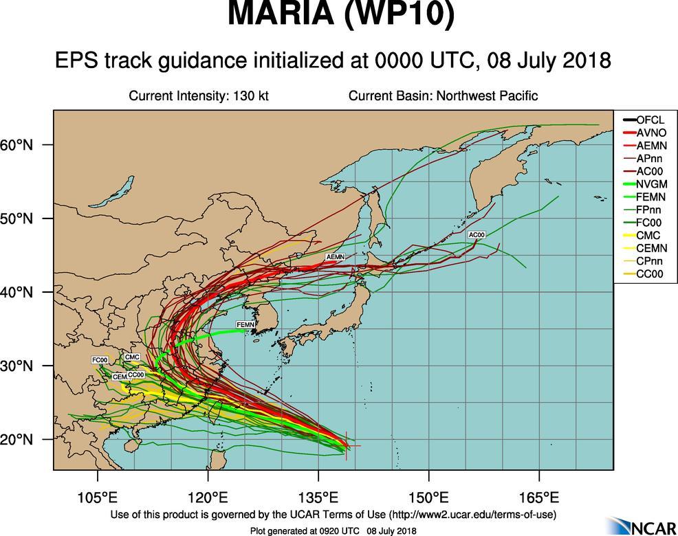
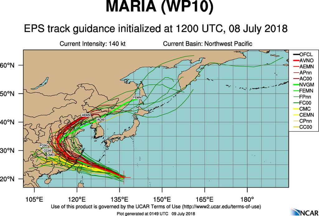
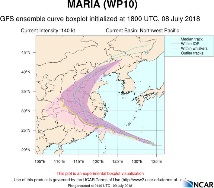
1 Overview of the Tropical Cyclone Guidance Project Dr. Jonathan L. Vigh With thanks to Mahsa Mirzargar (Univ. of Miami) Shanghai Typhoon Institute 09 July 2018 NCAR is sponsored by the National Science Foundation
2 Road Map What is the Tropical Cyclone Guidance Project? Why is this project relevant? Current capabilities Desired future capabilities
3 What is the Tropical Cyclone Guidance Project (TCGP)? TCGP is... a real-time platform for the visualization and dissemination of tropical cyclone forecast aids a testbed for displaying and comparing experimental forecast aids in real-time a portal to additional sources of information a provider of real-time observational information that goes beyond traditional metrics of track and intensity by adding structure information an experiment in how hurricane communications can be improved and refined hurricanes.ral.ucar.edu


4 Why is TCGP relevant? There is a societal need for clear and timely visualization and dissemination of tropical cyclone guidance The official NHC forecast is based to a large degree on the consensus of a small group of topflight models along with subjective forecaster intuition/weighting


5 Why is TCGP relevant? Changes in model scenarios often lead to revisions to the official forecast track in the next cycle => changes in model projections can give early indication of changes in the official forecast 26 Aug 1400 UTC 26 Aug 1500 UTC


6 Why is TCGP relevant? Large spread tends to indicate large uncertainty Small spread tends to indicate reduced uncertainty and higher confidence 26 Aug 2000 UTC 26 Aug 2100 UTC


7 Why is TCGP relevant? Changes in model scenarios often lead to revisions to the official forecast track in the next cycle => changes in model projections can give early indication of changes in the official forecast 27 Aug 0200 UTC 27 Aug 0300 UTC
8 Why is TCGP relevant? There is no such thing as the general public! Each user has a unique cost/value function for taking protective action: government agencies (e.g. NASA, DOD/Navy) multinational corporation with widespread geographical operations (e.g. FedEx, shipping company) energy operator in Gulf of Mexico (e.g. Chevron) fisherman in Louisiana emergency manager for a coastal county weather-savvy small business proprietor energy traders coastal resident Thus, it is impossible for one warning/communication system to adequately meet all user needs
9 Why is TCGP relevant? The traditional warning system has focused on: a) where the storm is going (e.g. track ) b) how strong the maximum winds will be (e.g. intensity ) Yet, hurricanes and tropical storms present a very wide spectrum of structures and sizes. Experts as well as savvy users need additional information beside just track and intensity. Impact-based warnings are not adequate to convey the threat to all users. As the experience with Hurricane Sandy shows, sole reliance on impacts can confuse people.
10 Why is TCGP relevant? Summary of usage Total hits Clicks Plot Views Total Bandwidth (GB) ,161,733 1,282, , ,645,476 1,936,818 1,270, ,633,209 1,080, , TCGP gets heavy web usage during storm events Peak day: Aug 14, 2013 Tropical Storm Dorian 13.2 GB of bandwidth 91,467 clicks In 2005 season, 3,000,000 hits in one month ~35 GB of bandwidth in one day
11 Development Timeline Pre-TCGP Era ( ) Expert resource at Colorado State University in support of daily tropical weather briefings very simple interface, little documentation Phase I - released 14 Aug 2011 Moved site from CSU to NCAR Brought new storm-based interface with overview map 4 types of plots: early track, late track, GFS track, intensity 3 basins: North Atlantic, Eastern Pacific, Central Pacific Updates on a 6 hour cycle Vortex Data Messages Phase II - late 2011 Expanded site to cover all global basins Northwest Pacific, North Indian Ocean, South Indian Ocean, Southwest Pacific Added new portal features: links to CIRA satellite products, links to radar and buoy data, links to official warning information
12 Recent additional capabilities Added more models and global ensembles Kerry Emanuel s CHIPS ensemble HWRF for all global basins GEFS/GEM/NAVGEM for global basins Added links to operational information Buoys Surface observations (U.S. regions) Radars Addition of links to research products ARCHER center-finding Satellite consensus estimates
13
14
15
16
17
18
19
20
21
22 Along with visual plots, TCGP provides the underlying raw data in Automated Tropical Cyclone Forecast (ATCF) format:
23 Vortex Data Messages a nutrition label for hurricanes

24 TCGP provides extensive documentation throughout the site

25 TCGP is building a model encyclopedia to document the various forecast models
26 Future Development Phase III Structure visualizations Add plots of structure and intensity data derived from VDMs Add plots of real-time flight-level data Add an overview plot which shows the history of storm location fixes for each storm Add data files of real-time structure parameters in a format that can be used for developing forecast aids for structure and intensity change

27 1. Add visualizations of Vortex Data Messages over storm lifecycle

28 4. Add visualizations of real-time flight data from reconnaissance aircraft


29 Add visualizations of real-time surface wind speed Add diagnostic comparisons between observations and model-simulated wind structure
30 Future Development Phase IV Retrospective archive Gather legacy model forecast aids for global basins Implement retrospective plots of these data for historic storms Run for historic storms Improves additional aspects of the user interface across the site Web Services REST API Web-map service
31 Future Development Phase V Real-time Verification Compute real-time verification of model errors and biases Usual metrics (track, intensity, size) Additional metrics (precipitation, wind field,... storm surge, etc.) Evaluation of models using synthetic trajectories Display plots and/or animations of model trends: d(prog)/dt Real-time model scorecards
32 Additional Desired Capabilities Add more models from around the world Add basins that get TCs on a rare basis Mediterranean Sea South Atlantic Add support for multiple languages Spanish Mandarin French Add translation for both time and wind speed averaging periods Add more official information from various agencies

33 Add Synthetic Profiles to Evaluate Model Wind Forecasts HWR HWRF s wind field is too broad and too symetric


34 Add visualizations of storm track history Add zoomed map of current location so users can tell if the storm is following the forecast track
35 Experience so far TCGP has filled an important niche in the space between operations and research Lack of open data policies among many operational modeling centers make it difficult to achieve the dream of providing global coverage Lack of (funded) support has made it difficult to achieve further development Nevertheless, progress continues There are many areas for potential collaboration with STI Localizing hazard information and intersecting this with vulnerability to obtain risk is the next frontier
Careful, Cyclones Can Blow You Away!
 Title: Careful, Cyclones Can Blow You Away! (Meteorology) Grade(s): 6-8 Introduction: Most people associate twisters with tornadoes, but in fact tropical twisters come from hurricanes. Hurricanes are what
SIXTH INTERNATIONAL WORKSHOP on TROPICAL CYCLONES. Working Group: Phillipe Caroff, Jeff Callaghan, James Franklin, Mark DeMaria
 WMO/CAS/WWW Topic 0.1: Track forecasts SIXTH INTERNATIONAL WORKSHOP on TROPICAL CYCLONES Rapporteur: E-mail: Lixion A. Avila NOAA/National Hurricane Center 11691 SW 17th Street Miami, FL 33165-2149, USA
NHC Ensemble/Probabilistic Guidance Products
 NHC Ensemble/Probabilistic Guidance Products Michael Brennan NOAA/NWS/NCEP/NHC Mark DeMaria NESDIS/STAR HFIP Ensemble Product Development Workshop 21 April 2010 Boulder, CO 1 Current Ensemble/Probability
GC Briefing. Weather Sentinel Tropical Storm Michael. Status at 8 AM EDT (12 UTC) Today (NHC) Discussion. October 11, 2018
 Today (NHC) Discussion. October 11, 2018") GC Briefing Weather Sentinel Tropical Storm Michael October 11, 2018 After making landfall as a high-end category-4 hurricane on the Florida Panhandle, Michael weakened to tropical storm status early this
GC Briefing Weather Sentinel Tropical Storm Michael October 11, 2018 After making landfall as a high-end category-4 hurricane on the Florida Panhandle, Michael weakened to tropical storm status early this
Coastal Emergency Risks Assessment - CERA Real-Time Storm Surge and Wave Visualization Tool
 Coastal Emergency Risks Assessment - CERA Real-Time Storm Surge and Wave Visualization Tool Introduction This document provides guidance for using the Coastal Emergency Risks Assessment (CERA) visualization
Understanding Weather and Climate Risk. Matthew Perry Sharing an Uncertain World Conference The Geological Society, 13 July 2017
 Understanding Weather and Climate Risk Matthew Perry Sharing an Uncertain World Conference The Geological Society, 13 July 2017 What is risk in a weather and climate context? Hazard: something with the
A Multi-Model Ensemble for Western North Pacific Tropical Cyclone Intensity Prediction
 DISTRIBUTION STATEMENT A. Approved for public release; distribution is unlimited. A Multi-Model Ensemble for Western North Pacific Tropical Cyclone Intensity Prediction Jonathan R. Moskaitis Naval Research
Satellite Applications to Hurricane Intensity Forecasting
 Satellite Applications to Hurricane Intensity Forecasting Christopher J. Slocum - CSU Kate D. Musgrave, Louie D. Grasso, and Galina Chirokova - CIRA/CSU Mark DeMaria and John Knaff - NOAA/NESDIS Center
Some figures courtesy of: Chris Landsea National Hurricane Center, Miami. Intergovernmental Panel on Climate Change
 Hurricanes and Global Warming Pat Fitzpatrick Mississippi State University, GeoSystems Research Institute Some figures courtesy of: Chris Landsea National Hurricane Center, Miami Intergovernmental Panel
The role of testbeds in NOAA for transitioning NWP research to operations
 ECMWF Workshop on Operational Systems November 18, 2013 The role of testbeds in NOAA for transitioning NWP research to operations Ligia Bernardet 1* and Zoltan Toth 1 1 NOAA ESRL Global Systems Division,
Tropical Update. 5 PM EDT Tuesday, September 5, 2017 Hurricane Irma, Tropical Storm Jose, and Tropical Depression Thirteen
 Tropical Update 5 PM EDT Tuesday, September 5, 2017 Hurricane Irma, Tropical Storm Jose, and Tropical Depression Thirteen This update is intended for government and emergency response officials, and is
Canadian Hurricane Center: How NHC Products are used to issue Warnings and Communicate Hazards
 Canadian Hurricane Center: How NHC Products are used to issue Warnings and Communicate Hazards Bob Robichaud Warning Preparedness Meteorologist Canadian Hurricane Centre Contents Brief background on the
Tropical Cyclone Formation/Structure/Motion Studies
 Tropical Cyclone Formation/Structure/Motion Studies Patrick A. Harr Department of Meteorology Naval Postgraduate School Monterey, CA 93943-5114 phone: (831) 656-3787 fax: (831) 656-3061 email: paharr@nps.edu
T-PARC and TCS08 (Submitted by Pat Harr, Russell Elsberry and Tetsuo Nakazawa)
") WORLD METEOROLOGICAL ORGANIZATION COMMISSION FOR ATMOSPHERIC SCIENCES INTERNATIONAL CORE STEERING COMMITTEE FOR THORPEX Eighth Session DWD, Offenbach (2 4 November 2009) CAS/ICSC-8/DOC4.1 (3 X.2009) Item:
WORLD METEOROLOGICAL ORGANIZATION COMMISSION FOR ATMOSPHERIC SCIENCES INTERNATIONAL CORE STEERING COMMITTEE FOR THORPEX Eighth Session DWD, Offenbach (2 4 November 2009) CAS/ICSC-8/DOC4.1 (3 X.2009) Item:
TSR TROPICAL STORM TRACKER LAUNCH
 TSR TROPICAL STORM TRACKER LAUNCH The Old Library, Lloyd s s of London Friday 30th May 2003 10.30am - 11.30am Tropical Storm Risk (TSR) Founded in 2000, Tropical Storm Risk (TSR) offers a leading resource
Add NOAA nowcoast Layers to Maps
 WebEOC Maps Add-on Quick Reference Guide Add NOAA nowcoast Layers to Maps Overview With Maps Add-on, you can configure an unlimited number of map layers. These layers allow you to control the data you
Tropical Update. 5 AM EDT Tuesday, September 12, 2017 Post-Tropical Cyclone Irma, Hurricane Jose, & Tropical Wave (10%)
") Tropical Update 5 AM EDT Tuesday, September 12, 2017 Post-Tropical Cyclone Irma, Hurricane Jose, & Tropical Wave (10%) This update is intended for government and emergency response officials, and is provided
Tropical Update 5 AM EDT Tuesday, September 12, 2017 Post-Tropical Cyclone Irma, Hurricane Jose, & Tropical Wave (10%) This update is intended for government and emergency response officials, and is provided
11/19/14. Chapter 11: Hurricanes. The Atmosphere: An Introduction to Meteorology, 12 th. Lutgens Tarbuck
 Chapter 11: Hurricanes The Atmosphere: An Introduction to Meteorology, 12 th Lutgens Tarbuck Lectures by: Heather Gallacher, Cleveland State University! Hurricanes: " Hurricanes are intense centers of
NHC Ocean Vector Winds Update
 NHC Ocean Vector Winds Update Michael J. Brennan NOAA/NWS/NCEP National Hurricane Center International Ocean Vector Winds Science Team Meeting Portland, Oregon, 20 May 2015 Current Status NHC is currently
NWS Operational Marine and Ocean Forecasting. Overview. Ming Ji. Ocean Prediction Center National Weather Service/NCEP. CIOSS/CoRP
 NWS Operational Marine and Ocean Forecasting Overview Ming Ji Ocean Prediction Center National Weather Service/NCEP CIOSS/CoRP CoRP Symposium Corvallis, OR Aug. 12-13, 13, 2008 Titanic Telegram Marine
Outlook 2008 Atlantic Hurricane Season. Kevin Lipton, Ingrid Amberger National Weather Service Albany, New York
 Outlook 2008 Atlantic Hurricane Season Kevin Lipton, Ingrid Amberger National Weather Service Albany, New York Summary 2007 Hurricane Season Two hurricanes made landfall in the Atlantic Basin at category-5
16D.6 USE OF SYNTHETIC PROFILES TO DIAGNOSE SIMULATED TROPICAL CYCLONES IN REGIONAL HURRICANE MODELS
 16D.6 USE OF SYNTHETIC PROFILES TO DIAGNOSE SIMULATED TROPICAL CYCLONES IN REGIONAL HURRICANE MODELS Jonathan L. Vigh NCAR Research Applications Laboratory, Boulder, Colorado Chanh Kieu and Vijay Tallapragada
Ch. 11: Hurricanes. Be able to. Define what hurricane is. Identify the life and death of a hurricane. Identify the ways we track hurricanes.
 Ch. 11: Hurricanes Be able to Define what hurricane is. Identify the life and death of a hurricane. Identify the ways we track hurricanes. What are Hurricanes? Smaller than mid-latitude cyclones. Don t
Predicting Tropical Cyclone Formation and Structure Change
 Predicting Tropical Cyclone Formation and Structure Change Patrick A. Harr Department of Meteorology Naval Postgraduate School Monterey, CA 93943-5114 phone: (831)656-3787 fax: (831)656-3061 email: paharr@nps.navy.mil
Tropical Update. 5 AM EDT Thursday, September 7, 2017 Hurricane Irma, Hurricane Jose, and Hurricane Katia
 Tropical Update 5 AM EDT Thursday, September 7, 2017 Hurricane Irma, Hurricane Jose, and Hurricane Katia This update is intended for government and emergency response officials, and is provided for informational
Your Source for Global Aviation Forecasts
 Your Source for Global Aviation Forecasts (831) 238-5054 100 Sky Park Drive Monterey, CA 93940 Weather4Cast.com Live Weather Data Feeds Weather4Cast.com provides Live Aviation Weather Data Feeds formatted
GC Briefing. Weather Sentinel Hurricane Florence. Status at 5 PM EDT (21 UTC) Today (NHC) Discussion. September 13, 2018
 Today (NHC) Discussion. September 13, 2018") GC Briefing September 13, 2018 Weather Sentinel Hurricane Florence Tropical storm conditions have been reported for areas of North Carolina and will continue to spread inland to the west and south. Hurricane
GC Briefing September 13, 2018 Weather Sentinel Hurricane Florence Tropical storm conditions have been reported for areas of North Carolina and will continue to spread inland to the west and south. Hurricane
Enhancing Weather Information with Probability Forecasts. An Information Statement of the American Meteorological Society
 Enhancing Weather Information with Probability Forecasts An Information Statement of the American Meteorological Society (Adopted by AMS Council on 12 May 2008) Bull. Amer. Meteor. Soc., 89 Summary This
NWS and Navy Plans for the ATCF and AWIPS2
 NWS and Navy Plans for the ATCF and AWIPS2 Mark DeMaria, Craig A. Mattocks, Christopher Mello, Michael Brennan and Monica Bozeman NOAA/NWS National Hurricane Center, Miami, FL Charles R. Sampson and Michael
The Wind Hazard: Messaging the Wind Threat & Corresponding Potential Impacts
 The Wind Hazard: Messaging the Wind Threat & Corresponding Potential Impacts Scott Spratt Warning Coordination Meteorologist NWS Melbourne, FL David Sharp Science & Operations Officer NWS Melbourne, FL
ATMOSPHERIC MODELLING. GEOG/ENST 3331 Lecture 9 Ahrens: Chapter 13; A&B: Chapters 12 and 13
 ATMOSPHERIC MODELLING GEOG/ENST 3331 Lecture 9 Ahrens: Chapter 13; A&B: Chapters 12 and 13 Agenda for February 3 Assignment 3: Due on Friday Lecture Outline Numerical modelling Long-range forecasts Oscillations
Climate Prediction Center Research Interests/Needs
 Climate Prediction Center Research Interests/Needs 1 Outline Operational Prediction Branch research needs Operational Monitoring Branch research needs New experimental products at CPC Background on CPC
11A.1 PREDICTION OF TROPICAL CYCLONE TRACK FORECAST ERROR FOR HURRICANES KATRINA, RITA, AND WILMA
 11A.1 PREDICTION OF TROPICAL CYCLONE TRACK FORECAST ERROR FOR HURRICANES KATRINA, RITA, AND WILMA James S. Goerss* Naval Research Laboratory, Monterey, California 1. INTRODUCTION Consensus tropical cyclone
Tropical Update. 1 PM EDT Monday, May 21, 2018 Caribbean Disturbance (20%)
") Tropical Update 1 PM EDT Monday, May 21, 2018 Caribbean Disturbance (20%) This update is intended for government and emergency response officials, and is provided for informational and situational awareness
Tropical Update 1 PM EDT Monday, May 21, 2018 Caribbean Disturbance (20%) This update is intended for government and emergency response officials, and is provided for informational and situational awareness
JTWC use of ensemble products. Matthew Kucas Joint Typhoon Warning Center Pearl Harbor, HI
 Matthew Kucas Joint Typhoon Warning Center Pearl Harbor, HI Overview Tropical cyclone track forecasting Deterministic model consensus and single-model ensembles as track forecasting aids Conveying uncertainty
A Preliminary Exploration of the Upper Bound of Tropical Cyclone Intensification
 A Preliminary Exploration of the Upper Bound of Tropical Cyclone Intensification Jonathan L. Vigh (NCAR/RAL) Kerry Emanuel (MIT) Mrinal K. Biswas (NCAR/RAL) Eric A. Hendricks (Naval Postgraduate School)
WSI Tropical MarketFirst
 Todd Crawford, Ph.D. Director of R&D for Energy and Risk Services William Ramstrom Tropical Meteorologist, WSI June 2008 Introduction WSI Corporation has recently developed WSI Tropical MarketFirst, a
Catalysing Innovation in Weather Science - the role of observations and NWP in the World Weather Research Programme
 Catalysing Innovation in Weather Science - the role of observations and NWP in the World Weather Research Programme Estelle de Coning, Paolo Ruti, Julia Keller World Weather Research Division The World
DYNAMIC POSITIONING CONFERENCE October 7-8, Operations. Using GIS to Understand Hurricane Windfields in the Gulf of Mexico
 Return to Session Directory DYNAMIC POSITIONING CONFERENCE October 7-8, 2008 Operations Using GIS to Understand Hurricane Windfields in the Gulf of Mexico Jill F. Hasling and Maureen T. Maiuri Weather
Objectives for meeting
 Objectives for meeting 1) Summarize planned experiments 2) Discuss resource availability Aircraft Instrumentation Expendables 3) Assign working groups to complete each experiment plan Flight planning and
1.2 DEVELOPMENT OF THE NWS PROBABILISTIC EXTRA-TROPICAL STORM SURGE MODEL AND POST PROCESSING METHODOLOGY
 1.2 DEVELOPMENT OF THE NWS PROBABILISTIC EXTRA-TROPICAL STORM SURGE MODEL AND POST PROCESSING METHODOLOGY Huiqing Liu 1 and Arthur Taylor 2* 1. Ace Info Solutions, Reston, VA 2. NOAA / NWS / Science and
Weather forecasts and warnings: Support for Impact based decision making
 Weather forecasts and warnings: Support for Impact based decision making Gerry Murphy, Met Éireann www.met.ie An Era of Change Climate and weather is changing Societal vulnerability is increasing The nature
Unit 5: NWS Hazardous Weather Products. Hazardous Weather and Flooding Preparedness
 Unit 5: NWS Hazardous Weather Products Objectives Describe the mission of the NWS Describe the basic organizational structure of the NWS Explain the purpose of various NWS products Explain how Probability
Frank Revitte National Weather Service. Weather Forecast Office New Orleans/Baton Rouge
 Frank Revitte National Weather Service Weather Forecast Office New Orleans/Baton Rouge Above normal activity 17 Total Named Storms 7 Tropical Storms 4 Hurricanes 6 Major Hurricanes Not the most active,
Hurricane Season 2010 & NOAA s Deepwater Response
 Hurricane Season 2010 & NOAA s Deepwater Response What s Happened? What Will 2010 Bring? Possible Shoreline Effects Darin Figurskey Meteorologist-in-Charge NOAA s NWS Raleigh, NC NOAA s National Weather
Tropical Update. 5 PM EDT Thursday, September 7, 2017 Hurricane Irma, Hurricane Jose, and Hurricane Katia
 Tropical Update 5 PM EDT Thursday, September 7, 2017 Hurricane Irma, Hurricane Jose, and Hurricane Katia This update is intended for government and emergency response officials, and is provided for informational
Using Flight Level Data to Improve Historical Tropical Cyclone Databases
 Using Flight Level Data to Improve Historical Tropical Cyclone Databases Dr. Jonathan L. Vigh Shanghai Typhoon Institute 12 July 2018 NCAR is sponsored by the National Science Foundation On the Need for
Chapter 24. Tropical Cyclones. Tropical Cyclone Classification 4/19/17
 Chapter 24 Tropical Cyclones Tropical Cyclones Most destructive storms on the planet Originate over tropical waters, but their paths often take them over land and into midlatitudes Names Hurricane (Atlantic
HWRF Ocean: MPIPOM-TC
 HWRF v3.7a Tutorial Nanjing, China, December 2, 2015 HWRF Ocean: MPIPOM-TC Ligia Bernardet NOAA SRL Global Systems Division, Boulder CO University of Colorado CIRS, Boulder CO Acknowledgement Richard Yablonsky
2006 & 2007 Pre-Hurricane Scenario Analyses
 2006 & 2007 Pre-Hurricane Scenario Analyses Executive Summary May 2007 Page 1 OF X FOR OFFICIAL USE ONLY 4 Public Availability to be Determined Under 5 U.S.C. 552 NOTE: Limited Distribution. Release of
Tropical Update. 11 AM EDT Wednesday, October 10, 2018 Hurricane Michael, Hurricane Leslie & Tropical Storm Nadine, Caribbean Low (40%)
") Tropical Update 11 AM EDT Wednesday, October 10, 2018 Hurricane Michael, Hurricane Leslie & Tropical Storm Nadine, Caribbean Low (40%) This update is intended for government and emergency response officials,
Tropical Update 11 AM EDT Wednesday, October 10, 2018 Hurricane Michael, Hurricane Leslie & Tropical Storm Nadine, Caribbean Low (40%) This update is intended for government and emergency response officials,
A Look Back at the 2012 Hurricane Season and a Look Ahead to 2013 & Beyond. Daniel Brown National Hurricane Center Miami, Florida 24 April 2013
 A Look Back at the 2012 Hurricane Season and a Look Ahead to 2013 & Beyond Daniel Brown National Hurricane Center Miami, Florida 24 April 2013 2012 Atlantic Verification Good News- Lots of Accuracy Records
Observations and projections of extreme events. Carolina Vera CIMA/CONICET-Univ. of Buenos Aires, Argentina
 Observations and projections of extreme events Carolina Vera CIMA/CONICET-Univ. of Buenos Aires, Argentina Overview of SREX Chapter 3 More literature: ~ 900 references, ~ 75% of these published since AR4
The revised Atlantic hurricane database (HURDAT2) - Chris Landsea, James Franklin, and Jack Beven May 2015
 - Chris Landsea, James Franklin, and Jack Beven May 2015") The revised Atlantic hurricane database (HURDAT2) - Chris Landsea, James Franklin, and Jack Beven May 2015 The National Hurricane Center (NHC) conducts a post-storm analysis of each tropical cyclone in
The revised Atlantic hurricane database (HURDAT2) - Chris Landsea, James Franklin, and Jack Beven May 2015 The National Hurricane Center (NHC) conducts a post-storm analysis of each tropical cyclone in
The next generation in weather radar software.
 The next generation in weather radar software. PUBLISHED BY Vaisala Oyj Phone (int.): +358 9 8949 1 P.O. Box 26 Fax: +358 9 8949 2227 FI-00421 Helsinki Finland Try IRIS Focus at iris.vaisala.com. Vaisala
Tropical Update. 5 AM EDT Wednesday, September 6, 2017 Hurricane Irma, Tropical Storm Jose, and Tropical Storm Katia
 Tropical Update 5 AM EDT Wednesday, September 6, 2017 Hurricane Irma, Tropical Storm Jose, and Tropical Storm Katia This update is intended for government and emergency response officials, and is provided
(April 7, 2010, Wednesday) Tropical Storms & Hurricanes Part 2
 Tropical Storms & Hurricanes Part 2") Lecture #17 (April 7, 2010, Wednesday) Tropical Storms & Hurricanes Part 2 Hurricane Katrina August 2005 All tropical cyclone tracks (1945-2006). Hurricane Formation While moving westward, tropical disturbances
Lecture #17 (April 7, 2010, Wednesday) Tropical Storms & Hurricanes Part 2 Hurricane Katrina August 2005 All tropical cyclone tracks (1945-2006). Hurricane Formation While moving westward, tropical disturbances
Motivation & Goal. We investigate a way to generate PDFs from a single deterministic run
 Motivation & Goal Numerical weather prediction is limited by errors in initial conditions, model imperfections, and nonlinearity. Ensembles of an NWP model provide forecast probability density functions
WELCOME TO THE 2018 RA-IV WORKSHOP ON HURRICANE FORECASTING AND WARNING
 WELCOME TO THE 2018 RA-IV WORKSHOP ON HURRICANE FORECASTING AND WARNING Richard J. Pasch and Daniel P. Brown Senior Hurricane Specialists National Hurricane Center ORIENTATION Use of PCs NHC Facility Workshop
RMS Medium Term Perspective on Hurricane Activity
 RMS Medium Term Perspective on Hurricane Activity Dr. Manuel Lonfat Florida Commission on Hurricane Loss Projection Methodology Workshop Tallahassee, July 27 2006 Agenda Multiyear autocorrelation of Atlantic,
Methodology for 2013 Stream 1.5 Candidate Evaluation
 Methodology for 2013 Stream 1.5 Candidate Evaluation 20 May 2013 TCMT Stream 1.5 Analysis Team: Louisa Nance, Mrinal Biswas, Barbara Brown, Tressa Fowler, Paul Kucera, Kathryn Newman, Jonathan Vigh, and
Scenario-based Language for Hurricane Decision Support
 Scenario-based Language for Hurricane Decision Support David Sharp NOAA/National Weather Service Melbourne, FL Pablo Santos NOAA/National Weather Service Miami, FL Weather Model Outcomes (as seen on TV)
GFDL Hurricane Model Ensemble Performance During the 2012 Hurricane Season
 GFDL Hurricane Model Ensemble Performance During the 2012 Hurricane Season Tim Marchok (NOAA / GFDL) Matt Morin (DRC HPTG / GFDL) Morris Bender (NOAA / GFDL) HFIP Team Telecon 12 December 2012 Acknowledgments:
National Hurricane Center Products. Jack Beven National Hurricane Center
 National Hurricane Center Products Jack Beven National Hurricane Center Florida Governor s Hurricane Conference 11 May 2014 NHC Tropical Cyclone Products NHC provides the big picture that complements and
The Evolution and Use of Objective Forecast Guidance at NHC
 The Evolution and Use of Objective Forecast Guidance at NHC James L. Franklin Branch Chief, Hurricane Specialist Unit National Hurricane Center 2010 EMC/MMM/DTC Workshop 1 Hierarchy of TC Track Models
Global Climate Change and Human Health Cycloning out of Control: Climate Change Impacts on Natural Disasters; Cyclones
 INSTRUCTOR BACKGROUND Cyclones are one of the world s most devastating natural disasters causing billions of dollars in damages to homes, building and infrastructure annually. The United Nations estimates
Tropical Update. 11 AM EDT Tuesday, October 9, 2018 Hurricane Michael, Tropical Storm Leslie, Tropical Storm Nadine
 Tropical Update 11 AM EDT Tuesday, October 9, 2018 Hurricane Michael, Tropical Storm Leslie, Tropical Storm Nadine This update is intended for government and emergency response officials, and is provided
Hurricane Basics and Preparedness. Jim Weyman Director, Central Pacific Hurricane Center Phone Office:
 Hurricane Basics and Preparedness Jim Weyman Director, Central Pacific Hurricane Center Phone Office: 973-5270 james.weyman@noaa.gov United States Hurricane/Typhoon Centers National Hurricane Center, Miami
EARLY WARNINGS FOR HURRICANES
 1 EARLY WARNINGS FOR HURRICANES Dr. José Rubiera National Forecasting Center Instituto de Meteorología, Cuba Thematic Session Cluster 2 World Conference on Disaster Reduction Kobe, Japan, January 18 22,
Methodology for 2014 Stream 1.5 Candidate Evaluation
 Methodology for 2014 Stream 1.5 Candidate Evaluation 29 July 2014 TCMT Stream 1.5 Analysis Team: Louisa Nance, Mrinal Biswas, Barbara Brown, Tressa Fowler, Paul Kucera, Kathryn Newman, and Christopher
COAMPS-TC 2015 Version, Performance, and Future Plans
 COAMPS-TC 2015 Version, Performance, and Future Plans James D. Doyle, R. Hodur 1, J. Moskaitis, S. Chen, E. Hendricks 2, H. Jin, Y. Jin, A. Reinecke, S. Wang Naval Research Laboratory, Monterey, CA 1 IES/SAIC,
Indiana County Flash Flood of 22 June 2017
 Indiana County Flash Flood of 22 June 2017 By Richard H. Grumm National Weather Service State College, PA 1. Overview Slow moving thunderstorms brought 3 to 4 inches of rainfall to Indiana County, PA during
Predicting Tropical Cyclone Formation and Structure Change
 Predicting Tropical Cyclone Formation and Structure Change Patrick A. Harr Department of Meteorology Naval Postgraduate School Monterey, CA 93943-5114 Telephone: (831)656-3787 FAX:(831)656-3061 email:
Urgent Computing for Hurricane Forecasts
 Urgent Computing for Hurricane Forecasts Gabrielle Allen Center for Computation & Technology Dept Computer Science Louisiana State University gallen@cct.lsu.edu Representing the SURA Coastal Ocean Observing
Communicating Hurricane Threats and Impacts on a National Scale. Daniel Brown Warning Coordination Meteorologist National Hurricane Center
 Communicating Hurricane Threats and Impacts on a National Scale Daniel Brown Warning Coordination Meteorologist National Hurricane Center New NWS Products to Help Communicate Potential Impacts New probabilistic
Tropical Update. 12 PM EDT Friday, October 7, 2016 Hurricane Matthew & Tropical Storm Nicole
 Tropical Update 12 PM EDT Friday, October 7, 2016 Hurricane Matthew & Tropical Storm Nicole This update is intended for government and emergency response officials, and is provided for informational and
Recent ET/STC/TT near Iberian Peninsula and Canary Islands
 Recent ET/STC/TT near Iberian Peninsula and Canary Islands ET, Extratropical Transition STC, SubTropical Cyclogenesis TT, Tropical Transition Francisco Martín and Fermín Elizaga AEMet francisco.martín@inm.es
Hurricane Matthew. National Weather Service Wilmington NC. Steven Pfaff, WCM.
 Hurricane Matthew Threat Assessment for northeast South Carolina & southeast North Carolina National Weather Service Wilmington NC 515 PM EDT Monday October 3, 2016 Steven Pfaff, WCM Steven.Pfaff@noaa.gov
Tropical Update. 5 PM EDT Sunday, September 10, 2017 Hurricane Irma, Hurricane Jose, Tropical Wave (60%)
") Tropical Update 5 PM EDT Sunday, September 10, 2017 Hurricane Irma, Hurricane Jose, Tropical Wave (60%) This update is intended for government and emergency response officials, and is provided for informational
Tropical Update 5 PM EDT Sunday, September 10, 2017 Hurricane Irma, Hurricane Jose, Tropical Wave (60%) This update is intended for government and emergency response officials, and is provided for informational
HVX-HURREVAC (Beta) Webinar Series
 Webinar Series") HVX-HURREVAC (Beta) Webinar Series Day 1 - An introduction to HURREVAC and the new web-based HVX platform 2018 HVX-HURREVAC Webinar Series 1. Intro to HURREVAC and General Overview of the Program (August
HVX-HURREVAC (Beta) Webinar Series Day 1 - An introduction to HURREVAC and the new web-based HVX platform 2018 HVX-HURREVAC Webinar Series 1. Intro to HURREVAC and General Overview of the Program (August
WEEKLY WEATHER OUTLOOK BELIZE, CENTRAL AMERICA
 WEEKLY WEATHER OUTLOOK BELIZE, CENTRAL AMERICA PERIOD: Sunday, June 17 until Monday, June 25, 2012 DATE ISSUED: Sunday, June 17, 2012; 3:00 pm RFrutos EcoSolutions & Services SYNOPSIS: An upper level trough
Storm Hazard Assessment for San Pedro/Ambergris Caye, Belize. Statistical Estimation of Hazard Frequency and Intensity
 Storm Hazard Assessment for San Pedro/Ambergris Caye, Belize Statistical Estimation of Hazard Frequency and Intensity Prepared For: Caribbean Development Bank Advanced technology and analysis solving problems
NOAA Hurricane Forecast Improvement Project
 NOAA Hurricane Forecast Improvement Project Fred Toepfer Hurricane Forecast Improvement Project Manager November 9 th, 2009 Outline NOAA Hurricane Forecast Improvement Project Driving Issue Purpose NOAA
Challenges to Improving the Skill of Weekly to Seasonal Climate Predictions. David DeWitt with contributions from CPC staff
 Challenges to Improving the Skill of Weekly to Seasonal Climate Predictions David DeWitt with contributions from CPC staff 1 Outline CPC Background Prediction, monitoring, diagnostics, and climate services
Tropical Storm Harvey: SE Texas Impacts
 Tropical Storm Harvey: SE Texas Impacts 10 AM CDT UPDATE Thursday, August 24, 2017 Prepared by: Dan Reilly, Brian Kyle PLEASE MUTE YOUR LINES AND DON T PUT ON HOLD! Situation Overview Tropical Storm Harvey
PERSPECTIVES ON FOCUSED WORKSHOP QUESTIONS
 PERSPECTIVES ON FOCUSED WORKSHOP QUESTIONS REGARDING PAST ECONOMIC IMPACTS OF STORMS OR FLOODS Tom Knutson Geophysical Fluid Dynamics Laboratory National Oceanic and Atmospheric Administration 1. According
Use of big data, crowdsourcing and GIS in assessment of weather-related impact
 Use of big data, crowdsourcing and GIS in assessment of weather-related impact HK (Photo courtesy : GFS) PAN Chi-kin, Hong Kong Observatory (Photo courtesy : Roy Liu/China Daily) November 2017, KMA/WMO
Behind the Climate Prediction Center s Extended and Long Range Outlooks Mike Halpert, Deputy Director Climate Prediction Center / NCEP
 Behind the Climate Prediction Center s Extended and Long Range Outlooks Mike Halpert, Deputy Director Climate Prediction Center / NCEP September 2012 Outline Mission Extended Range Outlooks (6-10/8-14)
Homework 2: Hurricane Katrina. Part 1. Hurricane Katrina, August 28, 2005 Satellite Imagery
 Metr 302 Homework 2 Fall 2014 Meteorology 302 Fall 2014 Name Homework 2: Hurricane Katrina 100 points total Distributed Thursday 30 October 2014; Due Thursday 13 November 2014 Answer all questions in complete
Hyperlocal Marine Weather: What s Happening?
 Hyperlocal Marine Weather: What s Happening? André van der Westhuysen 1,2 and Jeff McQueen 1 1 NOAA / National Weather Service National Centers for Environmental Prediction 2 I.M Systems Group, Rockville
An Overview of Operations at the West Gulf River Forecast Center Gregory Waller Service Coordination Hydrologist NWS - West Gulf River Forecast Center
 National Weather Service West Gulf River Forecast Center An Overview of Operations at the West Gulf River Forecast Center Gregory Waller Service Coordination Hydrologist NWS - West Gulf River Forecast
The Atlantic Hurricane Database Reanalysis Project
 The Atlantic Hurricane Database Reanalysis Project 9 November, 2015 14 th International Workshop on Wave Hindcasting and Forecasting Chris Landsea, National Hurricane Center, Miami, USA Chris.Landsea@noaa.gov
Exercise Brunswick ALPHA 2018
 ALPHA Exercise Brunswick ALPHA 2018 Who we are (our structure) What we do (our forecasts) How you can access the information Tropical cyclone information (basic) Overview of the products used for Exercise
NOAA s Hurricane Forecast Improvement Project: Framework for Addressing the Weather Research Forecasting Innovation Act of 2017
 NOAA s Hurricane Forecast Improvement Project: Framework for Addressing the Weather Research Forecasting Innovation Act of 2017 Frank Marks (NOAA/AOML/HRD) November 7, 2018 NOAA Hurricane Forecast Improvement
The National Weather Service of the Future: Building a Weather-Ready Nation
 The of the Future: Building a Weather-Ready Nation Dr. Louis W. Uccellini Director, NOAA Assistant Administrator for Weather Services NCEP Production Suite Review December 2, 2014 Outline Building a Weather-Ready
Western States Water Council Forecasting Weather Data June 24, 2014
 Western States Water Council Forecasting Weather Data June 24, 2014 Roger V. Pierce Meteorologist -in- Charge NOAA / National Weather Service San Diego CA Mission- to provide forecasts and warnings: The
Advances in weather and climate science
 Advances in weather and climate science Second ICAO Global Air Navigation Industry Symposium (GANIS/2) 11 to 13 December 2017, Montreal, Canada GREG BROCK Scientific Officer Aeronautical Meteorology Division
April Forecast Update for North Atlantic Hurricane Activity in 2019
 April Forecast Update for North Atlantic Hurricane Activity in 2019 Issued: 5 th April 2019 by Professor Mark Saunders and Dr Adam Lea Dept. of Space and Climate Physics, UCL (University College London),
COLORADO STATE UNIVERSITY FORECAST OF ATLANTIC HURRICANE ACTIVITY FROM AUGUST 4-17, 2015
 COLORADO STATE UNIVERSITY FORECAST OF ATLANTIC HURRICANE ACTIVITY FROM AUGUST 4-17, 2015 We expect that the next two weeks will be characterized by below-average amounts (
Activities and Outlook related to Disaster Reduction in CMA
 Activities and Outlook related to Disaster Reduction in CMA WANG Bangzhong China Meteorological Administration March 15-17 2006 ADENDA Situation about MD and related disasters in CHINA Guidance for MD/RD