Scenario-based Language for Hurricane Decision Support
|
|
|
- Denis York
- 5 years ago
- Views:
Transcription


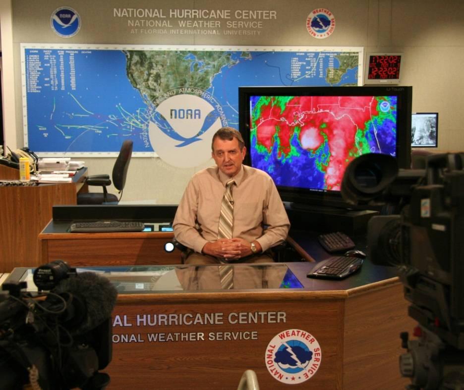
1 Scenario-based Language for Hurricane Decision Support David Sharp NOAA/National Weather Service Melbourne, FL Pablo Santos NOAA/National Weather Service Miami, FL Weather Model Outcomes (as seen on TV)
2 OR The Relationship Between the Latest Forecast, the Most Likely Scenario, and the Reasonable Worst Case Scenario Weather Model Outcomes (as seen on TV)


3 Old Weather Briefer s Adage: If you must apologize for a forecast, you didn t communicate the uncertainty well enough.


4
5 What actionable information does this image convey? Weather Model Outcomes (as seen on TV)
6 And, what actionable information does this image convey? Weather Model Outcomes (as seen on TV)


7 Perhaps it represents an attempt to use more than one single solution (i.e. deterministic outcome) to address forecast uncertainty and confidence issues. Weather Model Outcomes (as seen on TV)
8 Old Weather Briefer s Adage: Confusion and doubt are not the same as uncertainty. It is possible to clearly and confidently talk about uncertainty.

9 The Value of Probability Data But, many people have an aversion to using probability data. study.com Scenario #1 Scenario #2 Scenario #3 Plausible Outcomes; Most Likely Outcome
10 Axioms: Deterministic vs. Probabilistic For well-behaved systems, forecast uncertainty is typically larger at extended time periods. Especially for organized, well-forecast systems For ill-behaved systems, forecast uncertainty can be large at any time period. Especially for disorganized systems offering considerable forecast challenges
11 Axioms: Deterministic vs. Probabilistic Probabilistic-only wind information typically has its greatest value well before and leading into the local event. Deterministic-only wind information typically has its greatest value at the imminent onset and during the local event.


12 Axioms: Deterministic vs. Probabilistic Ideally, as a local hurricane wind event unfolds and draws closer in time probabilistic depictions should trend toward deterministic depictions.


13 The Latest Forecast Analyzed location, size, and intensity Forecast points, size, and intensity 5-day forecasts 12 & 24 hr points Motion The Official Forecast Synoptic


14 The Latest Forecast Analyzed location, size, and intensity Forecast points, size, and intensity 5-day forecasts 12 & 24 hr points Motion The Official Forecast Synoptic


15 The Latest Forecast Quadrant winds Somewhere vs. Everywhere Intermediate points 1-hr resolution (interpolated) CAT2-5 winds Day 6-7 NHC Storm-relative forecast WFO Geo-relative forecast (downscaled & refined)
16 The Latest Forecast Forecast Track Skinny Black Line Peak Wind Swath deterministic; zero error Alright, now I can make some really good decisions. Well, hang on a minute!


17 What is the one thing every decisionmaker wants but we cannot provide? a perfect forecast!!! DSS Texas Puerto Rico


18 The Most Likely Scenario Error Cone Cross Track Errors Along Track Errors Hurricanes are not points; they have size and dimension. As overlay to qualitatively consider outcome variations; center tracks within the cone two-thirds of the time.
19 The Most Likely Alternate Scenario For contingency planning, is there a next most likely solution (qualitative-sense)? Yes, but there are many alternate scenarios Determining which is the next most likely also takes expertise (and to assess whether there is actual meteorological bearing)


20 The Most Likely Alternate Scenario
21 Single-Solution Depictions Used Qualitatively Most Likely Scenario Most Likely Alternate Scenario

22 Incorporating Probability Data Cumulative Wind Speed Probabilities: Tropical Storm Chance of a tropical storm wind event at a particular location Quantitative; centered about latest forecast; point location values Accounts for potential variations in track, intensity, and size of the cyclone

23 Incorporating Probability Data Cumulative Wind Speed Probabilities: Hurricane Chance of a hurricane wind event at a particular location Quantitative; centered about latest forecast; point location values Accounts for potential variations in track, intensity, and size of the cyclone


24 Latest Forecast October 2, 2016


25 Latest Forecast October 2, 2016


26 Watches & Warnings Forecaster Expertise: - Subjective Insights - Objective Guidance

27 Reasonable Worst Case Scenario WIND THREAT Potential for wind > 110 mph Potential for wind mph Potential for wind mph Potential for wind mph Wind < 39 mph Forecast with Safety Margin 10% exceedance
28 Risk Tolerance: Spectrum of Plausible Outcomes (in event context; for a given community) Reasonable Best Case Most Likely Reasonable Worst Case 90% 80% 70% 60% ~ 50% 40% 30% 20% 10% Tolerate Much Risk % exceedance Tolerate Little Risk
29 Risk Tolerance: Spectrum of Plausible Outcomes (in event context; for a given community) Latest Forecast Most Likely Scenario 90% 80% 70% 60% ~ 50% 40% 30% 20% 10% Tolerate Much Risk % exceedance Tolerate Little Risk
30 Risk Tolerance: Spectrum of Plausible Outcomes (in event context; for a given community) Margin of Danger Latest Forecast Margin of Safety Reasonable Best Case Scenario Most Likely Scenario Reasonable Worst Case Scenario 90% 80% 70% 60% ~ 50% 40% 30% 20% 10% Tolerate Much Risk % exceedance Tolerate Little Risk
31 Risk Tolerance: Spectrum of Plausible Outcomes (in event context; for a given community) Margin of Danger Latest Forecast Margin of Safety Under-Prepare {relative to latest forecast} Prepare Over-Prepare {relative to latest forecast} 90% 80% 70% 60% ~ 50% 40% 30% 20% 10% Tolerate Much Risk % exceedance Tolerate Little Risk
32 Risk Tolerance: Spectrum of Plausible Outcomes Added loss of lives/property (in event context; for a given community) increasing regret potential Added loss of time/resources Margin of Danger Latest Forecast Margin of Safety Under-Prepare {relative to latest forecast} Prepare Over-Prepare {relative to latest forecast} 90% 80% 70% 60% ~ 50% 40% 30% 20% 10% Tolerate Much Risk % exceedance Tolerate Little Risk
33 Risk Tolerance: Spectrum of Plausible Outcomes Added loss of lives/property (in event context; for a given community) increasing regret potential Added loss of time/resources Margin of Danger Latest Forecast Margin of Safety Reasonable Best Case Scenario Most Likely Scenario Reasonable Worst Case Scenario 90% 80% 70% 60% ~ 50% 40% 30% 20% 10% Tolerate Much Risk % exceedance Tolerate Little Risk
34 Risk Tolerance: Spectrum of Plausible Outcomes (in event context; for a given community) Latest Forecast Margin of Safety Most Likely Scenario Reasonable Worst Case Scenario 90% 80% 70% 60% ~ 50% 40% 30% 20% 10% Tolerate Much Risk % exceedance Tolerate Little Risk
35 Latest Forecast Forecast with Safety Margin Most Likely Scenario Reasonable Worst Case Scenario WIND THREAT Potential for wind > 110 mph Potential for wind mph Potential for wind mph Potential for wind mph Wind < 39 mph
36 Risk Tolerance: Spectrum of Plausible Outcomes (in event context; for a given community) Latest Forecast Margin of Safety Most Likely Scenario Reasonable Worst Case Scenario 90% 80% 70% 60% ~ 50% 40% 30% 20% 10% Tolerate Much Risk % exceedance Tolerate Little Risk
37 Risk Tolerance: Spectrum of Plausible Outcomes (in event context; for a given community) Latest Forecast Margin of Safety Most Likely Scenario 90% 80% 70% 60% ~ 50% 40% 30% 20% 10% Tolerate Much Risk % exceedance Tolerate Little Risk
38 Risk Tolerance: Spectrum of Plausible Outcomes (in event context; for a given community) Latest Forecast Margin of Safety Most Likely Scenario 90% 80% 70% 60% ~ 50% 40% 30% 20% 10% Tolerate Much Risk % exceedance Tolerate Little Risk
39 Reasonable Worst Case Scenario Forecasters Perspective WIND THREAT Potential for wind > 110 mph Potential for wind mph Potential for wind mph Potential for wind mph Wind < 39 mph 10% Exceedance Margin of Safety

40 WIND THREAT Potential for wind > 110 mph Potential for wind mph Potential for wind mph Potential for wind mph Wind < 39 mph 20% Exceedance Margin of Safety
41 WIND THREAT Potential for wind > 110 mph Potential for wind mph Potential for wind mph Potential for wind mph Wind < 39 mph 30% Exceedance Margin of Safety
42 Most Likely Scenario WIND THREAT Potential for wind > 110 mph Potential for wind mph Potential for wind mph Potential for wind mph Wind < 39 mph Latest Forecast


43 Thank You
The Wind Hazard: Messaging the Wind Threat & Corresponding Potential Impacts
 The Wind Hazard: Messaging the Wind Threat & Corresponding Potential Impacts Scott Spratt Warning Coordination Meteorologist NWS Melbourne, FL David Sharp Science & Operations Officer NWS Melbourne, FL
The Local Wind Forecast and Its Uncertainty (Completing the Wind Forecast)
") The Local Wind Forecast and Its Uncertainty (Completing the Wind Forecast) Florida Governor Hurricane Conference May 11-16 2014 Pablo Santos Meteorologist In Charge NWS Miami/South Florida Forecast Office
The Local Wind Forecast and Its Uncertainty (Completing the Wind Forecast) Florida Governor Hurricane Conference May 11-16 2014 Pablo Santos Meteorologist In Charge NWS Miami/South Florida Forecast Office
Wind Speed Probability Products
 Wind Speed Probability Products Daniel Brown National Hurricane Center 2018 WMO Course 6 March 2018 Wind Speed Probabilities A Tool to Deal with Uncertainty Hurricane Irene Advisory Number 12 Issued 5:00
Probabilistic Hurricane Storm Surge A Local Perspective
 Probabilistic Hurricane Storm Surge A Local Perspective Florida Governor Hurricane Conference May 11-16 2014 2014 FLGHC TS 22 Pablo Santos Meteorologist In Charge NWS Miami/South Florida Forecast Office
Wind Speed Probability Products. Daniel Brown and Michael Brennan National Hurricane Center
 Wind Speed Probability Products Daniel Brown and Michael Brennan National Hurricane Center 2017 WMO Course 7 March 2017 Wind Speed Probabilities A Tool to Deal with Uncertainty Hurricane Irene Advisory
Planning for the Threat Preparing for the Impacts The Role of the Local Forecast
 Planning for the Threat Preparing for the Impacts The Role of the Local Forecast 2014 Florida Governor Hurricane Conference Pablo Santos NOAA/NWS WFO Miami, FL 2014 - FLGHC 2014 - FLGHC Decision Support
Communicating uncertainty from short-term to seasonal forecasting
 Communicating uncertainty from short-term to seasonal forecasting MAYBE NO YES Jay Trobec KELO-TV Sioux Falls, South Dakota USA TV weather in the US Most TV weather presenters have university degrees and
2017 Hurricane Season and Beyond
 2017 Hurricane Season and Beyond Ken Graham National Hurricane Center Building a Weather-Ready Nation Much of U.S. Coast Saw Tropical Wind Watches or Warnings 2017 Hurricane Season Facts and Figures 7th
Tropical Update. 5 AM EDT Wednesday, September 6, 2017 Hurricane Irma, Tropical Storm Jose, and Tropical Storm Katia
 Tropical Update 5 AM EDT Wednesday, September 6, 2017 Hurricane Irma, Tropical Storm Jose, and Tropical Storm Katia This update is intended for government and emergency response officials, and is provided
TROPICAL STORM NATE BRIEFING
 TROPICAL STORM NATE BRIEFING 10:30 AM CDT Friday, October 06, 2017 Prepared by: NWS NWSNewOrleans www.weather.gov/neworleans Situation Overview Track forecast has shifted slightly eastward. Hurricane Watch
Tropical Update. 11 AM EDT Tuesday, October 9, 2018 Hurricane Michael, Tropical Storm Leslie, Tropical Storm Nadine
 Tropical Update 11 AM EDT Tuesday, October 9, 2018 Hurricane Michael, Tropical Storm Leslie, Tropical Storm Nadine This update is intended for government and emergency response officials, and is provided
TROPICAL STORM NATE BRIEFING
 TROPICAL STORM NATE BRIEFING 2:00 PM CDT Friday, October 06, 2017 Prepared by: NWS NWSNewOrleans www.weather.gov/neworleans Situation Overview Track forecast has not changed since the 10 am advisory. Hurricane
NHC Ensemble/Probabilistic Guidance Products
 NHC Ensemble/Probabilistic Guidance Products Michael Brennan NOAA/NWS/NCEP/NHC Mark DeMaria NESDIS/STAR HFIP Ensemble Product Development Workshop 21 April 2010 Boulder, CO 1 Current Ensemble/Probability
HVX-HURREVAC (Beta) Webinar Series
 Webinar Series") HVX-HURREVAC (Beta) Webinar Series Day 1 - An introduction to HURREVAC and the new web-based HVX platform 2018 HVX-HURREVAC Webinar Series 1. Intro to HURREVAC and General Overview of the Program (August
HVX-HURREVAC (Beta) Webinar Series Day 1 - An introduction to HURREVAC and the new web-based HVX platform 2018 HVX-HURREVAC Webinar Series 1. Intro to HURREVAC and General Overview of the Program (August
Communicating Hurricane Threats and Impacts on a National Scale. Daniel Brown Warning Coordination Meteorologist National Hurricane Center
 Communicating Hurricane Threats and Impacts on a National Scale Daniel Brown Warning Coordination Meteorologist National Hurricane Center New NWS Products to Help Communicate Potential Impacts New probabilistic
The UK National Severe Weather Warning Service - Guidance Unit Perspective
 The UK National Severe Weather Warning Service - Guidance Unit Perspective Dan Suri, Chief Operational Meteorologist ECMWF User Workshop June 2015 Contents Who are the Guidance Unit? The National Severe
SIXTH INTERNATIONAL WORKSHOP on TROPICAL CYCLONES. Working Group: Phillipe Caroff, Jeff Callaghan, James Franklin, Mark DeMaria
 WMO/CAS/WWW Topic 0.1: Track forecasts SIXTH INTERNATIONAL WORKSHOP on TROPICAL CYCLONES Rapporteur: E-mail: Lixion A. Avila NOAA/National Hurricane Center 11691 SW 17th Street Miami, FL 33165-2149, USA
Major Hurricane Matthew Briefing Situation Overview
 Major Hurricane Matthew Briefing Situation Overview THIS IS NOW A WORST CASE STORM SURGE SCENARIO Catastrophic Damage is Anticipated for Coastal Areas. Major Hurricane Matthew is still expected to move
Donna J. Kain, PhD and Catherine F. Smith, PhD East Carolina University
 Risk Perceptions and Emergency Communication Effectiveness in Coastal Zones Preliminary Findings on Interpretations of Weather Related Messages and Maps Donna J. Kain, PhD (kaind@ecu.edu), and Catherine
Active Weather Threat Halloween Week Nor easter October 28 th 31 st 2012
 Active Weather Threat Halloween Week Nor easter October 28 th 31 st 2012 Prepared 1130 AM EDT Wednesday, October 24, 2012 Gary Szatkowski NOAA s NJ Forecast Office Weather.gov/phi Purpose of Briefing Briefing
Tropical Update. 5 AM EDT Tuesday, September 12, 2017 Post-Tropical Cyclone Irma, Hurricane Jose, & Tropical Wave (10%)
") Tropical Update 5 AM EDT Tuesday, September 12, 2017 Post-Tropical Cyclone Irma, Hurricane Jose, & Tropical Wave (10%) This update is intended for government and emergency response officials, and is provided
Tropical Update 5 AM EDT Tuesday, September 12, 2017 Post-Tropical Cyclone Irma, Hurricane Jose, & Tropical Wave (10%) This update is intended for government and emergency response officials, and is provided
Canadian Hurricane Center: How NHC Products are used to issue Warnings and Communicate Hazards
 Canadian Hurricane Center: How NHC Products are used to issue Warnings and Communicate Hazards Bob Robichaud Warning Preparedness Meteorologist Canadian Hurricane Centre Contents Brief background on the
NOAA Storm Surge Modeling Gaps and Priorities
 NOAA Storm Surge Modeling Gaps and Priorities HFIP Meeting November 9 th, 2017 Laura Paulik Alaka NHC Storm Surge Unit Introduction to Probabilistic Storm Surge P-Surge is based on an ensemble of Sea,
RSMC-Miami Update Daniel Brown Warning Coordination Meteorologist
 RSMC-Miami Update 2016 Daniel Brown Warning Coordination Meteorologist L-0324 Emergency Management Hurricane Preparedness Training Course Funding provided by FEMA s National Hurricane Program - partnership
Hurricane Matthew. National Weather Service Wilmington NC. Steven Pfaff, WCM.
 Hurricane Matthew Threat Assessment for northeast South Carolina & southeast North Carolina National Weather Service Wilmington NC 515 PM EDT Monday October 3, 2016 Steven Pfaff, WCM Steven.Pfaff@noaa.gov
Storm Surge Forecast with Shifting Forecast Tracks
 Storm Surge Forecast with Shifting Forecast Tracks Storm Surge Findings in the Florida Keys Jon Rizzo Warning Coordination Meteorologist National Weather Service Florida Keys Florida Keys Life History
Tropical Update. 5 AM EDT Thursday, September 7, 2017 Hurricane Irma, Hurricane Jose, and Hurricane Katia
 Tropical Update 5 AM EDT Thursday, September 7, 2017 Hurricane Irma, Hurricane Jose, and Hurricane Katia This update is intended for government and emergency response officials, and is provided for informational
Tropical Update. 5 PM EDT Thursday, August 27, 2015 Tropical Storm Erika
 Tropical Update 5 PM EDT Thursday, August 27, 2015 Tropical Storm Erika This update is intended for government and emergency response officials, and is provided for informational and situational awareness
Hurricane Matthew. National Weather Service Wilmington NC. Steven Pfaff, WCM.
 Hurricane Matthew Threat Assessment for northeast South Carolina & southeast North Carolina National Weather Service Wilmington NC 730 AM EDT Tuesday October 4, 2016 Steven Pfaff, WCM Steven.Pfaff@noaa.gov
Miami-Dade County Overview
 Miami-Dade County Overview 2,000 square miles World s busiest cruise port 2.6 million residents Second busiest US airport for international travelers Gateway to the Caribbean and Latin America Natural
Tropical Update. 5 PM EDT Tuesday, September 5, 2017 Hurricane Irma, Tropical Storm Jose, and Tropical Depression Thirteen
 Tropical Update 5 PM EDT Tuesday, September 5, 2017 Hurricane Irma, Tropical Storm Jose, and Tropical Depression Thirteen This update is intended for government and emergency response officials, and is
At the start of the talk will be a trivia question. Be prepared to write your answer.
 Operational hydrometeorological forecasting activities of the Australian Bureau of Meteorology Thomas Pagano At the start of the talk will be a trivia question. Be prepared to write your answer. http://scottbridle.com/
Tropical Update. 12 PM EDT Friday, October 7, 2016 Hurricane Matthew & Tropical Storm Nicole
 Tropical Update 12 PM EDT Friday, October 7, 2016 Hurricane Matthew & Tropical Storm Nicole This update is intended for government and emergency response officials, and is provided for informational and
NWS HURRICANES June 3, 2015
 NWS HURRICANES June 3, 2015 Hurricane Season June 1 November 30 2 What s the concern? All tropical systems passing within 125nm of central Maryland since 1950 Mid-Atlantic Hurricanes Greatest Risk: August
TROPICAL STORM NATE BRIEFING
 TROPICAL STORM NATE BRIEFING 5:00 AM CDT Friday, October 6, 2017 Prepared by: NWS NWSNewOrleans www.weather.gov/neworleans Situation Overview No significant changes to the track forecast this morning.
National Hurricane Center Products. Jack Beven National Hurricane Center
 National Hurricane Center Products Jack Beven National Hurricane Center Florida Governor s Hurricane Conference 11 May 2014 NHC Tropical Cyclone Products NHC provides the big picture that complements and
9.3 EMPLOYING TROPICAL CYCLONE WIND PROBABILITIES TO ENHANCE LOCAL FORECASTS AND IMPROVE GUIDANCE FOR DECISION-MAKERS
 9.3 EMPLOYING TROPICAL CYCLONE WIND PROBABILITIES TO ENHANCE LOCAL FORECASTS AND IMPROVE GUIDANCE FOR DECISION-MAKERS David Sharp* and Matthew Volkmer NOAA/National Weather Service, Melbourne, FL Pablo
Tropical Update. 5 PM EDT Sunday, October 7, 2018 Tropical Storm Michael, Tropical Storm Leslie, & Invest 92L (30%)
") Tropical Update 5 PM EDT Sunday, October 7, 2018 Tropical Storm Michael, Tropical Storm Leslie, & Invest 92L (30%) This update is intended for government and emergency response officials, and is provided
Tropical Update 5 PM EDT Sunday, October 7, 2018 Tropical Storm Michael, Tropical Storm Leslie, & Invest 92L (30%) This update is intended for government and emergency response officials, and is provided
Challenges of Communicating Weather Information to the Public. Sam Lashley Senior Meteorologist National Weather Service Northern Indiana Office
 Challenges of Communicating Weather Information to the Public Sam Lashley Senior Meteorologist National Weather Service Northern Indiana Office Dilbert the Genius Do you believe him? Challenges of Communicating
Tropical Update. 5 PM EDT Thursday, September 7, 2017 Hurricane Irma, Hurricane Jose, and Hurricane Katia
 Tropical Update 5 PM EDT Thursday, September 7, 2017 Hurricane Irma, Hurricane Jose, and Hurricane Katia This update is intended for government and emergency response officials, and is provided for informational
National Hurricane Program. FEMA Region IV
 National Hurricane Program FEMA Region IV Percent NHP A quick background Hurricane Program major buckets (Toolboxes) Hurricane Evacuation Study HURREVAC Post Storm Assessments Training Hurricane Liaison
Canes on Canes: Keeping South Florida Prepared During the Calm Before the Storm. Matt Onderlinde and Pete Finocchio
 Canes on Canes: Keeping South Florida Prepared During the Calm Before the Storm Matt Onderlinde and Pete Finocchio Outline The Science of Hurricanes Why and When South Floridians Must Be Weather-Ready
Case Studies in Communication Challenges: Hurricane Sandy
 Case Studies in Communication Challenges: Hurricane Sandy International Workshop on Tropical Cyclones Jeju Island, South Korea Chris Landsea, National Hurricane Center, RSMC Miami Major Hurricane Sandy
Tropical Update 6 AM EDT Friday, October 7, 2016 Hurricane Matthew & Hurricane Nicole
 Tropical Update 6 AM EDT Friday, October 7, 2016 Hurricane Matthew & Hurricane Nicole This update is intended for government and emergency response officials, and is provided for informational and situational
WELCOME TO THE 2018 RA-IV WORKSHOP ON HURRICANE FORECASTING AND WARNING
 WELCOME TO THE 2018 RA-IV WORKSHOP ON HURRICANE FORECASTING AND WARNING Richard J. Pasch and Daniel P. Brown Senior Hurricane Specialists National Hurricane Center ORIENTATION Use of PCs NHC Facility Workshop
Major Hurricane Matthew Briefing Situation Overview
 Major Hurricane Matthew Briefing Situation Overview At 5 p.m. Tuesday, Category 4 Hurricane Matthew was about 860 miles South-Southeast of Mayport, Florida, moving north around 10 mph. Maximum sustained
Cómo contar la predicción probabilistica? Part II: From body language to percentages
 Cómo contar la predicción probabilistica? How to tell probabilities in weather forecasting? Part II: From body language to percentages 1 From 100% qualitative to 100% quantitative probability communication
HURREVAC Webinar Series Day 1 Intro to HURREVAC and General Overview of the Program. National Hurricane Program Training Course
 HURREVAC Webinar Series Day 1 Intro to HURREVAC and General Overview of the Program 2017 HURREVAC Webinar Series 1. Intro to HURREVAC and General Overview of the Program (August 7 th or 14 th ) 2. Evacuation
1.2 DEVELOPMENT OF THE NWS PROBABILISTIC EXTRA-TROPICAL STORM SURGE MODEL AND POST PROCESSING METHODOLOGY
 1.2 DEVELOPMENT OF THE NWS PROBABILISTIC EXTRA-TROPICAL STORM SURGE MODEL AND POST PROCESSING METHODOLOGY Huiqing Liu 1 and Arthur Taylor 2* 1. Ace Info Solutions, Reston, VA 2. NOAA / NWS / Science and
TROPICAL CYCLONE TORNADOES
 TROPICAL CYCLONE TORNADOES 2018 GOVERNOR S HURRICANE CONFERENCE TUESDAY, MAY 15, 2018 WILL ULRICH NWS FORECAST OFFICE MELBOURNE WHERE ARE THE TORNADOES? WHERE ARE THE TORNADOES? C B A WEST MELBOURNE, FL
Betty Hearn Morrow Consulting Sociologist Professor Emerita, Florida International University
 Betty Hearn Morrow Consulting Sociologist Professor Emerita, Florida International University 2018 WMO RA-IV Workshop on Hurricane Forecasting and Warning National Hurricane Center - Miami, Florida 8 March
Enhancing Weather Information with Probability Forecasts. An Information Statement of the American Meteorological Society
 Enhancing Weather Information with Probability Forecasts An Information Statement of the American Meteorological Society (Adopted by AMS Council on 12 May 2008) Bull. Amer. Meteor. Soc., 89 Summary This
Strategic Radar Enhancement Project (SREP) Forecast Demonstration Project (FDP) The future is here and now
 Forecast Demonstration Project (FDP) The future is here and now") Strategic Radar Enhancement Project (SREP) Forecast Demonstration Project (FDP) The future is here and now Michael Berechree National Manager Aviation Weather Services Australian Bureau of Meteorology
Strategic Radar Enhancement Project (SREP) Forecast Demonstration Project (FDP) The future is here and now Michael Berechree National Manager Aviation Weather Services Australian Bureau of Meteorology
Overview of Current Tropical Cyclone Products Generated by NWS
 Overview of Current Tropical Cyclone Products Generated by NWS Todd B. Kimberlain National Hurricane Center HFIP Ensembles Workshop Boulder, Colorado 20 April 2010 National Weather Service hurricane forecast
HURRICANE NATE BRIEFING
 HURRICANE NATE BRIEFING 2:00 PM CDT Saturday, October 07, 2017 Prepared by: NWS NWSNewOrleans www.weather.gov/neworleans Situation Overview continues to intensify. It is now forecast to be a category 2
Caribbean Early Warning System Workshop
 Caribbean Early Warning System Workshop Hamonization in Existing EWS April 14-16, 2016 Presenter: Shawn Boyce Caribbean Institute for Meteorology and Hydrology Husbands, St. James Barbados Background Between
Overview of the Tropical Cyclone Guidance Project
 Overview of the Tropical Cyclone Guidance Project Dr. Jonathan L. Vigh With thanks to Mahsa Mirzargar (Univ. of Miami) Shanghai Typhoon Institute 09 July 2018 NCAR is sponsored by the National Science
Hurricane Isaac. National Weather Service. Communication Challenges and The Future. Weather Forecast Office New Orleans/Baton Rouge
 Hurricane Isaac Communication Challenges and The Future National Weather Service Weather Forecast Office New Orleans/Baton Rouge Hurricane Isaac Challenges 2012 Tropical Season Season was quiet for Louisiana
What s s New for 2009
 What s s New for 2009 Graphical Tropical Weather Outlook becomes operational Special Tropical Disturbance Statement replaced with Special Tropical Weather Outlook Tropical Cyclone Wind Field Graphic becomes
EARLY WARNINGS FOR HURRICANES
 1 EARLY WARNINGS FOR HURRICANES Dr. José Rubiera National Forecasting Center Instituto de Meteorología, Cuba Thematic Session Cluster 2 World Conference on Disaster Reduction Kobe, Japan, January 18 22,
EVALUATION AND VERIFICATION OF PUBLIC WEATHER SERVICES. Pablo Santos Meteorologist In Charge National Weather Service Miami, FL
 EVALUATION AND VERIFICATION OF PUBLIC WEATHER SERVICES Pablo Santos Meteorologist In Charge National Weather Service Miami, FL WHAT IS THE MAIN DIFFERENCE BETWEEN A GOVERNMENT WEATHER SERVICE FORECAST
Tropical Update. 11 AM EDT Wednesday, October 10, 2018 Hurricane Michael, Hurricane Leslie & Tropical Storm Nadine, Caribbean Low (40%)
") Tropical Update 11 AM EDT Wednesday, October 10, 2018 Hurricane Michael, Hurricane Leslie & Tropical Storm Nadine, Caribbean Low (40%) This update is intended for government and emergency response officials,
Tropical Update 11 AM EDT Wednesday, October 10, 2018 Hurricane Michael, Hurricane Leslie & Tropical Storm Nadine, Caribbean Low (40%) This update is intended for government and emergency response officials,
HURRICANE IRMA. 12 PM ET Saturday, September Prepared by: Kyle Thiem / Sid King.
 HURRICANE IRMA 12 PM ET Saturday, September 9 2017 Prepared by: Kyle Thiem / Sid King www.weather.gov/atlanta/briefings @NWSAtlanta www.weather.gov/atlanta Situation Overview 11:00 AM EDT Sat Sep 9 Location:
EFFECTIVE WARNING PROCESS: RECENT SOCIAL SCIENCE CONTRIBUTIONS
 EFFECTIVE WARNING PROCESS: RECENT SOCIAL SCIENCE CONTRIBUTIONS International Workshop on Tropical Cyclones 04 December 2014 Republic of Korea Dr. Betty Morrow, SocResearch Miami Dr. Jeffrey Lazo, National
Hyperlocal Marine Weather: What s Happening?
 Hyperlocal Marine Weather: What s Happening? André van der Westhuysen 1,2 and Jeff McQueen 1 1 NOAA / National Weather Service National Centers for Environmental Prediction 2 I.M Systems Group, Rockville
Lessons Learned from Hurricane Harvey and Irma
 EOL Visit to NSF 3 March 2016 Lessons Learned from Hurricane Harvey and Irma Wen-Chau Lee National Center for Atmospheric Research 23 November 2017 Outline: Meteorological elements of the active 2017 Atlantic
Tropical Update. 5 AM EDT Monday, October 8, 2018 Tropical Storm Michael, Tropical Storm Leslie, Invest 92L (10%) & African Tropical Wave (50%)
 & African Tropical Wave (50%)") Tropical Update 5 AM EDT Monday, October 8, 2018 Tropical Storm Michael, Tropical Storm Leslie, Invest 92L (10%) & African Tropical Wave (50%) This update is intended for government and emergency response
Tropical Update 5 AM EDT Monday, October 8, 2018 Tropical Storm Michael, Tropical Storm Leslie, Invest 92L (10%) & African Tropical Wave (50%) This update is intended for government and emergency response
We Had No Warning An Overview of Available Forecast Products Before and During Severe Weather Events
 We Had No Warning An Overview of Available Forecast Products Before and During Severe Weather Events Two main sources for severe weather info NOAA/NWS Storm Prediction Center (SPC) Convective Outlooks
Tropical Storm List
 Tropical Storm Email List http://tstorms.org/ tropical-storms@tstorms.org Tropical-Storms is a mailing list only for those who are professionally active in either the research or forecasting of tropical
Radius of reliability: A distance metric for interpreting and verifying spatial probability forecasts
 Radius of reliability: A distance metric for interpreting and verifying spatial probability forecasts Beth Ebert CAWCR, Bureau of Meteorology Melbourne, Australia Introduction Wish to warn for high impact
Experimental Probabilistic Hurricane Inundation Surge Height (PHISH) Guidance
 Guidance") Experimental Probabilistic Hurricane Inundation Surge Height (PHISH) Guidance DRBC Flood Advisory Committee John Kuhn - NWS/OCWWS Anne Myckow (NWS/MDL), Arthur Taylor (NWS/MDL) SLOSH Sea, Lake and Overland
Experimental Probabilistic Hurricane Inundation Surge Height (PHISH) Guidance DRBC Flood Advisory Committee John Kuhn - NWS/OCWWS Anne Myckow (NWS/MDL), Arthur Taylor (NWS/MDL) SLOSH Sea, Lake and Overland
TROPICAL DEPRESSION HARVEY BRIEFING
 TROPICAL DEPRESSION HARVEY BRIEFING 10:15 PM CDT Wednesday, August 23, 2017 Prepared by: Lara Beal NWSCorpus www.weather.gov/corpuschristi Situation Overview No changes to Watches. Hurricane Watch remains
Storm Summary for Hurricane Joaquin
 Storm Summary for Hurricane Joaquin Wednesday, September 30, 2015 at 5 PM EDT (Output from Hurrevac, based on National Hurricane Center Forecast Advisory #12) Joaquin is currently a Category 1 hurricane
Recent advances in Tropical Cyclone prediction using ensembles
 Recent advances in Tropical Cyclone prediction using ensembles Richard Swinbank, with thanks to Many colleagues in Met Office, GIFS-TIGGE WG & others HC-35 meeting, Curacao, April 2013 Recent advances
RECOMMENDED PRACTICE FOR SITE SPECIFIC ASSESSMENT OF MOBILE JACK-UP UNITS
 RECOMMENDED PRACTICE FOR SITE SPECIFIC ASSESSMENT OF MOBILE JACK-UP UNITS GULF OF MEXICO ANNEX Revision 0 September 2007 Rev Issue Date Details 0 September 2007 Submitted to SNAME OC7 for Adoption Introduction:
The National Hurricane Center
 The National Hurricane Center Where we are and where we hope to go Bill Read, Director National Hurricane Center U.S. HURRICANE FORECAST SERVICE HISTORY MODERN ERA HIGHLIGHTS 1935: Began 24 hour forecast
SLOSH New Orleans Basin 2012 Update
 SLOSH New Orleans Basin 2012 Update Michael Koziara Science and Operations Officer National Weather Service Slidell, LA The Basics What is storm surge? What is SLOSH? Details Assumptions Inundation = Storm
10 years after Hurricane Charley
 10 years after Hurricane Charley Hurricane Charley (2004) A Retrospective Scott M. Spratt Warning Coordination Meteorologist NWS Melbourne, FL Florida Governors Hurricane Conference May 15, 2014 11 AM
JTWC use of ensemble products. Matthew Kucas Joint Typhoon Warning Center Pearl Harbor, HI
 Matthew Kucas Joint Typhoon Warning Center Pearl Harbor, HI Overview Tropical cyclone track forecasting Deterministic model consensus and single-model ensembles as track forecasting aids Conveying uncertainty
Coordinated Safety Messaging: An Integrated Approach. Matt Moreland FLGHC: Effective Messaging and Decision Support Services May 16, 2017
 Coordinated Safety Messaging: An Integrated Approach Matt Moreland FLGHC: Effective Messaging and Decision Support Services May 16, 2017 Question According to most meteorologists, how long should a weather
Verification challenges in developing TC response procedures based on ensemble guidance
 Verification challenges in developing TC response procedures based on ensemble guidance Grant Elliott Senior Metocean Meteorologist ECMWF UEF 2016 workshop Disclaimer and important notice This presentation
NOAA s National Weather Service Philadelphia/Mt. Holly NJ
 Next Briefing Package: Thursday, October 1, 2015 no later than 300 PM Hazards and Impacts: Overview: A dangerous weather pattern is developing for our region. Threats include very heavy rainfall, inland
HURRICANE Information for the Teacher
 HURRICANE Information for the Teacher This hurricane simulation activity and STELLA model were adapted from materials developed by Jan Mons and Cathy Eaton of the Glynns Integration of Systems Thinking
CHAPTER 13 WEATHER ANALYSIS AND FORECASTING MULTIPLE CHOICE QUESTIONS
 CHAPTER 13 WEATHER ANALYSIS AND FORECASTING MULTIPLE CHOICE QUESTIONS 1. The atmosphere is a continuous fluid that envelops the globe, so that weather observation, analysis, and forecasting require international
2008 Hurricane Caravan. Daniel Noah Meteorologist National Weather Service x1 May 22, 2008
 2008 Hurricane Caravan Daniel Noah Meteorologist National Weather Service daniel.noah@noaa.gov, 813-645-2323 x1 May 22, 2008 National Weather Service We never close! Open 24 hours a day 365 days per year
Tropical Storm Ana. Created 615 AM Sat May 9, 2015 Reid Hawkins, Science Officer
 Tropical Storm Ana Threat Assessment for northeast South Carolina & southeast North Carolina Created 615 AM Sat May 9, 2015 Reid Hawkins, Science Officer National Weather Service Wilmington, NC 1 New Information
Current Details from the National Hurricane Center (NHC)
") Current Watches and Warnings A Hurricane Warning is in effect from Port Mansfield to Matagorda, Texas A Warning is in effect from north of Matagorda to High Island, Texas; south of Port Mansfield, Texas
Current Watches and Warnings A Hurricane Warning is in effect from Port Mansfield to Matagorda, Texas A Warning is in effect from north of Matagorda to High Island, Texas; south of Port Mansfield, Texas
Very Dangerous Coastal Storm Sandy October 28 th 31 st 2012
 Very Dangerous Coastal Storm Sandy October 28 th 31 st 2012 Prepared 600 PM EDT Monday October 29, 2012 Gary Szatkowski NOAA s NJ Forecast Office Weather.gov/phi Purpose of Briefing Briefing #11 for event
NOAA s National Weather Service Philadelphia/Mt. Holly NJ
 Next Briefing Package: Friday, October 2, 2015 no later than 300 PM Hazards and Impacts: Overview: A dangerous weather pattern still threatens our region. Threats include very heavy rainfall, inland river
Tropical Weather Briefing
 Tropical Weather Briefing August 28, 2012 700 AM CDT National Weather Service Weather Forecast Office Slidell, LA Current Satellite Tropical Storm Isaac Watches/Warnings Tropical Storm Isaac Track Guidance
Frank Revitte National Weather Service. Weather Forecast Office New Orleans/Baton Rouge
 Frank Revitte National Weather Service Weather Forecast Office New Orleans/Baton Rouge Above normal activity 17 Total Named Storms 7 Tropical Storms 4 Hurricanes 6 Major Hurricanes Not the most active,
Tropical Update. 5 PM EDT Sunday, September 10, 2017 Hurricane Irma, Hurricane Jose, Tropical Wave (60%)
") Tropical Update 5 PM EDT Sunday, September 10, 2017 Hurricane Irma, Hurricane Jose, Tropical Wave (60%) This update is intended for government and emergency response officials, and is provided for informational
Tropical Update 5 PM EDT Sunday, September 10, 2017 Hurricane Irma, Hurricane Jose, Tropical Wave (60%) This update is intended for government and emergency response officials, and is provided for informational
Weather briefing Strong Coastal Nor easter November 7 th -8 th, 2012
 Weather briefing Strong Coastal Nor easter November 7 th -8 th, 2012 Prepared 1245 PM EDT Tuesday November 6, 2012 Gary Szatkowski NOAA s NJ Forecast Office Weather.gov/phi Purpose of Briefing Briefing
GC Briefing. Weather Sentinel Hurricane Florence. Status at 5 PM EDT (21 UTC) Today (NHC) Discussion. September 13, 2018
 Today (NHC) Discussion. September 13, 2018") GC Briefing September 13, 2018 Weather Sentinel Hurricane Florence Tropical storm conditions have been reported for areas of North Carolina and will continue to spread inland to the west and south. Hurricane
GC Briefing September 13, 2018 Weather Sentinel Hurricane Florence Tropical storm conditions have been reported for areas of North Carolina and will continue to spread inland to the west and south. Hurricane
Current Details from the National Hurricane Center (NHC)
") Current Watches and Warnings A Hurricane Warning is in effect for the Dominican Republic from Cabo Engano to Puerto Plata; Turks and Caicos Islands and the Southeastern Bahamas A Warning is in effect for
Current Watches and Warnings A Hurricane Warning is in effect for the Dominican Republic from Cabo Engano to Puerto Plata; Turks and Caicos Islands and the Southeastern Bahamas A Warning is in effect for
Tracking Hurricane Sandy
 Name: Date: Tracking Hurricane Sandy Purpose: The purpose of this lab is to use data collected during Hurricane Sandy to track the movement of its low-pressure center. The student will also answer questions
GC Briefing. Weather Sentinel Tropical Storm Michael. Status at 8 AM EDT (12 UTC) Today (NHC) Discussion. October 11, 2018
 Today (NHC) Discussion. October 11, 2018") GC Briefing Weather Sentinel Tropical Storm Michael October 11, 2018 After making landfall as a high-end category-4 hurricane on the Florida Panhandle, Michael weakened to tropical storm status early this
GC Briefing Weather Sentinel Tropical Storm Michael October 11, 2018 After making landfall as a high-end category-4 hurricane on the Florida Panhandle, Michael weakened to tropical storm status early this
The Nuts and Bolts of These Community Preparedness Recognition Programs
 The Nuts and Bolts of These Community Preparedness Recognition Programs Bill Sammler Warning Coordination Meteorologist NOAA s National Weather Service, Wakefield VA http://weather.gov/akq Why is StormReady
Tropical Storm Harvey: SE Texas Impacts
 Tropical Storm Harvey: SE Texas Impacts 10 AM CDT UPDATE Thursday, August 24, 2017 Prepared by: Dan Reilly, Brian Kyle PLEASE MUTE YOUR LINES AND DON T PUT ON HOLD! Situation Overview Tropical Storm Harvey
Current Details from the Joint Typhoon Warning Center
 Current Details from the Joint Warning Center COORDINATES: 19.6 north, 125.5 east (previous location: 17.9 north, 130.3 east) LOCATION: 737 kilometers (458 miles) southeast of Taipei, Taiwan MOVEMENT: