H.3 Severe Impacts of Hurricane Irma in Cuba: Forecast Models, Forecast and Warning Processes.
|
|
|
- Antony Grant
- 5 years ago
- Views:
Transcription


 and Reseach Project Meeting World")
1 H.3 Severe Impacts of Hurricane Irma in Cuba: Forecast Models, Forecast and Warning Processes. Jose Rubiera Institute of Meteorology, La Habana, Cubauba Special Session: Recent high-impact landfalling TCs from Around the Globe Fourth International Workshop on Tropical Cyclone Landfall Processes (IWTCLP-4) and Reseach Project Meeting World Trade Center, Macau 5 8 December, 2017


2 Outlines Hurricane Irma s Highlight Early Warnings Numerical Guidance Warning and Risk Communication TheTurning Point The Impacts Damage Overview The Aftermath

3 Hurricane IRMA August 30 September 12, 2017
4 Hurricane IRMA s Highlights The most powerful hurricane ever in the Atlantic basin North of the Caribbean and East of the Gulf of Mexico, packing sustained winds (1-min) of 296 km/h Longest continuous time as a Category 5 hurricane: 66 hours 150 hours with Major Hurricane status (CAT 3, 4, 5). Third place in all Atlantic Hurricane Seasons regarding individual ACE index for a single storm: 66.6 units
5 Early Warnings Early Warnings on the possibility of a Major Hurricane to hit Cuban Northern coast were issued at 120, and 72 hours before the projected landfall. Special Bulletins were issued every 6 hours from 72 hour before the hit, and 3-hourly from 24 hours before and during the whole event.


6 Numerical Guidance Inmediate Forecast System Numerical Ocean Atmosphere Forecast System
7 Numerical Guidance
8 Numerical Guidance
9 Numerical Guidance
10 Numerical Guidance

11 Numerical Guidance

12 Numerical Guidance Winds and Wave Setup
13 Warning and Risk Communication Challenge: No historical memory of what a hurricane like Irma could do. Last Major Hurricane had impacted the threatened area back in September Last Category 5 hurricane impacted Cuba in 1932.
14 Warning and Risk Communication Information was given by forecasters on National TV and radio networks First, at the TV/radio studios, as everyday s normal bussiness Then, directly from the National Forecast Center from 72 hours before the forecasted hit. (the change in the scenario acted as a conditional reflex to increase the perception of risk)
15 Warning and Risk Communication The frequency of information changed from 6 hourly to 3 hourly from 24 hours before the expected landfall. When the hurricane was already effecting Cuba, TV and radio broadcasts were made every hour, or when something interesting was reported (strongest winds, coastal inundation, rainfall, etc.)

16 Warning and Risk Communication Younger forecasters gave place to Seniours from 48 hours before the projected landfall, increasing the importance of the event and adding credibility in a person with experience and knowledge, in which people trust. Plain language was always used.


17 Warning and Risk Communication Winds and Wave Setup All future impacts were addressed, with the support of graphics Forecasted Track and Wind Field Rainfall

18 The Turning Point All models, foreign and Cubans, insisted in a turn to the North before reaching the longitude of Havana However, Forecasters were confident and steady on this difficult forecast. Though they were being questioned, with a great pressure over them. And then Irma did turn to the North as was forecasted.. A great success and even more credibility and respect earned by the MetService. All Sinoptic evidence also supported the turn to the North. But there was concerns Havana was already being badly hit, and a movement more to the West woud mean a great disaster in the Cuban Capital.
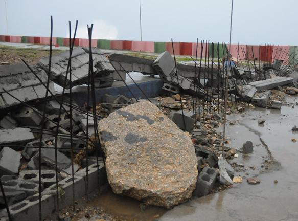
19 The Impacts Hurricane Winds in a wide area of the Northern coast of Cuba and te keys. A wider area in the Northern coast had a storm surge up to meter high, and a wave sutup of 6 to 7 meter high. Accumulated Rainfall totals had values of more tan 700 mm.

20 The Impacts Radar loop: A mosaic of 5 Cuban radars picking up Irma at the same time

21 Cuban Best Track The Impacts
22 IRMA s Total Accummulated Rainfall


23 IRMA s Total Accummulated Rainfall


24 Impacts: Winds


25 Impacts: Winds


26 Impacts: Storm Surge & Wind Setup


27 Impacts: Rainfall Rains were of benefit: Cuba was facing an extreme and long lasting drought. As an example, Zaza Dam, the largest in Cuba, was only at 15 % of its nominal capacity. After Irma it was at 93 %.
28 The Aftermath During the preparation stage, persons were evacuated and protected Only 10 people died in this major hurricane. Material and economic damages were very high, because of the impacts along the Northern coast
29 The Aftermath Electricity generation: Down to zero. Electrity had been almost completedly recovered (99.9 %) by September 29th. Housing: A total of houses were affected: totaly destroyed and with suffered partial damage. In addition, houses suffered total loss of roof, while had partial damage to the roof
30 The Aftermath Communication sector: Main damage in the telephone infrastructure: land lines down and data lines also down Roads: 537 kilometers damaged. Greated impacts in the causeways tp the touristvresorts of Santa Maria and Coco keys. Agriculture: Main effects concentrated in the poultry área, wuth 466 farms destroyed. Around hectares of various crops totally damaged
31 Conclusion Cuba has a well-organized hurricane warning and response program that goes a long way to ensure public safety, as it was shown with Irma s response. The forecast and warning system of the National Forecast Center proved to be good and efficient. Risk Communication also proved, once more, that it is a vital tool in preventing loss of life and providing people with the information they need. The rules of communication must be carefully followed, allowing people to have great confidence in the message, and, therefore, act accordingly.

32 References Rubiera, J., Puig, M., 2012: The Tropical Cyclone Early Warning System of Cuba, Chapter 2 in Institutional Partnership in Multi-Hazard Early Warning Systems: A Compilation of Seven National Good Practices and Guiding Principles ; Editorial Springer, London-New York, 2012; ISBN pp Rubiera, J., 2013: Huracanes, Cambio Climático y Reducción del Riesgo; Temas 2013 (1), 73:39 43; ISSN X. Sierra, M. et al, 2016: Herramientas de detección, reporte y evaluación para salidas de modelos de pronóstico numérico desarrollado en Cuba. Revista Cubana de Meteorología, Vol. 22, No.2, pp , 2016, ISSN: X.
Tropical Revolving Storms: Cuba 2008 By The British Geographer
 Place Context Tropical Revolving Storms: Cuba 2008 By The British Geographer The Republic of Cuba is located in the northern tropics with in island chain of the Caribbean. It is made up of one large Island,
WEDNESDAY 30 TH AUGUST, :57 p.m. Tropical Storm Irma forms in the Atlantic. Don t let your guard down, always #Be Ready.
 Chapter 1 - The Set Up In the days leading up to Irma a series of composed and sobering text messages, presented in truncated form below, from Department of Disaster Management warned us of the pending
EARLY WARNINGS FOR HURRICANES
 1 EARLY WARNINGS FOR HURRICANES Dr. José Rubiera National Forecasting Center Instituto de Meteorología, Cuba Thematic Session Cluster 2 World Conference on Disaster Reduction Kobe, Japan, January 18 22,
2017 Hurricane Season and Beyond
 2017 Hurricane Season and Beyond Ken Graham National Hurricane Center Building a Weather-Ready Nation Much of U.S. Coast Saw Tropical Wind Watches or Warnings 2017 Hurricane Season Facts and Figures 7th
Lessons Learned from Hurricane Harvey and Irma
 EOL Visit to NSF 3 March 2016 Lessons Learned from Hurricane Harvey and Irma Wen-Chau Lee National Center for Atmospheric Research 23 November 2017 Outline: Meteorological elements of the active 2017 Atlantic
and Weather extremes Tropical cyclones Today and in the Future Greg Holland c3we.ucar.edu
 Tropical cyclones and Weather extremes Today and in the Future c3we.ucar.edu Greg Holland (gholland@ucar.edu) Supported by NSF, Willis Re, IAG, and Zurich Insurance 1 Topics State of the Climate and its
RSMC-Miami Update Daniel Brown Warning Coordination Meteorologist
 RSMC-Miami Update 2016 Daniel Brown Warning Coordination Meteorologist L-0324 Emergency Management Hurricane Preparedness Training Course Funding provided by FEMA s National Hurricane Program - partnership
Frank Revitte National Weather Service. Weather Forecast Office New Orleans/Baton Rouge
 Frank Revitte National Weather Service Weather Forecast Office New Orleans/Baton Rouge Above normal activity 17 Total Named Storms 7 Tropical Storms 4 Hurricanes 6 Major Hurricanes Not the most active,
Footprinting Global Tropical Cyclones
 Footprinting Global Tropical Cyclones James Done, Greg Holland and Ming Ge: NCAR, Willis Research Network Ioana Dima-West, Geoffrey Saville and Sam Phibbs: Willis Towers Watson Yuqing Wang: U. Hawaii WRN
GC Briefing. Weather Sentinel Tropical Storm Michael. Status at 8 AM EDT (12 UTC) Today (NHC) Discussion. October 11, 2018
 Today (NHC) Discussion. October 11, 2018") GC Briefing Weather Sentinel Tropical Storm Michael October 11, 2018 After making landfall as a high-end category-4 hurricane on the Florida Panhandle, Michael weakened to tropical storm status early this
GC Briefing Weather Sentinel Tropical Storm Michael October 11, 2018 After making landfall as a high-end category-4 hurricane on the Florida Panhandle, Michael weakened to tropical storm status early this
Weekend Outlook Belize, Central America Valid for: Friday until Monday, May 25-28, 2012
 Weekend Outlook Belize, Central America Valid for: Friday until Monday, May 25-28, 2012 RFrutos Synopsis: Conditions this past week improved by Wednesday as a surface low and trough producing the showery
August Forecast Update for Atlantic Hurricane Activity in 2012
 August Forecast Update for Atlantic Hurricane Activity in 2012 Issued: 6 th August 2012 by Professor Mark Saunders and Dr Adam Lea Dept. of Space and Climate Physics, UCL (University College London), UK
Marshall Alexander Forecaster Commonwealth of Dominica
 Marshall Alexander Forecaster Commonwealth of Dominica Dominica 2015 Impacts Tropical Storm Danny (August 24 th ) Tropical Storm Erika (August 27 th ) Tropical Storm Grace (Remnants) (September 10 th -11
Agricultural Outlook Forum Presented: February 17, 2006 THE SCIENCE BEHIND THE ATLANTIC HURRICANES AND SEASONAL PREDICTIONS
 Agricultural Outlook Forum Presented: February 17, 2006 THE SCIENCE BEHIND THE ATLANTIC HURRICANES AND SEASONAL PREDICTIONS Gerald Bell Meteorologist, National Centers for Environmental Prediction NOAA,
Tropical Cyclone Joaquin (AL112015)
") Tropical Cyclone Joaquin (AL112015) Wind and Storm Surge Event Briefing 9 October 2015 Vito Alessio Robles No.179. Col. Hda Gpe Chimalistac. Del. Álvaro Obregón. Cp 01050, México D.F. Tel: +52 (55) 5616-8161,
Tropical Cyclone Joaquin (AL112015) Wind and Storm Surge Event Briefing 9 October 2015 Vito Alessio Robles No.179. Col. Hda Gpe Chimalistac. Del. Álvaro Obregón. Cp 01050, México D.F. Tel: +52 (55) 5616-8161,
Disaster Risk Management in India. Kamal Kishore New Delhi, 27 October 2016
 Disaster Risk Management in India Kamal Kishore New Delhi, 27 October 2016 Hazard, Exposure and Vulnerability Disaster Prevention Mitigation Hurricane Matthew: Cuba & Haiti Emergency Response Coordination
DIRECTION INTERREGIONALE ANTILLES-GUYANE
 DIRECTION INTERREGIONALE ANTILLES-GUYANE SUMMARY OF THE 2010 HURRICANE SEASON IN THE FRENCH WEST INDIES ( Martinique, Guadeloupe, St Barthelemy and St Martin ) Among the nineteen named tropical cyclones
Covered Area Rainfall Event (29-30 September 2016) Tropical Cyclone Matthew Excess Rainfall
 Tropical Cyclone Matthew Excess Rainfall") Covered Area Rainfall Event (29-30 September 2016) Tropical Cyclone Matthew Excess Rainfall Event Briefing Dominica 11 October 2016 Registered Office: c/o Sagicor Insurance Managers Ltd., 103 South Church
Covered Area Rainfall Event (29-30 September 2016) Tropical Cyclone Matthew Excess Rainfall Event Briefing Dominica 11 October 2016 Registered Office: c/o Sagicor Insurance Managers Ltd., 103 South Church
April Forecast Update for North Atlantic Hurricane Activity in 2019
 April Forecast Update for North Atlantic Hurricane Activity in 2019 Issued: 5 th April 2019 by Professor Mark Saunders and Dr Adam Lea Dept. of Space and Climate Physics, UCL (University College London),
August Forecast Update for Atlantic Hurricane Activity in 2015
 August Forecast Update for Atlantic Hurricane Activity in 2015 Issued: 5 th August 2015 by Professor Mark Saunders and Dr Adam Lea Dept. of Space and Climate Physics, UCL (University College London), UK
The Impact of 2007 Atlantic Hurricane Season on Dominica
 The Impact of 2007 Atlantic Hurricane Season on Dominica DOMINICA November 2007 Main Activities Freak Twister on June 21st 2007. Hurricane Dean on August 16th to 17th 2007 Active Tropical Wave on September
LECTURE #18: Hurricane Damage, Monitoring & Case Study
 GEOL 0820 Ramsey Natural Disasters Spring, 2018 LECTURE #18: Hurricane Damage, Monitoring & Case Study Date: 27 March 2018 I. Exam II grades now posted online o high: 98, low: 46, average: 80 (~3 points
Careful, Cyclones Can Blow You Away!
 Title: Careful, Cyclones Can Blow You Away! (Meteorology) Grade(s): 6-8 Introduction: Most people associate twisters with tornadoes, but in fact tropical twisters come from hurricanes. Hurricanes are what
CLIMATE CHANGE ADAPTATION BY MEANS OF PUBLIC PRIVATE PARTNERSHIP TO ESTABLISH EARLY WARNING SYSTEM
 CLIMATE CHANGE ADAPTATION BY MEANS OF PUBLIC PRIVATE PARTNERSHIP TO ESTABLISH EARLY WARNING SYSTEM By: Dr Mamadou Lamine BAH, National Director Direction Nationale de la Meteorologie (DNM), Guinea President,
Hurricanes. Environmental Geology Mr. Paul Lowrey. Stacey Singleton, Cassandra Combs, Dwight Stephenson, Matt Smithyman
 Environmental Geology Mr. Paul Lowrey Stacey Singleton, Cassandra Combs, Dwight Stephenson, Matt Smithyman Hurricanes EMPACTS Project, Spring 2017 Northwest Arkansas Community College, Bentonville, AR
Hurricanes 1. Thunderclouds. cool, dry air falls. warm, moist air rises
 Hurricanes 1 Hurricanes are gigantic tropical storms that can be hundreds of kilometres wide. They bring along very strong winds and a lot of rainfall. They often cause flooding near the coasts and sea
April Forecast Update for Atlantic Hurricane Activity in 2018
 April Forecast Update for Atlantic Hurricane Activity in 2018 Issued: 5 th April 2018 by Professor Mark Saunders and Dr Adam Lea Dept. of Space and Climate Physics, UCL (University College London), UK
Tropical Update. 5 PM EDT Tuesday, September 5, 2017 Hurricane Irma, Tropical Storm Jose, and Tropical Depression Thirteen
 Tropical Update 5 PM EDT Tuesday, September 5, 2017 Hurricane Irma, Tropical Storm Jose, and Tropical Depression Thirteen This update is intended for government and emergency response officials, and is
April Forecast Update for Atlantic Hurricane Activity in 2016
 April Forecast Update for Atlantic Hurricane Activity in 2016 Issued: 5 th April 2016 by Professor Mark Saunders and Dr Adam Lea Dept. of Space and Climate Physics, UCL (University College London), UK
Storm Surge Forecast with Shifting Forecast Tracks
 Storm Surge Forecast with Shifting Forecast Tracks Storm Surge Findings in the Florida Keys Jon Rizzo Warning Coordination Meteorologist National Weather Service Florida Keys Florida Keys Life History
Your web browser (Safari 7) is out of date. For more security, comfort and the best experience on this site: Update your browser Ignore
 is out of date. For more security, comfort and the best experience on this site: Update your browser Ignore") Your web browser (Safari 7) is out of date. For more security, comfort and the best experience on this site: Update your browser Ignore Educator Version 2005 HU RRICANE SEASO N Map traces a stormy season
Your web browser (Safari 7) is out of date. For more security, comfort and the best experience on this site: Update your browser Ignore Educator Version 2005 HU RRICANE SEASO N Map traces a stormy season
Lab 20. Predicting Hurricane Strength: How Can Someone Predict Changes in Hurricane Wind Speed Over Time?
 Predicting Hurricane Strength How Can Someone Predict Changes in Hurricane Wind Speed Over Time? Lab Handout Lab 20. Predicting Hurricane Strength: How Can Someone Predict Changes in Hurricane Wind Speed
Are You Ready For Hurricane Season? 2018 Hurricane Talk B Y : S T O R M T E A M 8 M E T E O R O L O G I S T J U L I E P H I L L I P S
 Are You Ready For Hurricane Season? 2018 Hurricane Talk B Y : S T O R M T E A M 8 M E T E O R O L O G I S T J U L I E P H I L L I P S About Me I am Currently a Weekday Meteorologist at WFLA Channel 8.
ARUBA CLIMATOLOGICAL SUMMARY 2017 PRECIPITATION
 ARUBA CLIMATOLOGICAL SUMMARY 2017 PRECIPITATION The total amount of rainfall recorded at Reina Beatrix International Airport for the year 2017 was 391.0 mm. This is 17.1 % below normal ( Figure 1 ). During
Hurricane Katrina Tracking Lab
 Hurricane Katrina Tracking Lab Introduction: The 2005 hurricane season was the most active season on record resulting in 28 named storms. Hurricane Katrina was the eleventh named storm and would end up
August Forecast Update for Atlantic Hurricane Activity in 2016
 August Forecast Update for Atlantic Hurricane Activity in 2016 Issued: 5 th August 2016 by Professor Mark Saunders and Dr Adam Lea Dept. of Space and Climate Physics, UCL (University College London), UK
Hurricane Harvey the Name says it all. by Richard H. Grumm and Charles Ross National Weather Service office State College, PA
 Hurricane Harvey the Name says it all by Richard H. Grumm and Charles Ross National Weather Service office State College, PA 16803. 1. Overview Hurricane Harvey crossed the Texas coast (Fig. 1) as a category
Canadian Hurricane Center: How NHC Products are used to issue Warnings and Communicate Hazards
 Canadian Hurricane Center: How NHC Products are used to issue Warnings and Communicate Hazards Bob Robichaud Warning Preparedness Meteorologist Canadian Hurricane Centre Contents Brief background on the
Hurricanes and Their Tracks
 LESSON PLAN 1 Hurricanes 3 5 Hurricanes and Their Tracks Children will know better what to expect of an approaching hurricane if they understand what a hurricane is and the weather associated with it.
Ocean in Motion 7: El Nino and Hurricanes!
 Ocean in Motion 7: El Nino and Hurricanes! A. Overview 1. Ocean in Motion -- El Nino and hurricanes We will look at the ocean-atmosphere interactions that cause El Nino and hurricanes. Using vocabulary
Chapter 16, Part Hurricane Paths. 2. Hurricane Paths. Hurricane Paths and Damage
 Chapter 16, Part 2 Hurricane Paths and Damage 1. Hurricane Paths Start over tropical water except South Atlantic and eastern South Atlantic, where water is too cold. Initially steered by easterly winds
SIXTH INTERNATIONAL WORKSHOP on TROPICAL CYCLONES. Working Group: Phillipe Caroff, Jeff Callaghan, James Franklin, Mark DeMaria
 WMO/CAS/WWW Topic 0.1: Track forecasts SIXTH INTERNATIONAL WORKSHOP on TROPICAL CYCLONES Rapporteur: E-mail: Lixion A. Avila NOAA/National Hurricane Center 11691 SW 17th Street Miami, FL 33165-2149, USA
At the Midpoint of the 2008
 At the Midpoint of the 2008 Atlantic Hurricane Season Editor s note: It has been an anxious couple of weeks for those with financial interests in either on- or offshore assets in the Gulf of Mexico and
Homework 9: Hurricane Forecasts (adapted from Pipkin et al.)
") November 2010 MAR 110 HW9 Hurricane Forecasts 1 Homework 9: Hurricane Forecasts (adapted from Pipkin et al.) Movement of Hurricanes The advance of a tropical storm or hurricane is controlled by the prevailing
November 2010 MAR 110 HW9 Hurricane Forecasts 1 Homework 9: Hurricane Forecasts (adapted from Pipkin et al.) Movement of Hurricanes The advance of a tropical storm or hurricane is controlled by the prevailing
National Situation Report As of 3:00 a.m. EDT, Thursday, September 21, 2017 Table of Contents Current Operations Monitoring Recovery
 25k Overview National Situation Report As of 3:00 a.m. EDT, Thursday, September 21, 2017 Table of Contents Current Operations Monitoring Recovery FEMA Headquarters Status FEMA Region Status NRCC Level
HURRICANE IRMA. 12 PM ET Saturday, September Prepared by: Kyle Thiem / Sid King.
 HURRICANE IRMA 12 PM ET Saturday, September 9 2017 Prepared by: Kyle Thiem / Sid King www.weather.gov/atlanta/briefings @NWSAtlanta www.weather.gov/atlanta Situation Overview 11:00 AM EDT Sat Sep 9 Location:
Lecture #18 (April 12, 2010, Monday) Tropical Storms & Hurricanes Part 3. Hurricane Floyd September 15, 1999
 Tropical Storms & Hurricanes Part 3. Hurricane Floyd September 15, 1999") Lecture #18 (April 12, 2010, Monday) Tropical Storms & Hurricanes Part 3 Hurricane Floyd September 15, 1999 Tropical Cyclone Names Names are given to distinguish storms and for ease of communication. Names
Lecture #18 (April 12, 2010, Monday) Tropical Storms & Hurricanes Part 3 Hurricane Floyd September 15, 1999 Tropical Cyclone Names Names are given to distinguish storms and for ease of communication. Names
Colorado State University (CSU) Atlantic Hurricane Season Forecast
 Atlantic Hurricane Season Forecast") Colorado State University (CSU) Atlantic Hurricane Season Forecast Dr. Philip Klotzbach of Colorado State University (CSU) has issued his latest forecast for the Atlantic Hurricane Season. The forecast
Colorado State University (CSU) Atlantic Hurricane Season Forecast Dr. Philip Klotzbach of Colorado State University (CSU) has issued his latest forecast for the Atlantic Hurricane Season. The forecast
A Hurricane Outlook for the 21st Century.
 A Hurricane Outlook for the 21st Century. Hugh Willoughby Florida International University Cat Winds Effects One 74-95 mph No real damage to building structures. Two Three Four Five 96-110 mph 111-130
Tropical Update. 5 AM EDT Thursday, September 7, 2017 Hurricane Irma, Hurricane Jose, and Hurricane Katia
 Tropical Update 5 AM EDT Thursday, September 7, 2017 Hurricane Irma, Hurricane Jose, and Hurricane Katia This update is intended for government and emergency response officials, and is provided for informational
Impact of Tropical Cyclones - Malaysia's Experience
 Impact of Tropical Cyclones - Malaysia's Experience ALUI BAHARI MALAYSIAN METEOROLOGICAL DEPARTMENT MINISTRY OF SCIENCE, TECHNOLOGY AND INNOVATION SCOPE Introduction Case Studies of Tropical Cyclones Impacting
Tropical Update. 5 PM EDT Thursday, September 7, 2017 Hurricane Irma, Hurricane Jose, and Hurricane Katia
 Tropical Update 5 PM EDT Thursday, September 7, 2017 Hurricane Irma, Hurricane Jose, and Hurricane Katia This update is intended for government and emergency response officials, and is provided for informational
HURRICANE NATE BRIEFING
 HURRICANE NATE BRIEFING 2:00 PM CDT Saturday, October 07, 2017 Prepared by: NWS NWSNewOrleans www.weather.gov/neworleans Situation Overview continues to intensify. It is now forecast to be a category 2
Colorado State University (CSU) Atlantic Hurricane Season Forecast
 Atlantic Hurricane Season Forecast") Colorado State University (CSU) Atlantic Hurricane Season Forecast Dr. Philip Klotzbach of Colorado State University (CSU) has issued his April forecast for the 2018 Atlantic Hurricane Season. The forecast
Colorado State University (CSU) Atlantic Hurricane Season Forecast Dr. Philip Klotzbach of Colorado State University (CSU) has issued his April forecast for the 2018 Atlantic Hurricane Season. The forecast
July Forecast Update for North Atlantic Hurricane Activity in 2018
 July Forecast Update for North Atlantic Hurricane Activity in 2018 Issued: 5 th July 2018 by Professor Mark Saunders and Dr Adam Lea Dept. of Space and Climate Physics, UCL (University College London),
Preliminary Assessment of 2017 Atlantic Hurricane Season. Phil Klotzbach. Department of Atmospheric Science. Phil Klotzbach
 Atlantic Basin Basin Tropical Seasonal Cyclone Hurricane Climatology Prediction and Preliminary Assessment of 2017 Atlantic Hurricane Season Phil Klotzbach Department of Atmospheric Science Colorado Phil
Pre-Season Forecast for North Atlantic Hurricane Activity in 2018
 Pre-Season Forecast for North Atlantic Hurricane Activity in 2018 Issued: 30 th May 2018 by Professor Mark Saunders and Dr Adam Lea Dept. of Space and Climate Physics, UCL (University College London),
EFFECTIVE TROPICAL CYCLONE WARNING IN BANGLADESH
 Country Report of Bangladesh On EFFECTIVE TROPICAL CYCLONE WARNING IN BANGLADESH Presented At JMA/WMO WORKSHOP ON EFFECTIVE TROPICAL CYCLONE WARNING IN SOUTHEAST ASIA Tokyo, Japan,11-14 March 2014 By Sayeed
WEATHER SYSTEMS IMPACTING THE CAYMAN ISLANDS Prepared by the staff of the Cayman Islands National Weather Service
 WEATHER SYSTEMS IMPACTING THE CAYMAN ISLANDS 2008 Prepared by the staff of the Cayman Islands National Weather Service TROPICAL STORM DOLLY Formed 194 miles west of Grand Cayman July 19 th. The tropical
Tropical Update. 5 PM EDT Sunday, September 10, 2017 Hurricane Irma, Hurricane Jose, Tropical Wave (60%)
") Tropical Update 5 PM EDT Sunday, September 10, 2017 Hurricane Irma, Hurricane Jose, Tropical Wave (60%) This update is intended for government and emergency response officials, and is provided for informational
Tropical Update 5 PM EDT Sunday, September 10, 2017 Hurricane Irma, Hurricane Jose, Tropical Wave (60%) This update is intended for government and emergency response officials, and is provided for informational
Tropical Cyclone EARL (AL052016)
") Tropical Cyclone EARL (AL052016) Wind and Storm Surge Event Briefing 5 August 2016 Registered Office: c/o Sagicor Insurance Managers Ltd., 103 South Church Street 1st Floor Harbour Place, P.O. Box 1087,
Tropical Cyclone EARL (AL052016) Wind and Storm Surge Event Briefing 5 August 2016 Registered Office: c/o Sagicor Insurance Managers Ltd., 103 South Church Street 1st Floor Harbour Place, P.O. Box 1087,
Inner core dynamics: Eyewall Replacement and hot towers
 Inner core dynamics: Eyewall Replacement and hot towers FIU Undergraduate Hurricane Internship Lecture 4 8/13/2012 Why inner core dynamics is important? Current TC intensity and structure forecasts contain
Major Hurricane Matthew Briefing Situation Overview
 Major Hurricane Matthew Briefing Situation Overview THIS IS NOW A WORST CASE STORM SURGE SCENARIO Catastrophic Damage is Anticipated for Coastal Areas. Major Hurricane Matthew is still expected to move
HURRICANES AND TORNADOES
 HURRICANES AND TORNADOES The most severe weather systems are hurricanes and tornadoes. They occur in extremely low pressure systems, or cyclones, when the air spirals rapidly into the center of a low.
2004 Hurricane Season: Climate Overview and Lessons Learned
 2004 Hurricane Season: Climate Overview and Lessons Learned Mark Saunders, PhD (Presenter: Milan Simic,, PhD, Benfield) Lead Scientist, Tropical Storm Risk Benfield Hazard Research Centre University College
Tropical Update. 5 AM EDT Wednesday, September 6, 2017 Hurricane Irma, Tropical Storm Jose, and Tropical Storm Katia
 Tropical Update 5 AM EDT Wednesday, September 6, 2017 Hurricane Irma, Tropical Storm Jose, and Tropical Storm Katia This update is intended for government and emergency response officials, and is provided
Weather Outlook for Spring and Summer in Central TX. Aaron Treadway Meteorologist National Weather Service Austin/San Antonio
 Weather Outlook for Spring and Summer in Central TX Aaron Treadway Meteorologist National Weather Service Austin/San Antonio Outline A Look Back At 2014 Spring 2015 So Far El Niño Update Climate Prediction
Chapter 1 Study Guide
 Chapter 1 Study Guide Reminders: Vocabulary quiz and test will be on Tuesday, September 6th. Complete study guide and bring completed to school Friday, September 2nd. You are NOT required to print the
Weather forecasts and warnings: Support for Impact based decision making
 Weather forecasts and warnings: Support for Impact based decision making Gerry Murphy, Met Éireann www.met.ie An Era of Change Climate and weather is changing Societal vulnerability is increasing The nature
ARUBA CLIMATOLOGICAL SUMMARY 2014 PRECIPITATION
 ARUBA CLIMATOLOGICAL SUMMARY 2014 PRECIPITATION The total amount of rainfall recorded at Reina Beatrix International Airport for the year 2014 was 309.2 mm. This is 34.4 % below normal ( Figure 1 ). During
11/17/2017. Memorable Hurricanes of 2004 MET 4532
 MET 4532 2004 Hurricane Season Lecture 31 & 32 2004, 2005, and After 17-20 November 2017 1 2 Memorable Hurricanes of 2004 Hurricane Dates Damage (US) Deaths (US) Charlie (4) 9-14 AUG $14B 10 Ivan (4) 2-24
Tropical Update. 5 AM EDT Tuesday, September 12, 2017 Post-Tropical Cyclone Irma, Hurricane Jose, & Tropical Wave (10%)
") Tropical Update 5 AM EDT Tuesday, September 12, 2017 Post-Tropical Cyclone Irma, Hurricane Jose, & Tropical Wave (10%) This update is intended for government and emergency response officials, and is provided
Tropical Update 5 AM EDT Tuesday, September 12, 2017 Post-Tropical Cyclone Irma, Hurricane Jose, & Tropical Wave (10%) This update is intended for government and emergency response officials, and is provided
July Forecast Update for Atlantic Hurricane Activity in 2016
 July Forecast Update for Atlantic Hurricane Activity in 2016 Issued: 5 th July 2016 by Professor Mark Saunders and Dr Adam Lea Dept. of Space and Climate Physics, UCL (University College London), UK Forecast
Tropical Cyclone Harvey (AL092017)
") Tropical Cyclone Harvey (AL092017) Wind and Storm Surge Preliminary Event Briefing Windward Islands 20 August 2017 Registered Office: CCRIF SPC c/o Sagicor Insurance Managers Limited, 198 North Church
Tropical Cyclone Harvey (AL092017) Wind and Storm Surge Preliminary Event Briefing Windward Islands 20 August 2017 Registered Office: CCRIF SPC c/o Sagicor Insurance Managers Limited, 198 North Church
Hurricanes. Cause: a low pressure storm system over warm ocean water. Effect: potential massive widespread destruction and flooding.
 Hurricanes Hurricanes Cause: a low pressure storm system over warm ocean water. Effect: potential massive widespread destruction and flooding. Hurricanes also known as: cyclone (Indian Ocean) or typhoon
Hurricane Science Tutorial. Kerry Emanuel Lorenz Center, MIT
 Hurricane Science Tutorial Kerry Emanuel Lorenz Center, MIT Why Should You Care? Forecasting Much progress in social science of response to warnings, requests to evacuate, etc. Forecasters are ambassadors
Tropical Storm Harvey: SE Texas Impacts
 Tropical Storm Harvey: SE Texas Impacts 10 AM CDT UPDATE Thursday, August 24, 2017 Prepared by: Dan Reilly, Brian Kyle PLEASE MUTE YOUR LINES AND DON T PUT ON HOLD! Situation Overview Tropical Storm Harvey
(April 7, 2010, Wednesday) Tropical Storms & Hurricanes Part 2
 Tropical Storms & Hurricanes Part 2") Lecture #17 (April 7, 2010, Wednesday) Tropical Storms & Hurricanes Part 2 Hurricane Katrina August 2005 All tropical cyclone tracks (1945-2006). Hurricane Formation While moving westward, tropical disturbances
Lecture #17 (April 7, 2010, Wednesday) Tropical Storms & Hurricanes Part 2 Hurricane Katrina August 2005 All tropical cyclone tracks (1945-2006). Hurricane Formation While moving westward, tropical disturbances
A global slowdown of tropical-cyclone translation speed and implications for flooding
 A global slowdown of tropical-cyclone translation speed and implications for flooding Thomas Mortlock, Risk Frontiers As the Earth s atmosphere warms, the atmospheric circulation changes. These changes
CURRENT AND FUTURE TROPICAL CYCLONE RISK IN THE SOUTH PACIFIC
 CURRENT AND FUTURE TROPICAL CYCLONE RISK IN THE SOUTH PACIFIC COUNTRY RISK PROFILE: SAMOA JUNE 2013 Samoa has been affected by devastating cyclones on multiple occasions, e.g. tropical cyclones Ofa and
Hurricanes in the Gulf of Mexico: The History and Future of the Texas Coast
 # 82 Hurricanes in the Gulf of Mexico: The History and Future of the Texas Coast Dr. Kerry Emanuel January 8, 2013 Produced by and for Hot Science - Cool Talks by the Environmental Science Institute. We
TROPICAL DEPRESSION HARVEY BRIEFING
 TROPICAL DEPRESSION HARVEY BRIEFING 10:15 PM CDT Wednesday, August 23, 2017 Prepared by: Lara Beal NWSCorpus www.weather.gov/corpuschristi Situation Overview No changes to Watches. Hurricane Watch remains
Understanding Weather and Climate Risk. Matthew Perry Sharing an Uncertain World Conference The Geological Society, 13 July 2017
 Understanding Weather and Climate Risk Matthew Perry Sharing an Uncertain World Conference The Geological Society, 13 July 2017 What is risk in a weather and climate context? Hazard: something with the
Hurricanes. Hurricanes are large, tropical storm systems that form and develop over the warm waters near the equator.
 Hurricanes Hurricanes are large, tropical storm systems that form and develop over the warm waters near the equator. They are responsible for weather that can devastate entire communities: Heavy rain --
STORM HISTORY FOR COLLIER COUNTY
 STORM HISTORY FOR COLLIER COUNTY In 1960, when hurricane 'Donna' struck, there were approximately 15,500 people living full time in Collier County. Today there are more than 330,000 residents, most of
Recent development of the National Hydro-Meteorological Service (NHMS) of Viet Nam for disaster risk reduction
 of Viet Nam for disaster risk reduction") Ministry of Natural Resources and Environment National Hydro-Meteorological Service Recent development of the National Hydro-Meteorological Service (NHMS) of Viet Nam for disaster risk reduction Tran Van
Ministry of Natural Resources and Environment National Hydro-Meteorological Service Recent development of the National Hydro-Meteorological Service (NHMS) of Viet Nam for disaster risk reduction Tran Van
Caribbean Early Warning System Workshop
 Caribbean Early Warning System Workshop Hamonization in Existing EWS April 14-16, 2016 Presenter: Shawn Boyce Caribbean Institute for Meteorology and Hydrology Husbands, St. James Barbados Background Between
Hurricane Recipe. Hurricanes
 Hurricanes A hurricane is a powerful, rotating storm that forms over warm oceans near the Equator. Hurricanes have strong, rotating winds (at least 74 miles per hour), a huge amount of rain, low air pressure,
Untitled.notebook May 12, Thunderstorms. Moisture is needed to form clouds and precipitation the lifting of air, or uplift, must be very strong
 Thunderstorms Moisture is needed to form clouds and precipitation the lifting of air, or uplift, must be very strong cold air and warm air must mix; creating an active circulation system that has both
Use of Geospatial data for disaster managements
 Use of Geospatial data for disaster managements Source: http://alertsystemsgroup.com Instructor : Professor Dr. Yuji Murayama Teaching Assistant : Manjula Ranagalage What is GIS? A powerful set of tools
Ch. 3: Weather Patterns
 Ch. 3: Weather Patterns Sect. 1: Air Mass & Fronts Sect. 2: Storms Sect. 3: Predicting the Weather Sect. 4: Weather forecasters use advanced technologies Ch. 3 Weather Fronts and Storms Objective(s) 7.E.1.3
Remote sensing and GIS for multi-hazard risk assessments in the coastal zone: recent applications and challenges in the Pacific Jens Kruger
 Remote sensing and GIS for multi-hazard risk assessments in the coastal zone: recent applications and challenges in the Pacific Jens Kruger Geoscience Division Pacific Community (SPC) The First Pacific
Tropical Cyclone Hazards. Presentation
 Tropical Cyclone Hazards Presentation Kerry N Mallory AE5JY September 7, 2011 Tropical Cyclone Hazards The Four Primary Weapons of a Tropical Cyclone are: 1. Wind 2. Storm Surge 3. Rain/Freshwater Flooding
Tuesday, September 13, 16
 Weather Weather State Objectives 4.c, 4.d, 4.h. Discussion What are some ways in which weather affects your everyday life? Discussion What are some ways in which weather affects your everyday life? What
Natural Disasters. in Florida. Severe Thunderstorms
 Natural Disasters in Florida SC.6.E.7.7 Investigate how natural disasters have affected human life in Florida. Severe Thunderstorms While the typical afternoon thunderstorm in Florida may not appear to
WMO Public Weather Services: Enhanced Communication Skills for Improved Service Delivery. by S.W. Muchemi (WMO)
") WMO Public Weather Services: Enhanced Communication Skills for Improved Service Delivery by S.W. Muchemi (WMO) Functions of the Public Weather Services (PWS) programme of WMO To strengthen the capabilities
WMO Public Weather Services: Enhanced Communication Skills for Improved Service Delivery by S.W. Muchemi (WMO) Functions of the Public Weather Services (PWS) programme of WMO To strengthen the capabilities
Societal impacts of inland moving tropical cyclones across the southeastern U.S
 Societal impacts of inland moving tropical cyclones across the southeastern U.S Maggie M. Kovach, Gretchen Carlson, Charles E. Konrad II NOAA Southeast Regional Climate Center Department of Geography University
NW Pacific and Japan Landfalling Typhoons in 2000
 NW Pacific and Japan Landfalling Typhoons in 2000 Pre-Season Forecast Issued 26th May, 2000 Produced under contract for TSUNAMI in collaboration with the UK Met. Office by Drs Paul Rockett, Mark Saunders
The National Hurricane Center
 The National Hurricane Center Where we are and where we hope to go Bill Read, Director National Hurricane Center U.S. HURRICANE FORECAST SERVICE HISTORY MODERN ERA HIGHLIGHTS 1935: Began 24 hour forecast
Hurricane Basics and Preparedness. Jim Weyman Director, Central Pacific Hurricane Center Phone Office:
 Hurricane Basics and Preparedness Jim Weyman Director, Central Pacific Hurricane Center Phone Office: 973-5270 james.weyman@noaa.gov United States Hurricane/Typhoon Centers National Hurricane Center, Miami