Use of GlobWave data by the Royal Australian Navy
|
|
|
- Mark Stokes
- 5 years ago
- Views:
Transcription
1 Use of GlobWave data by the Royal Australian Navy Martin Rutherford Director Maritime Military Geospatial Information Hydrography and METOC Branch Royal Australian Navy 07 November 2012


2 Outline Anti Piracy Near-real time Web Services Wave Model Validation Investigating Maritime Incidents Climatology Ship Routing Cross-Seas


3 Anti-Piracy GlobWave data used to find the significant wave height at the time of each reported piracy attack Initial study in 2010 looked at Study repeated using GlobWave GDR in 2011 Recent study by NZ looked at Over 440 match-ups used for analysis

4 Analysis of Previous Pirate Events

5 Analysis of Previous Pirate Events

6 Analysis of Previous Pirate Events

7 Analysis of Previous Pirate Events

8 Analysis of Previous Pirate Events

9 CTF150 Support
10 Near-Real time Web Services Prototype Service only Planned for operational release when CryoSat-2 near real-time becomes available. ftp pull from GlobWave, then loaded into ESRI ArcGIS Server Published as a WMS Plan to make a rolling past 24 hours data available

11 Near-Real time Web Services
12 Wave Model Verification Wave models do not assimilate altimeter observations. Important tool for gaining confidence in the wave forecast for wave dependant maritime activities

13 Wave Model Verification

14 Wave Model Verification

15 Wave Model Verification

16 Wave Model Validation 2 1 3
17 Investigating Maritime Incidents On 15 December 2010 a boat (later designated SIEV- 221) floundered in heavy seas and was washed onto rocks at Christmas Island resulting in the loss of 48 lives. A further 42 people were saved. The RAN was central to the rescue attempts and subsequent inquiries. On such a small and isolated island in the Indian Ocean, very few in-situ wind and wave observations were available and satellite remotely sensed observations were relied upon.

18 Investigating Maritime Incidents
19 Investigating Maritime Incidents

20 Investigating Maritime Incidents
21 Investigating Maritime Incidents

22 Investigating Maritime Incidents


23 Climatology Two climatologies created from Altimeter data Mean SWH Max SWH Swell climatologies currently under consideration, but insufficient data to be statistically significant until ERS- 1 and ERS-2 data are released. Additional QC performed as the GlobWave QC and flags have allowed some unrealistic values to be included with flags suggesting the data is good. No optimal interpolation used, just simple binning of the data.
24 Climatology

25 Climatology


26 Climatology Sig. Wave Height
27 Climatology Sig. Wave Height Histograms
28 Climatology Sig. Wave Height Histograms
29 Ship Routing Case Study The Royal Australian Navy recently took delivery of the hull of a new ship, which was transported on a heavy lift carrier from Northern Spain. When considering the timing and route to be taken, GlobWave date was used. Instead of the simplistic mean and maximum climatologies an interactive site was used to allow planners to explore different routes. The data was published using ArcGIS Online and simply clicking anywhere on the screen displayed the statistics and a histogram of observations.
 Click on GlobWave Climatology under the Contents The mean and max are rasters only.")
30 Ship Routing Case Study Two months of the data is still in the public domain at: To use: Click on Show Contents (top left, second button) Click on GlobWave Climatology under the Contents The mean and max are rasters only./ Click on the Sea State data Now click anywhere on the map and the statistics and a histogram will be displayed Route planners used the tool to determine the optimum time to sail; before the early autumn storms, through the Atlantic and across the southern Indian Ocean after winter storms and before cyclone season.
31 Cross Seas A detailed study of the sea state to the NW of Australia was initiated after Navy patrol vessels reported worse conditions than expected and resulted in slight damage and fatigue to some platforms. Preliminary analysis suggests that the area is frequently subject to cross seas, either due to the wind driven seas being in a different direction to the swell, or two significant swell having different directions and, on occasions both occurring. This led to a broader study of where sea and swell (Type 1), two swells (Type 2) and combined (Type 3) cross seas exist.

32 Cross Seas

33 Cross Seas

34 Cross Seas

35 Cross Seas

36 Summary The Royal Australian Navy has derived significant benefit from GlobWave across a range of activities from planning and supporting operations and verifying wave models to understanding the maritime environment and its impacts. The Globwave data is easy to access and use, relatively error free (data that slips through the QC is easy to trap and clean).

 for deriving wave")
37 A Wish List Publish ERS1 and ERS2 SAR data Publish Cryosat-2 in NRT mode Apply more rigorous QC and fill in missing additional fields Publish algorithm(s) for deriving wave period from backscatter
38 Questions and comments to: Martin Rutherford
Project GlobWave. User Meeting 5 th -6 th October, Geoff Busswell, GlobWave Project Manager
 Project GlobWave User Meeting 5 th -6 th October, 2011 Geoff Busswell, GlobWave Project Manager www.globwave.info Partners ESA: Funding the project through its Data User Element Programme CNES: Providing
HR-DDS and Pilot Wave Forecast Verification Scheme Extension. Interactive on-demand analysis David Poulter, National Oceanography Centre
 HR-DDS and Pilot Wave Forecast Verification Scheme Extension Interactive on-demand analysis David Poulter, National Oceanography Centre GlobWave 2010. All rights reserved The Globwave HR-DDS The GlobWave
The impact of the assimilation of altimeters and ASAR L2 wave data in the wave model MFWAM
 The impact of the assimilation of altimeters and ASAR L2 wave data in the wave model MFWAM Lotfi Aouf 1, Jean-Michel Lefèvre 1 1) Météo-France, Toulouse 12 th Wave Hindcasting and Forecasting, Big Island
The Information System in ECDIS
 The Information System in ECDIS Bjørn Åge Hjøllo Product Manager Weather/Routing/Piracy Jeppesen, Norway Nordic Institute of Navigation (NNF); Seminar on enavigation Bergen, May 2011 19 May 2011-1 - enavigation
CHAPTER 27 AN EVALUATION OF TWO WAVE FORECAST MODELS FOR THE SOUTH AFRICAN REGION. by M. Rossouw 1, D. Phelp 1
 CHAPTER 27 AN EVALUATION OF TWO WAVE FORECAST MODELS FOR THE SOUTH AFRICAN REGION by M. Rossouw 1, D. Phelp 1 ABSTRACT The forecasting of wave conditions in the oceans off Southern Africa is important
On the impact of the assimilation of ASAR wave spectra in the wave model MFWAM
 On the impact of the assimilation of ASAR wave spectra in the wave model MFWAM Lotfi Aouf, Jean-Michel Lefèvre Météo-France, Toulouse SEASAR 2012, 4 th International workshop on Advances in SAR oceanography,
Use and Feedback on GlobWave Data and Services Perspective of basic studies
 Use and Feedback on GlobWave Data and Services Perspective of basic studies Sergei I. Badulin P.P. Shirshov Institute of Oceanology of Russian Academy of Science http://www.ocean.ru/eng/ bookmark us P.P.SHIRSHOV
The impact of combined assimilation of altimeters data and wave spectra from S-1A and 1B in the operational model MFWAM
 The impact of combined assimilation of altimeters data and wave spectra from S-1A and 1B in the operational model MFWAM Lotfi Aouf and Alice Dalphinet Météo-France, Département Marine et Oceanographie
CopernicusEU. the EU's Earth Observation Programme. Sara Zennaro Atre Delegation of the European Union to Japan
 Copernicus the EU's Earth Observation Programme Sara Zennaro Atre Delegation of the European Union to Japan Status Overview, Sept 2016 & Ocean Policies Seminar 4 October 2016 ollow us on: Copernicus EU
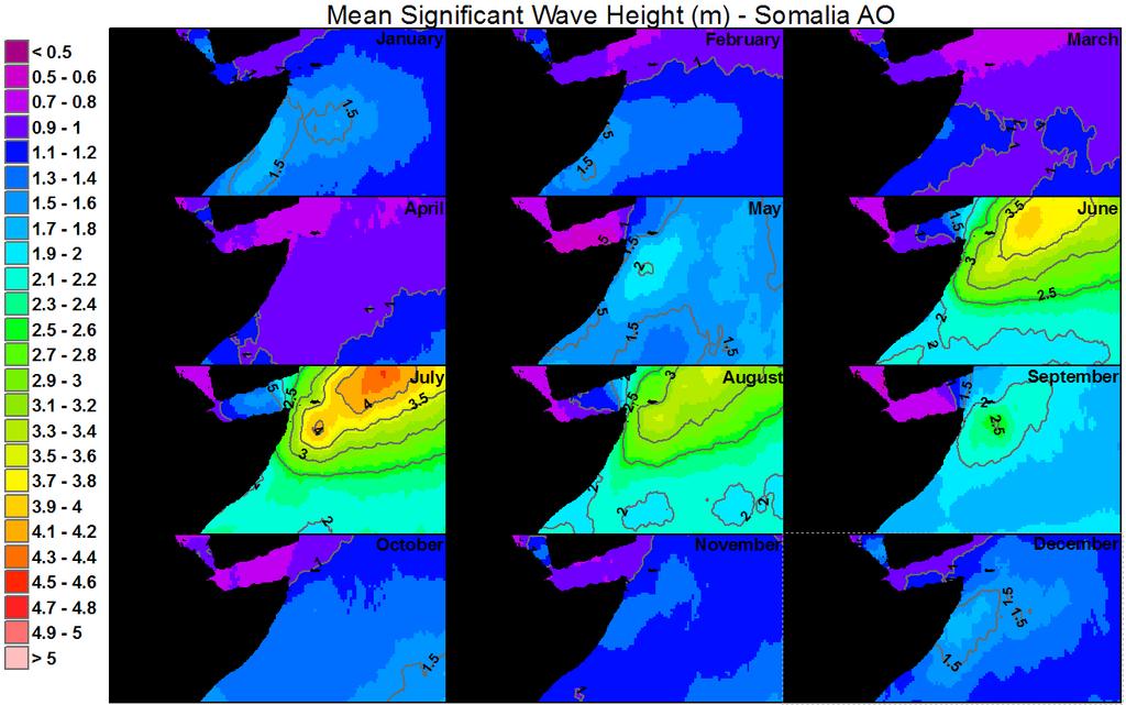
An Integrated Network of In situ and Remote Sensors to Characterize the Somali Current
 DISTRIBUTION STATEMENT A. Approved for public release; distribution is unlimited. An Integrated Network of In situ and Remote Sensors to Characterize the Somali Current Eric J. Terrill, Ph.D. Director,
Global Distribution and Associated Synoptic Climatology of Very Extreme Sea States (VESS)
") Global Distribution and Associated Synoptic Climatology of Very Extreme Sea States (VESS) Vincent J. Cardone, Andrew T. Cox, Michael A. Morrone Oceanweather, Inc., Cos Cob, Connecticut Val R. Swail Environment
Global Distribution and Associated Synoptic Climatology of Very Extreme Sea States (VESS) Vincent J. Cardone, Andrew T. Cox, Michael A. Morrone Oceanweather, Inc., Cos Cob, Connecticut Val R. Swail Environment
How DBCP Data Contributes to Ocean Forecasting at the UK Met Office
 How DBCP Data Contributes to Ocean Forecasting at the UK Met Office Ed Blockley DBCP XXVI Science & Technical Workshop, 27 th September 2010 Contents This presentation covers the following areas Introduction
Gridded Ambient Air Pollutant Concentrations for Southern California, User Notes authored by Beau MacDonald, 11/28/2017
 Gridded Ambient Air Pollutant Concentrations for Southern California, 1995-2014 User Notes authored by Beau, 11/28/2017 METADATA: Each raster file contains data for one pollutant (NO2, O3, PM2.5, and PM10)
Model and observation bias correction in altimeter ocean data assimilation in FOAM
 Model and observation bias correction in altimeter ocean data assimilation in FOAM Daniel Lea 1, Keith Haines 2, Matt Martin 1 1 Met Office, Exeter, UK 2 ESSC, Reading University, UK Abstract We implement
VOYAGE (PASSAGE) PLANNING
 PLANNING") VOYAGE (PASSAGE) PLANNING Introduction O Passage planning or voyage planning is a procedure of developing a complete description of a vessel's voyage from start to finish. O Production of a passage plan
VOYAGE (PASSAGE) PLANNING Introduction O Passage planning or voyage planning is a procedure of developing a complete description of a vessel's voyage from start to finish. O Production of a passage plan
Outline of 4 Lectures
 Outline of 4 Lectures 1. Sept. 17, 2008: TC best track definition and datasets, global distribution of TCs; Review of history of meteorological satellites, introducing different orbits, scanning patterns,
Recent improvements on the wave forecasting system of Meteo-France: modeling and assimilation aspects
 Recent improvements on the wave forecasting system of Meteo-France: modeling and assimilation aspects L. Aouf and J-M. Lefèvre Division Marine et Océanographie, Météo-France 13 th International workshop
TEACHER VERSION: Suggested student responses are included. Seasonal Cycles: the North Atlantic Phytoplankton Bloom
 Name: Date: Guiding Question: TEACHER VERSION: Suggested student responses are included. Seasonal Cycles: the North Atlantic Phytoplankton Bloom What are the factors that control the patterns/cycles of
2. What is a phytoplankton bloom and when does it generally occur in the North Atlantic?
 Name: Date: Guiding Question: Seasonal Cycles: the North Atlantic Phytoplankton Bloom What are the factors that control the patterns/cycles of phytoplankton growth in the North Atlantic Ocean? Introduction
Plan for operational nowcasting system implementation in Pulkovo airport (St. Petersburg, Russia)
") Plan for operational nowcasting system implementation in Pulkovo airport (St. Petersburg, Russia) Pulkovo airport (St. Petersburg, Russia) is one of the biggest airports in the Russian Federation (150
Plan for operational nowcasting system implementation in Pulkovo airport (St. Petersburg, Russia) Pulkovo airport (St. Petersburg, Russia) is one of the biggest airports in the Russian Federation (150
Environmental Data In Support of Search & Rescue Operations in the Central Mediterranean Sea
 Environmental Data In Support of Search & Rescue Operations in the Central Mediterranean Sea Dr. Eric Comerma (RPS ASA) eric.comerma@rpsgroup.com Cathleen Turner (RPS ASA) Prof. Aldo Drago (Univ. of Malta)
Ocean Observation from Haiyang Satellites:
 SPACE SCIENCE ACTIVITIES IN CHINA Ocean Observation from Haiyang Satellites: 2012 2014 AUTHORS JIANG Xingwei LIN Mingsen National Satellite Ocean Application Service, Beijing 100081 ABSTRACT During 2012
an accessible interface to marine environmental data Russell Moffitt
 an accessible interface to marine environmental data Russell Moffitt The Atlas Project GOAL: To provide a single point of access to oceanographic and environmental data for use by marine resource researchers,
Project GlobWave. GlobWave All rights reserved
 Project GlobWave GlobWave 2009. All rights reserved Agenda 1 2 3 4 5 6 7 8 9 10 11 12 Partners Objective Strategy Satellite Products Satellite vs In Situ Matchup Database Satellite vs Satellite Matchup
Current and future climate of the Cook Islands. Pacific-Australia Climate Change Science and Adaptation Planning Program
 Pacific-Australia Climate Change Science and Adaptation Planning Program Penrhyn Pukapuka Nassau Suwarrow Rakahanga Manihiki N o r t h e r n C o o k I s l a nds S o u t h e Palmerston r n C o o k I s l
S3-A Wind & Wave Cyclic Performance Report. Cycle No Start date: 11/11/2016. End date: 07/12/2016
 PREPARATION AND OPERATIONS OF THE MISSION PERFORMANCE CENTRE (MPC) FOR THE COPERNICUS SENTINEL-3 MISSION Start date: 11/11/2016 End date: 07/12/2016 Contract: 4000111836/14/I-LG Customer: ESA Document
EVALUATION OF WINDSAT SURFACE WIND DATA AND ITS IMPACT ON OCEAN SURFACE WIND ANALYSES AND NUMERICAL WEATHER PREDICTION
 5.8 EVALUATION OF WINDSAT SURFACE WIND DATA AND ITS IMPACT ON OCEAN SURFACE WIND ANALYSES AND NUMERICAL WEATHER PREDICTION Robert Atlas* NOAA/Atlantic Oceanographic and Meteorological Laboratory, Miami,
S3-A Wind & Wave Cyclic Performance Report. Cycle No Start date: 07/08/2017. End date: 03/09/2017
 PREPARATION AND OPERATIONS OF THE MISSION PERFORMANCE CENTRE (MPC) FOR THE COPERNICUS SENTINEL-3 MISSION Start date: 07/08/2017 End date: 03/09/2017 Contract: 4000111836/14/I-LG Customer: ESA Document
EONav Satellite data in support of maritime route optimization
 EONav Satellite data in support of maritime route optimization Leif Eriksson Department of Space, Earth and Environment Chalmers University of Technology Outline Why is maritime navigation support needed?
S3-A Wind & Wave Cyclic Performance Report. Cycle No Start date: 13/02/2018. End date: 11/03/2018
 PREPARATION AND OPERATIONS OF THE MISSION PERFORMANCE CENTRE (MPC) FOR THE COPERNICUS SENTINEL-3 MISSION Start date: 13/02/2018 End date: 11/03/2018 Contract: 4000111836/14/I-LG Customer: ESA Document
PHYTOPLANKTON AGGREGATE EVENTS AND HOW THEY RELATE TO SEA SURFACE SLOPE
 PHYTOPLANKTON AGGREGATE EVENTS AND HOW THEY RELATE TO SEA SURFACE SLOPE Emily E. Anderson CE 394K.3 Fall 2015 4 December 2015 Objective Using skills gained in this ArcGIS class I wanted to create a map
National / Naval Ice Center (NIC) Operations Brief This brief is UNCLASSIFIED
 Operations Brief This brief is UNCLASSIFIED") National / Naval Ice Center (NIC) Operations Brief This brief is UNCLASSIFIED Christopher Szorc, Senior Ice Analyst/Forecaster USCG USN NOAA Outline NIC s mission is to provide timely, accurate and relevant
National / Naval Ice Center (NIC) Operations Brief This brief is UNCLASSIFIED Christopher Szorc, Senior Ice Analyst/Forecaster USCG USN NOAA Outline NIC s mission is to provide timely, accurate and relevant
S3-A Wind & Wave Cyclic Performance Report. Cycle No Start date: 24/11/2017. End date: 20/12/2017
 PREPARATION AND OPERATIONS OF THE MISSION PERFORMANCE CENTRE (MPC) FOR THE COPERNICUS SENTINEL-3 MISSION Start date: 24/11/2017 End date: 20/12/2017 Contract: 4000111836/14/I-LG Customer: ESA Document
OCEAN WAVE FORECASTING AT E.C.M.W.F.
 OCEAN WAVE FORECASTING AT E.C.M.W.F. Jean-Raymond Bidlot Marine Prediction Section Predictability Division of the Research Department European Centre for Medium-range Weather Forecasts Slide 1 Ocean waves:
Stability in SeaWinds Quality Control
 Ocean and Sea Ice SAF Technical Note Stability in SeaWinds Quality Control Anton Verhoef, Marcos Portabella and Ad Stoffelen Version 1.0 April 2008 DOCUMENTATION CHANGE RECORD Reference: Issue / Revision:
Model enhancement & delivery plans, RAI
 Model enhancement & delivery plans, RAI Karen McCourt, UK VCP Manager 12 th June 2013 Outline Current model outputs & dissemination Future model outputs & dissemination New website for dissemination to
1 Executive summary. 2 Principles of SAT-OCEAN service
 S SCOPE OF WORK FOR ROUTING SERVICES 1 Executive summary SAT-OCEAN has developed an innovative routing service enabling for significant time and energy savings. This solution is going beyond traditional
Exploitation of Ocean Predictions by the Oil and Gas Industry. GODAE OceanView Symposium 2013
 Exploitation of Ocean Predictions by the Oil and Gas Industry GODAE OceanView Symposium 2013 Introduction Information needs Challenges Acknowledgements IMarEST/SUT Metocean Awareness Course Colleagues
Impacts of Climate Change on Autumn North Atlantic Wave Climate
 Impacts of Climate Change on Autumn North Atlantic Wave Climate Will Perrie, Lanli Guo, Zhenxia Long, Bash Toulany Fisheries and Oceans Canada, Bedford Institute of Oceanography, Dartmouth, NS Abstract
Office of Naval Research Update and Status of Arctic Environmental Programs
 Office of Naval Research Update and Status of Arctic Environmental Programs October 2017 CDR Blake McBride Deputy, Ocean, Atmosphere and Space Research Division Office of Naval Research marvin.mcbride@navy.mil
J16.1 PRELIMINARY ASSESSMENT OF ASCAT OCEAN SURFACE VECTOR WIND (OSVW) RETRIEVALS AT NOAA OCEAN PREDICTION CENTER
 RETRIEVALS AT NOAA OCEAN PREDICTION CENTER") J16.1 PRELIMINARY ASSESSMENT OF ASCAT OCEAN SURFACE VECTOR WIND (OSVW) RETRIEVALS AT NOAA OCEAN PREDICTION CENTER Khalil. A. Ahmad* PSGS/NOAA/NESDIS/StAR, Camp Springs, MD Joseph Sienkiewicz NOAA/NWS/NCEP/OPC,
J16.1 PRELIMINARY ASSESSMENT OF ASCAT OCEAN SURFACE VECTOR WIND (OSVW) RETRIEVALS AT NOAA OCEAN PREDICTION CENTER Khalil. A. Ahmad* PSGS/NOAA/NESDIS/StAR, Camp Springs, MD Joseph Sienkiewicz NOAA/NWS/NCEP/OPC,
Iceberg monitoring service by joint use of drift model, SAR and altimeter data
 Iceberg monitoring service by joint use of drift model, SAR and altimeter data N. Longépé, F. Mercier, J.Y Lebras, M. Sutton, G. Hajduch Collecte Localisation Satellites (CLS) SeaSAR, Tromso, June 21,
S3-A Winds & Waves Cyclic Performance Report. Cycle No Start date: 21/08/2016. End date: 17/09/2016
 PREPARATION AND OPERATIONS OF THE MISSION PERFORMANCE CENTRE (MPC) FOR THE COPERNICUS SENTINEL-3 MISSION Start date: 21/08/2016 End date: 17/09/2016 Contract: 4000111836/14/I-LG Customer: ESA Document
Operational Use of Scatterometer Winds at JMA
 Operational Use of Scatterometer Winds at JMA Masaya Takahashi Numerical Prediction Division, Japan Meteorological Agency (JMA) 10 th International Winds Workshop, Tokyo, 26 February 2010 JMA Outline JMA
Arctic Risk Map. Communicating Region s Complex Risk Picture. Øivin Aarnes Esri Petroleum GIS Conference. London, Nov. 6th DNV GL OIL & GAS
 DNV GL OIL & GAS Arctic Risk Map Communicating Region s Complex Risk Picture Øivin Aarnes Esri Petroleum GIS Conference. London, Nov. 6th. 2015 1 2015 9 November 2015 SAFER, SMARTER, GREENER DNV GL Global
Wave Climate Variations in Indonesia Based on ERA-Interim Reanalysis Data from 1980 to 2014
 Wave Climate Variations in Indonesia Based on ERA-Interim Reanalysis Data from 1980 to 2014 Muhammad Zikra, a,* and Putika Ashfar b a) Department of Ocean Engineering, Institut Teknologi Sepuluh Nopember
PREDICTION AND MONITORING OF OCEANIC DISASTERS USING MICROWAVE REMOTE SENSING TECHNIQUES
 PREDICTION AND MONITORING OF OCEANIC DISASTERS USING MICROWAVE REMOTE SENSING TECHNIQUES O P N Calla International Centre for Radio Science, OM NIWAS A-23, Shastri Nagar, Jodhpur-342 003 Abstract The disasters
Characteristics of Storm Tracks in JMA s Seasonal Forecast Model
 Characteristics of Storm Tracks in JMA s Seasonal Forecast Model Akihiko Shimpo 1 1 Climate Prediction Division, Japan Meteorological Agency, Japan Correspondence: ashimpo@naps.kishou.go.jp INTRODUCTION
Impact of the Loss of QuikSCAT on NOAA NWS Marine Warning and
 Impact of the Loss of QuikSCAT on NOAA NWS Marine Warning and Forecast Operations Joseph Sienkiewicz 1 Michael J. Brennan 2, Richard Knabb 3, Paul S. Chang 4, Hugh Cobb 2, Zorana J. Jelenak 5, Khalil A.
MERSEA Marine Environment and Security for the European Area
 MERSEA Marine Environment and Security for the European Area Development of a European system for operational monitoring and forecasting of the ocean physics, biogeochemistry, and ecosystems, on global
ADVANTAGES OF GIS-INTEGRATED MARITIME DATA IN THE BLACK SEA REGION FOR MULTIPURPOSE USE
 INTERAGENCY INTERACTION IN CRISIS MANAGEMENT AND DISASTER RESPONSE 2017 ADVANTAGES OF GIS-INTEGRATED MARITIME DATA IN THE BLACK SEA REGION FOR MULTIPURPOSE USE Lyubka Pashova 1, Anna Kortcheva 2, Vasko
Wave-DDS and Pilot Wave Forecast Verification Scheme Extension
 Wave-DDS and Pilot Wave Forecast Verification Scheme Extension David Poulter, National Oceanography Centre GlobWave 2010. All rights reserved The Globwave Wave-DDS and PS-WFVS The GlobWave Diagnostic Systems
NWS Operational Marine and Ocean Forecasting. Overview. Ming Ji. Ocean Prediction Center National Weather Service/NCEP. CIOSS/CoRP
 NWS Operational Marine and Ocean Forecasting Overview Ming Ji Ocean Prediction Center National Weather Service/NCEP CIOSS/CoRP CoRP Symposium Corvallis, OR Aug. 12-13, 13, 2008 Titanic Telegram Marine
METOC at Defence Center for Operational Oceanography (FCOO)
") METOC at Defence Center for Operational Oceanography (FCOO) Forsvarets Center for Operativ Oceanografi Dr. Johan Söderqvist Oceanographer jos@fcoo.dk FCOO Staff (13 pos.) Geophysical expertise: oceanography,
METOC at Defence Center for Operational Oceanography (FCOO) Forsvarets Center for Operativ Oceanografi Dr. Johan Söderqvist Oceanographer jos@fcoo.dk FCOO Staff (13 pos.) Geophysical expertise: oceanography,
The Mid Latitude Low trends Check the clouds: Check the barometer: Check the wind: Check the temperature:
 The Mid Latitude Low Mid Latitude lows tend to develop along stationary fronts. In particular, they tend to develop along a boundary between a cold, polar air mass and a warm, tropical air mass. As they
Coast Survey Providing Improved Access to Maritime Navigation Products and Services
 Coast Survey Providing Improved Access to Maritime Navigation Products and Services Kurt A. Nelson, Branch Chief CGTP Leland Snyder, Branch Chief FADS Office of Coast Survey Agenda Current Coast Survey
Page 1. A Grieg Group Company
 Page 1 ECDIS PAST, PRESENT & Future 2000-2010 Past Present 2010-2015 2015... Future Page 2 History Page 3 DEEPLY - Past What is going on there????? I am Checking now Sir Page 4 ECDIS History ECDIS has
OPERATIONAL WAVE FORECASTING FOR TROPICAL CYCLONES CONDITIONS
 OPERATIONAL WAVE FORECASTING FOR TROPICAL CYCLONES CONDITIONS Jean-Michel Lefèvre 1, Lotfi Aouf 1, Pierre Queffeulou 2, Abderrahim Bentamy 2, Yves Quilfen 2 1 Meteo-France, Toulouse, France 2 IFREMER,
ASCAT B OCEAN CALIBRATION AND WIND PRODUCT RESULTS
 ASCAT B OCEAN CALIBRATION AND WIND PRODUCT RESULTS Jeroen Verspeek 1, Ad Stoffelen 1, Anton Verhoef 1, Marcos Portabella 2, Jur Vogelzang 1 1 KNMI, Royal Netherlands Meteorological Institute, De Bilt,
VCCS Geospatial Institute 2011
 John McGee Jennifer McKee With support from: NSF DUE-0903270 Acquiring and Downloading Digital Data in partnership with: Geospatial Technician Education Through Virginia s Community Colleges (GTEVCC) Review
Storms. 3. Storm types 4. Coastal Sectors 5. Sorm Location and Seasonality 6. Storm Severity 7. Storm Frequency and grouping 8. The design storm event
 1. Introduction Storms 2. The Impact of Storms on the coast 3. Storm types 4. Coastal Sectors 5. Sorm Location and Seasonality 6. Storm Severity 7. Storm Frequency and grouping 8. The design storm event
 Page 1 of 5 Home research global climate enso effects Research Effects of El Niño on world weather Precipitation Temperature Tropical Cyclones El Niño affects the weather in large parts of the world. The
The ECMWF coupled data assimilation system
 The ECMWF coupled data assimilation system Patrick Laloyaux Acknowledgments: Magdalena Balmaseda, Kristian Mogensen, Peter Janssen, Dick Dee August 21, 214 Patrick Laloyaux (ECMWF) CERA August 21, 214
INDIAN OCEAN STATE February 14, 2018 MJO INDEX
 Digana Village,Sri Lanka/ Male,Maldives/ New York, USA Phone: (+94) 81-2376746 (SL), (+960) 77880(MV) Web: http://www.tropicalclimate.org/maldives Blog: http://fectmv.blogspot.com E-mail: fectmv@gmail.com
Reducing Risk When Coastal or Blue Water Cruising. Lee S Chesneau Lee Chesneau s Marine Weather
 Reducing Risk When Coastal or Blue Water Cruising Lee S Chesneau Lee Chesneau s Marine Weather www.weatherbylee.com lee@chesneaumarineweather.com Expect the Unexpected When anyone asks me how I can best
Advances in Swell Prediction for Australia s North West Shelf. Presented by: Greg Williams and Steve Buchan RPS MetOcean Pty Ltd
 Advances in Swell Prediction for Australia s North West Shelf Presented by: Greg Williams and Steve Buchan RPS MetOcean Pty Ltd Some Acknowledgements Colleagues Greg Williams Doing it! Emma Foster TC wind
A Pilot Program to Examine High-Resolution Modeling of Coastal Land-Air-Sea Interaction in the Monterey Bay
 DISTRIBUTION STATEMENT A. Approved for public release; distribution is unlimited. A Pilot Program to Examine High-Resolution Modeling of Coastal Land-Air-Sea Interaction in the Monterey Bay James D. Doyle
Atmospheric circulation analysis for seasonal forecasting
 Training Seminar on Application of Seasonal Forecast GPV Data to Seasonal Forecast Products 18 21 January 2011 Tokyo, Japan Atmospheric circulation analysis for seasonal forecasting Shotaro Tanaka Climate
CLIMATOLOGICAL ASSESSMENT OF REANALYSIS OCEAN DATA. S. Caires, A. Sterl
 CLIMATOLOGICAL ASSESSMENT OF REANALYSIS OCEAN DATA S. Caires, A. Sterl Royal Netherlands Meteorological Institute, P.O. Box 201, NL-3730 AE De Bilt, Netherlands. 1 INTRODUCTION email: caires@knmi.nl J.-R.
A Preliminary Severe Winter Storms Climatology for Missouri from
 A Preliminary Severe Winter Storms Climatology for Missouri from 1960-2010 K.L. Crandall and P.S Market University of Missouri Department of Soil, Environmental and Atmospheric Sciences Introduction The
Preparation and dissemination of the averaged maps and fields of selected satellite parameters for the Black Sea within the SeaDataNet project
 Journal of Environmental Protection and Ecology 11, No 4, 1568 1578 (2010) Environmental informatics Preparation and dissemination of the averaged maps and fields of selected satellite parameters for the
OFFSHORE. Advanced Weather Technology
 Contents 3 Advanced Weather Technology 5 Working Safely, While Limiting Downtime 6 Understanding the Weather Forecast Begins at the Tender Stage 7 Reducing Time and Costs on Projects is a Priority Across
Chapter 24 Tropical Cyclones
 Chapter 24 Tropical Cyclones Tropical Weather Systems Tropical disturbance a cluster of thunderstorms about 250 to 600 km in diameter, originating in the tropics or sub-tropics Tropical depression a cluster
Marine Systems. Air Intake Systems. Camfil - clean air solutions
 Marine Systems Camfil Farr Segment brochure Air Intake Systems Camfil - clean air solutions Military Patrol Boat Weather Louvre 65 Cruiser Seabourn Legend Weather Louvre 65 + 185 Passenger Ship Color Fantasy
Chapter 1 Climate in 2016
 Chapter 1 Climate in 2016 1.1 Global climate summary Extremely high temperatures were frequently observed in many regions of the world, and in particular continued for most of the year in various places
8.1 Attachment 1: Ambient Weather Conditions at Jervoise Bay, Cockburn Sound
 8.1 Attachment 1: Ambient Weather Conditions at Jervoise Bay, Cockburn Sound Cockburn Sound is 20km south of the Perth-Fremantle area and has two features that are unique along Perth s metropolitan coast
On the relative importance of Argo, SST and altimetry for an ocean reanalysis
 Document prepared on February 20, 2007 for the Argo Steering Team Meeting (AST-8), Paris March 7-9 On the relative importance of Argo, SST and altimetry for an ocean reanalysis Peter R. Oke and Andreas
Met Éireann Climatological Note No. 15 Long-term rainfall averages for Ireland,
 Met Éireann Climatological Note No. 15 Long-term rainfall averages for Ireland, 1981-2010 Séamus Walsh Glasnevin Hill, Dublin 9 2016 Disclaimer Although every effort has been made to ensure the accuracy
esurge A Storm Surge Demonstration Project
 esurge A Storm Surge Demonstration Project Helen Snaith British Oceanographic Data Centre, National Oceanography Centre, UK The Impact of Storm Surges Great flood in the Netherlands History: Zeeland, 31
Digitization of the Kobe Collection
 Digitization of the Kobe Collection Akiko Shouji, Takashi Aizawa and Takashi Yoshida Climate and Marine Department, Japan Meteorological Agency Introduction The Japan Meteorological Agency (JMA) carried
Safetrans Safe design and operation of marine transports
 Safetrans Safe design and operation of marine transports CONTENTS General Voyage Motion Climate Monte Carlo Simulations Calculation of Ship Motions Weather Databases User Group References 2 SAFETRANS Safetrans
INDIAN OCEAN STATE February 28, 2018 MJO INDEX
 Digana Village,Sri Lanka/ Male,Maldives/ New York, USA Phone: (+94) 81-2376746 (SL), (+960) 77880(MV) Web: http://www.tropicalclimate.org/maldives Blog: http://fectmv.blogspot.com E-mail: fectmv@gmail.com
Issue Overview: El Nino and La Nina
 Issue Overview: El Nino and La Nina By Bloomberg, adapted by Newsela staff on 09.28.16 Word Count 748 TOP: A Category 5 typhoon in the Pacific Ocean. BOTTOM: Graphics courtesy of the U.S. National Oceanic
April Forecast Update for Atlantic Hurricane Activity in 2018
 April Forecast Update for Atlantic Hurricane Activity in 2018 Issued: 5 th April 2018 by Professor Mark Saunders and Dr Adam Lea Dept. of Space and Climate Physics, UCL (University College London), UK
August Forecast Update for Atlantic Hurricane Activity in 2012
 August Forecast Update for Atlantic Hurricane Activity in 2012 Issued: 6 th August 2012 by Professor Mark Saunders and Dr Adam Lea Dept. of Space and Climate Physics, UCL (University College London), UK
Fleet Numerical Meteorology and Oceanography Center. Current Sub-seasonal to Seasonal Capabilities
 Fleet Numerical Meteorology and Oceanography Center Current Sub-seasonal to Seasonal Capabilities presented at Workshop on Metrics, Post-Processing, and Products for S2S 28 Feb 2018 Chuck Skupniewicz Modeling
Status & Challengers of Cook Islands GEO DRM. Cook Islands GEO S/GIS History
 Status & Challengers of Cook Islands GEO DRM By Patrick A. ARIOKA Planning & Advisory Officer EMERGENCY MANAGEMENT COOK ISLANDS Cook Islands GEO S/GIS History 1990 NZODA/MFAT trained by Landcare Research
A Preliminary Analysis on the Statistics of about One-Year Air Gap Measurement for a Semi-submersible in South China Sea
 Proceedings of the Twenty-sixth (2016) International Ocean and Polar Engineering Conference Rhodes, Greece, June 26-July 1, 2016 Copyright 2016 by the International Society of Offshore and Polar Engineers
Development of spatial intercomparison within the operational wave forecast verification exchange
 Development of spatial intercomparison within the operational wave forecast verification exchange Adrian Hines, Met Office / JCOMM Jean-Michel Lefèvre, Météo-France / JCOMM Dave Poulter, National Oceanography
SEASONAL CLIMATE PREDICTION
 SEASONAL CLIMATE PREDICTION David Walland Australian Bureau of Meteorology WMO RA-V Seminar on Climate Services Honiara, Solomon Islands, 1-4 November 2011 Overview Major climate Drivers in the region
Careful, Cyclones Can Blow You Away!
 Title: Careful, Cyclones Can Blow You Away! (Meteorology) Grade(s): 6-8 Introduction: Most people associate twisters with tornadoes, but in fact tropical twisters come from hurricanes. Hurricanes are what
April Forecast Update for Atlantic Hurricane Activity in 2016
 April Forecast Update for Atlantic Hurricane Activity in 2016 Issued: 5 th April 2016 by Professor Mark Saunders and Dr Adam Lea Dept. of Space and Climate Physics, UCL (University College London), UK
WaveNet: A Web-Based Metocean Data Access, Processing and Analysis Tool; Part 5 WW3 Database
 WaveNet: A Web-Based Metocean Data Access, Processing and Analysis Tool; Part 5 WW3 Database by Zeki Demirbilek, Lihwa Lin, Derek Wilson, and Jay Rosati PURPOSE: This Coastal and Hydraulics Engineering
April Forecast Update for North Atlantic Hurricane Activity in 2019
 April Forecast Update for North Atlantic Hurricane Activity in 2019 Issued: 5 th April 2019 by Professor Mark Saunders and Dr Adam Lea Dept. of Space and Climate Physics, UCL (University College London),
FOURTH INTERNATIONAL PORT METEOROLOGICAL OFFICERS WORKSHOP AND SUPPORT TO GLOBAL OCEAN OBSERVATIONS USING SHIP LOGISTICS
 FOURTH INTERNATIONAL PORT METEOROLOGICAL OFFICERS WORKSHOP AND SUPPORT TO GLOBAL OCEAN OBSERVATIONS USING SHIP LOGISTICS PMO-IV 8-10 DEC 2010, ORLANDO, FLORIDA, USA 1 This presentation is generally for
REGIONAL SPECIALIZED METEOROLOGICAL CENTRE (RSMC), EXETER, VOS MONITORING REPORT. (Submitted by Colin Parrett (United Kingdom), RSMC, Exeter)
, EXETER, VOS MONITORING REPORT. (Submitted by Colin Parrett (United Kingdom), RSMC, Exeter)") WORLD METEOROLOGICAL ORGANIZATION JOINT WMO/IOC TECHNICAL COMMISSION FOR OCEANOGRAPHY AND MARINE METEOROLOGY (JCOMM) SHIP OBSERVATIONS TEAM (SOT) EIGHTH SESSION CAPE TOWN, SOUTH AFRICA, 20-24 APRIL 2015
WORLD METEOROLOGICAL ORGANIZATION JOINT WMO/IOC TECHNICAL COMMISSION FOR OCEANOGRAPHY AND MARINE METEOROLOGY (JCOMM) SHIP OBSERVATIONS TEAM (SOT) EIGHTH SESSION CAPE TOWN, SOUTH AFRICA, 20-24 APRIL 2015
LONG TERM VARIATIONS OF SIGNIFICANT WAVE HEIGHT AROUND INDONESIA SEAS
 International Journal of Civil Engineering and Technology (IJCIET) Volume 9, Issue 9, September 2018, pp. 933 941, Article ID: IJCIET_09_09_089 Available online at http://www.iaeme.com/ijciet/issues.asp?jtype=ijciet&vtype=9&itype=9
NGGPS Community Sea Ice Model Recommendation Workshop. Rebecca Heim / Gene Petrescu NOAA/NWS Alaska Region
 NGGPS Community Sea Ice Model Recommendation Workshop Rebecca Heim / Gene Petrescu NOAA/NWS Alaska Region NWS Alaska Region Ice Services Excerpts from NOAAs Arctic Action Plan NOAA s National Weather Service
Atmospheric patterns for heavy rain events in the Balearic Islands
 Adv. Geosci., 12, 27 32, 2007 Author(s) 2007. This work is licensed under a Creative Commons License. Advances in Geosciences Atmospheric patterns for heavy rain events in the Balearic Islands A. Lana,
The known requirements for Arctic climate services
 The known requirements for Arctic climate services based on findings described in STT White paper 8/2015 Johanna Ekman / EC PHORS STT Regional drivers The Arctic region is home to almost four million people