The City of Ottawa Flood Hazards
|
|
|
- Aron Carr
- 5 years ago
- Views:
Transcription
1 The City of Ottawa Flood Hazards The City of Ottawa is located in North Central LaSalle County, approximately 45 miles West of Joliet and 90 miles South of Rockford. The primary water course and sources of flooding are the Fox River and the Illinois River. A secondary and relatively inconsequential source of flooding is from the Goose Creek watershed which is only 6.58 square miles. The total fall for the Fox River from its source to Ottawa is 471 feet. The Fox River flows Southwest from its source, just North of Waukesha, Wisconsin, 187 miles to the mouth at the Illinois River in downtown Ottawa. There is a total of 2657 square miles of watershed in this basin. The water level of the Fox River is influenced more by the rainfall and runoff of Northeastern Illinois and Southern Wisconsin than by local rain events. The Illinois River is influenced by Northeast Illinois, and Northwestern Indiana. The Kankakee, Iroquois, Des Plaines and Chicago Rivers are tributaries of the Illinois River upstream of Ottawa. A critical component of our flood hazard in Ottawa is that the watershed of the Fox and Illinois Rivers upstream of Ottawa is more than 11,000 square miles. As a result, the City could receive a minimal amount of rain, yet experience a severe flood event caused by runoff from the watershed. The Illinois River flows West from its source at the confluence of the Kankakee and Des Plaines Rivers, through Ottawa from (mile mark 242.6) the Eastern boundaries to the Western city limits (mile mark 238.3).
2 Flood discharges during a 100 year flood event for the Goose Creek is 1,700 cubic feet per second (cfs), for the Fox River is 42,600 cfs and for the Illinois is 114,000 cfs. The Illinois and Fox River flood characteristics have been studied by the Rock Island, U.S. Army Corps of Engineers. A Flood Damage Reduction Project for the Illinois and Fox Rivers was completed by the USACE in February A levee was constructed by the USACE pursuant to this study on the Illinois and Fox Rivers. This levee lost its accreditation in March of The preliminary Digital Flood Insurance Rate Maps, published in March 2010, increased the Base Flood Elevation on the Illinois and Fox Rivers approximately 1.5 feet. The levee provides protection for Ottawa High School, considered a critical facility, and a small section of the Fox River levee does not have the Flood Protection Elevation required for critical facilities. The Federal Emergency Management Agency (FEMA) has published a preliminary Flood Insurance Study dated March 10, A Hydrologic and Hydraulic analyses was performed for the City of Ottawa for the Goose Creek in Record floods have occurred in 1974, 1982, 1983, 1996, 1997, 2007, 2008 and 2009 and The flood of 2013 crested 1.5 above any recorded event. The 1974, 1983, 1996, 2007, 2008 and 2013 floods all resulted in Federal Disaster declarations. In 2008 Central School was flooded and subsequently declared substantially damaged. This was perhaps the largest single flood loss recorded in the City of Ottawa with FEMA providing over 12 million dollars in relief. During a flood event Green Street, a secondary means of egress for the East side of Ottawa, becomes impassible. The only other access to the East side is the Main Street bridge. During record flood events this bridge could become unusable, effectively isolating the East side. This happened during the 2013 flood event. Fire and police personal were staged, with apparatus, on the south side of the bridge with a helicopter on stand-by in the event a medivac was needed. During record flood events residential flooding occurs on the East side (Illinois River) and an area known as the Flats (Fox River)at approximately cross section D as noted on FIRM panel #530 dated July 18, As of this date all the homes in the Special Flood Hazard Area (SFHA) of the Flats have been purchased and removed. During these events OSF St. Elizabeth hospital can be threatened, however, they have recently constructed a flood protection wall which protects above the 500 year event. Ottawa High School is also threatened. The high school has a very good flood fighting plan which has been extremely effective, even preventing damage from the record floods of 2008 and OSF St. Elizabeth hospital also has a very effective flood fighting plan that was recognized by Witt O Brian Associates during a 2014 evaluation. The City of Ottawa s Waste Water Treatment Facility can also be threatened. A flood protection wall is being constructed at this time. The YMCA is the only other
3 commercial facility affected during major flood events. Their flood fighting plan prevented major losses during the 2013 event. During the winter months ice jams on the Fox River cause localized flooding from the mouth upstream to the OSF St. Elizabeth hospital. Flood Threat Recognition System LEADS: Law Enforcement Agency Data System: A nationwide system utilized by all Law Enforcement Agency s to receive and transmit data. The City of Ottawa s Emergency 911 Communications Center receives emergency weather notification calls from the Emergency Weather Service across the LEADS. This system is used to make emergency weather notification calls. This system is manned at all time and provides, storm, flooding and other weather related data and alerts. EmNet: Emergency Management Network: This is a satellite based system. The EmNet server is constantly transmitting data stream that is derived from computers located at the National Oceanic and Atmospheric Administration (NOAA) Port facility. This data stream includes all warnings and alerts issued by the National Weather Service (NWS) for stations within the US. This is an audio alarm program. When an alert is broadcast the alarm notifies on duty dispatchers. The system is monitored at all times. NOAA: National Oceanic & Atmospheric Administration: The Emergency 911 Communications Center monitors the NOAA system at all times. A NOAA Weather Alert Radio, monitored 24/7, relays weather alerts to the dispatchers. Dispatchers can check local forecasts, radar, storm watches and warnings, weather graphs and real time weather reports. When emergency notification from either EmNet or LEADS is transmitted, dispatch uses this network for further details. National Weather Service web page: The National Weather Service hosts a website with Advanced Hydrologic Prediction Service. This site is also monitored at the Emergency 911 Communications Center as well as Community Development Department, Waste Water Treatment plant and by city personal responsible for floodplain management. This site gives advance warning of flood threats on the Illinois River, with approximately 48 hours lead time. In March, 2016, the National Weather Service with the Illinois State Water Survey activated flood inundation mapping for the City of Ottawa. These maps depict flood levels 4 feet in excess of any flood on record. Additionally, these maps have depth grids for all flooded areas.
4 U.S. Geological Survey web page: The City of Ottawa s floodplain management team subscribes to a real time National Water Information System. This site provides valuable information related to water discharge rates immediately upstream of the City limits. When a flood watch or warning is issued this site is used primarily for real time data. Prediction of flooding on the Fox River in Ottawa, from the Fox Lake Pool is generally 24 to 48 in advance. In March of 2016 the Illinois State Water Survey with the National Weather Service and The National Oceanic and Atmospheric Administration added Inundation Maps for the City of Ottawa with depth grids. Emergency Warning Dissemination Emergency 911 Communications Center: The Emergency 911 Communications Center, also known as a Public Safety Answering Point (PSAP) is a facility equipped and staffed to receive emergency and non-emergency calls requesting police, fire, EMS and other public safety services via telephone and other communications devices. The Ottawa Police Department s Emergency Communications Center is a primary PSAP, which means emergency calls are answered here first and triaged. The Center is staffed and operating 24 hours a day 7 days a week. The PSAP is also the point from which all calls are dispatched. The Ottawa Police 911 Communications Center employees (also known as Telecommunicators) are first level public safety communications professionals who essentially serve as first responders to every class of emergency for which public safety services are provided. The Telecommunicators primary responsibility is to receive, process, transmit and/or dispatch emergency and non-emergency calls for police, fire, EMS and other public safety services via telephone or other communications devices. The Community Emergency Notification System (Nixtle) is a web-based emergency notification system that will assist public safety officials in making emergency notifications in a timely manner. The system allows the originator to initiate a voice message broadcast to residents or businesses by their predetermined group or geographic location. This system is used to notify residents in the floodplain and critical facilities in the community of impending flood events. Cable TV & Radio Emergency Broadcasts: A system in place at the Ottawa Police Department for notification of life threatening emergencies, catastrophic flooding or other community disasters. The Ottawa police dispatch can interrupt local radio and cable TV broadcasts with emergency information and directions.
5 Ottawa Daily Times: When a flood emergency exists, the City Engineer or Building Official notifies the news center with the appropriate warning. This can be done via telephone, the web or text from a cell phone. The news center then publishes the warning on their front page of the web-based media and broadcasts this warning via their Social Media Network to Facebook, Twitter and all subscribers. Activation Guidelines Emergency 911 Communications Center will notify the City Engineer and the Building Official upon any posted flood watch. The City Engineer and Building Official will begin to monitor the National Weather Service s Advanced Hydrological Prediction Service for both the Illinois and Fox River. City of Ottawa Inundation mapping for the Fox and Illinois River will be used to gauge the extent of inland flooding with depth grids. The Building Official will contact the High School for live gauge reports. In the event the National Weather Service issues a flood warning, the City Engineer and the Building Official will be immediately notified by the Emergency 911 Communications Center. After monitoring the Advanced Hydrological Prediction and determining when the Action Plan will be implemented, the City Engineer will notify the appropriate department heads to take action. River Gauges & Data Collection Points The river gauge is a pressure transducer with a Data Collection Platform located at a gatewell in the Ottawa Township High School levee. The gage elevation was surveyed and certified by the U.S. Army Corps of Engineers. The data is linked to the Corps of Engineers Hydraulics Branch and the National Weather Service via satellite. Ottawa High School also has a secondary gage located in the same gatewell. This gage is hardwired to the school. Data is collected and stored by the Ottawa Township High School Maintenance Staff as a backup to the National Weather Service gage and is calibrated and compared to the National Weather Service gage.
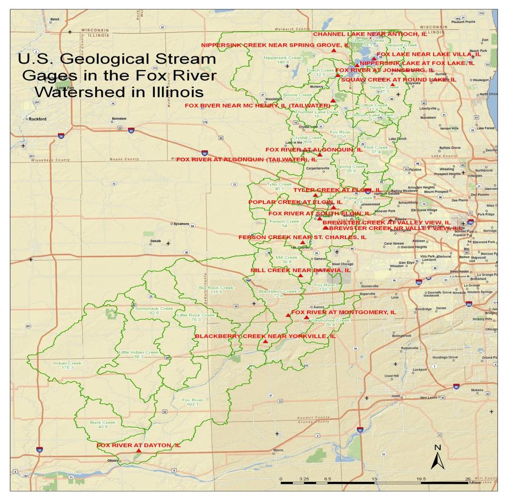
6 Ottawa High School also has three staff gages located around the property with elevation marks established by survey. The City of Ottawa has a staff gage located on the downstream face of the north pier of Highway 23 Bridge. This gage has been established by survey and has been compared and verified to the gage at Ottawa High School by previous high water events. The gage at Ottawa High School is an official forecast point for the National Weather Service. The National Weather Service has multiple official forecast points both upstream and downstream of this gage on both the Illinois and Fox Rivers. This data is monitored at all times by the City of Ottawa s Emergency 911 Communications Center. Upstream indicators on the Illinois allows a 24 to 48 hour warning of peak flows. Since the Corps of Engineers gauge is an official forecast point for the National Weather Service, it is continuously monitored. Maintenance is performed as required, and the Corps has dedicated staff to maintain these gages and can be dispatched in short notice to make repairs. The City of Ottawa performs witnessed monthly checks of all data collection and communications and keeps record of these on file at the dispatch center. On the Fox River approximately 5000 feet upstream of Ottawa city limits is another gauge. This gauge is maintained by the U.S. Geological Survey, Urbana, Illinois. The upstream gauges are easily monitored from the National Weather Service website and are an excellent warning source. Additional information is available on a real time basis from the USGS web site. Predictions from the Chain of Lakes pool levels allow at least a 24 hour warning.
7

8 Action Plan ALL DEPARTMENTS REFER TO APPENDIX B, INUNDATION MAPS OR GO TO: Stage Staff Assignment Required Action and Notifications None No action normal pool Scott Clinch, High School River infiltration to southeast corner of levee at baseball field. Gatewell D closed, pumping begins and flood fighting preparations begin. Building Official contacts Scott Clinch. (5 min.) Public Works Backup in CSO 009, arch sewer to Webster St. Close sluice gate MH. City Engineer confirms with Public Works Director. (5 min) High School Pumping operations start (45 min.)
9 460.8 River Rescue Public Works Ottawa High School City of Ottawa Ottawa High School 463 City of Ottawa Ottawa High School City of Ottawa 464 City of Ottawa 465 Heritage Harbor OSF St. Elizabeth Hospital City of Ottawa Marquette High School 466 Heritage Harbor City of Ottawa City of Ottawa Emergency boat docks and ramps begin to flood. Building Official contacts River Rescue. (5 min) Illinois River overtops CSO 18B at High School. City Engineer confirms with Director of Public Works (5 min) River infiltrates East side City storm system. Pumping begins to control stormwater and mixed systems. (1 hour). Fox River tops Combined Sewer Overflow (CSO) 18A at Ottawa High School. Close valve in Manhole 011C546. City Engineer confirms with Public Works. (20 min) FLOOD STAGE River flooding infiltrates West Parking Lot. Close Gate B, begin pumping to mitigate seepage & storm water. (45 min) City Engineer & Building Official to notify OSF St. Elizabeth Hospital, YMCA, & Public Works, Ottawa Police and Fire Departments to prepare for further flood fighting. (30 min). Illinois River flows into effluent pipe. Close gravity effluent valve and start high river pumps. (30 min) Building Official notifies Public Works to close Allen Park. Have Thrush Sanitation remove portable toilets from Allen Park and Fox River Park. Have the electrical inspector see that the River Walk power is shut down. (See appendix A, River Walk Electrical Shut Down Procedure). (1 hr. 20 min). City Engineer to notify Ameren and Nicor Gas to close down all utilities in the Special Flood Hazard Area. (5 min) Harborwalk floods. Dock ramps cannot be accessed without a boat. Moderate Flood Stage Building Official contacts hospital. Lower green spaces on the hospital grounds begin to flood. (5 min) City Engineer contacts Public Works to barricade Hudson Street as it will become impassible (25 min). Football fields begin to flood. Building Official contacts high school. (5 min) Travel-lift slab area begins to flood. Secure all items and remove to high ground. (2 hours) City Engineer ensures that River Walk at Hudson Street is closed, Fox River Park is closed and St. Clair Street is barricaded. (1 hour) Illinois River level reaches Douglas and Leland CSO. City Engineer to notify Waste Water Treatment Plant. (5 min)
10 467.3 City of Ottawa City of Ottawa and Shoreline Boat Club City of Ottawa Illinois River level reaches Chester Street CSO. City Engineer to notify Public Works to close sluice gate MH012DO11 (40 min) Building Official to notify Streets Department to close Green Street. Have the police activate the NIXLE to notify east side resident. Notify Shoreline Boat Club to secure boats & land cradles and to evacuate property.( City 25min, Shoreline 2 hours) Illinois River floods the old Central School property. Blockade driveway entrances. (20 min) River Rescue Building is threatened. River Rescue personnel to remove equipment to higher ground and begin 24 hour watch. (2 hours) City of Ottawa Fox River is flowing into CS0-011 off Main Street River Rescue River infiltrates building City of Ottawa Illinois River is flowing into CS0-006 off Riverview Drive YMCA Flood fighting begins, sandbag lower level entry ways.(4 hours) MAJOR FLOOD STAGE 469 OSF St. Elizabeth Hospital Shut storm drain valve off. (15 min) 469 City of Ottawa 470 Ottawa High School City Engineer engages incident command. Activate the City of Ottawa's Emergency Response Plan. Notify the Mayor of emergency status. Designate Public Information Officer and contact LaSalle County EOM, Contact Red Cross, WCMY radio station, and The Times. Activate Community Emergency Notification System (NIXLE) Inform entire community of the current flood threat. River infiltration at Shabbona Street begins. Construction of sandbag enclosure begins. (4.5 to 6 hours) City of Ottawa City Engineer to have Public Works monitor Jackson Street lift station. Shut down power if necessary YMCA Fox River reaches center of parking lot City of Ottawa Fox River is flowing into CS0-013 off Madison Street 472 OSF St. Elizabeth Hospital West parking lot floods City of Ottawa Sand bag Waste Water Treatment facility berm (6 hours) 473 OSF St. Elizabeth Hospital Emergency Room Floor Elevation. Flood protection wall installed in 2009 should prevent any infiltration of water. 474 Shoreline Boat Club Building will be under water. 474 City of Ottawa Illinois River will overtop the berm at WWTP if not sandbagged Ottawa High School Top of Fox River levee. 475 Heritage Harbor All power should be shut down to docks. (15 min) Heritage Harbor Lowest basement begins to flood Ottawa High School Top of flood protection wall on Fox River South of Main Street Bridge.
11 476 City of Ottawa Heritage Harbor City Engineer to monitor Main Street bridge. If the Main Street bridge is to be closed, move to Unified Command. Consider evacuation of East side. Mayor to consider Disaster Declaration. Notify all residents of East Side via NIXLE. Police and Fire Departments stage on south side of bridge. Have lifeline helicopter on standby (may use high school west lot). (1 hr.) Roadway connecting West peninsula to Canal Road begins to flood. Power transformers should be shut down. Flood Impacts During a flood event at Flood Stage and Moderate Flood Stage the impact to the general public is limited. Most repetitive loss properties that were affected at these stages have been mitigated. The Police Dispatch does take on additional burden but generally there are no call back to duty during these stages. In the flood response section of this plan, there are designated times and stages to shut down utilities such as power and gas.
12 When the flood stage moves to a Major event, additional personal are called to duty. During the major event of 2013, the mayor declared an emergency status and called all city personal back to duty. As noted in the response section the fire and police department stage equipment and personal on the east side of the Main Street bridge until the flood waters recede. After the flood event there is a dedicated packet of hand outs (outlined in the PPI) that is delivered to all properties affected by the flood. This informational hand out outlines flood safety measures during and after a flood event.
Local Flood Hazards. Click here for Real-time River Information
 Local Flood Hazards Floods of the White River and Killbuck Creek are caused by runoff from general, and/or intense rainfall. Other areas of flooding concern are from the Boland Ditch and Pittsford Ditch.
City of Madison Flooding Event AUGUST 20 TH, 2018-PRESENT
 City of Madison Flooding Event AUGUST 20 TH, 2018-PRESENT Presentation Overview Review of Flash Flooding and Flooding from High Lake Levels (August 20 th -Present) Lake Level Information Damages FEMA How
United States Multi-Hazard Early Warning System
 United States Multi-Hazard Early Warning System Saving Lives Through Partnership Lynn Maximuk National Weather Service Director, Central Region Kansas City, Missouri America s s Weather Enterprise: Protecting
COMMUNITY EMERGENCY RESPONSE TEAM FLOODS INTRODUCTION
 INTRODUCTION Floods are one of the most common hazards in the United States. A flood occurs any time a body of water rises to cover what is usually dry land. Flood effects can be local, impacting a neighborhood
Flood Scenario Worksheet
 Flood Scenario Worksheet Scenario adapted from: http://www.epa.gov/watersecurity/tools/trainingcd/simple/source/scenario-8/ssc8-0.pdf Simple Tabletop Exercise, Interdependency Natural Disaster Scenario,
Lessons Learned and Shared
 Lessons Learned and Shared Plan for the worst. Hope for the best. Remember that hope is not a strategy. Agnes 8 Lessons 1. Identify Susceptible Communities 2. Develop a Plan 3. Threat Recognition 4. Review
President s Day Weekend Storm Community Meeting and Workshop April 17, 2017
 President s Day Weekend Storm Community Meeting and Workshop April 17, 2017 Meeting outline 1. Progress update on the City of San Jose s recovery efforts 2. Water district presentation on: Weather situation
Floods. Floods COMMUNITY EMERGENCY RESPONSE TEAM FLOODS CONTENT INSTRUCTOR GUIDANCE
 Floods Floods Introduce this topic by explaining that floods are one of the most common hazards in the United States. A flood occurs any time a body of water rises to cover what is usually dry land. Display
UNIVERSITY OF WISCONSIN-PARKSIDE TORNADO WARNINGS AND ALERT POLICY ADMINISTRATIVE POLICY NUMBER 39 TABLE OF CONTENTS
 UNIVERSITY OF WISCONSIN-PARKSIDE TORNADO WARNINGS AND ALERT POLICY ADMINISTRATIVE POLICY NUMBER 39 TABLE OF CONTENTS Page 1. PURPOSE 2 2. DEFINITIONS 2 3. GENERAL OVERVIEW 2 4. SPECIFIC PROCEDURES 3 4.1
WINTER STORM Annex II
 WINTER STORM Annex II I. PURPOSE A. This annex has been prepared to ensure a coordinated response by state agencies to requests from local jurisdictions to reduce potential loss of life and to ensure essential
MEDIA RELEASE FOR IMMEDIATE RELEASE March 17, 2014 Preparing for the Spring Thaw
 BRACEBRIDGE, ONT Springtime is fast approaching and flooding in low lying areas of the Town is a potential risk due to melting snow and spring rain fall. Flooding can also be experienced during extreme
Information Reception: Decision Support Standards: Public Notification Plan: Protection Program: Education:
 The National Weather Service (NWS) has implemented a voluntary recognition program to help large outdoor venues, including those on university campuses, better protect staff and patrons from the dangers
Table G - 6. Mitigation Actions Identified for Implementation by the City of Kent ( ) (From Wilkin County Master Mitigation Action Chart)
 (From Wilkin County Master Mitigation Action Chart)") Table G - 6. Actions Identified by the () (From Master Action Chart) Multi-Hazard Plan, 2017 Action Comments 5 All-Hazards Local Planning & Regulations Update the Operations Plan on an annual basis. Work
Table G - 6. Actions Identified by the () (From Master Action Chart) Multi-Hazard Plan, 2017 Action Comments 5 All-Hazards Local Planning & Regulations Update the Operations Plan on an annual basis. Work
Annex B Natural No-Notice Event
 Annex B Natural No-Notice Event Version: 1.0 Effective: 10/01/2015 Revision Date: 10/01/2015 Approved By: John Pitcher Purpose The purpose of Natural No-Notice Event Annex is to ensure the safety of BHCC
OC Public Works El Niño Storm Preparation 2015
 OC Public Works El Niño Storm Preparation 2015 December 8, 2015 Overview About OC Public Works Storm Preparation Pre-Storm During Storm Post-Storm Storm Preparation Canyon and Burn Areas County Department
OXFORD HEIGHTS SUBDIVISION EMERGENCY EVACUATION PLAN
 OXFORD HEIGHTS SUBDIVISION EMERGENCY EVACUATION PLAN March 27, 2007 Oxford Heights Overview and Historical Conditions Oxford Heights is a medium sized community located on the southern side of Elizabeth
U.S. ARMY CORPS OF ENGINEERS
 CORPS FACTS Regulating Mississippi River Navigation Pools U.S. ARMY CORPS OF ENGINEERS BUILDING STRONG Historical Background Federal improvements in the interest of navigation on the Mississippi River
YELLOWSTONE RIVER FLOOD STUDY REPORT TEXT
 YELLOWSTONE RIVER FLOOD STUDY REPORT TEXT TECHNICAL REPORT Prepared for: City of Livingston 411 East Callender Livingston, MT 59047 Prepared by: Clear Creek Hydrology, Inc. 1627 West Main Street, #294
New Pig Corporation newpig.com HOT-HOGS Page 1 of 10
 Develop a Disaster Preparedness Plan Assess your risks of natural and manmade disasters Purchase adequate insurance and ensure that you have the types of coverage you may need Keep employee contact information
Unit 5: NWS Hazardous Weather Products. Hazardous Weather and Flooding Preparedness
 Unit 5: NWS Hazardous Weather Products Objectives Describe the mission of the NWS Describe the basic organizational structure of the NWS Explain the purpose of various NWS products Explain how Probability
SNOW REMOVAL GUIDE. City Of Orange Township. Public Works Snow Removal Hotline: (973) My Orange Hotline: (973)
 My Orange Hotline: (973)") Mayor Dwayne D. Warren, Esq. And The Orange Municipal Council MOVING ORANGE FORWARD City Of Orange Township SNOW REMOVAL GUIDE Public Works Snow Removal Hotline: (973) 266-4030 My Orange Hotline: (973)
Mayor Dwayne D. Warren, Esq. And The Orange Municipal Council MOVING ORANGE FORWARD City Of Orange Township SNOW REMOVAL GUIDE Public Works Snow Removal Hotline: (973) 266-4030 My Orange Hotline: (973)
PUBLIC SAFETY POWER SHUTOFF POLICIES AND PROCEDURES
 PACIFIC GAS AND ELECTRIC COMPANY PUBLIC SAFETY POWER SHUTOFF POLICIES AND PROCEDURES SEPTEMBER 2018 1 PACIFIC GAS AND ELECTRIC COMPANY PUBLIC SAFETY POWER SHUTOFF POLICIES AND PROCEDURES SEPTEMBER 2018
3.11 Floodplains Existing Conditions
 Other stormwater control practices may be needed to mitigate water quality impacts. In addition to detention facilities, other practices such as vegetated basins/buffers, infiltration basins, and bioswales
SITUATION REPORT #7 September 8 th, 2017
 MCO AIRPORT EMERGENCY OPERATIONS CENTER SITUATION REPORT #7 September 8 th, 2017 STATE OF FLORIDA REGION V FEMA REGION IV GENERAL INFORMATION Local State of Emergency Declaration Number: 17-235 Dated:
Hurricane Preparation and Recovery. October 11, 2011 Jon Nance, Chief Engineer, NCDOT
 Hurricane Preparation and Recovery October 11, 2011 Jon Nance, Chief Engineer, NCDOT North Carolina & Severe Weather Our state often bears the brunt of storms, which include: Ice storms Snow storms Heavy
MUNICIPALITY OF ANCHORAGE PUBLIC TRANSPORTATION DEPARTMENT AnchorRIDES TRANSPORTATION SYSTEM
 Purpose: The Public Transportation Department and contracted provider will provide safe transportation for AnchorRIDES customers and employees during severe weather or emergency conditions. AnchorRIDES
CLEA# Approved Date: Feb Revision Date: Aug 02, May06, Mar08, Jan 09 New ( ) Amends ( ) Rescinds ( ) Pages:
 Amends ( ) Rescinds ( ) Pages:") 8-112 Winter Storm Response Plan-ERP CLEA# Approved Date: Feb. 1998 GLECP # Revision Date: Aug 02, May06, Mar08, Jan 09 New ( ) Amends ( ) Rescinds ( ) Pages: 8-112.1 Overview The dangers of winter storms
8-112 Winter Storm Response Plan-ERP CLEA# Approved Date: Feb. 1998 GLECP # Revision Date: Aug 02, May06, Mar08, Jan 09 New ( ) Amends ( ) Rescinds ( ) Pages: 8-112.1 Overview The dangers of winter storms
September 13, 2018 MEDIA RELEASE. Waynesboro Department of Emergency Management Waynesboro Police Department Waynesboro Fire Department
 MEDIA RELEASE September 13, 2018 The City continues to prepare for and monitor the track and potential impacts of Hurricane Florence. Current guidance from the National Weather Service, the National Hurricane
 STATE OF WISCONSIN/ DEPARTMENT OF MILITARY AFFAIRS WISCONSIN EMERGENCY MANAGEMENT 2400 WRIGHT STREET P.O. BOX 7865 MADISON, WISCONSIN 53707-7865 608-242-3232 February 22, 2007 Re: Tornado and Severe Weather
Red River Levee Panel
 Red River Levee Panel Mississippi River Commission Monday, August 9, 2017 Red River Levees in LA & AR NONE along TX & OK Boarder Red River Levee Issues Caddo Levee Cherokee Park Authorization Bossier Levee
Town of Barnstable. Department of Public Work. Snow and Ice Control Operations Plan
 Town of Barnstable Department of Public Work Snow and Ice Control Operations Plan I. Mission: The mission of the Department of Public Works is to remove accumulations of snow and ice from town, county
Dr. Amanda Schroeder. NWS Weather Forecast Office Fort Worth, TX. Sustainable Urban Water Workshop University of Texas-Arlington June 4-5, 2015
 Dr. Amanda Schroeder NWS Weather Forecast Office Fort Worth, TX Sustainable Urban Water Workshop University of Texas-Arlington June 4-5, 2015 Outline Communicating the message - official Flood and Flash
 Red River Flooding June 2015 Caddo and Bossier Parishes Presented by: Flood Technical Committee Where the Rain Falls Matters I-30 versus I-20 I-20 Backwater and Tributary Floods (Localized) 2016 Flood
Rebuilding Flood-Conscious Society
 A zone where strong flood flow or river bank erosion by levee breach are anticipated, which likely to occur collapsing/washing away of house. Set up the joint councils by relative stakeholders(river managers,
StormReady Supporter Application Form updated by NWS Chanhassen on April 7, Name of Applying Entity: Point of Contact: Title:
 NATIONAL WEATHER SERVICE 1733 Lake Drive West Chanhassen, Minnesota www.weather.gov/twincities www.stormready.noaa.gov 952-361-6671, todd.krause@noaa.gov StormReady Supporter Application Form updated by
Aid to Critical Infrastructure and Key Resources During a Disaster. Pete Grandgeorge MidAmerican Energy Company
 Aid to Critical Infrastructure and Key Resources During a Disaster Pete Grandgeorge MidAmerican Energy Company MidAmerican Energy Company Approximately 3,000 employees and 100 staffed facilities 1.4 million
HISTORY OF CONSTRUCTION FOR EXISTING CCR SURFACE IMPOUNDMENT PLANT GASTON ASH POND 40 CFR (c)(1)(i) (xii)
(1)(i) (xii)") HISTORY OF CONSTRUCTION FOR EXISTING CCR SURFACE IMPOUNDMENT PLANT GASTON ASH POND 40 CFR 257.73(c)(1)(i) (xii) (i) Site Name and Ownership Information: Site Name: E.C. Gaston Steam Plant Site Location:
HISTORY OF CONSTRUCTION FOR EXISTING CCR SURFACE IMPOUNDMENT PLANT GASTON ASH POND 40 CFR 257.73(c)(1)(i) (xii) (i) Site Name and Ownership Information: Site Name: E.C. Gaston Steam Plant Site Location:
Daily Operations Briefing Tuesday, January 6, :30 a.m. EST
 Daily Operations Briefing Tuesday, January 6, 2015 8:30 a.m. EST Significant Activity: Jan 5-6 Significant Events: Flooding Western WA - FINAL Significant Weather: Snow Northern/Central Rockies to Northern/Central
UPPER COSUMNES RIVER FLOOD MAPPING
 UPPER COSUMNES RIVER FLOOD MAPPING DRAFT BASIC DATA NARRATIVE FLOOD INSURANCE STUDY SACRAMENTO COUTY, CALIFORNIA Community No. 060262 November 2008 Prepared By: CIVIL ENGINEERING SOLUTIONS, INC. 1325 Howe
Nurture Nature Center Receives Grant From National Oceanic and Atmospheric Administration To Study Flood Forecast and Warning Tools
 Nurture Nature Center Receives Grant From National Oceanic and Atmospheric Administration To Study Flood Forecast and Warning Tools One of four national awards by National Weather Service to advance weather
City of Saginaw Right of Way Division Snow and Ice Removal Policy January 18, 2016
 Snow and Ice Removal Policy January 18, 2016 It is the policy of the to provide snowplowing and ice removal services in order to: Provide safe traveling conditions for motorists and pedestrians Assist
TORNADO/high winds *
 TORNADO/high winds * WATCH Bring people inside. Secure outside objects. Clear window ledges & wall hangings Close drapes Protect windows Assemble and check supplies Call in applicable staff Pre-Storm:
Monitoring Scour Critical Bridges During Floods For Local Bridge Owners. Presented by
 Monitoring Scour Critical Bridges During Floods For Local Bridge Owners Presented by SAFETY FIRST DO NOT ENDANGER YOURSELF OR OTHERS WHILE MONITORING BRIDGES DO NOT ENTER FLOOD WATERS FLOOD WATERS INCLUDE
Severe Storm Response Version # 1-0-1
 Severe Storm Response Version # 1-0-1 Weather Warnings Environment Canada issues severe weather warnings, watches and advisories Weather Watch Severe weather may develop. Weather Warning Severe weather
State Of Wisconsin Department of Military Affairs
 State Of Wisconsin Department of Military Affairs Division of Emergency Management Brian M. Satula Administrator Scott Walker Governor For more information contact: Tod Pritchard Office: 608-242-3324 Cell:
Daily Operations Briefing. Friday, May 5, :30 a.m. EDT
 Daily Operations Briefing Friday, May 5, 2017 8:30 a.m. EDT Significant Activity May 4-5 Significant Events: Flooding Southern/Central Plains Significant Weather: Flash flooding possible Mid-Atlantic through
Tornado Drill Exercise Plan (EXPLAN)
") Tornado Drill Exercise Plan (EXPLAN) As part of the National Weather Service s (NWS) Severe Weather Preparedness Week in Indiana Purdue University March 19, 2019 As of Feb 19, 2019 TABLE OF CONTENTS Introduction...
Tornado Drill Exercise Plan (EXPLAN) As part of the National Weather Service s (NWS) Severe Weather Preparedness Week in Indiana Purdue University March 19, 2019 As of Feb 19, 2019 TABLE OF CONTENTS Introduction...
Trainee Manual C02 CITY OF SASKATOON. Water and Sewer Section. Severe Storm Response Trainee Manual. Version # 1-0-3
 Trainee Manual C02 CITY OF SASKATOON Water and Sewer Section Severe Storm Response Trainee Manual CITY OF SASKATOON Severe Storm Response Trainee Manual City of Saskatoon Severe Storm Response Trainees
Title: Storm of the Century: Documenting the 1993 Superstorm
 A. PAIIF 2011 Cover Page Title: Storm of the Century: Documenting the 1993 Superstorm Point of Contact: Name: Alex Granger Email: alex.granger@noaa.gov Phone Number: 571-555-9278 Mailing Address: Research
Background on the March 13-14, 2007 Flooding in Browns Valley (Traverse County), Minnesota
, Minnesota") Background on the March 13-14, 2007 Flooding in Browns Valley (Traverse County), Minnesota Report to the Minnesota Governor s Office Prepared by: Minnesota Department of Natural Resources Waters Division
Background on the March 13-14, 2007 Flooding in Browns Valley (Traverse County), Minnesota Report to the Minnesota Governor s Office Prepared by: Minnesota Department of Natural Resources Waters Division
Section 4: Model Development and Application
 Section 4: Model Development and Application The hydrologic model for the Wissahickon Act 167 study was built using GIS layers of land use, hydrologic soil groups, terrain and orthophotography. Within
Winter Weather. Naval Station Great Lakes Winter Season
 Winter Weather Naval Station Great Lakes Winter Season 2015-2016 Local Area Information Resources Lake County Passage (local road conditions) https://www.lakecountypassage.com/index.jsp 1620 AM National
THE NEED FOR AN ADDITIONAL SPILLWAY AT THE SANFORD DAM BOILING SPRING LAKES, NC. Presentation for The Brunswick County Commissioners April 20, 2015
 THE NEED FOR AN ADDITIONAL SPILLWAY AT THE SANFORD DAM BOILING SPRING LAKES, NC Presentation for The Brunswick County Commissioners April 20, 2015 The Sanford Dam Earth Dam constructed in 1961 Drainage
Southington. Challenges
 Southington Southington, similar to its next-door neighbor Berlin, is a suburban community in the southeast part of the region. Originally an agricultural community, Southington has also hosted industry
Appendix C Fluvial Flood Hazards
 Appendix C Fluvial Flood Hazards Sea Level Rise Vulnerability Assessment and Adaptation Project March 2019 Contents Contents... i Figures... i Tables... i Definitions, Acronyms, & Abbreviations... ii
National Weather Service. Building a Weather Ready Nation
 National Weather Service Building a Weather Ready Nation The NWS is a federal agency Department of Commerce National Oceanic and Atmospheric Administration National Weather Service Today s National Weather
Page G Crow Wing County Multi-Hazard Mitigation Plan, 2017
 Table G - 10. s Identified by the () (From Crow Wing County Master Chart) 1 5 All- Hazards All- Hazards Work to ensure that all Crow Wing County residents are aware of and sign-up for the County s Emergency
Analysis of Hydraulic Impacts on the Schuylkill River
 Analysis of Hydraulic Impacts on the Schuylkill River Manayunk Sewer Basin Construction Project and the Venice Island Recreation Center Reconstruction Project Venice Island, Manayunk, Philadelphia, PA
CITY OF NEW LONDON WINTER ROAD & SIDEWALK MAINTENANCE POLICY
 CITY OF NEW LONDON WINTER ROAD & SIDEWALK MAINTENANCE POLICY GENERAL The purpose of this policy is to set up acceptable procedures and policies for the winter maintenance of public areas in the City of
USGS Flood Inundation Mapping of the Suncook River in Chichester, Epsom, Pembroke and Allenstown, New Hampshire
 USGS Flood Inundation Mapping of the Suncook River in Chichester, Epsom, Pembroke and Allenstown, New Hampshire NH Water & Watershed Conference Robert Flynn, USGS NH-VT Water Science Center March 23, 2012
Timeframe. Crow Wing County, Baxter, Brainerd, Breezy Point, Crosby, Crosslake, Cuyuna, Deerwood, Emily, Fifty
 Table G - 13. s Identified for by the () (From Crow Wing County Master Chart) 1 5 9 All- Hazards All- Hazards Winter Work to ensure that all Crow Wing County residents are aware of and sign-up for the
INFLOW DESIGN FLOOD CONTROL SYSTEM PLAN 40 C.F.R. PART PLANT YATES ASH POND 2 (AP-2) GEORGIA POWER COMPANY
 GEORGIA POWER COMPANY") INFLOW DESIGN FLOOD CONTROL SYSTEM PLAN 40 C.F.R. PART 257.82 PLANT YATES ASH POND 2 (AP-2) GEORGIA POWER COMPANY EPA s Disposal of Coal Combustion Residuals from Electric Utilities Final Rule (40 C.F.R.
INFLOW DESIGN FLOOD CONTROL SYSTEM PLAN 40 C.F.R. PART 257.82 PLANT YATES ASH POND 2 (AP-2) GEORGIA POWER COMPANY EPA s Disposal of Coal Combustion Residuals from Electric Utilities Final Rule (40 C.F.R.
Complete Weather Intelligence for Public Safety from DTN
 Complete Weather Intelligence for Public Safety from DTN September 2017 White Paper www.dtn.com / 1.800.610.0777 From flooding to tornados to severe winter storms, the threats to public safety from weather-related
SNOW CONTROL OPERATIONS
 SNOW CONTROL OPERATIONS PUBLIC WORKS TEAM STREET MAINTENANCE DIVISION SNOW CONTROL OPERATIONS Standard Operating Procedures for Snow Removal Operations. 1. Plowing operations will be initiated when snow
VISIT MISSISSIPPI GULF COAST CRISIS COMMUNICATION MANUAL 2016
 VISIT MISSISSIPPI GULF COAST CRISIS COMMUNICATION MANUAL 2016 This manual was prepared for Visit Mississippi Gulf Coast staff in the event of a crisis, and will help to distinguish the appropriate course
National Public Weather and Warning Services in the Swaziland Meteorological Service Dennis S.Mkhonta /
 National Public Weather and Warning Services in the Swaziland Meteorological Service Dennis S.Mkhonta dennis.mkhonta@gmail.com / dennis@swazimet.gov.sz Introduction Swaziland s geographical position exposes
National Weather Service 1
 National Weather Service 1 National Weather Service Source: FEMA 2 The Need for a Robust/Diverse Severe Weather Plan Presidential Disaster Declarations 2015 Kentucky Disaster Declarations DR-4216 (Feb
Delaware River Flood Advisory Committee
 Delaware River Flood Advisory Committee A Partnership to Support Flood Mitigation Alan Tamm Pennsylvania Emergency Management Agency Bureau of Recovery and Mitigation atamm@state.pa.us Peter Gabrielsen
Dunn County Snow Removal Policy
 Dunn County Snow Removal Policy OVERVIEW With the advent of another winter season in the northern plains comes the possibility of snow, freezing rain and slippery roadways, and area resident s concern
NOAA s National Weather Service. National Weather Service
 NOAA s National Weather Service Serving the Nation s Environmental Forecasting Needs Lynn Maximuk Regional Director National Weather Service Central Region Headquarters Kansas City, Missouri America s
MUNICIPALITY OF ANCHORAGE PUBLIC TRANSPORTATION DEPARTMENT AnchorRIDES PARATRANSIT SYSTEM
 Purpose: The Public Transportation Department (PTD) and AnchorRIDES paratransit contractor will provide transportation in as safe a manner as effectively possible. Paratransit vehicles primarily operate
ICE STORM! a mini tabletop exercise for home care agencies
 1 ICE STORM! a mini tabletop exercise for home care agencies HCA Education and Research Winter 2010 2011 2 What is a tabletop exercise? People come together to review and discuss a hypothetical emergency
3Chapter Three: Rescue and Response
 17 16 Report Science Title and the Storms: the USGS Response to the Hurricanes of 2005 3Chapter Three: Rescue and Response This chapter documents the U.S. Geological Survey s (USGS) humanitarian rescue
LOMR SUBMITTAL LOWER NEHALEM RIVER TILLAMOOK COUNTY, OREGON
 LOMR SUBMITTAL LOWER NEHALEM RIVER TILLAMOOK COUNTY, OREGON Prepared for: TILLAMOOK COUNTY DEPARTMENT OF COMMUNITY DEVELOPMENT 1510-B THIRD STREET TILLAMOOK, OR 97141 Prepared by: 10300 SW GREENBURG ROAD,
Sunday, March 24, :30 a.m. EDT
 Sunday, March 24, 2019 8:30 a.m. EDT Significant Activity Mar 23-24 Significant Events: Flooding Central U.S. Tropical Activity: No activity affecting U.S. interests Significant Weather: Severe thunderstorms
Real-Time Flood Forecasting Modeling in Nashville, TN utilizing HEC-RTS
 Real-Time Flood Forecasting Modeling in Nashville, TN utilizing HEC-RTS Brantley Thames, P.E. Hydraulic Engineer, Water Resources Section Nashville District, USACE August 24, 2017 US Army Corps of Engineers
PENNSYLVANIA DEPARTMENT OF TRANSPORTATION ENGINEERING DISTRICT 3-0
 PENNSYLVANIA DEPARTMENT OF TRANSPORTATION ENGINEERING DISTRICT 3-0 LYCOMING COUNTY S.R.15, SECTION C41 FINAL HYDROLOGIC AND HYDRAULIC REPORT STEAM VALLEY RUN STREAM RELOCATION DATE: June, 2006 REVISED:
Managing an Extreme Weather Event of Prolonged Duration May 22, 2013
 Managing an Extreme Weather Event of Prolonged Duration May 22, 2013 MISSOURI RIVER FLOOD OF 2011 M I C H A E L J. K E N N E R L Y P. E. D I R E C T O R O F T H E O F F I C E O F D E S I G N I O W A D
DRAFT - Tsunami Response Plan Playbook Santa Cruz Harbor Maritime Community
 DRAFT - Tsunami Response Plan Playbook Santa Cruz Harbor Maritime Community Page 1 Best to display on 11X17 paper Purpose and Use of this Real-time Tsunami Response Plan Playbook PURPOSE: This product
City of Punta Gorda Community Emergency Management Plan 2013
 City of Punta Gorda Community Emergency Management Plan 2013 Hurricane Andrew- August 24, 1992 Category 5 hurricane. The second-most-destructive hurricane in U.S. history. The first named storm of the
WHAT HAPPENS WHEN A TORNADO STRIKES THE COMMUNITY? Carroll County Sheriff s Office Emergency Management
 WHAT HAPPENS WHEN A TORNADO STRIKES THE COMMUNITY? Carroll County Sheriff s Office Emergency Management WHAT IS EMERGENCY MANAGEMENT? Carroll County Sheriff s Office Emergency Management Agency is responsible
Progress Report. Flood Hazard Mapping in Thailand
 Progress Report Flood Hazard Mapping in Thailand Prepared By: Mr. PAITOON NAKTAE Chief of Safety Standard sub-beuro Disaster Prevention beuro Department of Disaster Prevention and Mitigation THAILAND E-mail:
Winter Weather. National Weather Service Buffalo, NY
 Winter Weather National Weather Service Buffalo, NY Average Seasonal Snowfall SNOWFALL = BIG IMPACTS School / government / business closures Airport shutdowns/delays Traffic accidents with injuries/fatalities
The Nuts and Bolts of These Community Preparedness Recognition Programs
 The Nuts and Bolts of These Community Preparedness Recognition Programs Bill Sammler Warning Coordination Meteorologist NOAA s National Weather Service, Wakefield VA http://weather.gov/akq Why is StormReady
Emergency Action Plan (EAP) Tata Pond Dam
 Tata Pond Dam") For Official Use Only Not for Public Distribution 02/03/16 Emergency Action Plan (EAP) Tata Pond Dam State of Connecticut Dam ID: 0000 Town or City, County, Connecticut Name of Dam Owner Dam Hazard Classification
For Official Use Only Not for Public Distribution 02/03/16 Emergency Action Plan (EAP) Tata Pond Dam State of Connecticut Dam ID: 0000 Town or City, County, Connecticut Name of Dam Owner Dam Hazard Classification
LOMR SUBMITTAL LOWER NESTUCCA RIVER TILLAMOOK COUNTY, OREGON
 LOMR SUBMITTAL LOWER NESTUCCA RIVER TILLAMOOK COUNTY, OREGON Prepared for: TILLAMOOK COUNTY DEPARTMENT OF COMMUNITY DEVELOPMENT 1510-B THIRD STREET TILLAMOOK, OR 97141 Prepared by: 10300 SW GREENBURG ROAD,
USING GIS TO MODEL AND ANALYZE HISTORICAL FLOODING OF THE GUADALUPE RIVER NEAR NEW BRAUNFELS, TEXAS
 USING GIS TO MODEL AND ANALYZE HISTORICAL FLOODING OF THE GUADALUPE RIVER NEAR NEW BRAUNFELS, TEXAS ASHLEY EVANS While the state of Texas is well-known for flooding, the Guadalupe River Basin is one of
Suwannee Satilla Basins Flood Control Issues, Opportunities and Assistance
 Suwannee Satilla Basins Flood Control Issues, Opportunities and Assistance Georgia Silver Jackets Meeting Valdosta, GA April 11, 2013 Presentation Outline Basin overview Recent floods: 2009 100 year flood
EMERGENCY WARNING SYSTEM PROCEDURES FOR DEBRIS FLOWS IN WESTERN OREGON
 EMERGENCY WARNING SYSTEM PROCEDURES FOR DEBRIS FLOWS IN WESTERN OREGON Updated: 12/03/2007 by the Oregon Department of Forestry and the Oregon Department of Geology and Mineral Industries Debris flows
ADMINISTRATION BUILDING
 TORNADO PROCEDURES Tornadoes are nature s most violent storms, and over a small area, the most destructive. A tornado s whirling winds may reach 300 miles per hour or more. Generally short-lived and fast
Hurricane Matthew Threats and Impacts Briefing for Eastern NC
 Hurricane Matthew Threats and Impacts Briefing for Eastern NC October 6 th, 2016 Date/Time Created: 10/6/2016, Noon EDT National Weather Service Newport/Morehead City, NC Hurricane Matthew Key Points Changes
Risk Assessment and Mitigation. Hurricane Checklist
 Risk Assessment and Mitigation Hurricane Checklist Hurricane Checklist Hurricanes are severe tropical storms with sustained winds of at least 74 miles per hour. Hurricane winds can reach 160 miles per
FLOOD/SCS EVENT, APRIL 28 MAY 4
 REPORT DATE: May 4, 2017 EVENT DATE: April 28-May 4, 2017 FLOOD/SCS EVENT, APRIL 28 MAY 4 Event Summary General Significant Flood Outlook. SOURCE: National Weather Service. A significant severe thunderstorm
Snow and Ice Removal
 Policy # 6.6 Procedure # - Replaces 5.10 & 5.10A Revises - Date Approved February 10, 2014 Method of Approval Resolution #17 1. PRINCIPLES The City of Dauphin desires to maintain the City streets, lanes,
CHAPTER FIVE: THE LOWER MISSISSIPPI REGION AND PLAQUEMINES PARISH
 CHAPTER FIVE: THE LOWER MISSISSIPPI REGION AND PLAQUEMINES PARISH 5.1 Overview Plaquemines Parish is the area where the last portion of the Mississippi River flows out into the Gulf of Mexico (see Figures
City of Brainerd, Minnesota Snowplowing Policy
 City of Brainerd, Minnesota Snowplowing Policy 1. Introduction The city of Brainerd, Minnesota, finds that it is in the best interest of the residents of the city to assume basic responsibility for control
Pequabuck River Flooding Study and Flood Mitigation Plan The City of Bristol and Towns of Plainville and Plymouth, CT
 Pequabuck River Flooding Study and Flood Mitigation Plan The City of Bristol and Towns of Plainville and Plymouth, CT Raymond Rogozinski and Maged Aboelata The City of Bristol and Towns of Plainville and
Floodplain Mapping & Flood Warning Applications in North Carolina
 Floodplain Mapping & Flood Warning Applications in North Carolina Marc Stanard, IT Project Manager Ken Ashe, Assistant Director David Herlong, Flood Warning Program Manager NC Crime Control & Public Safety
Speakers: NWS Buffalo Dan Kelly and Sarah Jamison, NERFC Jeane Wallace. NWS Flood Services for the Black River Basin
 Speakers: NWS Buffalo Dan Kelly and Sarah Jamison, NERFC Jeane Wallace NWS Flood Services for the Black River Basin National Weather Service Who We Are The National Oceanic and Atmospheric Administration
NWS Resources For Public Works
 NWS Resources For Public Works August 28th, 2016 Shawn DeVinny shawn.devinny@noaa.gov Meteorologist National Weather Service Twin Cities/Chanhassen, MN 1 APWA 2016 PWX 8/28/2016 National Weather Service