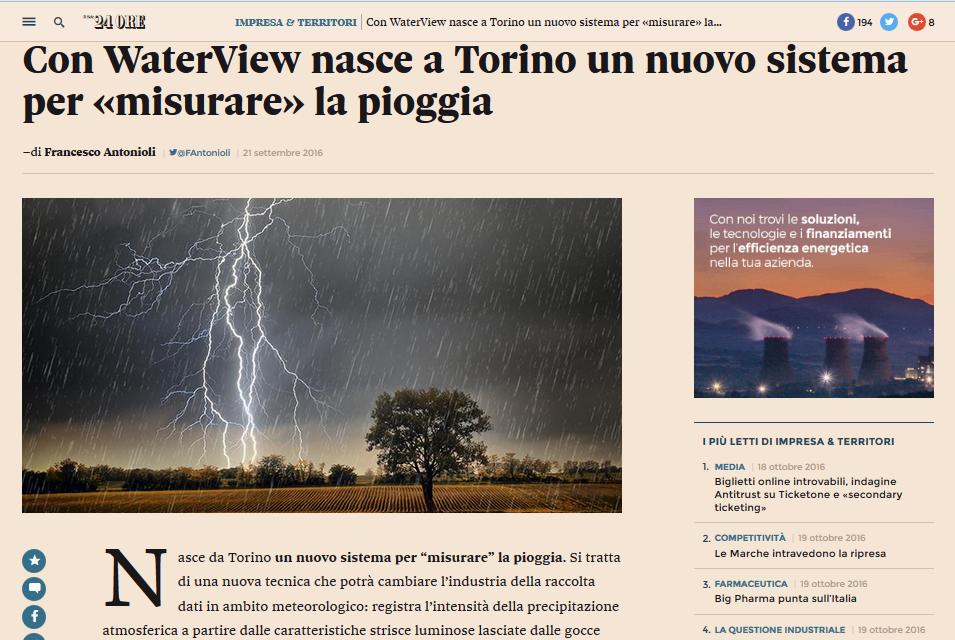
SmartRAIN: an IOT-based solution for real time rain mapping
|
|
|
- Susan Brooks
- 6 years ago
- Views:
Transcription
1

2 SmartRAIN: an IOT-based solution for real time rain mapping
3 Giugno submission Open disruptive innovation 9.91
4 Giugno submission Open disruptive innovation Settembre submission Inclusive societies
5 Giugno 2015 Settembre 2015 Febbraio submission Open disruptive innovation 2 submission Inclusive societies 3 submission New business models

6 Giugno 2015 Settembre 2015 Febbraio 2015 Giugno submission 2 submission 3 submission Project start Open disruptive innovation Inclusive societies New business models

7 1. Excellence 1.1 Objectives The far-reaching objective of this project is to integrate traditional at-ground rain gauging systems with optical lowcost systems, with the ultimate aim of improving the spatial resolution of the current terrestrial rain-gauging networks and their capacity to map rainfall patterns at the ground. Capturing rainstorm patterns in real-time with adequate spatial and temporal resolution is currently prevented by the sparseness of terrestrial rain-gauging networks and by the coarse resolution of both weather radar and satellite images. Damages caused by unobserved/improperly-managed rainstorms are huge. Insurance companies estimate yearly overall losses due to severe storms in Europe in about 5-8 billion EUR, while 400 billion US$ in damages are estimated annually in the US, based on US National Weather Service data [1]. Damages are expected to increase in the next decades, following the predicted increase in the frequency of heavy rainfall events at global scale [2]. Since the costs for repairing damages are estimated to be about 6 times higher than the cost of adaptation, the market for technologies to adapt to climate change is rapidly growing in Europe and worldwide. Water for food production already accounts for about 70% of global freshwater withdrawals. Estimates show that 45% more agricultural water will be required by 2030 to feed 8 billion people [4]. Meeting the growing need for actionable hydrological information using increasingly sophisticated technologies does represent the main avenue toward a high return on investment in managing water resources to ensure collective water security. Within this general context, our project investigates the technical and economic viability of a novel solution for monitoring rain at the ground. The system is designed for being composed by i) a hardware module for acquiring images during rain events and either processing or sending them to a cloud-based service; ii) a software module (i.e., the SmartRain algorithm) which stores and processes the registered images to derive quantitative rain rate measures. The SmartRain algorithm is patent pending since January 2015; an experimental proof a concept of the technology is presented by [3]. We are currently validating the technology in the lab and in the real environment (with low cost sensors under real rain conditions). Some technical detail about the overall idea, ground principles and technology are reported in Figure 1.3a. The objectives of the feasibility study are listed herein, in a chronological order: a. Prototyping the system as a stand-alone sensor; b. Testing the system portability to non-dedicated cameras; c. Exploring the market: volumes, geographical areas, trends, segments, barriers; d. Identifying a cost-effective technological proposition for the market; e. Defining the value proposition(s); f. Demonstrating the system in the relevant environment; g. Defining a go-to-market strategy. 1.2 Relation to the work programme The project is framed under the topic ICT : Open Disruptive and Innovation Scheme (ODI), which provides support to early stage high risk innovative SMEs in the ICT sector. We fit the challenge, scope and expected impact of the ODI topic because: - We foster SmartRain, an innovative project which does have the potential to disrupt the current rain gauge market; - The idea is innovative worldwide and is the invention of the founders of WaterView; - We are the founders of WaterView: a young, innovative, high-risk/high-gain startup in the ICT sector; - We are looking for swift support for validating, prototyping and demonstrating our idea. SmartRain 1


8 1. Excellence 1.1 Objectives The far-reaching objective of this project is to integrate traditional at-ground rain gauging systems with optical lowcost systems, with the ultimate aim of improving the spatial resolution of the current terrestrial rain-gauging networks and their capacity to map rainfall patterns at the ground. Capturing rainstorm patterns in real-time with adequate spatial and temporal resolution is currently prevented by the sparseness of terrestrial rain-gauging networks and by the coarse resolution of both weather radar and satellite images. Damages caused by unobserved/improperly-managed rainstorms are huge. Insurance companies estimate yearly overall losses due to severe storms in Europe in about 5-8 billion EUR, while 400 billion US$ in damages are estimated annually in the US, based on US National Weather Service data [1]. Damages are expected to increase in the next decades, following the predicted increase in the frequency of heavy rainfall events at global scale [2]. Since the costs for repairing damages are estimated to be about 6 times higher than the cost of adaptation, the market for technologies to adapt to climate change is rapidly growing in Europe and worldwide. Water for food production already accounts for about 70% of global freshwater withdrawals. Estimates show that 45% more agricultural water will be required by 2030 to feed 8 billion people [4]. Meeting the growing need for actionable hydrological information using increasingly sophisticated technologies does represent the main avenue toward a high return on investment in managing water resources to ensure collective water security. Within this general context, our project investigates the technical and economic viability of a novel solution for monitoring rain at the ground. The system is designed for being composed by i) a hardware module for acquiring images during rain events and either processing or sending them to a cloud-based service; ii) a software module (i.e., the SmartRain algorithm) which stores and processes the registered images to derive quantitative rain rate measures. The SmartRain algorithm is patent pending since January 2015; an experimental proof a concept of the technology is presented by [3]. We are currently validating the technology in the lab and in the real environment (with low cost sensors under real rain conditions). Some technical detail about the overall idea, ground principles and technology are reported in Figure 1.3a. The objectives of the feasibility study are listed herein, in a chronological order: a. Prototyping the system as a stand-alone sensor; b. Testing the system portability to non-dedicated cameras; c. Exploring the market: volumes, geographical areas, trends, segments, barriers; d. Identifying a cost-effective technological proposition for the market; e. Defining the value proposition(s); f. Demonstrating the system in the relevant environment; g. Defining a go-to-market strategy. 1.2 Relation to the work programme The project is framed under the topic ICT : Open Disruptive and Innovation Scheme (ODI), which provides support to early stage high risk innovative SMEs in the ICT sector. We fit the challenge, scope and expected impact of the ODI topic because: - We foster SmartRain, an innovative project which does have the potential to disrupt the current rain gauge market; - The idea is innovative worldwide and is the invention of the founders of WaterView; - We are the founders of WaterView: a young, innovative, high-risk/high-gain startup in the ICT sector; - We are looking for swift support for validating, prototyping and demonstrating our idea. SmartRain 1 1. EXCELLENCE 1.1 Objectives Our objective is to provide the public administration with a brand new, IoT based solution for abating the costs and improving the quality of real time rain mapping. The solution is built around our patented technology SmartRAIN and uses advanced image processing techniques to transform imaging devices, like surveillance IP cameras and smartphone cameras, into eyes for seeing, gauging and communicating rain intensity in real time. By augmenting the potential of non dedicated, existing hardware, we will integrate traditional rain gauging networks (which are sparse and expensive) with cheaper, denser and smarter networks of fixed and mobile sensors, thus disrupting the current panorama of data acquisition rainstorm sensing. Our innovation will enable our customers (public bodies in charge of natural hazard management and civil protection duties, public entities that manage transport infrastructures, public agencies that manage rain gauging networks, managers of urban drainage systems) to release better weather-related services to citizens (our users) by: - Publishing real-time open rain maps based on the fusion of traditional and SmartRAIN weather data on public web portals and a dedicated app; - Engaging citizens in taking (and sharing) rain measures by shooting pictures during rainstorm events, through the same dedicated app; - Issuing personalized alerts based on real-time rain data and citizens geo-localization. Why Losses due by unobserved/improperly-managed rainstorms are huge. Insurance companies estimate yearly overall losses due to severe storms in Europe in about 5-8 billion EUR, while 12,3 billion US$ in damages are estimated annually in the US, based on US National Weather Service data [1]. Damages are expected to increase in the next decades, following the predicted increase in the frequency of heavy rainfall events at global scale [2]. Since the costs for repairing damages are estimated to be about 6 times higher than the costs of adaptation, the market for technologies to adapt to climate change is rapidly growing in Europe and worldwide. Today rainfall is monitored by combining the information from terrestrial rain gauging systems, weather radars and satellite images. Capturing rainstorm patterns in real-time with adequate spatial and temporal resolution however is yet to be satisfactory, due to the coarse resolution of both weather radar and satellite images and to the sparseness of terrestrial rain-gauging networks. Network sparseness is mainly ascribable to the relevant costs associated with the installation and maintenance of current instrumentation (2000 /year for a standard tipping-bucket rain gauge with a 10 yearlong service life, 300 k /year for a weather radar with a 50 year-long service life). Bizopp in figures The magnitude of the entire weather-related industry, both in the public and private sectors, is estimated at 30 G, and data are the new oil for this industry. At the end of 2015 IBM acquired most of The Weather Company for over 2 G$. The dimension of the deal is mainly motivated by the nature of the core product of The Weather Company: weather data. IoT technologies allow to collect huge amounts of environmental data at a reasonable cost, anytime and anywhere. In our case, the number of IoT-ready, unconventional rain gauges like IP and smartphone cameras is already large, and is growing very fast. There are 1.5 billion smartphone users in the world. In other words, more people have mobile phones than have access to flush toilets and electricity. Smartphones outsold feature phones for the first time ever in the first quarter of 2013, with Asia as the fastest growing market with 74.1% growth [3]. The IP video surveillance camera market is expected to grow at a CAGR of 32.1% ( ), with 90 million units sold in The increase in number of infrastructure projects and smart cities is resulting in a quick adoption of IP cameras, which are developed with ability to perform analytics not only at the server but also within the camera [4].WaterView will leverage the power of digital cameras in the world of IoT to turn, for the very first time, non-dedicated hardware into simple yet powerful tools for an effective rainstorm hazard management and mitigation. SmartRAIN 1 Comparison between a real rain event (left column) and its reconstruction based on the measures taken by few traditional rain gauges (top right) or in presence of additional fixed and mobile SmartRAIN nodes (bottom right). Number of loss events worldwide Event Geophysical Hydrological Meteorological Climatological Source: NatCarSERVICE by Munich RE Total GDP@Risk ($4.56trn) by threat Flood 9.5% Other threats Source: Lloyd's City Risk Index Accuracy Radar SmartRAIN Disdrometer Rain gauge Satellite Affordability Affordability, Accuracy and Spatial coverage (proportional to diameter) of rain sensing technologies
9 Cosa abbiamo cambiato Partire da evaluation grid Curare la presentazione della domanda Trovare un partner inserire lettera intenti Stabilire tempi e obiettivi chiari e verificabili
10 Cosa abbiamo cambiato Description of work (broken down into tasks) Business-oriented activities T A Seizing citizens interest towards rain/flood hazard prevention T A1 Data mining of images and videos shared during hazardous events T A2 Primary researches on large citizen samples T A3 Pilot engagement experiments on selected user communities T B Characterizing the customer landscape T B1 Contacting public bodies in charge of civil protection duties in EU T B2 Categorizing administrative procedures T B3 Measuring authority fragmentation and defining territorial competences T C Identifying and contacting potential European commercial partners T D Performing a complete risk analysis T D1 Strategy definition in case of lack of funding T D2 Privacy restrictions on images acquired in urban environment T D3 Platform dependent hardware/software constraints Verification (minimum thresholds) 1000 images mined on socials and analyzed 1000 people contacted through online surveys 4 engagement actions performed 10 EU public bodies contacted Report mapping authority and administrative structures 3 most achievable EU countries identified 10 resellers contacted, at least 2 positive feedbacks Internal report with company priorities in 5 years 10 countries investigated, at least 3 positive feedbacks 5 hardware producers contacted
11
CLIMATE CHANGE ADAPTATION BY MEANS OF PUBLIC PRIVATE PARTNERSHIP TO ESTABLISH EARLY WARNING SYSTEM
 CLIMATE CHANGE ADAPTATION BY MEANS OF PUBLIC PRIVATE PARTNERSHIP TO ESTABLISH EARLY WARNING SYSTEM By: Dr Mamadou Lamine BAH, National Director Direction Nationale de la Meteorologie (DNM), Guinea President,
INCA-CE achievements and status
 INCA-CE achievements and status Franziska Strauss Yong Wang Alexander Kann Benedikt Bica Ingo Meirold-Mautner INCA Central Europe Integrated nowcasting for the Central European area This project is implemented
WMO/WWRP FDP: INCA CE
 WMO/WWRP FDP: INCA CE Yong Wang ZAMG, Austria This project is implemented through the CENTRAL EUROPE Programme co-financed by the ERDF INCA CE: implementation over Central Europe A Nowcasting Initiative
The Integrated Ge spatial Information Framework to the strengthening of NSDI, Mongolia
 Young Geospatial Professionals Summit 21 NOV 2018 The Integrated Ge spatial Information Framework to the strengthening of NSDI, Mongolia BAYARMAA ENKHTUR Geospatial information and technology department
Geospatial natural disaster management
 Geospatial natural disaster management disasters happen. are you ready? Natural disasters can strike almost anywhere at any time, with no regard to a municipality s financial resources. These extraordinarily
GEOMATICS. Shaping our world. A company of
 GEOMATICS Shaping our world A company of OUR EXPERTISE Geomatics Geomatics plays a mayor role in hydropower, land and water resources, urban development, transport & mobility, renewable energy, and infrastructure
Commercialisation. Lessons learned from Dutch weather market
 Commercialisation Lessons learned from Dutch weather market Where information comes together weather traffic public transport Weather, traffic and public transport. Daily actual information that influences
Voices from Private Sector: Insights for Future NSDI Development in Indonesia
 Voices from Private Sector: Insights for Future NSDI Development in Indonesia Ta n d a n g Yu l i a d i D w i P u t ra, Ryosuke S h i b a s a k i I n st i t u t e o f I n d u st r i a l S c i e n c e,
INCA CE: Integrating Nowcasting with crisis management and risk prevention in a transnational framework
 INCA CE: Integrating Nowcasting with crisis management and risk prevention in a transnational framework Yong Wang ZAMG, Austria This project is implemented through the CENTRAL EUROPE Programme co-financed
12/07/2017. Flash Flood Warning Service, an advanced approach towards flood resilient cities Floodplain Management Association Conference, Newcastle
 12/07/2017 Worldwide problem: Flash Floods Flash Floods are a Global Problem Flash Flood Warning Service, an advanced approach towards flood resilient cities Floodplain Management Association Conference,
Building a National Data Repository
 Building a National Data Repository Mladen Stojic, Vice President - Geospatial 1/30/2013 2012 Intergraph Corporation 1 Information has meaning and gives power only when shared and distributed. Information,
Putting the U.S. Geospatial Services Industry On the Map
 Putting the U.S. Geospatial Services Industry On the Map December 2012 Definition of geospatial services and the focus of this economic study Geospatial services Geospatial services industry Allow consumers,
BARON END-TO-END HYDROLOGICAL MODELING SOLUTION NOW AVAILABLE IN NEW BARON LYNX DISPLAY
 4930 Research Drive Huntsville, AL 35805 (256)-881-8811 www.baronweather.com FOR IMMEDIATE RELEASE BARON END-TO-END HYDROLOGICAL MODELING SOLUTION NOW AVAILABLE IN NEW BARON LYNX DISPLAY Powerful scientific
GIS Workshop Data Collection Techniques
 GIS Workshop Data Collection Techniques NOFNEC Conference 2016 Presented by: Matawa First Nations Management Jennifer Duncan and Charlene Wagenaar, Geomatics Technicians, Four Rivers Department QA #: FRG
Land Use in the context of sustainable, smart and inclusive growth
 Land Use in the context of sustainable, smart and inclusive growth François Salgé Ministry of sustainable development France facilitator EUROGI vice president AFIGéO board member 1 Introduction e-content+
World Meteorological Organization
 World Meteorological Organization Opportunities and Challenges for Development of Weather-based Insurance and Derivatives Markets in Developing Countries By Maryam Golnaraghi, Ph.D. Head of WMO Disaster
Working with ArcGIS Online
 Esri International User Conference San Diego, CA Technical Workshops July 12, 2011 Working with ArcGIS Online Bern Szukalski, Deane Kensok Topics for this Session ArcGIS Online Overview ArcGIS Online Content
REPORT ON INVESTMENTS
 REPORT ON INVESTMENTS D.T2.3.3 Investments for technical equipment for the implementation of Web-GIS platform in Mantova 1 Local support group designing Mantova Web-GIS platform. Picture by Maria Giulia
Complete Weather Intelligence for Public Safety from DTN
 Complete Weather Intelligence for Public Safety from DTN September 2017 White Paper www.dtn.com / 1.800.610.0777 From flooding to tornados to severe winter storms, the threats to public safety from weather-related
Integrating Nowcastingwith crisis management and risk prevention in a transnational framework (INCA-CE)
") Integrating Nowcastingwith crisis management and risk prevention in a transnational framework (INCA-CE) Yong Wang ZAMG, Austria This project is implemented through the CENTRAL EUROPE Programme co-financed
Integrating Nowcastingwith crisis management and risk prevention in a transnational framework (INCA-CE) Yong Wang ZAMG, Austria This project is implemented through the CENTRAL EUROPE Programme co-financed
3D Urban Information Models in making a smart city the i-scope project case study
 UDC: 007:528.9]:004; 007:912]:004; 004.92 DOI: 10.14438/gn.2014.17 Typology: 1.04 Professional Article 3D Urban Information Models in making a smart city the i-scope project case study Dragutin PROTIĆ
Jordan's Strategic Research Agenda in cultural heritage
 Jordan's Strategic Research Agenda in cultural heritage Analysis of main results Alessandra Gandini Amman, Jordan 3 rd November 2013 Main objectives The work performed had the main objective of giving
Gov 2.0. Encourage citizen engagement, deliver transparency, and foster collaboration with ArcGIS.
 Gov 2.0 Encourage citizen engagement, deliver transparency, and foster collaboration with ArcGIS. F E D E R A L GIS A Platform for Open Government Upon taking office, President Barack Obama issued an open
Concept note. High-Level Seminar: Accelerating Sustainable Energy for All in Landlocked Developing Countries through Innovative Partnerships
 Concept note High-Level Seminar: Accelerating Sustainable Energy for All in Landlocked Developing Countries through Innovative Partnerships Date: 24 and 25 October 2016 Venue: Conference Room C3, Vienna
WMO Guide on Integrated Urban Weather, Environment and Climate Services for Cities (IUWECS) Hong Kong- an experience from a high-density city
 Hong Kong- an experience from a high-density city") WMO Guide on Integrated Urban Weather, Environment and Climate Services for Cities (IUWECS) Hong Kong- an experience from a high-density city Dr. Chao REN Associate Professor School of Architecture The
WMO Guide on Integrated Urban Weather, Environment and Climate Services for Cities (IUWECS) Hong Kong- an experience from a high-density city Dr. Chao REN Associate Professor School of Architecture The
Geospatial Information and Services for Disasters (GIS4D)
") Geospatial Information and Services for Disasters (GIS4D) 31 July 2017 Tae Hyung KIM ICT and Disaster Risk Reduction Division (IDD) UNESCAP 1 About ESCAP Who is ESCAP? United Nations Economic and Social
Geospatial Information and Services for Disasters (GIS4D) 31 July 2017 Tae Hyung KIM ICT and Disaster Risk Reduction Division (IDD) UNESCAP 1 About ESCAP Who is ESCAP? United Nations Economic and Social
Quantum Networking: Deployments, Components and Opportunities September 2017
 Quantum Networking: Deployments, Components and Opportunities 2017-2026 September 2017 2025 Library Ave., Suite 402 Quantum Networking: Deployments, Components and Opportunities 2017-2026 Page 1 Report
1 Introduction. Station Type No. Synoptic/GTS 17 Principal 172 Ordinary 546 Precipitation
 Use of Automatic Weather Stations in Ethiopia Dula Shanko National Meteorological Agency(NMA), Addis Ababa, Ethiopia Phone: +251116639662, Mob +251911208024 Fax +251116625292, Email: Du_shanko@yahoo.com
The ESPON Programme. Goals Main Results Future
 The ESPON Programme Goals Main Results Future Structure 1. Goals Objectives and expectations Participation, organisation and networking Themes addressed in the applied research undertaken in ESPON projects
June 19 Huntsville, Alabama 1
 June 19 Huntsville, Alabama 1 Real-Time Geospatial Data: The Fusion of PI and ArcGIS Enabling Smarter Facilities Management OSIsoft and Esri Mapping and Location Analytics Platform Supporting Your Use
A.C.R.E and. C3S Data Rescue Capacity Building Workshops. December 4-8, 2017 Auckland, New Zealand. Session 3: Rescue of Large Format and Analog Data
 A.C.R.E and C3S Data Rescue Capacity Building Workshops December 4-8, 2017 Auckland, New Zealand Dr. Rick Crouthamel, D.Sc. Executive Director Session 3: Rescue of Large Format and Analog Data 4 December
Unique Vaisala Global Lightning Dataset GLD360 TM
 Unique Vaisala Global Lightning Dataset GLD360 TM / THE ONLY LIGHTNING DETECTION NETWORK CAPABLE OF DELIVERING HIGH-QUALITY DATA ANYWHERE IN THE WORLD GLD360 provides high-quality lightning data anywhere
INCA-CE: The Challenge of Severe Weather Warnings. Yong Wang, ZAMG
 INCA-CE: The Challenge of Severe Weather Warnings Yong Wang, ZAMG Severe Weather and Impact The need of civil society and economy Save Life! Save Cost! Reduce Risks and impacts! The Challenge of Severe
THE ROLE OF GEOSPATIAL AT THE WORLD BANK
 THE ROLE OF GEOSPATIAL AT THE WORLD BANK INSPIRE Conference Barcelona, Spain September 26, 2016 Kathrine Kelm Senior Land Administration Specialist Global Land and Geospatial Unit The World Bank Group
Evaluating e-government : implementing GIS services in Municipality
 Evaluating e-government : implementing GIS services in Municipality Municipality of Thessaloniki - G.I.S. Unit Misirloglou Symeon Head of the GIS Unit ESRI UC - 2016 The GIS Section - subset of the department
GIS in Weather and Society
 GIS in Weather and Society Olga Wilhelmi Institute for the Study of Society and Environment National Center for Atmospheric Research WAS*IS November 8, 2005 Boulder, Colorado Presentation Outline GIS basic
Climate Risk Visualization for Adaptation Planning and Emergency Response
 Climate Risk Visualization for Adaptation Planning and Emergency Response NCR Flood Fact Finding Workshop Ricardo Saavedra ricardo@vizonomy.com Social Media, Mobile, and Big Data St. Peter s Basilica,
United States Multi-Hazard Early Warning System
 United States Multi-Hazard Early Warning System Saving Lives Through Partnership Lynn Maximuk National Weather Service Director, Central Region Kansas City, Missouri America s s Weather Enterprise: Protecting
XXIII CONGRESS OF ISPRS RESOLUTIONS
 XXIII CONGRESS OF ISPRS RESOLUTIONS General Resolutions Resolution 0: Thanks to the Czech Society commends: To congratulate The Czech Society, its president and the Congress Director Lena Halounová, the
Space for Smarter Government Programme
 Space for Smarter Government Programme Development of Operational National Satellite Imaging Flood Mapping Capability Project Number: 59287-454144 Web: http://www.spaceforsmartergovernment.uk/ Email: ssgp@sa.catapult.org.uk
Crime Analysis. GIS Solutions for Intelligence-Led Policing
 Crime Analysis GIS Solutions for Intelligence-Led Policing Applying GIS Technology to Crime Analysis Know Your Community Analyze Your Crime Use Your Advantage GIS aids crime analysis by Identifying and
GIS for Crime Analysis. Building Better Analysis Capabilities with the ArcGIS Platform
 GIS for Crime Analysis Building Better Analysis Capabilities with the ArcGIS Platform Crime Analysis The Current State One of the foundations of criminological theory is that three things are needed for
Advancing Geoscientific Capability. Geological Survey of Finland
 Advancing Geoscientific Capability Geological Survey of Finland GTK in brief The Geological Survey of Finland (GTK) is one of the largest European centres of excellence in assessment, research and the
Demystifying ArcGIS Online. Karen Lizcano Esri
 Demystifying ArcGIS Online Karen Lizcano Esri An Integrated Web GIS Platform Desktop Web Device Powered by Services Managed via Portal Access from any Device Portal Server Online Content and Services ArcGIS
CLICK HERE TO KNOW MORE
 CLICK HERE TO KNOW MORE UrtheCast Constellations: World s first fully-integrated Optical and SAR constellations Fabrizio Pirondini, CEO Deimos Imaging & GM Earth Observation UrtheCast Geospatial World
Earth Observation and GEOSS in Horizon Copernicus for Raw Material Workshop 5 th September 2016
 Earth Observation and GEOSS in Horizon 2020 Copernicus for Raw Material Workshop 5 th September 2016 Gilles OLLIER Head of Sector -Earth observation Directorate Environment Unit I.4 Climate Actions and
New Concept of Regional Cooperation in Asia for Water Disaster Management Applying Satellite Precipitation Measurement
 New Concept of Regional Cooperation in Asia for Water Disaster Management Applying Satellite Precipitation Measurement Yusuke Muraki Japan Aerospace Exploration Agency (JAXA) Mission Planning Department
The Kentucky Mesonet: Entering a New Phase
 The Kentucky Mesonet: Entering a New Phase Stuart A. Foster State Climatologist Kentucky Climate Center Western Kentucky University KCJEA Winter Conference Lexington, Kentucky February 9, 2017 Kentucky
Augmented Reality Market Research Report- Global Forecast till 2023
 Report Information More information from: https://www.marketresearchfuture.com/reports/1143 Augmented Reality Market Research Report- Global Forecast till 2023 Report / Search Code: MRFR/ICT/0637-HCRR
Climate Resilience Decision Making Framework in the Caribbean. A case of Spatial Data Management
 Climate Resilience Decision Making Framework in the Caribbean A case of Spatial Data Management Bishwa Pandey Sr. Data Management Specialist The World Bank Background The mission of The World Bank s Latin
Norwegian spatial data infrastructure supporting disaster risk management Norwegian Mapping Authority
 Norwegian spatial data infrastructure supporting disaster risk management Norwegian Mapping Authority Arvid Lillethun, Norwegian Mapping Authority Land and Poverty 2018 Conference, World Bank 19.-23. March
Space research. Horizon Work Programme. "Countdown to Horizon 2020 Space" Earth Observation topics. Brussels, 12 December 2013
 Space research Horizon 2020 - Work Programme "Countdown to Horizon 2020 Space" Earth Observation topics Brussels, 12 December 2013 richard.gilmore@ec.europa.eu Table of contents FP/Copernicus - general
Plan4all (econtentplus project)
") Plan4all (econtentplus project) Karel CHARVAT 1, Tomáš MILDORF 2 1 Help service remote sensing, Ltd., Černoleská 1600, 256 01 Benešov u Prahy, Czech Republic charvat@bnhelp.cz 2 Department of Mathematics
Plan4all (econtentplus project) Karel CHARVAT 1, Tomáš MILDORF 2 1 Help service remote sensing, Ltd., Černoleská 1600, 256 01 Benešov u Prahy, Czech Republic charvat@bnhelp.cz 2 Department of Mathematics
Introduction to Space Weather in ARTES Applications Added Value of IAP Space Weather Activities
 Introduction to Space Weather in ARTES Applications Added Value of IAP Space Weather Activities TIA-APS 25/04/2016 Issue/Revision: 1. Reference: ESA-TIAA-HO-2016-0828 Status: Draft Introduction IAP stands
Sri Lanka Enhancing the Role of ICTs for Disaster Risk Management
 Workshop on ICT for Promoting Inclusive and Disaster Resilient Development Ulaanbaatar, Mongolia Sri Lanka Enhancing the Role of ICTs for Disaster Risk Management Kanchana Thudugala Programme Head, eservices
New NASA Ocean Observations and Coastal Applications
 New NASA Ocean Observations and Coastal Applications Duane Armstrong Chief, Applied Science & Technology Project Office August 20, 2014 1 Outline NASA s new Earth Science Ocean Science Missions for 2014
Building Institutional Capacity for Multi-Hazard Early Warning in Pacific Countries Subtitle
 Building Institutional Capacity for Multi-Hazard Early Warning in Pacific Countries Subtitle Title Keran Wang Chief, Space Applications Section ICT and Disaster Risk Reduction Division 30 March 2018 Slide
Challenges and Successes in Sharing Geospatial Data in Africa
 Challenges and Successes in Sharing Geospatial Data in Africa 2018 GeoNode Summit Torino, Italy March 26-28, 2018 Bernard Justus Muhwezi Manager, Geo-Information Services Uganda Bureau of Statistics, Kampala,
Weather Information for Road Managers
 Weather Information for Road Managers by Paul A. Pisano, Lynette C. Goodwin and Andrew D. Stern How Does Weather Affect Roads? The complex interactions between weather and roads have major affects on traffic
Preliminary assessment of socio-economic benefits from CMA Meteorological Satellite Programmes. Dr. ZHENG Guoguang / YANG Jun
 Preliminary assessment of socio-economic benefits from CMA Meteorological Satellite Programmes Dr. ZHENG Guoguang / YANG Jun China Meteorological Administration CMA report to CM-12 WMO HQ, June 21, 2014
GEOMATICS AND DISASTER MANAGEMENT: Early Impact assessment in Haiti
 GEOMATICS AND DISASTER MANAGEMENT: Early Impact assessment in Haiti We will talk about... Post-disaster response: the main questions to be answered Post-disaster rapid mapping: the role of Geomatics The
Weather Analysis and Forecasting
 Weather Analysis and Forecasting An Information Statement of the American Meteorological Society (Adopted by AMS Council on 25 March 2015) Bull. Amer. Meteor. Soc., 88 This Information Statement describes
Scout Aerial Africa DRONES THE BIG PICTURE FOR GEOLOGY AND MINING
 Scout Aerial Africa DRONES THE BIG PICTURE FOR GEOLOGY AND MINING WHO ARE WE? Scout Aerial Group is a diversified operating and investment group with market leading businesses and targeted investment in
Business Model for sustainable regional development by tourism
 Business Model for sustainable regional development by tourism Why EuroVeloPark Banat? Steps to Success Action proposal 1. Drawing of the Basis Map 2. Data Acquisition, POIs, etc. 3. Printed Map and Distribution
Towards a fully integrated urban weather environment climate service in Mexico City
 Towards a fully integrated urban weather environment climate service in Mexico City Mexico City Ministry of Environment SEDEMA Tanya Müller (Secretary of Environment), Beatriz Cárdenas (SEDEMA), Luisa
16-19 January, 2018, HICC, Hyderabad, India. One Global Platform- Four Key Events!
 16-19 January, 2018, HICC, Hyderabad, India One Global Platform- Four Key Events! GE 4SDGs ADDRESSING AGENDA 2030 WORLD 18-19 January, 2018 18 January, 2018 S U M M I T 16 January, 2018 19 January, 2018
Measures Also Significant Factors of Flood Disaster Reduction
 Non-Structual Measures Also Significant Factors of Flood Disaster Reduction Babiaková Gabriela, Leškov ková Danica Slovak Hydrometeorological Institute, Bratislava Hydrological Forecasts and Warning Department
A BRIEF INTRODUCTION TO COPERNICUS AND CAMS
 A BRIEF INTRODUCTION TO COPERNICUS AND CAMS Juan Garcés de Marcilla Director of Copernicus Services European Centre for Medium-Range Weather Forecasts Copernicus EU Copernicus EU Copernicus EU www.copernicus.eu
Creating a WeatherSMART nation: SAWS drought related research, services and products
 Creating a WeatherSMART nation: SAWS drought related research, services and products Drought Dialogue 23-24 June 2016 Western Cape Government Hannes Rautenbach South African Weather Service SAWS mandate
Urbanization and Sustainable Development of Cities: A Ready Engine to Promote Economic Growth and Cooperation
 Urbanization and Sustainable Development of Cities: A Ready Engine to Promote Economic Growth and Cooperation Wan Portia Hamzah Institute of Strategic and International Studies (ISIS) Malaysia 10 September
Geo-Enabling Mountain Bike Trail Maintenance:
 Title Slide Geo-Enabling Mountain Bike Trail Maintenance: Enhanced Stewardship of the Fountainhead Mountain Bike Trail through GIS Technology Ruthann Ligon Follow the Trail Fountainhead Mountain Bike
Open spatial data infrastructure
 Open spatial data infrastructure a backbone for digital government Thorben Hansen Geomatikkdagene 2018 Stavanger 13.-15. mars Spatial Data Infrastructure definition the technology, policies, standards,
GIS Geographical Information Systems. GIS Management
 GIS Geographical Information Systems GIS Management Difficulties on establishing a GIS Funding GIS Determining Project Standards Data Gathering Map Development Recruiting GIS Professionals Educating Staff
Digital Development of Territories. Pedro Leite Member of the Board of Directors
 Digital Development of Territories Pedro Leite Member of the Board of Directors Digital Development of Territories Pedro Leite Member of the Board of Directors Azores Archipelago 9 islands located in the
SCENT: A Smart Toolbox for Engaging Citizens into a People Centric Observation Web. INSPIRE 2016 Conference Barcelona, 28 September 2016
 SCENT: A Smart Toolbox for Engaging Citizens into a People Centric Observation Web INSPIRE 2016 Conference Barcelona, 28 September 2016 Summary SCENT Facts & figures Motivation SCENT @ a glance SCENT objectives
Why Hydrological Services are Important to Business
 Why Hydrological Services are Important to Business Dr. David Green Program Manager, Disasters Earth Science Division David.s.green@nasa.gov May 8, 2018 2 Communities and Areas of Intensive Risk Socio-Economic
NOAA Surface Weather Program
 NOAA Surface Weather Program Maintenance Decision Support System Stakeholder Meeting #9 Jim O Sullivan NOAA Surface Weather Program Manager NWS Office of Climate, Water, and Weather Services September
Esri and GIS Education
 Esri and GIS Education Organizations Esri Users 1,200 National Government Agencies 11,500 States & Regional Agencies 30,800 Cities & Local Governments 32,000 Businesses 8,500 Utilities 12,600 NGOs 11,000
CARTOGRAPHIC INFORMATION MANAGEMENT IN COLOMBIA REACH A LEVEL OF PERFECTION
 CARTOGRAPHIC INFORMATION MANAGEMENT IN COLOMBIA REACH A LEVEL OF PERFECTION Jaime Alberto Duarte Castro 1 Carrera 30 No. 48 51 Bogotá - Colombia, jduarte@igac.gov.co Claudia Inés Sepúlveda Fajardo 2 Carrera
CONFERENCE STATEMENT
 CONFERENCE STATEMENT We, the elected representatives from Canada, Denmark/Greenland, Finland, Iceland, Norway, Russia, Sweden and the United States of America; In collaboration with the indigenous peoples
Climate Change in Newfoundland & Labrador
 Climate Change in Newfoundland & Labrador Impacts and Adaptation Newleef Conference 08 October 2015 Met-Ocean Services The Team 55 personnel; 24/7 operational weather forecast desk; Equipment technician
The Swedish National Geodata Strategy and the Geodata Project
 The Swedish National Geodata Strategy and the Geodata Project Ewa Rannestig, Head of NSDI Co-ordination Unit, Lantmäteriet, ewa.rannstig@lm.se Ulf Sandgren, Project Manager Geodata Project, Lantmäteriet,
Global Challenges - Partnering with Service Providers. World Meteorological Organization. J. Lengoasa WMO Deputy Secretary-General
 WMO World Meteorological Organization Working together in weather, climate and water Global Challenges - Partnering with Service Providers J. Lengoasa WMO Deputy Secretary-General jlengoasa@wmo.int http://www.wmo.int/pages/gfcs/gfcs_en.html
Using a novel Hail Sensor to Optimize Weather Radar
 Using a novel Hail Sensor to Optimize Weather Radar By: Christian Ruckstuhl, Justin D Atri, Serge Mattli, Martin Loeffler-Mang, Dominik Schoen, Edgar Wetzel, and Urs Germann 2 World s first online network
EuroGEOSS Protected Areas Pilot
 EuroGEOSS Protected Areas Pilot Max Craglia European Commission Joint Research Centre Part 1: the present MyNatura2000 Mobile app. Awareness raising & volunteered data collection. Natura2000 covers 18%
THE AIR SEVERE THUNDERSTORM MODEL FOR AUSTRALIA
 THE AIR SEVERE THUNDERSTORM MODEL FOR AUSTRALIA In Australia, severe thunderstorms occur more frequently and cost more annually than any other atmospheric peril. The industry s first comprehensive severe
Use of graphene by an energy utility
 Use of graphene by an energy utility ENGIE A global player in the energy business (2015) Power Natural gas Energy services No.1 Independent Power Producer (IPP) in the world. No.1 producer of nonnuclear
Web GIS & ArcGIS Pro. Zena Pelletier Nick Popovich
 Web GIS & ArcGIS Pro Zena Pelletier Nick Popovich Web GIS Transformation of the ArcGIS Platform Desktop Apps GIS Web Maps Web Scenes Layers Evolution of the modern GIS Desktop GIS (standalone GIS) GIS
Imagery and the Location-enabled Platform in State and Local Government
 Imagery and the Location-enabled Platform in State and Local Government Fred Limp, Director, CAST Jim Farley, Vice President, Leica Geosystems Oracle Spatial Users Group Denver, March 10, 2005 TM TM Discussion
Let's Make Our Cities Breathable BECAUSE CLEAN AIR BELONGS TO EVERYONE.
 Let's Make Our Cities Breathable BECAUSE CLEAN AIR BELONGS TO EVERYONE. Clean Air is a Human Right that Everyone Should be Entitled to Making cities more breathable starts by measuring, analyzing and understanding
Land Administration and Cadastre
 Geomatics play a major role in hydropower, land and water resources and other infrastructure projects. Lahmeyer International s (LI) worldwide projects require a wide range of approaches to the integration
Unique Vaisala Global Lightning Dataset GLD360 TM
 Unique Vaisala Global Lightning Dataset GLD360 TM / THE ONLY LIGHTNING DETECTION NETWORK CAPABLE OF DELIVERING SUCH HIGH-QUALITY DATA ANYWHERE IN THE WORLD GLD360 provides high-quality lightning data anywhere
Primary author: Tymvios, Filippos (CMS - Cyprus Meteorological Service, Dpt. of Aeronautical Meteorology),
,") Primary author: Tymvios, Filippos (CMS - Cyprus Meteorological Service, Dpt. of Aeronautical Meteorology), ftymvios@ms.moa.gov.cy Co-author: Marios Theophilou (Cyprus Meteorological Service, Climatology
Primary author: Tymvios, Filippos (CMS - Cyprus Meteorological Service, Dpt. of Aeronautical Meteorology), ftymvios@ms.moa.gov.cy Co-author: Marios Theophilou (Cyprus Meteorological Service, Climatology
Spatially enabling e-government through geo-services
 Spatially enabling e-government through geo-services Mauro Salvemini EUROGI PRESIDENT Professor at Sapienza Università di Roma (IT) 1 About the presentation Few information about Eurogi ; Some essential
Richard Butgereit Florida Division of Emergency Management
 1 There s An App for That! Emergency Management Apps and Resources http://floridaevacuates.com/locator for You and the Public Richard Butgereit richard.butgereit@em.myflorida.com g @ y Florida Division
Lightning Safety in a Flash / VAISALA AIRPORT LIGHTNING INFORMATION SYSTEM (ALIS)
") Lightning Safety in a Flash / VAISALA AIRPORT LIGHTNING INFORMATION SYSTEM (ALIS) Global Threat to Airports Proven. Global. The Vaisala Airport Lightning Information System (ALIS) opens a new era of universal
Lightning Safety in a Flash / VAISALA AIRPORT LIGHTNING INFORMATION SYSTEM (ALIS) Global Threat to Airports Proven. Global. The Vaisala Airport Lightning Information System (ALIS) opens a new era of universal
Mitigation planning in Epirus- The case of frost and snowfalls. Thematic seminar Epirus September 2011
 Mitigation planning in Epirus- The case of frost and snowfalls Thematic seminar Epirus September 2011 1 Structure of Mitigation Planning in Greece First Level: General Plan for Civil Protection Ksenokratis
DEVELOPMENT OF A FORECAST EARLY WARNING SYSTEM ethekwini Municipality, Durban, RSA. Clint Chrystal, Natasha Ramdass, Mlondi Hlongwae
 DEVELOPMENT OF A FORECAST EARLY WARNING SYSTEM ethekwini Municipality, Durban, RSA Clint Chrystal, Natasha Ramdass, Mlondi Hlongwae LOCATION DETAILS AND BOUNDARIES ethekwini Municipal Area = 2297 km 2
GMES Service for Geospatial Reference Data Access (RDA) Covering Areas Outside Europe
 Covering Areas Outside Europe") INSPIRE Conference 2011 Edinburgh 27 June - 1 July GMES Service for Geospatial Reference Data Access (RDA) Covering Areas Outside Europe Andrea Ajmar, Simone Balbo, Piero Boccardo, Simone Dalmasso, Anna
INSPIRE Conference 2011 Edinburgh 27 June - 1 July GMES Service for Geospatial Reference Data Access (RDA) Covering Areas Outside Europe Andrea Ajmar, Simone Balbo, Piero Boccardo, Simone Dalmasso, Anna
Indicator: Proportion of the rural population who live within 2 km of an all-season road
 Goal: 9 Build resilient infrastructure, promote inclusive and sustainable industrialization and foster innovation Target: 9.1 Develop quality, reliable, sustainable and resilient infrastructure, including