Forecasting Polar Lows. Gunnar Noer The Norwegian Meteorological Institute in Tromsø
|
|
|
- Cora Robinson
- 6 years ago
- Views:
Transcription

1 Forecasting Polar Lows Gunnar Noer The Norwegian Meteorological Institute in Tromsø


2 Longyearbyen Hopen Bear Island Jan Mayen Tromsø Gunnar Noer Senior forecaster / developer for polar meteorology The Norwegian Meteorological Instute Forecasting division of Northern Norway Bergen Oslo met.no

3 Agenda: Definition Key processes Climatology Forecasting Observing the PL by satellites
 north of the polar front Diameter 100 600km Cyclonic")
4 Definition of the polar low (European Polar Low Work Group) A small, but fairly intense low in maritime areas In cold air outbreaks (CAO) north of the polar front Diameter km Cyclonic curvature

5 Cold air outbreak Polar low Synoptic low

6 The weather in a polar low: Strong wind in western and northern parts Average observed max wind 42kt 25% have 50kt or more Dense snow fall Horizontal visibility < 100m Vertical visibility < 100ft Cb, icing and turbulence Eastern half usually less dramatic: Clear eye Off shore winds

7 Climatology of the polar low: Areas: Norwegian Sea/ Barents Sea Japan Sea, Bering Sea West of Greenland, Ungava bay Northeastern Pacific Monthly distribution Sept Oct Nov Dec Jan Feb Mar Apr May
8 Key processes: Polar Lows develop from areas of instability: Baroclinic, convective Occlusions, troughs, convergence lines, etc. Destabilization of the lower layers, surface to 850 hpa: Cold Arctic air is advected over warmer waters Supply from the sea surface of latent and sensible heat Further destabilization of upper layers Passage of cold air aloft Unrestricted convection up to hPa Upper trough in the Z500 hpa, with PVA and stretching of the column
9 Forecasting methodology: Look for: Cold air outbreaks at low levels, -cloud streets, etc. Area of low level instability: Convergence zone, occlusion, Cb cluster, etc. Cold trough at 500hPa with PVA SST T C (can be less) Polar lows usually situated at the fringes of the cold cores.
10 Cloud streets 1. The cold air outbreak

11 Old occlusions Circulations Convergence lines 2. Low level disturbances

12 The cold upper trough: Z500hPa with positive vorticity advection SST- T500hPa ~ 44 to 50 C

13 How cold? SST T C - with exceptions! SST-T500 Polar Lows

14 Development in the model: MSLP signature Precipitation and cloud bands Baroclinic zones, as seen from thickness or in the equivalent potential 850 hpa

15 Surface wind :! Sharp shear zones! Check position of the model
 AVHRR infrared or")
16 Observing polar lows from satellites Polar orbiting (North of 70 degrees North) AVHRR infrared or visible
17 Using the Ascat for wind Scatterometer winds observations from Ascat or Oceansat

18 Using the Ascat for wind Hirlam 8km model winds vs. Ascat Are both lows captured?

19 Scatterometer wind: Absolute wind speed OK Ambiguity in wind direction Contaminated by rain Insensitive to snow

20 Polar lows seen from SAR: 18 utc 21 utc 19:30 utc Shear zone ~ 1-3 km, time to increase ~ 1-10 minutes


21 The 18.Nov low: Early detection by SAR? 10 utc 12 utc 14 utc 20 utc


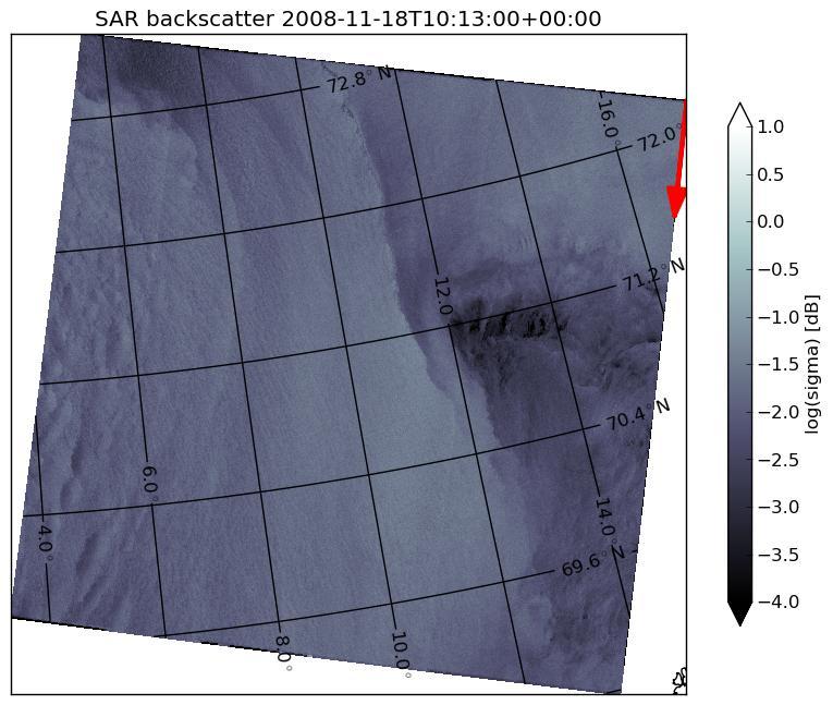
22 Surface signature in the SAR? 10 utc


23 AVHRR vs. SAR Signature of the polar low at surface vs. cloud top
24 Summary on polar lows: Small, fairly intense lows in the marine Arctic in the winter Forecasting: Cold air outbreaks Areas of deep convective instability Observing the polar low from satellites: AVHRR IR and visible for general cloud top Ascat for absolute wind speed SAR for qualitative detailed studies

25 Questions? polarlow.met.no
Dates and Positions of Polar lows over the Nordic Seas between 2000 and 2010
 no. 16/2010 Polar Lows Dates and Positions of Polar lows over the Nordic Seas between 2000 and 2010 Gunnar Noer and Trond Lien report Title Dates and positions of polar lows over the Nordic Seas between
Polar Lows and other High Latitude Weather Systems. John Turner and Tom Bracegirdle British Antarctic Survey Cambridge, UK
 Polar Lows and other High Latitude Weather Systems John Turner and Tom Bracegirdle British Antarctic Survey Cambridge, UK A mosaic of infra-red satellite imagery of the Antarctic and Southern Ocean on
Polar Lows and Other High Latitude Weather Systems
 Polar Lows and Other High Latitude Weather Systems John Turner and Tom Bracegirdle British Antarctic Survey, Cambridge, UK (J.Turner@bas.ac.uk) 1. Introduction Polar lows are mesoscale (less than 1,000
LATE REQUEST FOR A SPECIAL PROJECT
 LATE REQUEST FOR A SPECIAL PROJECT 2016 2018 MEMBER STATE: Norway Principal Investigator0F1 : Prof. Rune Grand Graversen Affiliation: Address: E-mail: Other researchers: Project Title: University of Tromsø
2016/17 Winter Monson in East Asia. Shingo ITO Tokyo Climate Center Japan Meteorological Agency
 2016/17 Winter Monson in East Asia Shingo ITO Tokyo Climate Center Japan Meteorological Agency 1 Outline 1. Overview of temperature anomalies in 2016/17 winter 2. Seasonal mean circulation characteristics
Satellites, Weather and Climate Module??: Polar Vortex
 Satellites, Weather and Climate Module??: Polar Vortex SWAC Jan 2014 AKA Circumpolar Vortex Science or Hype? Will there be one this year? Today s objectives Pre and Post exams What is the Polar Vortex
Lecture #14 March 29, 2010, Monday. Air Masses & Fronts
 Lecture #14 March 29, 2010, Monday Air Masses & Fronts General definitions air masses source regions fronts Air masses formation types Fronts formation types Air Masses General Definitions a large body
The Atmospheric Circulation
 The Atmospheric Circulation Vertical structure of the Atmosphere http://www.uwsp.edu/geo/faculty/ritter/geog101/textbook/atmosphere/atmospheric_structure.html The global heat engine [courtesy Kevin Trenberth,
1. COLD FRONT - CLOUD STRUCTURE IN SATELLITE IMAGES
 1. COLD FRONT - CLOUD STRUCTURE IN SATELLITE IMAGES The satellite image shows a cyclonically curved synoptic scale cloud band usually a few hundred kilometres wide; in the VIS image the cloud band mostly
 http://www.ssec.wisc.edu/data/composites.html Red curve: Incoming solar radiation Blue curve: Outgoing infrared radiation. Three-cell model of general circulation Mid-latitudes: 30 to 60 latitude MID-LATITUDES
3. Midlatitude Storm Tracks and the North Atlantic Oscillation
 3. Midlatitude Storm Tracks and the North Atlantic Oscillation Copyright 2006 Emily Shuckburgh, University of Cambridge. Not to be quoted or reproduced without permission. EFS 3/1 Review of key results
Detection, tracking and study of polar lows from satellites Leonid P. Bobylev
 Detection, tracking and study of polar lows from satellites Leonid P. Bobylev Nansen Centre, St. Petersburg, Russia Nansen Centre, Bergen, Norway Polar lows and their general characteristics International
Government of Sultanate of Oman Public Authority of Civil Aviation Directorate General of Meteorology. National Report To
 Government of Sultanate of Oman Public Authority of Civil Aviation Directorate General of Meteorology National Report To Panel on Tropical Cyclones in the Bay of Bengal And Arabian Sea 43rd Session, India
Verification of the Seasonal Forecast for the 2005/06 Winter
 Verification of the Seasonal Forecast for the 2005/06 Winter Shingo Yamada Tokyo Climate Center Japan Meteorological Agency 2006/11/02 7 th Joint Meeting on EAWM Contents 1. Verification of the Seasonal
A polar low named Vera
 4/2009 Meteorology A polar low named Vera dynamics and model performance Thor Erik Nordeng 3 Background 20th November 2008 the Norwegian Meteorological Institute issued an extreme weather warning for
The impact of polar mesoscale storms on northeast Atlantic Ocean circulation
 The impact of polar mesoscale storms on northeast Atlantic Ocean circulation Influence of polar mesoscale storms on ocean circulation in the Nordic Seas Supplementary Methods and Discussion Atmospheric
AIR MASSES. Large bodies of air. SOURCE REGIONS areas where air masses originate
 Large bodies of air AIR MASSES SOURCE REGIONS areas where air masses originate Uniform in composition Light surface winds Dominated by high surface pressure The longer the air mass remains over a region,
4/29/2011. Mid-latitude cyclones form along a
 Chapter 10: Cyclones: East of the Rocky Mountain Extratropical Cyclones Environment prior to the development of the Cyclone Initial Development of the Extratropical Cyclone Early Weather Along the Fronts
Transient and Eddy. Transient/Eddy Flux. Flux Components. Lecture 3: Weather/Disturbance. Transient: deviations from time mean Time Mean
 Lecture 3: Weather/Disturbance Transients and Eddies Climate Roles Mid-Latitude Cyclones Tropical Hurricanes Mid-Ocean Eddies Transient and Eddy Transient: deviations from time mean Time Mean Eddy: deviations
Science Olympiad Meteorology Quiz #1 Page 1 of 7
 1) What is generally true about the stratosphere: a) Has turbulent updrafts and downdrafts. b) Has either a stable or increasing temperature profile with altitude. c) Where the auroras occur. d) Both a)
Tropical Cyclone Formation/Structure/Motion Studies
 Tropical Cyclone Formation/Structure/Motion Studies Patrick A. Harr Department of Meteorology Naval Postgraduate School Monterey, CA 93943-5114 phone: (831) 656-3787 fax: (831) 656-3061 email: paharr@nps.edu
ESCI 344 Tropical Meteorology Lesson 7 Temperature, Clouds, and Rain
 ESCI 344 Tropical Meteorology Lesson 7 Temperature, Clouds, and Rain References: Forecaster s Guide to Tropical Meteorology (updated), Ramage Tropical Climatology, McGregor and Nieuwolt Climate and Weather
SST measurements over the Arctic based on METOP data
 SST measurements over the Arctic based on METOP data Pierre Le Borgne*, Steinar Eastwood**, Jacob Hoyer*** EUMETSAT / Ocean and Sea Ice Satellite Application Facility Presented at the Space and the Arctic
Chapter 1 Anatomy of a Cyclone
 Chapter 1 Anatomy of a Cyclone The Beast in the East 15-17 February 2003 Extra-tropical cyclone an area of low pressure outside of the tropics Other names for extra-tropical cyclones: Cyclone Mid-latitude
THE FEASIBILITY OF EXTRACTING LOWLEVEL WIND BY TRACING LOW LEVEL MOISTURE OBSERVED IN IR IMAGERY OVER CLOUD FREE OCEAN AREA IN THE TROPICS
 THE FEASIBILITY OF EXTRACTING LOWLEVEL WIND BY TRACING LOW LEVEL MOISTURE OBSERVED IN IR IMAGERY OVER CLOUD FREE OCEAN AREA IN THE TROPICS Toshiro Ihoue and Tetsuo Nakazawa Meteorological Research Institute
A case of Rapid Cyclogenesis over Ionian Sea on February 6 th, 2012
 Author: Kyriaki Metheniti, HNMS Showcase Title: A case of Rapid Cyclogenesis Time frame: February 6 to February 7, 2012 Study region: Eastern Mediterranean, Ionian Sea A case of Rapid Cyclogenesis over
Hurricanes. April 14, 2009
 Tropical Weather & Hurricanes Chapter 15 April 14, 2009 Tropical meteorology Tropics characterized by seasonal wet and drier periods- wet when sun is nearly overhead at noon and inter-tropical convergence
Lec 10: Interpreting Weather Maps
 Lec 10: Interpreting Weather Maps Case Study: October 2011 Nor easter FIU MET 3502 Synoptic Hurricane Forecasts Genesis: on large scale weather maps or satellite images, look for tropical waves (Africa
Synoptic and mesoscale analysis of waterspouts in the Adriatic ( preliminary climatology)
") Synoptic and mesoscale analysis of waterspouts in the Adriatic (2001-2011 preliminary climatology) Josipa Kuzmić 1, Tanja Renko 1, Nataša Strelec Mahović 1 1 Meteorological and Hydrological Service of
Synoptic and mesoscale analysis of waterspouts in the Adriatic (2001-2011 preliminary climatology) Josipa Kuzmić 1, Tanja Renko 1, Nataša Strelec Mahović 1 1 Meteorological and Hydrological Service of
Middle Latitude Cyclones a storm that forms at middle and high latitudes, outside of the tropics.
 Middle Latitude Cyclones a storm that forms at middle and high latitudes, outside of the tropics. Polar Front Theory a theory that explains the life cycle of mid latitude cyclones and their associated
Synoptic Meteorology
 M.Sc. in Meteorology Synoptic Meteorology [MAPH P312] Prof Peter Lynch Second Semester, 2004 2005 Seminar Room Dept. of Maths. Physics, UCD, Belfield. Part 9 Extratropical Weather Systems These lectures
Summary of November Central U.S. Winter Storm By Christopher Hedge
 Summary of November 12-13 2010 Central U.S. Winter Storm By Christopher Hedge Event Overview The first significant snowfall of the 2010-2011 season affected portions of the plains and upper Mississippi
Aviation Hazards: Thunderstorms and Deep Convection
 Aviation Hazards: Thunderstorms and Deep Convection TREND Diagnosis of thunderstorm hazards using imagery Contents Satellite imagery Visible, infrared, water vapour Basic cloud identification Identifying
J16.1 PRELIMINARY ASSESSMENT OF ASCAT OCEAN SURFACE VECTOR WIND (OSVW) RETRIEVALS AT NOAA OCEAN PREDICTION CENTER
 RETRIEVALS AT NOAA OCEAN PREDICTION CENTER") J16.1 PRELIMINARY ASSESSMENT OF ASCAT OCEAN SURFACE VECTOR WIND (OSVW) RETRIEVALS AT NOAA OCEAN PREDICTION CENTER Khalil. A. Ahmad* PSGS/NOAA/NESDIS/StAR, Camp Springs, MD Joseph Sienkiewicz NOAA/NWS/NCEP/OPC,
J16.1 PRELIMINARY ASSESSMENT OF ASCAT OCEAN SURFACE VECTOR WIND (OSVW) RETRIEVALS AT NOAA OCEAN PREDICTION CENTER Khalil. A. Ahmad* PSGS/NOAA/NESDIS/StAR, Camp Springs, MD Joseph Sienkiewicz NOAA/NWS/NCEP/OPC,
Thanksgiving Snow and Arctic Front 25 November 2005 By Richard H. Grumm National Weather Service State College, PA 16801
 Thanksgiving Snow and Arctic Front 25 November 2005 By Richard H. Grumm National Weather Service State College, PA 16801 1. INTRODUCTION An approaching arctic front brought light snow to most of western
ENSO Outlook by JMA. Hiroyuki Sugimoto. El Niño Monitoring and Prediction Group Climate Prediction Division Japan Meteorological Agency
 ENSO Outlook by JMA Hiroyuki Sugimoto El Niño Monitoring and Prediction Group Climate Prediction Division Outline 1. ENSO impacts on the climate 2. Current Conditions 3. Prediction by JMA/MRI-CGCM 4. Summary
NOAA/NESDIS Tropical Web Page with LEO Satellite Products and Applications for Forecasters
 NOAA/NESDIS Tropical Web Page with LEO Satellite Products and Applications for Forecasters Sheldon Kusselson National Oceanic and Atmospheric Administration (NOAA) National Environmental Satellite Data
A polar low named Vera: the use of potential vorticity diagnostics to assess its development
 Quarterly Journal of the Royal Meteorological Society Q. J. R. Meteorol. Soc. 137: 179 183, October 11 A A polar low named Vera: the use of potential vorticity diagnostics to assess its development Thor
Tropical-Extratropical Transition
 Tropical-Extratropical Transition Extratropical Transition A significant number of tropical cyclones move into the midlatitudes and transform into extratropical cyclones. This process is generally referred
Satellites, Weather and Climate Module 9: Air/sea interactions winter cyclogenesis
 Satellites, Weather and Climate Module 9: Air/sea interactions winter cyclogenesis Winter storms things to consider Deep moisture Thermal discontinuity Favorable surface and upper level features Geographical
Extratropical and Polar Cloud Systems
 Extratropical and Polar Cloud Systems Gunilla Svensson Department of Meteorology & Bolin Centre for Climate Research George Tselioudis Extratropical and Polar Cloud Systems Lecture 1 Extratropical cyclones
Inflow and Outflow through the Sea-to-Sky Corridor in February 2010: Lessons Learned from SNOW-V10 *
 Inflow and Outflow through the Sea-to-Sky Corridor in February 2010: Lessons Learned from SNOW-V10 * Ruping Mo National Laboratory for Coastal and Mountain Meteorology, Environment Canada, Vancouver, BC,
High Resolution Modeling of Multi-scale Cloud and Precipitation Systems Using a Cloud-Resolving Model
 Chapter 1 Atmospheric and Oceanic Simulation High Resolution Modeling of Multi-scale Cloud and Precipitation Systems Using a Cloud-Resolving Model Project Representative Kazuhisa Tsuboki Author Kazuhisa
Air Masses of North America cp and ca air masses Air mass characterized by very cold and dry conditions
 Chapter 8: Air Masses, Fronts, and Middle-Latitude Cyclones Air masses Fronts Middle-latitude cyclones Air Masses Air mass an extremely large body of air whose properties of temperature and humidity are
The Impact of air-sea interaction on the extratropical transition of tropical cyclones
 The Impact of air-sea interaction on the extratropical transition of tropical cyclones Sarah Jones Institut für Meteorologie und Klimaforschung Universität Karlsruhe / Forschungszentrum Karlsruhe 1. Introduction
Regional Sea Ice Outlook for Greenland Sea and Barents Sea - based on data until the end of May 2013
 Regional Sea Ice Outlook for Greenland Sea and Barents Sea - based on data until the end of May 2013 Sebastian Gerland 1*, Max König 1, Angelika H.H. Renner 1, Gunnar Spreen 1, Nick Hughes 2, and Olga
Lecture 14. Extratropical Cyclones extratropical cyclone
 Lecture 14. Extratropical Cyclones In mid-latitudes, much of our weather is associated with a particular kind of storm, the extratropical cyclone Cyclone: circulation around low pressure center Some midwesterners
Interpretation of Outputs from Numerical Prediction System
 Interpretation of Outputs from Numerical Prediction System Hiroshi OHNO Tokyo Climate Center (TCC)/ Climate Prediction Division of Japan Meteorological Agency (JMA) Procedure of Seasonal Forecast (1) 1.
Pacific Storm Track at Different Horizontal Resolutions Snap-shot of Column Liquid Water Content
 Color Plates Pacific Storm Track at Different Horizontal Resolutions Snap-shot of Column Liquid Water Content Fig. 2.8 A snapshot of the cyclone frontal-system by a nonhydrostatic model run with two very
The water vapour channels of SEVIRI (Meteosat). An introduction
. An introduction") The water vapour channels of SEVIRI (Meteosat). An introduction jose.prieto@eumetsat.int Cachoeira P. July 2006 Formats 1.5 1 Objectives 2 Describe the characteristics of WV channels on board of SEVIRI
The water vapour channels of SEVIRI (Meteosat). An introduction jose.prieto@eumetsat.int Cachoeira P. July 2006 Formats 1.5 1 Objectives 2 Describe the characteristics of WV channels on board of SEVIRI
Fronts in November 1998 Storm
 Fronts in November 1998 Storm Much of the significant weather observed in association with extratropical storms tends to be concentrated within narrow bands called frontal zones. Fronts in November 1998
P R O L O G U E CORRELATION COEF. dsst/dt during wintertime (i.e., end of Feb. minus beginning of Dec, using 11-day averaged climatology)
") P R O L O G U E dsst/dt during wintertime (i.e., end of Feb. minus beginning of Dec, using 11-day averaged climatology) Correlation between total precipitable water (from NVAP-M) and total cloud (from
P R O L O G U E dsst/dt during wintertime (i.e., end of Feb. minus beginning of Dec, using 11-day averaged climatology) Correlation between total precipitable water (from NVAP-M) and total cloud (from
Hurricanes and Tropical Weather Systems:
 Hurricanes and Tropical Weather Systems: An influence on weather in parts of the USA Meteorology 411 Iowa State University Week 2 Bill Gallus Classification/Terminology Tropical Disturbance enhanced convection
Recent Data Assimilation Activities at Environment Canada
 Recent Data Assimilation Activities at Environment Canada Major upgrade to global and regional deterministic prediction systems (now in parallel run) Sea ice data assimilation Mark Buehner Data Assimilation
Multiscale Analyses of Inland Tropical Cyclone Midlatitude Jet Interactions: Camille (1969) and Danny (1997)
 and Danny (1997)") Multiscale Analyses of Inland Tropical Cyclone Midlatitude Jet Interactions: Camille (1969) and Danny (1997) Matthew Potter, Lance Bosart, and Daniel Keyser Department of Atmospheric and Environmental
Multiscale Analyses of Inland Tropical Cyclone Midlatitude Jet Interactions: Camille (1969) and Danny (1997) Matthew Potter, Lance Bosart, and Daniel Keyser Department of Atmospheric and Environmental
The Arctic Energy Budget
 The Arctic Energy Budget The global heat engine [courtesy Kevin Trenberth, NCAR]. Differential solar heating between low and high latitudes gives rise to a circulation of the atmosphere and ocean that
Appalachian Lee Troughs and their Association with Severe Thunderstorms
 Appalachian Lee Troughs and their Association with Severe Thunderstorms Daniel B. Thompson, Lance F. Bosart and Daniel Keyser Department of Atmospheric and Environmental Sciences University at Albany/SUNY,
Impacts of the April 2013 Mean trough over central North America
 Impacts of the April 2013 Mean trough over central North America By Richard H. Grumm National Weather Service State College, PA Abstract: The mean 500 hpa flow over North America featured a trough over
A 2-year climatology of polar low events over the Nordic Seas from satellite remote sensing
 GEOPHYSICAL RESEARCH LETTERS, VOL. 35, L09815, doi:10.1029/2008gl033706, 2008 A 2-year climatology of polar low events over the Nordic Seas from satellite remote sensing A.-M. Blechschmidt 1 Received 20
Weather report 28 November 2017 Campinas/SP
 Weather report 28 November 2017 Campinas/SP Summary: 1) Synoptic analysis and pre-convective environment 2) Verification 1) Synoptic analysis and pre-convective environment: At 1200 UTC 28 November 2017
AOSC 200 Tim Canty. Class Web Site: Topics for today: Air Masses. Fronts. Lecture 19 Apr
 Air Masses AOSC 200 Tim Canty Class Web Site: http://www.atmos.umd.edu/~tcanty/aosc200 Topics for today: Air Masses Fronts Lecture 19 Apr 11 2019 1 Today s Weather Map http://www.wpc.ncep.noaa.gov/#page=sfc
Chapter 24 Tropical Cyclones
 Chapter 24 Tropical Cyclones Tropical Weather Systems Tropical disturbance a cluster of thunderstorms about 250 to 600 km in diameter, originating in the tropics or sub-tropics Tropical depression a cluster
Satellite microwave observations and investigations of extreme events (polar lows) in the Arctic
 in the Arctic") Satellite microwave observations and investigations of extreme events (polar lows) in the Arctic Elizaveta Zabolotskikh, Vladimir Kudryavtsev, Pavel Golubkin, Olga Aniskina, and Bertrand Chapron Outline
Satellite microwave observations and investigations of extreme events (polar lows) in the Arctic Elizaveta Zabolotskikh, Vladimir Kudryavtsev, Pavel Golubkin, Olga Aniskina, and Bertrand Chapron Outline
Day Microphysics RGB Nephanalysis in daytime. Meteorological Satellite Center, JMA
 Day Microphysics RGB Nephanalysis in daytime Meteorological Satellite Center, JMA What s Day Microphysics RGB? R : B04 (N1 0.86) Range : 0~100 [%] Gamma : 1.0 G : B07(I4 3.9) (Solar component) Range :
Foundations of Earth Science, 6e Lutgens, Tarbuck, & Tasa
 Foundations of Earth Science, 6e Lutgens, Tarbuck, & Tasa Weather Patterns and Severe Weather Foundations, 6e - Chapter 14 Stan Hatfield Southwestern Illinois College Air masses Characteristics Large body
APPENDIX B PHYSICAL BASELINE STUDY: NORTHEAST BAFFIN BAY 1
 APPENDIX B PHYSICAL BASELINE STUDY: NORTHEAST BAFFIN BAY 1 1 By David B. Fissel, Mar Martínez de Saavedra Álvarez, and Randy C. Kerr, ASL Environmental Sciences Inc. (Feb. 2012) West Greenland Seismic
A SEVERE WEATHER EVENT IN ROMANIA DUE TO MEDITERRANEAN CYCLONIC ACTIVITY
 A SEVERE WEATHER EVENT IN ROMANIA DUE TO MEDITERRANEAN CYCLONIC ACTIVITY Florinela Georgescu, Gabriela Bancila, Viorica Dima National Meteorological Administration, Bucharest, Romania Abstract Mediterranean
Air Mass Thunderstorms. Air Mass Thunderstorms. Air Mass Thunderstorms. Lecture 26 Air Mass Thunderstorms and Lightning
 Lecture 26 and Lightning Life Cycle Environment Climatology Lightning 1 2 Short-lived, isolated thunderstorms that are not severe are often called air-mass thunderstorms. There are three stages describing
Divergence, Spin, and Tilt. Convergence and Divergence. Midlatitude Cyclones. Large-Scale Setting
 Midlatitude Cyclones Equator-to-pole temperature gradient tilts pressure surfaces and produces westerly jets in midlatitudes Waves in the jet induce divergence and convergence aloft, leading to surface
Severe Weather with a strong cold front: 2-3 April 2006 By Richard H. Grumm National Weather Service Office State College, PA 16803
 Severe Weather with a strong cold front: 2-3 April 2006 By Richard H. Grumm National Weather Service Office State College, PA 16803 1. INTRODUCTION A strong cold front brought severe weather to much of
- tornadoes. Further Reading: Chapter 08 of the text book. Outline. -tropical storms. -Storm surge
 (1 of 12) Further Reading: Chapter 08 of the text book Outline - tornadoes -tropical storms -Storm surge (2 of 12) Introduction Previously, We talked about fronts and their relationship to air masses Also
The Planetary Circulation System
 12 The Planetary Circulation System Learning Goals After studying this chapter, students should be able to: 1. describe and account for the global patterns of pressure, wind patterns and ocean currents
The feature of atmospheric circulation in the extremely warm winter 2006/2007
 The feature of atmospheric circulation in the extremely warm winter 2006/2007 Hiroshi Hasegawa 1, Yayoi Harada 1, Hiroshi Nakamigawa 1, Atsushi Goto 1 1 Climate Prediction Division, Japan Meteorological
Tropical Waves. John Cangialosi and Lixion Avila National Hurricane Center. WMO Region IV Tropical Cyclone Workshop
 Tropical Waves John Cangialosi and Lixion Avila National Hurricane Center WMO Region IV Tropical Cyclone Workshop Outline Basic definition Schematic diagrams/interactions Operational products/forecasts
A Tropical Cyclone with a Very Large Eye
 JANUARY 1999 PICTURES OF THE MONTH 137 A Tropical Cyclone with a Very Large Eye MARK A. LANDER University of Guam, Mangilao, Guam 9 September 1997 and 2 March 1998 1. Introduction The well-defined eye
On the effect of forward shear and reversed shear baroclinic flows for polar low developments. Thor Erik Nordeng Norwegian Meteorological Institute
 On the effect of forward shear and reversed shear baroclinic flows for polar low developments Thor Erik Nordeng Norwegian Meteorological Institute Outline Baroclinic growth a) Normal mode solution b) Initial
Synoptic Meteorology II: Petterssen-Sutcliffe Development Theory Application March 2015
 Synoptic Meteorology II: Petterssen-Sutcliffe Development Theory Application 10-12 March 2015 In our lecture on Petterssen-Sutcliffe Development Theory, we outlined the principle of selfdevelopment in
Using Satellite Passive Microwave Data to Study Arctic Polar Lows
 Using Satellite Passive Microwave Data to Study Arctic Polar Lows Elizaveta V. Zabolotskikh 1,2, Leonid P. Bobylev 1,3, Vladimir Kudryavtsev 1,2, and Leonid Mitnik 4 1Nansen Centre, St. Petersburg, Russia
ALASKA REGION CLIMATE FORECAST BRIEFING. January 23, 2015 Rick Thoman ESSD Climate Services
 ALASKA REGION CLIMATE FORECAST BRIEFING January 23, 2015 Rick Thoman ESSD Climate Services Today Climate Forecast Basics Review of recent climate forecasts and conditions CPC Forecasts and observations
Update on SCOPE-Nowcasting Pilot Project Real Time Ocean Products Suman Goyal Scientist-E
 Update on SCOPE-Nowcasting Pilot Project Real Time Ocean Products Suman Goyal Scientist-E 19-22 Nov 2013 SCOPE-Nowcasting-1 Agenda Item 5 Pilot Projects Overview Users /Clients User requirements Product
PICTURE OF THE MONTH. Satellite Imagery of Sea Surface Temperature Cooling in the Wake of Hurricane Edouard (1996)
") 2716 MONTHLY WEATHER REVIEW VOLUME 125 PICTURE OF THE MONTH Satellite Imagery of Sea Surface Temperature Cooling in the Wake of Hurricane Edouard (1996) FRANK M. MONALDO Applied Physics Laboratory, The
2716 MONTHLY WEATHER REVIEW VOLUME 125 PICTURE OF THE MONTH Satellite Imagery of Sea Surface Temperature Cooling in the Wake of Hurricane Edouard (1996) FRANK M. MONALDO Applied Physics Laboratory, The
A Numerical Modeling Study of Mesoscale Cyclogenesis to the East of the Korean Peninsula
 VOLUME 126 MONTHLY WEATHER REVIEW SEPTEMBER 1998 A Numerical Modeling Study of Mesoscale Cyclogenesis to the East of the Korean Peninsula TAE-YOUNG LEE AND YOUNG-YOUN PARK Department of Atmospheric Sciences,
From short range forecasts to climate change projections of extreme events in the Baltic Sea region
 Great Baltic Sea flood, November 13, 1872 Farm houses in Niendorf (near Lübeck) being torn away. Privately owned, Fam. Muuß, Hotel Friedrichsruh. Sea level 3.50 m above normal. From short range forecasts
Temperature and salinity fluctuations in the Norwegian Sea in relation to wind
 ICES Annual Science Conference 1999 Theme session L: Nordic Seas Exchanges ICES C.M. 19991L:03 Temperature and salinity fluctuations in the Norwegian Sea in relation to wind by Kjell Arne Mork and Lars
Winter Forecast for GPC Tokyo. Shotaro TANAKA Tokyo Climate Center (TCC) Japan Meteorological Agency (JMA)
 Japan Meteorological Agency (JMA)") Winter Forecast for 2013 2014 GPC Tokyo Shotaro TANAKA Tokyo Climate Center (TCC) Japan Meteorological Agency (JMA) NEACOF 5, October 29 November 1, 2013 1 Outline 1. Numerical prediction 2. Interannual
Winter Forecast for 2013 2014 GPC Tokyo Shotaro TANAKA Tokyo Climate Center (TCC) Japan Meteorological Agency (JMA) NEACOF 5, October 29 November 1, 2013 1 Outline 1. Numerical prediction 2. Interannual
1. INTRODUCTION: 2. DATA AND METHODOLOGY:
 27th Conference on Hurricanes and Tropical Meteorology, 24-28 April 2006, Monterey, CA 3A.4 SUPERTYPHOON DALE (1996): A REMARKABLE STORM FROM BIRTH THROUGH EXTRATROPICAL TRANSITION TO EXPLOSIVE REINTENSIFICATION
Ki-Hong Min 1*, Seonhee Choo 2, and Gyuwon Lee 1, and Kyung-Eak Kim 1,3
 Ki-Hong Min 1*, Seonhee Choo 2, and Gyuwon Lee 1, and Kyung-Eak Kim 1,3 1 School of Earth System Sciences, Major in Atmospheric Science, Kyungpook National University, Daegu, South Korea 2 Forecast Technology
Cold air outbreak over the Kuroshio Extension Region
 Cold air outbreak over the Kuroshio Extension Region Jensen, T. G. 1, T. Campbell 1, T. A. Smith 1, R. J. Small 2 and R. Allard 1 1 Naval Research Laboratory, 2 Jacobs Engineering NRL, Code 7320, Stennis
Examination #3 Wednesday, 28 November 2001
 Name & Signature Dr. Droegemeier Student ID Meteorology 1004 Introduction to Meteorology Fall, 2001 Examination #3 Wednesday, 28 November 2001 BEFORE YOU BEGIN!! Please be sure to read each question CAREFULLY
Meteorological Satellite Image Interpretations, Part III. Acknowledgement: Dr. S. Kidder at Colorado State Univ.
 Meteorological Satellite Image Interpretations, Part III Acknowledgement: Dr. S. Kidder at Colorado State Univ. Dates EAS417 Topics Jan 30 Introduction & Matlab tutorial Feb 1 Satellite orbits & navigation
Examination of Tropical Cyclogenesis using the High Temporal and Spatial Resolution JRA-25 Dataset
 Examination of Tropical Cyclogenesis using the High Temporal and Spatial Resolution JRA-25 Dataset Masato Sugi Forecast Research Department, Meteorological Research Institute, Japan Correspondence: msugi@mri-jma.go.jp
Interpretation of Polar-orbiting Satellite Observations. Atmospheric Instrumentation
 Interpretation of Polar-orbiting Satellite Observations Outline Polar-Orbiting Observations: Review of Polar-Orbiting Satellite Systems Overview of Currently Active Satellites / Sensors Overview of Sensor
A Synoptic Climatology of Heavy Precipitation Events in California
 A Synoptic Climatology of Heavy Precipitation Events in California Alan Haynes Hydrometeorological Analysis and Support (HAS) Forecaster National Weather Service California-Nevada River Forecast Center
Polar Front Theory. Cyclogenesis. Day 1. Days 2-5. What Happens Aloft. Up Above
 Cyclogenesis Tor Bergeron lecturing Mid latitude cyclones are born on the Polar Front as a developing wave Theory of cyclogenesis (formation of cyclones) first developed by the Norwegian meteorologists
Inner core dynamics: Eyewall Replacement and hot towers
 Inner core dynamics: Eyewall Replacement and hot towers FIU Undergraduate Hurricane Internship Lecture 4 8/13/2012 Why inner core dynamics is important? Current TC intensity and structure forecasts contain
STATUS OF OPERATIONAL AMVS FROM FY-2C AND D
 STATUS OF OPERATIONAL AMVS FROM FY-2C AND D Zhang Qisong, Xu Jianmin, Lu Feng, Zhang Xiaohu, Zhao Fengsheng, Gong Jiandong, Li Yun National Satellite Meteorological Center, Beijing 100081, CHINA Abstract
Diabatic processes and the structure of the warm conveyor belt
 2 nd European Windstorm Workshop Leeds, 3-4 September 2012 Diabatic processes and the structure of the warm conveyor belt Oscar Martínez-Alvarado J. Chagnon, S. Gray, R. Plant, J. Methven Department of
Analysis of Fall Transition Season (Sept-Early Dec) Why has the weather been so violent?
 Why has the weather been so violent?") WEATHER TOPICS Analysis of Fall Transition Season (Sept-Early Dec) 2009 Why has the weather been so violent? As can be seen by the following forecast map, the Fall Transition and early Winter Season of
WEATHER TOPICS Analysis of Fall Transition Season (Sept-Early Dec) 2009 Why has the weather been so violent? As can be seen by the following forecast map, the Fall Transition and early Winter Season of
and 24 mm, hPa lapse rates between 3 and 4 K km 1, lifted index values
 3.2 Composite analysis 3.2.1 Pure gradient composites The composite initial NE report in the pure gradient northwest composite (N = 32) occurs where the mean sea level pressure (MSLP) gradient is strongest
Convective Cloud Features in typical synoptic situations. Frans Debie
 Convective Cloud Features in typical synoptic situations Frans Debie me SATRAPPERS Henk vesa Frans Veronika ab Teachers classroom Langen Cumulonimbus: Convection Convection, seen from ground 1 2 3 4 Outflow