How Graphic Representations of Outages at Alabama Power Are Made Simple
|
|
|
- Irene Armstrong
- 5 years ago
- Views:
Transcription
1 How Graphic Representations of Outages at Alabama Power Are Made Simple
2 Presentation Overview This presentation will discuss the steps we took at Alabama Power using GIS to create a couple of different maps of outages reported in our Outage Management System. Reasons Outage Maps Developed Executive Dashboard Update Media
3 Presentation Agenda Alabama Power Who are we? How Our Outage Management System (OMS) Functions Maps Real Time Outage Map Historic Outage Map The Future AMI (Advanced Metering Infrastructure) IDMS (Integrated Distribution Management System)

4 Alabama Power Company Affiliate of The Southern Company Headquartered in Birmingham, Alabama Employees Employees 6,980 Customers Total 1,431,334 Residential 1,207,883 Commercial.216,830 Others*..6,621 Miles of Line Total 89,648 Transmission Total 10,218 Distribution Total 79,430 Service Territory Square Miles..44,500 Divisions...6 Operation Centers.82 Transmission and Distribution Total poles and towers 1,516,602 Distribution poles.1,396,297

5 Hurricane Hurricane Katrina Date: August 2005 Type of storm: Hurricane Peak customers out: 636,891 Days to restore service: 9

6 Ice Storms Ice Storm of 1982 Date: January 12, 1982 Type of storm: Ice Peak customers out: 250,000 Days to restore service: 9

7 Ice and Snow The Blizzard of 1993 Date: March 13, 1993 Type of storm: Snow Peak customers out: 404,206 Days to restore service: 8
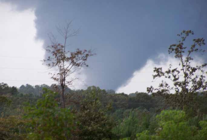
8 Tornadoes

9 Straight Line Winds
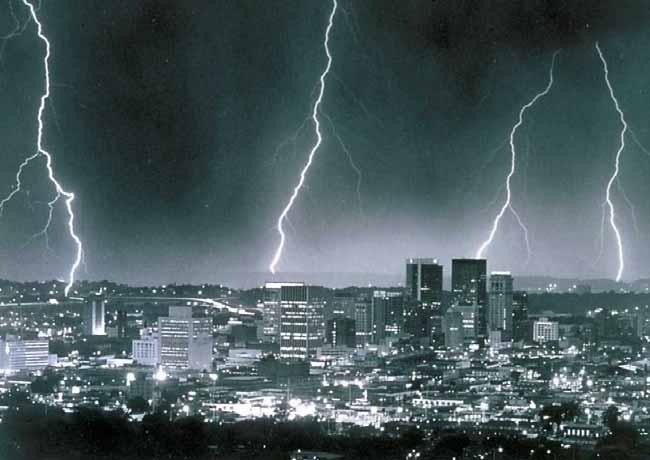
10 Afternoon Thunderstorms


11 Outage Management System Used to identify the source of outages in the electrical distribution system based on customer calls via an interface to the Customer Accounting System CUSTOMER ACCOUNT Outage Management System

12 Data OMS DATA RECEIVED FROM OUTAGE MANAGEMENT SYSTEM TABLE OPERATION CENTER DEVICE # OF CUSTOMERS COMMENTS TIME (OUTAGE AND RESTORATION)
13 Data Structure OMS GIS REAL TIME OUTAGE GRAPHIC HISTORIC OUTAGE ANALYSIS
14 Data Structure OPERATION CENTER TABLE Contains Operation Center and Number of Customers Out by Operation Center Directly from OMS OMS OPERATION CENTER # OF CUSTOMERS BY OPERATION CENTER OUTAGE OPERATION CENTER TABLE
15 Data Structure PRIMARY TABLE Created by Joining Primary Table with OMS Table Based on Sectionalizing Device GIS SECTIONALIZING DEVICE OMS PRIMARY OBJECTID SECTIONALIZING DEVICE # OF CUSTOMERS BY DEVICE COMMENTS OUTAGE PRIMARY TABLE OPERATION CENTER
16 Data Structure ArcMap Publish ArcReader (.pmf) GIS OUTAGE PRIMARY TABLE GIS OH/UG PRIMARY TABLE GIS OPERATION CENTER TABLE OUTAGE OPERATION CENTER TABLE PRIMARY SYMBOLOGY Energized De-Energized OP CENTER SYMBOLOGY

17 Real Time Outage Map


18 Outage Map at State Level

19 Outage Map at Operation Center Level Energized De-Energized

20 Outage Map at Primary Level With Satellite Image and Street View
21 Outage Map in ArcReader TOOLS Zoom in/out Pan Go to previous/next extent View spatial bookmarks Searching by address or feature Identify features Hyperlink tool Measure features Mark-up capabilities


22 Historic Outage Map Post Storm Restoration Shows Storm Impact and Restoration Efforts Helps Analyze Past Storm Operation in Preparation for Future Events Tracking Analyst Tool (ESRI)

23 Historic Outage Maps Data Sources OMS Wind Band Shapefile APCO GIS Database ESRI Resource Center (Imagery, Weather Radar, and Street Maps)


24 Historic Outage Maps Major Storm Hurricane Post Hurricane Past Hurricanes Customers Impacted Tracking Analyst Tool.avi Path Impact Impact Comparison

")


25 Tracking Analyst (ESRI Extension) How to Add Temporal Data How to Customize Layer How to Play Back Data
26 Historic Storm Video (June 2009)
27 Historic Storm Video (Hurricane Dennis 2005)
28
 Integrated Distribution Management")
29 Future Outage Management Advanced Metering Infrastructure (AMI) Integrated Distribution Management System (IDMS)

30 Future Outage Management Advanced Metering Infrastructure Read Any Meter Anytime Voltage Information Active Power Outage, Power Restoration, and Tamper Detection
31 Future Outage Management Integrated Distribution Management System IDMS Infrastructure USERS DGIS SUB INFO MODEL VALIDATE BUILD Electronic User Environment AMI CSS Meters Field RTU Devices SCADA Distribution Model OMS IVR SWITCHING MANAGEMENT Business Rules Switching History ADVANCED APPLICATIONS OUTAGE HISTORY ANALYSIS


32 Future Outage Management


33 Future Outage Management


34

35 THANKS FOR YOUR TIME! QUESTIONS? Contact Us: Sultan Alhabsi Brandon Clark
GIS Solution For Electric Utilities With Integration With Distribution Management System
 GIS Solution For Electric Utilities With Integration With Distribution Management System Agenda Importance Of The GIS GIS - DMS Integration Requirements Distribution Management System The Benefits Of The
BVES Annual Reliability Public Presentation 2016 Performance
 BVES Annual Reliability Public Presentation 2016 Performance December 13, 2017 Agenda Company Overview What is Electric Utility Reliability? Requirements & Definitions Reliability Indices 2016 Reliability
Superstorm Sandy What Risk Managers and Underwriters Learned
 Superstorm Sandy What Risk Managers and Underwriters Learned Gary Ladman Vice President, Property Underwriting AEGIS Insurance Services, Inc. Superstorm Sandy Change in the Weather Recent years appears
Enterprise GIS to Support ADMS ESRI GeoConx EGUG 2016 Parag Parikh
 October 20, 2016 ESRI GeoConX Enterprise GIS to Support ADMS ESRI GeoConx EGUG 2016 Parag Parikh Parag.Parikh@us.abb.com Slide 1 WE Energies Overview Total accounts: 2,240,640 Electric accounts: 1,148,805
2016 HURRICANE SEASON PREPARATION. March 30, 2016
 2016 HURRICANE SEASON PREPARATION March 30, 2016 Hurricane Season Plan Preparation Communication Restoration Distribution Vegetation Management Mainline Trimming (3 Year Cycle) Mainline Annual Trim Schedule
A Utility s Response and Recovery. Marc Butts Southern Company 03/19/2014
 A Utility s Response and Recovery Marc Butts Southern Company 03/19/2014 Service territory across four states: 120,000 square miles Serves approximately 4 million customers Other Subsidiaries: Southern
Director, Operations Services, Met-Ed
 Director, Operations Services, Met-Ed Pennsylvania House Republican Policy Committee Hearing on Storm Response Tobyhanna Township Municipal Building Pocono Pines, Pa. August 9, 2018 Planning and Forecast
How Power is Restored After a Severe Storm. Presented by Stacy Shaw, Safety Director & Nolan Hartzler, GIS Mapping Technician
 How Power is Restored After a Severe Storm Presented by Stacy Shaw, Safety Director & Nolan Hartzler, GIS Mapping Technician Hurricanes, ice storms, tornadoes One inch of ice on a single span of electric
Smart Grid Opportunities Being Pursued. Stephanie Hamilton Brookhaven National Laboratory June 5, 2013
 Smart Grid Opportunities Being Pursued Stephanie Hamilton Brookhaven National Laboratory June 5, 2013 OUR DREAM!! BNL s Smarter Electric Grid Research, Innovation, Development. Demonstration, Deployment
Electric Distribution Storm Hardening Initiatives. Paul V. Stergiou Distribution Engineering October 14 th, 2015
 Consolidated Edison Company of New York, Inc. Electric Distribution Storm Hardening Initiatives Paul V. Stergiou Distribution Engineering October 14 th, 2015 Energy For New York City And Westchester 3.3
Demystifying ArcGIS Online. Karen Lizcano Esri
 Demystifying ArcGIS Online Karen Lizcano Esri An Integrated Web GIS Platform Desktop Web Device Powered by Services Managed via Portal Access from any Device Portal Server Online Content and Services ArcGIS
Lesson: Don t Wait For the Storm
 Lesson: Don t Wait For the Storm Developing a GIS for Plaquemines Parish, Louisiana Presented by: Daniel Mellott, GISP Burk Kleinpeter, Inc. Where is Plaquemines Parish? 1998 GIS Feasibility Study User
Project Charter. $58,000 See attached budget report. shapefile to track poles and pole attachments. Poles are defined as a support structure on
 Project Charter Title: Pole and Pole Attachment Geodatabase Design Sponsor: City of Philadelphia Streets Department Date: May 10, 2006 Estimated Start Date: June 1, 2006 Projected Finish Date: October
Is Your GIS Ready For Grid Modernization? A State-of-the Industry Report
 Is Your GIS Ready For Grid Modernization? A State-of-the Industry Report Is Your GIS Ready For Grid Modernization? Survey Overview In the first quarter of 2019, Energy Acuity conducted a grid modernization
NWS Resources For School Districts
 NWS Resources For School Districts January 23rd, 2017 Shawn DeVinny shawn.devinny@noaa.gov Meteorologist National Weather Service Twin Cities/Chanhassen, MN Outline Watches/Warnings/Advisories Example
Ken R. Waters. NOAA/National Weather Service Honolulu, Hawaii
 4.B1 VERIFICATION OF NATIONAL WEATHER SERVICE WARNINGS USING GEOGRAPHIC INFORMATION SYSTEMS Ken R. Waters NOAA/National Weather Service Honolulu, Hawaii 1. INTRODUCTION The NOAA/National Weather Service
IH 35 at Blanco River May 2015
 IH 35 at Blanco River May 2015 Presentation Objectives Background of historical damage assessment processes Introduction to Collector App ( Mat Peck) Collector App and Flood Damage Assessment (Katie Steele)
Leveraging the GIS Capability within FlexiCadastre
 Managing Local Land Concerns, Maintaining Corporate Governance Leveraging the GIS Capability within FlexiCadastre Regional User Conference, North America May 6 th May 9 th, 2013 Cameron McKellar, Technical
Review of. Florida s Investor-Owned Electric Utilities Service Reliability reports. State of Florida
 Review of Florida s Investor-Owned Electric Utilities 2 0 1 2 Service Reliability reports N O V E M B E R 2 0 1 3 State of Florida Florida Public Service Commission Division of ENGINEERING Review of Florida
Peterborough Distribution Inc Ashburnham Drive, PO Box 4125, Station Main Peterborough ON K9J 6Z5
 Peterborough Distribution Inc. 1867 Ashburnham Drive, PO Box 4125, Station Main Peterborough ON K9J 6Z5 November 15, 2017 Ontario Energy Board PO Box 2319 27 th Floor, 2300 Yonge St Toronto ON M4P 1E4
How does ArcGIS Server integrate into an Enterprise Environment? Willy Lynch Mining Industry Specialist ESRI, Denver, Colorado USA
 How does ArcGIS Server integrate into an Enterprise Environment? Willy Lynch Mining Industry Specialist ESRI, Denver, Colorado USA wlynch@esri.com ArcGIS Server Technology Transfer 1 Agenda Who is ESRI?
Mapping Weather Information
 Charles Sturt University Wagga Wagga 17 October 2013 Mapping Weather Information Robert Dahni Bureau of Meteorology Bureau of Meteorology The Bureau's mission We provide Australians with environmental
Estimating the Spatial Distribution of Power Outages during Hurricanes for Risk Management
 Estimating the Spatial Distribution of Power Outages during Hurricanes for Risk Management Marco Palmeri Independent Consultant Master s Candidate, San Francisco State University Dept. of Geography September
The Tampa Bay Catastrophic Plan Presentation to CFGIS Users Group FDOT District 5 Urban Offices - Orlando July 30, 2010
 The Tampa Bay Catastrophic Plan Presentation to CFGIS Users Group FDOT District 5 Urban Offices - Orlando July 30, 2010 Brady Smith Senior Planner Tampa Bay Regional Planning Council Introduction Recent
Maryland Transit Administration (MTA) Bus Accident Mapping and Analysis Application
 Bus Accident Mapping and Analysis Application") Maryland Transit Administration (MTA) Bus Accident Mapping and Analysis Application Ralign Wells, MTA Administrator Bernadette Bridges, MTA Chief Safety Officer Office of Safety, Quality Assurance, and
Maryland Transit Administration (MTA) Bus Accident Mapping and Analysis Application Ralign Wells, MTA Administrator Bernadette Bridges, MTA Chief Safety Officer Office of Safety, Quality Assurance, and
AUTOMATING PROCEDURE FOR TORNADO WARNING LEAD TIMES
 AUTOMATING PROCEDURE FOR TORNADO WARNING LEAD TIMES Tim Loftus BI Analyst, Meteorologist July 11, 2017 AGENDA SKYGUARD Current Process Manual calculation Automating Lead Time Calculation Model Builder/Python
URD Cable Fault Prediction Model
 1 URD Cable Fault Prediction Model Christopher Gubala ComEd General Engineer Reliability Analysis 2014 IEEE PES General Meeting Utility Current Practices & Challenges of Predictive Distribution Reliability
IBM Insights for Weather
 Service Description IBM Insights for Weather This Service Description describes the Cloud Service IBM provides to Client. Client means the company and its authorized users and recipients of the Cloud Service.
Changes in Esri GIS, practical ways to be ready for the future
 Changes in Esri GIS, practical ways to be ready for the future John Sharrard, Esri April 16, 2015 The only thing that is constant is change. Heraclitus, ca. 500 B.C. My story (of experiencing change) Changes
PREPARED DIRECT TESTIMONY OF GREGORY TEPLOW SOUTHERN CALIFORNIA GAS COMPANY AND SAN DIEGO GAS & ELECTRIC COMPANY
 Application No: A.1-0- Exhibit No.: Witness: Gregory Teplow Application of Southern California Gas Company (U 0 G) and San Diego Gas & Electric Company (U 0 G) for Authority to Revise their Natural Gas
Popular Mechanics, 1954
 Introduction to GIS Popular Mechanics, 1954 1986 $2,599 1 MB of RAM 2017, $750, 128 GB memory, 2 GB of RAM Computing power has increased exponentially over the past 30 years, Allowing the existence of
IS YOUR BUSINESS PREPARED FOR A POWER OUTAGE?
 IS YOUR BUSINESS PREPARED FOR A POWER OUTAGE? Keeping your power on is our business Whether your business is large, small or somewhere in between, we understand that a power outage presents special challenges
FROM WATER LEAKS TO WINE GRAPES: A NEW OUTLOOK FOR IMAGERY ANALYSIS
 Place image here (10 x 3.5 ) FROM WATER LEAKS TO WINE GRAPES: A NEW OUTLOOK FOR IMAGERY ANALYSIS ENVI AS A FRAMEWORK FOR CLOUD SERVICES & DEEP LEARNING Presented By Gordon Sumerling on Behalf of Cherie
UNIT 4: USING ArcGIS. Instructor: Emmanuel K. Appiah-Adjei (PhD) Department of Geological Engineering KNUST, Kumasi
 Department of Geological Engineering KNUST, Kumasi") UNIT 4: USING ArcGIS Instructor: Emmanuel K. Appiah-Adjei (PhD) Department of Geological Engineering KNUST, Kumasi Getting to Know ArcGIS ArcGIS is an integrated collection of GIS software products ArcGIS
UNIT 4: USING ArcGIS Instructor: Emmanuel K. Appiah-Adjei (PhD) Department of Geological Engineering KNUST, Kumasi Getting to Know ArcGIS ArcGIS is an integrated collection of GIS software products ArcGIS
Automated Damage Assessment for Event Response from Overhead Imagery. Shari Matzner Jerry Tagestad Sadie Montgomery Andre Coleman Tom Warfel
 Automated Damage Assessment for Event Response from Overhead Imagery Shari Matzner Jerry Tagestad Sadie Montgomery Andre Coleman Tom Warfel The power is out Extreme weather events are the primary cause
NWS Resources For Public Works
 NWS Resources For Public Works August 28th, 2016 Shawn DeVinny shawn.devinny@noaa.gov Meteorologist National Weather Service Twin Cities/Chanhassen, MN 1 APWA 2016 PWX 8/28/2016 National Weather Service
PUB NLH 185 Island Interconnected System Supply Issues and Power Outages Page 1 of 9
 PUB NLH 1 Page 1 of 1 Q. Provide Hydro s list of outage cause codes and indicate how troublemen are managed and trained to properly use the codes. Explain the method used to report outage causes. A. Hydro
Oakland County Parks and Recreation GIS Implementation Plan
 Oakland County Parks and Recreation GIS Implementation Plan TABLE OF CONTENTS 1.0 Introduction... 3 1.1 What is GIS? 1.2 Purpose 1.3 Background 2.0 Software... 4 2.1 ArcGIS Desktop 2.2 ArcGIS Explorer
Storm Damage Modeling at the University of Connecticut
 Storm Damage Modeling at the University of Connecticut Brian Hartman, PhD ASA 31 January 2014.0 (but I don t care, it doesn t matter) Workshop on Insurance Mathematics Quebec, QC Acknowledgements The UConn
Learning ArcGIS: Introduction to ArcCatalog 10.1
 Learning ArcGIS: Introduction to ArcCatalog 10.1 Estimated Time: 1 Hour Information systems help us to manage what we know by making it easier to organize, access, manipulate, and apply knowledge to the
June 19 Huntsville, Alabama 1
 June 19 Huntsville, Alabama 1 Real-Time Geospatial Data: The Fusion of PI and ArcGIS Enabling Smarter Facilities Management OSIsoft and Esri Mapping and Location Analytics Platform Supporting Your Use
2008 Hurricane Caravan. Daniel Noah Meteorologist National Weather Service x1 May 22, 2008
 2008 Hurricane Caravan Daniel Noah Meteorologist National Weather Service daniel.noah@noaa.gov, 813-645-2323 x1 May 22, 2008 National Weather Service We never close! Open 24 hours a day 365 days per year
Customer Premise Information Lookup Mapping With ArcGIS Online Jamie Patterson Senior GIS Technician
 Customer Premise Information Lookup Mapping With ArcGIS Online Jamie Patterson Senior GIS Technician January 19, 2016 Bio Jamie Patterson: ASU M.A. in Geography, 2008 10 years in the GIS industry Sr.
Exercise Brunswick ALPHA 2018
 ALPHA Exercise Brunswick ALPHA 2018 Who we are (our structure) What we do (our forecasts) How you can access the information Tropical cyclone information (basic) Overview of the products used for Exercise
Wind Tower Deployments and Pressure Sensor Installation on Coastal Houses Preliminary Data Summary _ Sea Grant Project No.
 Wind Tower Deployments and Pressure Sensor Installation on Coastal Houses Preliminary Data Summary _ Sea Grant Project No.:1020040317 Submitted to: South Carolina Sea Grant Consortium 287 Meeting Street
A COMMENTARY ON THE USE OF GIS TO ENHANCE THE VISUALIZATION OF DEMAND SIDE MANAGEMENT PROJECTS IN ESKOM.
 A COMMENTARY ON THE USE OF GIS TO ENHANCE THE VISUALIZATION OF DEMAND SIDE MANAGEMENT PROJECTS IN ESKOM. Yvonne Steenkamp University of Salzburg UNIGIS Sub Saharan Africa AGENDA OUTLINE MOTIVATION METHOD
Introduction to Weather Analytics & User Guide to ProWxAlerts. August 2017 Prepared for:
 Introduction to Weather Analytics & User Guide to ProWxAlerts August 2017 Prepared for: Weather Analytics is a leading data and analytics company based in Washington, DC and Dover, New Hampshire that offers
DISTRIBUTION SYSTEM ELECTRIC INFRASTRUCTURE RELIABILITY PERFORMANCE INDICATORS
 EB-- Exhibit D Page of DISTRIBUTION SYSTEM ELECTRIC INFRASTRUCTURE RELIABILITY PERFORMANCE INDICATORS FIVE-YEAR HISTORICAL RELIABILITY PERFORMANCE THESL tracks System Average Interruption Frequency Index
NC Emergency Management A View from the Counties
 NC Emergency Management A View from the Counties Amy Bason, NCACC Rocky Hyder, Henderson County Jeff Batten, Durham County Norman Bryson, Onslow County PARTNERSHIP Emergency Management efforts require
LECTURE #15: Thunderstorms & Lightning Hazards
 GEOL 0820 Ramsey Natural Disasters Spring, 2018 LECTURE #15: Thunderstorms & Lightning Hazards Date: 1 March 2018 (lecturer: Dr. Shawn Wright) I. Severe Weather Hazards focus for next few weeks o somewhat
Maryland Transit Administration (MTA) Bus Accident Mapping and Analysis Application
 Bus Accident Mapping and Analysis Application") Maryland Transit Administration (MTA) Bus Accident Mapping and Analysis Application Ralign Wells, MTA Administrator Bernadette Bridges, MTA Chief Safety Officer Office of Safety, Quality Assurance, and
Maryland Transit Administration (MTA) Bus Accident Mapping and Analysis Application Ralign Wells, MTA Administrator Bernadette Bridges, MTA Chief Safety Officer Office of Safety, Quality Assurance, and
Debbie Lee, Communications and Public Affairs Officer. Update on Southern California Edison s Capital Improvement Projects
 Information Item Date: June 22, 2015 To: From: Subject: Mayor and City Council Debbie Lee, Communications and Public Affairs Officer Update on Southern California Edison s Capital Improvement Projects
OUT OF THE DARKNESS AN ECLIPSE AND A POWER OUTAGE. Or..
 OUT OF THE DARKNESS AN ECLIPSE AND A POWER OUTAGE Or.. HOW ZAC BROWN AND A COSMIC EVENT SAVED TETON COUNTY COLORADO ASSOCIATION OF SKI TOWNS CONFERENCE TETON VILLAGE, WY JANUARY 17, 2019 No one can whistle
DYNAMIC POSITIONING CONFERENCE October 7-8, Operations. Using GIS to Understand Hurricane Windfields in the Gulf of Mexico
 Return to Session Directory DYNAMIC POSITIONING CONFERENCE October 7-8, 2008 Operations Using GIS to Understand Hurricane Windfields in the Gulf of Mexico Jill F. Hasling and Maureen T. Maiuri Weather
Algorithms for GIS csci3225
 Algorithms for GIS csci3225 Laura Toma Bowdoin College Spatial analysis: the beginnings Finding: nb. cholera deaths aer spatially clustered around the Broad St pump 1848, London, John Snow Claim: Cholera
ArcGIS for Local Government
 Wednesday, June 29th ArcGIS for Local Government Dan Rose, GIS Analyst WaterOne IT/GIS Agenda / Talking Points What is the LGIM? WaterOne s GIS and LGIM background Our geodatabase redesign Our strategies
NOAA Surface Weather Program
 NOAA Surface Weather Program Maintenance Decision Support System Stakeholder Meeting #9 Jim O Sullivan NOAA Surface Weather Program Manager NWS Office of Climate, Water, and Weather Services September
An overview of the applications for early warning and mapping of the flood events in New Brunswick
 Flood Recovery, Innovation and Reponse IV 239 An overview of the applications for early warning and mapping of the flood events in New Brunswick D. Mioc 1, E. McGillivray 2, F. Anton 1, M. Mezouaghi 2,
Introduction to the 176A labs and ArcGIS Purpose of the labs
 Introduction to the 176A labs and ArcGIS Purpose of the labs Acknowledgement: Slides by David Maidment, U Texas-Austin and Francisco Olivera (TAMU) Hands-on experience with a leading software package Introduction
Creating Distribution Boundaries Using Computational Geometry & Meteorological Mesonet Better Predictions for Storm Damage
 Creating Distribution Boundaries Using Computational Geometry & Meteorological Mesonet Better Predictions for Storm Damage EPRI GIS Interest Group Webcast May 22, 2014 Legal Notices Please observe these
Title: Storm of the Century: Documenting the 1993 Superstorm
 A. PAIIF 2011 Cover Page Title: Storm of the Century: Documenting the 1993 Superstorm Point of Contact: Name: Alex Granger Email: alex.granger@noaa.gov Phone Number: 571-555-9278 Mailing Address: Research
Future State Visualization in Power Grid
 Future State Visualization in Power Grid Keith P. Hock Ameren St. Louis, USA Kiamran Radjabli Utilicast San Diego, USA Abstract Electrical utilities are faced with a challenge of processing large amount
Weather Studies Introduction to Atmospheric Science
 Weather Studies Introduction to Atmospheric Science American Meteorological Society Chapter 1 Monitoring The Weather Credit: This presentation was prepared for AMS by Michael Leach, Professor of Geography
How to Effectively Use Weather Radar. Presented by: Robert Reale Company:
 How to Effectively Use Weather Radar Presented by: Robert Reale Company: Who Am I? What is WeatherWorks? WeatherWorks Private weather consulting firm located in Hackettstown, NJ Over 30 years in the snow
Thales Canada, System Division. BattleView: Integrating ArcGIS Into Canadian Army s Command And Control Application
 BattleView: Integrating ArcGIS Into Canadian Army s Command And Control Application BattleView Overview Canadian Army s command and control (C2) application Deployed in army headquarters unit and above
Review of. Florida s Investor-Owned Electric Utilities Service Reliability reports. State of Florida
 Review of Florida s Investor-Owned Electric Utilities 2 0 1 1 Service Reliability reports N O V E M B E R 2 0 1 2 State of Florida Florida Public Service Commission Division of ENGINEERING Review of Florida
ELECTRIC SYSTEM RELIABILITY ANNUAL REPORT
 ELECTRIC SYSTEM RELIABILITY ANNUAL REPORT 2015 LIBERTY UTILITIES (CALPECO ELECTRIC) LLC (U 933 E) -- PUBLIC VERSION -- Prepared for California Public Utilities Commission July 15, 2016 EXECUTIVE SUMMARY
REVISED UPDATED PREPARED DIRECT SAFETY ENHANCEMENT COST ALLOCATION TESTIMONY OF GARY LENART SAN DIEGO GAS & ELECTRIC COMPANY AND
 Application No: Exhibit No.: Witness: A.--00 ) In the Matter of the Application of San Diego Gas & ) Electric Company (U 0 G) and Southern California ) Gas Company (U 0 G) for Authority to Revise ) Their
Developing a Tactical-Level Geospatial Course for Army Engineers
 Developing a Tactical-Level Geospatial Course for Army Engineers Jared L. Ware Geospatial Information Science Program Department of Geography and Environmental Engineering United States Military Academy
Google Maps and Beyond
 Google Maps and Beyond Aaron Paul First American Title apaul@firstam.com 2015 APRA Symposium Association of Professional Reserve Analysts May 2 nd, 2015 Google Maps and Beyond - Overview Business case
ARMY ITAM GIS: Automating Standard Army Training Map Production
 ARMY ITAM GIS: Automating Standard Army Training Map Production Douglas Willets ITAM Western Regional Support Center, Center for Environmental Management of Military Lands, Colorado State University, Fort
Environmental Systems Research Institute
 Introduction to ArcGIS ESRI Environmental Systems Research Institute Redlands, California 2 ESRI GIS Development Arc/Info (coverage model) Versions 1-7 from 1980 1999 Arc Macro Language (AML) ArcView (shapefile
D2D SALES WITH SURVEY123, OP DASHBOARD, AND MICROSOFT SSAS
 D2D SALES WITH SURVEY123, OP DASHBOARD, AND MICROSOFT SSAS EDWARD GAUSE, GISP DIRECTOR OF INFORMATION SERVICES (ENGINEERING APPS) HTC (HORRY TELEPHONE COOP.) EDWARD GAUSE, GISP DIRECTOR OF INFORMATION
Application of GIS Technologies in maintenance and development of a Gas Transmission System
 Application of GIS Technologies in maintenance and development of a Gas Transmission System by Iva Juretić and Vanja Skopljak Štulić The main role of GIS, in addition to providing spatial data, is to create
Applications of GIS in Electrical Power System
 Applications of GIS in Electrical Power System Abdulrahman M. AL-Sakkaf 201102310 CRP 514 May 2013 Dr. Baqer M. AL-Ramadan Abstract GIS has been widely used in various areas and disciplines. This paper
Winter Weather. National Weather Service Buffalo, NY
 Winter Weather National Weather Service Buffalo, NY Average Seasonal Snowfall SNOWFALL = BIG IMPACTS School / government / business closures Airport shutdowns/delays Traffic accidents with injuries/fatalities
Enterprise Linear Referencing at the NYS Department of Transportation
 Enterprise Linear Referencing at the NYS Department of Transportation One Highway Network to Support Many Business Processes May 9, 2018 May 9, 2018 2 Agenda An overview of Linear Referencing How NYSDOT
Lecture 2. Introduction to ESRI s ArcGIS Desktop and ArcMap
 Lecture 2 Introduction to ESRI s ArcGIS Desktop and ArcMap Outline ESRI What is ArcGIS? ArcGIS Desktop ArcMap Overview Views Layers Attribute Tables Help! Scale Tips and Tricks ESRI Environmental Systems
Winter Ready DC District of Columbia Public Service Commission
 Winter Ready DC District of Columbia Public Service Commission Presented by: Michael Poncia, Vice President, Customer Operations, Pepco Holdings October 26, 2017 Preparing our System Improving our system
Add NOAA nowcoast Layers to Maps
 WebEOC Maps Add-on Quick Reference Guide Add NOAA nowcoast Layers to Maps Overview With Maps Add-on, you can configure an unlimited number of map layers. These layers allow you to control the data you
Wildfire Threat Analysis. Analyzing wildfires to protect your assets
 Wildfire Threat Analysis Analyzing wildfires to protect your assets Piet Nooij FortisBC February 26, 2018 Introduction Every year, hundreds of wildfires in the province of British Columbia pose a threat
Tropical Update. 11 AM EDT Wednesday, October 10, 2018 Hurricane Michael, Hurricane Leslie & Tropical Storm Nadine, Caribbean Low (40%)
") Tropical Update 11 AM EDT Wednesday, October 10, 2018 Hurricane Michael, Hurricane Leslie & Tropical Storm Nadine, Caribbean Low (40%) This update is intended for government and emergency response officials,
Tropical Update 11 AM EDT Wednesday, October 10, 2018 Hurricane Michael, Hurricane Leslie & Tropical Storm Nadine, Caribbean Low (40%) This update is intended for government and emergency response officials,
Sustainability Adaptation Transparency Accountability. $400 FBC of fuel.
 Sustainability Adaptation Transparency Accountability $400 FBC of fuel. We need a sustainability platform Tools for organization, collaboration, policy, data collection, storage, analysis, understanding,
Airport Meteorology Analysis
 Airport Meteorology Analysis Alex Alshtein Kurt Etterer October 2014 Presented at ICAO Business Class 2014 ICAO, Montreal, Canada Approved for Public Release: 14-3466. Distribution Unlimited. October 2014
A Comprehensive Inventory of the Number of Modified Stream Channels in the State of Minnesota. Data, Information and Knowledge Management.
 A Comprehensive Inventory of the Number of Modified Stream Channels in the State of Minnesota Data, Information and Knowledge Management Glenn Skuta Environmental Analysis and Outcomes Division Minnesota
PSEG Long Island LLC 111 Eighth Avenue, 13th Floor New York, NY 10011
 PSEG Long Island LLC 111 Eighth Avenue, 13th Floor New York, NY 10011 December 31, 2013 Mr. John D. McMahon Chief Operating Officer Long Island Lighting Company d/b/a/ LIPA 333 Earle Ovington Boulevard,
Outlook 2008 Atlantic Hurricane Season. Kevin Lipton, Ingrid Amberger National Weather Service Albany, New York
 Outlook 2008 Atlantic Hurricane Season Kevin Lipton, Ingrid Amberger National Weather Service Albany, New York Summary 2007 Hurricane Season Two hurricanes made landfall in the Atlantic Basin at category-5
Understanding Common Storms and Weather Phenomena
 Understanding Common Storms and Weather Phenomena Overview: In teaching students about common storms and weather phenomena, the goal is for the student to be able to investigate and understand the basic
2006 & 2007 Pre-Hurricane Scenario Analyses
 2006 & 2007 Pre-Hurricane Scenario Analyses Executive Summary May 2007 Page 1 OF X FOR OFFICIAL USE ONLY 4 Public Availability to be Determined Under 5 U.S.C. 552 NOTE: Limited Distribution. Release of
Evaluating e-government : implementing GIS services in Municipality
 Evaluating e-government : implementing GIS services in Municipality Municipality of Thessaloniki - G.I.S. Unit Misirloglou Symeon Head of the GIS Unit ESRI UC - 2016 The GIS Section - subset of the department
Introduction to GIS. Geol 4048 Geological Applications of Remote Sensing
 Introduction to GIS Geol 4048 Geological Applications of Remote Sensing GIS History: Before Computers GIS History Using maps for a long time Dr. Roger F. Tomlinson Father of GIS He was an English geographer
Flooding in Manayunk Neighborhood of Philadelphia
 Flooding in Manayunk Neighborhood of Philadelphia Samuel Brodfuehrer GIS in Water Resources December 8, 2017 Introduction... 3 Philadelphia Overview... 3 Manayunk Overview... 4 Project Objective... 6 Methods
Time Series Analysis with SAR & Optical Satellite Data
 Time Series Analysis with SAR & Optical Satellite Data Thomas Bahr ESRI European User Conference Thursday October 2015 harris.com Motivation Changes in land surface characteristics mirror a multitude of
NOAA s National Weather Service. National Weather Service
 NOAA s National Weather Service Serving the Nation s Environmental Forecasting Needs Lynn Maximuk Regional Director National Weather Service Central Region Headquarters Kansas City, Missouri America s
Engineering ABSTRACT. GIS Visualization of electrical network in Kurdistan Region for smart phones. Ismael Khorshed Abdulrahman Salar Kheder Shaikhah
 GIS Visualization of electrical network in Kurdistan Region for smart phones Engineering KEYWORDS : Ismael Khorshed Abdulrahman Salar Kheder Shaikhah ABSTRACT Assistant Lecturer at: Hawler Polytechnic
The Dayton Power and Light Company Load Profiling Methodology Revised 7/1/2017
 The Dayton Power and Light Company Load Profiling Methodology Revised 7/1/2017 Overview of Methodology Dayton Power and Light (DP&L) load profiles will be used to estimate hourly loads for customers without
6 6 INFORMATION 165 docstructure.indb /08/11 14:43:39
 6 6 INFORMATION165 USEFUL INFORMATION SiriusXM RADIO DATA SERVICE* *: SiriusXM U.S. satellite and data services are available only in the 48 contiguous USA and DC. SiriusXM satellite service is also available
Operational Uses of Weather Information in GIS-based Decision Support Systems
 MxInsight White Paper Operational Uses of Weather Information in by Ronald J. Sznaider Vice President Corporate Development Meteorlogix 2004-2005 Meteorlogix, LLC. Meteorlogix is a trademark and the property
Kosciusko REMC Script August 18, 2014
 Kosciusko REMC Script August 18, 2014 It is 7:42 PM. The National Weather Service has just issued a severe thunderstorm warning for most of northern Indiana. A monster sized supercell with heavy rotation
Review of Florida s Investor-Owned Electric Utilities Service Reliability Reports. September
 Review of Florida s Investor-Owned Electric Utilities 2 0 1 5 Service Reliability Reports September 2 0 1 6 State of Florida Florida Public Service Commission Division of Engineering Review of Florida