THESE TERMS GOVERN YOUR USE OF THIS DOCUMENT
|
|
|
- Herbert Lane
- 5 years ago
- Views:
Transcription
1 THESE TERMS GOVERN YOUR USE OF THIS DOCUMENT Your use of this Ontario Geological Survey document (the Content ) is governed by the terms set out on this page ( Terms of Use ). By downloading this Content, you (the User ) have accepted, and have agreed to be bound by, the Terms of Use. Content: This Content is offered by the Province of Ontario s Ministry of Northern Development and Mines (MNDM) as a public service, on an as-is basis. Recommendations and statements of opinion expressed in the Content are those of the author or authors and are not to be construed as statement of government policy. You are solely responsible for your use of the Content. You should not rely on the Content for legal advice nor as authoritative in your particular circumstances. Users should verify the accuracy and applicability of any Content before acting on it. MNDM does not guarantee, or make any warranty express or implied, that the Content is current, accurate, complete or reliable. MNDM is not responsible for any damage however caused, which results, directly or indirectly, from your use of the Content. MNDM assumes no legal liability or responsibility for the Content whatsoever. Links to Other Web Sites: This Content may contain links, to Web sites that are not operated by MNDM. Linked Web sites may not be available in French. MNDM neither endorses nor assumes any responsibility for the safety, accuracy or availability of linked Web sites or the information contained on them. The linked Web sites, their operation and content are the responsibility of the person or entity for which they were created or maintained (the Owner ). Both your use of a linked Web site, and your right to use or reproduce information or materials from a linked Web site, are subject to the terms of use governing that particular Web site. Any comments or inquiries regarding a linked Web site must be directed to its Owner. Copyright: Canadian and international intellectual property laws protect the Content. Unless otherwise indicated, copyright is held by the Queen s Printer for Ontario. It is recommended that reference to the Content be made in the following form: <Author s last name>, <Initials> <year of publication>. <Content title>; Ontario Geological Survey, <Content publication series and number>, <total number of pages>p. Use and Reproduction of Content: The Content may be used and reproduced only in accordance with applicable intellectual property laws. Non-commercial use of unsubstantial excerpts of the Content is permitted provided that appropriate credit is given and Crown copyright is acknowledged. Any substantial reproduction of the Content or any commercial use of all or part of the Content is prohibited without the prior written permission of MNDM. Substantial reproduction includes the reproduction of any illustration or figure, such as, but not limited to graphs, charts and maps. Commercial use includes commercial distribution of the Content, the reproduction of multiple copies of the Content for any purpose whether or not commercial, use of the Content in commercial publications, and the creation of value-added products using the Content. Contact: FOR FURTHER INFORMATION ON The Reproduction of Content The Purchase of MNDM Publications PLEASE CONTACT: BY TELEPHONE: BY MNDM Publication Services MNDM Publication Sales Local: (705) Toll Free: , ext (inside Canada, United States) Local: (705) Toll Free: , ext (inside Canada, United States) Crown Copyright Queen s Printer Local: (416) Toll Free: (inside Canada, United States) Pubsales@ndm.gov.on.ca Pubsales@ndm.gov.on.ca Copyright@gov.on.ca
2 LES CONDITIONS CI-DESSOUS RÉGISSENT L'UTILISATION DU PRÉSENT DOCUMENT. Votre utilisation de ce document de la Commission géologique de l'ontario (le «contenu») est régie par les conditions décrites sur cette page («conditions d'utilisation»). En téléchargeant ce contenu, vous (l'«utilisateur») signifiez que vous avez accepté d'être lié par les présentes conditions d'utilisation. Contenu : Ce contenu est offert en l'état comme service public par le ministère du Développement du Nord et des Mines (MDNM) de la province de l'ontario. Les recommandations et les opinions exprimées dans le contenu sont celles de l'auteur ou des auteurs et ne doivent pas être interprétées comme des énoncés officiels de politique gouvernementale. Vous êtes entièrement responsable de l'utilisation que vous en faites. Le contenu ne constitue pas une source fiable de conseils juridiques et ne peut en aucun cas faire autorité dans votre situation particulière. Les utilisateurs sont tenus de vérifier l'exactitude et l'applicabilité de tout contenu avant de l'utiliser. Le MDNM n'offre aucune garantie expresse ou implicite relativement à la mise à jour, à l'exactitude, à l'intégralité ou à la fiabilité du contenu. Le MDNM ne peut être tenu responsable de tout dommage, quelle qu'en soit la cause, résultant directement ou indirectement de l'utilisation du contenu. Le MDNM n'assume aucune responsabilité légale de quelque nature que ce soit en ce qui a trait au contenu. Liens vers d'autres sites Web : Ce contenu peut comporter des liens vers des sites Web qui ne sont pas exploités par le MDNM. Certains de ces sites pourraient ne pas être offerts en français. Le MDNM se dégage de toute responsabilité quant à la sûreté, à l'exactitude ou à la disponibilité des sites Web ainsi reliés ou à l'information qu'ils contiennent. La responsabilité des sites Web ainsi reliés, de leur exploitation et de leur contenu incombe à la personne ou à l'entité pour lesquelles ils ont été créés ou sont entretenus (le «propriétaire»). Votre utilisation de ces sites Web ainsi que votre droit d'utiliser ou de reproduire leur contenu sont assujettis aux conditions d'utilisation propres à chacun de ces sites. Tout commentaire ou toute question concernant l'un de ces sites doivent être adressés au propriétaire du site. Droits d'auteur : Le contenu est protégé par les lois canadiennes et internationales sur la propriété intellectuelle. Sauf indication contraire, les droits d'auteurs appartiennent à l'imprimeur de la Reine pour l'ontario. Nous recommandons de faire paraître ainsi toute référence au contenu : nom de famille de l'auteur, initiales, année de publication, titre du document, Commission géologique de l'ontario, série et numéro de publication, nombre de pages. Utilisation et reproduction du contenu : Le contenu ne peut être utilisé et reproduit qu'en conformité avec les lois sur la propriété intellectuelle applicables. L'utilisation de courts extraits du contenu à des fins non commerciales est autorisé, à condition de faire une mention de source appropriée reconnaissant les droits d'auteurs de la Couronne. Toute reproduction importante du contenu ou toute utilisation, en tout ou en partie, du contenu à des fins commerciales est interdite sans l'autorisation écrite préalable du MDNM. Une reproduction jugée importante comprend la reproduction de toute illustration ou figure comme les graphiques, les diagrammes, les cartes, etc. L'utilisation commerciale comprend la distribution du contenu à des fins commerciales, la reproduction de copies multiples du contenu à des fins commerciales ou non, l'utilisation du contenu dans des publications commerciales et la création de produits à valeur ajoutée à l'aide du contenu. Renseignements : POUR PLUS DE RENSEIGNEMENTS SUR la reproduction du contenu l'achat des publications du MDNM les droits d'auteurs de la Couronne VEUILLEZ VOUS ADRESSER À : Services de publication du MDNM Vente de publications du MDNM Imprimeur de la Reine PAR TÉLÉPHONE : PAR COURRIEL : Local : (705) Numéro sans frais : , poste 5691 (au Canada et aux États-Unis) Local : (705) Numéro sans frais : , poste 5691 (au Canada et aux États-Unis) Local : Numéro sans frais : (au Canada et aux États-Unis) Pubsales@ndm.gov.on.ca Pubsales@ndm.gov.on.ca Copyright@gov.on.ca
3 Ontario Ministry of Northern Development and Mines ONTARIO GEOLOGICAL SURVEY Open File Report 5762 Building Stone Inventory of the Sudbury Resident Geologist's Area Volume II by K. Lacey 1991 Parts of this publication may be quoted if credit is given. It is recommended that reference to this publication be made in the following form: Lacey, K Building Stone Inventory of the Sudbury Resident Geologist's Area, Volume II; Ontario Geological Survey, Open File Report 5762, 35p. :CANAD\ Tnis project is part of the five-year Canada-Ontario 1985 Mineral Develop- EONTARIO ment Agreement (COMDA), a subsidiary agreement to the Economic and Regional Development Agreement (ERDA) signed by the governments of Canada and Ontario. Queen's Printer for Ontario, 1991
4
5 Ontario Geological Survey OPEN FILE REPORT Open File Reports are made available to the public subject to the following conditions: This report is unedited. Discrepancies may occur for which the Ontario Geological Survey does not assume liability. Recommendations and statements of opinions expressed are those of the author or authors and are not to be construed as statements of government policy. This Open File Report is available for viewing at the following locations: (1) Mines Library Ministry of Northern Development and Mines 8th floor, 77 Grenville Street Toronto/ Ontario M7A 1W4 (2) The office of the Regional or Resident Geologist in whose district the area covered by this report is located. Copies of this report may be obtained at the user 7 s expense from a commercial printing house. For the address and instructions to order, contact the appropriate Regional or Resident Geologist's office(s) or the Mines Library. Microfiche copies (42x reduction) of this report are available for each plus provincial sales tax at the Mines Library or the Public Information Centre, Ministry of Natural Resources, W-1640, 99 Wellesley Street West, Toronto. Handwritten notes and sketches may be made from this report. Check with the Mines Library or Regional/Resident Geologist's office whether there is a copy of this report that may be borrowed. A copy of this report is available for Inter-Library loan. This report is available for viewing at the following Regional or Resident Geologist's offices: Algonquin District, Box 190, Dorset POA 1EO Southwestern District, Box 5463, 659 Exeter Road, London N6A 4L6 Sudbury District, 200 Brady St., 6th Floor, Sudbury P3A 5W2 Cobalt District, Box 230, Presley Street, Cobalt POJ ICO The right to reproduce this report is reserved by the Ontario Ministry of Northern Development and Mines. Permission for other reproductions must be obtained in writing from the Director, Ontario Geological Survey. V.G. Milne, Director Ontario Geological Survey 111
6
7 VOLUME II FOREWORD This section of the report is a continuation of the Sudbury Building Stone Inventory initiated in May 1988, and released as Open File Report The intent of this supplementary program is to better assess the potential for possible granite dimension stone quarries within the Sudbury region, by expanding the study area to include the less accessible parts of the area. Included in this section are details of the 1989 reconnaissance program, updated information on producing quarries, development programs, and exploration for building stone in the Sudbury area. The use of granite products in the construction industry has dramatically increased over the past four years, resulting in unprecedented growth within the industry. This resurgence can be attributed to advancing technology in quarry methods, fabrication equipment and installation techniques that have significantly lowered the cost of granite applications. The largest gain in the demand for granite is in the use of thin panels, l" to 3", for wall veneer and flooring tiles for industrial/commercial buildings and the equally important residential market. The purity and durability of granite, and low maintenance costs, have appealed to architects and home owners alike. An ageless building material has been rediscovered. Open File Report 5721 includes reconnaissance surveys from 1988, descriptions of active quarries, exploration programs and high potential areas within the Sudbury Resident Geologist's district (see Figure 5, page 10). Reconnaissance surveys from 1989 appear in this report (OFR 5762). Funding for this project has been provided under the Canada- Ontario Mineral Development Agreement (COMDA) in cooperation with the Sudbury Resident Geologist's office. The intent of this study is to stimulate exploration for granite building stone in the Sudbury region, and hopefully develop new sources of granite dimension stone for an emerging and expanding industry. v
8
9 CONTENTS Astract...ix Introduction...l Acknowledgements Field Investigations Fabrication Plants ' Production/Development...19 Exploration Conclusions and Recommendations...28 List of Properties References...33 List of Photos Antrim Township...10 Teasdale Township...10 Moses Township...11 List of Maps 1. General Geology and Building Stone Location Map...back pocket 2. Legend...back pocket Vll
10
11 ABSTRACT The granite building and dimensional stone industry in North America has shown continued growth over the past few years. Most of this increase is exterior panels of landmark buildings and flooring tiles. The demand for new colours and distinctive textured granite is steadily increasing. This report contains detailed information and references for 14 areas with good potential for producing dimensional stone. Detailed information and history of three currently producing granite quarries in the Sudbury area are also included. They are Dana Black Granite, Killarney Tweed and Positano Granite. This study, funded under the Canada-Ontario Mineral Development Agreement (COMDA), is designed to stimulate exploration for granite building stone in the Sudbury Area, and to encourage development and support of the three active quarries. IX
12
13 BUILDING STONE INVENTORY OF THE SUDBURY RESIDENT GEOLOGIST'S AREA by Kerry Lacey 1 IGeological Technicial/ Ministry of Northern Development and Mines, Sudbury This report is published with the permission of V.G. Milne, Director, Ontario Geological Survey. XI
14
15 INTRODUCTION The demand for granite and granite products continued to show strong gains in Several key reasons have contributed to this resurgence, but the most important factor is a world wide trend toward incorporating natural stone products (granite showing the largest growth) in modern architecture. Such trends are cyclical in nature but over the past four years this increase has been unprecedented. Granite quarrying is now an extremely competitive/ worldwide industry incorporating modern, efficient equipment and massive production to keep costs low. New quarry methods have increased recovery rates and product quality to supply a rapidly expanding market. The industry is led by Italy, which as a country is largely responsible for the current resurgence in the use of natural stone. Fully 30 percent of all quarried natural stone is produced each year by Italy. This, combined with 32 percent of the total foreign production imported for fabrication and re-export, and manufacturing of 82 percent of all machinery, tools and plants used in the international stone industry, add up to an impressive percent of the world market (Dimension Stone Magazine, September 1989). Italy is not the only country that has seen substantial
16 growth in the production and processing of granite dimension stone. Other leaders in the world granite trade include Finland, U.S.A., South Africa, West Germany, Sweden, and Canada (90* from Quebec). Within the past 2-3 years Brazil and India have been gaining an expanded market share with production of multi-coloured granite and gneiss. The Canadian granite industry is concentrated in the province of Quebec, where 90* of the total Canadian production of dimension stone granite came from approximately 35 quarries. Most quarries are located within four main regions in the southern part of the province. A wide variety in texture and colours of granite is available, with the largest percentage being brown, pink and white. The value of granite dimension stone production in Quebec has risen steadily from an estimated value of $10. 6 million in 1980 to $55 million in 1985 (S. Nautel, MP 116). Statistics from 1985 to 1989 are not available, but it is safe to say the Quebec industry has maintained its strong growth, as demand for granite products continues to expand. The Ontario granite industry is centered at Vermilion Bay in northwestern Ontario where a medium grained, homogeneous, pink granite is quarried by two companies, Nelson Granite Co. and Granite Quarrying Inc. (GQI). Both companies quarry the same stone from quarries north and south of the Trans-Canada Highway.
17 Within the past three years, extensive exploration in the Kenora district has been quite successful, with two new quarries producing white and yellow granite, and several deposits looking very promising after initial testing. The only other areas in the province to produce granite dimension stone in 1989 were near Sudbury, and a small quarry in the Kingston area. Dana Black Granite, located 8 km northwest of River Valley, 85 km east of Sudbury, produced a coarse grained, black gabbro anorthosite from January to November Production of quarry blocks, averaging 1. 2 x 1. 2 x 2. 4 m, totalled approximately 900 cubic metres, making it the third largest producer in the province. Canadian Shield Quarries Limited shipped all materials to Quebec for fabrication into building stone and monuments. The granite quarrying industry has undergone wholesale mechanization of production techniques over the last 10 to 15 years. Gone from most quarries are the conventional derricks and wire drag lines for lifting and manoeuvering large blocks. These are replaced by large rubber tired, front end loaders and fork lifts which provide much more versatility in quarry design. Derricks allowed for quarrying only as far as the length of its arm and made quarrying difficult as quarries deepened. Recent quarry methods developed in Finland allow for
18 large blocks of granite up to 4000m^ (10,600 t) to be loosened from the face in one blast (M. Smith, 1987). Those blocks are later trimmed down to manageable sizes of tons or maximum dimensions specified by fabricators. This method can only be used on fracture free or near fracture free deposits. Deposits that are moderately jointed with spacing between joints at 2-4 metres require much more time in drilling out each block. Drilling is the most time consuming and expensive element in quarrying granite. All sides of each block must be cut or separated by drilling a parallel line of holes for inserting wedges or explosives to separate it from larger blocks or the quarry face. Ideally a granite deposit will have horizontal sheeting spaced at the desired height of each block to remove it from the quarry. This eliminates one surface that needs to be drilled. Torch cutting and slot drilling are methods used to cut a 5 to 10 cm wide channel on each side of the block to be removed to allow free movement after wedging or blasting. The torch cutting method uses a mixture of ignited fuel oil and compressed air forced through a hand held torch or attached to a frame guide. The thermal shock causes the rock to split and the fragments are blown from the channel.. Granites with high quartz content are generally better suited for this method, as granites with little quartz will melt rather than splinter. Torch cutting is a very noisy and dusty operation, and may cause thermal stress cracks in the granite, adding to quarry waste. Slot drilling is a method
19 of drilling a series of pilot holes evenly spaced along one edge of the block. The slot is opened by drilling the spaces between the pilot holes using the same diameter bit and guide. The next step in producing granite dimension stone products is the cutting and sawing of large mill blocks into finished products. Fabrication is usually done away from the quarry at processing plants, but some quarry operators manufacture finished products as well. Granite is cut by one of three methods: gang saw, wire saw, or circular saw. The long time industry standard is the wire saw, which is a single, double, or triple braided steel wire which may be several thousand feet long. The wire is forced through the block by motor drive tension pullies. Aluminum oxide, silicon carbide, sand and other abrasives are fed to the wire which wears a groove or channel into the stone. The wire saw is still common in granite shops, but is slowly being replaced by multi blade gang saws and large circular saws. Gang saws have become increasingly popular in producing thin panels for building stone and slabs for smaller retail manufactures. A gang saw consists of a set of flat steel blades set in a frame that moves with a reciprocating motion. The frame is lowered into the block cutting as many as 60 slabs in one pass, depending on thickness desired. Various types of abrasives are added to the steel blades depending on the hardness of the material. Some gang saws are equipped with diamond impregnated edges and do not require any additional abrasives. Large circular diamond impregnated saws are also common in producing granite products.
20 Saws as large as 3 m are set in a frame and make repeated passes across the block. Many of these machines are computer controlled, and, once set, require little supervision and can run continuously. The use of diamond edged cutting equipment has many advantages over wire saws. The initial expense is more than compensated for in increased production, accurate smooth cutting, and ease of operation. This increased accuracy is also a key factor when applying the finish to the stone as much of the preliminary grinding is not required. This has proved to be very important for the increased use of stone over the past few years. In the past, architects have stayed away from large projects involving granite because of weight restrictions, inferior workmanship, and high cost factors. But, new equipment can produce thinner panels which have greatly reduced weight problems and allow for much better control over product quality which is vital in large installations. Along with large buildings of a commercial or industrial design, the residential markets are also using increased volumes of granite for such items as flooring tiles, counter tops, and furniture. This expanding residential market is very important to local small producers and new quarries, especially where coarse grained granite is produced which is not in high demand for monument stone. This new popularity and increased demand for granite has
21 spurred exploration in Ontario and around the world. The demand for new colours and textures of granite has never been greater. This report is designed to outline high potential areas and encourage exploration and possible development of these sites. ACKNOWLEGEMENTS The author would like to thank the following persons for their contribution to this report: Wilf Meyer, Sudbury Resident Geologist for editing this report; Margaret Scorethorne who assisted in 1989 field investigations (funded under the Experience '89 program); Tracy Livingstone for typing; and the many individuals involved in the granite dimension stone industry in Sudbury who provided much helpful insight and information. Many thanks to Curd Hos and Diane Chlifoux of Dana Black Granite (Canadian Shield Quarries Ltd); George Iltso-Poulos (Canadian Unique Granites); Tina Positano (Positano Granite); Guy Hinse (Norgranite Ltd. ); and, the Khouri family (Khouri Granite Ltd. ).
22 FIELD INVESTIGATIONS Field investigations in 1989 focused on a large area (approximately 30 townships) located north and west of the Sudbury Basin (see Figure 17.2 rear pocket, for location). The area is approximately bounded by latitudes ON and 47 ON and by longitudes 81 O 31'W and 82 OW. The area is underlain predominantly by Precambrian felsic intrusions that range in composition between true granite and quartz monzonite. The area represents a large part of the Sudbury Resident Geologist' s District that has received little attention by prospectors and government workers alike. This study was limited to characteristics such as joint density, colour, mineralogy, texture and possible marketability of the granite, it does not touch on geologic interpretation. Only areas that appeared to have potential for quarrying were of interest to this study. Previous geologic mapping in the area was by Bell (1897), Osborne (1929), and Sheerman (1952). All were regional reconnaissance surveys, using waterways and any accessible logging roads available at the time. The area has a colourful history that centers on the logging industry which spread north from the North Channel of Lake Huron. Large saw mills in Webbwood and Massey processed logs that were floated down the Sable and Wiskconasissin Rivers in the early 1900s. In 1943 a logging road was completed to join the CNR and
23 CP Railroads and the villages of Ramsey in the north and Webbwood in the south. Ramsey is still the main logging center in this part of Northeastern Ontario. All areas investigated in this region were reached from the Webbwood-Ramsey tote road and the Massey tote road, a parallel north-south road 10 km to the west that joins the village of Massey on Highway 17 and Sauble Lake, a distance of 83 km (see Figure 17. l rear pocket). The Birch Lake and Cartier batholiths dominate the study area and together cover approximately 350km^. Both are early Precambrian felsic intrusions comprised of pink to green, medium grained, equigranular to porphyritic quartz monzonite. These large bodies intrude Archean gneissic and migmatitic rocks, including foliated granite, granodiorite and augen gneiss. The batholiths are members of a composite group of felsic plutons termed the "Algoman granite" that were emplaced some 2500 m. y. or more ago in the southern part of Superior Province (van Schmus 1965). They represent magmatic intrusions emplaced after major deformation and regional metamorphism during the Kenoran Orogeny (Stockwell et al 1970).
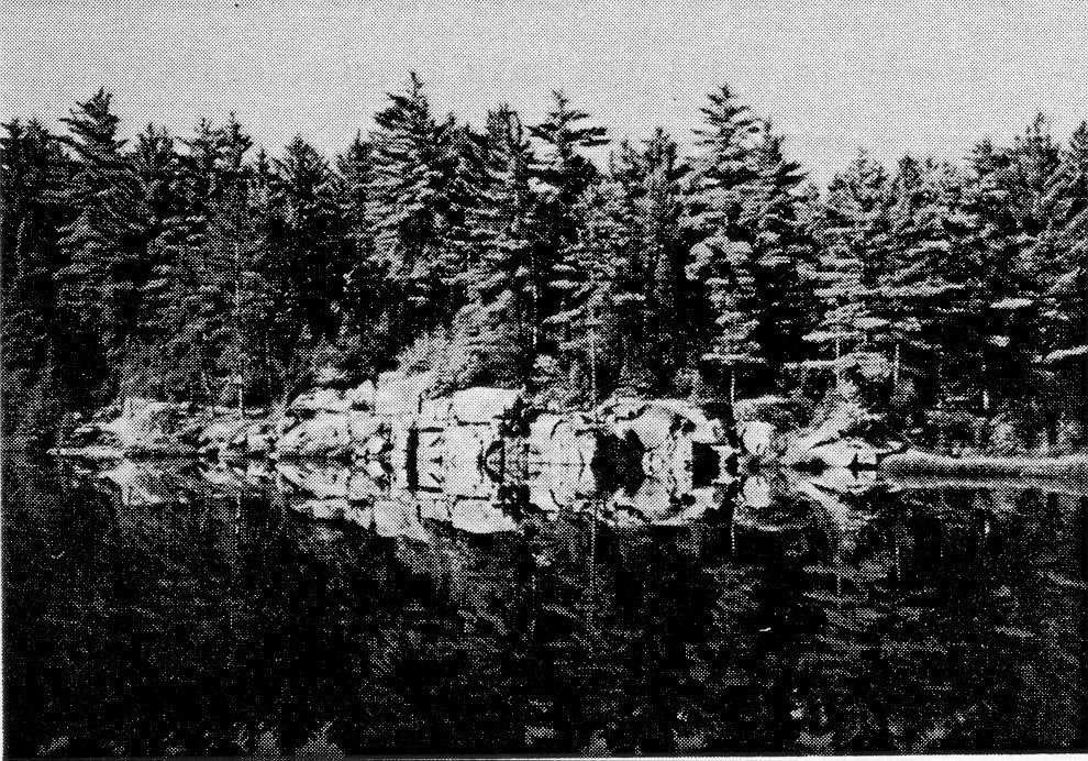
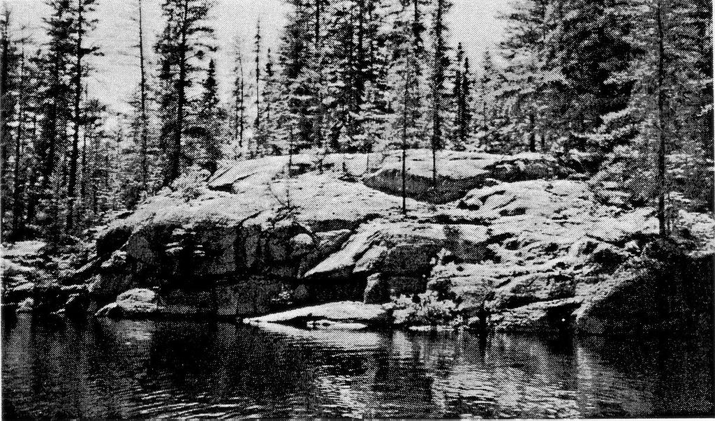
 Typical \"blocky\" jointing, Birch Lake Batholith (Central Teasdale")
24 10 Typical closely spaced jointing, Cartier Batholith (Central Antrim Township along Highway 144) Typical "blocky" jointing, Birch Lake Batholith (Central Teasdale Township)

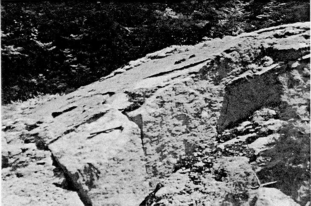
25 11 Well developed joint sets/ l metre spacing (Northwest Moses Township)
26 12 The Cartier batholith is comprised of felsic plutonic rocks that are pink to grey-green, generally leucocratic, medium to coarse grained and of variable textures. Zones of porphyritic, pegmatitic, and slightly foliated granite are common with rapid textural changes, occurring over short distances. These rocks have an average composition of quartz monzonite with approximately 20 percent quartz, 45 percent pink to red microcline, 30 percent white to clear plagioclase (albiteoligoclase), 5 percent mafic minerals which are mainly biotite and amphibole, and accessory muscovite, chlorite, epidote, sphene, zircon and iron oxides. The Cartier quartz monzonite contains numerous fine grained aplite dykes, up to l metre in width, which can extend up to hundreds of metres into surrounding older gneissic host rocks. Mafic xenoliths and dykes, ranging in size from a few cm to metres, of biotite rich rocks and fine to medium grained metagabbro are also very common in the batholith and surrounding rocks. The physiography throughout the extent of the Cartier batholith area (see Figure 17. 1) is moderately rugged with rounded well exposed ridges up to 50 metres high, and numerous shallow swampy areas. A large, fluvioglacial sand and gravel deposit dominates the central portion of the batholith, covering parts or all of Solski, Tofflemire, Moses, Acheson, Venturi and Ermatinger townships.
27 13 The massive pink to grey-green quartz monzonites of the batholith are generally not suitable for producing granite dimension stone. Consistently high joint and fracture densities with an average l metre spacing form "blocky" joint patterns. The numerous inclusions and rapid textural changes could not be avoided in quarrying. Only one small area 100 x 300 metres in north central Cascaden Township (see page 47) has been outlined which may have moderate potential for limited quarrying. This general assessment is based on extensive road reconnaissance, and short traverses to examine all outcrops and road cuts. A large portion of the area was not examined due to inaccessability, and this may yet hold some potential. However, the author believes that this general assessment will also be applicable to the inaccessible areas because the outcrops examined are all poorly suited for quarrying. The second major batholith in the region is the Birch Lake batholith so named for a large lake that dominates Gough Township and the southern portion of the intrusion. This large intrusion stretches from the North Channel of Lake Huron north to approximately latitude 46 O 35' where it stretches West to East across the townships of Teasdale, Strain, Weeks, and Bigelow (see Figure 17. l for location). Card and Palonen in Ontario Geological Report 139, Geology
28 14 of Shakespeare and Dunlop Townships, described the typical "Birch Lake" granite and suggested emplacement as follows: The felsic plutonic rocks consist mainly of pink, medium-grained equigranular or porphyritic quartz monzonite and contain scattered inclusions of biotite and hornblende-ri eh rocks ranging from a few inches (cm) to several feet (m) in maximum dimension. The inclusions have recrystallized, but were apparently not assimilated to any extent by the granitic magma. Minor amounts of older granitoid and quartz-rich metasedimentary rock inclusions, grey quartz monzonite, granodioritic and dioritic gneiss are present in the quartz monzonite. A few small pegmatitic dikes are also present. The quartz monzonite consists of approximately equal porportions of plagioclase, potassic feldspar, and quartz and contains only minor amounts of femic minerals the most common of which is biotite. Saussuritization of the plagioclase, originally either albite or oligoclase, is prevalent. Perthitic microcline crystals up to several centimetres in maximum dimension give the rock a characteristic porphyritic texture. Where gneissic foliation occurs, the constituent minerals have been cataclast!call y deformed, and show a preferred orientation within the foliation planes. The granodioritic and dioritic gneiss contain a high proportion of plagioclase and femic minerals, including hornblende, and probably represent the
29 15 remnants of assimilated mafic volcanic or intrusive rocks. The felsic plutonic rocks are the basement on which the Huronian supracrustal sequence was deposited. The basement was involved in orogenic events that affected the Huronian rocks; the intensity of deformation and metamorphism decreases northward. Gneissic foliation is strongly developed in the Birch Lake Granite in Shakespeare Township and southern Dunlop Township, but is confined to relatively narrow zones in northern Dunlop Township. Similarly, the number of mafic dikes, probably emplaced in the basement rocks during an early deformational event, decrease northward. Well-developed joint sets are present in the granitic rocks throughout the map area. The felsic plutonic rocks of quartz monzonitic composition probably represent magmatic intrusions emplaced at intermediate (mesozonal) levels in the earth's crust (Buddington 1959). They are part of a series of felsic igneous plutons emplaced within the Superior Province at least 2,500 million years ago (Van Schmus 1965). Two large mafic bodies that vary in composition from gabbro to anorthosite intrude the early Precambrian (Archean) rocks of the Birch Lake batholith. One, the Shakespeare-Dunlop intrusion, is located in northern Shakespeare and southern Dunlop townships and forms the
30 16 west shore of Agnew Lake (see Figure 17. 1). This intrusion consists of gabbro, anorthositic gabbro, gabbro anorthosite, and minor granitic segregations and dykes (Card and Palonen 1976). The rocks are medium to coarse grained, black to dark green, with variable textures which range from' equigranular, porphyritic to glomeroporphyritic. The variable textures and very high joint density make this intrusion unsuitable for producing dimension stone. However, an interesting glomeroporphyritic phase of the gabbro, located along the northern contact of the intrusion with the felsic rocks of the Birch Lake batholith in Shibananing Township, is being investigated for a possible source of ornamental stone. Large light green to whitish phenocrysts of plagioclase average 5 cm in width, and take an exceptional polish against a fine grained black matrix. Joint density is high with an average spacing of l metre, and it will be difficult to quarry blocks of consistent size. The other, the East Bull Lake intrusion, is located to the northwest, centered just south of the intersection of Boon, Gerow, Lockeyer and Mandamin townships. The East Bull Lake intrusion forms a rugged topography of high hills, with near vertical cliff faces up to 60 metres high being common. The rock is highly variable in composition and texture ranging from gabbro to norite, with massive coarse grained to porphyritic sections. Colour ranges from black to green-grey and again is variable over short distances. The potential for producing building stone from this intrusion is low due to its inconsistent nature.
31 17 The East Bull Lake and Shakespeare-Dunlop intrusions belong to a group of gabbro-anorthosite intrusions that occur along the base of the Huronian Supergroup between Sudbury and Cutler. Across Cartier and Birch Lake batholiths, and the mafic Shakespeare-Dunlop and East Bull Lake intrusions extensive road reconnaissance and short traverses have failed to outline any new target areas for building stone deposits. Intense jointing and faulting, combined with numerous rapid textural changes and colour variation, give the overall area low potential. FABRICATION PLANTS Two companies within the Sudbury Area are capable of fabricating products from granite and marble blocks weighing up to 15 tonnes. Peter Ellero 8c Son Granite and Marble Manufacturing Ltd. is a well established business which has been operating for over 35 years. This company' s main business is fabricating and engraving granite monuments, custom-made furniture, and a wide variety of sculptured items from marble, onyx, serpentine, granite and nickel-copper ore. Many visiting dignitaries to the Sudbury area have received hand crafted gifts from the Ellero family.
32 18 Equipment at the plant consists of a multi blade (diamond impregnated), reciprocating saw or "mini gangsaw" capable of slabbing granite and marble blocks to varying thicknesses. Other machinery includes a semi-automatic polishing table, circular diamond impregnated saws and various specialty items like edge routers, drill press and grinding equipment. In 1988 Ellero expanded its facilities to include an expanded work area and large showroom for displaying sculptured articles and a large selection of granite monuments. The other fabricating plant belongs to Khouri Granite Ltd. This company began full operation in January This facility is capable of manufacturing all types of granite and marble products from rough quarry blocks weighing up to 15 tonnes. The shop is equipped with a diamond wire saw for cutting slabs from large blocks, automatic and semi-automatic polishing equipment, and diamond impregnated circular saws. The automatic polisher can polish or "hone" large slabs of marble or granite with dimensions up to 1. 8 x 1. 8 x 3. 2 metres. A five step process can complete a fine polish in approximately three and a half hours, depending on the hardness of the material. The process uses sets of four disposable polishing heads made of abrasive grit in a matrix of cement with the consistency of a fine grained fire brick. Other equipment at the plant includes circular diamond impregnated saws, edge router, and sand blasting equipment for engraving monuments. The plant is also equipped with offices and
33 19 a large indoor showroom. Khouri Granite Ltd. produce a wide variety of items from natural stone, including floor tiles, mantel pieces, monuments, decorative items, and furniture. Currently the company installs most of what they manufacture and with this they maintain quality control throughout. The first.full year of operation was very encouraging with the five full time employees working six days a week to meet current demand. A large percentage of their market was granite floor tiles and counter tops, manufactured and installed in homes in the Sudbury area. Both companies are helping in the development of local quarries by cutting and polishing sample products for material testing and market evaluation. By avoiding high transportation costs in sending the material to plants in Quebec or Southern Ontario, more local granite can be quarried and cut which will greatly aid in evaluation of deposits. PRODUCTION/DEVELOPMENT Canadian Shield Quarries Ltd. (Dana Black Granite) Canadian Shield Quarries Ltd. produced approximately 900
34 20 cubic metres of rough dimension stone blocks from its quarry in south central dana township. All material was shipped from the quarry as rough quarry blocks to fabricating plants in Quebec. The quarry operated from January 1989 to November 1989 producing quarry blocks that averaged 1. 2 x 1. 2 x 2. 4 metres. The Dana "black granite" is medium to coarse grained, equigranular gabbroic anorthosite comprised of 90* bytownite, Q* hypersthene and 2 % augite (see p. 41 for full description and location). The bytownite crystals are fresh, well-twinned, anhedral to subhedral stubby laths randomly inter-grown that average four to five millimetres in length (Vos 1981). Occasional white " cloudy" patches and thin white veinlets of natrolite and prehnite make quarrying difficult as they do not always appear on the surface of quarried blocks. The stone takes an excellent polish and is used for monuments and architectural stone. The deposit is moderately jointed with average spacing at 2.0 metres. A prominent parallel joint system runs at N15 OW throughout the quarry. Numerous secondary joint systems cut the main trend and occur at random orientations to it. The quarry has extensive reserves and could expand into a major producer if conditions continue to grow at current rates.
35 21 Canadian Unique Granites Ltd. (Killarney Tweed) Canadian Unique Granites Ltd. continued to evaluate its granite quarry southwest of Sudbury in Goschen Township (see page 38 for location and description). The colourful black/pink and white orthoclase porphyry is being enthusiastically promoted and advertised to Canadian and worldwide granite companies. Sample products cut from a stock pile of quarried blocks in 1988 and the spring of 1989 have been sent to architects, developers, and fabricating companies for market evaluation and possible sales. Several company representatives visited the quarry site, and Canadian Unique Granites Ltd. did generate considerable interest in the stone. The company plans to quarry this stone and is currently seeking investors and development help to bring the deposit into production. The quarry to date has produced approximately 43 cubic metres of granite blocks averaging 1. 2 x 1. 5 x 1.8m. This volume of stone represent about 15% recovery of quarried material, most of which has since been cut for promotional material. Joint spacing at the deposit is variable with average spacing 1. 6 metres. The area of uniform, consistent texture and colour is extensive, stretching at least 400 metres to the northeast. This deposit, although moderately jointed, has great
36 22 potential to become a producer of medium to large size blocks. The coarse grained porphyritic texture and uniform colour are in demand for construction materials, expecially thin veneer cladding for external building panels. Poscan Ltd. (Positano Granite) Poscan Ltd. quarried a small volume of Positano Granite from its quarry in central Henry Township, 65 km east of Sudbury. The stone is a highly variable gneissic to mottly textured anorthositic gabbro (see page 50 for a full description). The white and black stone is currently being marketed for internal use because of a small percentage of sulphides. The stone has been actively promoted throughout Canada and the United States seeking sales opportunities. The company plans to produce dimension stone throughout The quarry is easily reached by a good gravel forest access road which joins the villages of Hagar and River Valley north of Highway 11. Quarry operations at this site began in the mid-seventies with test blocks removed for market evaluation. The quarry has changed hands several times since then, with the cost of evaluation and testing being the main reason for the transfers.
37 23 Poscan Ltd., the current owner, has removed approximately 43 cubic metres since early 1988 for promotional work. Most of these blocks are in the 1. 2 x 1. 2 x 2. 4 m range. The extent of the deposit with jointing that will allow for removal of consistently large size blocks is limited to a well exposed ridge approximately 150 x 300 metres. Joint spacing increases significantly beyond this area and recovery of commercial blocks is suspect. Positano Granite is a striking stone with few comparisons. It is ideally suited for interior accent applications and custom furniture. EXPLORATION 1989 In 1989 four companies carried out exploration projects on six properties in the Sudbury area for possible dimension stone resources. Most of this work consisted of removing overburden and quarrying test blocks for stone quality testing and market evaluation. This is an important early step in evaluating a new deposit, as it will indicate the size of blocks that can be removed and the quarry methods needed for production. This stage of exploration also provides essential information on cost factors for the various aspects of production including quarrying,
38 24 transportation and fabrication which are needed for financial planning. Listed below are details from each exploration program in the Sudbury district. Norgranite Ltd. Norgranite continued to evaluate three locations in the Sudbury area for possible building stone resources. The three sites are located southeast of Sudbury and are located within two intrusive bodies: the Cosby batholith and the St. Charles sill. All three sites offer a different and distinct colour and texture, they include the Pure Lake prospect/ a brown to salmon- pink, medium to coarse grained monzonite (see p. 26 for full description and location); the Chartrand Farm prospect, a highly contorted gneiss with pink to light brown augen phenocrysts up to 5 cm in length (see p. 28 for full description and location); and, the St. Charles sill, a white and black, massive, coarse grained plagioclase porphyry (see p. 23 for full description and location). All three sites have undergone mapping, stripping, A. S. T. M. testing, and removal of test blocks for market evaluation. Initial testing of the Pure Lake prospect has been hampered by persistent hairline, rusty, weathered joints that have made recovery of large test blocks difficult.
39 25 The Chartrand Farm prospect and St. Charles prospect appear on initial testing to be competent and should allow for removal of blocks in the 1. 2 x 1. 2 x 2. 4 m range. Norgranite has dropped many of its claims staked in the spring of 1988 to concentrate on targeted areas. All three stones take a good polish and have good marketable colours. More testing is needed to outline areas of consistent colour, texture, and favourable jointing. Blue Mountain Granite Ltd. A new (1989) Sudbury based company has investigated two sites within the Killarney batholith located approximately 35 km northeast of the village of Killarney. The company has stripped two areas under an active Quarry Permit and has extracted test blocks from both sites. The first site is located in west central Sale Township along the Bell Lake access road three kilometres northeast from the "Killarney Tweed" quarry of Canadian Unique Granites Ltd. (see Figure 17. l in rear pocket). The stone is a quartz monzonite orthoclase porphyry with a black and grey matrix and pink to red orthoclase phenocrysts from l to 6 cm. The joint density at this site is moderate, averaging 1. 6 metres, but areas up to 9 metres square are fracture free. Throughout the exposed ridges a consistent sheeting of 1. 5 metres was observed. The topography consists of four well exposed northeast trending
40 26 ridges up to 8. 5 metres high, with thin overburden (*cl. 5 metres) between ridges. The Quarry Permit covers approximately 85 hectares, and is located within 50 metres of a good all season gravel road. Transportation will not be a problem. The second site, which Blue Mountain Granite is investigating, is a gneissic red and black quartz monzonite located in northeast Carlyle Township. Access is again provided by the Bell Lake road which lies just west of the Quarry Permit (see Figure 17. 1). The overburden at this site is extensive (up to 3 m) and assessment will be difficult. Blue Mountain Granite Ltd. has stripped two small areas (lom^) for removing test blocks. Joint density is difficult to estimate but the two stripped areas have moderate jointing averaging 1.5 metres. Two blocks, measuring 1.2 x 1.2 x 1.8 m, were removed and shipped along with one block from the first test area to Italy for testing and market evaluation. Preliminary testing of both sites is encouraging and the stone appears competent enough to allow extraction of blocks in the 2. 5 to 3.0m range, but consistency in texture may be a problem. Blue Mountain Granite plans to test the sites on a full production basis in the spring of 1990.
41 27 Jim Owen Jim Owen continued to evaluate a "black granite" property which straddles the Nairn and Baldwin townships boundary 45 km west of Sudbury. The stone is a fine grained black to blue Nipissing diabase comprised predominantly of plagioclase and lesser amounts of pyroxene and/or hornblende, quartz, and accessory titanium, sphene and other oxide minerals. The deposit forms a large ridge which lies parallel to Huronian sedimentary beds which it intrudes. The Nipissing diabase contains random quartz veins which range in width from 2 mm to 10 cm. Jointing is variable and closely spaced with an average spacing of 1. O metre. The program to date has consisted of stripping, geological mapping (joint density map), diamond drilling and block extraction. The diabase takes a fair polish with occasional cloudy areas of lighter coloured feldspars. exploration program was partly funded under the NOR-DEV grant The program. Exploration to date has produced several test blocks, but these are of poor quality with many factures and inconsistent texture. Jim Owen intends to continue evaluation of the property and test new areas on the Quarry Permit for a better recovery rate. This stone may be better suited for ornamental uses such as furniture, sills, planters, and small, decorative items where large uniform, blocks are not required.
42 28 Sudbury Canadian Granite Ltd. Sudbury Canadian Granite Ltd. continued development of its Massey "black granite" property 17 km north of the village of Massey, 75 km west of Sudbury. The property has been worked since 1986 with limited success. A detailed geological map, extensive stripping and test block removal have not met expectations. High joint density have not allowed removal of competent blocks larger than l x l x 1. 5 metres. The stone is a fine grained black gabbro that forms a circular plug 3 km in diameter which intrudes early Precambrian felsic granite of the Birch Lake batholith. The quarry has six working faces in an 80 ha Quarry Permit area, but all contain consistently high joint density. The rock takes an exceptional mirror finish and would make an excellent monument stone if larger blocks could be recovered. Sudbury Canadian Granites Ltd. plans to continue to test the site and possibly outline areas with lower joint density. CONCLUSIONS AND RECOMMENDATIONS This study focussed on quarriable areas or areas with joint spacing that will allow for extraction of commercial size granite blocks of consistent uniform texture and colour. The expanded
43 29 (1989) study area west and north of the Sudbury Basin was choosen because of the large extent of granitic terrain and limited mapping or information with reference to joint or fracture density. The plan was to locate areas with limited to moderate jointing in the early Precambrian batholiths, or to locate smaller, middle or late Precambrian intrusions within the batholiths. After extensive reconnaissance, it was discovered that much of the area is unsuitable for quarrying. Well developed ' blocky' joint sets are pervasive, with average spacing at one metre, and often less. The data base collected for the 1989 study is small, mainly because it is of little value to promote an area or provide whole rock comparisons and detailed petrographic analysis on rocks which are not suited for quarrying. By highlighting areas that have good characteristics and are truly "high potential" prospects, interested parties will be able to focus on these areas and carry out detailed field work or preliminary testing. The results of the field work in 1989 were disappointing, with no new areas found or assessed as having high potential. When looking at combined 1988 and 1989 results, the project can overall be considered successful. Four of the fourteen sites described in the 1988 field investigations (Part A) have been tested by local companies for quarriability and market evaluation. This brings the total to nine sites under various stages of development in the Sudbury
44 30 Region. Only Canadian Shield Quarries Ltd. (Dana Black Granite) produced on a full time basis in Poscan Ltd. (Positano Granite) and Canadian Unique Granites Ltd. (Killarney Tweed) have performed test quarrying and market evaluation on quarry sites in the district but production has proven difficult because of the high cost of quarrying, testing, and fabrication. Both companies have generated interest in their respective stones and plan to continue to develop the properties. Six other sites in the district are under evaluation which may include stripping, mapping, diamond drilling, and removing test blocks. Sudbury has the potential to become an important producer of granite dimension stone for the expanding Ontario and Canadian markets. The prospects under evaluation offer a good variety of "marketable" colours and textures well suited for construction granite. The large batholiths located south of Superior and Southern provinces offer the best potential to produce dimension stone. They include: the Grenville Front plutons (Killarney granites), the Cosby batholith, the West Bay batholith, and the River Valley anorthosite. All four areas have excellent road access, and extensive outcrops with favourable jointing, colour, and texture. Although several exploration projects and operating quarries are located within three of the four areas, opportunity exists for new development especially in the gneissic and migmatitic
45 rocks of the West Bay batholith. 31
46 32 LIST OF PROPERTIES 1) Massey "Black Granite" (Sudbury Canadian Granite Ltd see page 28 2) Dan Brunne (glomeroporphyritic gabbro) see page 16 3) Jim Owen Prospect (Nipissing Diabase) see page 27 4) Cartier Prospect see page 60 (in OFR 5721) 5) Boswell Prospect see page 58 (in OFR 5721)
47 33 REFERENCES Card, K. D. 1978: Geology of the Sudbury - Manitoulin Area, Districts of Sudbury and Manitoulin; Ontario Geological Survey GR 166, 230 p. Accompanied by Map 2360, 4 Charts. Card, K. D., and Innes, D. G. 1981: Geology of the Benny Area, District of Sudbury; Ontario Geological Survey Report 206, 117 p. Accompanied by Maps 2434, and 2435 scale 1: (l inch to 1/2 mile), and 4 Charts. Card, K. D., and Lumbers, S. B. 1975: Sudbury - Cobalt Geological Compilation Series; Ontario Geological Survey Map 2361 scale l" = 4 miles. Card, K. D., and Palonen, P. A. 1976: Geology of the Dunlop-Shakespeare Area, District of Sudbury; Ontario Division of Mines, GR 139, 52 p. Accompanied by Map Choudhry, Abdul G. 1984: Geology of Hart, Ermatinger and Totten Townships; Ontario Geological Survey Open File Report 5525, 70 p.. Accompanied by 6 Figures, 9 Tables, and 3 Maps in back pocket (P. 2599, P. 2600, P. 2601). Collins, W. H. 1925: North Shore of Lake Huron; Geological Survey of Canada Memoir 143. Hewitt, D. F. 1964a: Building Stone of Ontario Part l - Introduction; Ontario Department of Mines, Industrial Mineral Report No. 14, 43 P- Hewitt, D. F. 1964b: Building Stones of Ontario, Part 5 - Granite and Gneiss; Ontario Department of Mines, Industrial Mineral Report No. 19, 51 p. Lacey, J. K. 1989: Building stone inventory of the Sudbury Resident Geologist' s area; Ontario Geological Survey, Open File Report 5172, 64 p. Lafleur, Jean and Dressler, Burkhard O. 1985: Geology of Cascaden, Dowling, Levack and Trill Townships, District of Sudbury, Ontario Geological Survey Open File Report 5533, 135 p., 13 Figures, 12 Photos, 8 Tables, and 4 Maps in back pocket.
48 34 Lumbers, S. B. 1975: Geology of the Burwash Area, Districts of Nipissing, Parry Sound and Sudbury; Ontario Geological Survey, GR 116, 160 p. Map Lumbers, S. B. 1971: Geology of the North Bay Area, Districts of Nipissing and Parry Sound; Ontario Department of Mines and Northern Affairs, GR 94, 104 p. Map Lumbers, S. B. 1971b: No. 26 River Valley Area, Districts of Sudbury and Nipissing; in Summary of Field Work 1971, by the Geological Branch, edited by E. G. Pye, Ontario Department of Mines and Northern Affairs, MP 49, 109 p. (see p ). Marmont, C. 1986: Geology of Tofflemire, Venturi, and Vernon Townships, District of Sudbury; Ontario Geological Survey, Open File Report 5624, 86 p., 27 Figures, 5 Tables, 10 Photos, and l Map in back pocket. Moore, E. S., and Armstrong, H. S. 1943: Geology of the East Bull Lake Area, District of Algoma; Ontario Department of Mines, Vol. Lil, Part VT. Nantel, S. 1983: Dimension Stone of Quebec: Geological Aspects of Commercial Deposits; p IN 19th Forum on the Geology of Industrial Minerals, Proceedings, edited by S. E. Yundt, Ontario Geological Survey, Miscellaneous Paper 114, 216p. Power, W. Robert 1983: Construction Materials, Dimension and Cut Stone; p IN Industrial Minerals and Rocks, Fifth Edition, Volume 1. Robertson, J. A. 1976: Geology of the Massey Area, Districts of Algoma, Manitoulin and Sudbury; Ontario Division of Mines, GR 136, 130 p. Accompanied by Maps 2308, 2309, Scale 1: = 1/2 mile, and 2 Charts. Rogers, D. P. 1961: A petrographic reconnaissance of granitic rocks in the Biscotasing Area; Ontario (M. A. thesis, University of Toronto. Shadmon, A. 1989: STONE, an introduction; Intermediate Technology Publications Ltd., London, 140 p.
49 35 Sheehan, H. W. 1952: The Geology of the Lac Aux Sables-Shawka Lake Area, District of Algoma and Sudbury; Ontario Department of Mines, PR Smith, M. 1987: Dimensional Stone Blasting in Finland; p IN Mining Magazine, October Storey, C. C. 1986: Building and Ornamental Stone Inventory in the Districts of Kenora and Rainy River; Ontario Geological Survey, Mineral Deposits Circular 27, 168 p. Tolman, C. 1929: The Birch Lake Batholith, Ontario; American Journal of Science, Vol. 17, Series 5, pp Verschuren, C. P., Kingston, P. W., and Caley, W. F. 1989: Criteria for quarry development in southeastern Ontario; CIM Bulletin, February, 1989, pp Vos, M. A., and Smith, V. 1983: Industrial Minerals of Northern Ontario Supplement 2; Ontario Geological Survey OFR 5439, 500 p. and 3 figures Vos, M. A., Smith, B. A., and Stevenato, R. J. 1981: Industrial Minerals of the Sudbury Area; Ontario Geological Survey OFR 5329, 156 p., 8 tables and 9 figures.
50
51 LEGEND SUPERIOR AND SOUTHERN PROVINCES MIDDLE PRECAMBRIAN SUDBURY IGNEOUS COMPLEX WHITEWATER GROUP NIPISSING DIABASE HURONIAN SUPERGROUP UNSUBDIVIDEO MAFIC INTRUSIVE ROCKS EARLY PRECAMBRIAN FELSIC INTRUSIVE AND METAMORPHIC ROCKS METAVOLCANICS UNSUBDIVIDEO * NOTE - General Geology taken from O. G. S. Compilation Maps 2361 and 2419, Scale l" = 4 miles

52 OUELLETTE ^\ V l~ ~J0? 'cr v-';'-v7* -A-t.x *- - \* * General Geology and Building Stone Symbols 1989 Reconnaissance Survey Township Boundaries ji'^vr ~ ^~ Sudbury Resident Geologist Area West Boundary * \ -*A ^* Good all Season Road Summer Road 4 Wheel drive V * * ' - X See page 8 for description of properties and Geology Taken from OGS Compilation Maps 2361 and 2419 Scale l" ^ 4mlles
53
54
55
AGGREGATE RESOURCES OF ONTARIO (ARO) METADATA
 METADATA") AGGREGATE RESOURCES OF ONTARIO (ARO) METADATA GENERAL INFORMATION Official Name of the Data Set or Information Holding: Aggregate Resources of Ontario Acronyms are Used to Identify the Data Set or Information
AGGREGATE RESOURCES OF ONTARIO (ARO) METADATA GENERAL INFORMATION Official Name of the Data Set or Information Holding: Aggregate Resources of Ontario Acronyms are Used to Identify the Data Set or Information
MRD283-REV METADATA. Acronyms are Used to Identify the Data Set or Information Holding: MRD283-REV
 MRD283-REV METADATA GENERAL INFORMATION Official Name of the Data Set or Information Holding: Ambient Groundwater Geochemistry Data for Southern Ontario, 2007 2014 Acronyms are Used to Identify the Data
MRD 228 METADATA. Official Name of the Data Set or Information Holding: Physiography of Southern Ontario
 MRD 228 METADATA GENERAL INFORMATION Official Name of the Data Set or Information Holding: Physiography of Southern Ontario Acronyms are Used to Identify the Data Set or Information Holding: MRD228 Describe
MRD 281. Official Name of the Data Set or Information Holding: Northeastern Ontario Rhyolite Database
 MRD 281 GENERAL INFORMATION Official Name of the Data Set or Information Holding: Northeastern Ontario Rhyolite Database Acronyms are Used to Identify the Data Set or Information Holding: MRD281 Describe
We are committed to providing accessible customer service. If you need accessible formats or communications supports, please contact us.
 We are committed to providing accessible customer service. If you need accessible formats or communications supports, please contact us. Nous tenons à améliorer l accessibilité des services à la clientèle.
GEOPHYSICAL DATA SET (GDS) 1084B METADATA
 1084B METADATA") GEOPHYSICAL DATA SET (GDS) 1084B METADATA GENERAL INFORMATION Official Name of the Data Set or Information Holding: Ontario Airborne Geophysical Surveys, Magnetic Gradiometer and Gamma-Ray Spectrometric
GEOPHYSICAL DATA SET (GDS) 1084B METADATA GENERAL INFORMATION Official Name of the Data Set or Information Holding: Ontario Airborne Geophysical Surveys, Magnetic Gradiometer and Gamma-Ray Spectrometric
MRD273-REV METADATA. Acronyms are Used to Identify the Data Set or Information Holding: MRD273-REV
 MRD273-REV METADATA GENERAL INFORMATION Official Name of the Data Set or Information Holding: Ontario Precambrian Bedrock Magnetic Susceptibility Geodatabase for 2001 to 2012 Acronyms are Used to Identify
We are committed to providing accessible customer service. If you need accessible formats or communications supports, please contact us.
 We are committed to providing accessible customer service. If you need accessible formats or communications supports, please contact us. Nous tenons à améliorer l accessibilité des services à la clientèle.
Local: (705) Toll Free: , ext (inside Canada, United States) Local: (705) Toll Free: , ext.
 Toll Free: , ext (inside Canada, United States) Local: (705) Toll Free: , ext.") THESE TERMS GOVERN YOUR USE OF THIS DOCUMENT Your use of this Ontario Geological Survey document (the Content ) is governed by the terms set out on this page ( Terms of Use ). By downloading this Content,
THESE TERMS GOVERN YOUR USE OF THIS DOCUMENT Your use of this Ontario Geological Survey document (the Content ) is governed by the terms set out on this page ( Terms of Use ). By downloading this Content,
THESE TERMS GOVERN YOUR USE OF THIS DOCUMENT
 THESE TERMS GOVERN YOUR USE OF THIS DOCUMENT Your use of this Ontario Geological Survey document (the Content ) is governed by the terms set out on this page ( Terms of Use ). By downloading this Content,
Local: (705) Toll Free: , ext (inside Canada, United States) Local: (705) Toll Free: , ext.
 Toll Free: , ext (inside Canada, United States) Local: (705) Toll Free: , ext.") THESE TERMS GOVERN YOUR USE OF THIS DOCUMENT Your use of this Ontario Geological Survey document (the Content ) is governed by the terms set out on this page ( Terms of Use ). By downloading this Content,
THESE TERMS GOVERN YOUR USE OF THIS DOCUMENT Your use of this Ontario Geological Survey document (the Content ) is governed by the terms set out on this page ( Terms of Use ). By downloading this Content,
THESE TERMS GOVERN YOUR USE OF THIS DOCUMENT
 THESE TERMS GOVERN YOUR USE OF THIS DOCUMENT Your use of this Ontario Geological Survey document (the Content ) is governed by the terms set out on this page ( Terms of Use ). By downloading this Content,
Local: (705) Toll Free: , ext (inside Canada, United States) Local: (705) Toll Free: , ext.
 Toll Free: , ext (inside Canada, United States) Local: (705) Toll Free: , ext.") THESE TERMS GOVERN YOUR USE OF THIS DOCUMENT Your use of this Ontario Geological Survey document (the Content ) is governed by the terms set out on this page ( Terms of Use ). By downloading this Content,
THESE TERMS GOVERN YOUR USE OF THIS DOCUMENT Your use of this Ontario Geological Survey document (the Content ) is governed by the terms set out on this page ( Terms of Use ). By downloading this Content,
MRD 207 METADATA DETAIL PAGE
 MRD 207 METADATA DETAIL PAGE The following represents the Basic description of an information holding. To obtain more information about this holding, see the section named Contacts. GENERAL INFORMATION
MRD 229-Revised METADATA
 GENERAL INFORMATION MRD 229-Revised METADATA Official Name of the Data Set or Information Holding: Till Compositional Database: Investigation of the Overburden Signature of the Caribou Lake Greenstone
2013 GEOLOGICAL ASSESSMENT REPORT SHERIDAN HILL PROPERTY
 2013 GEOLOGICAL ASSESSMENT REPORT ON THE SHERIDAN HILL PROPERTY NEW WESTMINSTER MINING DIVISION BRITISH COLUMBIA NTS 092G07 49 16 31 NORTH LATITUDE, 122 39 48 WEST LONGITUDE PREPARED FOR Sheridan Hill
THESE TERMS GOVERN YOUR USE OF THIS DOCUMENT
 THESE TERMS GOVERN YOUR USE OF THIS DOCUMENT Your use of this Ontario Geological Survey document (the Content ) is governed by the terms set out on this page ( Terms of Use ). By downloading this Content,
Igneous and Metamorphic Rock Forming Minerals. Department of Geology Mr. Victor Tibane SGM 210_2013
 Igneous and Metamorphic Rock Forming Minerals Department of Geology Mr. Victor Tibane 1 SGM 210_2013 Grotzinger Jordan Understanding Earth Sixth Edition Chapter 4: IGNEOUS ROCKS Solids from Melts 2011
THESE TERMS GOVERN YOUR USE OF THIS DOCUMENT
 THESE TERMS GOVERN YOUR USE OF THIS DOCUMENT Your use of this Ontario Geological Survey document (the Content ) is governed by the terms set out on this page ( Terms of Use ). By downloading this Content,
Chapter 10. Chapter Rocks and the Rock Cycle. Rocks. Section 1 Rocks and the Rock Cycle
 Chapter 10 Rocks 1 Chapter 10 Section 1 Rocks and the Rock Cycle 2 10.1 Rocks and the Rock Cycle Magma is the parent material for all rocks. Once the magma cools and hardens, many changes can occur. Geology:
APPENDIX 2 Table 2. Sample descriptions
 Table 2. descriptions 225 Felsic gneiss, fine-grained and very light-gray. From the upper part of the lower of the two layers, which connect. 226 Amphibolite, even-grained, fine-grained, medium-gray, little
GLY 155 Introduction to Physical Geology, W. Altermann. Grotzinger Jordan. Understanding Earth. Sixth Edition
 Grotzinger Jordan Understanding Earth Sixth Edition Chapter 4: IGNEOUS ROCKS Solids from Melts 2011 by W. H. Freeman and Company Chapter 4: Igneous Rocks: Solids from Melts 1 About Igneous Rocks Igneous
THESE TERMS GOVERN YOUR USE OF THIS DOCUMENT
 THESE TERMS GOVERN YOUR USE OF THIS DOCUMENT Your use of this Ontario Geological Survey document (the Content ) is governed by the terms set out on this page ( Terms of Use ). By downloading this Content,
BLURTON CREEK NICKEL PROPERTY. (Minfile # 082LNW-039)
") 5489153 BLURTON CREEK NICKEL PROPERTY (Minfile # 082LNW-039) Mara Lake Area / Salmon Arm B.C NTS - 82L-11 (UTM 83/Z10, 357690E, 5614220N) Prepared by: Jim Cuttle, B.Sc., P.Geo. 86 Cloudburst Road Whistler,
5489153 BLURTON CREEK NICKEL PROPERTY (Minfile # 082LNW-039) Mara Lake Area / Salmon Arm B.C NTS - 82L-11 (UTM 83/Z10, 357690E, 5614220N) Prepared by: Jim Cuttle, B.Sc., P.Geo. 86 Cloudburst Road Whistler,
THESE TERMS GOVERN YOUR USE OF THIS DOCUMENT
 THESE TERMS GOVERN YOUR USE OF THIS DOCUMENT ISBN 978-1-4606-4599-4 (DVD) ISBN 978-1-4606-4598-7 (zip file) Your use of this electronic information product ( EIP ), and the digital data files contained
FIRST YEAR ASSESSMENT REPORT PROSPECTING LICENCE 16512M MARYSTOWN AREA, BURIN PENINSULA NTS 1M/3
 FIRST YEAR ASSESSMENT REPORT OF PROSPECTING ON LICENCE 16512M MARYSTOWN AREA, BURIN PENINSULA NTS 1M/3 BY NATHANIEL NOEL MSc. FOR E. MICHELE NOEL MINERAL LICENCES: 16512 M WORK CONDUCTED: MID-SEPTEMBER
Mishi Lake Gold Property Mishibishu Lake Area, Wawa
 Mishi Lake Gold Property Mishibishu Lake Area, Wawa Location, Accessibility, Infrastructure and Local Resources The property is located 40 km west of Wawa, Ontario, in the Mishibishu Lake Area, Sault Ste.
PROSPECTING REPORT. Broken Hill Property. EVENT # TENURE # Tenure Name: Broken Hill. New Westminster Mining Division Map 092H
 2009-2010 PROSPECTING REPORT Broken Hill Property EVENT # 4514071 TENURE # 600988 Tenure Name: Broken Hill New Westminster Mining Division Map 092H Central Coordinate Reference 121 24 26.2 W Longitude
Chapter 4 Rocks & Igneous Rocks
 Chapter 4 Rocks & Igneous Rocks Rock Definition A naturally occurring consolidated mixture of one or more minerals e.g, marble, granite, sandstone, limestone Rock Definition Must naturally occur in nature,
THESE TERMS GOVERN YOUR USE OF THIS DOCUMENT
 THESE TERMS GOVERN YOUR USE OF THIS DOCUMENT Your use of this Ontario Geological Survey document (the Content ) is governed by the terms set out on this page ( Terms of Use ). By downloading this Content,
THIS IS A NEW SPECIFICATION
 THIS IS A NEW SPECIFICATION ADVANCED SUBSIDIARY GCE GEOLOGY Rocks Processes and Products F792 * OCE / 11038 * Candidates answer on the question paper OCR Supplied Materials: None Other Materials Required:
EARTH SCIENCE. Geology, the Environment and the Universe. Chapter 5: Igneous Rocks
 EARTH SCIENCE Geology, the Environment and the Universe Chapter 5: Igneous Rocks CHAPTER 5 Igneous Rocks Section 5.1 What are igneous rocks? Section 5.2 Classification of Igneous Rocks Click a hyperlink
THESE TERMS GOVERN YOUR USE OF THIS DOCUMENT
 THESE TERMS GOVERN YOUR USE OF THIS DOCUMENT Your use of this Ontario Geological Survey document (the Content ) is governed by the terms set out on this page ( Terms of Use ). By downloading this Content,
Block: Igneous Rocks. From this list, select the terms which answer the following questions.
 Geology 12 Name: Mix and Match: Igneous Rocks Refer to the following list. Block: porphyritic volatiles mafic glassy magma mixing concordant discontinuous reaction series igneous vesicular partial melting
Local: (705) Toll Free: , ext (inside Canada, United States) Local: (705) Toll Free: , ext.
 Toll Free: , ext (inside Canada, United States) Local: (705) Toll Free: , ext.") THESE TERMS GOVERN YOUR USE OF THIS DOCUMENT Your use of this Ontario Geological Survey document (the Content ) is governed by the terms set out on this page ( Terms of Use ). By downloading this Content,
THESE TERMS GOVERN YOUR USE OF THIS DOCUMENT Your use of this Ontario Geological Survey document (the Content ) is governed by the terms set out on this page ( Terms of Use ). By downloading this Content,
THIS IS A NEW SPECIFICATION
 THIS IS A NEW SPECIFICATION ADVANCED SUBSIDIARY GCE GEOLOGY Rocks Processes and Products F792 * OCE / 1 3804* Candidates answer on the Question Paper OCR Supplied Materials: None Other Materials Required:
The 3 types of rocks:
 Igneous Rocks and Intrusive Igneous Activity The 3 types of rocks:! Sedimentary! Igneous! Metamorphic Marble 1 10/7/15 SEDIMENTARY ROCKS Come from rocks sediments (rock fragments, sand, silt, etc.) Fossils
Surname. Number OXFORD CAMBRIDGE AND RSA EXAMINATIONS ADVANCED SUBSIDIARY GCE F792 GEOLOGY. Rocks Processes and Products
 Candidate Forename Centre Number Candidate Surname Candidate Number OXFORD CAMBRIDGE AND RSA EXAMINATIONS ADVANCED SUBSIDIARY GCE F792 GEOLOGY Rocks Processes and Products WEDNESDAY 20 MAY 2009: Afternoon
For personal use only
 AVZ Minerals Limited 19 September 2016 ACQUISITION OF MANONO EXTENSION LITHIUM, TIN AND TANTALUM PROJECT IN THE DEMOCRATIC REPUBLIC OF CONGO Company to acquire, subject to due diligence, the Manono Extension
For personal use only
 2 May 2018 METEORIC SECURES FURTHER HIGHLY PROSPECTIVE CANADIAN COBALT PROJECT Meteoric has secured the Beauchamp Cobalt Project 40km north of the Cobalt Camp, Ontario Beauchamp comprises 33.5km 2 being
Gossan s Industrial Mineral Opportunities in Manitoba
 Gossan s Industrial Mineral Opportunities in Manitoba Presentation to: Gossan Resources Limited James Bamburak, M.Sc., P.Geo. July 2003 Manitoba Industry, Trade and Mines Industrial Mineral Opportunities
Bedrock mapping and geological characterization in the northern Glennie domain, west-central Reindeer Zone
 Bedrock mapping and geological characterization in the northern Glennie domain, west-central Reindeer Zone Samantha Van De Kerckhove, Ryan Morelli and Dylan Deck Saskatchewan Geological Open House, 2017
Reguibat surface uranium project, Mauritania
 International Symposium on Uranium Raw Material for the Nuclear Fuel Cycle: Exploration, Mining, Production, Supply and Demand, Economics and Environmental Issues Reguibat surface uranium project, Mauritania
Local: (705) Toll Free: , ext (inside Canada, United States) Local: (705) Toll Free: , ext.
 Toll Free: , ext (inside Canada, United States) Local: (705) Toll Free: , ext.") THESE TERMS GOVERN YOUR USE OF THIS DOCUMENT Your use of this Ontario Geological Survey document (the Content ) is governed by the terms set out on this page ( Terms of Use ). By downloading this Content,
THESE TERMS GOVERN YOUR USE OF THIS DOCUMENT Your use of this Ontario Geological Survey document (the Content ) is governed by the terms set out on this page ( Terms of Use ). By downloading this Content,
THESE TERMS GOVERN YOUR USE OF THIS DOCUMENT
 THESE TERMS GOVERN YOUR USE OF THIS DOCUMENT Your use of this Ontario Geological Survey document (the Content ) is governed by the terms set out on this page ( Terms of Use ). By downloading this Content,
GEOLOGICAL FEATURES OF THE BADGER SPRINGS TRAIL FOR HIKERS Rev. 3,
 GEOLOGICAL FEATURES OF THE BADGER SPRINGS TRAIL FOR HIKERS Rev. 3, 12-3-02 http://ensayoes.com/docs/176/index-2111121.html Trail location The Badger Springs trail is just a short distance North of the
Essentials of Geology, 11e
 Essentials of Geology, 11e Igneous Rocks and Intrusive Activity Chapter 3 Instructor Jennifer Barson Spokane Falls Community College Geology 101 Stanley Hatfield Southwestern Illinois College Characteristics
Local: (705) Toll Free: , ext (inside Canada, United States) Local: (705) Toll Free: , ext.
 Toll Free: , ext (inside Canada, United States) Local: (705) Toll Free: , ext.") THESE TERMS GOVERN YOUR USE OF THIS DOCUMENT Your use of this Ontario Geological Survey document (the Content ) is governed by the terms set out on this page ( Terms of Use ). By downloading this Content,
THESE TERMS GOVERN YOUR USE OF THIS DOCUMENT Your use of this Ontario Geological Survey document (the Content ) is governed by the terms set out on this page ( Terms of Use ). By downloading this Content,
DISCOVERY OF MINERALISED PORPHYRY & MAGNETITE-COPPER-GOLD AT KAMARANGAN
 MEDUSA MINING LIMITED ABN: 60 099 377 849 Unit 7, 11 Preston Street Como WA 6152 PO Box 860 Canning Bridge WA 6153 Telephone: +618-9367 0601 Facsimile: +618-9367 0602 Email: admin@medusamining.com.au Internet:
Marshall Shore Town Park, Liberty, Maine
 Maine Geologic Facts and Localities August, 2005 Marshall Shore Town Park, Liberty, Maine 44 22 33.04 N, 69 21 9.19 W Text by Henry N. Berry IV, Department of Agriculture, Conservation & Forestry 1 Introduction
NOA ASSESSMENT HARRIS QUARRY MENDOCINO COUNTY, CALIFORNIA TABLE OF CONTENTS
 NOA ASSESSMENT HARRIS QUARRY MENDOCINO COUNTY, CALIFORNIA TABLE OF CONTENTS Introduction... 1 Scope of Services... 1 Project Location and Description... 1 Geologic Setting... 1 Regional Geology... 1 Site
Pahtavaara Drill Program Intersects 32.8 G/T Gold Over 2.0M And 2.1 G/T Gold Over 18.0M In The Karoliina Zone
 Page 1 of 6 a Pahtavaara Drill Program Intersects 32.8 G/T Gold Over 2.0M And 2.1 G/T Gold Over 18.0M In The Karoliina Zone Jan 11, 2017 Toronto, Ontario, Canada Listed: RUP-TSX-V January 10, 2017 Rupert
We are committed to providing accessible customer service. If you need accessible formats or communications supports, please contact us.
 We are committed to providing accessible customer service. If you need accessible formats or communications supports, please contact us. Nous tenons à améliorer l accessibilité des services à la clientèle.
Rocks Rock- A group of minerals, glass, mineroid bound together in some way.
 Rocks Rock- A group of minerals, glass, mineroid bound together in some way. All rocks fit into one of three categories: Igneous- formed by the cooling and hardening of hot molten rock Sedimentary- formed
Probe Metals Continues to Intersect Significant Gold Mineralization in Expansion Drilling at Val-d Or East, including 4.1 g/t Gold Over 15.
 NEWS RELEASE 10/2018 Symbol: TSX-V: PRB Shares Issued: 110,584,945 Probe Metals Continues to Intersect Significant Gold Mineralization in Expansion Drilling at Val-d Or East, including 4.1 g/t Gold Over
PROSPECTING REPORT. Deneau Creek. EVENT # TENURE # Tenure Name: Deneau Creek. New Westminster Mining Division Map 092H
 2010-2011 PROSPECTING REPORT Deneau Creek EVENT # 4844921 TENURE # 578616 Tenure Name: Deneau Creek New Westminster Mining Division Map 092H Central Coordinate Reference 121 18 04.5 W Longitude 49 26 13.9
CARIBOO - GRIZZLY ZINC PROJECT
 CARIBOO - GRIZZLY ZINC PROJECT The Grizzly Lake or Cariboo Zinc property straddles the gravel Weldwood 8400 logging road in the Grizzly Lake area about 55 kilometres northeast of Likely. Roads constructed
Assessment Work Report (Stripping & Mapping) HavikLake Granite Dimension Stone Deposit (Redditt Auburn) Kilgore Lake Area Kenora Mining Division
 HavikLake Granite Dimension Stone Deposit (Redditt Auburn) Kilgore Lake Area Kenora Mining Division") Assessment Work Report (Stripping & Mapping) HavikLake Granite Dimension Stone Deposit (Redditt Auburn) Kilgore Lake Area Kenora Mining Division Claim K-3007960 for Redditt Stones Inc. -' 2 3523 1 Prepared
Assessment Work Report (Stripping & Mapping) HavikLake Granite Dimension Stone Deposit (Redditt Auburn) Kilgore Lake Area Kenora Mining Division Claim K-3007960 for Redditt Stones Inc. -' 2 3523 1 Prepared
NEW HAZELTON, OMINECA M.D.,
 PROSPECTING REPORT JUDI 1 TO 6 MINERAL CLAIMS NEW HAZELTON, OMINECA M.D., B.C. MAP 93M/4E, LAT. SS014'N, LONG. 127'33'W OWNED BY: A. L'ORSA ANTHONY L'ORSA Smithers, B.C. 21 February, 1981 TABLE OF CONTENTS
We are committed to providing accessible customer service. If you need accessible formats or communications supports, please contact us.
 We are committed to providing accessible customer service. If you need accessible formats or communications supports, please contact us. Nous tenons à améliorer l accessibilité des services à la clientèle.
A. IGNEOUS Rocks formed by cooling and hardening of hot molten rock called magma (within crust or at its surface).
.") EARTH SCIENCE 11 CHAPTER 5 NOTES KEY How Earth's Rocks Were Formed Early geologists believed that the physical features of the Earth were formed by sudden spectacular events called CATASTROPHES. Modern
EARTH SCIENCE 11 CHAPTER 5 NOTES KEY How Earth's Rocks Were Formed Early geologists believed that the physical features of the Earth were formed by sudden spectacular events called CATASTROPHES. Modern
Probe Metals Confirms Continuity of Gold Mineralization on its Val-d Or East Project And Increases 2017 Drill Program to 75,000 metres
 NEWS RELEASE 07/2017 Symbol: TSX-V: PRB Shares Issued: 93,328,938 Probe Metals Confirms Continuity of Gold Mineralization on its Val-d Or East Project And Increases 2017 Drill Program to 75,000 metres
For Sale - 56 Acre Sandstone Quarry State Route 511, Oberlin/Kipton, OH 44075
 14647 State Route 511, Oberlin/Kipton, OH 44075 56 ACRES Vermilion Rd Gifford Rd Haigh Rd 44 Summary The Kipton sandstone quarry is included in 56 acre tract owned by Terry A. Johnson, of Huron, Ohio.
REPORT ON DIAMOND DRILLING SUBSTITUTION EAST PROPERTY CLAIMS AND HEBERT TOWNSHIP ONTARIO, CANADA
 REPORT ON DIAMOND DRILLING SUBSTITUTION EAST PROPERTY CLAIMS 1248920 AND 1248921 HEBERT TOWNSHIP ONTARIO, CANADA Adroit Resources Inc. Suite #610-1111 Melville Street Vancouver, British Columbia, Canada
23/9/2013 ENGINEERING GEOLOGY. Chapter 2: Rock classification:
 ENGINEERING GEOLOGY Chapter 2: Rock classification: ENGINEERING GEOLOGY Chapter 1.0: Introduction to engineering geology Chapter 2.0: Rock classification Igneous rocks Sedimentary rocks Metamorphic rocks
Press Release Azimut and Partners announce Drilling Results from Eleonore South Gold Property, James Bay region, Quebec
 For immediate release December 17, 2018 Symbol: AZM. TSX Venture Press Release Azimut and Partners announce Drilling Results from Eleonore South Gold Property, James Bay region, Quebec Longueuil, Quebec
Report. Mining Claim SO Butt Township. District of Nipissing. Southern Ontario Mining District. Richard Keevil ~ Geologist. August 29,2006.
 Report On Mining Claim SO 1077365 Butt Township District of Nipissing Southern Ontario Mining District ~ "'_I ""'..1 D I..:"'.U&O... ~u ~]. Richard Keevil ~ Geologist August 29,2006. Richard R. Keevil,
The Geology of Sebago Lake State Park
 Maine Geologic Facts and Localities September, 2002 43 55 17.46 N, 70 34 13.07 W Text by Robert Johnston, Department of Agriculture, Conservation & Forestry 1 Map by Robert Johnston Introduction Sebago
RR#7 - Multiple Choice
 1. Which mineral is mined for its iron content? 1) hematite 2) fluorite 3) galena 4) talc 2. Which rock is composed of the mineral halite that formed when seawater evaporated? 1) limestone 2) dolostone
WESDOME ANNOUNCES HIGH GRADE GOLD DISCOVERY AT KIENA COMPLEX IN VAL D OR QUEBEC
 ` PRESS RELEASE AUGUST 24 2016 TSX:WDO WESDOME ANNOUNCES HIGH GRADE GOLD DISCOVERY AT KIENA COMPLEX IN VAL D OR QUEBEC Toronto, Ontario August 24, 2016 Wesdome Gold Mines Ltd. (TSX: WDO) is pleased to
9/4/2015. Feldspars White, pink, variable Clays White perfect Quartz Colourless, white, red, None
 ENGINEERING GEOLOGY Chapter 1.0: Introduction to engineering geology Chapter 2.0: Rock classification Igneous rocks Sedimentary rocks Metamorphic rocks Chapter 3.0: Weathering & soils Chapter 4.0: Geological
Magmatic Ore Deposits:
 Magmatic Ore Deposits: A number of processes that occur during cooling and crystallization of magmatic bodies can lead to the separation and concentration of minerals. 1- Pegmatites 2- Layered intrusions
Summary of Rover Metals Geologic Mapping Program at the Up Town Gold Project, Northwest Territories
 October 13, 2017 Summary of Rover Metals Geologic Mapping Program at the Up Town Gold Project, Northwest Territories Vancouver, British Columbia, Canada - Rover Metals Corp., Rover, is pleased to provide
Topics that will be discussed
 Topics that will be discussed The Rock Cycle Igneous Rock Sedimentary Rock Metamorphic Rock The Rock Cycle -Rocks The parent material for all rocks is MAGMA. What is MAGMA? -Rock forming Minerals Are:
Probe Metals Continues to Expand Gold Zones At Val-d Or East
 NEWS RELEASE 02/2018 Symbol: TSX-V: PRB Shares Issued: 93,914,742 Highlights: Probe Metals Continues to Expand Gold Zones At Val-d Or East New Beliveau Deposit resource expansion drilling to the West returned
Urban fieldwork the stories from materials, colours, lines and shapes Find out the stories told by materials used in building and for decoration
 Urban fieldwork the stories from materials, colours, lines and shapes Find out the stories told by materials used in building and for decoration When you look at the stones used for buildings and in parks
Introduction to Prospecting. Session Two Geology
 Introduction to Prospecting Session Two Geology The Earth Earth is 4.6 billion years old (Ba). Bacteria & algae +3.5 Ba. Microscopic animals ~2 Ba. Animals ~600 million years (Ma) old. Mankind about 100,000
EXPLORATION NEWS RELEASE EL GALLO EXPANDED AT DEPTH & TO THE WEST SEVERAL ZONES MERGING TOGETHER RESOURCE ESTIMATE 2 WEEKS
 June 23, 2010 EXPLORATION NEWS RELEASE EL GALLO EXPANDED AT DEPTH & TO THE WEST SEVERAL ZONES MERGING TOGETHER RESOURCE ESTIMATE 2 WEEKS TORONTO, ONTARIO (JUNE 23, 2010) US GOLD CORPORATION (NYSE Amex:
Plate tectonics, rock cycle
 Dikes, Antarctica Rock Cycle Plate tectonics, rock cycle The Rock Cycle A rock is a naturally formed, consolidated material usually composed of grains of one or more minerals The rock cycle shows how one
Pacific Empire Minerals Provides Copper King RC Drilling Results
 Pacific Empire Minerals Provides Copper King RC Drilling Results November 1, 2018 - Vancouver, BC, Canada - Pacific Empire Minerals Corp. (TSXV: PEMC) ( Pacific Empire, PEMC or the Company ), a hybrid
Photo 119. Ripple marks in the Gordon Lake Formation. Highway 639 at the entrance to Laurentian Lodge.
 in particular of the Bruce Limestone by the Nipissing Diabase, has produced the rocks known as skarns (page 162). Regional metamorphism, particularly in the Massey - Whitefish Falls area, has produced
We are committed to providing accessible customer service. If you need accessible formats or communications supports, please contact us.
 We are committed to providing accessible customer service. If you need accessible formats or communications supports, please contact us. Nous tenons à améliorer l accessibilité des services à la clientèle.
Probe Metals Intersects 3.2 g/t Gold Over 45.5 Metres At Val-d Or East
 NEWS RELEASE 11/2018 Symbol: TSX-V: PRB Shares Issued: 110,584,945 Highlights: Probe Metals Intersects 3.2 g/t Gold Over 45.5 Metres At Val-d Or East Near-surface intercept grading 3.2 g/t Au over 45.5
A Brief Review of the Geology of Monhegan Island, Maine
 Maine Geologic Facts and Localities April, 2010 A Brief Review of the Geology of Monhegan Island, Maine 43 45 58.95 N, 69 18 47.45 W Text by R. G. Marvinney, Department of Agriculture, Conservation & Forestry
THESE TERMS GOVERN YOUR USE OF THIS DOCUMENT
 THESE TERMS GOVERN YOUR USE OF THIS DOCUMENT Your use of this Ontario Geological Survey document (the Content ) is governed by the terms set out on this page ( Terms of Use ). By downloading this Content,
IVANHOE DISCOVERS IMPORTANT NEW GOLD-COPPER PORPHYRY DISTRICT IN SOUTHERN MONGOLIA NEW PORPHYRY DISTRICT NOW NAMED BRONZE FOX
 November 29, 2004 IVANHOE DISCOVERS IMPORTANT NEW GOLD-COPPER PORPHYRY DISTRICT IN SOUTHERN MONGOLIA NEW PORPHYRY DISTRICT NOW NAMED BRONZE FOX ULAANBAATAR, MONGOLIA Ivanhoe Mines Chairman Robert Friedland
Name Class Date STUDY GUIDE FOR CONTENT MASTERY
 Igneous Rocks What are igneous rocks? In your textbook, read about the nature of igneous rocks. Use each of the terms below just once to complete the following statements. extrusive igneous rock intrusive
THESE TERMS GOVERN YOUR USE OF THIS DOCUMENT
 THESE TERMS GOVERN YOUR USE OF THIS DOCUMENT Your use of this Ontario Geological Survey document (the Content ) is governed by the terms set out on this page ( Terms of Use ). By downloading this Content,
THESE TERMS GOVERN YOUR USE OF THIS DOCUMENT
 THESE TERMS GOVERN YOUR USE OF THIS DOCUMENT Your use of this Ontario Geological Survey document (the Content ) is governed by the terms set out on this page ( Terms of Use ). By downloading this Content,
GEOLOGICAL MAPPING OF SKARNS ON THE SHEEP AND EWE CLAIMS, TURNAGAIN RIVER, B.C. DURING THE 1979 SUMMER SEASON
 GEOLOGICAL MAPPING OF SKARNS ON THE SHEEP AND EWE CLAIMS, TURNAGAIN RIVER, B.C. DURING THE 1979 SUMMER SEASON CLAIMS: Sheep 1 to 4 Ewe 1, 3, 4 to 8 Lamb 12 Fraction Liard Mining Division, B.C. NTS 104
EXPLOR INTERSECTS MULTIPLE COPPER ZONES GRADES UP TO 3.65% CU OVER 5.35 METERS ON THE CHESTER COPPER PROPERTY
 15 Gamble East Street - Suite 204 - Rouyn-Noranda (Canada) J9X 3B6 Listing (TSX-V = EXS) (OTCQB = EXSFF) (FSE & BE = E1H1) EXPLOR INTERSECTS MULTIPLE COPPER ZONES GRADES UP TO 3.65% CU OVER 5.35 METERS
Igneous Rocks. Sedimentary Rocks. Metamorphic Rocks
 Name: Date: Igneous Rocks Igneous rocks form from the solidification of magma either below (intrusive igneous rocks) or above (extrusive igneous rocks) the Earth s surface. For example, the igneous rock
Rocks & Minerals. Lesson 1 Properties of Minerals. What is a mineral? What is a mineral?
 Rocks & Minerals What is a mineral? A mineral must have 5 specific characteristics to be considered a mineral a. b. c. d. e. Naturally occurring - formed by natural processes. Solid - must have a definite
OYUT ULAAN COPPER GOLD PROJECT RECONNAISSANCE DRILLING RESULTS
 ASX / MEDIA RELEASE Manager Company Announcements By Electronic Lodgement 7 pages Company Announcements Office 6 June 2013 Australian Securities Exchange 4th Floor, 20 Bridge Street SYDNEY NSW 2001 OYUT
=%REPORT RECONNAISSANCE OF CHISHOLM LAKE PROSPECT. October 25, 1977
 =%REPORT ON FIELD RECONNAISSANCE OF CHISHOLM LAKE PROSPECT October 25, 1977 Bruce D. Vincent Imperial Oil Limited, Minerals - Coal, CALGARY, ALBERTA CHISHOLM LAKE PROSPECT Introduction The Chisholm Lake
Bradbury Mountain, Pownal, Maine
 Maine Geologic Facts and Localities August, 2008 Bradbury Mountain, Pownal, Maine 43 o 53 56.56 N, 70 o 10 45.11 W Text by Henry N. Berry IV, Department of Agriculture, Conservation & Forestry 1 Introduction
Answers. Rocks. Year 8 Science Chapter 8
 Answers Rocks Year 8 Science Chapter 8 p171 1 Rocks are made up of minerals such as quartz, feldspars, micas, and calcite. Different rocks are made up of different combinations of minerals. 2 Igneous,
THESE TERMS GOVERN YOUR USE OF THIS DOCUMENT
 THESE TERMS GOVERN YOUR USE OF THIS DOCUMENT Your use of this Ontario Geological Survey document (the Content ) is governed by the terms set out on this page ( Terms of Use ). By downloading this Content,
Darnley Bay Resources Preliminary Airborne Survey Results
 4 King Street West, Suite 1103 Toronto, Ontario M5H 1B6, Canada Tel:(416) 862-7885 Fax:(416) 862-7889 dbr@darnleybay.com UPDATE Trading Symbol: DBL. TSX Venture Exchange April 19, 2010 Darnley Bay Resources