Ground Penetration Radar Survey at Yallah s Lower Basin, St. Thomas May , and June
|
|
|
- Brianna White
- 5 years ago
- Views:
Transcription


1 Ground Penetration Radar Survey at Yallah s Lower Basin, St. Thomas May , and June Faisal Butt and Nils-Otto Kitterød University of the West Indies, Mona Campus, Kingston, June
2 Acknowledgements This work was made possible through a research grant from the Office of the Principal, UWI Mona under the New Intiative Scheme and financial and technical support from the Department of Geosciences, University of Oslo. We are grateful for the funding received from these bodies. We are also indebted to the staff of the Water Resources Authority (WRA) for their assistance in the field. We would particularly like to thank Ms. Anika Sutherland, Mr. Paul Henderson, Mr. Hector Grant and Mr. Michael Wilson for their outstanding work in the field. It was largely due to the diligent effort they put in that we were able to complete our tasks in time. 2
3 Introduction The field work described herein was carried out as part of the project entitled Modelling Groundwater Flow in the Alluvial Aquifer of the Lower Yallahs Basin, St. Thomas. A Ground Penetrating Radar (GPR) survey was performed at the Lower Yallah s Basin during May and June 1-3, This report primarily presents the data obtained during the field work and does not include any interpretation of data. Raw GPR data are attached as an appendix and is available for downloading at: until Nov Coastal Alluvial deposits are important resources around the world. At Lower Yallah s Basin obvious interests are agriculture, gravel mining, and tourist industry. The potential value of this resource depends, however, to a large extent on the availability of fresh water. Balancing of interests may consequently burn down to a question of water management. According to previous studies (Baptiste, 1996) the main recharge of the aquifer is through seepage of water from Yallahs River. Baptiste (1996) estimated a sustained flow into the aquifer at m 3 /day. Furthermore, it was estimated that in order to prevent hazardous intrusion of salt water from the Caribbean Sea, the recharge of the aquifer should not be lower than m 3 /day (based on an aquifer thickness of 1,316 m). Safe yield was consequently estimated to be m 3 /day. The estimate of safe yield assumes, however, that maximum pumping rate from any location within the aquifer does not exceed m 3 /day. The objectives of the present survey were spatial estimation of: (1) depth to groundwater table (2) depth to the fresh-salt water diffusion zone; and (3) sedimentological structures within the alluvium. Ground Penetrating Radar The physical principle of the Ground Penetrating Radar (GPR) is well-known and details are available in textbooks (e.g. Sharma, 1997). The high frequency Electro-Magnetic (EM) signal that is transmitted through the ground is sensitive to changes in the relative dielectric conductivity (Table I). Contrasts in the dielectric properties in natural soils are usually related to the degree of water saturation. Where changes in the water content take place (as for example the interface between the unsaturated and saturated zones) reflection in the GPR-signal will occur. However, registration of the GPR-reflections also depends on the transmission of the EM waves. The critical factor for transmission is the electrical conductivity of the subsurface. High electrical conductivity dampens the signals. It is possible to improve the depth of penetration by using EM-waves of lower frequencies (or longer wavelengths). However, lower frequencies also result in lower resolution. Two different frequencies were used in the present survey i.e., 200 MHz and 3
4 50 MHz. Given an average velocity (v) of 125m/ms, signals with frequencies (f) of 200 MHz and 50 MHz, have wavelengths (w) of m and 2.5 m respectively (w=v/f). Theoretical value of vertical resolution is w/4, but in practice (due to noise and scattering) the vertical resolution varies between 0.5 and 1.0 m. GPR data can be used for a number of purposes such as infiltration studies (Kowalski et al. 2001) or as input for geostatistical analysis (Langsholt et al., 1998). Medium ε r Velocity [m/ms] Air Fresh water Limestone Granite Schist Concrete Clay Silt Sand Moraine/Till Ice Permafrost Table 1. Relative dielectric constant (ε r ) also called relative permittivity, and propagation velocities for different media (Malå Geoscience, 2001) Ground Penetrating Survey at Lower Yallah s Basin The survey carried over a 5-day period (May and June 1-3, 2004) was concentrated on the western part of the Aquifer at Albion. Three short profiles were also sampled in the main riverbed of Yallah s river (Fig.1). Two different types of sampling were carried out: zero-offset sampling and move-out sampling. Separation distance between receiver and transmitter antenna for the zero-offset profiles were 1 m for both 200- and 50 MHz antennas. The move-out configuration (Fig. 2) was performed only with the 200 MHz antennas due to a serious malfunction in the 50 MHz antennas after May 28. Moveout sampling improves the quality of information and facilitates more accurate signal processing (Fisher et al., 1992a,b; Vasco et al., 1997). Only plot of raw data is included in this field report. Location of GPR-profiles and groundwater wells are given in Fig. 1 and in the Appendix. 4
5 Figure 1. Location of groundwater wells (magenta) and Ground Penetrating Radar (GPR) profiles. NOTE: The GPR profiles and the wells are in consistent coordinates, but the topography is not. For example the was the long GPR profile at the lower left corner terminated at the seashore m - ground surface - receiver antenna - subsurface reflector - transmitter antenna - ray path Figure 2. Move-out configuration. For each GPR-shot, the receiving antenna was kept at the same location while the transmitting antenna was moved from 1 m, 3 m, 5 m... etc. to 30 m from the receiving antenna. After one shot point, the receiving antenna was moved one 1 m forward, and the same procedure was repeated. 5
6 References: Baptiste, J., Hydrogeological study of the lower Yallah s Basin, St. Thomas, Jamaica, W.I., Ph.D thesis (monograph), University of the West Indies, Department of Geology, faculty of Natural Resources, Campus: Mona, 1996 Fisher, E., McMechan, G.A., Annan, A.P., Acquisition and processing of wide-aperture ground-penetrating radar data, Geophysics, 57 (3) , 1992a Fisher, E., McMechan, G.A., Annan, A.P., Cosway, S.W., Examples of reverse-time migration of single-channel, ground-penetrating radar profiles, Geophysics 57 (4) , 1992b Langsholt, E., Kitterød, N.-O., Gottschalk, L., Developement of 3-D hydrostratigraphical architecture of the unsaturated zone based on soft and hard data, Groundwater 36(1) 1998 Kowalsky, M.B., Dietrich, P., Teutsch, G., Forward modeling of ground-penetrating radar data using digitized outcrop images and multiple scenarios of water saturation, Water Res. Res., 37(6) , 2001 Malå Geoscience, RAMAC Ground Vision Software Manual, Ver. 1.3, 2001 Sharma, P.V., Environmental and engineering geophysics, Cambridge University Press, ISBN , 1997 Vasco, D.W., Peterson, J.E., Lee K.H., Ground-penetrating radar velocity tomography in heterogeneous and anisotropic media, Geophys., 62 (6) ,
7 Ground Penetration Radar Survey at Yallah s Lower Basin, St. Thomas May , and June Appendix A) Plot of raw Ground Penetrating Radar data B) Geophysical Survey, Yallahs, St. Thomas, Geographical Positions and Field Notes Faisal Butt and Nils-Otto Kitterød University of the West Indies, Mona Campus, Kingston, June


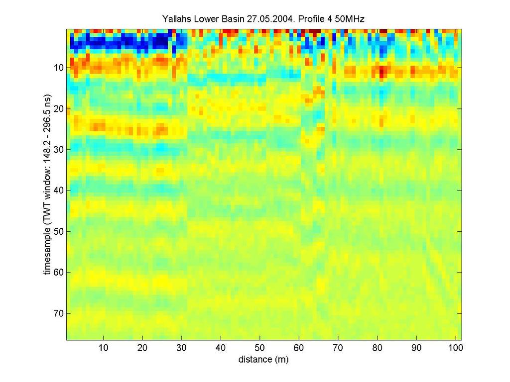
8 A) Plot of raw Ground Penetrating Radar data 8


9 9


10 10
11 11

12 12


13 13


14 14


15 15
16 16

17 17
18 18
19 B) Geophysical Survey, Yallahs, St. Thomas, Geographical Positions and Field Notes Day 1 May 27, 2004 Well Name Depth to Water (ft) Elevation of Measurement Point (above sea level) London Piece Well E, N top of casing Norris E, N m top of pipe Yallahs E, N m top of casing Profile 1 North-South 200 mhz E, N E, N E, N Profile 2 West-East 200 mhz E, N E, N E, N Crosspoint E, N Profile 3 West-East 50 mhz E, N E, N E, N Profile 4 North-South 50 mhz E, N E, N 19
20 Day 2 May 28, 2004 Profile 1 Parallel to Coast E, N E N E, N Profile 2 Perpendicular to Coast E, N E, N E, N E, N E, N E, N E, N Crosspoint E, N Note: Land starts to slope at 11 metres from coastline and flattens at 18 metres. Equipment boxes were at 33 metres. Asphalt starts at 94 metres. Transect turned parallel to sea at 250 metres and then turned perpendicular at 284 metres. Stopped for lunch at 800 metres. 20
21 Day 3 June 1, 2004 Well Name Depth to water (ft. below groundlevel) Elevation above sea level Yallahs nonpumping well at quarry E N metres Pumping well at quarry E N No measurement point and splashing water. Note: Nearby well pumping approximately metres away. Bucket bail test was performed with a five gallon (18.9 litres) bucket. Times taken were 1.83s, 1.91s, 1.30s, 1.48s, 1.34s, 1.57s, 1.73s, and 1.43s. Profile 1 From pumping well to observation well E, End E, N Note: Measurements were taken at 0.5 metre interval. There was a pipe at 9 metres. There was a light wire at 10 metres. There was the steel gate for the well house at 20 metres. Profile 2 From observation well to fence at quarry E, N E, N E, N Note: Crosspoint is at 10 metres. Water at surface at 26.5 metres, metres and metres. There was metal across the road at 56 metres. Profile turned at 63 metres (crosspoint with profile 3). Profile E, N E, N 21
22 Profile E, N E, N E, N Note: Canal at 5 metres. Profile E, N E, N Profile E, N E, N E, N E, N E, N E, N Note: Profile 6 is perpendicular to Profile 5. Asphalt starts at 135 metres Profile E, N E, N E, N E, N Note: Profile 7 Crosses with Profile 6 at 11 metres. Profile E, N E, N E, N Note: Profile 7 crosses Profile 8 at 5 metres. 22
23 Profile E, N E, N E, N E, N E, N E, N Note: A truck was parked at 150 metres. Day 4 June 2, 2004 Profile E, N E, N E, N E, N E, N E, N E, N E, N E, N E, N E, N E, N E, N E, N Note: Profile 2 crosses Profile 1 at 640 metres E, N. Profile 1 crosses Profile 2 at 15 metres. Profile E, N E, N Note: Profile 3 crosses Profile 2 at 43 metres. Profile 2 crosses Profile 3 at 8 metres. Crosspoint E, N. 23
24 Profile E, N E, N E, N E, N E, N E, N E, N 311 (end) E, N Note: Pipe crosses road at 60 metres and metres. Asphalt starts at 387 metres. Slopes downwards at 292 metres and slope ends at 300 metres. at 292 metres are E, N at approximately 11 metres above sea level. Profile 3 crosses profile on Day 1 at 305 metres. Profile 4 Move out after lunch E, N Day 5 June 3, 2004 Profile 1 Elevation (metres a.m.s.l.) E, N E, N 12 Note: Continued where the profile from the previous day had ended. Gravel and bad road started at 41 metres. Profile 2 Perpendicular to Coast E, N E, N 24
25 Profile 3 On ridge at Yallahs river Elevation (metres a.m.s.l.) E, N E, N 26 Note: Elevation at 40 metres is 24 metres a.m.s.l. Profile 4 In river bed running west to east E, N E, N E, N Profile 5 North-South towards sea E, E, N E, N E, N E, N E, N E, N 25
Ground subsidence is a worldwide problem especially
 Ground Engineering: GPR A Case Study on Ground Subsidence Using Ground Penetrating Radar Nur Azwin Ismail and Rosli Saad Geophysics Section, School of Physics, Universiti Sains Malaysia Ground subsidence
Soils, Hydrogeology, and Aquifer Properties. Philip B. Bedient 2006 Rice University
 Soils, Hydrogeology, and Aquifer Properties Philip B. Bedient 2006 Rice University Charbeneau, 2000. Basin Hydrologic Cycle Global Water Supply Distribution 3% of earth s water is fresh - 97% oceans 1%
A Case Study on Ground Subsidence Using Ground Penetrating Radar
 2012 International Conference on Environmental, Biomedical and Biotechnology IPCBEE vol.41 (2012) (2012) IACSIT Press, Singapore A Case Study on Ground Using Ground Penetrating Radar Nur Azwin Ismail +
THE MINISTRY OF ENERGY AND ENERGY INDUSTRIES MINERALS DIVISION MINE DESIGN TEMPLATE OPERATOR NAME: OPERATOR ADDRESS: PHONE NUMBER: FACSIMILE:
 THE MINISTRY OF ENERGY AND ENERGY INDUSTRIES MINERALS DIVISION MINE DESIGN TEMPLATE 1.0 GENERAL INFORMATION OPERATOR NAME: OPERATOR ADDRESS: PHONE NUMBER: FACSIMILE: NAME OF CONTACT: CELLULAR PHONE: EMAIL
Geophysical mapping and imaging of soil structures: basic overview
 Geophysical mapping and imaging of soil structures: basic overview Stéphane Garambois Landslide team, LGIT, Université Joseph Fourier 3D imaging of the water table (seismic) Geophysical methods 1 Plan
FINAL REPORT GEOPHYSICAL INVESTIGATION WATER TOWER NO. 6 SITE PLANT CITY, FL
 APPENDIX B FINAL REPORT GEOPHYSICAL INVESTIGATION WATER TOWER NO. 6 SITE PLANT CITY, FL Prepared for Madrid Engineering Group, Inc. Bartow, FL Prepared by GeoView, Inc. St. Petersburg, FL February 28,
Sabal Trail Pipeline Project Evaluation of Karst Topography and Sinkhole Potential for Pipeline and Facilities
 November 11, 2014 Sabal Trail Pipeline Project Evaluation of Karst Topography and Sinkhole Potential for Pipeline and Facilities Gulf Interstate Engineering Attention: Mr. Denys Stavnychyi - Project Engineer
SEISMIC RADAR AND ELECTRICAL TECHNIQUES FOR WASTE DISPOSAL ASSESSMENT. M. Pipan, G. Dal Moro, E. Forte & M. Sugan
 SEISMIC RADAR AND ELECTRICAL TECHNIQUES FOR WASTE DISPOSAL ASSESSMENT M. Pipan, G. Dal Moro, E. Forte & M. Sugan Department of Geological, Environmental and Marine Sciences, University of Trieste Via Weiss,
Hazard Mapping Along the Dead Sea Shoreline
 FIG Working Week in Marrakech, Morocco 18-22 May 2011 Hazard Mapping Along the Dead Sea Shoreline Rami Al-Ruzouq, Abdullah Al-Zuobi, AbdEl-Rahman Abueladas, Emad Akkawi Department of Surveying and Geomatics
ambiguity in earth sciences IESO Geophysics Section Eddy hartantyo, Lab Geofisika FMIPA UGM
 ambiguity in earth sciences IESO Geophysics Section Eddy hartantyo, Lab Geofisika FMIPA UGM Pelatihan Tahap II IESO Teknik Geologi UGM Februari 2009 1 Introduction Photos from http://www.eegs.org/whatis/
High Resolution Geophysics: A Better View of the Subsurface. By John Jansen, P.G., Ph.D., Aquifer Science and Technology
 High Resolution Geophysics: A Better View of the Subsurface By John Jansen, P.G., Ph.D., Aquifer Science and Technology Geologist Use Only Part of the Information Available To Them Most Geologist rely
APPENDIX C GEOPHYSICAL REPORT
 APPENDIX C GEOPHYSICAL REPORT GEOPHYSICAL ENGINEERING SURVEY REPORT 700 E 241 st Street NOVA PROJECT NUMBER 15-0522 DATED January 27, 2015 PREPARED FOR: LANGAN Long Warf Maritime Center New Haven, CT 06511
In-seam GPR and 2-C seismic investigations at the Goderich, Ontario salt mine
 In-seam GPR and 2-C seismic investigations at the Goderich, Ontario salt mine Jill Belisle and Robert R. Stewart In-seam techniques ABSTRACT In-seam GPR and 2-C seismic techniques used in conjunction with
E : Ground-penetrating radar (GPR)
") Geophysics 3 March 009 E : Ground-penetrating radar (GPR) The EM methods in section D use low frequency signals that trael in the Earth by diffusion. These methods can image resistiity of the Earth on
Geophysics 3 March 009 E : Ground-penetrating radar (GPR) The EM methods in section D use low frequency signals that trael in the Earth by diffusion. These methods can image resistiity of the Earth on
Ground Penetrating Radar & By Mike Kelty Western Technologies Inc.
 Ground Penetrating Radar & Thermorgraphy By Mike Kelty Western Technologies Inc. Overview Types of Locating Methods/Equipment How GPR Works GPR Applications How Thermography Works Thermography Applications
Vertical fracture detection by exploiting the polarization properties of ground-penetrating radar signals
 GEOPHYSICS, VOL. 69, NO. 3 (MAY-JUNE 2004); P. 803 810, 10 FIGS. 10.1190/1.1759466 Vertical fracture detection by exploiting the polarization properties of ground-penetrating radar signals Georgios P.
Hydrogeological Assessment for Part of Lots 2 and 3, Concession 5, Township of Thurlow, County of Hastings 1.0 INTRODUCTION. 1.
 February 10,2017 25506400 Ontario Ltd. Foxboro, ON Attention: Brad Newbatt Re: Hydrogeological Assessment for Part of Lots 2 and 3, Concession 5, Township of Thurlow, County of Hastings 1.0 INTRODUCTION
Geophysics for Environmental and Geotechnical Applications
 Geophysics for Environmental and Geotechnical Applications Dr. Katherine Grote University of Wisconsin Eau Claire Why Use Geophysics? Improve the quality of site characterization (higher resolution and
GPR AS A COST EFFECTIVE BEDROCK MAPPING TOOL FOR LARGE AREAS. Abstract
 GPR AS A COST EFFECTIVE BEDROCK MAPPING TOOL FOR LARGE AREAS Dr. Jutta L. Hager, Hager GeoScience, Inc., Waltham, MA Mario Carnevale, Hager GeoScience, Inc., Waltham, MA Abstract Hager GeoScience, Inc.
G. Barrocu G. Ranieri Faculty of Engineering, University of Cagliari, Italy. In the region of Muravera, south-east coast of Sardinia, the trend of
 HYDROGEOLOGICAL AND GEOPHYSICAL INVESTIGATIONS FOR EVALUATING SALT INTRUSION PHENOMENA IN SARDINIA G. Barbieri G. Barrocu G. Ranieri Faculty of Engineering, University of Cagliari, Italy Abstract In the
CROSSHOLE RADAR TOMOGRAPHY IN AN ALLUVIAL AQUIFER NEAR BOISE, IDAHO. Abstract. Introduction
 CROSSHOLE RADAR TOMOGRAPHY IN AN ALLUVIAL AQUIFER NEAR BOISE, IDAHO William P. Clement, Center for Geophysical Investigation of the Shallow Subsurface, Boise State University, Boise, ID, 83725 Warren Barrash,
Geophysical Applications GPR Ground Penetrating Radar
 Overview: Basics of GPR Radar-wave velocity, attenuation and skin depth Modes of acquisition The Radar-range equation Dielectric properties of materials and relation to porosity Case studies [Archeology,
Seismic Reflection Imaging across the Johnson Ranch, Valley County, Idaho
 Seismic Reflection Imaging across the Johnson Ranch, Valley County, Idaho Report Prepared for the Skyline Corporation Lee M. Liberty Center for Geophysical Investigation of the Shallow Subsurface (CGISS)
3-D ground-penetrating radar surveys on a frozen river lagoon
 3-D ground-penetrating radar surveys on a frozen river lagoon Monica Moldoveanu and Robert R. tewart ABTRACT Ground-penetrating radar (GPR) surveys were acquired at Bowness Park, Calgary to characterize
P Forsmark site investigation. Ground penetrating radar and resistivity measurements for overburden investigations
 P-03-43 Forsmark site investigation Ground penetrating radar and resistivity measurements for overburden investigations Johan Nissen, Malå Geoscience AB April 2003 Svensk Kärnbränslehantering AB Swedish
Surface Processes Focus on Mass Wasting (Chapter 10)
") Surface Processes Focus on Mass Wasting (Chapter 10) 1. What is the distinction between weathering, mass wasting, and erosion? 2. What is the controlling force in mass wasting? What force provides resistance?
Surface Processes Focus on Mass Wasting (Chapter 10) 1. What is the distinction between weathering, mass wasting, and erosion? 2. What is the controlling force in mass wasting? What force provides resistance?
Geophysical Site Investigation (Seismic methods) Amit Prashant Indian Institute of Technology Gandhinagar
 Amit Prashant Indian Institute of Technology Gandhinagar") Geophysical Site Investigation (Seismic methods) Amit Prashant Indian Institute of Technology Gandhinagar Short Course on Geotechnical Aspects of Earthquake Engineering 04 08 March, 2013 Seismic Waves
Geophysical Site Investigation (Seismic methods) Amit Prashant Indian Institute of Technology Gandhinagar Short Course on Geotechnical Aspects of Earthquake Engineering 04 08 March, 2013 Seismic Waves
1. Resistivity of rocks
 RESISTIVITY 1) Resistivity of rocks 2) General principles of resistivity surveying 3) Field procedures, interpretation and examples 4) Summary and conclusions INDUCED POLARIZATION 1) General principles
Dielectric constant determination using ground-penetrating radar reflection coefficients
 Ž. Journal of Applied Geophysics 43 000 189 197 www.elsevier.nlrlocaterjappgeo Dielectric constant determination using ground-penetrating radar reflection coefficients Philip M. Reppert ), F. Dale Morgan,
GPR survey and field work summary in Siilinjärvi mine during July 2014
 GEOLOGICAL SURVEY OF FINLAND Groundwater Espoo 21.6.2016 67/2016 GPR survey and field work summary in Siilinjärvi mine during July 2014 Samrit Luoma, Juha Majaniemi, Tiina Kaipainen, and Antti Pasanen
A GPR ASSESSMENT OF THE PREHISTORIC NAPLES CANAL NAPLES, FLORIDA ARCHAEOLOGICAL AND HISTORICAL CONSERVANCY, INC.
 A GPR ASSESSMENT OF THE PREHISTORIC NAPLES CANAL NAPLES, FLORIDA ARCHAEOLOGICAL AND HISTORICAL CONSERVANCY, INC. AHC TECNICAL REPORT NO. 1004 DECEMBER 2013 A GPR ASSESSMENT OF THE PREHISTORIC NAPLES CANAL
Determining the History of Dune du Pilat, France: An Application of Ground Penetrating Radar and Sedimentology Techniques
 Determining the History of Dune du Pilat, France: An Application of Ground Penetrating Radar and Sedimentology Techniques By Sarah Betancourt, Sanna Lee, Nicholas Ritter, Emmanuel Teferi, and Joe Zhang
Geological Mapping using Geophysics
 Geological Mapping using Geophysics Pugin, A.J.M. and T.H. Larson Illinois State Geological Survey, 615 E Peabody Dr., Champaign, IL 61820; E-mail: A.J.M. Pugin at pugin@isgs.uiuc.edu Mapping Techniques.
SEISMIC REFRACTION ANALYSIS OF EAST RIVER FLATS MINNEAPOLIS MINNESOTA A THESIS SUBMITTED TO THE FACULTY OF UNIVERSITY OF MINNESOTA AUTUMN HAAGSMA
 SEISMIC REFRACTION ANALYSIS OF EAST RIVER FLATS MINNEAPOLIS MINNESOTA A THESIS SUBMITTED TO THE FACULTY OF UNIVERSITY OF MINNESOTA BY AUTUMN HAAGSMA IN PARTIAL FULFILLMENT OF THE REQUIREMENTS FOR THE DEGREE
Site characterization at the Groundwater Remediation Field Laboratory
 Site characterization at the Groundwater Remediation Field Laboratory WILLIAM P. C LEMENT, STEVE CARDIMONA, ANTHONY L. ENDRES, Boston College, Boston, Massachusetts KATHARINE KADINSKY-CADE, Phillips Laboratory,
THE ROLE OF 3-D GEOLOGIC MODELING AND DATABASE SOLUTIONS IN THE VIRTTAANKANGAS ARTIFICIAL RECHARGE PROJECT, SOUTHWESTERN FINLAND
 THE ROLE OF 3-D GEOLOGIC MODELING AND DATABASE SOLUTIONS IN THE VIRTTAANKANGAS ARTIFICIAL RECHARGE PROJECT, SOUTHWESTERN FINLAND Artimo, A. 1, S. Saraperä 2, and I. Ylander 1 1 Turku Region Water Ltd.,
Groundwater Sustainability at Wadi Al Bih Dam, Ras El Khaimah, United Arab Emirates (UAE) using Geophysical methods
 using Geophysical methods") Groundwater Sustainability at Wadi Al Bih Dam, Ras El Khaimah, United Arab Emirates (UAE) using Geophysical methods Ahmed Murad, Amir Gabr, Saber Mahmoud, Hasan Arman & Abdulla Al Dhuhoori Geology Department
Groundwater Sustainability at Wadi Al Bih Dam, Ras El Khaimah, United Arab Emirates (UAE) using Geophysical methods Ahmed Murad, Amir Gabr, Saber Mahmoud, Hasan Arman & Abdulla Al Dhuhoori Geology Department
TAMPA BAY TRIBUTARIES BASIN. Hydrogeological Setting
 TAMPA BAY TRIBUTARIES BASIN Hydrogeological Setting Aquifers within the Tampa Bay Tributaries Basins ground water flow system include the Floridan aquifer system, the intermediate aquifer system, and the
Sabal Trail Pipeline Project Evaluation of Karst Topography and Sinkhole Potential for Pipeline and Facilities
 November 11, 2014 Sabal Trail Pipeline Project Evaluation of Karst Topography and Sinkhole Potential for Pipeline and Facilities Gulf Interstate Engineering Attention: Mr. Denys Stavnychyi - Project Engineer
GPR surveys at Nõmmküla Detection of underground water routes
 GPR surveys at Nõmmküla 2009 Detection of underground water routes Tomi Herronen & Timo Saarenketo 2009 1. Introduction The purpose of this survey was to locate possible underground water routes (rivers)
Groundwater Level Monitoring of the Quaternary Aquifer at Al Ain City, United Arab Emirates (UAE) using Geophysical Methods
 using Geophysical Methods") Groundwater Level Monitoring of the Quaternary Aquifer at Al Ain City, United Arab Emirates (UAE) using Geophysical Methods Ahmed Murad & Amir Gabr Geology Department UAE University Outlines Introduction
Groundwater Level Monitoring of the Quaternary Aquifer at Al Ain City, United Arab Emirates (UAE) using Geophysical Methods Ahmed Murad & Amir Gabr Geology Department UAE University Outlines Introduction
Ronin Placer Ground-penetrating Radar Survey Report
 Ronin Placer Ground-penetrating Radar Survey Report Tenures: 837095, 837097 Mining Division: Greenwood NTS Location: 082E/03 Geographic Center Coordinates: UTM Zone 11, E 345340, N 5438730 Claims Owner:
Static Corrections for Seismic Reflection Surveys
 Static Corrections for Seismic Reflection Surveys MIKE COX Volume Editors: Series Editor: Eugene F. Scherrer Roland Chen Eugene F. Scherrer Society of Exploration Geophysicists Tulsa, Oklahoma Contents
First Field Test of NAPL Detection with High Resolution Borehole Seismic Imaging
 1 First Field Test of NAPL Detection with High Resolution Borehole Seismic Imaging Jil T. Geller, John E. Peterson, Kenneth H. Williams, Jonathan B. Ajo!Franklin*, and Ernest L. Majer Earth Sciences Division,
Evaluation of Subsurface Formation of Pabna District, Bangladesh
 IOSR Journal of Applied Geology and Geophysics (IOSR-JAGG) e-issn: 2321 0990, p-issn: 2321 0982.Volume 1, Issue 4 (Sep. Oct. 2013), PP 30-36 Evaluation of Subsurface Formation of Pabna District, Bangladesh
Application of Ground Penetrating Radar for hydro-geological study
 Journal of Scientific & Industrial Research Vol. 65, February 2006, pp. 160-164 Application of Ground Penetrating Radar for hydro-geological study K K K Singh* Central Mining Research Institute, Dhanbad
FUNDAMENTALS OF ENGINEERING GEOLOGY
 FUNDAMENTALS OF ENGINEERING GEOLOGY Prof. Dr. HUSSEIN HAMEED KARIM Building and Construction Engineering Department 2012 Preface The impulse to write this book stemmed from a course of geology given by
Influence of Paleochannels on Seepage
 Study 4 Influence of Paleochannels on Seepage Public Draft 2014 Monitoring and Analysis Plan September 2013 August 2012 Influence of Paleochannels on Seepage 1. Statement of Need Historical maps, aerial
ENVIRONMENTAL GEOSCIENCE UNIFORM SYLLABUS
 ENVIRONMENTAL GEOSCIENCE UNIFORM SYLLABUS The Association of Professional Engineers and Geoscientists of the Province of British Columbia Note: 1. This Syllabus May Be Subject To Change 2. These Courses
Delineation of Zones at Risk from Groundwater Inflows at an Underground Platinum Mine in South Africa
 Delineation of Zones at Risk from Groundwater Inflows at an Underground Platinum Mine in South Africa Mr Andreas Stoll andreas.stoll@erm.com Environmental Resources Management Swiss GmbH (ERM), Switzerland
Ground Penetrating Radar (GPR)
") Ground Penetrating Radar (GPR) In the search for uraniferous paleo-channels Klaus P. Knupp kknupp@mweb.com.na Uranium Conference 23-24 October 2009, Swakopmund, Namibia Some GPR Principles Source: Sensors
Ground Penetrating Radar (GPR) In the search for uraniferous paleo-channels Klaus P. Knupp kknupp@mweb.com.na Uranium Conference 23-24 October 2009, Swakopmund, Namibia Some GPR Principles Source: Sensors
TRC1504: Alternative Uses of Ground Penetrating Radar in Highway in Construction and Maintenance. Elisha Wright-Kehner, P.E.
 TRC1504: Alternative Uses of Ground Penetrating Radar in Highway in Construction and Maintenance Elisha Wright-Kehner, P.E. Why GPR? Practicality Non-invasive (Non-destructive Testing - NDT) Real-time
Seismic tests at Southern Ute Nation coal fire site
 Seismic tests at Southern Ute Nation coal fire site Sjoerd de Ridder and Seth S. Haines ABSTRACT We conducted a near surface seismic test at the Southern Ute Nation coal fire site near Durango, CO. The
Electrical Resistivity Survey for Delineating Seawater Intrusion in a Coastal Aquifer
 Electrical Resistivity Survey for Delineating Seawater Intrusion in a Coastal Aquifer Sung-Ho Song*, Gyu-Sang Lee*, Jin-Sung Kim*, Baekuk Seong*, Young-gyu Kim*, Myung-Ha Woo* and Namsik Park** Abstract
 12 10 8 6 4 2 0 40-50 50-60 60-70 70-80 80-90 90-100 Fresh Water What we will cover The Hydrologic Cycle River systems Floods Groundwater Caves and Karst Topography Hot springs Distribution of water in
Comparison of geophysical. techniques to determine depth to. bedrock in complex weathered. environments of the Mount Crawford. region, South Australia
 Comparison of geophysical techniques to determine depth to bedrock in complex weathered environments of the Mount Crawford region, South Australia Thesis submitted in accordance with the requirements of
Use of Geophysical Software for Interpretation of Ice-Penetrating Radar Data and Mapping of Polar Ice Sheets
 Use of Geophysical Software for Interpretation of Ice-Penetrating Radar Data and Mapping of Polar Ice Sheets Alex O. Martinez University of Kansas 2335 Irving Hill Road Lawrence, KS 66045-7612 http://cresis.ku.edu
FOUNDATION DESIGN AND CASE STUDIES
 The University of the West Indies Organization of American States PROFESSIONAL DEVELOPMENT PROGRAMME: COASTAL INFRASTRUCTURE DESIGN, CONSTRUCTION AND MAINTENANCE A COURSE IN DESIGN OF MARINE STRUCTURES
Enhanced Characterization of the Mississippi River Valley Alluvial Aquifer Using Surface Geophysical Methods
 Photo by Shane Stocks, U.S. Geological Survey Enhanced Characterization of the Mississippi River Valley Alluvial Aquifer Using Surface Geophysical Methods Presented by Ryan F. Adams US Geological Survey
APPLICATION OF ELECTRICAL RESISTIVITY TOMOGRAPHY FOR SAND UNDERWATER EXTRACTION
 International Scientific Conference GEOBALCANICA 2018 APPLICATION OF ELECTRICAL RESISTIVITY TOMOGRAPHY FOR SAND UNDERWATER EXTRACTION Maya Grigorova Ivaylo Koprev University of Mining and Geology St. Ivan
11/22/2010. Groundwater in Unconsolidated Deposits. Alluvial (fluvial) deposits. - consist of gravel, sand, silt and clay
 deposits. - consist of gravel, sand, silt and clay") Groundwater in Unconsolidated Deposits Alluvial (fluvial) deposits - consist of gravel, sand, silt and clay - laid down by physical processes in rivers and flood plains - major sources for water supplies
Groundwater in Unconsolidated Deposits Alluvial (fluvial) deposits - consist of gravel, sand, silt and clay - laid down by physical processes in rivers and flood plains - major sources for water supplies
Near-Surface Seismic Reflection Applications
 Near-Surface Seismic Reflection Applications Don Steeples, The University of Kansas, Lawrence, KS USA Abstract Nonintrusive methods of gaining knowledge about the Earth s subsurface comprise several of
Geophysical Surveys for Groundwater Modelling of Coastal Golf Courses
 1 Geophysical Surveys for Groundwater Modelling of Coastal Golf Courses C. RICHARD BATES and RUTH ROBINSON Sedimentary Systems Research Group, University of St. Andrews, St. Andrews, Scotland Abstract
Improved Hydrogeophysical Parameter Estimation from Empirical Mode Decomposition Processed Ground Penetrating Radar Data
 University of South Carolina Scholar Commons Faculty Publications Earth and Ocean Sciences, Department of 12-1-2009 Improved Hydrogeophysical Parameter Estimation from Empirical Mode Decomposition Processed
VULNERABILITY OF WATER SUPPLY TO NATURAL HAZARDS IN JAMAICA
 VULNERABILITY OF WATER SUPPLY TO NATURAL HAZARDS IN JAMAICA RAFI AHMAD rafi.ahmad@uwimona.edu.jm Unit for disaster studies, Department of Geography & Geology, The University of the West Indies, Mona Kingston
Buried-valley Aquifers: Delineation and Characterization from Reflection Seismic and Core Data at Caledon East, Ontario
 Buried-valley Aquifers: Delineation and Characterization from Reflection Seismic and Core Data at Caledon East, Ontario Russell, H.A.J. 1, S.E. Pullan 1, J.A. Hunter 1, D.R. Sharpe 1, and S. Holysh 2 1
Detecting Buried Human Bodies Using Ground-Penetrating Radar
 Earth Science Research; Vol. 5, No. 2; 2016 ISSN 1927-0542 E-ISSN 1927-0550 Published by Canadian Center of Science and Education Detecting Buried Human Bodies Using Ground-Penetrating Radar Widodo 1,
Site Characterization & Hydrogeophysics
 Site Characterization & Hydrogeophysics (Source: Matthew Becker, California State University) Site Characterization Definition: quantitative description of the hydraulic, geologic, and chemical properties
Tuesday 6 June 2017 Afternoon
 Oxford Cambridge and RSA Tuesday 6 June 2017 Afternoon A2 GCE GEOLOGY F794/01 Environmental Geology *6783378785* Candidates answer on the Question Paper. OCR supplied materials: None Other materials required:
Cuyama Basin North Fork Vineyard
 Cuyama Basin North Fork Vineyard Company Background plus Data Insights to Support GSP Development for the Cuyama Basin Presented by Grapevine Capital Partners and Cleath-Harris Geologists April 26th, 2018
GEOLOGY (GEOL) Geology (GEOL) 1. GEOL 118 Societal Issues in Earth Science (4 crs)
 Geology (GEOL) 1. GEOL 118 Societal Issues in Earth Science (4 crs)") Geology (GEOL) 1 GEOLOGY (GEOL) GEOL 102 Oceanography (3 crs) Survey of the world oceans with emphasis on geologic processes. Also includes chemical, physical, and biological aspects of the sea. Investigates
Geology (GEOL) 1 GEOLOGY (GEOL) GEOL 102 Oceanography (3 crs) Survey of the world oceans with emphasis on geologic processes. Also includes chemical, physical, and biological aspects of the sea. Investigates
Shallow Karst Aquifer System of the Lake Belt Study Area, Miami-Dade County, Florida, USA EXTENDED ABSTRACT
 Second International Conference on Saltwater Intrusion and Coastal Aquifers Monitoring, Modeling, and Management. Merida, Mexico, March 30 April 2, 2003 Shallow Karst Aquifer System of the Lake Belt Study
Geology and Soils. Technical Memorandum
 Geology and Soils Technical Memorandum TO: FDOT FROM: HDR, Inc. DATE: February 2013 PROJECT: St Johns River Crossing FPID No: 208225-3-21-01 Clay, Duval, and St. Johns Counties; Florida Geology and soils
Relevance of 2D Electrical Imaging in Subsurface Mapping: Case Study of National Animal Production Research Institute (NAPRI), Zaria.
, Zaria.") Relevance of 2D Electrical Imaging in Subsurface Mapping: Case Study of National Animal Production Research Institute (NAPRI), Zaria. S.I. Fadele, Ph.D. (in view) 1* ; J. Adamu, M.Sc. 2 ; N.O. Patrick,
Relevance of 2D Electrical Imaging in Subsurface Mapping: Case Study of National Animal Production Research Institute (NAPRI), Zaria. S.I. Fadele, Ph.D. (in view) 1* ; J. Adamu, M.Sc. 2 ; N.O. Patrick,
KANSAS GEOLOGICAL SURVEY Open File Report LAND SUBSIDENCE KIOWA COUNTY, KANSAS. May 2, 2007
 KANSAS GEOLOGICAL SURVEY Open File Report 2007-22 LAND SUBSIDENCE KIOWA COUNTY, KANSAS Prepared by Michael T. Dealy L.G., Manager, Wichita Operations SITE LOCATION The site was approximately four miles
Foundation pile and cavity detection by the 3D directional borehole radar system, ReflexTracker
 Foundation pile and cavity detection by the 3D directional borehole radar system, ReflexTracker K. Wada, S. Karasawa, K. Kawata, T. Ueki Matsunaga Geo-survey Co., Ltd. 1-23-1 Ooi, 140-0014, Tokyo, Japan
Does the SDCP need inputs from geology?
 The British Geological Survey s Experience and Expertise in Supporting Projects such as the Sirte Depression Connection Project David Ovadia Director of International Kingsley Dunham Centre Keyworth Nottingham
What we will cover. The Hydrologic Cycle. River systems. Floods. Groundwater. Caves and Karst Topography. Hot springs
 Fresh Water What we will cover The Hydrologic Cycle River systems Floods Groundwater Caves and Karst Topography Hot springs On a piece of paper, put these reservoirs of water in to order from largest to
Monday 2 June 2014 Morning
 Monday 2 June 2014 Morning A2 GCE GEOLOGY F794/01 Environmental Geology *3076922876* Candidates answer on the Question Paper. OCR supplied materials: None Other materials required: Electronic calculator
Seepage Analysis for Shurijeh Reservoir Dam Using Finite Element Method. S. Soleymani 1, A. Akhtarpur 2
 Seepage Analysis for Shurijeh Reservoir Dam Using Finite Element Method S. Soleymani 1, A. Akhtarpur 2 1 Group of Dam Construction, Toossab Company, P.O. Box 917751569, Mashhad City, Iran, PH (+98) 511-7684091;
Ronin and Dayton Placer Ground-penetrating Radar Survey Report
 Ronin and Dayton Placer Ground-penetrating Radar Survey Report Tenures: 837095, 837097, 889865, 890187 Mining Division: Greenwood NTS Location: 082E/03 Geographic Center Coordinates: UTM Zone 11, E 345340,
NATURAL HAZARDS PROFILE OF JAMAICA RAFI AHMAD
 NATURAL HAZARDS PROFILE OF JAMAICA RAFI AHMAD rafi.ahmad@uwimona.edu.jm UNIT FOR DISASTER STUDIES DEPARTMENT OF GEOGRAPHY AND GEOLOGY Tel. 1-876-927-2728/2129 Fax: 1-876-977-6029 THE UNIVERSITY OF THE
Land subsidence due to groundwater withdrawal in Hanoi, Vietnam
 Land Subsidence (Proceedings of the Fifth International Symposium on Land Subsidence, The Hague, October 1995). 1AHS Publ. no. 234, 1995. 55 Land subsidence due to groundwater withdrawal in Hanoi, Vietnam
Airborne Geophysics to Map Groundwater. Bill Brown
 Airborne Geophysics to Map Groundwater Bill Brown bb@skytem.com A 6 borehole represents 1 millionth of an acre Aquifer Materials An aquifer is an underground layer of water bearing permeable rock, rock
CONTENTS 1. INTRODUCTION. 2. THE D.C. RESISTIVITY METHOD 2.1 Equipment 2.2 Survey Procedure 2.3 Data Reduction
 (i) CONTENTS 1. INTRODUCTION page 1 2. THE D.C. RESISTIVITY METHOD 2.1 Equipment 2.2 Survey Procedure 2.3 Data Reduction 3 3 3 3 3. GEOPHYSICAL RESULTS 3.1 General 3.2 Discussion 4 4 4 4. LIMITATIONS 5
Impact of the Danube River on the groundwater dynamics in the Kozloduy Lowland
 GEOLOGICA BALCANICA, 46 (2), Sofia, Nov. 2017, pp. 33 39. Impact of the Danube River on the groundwater dynamics in the Kozloduy Lowland Peter Gerginov Geological Institute, Bulgarian Academy of Sciences,
Joint inversion of geophysical and hydrological data for improved subsurface characterization
 Joint inversion of geophysical and hydrological data for improved subsurface characterization Michael B. Kowalsky, Jinsong Chen and Susan S. Hubbard, Lawrence Berkeley National Lab., Berkeley, California,
HYDROGEOLOGICAL PROPERTIES OF THE UG2 PYROXENITE AQUIFERS OF THE BUSHVELD COMPLEX
 R. Gebrekristos, P.Cheshire HYDROGEOLOGICAL PROPERTIES OF THE UG2 PYROXENITE AQUIFERS OF THE BUSHVELD COMPLEX R. Gebrekristos Digby Wells Environmental P. Cheshire Groundwater Monitoring Services Abstract
A GPR ASSESSMENT OF THE NAPLES CANAL 8CR59: PHASE II NAPLES, FLORIDA ARCHAEOLOGICAL AND HISTORICAL CONSERVANCY, INC.
 A GPR ASSESSMENT OF THE NAPLES CANAL 8CR59: PHASE II NAPLES, FLORIDA ARCHAEOLOGICAL AND HISTORICAL CONSERVANCY, INC. AHC TECNICAL REPORT NO. 1023 JUNE 2014 A GPR ASSESSMENT OF THE NAPLES CANAL 8CR59: PHASE
resource and vulnerability Robineau & Join, nov
 Groundwater in tropical islands resource and vulnerability Robineau & Join, nov 2007 1 Diversity of hydrogeological environments in coastal areas of tropical islands : Hydrologic conditions (surface waters)
DATA ACQUISITION METHODS FOR GROUNDWATER INVESTIGATION AND THE SITING OF WATER SUPPLY WELLS
 DATA ACQUISITION METHODS FOR GROUNDWATER INVESTIGATION AND THE SITING OF WATER SUPPLY WELLS M.B.J. Foster Tetra Tech EM Inc., San Francisco, CA, USA Keywords: Groundwater, water wells, drilled wells, geophysical
AWRA PMAS Engineers Club of Philadelphia. A Geologic Perspective on Stormwater
 AWRA PMAS Engineers Club of Philadelphia A Geologic Perspective on Stormwater Toby J. Kessler, P.G. Hydrogeologist Trevor G. Woodward, P.G. Engineering Geologist September 10, 2014 Gilmore & Associates,
patersongroup Consulting Engineers April 20, 2010 File: PG1887-LET.01R Novatech Engineering Consultants Suite 200, 240 Michael Cowpland Drive
 patersongroup April 20, 2010 File: PG1887-LET.01R Novatech Engineering Consultants Suite 200, 240 Michael Cowpland Drive Ottawa, Ontario K2M 1P6 Attention: Mr. Adam Thompson Consulting Engineers 28 Concourse
Groundwater. (x 1000 km 3 /y) Oceans Cover >70% of Surface. Groundwater and the. Hydrologic Cycle
 Oceans Cover >70% of Surface. Groundwater and the. Hydrologic Cycle") Chapter 17 Oceans Cover >70% of Surface Groundwater and the Hydrologic Cycle Vasey s Paradise, GCNP Oceans are only 0.025% of Mass Groundwater Groundwater is liquid water that lies in the subsurface in
Chapter 17 Oceans Cover >70% of Surface Groundwater and the Hydrologic Cycle Vasey s Paradise, GCNP Oceans are only 0.025% of Mass Groundwater Groundwater is liquid water that lies in the subsurface in
GPR profiling and electrical resistivity tomography for buried cavity detection: a test site at the Abbaye de l'ouye (France)
") GPR profiling and electrical resistivity tomography for buried cavity detection: a test site at the Abbaye de l'ouye (France) Nerouz BOUBAKI, Albane SAINTENOY, Piotr TUCHOLKA IDES - UMR 8148 CNRS, Université
GPR profiling and electrical resistivity tomography for buried cavity detection: a test site at the Abbaye de l'ouye (France) Nerouz BOUBAKI, Albane SAINTENOY, Piotr TUCHOLKA IDES - UMR 8148 CNRS, Université
Evolution of the conceptual hydrogeologic and ground-water flow model for Las Vegas Valley, Clark County, Nevada
 Evolution of the conceptual hydrogeologic and ground-water flow model for Las Vegas Valley, Clark County, Nevada Geological Society of America Annual Meeting November 14, 2 David J. Donovan Southern Nevada
USE OF GEOPHYSICAL SURVEYS FOR FILL CHARACTERIZATION AND QUANTITY ESTIMATION AT BROWNFIELD SITES A CASE HISTORY. Abstract
 USE OF GEOPHYSICAL SURVEYS FOR FILL CHARACTERIZATION AND QUANTITY ESTIMATION AT BROWNFIELD SITES A CASE HISTORY John A. Mundell, Mundell & Associates, Inc., Indianapolis, IN Gregory B. Byer, Mundell &
Walkaway Seismic Experiments: Stewart Gulch, Boise, Idaho
 Walkaway Seismic Experiments: Stewart Gulch, Boise, Idaho Lee M. Liberty Center for Geophysical Investigation of the Shallow Subsurface Boise State University Boise, Idaho 1. Summary CGISS conducted walkaway
LECTURE 10. Module 3 : Field Tests in Rock 3.6 GEOPHYSICAL INVESTIGATION
 LECTURE 10 3.6 GEOPHYSICAL INVESTIGATION In geophysical methods of site investigation, the application of the principles of physics are used to the study of the ground. The soil/rock have different characteristics
M E M O R A N D U M. Mr. Jonathan K. Thrasher, P.E. and Mr. Ian Kinnear, P.E. PSI
 M E M O R A N D U M TO: FROM: Mr. Mark Schilling Gulf Interstate Engineering Mr. Jonathan K. Thrasher, P.E. and Mr. Ian Kinnear, P.E. PSI DATE: November 11, 2014 RE: Summary of Findings Geotechnical Study