SURVEY PORTRAY SAFEGUARD
|
|
|
- Wesley Patrick
- 5 years ago
- Views:
Transcription
 and")


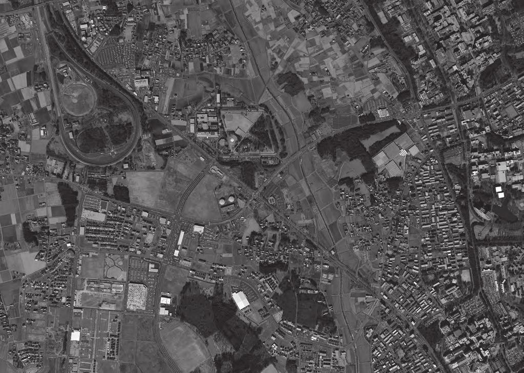
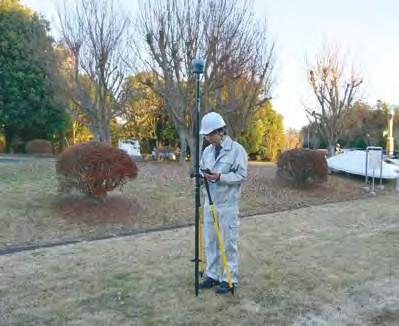
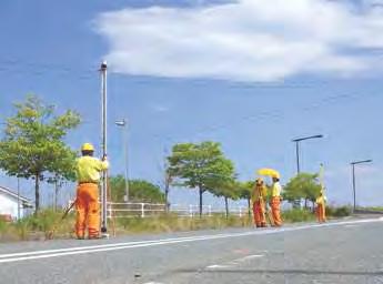
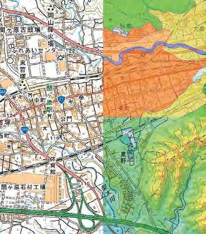
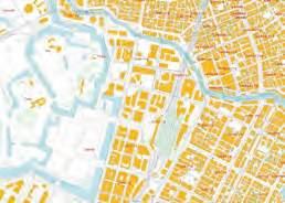
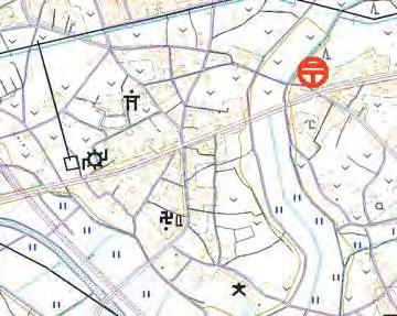
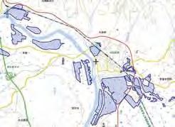
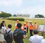
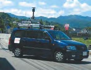
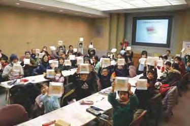
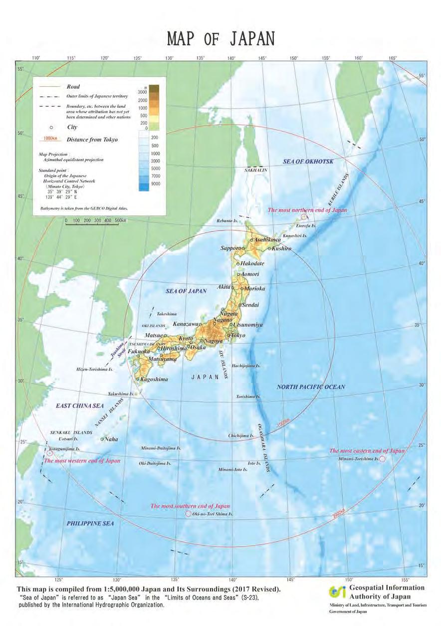
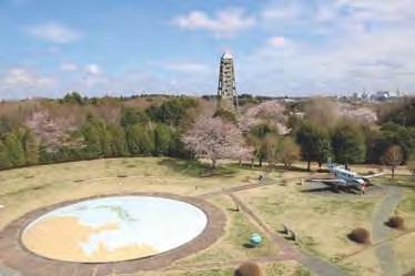
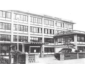
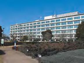
1 SURVEY GSI (Headquarters) and Science Museum of Map and Survey Kokudochiriin (GSI) Main Bldg. P Science Museum of Map and Survey Main gate P Kokudochiriin (GSI) PORTRAY Tokyo SAFEGUARD


2

3 1 2

4

5 5 6

6 7 8


7 9 10


8 11 12

9 13 14


10 15 16


11 17 18
 and areas that move slowly without generating seismic waves (sliding zones) on a plate boundary which is the source of the occurrence")


 technology has been increasingly utilized with big data and deep learning in various fields, along with dramatic advances made in spatial awareness technology and")


).")
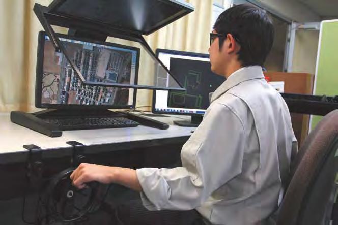
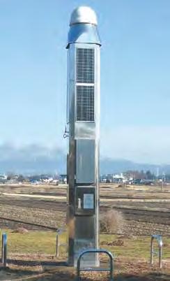
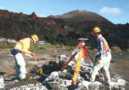
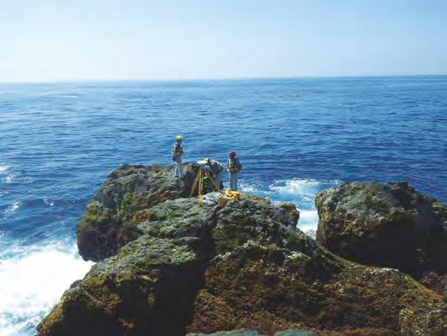
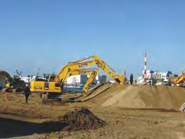
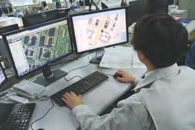
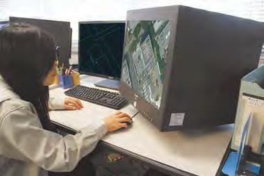
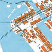
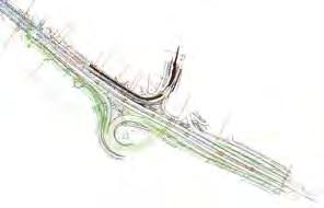
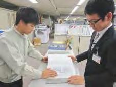
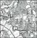
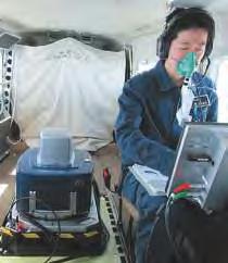
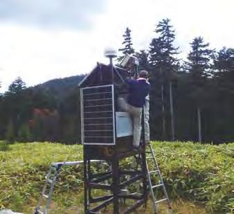
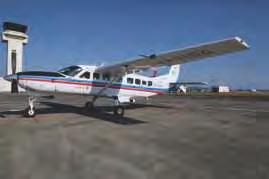
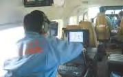
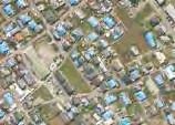
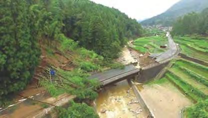
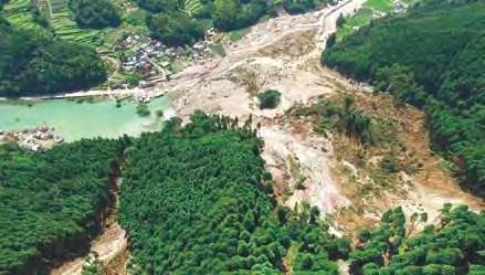
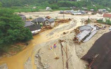
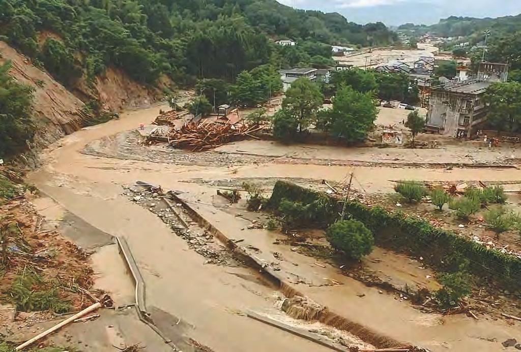
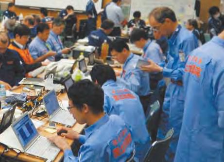
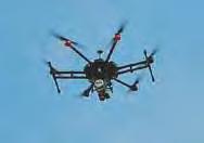
12 Advancing Research and Development for the Future Challenge in AI-Using Automatic Mapping Research and Technology Development Unveiling the Mechanism of the Nankai Trough Earthquake Previous studies have revealed that there are areas stuck on a fault (asperities) and areas that move slowly without generating seismic waves (sliding zones) on a plate boundary which is the source of the occurrence of subduction-zone megathrust earthquakes, and their ranges change with time. GSI is working on a research for estimating temporal changes of asperities and sliding zones by combining GNSS CORSs on land and control points on the sea bottom, established by the Japan Coast Guard, to unveil the mechanism of occurrence of the megathrust earthquakes Weighting 1 Input Input layer Weighting 2 Hidden layer Output layer Roads Inference Road Pathway Illustrated image of deep learning with large training data River Neural Network Building GSI Advances Research and Development with an Eye on the Near Future The widespread diffusion of mobile devices including smart phones has diversified map utilization in daily life and increased the need for high-accuracy maps with updated information. Meanwhile, map maintenance and updating that entail many processes performed by engineers require time and costs. Thus, a new breakthrough is demanded to overcome this problem and sophisticate and speed up the processes for map maintenance and updating. Recently, Artificial Intelligence (AI) technology has been increasingly utilized with big data and deep learning in various fields, along with dramatic advances made in spatial awareness technology and computer processing capability. GSI has been advancing studies for establishing an AI system for mapping in order to increase efficiency in mapping, achieve automatic update of the existing maps, and speed up the grasping and sharing of disaster situations in the future. In addition, GSI is conducting research and development of new technology for its practical use in the near future, such as research to reveal the crustal movement mechanism and the development of more sophisticated space survey technology Determining Accurate Positions of GNSS CORSs in More Detail The crustal movement has been monitored by calculating positional relationship among GNSS CORSs with high-precision. This method, called relative positioning, requires an enormous amount of calculation as the analysis is based on the combination of GNSS CORSs. Moreover, once a trouble occurs in a part of GNSS CORSs, the continuous crustal monitoring may not be possible. To overcome this weakness, GSI has been studying precise and rapid crustal movement monitoring technique based on directly calculating the position of each GNSS CORS, not relative position, using the data of worldwide GNSS observation stations (Precise Point Positioning (PPP)). Grasp What Is Happening Now Global network of GNSS observation stations East-West (m) Advancing Research and Development for the Future 19 Railway Training data 0.08 Temporal change of asperities and sliding zones in the Nankai Trough area (Blue: asperity; Red: sliding zone) Deep Learning Buildings / / Foreshock M6.5 Largest aftershock M6.4 Current analysis PPP 4/14 18:00 Real-time orthoimage taken from disaster-prevention helicopter (Red line is the flight route) Elevation data 4/15 0:00 6:00 12:00 Enhancement of crustal movement monitoring by Precise Point Positioning (PPP) (Changes in coordinates of GNSS CORS Jonan before and after the 2016 Kumamoto Earthquake) Estimated inundated depth (m) Analysis Room in Research Building Estimation of precise orbit of GNSS satellite and correction information for Precise Point Positioning (PPP) Grasping the inundation condition The prompt and efficient grasping of the disaster situations is the key to disaster response. To speed up grasping of a floodcaused inundation condition, GSI is developing a system that enables real-time estimation of the volume of inundation water using the automatically measured inundation range and area based on video images taken by disaster-prevention helicopters of Regional Development Bureaus of MLIT and other agencies. GSI is also examining ways to identify an inundation range by using AI technology. 20
13 21 22


14 23 24

15 25 26

16 27 28
Seismic Activity and Crustal Deformation after the 2011 Off the Pacific Coast of Tohoku Earthquake
 J-RAPID Symposium March 6-7, 2013 Seismic Activity and Crustal Deformation after the 2011 Off the Pacific Coast of Tohoku Earthquake Y. Honkura Tokyo Institute of Technology Japan Science and Technology
Case Study of Japan: Crustal deformation monitoring with GNSS and InSAR
 Technical Seminar Reference Frame in Practice, Case Study of Japan: Crustal deformation monitoring with GNSS and InSAR Basara Miyahara miyahara-b96ip@milt.go.jp Geospatial Information Authority of Japan
How GNSS CORS in Japan works for geodetic control and disaster mitigations
 ICG Working Group D Reference Frames, Timing and Applications How GNSS CORS in Japan works for geodetic control and disaster mitigations ICG11, Nov. 7-11, 2016, Sochi, Russia Hiromichi TSUJI Geodetic Observation
REPORT ON THE TOHOKU AREA PASIFIC OFFSHORE EARTHQUAKE
 REPORT ON THE TOHOKU AREA PASIFIC OFFSHORE EARTHQUAKE GENERAL PERSPECTIVE The Highest Magnitude Ever Recorded The 2011 off the Pacific Coast of Tohoku Earthquake (hereafter, the 2011 Tohoku- Pacific Earthquake
The Current Activities of the Headquarters for Earthquake Research Promotion Concerning Tonankai/Nankai Earthquakes
 The Current Activities of the Headquarters for Earthquake Research Promotion Concerning Tonankai/Nankai Earthquakes ISOGAI Keisuke Director of Earthquake Research Division, Research and Development Bureau,
Case study of Japan: Reference Frames in Practice
 Case study of Japan: Reference Frames in Practice Basara Miyahara and Koji Matsuo Sponsors: 1 Outline Introduction - Geodetic reference frame of Japan - GEONET : continuous GNSS observation system Geometric
NGIAs' roles in successful disaster response
 The Second UN-GGIM-AP Plenary Meeting NGIAs' roles in successful disaster response Japan Teheran Iran 28 October 2013 Shin-ichi SAKABE, Director of International Affairs Division Geospatial Information
Source modeling of hypothetical Tokai-Tonankai-Nankai, Japan, earthquake and strong ground motion simulation using the empirical Green s functions
 Source modeling of hypothetical Tokai-Tonankai-Nankai, Japan, earthquake and strong ground motion simulation using the empirical Green s functions Y. Ishii & K. Dan Ohsaki Research Institute, Inc., Tokyo
Crustal deformation by the Southeast-off Kii Peninsula Earthquake
 Crustal deformation by the Southeast-off Kii Peninsula Earthquake 51 Crustal deformation by the Southeast-off Kii Peninsula Earthquake Tetsuro IMAKIIRE, Shinzaburo OZAWA, Hiroshi YARAI, Takuya NISHIMURA
Evidence: They both occur on divergent and convergent boundaries
 Name: Outcome E CER Part 1 Graphic Organizer Directions: Based on your understanding of faults, plates and stresses, along with the use of your data, what can you infer about the relationship between earthquakes
Earthquake Source. Kazuki Koketsu. Special Session: Great East Japan (Tohoku) Earthquake. Earthquake Research Institute, University of Tokyo
 Earthquake. Earthquake Research Institute, University of Tokyo") 2012/9/24 17:20-17:35 WCEE SS24.4 Special Session: Great East Japan (Tohoku) Earthquake Earthquake Source Kazuki Koketsu Earthquake Research Institute, University of Tokyo 1 Names and features of the earthquake
2012/9/24 17:20-17:35 WCEE SS24.4 Special Session: Great East Japan (Tohoku) Earthquake Earthquake Source Kazuki Koketsu Earthquake Research Institute, University of Tokyo 1 Names and features of the earthquake
LAB 6: Earthquakes & Faults
 Name School LAB 6: Earthquakes & Faults An earthquake is what happens when two blocks of the earth suddenly slip past one another. The surface where they slip is called the fault or fault plane. The location
Coseismic slip model
 Figure 3 - Preliminary highly smoothed model of coseismic slip for the 11 March UCL Institute for Risk & Disaster Reduction Magnitude 9.0 (JMA scale) earthquake Occurred at 02:46:23 pm local time near
Uncertainty in the assessment of seismic hazard
 The 3rd annual meeting of the seismic hazard assessment for the next generation map China-Japan-Korea cooperative program June 17 21, 2013, in Sendai, Japan Uncertainty in the assessment of seismic hazard
Scaling relations of seismic moment, rupture area, average slip, and asperity size for M~9 subduction-zone earthquakes
 GEOPHYSICAL RESEARCH LETTERS, VOL. 4, 7 74, doi:1.12/grl.976, 213 Scaling relations of seismic moment, rupture area, average slip, and asperity size for M~9 subduction-zone earthquakes Satoko Murotani,
ACTIVITIES OF THE HEADQUARTERS FOR EARTHQUAKE RESEARCH PROMOTION
 Journal of Japan Association for Earthquake Engineering, Vol.4, No.3 (Special Issue), 2004 ACTIVITIES OF THE HEADQUARTERS FOR EARTHQUAKE RESEARCH PROMOTION Sadanori HIGASHI 1 1 Member of JAEE, Earthquake
Internal Layers of the Earth
 Lecture #4 notes Geology 3950, Spring 2006; CR Stern Seismic waves, earthquake magnitudes and location, and internal earth structure (pages 28-95 in the 4 th edition and 28-32 and 50-106 in the 5 th edition)
LETTER Earth Planets Space, 56, , 2004
 LETTER Earth Planets Space, 56, 353 357, 2004 Deep seismic activities preceding the three large shallow earthquakes off south-east Hokkaido, Japan the 2003 Tokachi-oki earthquake, the 1993 Kushiro-oki
Earthquake and Tsunami Modeling in Japan. Renee Lee Product Manager, RMS
 Earthquake and Tsunami Modeling in Japan Renee Lee Product Manager, RMS RMS JAPAN EARTHQUAKE MODEL HISTORY 2011 GREAT EAST JAPAN EARTHQUAKE M9.0 SCOPE OF JAPAN EARTHQUAKE MODEL UPDATE (2012) Event Rate
focus seismic waves Earthquakes
 LESSON 3 fault line All of a sudden, Earth s crust shakes and solid land shifts. What causes an earthquake? How can an earthquake be measured? Read this selection to learn about earthquakes. Earthquakes
Modernization of National Geodetic Datum in China *
 UNITED NATIONS E/CONF.102/IP.16 ECONOMIC AND SOCIAL COUNCIL Nineteenth United Nations Regional Cartographic Conference for Asia and the Pacific Bangkok, 29 October 1 November 2012 Item 6(b) of the provisional
GEO-VIII November Geohazard Supersites and Natural Laboratories Progress Report. Document 9
 GEO-VIII 16-17 November 2011 Geohazard Supersites and Natural Laboratories Progress Report Document 9 This document is submitted to GEO-VIII for information. Geohazard Supersites and Natural Laboratories
UGRC 144 Science and Technology in Our Lives/Geohazards
 UGRC 144 Science and Technology in Our Lives/Geohazards Session 3 Understanding Earthquakes and Earthquake Hazards Lecturer: Dr. Patrick Asamoah Sakyi Department of Earth Science, UG Contact Information:
What causes an earthquake? Giant snakes, turtles, catfish, and spiders?
 What causes an earthquake? Giant snakes, turtles, catfish, and spiders? What causes an earthquake? The movement of Earth s plates creates enormous forces that squeeze or pull the rock in the crust as if
BC Smart Infrastructure Monitoring System (BCSIMS)
") BC Smart Infrastructure Monitoring System (BCSIMS) 2013 UBC-Tongji-CSRN Symposium Sharlie Huffman, P.Eng. Sr. Seismic & Structural Health Engineer Bridge Engineering BCSIMS BC Seismicity Monitoring networks
BC Smart Infrastructure Monitoring System (BCSIMS) 2013 UBC-Tongji-CSRN Symposium Sharlie Huffman, P.Eng. Sr. Seismic & Structural Health Engineer Bridge Engineering BCSIMS BC Seismicity Monitoring networks
A Study on the Risk Assessment of Emergency Supplies. Transportation Routes Considering Scenario Earthquakes
 ORIGINAL ARTICLE A Study on the Risk Assessment of Emergency Supplies Transportation s Considering Scenario Earthquakes Kazuaki Torisawa 1, Harumi Yashiro 2, Sei ichiro Fukushima 3*, Satoshi Kina 4 1 Kajima
REAL-TIME TSUNAMI INUNDATION PREDICTION USING OFFSHORE TSUNAMI OBSERVATION. Daisuke TATSUMI 1 and Takashi TOMITA 1
 REAL-TIME TSUNAMI INUNDATION PREDICTION USING OFFSHORE TSUNAMI OBSERVATION Daisuke TATSUMI and Takashi TOMITA The previous real-time tsunami prediction based on the inversion method and the linear superposition
AIM: What are the features of Earthquakes and where are they located? Do Now: What are some words that are associated with earthquakes?
 Notepack # 11 November 8, 201 AIM: What are the features of Earthquakes and where are they located? Do Now: What are some words that are associated with earthquakes? What are Earthquakes? The shaking or
Low-Latency Earthquake Displacement Fields for Tsunami Early Warning and Rapid Response Support
 Low-Latency Earthquake Displacement Fields for Tsunami Early Warning and Rapid Response Support Hans-Peter Plag, Geoffrey Blewitt Nevada Bureau of Mines and Geology and Seismological Laboratory University
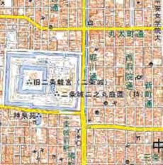
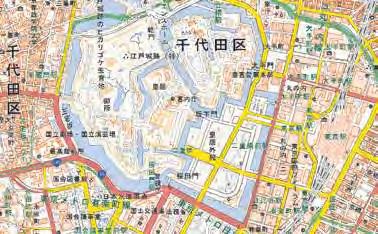
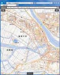
Koenji. Using ARCGIS Online to explore a place
 Koenji Using ARCGIS Online to explore a place ArcGIS Online is a GIS program that can be opened at http://www.arcgis.com/home/ You can click on Sign-up now or Make a map to get started. It is free to use
Lab 9: Satellite Geodesy (35 points)
") Lab 9: Satellite Geodesy (35 points) Here you will work with GPS Time Series data to explore plate motion and deformation in California. This lab modifies an exercise found here: http://www.unavco.org:8080/cws/pbonucleus/draftresources/sanandreas/
Lab 9: Satellite Geodesy (35 points) Here you will work with GPS Time Series data to explore plate motion and deformation in California. This lab modifies an exercise found here: http://www.unavco.org:8080/cws/pbonucleus/draftresources/sanandreas/
Chapter 2. Earthquake and Damage
 EDM Report on the Chi-Chi, Taiwan Earthquake of September 21, 1999 2.1 Earthquake Fault 2.1.1 Tectonic Background The island of Taiwan is located in the complex junction where the Eurasian and Philippine
Our Changing Earth: Plate Tectonics and Large-Scale System Interactions By Gabrielle Sierra
 Our Changing Earth: Plate Tectonics and Large-Scale System Interactions By Gabrielle Sierra! David!and!Charlie!were!setting!off!on!a!hiking!trip!with!their!uncle!Max.!!! They!had!packed!all!of!the!essential!items!they!would!need!for!their!day!of!hiking.!Inside!their!
Tsunami Risk Mitigation Strategy for Thailand. Kjell Karlsrud Norwegian Geotechnical Institute (NGI)
") Tsunami Risk Mitigation Strategy for Thailand Kjell Karlsrud Norwegian Geotechnical Institute (NGI) The project was undertaken by NGI in cooperation with: NORSAR, UiB, UiO, NIBR, B.Heyerdahl, NTNU, Sintef
Tsunami Risk Mitigation Strategy for Thailand Kjell Karlsrud Norwegian Geotechnical Institute (NGI) The project was undertaken by NGI in cooperation with: NORSAR, UiB, UiO, NIBR, B.Heyerdahl, NTNU, Sintef
How to communicate Cascadia Subduction Zone earthquake hazards
 How to communicate Cascadia Subduction Zone earthquake hazards Tom Brocher Research Geophysicist Earthquake Science Center U.S. Geological Survey Menlo Park, California Seattle Post-Intelligencer Lessons
Outline of Guideline for Development and Utilization of Tsunami Disaster Management Map
 Outline of Guideline for Development and Utilization of Tsunami Disaster Management Map Port and Airport Research Institute, Japan The Overseas Coastal Area Development Institute of Japan Ports and Harbours
Page 1. Name:
 Name: 6185-1 - Page 1 1) Which statement correctly compares seismic P-waves with seismic S-waves? A) P-waves travel faster than S-waves and pass through Earth's liquid zones. B) P-waves travel slower than
Read & Learn Earthquakes & Faults
 Read Earthquakes & Faults Read the provided article. Use the information in the reading to answer the questions on the task cards on your answer sheet. Make sure your answers are in the correct spot on
crustal structure experiment beneath Wairarapa - Wellington area: results from SAHKE
 crustal structure experiment beneath Wairarapa - Wellington area: results from SAHKE Tim Stern and SAHKE team* * VUW, GNS, University of Southern California, University of Tokyo(Japan) SAHKE = Seismic
Sendai Earthquake NE Japan March 11, Some explanatory slides Bob Stern, Dave Scholl, others updated March
 Sendai Earthquake NE Japan March 11, 2011 Some explanatory slides Bob Stern, Dave Scholl, others updated March 14 2011 Earth has 11 large plates and many more smaller ones. Plates are 100-200 km thick
Basic Plan for the Advancement of Utilizing Geospatial Information
 Basic Plan for the Advancement of Utilizing Geospatial Information (Provisional English Translation * ) Cabinet Decision March 24, 2017 * This document is an unofficial translation. Contents Preamble...
Field Trip Overview Map
 CEETEP Field Trip Guide October 11, 2014 Cascadia Subduction Zone CASCADE VOLCANOES COAST RANGE North American Plate get Pu Juan De Fuca Ridge & tte Locked Zone Earthquake me MID-OCEAN RIDGE lla Pacific
Final Presentation on Disaster Risk Management in Japan. Through ADRC V. R Programme. Main Findings and Action Plan:
 Final Presentation on Disaster Risk Management in Japan Through ADRC V. R Programme Main Findings and Action Plan: Problem/Hazard and Disaster in Japan Good Practiced on Disaster Risk Management in Japan
We have previously looked at artificial seismograms such as this one here.
 We have previously looked at artificial seismograms such as this one here. S P A realistic Seismic Record Each vertical line = 1 minute Each horizontal line = 15 minutes Seismic station PMM is in Parkfield,
KNOWLEDGE NOTE 5-1. Risk Assessment and Hazard Mapping. CLUSTER 5: Hazard and Risk Information and Decision Making. Public Disclosure Authorized
 Public Disclosure Authorized Public Disclosure Authorized Public Disclosure Authorized Public Disclosure Authorized KNOWLEDGE NOTE 5-1 CLUSTER 5: Hazard and Risk Information and Decision Making Risk Assessment
Real Time Monitoring System for Megathrust Earthquakes and Tsunamis - Cabled Network System and Buoy System in Japan -
 Real Time Monitoring System for Megathrust Earthquakes and Tsunamis - Cabled Network System and Buoy System in Japan - 1 Subduction zones around the world Haiti Italy Turkey Tohoku Sichuan Taiwan Sumatra
Indian Ocean Tsunami Warning System: Example from the 12 th September 2007 Tsunami
 Indian Ocean Tsunami Warning System: Example from the 12 th September 2007 Tsunami Charitha Pattiaratchi 1 Professor of Coastal Oceanography, The University of Western Australia Email: chari.pattiaratchi@uwa.edu.au
Earthquakes and Tsunamis
 Earthquakes and Tsunamis Kenji Satake Earthquake Research Institute University of Tokyo 1 Part I 2011 Tohoku earthquake and tsunami 2 Fukushima Dai ichi NPP accident Earthquake ground motion Reactors automatically
Damage of Sewage Plant by Tsunami
 Damage of Sewage Plant by Tsunami K. Fujima & Y. Shigihara National Defense Acadfemy, Japan SUMMARY: This work describes a damage assessment of a sewage plant in Shizuoka city by next Tokai earthquake
LOCAL TSUNAMIS: CHALLENGES FOR PREPAREDNESS AND EARLY WARNING
 LOCAL TSUNAMIS: CHALLENGES FOR PREPAREDNESS AND EARLY WARNING HARALD SPAHN 1 1 German Technical Cooperation International Services, Jakarta, Indonesia ABSTRACT: Due to the threat of local tsunamis warning
Forces in Earth s Crust
 Name Date Class Earthquakes Section Summary Forces in Earth s Crust Guide for Reading How does stress in the crust change Earth s surface? Where are faults usually found, and why do they form? What land
What is an Earthquake?
 Earthquakes What is an Earthquake? Earthquake - sometimes violent shaking of ground caused by movement of Earth s tectonic plates; creates seismic waves Often followed by smaller earthquakes (aftershocks);
A Statistical Framework for Analysing Big Data Global Conference on Big Data for Official Statistics October, 2015 by S Tam, Chief
 A Statistical Framework for Analysing Big Data Global Conference on Big Data for Official Statistics 20-22 October, 2015 by S Tam, Chief Methodologist Australian Bureau of Statistics 1 Big Data (BD) Issues
Deterministic and Non-deterministic Behavior of Earthquakes and Hazard Mitigation Strategy
 Deterministic and Non-deterministic Behavior of Earthquakes and Hazard Mitigation Strategy Hiroo Kanamori Seismological Laboratory, California Institute of Technology Earthquake Process Deterministic Non-deterministic
Evidence for plate tectonics
 Evidence for plate tectonics See class powerpoint Printed tables 2x essay Qs markschemes Discuss/Evaluate the evidence for plate tectonics Discuss/evaluate the evidence for plate tectonics Essay: To what
July 5-6, 2010 Mytilene, Greece
 Web GIS platform for forest fire management Prof. Kostas Kalabokidis Principal Investigator Univ. of the Aegean, Dept. of Geography, Greece Prof. George Kallos Univ. of Athens, Dept. of Physics, Greece
Activity - Using GPS Data and Geologic Markers to Track Plate Motion
 Name: Date: Hour: Activity - Using GPS Data and Geologic Markers to Track Plate Motion Section Points Received Points Possible Part A Analysis 4.5 Part B Analysis 11.5 Total 16 Introduction: GPS satellites
New Seismic Activity Model of Large Earthquakes along Nankai Trough for Probabilistic Seismic Hazard Maps
 New Seismic Activity Model of Large Earthquakes along Nankai Trough for Probabilistic Seismic Hazard Maps Toshihiko Okumura (Shimizu Corp.) Hiroyuki Fujiwara (NIED) Plate Tectonics around Japan Pacific
9.3. Earthquakes. Earthquakes at Divergent Boundaries
 9.3 Earthquakes Preview the headings on these two pages. What can you say about where earthquakes occur? As the plates that make up Earth s crust move, the rough edges lock together. Over time, pressure
GIS present situation in Japan
 GIS present situation in Japan September 26, 2006 INTERPREVENT 2006 in Niigata University Geographic Information Analysis Research Div. Geography and Crustal Dynamics Research Senter Geographical Survey
4-3-1 Earthquake and Tsunami Countermeasures of Tokyo s
 4-3-1 Earthquake and Tsunami Countermeasures of Tokyo s Sewerage Masahiro Hikino* and Gaku Sato** *Planning Section, Planning and Coordinating Division, Bureau of Sewerage, Tokyo Metropolitan Government
Risk-based land use and spatial planning
 Risk-based land use and spatial planning Miho OHARA International Centre for Water Hazards and Risk Management (ICHARM) Public Works Research Institute PWRI), Japan Under the auspices of UNESCO Introduction
The Structure of the Earth and Plate Tectonics
 The Structure of the Earth and Plate Tectonics Agree or Disagree? 1. The Earth if made up of 4 different layers. 2. The crust (where we live) can be made of either less dense continental crust or the more
- Information before strong ground motion -
 -Earthquake Early Warning - Information before strong ground motion - Mitsuyuki HOSHIBA Japan Meteorological Agency January 12, 2007 1 Distribution of Earthquakes Causing Tsunami (1896~2004) in Japan Distribution
Aseismic slip and low-frequency earthquakes in the Bungo channel, southwestern Japan
 GEOPHYSICAL RESEARCH LETTERS, VOL. 31, L769, doi:1.19/3gl19381, Aseismic slip and low-frequency earthquakes in the Bungo channel, southwestern Japan Shinzaburo Ozawa, 1 Yuki Hatanaka, 1 Masaru Kaidzu,
Coseismic slip distribution of the 1946 Nankai earthquake and aseismic slips caused by the earthquake
 Earth Planets Space, 53, 235 241, 2001 Coseismic slip distribution of the 1946 Nankai earthquake and aseismic slips caused by the earthquake Yuichiro Tanioka 1 and Kenji Satake 2 1 Meteorological Research
Operational Aspects of GNSS CORS What is a GNSS CORS system used for?
 Please insert a picture (Insert, Picture, from file). Size according to grey field (10 cm x 25.4 cm). Scale picture: highlight, pull corner point Cut picture: highlight, choose the cutting icon from the
Earthquakes and How to Measure Them
 Earthquakes and How to Measure Them Earth Systems Georgia Performance Standards: SES2c. Relate certain geologic hazards to plate tectonic settings. Created by: Christy Dion Paulding County High School
Tsunami Simulation of 2009 Dusky Sound Earthquake in New Zealand
 Tsunami Simulation of 2009 Dusky Sound Earthquake in New Zealand Polina Berezina 1 Institute of Geology, Taras Shevchenko National University of Kyiv, Kyiv, Ukraine Supervisor: Prof. Kenji Satake Earthquake
Plate Tectonics. The Theory of Plate Tectonics. The Plate Tectonics Theory. 62 Plate Tectonics Reading Essentials
 CHAPTER 4 LESSON 3 Tectonics The Theory of Tectonics Key Concepts What is the theory of plate tectonics? What are the three types of plate boundaries? Why do tectonic plates move? What do you think? Read
The Earthquake of Padang, Sumatra of 30 September 2009 scientific information and update
 The Earthquake of Padang, Sumatra of 30 September 2009 scientific information and update 01-October-2009 Christophe Vigny Directeur de recherches at CNRS Laboratoire de Géologie Geoscience Dept. Of ENS,
8 th Grade Science Plate Tectonics and Topography Review
 8 th Grade Science Plate Tectonics and Topography Review #1 Scientists believe that the land masses of Earth were once joined together as one supercontinent called. A: Australia B: Wegner C: Pangaea D:
Depth (Km) + u ( ξ,t) u = v pl. η= Pa s. Distance from Nankai Trough (Km) u(ξ,τ) dξdτ. w(x,t) = G L (x,t τ;ξ,0) t + u(ξ,t) u(ξ,t) = v pl
 + u ( ξ,t) u = v pl. η= Pa s. Distance from Nankai Trough (Km) u(ξ,τ) dξdτ. w(x,t) = G L (x,t τ;ξ,0) t + u(ξ,t) u(ξ,t) = v pl") Slip history during one earthquake cycle at the Nankai subduction zone, inferred from the inversion analysis of levelling data with a viscoelastic slip response function Mitsuhiro Matsu'ura, Akira Nishitani
Slip history during one earthquake cycle at the Nankai subduction zone, inferred from the inversion analysis of levelling data with a viscoelastic slip response function Mitsuhiro Matsu'ura, Akira Nishitani
NUMERICAL SIMULATION AS GUIDANCE IN MAKING TSUNAMI HAZARD MAP FOR LABUAN ISLAND
 NUMERICAL SIMULATION AS GUIDANCE IN MAKING TSUNAMI HAZARD MAP FOR LABUAN ISLAND MOHD RIDZUAN bin Adam Supervisor: Fumihiko IMAMURA MEE09199 ABSTRACT At the northeast end of the South China Sea, tsunamis
Sentinel Asia Tsunami Working Group
 Sentinel Asia Tsunami Working Group Co-Chairman: Prof. Shunichi Koshimura Abdul Muhari, PhD 4 th Joint Project Team Meeting (JPTM 2017): Sentinel Asia STEP 3 Abdul MUHARI, PhD Ministry of Marine Affairs
What scientists know and do not know about the big one at Cascadia
 What scientists know and do not know about the big one at Cascadia Kelin Wang Pacific Geoscience Centre, Geological Survey of Canada Natural Resources Canada The Cascadia Subduction Zone M 7.3, 1946 Rupture
Lessons from the 2004 Sumatra earthquake and the Asian tsunami
 Lessons from the 2004 Sumatra earthquake and the Asian tsunami Kenji Satake National Institute of Advanced Industrial Science and Technology Outline 1. The largest earthquake in the last 40 years 2. Tsunami
Earthquakes. Earthquake Magnitudes 10/1/2013. Environmental Geology Chapter 8 Earthquakes and Related Phenomena
 Environmental Geology Chapter 8 Earthquakes and Related Phenomena Fall 2013 Northridge 1994 Kobe 1995 Mexico City 1985 China 2008 Earthquakes Earthquake Magnitudes Earthquake Magnitudes Richter Magnitude
Dense Ocean floor Network System for Earthquakes and Tsunamis DONET
 Dense Ocean floor Network System for Earthquakes and Tsunamis DONET Yoshiyuki Kaneda Japan Agency for Marine-Earth Science and Technology (JAMSTEC) ION 1 Earthquakes in the Nankai Trough Tokai Nankai Hyuga
Japan Seismic Hazard Information Station
 Japan Seismic Hazard Information Station (J-SHIS) Hiroyuki Fujiwara National Research Institute for Earth Science and Disaster Prevention (NIED) Background of the Project Headquarters for Earthquake Research
REGIONAL CHARACTERISTICS OF STRESS FIELD AND ITS DYNAMICS IN AND AROUND THE NANKAI TROUGH, JAPAN
 46 4 2003 7 CHINESE JOURNAL OF GEOPHYSICS Vol. 46, No. 4 July, 2003 1 1 2 3 1, 100037 2, 920-1192 3, 237-0061,,, : -. (10 22 ), (60 85km) ; (40 ), (160km)..,. GPS,, -,,.,,,.. 0001-5733(2003) 04-0488 -
Forces in the Earth s crust
 EARTHQUAKES Forces in the Earth s crust How does stress in the crust change Earth s surface? Where are faults usually found, and why do they form? What land features result from the forces of plate movement?
NAME: PERIOD: DATE: LAB PARTNERS: LAB #16 SUBDUCTION BOUNDARIES*
 NAME: PERIOD: DATE: LAB PARTNERS: LAB #16 SUBDUCTION BOUNDARIES* INTRODUCTION The vast majority of earthquakes occur at plate boundaries. The deepest earthquakes occur at subduction boundaries where lithosphere
Welcome to GCSE Geography. Where will it take us today?
 Welcome to GCSE Geography Where will it take us today? Topic 1.2: global hazards 1.2a: What processes occur @ plate boundaries aiii) How the movement of tectonic plates causes earthquakes 09/12/2018 Let
Continental Drift. Wegener theory that the crustal plates are moving and once were a super continent called Pangaea.
 PLATE TECTONICS WHAT IS TECTONICS? Tectonism is the faulting or folding or other deformation of the outer layer of a planet. It happens very slowly, on the scale of millions of years. Tectonic activity
12. The diagram below shows the collision of an oceanic plate and a continental plate.
 Review 1. Base your answer to the following question on the cross section below, which shows the boundary between two lithospheric plates. Point X is a location in the continental lithosphere. The depth
Probabilistic Seismic Hazard Maps in Dam Foundation
 Probabilistic Seismic Hazard Maps in Dam Foundation by Hideaki Kawasaki 1, Masafumi Kondo 2, Akira Nakamura 3, Kenji Inagaki 4 ABSTRACT Because Japan is one of the world s most earthquake prone countries,
Tohoku-oki event: Tectonic setting
 Tohoku-oki event: Tectonic setting This earthquake was the result of thrust faulting along or near the convergent plate boundary where the Pacific Plate subducts beneath Japan. This map also shows the
Some Problems Related to Empirical Predictions of Strong Motion
 Bull. Earthq. Res. Inst. Univ. Tokyo Vol. 2+,**0 pp.,/-,/2 Some Problems Related to Empirical Predictions of Strong Motion Saburoh Midorikawa + * + Center for Urban Earthquake Engineering, Tokyo Institute
THE ROLE OF OCEAN OBSERVATORIES IN CLIMATE CHANGE MONITORING, MULTI-HAZARD EARLY WARNING AND DISASTER RISK REDUCTION
 THE ROLE OF OCEAN OBSERVATORIES IN CLIMATE CHANGE MONITORING, MULTI-HAZARD EARLY WARNING AND DISASTER RISK REDUCTION Tania L. Insua, Moran, K., De Leo, F., Sastri, A., Heesemann, M., Dewey, R. UNOOSA Conference
Tectonic Plates Lexile 840L
 6.10: Tectonic Plates Tectonic Plates Lexile 840L 1 On March 11, 2011, an earthquake measuring 8.9 on the Richter scale rocked the sea floor. It made a giant wave, which grew as tall as 30 feet (9.14 meters)
Development and Public Release of Solar Radiation Map for Effective Use of Solar Energy Based on GIS with Digital Surface Model
 Development and Public Release of Solar Radiation Map for Effective Use of Solar Energy Based on GIS with Digital Surface Model Atsushi Shiota, Yuuki Koyamatsu, Kiyotaka Fuji, Yasunori Mitani, and Yaser
What type of land feature is located at Point A? A Cliff B Delta C Mountain D Valley
 1 What type of land feature is located at Point A? A Cliff B Delta C Mountain D Valley Alfred Wegener s theory of continental drift was 2 not accepted by scientists when the theory was first proposed.
A) B) C) D) 4. Which diagram below best represents the pattern of magnetic orientation in the seafloor on the west (left) side of the ocean ridge?
 B) C) D) 4. Which diagram below best represents the pattern of magnetic orientation in the seafloor on the west (left) side of the ocean ridge?") 1. Crustal formation, which may cause the widening of an ocean, is most likely occurring at the boundary between the A) African Plate and the Eurasian Plate B) Pacific Plate and the Philippine Plate C)
1. Crustal formation, which may cause the widening of an ocean, is most likely occurring at the boundary between the A) African Plate and the Eurasian Plate B) Pacific Plate and the Philippine Plate C)
Depth-dependent slip regime on the plate interface revealed from slow earthquake activities in the Nankai subduction zone
 2010/10/11-14 Earthscope Workshop Depth-dependent slip regime on the plate interface revealed from slow earthquake activities in the Nankai subduction zone Kazushige Obara, ERI, Univ. Tokyo Recurrence
How the earthquakes and landslides affect Quito, my place. Ecuador is located on the Northwestern part of the South-American plate which is being
 How the earthquakes and landslides affect Quito, my place. Ecuador is located on the Northwestern part of the South-American plate which is being subducted by the Nazca plate. Due to this subduction a
Topic 5: The Dynamic Crust (workbook p ) Evidence that Earth s crust has shifted and changed in both the past and the present is shown by:
 Evidence that Earth s crust has shifted and changed in both the past and the present is shown by:") Topic 5: The Dynamic Crust (workbook p. 65-85) Evidence that Earth s crust has shifted and changed in both the past and the present is shown by: --sedimentary horizontal rock layers (strata) are found
Topic 5: The Dynamic Crust (workbook p. 65-85) Evidence that Earth s crust has shifted and changed in both the past and the present is shown by: --sedimentary horizontal rock layers (strata) are found
Diagram 1. Diagram What kind of crust is plate A, B and C made of? 2. What type of plate boundary is shown at X?
 Diagram 1 1. What kind of crust is plate A, B and C made of? 2. What type of plate boundary is shown at X? 3. What plate boundary is shown at Y? 4. What is being shown at Z? Why is plate B going underneath
7.1 FIJI 1, :57:22 UTC
 A magnitude 7.1 earthquake struck 141 km (88 miles) northeast of Ndoi Island, Fiji, and 313 km (194 mi) west-northwest of Nuku alofa, Tonga according to the US Geological Survey, but there were no reports
A Broad View of Geospatial Technology & Systems
 A Broad View of Geospatial Technology & Systems Pete Large Vice President, Trimble On the shoulders of giants 1 Since their time, our ability to generate geospatial information has grown exponentially