The Role of Science and Technology in Earthquake Hazard Characterization: A Chilean Experience
|
|
|
- Pearl Richardson
- 5 years ago
- Views:
Transcription


1 The Role of Science and Technology in Earthquake Hazard Characterization: A Chilean Experience STI Contribution to Policy Making on Natural Disaster Resilience APEC Workshop, 1-2 August 2018 Santiago - Chile Sergio Barrientos Director Centro Sismológico Nacional Universidad de Chile
 2010 2015 1877 1922")

2 Some Significant Earthquakes in Chile Cisternas et al, (2005) Foundation of Santiago


3 Some Significant Earthquakes in Chile First large earthquake reported in Santiago - One fourth of the population was killed - Tax exemption for 6 years 1541.with so much rumble, force and movement so the buildings -that had been made for more than a hundred years- began to fall.
 The island of Quiriquina was uplifted 8 feet, Santa Maria Island 8 to 10 feet, Talcahuano 4 to 5 feet, Tubul 6")


4 Some Significant Earthquakes in Chile February 11:30AM Concepcion M = 8 to 8.5 (Lomnitz,2004) The island of Quiriquina was uplifted 8 feet, Santa Maria Island 8 to 10 feet, Talcahuano 4 to 5 feet, Tubul 6 feet-- according to Darwin's own estimates, based on the level of dead shellfish as a reference. Subsidence was reported in the Maule estuary. Large tsunami Charles Darwin Maria Graham November 10:15 PM Valparaiso M= 8 to 8.5 (Lomnitz,2004) The alteration of the sea level at Valparaiso was about three feet, and some rocks were thus newly exposed, on which the fishermen collected the scallop-shell fish, which was not known to exist before the earthquake. At Quintero, the elevation was about four feet. No significant tsunami. Henry Warbuton published in Trans. Geol. Soc. London in 1823 Discussion with Greenough, Pres. of the Soc., (to rebuke Lyell s ideas) Creation of the Chilean Seismological Service


5 Some Significant Earthquakes in Chile Largest loss of life due to a disaster of natural origin in Chile : Patagonia: Thought to be free of earthquakes Building and Urban Planning General Ordinance


6 Some Significant Earthquakes in Chile Largest event in historical instrumental seismology: 1000-km-long rupture. Estimated toll: between 2000 and Failed tailing-dam; unknown number deaths probably more than 200 Intermediate depth, normal fault Precusor of Onemi created Largest event in central Chile since 1906


7 Some Significant Earthquakes in Chile M6.2 event produced rock-fall and landslides in Aysen: 10 people killed Massive coastal evacuation 1 million people: Onemi M8.8 event, largest in 50 years.


8 Seismicity of Chile High rates of seismic prouctivity - Number of events per unit time - Giant earthquakes Approx. one magnitude 8 earthquake every decade Different types of faults and seismogenic regions Significant number of events followed by tsunamis Shallow seismicity Active tectonics close to urban centers and infrastructure In Chile, since 1900, in terms of Disasters of Natural Origin: 99% fatalities due to earthquakes and tsunamis 98% economic loss due to earthquakes and tsunamis Tsunamis: Runups 4 m or more: 25 yr Runups 10 m or more: yr
 Probability of occurrence of")

9 Interplate events Probabilistic Approach, Cornell, (1968) Probability of occurrence of earthquakes with magnitude M(6,7,8,9) within 50 km in a random period of 30 yr. Medina et al.


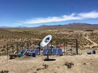

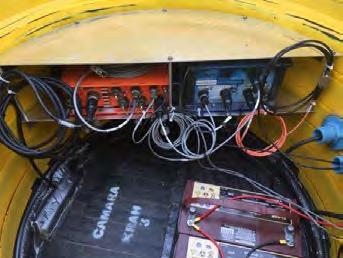
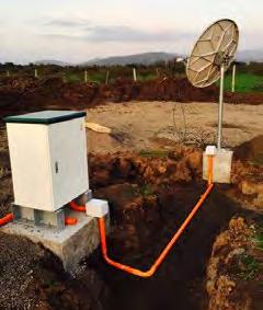
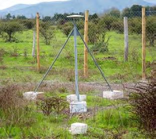
10 Observation System Broad-band GPS Strong Motion


11 VA06 Catapilco


12 VA06 Catapilco Pedernales, Ecuador 16 Apr 2016


13 Data Center Early Bird Similar systems installed at ONEMI and SHOA SeisComP Antelope, Early Bird


14 Seismicity of Chile Feb 2010 Jun 2018 Instrumentally recorded Felt


15 Northern Chile Sipple et al. (2018)


16 Illapel 2015, Acceleration records 297 evtdb.csn.uchile.cl Leyton (2015)

17 Iquique 2014, Acceleration records Mexico City, 1985 Leyton, 2014


18 MSK Intensity in Santiago Strong motion instruments


19 Significant Earthquakes in Chile Astroza et al., 2010 Kiser and Ishi (2011)


20 Ground Displacements (GNSS) DIPLOMA DE POSTITULO EN SISMOLOGIA

21 Large earthquakes in Chile IPOC

22 Large earthquakes in Chile

23 Large earthquakes in Chile G-FAST, B. Crowell Earthquake location input PGD, Fault Mechanism, Centroid In addition Okada formulation SLAB 1.0 contact Surface Laplacian smoothing


24 Large earthquakes in Chile Iquique 2014 Maule 2010 Illapel 2015 Chiloe 2016 Valparaiso 2017 Fault-slip estimates by F. Del Campo


25 GNSS records M=6.9 M=7.6 M=8.2 M=8.3 M=8.8 J.C. Baez


26 Tsunami Warning System: GPS
Technical Report December 25, 2016, Mw=7.6, Chiloé Earthquake
 Technical Report December 25, 2016, Mw=7.6, Chiloé Earthquake Sergio Barrientos and the CSN team On December 25, 2016 at 11:22 a.m. (local time) an Mw=7.6 earthquake took place on the coast of the Los
Tsunami and earthquake in Chile Part 2
 EUROPEAN COMMISSION DIRECTORATE GENERAL JRC JOINT RESEARCH CENTRE Institute for the Protection and Security of the Citizen Global Security and Crisis Management Unit CriTech Sunday, 28 February 2010 Executive
Earthquake Hazards. Tsunami
 Earthquake Hazards Tsunami Review: What is an earthquake? Earthquake is the vibration (shaking) and/or displacement of the ground produced by the sudden release of energy. The point inside the Earth where
Earthquake Hazards. Tsunami
 Earthquake Hazards Tsunami Measuring Earthquakes Two measurements that describe the power or strength of an earthquake are: Intensity a measure of the degree of earthquake shaking at a given locale based
Earthquakes. Earthquake Magnitudes 10/1/2013. Environmental Geology Chapter 8 Earthquakes and Related Phenomena
 Environmental Geology Chapter 8 Earthquakes and Related Phenomena Fall 2013 Northridge 1994 Kobe 1995 Mexico City 1985 China 2008 Earthquakes Earthquake Magnitudes Earthquake Magnitudes Richter Magnitude
Earthquake Hazards. Tsunami
 Earthquake Hazards Tsunami Review: What is an earthquake? Earthquake is the vibration (shaking) and/or displacement of the ground produced by the sudden release of energy. The point inside the Earth where
Introduction to Environmental Geology, 5e Case History: Indonesian Tsunami Indonesian Tsunami (2) Introduction Historic Tsunamis
 Introduction Historic Tsunamis") 1 2 3 4 5 6 7 8 9 Introduction to Environmental Geology, 5e Chapter 7 Tsunami Case History: Indonesian Tsunami December 26, 2004, within a few hours, close to 250,000 people were killed With no warning
1 2 3 4 5 6 7 8 9 Introduction to Environmental Geology, 5e Chapter 7 Tsunami Case History: Indonesian Tsunami December 26, 2004, within a few hours, close to 250,000 people were killed With no warning
Tsunami Seismic Sea Wave. Dr. Wan Zuhairi Wan Yaacob Program Geologi, UKM
 Tsunami Seismic Sea Wave soo-nah-mee Dr. Wan Zuhairi Wan Yaacob Program Geologi, UKM the breaking wave off Kanagawa wood block color print the event s surface wave magnitude, Ms. Historical map of 731
Education and Drill Activities against Tsunami Disasters in Chile and Japan -WG4a Activities-
 Education and Drill Activities against Tsunami Disasters in Chile and Japan -WG4a Activities- Dr. F. Miura, Yamaguchi U., Mr. M. Reyes, UV MSc. O. Cifuentes, UDEC, Enhancement of Technology to Develop
Earthquake Source Dynamics and seismic radiation From large Chilean earthquakes
 . Earthquake Source Dynamics and seismic radiation From large Chilean earthquakes R. Madariaga 1,2, S. Ruiz 2, F. Leyton 3, J.C. Baez 3 École Normale Supérieure de Paris, France; Centro Sismologico Nacional
Introduction to Environmental Geology, 5e
 Lecture Presentation prepared by X. Mara Chen, Salisbury University Introduction to Environmental Geology, 5e Edward A. Keller Chapter 7 Tsunami Case History: Indonesian Tsunami December 26, 2004, within
Data Repository of Paper: The role of subducted sediments in plate interface dynamics as constrained by Andean forearc (paleo)topography
topography") Data Repository of Paper: The role of subducted sediments in plate interface dynamics as constrained by Andean forearc (paleo)topography Nicolás J. Cosentino 1*, Felipe Aron 2,3, Jorge G. F. Crempien 2,3,
Data Repository of Paper: The role of subducted sediments in plate interface dynamics as constrained by Andean forearc (paleo)topography Nicolás J. Cosentino 1*, Felipe Aron 2,3, Jorge G. F. Crempien 2,3,
Magnitude 7.0 N of ANCHORAGE, ALASKA
 A magnitude 7.0 earthquake occurred just before 8:30 am local time 8 miles north of Anchorage at a depth of 40.9 km (25.4 miles). There are reports of major infrastructure damage and damage to many homes
Lessons from the 2004 Sumatra earthquake and the Asian tsunami
 Lessons from the 2004 Sumatra earthquake and the Asian tsunami Kenji Satake National Institute of Advanced Industrial Science and Technology Outline 1. The largest earthquake in the last 40 years 2. Tsunami
Earthquakes and Tsunamis
 Earthquakes and Tsunamis Kenji Satake Earthquake Research Institute University of Tokyo 1 Part I 2011 Tohoku earthquake and tsunami 2 Fukushima Dai ichi NPP accident Earthquake ground motion Reactors automatically
Chile and GEO. Luciano Parodi Geo Principal of Chile Ministry of Foreign Affairs of Chile
 Chile and GEO Luciano Parodi Geo Principal of Chile Ministry of Foreign Affairs of Chile LATIN AMERICA GEOSPATIAL FORUM -GEOSS IN THE AMERICAS - INITIATIVES GEOSS ARCHITECTURE IMPLEMENTATION PILOT -AIP
Earthquakes. Building Earth s Surface, Part 2. Science 330 Summer What is an earthquake?
 Earthquakes Building Earth s Surface, Part 2 Science 330 Summer 2005 What is an earthquake? An earthquake is the vibration of Earth produced by the rapid release of energy Energy released radiates in all
IQUIQUE: A CASE STUDY FOR HAZUS IMPLEMENTATION IN CHILE.
 IQUIQUE: A CASE STUDY FOR HAZUS IMPLEMENTATION IN CHILE. Paula Aguirre / paula.aguirre@cigiden.cl Jorge Vásquez, Juan Carlos de la Llera, Andrea Vásquez, Felipe Rivera. December 9th, 215 1 OUTLINE 1. Chile:
I. Locations of Earthquakes. Announcements. Earthquakes Ch. 5. video Northridge, California earthquake, lecture on Chapter 5 Earthquakes!
 51-100-21 Environmental Geology Summer 2006 Tuesday & Thursday 6-9:20 p.m. Dr. Beyer Earthquakes Ch. 5 I. Locations of Earthquakes II. Earthquake Processes III. Effects of Earthquakes IV. Earthquake Risk
International Cooperation on Earthquake Disaster Management to Protect Lives
 Pontificia Universidad Católica de Chile Chile, un país s con múltiples m amenazas International Cooperation on Earthquake Disaster Management to Protect Lives Raúl Alvarez Medel, Pontificia Universidad
Earthquakes Earth, 9th edition, Chapter 11 Key Concepts What is an earthquake? Earthquake focus and epicenter What is an earthquake?
 1 2 3 4 5 6 7 8 9 10 Earthquakes Earth, 9 th edition, Chapter 11 Key Concepts Earthquake basics. "" and locating earthquakes.. Destruction resulting from earthquakes. Predicting earthquakes. Earthquakes
68. Izu-Torishima. Summary. Latitude: 30 29'02" N, Longitude: '11" E, Elevation: 394 m (Ioyama) (Elevation Point) (68.
 (Elevation Point) (68.") 68. Izu-Torishima Latitude: 30 29'02" N, Longitude: 140 18'11" E, Elevation: 394 m (Ioyama) (Elevation Point) Izu-Torishima taken from southeast side on August 12, 2002. Courtesy of the Maritime Safety
68. Izu-Torishima Latitude: 30 29'02" N, Longitude: 140 18'11" E, Elevation: 394 m (Ioyama) (Elevation Point) Izu-Torishima taken from southeast side on August 12, 2002. Courtesy of the Maritime Safety
Characteristics of seismic activity before Chile M W 8.8 earthquake in 2010
 Earthq Sci (2010)23: 333 341 333 Doi: 10.1007/s11589-010-0730-x Characteristics of seismic activity before Chile M W 8.8 earthquake in 2010 Yan Xue 1,2, Jie Liu 2 and Gang Li 2 1 Institute of Geophysics,
Earthquakes Chapter 19
 Earthquakes Chapter 19 Does not contain complete lecture notes. What is an earthquake An earthquake is the vibration of Earth produced by the rapid release of energy Energy released radiates in all directions
Mechanism of tsunami generation,propagation and runup -sharing experiences with Japanese
 Mechanism of tsunami generation,propagation and runup -sharing experiences with Japanese Mechanism of tsunami generation Predicting the propagation, runup and inundation of tsunamis Near and far-field
The Cascading Hazards from Cascadia s Earthquakes
 Tsunamis The Cascading Hazards from Cascadia s Earthquakes Earthquakes (Nisqually earthquake, Seattle, WA) Volcanoes (Mt St Helens eruption, WA) Joan Gomberg gomberg@usgs.gov Landslides (Oso landslide,
Earthquakes and Earthquake Hazards Earth - Chapter 11 Stan Hatfield Southwestern Illinois College
 Earthquakes and Earthquake Hazards Earth - Chapter 11 Stan Hatfield Southwestern Illinois College What Is an Earthquake? An earthquake is the vibration of Earth, produced by the rapid release of energy.
MMA Memo No National Radio Astronomy Observatory. Seismicity and Seismic Hazard at MMA site, Antofagasta, Chile SERGIO E.
 MMA Memo No. 250 National Radio Astronomy Observatory Seismicity and Seismic Hazard at MMA site, Antofagasta, Chile SERGIO E. BARRIENTOS Departamento de Geofisica Universidad de Chile June, 1996 Seismicity
A GLOBAL SURGE OF GREAT EARTHQUAKES FROM AND IMPLICATIONS FOR CASCADIA. Thorne Lay, University of California Santa Cruz
 A GLOBAL SURGE OF GREAT EARTHQUAKES FROM 2004-2014 AND IMPLICATIONS FOR CASCADIA Thorne Lay, University of California Santa Cruz Last 10 yrs - 18 great earthquakes: rate 1.8/yr; rate over preceding century
Natural Disasters Spring, LECTURE #8: Earthquake Disasters: Monitoring & Mitigation. Date: 1 Feb 2018 (lecturer: Dr.
 GEOL 0820 Ramsey Natural Disasters Spring, 2018 LECTURE #8: Earthquake Disasters: Monitoring & Mitigation Date: 1 Feb 2018 (lecturer: Dr. Shawn Wright) I. Exam I - Reminder Feb 6 th next class details:
What is an Earthquake?
 Earthquakes What is an Earthquake? Earthquake - sometimes violent shaking of ground caused by movement of Earth s tectonic plates; creates seismic waves Often followed by smaller earthquakes (aftershocks);
Finding an Earthquake Epicenter Pearson Education, Inc.
 Finding an Earthquake Epicenter Measuring the Size of Earthquakes Two measurements that describe the size of an earthquake are: 1. Intensity a measure of the degree of earthquake shaking at a given locale
UNIT - 7 EARTHQUAKES
 UNIT - 7 EARTHQUAKES WHAT IS AN EARTHQUAKE An earthquake is a sudden motion or trembling of the Earth caused by the abrupt release of energy that is stored in rocks. Modern geologists know that most earthquakes
Lessons Learned from Past Tsunamis Warning and Emergency Response
 UNESCO IOC CTIC US NOAA ITIC Regional Training Workshop on Strengthening Tsunami Warning and Emergency Response Standard Operating Procedures and the Development of the ICG/CARIBE-EWS PTWC New Enhanced
Magnitude 7.9 SE of KODIAK, ALASKA
 A magnitude 7.9 earthquake occurred at 12:31 am local time 181 miles southeast of Kodiak at a depth of 25 km (15.5 miles). There are no immediate reports of damage or fatalities. Light shaking from this
The Science and Policy of Natural Hazards
 Image courtesy of USGS. 12.103 Image courtesy of NOAA. The Science and Policy of Natural Hazards Image courtesy of USGS. Image courtesy of NOAA. Topics Four categories of hazards will be investigated in
TSUNAMI HAZARD ASSESSMENT FOR THE CENTRAL COAST OF PERU USING NUMERICAL SIMULATIONS FOR THE 1974, 1966 AND 1746 EARTHQUAKES
 TSUNAMI HAZARD ASSESSMENT FOR THE CENTRAL COAST OF PERU USING NUMERICAL SIMULATIONS FOR THE 1974, 1966 AND 1746 EARTHQUAKES Sheila Yauri Supervisor: Yushiro FUJII MEE10521 Bunichiro SHIBAZAKI ABSTRACT
Important Concepts. Earthquake hazards can be categorized as:
 Lecture 1 Page 1 Important Concepts Monday, August 17, 2009 1:05 PM Earthquake Engineering is a branch of Civil Engineering that requires expertise in geology, seismology, civil engineering and risk assessment.
Lecture Outline Wednesday-Monday April 18 23, 2018
 Lecture Outline Wednesday-Monday April 18 23, 2018 Questions? Lecture Final Exam Lecture Section 1 Friday May 4, 8:00-10:00am Lecture Section 2 Friday May 4, 3:10-5:10 pm Final Exam is 70% new material
Peter Sammonds Professor of Geophysics
 Peter Sammonds Professor of Geophysics Director, UCL Institute for Risk & Disaster Reduction NERC Strategic Advisor The precautionary principle: Natural hazards and critical infrastructure Acknowledge
Hazard and Vulnerability of Moderate Seismicity Regions
 Hazard and Vulnerability of Moderate Seismicity Regions presented by Professor Tso-Chien PAN Dean, College of Engineering Director, 25 October 2010 DRM GDLN Session on Earthquake Vulnerability Reduction
UGRC 144 Science and Technology in Our Lives/Geohazards
 UGRC 144 Science and Technology in Our Lives/Geohazards Session 3 Understanding Earthquakes and Earthquake Hazards Lecturer: Dr. Patrick Asamoah Sakyi Department of Earth Science, UG Contact Information:
Tsunami Research and Its Practical Use for Hazard Mitigation. Hiroo Kanamori Seismological Laboratory, California Institute of Technology
 Tsunami Research and Its Practical Use for Hazard Mitigation Hiroo Kanamori Seismological Laboratory, California Institute of Technology Cause of Tsunami Earthquakes Landslides Volcanic origin Impact (Dr.
Forecasting Future Earthquakes from Tsunami Deposits and Simulation
 Forecasting Future Earthquakes from Tsunami Deposits and Simulation Kenji Satake Earthquake Research Institute The University of Tokyo satake@eri.u-tokyo.ac.jp Contents 1. Earthquake Recurrence and Forecast
TSUNAMI INUNDATION MAPPING PROJECT
 TSUNAMI INUNDATION MAPPING PROJECT Andrés Enríquez Olavarría Errazuriz 254, Playa Ancha, Valparaíso, Chile Telephone: +56 (032) 2266666 e-mail: aenriquez@shoa.cl WEB Site: www.shoa.mil.cl Abstract The
JCOMM-CHy Coastal Inundation Forecasting Demonstration Project (CIFDP)
") WMO World Meteorological Organization Working together in weather, climate and water JCOMM-CHy Coastal Inundation Forecasting Demonstration Project (CIFDP) Coastal Flooding & Vulnerable Populations Coastal
WMO World Meteorological Organization Working together in weather, climate and water JCOMM-CHy Coastal Inundation Forecasting Demonstration Project (CIFDP) Coastal Flooding & Vulnerable Populations Coastal
Magnitude 7.0 PAPUA, INDONESIA
 A 7.0 magnitude earthquake struck eastern Indonesia's mountainous West Papua province on Saturday but there were no immediate reports of casualties or damage. The region is sparsely populated. According
I. INTRODUCTION II. EARTHQUAKES
 2018 IJSRST Volume 4 Issue 5 Print ISSN: 2395-6011 Online ISSN: 2395-602X Themed Section: Science and Technology Iraq Earthquake Contour Maps Bashair A.R. Mohammed *1, Israa H. Mohammed 2, Tariq N. Ataiwe
Predicting of Tsunami Inundation Area based on Propagation and Runup Numerical Model in Pacitan City
 Predicting of Tsunami Inundation Area based on Propagation and Runup Numerical Model in Pacitan City 1 Agus Suharyanto, 1 Alwafi Pujiraharjo, 2 Adipandang Yudono, 3 Keisuke Murakami, and 3 Chikashi Deguchi
Global Death and Construction: Earthquakes on an Urban Planet
 # 24 Global Death and Construction: Earthquakes on an Urban Planet Dr. Roger Bilham March 21, 2003 Produced by and for Hot Science - Cool Talks by the Environmental Science Institute. We request that the
Application of a GIS for Earthquake Hazard Assessment and Risk Mitigation in Vietnam
 Application of a GIS for Earthquake Hazard Assessment and Risk Mitigation in Vietnam Nguyen Hong Phuong Earthquake Information and Tsunami Warning Centre, VAST OUTLINE Introduction Fault Source Model and
Title. Author(s)Heki, Kosuke. CitationScience, 332(6036): Issue Date Doc URL. Type. File Information. A Tale of Two Earthquakes
Heki, Kosuke. CitationScience, 332(6036): Issue Date Doc URL. Type. File Information. A Tale of Two Earthquakes") Title A Tale of Two Earthquakes Author(s)Heki, Kosuke CitationScience, 332(6036): 1390-1391 Issue Date 2011-06-17 Doc URL http://hdl.handle.net/2115/48524 Type article (author version) File Information
Title A Tale of Two Earthquakes Author(s)Heki, Kosuke CitationScience, 332(6036): 1390-1391 Issue Date 2011-06-17 Doc URL http://hdl.handle.net/2115/48524 Type article (author version) File Information
Did a submarine landslide contribute to the 2011 Tohoku tsunami?
 Press Release Did a submarine landslide contribute to the 2011 Tohoku tsunami? 1. Key points Large tsunami amplitudes in Northern Tohoku (Sanriku) suggest that a secondary tsunami source lies offshore
Seismic vulnerability in Latinamerica Speaker: Rafael Osiris de León Sciences Academy of Dominican Republic.
 Seismic vulnerability in Latinamerica Speaker: Rafael Osiris de León Sciences Academy of Dominican Republic. IANAS GENERAL ASSEMBLY Punta Cana, 16-20 July, 2013 TECTONIC PLATES AND EARTHQUAKES Pacific
Sendai Earthquake NE Japan March 11, Some explanatory slides Bob Stern, Dave Scholl, others updated March
 Sendai Earthquake NE Japan March 11, 2011 Some explanatory slides Bob Stern, Dave Scholl, others updated March 14 2011 Earth has 11 large plates and many more smaller ones. Plates are 100-200 km thick
Magnitude 7.7 QUEEN CHARLOTTE ISLANDS REGION
 A major 7.7 magnitude earthquake struck at 8:04 PM local time in western British Columbia, Canada. The epicenter is located on Moresby Island, the southern large island in the Queen Charlotte Islands region.
GLOBAL CHANGES OF THE SEISMICITY OF THE EARTH
 GLOBAL CHANGES OF THE SEISMICITY OF THE EARTH Valentin Ulomov Schmidt Institute of Physics of the Earth, Russian Academy of Sciences, (Russia, Moscow), ulomov@ifz.ru Introduction Beginning in 2010 was
A magnitude 7.8 earthquake has occurred km (63.3 mi) ESE of Suva, Fiji at a depth of km (378 miles).
 ESE of Suva, Fiji at a depth of km (378 miles).") A magnitude 7.8 earthquake has occurred 101.8 km (63.3 mi) ESE of Suva, Fiji at a depth of 608.6 km (378 miles). There is no risk of a tsunami from an earthquake at this depth. Images courtesy of Google
A magnitude 7.8 earthquake has occurred 101.8 km (63.3 mi) ESE of Suva, Fiji at a depth of 608.6 km (378 miles). There is no risk of a tsunami from an earthquake at this depth. Images courtesy of Google
Magnitude 7.1 PERU. There are early reports of homes and roads collapsed leaving one dead and several dozen injured.
 A magnitude 7.1 earthquake has occurred offshore Peru. The earthquake struck just after 4 a.m. local time and was centered near the coast of Peru, 40 km (25 miles) south-southwest of Acari, Peru at a depth
Contribution from 2010 Kerry Kelts Award Winner
 Contribution from 2010 Kerry Kelts Award Winner Imprint of the M w 8.8 Maule earthquake (27 February 2010) on lake sediments in South-Central Chile Martaan Van Daele Renard Centre of Marine Geology Ghent
GEO-VIII November Geohazard Supersites and Natural Laboratories Progress Report. Document 9
 GEO-VIII 16-17 November 2011 Geohazard Supersites and Natural Laboratories Progress Report Document 9 This document is submitted to GEO-VIII for information. Geohazard Supersites and Natural Laboratories
Chapter 4 Earthquakes and Tsunamis
 Geology of the Hawaiian Islands Class 21 30 March 2004 100 100 100 96 A B C D F Exam Scores 95 94 94 90 85 83 83 83 Mean 72 67 61 59 59 55 54 41 Mean = 78.5 Median = 83 Any Questions? Chapter 4 Earthquakes
Chapter 4 Earthquakes and Tsunamis. Geology of the Hawaiian Islands. Any Questions? Class March Mean = 78.
 Geology of the Hawaiian Islands Class 21 30 March 2004 Any Questions? 100 100 100 96 A B C D F Exam Scores 95 94 94 90 85 83 83 83 Mean 72 67 61 59 59 55 54 41 Mean = 78.5 Median = 83 Chapter 4 Earthquakes
Magnitude 7.2 OAXACA, MEXICO
 A magnitude 7.2 earthquake has occurred in Oaxaca, Mexico at a depth of 24.6 km (15 miles). It was felt as far away as Guatemala. There have been no reported deaths directly linked to the earthquake. Emergency
Magnitude 7.0 NEW CALEDONIA
 A magnitude 7.0 earthquake has occurred 82km ENE of Maré Island, the secondlargest of the Loyalty Islands in the archipelago of New Caledonia. The initial report of the magnitude and shallow 10km depth
Magnitude 8.2 NORTHWEST OF IQUIQUE, CHILE
 An 8.2-magnitude earthquake struck off the coast of northern Chile, generating a local tsunami. The USGS reported the earthquake was centered 95 km (59 miles) northwest of Iquique at a depth of 20.1km
News Release December 30, 2004 The Science behind the Aceh Earthquake
 News Release December 30, 2004 The Science behind the Aceh Earthquake PASADENA, Calif. - Kerry Sieh, the Robert P. Sharp Professor of Geology at the California Institute of Technology and a member of Caltech's
EARTHQUAKE SOURCE PARAMETERS FOR SUBDUCTION ZONE EVENTS CAUSING TSUNAMIS IN AND AROUND THE PHILIPPINES
 EARTHQUAKE SOURCE PARAMETERS FOR SUBDUCTION ZONE EVENTS CAUSING TSUNAMIS IN AND AROUND THE PHILIPPINES Joan Cruz SALCEDO Supervisor: Tatsuhiko HARA MEE09186 ABSTRACT We have made a set of earthquake source
Wainui Beach Management Strategy (WBMS) Summary of Existing Documents. GNS Tsunami Reports
 Summary of Existing Documents. GNS Tsunami Reports") Wainui Beach Management Strategy (WBMS) Summary of Existing Documents GNS Tsunami Reports a) Review of Tsunami Hazard and Risk in New Zealand ( National Risk Report ) b) Review of New Zealand s Preparedness
Wainui Beach Management Strategy (WBMS) Summary of Existing Documents GNS Tsunami Reports a) Review of Tsunami Hazard and Risk in New Zealand ( National Risk Report ) b) Review of New Zealand s Preparedness
Preliminary report on the Canterbury Earthquake South Island of New Zealand , M 6.3
 Preliminary report on the Canterbury Earthquake South Island of New Zealand 21.02.2011, M 6.3 Kyriazis Pitilakis and the group of - Aristotle University Thessaloniki, Greece. General 2 General 147 people
2014/TPTWG/WKSP/013 Responding to Global Earthquake Hazards
 2014/TPTWG/WKSP/013 Responding to Global Earthquake Hazards Submitted by: United States Workshop on Improving Global Supply Chain Resilience: Advancing the Seven APEC Principles in Your Organization Christchurch,
7 Ground Motion Models
 7 Ground Motion Models 7.1 Introduction Ground motion equations are often called attenution relations but they describe much more than just the attenutation of the ground motion; they describe the probability
THE 2011 TOHOKU EARTHQUAKE IN JAPAN. VSU Lyuben Karavelov, Sofia, Bulgaria. Key words: Tohoku earthquake, strong ground motion, damage
 THE 2011 TOHOKU EARTHQUAKE IN JAPAN Radan Ivanov 1 VSU Lyuben Karavelov, Sofia, Bulgaria Abstract: This earthquake which occurred on March 11, 2011, had a magnitude of 9.0, which places it as the fourth
crustal structure experiment beneath Wairarapa - Wellington area: results from SAHKE
 crustal structure experiment beneath Wairarapa - Wellington area: results from SAHKE Tim Stern and SAHKE team* * VUW, GNS, University of Southern California, University of Tokyo(Japan) SAHKE = Seismic
Preparation for Future Earthquake and Tsunami Hazards: Lessons Learned from the 2004 Sumatra-Andaman Earthquake and the Asian Tsunami
 First International Conference of Aceh and Indian Ocean Studies Organized by Asia Research Institute, National University of Singapore & Rehabilitation and Construction Executing Agency for Aceh and Nias
Development of Spatial Information Database of Building Damage and Tsunami Inundation Areas following the 2010 Chile Earthquake
 Development of Spatial Information Database of Building Damage and Tsunami Inundation Areas following the 2010 Chile Earthquake Fumio YAMAZAKI 1, Yoshihisa MARUYAMA 2, Hiroyuki MIURA 3, Shizuko MATSUZAKI
Lecture-06: Disasters of Bangladesh: Earthquakes
 URP 4243: Hazards and Disaster Management Lecture-06: Disasters of Bangladesh: Earthquakes 50 1 Course Teacher: Md. Esraz-Ul-Zannat Assistant Professor Dept. of URP, KUET January 18, 2018 ACKNOWLEDGEMENT
Deadly Earthquake Strikes Peru
 Deadly Earthquake Strikes Peru KEY POINTS On 14 January 2018, a magnitude-7.1 earthquake struck off the coast of Peru. At least two people have been reported dead, with dozens more left injured or homeless.
Seismic Vulnerabilities of Multnomah County s Willamette River Bridges November 6, 2014
 Seismic Vulnerabilities of Multnomah County s Willamette River Bridges November 6, 2014 Ian Cannon, P.E. - Multnomah County Bridge Division Steve Drahota, P.E. - HDR Engineering, Inc. Response to the Budget
Subduction Zone Observatory
 Subduction Zone Observatory Observations made with simple tools can provide important scientific constraints. (can also combine with more sophisticated measurements). Standardized well-planned marine intertidal
NPTEL Online - IIT Kanpur. Course Name Geotechnical Earthquake Engineering. Department IIT Kanpur
 NPTEL Online - IIT Kanpur Course Name Geotechnical Earthquake Engineering Department Instructor Civil Engineering Department IIT Kanpur Prof. N.R. Patra Module 1 INTRODUCTION TO GEOTECHNICAL ENGINEERING
Establishment and Operation of a Regional Tsunami Warning Centre
 Establishment and Operation of a Regional Tsunami Warning Centre Dr. Charles McCreery, Director NOAA Richard H. Hagemeyer Pacific Tsunami Warning Center Ewa Beach, Hawaii USA Why A Regional Tsunami Warning
THE KINEMATIC OF THE MOTION PERCEIVED IN THE TALL BUILDINGS OF BUENOS AIRES CITY CAUSED BY THE GREAT 2010 CHILEAN SEISMIC EVENT
 THE KINEMATIC OF THE MOTION PERCEIVED IN THE TALL BUILDINGS OF BUENOS AIRES CITY CAUSED BY THE GREAT 2010 CHILEAN SEISMIC EVENT CARMONA, Juan S. (1) - SABBIONE, Nora C. (2) (1) Earthquake Engineering Research
Increasingly technological
 QU: How can tectonic events be managed? AIM: To explain the approaches to tectonic hazard prediction, monitoring and event modification. Hazard Modification, Mitigation and Adaption Modify the loss Modify
Low-Latency Earthquake Displacement Fields for Tsunami Early Warning and Rapid Response Support
 Low-Latency Earthquake Displacement Fields for Tsunami Early Warning and Rapid Response Support Hans-Peter Plag, Geoffrey Blewitt Nevada Bureau of Mines and Geology and Seismological Laboratory University
Disclaimer. This report was compiled by an ADRC visiting researcher (VR) from ADRC member countries.
 from ADRC member countries.") Disclaimer This report was compiled by an ADRC visiting researcher (VR) from ADRC member countries. The views expressed in the report do not necessarily reflect the views of the ADRC. The boundaries and
Disclaimer This report was compiled by an ADRC visiting researcher (VR) from ADRC member countries. The views expressed in the report do not necessarily reflect the views of the ADRC. The boundaries and
Approach of Estimating Tsunami Economic Losses in The. Okinawa Island with Scenario-based of Input-Output Table. and Okinawa Earthquake Sources
 ORIGINAL ARTICLE Approach of Estimating Tsunami Economic Losses in The Okinawa Island with Scenario-based of Input-Output Table and Okinawa Earthquake Sources Kwanchai Pakoksung 1*, Anawat Suppasri 1,
Egyptian National Seismological Network (ENSN) and its Roles for Monitoring the Seismic Activity
 and its Roles for Monitoring the Seismic Activity") Egyptian National Seismological Network (ENSN) and its Roles for Monitoring the Seismic Activity Seismologist at National Research Institute of Astronomy and Geophysics (NRIAG), Egypt Outlines: ENSN Overview
Egyptian National Seismological Network (ENSN) and its Roles for Monitoring the Seismic Activity Seismologist at National Research Institute of Astronomy and Geophysics (NRIAG), Egypt Outlines: ENSN Overview
GEORED Project: GNSS Geodesy Network for Geodynamics Research in Colombia, South America. Héctor Mora-Páez
 GEORED Project: GNSS Geodesy Network for Geodynamics Research in Colombia, South America. Héctor Mora-Páez Colombian Geological Survey UNAVCO SCIENCE MEETING Feb 27 March 1, 2012 Boulder, CO, TECTONIC
Magnitude 7.1 PHILIPPINES
 A magnitude 7.1 earthquake struck in the southeastern Philippines just after 8 am local time Tuesday morning killing 82 people and reducing a 17 th century church to rubble. Offices and schools were closed
KNOWLEDGE NOTE 5-1. Risk Assessment and Hazard Mapping. CLUSTER 5: Hazard and Risk Information and Decision Making. Public Disclosure Authorized
 Public Disclosure Authorized Public Disclosure Authorized Public Disclosure Authorized Public Disclosure Authorized KNOWLEDGE NOTE 5-1 CLUSTER 5: Hazard and Risk Information and Decision Making Risk Assessment
Near-Field Spectra of Large Earthquakes
 Pure Appl. Geophys. Ó 2018 Springer Nature Switzerland AG https://doi.org/10.1007/s00024-018-1983-x Pure and Applied Geophysics Near-Field Spectra of Large Earthquakes RAUL MADARIAGA, 1 SERGIO RUIZ, 2
The Current Activities of the Headquarters for Earthquake Research Promotion Concerning Tonankai/Nankai Earthquakes
 The Current Activities of the Headquarters for Earthquake Research Promotion Concerning Tonankai/Nankai Earthquakes ISOGAI Keisuke Director of Earthquake Research Division, Research and Development Bureau,
Initiative. Country Risk Profile: papua new guinea. Better Risk Information for Smarter Investments PAPUA NEW GUINEA.
 Pacific Catastrophe Risk Assessment And Financing Initiative PAPUA NEW GUINEA September 211 Country Risk Profile: papua new is expected to incur, on average, 85 million USD per year in losses due to earthquakes
M 7.1 EARTHQUAKE 5KM ENE OF RABOSO, MEXICO EXACT LOCATION: N W DEPTH: 51.0KM SEPTEMBER 19, 1:14 LOCAL TIME
 M 7.1 EARTHQUAKE 5KM ENE OF RABOSO, MEXICO EXACT LOCATION: 18.584 N 98.399 W DEPTH: 51.0KM SEPTEMBER 19, 2017 @ 1:14 LOCAL TIME Photo: Eduardo Verdugo / AP Photo: Alfredo Estrella/ Agence France-Presse/
Supporting Online Material for
 www.sciencemag.org/cgi/content/full/science.1192094/dc1 Supporting Online Material for Land-Level Changes Produced by the M w 8.8 2010 Chilean Earthquake Marcelo Farías,* Gabriel Vargas, Andrés Tassara,
The Earthquake of Padang, Sumatra of 30 September 2009 scientific information and update
 The Earthquake of Padang, Sumatra of 30 September 2009 scientific information and update 01-October-2009 Christophe Vigny Directeur de recherches at CNRS Laboratoire de Géologie Geoscience Dept. Of ENS,
NGIAs' roles in successful disaster response
 The Second UN-GGIM-AP Plenary Meeting NGIAs' roles in successful disaster response Japan Teheran Iran 28 October 2013 Shin-ichi SAKABE, Director of International Affairs Division Geospatial Information
TWO PEAKS RESPONSE SPECTRA (2PRS) FOR SUBDUCTION EARTHQUAKES CONSIDERING SOIL AND SOURCE EFFECTS
 FOR SUBDUCTION EARTHQUAKES CONSIDERING SOIL AND SOURCE EFFECTS") The 4 th October -7, 8, Beijing, China TWO PEAKS RESPONSE SPECTRA (PRS) FOR SUBDUCTION EARTHQUAKES CONSIDERING SOIL AND SOURCE EFFECTS ABSTRACT : Sergio Ruiz and G. Rodolfo Saragoni Civil Engineer. Graduate
The 4 th October -7, 8, Beijing, China TWO PEAKS RESPONSE SPECTRA (PRS) FOR SUBDUCTION EARTHQUAKES CONSIDERING SOIL AND SOURCE EFFECTS ABSTRACT : Sergio Ruiz and G. Rodolfo Saragoni Civil Engineer. Graduate
2. Tsunami Source Details
 2. Tsunami Source Details The Northland area faces a range of potential tsunamigenic sources that include several local and distant fault systems and underwater landslides. A NIWA study (Goff et al. 2006)