» Kras Geopark in the Project KRAS-CARSO«
|
|
|
- Dortha Newman
- 5 years ago
- Views:
Transcription

1 » Kras Geopark in the Project KRAS-CARSO«Martina Stupar, B.Sc.Geology Nature conservation consultant Geoconference»Emerging new geoparks in Europe sharing knowledge & good examples«mežica, 21. November 2012
2 Historical point of view of the Kart region for speleology Karst constitutes one of the world s great landscape types, where special type of surface and of special phenomena occur. Karst is exceptional important for the history of geological, geomorphological, biological (biospeleological) and karstological research. - where the first scientific research of a karst topography was made. - The name has Paleoeuropean origin (karra, meaning stone)

3 Preliminary study for the establishment of the Karst Geopark 1. Geology 2. Geomorphology and speleology 3. Biodiversity 4. Protected areas 5. Culture heritage dr.bogdan Jurkovšek dr.tea Kolar- Jurkovšek dr.ladislav Placer dr.bojan Otoničar Eda Belingar

4 Geological review
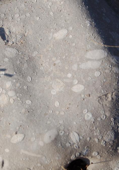
5 1. Geology External Dinarides; Mesozoic carbonate platform, named Adriatic-Dinaric carbonate platform, Lithostratigraphy; massive or beded limestone; devided in formations (named by local villages and cities; Brje formation, Komen, Sežana, ) and Alveolinid- nummulotid limestone, ended with Flysh sediments Geological features ; - geological sections; (K/Tc) Dolenja vas, scientific importance -fossils; outcrops of Tomaj limestone; vertibrates, plants, Kozina; Upper Cretaceous dinosaur locality in paleokarst cave -quarries of limestone; Doline, Lipica, Kazlje, - abandoned coal mines with fossils (Stomatopsis)
6 Tectonics; - geological section of Raša fault in Senožeče, Divača fault near Povir - Geomorphological features directly linked with tectonics; Brestovica dol, Karst edge, cave systems (Škocjan caves), and underground Reka river, systems of dolines on surface,.. - Geology, soil and ethnology (terra rossa, Teran vine, typical karst landscape, land use, karst rock walls dry walls (suhi zid)) Evaluation /assessment for geoturism regarding the potencial risk of endangered, preservation, accessibility and other criteria; 11 geological and 9 tectonical features were suggested for geoturism

7


8

9
10 2. Geomorphology and speleology Karst plateau 200 to 500 m height above sea level, cca 440 km2 Karst formations - features on the surface, karren, sinkholes, dolines, collapse dolines, blind valleies, remains of old caves which have appeared due to the lowering of karst relief roofless caves, - subterranian features, caves, cave systems, shafts, underground river s chanells, cave flowstone, cave fauna. - paleokarst (upper cretatious emersion ) Evaluation /assessment for geoturism regarding the potencial risk of endangered, preservation, accessibility and other criteria. 25 karst features were suggested ( + tourist caves; Škocjanske jame, Vilenica, Divaška jama)

11

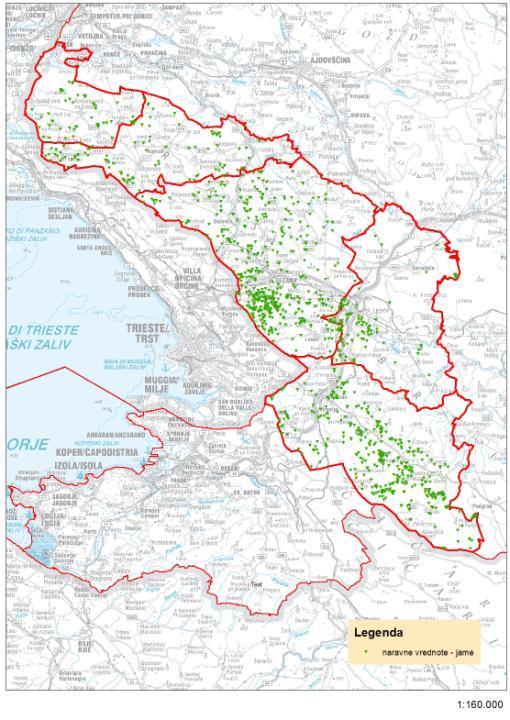
12 In the Cave cadastre are listed caves (Karst Research Institute, March 2012)

13

14

15


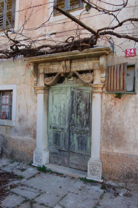
16
17
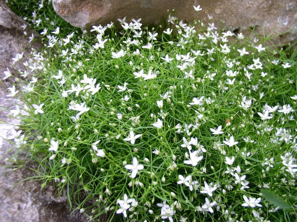
18 3. Biodiversity Geographical, geological, climate conditions hundreds of years of land use and human impact result habitat diversity and extremely rich flora and fauna. - large number of rare, endanegered and endemic species - hot spot of biodiversity - cave favna; beetles, vertibrates (Proteus), locus typicus for new genera. Rare habitats are protected with Natura 2000 direktive.


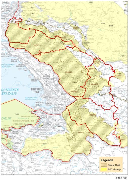
19 Natura 2000 protected habitats of Leptodirus hochenwarti, Proteus anguinus, and other cave habitats
20


21

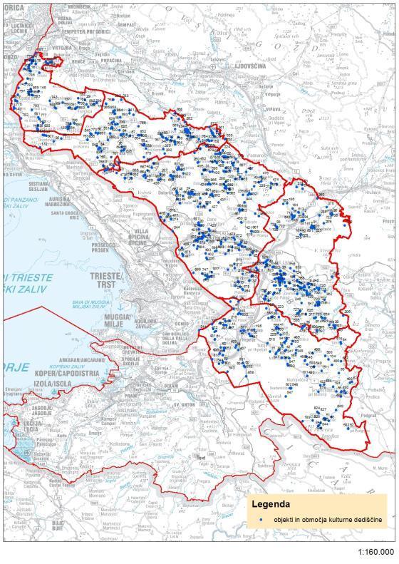
22 4. Protected areas Nature heritage areas; 83 of local importance 81 of national importance (+1052 caves) 72 natural monuments The Landscape park Glinščica The Regional Park Škocjanske Jame also put on the UNESCO's world heritage list in 1986.
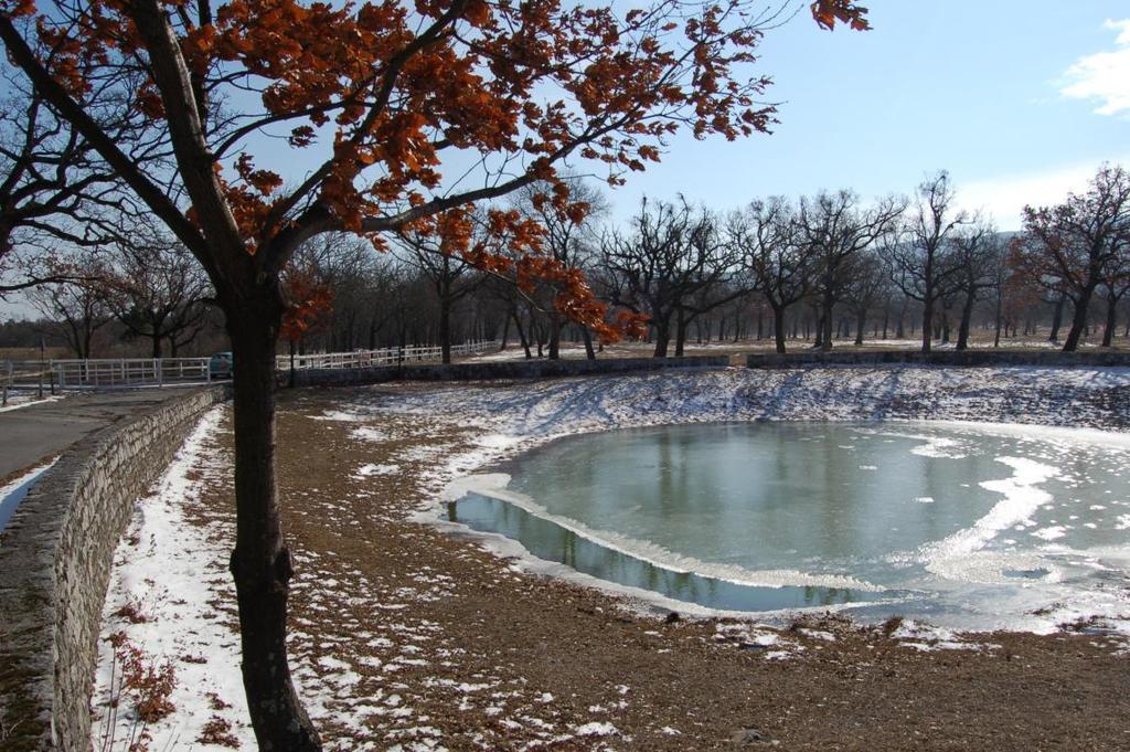
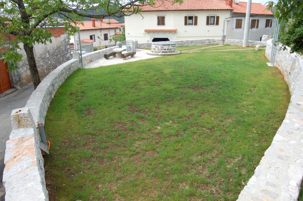
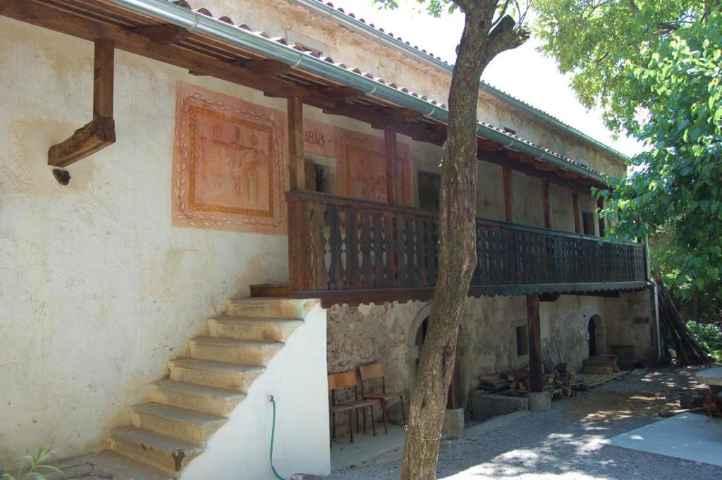
23 5. Cultural heritage - cultural landscape; - architectural heritage, Štanjel - sacral heritage, churches - water supply facilities, vilage fountains, water ponds, ice pit (ledenica) - Castles, - arheological heritage, in caves Mala Triglavca, Tominčeva jama, Mušja jam -..is enlisted in Register of immovable cultural heritage of RS
24

25
26
27
28


29
30
31 6. Conclusions 1.The area has clearly defined boundaries and it has sufficient surface area for true territorial economic development, based on geological and speleological heritage as well as cultural, archaeological, historical and ethnological interest. 2. The area comprise over ten of numbers of geological sites of international or national importance in terms of their scientific quality, rarity, aesthetic appeal or educational value. 3. Geological heritage is represented through the sinergy of geodiversity, biodiversity and culture as well as due to untengible heritage of this geografic defined area,.


32 Kras Geopark Karst Geopark proposed area includes the municipalities Miren Kostanjevica, Komen, Sežana, Divača in Hrpelje Kozina and corresponds to the basic expert criteria to become a Geopark.

33 Thank you!
34
Each State Party may propose a maximum of two properties, preferably relating to one cultural and one natural site.
 Submission Form At its 35th session (UNESCO Paris, 2011), the World Heritage Committee (Decision 35COM12D.7) requested the World Heritage Centre, with the support of the Advisory Bodies, to develop, for
Geotourism s Contribution to Protected Areas
 Geotourism s Contribution to Protected Areas Professor Ross Dowling Edith Cowan University, Australia GlobalECO 2014 Ecotourism in Protected Areas Forum 12 November 2014 Sydney Olympic Park, Sydney Australia
Module 10: Resources and Virginia Geology Topic 4 Content: Virginia Geology Notes
 Virginia is composed of a very diverse landscape that extends from the beaches and barrier islands all of the way to the highly elevated Appalachian Plateau. Geologists have discovered ancient shallow
Geodiversity, Geoheritage & Geoconservation
 Geodiversity, Geoheritage & Geoconservation Geodiversity what is its place within nature diversity? Geodiversity is the variety of nature elements, such as minerals, rocks, fossils, landforms and their
GEOTOURISM IN LANGKAWI UNESCO GLOBAL GEOPARK
 LANGKAWI TOURISM SYMPOSIUM 2016 GEOTOURISM IN LANGKAWI UNESCO GLOBAL GEOPARK Prof. Emeritus Dato Dr. Ibrahim Komoo Council, UNESCO Global Geoparks Vice President, Asia Pacific Geoparks Network Advisor,
What is Geopark? Geopark? YES.
 What is Geopark? NO Geopark? YES What is Geopark? The Geopark is an area where earth s history is experienced How do landscapes originate? What rocks and raw materials are found there? How does geology
2012. Proceedings of the 11 European Geoparks Conference. AGA Associação Geoparque Arouca, Arouca, 5-6.
 References to this volume It is suggested that either the following alternatives should be used for future bibliographic references to the whole or part this volume: th Sá, A.A., Rocha, D., Paz, A. & Correia,
Summary: This paper updates the Sub-committee on current thinking regarding the proposal for a Cotswolds Geopark
 REFRESH OF THE PROPOSAL FOR A COTSWOLDS GEOPARK Summary: This paper updates the Sub-committee on current thinking regarding the proposal for a Cotswolds Geopark Recommendations: a) That the Sub-committee
Contents Research Objects, Tasks and Historical Development of Tourism Earth-science Role of Tourism Earth-science in Tourism Development
 Contents 1 Research Objects, Tasks and Historical Development of Tourism Earth-science.... 1 1.1 Research Objects of Tourism Earth-science.... 1 1.1.1 Definition of Tourism Earth-science... 1 1.1.2 Definition
Do Now - APES. Due Next Class. Mining HW. Work on QSC using today s notes
 Do Now - APES 1. Grab a chromebook 2. Log on to Albert.io & work on The Living World Loss of Biodiversity Soil & Soil Dynamics Fishing (10min) Mining HW Due Next Class Work on QSC using today s notes Do
EUROPEAN DIPLOMA-HOLDING AREAS AND THE GEOPARK INITIATIVE IN HUNGARY
 dr. Rozalia Szekeres Erdine, dr. Annamaria Kopek, Gyorgy Dudas, Jozsef Vers and Imre Szarvas EUROPEAN DIPLOMA-HOLDING AREAS AND THE GEOPARK INITIATIVE IN HUNGARY Ipolytarnóc Novohrad-Nógrád Geopark Tihany
URBAN HYDROLOGY: WATER IN THE CITY OF TSHWANE Plant Sciences Auditorium, University of Pretoria January 2014 URBAN HYDROGEOLOGY
 URBAN HYDROLOGY: WATER IN THE CITY OF TSHWANE Plant Sciences Auditorium, University of Pretoria 23 24 January 2014 URBAN HYDROGEOLOGY MATTHYS A. DIPPENAAR DEPARTMENT GEOLOGY, UNIVERSITY OF PRETORIA HYDROGEOLOGY
HERITAGE TOURISM. B y M. Liga Suryadana
 HERITAGE TOURISM B y M. Liga Suryadana Some definitions of Heritage: the natural, cultural and built environments of an area (Millar, S., 1991, Heritage management for heritage tourism, in Medlik, S.,
Local Development Pilot Project: Island of Cres. Ranka Saračević Würth, Ministry of Culture, Republic of Croatia
 Local Development Pilot Project: Island of Cres Ranka Saračević Würth, Ministry of Culture, Republic of Croatia BACKGROUND, RATIFICATION OF THE FARO CONVENTION BY REPUBLIC OF CROATIA The Framework Convention
Stevns Klint SITE INFORMATION. IUCN Conservation Outlook Assessment 2014 (archived) Finalised on 27 October 2014
 Finalised on 27 October 2014") IUCN Conservation Outlook Assessment 2014 (archived) Finalised on 27 October 2014 Please note: this is an archived Conservation Outlook Assessment for Stevns Klint. To access the most up-to-date Conservation
IUCN Conservation Outlook Assessment 2014 (archived) Finalised on 27 October 2014 Please note: this is an archived Conservation Outlook Assessment for Stevns Klint. To access the most up-to-date Conservation
Geodiversity Action Plan, Cornwall and the Isles of Scilly 1 st Edition, 2005
 Geodiversity Action Plan, Cornwall and the Isles of Scilly 1 st Edition, 2005 Executive Summary Introduction Some 400 million years ago, the geology in Cornwall and the Isles of Scilly evolved in a completely
Strategies for biodiversity conservation
 Institute of Earth Systems University of Malta Strategies for biodiversity conservation Louis F. Cassar PhD Elisabeth Conrad PhD The conservation imperative: perspective Biodiversity hotspot High endemism
Role of Geotourism in Australia s Nature Based Tourism Strategy GlobalEco Angus M Robinson Geotourism Forum, Ecotourism Australia
 Role of Geotourism in Australia s Nature Based Tourism Strategy 2025 - GlobalEco 2016 Angus M Robinson Geotourism Forum, Ecotourism Australia Today s Agenda Nature Based Tourism Strategy 2025 Natural &
The Contested Cultural Landscape of a Lebanese Border Town: MARJA AYOUN
 The Contested Cultural Landscape of a Lebanese Border Town: MARJA AYOUN IBD 2013 FNAS MAY 2013 Dr. Christine Mady, City & Regional Planning NDU -FAAD In this Presentation A PLANNING PERSPECTIVE INTRODUCING
Term Knowledge Using and applying Grade Criteria Autumn 1 Assessment window October Natural hazards pose major risks to people and property.
 Assessment Schedule Year 9 2015/6 Term Knowledge Using and applying Grade Criteria Autumn 1 Assessment window October 2015 3.1.1.2 Tectonic Natural hazards pose major risks to people and property. Definition
Application for Geotourism Charter
 Application for Geotourism Charter Thank you for the interest in geotourism as a long-term strategy to foster wisely managed tourism and enlightened destination stewardship. National Geographic s Center
It usually refers to limestone terrain characteristically. possessing a patchy and thin soil cover, containing many enclosed depressions, and
 Karst Landform karst is terrain in which soluble rocks are altered above and below ground by the dissolving action of water and that bears distinctive characteristics of relief and drainage (Jennings 1971,)
Directed Reading. Section: Types of Maps
 Skills Worksheet Directed Reading Section: Types of Maps 1. What are some of the characteristics of an area shown on maps used by Earth scientists? a. types of animals, types of plants, types of minerals
CAMP SLOVENIA. Mezek Slavko RRC Koper. Project coordinator November 2005
 CAMP SLOVENIA Mezek Slavko RRC Koper Project coordinator November 2005 http://camp.rrc-kp.si/ Content About MAP CAMP programme CAMP Slovenia Project background CAMP Slovenia Project area CAMP Slovenia
IAVCEI. Commission on Volcano Geoheritage and Protected Volcanic Landscapes
 IAVCEI Commission on Volcano Geoheritage and Protected Volcanic Landscapes Joan Marti 1; Károly Németh 2, Tom Casadewall 3; Mohammed Rashad Moufti 4, 1 Institute of Earth Sciences "Jaume Almera, CSIC,
Digitization of Natural Heritage Framework, Methodology, Standards, Best Practices
 Digitization of Natural Heritage Framework, Methodology, Standards, Best Practices Margherita Azzari Associate Professor University of Florence Franca Fauci P. R. Manager Foundation for Research and Innovation
Chapter 8 Earth Systems and Resources
 Chapter 8 Earth Systems and Resources Earth s resources were determined when the planet formed. The Earth s Crust Layers Core: innermost zone of the planet, largely nickel and iron. Mantle: above the core,
Field trip to Nerja Cave and coastal karst. Studies of Nerja cave and vadose and non-vadose zone
 Field trip to Nerja Cave and coastal karst. Studies of Nerja cave and vadose and non-vadose zone Key features Departure: Thursday 15th October (8.30 am) from Malaga city (Hotel Malaga Palacio) Return:
GEODIVERSITY: CONCEPT, ASSESSMENT AND TERRITORIAL APLICATION. THE CASE OF TIERMES-CARACENA (SORIA)
") Boletín de Geodiversity: la A.G.E. N.º concept, 45-2007, assessment págs. 389-393 and territorial aplication. The case of Tiermes-Caracena (Soria) GEODIVERSITY: CONCEPT, ASSESSMENT AND TERRITORIAL APLICATION.
Boletín de Geodiversity: la A.G.E. N.º concept, 45-2007, assessment págs. 389-393 and territorial aplication. The case of Tiermes-Caracena (Soria) GEODIVERSITY: CONCEPT, ASSESSMENT AND TERRITORIAL APLICATION.
Development of the Portal of Cultural Heritage Objects the Kingdom of Poland
 Evgeny KOVALEV, Natalia KOVALEVA Sholokhov Moscow State University for the Humanities, Russia Hadi SALEH Vladimir State University Named After Alexander and Nikolay Stoletovs, Russia Development of the
Third International Conference on Learning Cities Global goals, local actions: Towards lifelong learning for all in 2030.
 Environmental, urban, and individual regeneration in former mining landscapes of the Sulcis-Iglesiente area: the role of Geo-minerary Park in fostering a learning city Third International Conference on
Twenty-four models of Geotourism
 Twenty-four models of Geotourism Tao Xu Zhenyang Wu Anze Chen E-mail: 378260643@qq.com; TEL:010-18610562209 Tao Xu, Ph. D., Director of Institute of geotourism, School of Humanities and Economic Management,
Name Class Date. Study Guide for 7 th Grade Final Exam (Semester One)
") Name Class Date Study Guide for 7 th Grade Final Exam (Semester One) 1. What are the steps of the scientific method? Define the problem or question Form a hypothesis (MUST BE TESTABLE) o (identify variables)
Name Class Date Study Guide for 7 th Grade Final Exam (Semester One) 1. What are the steps of the scientific method? Define the problem or question Form a hypothesis (MUST BE TESTABLE) o (identify variables)
Geopark Karavanke/Karawanken. Geo adventures in the cross- border geopark between Slovenia and Austria
 Geopark Karavanke/Karawanken Geo adventures in the cross- border geopark between Slovenia and Austria Msc. Suzana Fajmut Štrucl, Podzemlje Pece d.o.o. Msc. Mojca Bedjanič, Institute of the Republic of
LANDSCAPE AREA C_ CHIANIELLO-SOPRANO MOUNTAIN
 LANDCAPE AREA C_ CHIANIELLO-OPRANO MOUNTAIN Included Geosites Id_denomination Imp. Id_denomination Imp. Id_denomination Imp. 8_ Lady of Granato (M. Vesole) M 13_ River Karst canyon of Trentinara 18_North
Fossils and Geology of Litzsinger Road Ecology Center
 Fossils and Geology of Litzsinger Road Ecology Center Table of Content Key Terms 1 Key Terms 2 What you need to know Geologic Map of Missouri Geologic Time Chart More of what you need to know Digital map
IVONA CIMERMANOVÁ Slovak Environmental Agency, Tajovského 28, Banská Bystrica, Slovakia (
 Geoparks in Slovakia IVONA CIMERMANOVÁ Slovak Environmental Agency, Tajovského 28, Banská Bystrica, Slovakia (E-mail: ivona.cimermanova@sazp.sk) ABSTRACT Geopark is a territory with sites of scientific
2012. Proceedings of the 11 European Geoparks Conference. AGA Associação Geoparque Arouca, Arouca, 5-6.
 References to this volume It is suggested that either the following alternatives should be used for future bibliographic references to the whole or part this volume: th Sá, A.A., Rocha, D., Paz, A. & Correia,
Section 11.1 pp Where Mountains Form
 Section 11.1 pp. 236 237 Where Mountains Form Chapter 11 Set a Purpose: TE, p. 236 Reading Study Guide, p. 36 Discussion: TE, p. 236 Differentiating ion Reading Support: TE, p. 236 Visual Teaching Interpret
BOY SCOUTS GEOLOGY MERIT BADGE
 Requirements highlighted in yellow will be covered at the club show. Merit Badge Counselors will be on-hand. Please bring your own paperwork. Children under 12 and scouts in uniform are admitted to the
Chapter 14: Groundwater. Fig 14.5b
 Chapter 14: Groundwater Fig 14.5b OBJECTIVES Recognize that groundwater is a vital source of accessible freshwater. Describe how groundwater forms below the water table. Explain the origin of aquifers,
Marketing Australia s Scenic Areas SEGRA, 26 October Angus M Robinson Chair, GSA Geotourism Standing Committee
 Marketing Australia s Scenic Areas SEGRA, 26 October 2017 Flinders Ranges National Landscape Angus M Robinson Chair, GSA Geotourism Standing Committee Today s Agenda Chinese tourism to Australia Challenges
An Introduction to Field Explorations for Foundations
 An Introduction to Field Explorations for Foundations J. Paul Guyer, P.E., R.A. Paul Guyer is a registered mechanical engineer, civil engineer, fire protection engineer and architect with over 35 years
THIS IS A NEW SPECIFICATION
 THIS IS A NEW SPECIFICATION ADVANCED GCE GEOLOGY Environmental Geology F794 * OCE / 12353* Candidates answer on the Question Paper OCR Supplied Materials: None Other Materials Required: Ruler (cm/mm) Thursday
The Earth s Layers. Convection and Hot Spots. The Earth s Layers. The Earth s resources were determined when the planet formed.
 The Earth s resources were determined when the planet formed. Chapter 8 Earth Systems and Resources The Earth s Layers Core- the innermost zone of the planet made of nickel and iron. Mantle- above the
Landscape evolution. An Anthropic landscape is the landscape modified by humans for their activities and life
 Landforms Landscape evolution A Natural landscape is the original landscape that exists before it is acted upon by human culture. An Anthropic landscape is the landscape modified by humans for their activities
Composition of the crust. Ore deposits. Ore distribution. Resources: Mineral resources. Reading: Today: Ch 12 (to p306)
") Composition of the crust Resources: Mineral resources Reading: Today: Ch 12 (to p306) QUESTION Ore deposits A rock containing a useful metal in a useable concentration Ore distribution by definition ore
Composition of the crust Resources: Mineral resources Reading: Today: Ch 12 (to p306) QUESTION Ore deposits A rock containing a useful metal in a useable concentration Ore distribution by definition ore
Mineral resources. Composition of the crust. Resources: Reading: Today: Ch 12 (to p306) QUESTION Environmental Geology Mineral resources
 QUESTION Environmental Geology Mineral resources") Resources: Mineral resources Reading: Today: Ch 12 (to p306) QUESTION Composition of the crust 1 Ore deposits A rock containing a useful metal in a useable concentration Concentration factor = concentration
Resources: Mineral resources Reading: Today: Ch 12 (to p306) QUESTION Composition of the crust 1 Ore deposits A rock containing a useful metal in a useable concentration Concentration factor = concentration
PROMOTING NATURE CONSERVATION AND SUSTAINABLE AGRICULTURAL DEVELOPMENT IN THE RURAL AREAS OF HONG KONG
 1 PROMOTING NATURE CONSERVATION AND SUSTAINABLE AGRICULTURAL DEVELOPMENT IN THE RURAL AREAS OF HONG KONG Director of Agriculture, Fisheries and Conservation Dr. LEUNG Siu-fai A STONE S THROW AWAY FROM
Cretaceous, Dakota Formation, Terra Cotta Member South Side of I-70, Salina County, Kansas
 Cretaceous, Dakota Formation, Terra Cotta Member South Side of I-70, Salina County, Kansas Written By: Steven D.J. Baumann G-102010-1A Outcrop looking southeast Photo taken by: Steven Baumann on 10-20-2010
Legal problems of environmental management. Spatial planning and space management. M. Gajewski 2014 / 2015
 Legal problems of environmental management Spatial planning and space management M. Gajewski 2014 / 2015 Course contents (in brief) Constitutional basis of the environment protection system. General principles
GLOBAL NETWORK OF NATIONAL GEOPARKS. Patrick J Mc Keever
 Patrick J Mc Keever A GEOPARK is an area with. geological heritage of international significance but also with. a sustainable development strategy or plan involving local communities. IS A GEOPARK JUST
test date Name date Review: Geologic Time & Geologic Procesess-: You will record 1-38 answers on the scan sheet! These are worth 1.
 Review: Geologic Time & Geologic Procesess-: You will record 1-38 answers on the scan sheet! These are worth 1.5 points each Use your EARTH HISTORY CHART Part I. Matching All of the statements match to
Karst: multiple concepts for a unique geological object Dr Michel Bakalowicz
 Karst: multiple concepts for a unique geological object Dr Michel Bakalowicz Michel.Bakalowicz@gmail.com By way of an introduction The project of exploiting a lignite deposit in a limestone environment
Policies and implemented tools for digitalization of Natural heritage in Gorenjska region (Slovenia)
") Policies and implemented tools for digitalization of Natural heritage in Gorenjska region (Slovenia) Barbara Špehar, Regional Development Agency of Gorenjska dr. Mirjam Dular, Tadeja Šubic, Institute of
Policies and implemented tools for digitalization of Natural heritage in Gorenjska region (Slovenia) Barbara Špehar, Regional Development Agency of Gorenjska dr. Mirjam Dular, Tadeja Šubic, Institute of
GIS AND REMOTE SENSING FOR OPEN SPACE PROTECTION ENVIRONMENTAL MANAGEMENT DEPARTMENT
 GIS AND REMOTE SENSING FOR OPEN SPACE PROTECTION ENVIRONMENTAL MANAGEMENT DEPARTMENT 22 nd May 2009 1 Introduction It is said that more than 80% of the City s activities throughout the world are spatially
Approaching Traditional Cultural Landscapes as Interrelated Dimensions and Intensive Zones of Historical and Cultural Significance
 Approaching Traditional Cultural Landscapes as Interrelated Dimensions and Intensive Zones of Historical and Cultural Significance CULTURAL RESOURCE PROTECTION SUMMIT, 2018 Warren King George Muckleshoot
Section I: Multiple Choice Select the best answer to each question. Mark your final answer on the answer sheet. (1 pt each)
") Sedimentary Rocks & Surface Processes Quest Name: Earth Science 2013 Block: Date: Section I: Multiple Choice Select the best answer to each question. Mark your final answer on the answer sheet. (1 pt each)
Sedimentary Rocks & Surface Processes Quest Name: Earth Science 2013 Block: Date: Section I: Multiple Choice Select the best answer to each question. Mark your final answer on the answer sheet. (1 pt each)
ECONOMIC IMPACTS OF GEOTOURISM AND GEOPARKS IN CHINA
 ECONOMIC IMPACTS OF GEOTOURISM AND GEOPARKS IN CHINA Global Eco Asia-Pacific Conference 2017, Adelaide 27-29 November, 2017 Dr Young Ng MH Geotourism Standing Committee, Geological Society of Australia
Eco-cultural subregions as open air museum
 Eco-cultural subregions as open air museum Phrygian Valley Dr. Fatma Aşılıoğlu Kalecik Vocational School Ankara University, Turkey What is an eco-cultural subregion? eco + cultural Ecological features
Solution Processes and. Karst Topography
 Solution Processes & Karst Topography Come forth into the light of things, Let Nature be your teacher. William Wordsworth 1 Solution Processes and Karst Topography The Impact of Solution Processes on the
Grounds. (*) Arouca Declaration; International Congress of Geotourism, Arouca Geopark, Portugal, Nov
 Arouca Declaration; International Congress of Geotourism, Arouca Geopark, Portugal, Nov") Grounds In the past few years, Latin America has witnessed increasing actions intended to conceive and develop geoparks, mainly as a result of the initiative promoted by the UNESCO Geoscience and Geoparks
Grounds In the past few years, Latin America has witnessed increasing actions intended to conceive and develop geoparks, mainly as a result of the initiative promoted by the UNESCO Geoscience and Geoparks
Karst found mostly in limestone (rock with at least 50% carbonate minerals), depends on 1) permeability & porosity
, depends on 1) permeability & porosity") KARST LANDFORMS produced by weathering & erosion in regions of carbonate rocks and evaporites processes called karstification mainly below ground surface predominantly underground drainage poorly-developed
KARST LANDFORMS produced by weathering & erosion in regions of carbonate rocks and evaporites processes called karstification mainly below ground surface predominantly underground drainage poorly-developed
Uranium Mining Activities in Los Gigantes, Argentina: Possible Case Study Site
 Uranium Mining Activities in Los Gigantes, Argentina: Possible Case Study Site Dr. Daniel S. Cicerone Soil and Water Chemistry Division Department of Environment, Chemistry Management National Atomic Energy
CRITERIA FOR THE ASSESSMENT OF OUTSTANDING UNIVERSAL VALUE
 CRITERIA FOR THE ASSESSMENT OF OUTSTANDING UNIVERSAL VALUE Workshop of National Focal Points of Central, South-East and Eastern European Countries on the Preparation of the Second Cycle of the Periodic
Geology 12 FINAL EXAM PREP. Possible Written Response Exam Questions
 Geology 12 FINAL EXAM PREP Possible Written Response Exam Questions Use this study guide to prepare for the written response portion of the final exam. Name FINAL EXAM - POSSIBLE WRITTEN RESPONSE QUESTIONS
Salt Damage at Petra, Jordan: A Study of the Effects of Wind on Salt Distribution and Crystallisation
 Salt Damage at Petra, Jordan: A Study of the Effects of Wind on Salt Distribution and Crystallisation Dr. Fadi Bala awi Assistant Professor Department of Conservation science Queen Rania's Institute of
Earth History: Record in the Rocks
 Earth History: Record in the Rocks The geologic history of Earth can be read from rocks if you know what to look for. In this presentation, you will see examples of many types of clues, stored in rocks.
Annex I. Common criteria for the choice of Protected Marine and Coastal Areas that could be included in SPAMI list
 Annex I Common criteria for the choice of Protected Marine and Coastal Areas that could be included in SPAMI list PROTOCOL CONCERNING SPECIALLY PROTECTED AREAS AND BIOLOGICAL DIVERSITY IN THE MEDITERRANEAN
PALEOGEOGRAPHY of NYS. Definitions GEOLOGIC PROCESSES. Faulting. Folding 9/6/2012. TOPOGRAPHIC RELIEF MAP of NYS GRADATIONAL TECTONIC
 TOPOGRAPHIC RELIEF MAP of NYS PALEOGEOGRAPHY of NYS Prof. Anthony Grande AFG 2012 Definitions GEOLOGIC PROCESSES Geography: study of people living on the surface of the earth. Geology: the scientific study
Sustainable development in the Hateg Country Dinosaurs Geopark. GEO 1 Group March 2014
 Sustainable development in the Hateg Country Dinosaurs Geopark Group March 2014 Introduction Conservation of geological ecological cultural heritage Worldwide: Global Geoparks Network In Europe: European
Important Note: The current 2004 SCOS will continue to be the operational standards in the and school years
 This document is designed to help North Carolina educators teach the s (Standard Course of Study). NCDPI staff are continually updating and improving these tools to better serve teachers. Earth/Environmental
Investigation of Hour Alazim Wetland Geotourism Capabilities
 Australian Journal of Basic and Applied Sciences, 6(7): 226-230, 2012 ISSN 1991-8178 Investigation of Hour Alazim Wetland Geotourism Capabilities 1 Mahdi Mashal, 1 Shima Rahmati Kamel, 1 Sanaz Seyedi Sahebari,
Physical Geography: Patterns, Processes, and Interactions, Grade 11, University/College Expectations
 Geographic Foundations: Space and Systems SSV.01 explain major theories of the origin and internal structure of the earth; Page 1 SSV.02 demonstrate an understanding of the principal features of the earth
The Dolomites SITE INFORMATION. IUCN Conservation Outlook Assessment 2014 (archived) Finalised on 15 June 2014
 Finalised on 15 June 2014") IUCN Conservation Outlook Assessment 2014 (archived) Finalised on 15 June 2014 Please note: this is an archived Conservation Outlook Assessment for The Dolomites. To access the most up-to-date Conservation
IUCN Conservation Outlook Assessment 2014 (archived) Finalised on 15 June 2014 Please note: this is an archived Conservation Outlook Assessment for The Dolomites. To access the most up-to-date Conservation
Terrain Units PALEOGEOGRAPHY: LANDFORM CREATION. Present Geology of NYS. Detailed Geologic Map of NYS
 NYS TOPOGRAPHY Why so? PALEOGEOGRAPHY: LANDFORM CREATION Prof. Anthony Grande AFG 014 Present Geology of NYS Detailed Geologic Map of NYS Generalized Geology Detailed Geology Hot links to the fold out
The History of Life on Earth
 8 The History of Life on Earth lesson 1 Geologic Time and Mass Extinctions Grade Seven Science Content Standard. 4.b. Students know the history of life on Earth has been disrupted by major catastrophic
CLLD Cooperation OFFER
 Title of the proposed project (English) CLLD Cooperation OFFER PARKS PROTECTION III - Management, Protection and Economic Development in Protected Areas Type of project (select as many as you want) Cooperation
Depositional Environments. Depositional Environments
 Depositional Environments Geographic area in which sediment is deposited Characterized by a combination of geological process & environmental conditions Depositional Environments Geological processes:
Chapter 8 Earth Systems
 Chapter 8 Earth Systems Friedland and Relyea Environmental Science for AP, second edition 2015 W.H. Freeman and Company/BFW AP is a trademark registered and/or owned by the College Board, which was not
Modern Technologies for the Conservation of Cultural Heritage
 ETH-Zurich Space technologies to support the conservation of natural and cultural heritage Modern Technologies for the Conservation of Cultural Heritage FRANCO NICCOLUCCI ANDREA D ANDREA niccolucci@unifi.it
OBSERVING AND MAPPING THE ROCK STREAMS AND QUARRIES IN SOME MASSIFS FROM THE ROMANIAN CARPATHIANS BY MEANS OF SATELLITE IMAGES
 VASILE LOGHIN 371 OBSERVING AND MAPPING THE ROCK STREAMS AND QUARRIES IN SOME MASSIFS FROM THE ROMANIAN CARPATHIANS BY MEANS OF SATELLITE IMAGES Key words: rock streams, quarries, satellite images, Carpathians
Bruce County s BIG Picture
 Bruce County s BIG Picture Overview Students will learn the importance of this planet we call Earth. Through different topics such as plate tectonics, glacial periods, climate change and endangered species,
WELCOME & INTRODUCTION
 MPA Management Capacity Building Training Module 1: WELCOME & INTRODUCTION Participants Distinguished Guests Welcome Site Overviews of MPAs represented Overview of Training Program What are Today s Objectives?
IN THE ZONE? Nature and culture in a Swedish Biosphere Reserve. Katarina Saltzman Department of Conservation University of Gothenburg
 IN THE ZONE? Nature and culture in a Swedish Biosphere Reserve Katarina Saltzman Department of Conservation University of Gothenburg In this presentation I will present a study conducted within the research
WATER ON AND UNDER GROUND. Objectives. The Hydrologic Cycle
 WATER ON AND UNDER GROUND Objectives Define and describe the hydrologic cycle. Identify the basic characteristics of streams. Define drainage basin. Describe how floods occur and what factors may make
Your web browser (Safari 7) is out of date. For more security, comfort and the best experience on this site: Update your browser Ignore
 is out of date. For more security, comfort and the best experience on this site: Update your browser Ignore") Your web browser (Safari 7) is out of date. For more security, comfort and the best experience on this site: Update your browser Ignore BEDRO CK For the complete encyclopedic entry with media resources,
Your web browser (Safari 7) is out of date. For more security, comfort and the best experience on this site: Update your browser Ignore BEDRO CK For the complete encyclopedic entry with media resources,
Ecosystems at Risk Case Study 1 Coastal Sand Dunes- Stockton Bight Introduction
 Ecosystems at Risk Case Study 1 Coastal Sand Dunes- Stockton Bight Introduction 1. What are Coastal Sand Dune ecosystems? 2. What are the natural functions of Coastal Sand Dunes? 3. Why are the Stockton
Higher National Unit specification. General information for centres. Geology and Geomorphology. Unit title: Unit code: F3SL 34
 Higher National Unit specification General information for centres Unit title: Geology and Geomorphology Unit code: F3SL 34 Unit purpose: This Unit provides an introduction to geology and geomorphology.
2018 Geography Mock Examination
 2018 Geography Mock Examination Your Geography mock examination will test your understanding of Paper 1 (Living with the physical environment) and Section B (Fieldwork) from Paper 2. Attached are the necessary
Mammoth Cave National Park, Kentucky
 Mammoth Cave National Park, Kentucky Objectives of Today s Lecture Refresher on Sedimentary Depositional Systems and Rock Classifications Transgressive and Regressive Marine Environments Carbonate Depositional
a national geological survey perspective François ROBIDA BRGM (French Geological Survey)
") a national geological survey perspective François ROBIDA BRGM (French Geological Survey) Pre-Conference Seminar on Socio-Economic Value of Geospatial for National and Regional Development 21 August 2017,
a national geological survey perspective François ROBIDA BRGM (French Geological Survey) Pre-Conference Seminar on Socio-Economic Value of Geospatial for National and Regional Development 21 August 2017,
PHYSICAL FEATURES OF EUROPE. Europe Unit
 PHYSICAL FEATURES OF EUROPE Europe Unit PENINSULA OF PENINSULAS Europe is a large peninsula that consists of many smaller peninsulas Most places in Europe are no more than 300 miles from an ocean or sea
Geomorphology Of The Chilliwack River Watershed Landform Mapping At North Cascades National Park Service Complex, Washington By National Park Service
 Geomorphology Of The Chilliwack River Watershed Landform Mapping At North Cascades National Park Service Complex, Washington By National Park Service READ ONLINE Snowshed contributions to the Nooksack
EARTH S SYSTEMS: PROCESSES THAT SHAPE THE EARTH
 9 Week Unit UNIT 2 EARTH S SYSTEMS: PROCESSES THAT SHAPE THE EARTH Fourth Grade Rogers Public Schools : Earth s Systems: Processes that Shape the Earth 9 weeks In this unit, students develop understandings
Data Dictionary for Network of Conservation Areas Transcription Reports from the Colorado Natural Heritage Program
 Data Dictionary for Network of Conservation Areas Transcription Reports from the Colorado Natural Heritage Program This Data Dictionary defines terms used in Network of Conservation Areas (NCA) Reports
Working Group on the Geological Heritage
 Strasbourg, 17 June 2002 CO-DBP/GEO (2002) 2 [CO-DBP/geo/documents2002//02e] Committee for the activities of the Council of Europe in the field of biological and landscape diversity (CO-DBP) Working Group
Dr Ozlem Adiyaman Earth Sciences and Geo-hazards Risk Reduction Section Division of Ecological and Earth Sciences ( ) NATURAL SCIENCES
 NATURAL SCIENCES") Earth Sciences and Geo-hazards Risk Reduction Section Earth observation with COPERNICUS to : protect, monitor, document, present and share our common heritage, our cultural and natural UNESCO World Heritage
Earth Sciences and Geo-hazards Risk Reduction Section Earth observation with COPERNICUS to : protect, monitor, document, present and share our common heritage, our cultural and natural UNESCO World Heritage
Swaledale and Arkengarthdale Archaeology Group
 Swaledale and Arkengarthdale Archaeology Group Bellerby Moor GPS Earthwork Survey Report prepared by: Tim Laurie and Stephen Eastmead. Swaledale and Arkengarthdale Archaeology Group. January 27/01/2012.
5.2. Historic heritage. Photo: Vaughan Homestead, Long Bay Regional Park, Auckland. (Source: ARC). Historic heritage
. Historic heritage") Photo: Vaughan Homestead, Long Bay Regional Park, Auckland. (Source: ARC). 274 Hazards and heritage Contents 5.2 Introduction 276 monitoring programmes 276 The state of historic heritage 277 Heritage items
Photo: Vaughan Homestead, Long Bay Regional Park, Auckland. (Source: ARC). 274 Hazards and heritage Contents 5.2 Introduction 276 monitoring programmes 276 The state of historic heritage 277 Heritage items