"History and current state of marine geology research in Albania" by Sokol Marku Albanian Geological Survey
|
|
|
- Eric Hubbard
- 5 years ago
- Views:
Transcription
1 "History and current state of marine geology research in Albania" by Sokol Marku Albanian Geological Survey

.")

2 Geographic position Albania Albania, is a country in Southeastern Europe (Balcan Peninsula). It spans 28,748 square kilometres and had a total population of about 3 million people. Albania s capital is Tirana

 from Italy across the Strait of Otranto, which connects the Adriatic to")
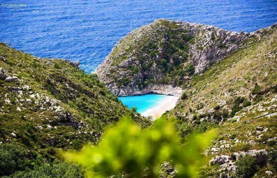
3 Geographic position Albania Albania, has a favorable geographic position. Much of the country is mountainous but its coast touches the Adriatic Sea to the west and the Ionian Sea to the southwest Albania is less than 72 km away (45 mi) from Italy across the Strait of Otranto, which connects the Adriatic to the Ionian


4 Shortly on Geology of Albania First information regarding Geological setting of Albania, come from the end of XIX century, from foreign explorers, mainly French or Austro Hungarian. Franz Baron Von Nopsca published the first geological Map of Northern Albania in the beginning of 20 th century. In March 1922 was founded the first governmental institution, called Geological Office, which was headed by Dr. Ernst Nowack, who in 1929 published the first Geological Map of Albania in scale 1: , and an explanatory text in German language. After re foundation of Albanian Geological Survey in 1952 improved versions of Geological Map in 1: was published in continuity in 1953, 1967, 1983 and finally in Every map presents the progress of scientific concepts in the time of publication Dr. Ernst Nowack Geological Map of Albania in scale 1: Salzburg 1929
 are followed nothward by Dinarides s.s and southward by Helenides.")

5 Geological setting of Albania Geological Map of Albania in scale 1: The geological ensemble of Albania is called Albanide. Albanides constructing the central part of Dinarides s.l. (Suess,1883) are followed nothward by Dinarides s.s and southward by Helenides. Tectonic units are divided in Inner and Outer units. The oldest formations in Albanides belong to Ordovician, Silurian and Devonian age. A significant spreading has the magmatic formations concentrated the inner tectonic unit called Mirdita Zone Tectonic scheme of Albaniades


 was woody constructed.")
6 Marine Research in Albania The earlier research in marine area of Albania was performed during 1909, by Austro Hungarian researcher on the board of research vessel Naiade The only data we have from that expedition is the participation on research team of Dr. Ernst Nowack, which mean that also geological surveys was performed during this expedition. The expedition covered whole Adriatic Sea Area Institute of Hidro meteorology in Academy of Sciences of Albania leads in 1960 and 1962 two expedition in South Adriatic Basin. The researchers group was leaded by the hydrologist Prof. Dr. Niko Pano. The goals was to make evaluation quality of sea waters, measurement on sea currents, bathymetry and biological observations. The ship used in second expedition, called the modern expedition was the 500 tons mercantile vessel Dajti. That has a iron body, more appropriate for the measurements meantime in first expedition the ship used (unknown name) was woody constructed. Area of coverage was the entire basin of South Adriatic basin excluding national seas of Italy and Yugoslavia Niko Pano


7 Research in Marine Geology Those began since the late 70 th with an experimental seismic profiling from Institute of Petrol and Gas The goal was to clarify the continuity of outer zones of Albanides in seaward direction. Research team has in disposal a vessel of 34 meters, constructed in naval shipyard of Durrës named Naftëtari. In this shipyard, in , was realized also an experimental bathyscaph, to be used in marine research, but this machine remain in experimental state, and was abandoned in 1989 After political changes in 1990 the research performed by IPG was abandoned, but several foreign companies continues the recognition exploring in Albanian sea area and realized a number of seismic profiles from north to south


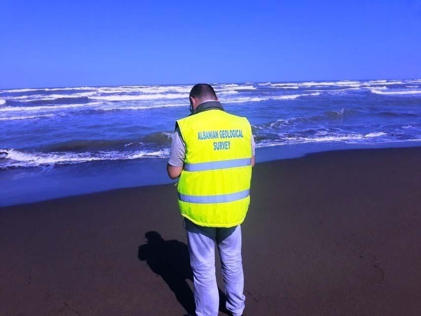
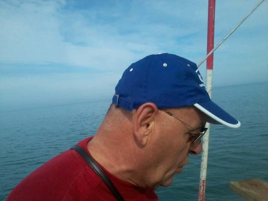
8 Research in Marine Geology Some political wrong decisions lead in 1992 to the transformation of Albanian Geological Survey into a limitated company That decision was rejected in 1998 with the reforming of AGS. Since that moment to AGS was recognize the role of scientific and technical adviser of government in field of geosciences. According to this began the periodical monitoring of coastline behavior. During that time specialists of AGS was part of Italian Albanian expedition in board of research Vessel Universitatis performed in framework of Interreg III during in Vlora Gulf


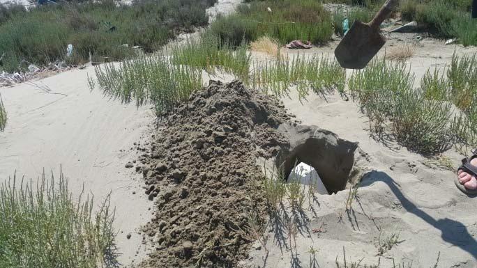
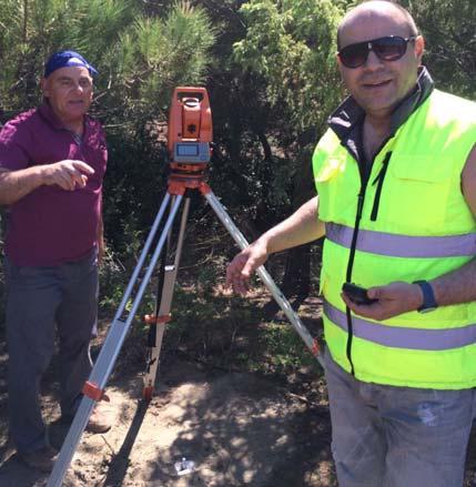
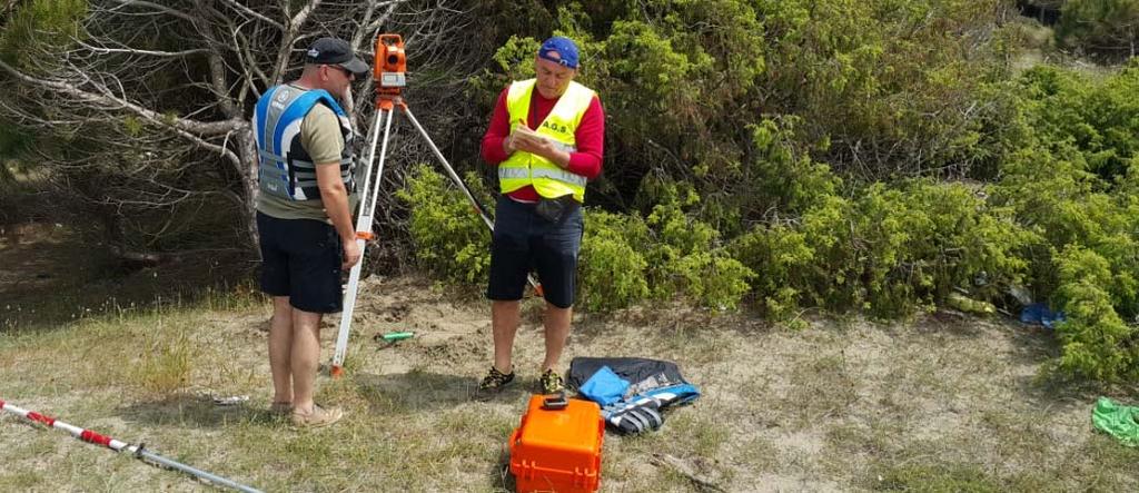
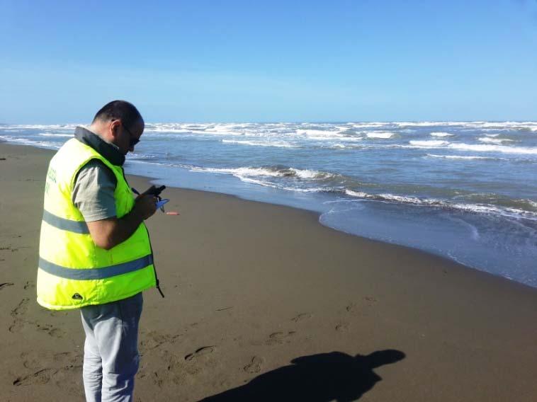
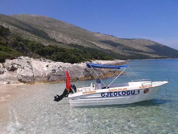
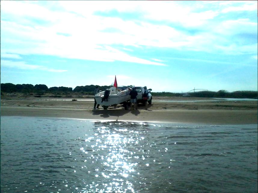
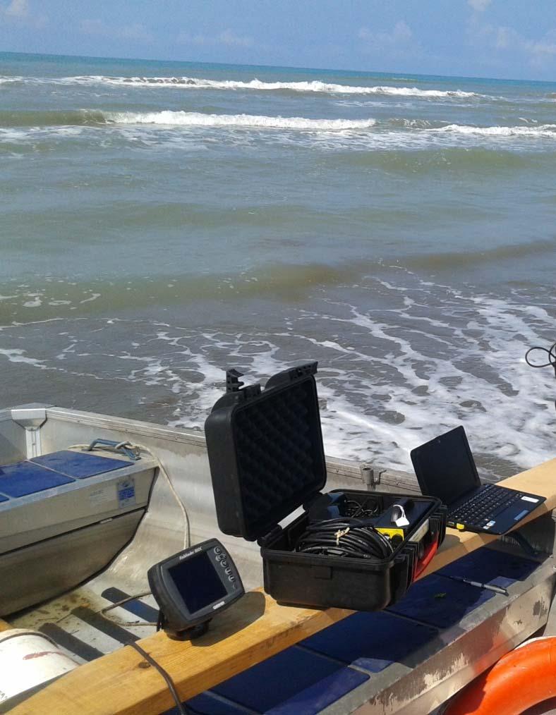
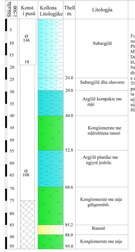
9 Organization of Marine Geology Directorate in AGS Since 2014 AGS pay a special attention to the Marine Geology. This was concretize with the foundation of Marine geology Directorate. The Directorate is organized in two branch, Sector for Marine Dynamic and Sector for Continental Shelf, The Directorate has the task to building marine geology maps, studying the lithologic composition of the seabed substrate and sea floor, bathymetric changes and morphology of the seabed, identification of natural resources in the marine and coastal areas also to study subordinate ecosystems, monitoring the behavior of the coastline, contributes to geo engineering works, archaeological research, etc. The Directorate is completed with a staff of engineers, and is slowly going to be equipped with boats, measuring equipments for specific study purposes. Since the beginning of this activity directorate was involved in the international project EMODnet, part of the European Horizon 2020 program.


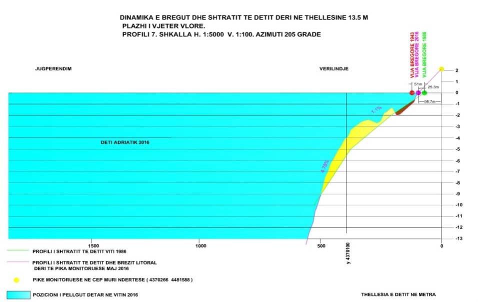
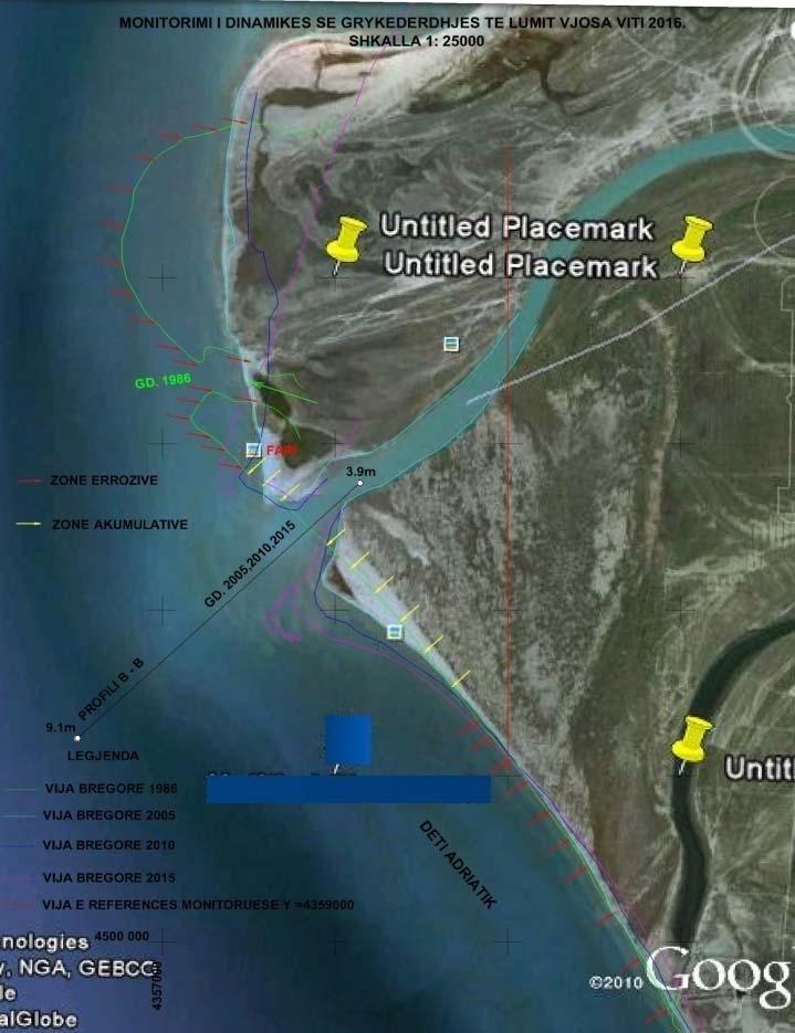
10 Organization of Marine Geology Directorate in AGS For monitoring of coast behavior we have build a system of 36 geodetically fixed points along the coastline during , and will use them as constant point of monitoring During a generalized map of for marine area of Ionian Sea was completed, based on archival data combined with new observations. This study will be realized now for Adriatic sea. The project begin this year. New projects are proposed to be performed regarding the protection of coast by erosion, evaluation of hydrocarbon potential etc. By our results, now we have began to publish and paper with problems of coastline behavior and coast classification Our staff need to be professionally trained in equipments and methodologies used in marine research, and this actual training is a appreciated help for this purpose. We hope that Turkish help will be permanent and will be concretized in the future also in join projects for the maritime area of Albania


11 Organization of Marine Geology Directorate in AGS
12 Organization of Marine Geology Directorate in AGS
13 Organization of Marine Geology Directorate in AGS


14 Organization of Marine Geology Directorate in AGS


15 Organization of Marine Geology Directorate in AGS


16 Organization of Marine Geology Directorate in AGS


17 Organization of Marine Geology Directorate in AGS
18


19


20

21 Thank You for your attention
Elaboration of Maps for Climatic and Seismic Actions for Structural Design in the Balkan region - ALBANIA
 ELABORATION OF MAPS FOR CLIMATIC AND SEISMIC ACTIONS FOR STRUCTURAL DESIGN IN THE BALKAN REGION Elaboration of Maps for Climatic and Seismic Actions for Structural Design in the Balkan region - ALBANIA
International Workshop on Groundwater Systems in Europe, August, 2013 Berlin
 Hydrogeological Mapping in Albania From the IHME contribution to larger scale national maps R. Eftimi, I. Tafilaj, G. Bisha & Xh. Sheganaku Mali me Gropa karst plateau Selita spring The hydrogeological
EU HOs in Mediterranean and Black Sea (MBS) CROATIA FRANCE GREECE ITALY MALTA X SLOVENIA X SPAIN ROMANIA X
 CROATIA FRANCE GREECE ITALY MALTA X SLOVENIA X SPAIN ROMANIA X") EU HOs in Mediterranean and Black Sea (MBS) CROATIA FRANCE GREECE ITALY MALTA X SLOVENIA X SPAIN ROMANIA X Croatia Current status of hydrographic survey in acc. IHO C-55 pub. criteria Croatia Croatia by
EU HOs in Mediterranean and Black Sea (MBS) CROATIA FRANCE GREECE ITALY MALTA X SLOVENIA X SPAIN ROMANIA X Croatia Current status of hydrographic survey in acc. IHO C-55 pub. criteria Croatia Croatia by
Seismic Interpretation & Exploration
 Seismic Interpretation & Exploration Ecolog is a private consulting and design firm established in 2002, with a track record of designing, managing and executing exploration activities and geophysical-geological
Coastal data for Integrated Maritime Policies
 Coastal data for Integrated Maritime Policies LOCHET Corine Shom Name of presentation Protection against erosion and marine flood Name presenter Link between different data scales and Name of presentation
MODELS AND TOOLS FOR GOVERNANCE OF
 Working Papers Collection No. 1/2015 MODELS AND TOOLS FOR GOVERNANCE OF THE ADRIATIC AND IONIAN SEAS www.unimc.it/maremap NATIONAL POLITICS AND EU POLITICS: THE MARITIME SPATIAL PLANNING AND INTEGRATED
WP4: COASTAL PROCESSES
 WP4: COASTAL PROCESSES Coordinator: G. EBERHARDS Faculty of Geography and Earth Sciences, University of Latvia Daugavpils, 2008 Goal: The objective of this study is analysis of coastal changes and forecast
Coastal Mapping Follow on? Bruno Frachon Corine Lochet Gaël Morvan
 Coastal Mapping Follow on? Bruno Frachon Corine Lochet Gaël Morvan Shared objectives; IHO DG MARE CPMR Development of a Joint European Coastal Mapping Programme (JECMaP) within the IHO EU network with
Marine/Maritime Spatial Planning Andrej Abramić
 Marine/Maritime Spatial Planning Andrej Abramić EcoAqua SUMMER SCHOOL: Ecosystem approach to aquaculture 26-29th of October 2015 Research and Technology to enhance excellence in Aquaculture development
CANADIAN HYDROGRAPHIC SERVICE & OCEANOGRAPHIC SERVICES
 CANADIAN HYDROGRAPHIC SERVICE & OCEANOGRAPHIC SERVICES Presentation to Warming of the North Conference Ottawa, March 2 nd, 2015 Denis Hains, Director General & Hydrographer General of Canada TIP OF THE
Marine Spatial Planning as an important tool for implementing the MSFD
 Marine Spatial Planning as an important tool for implementing the MSFD Risto Kalliola Tallinn, Nov. 16 th 2012 DEPARTMENT OF GEOGRAPHY AND GEOLOGY University of Turku, Finland Ten principles to provide
Coastal regions: People living along the coastline and integration of NUTS 2010 and latest population grid
 Statistics in focus (SIF-SE background article) Authors: Andries ENGELBERT, Isabelle COLLET Coastal regions: People living along the coastline and integration of NUTS 2010 and latest population grid Among
GENERALIZED GEOPHYSICAL OVERVIEW ON SHKODËR-PEJË DEEP TRANSVERSAL FRACTURE
 XX CONGRESS OF THE CARPATHIAN GEOLOGICAL ASSOCIATION BALKAN TIRANA, ALBANIA, 24-26 SEPTEMBER 2014 GENERALIZED GEOPHYSICAL OVERVIEW ON SHKODËR-PEJË DEEP TRANSVERSAL FRACTURE Frashëri A 1.; Bushati S. 2;
CONTINENTAL SHELF SUBMISSION OF ANGOLA - EXECUTIVE SUMMARY -
 CONTINENTAL SHELF SUBMISSION OF ANGOLA - EXECUTIVE SUMMARY - INDEX List of Figures 2 List of Tables 3 1 Introduction 5 2 Provisions of Article 76 7 3 Angolan Institutions responsible for the Submission
R E P U B L I C O F C Y P R U S NATIONAL REPORT OF CYPRUS TO THE MEDITERRANEAN AND BLACK SEAS HYDROGRAPHIC COMMISSION (MBSHC)
") R E P U B L I C O F C Y P R U S NATIONAL REPORT OF CYPRUS TO THE MEDITERRANEAN AND BLACK SEAS HYDROGRAPHIC COMMISSION (MBSHC) ISTANBUL MEETING 25-27 SEPTEMBER 2013 NATIONAL REPORT OF CYPRUS TO THE MEDITERRANEAN
R E P U B L I C O F C Y P R U S NATIONAL REPORT OF CYPRUS TO THE MEDITERRANEAN AND BLACK SEAS HYDROGRAPHIC COMMISSION (MBSHC) ISTANBUL MEETING 25-27 SEPTEMBER 2013 NATIONAL REPORT OF CYPRUS TO THE MEDITERRANEAN
Turkey National Report
 UNITED NATIONS Working Paper GROUP OF EXPERTS ON No. 26 GEOGRAPHICAL NAMES Twenty-third Session Vienna, 28 March 4 April 2006 Item 5 of the Provisional Agenda: Reports of the division Turkey National Report
Fourth Energy Summit Sustainable, competitive and secure energy in Europe. Avraam Zelilidis, Professor Department of Geology, University of Patras
 Fourth Energy Summit Sustainable, competitive and secure energy in Europe Monday 14 th November 2011, Nicosia Cyprus The status of energy exploration in Cyprus and its geostrategic significance for the
Module 7: Plate Tectonics and Earth's Structure Topic 2 Content: Major Events in the History of Plate Tectonics Theory Notes
 Introduction Like most scientific theories, the Theory of Plate Tectonics did not come about overnight, or even over one decade. It was a discovery many centuries in the making. In this interactivity,
Geophysical Site Surveys
 Geophysical Site Surveys Simon Oakley Geoscience Team Leader Fugro Survey Limited 16/04/2014 Contents Menu Introduction Section 1 - Geophysical Site Surveys - Seabed Bathymetry - Shallow Geology - Seabed
Geomagnetic Measurements in Macedonia
 Geomagnetic Measurements in Macedonia T. Delipetrov 1*, J. Rasson 2, M. Delipetrev 1 1 Faculty of Mining and Geology, Goce Delcev 89 2000 Stip, R. Macedonia 2 Institut Royal Meteorologique, Centre de Physique
Current Hydrographic Projects at BSH
 7 th Workshop Seabed Acoustics, Rostock, November 19/20, 2015 P01-1 Current Hydrographic Projects at BSH Thomas Dehling Federal Maritime and Hydrographic Agency (BSH) Germany Contact Address Website BSH
R E P U B L I C O F C Y P R U S. NATIONAL REPORT OF CYPRUS TO THE 19 th MEDITERRANEAN AND BLACK SEAS HYDROGRAPHIC COMMISSION (MBSHC)
") R E P U B L I C O F C Y P R U S NATIONAL REPORT OF CYPRUS TO THE 19 th MEDITERRANEAN AND BLACK SEAS HYDROGRAPHIC COMMISSION (MBSHC) BATUMI MEETING 30 JUNE TO 02 JULY 2015 NATIONAL REPORT OF CYPRUS TO THE
R E P U B L I C O F C Y P R U S NATIONAL REPORT OF CYPRUS TO THE 19 th MEDITERRANEAN AND BLACK SEAS HYDROGRAPHIC COMMISSION (MBSHC) BATUMI MEETING 30 JUNE TO 02 JULY 2015 NATIONAL REPORT OF CYPRUS TO THE
Aquaculture Spatial Planning: The case of Greece
 Aquaculture Spatial Planning: The case of Greece Nikos Anagnopoulos Panhellenic Association for Small-Medium sized Aquaculture Enterprises Panhellenic Association for Small-Medium sized Aquaculture Enterprises
Geographical position
 Geographical position Albania is located in South-Western Europe, in the Western of the Balkan peninsula, between the geographical coordinates 39 o 16' N latitude and 42 o 39' E longitude. The Republic
Sam Bateman and. State Practice Regarding Straight Baselines In East Asia Legal, Technical and Political Issues in a
 State Practice Regarding Straight Baselines In East Asia Legal, Technical and Political Issues in a Changing Environment Sam Bateman and Clive Schofield The Australian National Centre for Ocean Resources
GEOGRAPHICAL NAMES AS PART OF THE GLOBAL, REGIONAL AND NATIONAL SPATIAL DATA INFRASTRUCTURES
 GEOGRAPHICAL NAMES AS PART OF THE GLOBAL, REGIONAL AND NATIONAL SPATIAL DATA INFRASTRUCTURES Željko HEĆIMOVIĆ, Željka JAKIR, Zvonko ŠTEFAN, Danijela KUKIĆ zeljko.hecimovic@cgi.hr, zeljka.jakir@cgi.hr,
Limits in the Seas. No. 96 June 6, Greece Italy. Continental Shelf Boundary. (Country Codes: GR-IT)
") Limits in the Seas No. 96 June 6, 1982 Greece Italy Continental Shelf Boundary (Country Codes: GR-IT) The Geographer Office of the Geographer Bureau of Intelligence and Research INTERNATIONAL BOUNDARY
Limits in the Seas No. 96 June 6, 1982 Greece Italy Continental Shelf Boundary (Country Codes: GR-IT) The Geographer Office of the Geographer Bureau of Intelligence and Research INTERNATIONAL BOUNDARY
Joides Resolution at Hong-Kong
 Report from Iván Hernández-Almeida, post-doc at the Oeschger Centre for Climate Change Research/Institute of Geography, University of Bern. Shipboard Micropaleontologist (radiolarian specialist) on IODP
Geological information for Europe : Towards a pan-european Geological Data Infrastructure
 Geological information for Europe : Towards a pan-european Geological Data Infrastructure Integrating geoscientific information for EU competitiveness Co-funded by the European Union European societal
The Sea Floor. Chapter 2
 The Sea Floor Chapter 2 Geography of the Ocean Basins World ocean is the predominant feature on the Earth in total area Northern Hemisphere = 61% of the total area is ocean. Southern Hemisphere = about
GLY Coastal Geomorphology Notes
 GLY 4734 - Coastal Geomorphology Notes Dr. Peter N. Adams Spring 2011 2 Coastal Classification In this lecture, we discuss some successful classification schemes of the coastal landscape, and pay particular
WORKD CLIMATE CHANGE CONFERENCE, Moscow, 29 September-3 October IMPACT OF THE CLIMATE CHANGE ON ADRIATIC SEA HYDROLOGY
 WORKD CLIMATE CHANGE CONFERENCE, Moscow, 9 September-3 October 003. IMPACT OF THE CLIMATE CHANGE ON ADRIATIC SEA HYDROLOGY Alfred FRASHERI*, Niko PANO** *Department of Earth Sciences, Faculty of Geology
I. Earth s Layers a. Crust: Earth s outside layer. Made of mostly rock. i. Continental: er; made of mostly granite, forms the continents and shallow
 I. Earth s Layers a. Crust: Earth s outside layer. Made of mostly rock. i. Continental: er; made of mostly granite, forms the continents and shallow sea beds, floats! ii. Oceanic: er; dense rock such as
HARMONIZATION OF SEISMIC HAZARD MAPS FOR THE WESTERN BALKAN COUNTRIES : Overview of main BSHAP results
 Zagreb, Croatia Hotel Sheraton 12-13 May 2011 NATO SfP Project no. 983054 HARMONIZATION OF SEISMIC HAZARD MAPS FOR THE WESTERN BALKAN COUNTRIES : Overview of main BSHAP results Prof. Branislav Glavatović,
SCIENCE IN THE NEWS Plate Tectonics
 SCIENCE IN THE NEWS Plate Tectonics From VOA Learning English, this is Science in the News. I m Anna Matteo. And I m Christopher Cruise. Scientists who study the Earth tell us the continents and ocean
Chapter Two. Figure 02_02. Geography of the Ocean Basins. The Sea Floor
 Chapter Two The Sea Floor Geography of the Ocean Basins Figure 02_02 The world ocean is the predominant feature on the Earth in total area. In the Northern Hemisphere, 61% of the total area is ocean. In
Pal NIKOLLI Bashkim IDRIZI Ismail KABASHI Adelajda HALILI THE IMPLEMENTATION OF NATIONAL SPATIAL DATA INFRASTRUCTURE IN ALBANIA
 Pal NIKOLLI Bashkim IDRIZI Ismail KABASHI Adelajda HALILI THE IMPLEMENTATION OF NATIONAL SPATIAL DATA INFRASTRUCTURE IN ALBANIA Overview: Goals of paper Some definitions of SDI NSDI Development NSDI in
Laboratory #7: Plate Tectonics
 Materials Needed: 1. Pencil 2. Colored Pencils 3. Metric/Standard Ruler 4. Calculator 5. Tracing Paper Laboratory #7: Plate Tectonics Plate Tectonics The Earth is composed of layers. At the center is a
Study on Arctic Lay and Traditional Knowledge
 Framework Contract No MARE/2012/07 Support to the Implementation of the Integrated Maritime Policy of the EU Specific Contract No 3 Study on Arctic Lay and Traditional Knowledge 18 October 2013 1 The project
NOAA Nautical Charts and Coastal and Marine Spatial Planning. Meredith Westington Chief Geographer NOAA/NOS/Office of Coast Survey
 NOAA Nautical Charts and Coastal and Marine Spatial Planning Meredith Westington Chief Geographer NOAA/NOS/Office of Coast Survey Ocean Policy Task Force What is CMSP? A comprehensive, adaptive, integrated,
Billions of measurements for millions of square kilometres
 Billions of measurements for millions of square kilometres Dr. Mathias Jonas Secretary-General of the : History and Constitution 2 1 All waters on earth 3 20 th Century idea: GEBCO General bathymetric
MARITIME PLANNING IN PORTUGAL
 MARITIME PLANNING IN PORTUGAL Marta Chantal Ribeiro 2 May 2007 In Portugal there is currently no strategic planning system in force for the maritime area as a whole The maritime area under Portuguese jurisdiction
IODP drilling and core storage facilities
 4 IODP drilling and core storage facilities Neville Exon As the knowledge obtainable from ocean drilling is various and extensive, its end-users are similarly various and extensive. Scientific ocean drilling
UNIT 4: POLITICAL ORGANIZATION OF SPACE
 UNIT 4: POLITICAL ORGANIZATION OF SPACE Advanced Placement Human Geography Session 1 ADVANCED PLACEMENT HUMAN GEOGRAPHY REVIEW SESSIONS: UNIT FOUR By Geri Flanary To accompany AP Human Geography: A Study
Lecture #13 notes, Geology 3950 Spring 2006: CR Stern Magnetic reversals (text pages th edition and in the 5 th edition)
") Lecture #13 notes, Geology 3950 Spring 2006: CR Stern Magnetic reversals (text pages 35-37 4 th edition and 53-55 in the 5 th edition) The earth has a magnetic field generated by circulation of charged
Lecture #13 notes, Geology 3950 Spring 2006: CR Stern Magnetic reversals (text pages 35-37 4 th edition and 53-55 in the 5 th edition) The earth has a magnetic field generated by circulation of charged
Technologies for sea bottom inhabitants' monitoring and Integral Costal Zones Management. Example of the Kandalaksha Bay, White Sea
 Technologies for sea bottom inhabitants' monitoring and Integral Costal Zones Management. Example of the Kandalaksha Bay, White Sea Mikhail Tokarev, Roman Pevzner Transfer Technology Office of Lomonosov
Introduction to EMODnet
 Introduction to EMODnet Antonio Novellino Torino, 14-15 Ottobre 2015 What is EMODnet? Initiated by the European Commission in response to the EU Future Maritime Policy and Blue Growth, launched in June
CHAPTER 2 THE WAY THE EARTH WORKS: EXAMINING PLATE TECTONICS
 CHAPTER 2 THE WAY THE EARTH WORKS: EXAMINING PLATE TECTONICS Coverage of plate tectonics is required early in introductory Geology as context for the mineralogy, petrology, structure, internal processes,
Explain the impact of location, climate, natural resources, and population distribution on Europe. a. Compare how the location, climate, and natural
 SS6G10 Explain the impact of location, climate, natural resources, and population distribution on Europe. a. Compare how the location, climate, and natural resources of Germany, the United Kingdom and
5 Time Marches On. TAKE A LOOK 1. Identify What kinds of organisms formed the fossils in the picture?
 CHAPTER 6 5 Time Marches On SECTION The Rock and Fossil Record BEFORE YOU READ After you read this section, you should be able to answer these questions: How do geologists measure time? How has life changed
APPLICATION FOR THE CONSENT TO CONDUCT MARINE SCIENTIFIC RESEARCH IN AREAS UNDER NATIONAL JURISDICTION OF THE UNITED KINGDOM
 APPLICATION FOR THE CONSENT TO CONDUCT MARINE SCIENTIFIC RESEARCH IN AREAS UNDER NATIONAL JURISDICTION OF THE UNITED KINGDOM 1. General information Date: 27 th January 2011 1.1 Cruise name and/or number:
Cross-border Maritime Spatial Plan for the Black sea - Romania and Bulgaria project
 Cross-border Maritime Spatial Plan for the Black sea - Romania and Bulgaria project in Romania and Bulgaria Plan Presentation A first step in the management of the marine areas of Romania and Bulgaria
Oceanography, An Invitation to Marine Science 9e Tom Garrison. Ocean Basins Cengage Learning. All Rights Reserved.
 Oceanography, An Invitation to Marine Science 9e Tom Garrison 4 Ocean Basins Key Concepts Tectonic forces shape the seabed The ocean floor is divided into continental margins and deep ocean basins The
Lab # - Ocean Bottom Topography. Background Information:
 Name Lab Grade /10 Date Period Lab # - Ocean Bottom Topography Background Information: Ocean depth varies markedly from one location to another. Over large areas water depth is less than 200m (650 ft);
SW Florida Escarpment Mapping Area
 Overview NOAA s Okeanos Explorer (EX) Program plans to conduct systematic mapping and telepresence-enabled ROV explorations in the Gulf of Mexico during Spring 2014. In 2011, the EX conducted mapping operations
60% water. Big Bang: 14,000 millions years ago The Earth originated about 4,500 millions years ago its orbit allows water to exist in a liquid state!
 Ch2. The Sea Floor #1 Why geology of the oceans? Marine habitats are directly shaped by geological processes The form of the coastlines The depth of the water Type of bottom (muddy, sandy, rocky) #2 Geological
History of Plate Tectonics
 History of Plate Tectonics Continental Drift The hypothesis of how the continents were all once together and then split apart and drifted to their current location. classroomatsea.net Early Thoughts Elie
Name three countries in Europe.
 Name three countries in Europe. I will be able to identify the 5 themes of geography for Europe and locate the countries and capitals of Europe and the major physical features. People: Past: Through the
NATIONAL REPORT OF HYDROGRAPHIC SERVICE OF THE RUSSIAN FEDERATION NAVY
 2nd Meeting Arctic Regional Hydrographic Commission Copenhagen Denmark September 28-29, 2011 ARHC2-02B National report Russian Federation NATIONAL REPORT OF HYDROGRAPHIC SERVICE OF THE RUSSIAN FEDERATION
GEO-VIII November Geohazard Supersites and Natural Laboratories Progress Report. Document 9
 GEO-VIII 16-17 November 2011 Geohazard Supersites and Natural Laboratories Progress Report Document 9 This document is submitted to GEO-VIII for information. Geohazard Supersites and Natural Laboratories
MR. George ALEXAKIS, parallel session 3. "Mediterranean Sea Region. laying the conditions. for sustainable growth and jobs"
 parallel session 3 "Mediterranean Sea Region laying the conditions for sustainable growth and jobs" MR. George ALEXAKIS, elected Regional Councillor of Crete, Greece and representative of Crete in CRPM.
Social Studies. Chapter 2 Canada s Physical Landscape
 Social Studies Chapter 2 Canada s Physical Landscape Introduction Canada s geography its landforms and climate - has a great impact on Canadians sense of identity. Planet Earth The earth is divided into
COMPLICATIONS IN DELIMITING THE OUTER CONTINENTAL SHELF. Ron Macnab Geological Survey of Canada (Retired)
") COMPLICATIONS IN DELIMITING THE OUTER CONTINENTAL SHELF Ron Macnab Geological Survey of Canada (Retired) DISCLAIMER The contents of this presentation are the author s personal views only, and do not represent
COMPLICATIONS IN DELIMITING THE OUTER CONTINENTAL SHELF Ron Macnab Geological Survey of Canada (Retired) DISCLAIMER The contents of this presentation are the author s personal views only, and do not represent
APPENDIX B PHYSICAL BASELINE STUDY: NORTHEAST BAFFIN BAY 1
 APPENDIX B PHYSICAL BASELINE STUDY: NORTHEAST BAFFIN BAY 1 1 By David B. Fissel, Mar Martínez de Saavedra Álvarez, and Randy C. Kerr, ASL Environmental Sciences Inc. (Feb. 2012) West Greenland Seismic
Map shows 3 main features of ocean floor
 Map shows 3 main features of ocean floor 2017 Pearson Education, Inc. Chapter 3 Marine Provinces 2017 Pearson Education, Inc. 1 Chapter 3 Overview The study of bathymetry determines ocean depths and ocean
Mapping ecosystem services provided by benthic habitats in the European Atlantic Ocean
 Mapping and Assessment Ecosystem Services and Links to Good Environmental Status Mapping ecosystem services provided by benthic habitats in the European Atlantic Ocean Ibon Galparsoro, Angel Borja and
Tectonic Time Trials
 Unit 3 Personnel: Tectonic Time Trials Reader Person to Reset Buzzer Score Keeper (As ticks: IIII II ) IF POSSIBLE, USE A BUZZER SYSTEM SUCH AS THOSE USED ON THE TELEVISION GAME, JEOPARDY. Rules of the
CHAPTER IV THE RELATIONSHIP BETWEEN OCEANOGRAPHY AND METEOROLOGY
 CHAPTER IV THE RELATIONSHIP BETWEEN OCEANOGRAPHY AND METEOROLOGY THE relationship between oceanography and meteorology is of an order different from that between it and geology or biology, because meteorologic
Country Fiche Latvia Updated October 2016
 Country Fiche Latvia Updated October 2016 1. General information Marine area under Latvian jurisdiction includes inland sea waters, Territorial sea (12 nautical miles from the baseline) and exclusive economic
FOOT OF THE CONTINENTAL SLOPE IN ARTICLE 76
 FOOT OF THE CONTINENTAL SLOPE IN ARTICLE 76 Vaughan Stagpoole, Institute of Geological & Nuclear Sciences, Lower Hutt, New Zealand, v.stagpoole@gns.cri.nz Ray Wood, Institute of Geological & Nuclear Sciences,
On strategy for the development of the Russian Federation activities in the Antarctic for the period until 2020 and longer-term perspective
 Agenda Item: ATCM 5 Presented by: Original: Russian Federation Russian, English On strategy for the development of the Russian Federation activities in the Antarctic for the period until 2020 and longer-term
Sediment Transport and Strata Formation in the Adriatic Sea
 Sediment Transport and Strata Formation in the Adriatic Sea Wayne R. Geyer James D. Irish Peter A. Traykovski Woods Hole Oceanographic Institution Woods Hole, MA 02543 Tel. (508) 289-2868, Fax: (508) 457-2194,
Name Date Class. How have geologists learned about Earth s inner structure? What are the characteristics of Earth s crust, mantle, and core?
 Chapter 4 Plate Tectonics Section 1 Summary Earth s Interior How have geologists learned about Earth s inner structure? What are the characteristics of Earth s crust, mantle, and core? Earth s surface
North Coastal Zone Management of the Adriatic Sea and the Measures Taken To Protect the Coast from Sea Erosion
 IOSR Journal of Environmental Science, Toxicology and Food Technology (IOSR-JESTFT) e-issn: 2319-2402,p- ISSN: 2319-2399.Volume 9, Issue 1 Ver. II (Jan. 2015), PP 23-27 www.iosrjournals.org North Coastal
What is the largest country in the world? Russia
 What is the largest country in the world? #1 Russia CSCOPE 2007 2 Russia Dimensions #2-3 Spans 11 Time Zones From East to West: Gulf of Finland to Alaska From North to South: Above the Arctic Circle to
THE ROLE OF SEAMIC IN SUSTAINABLE MINERAL RESOURCES DEVELOPMENT IN AFRICA
 THE ROLE OF SEAMIC IN SUSTAINABLE MINERAL RESOURCES DEVELOPMENT IN AFRICA Ketema Tadesse Director General-SEAMIC Dar es Salaam, Tanzania August 11, 2009 SEAMIC BACKGROUND SEAMIC was established in 1977
EARTH S INTERIOR, EVIDENCE FOR PLATE TECTONICS AND PLATE BOUNDARIES
 EARTH S INTERIOR, EVIDENCE FOR PLATE TECTONICS AND PLATE BOUNDARIES LAYERS OF THE EARTH Crust Inner Core Most Dense Solid Iron & Nickel Mantle Thickest layer Outer Core Liquid Iron & Nickel ANOTHER LOOK
HELSINKI COMMISSION Baltic Marine Environment Protection Commission
 HELSINKI COMMISSION Baltic Marine Environment Protection Commission HELCOM RECOMMENDATION 24/10 Adopted 25 June 2003, having regard to Article 20, Paragraph 1 b) of the 1992 Helsinki Convention IMPLEMENTATION
Stevns Klint SITE INFORMATION. IUCN Conservation Outlook Assessment 2014 (archived) Finalised on 27 October 2014
 Finalised on 27 October 2014") IUCN Conservation Outlook Assessment 2014 (archived) Finalised on 27 October 2014 Please note: this is an archived Conservation Outlook Assessment for Stevns Klint. To access the most up-to-date Conservation
IUCN Conservation Outlook Assessment 2014 (archived) Finalised on 27 October 2014 Please note: this is an archived Conservation Outlook Assessment for Stevns Klint. To access the most up-to-date Conservation
Report. Workshop 5: How can atlases help to organise and promote the seas?
 Workshop 5: How can atlases help to organise and promote the seas? Report 1. Three key messages included on the reporting slide for the last plenary session Atlases help people to visualise intuitively
EXECUTIVE SUMMARY A SUBMISSION OF DATA AND INFORMATION ON THE OUTER LIMITS OF THE CONTINENTAL SHELF OF THE REPUBLIC OF NIGERIA PURSUANT TO
 EXECUTIVE SUMMARY A SUBMISSION OF DATA AND INFORMATION ON THE OUTER LIMITS OF THE CONTINENTAL SHELF OF THE REPUBLIC OF NIGERIA PURSUANT TO PART VI OF AND ANNEX II TO THE UNITED NATIONS CONVENTION ON THE
National Perspectives - Portugal. Margarida Almodovar
 National Perspectives - Portugal Margarida Almodovar margarida.almodovar@mam.gov.pt from base line to the external limit of the continental shelf behind 200 miles and according to UNCLOS definitions Economic
World Industrial Regions
 World Industrial Regions North America Industrialized areas in North America Changing distribution of U.S. manufacturing Europe Western Europe Eastern Europe East Asia Manufacturing Regions Fig. 11-3:
Marine Spatial Planning, a Norwegian user case NSHC33
 Marine Spatial Planning, a Norwegian user case NSHC33 Marine Spatial Management Tool Support the marine spatial planning process with updated and reliable geospatial information Marine management is important
ADRIPLAN Project Prof. Francesco Musco, IUAV University of Venice
 ADRIPLAN Project Prof. Francesco Musco, IUAV University of Venice msp@iuav.it Riga, Baltic MSP Forum, 17/18 June 2014 Outline The ADRIPLAN Project (DG MARE) Methodological insights Planning Design & interaction
2014 ATAR & WACE COURSE STATISTICS
 2014 & WACE COURSE STATISTICS Table 1.1 Table 1.2 Table 1.3 Table 1.4 Table 2.1 Table 2.2 Table 2.3 Table 2.4 Table 3.1, by Range - Total Year 12 student population, by Range - School Leaver population,
10/27/2014. Before We Begin, You Need to Understand These Terms: Earth s Structural Key Elements & the Hazards of Plate Movement
 Earth s Structural Key Elements & the Hazards of Plate Movement Before We Begin, You Need to Understand These Terms: Density Convection Currents AICE EM: Lithosphere Key Content 1 & 2 Density: heat rises,
Edgebrook Geography Bee Workshop
 Edgebrook Geography Bee Workshop January 12, 2015 1/13/2015 1 Image from https://www.google.com/search?q=world+map 1/13/2015 2 Two Bees Grade 4-8: National Geographic Society (NGS) Geography Bee School
Historical Fisheries off the Grand Banks (Wet and Dry Fisheries)
") Lesson Overview Historical Fisheries off the Grand Banks (Wet and Dry Fisheries) The French conducted the earliest trans-atlantic fishery with the Portuguese fishermen, soon joined by Basques, who took
Lesson Overview Historical Fisheries off the Grand Banks (Wet and Dry Fisheries) The French conducted the earliest trans-atlantic fishery with the Portuguese fishermen, soon joined by Basques, who took
A National Geocentric Datum and the Administration of Marine Spaces in Malaysia 2
 A National Geocentric Datum and the Administration of Marine Spaces in Malaysia 2 CheeHai TEO 3 and Ahmad FAUZI 4 Abstract Malaysia is a country with two primary land masses, Peninsular Malaysia and East
General Oceanography Geology 105 Expedition 8 Plate Boundaries Beneath the Sea Complete by Thursday at 11:00 PM
 General Oceanography Geology 105 Expedition 8 Plate Boundaries Beneath the Sea Complete by Thursday at 11:00 PM Name Expedition Objectives Learn about the types of plate boundaries and their key characteristics
Center of valley versus Thalweg: Revisiting the Israel Jordan Aravah Boundary Dispute
 Center of valley versus Thalweg: Revisiting the Israel Jordan Aravah Boundary Dispute Maxim SHOSHANY and Haim SREBRO, Israel Key words: Israel Jordan Boundary Dispute, Aravah Valley, Boundary Definition,
JOINT SUBMISSION TO THE COMMISSION ON THE LIMITS OF THE CONTINENTAL SHELF BY TUVALU, THE REPUBLIC OF FRANCE AND NEW ZEALAND (TOKELAU)
") JOINT SUBMISSION TO THE COMMISSION ON THE LIMITS OF THE CONTINENTAL SHELF BY TUVALU, THE REPUBLIC OF FRANCE AND NEW ZEALAND (TOKELAU) TABLE OF CONTENTS i. PREFACE... iii ii. LIST OF FIGURES... iv iii.
JOINT SUBMISSION TO THE COMMISSION ON THE LIMITS OF THE CONTINENTAL SHELF BY TUVALU, THE REPUBLIC OF FRANCE AND NEW ZEALAND (TOKELAU) TABLE OF CONTENTS i. PREFACE... iii ii. LIST OF FIGURES... iv iii.
Reading for Information Grade 2 Correlations to Idaho Content Standards
 Science Life Science Physical Science Grade 2 Leveled Plants Live and Grow Plants: Alive and Growing Plants: Living and Growing It Takes Force Making Things Move Facts about Force Grade 2 Correlations
2012 FORUM OF MARINE PROTECTED AREAS IN THE MEDITERRANEAN ANTALYA, TURKEY
 2012 FORUM OF MARINE PROTECTED AREAS IN THE MEDITERRANEAN ANTALYA, TURKEY SPECIAL EVENT Challenges for Open Seas MPAs in the Mediterranean region November 27, 2012. 15h00-16H00 Slide # 1 2012 FORUM OF
Marine Spatial Planning in Hellas; Recent Facts and Perspectives
 XXV FIG CONGRESS Engaging the Challenges, Enhancing the Relevance Kuala Lumpur, Malaysia 16 21 June 2014 Marine Spatial Planning in Hellas; Recent Facts and Perspectives Mrs. Chaiditsa BOLANOU Surveying
Baltic Marine Environment Protection Commission
 Baltic Marine Environment Protection Commission Maritime Group Klaipeda, Lithuania, 23-25 November 2015 MARITIME 15-2015 Document title FAMOS Finalising Surveys for the Baltic Motorways of the Sea Code
Mapping of marine habitats in shallow coastal areas in Denmark
 6 th Workshop Seabed Acoustics, Rostock, November 14/15, 2013 P11-1 Mapping of marine habitats in shallow coastal areas in Denmark Dr. Zyad Al-Hamdani Geological Survey of Denmark and Greenland - GEUS
Chapter Overview. Bathymetry. Measuring Bathymetry. Measuring Bathymetry
 CHAPTER 3 Marine Provinces Chapter Overview The study of bathymetry determines ocean depths and ocean floor topography. Echo sounding and satellites are efficient bathymetric tools. Most ocean floor features
Tuesday, September 05, 2017 Planet Earth
 Tuesday, September 05, 2017 Planet Earth Objective: Describe the solar system and Earth s location in it. Identify Earth s shape. Discuss Earth s structure. List Earth s landforms Do Now: What is a compass