Considerations on debris-flow hazard analysis, risk assessment and management.
|
|
|
- Georgia Burke
- 5 years ago
- Views:
Transcription
1 European Geosciences Union General Assembly 2008, April, Vienna Considerations on debris-flow hazard analysis, risk assessment and management. A. Remaître 1, J.-P. Malet 1, O. Maquaire 2 1. CNRS UMR 7516, School and Observatory of Earth Sciences, University Louis Pasteur, Strasbourg. 2. CNRS UMR 6554, GEOPHEN, University of Caen Basse-Normandie, Caen.
2 Introduction Debris flows are a common type of rapid gravitational mass movement. They consist mostly of a mixture of water, sediment and debris that can travel in a series of surge long distances;
3 Introduction Debris flows are a common type of rapid gravitational mass movement. They consist mostly of a mixture of water, sediment and debris that can travel in a series of surge long distances; Debris flows are widely recognize as one of the dominant geomorphic processes in mountainous areas and may constitute a dangerous natural hazard for the inhabitants and infrastructures located downslope.
logical settings) can be completely different!")
4 Debris flows temporal characteristics modified from Leroueil, 2002 Kinematical characteristics of successive events in a single watershed (especially for large watershed with various geo(morpho)logical settings) can be completely different! modified from Remaître 2006
: - landslide(s); - runoff; - combination of several")
5 Debris-flow risk in a torrential watershed Triggering (1 or several sources): - landslide(s); - runoff; - combination of several mechanisms.
6 Debris-flow risk in a torrential watershed Triggering (1 or several sources): - landslide(s); - runoff; - several mechanisms. Runout: - Increasing of debris flow volume, discharge (magnitude) according scouring phenomena; - Evolution of the behaviour according surficial formations involved in the flow.
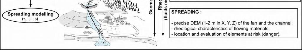
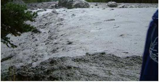
7 Debris-flow risk in a torrential watershed Triggering (1 or several sources): - landslide(s); - runoff; - several mechanisms. Runout: - Increasing of debris flow volume, discharge (magnitude) according scouring phenomena; - Evolution of the behaviour according surficial formations involved in the flow. Spreading: - Stopping and spreading of the material strongly influenced by channel/fan detailed morphology and behaviour of the debris flow.
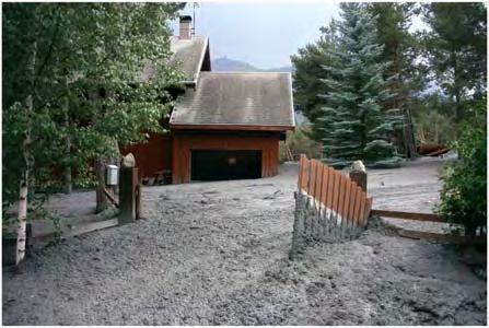
8 Debris-flows risk assessment and management Risk assessment: - where (how) it will be triggered? - frequency? - intensity (magnitude) at the torrential fan? - elements at risk (and their vulnerability)?
9 Debris-flows risk assessment and management Risk assessment: - where (how) it will be triggered? - frequency? - intensity (magnitude) at the torrential fan? - elements at risk? Risk management: - Warning system? - Mitigation (torrential correction)? - Displacement of the population at risk?

10 Debris-flows analyses: multidisciplinary approach
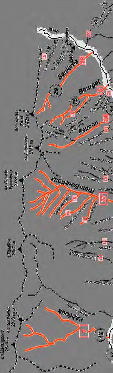
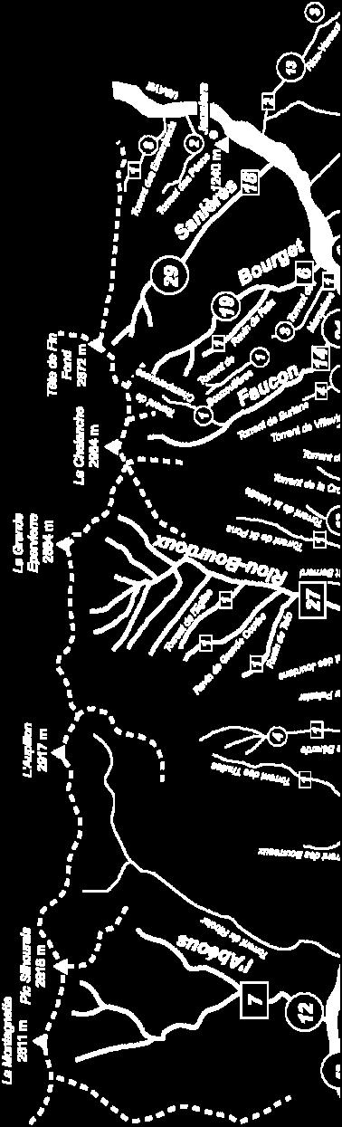
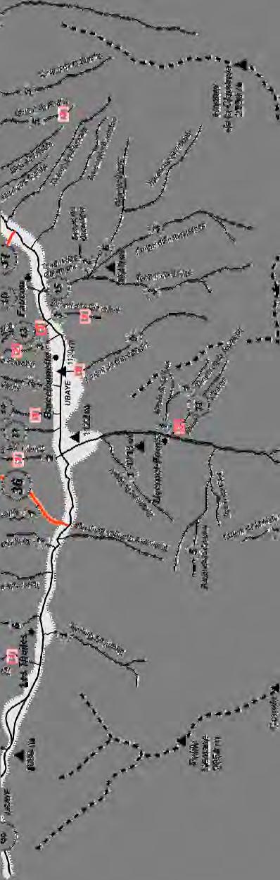
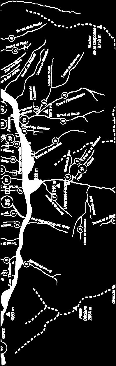
11 Example a torrential risk basin: Barcelonnette basin
12 Runout modelling (1D): Run-out distance (m) Flow height (m)

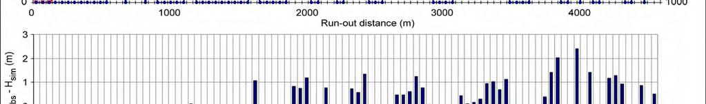
13 Runout modelling (1D): calibration and validation
14 Runout modelling (1D): hazard analysis Influence of check dams (number, location) on debris-flow intensity

15 Runout modelling (1D): hazard analysis Influence of check dams (number, location) on debris-flow intensity Sensitivity analysis show that the location of check dams as a greater influence on the intensity than their number. Check dams are more efficient when they are located in the upper part (early energy breaking); Therefore, a small number of check dams but located near the triggering area may decrease significantly the debris-flow intensity on the alluvial fans.

")

16 Runout modelling (1D): hazard analysis Definition of minimal volumes to produce overflowing (Faucon) Bridge 3 Bridge 2 Bridge 1 Identification of critical overflowing points
17 Concluding remarks: Regarding their complexity, debris-flow hazard analysis, risk assessment and management needs a multidisciplinary approach (quantitative geomorphology, engineering geology, soil and fluid mechanics, economy, landuse planning, ); Numerical models (if they are calibrate and validate both at laboratory and field scales) can be used for hazard analysis according realistic scenarios nevertheless, well documented event database concerning all the aspects of debris-flows kinematics and consequences are needed for further development of numerical models and risk assessment and management methodologies. Thank you for your attention
Landslide hazard and risk management in the Barcelonnette Basin: some case studies
 Intensive Course Barcelona, UPC, 1-4 September 2008 Landslide hazard and risk management in the Barcelonnette Basin: some case studies J.-P. Malet 1, A. Remaître 1, Y. Thiery 1 O. Maquaire 2, M. Peyron
Emergency preparedness tools for landslides
 http://omiv.unistra.fr Emergency preparedness tools for landslides A. Remaître, J.-P. Malet, S. Sterlacchinni, A. Pasuto Institut de Physique du Globe, Université de Strasbourg, Strasbourg, France CERG,
Assistant in the Geomatic and risk analysis institute (IGAR) and Geophysical institute (IG), University of Lausanne
 and Geophysical institute (IG), University of Lausanne") Who am I? That is the question Travelletti Julien Nationality: Swiss Date of birth: 24.10.1980 Master in engineering geology, University of Lausanne, Switzerland, 2007 «Large-scale landslide and debris
Who am I? That is the question Travelletti Julien Nationality: Swiss Date of birth: 24.10.1980 Master in engineering geology, University of Lausanne, Switzerland, 2007 «Large-scale landslide and debris
Dan Miller + Kelly Burnett, Kelly Christiansen, Sharon Clarke, Lee Benda. GOAL Predict Channel Characteristics in Space and Time
 Broad-Scale Models Dan Miller + Kelly Burnett, Kelly Christiansen, Sharon Clarke, Lee Benda GOAL Predict Channel Characteristics in Space and Time Assess Potential for Fish Use and Productivity Assess
Analysis of soil failure modes using flume tests
 Analysis of soil failure modes using flume tests A. Spickermann & J.-P. Malet CNRS UMR 7516, School and Observatory of Earth Sciences, University of Strasbourg, Strasbourg, France Th.W.J. van Asch, M.C.G.
Debris flow: categories, characteristics, hazard assessment, mitigation measures. Hariklia D. SKILODIMOU, George D. BATHRELLOS
 Debris flow: categories, characteristics, hazard assessment, mitigation measures Hariklia D. SKILODIMOU, George D. BATHRELLOS Natural hazards: physical phenomena, active in geological time capable of producing
Morphology and sedimentology of a complex debris flow in a clay-shale basin
 Earth Surface Processes and Landforms Morphology Earth Surf. Process. and sedimentology Landforms 30, of 339 a debris 348 (2005) flow 339 Published online in Wiley InterScience (www.interscience.wiley.com).
ENVIRONMENTAL GEOSCIENCE UNIFORM SYLLABUS
 ENVIRONMENTAL GEOSCIENCE UNIFORM SYLLABUS The Association of Professional Engineers and Geoscientists of the Province of British Columbia Note: 1. This Syllabus May Be Subject To Change 2. These Courses
Flow behaviour and runout modelling of a complex debris flow in a clay-shale basin
 Earth Surface Processes and Landforms Flow Earth behaviour Surf. Process. and Landforms runout modelling 30, 479 488 (2005) 479 Published online in Wiley InterScience (www.interscience.wiley.com). DOI:
RISK ASSESSMENT METHODOLOGIES FOR LANDSLIDES
 RISK ASSESSMENT METHODOLOGIES FOR LANDSLIDES Jean-Philippe MALET Olivier MAQUAIRE CNRS & CERG. Welcome to Paris! 1 Landslide RAMs Landslide RAM A method based on the use of available information to estimate
APPROACH TO THE SPANISH WATER ORGANISATION IMPROVING FLOOD HAZARD MAPPING, LAWS AND AUTHORITIES COORDINATION
 "Workshop On Land Use Planning And Water Management, With Focus On Flood Risk Management Oslo, Norway. Wednesday 31 January and Thursday 1 February 2007 APPROACH TO THE SPANISH WATER ORGANISATION IMPROVING
MANAGEMENT OF LARGE MUDSLIDES
 36 MANAGEMENT OF LARGE MUDSLIDES Three large and active mudslides Poche, 1860?, Super-Sauze, 1960?, La Valette, March 1982, 1 M m 3 900,000 m 3 4-5 M m 3 37 Three large and active mudslides Type of development:
1. INTRODUCTION. EXAMPLE OF SECHILIENNE ROCKFALL (France)
") FORM OSE POST-GRADUATE COURSE Landslide vulnerability and risk 1 FORM OSE POST-GRADUATE COURSE Landslide vulnerability and risk 2 FORM OSE POST-GRADUATE COURSE Landslide vulnerability and risk 3 Christophe
FORM OSE POST-GRADUATE COURSE Landslide vulnerability and risk 1 FORM OSE POST-GRADUATE COURSE Landslide vulnerability and risk 2 FORM OSE POST-GRADUATE COURSE Landslide vulnerability and risk 3 Christophe
Analysis of soil failure modes using flume tests
 Analysis of soil failure modes using flume tests A. Spickermann & J.-P. Malet Institute of Earth Physics, CNRS UMR 751, University of Strasbourg, Strasbourg, France Th.W.J. van Asch, M.C.G. van Maarseveen,
A probabilistic approach for landslide hazard analysis
 A probabilistic approach for landslide hazard analysis S. Lari, P. Frattimi, G.B. Crosta Engineering Geology 182 (2014) 3-14 報告者 : 符智傑 指導教授 : 李錫堤老師 報告日期 :2016/05/05 Introduction A general framework for
A STUDY ON DEBRIS FLOW DEPOSITION BY THE ARRANGEMENT OF SABO DAM
 Annual Journal of Hydraulic Engineering, JSCE, Vol.57, 2013, February A STUDY ON DEBRIS FLOW DEPOSITION BY THE ARRANGEMENT OF SABO DAM Namgyun Kim 1, Hajime NAKAGAWA 2, Kenji KAWAIKE 3, and Hao ZHANG 4
SPATIAL MODELS FOR THE DEFINITION OF LANDSLIDE SUSCEPTIBILITY AND LANDSLIDE HAZARD. J.L. Zêzere Centre of Geographical Studies University of Lisbon
 SPATIAL MODELS FOR THE DEFINITION OF LANDSLIDE SUSCEPTIBILITY AND LANDSLIDE HAZARD J.L. Zêzere Centre of Geographical Studies University of Lisbon CONCEPTUAL MODEL OF LANDSLIDE RISK Dangerous Phenomena
Erosion and Deposition
 Erosion and Deposition Chapter Test A Multiple Choice Write the letter of the correct answer on the line at the left. 1. Water erosion begins when runoff from rainfall flows in a thin layer over the land
International Symposium on Natural Disaster Mitigation. Local vulnerability assessment of landslides and debris flows
 International Symposium on Natural Disaster Mitigation of landslides and debris flows Lessons learnt from Cam Pha town and Van Don district, Quang Ninh province, Vietnam Nguyen Quoc Phi Faculty of Environment
APPLICATION TO PAST DISASTERS OF A METHOD OF SETTING THE RANGE OF DEBRIS FLOW DAMAGE TO HOUSES
 APPLICATION TO PAST DISASTERS OF A METHOD OF SETTING THE RANGE OF DEBRIS FLOW DAMAGE TO HOUSES Hideaki MIZUNO Senior Researcher Erosion and Sediment Control National Institute for Land and Infrastructure
Slope failure process recognition based on mass-movement induced structures
 2nd Conference on 6-11 September, 2011 SLOPE TECTONICS Vienna, Austria Slope failure process recognition based on mass-movement induced structures R. Poisel, A. Preh, R. Hofmann (1) Institute for Geotechnics,
AN APPROACH TO THE CLASSIFICATION OF SLOPE MOVEMENTS
 Training/workshop on Earthquake Vulnerability and Multi-Hazard Risk Assessment: Geospatial Tools for Rehabilitation and Reconstruction Effort 13 31 March 2006, Islamabad, Pakistan AN APPROACH TO THE CLASSIFICATION
Gateway Trail Project
 Gateway Trail Project Debris Flow Hazard Assessment By: Juan de la Fuente April 30, 2010 Background- On April 22, 2010, the Shasta-Trinity National Forest (Mt. Shasta-McCloud Unit) requested a geologic
Monte Rosa east face and Belvedere Glacier:
 Monte Rosa east face and Belvedere Glacier: Glacier surge, glacier lake, slope instabilities and related emergencies Christian Huggel, Luzia Fischer Glaciers in an Environmental Context: Case Studies C.
Modeling Great Britain s Flood Defenses. Flood Defense in Great Britain. By Dr. Yizhong Qu
 Modeling Great Britain s Flood Defenses AIRCurrents Editor s note: AIR launched its Inland Flood Model for Great Britain in December 2008. The hazard module captures the physical processes of rainfall-runoff
Avalanches. Avalanche s
 Avalanches Avalanche s Avalanches were first imagined as giant snowballs which increased in size from accretion of underlying snow What are avalanches? They are flows which move under the influence of
FLORA: FLood estimation and forecast in complex Orographic areas for Risk mitigation in the Alpine space
 Natural Risk Management in a changing climate: Experiences in Adaptation Strategies from some European Projekts Milano - December 14 th, 2011 FLORA: FLood estimation and forecast in complex Orographic
1 Introduction. Keywords. Landslide monitoring, GNSS, camera, LiDAR
 The French National Landslide Observatory OMIV Monitoring surface displacement using permanent GNSS, photogrammetric cameras and terrestrial LiDAR for understanding the landslide mechanisms J.-P. Malet,
Debris flow hazard and mitigation works in Fiames slope (Dolomites, Italy)
") Monitoring, Simulation, Prevention and Remediation of Dense and Debris Flows 15 Debris flow hazard and mitigation works in Fiames slope (Dolomites, Italy) 1 2 2 P. R. Tecca, C. Armento & R. Genevois 1
Monitoring, Simulation, Prevention and Remediation of Dense and Debris Flows 15 Debris flow hazard and mitigation works in Fiames slope (Dolomites, Italy) 1 2 2 P. R. Tecca, C. Armento & R. Genevois 1
2013 Esri Europe, Middle East and Africa User Conference October 23-25, 2013 Munich, Germany
 2013 Esri Europe, Middle East and Africa User Conference October 23-25, 2013 Munich, Germany Environmental and Disaster Management System in the Valles Altos Region in Carabobo / NW-Venezuela Prof.Dr.habil.Barbara
Multi-step hazard assessment of debris flows in an Alpine region
 Multi-step hazard assessment of debris flows in an Alpine region R. Genevois Department of Geosciences, University of Padova, Padova, Italy P.R. Tecca CNR-IRPI, Padova, Italy M. Floris, C. Squarzoni &
A STUDY ON DEBRIS FLOW OUTFLOW DISCHARGE AT A SERIES OF SABO DAMS
 A STUDY ON DEBRIS FLOW OUTFLOW DISCHARGE AT A SERIES OF SABO DAMS Namgyun KIM *, Hajime NAKAGAWA **, Kenji KAWAIKE *** and Hao ZHANG **** Abstract Debris flows are very dangerous phenomena in mountainous
Impacts of Climate Change and Water-Related Disaster Reduction Management in the Asia-Pacific Region
 Impacts of Climate Change and Water-Related Disaster Reduction Management in the Asia-Pacific Region Katumi MUSIAKE Professor, Fukushima University Secretary General, Asia Pacific Association of Hydrology
The Effects of Hydraulic Structures on Streams Prone to Bank Erosion in an Intense Flood Event: A Case Study from Eastern Hokkaido
 Symposium Proceedings of the INTERPRAENENT 2018 in the Pacific Rim The Effects of Hydraulic Structures on Streams Prone to Bank Erosion in an Intense Flood Event: A Case Study from Eastern Hokkaido Daisuke
MULTI-HAZARD RISK ASSESSMENT AND DECISION MAKING
 MULTI-HAZARD RISK ASSESSMENT AND DECISION MAKING JULINDA KEÇI Epoka University Logo of the institution CONTENT: Introduction Multi Hazard Risks Multi-Hazard Risk Assessment Quantitative Assessment Event
ANALYSIS OF DEBRIS FLOW CHARACTERISTICS WITH NUMERICAL MODELLING APPLICATION TO TWO ALPINE TORRENTS AND TO THE SEMERU VOLCANO
 University Louis Pasteur STRASBOURG Sylvain Gröndahl Master 2 nd year Mention Géosciences, Environnement, Risques Spécialité «Risques Technologiques et Naturels» Parcours «Risques Naturels» INTERNSHIP
International Conference Analysis and Management of Changing Risks for Natural Hazards November 2014 l Padua, Italy
 Abstract code: CP8 Public awareness on natural and technological hazards as a key for safety: the BeSafeNet initiative contribution 1 A. Micallef 1, A. Alexandrou 2, G. Gerοsimou 2, D. Castaldini 3, M.
Debris flow hazard mapping with a random walk model in Korea
 Risk Analysis VII PI-627 Debris flow hazard mapping with a random walk model in Korea H.-J. Youn, C.-W. Lee & C.-S. Woo Korea Forest Research Institute, Korea Abstract Recently, the sediment-related disasters,
Haydar Hussin (1), Roxana Ciurean (2), Paola Reichenbach (1), Cees van Westen (3), Gianluca Marcato (4), Simone Frigerio (4), V. Juliette Cortes (4)
, Roxana Ciurean (2), Paola Reichenbach (1), Cees van Westen (3), Gianluca Marcato (4), Simone Frigerio (4), V. Juliette Cortes (4)") 7/10/2013 Changing Hydro-meteorological Risks - as Analyzed by a New Generation of European Scientists Probabilistic 2D numerical landslide modeling: a first step towards assessing changes in risk due
7/10/2013 Changing Hydro-meteorological Risks - as Analyzed by a New Generation of European Scientists Probabilistic 2D numerical landslide modeling: a first step towards assessing changes in risk due
The Safeland Project General Overview and Monitoring Technology Development
 Ber. Geol. B. A., 82, ISSN 1017 8880 Landslide Monitoring Technologies & Early Warning Systems The Safeland Project General Overview and Monitoring Technology Development The SafeLand Consortium a), N.
Hazard Zonation for Glacial Lake Outburst Flood (GLOF) in Bhutan Himalaya
 in Bhutan Himalaya") Hazard Zonation for Glacial Lake Outburst Flood (GLOF) in Bhutan Himalaya A mode of Adaptation to the impacts of climate change DGM-NCAP Project Karma Department of Geology & Mines Ministry of Economic
Hazard Zonation for Glacial Lake Outburst Flood (GLOF) in Bhutan Himalaya A mode of Adaptation to the impacts of climate change DGM-NCAP Project Karma Department of Geology & Mines Ministry of Economic
4.17 Spain. Catalonia
 4.17 Spain Catalonia In Spain, inundation studies are the responsibility of the respective Hydrographic Confederations of each river basin (River Basin Authorities). The actual status of inundation studies
GIS as a tool in flood management
 GIS for the United Nations and the International Community Conference Panel: GIS and Capacity - How Territorial Planning Benefits from Geospatial Information 3-5 April 2012 Geneva, Switzerland GIS as a
River Response. Sediment Water Wood. Confinement. Bank material. Channel morphology. Valley slope. Riparian vegetation.
 River Response River Response Sediment Water Wood Confinement Valley slope Channel morphology Bank material Flow obstructions Riparian vegetation climate catchment vegetation hydrological regime channel
Earthquake hazards. Aims 1. To know how hazards are classified 2. To be able to explain how the hazards occur 3. To be able to rank order hazards
 Earthquake hazards Aims 1. To know how hazards are classified 2. To be able to explain how the hazards occur 3. To be able to rank order hazards Types of hazard Primary A direct result of the earthquake
Landslide susceptibility mapping at 1:1M scale over France: exploratory results with a heuristic model
 Landslide susceptibility mapping at 1:1M scale over France: exploratory results with a heuristic model J.-P. Malet & Y. Thiery CNRS UMR 7516, School and Observatory of Earth Sciences, University of Strasbourg,
Impact of Large Landslides in the Mountain Environment: Identification and Mitigation of Risk
 Impact of Large Landslides in the Mountain Environment: Identification and Mitigation of Risk Contract n EVG1-CT-2000-00035 3 rd Scientific Report on Activities March 1 st August 31 st 2002 Financial/administrative
A Roundup of Recent Debris Flow Events in Taiwan
 2015 International Workshop on Typhoon and Flood APEC Experience Sharing on Hazardous Weather Events and Risk Management A Roundup of Recent Debris Flow Events in Taiwan Hsiao-Yuan(Samuel) Yin Ph.D. sammya@mail.swcb.gov.tw
The recognition and identification of debris flow hazards for proposed development sites in New Zealand
 th Proc. 18 NZGS Geotechnical Symposium on Soil-Structure Interaction. Ed. CY Chin, Auckland The recognition and identification of debris flow hazards for proposed development sites in New Zealand Elisabeth
Understanding disaster risk ~ Lessons from 2009 Typhoon Morakot, Southern Taiwan
 Understanding disaster risk ~ Lessons from 2009 Typhoon Morakot, Southern Taiwan Wen Chi Lai, Chjeng-Lun Shieh Disaster Prevention Research Center, National Cheng-Kung University 1. Introduction 08/10
Landslide Hazard Assessment Methodologies in Romania
 A Scientific Network for Earthquake, Landslide and Flood Hazard Prevention SciNet NatHazPrev Landslide Hazard Assessment Methodologies in Romania In the literature the terms of susceptibility and landslide
INTRODUCTION. Climate
 INTRODUCTION Climate Landslides are serious natural disasters in many parts of the world. Since the past 30 years, rainfall triggered landslides and debris flows had been one of the natural disasters of
The 2005 Flood and Sediment Disaster in the Western Parts of Tyrol/Austria Facts und Conclusions
 Disaster Mitigation of Debris Flows, Slope Failures and Landslides 779 The 2005 Flood and Sediment Disaster in the Western Parts of Tyrol/Austria Facts und Conclusions Joerg Heumader Federal Service for
Harmonised approaches for landslide susceptibility mapping in Europe
 Harmonised approaches for landslide susceptibility mapping in Europe J. Hervás Institute for Environment and Sustainability, Joint Research Centre (JRC), European Commission, Ispra, Italy A. Günther Federal
Landslides in a Multi-Hazard context
 Proceedings of the Second World Landslide Forum 3-7 October 2011, Rome Melanie S. Kappes (1), Thomas Glade (2) Landslides in a Multi-Hazard context (1) University of Vienna, Geomorphic Systems and Risk
Terranum Sàrl. Rock-solid Expertise and Software
 Terranum Sàrl Rock-solid Expertise and Software About Founded in May 2011, Terranum Sàrl develops rock-solid expertise for natural hazards, geology, hydrology, 3D and LiDAR measurements, and customized
Contribution of HPC to the mitigation of natural risks. B. Feignier. CEA-DAM Ile de France Département Analyse, Surveillance, Environnement
 Contribution of HPC to the mitigation of natural risks B. Feignier CEA-DAM Ile de France Département Analyse, Surveillance, Environnement Introduction Over the last 40 years, the increase in computational
Topographic Laser Scanning of Landslide Geomorphology System: Some Practical and Critical Issues
 Topographic Laser Scanning of Landslide Geomorphology System: Some Practical and Critical Issues Khamarrul Azahari Razak, Rozaimi Che Hasan UTM Razak School of Engineering and Advanced Technology, UTM
Internationales Symposion INTERPRAEVENT 2004 RIVA / TRIENT
 APPLICATION TO PAST DISASTERS OF A METHOD OF SETTING APPLICATION THE RANGE TO OF PAST DEBRIS DISASTERS FLOW OF DAMAGE A METHOD TO HOUSES OF SETTING THE RANGE OF DEBRIS FLOW DAMAGE TO HOUSES Hideaki Mizuno
A Numerical Method for Determine the Dredging Requirements for Channel Restoration Using Alishan Creek in Central Taiwan as an Example
 A Numerical Method for Determine the Dredging Requirements for Channel Restoration Using Alishan Creek in Central Taiwan as an Example Instructors : Dr. Jie-Dar Cheng Dr. Honglay Chen Dr. Chao-Yuan Lin
Land recycling and reusing: man made terraces as a peculiar problem in the Liguria region.
 Land recycling and reusing: man made terraces as a peculiar problem in the Liguria region. G. Brancucci and G. Paliaga & Francesca Nervi POLIS Department University of Genova - Italy The Ligurian territory
Aspects of risk assessment in power-law distributed natural hazards
 Natural Hazards and Earth System Sciences (2004) 4: 309 313 SRef-ID: 1684-9981/nhess/2004-4-309 European Geosciences Union 2004 Natural Hazards and Earth System Sciences Aspects of risk assessment in power-law
GEOSPATIAL ANALYSIS OF GLACIAL DYNAMICS OF SHIGAR AND SHAYOK BASINS. Syed Naseem Abbas Gilany 1
 GEOSPATIAL ANALYSIS OF GLACIAL DYNAMICS OF SHIGAR AND SHAYOK BASINS 1 OUTLINE Introduction Problem Statement / Rationale Objectives Material and Methods Study Area Datasets Required Data Analysis / Assessment
OBJECTIVES. Fluvial Geomorphology? STREAM CLASSIFICATION & RIVER ASSESSMENT
 STREAM CLASSIFICATION & RIVER ASSESSMENT Greg Babbit Graduate Research Assistant Dept. Forestry, Wildlife & Fisheries Seneca Creek, Monongahela National Forest, West Virginia OBJECTIVES Introduce basic
Interpretive Map Series 24
 Oregon Department of Geology and Mineral Industries Interpretive Map Series 24 Geologic Hazards, and Hazard Maps, and Future Damage Estimates for Six Counties in the Mid/Southern Willamette Valley Including
Prediction of landslide-induced debris flow hydrograph: the Atsumari debris flow disaster in Japan
 Monitoring, Simulation, Prevention and Remediation of Dense and Debris Flows 27 Prediction of landslide-induced debris flow hydrograph: the Atsumari debris flow disaster in Japan H. Takaoka 1, H. Hashimoto
Riverbank Landslides and the Probability Analysis of Landslide Dams
 International Journal of Structural and Civil Engineering Research Vol. 5, No. 3, August 2016 Riverbank Landslides and the Probability Analysis of Landslide Dams Chien-Yuan Chen and Wei-Ting Lee Dept.
DEBRIS FLOW MONITORING AND WARNING SYSTEMS: A NEW STUDY SITE IN THE ALPS
 DEBRIS FLOW MONITORING AND WARNING SYSTEMS: A NEW STUDY SITE IN THE ALPS Comiti F 1, Macconi P 2, Marchi L 3, Arattano M 4, Borga M 5, Brardinoni F 6, Cavalli M 3, D Agostino V 5, Hellweger S 3, Trevisani
Methodological approaches to urban hazard and risk assessment. Victor Jetten. Cees van Westen, Richard Sliuzas, Norman Kerle, Anne van Veen
 Methodological approaches to urban hazard and risk assessment Victor Jetten Cees van Westen, Richard Sliuzas, Norman Kerle, Anne van Veen Dept. of Earth Systems Analysis, ITC UN-GGIM Chengduforum15-17
WATER ON AND UNDER GROUND. Objectives. The Hydrologic Cycle
 WATER ON AND UNDER GROUND Objectives Define and describe the hydrologic cycle. Identify the basic characteristics of streams. Define drainage basin. Describe how floods occur and what factors may make
Contribution to the Mountain-Risks project of the Rock Mechanics Laboratory of the Swiss Federal Institute of Technology of Lausanne
 Contribution to the Mountain-Risks project of the Rock Mechanics Laboratory of the Swiss Federal Institute of Technology of Lausanne PhD Student: Jacopo Abbruzzese Supervisor: Dr. Vincent Labiouse MOUNTAIN
Pinyol, Jordi González, Marta Oller, Pere Corominas, Jordi Martínez, Pere
 Rockfall hazard mapping methodology applied to the Geological Hazard Prevention Map in Catalonia 1:25000 Pinyol, Jordi González, Marta Oller, Pere Corominas, Jordi Martínez, Pere ROCKFALL HAZARD MAPPING
DEM-based Ecological Rainfall-Runoff Modelling in. Mountainous Area of Hong Kong
 DEM-based Ecological Rainfall-Runoff Modelling in Mountainous Area of Hong Kong Qiming Zhou 1,2, Junyi Huang 1* 1 Department of Geography and Centre for Geo-computation Studies, Hong Kong Baptist University,
VINCENT COOPER Flood Hazard Mapping Consultant
 FLOOD HAZARD MAPPING OF GRENADA FINAL REPORT (NON-TECHNICAL) By VINCENT COOPER Flood Hazard Mapping Consultant For the Caribbean Development Bank January, 2006 TABLE OF CONTENTS INTRODUCTION 1 METHODOLOGY
Flash Flood Guidance System On-going Enhancements
 Flash Flood Guidance System On-going Enhancements Hydrologic Research Center, USA Technical Developer SAOFFG Steering Committee Meeting 1 10-12 July 2017 Jakarta, INDONESIA Theresa M. Modrick Hansen, PhD
Technical Review of Pak Beng Hydropower Project (1) Hydrology & Hydraulics and (2) Sediment Transport & River Morphology
 Hydrology & Hydraulics and (2) Sediment Transport & River Morphology") Technical Review of Pak Beng Hydropower Project (1) Hydrology & Hydraulics and (2) Sediment Transport & River Morphology The 2 nd Regional Stakeholder Forum The Pak Beng Hydropower Project 5 th May 2017
Technical Review of Pak Beng Hydropower Project (1) Hydrology & Hydraulics and (2) Sediment Transport & River Morphology The 2 nd Regional Stakeholder Forum The Pak Beng Hydropower Project 5 th May 2017
Regional assessment of debris flow impacts on transport infrastructures
 Regional assessment of debris flow impacts on transport infrastructures Debris flows may have dramatic consequences for the security of transport infrastructures in mountainous regions. Each year in the
Alluvial Fan Flood Hazard Assessment based on DTM Uncertainty
 Alluvial Fan Flood Hazard Assessment based on DTM Uncertainty Tarick Hosein February, 2010 Alluvial Fan Flood Hazard Assessment based on DTM Uncertainty by Tarick Hosein Thesis submitted to the International
Investigation of landslide based on high performance and cloud-enabled geocomputation
 Investigation of landslide based on high performance and cloud-enabled geocomputation Jun Liu 1, Shuguang Liu 2,*, Qiming Zhou 3, Jing Qian 1 1 Shenzhen Institutes of Advanced Technology, Chinese Academy
2014 Summer Training Courses on Slope Land Disaster Reduction Hydrotech Research Institute, National Taiwan University, Taiwan August 04-15, 2014
 Final Project Report 2014 Summer Training Courses on Slope Land Disaster Reduction Hydrotech Research Institute, National Taiwan University, Taiwan August 04-15, 2014 Landslides in Mt. Umyeon Susceptibility
Multiscalar Approach of Merapi Volcanic Erosion - Approche Multi Scalaire d Erosion de Volcan Merapi -
 Multiscalar Approach of Merapi Volcanic Erosion - Approche Multi Scalaire d Erosion de Volcan Merapi - Sandy Budi Wibowo PhD student at Univ. Paris 1 (N étudiant: 10928433) CDD Ingénieur d études (N agent
FFGS Advances. Initial planning meeting, Nay Pyi Taw, Myanmar February, Eylon Shamir, Ph.D,
 FFGS Advances Initial planning meeting, Nay Pyi Taw, Myanmar 26-28 February, 2018 Eylon Shamir, Ph.D, EShamir@hrcwater.org Hydrologic Research Center San Diego, California FFG System Enhancements The following
Effect of plan layout on the sediment control efficiency of slit-check dams for stony type debris flows mitigation
 River Basin Management VIII 259 Effect of plan layout on the sediment control efficiency of slit-check dams for stony type debris flows mitigation M. Silva 1, S. Costa 1 & A. H. Cardoso 2 1 AQUALOGUS,
The Effects of Flooding on Structures. Or What to Expect when the Drought Ends Violently
 The Effects of Flooding on Structures Or What to Expect when the Drought Ends Violently Let s Define Flood Increase in discharge compared to normal level Direct runoff of rainfall (we re talking about
GEOMORPHOLOGY APPROACH IN LANDSLIDE VULNERABILITY, TANJUNG PALAS TENGAH, EAST KALIMANTAN, INDONESIA
 GEOMORPHOLOGY APPROACH IN LANDSLIDE VULNERABILITY, TANJUNG PALAS TENGAH, EAST KALIMANTAN, INDONESIA *Twin H. W. Kristyanto Geology Study Program, FMIPA UI, Universitas Indonesia *Author for Correspondence:
Preparing Landslide Inventory Maps using Virtual Globes
 Introduction: A landslide is the movement of a mass of rock, debris, or earth down a slope, under the influence of gravity. Landslides can be caused by different phenomena, including intense or prolonged
Deep-Seated Landslides and Landslide Dams Characteristics Caused by Typhoon Talas at Kii Peninsula, Japan
 Deep-Seated Landslides and Landslide Dams Characteristics Caused by Typhoon Talas at Kii Peninsula, Japan Hefryan Sukma KHARISMALATRI*,1, Hitomi KIKUCHI 1, Yoshiharu ISHIKAWA 1, Takashi GOMI 1, Katsushige
MINISTRY OF FORESTS, LANDS AND NATURAL RESOURCE OPERATIONS, POST-WILDFIRE RISK ANALYSIS PRELIMINARY REPORT
 MINISTRY OF FORESTS, ANDS AND NATURA RESOURCE OPERATIONS, POST-WIDFIRE RISK ANAYSIS PREIMINARY REPORT NOTE: The results given on this form are preliminary in nature and are intended to be a warning of
1 INTRODUCTION. 1.1 Context
 1 INTRODUCTION 1.1 Context During the last 30 years ski run construction has been one of the major human activities affecting the Alpine environment. The impact of skiing on environmental factors and processes,
Geodetic monitoring of the Adroit landslide, Barcelonnette, French Southern Alps
 Geodetic monitoring of the Adroit landslide, Barcelonnette, French Southern Alps Gilbert FERHAT 1, Jean-Philippe MALET 1, Anne PUISSANT 2, Delphine CAUBET 3, Emilie HUBER 3 1 Institut de Physique du Globe
Erosion Surface Water. moving, transporting, and depositing sediment.
 + Erosion Surface Water moving, transporting, and depositing sediment. + Surface Water 2 Water from rainfall can hit Earth s surface and do a number of things: Slowly soak into the ground: Infiltration
Portland Water Bureau. Preparing Portland s Water Supply for The Big One. July 11, Tim Collins, P.E., G.E.
 Portland Water Bureau Preparing Portland s Water Supply for The Big One July 11, 2018 Tim Collins, P.E., G.E. Presentation Outline Portland water system overview Pacific Northwest seismic hazards Building
Special edition paper
 Development of a System for Natural Disaster Risk Factor Evaluation by the EADaS Method Ryuji Oshima* Asako Togari* Masahiko Tomori* Natural disasters of a variety of scales occur along railway lines,
Mass Wasting. Mass Wasting. Earth s s External Processes
 1 Mass Wasting Presentation Modified from Instructor Resource Center on CD-ROM, Foundations of Earth Science, 4 th Edition, Lutgens & Tarbuck Mass Wasting 2 Down-slope movement of rock, loose material
RISK ASSESSMENT COMMUNITY PROFILE NATURAL HAZARDS COMMUNITY RISK PROFILES. Page 13 of 524
 RISK ASSESSMENT COMMUNITY PROFILE NATURAL HAZARDS COMMUNITY RISK PROFILES Page 13 of 524 Introduction The Risk Assessment identifies and characterizes Tillamook County s natural hazards and describes how
VULNERABILITY OF WATER SUPPLY TO NATURAL HAZARDS IN JAMAICA
 VULNERABILITY OF WATER SUPPLY TO NATURAL HAZARDS IN JAMAICA RAFI AHMAD rafi.ahmad@uwimona.edu.jm Unit for disaster studies, Department of Geography & Geology, The University of the West Indies, Mona Kingston
What Are Disasters? The Rescue Kids Trio!
 The Rescue Kids Trio! What Are Disasters? This manual was made possible through funding by the Council of Local Authorities for International Relations. Disasters and emergency preparedness Emergency preparedness
Geology 101. Reading Guides for Chapters 6 and 12
 Geology 101 Name Chapter 6: Weathering and Soils (p. 160): Reading Guides for Chapters 6 and 12 This chapter is about the processes involved in the disintegration of rock. Weathering is often mistaken
Climate change and natural disasters, Athens, Greece October 31, 2018
 Flood early warning systems: operational approaches and challenges Climate change and natural disasters, Athens, Greece October 31, 2018 Athens, October 31, 2018 Marco Borga University of Padova, Italy
Geohazards in the Himalaya GEOL 3000 (3 Credits / 45 class hours)
") Geohazards in the Himalaya GEOL 3000 (3 Credits / 45 class hours) SIT Study Abroad Program: Nepal: Geoscience in the Himalaya PLEASE NOTE: This syllabus represents a recent term. Because courses develop
Geohazards in the Himalaya GEOL 3000 (3 Credits / 45 class hours) SIT Study Abroad Program: Nepal: Geoscience in the Himalaya PLEASE NOTE: This syllabus represents a recent term. Because courses develop