Portland Water Bureau. Preparing Portland s Water Supply for The Big One. July 11, Tim Collins, P.E., G.E.
|
|
|
- Godfrey Lyons
- 5 years ago
- Views:
Transcription

1 Portland Water Bureau Preparing Portland s Water Supply for The Big One July 11, 2018 Tim Collins, P.E., G.E.

2 Presentation Outline Portland water system overview Pacific Northwest seismic hazards Building a resilient system
3 Do you know where your drinking water comes from?

4 Portland s Drinking Water System

5 Population and Consumption Total service population 935, ,000 retail 369,000 wholesale Average demand 100 million gallons Peak demand 162 million gallons per day Winter demand 85 million gallons per day

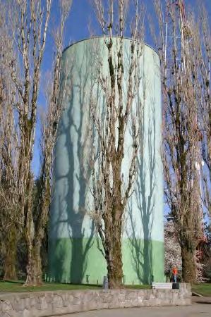
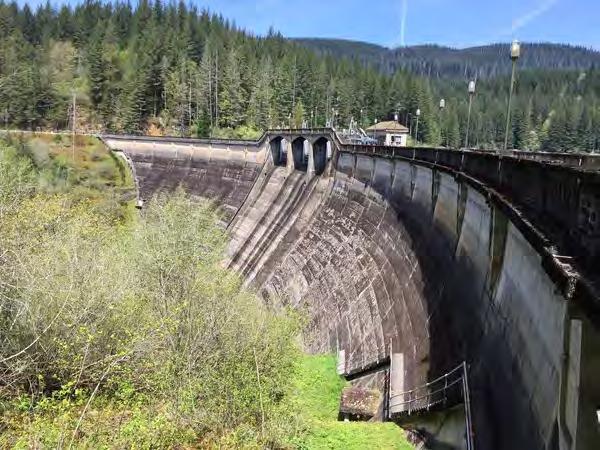
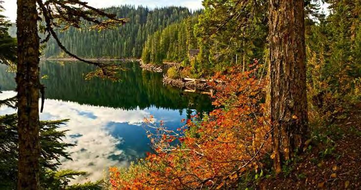
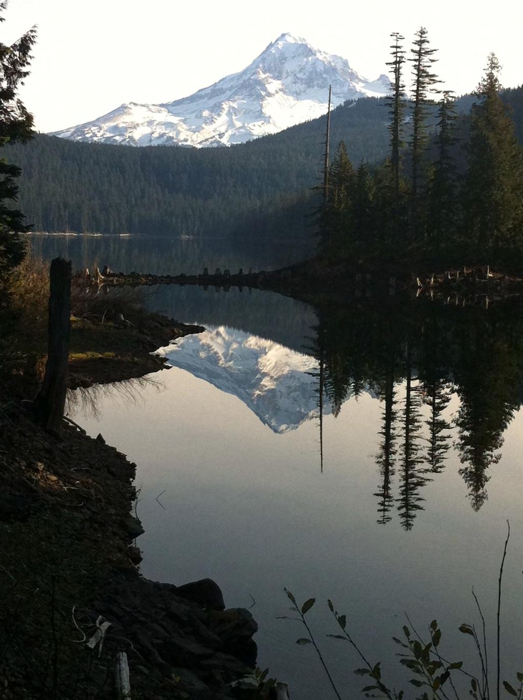
6 Surface Water Bull Run Watershed: Reservoirs 1 & 2

7 Climate, Topography and Geology 750 4,500 elev. 130 avg. annual precipitation Rain dominated system Underlying geology: Columbia River basalt

8 126 Years of Clean Water

9 Groundwater Columbia South Shore Well Field
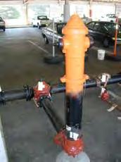

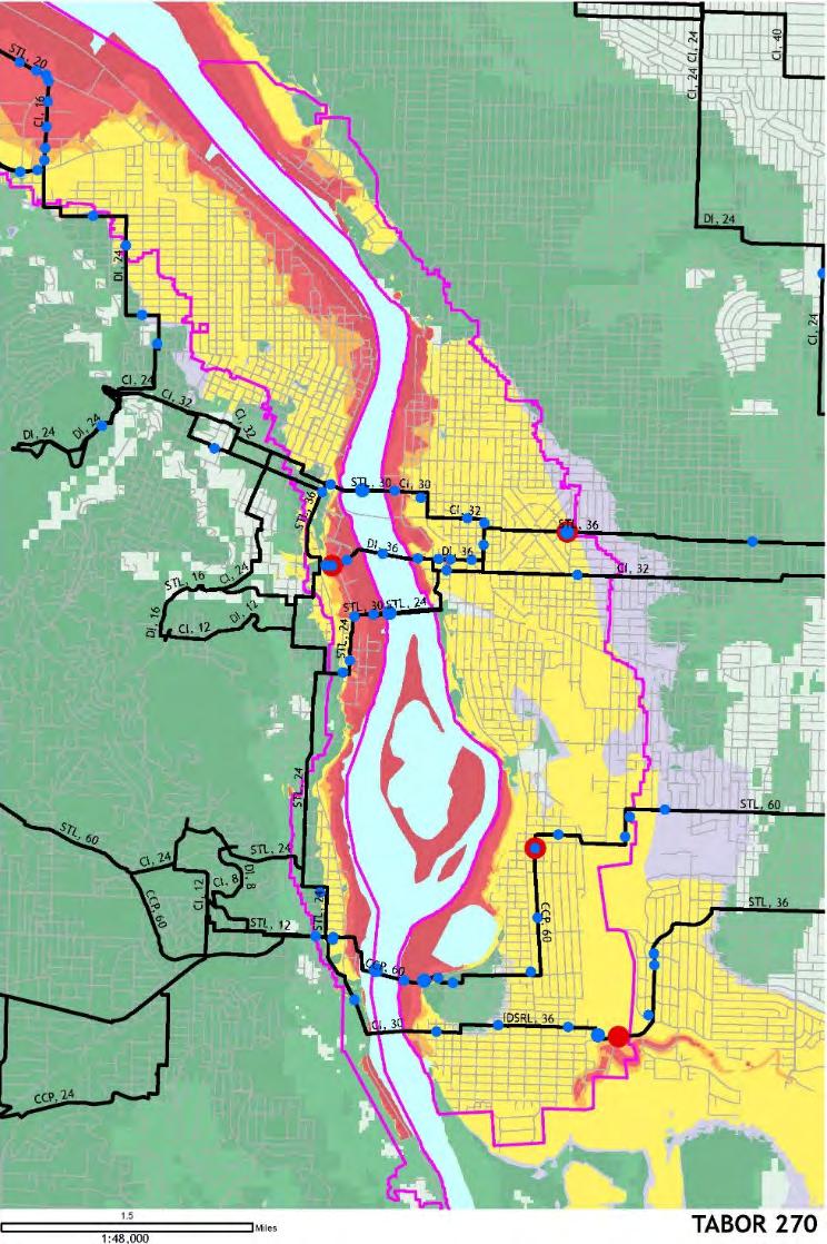
10 System Components 2,200 miles of small pipe 2 dams 100 miles of large pipe 58 tanks 15,000 hydrants 40,000 valves 180,000 meters 38 pump stations

11 Pacific Northwest Seismic Hazards

12 Plate Tectonic Map of the Pacific Northwest: The Cascadia Region Interplate Crustal Intraplate Modified from 2010 issue of Cascadia, Oregon Dept. of Geology and Mineral Industries

13 Juan de Fuca Plate The interaction between Juan de Fuca and North American plate generate seismic sources.

14 Vertical Slice through Subduction Zone Source:
15 Between Earthquakes Seafloor goes down Coast goes up Source:

16 During an Earthquake Seafloor goes up Coast goes down Source:
 by adding magnitude estimates and some labels. 20 earthquakes ruptured all of the subduction zone.")
17 Cascadia Subduction Zone Earthquakes Turbidites show how much of the subduction zone ruptured in ~42 earthquakes over the last 10,000 years. Recurrence Mw ~9 500 yrs Mw yrs Mw yrs Mw yrs Modified from Goldfinger et al. (in press) by adding magnitude estimates and some labels. 20 earthquakes ruptured all of the subduction zone. 2 to 3 earthquakes ruptured three quarters of subduction zone. 19 earthquakes ruptured the southern half or quarter of the subduction zone.
18 Frequency of Cascadia Zone Earthquakes Comparison of the history of subduction zone earthquakes along the Cascadia Subduction Zone in northern California, Oregon, and Washington, with events from human history. Ages of earthquakes are derived from study and dating of submarine landslides triggered by the earthquakes. Earthquake data provided by Chris Goldfinger, Oregon State University; time line by Ian P. Madin, DOGAMI.
19 What Damaging Phenomena Do Earthquakes Generate? Liquefaction Lateral Spreading Landslides Ground Shaking Fault Rupture These are of greatest concern to the PWB.


20 Liquefaction Source: Sand Liquefaction Phenomena induced by the May 2012 Emilia Romagna Earthquake. ENEA

21 Liquefaction results from strong ground shaking. Occurs in saturated soil profiles with significant sand content Results in a semi-fluid state Loss of soil strength and bearing capacity Liquefaction


22 Lateral Spreading Occurs when liquefaction occurs on a slope or near an open face.

23 Lateral spread in the February 29, 2001, M6.8 Nisqually Earthquake.

24 Lateral spread at North Wharf. January 12, 2010 M7.0 Haiti Earthquake Source USGS/EERI

25 Landslides Earthquake induced Groundwater induced Headworks landslide shut down the Bull Run system for a month in 1995.
 Water System Seismic Study")
26 Recent Studies Bull Run Watershed Landslide Assessment (2016) Water System Seismic Study (2017)
27 Transmission Main Vulnerabilities

28 Breaks and Leaks
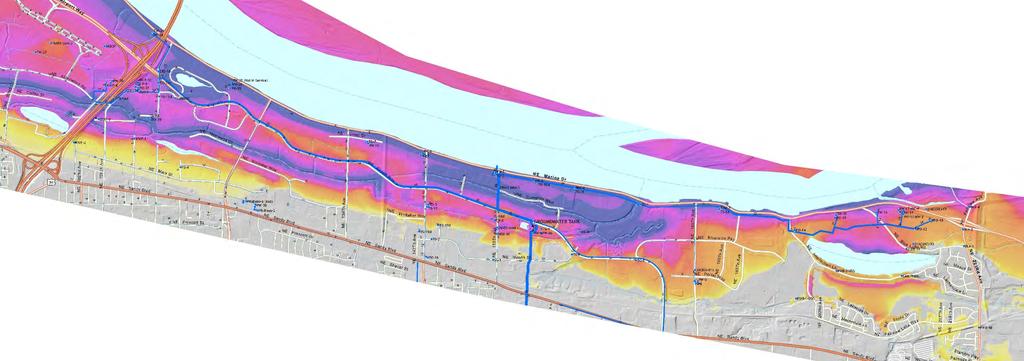
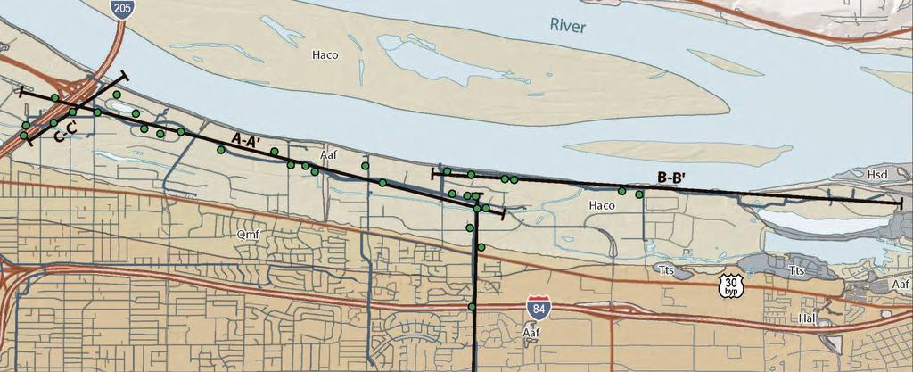

29 Wellfield Vulnerabilities
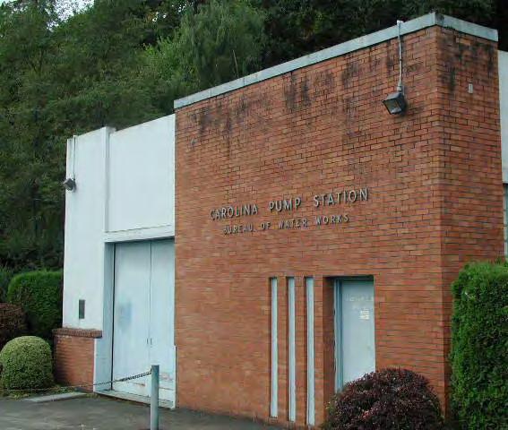
30 System Seismic Vulnerabilities Conduits: 10 or more failures on each conduit Backbone Pipelines: 200+ failures Distribution System: 3,000+ failures Columbia Wellfield: 150+ damage to multiple well casings, potential damage to collection tank Willamette River Crossings: All six crossings will be damaged Pump Stations and Tanks: Three pump stations and 10 tanks at high risk of damage

31 PWB Seismic Study Findings Existing water supply system will drain within hours Repair times will not meet the Resiliency Plan recommendations Significant resources will be necessary to bring to system into compliance with the Resiliency Plan Fill the tub!!!
32 Resiliency Actions

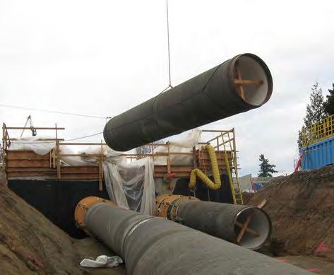
33 Oregon Resilience Plan Issued February 2013 Specifies likely impacts of a magnitude 9.0 Cascadia earthquake. Defines target states of recovery goals to be met within 50 years. Recommends changes in practice and policy.

34 Current System Recovery Targets & Status

35 PWB Resiliency Efforts Improve seismic resiliency of bridges Remove exposed portions of conduit Strengthen key facilities Improve river crossings Improve transmission backbone

36 Bridge Improvements Bowman s Bridge Seismic Upgrade, 1999 Bolt foundations to bedrock; structural improvements

37 Bridge Improvements Larson s Bridge Seismic Strengthening, 2003 Rock bolts; structural strengthening


38 Conduit Trestle Improvements Trestle removal, conduit hardening, scour protection, 2005


39 Groundwater Pump Station Seismic Upgrade Ground Improvements and structural improvements, 1999

40 Sandy River Crossing Tunnel Remove surface piping and bridge. Install new conduits 80 below the Sandy River bottom, 2007.


41 Sandy River Crossing Tunnel


42 Willamette River Crossing Currently no seismically hardened water main crossing Proposed alignment beneath liquefiable soils. Provide average daily demand after an earthquake Under design, complete 2020 Existing pipe New pipe
43 Questions?
Business Case: UV Facility Backup Generator
 Business Case: UV Facility Backup Generator Eric Brainich December 13, 2010 Background The Portland Water Bureau is currently working on the design for a new Ultra Violet (UV) Treatment Facility and the
The Cascading Hazards from Cascadia s Earthquakes
 Tsunamis The Cascading Hazards from Cascadia s Earthquakes Earthquakes (Nisqually earthquake, Seattle, WA) Volcanoes (Mt St Helens eruption, WA) Joan Gomberg gomberg@usgs.gov Landslides (Oso landslide,
Surviving the Big One: Understanding and Preparing for a Major Earthquake in Western Oregon
 Surviving the Big One: Understanding and Preparing for a Major Earthquake in Western Oregon May 21, 2013 City of Salem Salem Public Library Althea Rizzo, Geological Hazards Program Coordinator Oregon Emergency
Earthquakes in Oregon: Past, Present & Future. Earthquakes in OREGON: Are we ready for the Big One?
 Earthquakes in Oregon: Past, Present & Future Earthquakes in OREGON: Are we ready for the Big One? Scott Burns Portland State University Department of Geology New Yorker Article: 7/20/15 The Really Big
BE INFORMED MAKE A PLAN BUILD TWO KITS CASCADIA MEDICAL READINESS LEARNING OBJECTIVES
 LEARNING OBJECTIVES CASCADIA MEDICAL READINESS The Cascadia Subduction Zone (CSZ) Earthquake s Impact on Central Oregon s Medical Care Characterize the consequences of disasters on health services Characterize
Water Supply Forum Regional Water Supply Resiliency Project Earthquake Vulnerability Assessment Technical Memorandum
 Water Supply Forum Regional Water Supply Resiliency Project Earthquake Vulnerability Assessment Technical Memorandum Snohomish, King, and Pierce Counties, Washington April 11, 2016 Earthquake Vulnerability
This article is provided courtesy of the American Museum of Natural History.
 Avoiding Earthquake Surprises in the Pacific Northwest This article is provided courtesy of the American Museum of Natural History. How Vulnerable Is the Pacific Northwest? Cascadia is a region in the
GEOLOGY, SOILS, AND SEISMICITY
 4.9 GEOLOGY, SOILS, AND SEISMICITY 4.9.1 Introduction Information about the geological conditions and seismic hazards in the study area was summarized in the FEIR, and was based on the Geotechnical Exploration
Quantifying Earthquake and Geologic Hazards for the Portland, Oregon Water System Vulnerability Assessment
 Quantifying Earthquake and Geologic Hazards for the Portland, Oregon Water System Vulnerability Assessment Donald Ballantyne, PE, Vice President, and Charles Scawthorn, SE, Senior Vice President, EQE International
3.18 GEOLOGY AND SOILS
 3.18 GEOLOGY AND SOILS This section discusses geologic resource concerns as they relate to the environment, public safety, and project design both during construction and after completion of the project.
Cascadia Seismic Event Planning for the Maritime Community
 Cascadia Seismic Event Planning for the Maritime Community Jonathan Allan, Oregon Dept. of Geology and Mineral Industries Presentation to Annual Pacific Northwest Waterways Association Meeting (PNWA) October
Three Fs of earthquakes: forces, faults, and friction. Slow accumulation and rapid release of elastic energy.
 Earthquake Machine Stick-slip: Elastic Rebound Theory Jerky motions on faults produce EQs Three Fs of earthquakes: forces, faults, and friction. Slow accumulation and rapid release of elastic energy. Three
Earthquakes: What s Shaking? Yumei Wang, Geohazards Engineer, PE, Oregon Dept of Geology and Mineral Industries (DOGAMI)
") Earthquakes: What s Shaking? Yumei Wang, Geohazards Engineer, PE, Oregon Dept of Geology and Mineral Industries (DOGAMI) June 14, 2016 WRECA Source: https://www.youtube.com/watch?v=ru0j1x5zrl4&list=plb9ce291f48c9207c&index=5
Earthquakes: What s Shaking? Yumei Wang, Geohazards Engineer, PE, Oregon Dept of Geology and Mineral Industries (DOGAMI) June 14, 2016 WRECA Source: https://www.youtube.com/watch?v=ru0j1x5zrl4&list=plb9ce291f48c9207c&index=5
ASSESSING OREGON S SEISMIC RISK
 ASSESSING OREGON S SEISMIC RISK Martha Sartain 1 Richard Groff, P.E. 2 Craig Shike, P.E. 3 Mark Hirota, P.E. 4 Abstract The State of Oregon has unique seismic risks associated with its location adjacent
Seismic Hazard Abatement Program
 Seismic Hazard Abatement Program Recommendations To take the first steps toward a seismic mitigation program for older existing buildings To improve our current regulatory system for implementation of
PUBLIC COMMENT DRAFT 11/07/2016
 3.1 Earthquake Much of the Planning Area is susceptible to earthquake-induced landslides, liquefaction and severe ground shaking. A dense population and built environment in the cities of Gresham and Fairview
Interpretive Map Series 24
 Oregon Department of Geology and Mineral Industries Interpretive Map Series 24 Geologic Hazards, Earthquake and Landslide Hazard Maps, and Future Earthquake Damage Estimates for Six Counties in the Mid/Southern
Multi Hazard Evaluation of a High Voltage Transmission Network. John Eidinger 1 and Leon Kempner 2
 Multi Hazard Evaluation of a High Voltage Transmission Network John Eidinger 1 and Leon Kempner 2 1 G&E Engineering Systems Inc., P. O. Box 3592 Olympic Valley, CA 96146-3592; eidinger@earthlink.net. 2
Guidelines for Site-Specific Seismic Hazard Reports for Essential and Hazardous Facilities and Major and Special-Occupancy Structures in Oregon
 Guidelines for Site-Specific Seismic Hazard Reports for Essential and Hazardous Facilities and Major and Special-Occupancy Structures in Oregon By the Oregon Board of Geologist Examiners and the Oregon
The 1700/01/26 Cascadia subduction zone Earthquake and Tsunami
 Jason R. Patton GEO 142 1/13/15 Abstract: Cascadia subduction zone earthquakes (CSZ) can generate strong ground shaking and deadly tsunamis. Geologists used sediment cores and stream bank exposures to
Geology 101 Study Guide #4
 Geology 101 Study Guide #4 Our last unit is the study of the earthquakes, the Earth s interior and plate tectonics. We live in a region which has been added on to North America through plate tectonics.
By Chris Mikes and David Fleck Digital Terrain Analysis GEOG 593. Overview
 Earthquake and Infrastructure Damage Analysis in Multnomah and Clackamas Counties: The Application of LiDAR In The Development of an Emergency Response Plan By Chris Mikes and David Fleck Digital Terrain
Geologic Hazards. Montour County Multi-jurisdictional. General. Earthquake
 Geologic Hazards General s are very rare in Pennsylvania and have caused little damage with no reported injuries or causalities. s that do occur in Pennsylvania happen deep within the Earth s crust. This
Comparison of Mitigation Alternatives for Water Distribution Pipelines Installed in Liquefiable Soils. Donald Ballantyne 1 William Heubach 2
 Comparison of Mitigation Alternatives for Water Distribution Pipelines Installed in Liquefiable Soils Donald Ballantyne 1 William Heubach 2 Abstract Water pipeline distribution system mitigation measures
Cascadia megathrust earthquakes: reducing risk through science, engineering, and planning
 Cascadia megathrust earthquakes: reducing risk through science, engineering, and planning NSF Hazards SEES EAR-1331412 Urban Science and Engineering Workshop 21 July 2014 Everything to do with M9 Cascadia
Section Forces Within Earth. 8 th Grade Earth & Space Science - Class Notes
 Section 19.1 - Forces Within Earth 8 th Grade Earth & Space Science - Class Notes Stress and Strain Stress - is the total force acting on crustal rocks per unit of area (cause) Strain deformation of materials
THE PACIFIC NORTHWEST LIES WITHIN ONE OF THE MOST DANGEROUS SEISMIC ZONES IN THE WORLD
 THE PACIFIC NORTHWEST LIES WITHIN ONE OF THE MOST DANGEROUS SEISMIC ZONES IN THE WORLD. THE RISKS ARE ENORMOUS, BUT PUBLIC OFFICIALS AND ENGINEERS ARE SCRAMBLING TO ENHANCE THE REGION S EARTHQUAKE RESILIENCY
Plate Tectonics Tutoiral. Questions. Teacher: Mrs. Zimmerman. Plate Tectonics and Mountains Practice Test
 Teacher: Mrs. Zimmerman Print Close Plate Tectonics and Mountains Practice Test Plate Tectonics Tutoiral URL: http://www.hartrao.ac.za/geodesy/tectonics.html Questions 1. Fossils of organisms that lived
IV. ENVIRONMENTAL IMPACT ANALYSIS E. GEOLOGY/SOILS
 IV. ENVIRONMENTAL IMPACT ANALYSIS E. GEOLOGY/SOILS The following discussion is based upon information contained in the Hollywood Redevelopment Plan Amendment EIR and a letter prepared by Geotechnologies,
Geology, Soils, and Seismicity
 Section 3.8 Geology, Soils, and Seismicity Introduction This section generally evaluates the effects of the alternatives analyzed in this Supplemental DEIS with regard to geology, soils and seismicity.
The Richter Scale. Micro Less than 2.0 Microearthquakes, not felt. About 8,000/day
 Geologic Hazards General s are very rare in Pennsylvania and have caused very little damage and no reported injuries or casualties. Since the Commonwealth is not on an active fault, the earthquakes that
Prepared By: John Blair Sean Donahue Celeste Hoffman Kimberly Klinkers Megan Slater
 Prepared By: John Blair Sean Donahue Celeste Hoffman Kimberly Klinkers Megan Slater Green River Basin Location Green River Basin Stratigraphic Correlation Chart showing Study Map Units Sample of Existing
NPTEL Online - IIT Kanpur. Course Name Geotechnical Earthquake Engineering. Department IIT Kanpur
 NPTEL Online - IIT Kanpur Course Name Geotechnical Earthquake Engineering Department Instructor Civil Engineering Department IIT Kanpur Prof. N.R. Patra Module 1 INTRODUCTION TO GEOTECHNICAL ENGINEERING
Earthquakes, volcanic eruptions, tsunamis (why do we live here?) Tectonic plates. Tectonic plates: Juan de Fuca. Volcanism the past 37 million years
 Tectonic plates. Tectonic plates: Juan de Fuca. Volcanism the past 37 million years") Earthquakes, volcanic eruptions, tsunamis (why do we live here?) Tectonic plates Tectonic plates: Juan de Fuca Volcanism the past 37 million years Tectonic plates: Juan de Fuca Volcanism the past 37 million
Earthquakes, volcanic eruptions, tsunamis (why do we live here?) Tectonic plates Tectonic plates: Juan de Fuca Volcanism the past 37 million years Tectonic plates: Juan de Fuca Volcanism the past 37 million
Earthquakes. Earthquake Magnitudes 10/1/2013. Environmental Geology Chapter 8 Earthquakes and Related Phenomena
 Environmental Geology Chapter 8 Earthquakes and Related Phenomena Fall 2013 Northridge 1994 Kobe 1995 Mexico City 1985 China 2008 Earthquakes Earthquake Magnitudes Earthquake Magnitudes Richter Magnitude
RISK ASSESSMENT COMMUNITY PROFILE NATURAL HAZARDS COMMUNITY RISK PROFILES. Page 13 of 524
 RISK ASSESSMENT COMMUNITY PROFILE NATURAL HAZARDS COMMUNITY RISK PROFILES Page 13 of 524 Introduction The Risk Assessment identifies and characterizes Tillamook County s natural hazards and describes how
Lecture 4: Earthquakes and Seismic Waves
 Lecture 4: Earthquakes and Seismic Waves Key Questions 1. What are the sources for EQs in the PNW? 2. What is a seismograph and seismogram? 3. What is the difference between Richter magnitudes and Mercalli
UGRC 144 Science and Technology in Our Lives/Geohazards
 UGRC 144 Science and Technology in Our Lives/Geohazards Session 3 Understanding Earthquakes and Earthquake Hazards Lecturer: Dr. Patrick Asamoah Sakyi Department of Earth Science, UG Contact Information:
Earthquakes and Earth s Interior
 - What are Earthquakes? Earthquakes and Earth s Interior - The shaking or trembling caused by the sudden release of energy - Usually associated with faulting or breaking of rocks - Continuing adjustment
Impacts of 2014 Chiangrai Earthquake from Geotechnical Perspectives
 EIT-JSCE Joint International Symposium on Human Resource Development for Disaster-Resilient Countries 214 Impacts of 214 Chiangrai Earthquake from Geotechnical Perspectives Suttisak Soralump 1, Jessada
3.8 Geology/Soils. Environmental Setting. Topography. Geology and Soils
 3.8 Geology/Soils This section examines whether implementation of the 2004 Land Use Mobility Elements, Zoning Code Revisions, and Central District Specific Plan the will expose people or structures to
Date: / Page # Version A Page 1
 Name: Plate Tectonics Quiz 1. Which best describes a major characteristic of both volcanoes and earthquakes? (1) They are centered at the poles. (2) They are located in the same geographic areas. (3) They
Dynamic Crust Practice
 1. Base your answer to the following question on the cross section below and on your knowledge of Earth science. The cross section represents the distance and age of ocean-floor bedrock found on both sides
Activity Turbidites in a Jar
 Sand Dikes & Marine Turbidites Activity Turbidites in a Jar Paleoseismology is the study of the timing, location, and magnitude of prehistoric earthquakes preserved in the geologic record. Knowledge of
Magnitude 6.3 SOUTH ISLAND OF NEW ZEALAND
 A magnitude 6.3 earthquake shook the southern New Zealand city of Christchurch. At least 100 people are reported dead, and there are reports of collapsed buildings, cracked streets and flooding due to
Oregon Highways Seismic Options Report
 Oregon Highways Seismic Options Report Bridge and Geo-Environmental Sections Technical Services Branch Oregon Department of Transportation March 2013 Table of Contents EXECUTIVE SUMMARY...ii The Earthquakes
Website Lecture 4 The Physical Environment Continued
 Website http://websites.rcc.edu/halama Lecture 4 The Physical Environment Continued 1 Lecture 4 1. Weather and Climate Global Local 2. Internal Planetary Processes Layers Plate Tectonics Earthquakes Volcanos
VULNERABILITY OF WATER SUPPLY TO NATURAL HAZARDS IN JAMAICA
 VULNERABILITY OF WATER SUPPLY TO NATURAL HAZARDS IN JAMAICA RAFI AHMAD rafi.ahmad@uwimona.edu.jm Unit for disaster studies, Department of Geography & Geology, The University of the West Indies, Mona Kingston
URD Cable Fault Prediction Model
 1 URD Cable Fault Prediction Model Christopher Gubala ComEd General Engineer Reliability Analysis 2014 IEEE PES General Meeting Utility Current Practices & Challenges of Predictive Distribution Reliability
Impact : Changes to Existing Topography (Less than Significant)
") 4.2 Land Resources 4.2.1 Alternative A Proposed Action Impact 4.2.1-1: Changes to Existing Topography (Less than Significant) Development of the project site would involve grading and other earthwork as
4.2 Land Resources 4.2.1 Alternative A Proposed Action Impact 4.2.1-1: Changes to Existing Topography (Less than Significant) Development of the project site would involve grading and other earthwork as
Yumei Wang, DOGAMI Geohazards Engineer, PE. Oct. 21, M6.3. Y Wang, DOGAMI, 2014
 Earthquake Risks in Multnomah County Yumei Wang, DOGAMI Geohazards Engineer, PE Oct. 21, 2014 2011 M6.3 Y Wang, DOGAMI, 2014 Outline I. Oregon s Earthquake Setting II. Seismic Vulnerabilities - URM & Weak
EARTHQUAKE CHAPTER. Hazard Analysis/Characterization EARTHQUAKE SOURCES.
 EARTHQUAKE CHAPTER Oregon has experienced few damaging earthquakes during its recorded history, leading to decades of complacency and lack of attention to earthquake resistant design and construction.
ES 104 # 5 EARTHQUAKES:
 ES 104 Laboratory # 5 EARTHQUAKES: Epicenter Determination, Seismic Waves, and Hazards Introduction Earthquakes are vibrations of Earth caused by large releases of energy that accompany volcanic eruptions,
SEISMIC RISK ANALYSIS OF L AQUILA GAS DISTRIBUTION NETWORK Paper ID. 2999
 SEISMIC RISK ANALYSIS OF L AQUILA GAS DISTRIBUTION NETWORK Paper ID. 2999 Simona Esposito, Iunio Iervolino Department of Structural Engineering, University of Naples Federico II A gas distribution system
DEPARTMENT OF GEOLOGY AND MINERAL INDUSTRIES WAYS & MEANS SUBCOMMITTEE ON NATURAL RESOURCES MARCH 2, 2017
 DEPARTMENT OF GEOLOGY AND MINERAL INDUSTRIES WAYS & MEANS SUBCOMMITTEE ON NATURAL RESOURCES MARCH 2, 2017 1 ABOUT DOGAMI AGENCY MISSION, VISION & GOALS 2 Lidar image of a stream network along the Umpqua
Earthquake Hazards. Tsunami
 Earthquake Hazards Tsunami Review: What is an earthquake? Earthquake is the vibration (shaking) and/or displacement of the ground produced by the sudden release of energy. The point inside the Earth where
Earthquake Hazards. Tsunami
 Earthquake Hazards Tsunami Measuring Earthquakes Two measurements that describe the power or strength of an earthquake are: Intensity a measure of the degree of earthquake shaking at a given locale based
The moment magnitudes for the largest earthquakes recorded worldwide and in Washington are shown below. Table 6.1 Largest Recorded Earthquakes 1,2
 6.0 EARTHQUAKES: 6.1 Introduction Every location in Washington State has some level of earthquake hazard, but the level of earthquake hazard varies widely by location within the state. Historically, awareness
Tsunami potential and modeling
 Tsunami potential and modeling GEORGE PRIEST OREGON DEPT. OF GEOLOGY AND MINERAL INDUSTRIES NEWPORT COASTAL FIELD OFFICE April 7, 2012 GeoPRISMS Cascadia Workshop, Portland, Oregon What creates most uncertainty
Important Concepts. Earthquake hazards can be categorized as:
 Lecture 1 Page 1 Important Concepts Monday, August 17, 2009 1:05 PM Earthquake Engineering is a branch of Civil Engineering that requires expertise in geology, seismology, civil engineering and risk assessment.
IV. ENVIRONMENTAL IMPACT ANALYSIS G. GEOLOGY AND SOILS
 IV. ENVIRONMENTAL IMPACT ANALYSIS G. GEOLOGY AND SOILS The following section is a summary of the geotechnical report conducted for the proposed project. The Report of Geotechnical Investigation Proposed
Dynamic Earth A B1. Which type of plate boundary is located at the Jordan Fault? (1) divergent (3) convergent (2) subduction (4) transform
 divergent (3) convergent (2) subduction (4) transform") Dynamic Earth A B1 1. The edges of most lithospheric plates are characterized by (1) reversed magnetic orientation (2) unusually rapid radioactive decay (3) frequent volcanic activity (4) low P-wave and
Dynamic Earth A B1 1. The edges of most lithospheric plates are characterized by (1) reversed magnetic orientation (2) unusually rapid radioactive decay (3) frequent volcanic activity (4) low P-wave and
crustal structure experiment beneath Wairarapa - Wellington area: results from SAHKE
 crustal structure experiment beneath Wairarapa - Wellington area: results from SAHKE Tim Stern and SAHKE team* * VUW, GNS, University of Southern California, University of Tokyo(Japan) SAHKE = Seismic
Earthquake hazards. Aims 1. To know how hazards are classified 2. To be able to explain how the hazards occur 3. To be able to rank order hazards
 Earthquake hazards Aims 1. To know how hazards are classified 2. To be able to explain how the hazards occur 3. To be able to rank order hazards Types of hazard Primary A direct result of the earthquake
Section 19.1: Forces Within Earth Section 19.2: Seismic Waves and Earth s Interior Section 19.3: Measuring and Locating.
 CH Earthquakes Section 19.1: Forces Within Earth Section 19.2: Seismic Waves and Earth s Interior Section 19.3: Measuring and Locating Earthquakes Section 19.4: Earthquakes and Society Section 19.1 Forces
Epicenter The point on the earth s surface vertically above the focus, the point in the crust where a seismic rupture begins.
 EARTHQUAKE DEFINITIONS: Earthquake A sudden slip on a fault and the resulting ground shaking and radiated seismic energy caused by the slip; or by volcanic or magmatic activity; or other sudden stress
Seismic Vulnerabilities of Multnomah County s Willamette River Bridges November 6, 2014
 Seismic Vulnerabilities of Multnomah County s Willamette River Bridges November 6, 2014 Ian Cannon, P.E. - Multnomah County Bridge Division Steve Drahota, P.E. - HDR Engineering, Inc. Response to the Budget
Hayden Island. i t. a u. p e. e k. By your Neighborhood Emergency Team
 Hayden Island n o i t a r a p e r P e k a u q h Eart By your Neighborhood Emergency Team Who are Hayden Island Nets? Your neighbors Completed 30 hr training from Fire Bureau and Portland Emergency Management
Earthquake Hazards. Tsunami
 Earthquake Hazards Tsunami Review: What is an earthquake? Earthquake is the vibration (shaking) and/or displacement of the ground produced by the sudden release of energy. The point inside the Earth where
Activity Pacific Northwest Tectonic Block Model
 Activity Pacific Northwest Tectonic Block Model The Cascadia tectonic margin is caught between several tectonic forces, during the relentless motions of the giant Pacific Plate, the smaller subducting
Full file at
 Chapter 2 PLATE TECTONICS AND PHYSICAL HAZARDS MULTIPLE-CHOICE QUESTIONS 1. What direction is the Pacific Plate currently moving, based on the chain of Hawaiian Islands with only the easternmost island
Magnitude 7.9 SE of KODIAK, ALASKA
 A magnitude 7.9 earthquake occurred at 12:31 am local time 181 miles southeast of Kodiak at a depth of 25 km (15.5 miles). There are no immediate reports of damage or fatalities. Light shaking from this
Hazards in the Seattle Area. Disaster Questions. Where Were You? Where Were You? Volcanoes St. Helens Adams, Rainier, Glacier, Baker
 Hazards in the Seattle Area Volcanoes St. Helens Adams, Rainier, Glacier, Baker Earthquakes Outer coast Puget Sound (Seattle Fault & others) Tsunami Outer coast Puget Sound (Seattle Fault & others) Disaster
Lidar Illustrated 2012 CALENDAR OREGON DEPARTMENT OF GEOLOGY AND MINERAL INDUSTRIES
 Lidar Illustrated 2012 CALENDAR OREGON DEPARTMENT OF GEOLOGY AND MINERAL INDUSTRIES Lidar Technology & Coverage in Oregon DOGAMI APPLICATIONS FOR HIGH-RESOLUTION LIDAR IMAGE: USGS Lidar (light detection
Tectonic Processes and Hazards Enquiry Question 1: Why are some locations more at risk from tectonic hazards?
 Tectonic Processes and Hazards Enquiry Question 1: Why are some locations more at risk from tectonic hazards? Key words Basalt Andesite Rhyolite Benioff Zone Subduction zone Crustal fracturing Definition
Earth s Structure and Natural Processes Practice Test
 Name: Earth s Structure and Natural Processes Practice Test Section: Directions: For each of the questions or incomplete statements below, choose the best of the answer choices given and write your answer
Stoneybrook Village. Preparedness Workshop #1
 Preparedness Workshop #1 AGENDA Hazards Overview 3 Steps of Preparedness Prepare for the worst (earthquake) Water in a Disaster How to shut off Water & Gas Next Steps Guest Speaker: Kip Much NW Natural
Magnitude 7.0 NEW CALEDONIA
 A magnitude 7.0 earthquake has occurred 82km ENE of Maré Island, the secondlargest of the Loyalty Islands in the archipelago of New Caledonia. The initial report of the magnitude and shallow 10km depth
What is an Earthquake?
 Earthquakes What is an Earthquake? Earthquake - sometimes violent shaking of ground caused by movement of Earth s tectonic plates; creates seismic waves Often followed by smaller earthquakes (aftershocks);
What is an earthquake?
 What is an earthquake? Shaking or vibration of the ground rocks undergoing deformation break suddenly along a fault 1906 San Francisco earthquake Oblique view of the San Andreas fault and San Francisco
Magnitude 7.7 QUEEN CHARLOTTE ISLANDS REGION
 A major 7.7 magnitude earthquake struck at 8:04 PM local time in western British Columbia, Canada. The epicenter is located on Moresby Island, the southern large island in the Queen Charlotte Islands region.
Assessment Schedule 2015 Earth and Space Science: Demonstrate understanding of the causes of extreme Earth events in New Zealand (91191)
") NCEA Level 2 Earth and Space Science (91191) 2015 page 1 of 6 Assessment Schedule 2015 Earth and Space Science: Demonstrate understanding of the causes of extreme Earth events in New Zealand (91191) Evidence
NCEA Level 2 Earth and Space Science (91191) 2015 page 1 of 6 Assessment Schedule 2015 Earth and Space Science: Demonstrate understanding of the causes of extreme Earth events in New Zealand (91191) Evidence
Magnitude 6.5 OFFSHORE NORTHERN CALIFORNIA
 A powerful offshore earthquake that struck near the Northern California coast left a hodgepodge of debris for communities to sort through Sunday but spared residents any serious injury. After 25,000 people
Numerical analysis of effect of mitigation measures on seismic performance of a liquefiable tailings dam foundation
 Numerical analysis of effect of mitigation measures on seismic performance of a liquefiable tailings dam foundation Yong-Beom Lee, Jorge Castillo Ausenco, USA Aurelian C. Trandafir Fugro GeoConsulting
Interpretive Map Series 24
 Oregon Department of Geology and Mineral Industries Interpretive Map Series 24 Geologic Hazards, and Hazard Maps, and Future Damage Estimates for Six Counties in the Mid/Southern Willamette Valley Including
APPLICATIONS OF EARTHQUAKE HAZARD MAPS TO LAND-USE AND EMERGENCY PLANNING EXAMPLES FROM THE PORTLAND AREA
 APPLICATIONS OF EARTHQUAKE HAZARD MAPS TO LAND-USE AND EMERGENCY PLANNING EXAMPLES FROM THE PORTLAND AREA O. Gerald Uba Metro, Portland, Oregon OVERVIEW The extent to which we understand "below ground"
ENGINEER S CERTIFICATION OF FAULT AREA DEMONSTRATION (40 CFR )
") PLATTE RIVER POWER AUTHORITY RAWHIDE ENERGY STATION BOTTOM ASH TRANSFER (BAT) IMPOUNDMENTS LARIMER COUNTY, CO ENGINEER S CERTIFICATION OF FAULT AREA DEMONSTRATION (40 CFR 257.62) FOR COAL COMBUSTION RESIDUALS
PLATTE RIVER POWER AUTHORITY RAWHIDE ENERGY STATION BOTTOM ASH TRANSFER (BAT) IMPOUNDMENTS LARIMER COUNTY, CO ENGINEER S CERTIFICATION OF FAULT AREA DEMONSTRATION (40 CFR 257.62) FOR COAL COMBUSTION RESIDUALS
State of art of seismic design and seismic hazard analysis for oil and gas pipeline system
 Earthq Sci (2010)23: 259 263 259 Doi: 10.1007/s11589-010-0721-y State of art of seismic design and seismic hazard analysis for oil and gas pipeline system Aiwen Liu Kun Chen and Jian Wu Institute of Geophysics,
3.0 SUMMARY OF POTENTIAL GEOTECHNICAL IMPACTS AND MITIGATION MEASURES
 3.0 SUMMARY OF POTENTIAL GEOTECHNICAL IMPACTS AND MITIGATION MEASURES This section summarizes the principal geotechnical conditions that occur in the project area. The potential impact that each condition
3.12 Geology and Topography Affected Environment
 3 Affected Environment and Environmental Consequences 3.12 Geology and Topography 3.12.1 Affected Environment 3.12.1.1 Earthquakes Sterling Highway MP 45 60 Project Draft SEIS The Kenai Peninsula is predisposed
IV. ENVIRONMENTAL IMPACT ANALYSIS E. GEOLOGY AND SOILS
 IV. ENVIRONMENTAL IMPACT ANALYSIS E. GEOLOGY AND SOILS The following section is a summary of the geotechnical report conducted for the Proposed Project. The Geotechnical Engineering Investigation (the
California s Mineral, Energy, and Soil Resources California s Water Resources California s Natural Hazards
 California s Mineral, Energy, and Soil Resources California s Water Resources California s Natural Hazards Some of the features of the California landscape formed as the result of tectonic process that
CHAPTER GEOLOGICALLY HAZARDOUS AREAS Applicability Regulations.
 CHAPTER 19.07 GEOLOGICALLY HAZARDOUS AREAS 19.07.010 Applicability. Geologically hazardous areas may pose a threat to the health and safety of citizens when incompatible development is sited in areas of
Landslide & Coastal Erosion Risk Reduction at Oregon s Water/Wastewater Networks
 Landslide & Coastal Erosion Risk Reduction at Oregon s Water/Wastewater Networks Laura Gabel, RG (with Bill Burns, RG & Jonathan Allan, Ph. D) Oregon Department of Geology and Mineral Industries (541)
Overview of National Seismic Hazard Maps for the next National Building Code
 Overview of National Seismic Hazard Maps for the next National Building Code John Adams Earthquakes Canada Geological Survey of Canada Copyright. Her Majesty the Queen in Right of Canada, 2004 CSCE Workshop
Downtown Anchorage Seismic Risk Assessment & Land Use Regulations to Mitigate Seismic Risk
 Prepared for: The Municipality of Anchorage Planning Department and the Geotechnical Advisory Commission Downtown Anchorage Seismic Risk Assessment & Land Use Regulations to Mitigate Seismic Risk Prepared
The AIR Earthquake Model for Canada
 The AIR Earthquake Model for Canada Canada experienced one of the most powerful earthquakes in world history when an M9.0 event struck just offshore of western North America in 1700. If a similar earthquake
4.5 GEOLOGY AND SOILS
 4.5.1 Setting 4.5 GEOLOGY AND SOILS a. Regional Geology. The is located in the south central Santa Cruz Mountains in the heart of the Central Coast ranges of California. This is a seismically active region
Field Trip Overview Map
 CEETEP Field Trip Guide October 11, 2014 Cascadia Subduction Zone CASCADE VOLCANOES COAST RANGE North American Plate get Pu Juan De Fuca Ridge & tte Locked Zone Earthquake me MID-OCEAN RIDGE lla Pacific
IV. ENVIRONMENTAL IMPACT ANALYSIS G. GEOLOGY AND SOILS
 IV. ENVIRONMENTAL IMPACT ANALYSIS G. GEOLOGY AND SOILS The following section is based upon the City of El Segundo General Plan and General Plan EIR and addresses the following geologic issues: soil erosion,