GAR global risk analysis: Unveiling the invisible
|
|
|
- Percival Price
- 5 years ago
- Views:
Transcription


1 1st IAVCEI/GVM workshop From volcanic hazard to risk assessment GAR global risk analysis: Unveiling the invisible Prof. Pascal Peduzzi Director UNEP/GRID-Geneva Geneva 27 June


2 The GAR reports Contribution to 14 reports on risk & global change Scientific papers


3 Introduction: disasters seen as fast events
")
4 Introduction: disasters are slowly built Disasters are the consequences of slow / continuous processes resulting from inappropriate (or lack of) choices 4


5 Special Report on Extremes (IPCC, 2012) Disaster Climate Environment Vulnerability DEVELOPMENT Natural variability Anthropogenic Changes Hazards DISASTER RISK Disaster Risk Management Adaptation Exposure GHG emissions, deforestation,
.")
6 Reducing Disaster Risk a challenge for development ( ) This study was the first one which provided a global estimate for human exposure to drought, earthquakes, floods, tropical cyclones. It did consider volcanoes: Volcanic eruption is important internationally, but lacks sufficient data for analysis at this time (see Technical Annex). At an early stage, volcanic eruptions were excluded from the DRI analysis because of the need to differentiate locally between different types of volcanic hazard. Data for such a task exists and could be compiled into an international database. 6

7 From hazard to human exposure Using statistical regressions between observed losses, past exposure and socio-economic parameters: characterized mortality risk for Drought, Flood, Tropical Cyclones and Earthquakes, at the national level. However, there were limitations: Flood was not well modeled We used the average losses over 21 year period, thus the role of Intensity of individual events could not be analyzed There were a need for a new approach 7

8 The Disaster Risk Index (DRI) ( , updated in 2009) Peduzzi, P., Dao, H., Herold, C., and Mouton, F.: Assessing global exposure and vulnerability towards natural hazards: the Disaster Risk Index, Nat. Hazards Earth Syst. Sci., 9, , Courtesy of P. Peduzzi and Hy Dao, UNEP,

9 Georeferencing EM-Dat for volcanic eruptions PEDUZZI, Pascal, HEROLD, Christian, DAO, Quoc-Hy. Mapping Disastrous Natural Hazards Using Global Datasets. In: Natural Hazards, 2005, vol. 35, n 2, p

,")
10 From Peduzzi et al Fig. 8. Map of Etna VEI 2-3 events as geo-referenced using a 10 km buffer. Sources of lava flows historic map: Behncke B., Dipartimento di Scienze Geologiche, Catania (IT), 10

11 Global Database on volcanoes with VEI Data source: Smithsonian Institution, Volcanoes of the world. Map: UNEP/GRID-Geneva in 11

12 The GAR assessments (2009, 2011, 2013, 2015, 2017) GAR 2009, understanding risk. We used the so called event per event Global Risk analysis to identify the underlying drivers of risk. This was characterised for Earthquakes, Flood, Tropical Cyclones and Landslides. We also modeled, tsunamis and drought analysis. 12


13 New Global Hazard Datasets created for GAR 2009 Tectonic Hazards 13


14 New Human & Economic exposure datasets (1 x 1 km Population and GDP distribution Models made for every years from 1970 to

15 1006 Past floods as detected by satellite sensors 15
16 Compilation of Past Earthquakes ShakeMaps 5686 events downloaded over the period

17 17


18 Individual past hazardous events modeling >6500 tropical cyclones events were processed Global coverage for the period 1970 to Using central pressure Maximum windspeed Latitude 18

19 Extraction of exposure and other parameters Nargis 2 May 2008 Myanmar 19
20 Footprints Category Pop. exp. GDP exp. Pop.Urb exp. GDP Urb. exp 1 10,500,000 43,000,000 4,800,000 32,500, ,500,000 3,500,000 1,400, , , , , ,000 Country: Myanmar Iso3: MMR Date: 02 May 2008 Killed: 138,366 Damages: 4,000 US$ millions GDPcap: 1,227 US$ Voice & acc.: Governance efficiency : Radio/inhabitant: 99.68% HDI: Urban growth: 2.55% Preview Tropical Cyclones Database Date Iso3 EM-DAT, Vulnerability CRED Database 43 indicators Date Iso3 Killed GDPcap Est. Voice damages & acc. Governance efficiency Radio/inhabitant HDI Urban growth 20
21 List of vulnerability parameters considered 43 indicators on: Economy, Demography, Environment, Development, Early Warning, Governance, Health, Education, 1 AIDS estimated deaths, aged 0-49 (% of tot. pop.) 2 non GLC2000 bare land 3 Arable and Permanent Crops - % of non GLC2000 bare land 4 Motor vehicles in use - Passenger cars (thousand) 5 Motor vehicles in use - Commercial vehicles (thousand) 6 Physical exposure to conflicts 7 Corruption Perceptions Index (CPI) 8 Arable and Permanent Crops - Total 9 Arable and Permanent Crops - Percent of Land Area 10 Control of Corruption 11 Deforestation rate 12 % of population with access to electricity 13 Forests and Woodland (% of Land Area) 14 Gross Domestic Product - Purchasing Power Parity per Capita 15 Gross Domestic Product - Purchasing Power Parity 16 inequality (Gini coefficient) 17 Human Induced Soil Degradation (GLASOD) 18 Government Effectiveness 19 Human Development Index (HDI) 20 Per capita government expenditure on health (PPP int. $) 21 # of hospital beds per 100,000 habitants # of doctors 22 infant mortality and malnutrition (though are also factored into HDI) 23 Improved Drinking Water Coverage - Total Population 24 telecommunications (phone density per 100,000 habitants) 25 Political Stability 21
22 Equation of risk used in the study * Risk = Hazard x Exposure x Vulnerability Calibrated using past disasters Modelled based on physical and geographical datasets Population or assets as extracted using GIS. To be identified using multiple regression analysis. Events footprints (8762 physical events): 5686 Earthquakes, 1106 floods, 4182 tropical cyclones). For which we extracted exposure and socio-economical contextual parameters: a database of 124,000 records (over 40 years, 208 countries, 43 parameters, in theory > 375,000 data cells, but some no data : 124,000 data cells). Events with reported losses successfully georeferenced: 718 Earthquakes, 620 floods, 1525 tropical cyclones). * UNDRO (1979), Natural Disasters and Vulnerability Analysis in Report of Expert Group Meeting 22
23 A multiplicative model Simplifying the equation R H Exp V R PhExp V Introducing the factors and their weights R Where: R C PhExp V i α i C PhExp V V... = risk of losses from a specify hazard type = multiplicative constant = physical exposure, i.e. the population exposed per year to a specific hazard = vulnerability factors (socio-economical parameters) = exponents of PhExp and Vi Taking the logarithms n V n ln( R) ln( C) ln( PhExp) 1 ln( V1) 2 ln( V2 )... n ln( V 0 n ) 23
24 What are the main factors increasing risk? The severity of hazards The exposure Poverty (low GDP per capita) Poor governance (low voice and accountability) Rapid urban growth, when associated with low development and low governance (for earthquakes) Remoteness (for floods) The role of vulnerability decrease with intensity, while the role of exposure increase! 24


25 From hazardous events to frequency and exposure 25

26 Aggregation of human exposure at country level 26

27 Aggregation of economical exposure at country level 27
28 Landslides risk 28

29 Landslides (modelled for both precipitation and earthquakes) About 2.2 million people are exposed to landslides worldwide. 55% of mortality risk is concentrated in 10 countries, which also account for 80% of the exposure. Comoros, Dominica, Nepal, Guatemala, Papua New Guinea, Solomon Islands, Sao Tome and Principe, Indonesia, Ethiopia, and the Philippines 29

30 Flood risk 30

31 Disaster risk is intensively concentrated 31

32 Tropical cyclones risk Earthquakes risk Multiple Risk 32

33 GAR 2013: trend analysis Cyclone mortality risk 200% 150% 100% 50% Flood economic loss risk 200% 150% 100% 50%
34 GAR 2013 and 2015 concentrated on probabilistic methodology and on economic risk 34

35 More than 50% of world population is now urban and about a third of urban population lives in slums 35

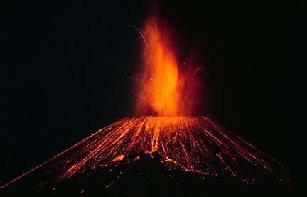
36 Vulnerability varies with the hazards and is a f(x) of intensity Fig.1.8 GAR Atlas 2017, adapted from Cardona et al


37 Exposed elements 37

38 Hazard scenarios 38

39 39

40 Losses scenarios 40
41 Economic risk From these scenarios we can derive two figures: The Maximum probable loss (PML) The Annual Average loss (AAL) 41


42 GAR 2015, studied ash falls 42


43 43
44 References De Bono, A., Mora, M.G. (2014) A global exposure model for disaster risk assessment, Int. Jour. Disaster Risk Reduction, 10, Kundzewicz Z., Kanae S., Seneviratne S., Handmer J., Nicholls N., Peduzzi P., Mechler R., Bouwer L., Arnell N., Mach K., Muir-Wood R., Zhang X., Honda Y., Luo Y., Benito G., Takahashi K., Sherstyukov B., Brakenridge G.R., Kron W. (2014) Flood risk and climate change global and regional perspectives, Hydrological Sciences Journal, 59(1), Peduzzi, P., Chatenoux, B., Dao, H., De Bono, A., Herold, C., Kossin, J., Mouton, F., Nordbeck, O. (2012) Global Trends Tropical Cyclones Risk, Nature Climate Change, 2(4), Løvholt, F., Glimsdal, S., Harbitz, C.B., Nadim, F., Zamora, N., Peduzzi, P., Dao, H., Smebye, H. (2012) Tsunami hazard and exposure on the global scale, Earth Science Reviews, 110 (1-4), Giuliani, G. and Peduzzi, P. (2011) The PREVIEW Global Risk Data Platform: a geoportal to serve and share global data on risk to natural hazards, Nat. Hazards Earth Syst. Sci., 11, Peduzzi, P. (2010) Landslides and vegetation cover in the 2005 North Pakistan earthquake: a GIS and statistical quantitative approach, Nat. Hazards Earth Syst. Sci., 10, Peduzzi, P., Dao, H., Herold, C., Mouton, F. (2009) Assessing global exposure and vulnerability towards natural hazards: the Disaster Risk Index, Nat. Hazards Earth Syst. Sci., 9, Chatenoux, B., Peduzzi, P. (2007) Impacts from the 2004 Indian Ocean Tsunami: analysing the potential protecting role of environmental features, Natural Hazards, 40, Farrokh, N., Kjekstad, O., Peduzzi, P., Herold, C., Jaedicke, C. (2006) Global landslide and avalanche hazard and risk hotspots, Landslides, 3(2): Peduzzi, P., Dao. H., Herold, C. (2005) Mapping Disastrous Natural Hazards Using Global Datasets, Natural Hazards, 35(2),
45 45
46 Why volcanic eruptions were not included? Volcanic eruptions. The variability of volcanic hazards was too complex to be entered into a general model. Volcanic hazard ranges from lahars linked with precipitation level, seismicity, topography and soils characteristics, to tephra falls influenced by the prevailing wind direction and strength, and phreatomagmatic eruption. Despite this complexity, much data is available for volcanic hazard and each active volcano is well described. Data needed for a global assessment of volcanic risk probably exists. But a finer resolution for elevation is needed. It would be necessary to include data on the shape and relief of volcanoes, computing slopes and hazard from lahars. Remote sensing analysis for local assessment of danger and population distribution would also be required. Peduzzi, P., Herold, C., Dao, H. (2005) Mapping Disastrous Natural Hazards Using Global Datasets. In: Natural Hazards, vol. 35, n 2, p

47 47


48 48

49 Global multi-hazards AAL relative to capital stock
50 50

51 51
52 GAR 2019 and further There are three different links between environment and risk 1) The decline of ecosystems is leading to further risk 2) The industrialization is leading to increase risk of Natech hazards. 3) New substances and pollution are adding new threats to health. e.g. Air pollution kills 6 million per year. New chemical substances are adding to new risk of cancer. 52
Global Atmospheric Circulation. Past climate change and natural causes. Global climate change and human activity
 GCSE Geography Edexcel B Revision Checklist Paper 1. Global Geographical Issues Topic 1. Hazardous Earth Key Idea I know/ understand The world s climate system Global Atmospheric Circulation Past climate
SUPPLEMENTARY INFORMATION
 SUPPLEMENTARY INFORMATION DOI: 10.1038/NCLIMATE1410 Global trends in tropical cyclone risk P. Peduzzi* 1,2, B. Chatenoux 1,3, H. Dao 4,5, A. De Bono 1,3, C. Herold 1,3, J. Kossin 6, F. Mouton 7, O. Nordbeck
Testing the GAR risk methodology at the national level : the case of earthquakes in Indonesia
 - A Technical report for the 2011 Global Assessment Report on Disaster Risk Reduction - Testing the GAR risk methodology at the national level : the case of earthquakes in Indonesia Christian Herold &
Initiative. Country Risk Profile: papua new guinea. Better Risk Information for Smarter Investments PAPUA NEW GUINEA.
 Pacific Catastrophe Risk Assessment And Financing Initiative PAPUA NEW GUINEA September 211 Country Risk Profile: papua new is expected to incur, on average, 85 million USD per year in losses due to earthquakes
2018 REVIEW OF DISASTER EVENTS
 2018 REVIEW OF DISASTER EVENTS Supplementary Information* BRUSSELS, 24 January, 2019 In 2018, there were 281 climate-related and geophysical events recorded in the EM-DAT (International Disaster Database)
Pacific Catastrophe Risk Assessment And Financing Initiative
 Pacific Catastrophe Risk Assessment And Financing Initiative TUVALU is expected to incur, on average,. million USD per year in losses due to earthquakes and tropical cyclones. In the next 5 years, has
Tectonic Processes and Hazards Enquiry Question 1: Why are some locations more at risk from tectonic hazards?
 Tectonic Processes and Hazards Enquiry Question 1: Why are some locations more at risk from tectonic hazards? Key words Basalt Andesite Rhyolite Benioff Zone Subduction zone Crustal fracturing Definition
Pacific Catastrophe Risk Assessment And Financing Initiative
 Pacific Catastrophe Risk Assessment And Financing Initiative PALAU September is expected to incur, on average,.7 million USD per year in losses due to earthquakes and tropical cyclones. In the next 5 years,
Pacific Catastrophe Risk Assessment And Financing Initiative
 Pacific Catastrophe Risk Assessment And Financing Initiative TIMOR-LESTE September Timor-Leste is expected to incur, on average, 5.9 million USD per year in losses due to earthquakes and tropical cyclones.
José Luis Palma, William Rose and Rüdiger Escobar Wolf Department of Geological Engineering and Sciences Michigan Technological University
 Assessing the Volcanic Threat of Central American Volcanoes José Luis Palma, William Rose and Rüdiger Escobar Wolf Department of Geological Engineering and Sciences Michigan Technological University Outline
Assessing Hazards and Risk
 Page 1 of 6 EENS 204 Tulane University Natural Disasters Prof. Stephen A. Nelson Assessing Hazards and Risk This page last updated on 07-Jan-2004 As discussed before, natural disasters are produced by
Natural Disasters in Member Countries (2002 Summary)
") 4.2 Member Countries and their Disaster Characteristics: Table 5: Natural Disasters in Member Countries (2002 Summary) (Country/Disaster Type/Disaster Characteristics) Data Country DisType Count of TotAff
4.2 Member Countries and their Disaster Characteristics: Table 5: Natural Disasters in Member Countries (2002 Summary) (Country/Disaster Type/Disaster Characteristics) Data Country DisType Count of TotAff
Pacific Catastrophe Risk Assessment And Financing Initiative
 Pacific Catastrophe Risk Assessment And Financing Initiative VANUATU September 211 Country Risk Profile: VANUATU is expected to incur, on average, 48 million USD per year in losses due to earthquakes and
Enquiry question: How does the world s climate system function, why does it change and how can this be hazardous for people?
 Content Topic 1: Hazardous Earth Enquiry question: How does the world s climate system function, why does it change and how can this be hazardous for people? 1.1 The atmosphere operates as a global system
Global Risk And Vulnerability Index Trends per Year (GRAVITY)
") Global Risk And Vulnerability Index Trends per Year (GRAVITY) Phase II: Development, analysis and results From The GRAVITY-Team United Nations Environment Programme Global Resource Information Database
Global Risk And Vulnerability Index Trends per Year (GRAVITY) Phase II: Development, analysis and results From The GRAVITY-Team United Nations Environment Programme Global Resource Information Database
Disaster Risk Assessment: Opportunities for GIS and data management with Open DRI
 Disaster Risk Assessment: Opportunities for GIS and data management with Open DRI Jacob Opadeyi Department of Geomatics Engineering and Land Management, The University of the West Indies, St. Augustine,
Assessing global exposure and vulnerability towards natural hazards: the Disaster Risk Index
 Nat. Hazards Earth Syst. Sci., 9, 1149 1159, 2009 Author(s) 2009. This work is distributed under the Creative Commons Attribution 3.0 License. Natural Hazards and Earth System Sciences Assessing global
Natural Disasters & Assessing Hazards and Risk. Natural Hazards and Natural Disasters
 Page 1 of 9 EENS 3050 Tulane University Natural Disasters Prof. Stephen A. Nelson Natural Disasters & Assessing Hazards and Risk This page last updated on 09-Jan-2018 Natural Hazards and Natural Disasters
World Geography. WG.1.1 Explain Earth s grid system and be able to locate places using degrees of latitude and longitude.
 Standard 1: The World in Spatial Terms Students will use maps, globes, atlases, and grid-referenced technologies, such as remote sensing, Geographic Information Systems (GIS), and Global Positioning Systems
They include earthquakes, volcanic eruptions, floods, landslides, and other processes and occurrences. They are included in the broader concept of.
 They include earthquakes, volcanic eruptions, floods, landslides, and other processes and occurrences. They are included in the broader concept of. In general, natural processes are labeled hazardous only
Global Risk And Vulnerability Index Trends per Year (GRAVITY)
") Global Risk And Vulnerability Index Trends per Year (GRAVITY) Phase IV: Annex to WVR and Multi Risk Integration A technical report for: United Nations Development Programme Bureau of Crisis Prevention
Global Risk And Vulnerability Index Trends per Year (GRAVITY) Phase IV: Annex to WVR and Multi Risk Integration A technical report for: United Nations Development Programme Bureau of Crisis Prevention
ESPON public database
 ESPON public database - tables and indicators overview - NUTS-Reference: NUTS 0 reference NUTS 1 reference NUTS 2 reference NUTS 3 reference ESPON basic indicators: Area NUTS 2 Area in square kilometer
National Disaster Management Centre (NDMC) Republic of Maldives. Location
 Republic of Maldives. Location") National Disaster Management Centre (NDMC) Republic of Maldives Location Country Profile 1,190 islands. 198 Inhabited Islands. Total land area 300 sq km Islands range b/w 0.2 5 sq km Population approx.
National Disaster Management Centre (NDMC) Republic of Maldives Location Country Profile 1,190 islands. 198 Inhabited Islands. Total land area 300 sq km Islands range b/w 0.2 5 sq km Population approx.
INDIANA ACADEMIC STANDARDS FOR SOCIAL STUDIES, WORLD GEOGRAPHY. PAGE(S) WHERE TAUGHT (If submission is not a book, cite appropriate location(s))
 WHERE TAUGHT (If submission is not a book, cite appropriate location(s))") Prentice Hall: The Cultural Landscape, An Introduction to Human Geography 2002 Indiana Academic Standards for Social Studies, World Geography (Grades 9-12) STANDARD 1: THE WORLD IN SPATIAL TERMS Students
Prentice Hall: The Cultural Landscape, An Introduction to Human Geography 2002 Indiana Academic Standards for Social Studies, World Geography (Grades 9-12) STANDARD 1: THE WORLD IN SPATIAL TERMS Students
Lesson 8. Natural Disasters
 Lesson 8 Natural Disasters 1 Reading is NOT a spectator sport! 2 Reading requires active participation! 3 PREDICT Try to figure out what information will come next and how the selection might end. 4 Natural
World Meteorological Organization
 World Meteorological Organization Opportunities and Challenges for Development of Weather-based Insurance and Derivatives Markets in Developing Countries By Maryam Golnaraghi, Ph.D. Head of WMO Disaster
MULTI-HAZARD RISK ASSESSMENT AND DECISION MAKING
 MULTI-HAZARD RISK ASSESSMENT AND DECISION MAKING JULINDA KEÇI Epoka University Logo of the institution CONTENT: Introduction Multi Hazard Risks Multi-Hazard Risk Assessment Quantitative Assessment Event
Physical Geography: Patterns, Processes, and Interactions, Grade 11, University/College Expectations
 Geographic Foundations: Space and Systems SSV.01 explain major theories of the origin and internal structure of the earth; Page 1 SSV.02 demonstrate an understanding of the principal features of the earth
The Science and Policy of Natural Hazards
 Image courtesy of USGS. 12.103 Image courtesy of NOAA. The Science and Policy of Natural Hazards Image courtesy of USGS. Image courtesy of NOAA. Topics Four categories of hazards will be investigated in
Capacity Building in Applications of Remote Sensing and GIS for Disaster Management
 Capacity Building in Applications of Remote Sensing and GIS for Disaster Management M.K. Hazarika, L. Samarakoon, N. Senevirathne, J.S.M. Fowze and R. de Silva Project Researcher GeoInformatics Center
Identifying Global Natural Disaster Hotspots
 Identifying Global Natural Disaster Hotspots Gregory Yetman and Robert S. Chen Center for International Earth Science Information Network (CIESIN), Columbia University Abstract The World Bank and Columbia
Jeopardy. Final Jeopardy $100 $100 $100 $100 $100 $200 $200 $200 $200 $200 $300 $300 $300 $300 $400 $400 $400 $500 $500 $500 $500 $500
 Jeopardy Earthquakes Volcanoes Tsunamis Wildfires Landslides/ Droughts $100 $100 $100 $100 $100 $200 $200 $200 $200 $200 $300 $300 $300 $300 $300 $400 $400 $400 $400 $400 $500 $500 $500 $500 $500 Final
Assessing the Volcanic Threat in Latin America. Jose L. Palma, University at Buffalo Bill Rose, Michigan Technological University
 Assessing the Volcanic Threat in Latin America Jose L. Palma, University at Buffalo Bill Rose, Michigan Technological University PASI Workshop, January 2011 Natural Disasters by Type, 1991-2005 90% 7%
Session III: Geohazards - Minimizing Risk, Maximizing Awareness. Grand Challenges on Natural and Human-induced Hazards and Disasters
 Session III: Geohazards - Minimizing Risk, Maximizing Awareness Grand Challenges on Natural and Human-induced Hazards and Disasters Sospeter Muhongo s.muhongo@icsu-africa.org www.icsu-africa.org IYPE-Global
Use of Geospatial data for disaster managements
 Use of Geospatial data for disaster managements Source: http://alertsystemsgroup.com Instructor : Professor Dr. Yuji Murayama Teaching Assistant : Manjula Ranagalage What is GIS? A powerful set of tools
Crowdsourcing approach for large scale mapping of built-up land
 Crowdsourcing approach for large scale mapping of built-up land Kavinda Gunasekara Kavinda@ait.asia Geoinformatics Center Asian Institute of Technology, Thailand. Regional expert workshop on land accounting
This table connects the content provided by Education Perfect to the NSW Syllabus.
 Education Perfect Geography provides teachers with a wide range of quality, engaging and innovative content to drive positive student learning outcomes. Designed by teachers and written by our in-house
The UN-GGIM: Europe core data initiative to encourage Geographic information supporting Sustainable Development Goals Dominique Laurent, France
 INSPIRE conference Strasbourg 6 September 2017 The UN-GGIM: Europe core data initiative to encourage Geographic information supporting Sustainable Development Goals Dominique Laurent, France Introduction
Indicators of sustainable development: framework and methodologies CSD Indicators of sustainable development 1996
 Indicators of sustainable development: framework and methodologies CSD Indicators of sustainable development 1996 Keywords: mountain areas, mountain development, natural resources management, sustainable
Annex 1 GAR GLOBAL RISK ASSESSMENT: DATA, METHODOLOGY, SOURCES AND USAGE
 Annex 1 GAR GLOBAL RISK ASSESSMENT: DATA, METHODOLOGY, SOURCES AND USAGE Contents Contents... 2 Introduction... 3 From GAR09 to GAR15 risk modelling: rationale for the probabilistic approach to risk assessment...
Cambridge International Examinations Cambridge International General Certificate of Secondary Education
 Cambridge International Examinations Cambridge International General Certificate of Secondary Education *4298138811* ENVIRONMENTAL MANAGEMENT 0680/23 Paper 2 October/November 2014 1 hour 45 minutes Candidates
12/05/2016. The First step in Adaptation to future climate change Reduce Vulnerability and Exposure to present Climate Variability (IPCC 2014)
") Integrating CCA, DRR and L+D to Address Emerging Challenges due to Slow Onset Processes Joy Jacqueline Pereira (Project Leader), SEADPRI-Universiti Kebangsaan Malaysia, Nguyen Van Thang (Collaborator),
Integrating CCA, DRR and L+D to Address Emerging Challenges due to Slow Onset Processes Joy Jacqueline Pereira (Project Leader), SEADPRI-Universiti Kebangsaan Malaysia, Nguyen Van Thang (Collaborator),
GIS methodologies for local tsunami risk assessment: examples
 GIS methodologies for local tsunami risk assessment: examples R. Frauenfelder 1,2, C.B. Harbitz 1,2, Sverdrup-Thygeson 1,2, G. Kaiser 2,4, R. Swarny 3, L. Gruenburg 3, S. Glimsdal 1,2, F. Løvholt 1,2,
Abdolreza Ansari Amoli. Remote Sensing Department Iranian Space Agency
 Risk Assessment and Mapping Using Earth Observation Data In Iran Abdolreza Ansari Amoli Remote Sensing & GIS Expert Remote Sensing Department Iranian Space Agency Different Types of Disasters in Iran Epidemic
Poverty and Hazard Linkages
 Poverty and Hazard Linkages Global Risk Identification Programme Proposal Development Coordination Meeting Friday, 19 May 2006 CIESIN Earth Institute Columbia University www.ciesin.columbia.edu Data Improvements
Natural Disasters in 2002: An Analytical Overview
 Natural Disasters in 2002: An Analytical Overview Chapter 1: Impact of Natural Disasters This Chapter deals with the overall trend and impact of Natural Disasters in the year 2002. It also addresses regional
Disaster Management & Recovery Framework: The Surveyors Response
 Disaster Management & Recovery Framework: The Surveyors Response Greg Scott Inter-Regional Advisor Global Geospatial Information Management United Nations Statistics Division Department of Economic and
Sabrina Wannewitz, Michael Hagenlocher and Matthias Garschagen
 Development and Validation of a Sub-national Multi-hazard Risk Index for the Philippines GI_Forum 2016, Vol.1 Page: 133-140 Short Paper Corresponding Author: hagenlocher@unu.ehs.edu DOI: 10.1553/giscience2016_01_s133
LECTURE #11: Volcanoes: Monitoring & Mitigation
 GEOL 0820 Ramsey Natural Disasters Spring, 2018 LECTURE #11: Volcanoes: Monitoring & Mitigation Date: 15 February 2018 I. What is volcanic monitoring? the continuous collection of one or more data sources
Impact of Cyclone Nargis
 Lessons Learnt from Nargis Recovery for the Next Disaster International Recovery Forum (2011) 12, JAN 2011, Kobe, Japan Home for over 100 national races. Profile of Myanmar The 2 nd largest country in
Climate Security Vulnerability in Africa. Joshua W. Busby Assistant Professor, LBJ School of Public Affairs University of Texas - Austin
 Climate Security Vulnerability in Africa Joshua W. Busby Assistant Professor, LBJ School of Public Affairs University of Texas - Austin 1 AGENDA Brief overview of our project Discussion of our vulnerability
Coping With Disaster: The Impact of Hurricanes on International Financial Flows,
 Coping With Disaster: The Impact of Hurricanes on International Financial Flows, 1970-2001 Dean Yang Gerald R. Ford School of Public Policy University of Michigan 1 Motivation Disasters cause huge human
WMO Statement on the State of the Global Climate Preliminary conclusions for 2018 and WMO Greenhouse Bulletin
 WMO Statement on the State of the Global Climate Preliminary conclusions for 2018 and WMO Greenhouse Bulletin Dr Elena Manaenkova Deputy Secretary General World Meteorological Organisation Statement on
PROF. DR HAB. PIOTR TRYJANOWSKI
 IMPACT OF EXTREME WEATHER EVENTS ON LOCAL COMMUNITIES AND POSSIBLE RESPONSE FROM THE LOCAL LEVEL PROF. DR HAB. PIOTR TRYJANOWSKI FACULTY OF VETERINARY MEDICINE AND ANIMAL SCIENCES Changes in natural
Virtual Design Center Deliverable 4-2: Three Levels of Assessment
 Virtual Design Center Deliverable 4-2: Three Levels of Assessment Project Name Operation Montserrat Test Questions 1. Which of these is an immediate result of the movement of tectonic plates: a) Ocean
Australia Government Geospatial Capacity Building Efforts in Asia and the Pacific. Dr John Dawson
 Australia Government Geospatial Capacity Building Efforts in Asia and the Pacific Dr John Dawson Presentation Overview About Geoscience Australia Examples of Geospatial Capacity Building Activity Geodesy
Earthquake Hazards. Tsunami
 Earthquake Hazards Tsunami Measuring Earthquakes Two measurements that describe the power or strength of an earthquake are: Intensity a measure of the degree of earthquake shaking at a given locale based
Geography General Course Year 12. Selected Unit 3 syllabus content for the. Externally set task 2019
 Geography General Course Year 12 Selected Unit 3 syllabus content for the Externally set task 2019 This document is an extract from the Geography General Course Year 12 syllabus, featuring all of the content
GLY July Ms. Nelda Breedt. Plates move slowly and eventually.
 GLY 162 Tectonic Processes: Volcanism Ms. Nelda Breedt GLY 162 Environmental Geology Plate Tectonics Plates move slowly and eventually. 2 Spread apart (divergent plates) Dive beneath one another (converging
9768 GEOGRAPHY. Mark schemes should be read in conjunction with the question paper and the Principal Examiner Report for Teachers.
 CAMBRIDGE INTERNATIONAL EXAMINATIONS Cambridge Pre-U Certificate MARK SCHEME for the May/June 2015 series 9768 GEOGRAPHY 9768/01 Paper 1 (Geographical Issues), maximum raw mark 105 This mark scheme is
Overview of the Exam and Syllabus
 Overview of the Exam and Syllabus Paper 01 consists of 60 multiple-choice items drawn from all areas of the syllabus. The time given to do this paper is one and a half hours. It is marked out of 60 and
Vulnerability of Bangladesh to Cyclones in a Changing Climate
 Vulnerability of Bangladesh to Cyclones in a Changing Climate Susmita Dasgupta Kiran Pandey Mainul Huq Zahirul Huq Khan M.M. Zahid Ahmed Nandan Mukherjee Malik Fida Khan 2010 Bangladesh: Tropical Cyclone
Erupted and killed approximately 15,000 people 200 years ago
 1 2 3 4 5 6 7 8 Introduction to Environmental Geology, 5e Chapter 8 Volcanic Activity Volcanoes: summary in haiku form A volcano forms. Magma comes to the surface - explodes, if felsic. Case History: Mt.
Assessment Objectives Grid for Geography - G1. Summer Application Skills Total. (a) (b) (c) (a)
 (b) (c) (a)") Assessment Objectives Grid for Geography - G1 Summer 2014 Question 1 Knowledge and Understanding Application Skills Total Key Question (a) 0 2 3 5 1.5 (b) 8 2 10 1.3 (c) 7 3 10 1.4 15 7 3 25 Question 2
Assessment Objectives Grid for Geography - G1 Summer 2014 Question 1 Knowledge and Understanding Application Skills Total Key Question (a) 0 2 3 5 1.5 (b) 8 2 10 1.3 (c) 7 3 10 1.4 15 7 3 25 Question 2
A Data Fusion Approach to Real-time Monitoring Systems and Information Management
 Landslide Preparedness in the ASEAN Member States A Data Fusion Approach to Real-time Monitoring Systems and Information Management Jessada Karnjana, PhD National Electronics and Computer Technology Center
RiskCity Training package on the Application of GIS for multi- hazard risk assessment in an urban environment.
 RiskCity Training package on the Application of GIS for multi- hazard risk assessment in an urban environment. Cees van Westen (Westen@itc.nl) & Nanette C. Kingma (Kingma@itc.nl) ITC: Training & Research
Disaster Risk Management in India. Kamal Kishore New Delhi, 27 October 2016
 Disaster Risk Management in India Kamal Kishore New Delhi, 27 October 2016 Hazard, Exposure and Vulnerability Disaster Prevention Mitigation Hurricane Matthew: Cuba & Haiti Emergency Response Coordination
Global Map: A Tool for Disaster Mitigation for the Asia and Pacific Region
 Global Map: A Tool for Disaster Mitigation for the Asia and Pacific Region D. R. Fraser Taylor Chair, International Steering Committee for Global Mapping (ISCGM) fraser_taylor@carleton.ca www. 18 th United
Extreme Weather Events: Infrastructure Damage and Impact on Vulnerable Populations
 Extreme Weather Events: Infrastructure Damage and Impact on Vulnerable Populations Cindy L. Parker MD, MPH Physicians for Social Responsibility Johns Hopkins Bloomberg School of Public Health 1 Climate
Natural hazards risk factors a card sort
 Student tasks 1. Cut up the cards below. 2. Read all of the risk factors and explanations carefully. Match each risk factor to its correct explanation. 3. Identify and explain which risk factor you feel
RISK OF PRINCIPAL DISASTERS IN INDIA AND IMPACTS OF DISASTERS ON ECONOMIC DEVELOPMENT
 RISK OF PRINCIPAL DISASTERS IN INDIA AND IMPACTS OF DISASTERS ON ECONOMIC DEVELOPMENT At the Himachal Pradesh Institute of Public Administration Shimla 05. 05.2012 Improve Disaster Management with the
Workshop on Drought and Extreme Temperatures: Preparedness and Management for Sustainable Agriculture, Forestry and Fishery
 Workshop on Drought and Extreme Temperatures: Preparedness and Management for Sustainable Agriculture, Forestry and Fishery 16-17 Feb.2009, Beijing, China Modeling Apple Tree Bud burst time and frost risk
OCR 2008 AS and A level Geography Specification Mapping Guide
 OCR 2008 AS and A level Geography Specification Mapping Guide Contents Introduction Error! Bookmark not defined. Specification map: 2008 OCR AS and A level Geography 3 What's new? 10 Introduction This
Julie Fero NRS 509. Mapping Volcanic Risk with GIS
 Julie Fero NRS 509 Mapping Volcanic Risk with GIS Introduction Volcanoes are present throughout the world, generally occurring along plate margins, making the entire world prone to volcanic influence,
Social Science Data for High Latitudes
 LCLUC Science Team Meeting High Latitudes in the Context of the International Polar Year Social Science Data for High Latitudes 2 May 2008 Dr. Robert S. Chen Director and Senior Research Scientist, CIESIN
What is the deal with climate change?
 Contents Climate change, vulnerability and adapta5on Hazards and challenges for SIDS Why work at the city level? Exis5ng assessment tools Aim and objec5ves Methodology Case studies Construc5ng the CCUVI
Smart use of Geographic Information System (GIS) platform for delivering weather information and nowcasting services
 platform for delivering weather information and nowcasting services") Smart use of Geographic Information System (GIS) platform for delivering weather information and nowcasting services C. K. Pan Hong Kong Observatory Hong Kong, China It is a world of beauty Source: Image
Smart use of Geographic Information System (GIS) platform for delivering weather information and nowcasting services C. K. Pan Hong Kong Observatory Hong Kong, China It is a world of beauty Source: Image
GIS in Locating and Explaining Conflict Hotspots in Nepal
 GIS in Locating and Explaining Conflict Hotspots in Nepal Lila Kumar Khatiwada Notre Dame Initiative for Global Development 1 Outline Brief background Use of GIS in conflict study Data source Findings
1. Impacts of Natural Disasters by Region, 2008
 1. Impacts of Natural Disasters by Region, 2008 Among all regions across the world in 2008, Asia not only ranks first but also dominates in all natural disaster s impact categories occurrence, killed,
World Geography Fall 2013 Semester Review Project
 Reporting Category RC 1: History, Government and Citizenship Standard WG.1 History. The student understands how geography and processes of spatial exchange (diffusion) influenced events in the past and
Semester: Two. Study Hours: 28 contact/80 independent BSU Credits: 10 ECTS: 5
 BATH SPA UNIVERSITY Erasmus, exchange & study abroad module catalogue Geography: semester 2 Modules at Bath Spa University are usually worth either 10, 20 or 40 credits. If you are using the European Credit
World Geography TEKS 2nd Nine Weeks. Unit of Study Regional Studies; U.S. and Canada Regional Studies; Latin America; and Europe
 World Geography TEKS 2nd Nine Weeks Unit of Study Regional Studies; U.S. and Canada Regional Studies; Latin America; and Europe 1) History. The student understands how geography and processes of spatial
Earthquake Hazards. Tsunami
 Earthquake Hazards Tsunami Review: What is an earthquake? Earthquake is the vibration (shaking) and/or displacement of the ground produced by the sudden release of energy. The point inside the Earth where
Country Report Nepal Geospatial Data Sharing Initiatives of Survey Department Supporting Disaster Management
 Third JPTM Step 2 for Sentinel Asia 6-8 July, 2010 Manila, The Philippines Country Report Nepal Geospatial Data Sharing Initiatives of Survey Department Supporting Disaster Management Durgendra M Kayastha
Cambridge International Examinations Cambridge International General Certificate of Secondary Education
 Cambridge International Examinations Cambridge International General Certificate of Secondary Education *7731101867* ENVIRONMENTAL MANAGEMENT 0680/21 Paper 2 October/November 2014 1 hour 45 minutes Candidates
Geospatial application in Kiribati
 Geospatial application in Kiribati ICC-21 ST RESAP (9 TH TO 13 TH OCTOBER, 2017) BANGKOK, THAILAND Outline Kiribati Profile Natural disasters in Kiribati Achievements Challenges/Issues Ways forward 1 Kiribati
Climate change and natural hazards
 WMO World Meteorological Organization Working together in weather, climate and water Climate change and natural hazards Universal Postal Union COUNCIL OF ADMINISTRATION/POSTAL OPERATIONS COUNCIL Bern,
MODELLING FROST RISK IN APPLE TREE, IRAN. Mohammad Rahimi
 WMO Regional Seminar on strategic Capacity Development of National Meteorological and Hydrological Services in RA II (Opportunity and Challenges in 21th century) Tashkent, Uzbekistan, 3-4 December 2008
Year 4 Geography Revision Pack Summer 2018 Name
 Year 4 Geography Revision Pack Summer 2018 Name Welcome to your geography revision pack for the upcoming Summer exams. Everything that we have been working on in lessons since Christmas will be covered
ENHANCING COMMITMENTS TO DISASTER PREPAREDNESS AND RESILIENCE OF PEOPLE WITH DISABILITIES
 ENHANCING COMMITMENTS TO DISASTER PREPAREDNESS AND RESILIENCE OF PEOPLE WITH DISABILITIES Global Risk Forum GRF Davos www.grforum.org Global Risk Forum GRF Davos Disasters Conflicts Natural Hazards Anthropogenic
Fukien Secondary School Monthly Vocabulary/Expression List for EMI Subjects Secondary Two. Subject: Geography
 Focus: General Specific : Section Two : Unit One 1 Landslide 2 Downslope movement 3 Rock 4 Soil 5 Gravity 6 Natural hazard 7 Rainwater 8 Friction 9 Hilly relief 10 Unstable 11 Season 12 Saturated 13 Construction
Towards a fully integrated urban weather environment climate service in Mexico City
 Towards a fully integrated urban weather environment climate service in Mexico City Mexico City Ministry of Environment SEDEMA Tanya Müller (Secretary of Environment), Beatriz Cárdenas (SEDEMA), Luisa
Geospatial Technologies for Resources Planning & Management
 Geospatial Technologies for Resources Planning & Management Lal Samarakoon, PhD Director, Geoinformatics Center Asian Institute of Technology, Thailand Content Geoinformatics for SDG Information Integration
CURRENT AND FUTURE TROPICAL CYCLONE RISK IN THE SOUTH PACIFIC
 CURRENT AND FUTURE TROPICAL CYCLONE RISK IN THE SOUTH PACIFIC SOUTH PACIFIC JUNE 2013 The South Pacific region is prone to significant tropical cyclone risk. This project compared both current and future
5.2. IDENTIFICATION OF NATURAL HAZARDS OF CONCERN
 5.2. IDENTIFICATION OF NATURAL HAZARDS OF CONCERN To provide a strong foundation for mitigation strategies considered in Sections 6 and 9, County considered a full range of natural hazards that could impact
Crisis Management and Natural Disasters Overview of JRC operational or pre-operational activities A. Annunziato, D. Al-Khudhairy
 Papagayo, Costarica 3-4 November 2009 Security Science and The Americas 1 Joint Research Centre (JRC) Crisis Management and Natural Disasters Overview of JRC operational or pre-operational activities A.
Land Accounts - The Canadian Experience
 Land Accounts - The Canadian Experience Development of a Geospatial database to measure the effect of human activity on the environment Who is doing Land Accounts Statistics Canada (national) Component
Syllabus Post Graduate Diploma in Disaster Management (PGDDM)
") Syllabus Post Graduate Diploma in Disaster Management (PGDDM) Programme Objective: The Programme has been framed with an intention to provide a general concept in the dimensions of disasters caused by
Syllabus Post Graduate Diploma in Disaster Management (PGDDM) Programme Objective: The Programme has been framed with an intention to provide a general concept in the dimensions of disasters caused by
GEO Geohazards Community of Practice
 GEO Geohazards Community of Practice 1) Co-Chair of GHCP With input from: Stuart Marsh, GHCP Co-Chair Francesco Gaetani, GEO Secretariat and many GHCP contributors 1) Nevada Bureau of Mines and Geology
THE INTEGRATED INFORMATION SYSTEM FOR NATURAL
 THE INTEGRATED INFORMATION SYSTEM FOR NATURAL DISASTER MITIGATION Junxiu Wu 1, Qiang Feng 2*, Bijun Liang 3, and Angsheng Wang 4 1 Department of Computer System, Technological Bureau of Xinhua News Agency,