RALFIE: Reduce Potential Radiation Exposure by OGC-based Sensor Information Platforms
|
|
|
- Diane Harrell
- 5 years ago
- Views:
Transcription


 Informa=on Technology")

,")
1 Sponsored by RALFIE: Reduce Potential Radiation Exposure by OGC-based Sensor Information Platforms Kyoung- Sook Kim, Hirotaka Ogawa, Isao Kojima Informa=on Technology Research Ins=tute (ITRI) Na=onal Ins=tute of Advanced Industrial Science and Technology (AIST), JAPAN Copyright 2015 Open Geospatial Consortium


 6")

2 AIST Na#onal Ins#tute of Advanced Industrial Science and Technology, JAPAN Mainly funded by METI (Ministry of Economy, Trade and Industry) 2200 Researchers + Suppor#ng Staffs Industrial Research Bridge between basic research and product development Cross- Domain R&D(Ex. Informa#on technology with Geoscience) 6 Major Research Area ITRI Copyright 2015 Open Geospatial Consortium OGC TC Meetings@Barcelona, Spain 2


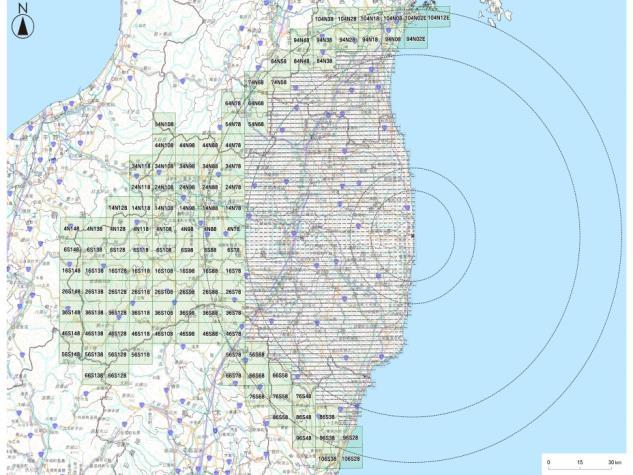


3 Fukushima Radiation Monitoring Database Project Na#onal Project to con#nuously Monitor/Construct/Publish Radia#on Monitoring Database of Fukushima Area Radia#on Monitoring Project Structure as of 2013 Project Management JAEA 2 Teams Database Publishing Database Construc#on Nuclear Regula#on Authority(NRA), JAPAN Japan Atomic Energy Agency(JAEA) AIST 2 Teams Hokkaido University 2 Teams Understand what happened at the accident in the past Help the decision making for the future Japan Map Center (Company) 1 Team Partners Okayama- U, The Ins#tute of Sta#s#cal Mathema#cs,, OGC Copyright 2015 Open Geospatial Consortium OGC TC Meetings@Barcelona, Spain 3

 Japanese characters for the a`ribute name Sensor/Database that JAEA produced => Legacy style data like CSVs. 1.")
4 AIST s Role in the Project Provide Ease- of Use Modern Sensor Data Service Framework based on the Interna=onal Standards. Real- Time Monitoring Posts/Sensors 4000 radia=on monitoring points in Fukushima- area Produce raw data in every 10 minutes for 3years Approx. 22million Records(as of 2013) Periodical Monitoring Result Database (Car, Helicopter, Soils etc.) 239 CSV Files (data collected by 県 or 全国 ) Approx. 17million Records 31 CSV table types (for possible one schema) Japanese characters for the a`ribute name Sensor/Database that JAEA produced => Legacy style data like CSVs. 1. Convert/Wrap Legacy sensors and data(csvs and raw data) and provide them as standard Web Services 2. Construct a data federa=on framework based on 1. Framework Easy to access/interoperate Easy to re- use Easy to combine with other geospa=al data Various Radia#on Sensors Need to handle various sensors OGC(Open Geospa#al Consor#um) Web Services Copyright 2015 Open Geospatial Consortium OGC TC Meetings@Barcelona, Spain 4
 Interface to radia=on measurements Federate with other OWS servers Process Data: WPS")

 Sensors SOS Service O&M Client Monitoring Databases Copyright 2015 Open Geospatial")
5 OGC-based Sensor Information Platforms Access Data : SOS and W*S (Sensor Observa#on Service) (Web Feature/Coverage Service) Interface to radia=on measurements Federate with other OWS servers Process Data: WPS (Web Processing Service) Spa=al & Temporal Analy=cs Produce various format KMZ,AVI etc. Client GIF89a, SVG, Flash, AVI, KMZ WPS Service Calculate Various Spa=al & Temporal Opera=ons Database/Sensor Federa#on Publish Data: WMS (Web Map Service) WMS Time of maps KMZ Rich Client with Google Earth/Map OWS Services (WMS,WFS,WCS) Sensors SOS Service O&M Client Monitoring Databases Copyright 2015 Open Geospatial Consortium OGC TC Meetings@Barcelona, Spain 5


6 Use Case: Combination of our SOS with other WMS data source (Weather) Human exposure to natural background radia#on, 0.27uSv/h Jan 1, 2013 The dose rate was rela#vely high Jan 16, 2013 The dose rate was rela#vely low when there was heavy snow Snow effect Simple overlay can be useful Copyright 2015 Open Geospatial Consortium OGC TC Spain 6


7 RALFIE Framework: Overview Assist Fukushima residents to reduce poten#al health effects of radia#on exposure based on life padern mining! Personal Health Assistance No#fica#on! Radia#on Monitoring Data Administra#ve Decision- Making Mobile Users Experts Government Exposure Es#ma#on Moving Features + Sensor Data (Radioac#vity) OGC Moving Feature Encoding OGC SensorThings API OGC GeoSMS Moving Object Databases Spa#otemporal Informa#on Plaform Data Interconnec=on Open Data (Sta#s#cs, Meteorology, Geology, etc.) Hotspot Detec#on Copyright 2015 Open Geospa=al Consor=um OGC TC Meetings@Barcelona, Spain 7
8 Health Effects caused by Radiation Exposure Radiation level The average person: 2 to 3 millisievert per year 400 millisieverts per hour at reactor No. 3 on March 15, 2011 CT scan (more than 1 millisievert) Radiation sickness: A whole-body dose of 3 sieverts (3,000 times the recommended public dose limit per year) Radiation type gamma and x-ray radiation: pass directly through the body without interacting with the tissue alpha and beta radiation: lower energy, more dangerous In the Fukushima situation the radioactive isotopes detected, iodine 131 and cesium 137, emit both gamma and beta radiation. Exposure time High radiation level during a short time > Low level dosage accumulated over time Difficulty to estimate effects of long-term and low-dose radiation, such as cancer risk, mental health, etc.! Refer to Copyright 2015 Open Geospatial Consortium OGC TC Meetings@Barcelona, Spain 8


 Raw")

")


")
9 RALFIE Framework D- Shudle Reader Bluetooth LE Measurement log API Ralfie Archiver LifePadern Radia#onData (R+V+U+O+M) Raw Trajectory Data Volunteered Radia#on Data (#me series) Map Data (POI, Roads) Official Monitoring Data Ralfie MobileApp LifeLog Ralfie Analyzer User Profile Data Seman#c log Mobile user Loca#on log Courtesy Wataru Naito (AIST) Copyright 2015 Open Geospatial Consortium OGC TC Spain 9

 EMR(Electronic Medical Record), EHR(Electronic health")


10 Lifelog Data Personal lifelogging Timelines of chronological sequences of ac=vity objects Food and exercise records, event pictures, loca=ons, etc. cf) EMR(Electronic Medical Record), EHR(Electronic health record), and PHR(Personal Health Record) Wearable sensors, smartphones Sony SmartBand Open Interfaces and Data Formats Plaiorms and the data they expose can be controlled and delivered to the correct users at the correct =me for the correct usage through APIs Ex) Sony Lifelog API: REST- based web- service API Samsung Galaxy User profile: name, height, weight, etc. Ac=vi=es: steps, sleep, transporta=on, music listening, etc. Loca=ons: a history of where the user has been Jawbone ( OGC Copyright 2015 Open Geospatial Consortium OGC TC Meetings@Barcelona, Spain 10

 to interpret")


11 Summary Data Mobile users Don t want to share whole their lifelogs Privacy issues, extract relevant informa#on using sta#s#cal data Want someone(expert) to interpret their logs Want to compare with others or average cases 0.75 msv 2.75 msv Summary data user expert Report Copyright 2015 Open Geospatial Consortium OGC TC Meetings@Barcelona, Spain 11
12 Possible Candidates of Existing Standards to Interoperate Health Domain Health Level 7 (HL7) for exchanging health care data ( A data set to provide a snapshot in time containing a summary of the pertinent clinical, demographic, and administrative data Statistical Data and Metadata Exchange Health Domain (SDMX- HD) SDMX: Statistical Data and Metadata Exchange (ISO/TS 17369:2005) WHO implementation of SDMX (summary data) to share and exchange medical indicators and metadata between medical organizations Publishing Statistical Data as Linked Data The RDF Data Cube Vocabulary (W3C Recommendation) ( Aggregate data, Numeric, Time series, Multi-dimensional tables, cubes Copyright 2015 Open Geospatial Consortium OGC TC Meetings@Barcelona, Spain 12
13 Conclusions Fukushima Radiation Monitoring Database Project To provide ease-of use modern sensor data service framework based on OGC Standards OWS (WMS, WFS, WPS), SOS. RALFIE Framework To assist Fukushima residents to reduce potential health effects of radiation exposure based on life pattern mining New fashion of OGC Moving Feature, SensorThings API Current open issues of data formats and interfaces Lifelog data Summary data Vocabulary, dimension, Copyright 2015 Open Geospatial Consortium OGC TC Spain 13
SYNERGY OF SATELLITE REMOTE SENSING AND SENSOR NETWORKS ON GEO GRID
 SYNERGY OF SATELLITE REMOTE SENSING AND SENSOR NETWORKS ON GEO GRID National Institute of Advanced Industrial Science and Technology, Japan Yoshio Tanaka (on behalf of AIST GEO Grid team) Contents Brief
Using OGC standards to improve the common
 Using OGC standards to improve the common operational picture Abstract A "Common Operational Picture", or a, is a single identical display of relevant operational information shared by many users. The
sample What happens when we are exposed to radiation? 1.1 Natural radiation Cosmic radiation
 1.1 Natural radiation 3 1 What happens when we are exposed to radiation? 1.1 Natural radiation For as long as humans have walked the earth, we have continually been exposed to naturally-occurring radiation.
Toward an automatic real-time mapping system for radiation hazards
 Toward an automatic real-time mapping system for radiation hazards Paul H. Hiemstra 1, Edzer J. Pebesma 2, Chris J.W. Twenhöfel 3, Gerard B.M. Heuvelink 4 1 Faculty of Geosciences / University of Utrecht
Waves & Radiation exam questions
 National 5 Physics Waves & Radiation exam questions these questions have been collated from previous Standard Grade (Credit) and Intermediate 2 exams Thurso High School 1. A mountain climber carries a
Open standards for sustainable disaster risk reduction
 Open standards for sustainable disaster risk reduction Steven Ramage Head of Ordnance Survey International, Member of the OGC Global Advisory Council The number of natural disasters has increased over
The sources include Am-241 which emits alpha radiation, Sr-90 which emits beta radiation and Co-60 which emits gamma radiation.
 1 The physics department in a college has a number of radioactive sources which are used to demonstrate the properties of ionising radiations. The sources include Am-241 which emits alpha radiation, Sr-90
Detection in Muncie, Indiana, of the Fukushima Nuclear Reactor Releases Following the Japanese Earthquake"
 Detection in Muncie, Indiana, of the Fukushima Nuclear Reactor Releases Following the Japanese Earthquake" Juan Carlos Ramirez-Dorronsoro, Department of Natural Resources and Environmental Management,
Hosted by Esri Official Distributor
 Hosted by Esri Official Distributor Esri European User Conference October 15-17, 2012 Oslo, Norway Hosted by Esri Official Distributor Interoperability and Standards Support in ArcGIS 10.1 Roberto Lucchi
Overview. Everywhere. Over everything.
 Cadenza Desktop Cadenza Web Cadenza Mobile Cadenza Overview. Everywhere. Over everything. The ultimate GIS and reporting suite. Provide, analyze and report data efficiently. For desktop, web and mobile.
One platform for desktop, web and mobile
 One platform for desktop, web and mobile Search and filter Get access to all data thematically filter data in context factually and spatially as well as display it dynamically. Export a selection or send
ISO Series Standards in a Model Driven Architecture for Landmanagement. Jürgen Ebbinghaus, AED-SICAD
 ISO 19100 Series Standards in a Model Driven Architecture for Landmanagement Jürgen Ebbinghaus, AED-SICAD 29.10.2003 The Company 100% SIEMENS PTD SIEMENS Business Services Shareholder & Strategic Business
INSPIREd solutions for Air Quality problems Alexander Kotsev
 INSPIREd solutions for Air Quality problems Alexander Kotsev www.jrc.ec.europa.eu Serving society Stimulating innovation Supporting legislation The European data puzzle The European data puzzle 24 official
Overview of Geospatial Open Source Software which is Robust, Feature Rich and Standards Compliant
 Overview of Geospatial Open Source Software which is Robust, Feature Rich and Standards Compliant Cameron SHORTER, Australia Key words: Open Source Geospatial Foundation, OSGeo, Open Standards, Open Geospatial
Q1. The diagram represents an atom of lithium.
 Q1. The diagram represents an atom of lithium. Complete the diagram by writing in the spaces the name of each type of particle. Use only words given in the box. Each word may be used once or not at all.
Efficient Delivery of Forecasts to a Nau/cal Sports Mobile Applica/on with Seman/c Data Services
 From Knowledge Genera/on To Science-based Innova/on Efficient Delivery of Forecasts to a Nau/cal Sports Mobile Applica/on with Seman/c Data Services Authors: Ricardo Amorim (1), Artur Rocha (2), Marco
Delivering Met to the Military User
 Delivering Met to the Military User Andy Kirkman Met Office Defence Business Manager ECMWF MOS Workshop - November 2007 Crown copyright 2006 Page 1 Delivering Met to the Military User This Presentation
Section 3: Nuclear Radiation Today
 : Nuclear Radiation Today Preview Key Ideas Bellringer Where is Radiation? Beneficial Uses of Nuclear Radiation Risks of Nuclear Radiation Nuclear Power Key Ideas Where are we exposed to radiation? What
3-1 Data Standardiza5on
 ITS488 Geographic Informa5on System 3-1 Data Standardiza5on 2014 08 26 Teerayut Horanont, PhD Sirindhorn Interna5onal Ins5tute of Technology (SIIT) Thammasat University E: teerayut@siit.tu.ac.th Part of
Spatially Enabled Society
 International Seminar on Land Administration Trends and Issues in Asia and the Pacific Region Spatially Enabled Society Abbas Rajabifard Vice Chair PCGIAP-WG3 Vice-President (President Elect), GSDI Association
OGC Standards Update 29 November 2018 Orlando
 OGC Standards Update 29 November 2018 Orlando Mark Reichardt mreichardt@opengeospatial.org +1 301 840-1361 OGC S INTEREST It s simple You have this or this and you need to make this... or this Courtesy
[2]
![[2]](/thumbs/79/78842361.jpg "[2]") 1 Fossil fuel power stations generate electricity. Nuclear power stations also generate electricity. (a) Many people think that nuclear power stations are a greater risk to people than fossil fuel power
1 Fossil fuel power stations generate electricity. Nuclear power stations also generate electricity. (a) Many people think that nuclear power stations are a greater risk to people than fossil fuel power
European Fallout from Chernobyl
 European Fallout from Chernobyl Fukushima Reactors: before & after earthquake and tsunami Fukushima reactors 3 & 4 (picture released by Tokyo Electric Power Company) Fukushima Reactor 1 A view inside one
Spatial Data Infrastructure Concepts and Components. Douglas Nebert U.S. Federal Geographic Data Committee Secretariat
 Spatial Data Infrastructure Concepts and Components Douglas Nebert U.S. Federal Geographic Data Committee Secretariat August 2009 What is a Spatial Data Infrastructure (SDI)? The SDI provides a basis for
Radiation Awareness Training. Stephen Price Office of Research Safety
 Radiation Awareness Training Stephen Price Office of Research Safety Purpose This training is intended for Clemson University Faculty, Staff or Students who do not work directly with radioactive materials
CHEMISTRY 170. Radioisotopes
 CHEMISTRY 170 Radioisotopes Positron Emission Tomography or PET scans use the radioisotope 18 F to create an image of the brain. DEPARTMENT OF CHEMISTRY UNIVERSITY OF KANSAS Radioisotopes Introduction
Climate Resilience Decision Making Framework in the Caribbean. A case of Spatial Data Management
 Climate Resilience Decision Making Framework in the Caribbean A case of Spatial Data Management Bishwa Pandey Sr. Data Management Specialist The World Bank Background The mission of The World Bank s Latin
NOKIS - Information Infrastructure for the North and Baltic Sea
 NOKIS - Information Infrastructure for the North and Baltic Sea Carsten Heidmann 1 and Jörn Kohlus 2 Abstract 1. General The initial motivation for the project NOKIS (German title: Nord- und Ostsee-Küsteninformationssystem)
Atomic Nucleus and Radioac1vity
 Atomic Nucleus and Radioac1vity Chin- Sung Lin Atomic Nucleus and Radioac1vity X- Rays and Radioac1vity In 1895, a German physicist, W. C. Roentgen was working with a cathode ray tube in his lab and discovered
The Challenge of Geospatial Big Data Analysis
 288 POSTERS The Challenge of Geospatial Big Data Analysis Authors - Teerayut Horanont, University of Tokyo, Japan - Apichon Witayangkurn, University of Tokyo, Japan - Shibasaki Ryosuke, University of Tokyo,
Core Questions Physics unit 4 - Atomic Structure
 Core Questions Physics unit 4 - Atomic Structure No. Question Answer 1 What did scientists think about atoms before the discovery of the They were tiny spheres that could not be broken up electron? 2 Which
GIS GIS.
 GIS 388 Vol., No.3, Autumn 2009 99-4 GIS Iranian Remote Sensing & GIS 2 * (GIS). GIS.2 389/5/6 : 389/2/6 :........ : 8878622 : GIS ( ) : * Email: PouriaAmirian@gmail.com ... (AQI) 2.(Cheng et al., 2007)..
Climate Data for Non-experts: Standards-based Interoperability
 Climate Data for Non-experts: Standards-based Interoperability Ben Domenico Unidata Program Center University Corporation for Atmospheric Research April 2010 Working Together on A Mosaic for Atmospheric
The PREVIEW Global Risk Data Platform: a geoportal to serve and share global data on risk to natural hazards
 The PREVIEW Global Risk Data Platform: a geoportal to serve and share global data on risk to natural hazards Gregory Giuliani (UNEP/GRID-Geneva & University of Geneva/enviroSPACE ) http://www.grid.unep.ch
CHEMISTRY 130 General Chemistry I. Radioisotopes
 CHEMISTRY 130 General Chemistry I Radioisotopes Positron Emission Tomography or PET scans use the radioisotope 18 F to create an image of the brain. DEPARTMENT OF CHEMISTRY UNIVERSITY OF KANSAS Radioisotopes
OGC Environmental Data Standards for Monitoring and Mapping. Alistair Ritchie Research Data Architect/Engineer Informatics Team
 MANAAKI WH ENUA L ANDCARE RES EARCH OGC Environmental Data Standards for Monitoring and Mapping Alistair Ritchie Research Data Architect/Engineer Informatics Team April 18 MANAAKI WH ENUA L ANDCARE RES
College Physics B - PHY2054C
 College - PHY2054C Physics - Radioactivity 11/24/2014 My Office Hours: Tuesday 10:00 AM - Noon 206 Keen Building Review Question 1 Isotopes of an element A have the same number of protons and electrons,
Global Geospatial Information Management Country Report Finland. Submitted by Director General Jarmo Ratia, National Land Survey
 Global Geospatial Information Management Country Report Finland Submitted by Director General Jarmo Ratia, National Land Survey Global Geospatial Information Management Country Report Finland Background
WHAT IS IONIZING RADIATION
 WHAT IS IONIZING RADIATION Margarita Saraví National Atomic Energy Commission - Argentina Workshop on Ionizing Radiation SIM Buenos Aires 10 November 2011 What is ionizing radiation? What is ionizing radiation?
Geospatial Standards Support - An Overview. Marten Hogeweg & Satish Sankaran
 Geospatial Standards Support - An Overview Marten Hogeweg & Satish Sankaran Agenda Interoperability and Standards ArcGIS Open, Interoperable and Standards Compliant Esri Open initiatives Understanding
Building a 4-D Weather Data Cube for the NextGen Initial Operating Capability (IOC)
") Building a 4-D Weather Data Cube for the NextGen Initial Operating Capability (IOC) Friends/Partners in Aviation Weather Vision Forum July 15, 2008 Bruce Lambert - DoD Tom Ryan FAA Jason Tuell NWS 1 Overview
Building a 4-D Weather Data Cube for the NextGen Initial Operating Capability (IOC) Friends/Partners in Aviation Weather Vision Forum July 15, 2008 Bruce Lambert - DoD Tom Ryan FAA Jason Tuell NWS 1 Overview
Nuclear Physics and Astrophysics
 Nuclear Physics and Astrophysics PHY-302 Dr. E. Rizvi Lecture 24 Medical Imaging Effects of Radiation We now know what radiation is But what does it mean for our bodies? Radioactivity is quantified in
Implementing INSPIRE Geoportal in Turkey
 Implementing INSPIRE Geoportal in Turkey Gencay SERTER City and Regional Planner 1 Presentation Plan Introduction INSPIRE and Turkey Importance of al Spatial Planning Portal Logical&Legal Hierarchy GeoPortal
She uses different thicknesses of sheets of paper between the source and the sensor. radioactive source
 1 Dr Williams shows her class an experiment with radioactivity. She uses three different radioactive sources an alpha emitter a beta emitter a gamma emitter. She uses different thicknesses of sheets of
Full file at
 Chapter 2 1. Which statement is incorrect? A. According to the atomic theory, all matter is composed of atoms. B. Protons, neutrons, and electrons are subatomic particles. C. Electrons are larger than
HALF LIFE. NJSP HMRU June 10, Student Handout CBRNE AWARENESS Module 4 1. Objectives. Student will
 June 10, 2004 Radiological/Nuclear Overview 1 Student will demonstrate a knowledge of self protection techniques identify types of radiation and their associated hazards demonstrate a knowledge of terminology
ArcGIS Online Tools and Water-Related Web Services You Can Use Every Day of Your Life!
 ArcGIS Online Tools and Water-Related Web Services You Can Use Every Day of Your Life! Brian Rowley, PE, CFM FMA 2014 Annual Conference 1 Gold Rush (49ers) John Sutter Sutter s Mill South fork of American
Perform. Xcel. Lead. Presenter. Raghavendran S. GM Technical (GIS)
") Perform. Xcel. Lead. Presenter Raghavendran S GM Technical (GIS) Perform. Xcel. Lead. The Trademarks/Logos belong to the respective companies 2015 PIXEL SOFTEK PVT. LTD. 1 Incorporated in 1996 HQ in Bangalore,
Perform. Xcel. Lead. Presenter Raghavendran S GM Technical (GIS) Perform. Xcel. Lead. The Trademarks/Logos belong to the respective companies 2015 PIXEL SOFTEK PVT. LTD. 1 Incorporated in 1996 HQ in Bangalore,
GIS at UCAR. The evolution of NCAR s GIS Initiative. Olga Wilhelmi ESIG-NCAR Unidata Workshop 24 June, 2003
 GIS at UCAR The evolution of NCAR s GIS Initiative Olga Wilhelmi ESIG-NCAR Unidata Workshop 24 June, 2003 Why GIS? z z z z More questions about various climatological, meteorological, hydrological and
Atomic Structure Summary
 Atomic Structure Summary All atoms have: a positively charged nucleus and negatively charged electrons around it Atomic nucleus consists of: positively charged protons and neutrons that have no electric
Together4Water project. Implementing an open-source database to monitor water-related SDG in Tunisia
 Linked Open Data in Agriculture Together4Water project Implementing an open-source database to monitor water-related SDG in Tunisia Ir. Raed Fehri Supervisors: Prof. Marnik Vanclooster Prof. Kim Mens Berlin,
SDI Standards at work
 SDI Standards at work Jan Juul Jensen Senior Technology Strategist Informi GIS Denmark Informi GIS Private held Limited Company Specialized in GIS 100+ employees HQ in Charlottenlund, Copenhagen Regional
Radioactivity One of the pieces of evidence for the fact that atoms are made of smaller particles came from the work of Marie Curie
 1 Nuclear Chemistry Radioactivity 2 One of the pieces of evidence for the fact that atoms are made of smaller particles came from the work of Marie Curie (1876-1934). She discovered radioactivity or radioactive
Information about the effects of the reactor disaster in Fukushima on the worldwide networked
 We make radiation measureable! Information about the effects of the reactor disaster in Fukushima on the worldwide networked economy Detect radiation in a reliable way www.sea-duelmen.de The reactor disaster
Nuclear Radiation. Natural Radioactivity. A person working with radioisotopes wears protective clothing and gloves and stands behind a shield.
 Nuclear Radiation Natural Radioactivity A person working with radioisotopes wears protective clothing and gloves and stands behind a shield. 1 Radioactive Isotopes A radioactive isotope has an unstable
PARTICLE RELATIVE MASS RELATIVE CHARGE. proton 1 +1
 Q1. (a) Atoms are made up of three types of particle called protons, neutrons and electrons. Complete the table below to show the relative mass and charge of a neutron and an electron. The relative mass
a national geological survey perspective François ROBIDA BRGM (French Geological Survey)
") a national geological survey perspective François ROBIDA BRGM (French Geological Survey) Pre-Conference Seminar on Socio-Economic Value of Geospatial for National and Regional Development 21 August 2017,
a national geological survey perspective François ROBIDA BRGM (French Geological Survey) Pre-Conference Seminar on Socio-Economic Value of Geospatial for National and Regional Development 21 August 2017,
CHEMISTRY Topic #1: Atomic Structure and Nuclear Chemistry Fall 2017 Dr. Susan Findlay See Exercises 2.3 to 2.6
 CHEMISTRY 1000 Topic #1: Atomic Structure and Nuclear Chemistry Fall 2017 Dr. Susan Findlay See Exercises 2.3 to 2.6 Balancing Nuclear Reactions mass number (A) atomic number (Z) 12 6 C In an ordinary
Spatial data interoperability and INSPIRE compliance the platform approach BAGIS
 Spatial data interoperability and INSPIRE compliance the platform approach BAGIS BAGIS Voluntary, independent, public, non-profit organization; Organization with main mission to promote the growth of the
Wallace Hall Academy Physics Department. Radiation. Pupil Notes Name:
 Wallace Hall Academy Physics Department Radiation Pupil Notes Name: Learning intentions for this unit? Be able to draw and label a diagram of an atom Be able to state what alpha particles, beta particles
P4 Quick Revision Questions
 P4 Quick Revision Questions H = Higher tier only SS = Separate science only P3 for AQA GCSE examination 2018 onwards Question 1... of 50 What are the components of an atom, their location and their charge?
4.4.1 Atoms and isotopes The structure of an atom Mass number, atomic number and isotopes. Content
 4.4 Atomic structure Ionising radiation is hazardous but can be very useful. Although radioactivity was discovered over a century ago, it took many nuclear physicists several decades to understand the
and have low penetrating power) Alpha particles are released through alpha decay. Beta Particles: An electron that comes from a nucleus through
 Alpha particles are released through alpha decay. Beta Particles: An electron that comes from a nucleus through") TOPIC 13: Nuclear Chemistry 1. When the atomic nucleus of one element is changed into the nucleus of a different element, the reaction is called transmutation. Stability of a Nucleus: Any element containing
TOPIC 13: Nuclear Chemistry 1. When the atomic nucleus of one element is changed into the nucleus of a different element, the reaction is called transmutation. Stability of a Nucleus: Any element containing
WEB MAP SERVICE (WMS) FOR GEOLOGICAL DATA GEORGE TUDOR
 FOR GEOLOGICAL DATA GEORGE TUDOR") WEB MAP SERVICE (WMS) FOR GEOLOGICAL DATA GEORGE TUDOR WEB MAP SERVICE (WMS) - GENERALITIES Projects with data from different sources Geological data are in different GIS software format Large amount of
WEB MAP SERVICE (WMS) FOR GEOLOGICAL DATA GEORGE TUDOR WEB MAP SERVICE (WMS) - GENERALITIES Projects with data from different sources Geological data are in different GIS software format Large amount of
Open Contextual Cartographic Visualization
 J. Kozel 223 Open Contextual Cartographic Visualization Jiří Kozel Laboratory on Geoinformatics and Cartography, Insitute of Geography, Faculty of Science, Masaryk University, Czech Republic jirikozel@centrum.cz
Data Aggregation with InfraWorks and ArcGIS for Visualization, Analysis, and Planning
 Data Aggregation with InfraWorks and ArcGIS for Visualization, Analysis, and Planning Stephen Brockwell President, Brockwell IT Consulting, Inc. Join the conversation #AU2017 KEYWORD Class Summary Silos
Dosimetry. Sanja Dolanski Babić May, 2018.
 Dosimetry Sanja Dolanski Babić May, 2018. What s the difference between radiation and radioactivity? Radiation - the process of emitting energy as waves or particles, and the radiated energy Radioactivity
Atmospheric Science and GIS Interoperability issues: some Data Model and Computational Interface aspects
 UNIDATA Boulder, Sep. 2003 Atmospheric Science and GIS Interoperability issues: some Data and Computational Interface aspects Stefano Nativi University of Florence and IMAA-CNR Outline Service-Oriented
ArcGIS for INSPIRE. Marten Hogeweg Satish Sankaran
 ArcGIS for INSPIRE Marten Hogeweg Satish Sankaran Outline What is ArcGIS ArcGIS for INSPIRE Web GIS Case Studies Roadmap Q&A What is INSPIRE? INSPIRE is the legal framework for a European Spatial Data
SITR-IDT The Spatial Data Infrastructure of Sardinia Region
 ITALY LOCAL AUTHORITY FOR MUNICIPALITIES, FINANCES AND URBAN PLANNING REGIONAL DEPARTMENT FOR CARTOGRAPHY AND INFORMATION SYSTEMS SITR-IDT The Spatial Data Infrastructure of Sardinia Region Content of
Discovery and Access of Geospatial Resources using the Geoportal Extension. Marten Hogeweg Geoportal Extension Product Manager
 Discovery and Access of Geospatial Resources using the Geoportal Extension Marten Hogeweg Geoportal Extension Product Manager DISCOVERY AND ACCESS USING THE GEOPORTAL EXTENSION Geospatial Data Is Very
GIS Building Communities beyond National Borders (Building Successful Spatial Data Infrastructures) Nick Land, ESRI Europe
 Nick Land, ESRI Europe") GIS Building Communities beyond National Borders (Building Successful Spatial Data Infrastructures) Nick Land, ESRI Europe UK worst flooding in the last 60 years 350,000 households without drinking water
GIS Building Communities beyond National Borders (Building Successful Spatial Data Infrastructures) Nick Land, ESRI Europe UK worst flooding in the last 60 years 350,000 households without drinking water
Global 3D Models with Local Content
 Gunnar Misund Associate Professor Head of Environmental Computing gunnar.misund@hiof.no - Morten Granlund, Scientfic Assistant Herman Kolås, Master Student Mats Lindh, Master Student - Østfold University
OGC Meteorology and Oceanography Domain Working Group progress report
 OGC Meteorology and Oceanography Domain Working Group progress report 2 nd Workshop on the use of GIS/OGC standards in meteorology Marie-Françoise Voidrot-Martinez, Chris Little Co-chairs OGC Met Ocean
You are Building Your Organization s Geographic Knowledge
 You are Building Your Organization s Geographic Knowledge And Increasingly Making it Available Sharing Data Publishing Maps and Geo-Apps Developing Collaborative Approaches Citizens Knowledge Workers Analysts
Differentiating Chemical Reactions from Nuclear Reactions
 Differentiating Chemical Reactions from Nuclear Reactions 1 CHEMICAL Occurs when bonds are broken or formed. Atoms remained unchanged, though may be rearranged. Involves valence electrons Small energy
Harmonisation of Spatial Planning Data
 INSPIRE Conference 18 June 2011 Edinburgh, Great Britain Harmonisation of Spatial Planning Data Tomas Mildorf University of West Bohemia mildorf@centrum.cz Pilsen, Czech Republic Co-funded by the Community
Fi#h Mee(ng of the Inter-agency and Expert Group on Sustainable Development Goals Indicators O"awa, Canada March 2017
 Fi#h Mee(ng of the Inter-agency and Expert Group on Sustainable Development Goals Indicators O"awa, Canada 28 31 March 2017 Report of the IAEG-SDGs Working Group on Geospa(al Informa(on co-chairs: Ms Marie
Unit 12: Nuclear Chemistry
 Unit 12: Nuclear Chemistry 1. Stability of isotopes is based on the ratio of neutrons and protons in its nucleus. Although most nuclei are stable, some are unstable and spontaneously decay, emitting radiation.
A Cotton Irrigator s Decision Support System Using National, Regional and Local Data
 A Cotton Irrigator s Decision Support System Using National, Regional and Local Data ISESS 2015, Melbourne Jamie Vleeshouwer, Nicholas J. Car, John Hornbuckle 26 March 2015 LAND & WATER FLAGSHIP / AGRICULTURE
The CLIMB Geoportal. A web-based dissemination and documentation platform for hydrological modelling data
 European Geosciences Union GA 2015 ESSI2.13/SSS1.8: Vienna, 14 th April The CLIMB Geoportal A web-based dissemination and documentation platform for hydrological modelling data Michael Blaschek*1, Daniel
Open spatial data infrastructure
 Open spatial data infrastructure a backbone for digital government Thorben Hansen Geomatikkdagene 2018 Stavanger 13.-15. mars Spatial Data Infrastructure definition the technology, policies, standards,
RADIATION MONITORING NETWORKS and some results from the reactor accident in Fukushima
 RADIATION MONITORING NETWORKS and some results from the reactor accident in Fukushima Sixth Annual Workshop on Radiation Measurement Cross Calibration Project June 13-15, 2011 Middle East Scientific Institute
Atomic Structure and Radioactivity
 Atomic Structure and Radioactivity Models of the atom know: Plum pudding model of the atom and Rutherford and Marsden s alpha experiments, being able to explain why the evidence from the scattering experiment
Higher -o-o-o- Past Paper questions o-o-o- 3.6 Radiation
 Higher -o-o-o- Past Paper questions 2000-2010 -o-o-o- 3.6 Radiation 2000 Q29 Radium (Ra) decays to radon (Rn) by the emission of an alpha particle. Some energy is also released by this decay. The decay
Isotopes and Radioactive Decay
 NAME PERIOD DATE CHAPTER 4 NOTES: ISOTOPES Isotopes and Radioactive Decay ISOTOPES: Atoms that contain the same number of protons but a different number of neutrons. Isotopes containing more neutrons have
Notes: Unit 13 Nuclear Chemistry
 Name: Regents Chemistry: Notes: Unit 13 Nuclear Chemistry Name: KEY IDEAS: Stability of isotopes is based in the ratio of neutrons and protons in its nucleus. Although most nuclei are stable, some are
The basic structure of an atom is a positively charged nucleus composed of both protons and neutrons surrounded by negatively charged electrons.
 4.4 Atomic structure Ionising radiation is hazardous but can be very useful. Although radioactivity was discovered over a century ago, it took many nuclear physicists several decades to understand the
Application Domain Extensions definition for crowd source and Volunteer Geographic Information for smart-cities services deployment.
 Application Domain Extensions definition for crowd source and Volunteer Geographic Information for smart-cities services deployment. F. Prandi, R. de Amicis, P. Parslow, M. Ford, E. D Hondt Outlook Introduction
Bentley Map Advancing GIS for the World s Infrastructure
 Bentley Map Advancing GIS for the World s Infrastructure Presentation Overview Why would you need Bentley Map? What is Bentley Map? Where is Bentley Map Used? Why would you need Bentley Map? Because your
How does ArcGIS Server integrate into an Enterprise Environment? Willy Lynch Mining Industry Specialist ESRI, Denver, Colorado USA
 How does ArcGIS Server integrate into an Enterprise Environment? Willy Lynch Mining Industry Specialist ESRI, Denver, Colorado USA wlynch@esri.com ArcGIS Server Technology Transfer 1 Agenda Who is ESRI?
Paper UC1351. Conference: User Conference Date: 08/10/2006 Time: 8:30am-9:45am Room: Room 23-B (SDCC)
") Conference: User Conference Date: 08/10/2006 Time: 8:30am-9:45am Room: Room 23-B (SDCC) Title of Paper: Increasing the Use of GIS in the Federal Government Author Name: Miss Abstract This presentation
Conference: User Conference Date: 08/10/2006 Time: 8:30am-9:45am Room: Room 23-B (SDCC) Title of Paper: Increasing the Use of GIS in the Federal Government Author Name: Miss Abstract This presentation
6-4 Atomic structure Physics
 6-4 Atomic structure Physics.0 Figure shows a helium atom. Figure. Use the words in the box to label the diagram. electron neutron proton.2 An alpha particle is the same as the nucleus of a helium atom.
Spatial Data on the Web Working Group. Geospatial RDA P9 Barcelona, 5 April 2017
 Spatial Data on the Web Working Group Geospatial IG @ RDA P9 Barcelona, 5 April 2017 Spatial Data on the Web Joint effort of the World Wide Web Consortium (W3C) and the Open Geospatial Consortium (OGC)
GIS-based Smart Campus System using 3D Modeling
 GIS-based Smart Campus System using 3D Modeling Smita Sengupta GISE Advance Research Lab. IIT Bombay, Powai Mumbai 400 076, India smitas@cse.iitb.ac.in Concept of Smart Campus System Overview of IITB Campus
Number of protons. 2. What is the nuclear symbol for a radioactive isotope of copper with a mass number of 60? A) Cu
 Cu") Chapter 5 Nuclear Chemistry Practice Problems 1. Fill in the missing information in the chart: Medical Use Atomic Mass symbol number Heart imaging 201 Tl 81 Number of protons Number of neutrons Abdominal
Chapter 5 Nuclear Chemistry Practice Problems 1. Fill in the missing information in the chart: Medical Use Atomic Mass symbol number Heart imaging 201 Tl 81 Number of protons Number of neutrons Abdominal
Let's Make Our Cities Breathable BECAUSE CLEAN AIR BELONGS TO EVERYONE.
 Let's Make Our Cities Breathable BECAUSE CLEAN AIR BELONGS TO EVERYONE. Clean Air is a Human Right that Everyone Should be Entitled to Making cities more breathable starts by measuring, analyzing and understanding
From the Venice Lagoon Atlas towards a collaborative federated system
 From the Venice Lagoon Atlas towards a collaborative federated system City of Venice Alessandro Mulazzani CORILA Consortium for Coordination of Research Activities Concerning the Venice Lagoon System ISMAR-CNR
Open Geospatial Consortium activities in the Maritime domain
 Open Geospatial Consortium activities in the Maritime domain Scott Simmons Executive Director, Standards Program General Maritime efforts participants Alliance partners IHO ISO / TC 211 Members Danish
3D Urban Information Models in making a smart city the i-scope project case study
 UDC: 007:528.9]:004; 007:912]:004; 004.92 DOI: 10.14438/gn.2014.17 Typology: 1.04 Professional Article 3D Urban Information Models in making a smart city the i-scope project case study Dragutin PROTIĆ