Vulnerability of Cape Ann, Massachusetts to Storm-Surge From Extreme Coastal Weather Events. GIS and GEODATABASE Design
|
|
|
- Randell Thomas
- 6 years ago
- Views:
Transcription

1 Vulnerability of Cape Ann, Massachusetts to Storm-Surge From Extreme Coastal Weather Events GIS and GEODATABASE Design

2 Coastal Storm-Surge Estimated 80 percent of U.S. population lives on or near the East/West coast. millions of people are at risk from disastrous weather events. NOAA states, The Greatest potential for loss of life related to a hurricane is from the storm surge, which historically has claimed nine of ten victims What is it Storm surge is defined as water that is pushed toward the shore by the force of the winds swirling around the storm. Large Hurricanes like Katrina have recorded storm surges close to 30 feet high
3 This GIS System can be used to: 1. Identify Extreme Coastal Event storm surge areas including residential, building, city infrastructure roads and bridges. Produce maps at 3 potential storm surge intervals of 10, 20 and 30 feet. 2. Identify 2 potential areas suitable for City infrastructure based on potential storm surge areas. 3. Investigate the concept of environmental inequities according to income and storm- surge locations


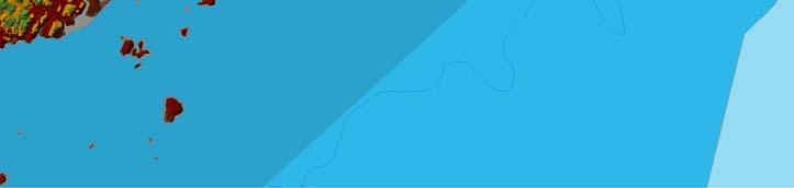
4 Cape Ann
5 Why Cape Ann For the purposes of this study, Cape Ann ==Gloucester/Rockport Cape Ann is surrounded by Atlantic Ocean from every direction except the west. Only 2 bridges connect most of Cape Ann to the mainland
6 Data Collection For GIS Both vector and raster datasets USGS website for National Elevation Data(NED). Replaced DEM last year. MassGIS website for Contours, Roads, Coastline projected coordinate system of NAD_1983_Stateplane_Massachusetts_M ainland_fips_2001
7 List of Data Layers included NED_ (Raster) Q3_floodmap (poly) Road layers for Cape Ann(Line) Coastal Zone layer(poly) bathometry layer for coastal elevations(line) Contour(line) TIN created from Raster Surge level layers created from Poly
8 Non Spatial Tables Created two non spatial tables that can be used later to geocode public building addresses. CityBuilding table EvacBuilding table
9 Geodatabase Setup 16 data layers of both vector and polygon data. Two Geodatabases StormSurgeBaseMap.mdb StormSurgeRaster.mdb
10 StormSurgeBaseMap.mdb Primary storage for feature classes, domains, and topology and relationship classes. 4 Feature Sets (LandFeatures, RoadsBuildings, SurgePolygons, Water) 2 non spatial tables(citybuildings and NewEvacBuildings) 1 topology with 4 rules on RoadsBuildings Feature Set relationship class in the SurgePolygons Feature Set called Surge
11 StormSurgeRaster.mdb does not have any feature datasets, domains or topology rules. primary purpose of this database is to store the raster datasets Raster data to large to include in other database
12 Snapshot of ArcCatalog Databases
13 Domains Coded Value Domains(2) CityBuilding table was built and populated with address data of public administration buildings and contains: two coded value domains. These domains are used to code differentiate whether the building is a public safety building or a City Administration building. d City public safety buildings of Gloucester. Range Domain(1) second table NewEvacBuildings, was designed to populate with possible locations of new city buildings The table contains a range domain that constrains the new buildings to certain elevation levels above what is considered a high enough elevation range based on the study. At this point the range is set to elevations from 40 feet to 100ft.

14 Domains Setup
15 Topology topology in the RoadsBuildings Feature Set contains four separate rules constraining the road layers To control accuracy of each road layer, the rule must not have Dangles was applied to each town road layer.

16 Topology


17 Layer MetaData Metadata included on all 3 created layers for Storm Surge.
18 Data Manipulation primary need to have a polygon layer of elevations to interact with the other layers of data Cannot select areas with line data Overlays/clips select by location not as effective with line data first convert the vector line contour data to a raster dataset. Then raster to polygon using Spatial Analyst toolset Use dissolve tool to clean up polygon layer after conversion
19 Once Solid Base layer Complete Create polygon Surge layers to use in geoprocessing selections, overlays etc. Perform Selections based on Location to Determine Roads effected by varying storm surge heights Perform selections based on LandUse and storm surge Perform Selections based on Building Addresses and storm surge


20 Vector Line Contour


21 Raster Contour Created


22 Polygon Contour Created


23 30 ft Polygon Storm-Surge
24 Possible Analysis with GIS The types of Analysis that can be performed on this GIS include: Identify roads affected at each storm-surge level. Identify public administration buildings effected by the surge Identify public safety buildings effected by the surge Identify evacuation routes off Cape Ann depending on stormsurge levels Identify Areas of Residential and commercial zoning effected by storm-surge Overlay storm-surge with FEMA Flood Maps to verify accuracy Identify Safety areas for future public building development outside of storm-surge zones Investigate the concept of environmental inequity from a coastal weather event on Cape Ann by using Census income data maps with storm-surge layers.

25 DownTown Gloucester Post Surge

26 Identify Roads effected Perform selections based on location between roads layer and storm-surge layers. Completely within Intersect 248 Gloucester roads Are completely within 30ft surge
27 Environmental Justice/Equity From Coastal Event on Cape Ann Used Environmental Justice Populations poly layer from MA GIS, to find area s meeting the following criteria On Cape Ann. Minority >=25% -Income less than 30,515 per household -Linguistic isolation 1 are effected by 9ft surge, both affected by 30ft surge

28 Environmental Justice Surge Area Effected 736,614 square meters Out of a total storm surge covering 52,551,936 About 1.4% of total surge
29 Model Builder Created a reusable model to Select polygon areas based on different storm surge heights(variables)
30 Conclusion The key to developing this GIS was the use of geodatabases to effectively organize the data. And the use of the powerful conversion tools to convert between vector and raster data formats Project included 2 Geodatabases 4 Feature Sets 16 spatial feature classes 2 coded value domains 1 range domain 1 topology on the RoadsBuildings feature set Metadata for 3 layers(created) Raster dataset A Model Builder Model for Surge Selection
31 ESRI ArcObjects And WebServices Wanted to make Storm surge data avaiable online. Use of ArcObjects to wrap my layers for creating a map viewer Built a prototype(in progress)
32 Web Services <html> <head> title>arcweb Explorer - using a custom Map Image Data Sources</title> <script type="text/javascript" src=" <script type="text/javascript"> //loads the ArcWeb Explorer SWF map function onbodyload() { AWUtils.insertMap("myMap", "948bcf0f264076d49f335f5f2d59066e",{glt:"mapImageGroupLayer", ds:"jmeuse:surge30"}); function oncreationcomplete() { // creating an instance of AWMap var myexplorer = new AWMap("myMap"); //setting the center and scale of the map var mylatlon = new AWLatLon( , ); myexplorer.centerandscale(mylatlon, ); } </script> </head> <body onload="onbodyload()"> <center> <!-- controls where the map will be loaded --> <div id="mymap" style="width:800px; height:600px;">you need at least <a href=" 8</a> to view this page.</div> </center> </body> </html>
Calhoun County, Texas Under 5 Meter Sea Level Rise
 Kyle Kacal GEO 327G Calhoun County, Texas Under 5 Meter Sea Level Rise PROBLEM AND PURPOSE: Sea level rise is threat to all coastal areas. Although natural sea level rise happens at a very slow rate, hurricanes
Outline. Chapter 1. A history of products. What is ArcGIS? What is GIS? Some GIS applications Introducing the ArcGIS products How does GIS work?
 Outline Chapter 1 Introducing ArcGIS What is GIS? Some GIS applications Introducing the ArcGIS products How does GIS work? Basic data formats The ArcCatalog interface 1-1 1-2 A history of products Arc/Info
Prepared by: Ryan Ratcliffe GPH-903 December 10, 2011
 Prepared by: Ryan Ratcliffe GPH-903 December 10, 2011 Scientific studies have proven that global sea level has risen 7.1 inches in the past century and computer models have suggested that climate change
Chapter 6. Fundamentals of GIS-Based Data Analysis for Decision Support. Table 6.1. Spatial Data Transformations by Geospatial Data Types
 Chapter 6 Fundamentals of GIS-Based Data Analysis for Decision Support FROM: Points Lines Polygons Fields Table 6.1. Spatial Data Transformations by Geospatial Data Types TO: Points Lines Polygons Fields
From a Hurricane Evacuation Map Series to a 3D Analytical Approach to Emergency Response by SHA Road Maintenance Crews
 From a Hurricane Evacuation Map Series to a 3D Analytical Approach to Emergency Response by SHA Road Maintenance Crews Mike Sheffer Highway Information Services Division GIS Program Coordinator GIS-T T
NR402 GIS Applications in Natural Resources
 NR402 GIS Applications in Natural Resources Lesson 1 Introduction to GIS Eva Strand, University of Idaho Map of the Pacific Northwest from http://www.or.blm.gov/gis/ Welcome to NR402 GIS Applications in
Introduction To Raster Based GIS Dr. Zhang GISC 1421 Fall 2016, 10/19
 Introduction To Raster Based GIS Dr. Zhang GISC 1421 Fall 2016, 10/19 Model of the course Using and making maps Navigating GIS maps Map design Working with spatial data Geoprocessing Spatial data infrastructure
IMPERIAL COUNTY PLANNING AND DEVELOPMENT
 IMPERIAL COUNTY PLANNING AND DEVELOPMENT GEODATABASE USER MANUAL FOR COUNTY BUSINESS DEVELOPMENT GIS June 2010 Prepared for: Prepared by: County of Imperial Planning and Development 801 Main Street El
HURRICANE MATTHEW A GIS PERSPECTIVE GLYNN COUNTY GIS
 HURRICANE MATTHEW A GIS PERSPECTIVE GLYNN COUNTY GIS Situation September 25 th October 9 th 2016 Hurricane Matthew tracked its way up the east coast bringing hurricane force winds and flooding from Haiti
Use of Geospatial data for disaster managements
 Use of Geospatial data for disaster managements Source: http://alertsystemsgroup.com Instructor : Professor Dr. Yuji Murayama Teaching Assistant : Manjula Ranagalage What is GIS? A powerful set of tools
Draft for Discussion 11/11/2016
 Coastal Risk Consulting (CRC) Climate Vulnerability Assessment for Village of Key Biscayne Deliverable 1.1 in Statement of Work. Preliminary Vulnerability Assessment Identifying Flood Hotspots Introduction...
Applications: Introduction Task 1: Introduction to ArcCatalog Task 2: Introduction to ArcMap Challenge Question References
 CHAPTER 1 INTRODUCTION 1.1 GIS? 1.1.1 Components of a GIS 1.1.2 A Brief History of GIS 1.1.3 GIS Software Products Box 1.1 A List of GIS Software Producers and Their Main Products 1.2 GIS Applications
Applied Cartography and Introduction to GIS GEOG 2017 EL. Lecture-2 Chapters 3 and 4
 Applied Cartography and Introduction to GIS GEOG 2017 EL Lecture-2 Chapters 3 and 4 Vector Data Modeling To prepare spatial data for computer processing: Use x,y coordinates to represent spatial features
COASTAL DATA APPLICATION
 2015 Coastal GeoTools Proactive By Design. Our Company Commitment COASTAL DATA APPLICATION Projecting Future Coastal Flood Risk for Massachusetts Bay Bin Wang, Tianyi Liu, Daniel Stapleton & Michael Mobile
Modeling Storm Surge for Emergency Management
 Modeling Storm Surge for Emergency Management Study Area: Guam is the southern-most island of the Mariana Archipelago and is located at 13 28 N, 144 47 E. It has a total area of 541.3 sq. km. and the highest
CENTRAL TEXAS HILL COUNTRY FLOOD
 CENTRAL TEXAS HILL COUNTRY FLOOD Term project report DECEMBER 7, 2018 UNIVERSITY OF TEXAS AT AUSTIN CE394K: GIS in Water Resources Engineering RIFAAI Mohamed Talha Table of Contents Introduction... 3 Context...
John Callahan (Delaware Geological Survey) Kevin Brinson, Daniel Leathers, Linden Wolf (Delaware Environmental Observing System)
 Kevin Brinson, Daniel Leathers, Linden Wolf (Delaware Environmental Observing System)") John Callahan (Delaware Geological Survey) Kevin Brinson, Daniel Leathers, Linden Wolf (Delaware Environmental Observing System) Delaware is extremely vulnerable to the impacts of coastal flooding Tropical
John Callahan (Delaware Geological Survey) Kevin Brinson, Daniel Leathers, Linden Wolf (Delaware Environmental Observing System) Delaware is extremely vulnerable to the impacts of coastal flooding Tropical
Flood Inundation Mapping
 KU GIS Day 2009 November 18, 2009 Flood Inundation Mapping Wendy L. Pearson NOAA s National Weather Service Central Region Headquarters Kansas City, Missouri Flood Inundation Mapping Objectives: Overview
SIE 509 Principles of GIS Exercise 5 An Introduction to Spatial Analysis
 SIE 509 Principles of GIS Exercise 5 An Introduction to Spatial Analysis Due: Oct. 31, 2017 Total Points: 50 Introduction: The Governor of Maine is asking communities to look at regionalization for major
Display data in a map-like format so that geographic patterns and interrelationships are visible
 Vilmaliz Rodríguez Guzmán M.S. Student, Department of Geology University of Puerto Rico at Mayagüez Remote Sensing and Geographic Information Systems (GIS) Reference: James B. Campbell. Introduction to
Canadian Board of Examiners for Professional Surveyors Core Syllabus Item C 5: GEOSPATIAL INFORMATION SYSTEMS
 Study Guide: Canadian Board of Examiners for Professional Surveyors Core Syllabus Item C 5: GEOSPATIAL INFORMATION SYSTEMS This guide presents some study questions with specific referral to the essential
What is CERA? Coastal Emergency Risks Assessment
 What is CERA? Coastal Emergency Risks Assessment Visualization tool using OGC standards Displays the outputs from the ADCIRC storm surge model or other coastal models Represents the maps on interactive
GIS Level 2. MIT GIS Services
 GIS Level 2 MIT GIS Services http://libraries.mit.edu/gis Email: gishelp@mit.edu TOOLS IN THIS WORKSHOP - Definition Queries - Create a new field in the attribute table - Field Calculator - Add XY Data
Lecture 2. A Review: Geographic Information Systems & ArcGIS Basics
 Lecture 2 A Review: Geographic Information Systems & ArcGIS Basics GIS Overview Types of Maps Symbolization & Classification Map Elements GIS Data Models Coordinate Systems and Projections Scale Geodatabases
NREL, Intro to GIS for Wind Energy Siting for IGERT Wind NSF
 NREL, 2010 Intro to GIS for Wind Energy Siting for IGERT Wind NSF Challenge: How to encourage offshore wind in the US while managing ecological responsibility and ocean use conflicts? Introduction NREL,
GIS CONCEPTS ARCGIS METHODS AND. 3 rd Edition, July David M. Theobald, Ph.D. Warner College of Natural Resources Colorado State University
 GIS CONCEPTS AND ARCGIS METHODS 3 rd Edition, July 2007 David M. Theobald, Ph.D. Warner College of Natural Resources Colorado State University Copyright Copyright 2007 by David M. Theobald. All rights
Welcome to NR502 GIS Applications in Natural Resources. You can take this course for 1 or 2 credits. There is also an option for 3 credits.
 Welcome to NR502 GIS Applications in Natural Resources. You can take this course for 1 or 2 credits. There is also an option for 3 credits. The 1st credit consists of a series of readings, demonstration,
Suitability Analysis on Second Home Areas Selection in Smithers British Columbia
 GEOG 613 Term Project Suitability Analysis on Second Home Areas Selection in Smithers British Columbia Zhengzhe He November 2005 Abstract Introduction / background Data Source Data Manipulation Spatial
A More Comprehensive Vulnerability Assessment: Flood Damage in Virginia Beach
 A More Comprehensive Vulnerability Assessment: Flood Damage in Virginia Beach By Raj Shah GIS in Water Resources Fall 2017 Introduction One of the most obvious effects of flooding events is death. Humans
Crystal Goodison & Alexis Thomas University of Florida GeoPlan Center
 Crystal Goodison & Alexis Thomas University of Florida GeoPlan Center A1A Fort Lauderdale, Hurricane Sandy, October 2012 Photo Credits: Susan Stocker, Sun Sentinel FAU s Research Report (completed Jan
The Looming Threat of Rising Sea Levels to the Florida Keys
 The Looming Threat of Rising Sea Levels to the Florida Keys 1. Introduction Sea levels are rising, and possibly faster than we thought before. In a recent report in 2017 by the National Oceanic and Atmospheric
A GIS TOUR OF DES MOINES PRESENTED BY ANNA WHIPPLE, GIS MANAGER APRIL 20, 2015
 A GIS TOUR OF DES MOINES PRESENTED BY ANNA WHIPPLE, GIS MANAGER APRIL 20, 2015 Welcome to Des Moines! Capital of Iowa Among 100 largest metropolitan areas Insurance, biotech, healthcare, and entertainment
TRB First International Conference on Surface Transportation Resilience
 TRB First International Conference on Surface Transportation Resilience Applying the Sea-Level Scenario Sketch Planning Tool to Enhance the Resilience of Long-Range Transportation Plans: Lessons Learned
Geodatabase for Sustainable Urban Development. Presented By Rhonda Maronn Maurice Johns Daniel Ashney Jack Anliker
 Geodatabase for Sustainable Urban Development Presented By Rhonda Maronn Maurice Johns Daniel Ashney Jack Anliker Objective Build a Geodatabase that will enable urban planners to create and assess the
Why GIS & Why Internet GIS?
 Why GIS & Why Internet GIS? The Internet bandwagon Internet mapping (e.g., MapQuest) Location-based services Real-time navigation (e.g., traffic) Real-time service dispatch Business Intelligence Spatial
USING MIKE TO MODEL COASTAL CATASTROPHE RISK
 USING MIKE TO MODEL COASTAL CATASTROPHE RISK Nicola Howe, Christopher Thomas, Joss Matthewman, John Maskell* 1 SUMMARY About RMS Who are we and what do we do? How do we use MIKE in our workflow? Case study:
New Jersey Department of Transportation Extreme Weather Asset Management Pilot Study
 New Jersey Department of Transportation Extreme Weather Asset Management Pilot Study Overview Prepared for: June 26, 2018 Introduction Overview of Pilot Study New Jersey s Climate New Jersey s Transportation
GIS-T 2010 Building a Successful Geospatial Data Sharing Framework: A Ohio DOT Success Story
 GIS-T 2010 Building a Successful Geospatial Data Sharing Framework: A Ohio DOT Success Story ODOT District 2 GIS John Puente District 1 GIS Coordinator\ Planning Administrator 2 Interoperability 3 District
ParkServe. The Trust for Public Land s. Emmalee Dolfi Gabriel Patterson-King ESRI User Conference 2017
 The Trust for Public Land s ParkServe Automating Large-Scale Data Transformation, QA/QC and Analysis Emmalee Dolfi Gabriel Patterson-King ESRI User Conference 2017 Our mission The Trust for Public Land
SWAMP GIS: A spatial decision support system for predicting and treating stormwater runoff. Michael G. Wing 1 * and Derek Godwin
 Journal of Spatial Hydrology Vol. 11, No. 2 Fall 2011 SWAMP GIS: A spatial decision support system for predicting and treating stormwater runoff Michael G. Wing 1 * and Derek Godwin Abstract SWAMP GIS
Regardless of the politics surrounding climate change, the sea level is rising. Based on
 Analysis of Sea Level Rise Impacts in Bath, Bowdoinham, and Topsham, Maine Hannah Glover with Cam Adams, Liza LePage, and Dan Lesser ES204: Johnson 14 December 2012 INTRODUCTION Regardless of the politics
North Atlantic Coast Comprehensive Study (NACCS) APPENDIX A: ENGINEERING
 APPENDIX A: ENGINEERING") North Atlantic Coast Comprehensive Study (NACCS) APPENDIX A: ENGINEERING NORTH ATLANTIC COAST COMPREHENSIVE STUDY: RESILIENT ADAPTATION TO INCREASING RISK Appendix A - Engineering Table of Contents North
North Atlantic Coast Comprehensive Study (NACCS) APPENDIX A: ENGINEERING NORTH ATLANTIC COAST COMPREHENSIVE STUDY: RESILIENT ADAPTATION TO INCREASING RISK Appendix A - Engineering Table of Contents North
Module 10 Summative Assessment
 Module 10 Summative Assessment Activity In this activity you will use the three dimensions of vulnerability that you learned about in this module exposure, sensitivity, and adaptive capacity to assess
GIS for ChEs Introduction to Geographic Information Systems
 GIS for ChEs Introduction to Geographic Information Systems AIChE Webinar John Cirucci 1 GIS for ChEs Introduction to Geographic Information Systems What is GIS? Tools and Methods Applications Examples
Geography 38/42:376 GIS II. Topic 1: Spatial Data Representation and an Introduction to Geodatabases. The Nature of Geographic Data
 Geography 38/42:376 GIS II Topic 1: Spatial Data Representation and an Introduction to Geodatabases Chapters 3 & 4: Chang (Chapter 4: DeMers) The Nature of Geographic Data Features or phenomena occur as
Assessing the relevance of wetlands for storm surge protection: a coupled hydrodynamic and geospatial framework
 Civil, Environmental, and Infrastructure Engineering VOLGENAU SCHOOL OF ENGINEERING Assessing the relevance of wetlands for storm surge protection: a coupled hydrodynamic and geospatial framework Jana
Sea Level Rise and Hurricane Florence storm surge research methodology
 Sea Level Rise and Hurricane Florence storm surge research methodology Hurricane Florence storm surge analysis was conducted using a variety of input sources. In order to determine the maximum storm surge
The Geodatabase Working with Spatial Analyst. Calculating Elevation and Slope Values for Forested Roads, Streams, and Stands.
 GIS LAB 7 The Geodatabase Working with Spatial Analyst. Calculating Elevation and Slope Values for Forested Roads, Streams, and Stands. This lab will ask you to work with the Spatial Analyst extension.
All About Spatial Data. Find it, Manage it, Use it
 All About Spatial Data Find it, Manage it, Use it Workshop Outline Define spatial data Spatial data formats Data Sources Metadata Evaluating Spatial Data Data Management Activities: define spatial data,
The Adoption and Utilization of Hazard Mitigation Practices by Jurisdictions along Gulf and Atlantic Coasts
 The Adoption and Utilization of Hazard Mitigation Practices by Jurisdictions along Gulf and Atlantic Coasts Alexander Abuabara, Walter Peacock abuabara@tamu.edu 2017/Jun Presentation Index Flooding Wind
Geographic Systems and Analysis
 Geographic Systems and Analysis New York University Robert F. Wagner Graduate School of Public Service Instructor Stephanie Rosoff Contact: stephanie.rosoff@nyu.edu Office hours: Mondays by appointment
Mapping Coastal Change Using LiDAR and Multispectral Imagery
 Mapping Coastal Change Using LiDAR and Multispectral Imagery Contributor: Patrick Collins, Technical Solutions Engineer Presented by TABLE OF CONTENTS Introduction... 1 Coastal Change... 1 Mapping Coastal
Designing GIS Databases to Support Mapping and Map Production Charlie Frye, ESRI Redlands Aileen Buckley, ESRI Redlands
 Designing GIS Databases to Support Mapping and Map Production Charlie Frye, ESRI Redlands Aileen Buckley, ESRI Redlands 1 Designing GIS Databases to Support Mapping and Map Production Charlie Frye, ESRI
Key Processes
 Data Manipulation and Extraction Key Processes Key Processes Re-Projecting Data Selecting by Attributes Exporting Data Hillshade Reclassification Conversion of Raster to Vector Re-Projecting Data Purpose
Sea level rise Web GIS Applications
 Florida International University FIU Digital Commons GIS Center GIS Center 2018 Sea level rise Web GIS Applications Zhaohui Fu GIS-RS Center, Florida International University, Fujen@fiu.edu Sheyla Santana
Summary of Available Datasets that are Relevant to Flood Risk Characterization
 Inter-Agency Characterization Workshop February 25-27, 2014 USACE Institute for Water Resources, Alexandria, VA, IWR Classroom Summary of Available Datasets that are Relevant to Characterization National
DP Project Development Pvt. Ltd.
 Dear Sir/Madam, Greetings!!! Thanks for contacting DP Project Development for your training requirement. DP Project Development is leading professional training provider in GIS technologies and GIS application
ESRI Survey Summit August Clint Brown Director of ESRI Software Products
 ESRI Survey Summit August 2006 Clint Brown Director of ESRI Software Products Cadastral Fabric How does Cadastral fit with Survey? Surveyors process raw field observations Survey measurements define high-order
The Coastal Change Analysis Program and the Land Cover Atlas. Rebecca Love NOAA Office for Coastal Management
 The Coastal Change Analysis Program and the Land Cover Atlas Rebecca Love NOAA Office for Coastal Management Natural Infrastructure = Greater Resilience NOAA C-CAP Regional Land Cover and Change coast.noaa.gov/digitalcoast/data/ccapregional
Boston Coastal Flooding Analysis and Mapping
 Boston Coastal Flooding Analysis and Mapping Philip Orton, Dara Mendeloff, Jane Mills, Malgosia Madajewicz Funding This research was funded by the National Oceanic and Atmospheric Administration (NOAA)
MODELLING CATASTROPHIC COASTAL FLOOD RISKS AROUND THE WORLD
 MODELLING CATASTROPHIC COASTAL FLOOD RISKS AROUND THE WORLD Nicola Howe Christopher Thomas Copyright 2016 Risk Management Solutions, Inc. All Rights Reserved. June 27, 2016 1 OUTLINE MOTIVATION What we
A Cloud-Based Flood Warning System For Forecasting Impacts to Transportation Infrastructure Systems
 A Cloud-Based Flood Warning System For Forecasting Impacts to Transportation Infrastructure Systems Jon Goodall Associate Professor, Civil and Environmental Engineering Associate Director, Link Lab April
Storm Surge Analysis Update Meeting Cross City, Florida June 17, 2014
 Big Bend Coastal Storm Surge Study Storm Surge Analysis Update Meeting Cross City, Florida June 17, 2014 Introductions Risk MAP Project Team FEMA Region IV Florida Division of Emergency Management (FDEM)
These modules are covered with a brief information and practical in ArcGIS Software and open source software also like QGIS, ILWIS.
 Online GIS Training and training modules covered are: 1. ArcGIS, Analysis, Fundamentals and Implementation 2. ArcGIS Web Data Sharing 3. ArcGIS for Desktop 4. ArcGIS for Server These modules are covered
Introduction to the 176A labs and ArcGIS
 Introduction to the 176A labs and ArcGIS Acknowledgement: Slides by David Maidment, U Texas-Austin and Francisco Olivera (TAMU) Purpose of the labs Hands-on experience with one software pakage Introduction
2006 & 2007 Pre-Hurricane Scenario Analyses
 2006 & 2007 Pre-Hurricane Scenario Analyses Executive Summary May 2007 Page 1 OF X FOR OFFICIAL USE ONLY 4 Public Availability to be Determined Under 5 U.S.C. 552 NOTE: Limited Distribution. Release of
SLR Calculator: Sea Level Rise (SLR) Inundation Surface Calculator Add-in for ArcGIS Desktop & 10.4
 Inundation Surface Calculator Add-in for ArcGIS Desktop & 10.4") 1 SLR Calculator: Sea Level Rise (SLR) Inundation Surface Calculator Add-in for ArcGIS Desktop 10.3.1 & 10.4 Florida Sea Level Scenario Sketch Planning Tool Version 1.6, July 2016 University of Florida
1 SLR Calculator: Sea Level Rise (SLR) Inundation Surface Calculator Add-in for ArcGIS Desktop 10.3.1 & 10.4 Florida Sea Level Scenario Sketch Planning Tool Version 1.6, July 2016 University of Florida
BECQ 2017 SLR Map Layer Updates: Methodology for Coastal Flood Geoprocessing
 BECQ 2017 SLR Map Layer Updates: Methodology for Coastal Flood Geoprocessing This paper summarizes the local and regional sea level data used to develop coastal flooding scenarios for the island of Saipan,
Maryland Transit Administration (MTA) Bus Accident Mapping and Analysis Application
 Bus Accident Mapping and Analysis Application") Maryland Transit Administration (MTA) Bus Accident Mapping and Analysis Application Ralign Wells, MTA Administrator Bernadette Bridges, MTA Chief Safety Officer Office of Safety, Quality Assurance, and
Maryland Transit Administration (MTA) Bus Accident Mapping and Analysis Application Ralign Wells, MTA Administrator Bernadette Bridges, MTA Chief Safety Officer Office of Safety, Quality Assurance, and
KENTUCKY HAZARD MITIGATION PLAN RISK ASSESSMENT
 KENTUCKY HAZARD MITIGATION PLAN RISK ASSESSMENT Presentation Outline Development of the 2013 State Hazard Mitigation Plan Risk Assessment Determining risk assessment scale Census Data Aggregation Levels
HEC & GIS Modeling of the Brushy Creek HEC & GIS Watershed Modeling of the
 HEC & GIS Modeling of the Brushy Creek HEC & GIS Watershed Modeling of the By Cassandra Fagan 5, December 2014 http://ubcwatershedstudy.ursokr.com/images/ Contents Introduction... 3 Figure 1: 24-hour rainfall
Administering your Enterprise Geodatabase using Python. Jill Penney
 Administering your Enterprise Geodatabase using Python Jill Penney Assumptions Basic knowledge of python Basic knowledge enterprise geodatabases and workflows You want code Please turn off or silence cell
Forecast Predictions of Winds, Waves and Storm Surge during Hurricane Arthur (2014)
") Forecast Predictions of Winds, Waves and Storm Surge during Hurricane Arthur (2014) R Cyriac 1, JC Dietrich 1, JG Fleming 2, BO Blanton 3, RA Luettich Jr 4, C Kaiser 5 1 Dept. of Civil, Construction, and
Forecast Predictions of Winds, Waves and Storm Surge during Hurricane Arthur (2014) R Cyriac 1, JC Dietrich 1, JG Fleming 2, BO Blanton 3, RA Luettich Jr 4, C Kaiser 5 1 Dept. of Civil, Construction, and
In this exercise we will learn how to use the analysis tools in ArcGIS with vector and raster data to further examine potential building sites.
 GIS Level 2 In the Introduction to GIS workshop we filtered data and visually examined it to determine where to potentially build a new mixed use facility. In order to get a low interest loan, the building
SANTA CLARA COUNTY THEMATIC ATLAS
 1 SANTA CLARA COUNTY THEMATIC ATLAS Project Overview Douglas Schenk, GIS Analyst Sampa Patra, GIS Analyst Making the Thematic Atlas 2 Brought to you by the County of Santa Clara Public Health Department,
Geodatabase An Overview
 Federal GIS Conference February 9 10, 2015 Washington, DC Geodatabase An Overview Ralph Denkenberger - esri Session Path The Geodatabase - What is it? - Why use it? - What types are there? Inside the Geodatabase
Hazard Assessment of Lava Flows, Wildfires, and Tsunamis on the Big Island of Hawaii s population. By: Thomas Ditges
 Hazard Assessment of Lava Flows, Wildfires, and Tsunamis on the Big Island of Hawaii s population By: Thomas Ditges The Problem: The Big Island of Hawaii is the largest and most dangerous of the Hawaiian
Popular Mechanics, 1954
 Introduction to GIS Popular Mechanics, 1954 1986 $2,599 1 MB of RAM 2017, $750, 128 GB memory, 2 GB of RAM Computing power has increased exponentially over the past 30 years, Allowing the existence of
Salisbury University: Eric Flint, John O Brien, & Alex Nohe
 Salisbury University: Eric Flint, John O Brien, & Alex Nohe Open Source (Public) Geographic Information System GNU General Public License Guarantees public s ability to download, modify and share software
Comparative Analysis of Hurricane Vulnerability in New Orleans and Baton Rouge. Dr. Marc Levitan LSU Hurricane Center. April 2003
 Comparative Analysis of Hurricane Vulnerability in New Orleans and Baton Rouge Dr. Marc Levitan LSU Hurricane Center April 2003 In order to compare hurricane vulnerability of facilities located in different
The Application of GIS on Nuclear Power & Seismic Risk to the Public & Environment in the United States
 The Application of GIS on Nuclear Power & Seismic Risk to the Public & Environment in the United States Amanda Jardine and Erica Massey April 11, 2012 Dr. Jason Pither Geography 370: Geographic Information
THE 3D SIMULATION INFORMATION SYSTEM FOR ASSESSING THE FLOODING LOST IN KEELUNG RIVER BASIN
 THE 3D SIMULATION INFORMATION SYSTEM FOR ASSESSING THE FLOODING LOST IN KEELUNG RIVER BASIN Kuo-Chung Wen *, Tsung-Hsing Huang ** * Associate Professor, Chinese Culture University, Taipei **Master, Chinese
A Comparative Study of the National Water Model Forecast to Observed Streamflow Data
 A Comparative Study of the National Water Model Forecast to Observed Streamflow Data CE394K GIS in Water Resources Term Project Report Fall 2018 Leah Huling Introduction As global temperatures increase,
Flooding in Manayunk Neighborhood of Philadelphia
 Flooding in Manayunk Neighborhood of Philadelphia Samuel Brodfuehrer GIS in Water Resources December 8, 2017 Introduction... 3 Philadelphia Overview... 3 Manayunk Overview... 4 Project Objective... 6 Methods
ArcGIS Enterprise: What s New. Philip Heede Shannon Kalisky Melanie Summers Shreyas Shinde
 ArcGIS Enterprise: What s New Philip Heede Shannon Kalisky Melanie Summers Shreyas Shinde ArcGIS Enterprise is the new name for ArcGIS for Server ArcGIS Enterprise Software Components ArcGIS Server Portal
From Vulnerability to Resilience And the Tools to Get There. Out of Harm s Way Partnership for the Delaware Estuary August 1, 2012
 From Vulnerability to Resilience And the Tools to Get There Out of Harm s Way Partnership for the Delaware Estuary August 1, 2012 Today s Presentation Tour of New Jersey Challenges Definitions so we re
Identifying Wildfire Risk Areas in Western Washington State
 Identifying Wildfire Risk Areas in Western Washington State Matthew Seto University of Washington Tacoma GIS Certification Program URISA 2015 Undergraduate Geospatial Skills Competition Introduction 2014
Acknowledgments xiii Preface xv. GIS Tutorial 1 Introducing GIS and health applications 1. What is GIS? 2
 Acknowledgments xiii Preface xv GIS Tutorial 1 Introducing GIS and health applications 1 What is GIS? 2 Spatial data 2 Digital map infrastructure 4 Unique capabilities of GIS 5 Installing ArcView and the
Esri Exam EADP10 ArcGIS Desktop Professional Version: 6.2 [ Total Questions: 95 ]
![Esri Exam EADP10 ArcGIS Desktop Professional Version: 6.2 [ Total Questions: 95 ]](/thumbs/73/68697597.jpg "Esri Exam EADP10 ArcGIS Desktop Professional Version: 6.2 [ Total Questions: 95 ]") s@lm@n Esri Exam EADP10 ArcGIS Desktop Professional Version: 6.2 [ Total Questions: 95 ] Question No : 1 An ArcGIS user runs the Central Feature geoprocessing tool on a polygon feature class. The output
s@lm@n Esri Exam EADP10 ArcGIS Desktop Professional Version: 6.2 [ Total Questions: 95 ] Question No : 1 An ArcGIS user runs the Central Feature geoprocessing tool on a polygon feature class. The output
Spatial Analysis in Your Browser
 Spatial Analysis in Your Browser Joseph Kerski Education Manager Esri jkerski@esri.com http://www.youtube.com/geographyuberalles Twitter http://twitter.com/josephkerski 303-449-7779 x 18237 Joseph Kerski
What s New in Topographic Information - USGS National Map
 + What s New in Topographic Information - USGS National Map SARGIS Workshop November 14, 2016 Rob Dollison, 703-648-5724 rdollison@usgs.gov + USGS 2 National Geospatial Program The National Geospatial
RHOAPS. Real-time Hydrology Ocean Atmosphere Prediction System. Pronunciation: Ropes Motto: More than just THREDDS
 RHOAPS Real-time Hydrology Ocean Atmosphere Prediction System Pronunciation: Ropes Motto: More than just THREDDS Key Aspects Integrated real-time data systems Atmospheric Hydrologic Coastal oceans Societal
Introducing GIS analysis
 1 Introducing GIS analysis GIS analysis lets you see patterns and relationships in your geographic data. The results of your analysis will give you insight into a place, help you focus your actions, or
Salem Coastal Vulnerability. By: Ariabel Adames, Abby Jackson, Mariluz Ayala, Mikara Crowley, Karley Skutul
 Salem Coastal Vulnerability By: Ariabel Adames, Abby Jackson, Mariluz Ayala, Mikara Crowley, Karley Skutul Total Population: 42,544 Sea level Rise: 10,700 Worst Case Storm Surge: 22,560 Minority Income
Miami-Dade County Technical Update Meeting South Florida Coastal Study. May 11, 2016
 Miami-Dade County Technical Update Meeting South Florida Coastal Study May 11, 2016 Welcome and Introductions FEMA Region IV Christina Lindemer Technical Lead Production and Technical Services (PTS) Contractor
Week 7 Last week: This week s topics. GIS and Forest Engineering Applications. FE 257. GIS and Forest Engineering Applications.
 FE 257. GIS and Forest Engineering Applications Week 7 Week 7 Last week: Spatial Projections Questions? Next week- read: Chapter 10: Updating GIS Databases Chapter 12: Synthesis of Techniques Applied to
B.2 Sources for Hazard Identification, Profiling, and Ranking (Section 3) Overview of Sussex County s History of Hazards
 Overview of Sussex County s History of Hazards") Appendix B Sources B.1 Sources for Planning Process (Section 2) FEMA. Mitigation Planning Guidance (386 Series). Available on the web at: http://www.fema.gov/plan/mitplanning/planning_resources.shtm FEMA
Appendix B Sources B.1 Sources for Planning Process (Section 2) FEMA. Mitigation Planning Guidance (386 Series). Available on the web at: http://www.fema.gov/plan/mitplanning/planning_resources.shtm FEMA
Steve Pietersen Office Telephone No
 Steve Pietersen Steve.Pieterson@durban.gov.za Office Telephone No. 031 311 8655 Overview Why geography matters The power of GIS EWS GIS water stats EWS GIS sanitation stats How to build a GIS system EWS
Lecture 1 Introduction to GIS. Dr. Zhang Spring, 2017
 Lecture 1 Introduction to GIS Dr. Zhang Spring, 2017 Topics of the course Using and making maps Navigating GIS Map design Working with spatial data Geoprocessing Spatial data infrastructure Digitizing
Hurricane Katrina and Oil Spills: Impact on Coastal and Ocean Environments
 Archived version from NCDOCKS Institutional Repository http://libres.uncg.edu/ir/asu/ Pine, J. C. (June 2006). Hurricane Katrina and oil spills: Impact on coastal and ocean environments. Oceanography,