WPHA Introduction. Bridging the Gap. Current Data Partnerships. Current EPHT Topic Areas
|
|
|
- Frank Matthews
- 5 years ago
- Views:
Transcription


 Lead-Safe Wisconsin Wisconsin Department")
1 WPHA 2014 Environmental Public Health Tracking: Mapping, Tracking, and Action Paul D. Creswell Senior Epidemiologist Environmental Public Health Tracking Program Wisconsin Bureau of Environmental and Occupational Health Wisconsin Department of Health Services Introduction Pew Environmental Health Commission Report: Pointed to: America s Environmental Health Gap Called for: a Nationwide Health Tracking Network for diseases and exposures 2002: EPHT responds to this need: Provides data on a variety of environmental exposures and outcomes Serves as a repository of state-specific environmental data Bridging the Gap With the right data, I could better address my community s issues. It would be great if I knew how to make my data more useful for local public health. LPHD EPHT Data Owners Current Data Partnerships Current EPHT Topic Areas EPHT currently has data partnerships with: Wisconsin Cancer Reporting System (WCRS) Lead-Safe Wisconsin Wisconsin Department of Natural Resources (DNR) Survey of the Health of Wisconsin (SHOW) Wisconsin Vital Records Service among others Current topics: Childhood lead poisoning Cancer Ambient Air quality (ozone and PM2.5) Water Quality Private well testing Radon Birth Defects Reproductive Outcomes Carbon Monoxide Poisonings Hospitalizations for Heart Attacks Hospitalizations for Asthma Heat vulnerability 1
, while WI EPHT provides Wisconsin specific data (e.")
: CEHPs are summary reports of the data from the WI EPHT portals and website.")
 for tracking and communicating environmental public health data.")

2 EPHT: State and National EPHT: Resources WI EPHT is a state-level program: WI EPHT is part of the national EPHT: cdc gov/ National EPHT provides some additional measures (e.g., heat stress), while WI EPHT provides Wisconsin specific data (e.g., private well data). The WI EPHT webpage provides County Environmental Health Profiles (CEHPs): CEHPs are summary reports of the data from the WI EPHT portals and website. The profiles provide maps, graphs, and tables for each specific topic area. Data Repositories Public Portal: Provides data-based tools (i.e., charts and maps) for tracking and communicating environmental public health data. Secure Portal: Provides greater data detail as well as integrated tools that facilitate data exploration and analysis. Public Portal Currently the public portal provides data on a variety of measures in a static format. Queries are atomized and users need to start over to view multiple topics. Example: Enhanced Public Portal Example: Some sub-county level data will be available for some measures. The new public portal allows for dynamic queries. Users can tell a story using maps and data. 2


3 Enhanced Portal Features In partnership with ESRI, EPHT is creating an enhanced public portal: Sub-county (census tract) level data will be available for some measures. D i ill ll d Dynamic map will allow users to pan around. Find an address feature will allow for individualized searches. Printing for reports will be enhanced. ArgGIS Online hosting will allow for map mash-ups to tell your data story. What Can You Do With EPHT Data? EPHT aims to assist local public health departments in meeting programmatic needs. EPHT data can assist in priority setting and communication strategies. EPHT data allows for tracking of progress on health initiatives. What Can You Do With Maps? Maps have become an increasingly prevalent way to represent data. Maps are images and a picture is worth 84.1 words! Images make it easier for us to absorb complex information. Maps provide relational data and tell a story. What Can You Do With Maps? Examples Comparisons between regions allow for an understanding of communitylevel needs and assets. Maps can assist in priority setting and allow us to provide evidence-based solutions where they will have the highest utility to partners throughout Wisconsin. Megan Christenson and Emily Reynolds will provide some examples: Megan will discuss how the BRACE project has used EPHT data to address the climate effects in Wisconsin. Emily will provide an example from her work on cancer prevention to illustrate how maps can be used in priority setting and planning of interventions. 3

4 Thanks! 4
5 Tracking, Mapping, and Action Megan Christenson, MS, MPH WPHA Conference May 14, 2014 Building Resilience Against Climate Effects (BRACE) Program Goals Identify health impacts of climate and severe weather events and vulnerable populations Anticipate future trends Monitor health effects Assure systems are in place to detect and respond to emerging health threats Source: 2 Wisconsin s Climate: Historic Temperature Change Wisconsin s Climate: Anticipated Temperature Change Projected Change in Annual Average Temperature (F) from 1980 to 2055 Wisconsin s annual average temperature has warmed by approximately 1.1 F from 1950 to Wisconsin s annual average temperature is expected to warm 4-9 F by the middle of the century. Source: WICCI, Source: WICCI, National Environmental Public Health Tracking (EPHT) Portal Examples using Wisconsin s EPHT Data Source:
6 EPHT heat stress definition: ICD-9 codes of , E900.0, or E900.9 Heat stroke Heat cramps Heat exhaustion Heat fatigue Heat edema (swelling) Heat Stress 7 Heat Stress Hospitalizations and ED Visits in Wisconsin Temperature Distribution: Milwaukee County Hospitalizations 600 ED Visits Note: Data source is the North American Land Data Assimilation System (NLDAS). 10 EPHT Heat Vulnerability County prevalence of diabetes Heart disease hospitalization rates Percent of population below poverty Percent of population that is non-white Percent of population aged 65+ and living alone Percent of population aged 5+ with a disability Population density Percent of forest canopy Percent of developed land use Percent of cultivated crop land use EPHT Heat Vulnerability: Percent of Population 65+ and Living Alone 11 Note: Data source is the 2000 U.S. Census. 12 2
7 EPHT Heat Vulnerability: Percent of Developed Land Use EPHT Heat Vulnerability: Percent of Population Below Poverty Line Note: Data source is the 2001 National Land Cover Database. 13 Note: Data source is the 2000 U.S. Census. 14 BRACE Heat Vulnerability Variables (24 total) Examples using Wisconsin s BRACE Data Population density Health behaviors and outcomes Demographic and socioeconomic factors Natural environment BRACE Heat Vulnerability Index (HVI) Standard methodology to calculate index Variables standardized by transformation into z- score (z-score = number of standard deviations away from the mean) Variables not weighted Heat Vulnerability Index = sum of all z-scores Draft Statewide Analysis
8 Draft Analysis: Milwaukee County Future Applications of HVI Map Use heat vulnerability maps to identify areas of highest risk. Add public transportation routes and existing cooling centers to map. Identify strategic locations for cooling centers based on transportation routes and high risk areas Thank You! Questions/Comments? 21 References Centers for Disease Control and Prevention. Climate-Ready States and Cities Initiative. Centers for Disease Control and Prevention. Environmental Health Tracking Program. html?c=15&i=65&m=-1# Wisconsin s Changing Climate: Impacts and Adaptation. 2011, Wisconsin Initiative on Climate Change Impacts. Nelson Institute for Environmental Studies, University of Wisconsin-Madison and the Wisconsin Department of Natural Resources, Madison, Wisconsin. 22 4


9 The Power of Maps in Public Health May 14, 2014 Geography Matters! Emily Reynolds Community Outreach Specialist WI Comprehensive Cancer Control Program What is GIS? Geographic Information System A map with a database underneath or A database that you can display on a map What can a map with public health data show us? Determine geographic distribution of disease Analyze spatial trends Map populations at risk Assess resource allocation Plan and target interventions Monitor diseases and interventions over time Geographic Distribution over time Analyze spatial trends Credit: US Centers for Disease Control 1
 Monitoring")


10 Mapping populations at risk Assessing resource allocation. What are some of the tools? Data Integration- layering various types of data (ie environmental, social, historical) Monitoring looking at data over time and geographic location Geocoding- plotting exact locations on maps Statistical Analysis Plan & Target Interventions: Community Outreach Project To provide training and technical assistance to communities to increase capacity for policy, systems, and environmental change for obesity prevention in order to the reduce the risk of cancer Nutrition, Physical Activity, & Obesity Coalitions Geographic distribution of obesity and cancer death Resource Allocation Bayfield Douglas Iron Ashland Vilas Burnett Washburn Sawyer Florence Price Oneida Forest Polk Rusk Barron Marinette Lincoln Langlade Taylor Saint Croix Chippewa MenomineeOconto Dunn Marathon Shawano Door Pierce Eau Claire Clark Pepin Kewaunee Wood Portage Waupaca Brown Outagamie Buffalo Trempealeau Jackson Waushara Manitowoc Winnebago Calumet Monroe Adams La Crosse Juneau MarquetteGreen Lake Fond du LacSheboygan Vernon Columbia Sauk Dodge Richland WashingtonOzaukee Crawford Grant Dane Iowa JeffersonWaukeshaMilwaukee Racine Lafayette Green Rock Walworth Kenosha 2


11 Resource Allocation Part 2 20 Communities Variety of coalitions Geographic diversity Health risk factors and outcomes Rural vs. Urban Current level of investment Bayfield Douglas Iron Ashland Vilas Burnett Washburn Sawyer Florence Price Oneida Forest Polk Rusk Barron Marinette Lincoln Langlade Taylor Saint Croix Chippewa MenomineeOconto Dunn Marathon Shawano Door Pierce Eau Claire Clark Pepin Kewaunee Wood Portage Waupaca Brown Outagamie Buffalo Trempealeau Jackson Waushara Manitowoc Winnebago Calumet Monroe Adams La Crosse Juneau MarquetteGreen Lake Fond du LacSheboygan Vernon Ozaukee Dodge Cashton Columbia Sauk Richland Crawford Dane Iowa JeffersonWaukeshaMilwaukee Grant Racine Lafayette Green Rock Walworth Kenosha Watertown Assessing an intervention. WI Survivorship Forum Brings together providers and cancer survivors from around the state to have a conversation and help address the survivorship chapter priorities. Two of the Goals: Bring providers and survivors together Host the forums in different areas around the state to encourage wide geographic spread After 3 years, are we meeting these two goals? Survivorship Forum Attendance Maps being used in new ways Maps are a great way to communicate! 3


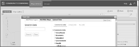


12 5/8/2014 ESRI ArcGIS Google:mapsengine.google.com Community Commons 4


13 National Mapping Resources ESRI communityanalyst.esri.com/ bao.esri.com/ Centers for Disease Control and Prevention County Health Rankings and Roadmaps Community Commons Google Mapping Tool Mapsengine.google.com WI Mapping Resources UW Robinson Map Library WI Department of Public Instruction UW-Extension- Food Security Emily Reynolds Community Outreach Specialist WI Comprehensive Cancer Control Program And others! How could you use maps? In groups of 3 or 4, take 10 minutes to brainstorm a few ideas for how you could use maps in your work? Share it back 5
Region NC. Page 1 of 6. Total Salt. Total Salt. Severity Index. Total Salt. Salt. Total Sand. Total Clear- Total Thaw- Lane.
 Notes: 1) Costs shown in table are estimated and do not include the 4.44% Administrative Costs; 2) Material Costs includes,, and other Deicing and icing Agents; 3) Equipment Costs are based on $60 per
GROUP HEALTH INSURANCE 2003 MONTHLY PREMIUM RATES BY COUNTY FOR GRADUATE ASSISTANTS EMPLOYEE SHARE
 GROUP HEALTH INSURANCE 2003 MONTHLY RATES BY COUNTY FOR GRADUATE ASSISTANTS 01 ADAMS UNITY-COMMUNITY 263.60 0.00 263.60 651.70 0.00 651.70 STANDARD PLAN 263.60 337.00 600.60 651.70 811.60 1,463.30 STANDARD
UNIVERSITY OF CAMBRIDGE INTERNATIONAL EXAMINATIONS Cambridge International Level 3 Pre-U Certificate Principal Subject
 UNIVERSITY OF CAMBRIDGE INTERNATIONAL EXAMINATIONS Cambridge International Level 3 Pre-U Certificate Principal Subject GEOGRAPHY 9768/01 Paper 1 Geographical Issues May/June 2013 INSERT 2 hours 30 minutes
FROZEN ROAD DECLARATION, MID SEASON THAW, ENDING THE DECLARATION, AND SPRING WEIGHT RESTRICTION DECISION PROCESS
 FROZEN ROAD DECLARATION, MID SEASON THAW, ENDING THE DECLARATION, AND SPRING WEIGHT RESTRICTION DECISION PROCESS Frozen Road Declaration: State highways in Wisconsin are determined to be frozen at the
Wisconsin GIS Inventory 2009 Report on County GIS Data Systems
 Wisconsin GIS Inventory 2009 Report on County GIS Data Systems May 2009 Additional products of this report not included in this document and available per request or at www.doa.state.wi.us/wlip: Appendix
2017 Plant Insect Update and Other Insects You Might Bump Into
 2017 Plant Insect Update and Other Insects You Might Bump Into PJ Liesch UW-Madison pliesch@wisc.edu @WiBugGuy labs.russell.wisc.edu/insectlab/ Why is Identification Important? Know thy enemy Know the
PUBLIC WORKS DEPARTMENT 2198 GLENDALE AVENUE GREEN BAY, WI PAUL A. FONTECCHIO, P.E. PHONE (920) FAX (920) DIRECTOR bc_h
 FAX (920) DIRECTOR bc_h") PUBLIC WORKS DEPARTMENT 28 GLENDALE AVENUE GREEN BAY, WI 54303 PAUL A. FONTECCHIO, P.E. PHONE (920) 492-4925 FAX (920) 434-4576 DIRECTOR EMAIL: bc_highway@co.brown.wi.us TO: FROM: PD&T Committee Paul Fontecchio,
PUBLIC WORKS DEPARTMENT 28 GLENDALE AVENUE GREEN BAY, WI 54303 PAUL A. FONTECCHIO, P.E. PHONE (920) 492-4925 FAX (920) 434-4576 DIRECTOR EMAIL: bc_highway@co.brown.wi.us TO: FROM: PD&T Committee Paul Fontecchio,
Wisconsin Historic Landscape Project
 Wisconsin Historic Landscape Project 2015 COMMUNITY FORUM REPORT Background and Purpose of the Forums Between 1832 and 1866 the US General Land Office (GLO) surveyed the land area that would become Wisconsin.
TABLE OF CONTENTS. H-1 Ideal Gas Law H-3 Latent Heat and Specific Heat. S-1 Standing Waves on a String
 TABLE OF CONTENTS Rules of the Lab Mechanics M-1 Welcome to the Physics Laboratory M-2 Motion on an Incline M-4 Acceleration in Free Fall M-6 Force and Motion M-5 Conservation of Momentum and Projectile
On Campus, Non-Campus, Public Property Crimes
 On Campus, Non-Campus, Public Property Crimes 2010-2013 Source: US Department of Education Background: FOX 6 News obtained a database of Clery Act crime statistics from the National Institute for Computer
!!!!!! Judy!Derricks,!NRCS!! Jason!Nemecek,!NRCS!! Sara!Walling,!WI!DATCP!! Joe!Baeten,!WI!DNR!! Randall!Warden,!A&L!Great!Lakes!Laboratories!!
 TO: JudyDerricks,NRCS JasonNemecek,NRCS SaraWalling,WIDATCP JoeBaeten,WIDNR RandallWarden,A&LGreatLakesLaboratories StevePeterson,AgSourceLaboratories RodEllwanger,DairylandLaboratories DustinSawyer,RockRiverLaboratory
Applying Health Outcome Data to Improve Health Equity
 Applying Health Outcome Data to Improve Health Equity Devon Williford, MPH, Health GIS Specialist Lorraine Dixon-Jones, Policy Analyst CDPHE Health Equity and Environmental Justice Collaborative Mile High
Purpose Study conducted to determine the needs of the health care workforce related to GIS use, incorporation and training.
 GIS and Health Care: Educational Needs Assessment Cindy Gotz, MPH, CHES Janice Frates, Ph.D. Suzanne Wechsler, Ph.D. Departments of Health Care Administration & Geography California State University Long
Knowing Your Insect Control Options for Trees and Shrubs. The Latest on Managing EAB
 Knowing Your Insect Control Options for Trees and Shrubs & The Latest on Managing EAB PJ Liesch UW-Madison: pliesch@wisc.edu Twitter: @WiBugGuy Pollinators! Bees, wasps, beetles, moths, butterflies! Honey
Maggie M. Kovach. Department of Geography University of North Carolina at Chapel Hill
 Maggie M. Kovach Department of Geography University of North Carolina at Chapel Hill Rationale What is heat-related illness? Why is it important? Who is at risk for heat-related illness and death? Urban
Community Inclusion in Colorado
 A Mapping Project for Emergency Preparedness and Response Aimee Voth Siebert, MA Julia Beems, MA Rachel Coles, MA Devon Williford, MPH Adam Anderson, MURP, MPH March 2015 understanding that HUMAN ENERGY
Developing Built Environment Indicators for Urban Oregon. Dan Rubado, MPH EPHT Epidemiologist Oregon Public Health Division
 Developing Built Environment Indicators for Urban Oregon Dan Rubado, MPH EPHT Epidemiologist Oregon Public Health Division What is the built environment? The built environment encompasses spaces and places
APPENDIX PHASE 1 GREEN INFRASTRUCTURE FRAMEWORK
 APPENDIX PHASE 1 GREEN INFRASTRUCTURE FRAMEWORK KANSAS MISSOURI CONTENTS A DATA WISHLIST 4 B PRECEDENTS 7 C WORKSHOP MATERIALS 13 D ANALYSIS PROCESS 124 E ATLAS & PLAYBOOK DETAILS 156 F POLICY ANALYSIS
This report details analyses and methodologies used to examine and visualize the spatial and nonspatial
 Analysis Summary: Acute Myocardial Infarction and Social Determinants of Health Acute Myocardial Infarction Study Summary March 2014 Project Summary :: Purpose This report details analyses and methodologies
Population Profiles
 U N D E R S T A N D I N G A N D E X P L O R I N G D E M O G R A P H I C C H A N G E MAPPING AMERICA S FUTURES, BRIEF 6 2000 2010 Population Profiles Atlanta, Las Vegas, Washington, DC, and Youngstown Allison
New NOAA Precipitation-Frequency Atlas for Wisconsin
 New NOAA Precipitation-Frequency Atlas for Wisconsin #215966 Presentation to the Milwaukee Metropolitan Sewerage District Technical Advisory Team January 16, 2014 Michael G. Hahn, P.E., P.H. SEWRPC Chief
Understanding Your Community A Guide to Data
 Understanding Your Community A Guide to Data Alex Lea September 2013 Research and Insight Team LeicestershireCounty Council Understanding Geographies Important to understand the various geographies that
Transportation and Logistics Planning and Development Mapping Tool
 Transportation and Logistics Planning and Development Mapping Tool Doreen Gonzales-Gaboyan Business Development and Outreach Center for Innovation through Visualization and Simulation (CIVS) Purdue University
Reducing Vulnerability to Extreme Heat: Science-Policy Interface
 Reducing Vulnerability to Extreme Heat: Science-Policy Interface Olga Wilhelmi, Mary Hayden, Jennifer Boehnert, Ursula Lauper and SIMMER research team October 23, 2013 Toronto SIMMER workshop Science-Policy
JOINT STRATEGIC NEEDS ASSESSMENT (JSNA) Key findings from the Leicestershire JSNA and Charnwood summary
 Key findings from the Leicestershire JSNA and Charnwood summary") JOINT STRATEGIC NEEDS ASSESSMENT (JSNA) Key findings from the Leicestershire JSNA and Charnwood summary 1 What is a JSNA? Joint Strategic Needs Assessment (JSNA) identifies the big picture in terms of
JOINT STRATEGIC NEEDS ASSESSMENT (JSNA) Key findings from the Leicestershire JSNA and Charnwood summary 1 What is a JSNA? Joint Strategic Needs Assessment (JSNA) identifies the big picture in terms of
Integrating GIS into Food Access Analysis
 GIS Day at Kansas University Integrating GIS into Food Access Analysis Daoqin Tong School of Geography and Development Outline Introduction Research questions Method Results Discussion Introduction Food
Geospatial Technologies for Resources Planning & Management
 Geospatial Technologies for Resources Planning & Management Lal Samarakoon, PhD Director, Geoinformatics Center Asian Institute of Technology, Thailand Content Geoinformatics for SDG Information Integration
An online data and consulting resource of THE UNIVERSITY OF TOLEDO THE JACK FORD URBAN AFFAIRS CENTER
 An online data and consulting resource of THE JACK FORD URBAN AFFAIRS CENTER THE CENTER FOR GEOGRAPHIC INFORMATION SCIENCE AND APPLIED GEOGRAPHICS DEPARTMENT OF GEOGRAPHY AND PLANNING THE UNIVERSITY OF
SUPPORTS SUSTAINABLE GROWTH
 DDSS BBUUN NDDLLEE G E O S P AT I A L G O V E R N A N C E P A C K A G E SUPPORTS SUSTAINABLE GROWTH www.digitalglobe.com BRISBANE, AUSTRALIA WORLDVIEW-3 30 CM International Civil Government Programs US
Acknowledgments xiii Preface xv. GIS Tutorial 1 Introducing GIS and health applications 1. What is GIS? 2
 Acknowledgments xiii Preface xv GIS Tutorial 1 Introducing GIS and health applications 1 What is GIS? 2 Spatial data 2 Digital map infrastructure 4 Unique capabilities of GIS 5 Installing ArcView and the
Tracey Farrigan Research Geographer USDA-Economic Research Service
 Rural Poverty Symposium Federal Reserve Bank of Atlanta December 2-3, 2013 Tracey Farrigan Research Geographer USDA-Economic Research Service Justification Increasing demand for sub-county analysis Policy
Approach to identifying hot spots for NCDs in South Africa
 Approach to identifying hot spots for NCDs in South Africa HST Conference 6 May 2016 Noluthando Ndlovu, 1 Candy Day, 1 Benn Sartorius, 2 Karen Hofman, 3 Jens Aagaard-Hansen 3,4 1 Health Systems Trust,
USDA NRCS Implementation of NOAA Atlas 14. NRCS Work to Implement NOAA Atlas 14
 USDA NRCS Implementation of NOAA Atlas 1 An Equal Opportunity Provider and Employer Annette Humpal, P.E. USDA NRCS Hydraulic Engineer Background: NRCS Work to Implement NOAA Atlas 1 NRCS Priority to work
Long Island Breast Cancer Study and the GIS-H (Health)
") Long Island Breast Cancer Study and the GIS-H (Health) Edward J. Trapido, Sc.D. Associate Director Epidemiology and Genetics Research Program, DCCPS/NCI COMPREHENSIVE APPROACHES TO CANCER CONTROL September,
Long Island Breast Cancer Study and the GIS-H (Health) Edward J. Trapido, Sc.D. Associate Director Epidemiology and Genetics Research Program, DCCPS/NCI COMPREHENSIVE APPROACHES TO CANCER CONTROL September,
Are You Maximizing The Value Of All Your Data?
 Are You Maximizing The Value Of All Your Data? Using The SAS Bridge for ESRI With ArcGIS Business Analyst In A Retail Market Analysis SAS and ESRI: Bringing GIS Mapping and SAS Data Together Presented
ArcGIS for Desktop. ArcGIS for Desktop is the primary authoring tool for the ArcGIS platform.
 ArcGIS for Desktop ArcGIS for Desktop ArcGIS for Desktop is the primary authoring tool for the ArcGIS platform. Beyond showing your data as points on a map, ArcGIS for Desktop gives you the power to manage
Jim Fox. copyright UNC Asheville's NEMAC
 Decisions and System Thinking Jim Fox November, 2012 1 UNC Asheville s s NEMAC National Environmental Modeling and Analysis Center Applied Research and technology development on integration of environmental
Mapping and Health Equity Advocacy
 Mapping and Health Equity Advocacy Sarah Treuhaft PolicyLink November 7, 2008 About us PolicyLink National research and action institute that advances policies to achieve economic and social equity Center
Hennepin GIS. Tree Planting Priority Areas - Analysis Methodology. GIS Services April 2018 GOAL:
 Hennepin GIS GIS Services April 2018 Tree Planting Priority Areas - Analysis Methodology GOAL: To create a GIS data layer that will aid Hennepin County Environment & Energy staff in determining where to
Role of GIS in Tracking and Controlling Spread of Disease
 Role of GIS in Tracking and Controlling Spread of Disease For Dr. Baqer Al-Ramadan By Syed Imran Quadri CRP 514: Introduction to GIS Introduction Problem Statement Objectives Methodology of Study Literature
GIS for Crime Analysis. Building Better Analysis Capabilities with the ArcGIS Platform
 GIS for Crime Analysis Building Better Analysis Capabilities with the ArcGIS Platform Crime Analysis The Current State One of the foundations of criminological theory is that three things are needed for
Finding Common Ground Through GIS
 Finding Common Ground Through GIS Matthew Stone, MPH Special Unit for Technical Assistance Chronic Disease and Injury Control California Department of Public Health ESRI Health GIS Conference Scottsdale,
Wisconsin Coastal Atlas Building the Coastal Spatial Data Infrastructure to Promote Hazard Resilience on the Great Lakes
 Wisconsin Coastal Atlas Building the Coastal Spatial Data Infrastructure to Promote Hazard Resilience on the Great Lakes David Hart GIS Specialist University of Wisconsin Sea Grant Institute ASPRS - Great
Environmentally-induced Population Displacements: Conclusions from PERN s Online Seminar
 Environment, Forced Migration & Social Vulnerability International Conference 9-11 October 2008 Bonn, Germany www.efmsv2008.org Environmentally-induced Population Displacements: Conclusions from PERN s
GeoHealth Applications Platform ESRI Health GIS Conference 2013
 GeoHealth Applications Platform ESRI Health GIS Conference 2013 Authors Thomas A. Horan, Ph.D. Professor, CISAT Director April Moreno Health GeoInformatics Ph.D. Student Brian N. Hilton, Ph.D. Clinical
Section 2. Indiana Geographic Information Council: Strategic Plan
 Section 2. Indiana Geographic Information Council: Strategic Plan Introduction A geographic information system (GIS) is an automated tool that allows the collection, modification, storage, analysis, and
Demographic Data in ArcGIS. Harry J. Moore IV
 Demographic Data in ArcGIS Harry J. Moore IV Outline What is demographic data? Esri Demographic data - Real world examples with GIS - Redistricting - Emergency Preparedness - Economic Development Next
Introducing the. a partnership of
 Introducing the a partnership of Background Need for online atlas identified by managers and researchers to make coastal data available Shoreline data Ocean and coastal resources Sea-level rise potential
MAKING PLANNING LOCAL
 Georgia Social Vulnerability Index 2010 Atlas MAKING PLANNING LOCAL VULNERABLE & AT-RISK POPULATIONS DATA FOR JURISDICTIONS AT THE CENSUS TRACT LEVEL Public Health Districts Regional Coordinating Hospital
Spatial Data Availability Energizes Florida s Citizens
 NASCIO 2016 Recognition Awards Nomination Spatial Data Availability Energizes Florida s Citizens State of Florida Agency for State Technology & Department of Environmental Protection Category: ICT Innovations
BROOKINGS May
 Appendix 1. Technical Methodology This study combines detailed data on transit systems, demographics, and employment to determine the accessibility of jobs via transit within and across the country s 100
CRP 608 Winter 10 Class presentation February 04, Senior Research Associate Kirwan Institute for the Study of Race and Ethnicity
 CRP 608 Winter 10 Class presentation February 04, 2010 SAMIR GAMBHIR SAMIR GAMBHIR Senior Research Associate Kirwan Institute for the Study of Race and Ethnicity Background Kirwan Institute Our work Using
Evaluating Community Analyst for Use in School Demography Studies
 Portland State University PDXScholar Publications, Reports and Presentations Population Research Center 7-2013 Evaluating Community Analyst for Use in School Demography Studies Richard Lycan Portland State
geographic patterns and processes are captured and represented using computer technologies
 Proposed Certificate in Geographic Information Science Department of Geographical and Sustainability Sciences Submitted: November 9, 2016 Geographic information systems (GIS) capture the complex spatial
Geospatial Assessment in Support of Urban & Community Forestry Programs
 Geospatial Assessment in Support of Urban & Community Forestry Programs Funded by the USDA Forest Service, State and Private Forestry, under Cooperative Agreement # 06-CA-112244225-338 with the University
Continental Divide National Scenic Trail GIS Program
 CDNST Vision Statement: Provide the most accurate geospatial locational information of the Continental Divide Trail and nearby resources to the public as well as help provide internal management information
Techniques for Science Teachers: Using GIS in Science Classrooms.
 Techniques for Science Teachers: Using GIS in Science Classrooms. After ESRI, 2008 GIS A Geographic Information System A collection of computer hardware, software, and geographic data used together for
Switching to AQA from Edexcel: Draft Geography AS and A-level (teaching from September 2016)
") Switching to AQA from Edexcel: Draft Geography AS and A-level (teaching from September 2016) If you are thinking of switching from OCR to AQA (from September 2016), this resource is an easy reference guide.
Switching to AQA from Edexcel: Draft Geography AS and A-level (teaching from September 2016) If you are thinking of switching from OCR to AQA (from September 2016), this resource is an easy reference guide.
Diffusion of GIS in Public Policy Doctoral Program
 Diffusion of GIS in Public Policy Doctoral Program By Fulbert Namwamba PhD Southern University This presentation demonstrate how GIS was introduced in the Public Policy Doctoral Program at Southern University,
University of Lusaka
 University of Lusaka BSPH 315 Health Mapping & GIS Topic: Background of GIS Content: 1. Aim of the course 2. What do you know about GIS? 3. Difference between geographic data and geographic information
Mapping Secondary Cities for Resiliency and Emergency Preparedness
 Mapping Secondary Cities for Resiliency and Emergency Preparedness Secondary Cities Geospatial Training Workshop Pilot Project: Cusco, Peru June 29 July 3 2015 WHO ARE WE? Office of the Geographer (GGI)
Measuring community health outcomes: New approaches for public health services research
 Research Brief March 2015 Measuring community health outcomes: New approaches for public health services research P ublic Health agencies are increasingly asked to do more with less. Tough economic times
ADMINISTRATION DEPARTMENT Land Management Information Center. An Inventory of Its Records
 MINNESOTA HISTORICAL SOCIETY Minnesota State Archives ADMINISTRATION DEPARTMENT Land Management Information Center An Inventory of Its Records OVERVIEW OF THE RECORDS Agency: Series Title: Land Management
John Laznik 273 Delaplane Ave Newark, DE (302)
") Office Address: John Laznik 273 Delaplane Ave Newark, DE 19711 (302) 831-0479 Center for Applied Demography and Survey Research College of Human Services, Education and Public Policy University of Delaware
Office Address: John Laznik 273 Delaplane Ave Newark, DE 19711 (302) 831-0479 Center for Applied Demography and Survey Research College of Human Services, Education and Public Policy University of Delaware
PUBLIC SAFETY POWER SHUTOFF POLICIES AND PROCEDURES
 PACIFIC GAS AND ELECTRIC COMPANY PUBLIC SAFETY POWER SHUTOFF POLICIES AND PROCEDURES SEPTEMBER 2018 1 PACIFIC GAS AND ELECTRIC COMPANY PUBLIC SAFETY POWER SHUTOFF POLICIES AND PROCEDURES SEPTEMBER 2018
Geographic Information Infrastructure and Policy Framework for Sustainable Mountain Development in the Hindu Kush-Himalayas
 Geo SMART ASIA 2017 22-24 August, Kualalampur Geographic Information Infrastructure and Policy Framework for Sustainable Mountain Development in the Hindu Kush-Himalayas Basanta Shrestha, Director Strategic
Tools for Climate Change Adaptation Planning
 Adaptation base for Planning Tool (ADAPT) CRiSTAL (Community-based Risk Screening Tool Adaptation and Livelihoods) NOAA CSC Coastal Inundation Toolkit NOAA CSC Roadmap Ecosystem-Based Managment Tools Network
An Assessment of People, Place and Business on Syracuse s Near Northside
 An Assessment of People, Place and Business on Syracuse s Near Northside May 2013 Report produced by Jon Glass, Kelly Montague and Mark Pawliw Edited by Jon Glass and Jonnell Robinson Syracuse Community
The CRP stresses a number of factors that point to both our changing demographics and our future opportunities with recommendations for:
 Plan Overview The CRP represents the first broad planning initiative covering Lake, Porter and LaPorte counties. Unlike previous plans released by NIRPC, which focused primarily on transportation, the
DATA DISAGGREGATION BY GEOGRAPHIC
 PROGRAM CYCLE ADS 201 Additional Help DATA DISAGGREGATION BY GEOGRAPHIC LOCATION Introduction This document provides supplemental guidance to ADS 201.3.5.7.G Indicator Disaggregation, and discusses concepts
Neighborhood social characteristics and chronic disease outcomes: does the geographic scale of neighborhood matter? Malia Jones
 Neighborhood social characteristics and chronic disease outcomes: does the geographic scale of neighborhood matter? Malia Jones Prepared for consideration for PAA 2013 Short Abstract Empirical research
GIS Visualization: A Library s Pursuit Towards Creative and Innovative Research
 GIS Visualization: A Library s Pursuit Towards Creative and Innovative Research Justin B. Sorensen J. Willard Marriott Library University of Utah justin.sorensen@utah.edu Abstract As emerging technologies
Empowering Local Health through GIS
 Empowering Local Health through GIS Mapping data from Washington s Immunization Information System (IIS). Presented to IACW October 16 th, 2013 by: Chris Halsell and Isaiah Berg Agenda IIS Overview Why
Foundation Geospatial Information to serve National and Global Priorities
 Foundation Geospatial Information to serve National and Global Priorities Greg Scott Inter-Regional Advisor Global Geospatial Information Management United Nations Statistics Division UN-GGIM: A global
GIS and Community Health. GIS and Community Health. Institutional Context and Interests in GIS Development. GIS and Community Health
 GIS and Community Health GIS and Community Health Some critiques of GIS emphasize the potentially harmful social consequences of the diffusion of GIS technology, including reinforcing the power of state
Oman NSDI Supporting Economic Development. Saud Al-Nofli Director of Spatial Data Directorate General of NSDI, NCSI
 Oman NSDI Supporting Economic Development 2017 Saud Al-Nofli Director of Spatial Data Directorate General of NSDI, NCSI "It s critical to make correct decisions the first time to optimize the Investments
USING MAPS TO SUPPORT TOBACCO EVALUATION: An Overview of ArcGIS and Tableau
 USING MAPS TO SUPPORT TOBACCO EVALUATION: An Overview of ArcGIS and Tableau Lindsay Kephart, MPH MA Tobacco Cessation and Prevention Program (MTCP) Massachusetts Department of Public Health Overview GIS
Spatial Variation in Local Road Pedestrian and Bicycle Crashes
 2015 Esri International User Conference July 20 24, 2015 San Diego, California Spatial Variation in Local Road Pedestrian and Bicycle Crashes Musinguzi, Abram, Graduate Research Assistant Chimba,Deo, PhD.,
Health and Medical Geography (GEOG 222)
") Spring 2019 Class meets: Tuesdays and Thursdays 12:30-1:45pm Carolina Hall Room 220 Instructor: Michael Emch Email: emch@unc.edu Course Objectives Health and Medical Geography (GEOG 222) This course is
Spring 2019 Class meets: Tuesdays and Thursdays 12:30-1:45pm Carolina Hall Room 220 Instructor: Michael Emch Email: emch@unc.edu Course Objectives Health and Medical Geography (GEOG 222) This course is
Georeferencing and Satellite Image Support: Lessons learned, Challenges and Opportunities
 Georeferencing and Satellite Image Support: Lessons learned, Challenges and Opportunities Shirish Ravan shirish.ravan@unoosa.org UN-SPIDER United Nations Office for Outer Space Affairs (UNOOSA) UN-SPIDER
A Framework for the Study of Urban Health. Abdullah Baqui, DrPH, MPH, MBBS Johns Hopkins University
 This work is licensed under a Creative Commons Attribution-NonCommercial-ShareAlike License. Your use of this material constitutes acceptance of that license and the conditions of use of materials on this
DEPARTMENT OF GEOLOGY AND MINERAL INDUSTRIES WAYS & MEANS SUBCOMMITTEE ON NATURAL RESOURCES MARCH 2, 2017
 DEPARTMENT OF GEOLOGY AND MINERAL INDUSTRIES WAYS & MEANS SUBCOMMITTEE ON NATURAL RESOURCES MARCH 2, 2017 1 ABOUT DOGAMI AGENCY MISSION, VISION & GOALS 2 Lidar image of a stream network along the Umpqua
Geographic Information System Visualization and Analysis for Assessment in Wisconsin
 WAAO Quarterly Meeting June 23, 2017 Adam Dorn City of Oshkosh IT Division Geographic Information System Visualization and Analysis for Assessment in Wisconsin Outline Introduction Data Maintenance Who
Social Vulnerability Index. Susan L. Cutter Department of Geography, University of South Carolina
 Social Vulnerability Index Susan L. Cutter Department of Geography, University of South Carolina scutter@sc.edu Great Lakes and St. Lawrence Cities Initiative Webinar December 3, 2014 Vulnerability The
UTAH S STATEWIDE GEOGRAPHIC INFORMATION DATABASE
 UTAH S STATEWIDE GEOGRAPHIC INFORMATION DATABASE Data Information and Knowledge Management NASCIO Awards 2009 STATE GEOGRAPHIC INFORMATION DATABASE B. EXECUTIVE SUMMARY Utah has developed one of the most
Remarks. for. H.E. Mr. Gyan Chandra Acharya
 Please check against delivery Remarks for H.E. Mr. Gyan Chandra Acharya Under-Secretary-General and High Representative for the Least Developed Countries, Landlocked Developing Countries and Small Island
NEW YORK AND CONNECTICUT SUSTAINABLE COMMUNITIES. Fair Housing & Equity Assessment & Regional Planning Enhancement
 NEW YORK AND CONNECTICUT SUSTAINABLE COMMUNITIES Fair Housing & Equity Assessment & Regional Planning Enhancement November 19, 2013 White Plains Public Library Federal grant to improve regional planning
The Church Demographic Specialists
 The Church Demographic Specialists Easy-to-Use Features Map-driven, Web-based Software An Integrated Suite of Information and Query Tools Providing An Insightful Window into the Communities You Serve Key
KENTUCKY HAZARD MITIGATION PLAN RISK ASSESSMENT
 KENTUCKY HAZARD MITIGATION PLAN RISK ASSESSMENT Presentation Outline Development of the 2013 State Hazard Mitigation Plan Risk Assessment Determining risk assessment scale Census Data Aggregation Levels
COASTAL HAZARDS. Alan Lulloff, Water Management Engineer Wisconsin Department of Natural Resources. Local Contact: John Spangberg (715)
") COASTAL HAZARDS Alan Lulloff, Water Management Engineer Wisconsin Department of Natural Resources Local Contact: John Spangberg (715)685-2923 The Northwest Ordinance of 1787 and the river Mississippi and
COASTAL HAZARDS Alan Lulloff, Water Management Engineer Wisconsin Department of Natural Resources Local Contact: John Spangberg (715)685-2923 The Northwest Ordinance of 1787 and the river Mississippi and
Final Group Project Paper. Where Should I Move: The Big Apple or The Lone Star State
 Final Group Project Paper Where Should I Move: The Big Apple or The Lone Star State By: Nathan Binder, Shannon Scolforo, Kristina Conste, Madison Quinones Main Goal: Determine whether New York or Texas
Table G - 6. Mitigation Actions Identified for Implementation by the City of Kent ( ) (From Wilkin County Master Mitigation Action Chart)
 (From Wilkin County Master Mitigation Action Chart)") Table G - 6. Actions Identified by the () (From Master Action Chart) Multi-Hazard Plan, 2017 Action Comments 5 All-Hazards Local Planning & Regulations Update the Operations Plan on an annual basis. Work
Table G - 6. Actions Identified by the () (From Master Action Chart) Multi-Hazard Plan, 2017 Action Comments 5 All-Hazards Local Planning & Regulations Update the Operations Plan on an annual basis. Work
Geospatial Information and Services for Disasters (GIS4D)
") Geospatial Information and Services for Disasters (GIS4D) 31 July 2017 Tae Hyung KIM ICT and Disaster Risk Reduction Division (IDD) UNESCAP 1 About ESCAP Who is ESCAP? United Nations Economic and Social
Geospatial Information and Services for Disasters (GIS4D) 31 July 2017 Tae Hyung KIM ICT and Disaster Risk Reduction Division (IDD) UNESCAP 1 About ESCAP Who is ESCAP? United Nations Economic and Social
STATE GEOGRAPHIC INFORMATION DATABASE
 STATE GEOGRAPHIC INFORMATION DATABASE Data Information and Knowledge Management STATE GEOGRAPHIC INFORMATION DATABASE EXECUTIVE SUMMARY Utah has developed one of the most comprehensive statewide GIS resources
STAR COMMUNITY RATING SYSTEM OBJECTIVE EE-4: EQUITABLE SERVICES & ACCESS COMMUNITY LEVEL OUTCOMES FOR KING COUNTY, WA
 STAR COMMUNITY RATING SYSTEM OBJECTIVE EE-4: EQUITABLE SERVICES & ACCESS COMMUNITY LEVEL OUTCOMES FOR KING COUNTY, WA OUTCOME I: EQUITABLE ACCESS AND PROXIMITY Background: This analysis has been developed
DOWNLOAD OR READ : WEB GIS PRINCIPLES AND APPLICATIONS PDF EBOOK EPUB MOBI
 DOWNLOAD OR READ : WEB GIS PRINCIPLES AND APPLICATIONS PDF EBOOK EPUB MOBI Page 1 Page 2 web gis principles and applications web gis principles and pdf web gis principles and applications Course Tutors
Copernicus Overview. Major Emergency Management Conference Athlone 2017
 Copernicus Overview Major Emergency Management Conference Athlone 2017 Copernicus is a European programme implemented by the European Commission. The services address six thematic areas: land, marine,
Geographic Information Systems A GIS Primer for Public Health. Capacity Building Workshop October 19, 2009
 Geographic Information Systems A for Public Health Capacity Building Workshop October 19, 2009 Agenda Welcome (:10) OAHPP GIS Workshop Series (:10) GIS: A Four Letter Word (:10) The Fundamentals (:30)
GIS at the Purdue Center for Regional Development: Some Examples
 GIS at the Purdue Center for Regional Development: Some Examples Indraneel Kumar SHaPE Brownbag Seminar February 1st, 2008 Regional Development for Local Success GIS Tools ESRI ArcGIS suite (ArcInfo-Workstation)
GIS Capability Maturity Assessment: How is Your Organization Doing?
 GIS Capability Maturity Assessment: How is Your Organization Doing? Presented by: Bill Johnstone Principal Consultant Spatial Vision Group November 8, 2018 1. Motivation for Capability Maturity Models