GIS Products in Support of Petroleum Resource Assessment in Northern Afghanistan
|
|
|
- Easter Stevenson
- 5 years ago
- Views:
Transcription
1 GIS Products in Support of Petroleum Resource Assessment in Northern Afghanistan ESRI Petroleum Users Group Houston, Texas February 27, 2007 Douglas W. Steinshouer 1, Craig J. Wandrey 2, Christopher C. Skinner 2 1 Contractor to the U.S. Geological Survey, Denver, CO 2 U.S. Geological Survey, Denver, CO
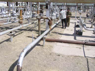
2 Assessment of Oil and Gas Resources in Northern Afghanistan Collaboration of the U.S. Geological Survey and the Afghanistan Ministry of Mines and Industry (AMMI) Joint Oil and Gas Resource Assessment Team Estimate of volumes of undiscovered petroleum Assist AMMI to develop data, technology and human resources to develop and manage Afghanistan s energy resources Must have best possible locations of wells and structural elements
3 The Scavenger Hunt for Data AMMI - Maps, geologic reports and production data; incomplete, poorly reproduced and preserved and of uncertain reliability Russian sources - Maps and geologic reports; incomplete, poorly reproduced and of uncertain reliability IHS / Petroconsultants - Incomplete and not very reliable well and field locations USGS - GPS locations, geochemical samples and analyses, geophysical surveys
4 Mapping in Afghanistan No nationwide mapping effort until 1959 Soviet US collaboration 1970 s vintage Soviet military topographic maps of Afghanistan in 1:50,000 and 1:100,000 scales - unreliable United States DMA topographic maps - unavailable
5 Soviet Era Maps No projection information provided Rule of thumb: Scale smaller than 1:1,000,00 likely to be Equidistant Conic projection. Scale larger than 1:1,000,000 likely to be Gauss-Krüger projection. Graticules and geographic features DO NOT match. What to use as reference?
6 The First Section All maps were considered State Secrets in The Soviet Union. The First Section managed base maps and altered working maps for publication. Did the First Section use its super cartographic powers on maps in Afghanistan?


7 A Tale of Two Maps Prospect Map Seismic Line Map


8 Jer Koduq Gas Field
9 Prospect Map Jer Koduq Gas Field
10 Seismic Line Map Jer Koduq Gas Field
11 Seismic Line Map Jer Koduq Gas Field
12 Seismic Line Map Jer Koduq Gas Field 1653 meters Well 52
13 Seismic Line Map Jer Koduq Gas Field Well meters
14 Seismic Line Map Jer Koduq Gas Field 1645 meters Well 19
15 Seismic Line Map Jer Koduq Gas Field Well meters
16 Seismic Line Map Jer Koduq Gas Field Well meters
17 A Datum for All Seasons? Pulkovo 1942 Common Soviet datum Krasovsky spheroid Herat North of 1959 Datum developed by the Soviets for Afghanistan International spheroid of 1924 WGS 1984 Geocentric datum commonly used by GPS receivers.
18 Jer Koduq Well 63 WGS 1984 Herat North Pulkovo meters 1000 meters Well 63 from Seismic Map 500 meters
19 Jer Koduq Well 63 WGS 1984 Herat North 1626 meters Pulkovo meters 1000 meters Well 63 from Seismic Map 500 meters


20 Transverse Mercator Projections Universal Transverse Mercator UTM Six degree zones numbered from 180 degrees Each zone has unique x coordinate origin Secant projection scale factor at CM = Gauss-Krüger Six degree zones numbered from Prime Meridian Prefix false easting = zone number x 1,000,000 Tangent projection scale factor at CM =
21 What if? Did the First Section alter maps in Afghanistan? Could modern GIS decode the alterations of the First Section? Alteration algorithm as simple as changing the scale factor of a Transverse Mercator projection? Could a trusted data set be reverse engineered to match the altered data?
22 If the glove fits Seismic Line Map Jer Koduq Gas Field
23 And the datum is 500 meters 1000 meters WGS 1984 Pulkovo 1942 Well 63 from Seismic Map Herat North probably Pulkovo 1942 Jer Koduq Well 63
24 The Fix is in To register and rectify scanned images of large-scale Soviet era maps of Afghanistan: Project reference data to a Transverse Mercator projection Use Gauss-Krüger coordinates and parameters Use a scale factor of Use the Pulkovo 1942 datum and the Krasovsky spheroid
25 Out of the Rabbit Hole To recover data digitized from Soviet era large-scale maps in Afghanistan: Use PROJECT DEFINE to alter the data s projection definition: Change the defined scale factor from to Project the data to the desired conventional projection, taking care to use the appropriate datum transformation definition
26 By Any Means Necessary? Are these manipulations justified? PRO: CON: They seem to work across the map extent They are describable and repeatable They avoid arbitrary manipulations like ADJUST They are the result of trial and error, not formal logic
27 Summary Can we say that we have solved the problem of Soviet era map distortion? No, we cannot. Especially not in the case of the infamous System 1963 coordinate system. The unexpected Transverse Mercator scale factor on these maps of Afghanistan might simply be a peculiarity of the Soviet cartographers that created them. It makes a good story, but we can t claim to have outwitted the First Section.
28 Hierarchy of Reliability GPS observations Seismic line map Dari prospect map Russian prospect map Structure maps IHS/Petroconsultants data
29 Digital Prospecting Kohi Kartaw Eocene mudstone
30 Brave New World The U.S. Geological Survey has equipped AMMI with some computers, ArcView and ArcGIS licenses, 2 scanners and 2 plotters Only gradually have they come to realize the value that digital data and GIS bring to their work
31 Requirements of Digital Products Simple to use Transferable from computer to computer Local installation No software cost Flexibility for end-users
32 Shapefiles Flexible format Editable in ArcView v3.x Robust
33 ArcReader Free software Local installation Good functionality Easy to use
34 The ArcReader project Presents the digital data collected and generated so far Provides a nucleus for creation of an Afghan data package Provides the Afghans with a template for new GIS projects
35 Thank you! For more information about the U.S. Geological Survey s Energy Resource Program s efforts in Afghanistan, please visit:
How does an ellipsoid differ from a sphere in approximating the shape and size of the Earth?
 Chapter 02 Test Bank Worksheet Questions 1. What is a map projection? Topic: Map Projection 2. How does an ellipsoid differ from a sphere in approximating the shape and size of the Earth? Topic: Ellipsoid
What is a Map Projection?
 What is a Map Projection? It is how we represent a three dimensional Earth on a flat piece of paper However The process of transferring information from the Earth to a map causes every projection to distort
WHERE ARE YOU? Maps & Geospatial Concepts Fall 2012
 WHERE ARE YOU? Maps & Geospatial Concepts Fall 2012 Where are you? Relative location I m at school Absolute Location 45 26 18.07 122 43 50.78 Datums Datums A reference surface of the Earth Used as the
Coordinate Systems. Location on earth is defined by coordinates
 Coordinate Systems We think of the earth as a sphere It is actually a spheroid (ellipsoid), slightly larger in radius at the equator than at the poles Shape of the Earth Location on earth is defined by
Georeferencing. Place names Postal addresses Postal codes Coordinate systems (lat/long, UTM, etc.)
") Georeferencing Georeferencing Used to describe the act of assigning locations to data or information Certain requirements include that they are: unique, have shared meaning, and are persistent through
Georeferencing Georeferencing Used to describe the act of assigning locations to data or information Certain requirements include that they are: unique, have shared meaning, and are persistent through
Georeferencing, Map Projections, Cartographic Concepts. -Coordinate Systems -Datum
 Georeferencing, Map Projections, Cartographic Concepts -Map Projections -Coordinate Systems -Datum Map projection is "the process of systematically transforming positions on the Earth's spherical surface
ch02.pdf chap2.pdf chap02.pdf
 Introduction to Geographic Information Systems 8th Edition Karl Solutions Manual Full Download: http://testbanklive.com/download/introduction-to-geographic-information-systems-8th-edition-karl-solutions-manu
Dr. ABOLGHASEM AKBARI Faculty of Civil Engineering & Earth Resources, University Malaysia Pahang (UMP)
") Workshop on : Dr. ABOLGHASEM AKBARI Faculty of Civil Engineering & Earth Resources, University Malaysia Pahang (UMP) 14-15 April 2016 Venue: Tehran, Iran GIS definitions GIS: A simplified view of the real
Workshop on : Dr. ABOLGHASEM AKBARI Faculty of Civil Engineering & Earth Resources, University Malaysia Pahang (UMP) 14-15 April 2016 Venue: Tehran, Iran GIS definitions GIS: A simplified view of the real
Intro to GIS Fall 2010 Georeferencing & Map Projections
 Intro to GIS Fall 2010 Georeferencing & Map Projections SHAPE OF THE EARTH Earth's Shape Geoid: shape of earth minus topographic features (irregular due to local variations in gravity) Ellipsoid: elongated
12/26/2012. Geographic Information Systems * * * * GIS (... yrezaei
 ( - Geographic Information Systems ( ( 1 2 3 Information System Data base DB IS IS DB (Knowledge ( ( (System (Information System - (Georefrence Analysis Data + Knowledge ======== Information 4 5 ( < 10%
Map projections. Rüdiger Gens
 Rüdiger Gens Coordinate systems Geographic coordinates f a: semi-major axis b: semi-minor axis Geographic latitude b Geodetic latitude a f: flattening = (a-b)/a Expresses as a fraction 1/f = about 300
Shape e o f f the e Earth
 1 Coordinate Systems & Projections Coordinate Systems Two map layers are not going to register spatially unless they are based on the same coordinate system. 2 Contents Shape of the earth Datum Projections
Lab #3 Map Projections.
 Lab #3 Map Projections http://visual.merriam-webster.com/images/earth/geography/cartography/map-projections.jpg Map Projections Projection: a systematic arrangement of parallels and meridians on a plane
This week s topics. Week 6. FE 257. GIS and Forest Engineering Applications. Week 6
 FE 257. GIS and Forest Engineering Applications Week 6 Week 6 Last week Chapter 8 Combining and splitting landscape features and merging GIS databases Chapter 11 Overlay processes Questions? Next week
Map Projections. What does the world look like? AITOFF AZIMUTHAL EQUIDISTANT BEHRMANN EQUAL AREA CYLINDRICAL
 Map Projections What does the world look like? AITOFF AZIMUTHAL EQUIDISTANT BEHRMANN EQUAL AREA CYLINDRICAL 1 CYLINDRICAL EQUAL AREA BONNE CRASTER PARABOLIC 2 ECKERT I ECKERT III ECKERT V There are many
Geospatial Data Standards Considerations for the delivery of 2D and 3D spatial data February 2019
 Geospatial Data Standards Considerations for the delivery of 2D and 3D spatial data February 2019 Prepared by: GRCA Geomatics Version Date Summary of Changes Changes Made By: 1.00 March 16, 2018 Version
When the Earth Was Flat. Measurements were made using a plumb bob, a spirit level, and a stick. Also, the Stars.
 ABSTRACT Defining the shape of the Earth geoid. Mathematical models spheroid or ellipsoid Mathematical projection of geodetic systems GIS/GPS technology The need for a unified projection systems World
EnvSci360 Computer and Analytical Cartography
 EnvSci360 Computer and Analytical Cartography Lecture 3 Geodesy Map Projections, Datums, and Coordinate Systems 1 Geodesy The science of measuring and representing the shape and size of the earth, and
Watershed Sciences 4930 & 6920 GEOGRAPHIC INFORMATION SYSTEMS
 PROJECTS Watershed Sciences 4930 & 6920 GEOGRAPHIC INFORMATION SYSTEMS WEEK THREE Lecture 5 PROJECT DATA/IDEAS, PROJECTIONS (Cont.) & LAB REVIEW Joe Wheaton GUEST LECTURE HOUSEKEEPING: LAB 01 GRADES This
WHERE ARE YOU? Maps & Geospatial Concepts Fall 2015
 WHERE ARE YOU? Maps & Geospatial Concepts Fall 2015 Where are you? Relative location I m at school Absolute Location 45 26 18.07 122 43 50.78 Where is Boston? Introducing Geodesy, Ellipsoids & Geoids Geodesy
Lesson 5: Map Scale and Projections
 Organizing Data and Information Lesson 5: Map Scale and Projections Map Scales Projections Information can be organized as lists, numbers, tables, text, pictures, maps, or indexes. Clusters of information
Working with georeferenced data. What is georeferencing? Coordinate Systems. Geographic and Projected Coordinate System
 GIS501 Fundamentals of Geographical Information Systems (GIS) Coordinate Systems Working with georeferenced data What is georeferencing? Geographically referenced data which is, in some way, referenced
The Elements of GIS. Organizing Data and Information. The GIS Database. MAP and ATRIBUTE INFORMATION
 GIS s Roots in Cartography Getting Started With GIS Chapter 2 Dursun Z. Seker MAP and ATRIBUTE INFORMATION Data (numbers and text) store as files refer to them collectively as a database gather inform.
Outline. Shape of the Earth. Geographic Coordinates (φ, λ, z) Ellipsoid or Spheroid Rotate an ellipse around an axis. Ellipse.
 Ellipsoid or Spheroid Rotate an ellipse around an axis. Ellipse.") Map Projections Outline Geodesy and map projections Prof. D. Nagesh Kumar Department of Civil Engineering Indian Institute of Science Bangalore 560 012, India http://www.civil.iisc.ernet.in/~nagesh Shape
Map Projections Outline Geodesy and map projections Prof. D. Nagesh Kumar Department of Civil Engineering Indian Institute of Science Bangalore 560 012, India http://www.civil.iisc.ernet.in/~nagesh Shape
Understanding Projections for GIS
 Presented by John Schaeffer Juniper GIS Services, Inc. This PowerPoint is available at JuniperGIS.com Presentation Objectives To understand basic concepts on projections and coordinate systems for the
REMOTE SENSING AND GEOSPATIAL APPLICATIONS FOR WATERSHED DELINEATION
 REMOTE SENSING AND GEOSPATIAL APPLICATIONS FOR WATERSHED DELINEATION Gaurav Savant (gaurav@engr.msstate.edu) Research Assistant, Department of Civil Engineering, Lei Wang (lw4@ra.msstate.edu) Research
Lecture 2. Map Projections and GIS Coordinate Systems. Tomislav Sapic GIS Technologist Faculty of Natural Resources Management Lakehead University
 Lecture 2 Map Projections and GIS Coordinate Systems Tomislav Sapic GIS Technologist Faculty of Natural Resources Management Lakehead University Map Projections Map projections are mathematical formulas
2. GETTING STARTED WITH GIS
 2. GETTING STARTED WITH GIS What are geographic information systems and what are they used for? ArcGIS: ArcMap, ArcCatalog and ArcToolbox Vector data vs. raster data vs. attribute tables Polygons, polylines,
REFERENCING COORDINATE SYSTEMS MAP PROJECTIONS GEOREFERENCING
 GIS in Ecology SPATIAL REFERENCING COORDINATE SYSTEMS MAP PROJECTIONS GEOREFERENCING : :1 Where on earth? Early mapmakers recognized the need for a system that could locate features on the earth's surface.
Map Projections & Coordinate Systems
 Map Projections & Coordinate Systems 9/7/2017 1 Why? Laying the Earth Flat Need convenient means of measuring and comparing distances, directions, areas, shapes. Traditional surveying instruments measure
GPS Remote Sensing. GIS Photogrammetry. GEODESY Equipment (total station) CARTOGRAPHY Survey Software. Map Projection Coordinate Systems
 CARTOGRAPHY Survey Software. Map Projection Coordinate Systems") GPS Remote Sensing GIS Photogrammetry GEODESY Equipment (total station) CARTOGRAPHY Survey Software Map Projection Coordinate Systems 1 Coordinate Systems, Datum and Map Projection Dr. Maher A. El-Hallaq
GPS Remote Sensing GIS Photogrammetry GEODESY Equipment (total station) CARTOGRAPHY Survey Software Map Projection Coordinate Systems 1 Coordinate Systems, Datum and Map Projection Dr. Maher A. El-Hallaq
Importance of Understanding Coordinate Systems and Map Projections.
 Importance of Understanding Coordinate Systems and Map Projections. 1 It is extremely important that you gain an understanding of coordinate systems and map projections. GIS works with spatial data, and,
Applied Cartography and Introduction to GIS GEOG 2017 EL. Lecture-1 Chapters 1 and 2
 Applied Cartography and Introduction to GIS GEOG 2017 EL Lecture-1 Chapters 1 and 2 What is GIS? A Geographic Information System (GIS) is a computer system for capturing, storing, querying, analyzing and
Mapping coordinate systems
 Mapping coordinate systems 1. The Earth's Graticule Latitude and Longitude The graticule is the imaginary grid of lines running east-west (lines of latitude = parallels) and north-south lines of longitude
Projections and Coordinate Systems
 Projections and Coordinate Systems Overview Projections Examples of different projections Coordinate systems Datums Projections Overview Projections and Coordinate Systems GIS must accurately represent
Version 1.1 GIS Syllabus
 GEOGRAPHIC INFORMATION SYSTEMS CERTIFICATION Version 1.1 GIS Syllabus Endorsed 1 Version 1 January 2007 GIS Certification Programme 1. Target The GIS certification is aimed at: Those who wish to demonstrate
GEOREFERENCING, PROJECTIONS Part I. PRESENTING DATA Part II
 Week 7 GEOREFERENCING, PROJECTIONS Part I PRESENTING DATA Part II topics of the week Georeferencing Coordinate systems Map Projections ArcMap and Projections Geo-referencing Geo-referencing is the process
Map Projections. Displaying the earth on 2 dimensional maps
 Map Projections Displaying the earth on 2 dimensional maps Map projections Define the spatial relationship between locations on earth and their relative locations on a flat map Are mathematical expressions
Georeferencing. datum. projection. scale. The next few lectures will introduce you to these elements. on the Earth, you ll need to understand how
 Georeferencing GOAL: To assign a location to all the features represented in our geographic information data In order to do so, we need to make use of the following elements: ellipsoid/geoid To determine
Overview key concepts and terms (based on the textbook Chang 2006 and the practical manual)
") Introduction Geo-information Science (GRS-10306) Overview key concepts and terms (based on the textbook 2006 and the practical manual) Introduction Chapter 1 Geographic information system (GIS) Geographically
Introduction Geo-information Science (GRS-10306) Overview key concepts and terms (based on the textbook 2006 and the practical manual) Introduction Chapter 1 Geographic information system (GIS) Geographically
Referencing map features: Coordinate systems and map projections
 Referencing map features: Coordinate systems and map projections Coordinate systems and map projections if we want to integrate geographic data from many different sources, we need to use a consistent
EUROPEAN COMPUTER DRIVING LICENCE. GIS Cartography. Syllabus
 EUROPEAN COMPUTER DRIVING LICENCE GIS Cartography Syllabus Purpose This document details the syllabus for ECDL GIS Module 1 Cartography. The syllabus describes, through learning outcomes, the knowledge
Map projections. Rüdiger Gens
 Rüdiger Gens 2 Outline! Relevant terms! Why map projections?! Map projection categories " Projection surfaces " Features preserved from distortions! Map projection examples! Right choice Relevant terms!
GPS Mapping. Teacher Instructions. Overview: Objectives: Materials: Answers to Student Worksheets:
 Overview: Scientists use Global Positioning System (GPS) receivers to map lava flows. GPS data are compiled by computer Geographic Information System (GIS) software into a digital map. Digital maps can
Spatial Data, 16 th Century Dutchmen, GPS and GIS. Martin Charlton, National Centre for Geocomputation National University of Ireland Maynooth
 Spatial Data, 16 th Century Dutchmen, GPS and GIS Martin Charlton, National Centre for Geocomputation National University of Ireland Maynooth Maps as truth Maps are cultural artifacts, comparable in history
Hydrology and Floodplain Analysis, Chapter 10
 Hydrology and Floodplain Analysis, Chapter 10 Hydrology and Floodplain Analysis, Chapter 10.1 Introduction to GIS GIS Geographical Information System Spatial Data Data linked with geographical location
Coordinate Systems and Datum Transformation in ArcGIS. Brittney White and Melita Kennedy
 Coordinate Systems and Datum Transformation in ArcGIS Brittney White and Melita Kennedy Where is my data? Problem Horizontal Vertical Projections Transformations Horizontal coordinate systems Geographic
UNIT 4: USING ArcGIS. Instructor: Emmanuel K. Appiah-Adjei (PhD) Department of Geological Engineering KNUST, Kumasi
 Department of Geological Engineering KNUST, Kumasi") UNIT 4: USING ArcGIS Instructor: Emmanuel K. Appiah-Adjei (PhD) Department of Geological Engineering KNUST, Kumasi Getting to Know ArcGIS ArcGIS is an integrated collection of GIS software products ArcGIS
UNIT 4: USING ArcGIS Instructor: Emmanuel K. Appiah-Adjei (PhD) Department of Geological Engineering KNUST, Kumasi Getting to Know ArcGIS ArcGIS is an integrated collection of GIS software products ArcGIS
1. Geospatial technology rarely links geospatial data to nonspatial data. a. True *b. False
 Chapter 2 Where in the Geospatial World Are You? 1. Geospatial technology rarely links geospatial data to nonspatial data. 2. For geospatial technology to work, every location on Earth must be: a. inhabited
Geographic coordinate systems
 1 Geographic coordinate systems In this chapter you ll learn about longitude and latitude. You ll also learn about the parts that comprise a geographic coordinate system including Spheres and spheroids
PETROLEUM GEOLOGY OF NORTH AFGANISTAN USING GIS TECHNIQUES
 PETROLEUM GEOLOGY OF NORTH AFGANISTAN USING GIS TECHNIQUES CRP 514 Geographic Information System Instructor: Dr. Baqer M. Al- Ramadan SYED HAROON ALI MS GEOLOGY EARTHSCIENCES DEPARTMENT KFUPM I.D.: g201207320
BUILDING AN ACCURATE GIS
 BUILDING AN ACCURATE GIS 2006 GIS in the Rockies Denver, Colorado September 13, 2006 William E. Linzey United States Department of Commerce National Oceanic and Atmospheric Administration National Geodetic
Import Digital Spatial Data into OneStop
 Import Digital Spatial Data into OneStop» Intended User: Pipeline Licence or Amendments Applicants Overview To apply for a pipeline or pipeline installation licence, applicants must upload the proposed
Lecture 10-14: Map Projections and Coordinate System
 URP 1281 Surveying and Cartography Lecture 10-14: Map Projections and Coordinate System December 27, 2015 Course Teacher: Md. Esraz-Ul-Zannat Assistant Professor Department of Urban and Regional Planning
ARMY ITAM GIS: Automating Standard Army Training Map Production
 ARMY ITAM GIS: Automating Standard Army Training Map Production Douglas Willets ITAM Western Regional Support Center, Center for Environmental Management of Military Lands, Colorado State University, Fort
An ESRI Technical Paper June 2007 Understanding Coordinate Management in the Geodatabase
 An ESRI Technical Paper June 2007 Understanding Coordinate Management in the Geodatabase ESRI 380 New York St., Redlands, CA 92373-8100 USA TEL 909-793-2853 FAX 909-793-5953 E-MAIL info@esri.com WEB www.esri.com
Fri. Jan. 26, Demonstration of QGIS with GPS tracks. Types of data, simple vector (shapefile) formats
 formats") Fri. Jan. 26, 2018 Demonstration of QGIS with GPS tracks Types of data, simple vector (shapefile) formats Map projections, Coordinate Reference Systems Demonstration of QGIS with geologic map 1 Raster
Fri. Jan. 26, 2018 Demonstration of QGIS with GPS tracks Types of data, simple vector (shapefile) formats Map projections, Coordinate Reference Systems Demonstration of QGIS with geologic map 1 Raster
Projections Part I - Categories and Properties James R. Clynch February 2006
 I. Introduction and References Projections Part I - Categories and Properties James R. Clynch February 2006 The world is, approximately, a sphere. Maps are flat. Making maps requires some method of putting
Modern Navigation. Thomas Herring
 12.215 Modern Navigation Thomas Herring Today s class Map Projections: Why projections are needed Types of map projections Classification by type of projection Classification by characteristics of projection
Import Digital Spatial Data (Shapefiles) into OneStop
 into OneStop") Import Digital Spatial Data (Shapefiles) into OneStop» Intended User: Pipeline Licence Applicants Overview To apply for a pipeline or pipeline installation licence, applicants must upload the proposed
Import Digital Spatial Data (Shapefiles) into OneStop» Intended User: Pipeline Licence Applicants Overview To apply for a pipeline or pipeline installation licence, applicants must upload the proposed
Spatial Reference Systems. Introduction
 Spatial Reference Systems Wolfgang Kainz Professor of Cartography and Geoinformation Department of Geography and Regional Research University of Vienna wolfgang.kainz@univie.ac.at Introduction Historic
Lecture 4. Coordinate Systems & Projections
 Lecture 4 Coordinate Systems & Projections Outline Geodesy Geoids Ellipsoids Geographic Coordinate Systems Magnetic North vs. True North Datums Projections Applying Coordinate Systems and Projections Why
GEOL 452/552 - GIS for Geoscientists I. Lecture 15
 GEOL 452/552 - GIS for Geoscientists I Lecture 15 Lecture Plan Midterm Multiple choice part graded (+ solutions) Jump to Ch. 11 for one lecture Coordinate systems Projections, datums, spheroids Unprojected
Projections & GIS Data Collection: An Overview
 Projections & GIS Data Collection: An Overview Projections Primary data capture Secondary data capture Data transfer Capturing attribute data Managing a data capture project Geodesy Basics for Geospatial
The Wildlife Society Meet and Greet. Come learn about what the UNBC Student Chapter of TWS is all about!
 Georeferencing I GEOG 300, Lecture 4 Dr. Anthony Jjumba 1 The Wildlife Society Meet and Greet Quiz Come learn about what the UNBC Student Chapter of TWS is all about! 5:30 7:30 PM, Wednesday September
GIS and Forest Engineering Applications FE 357 Lecture: 2 hours Lab: 2 hours 3 credits
 GIS and Forest Engineering Applications FE 357 Lecture: 2 hours Lab: 2 hours 3 credits Instructor: Michael Wing Assistant Professor Forest Engineering Department Oregon State University Peavy Hall 275
The Nature of Spatial Data. Keith C. Clarke Geography UCSB
 The Nature of Spatial Data Keith C. Clarke Geography UCSB Geographic primitives G = g (x, y, z, s, A, t) [x, y, z] = f(λ, φ, d) Geography also highly dependent upon model First, the datum (d) Models of
Plane coordinates ~~~~~~~~~~
 Coordinate Systems & Map Projections Geographic coordinates A Basic Introduction to Coordinate Systems & Map Projections Latitude & longitude Angles Parallels & meridians Lines Plane coordinates ~~~~~~~~~~
Georeferencing. Geography is the key to linking attributes. Georeferencing is the key to geography.
 Georeferencing Geography is the key to linking attributes. Georeferencing is the key to geography. Why georeferencing? Many reasons for having georeferences Many different approaches to georeferencing
GIS and Forest Engineering Applications FE 257 Lecture and laboratory, 3 credits
 GIS and Forest Engineering Applications FE 257 Lecture and laboratory, 3 credits Instructor: Michael Wing Associate Professor Forest Engineering, Resources, and Management Oregon State University Crop
THE EVOLUTION OF MATHEMATICAL BASES OF POLISH TOPOGRAPHIC MAPS DURING THE RECENT 80 YEARS
 Michal Stankiewicz is a lecturer in map redaction, topography and topographic cartography in Department of Geodesy and Cartography, Warsaw University of Technology. In 1979 he obtained the degree of Doctor
Introduction to Geographic Information Systems
 Introduction to Geographic Information Systems Lynn_Carlson@brown.edu 401-863-9917 The Environmental And Remote TecHnologies Lab MacMillan Hall, Room 105 http://www.brown.edu/research/earthlab/ Outline
Analytical and Computer Cartography Lecture 3: Review: Coordinate Systems
 Analytical and Computer Cartography Lecture 3: Review: Coordinate Systems Geographic Coordinates NAD83 NAD27 remained in use until the earthcentered international GRS80 was complete (Geodetic Reference
Laboratory Topic 4: Projections and Geo-Positioning in ArcGIS [ LAEP/GEOG c188 ]
![Laboratory Topic 4: Projections and Geo-Positioning in ArcGIS [ LAEP/GEOG c188 ]](/thumbs/81/82687491.jpg "Laboratory Topic 4: Projections and Geo-Positioning in ArcGIS [ LAEP/GEOG c188 ]") Laboratory Topic 4: Projections and Geo-Positioning in ArcGIS 10.4.1 - [ LAEP/GEOG c188 ] Projections in ArcGIS 10.4.1 In this tutorial you will learn to identify the Projection and Datum of a dataset,
Laboratory Topic 4: Projections and Geo-Positioning in ArcGIS 10.4.1 - [ LAEP/GEOG c188 ] Projections in ArcGIS 10.4.1 In this tutorial you will learn to identify the Projection and Datum of a dataset,
DATA SOURCES AND INPUT IN GIS. By Prof. A. Balasubramanian Centre for Advanced Studies in Earth Science, University of Mysore, Mysore
 DATA SOURCES AND INPUT IN GIS By Prof. A. Balasubramanian Centre for Advanced Studies in Earth Science, University of Mysore, Mysore 1 1. GIS stands for 'Geographic Information System'. It is a computer-based
GST 101: Introduction to Geospatial Technology Lab 3 - Understanding Coordinate Systems and Map Projections
 GST 101: Introduction to Geospatial Technology Lab 3 - Understanding Coordinate Systems and Map Projections Objective Explore and Understand Coordinate Systems and Map Projections Document Version: 3/3/2015
Coordinate Systems and Datum Transformations in Action
 Esri International User Conference San Diego, California Technical Workshops July 26, 2012 Coordinate Systems and Datum Transformations in Action Geri Miller Rob Juergens Objectives Coordinate systems
NR402 GIS Applications in Natural Resources Lesson 4 Map Projections
 NR402 GIS Applications in Natural Resources Lesson 4 Map Projections From http://www.or.blm.gov/gis/ 1 Geographic coordinates Coordinates are expressed as Latitude and Longitude in Degrees, Minutes, Seconds
STUDYING THE EFFECT OF DISTORTION IN BASIC MAP ELEMENTS FOR THE DEGREE OF SPATIAL ACCURACY OF GAZA STRIP MAPS
 STUDYING THE EFFECT OF DISTORTION IN BASIC MAP ELEMENTS FOR THE DEGREE OF SPATIAL ACCURACY OF GAZA STRIP MAPS Maher A. El-Hallaq Assistant professor, Civil Engineering Department, IUG,, mhallaq@iugaza.edu.ps
GIS in Water Resources Fall 2018 Homework #1
 GIS in Water Resources Fall 2018 Homework #1 Goal The goal of this homework is to reinforce the lecture material on Geodesy, Map Projections and Coordinate Systems by having you identify attributes and
Introduction to Geographic Information Science. Updates/News. Last Lecture. Geography 4103 / Map Projections and Coordinate Systems
 Geography 4103 / 5103 Introduction to Geographic Information Science Map Projections and Coordinate Systems Updates/News Thursday s lecture Reading discussion 1 find the readings online open questions,
Lab 1: Importing Data, Rectification, Datums, Projections, and Output (Mapping)
") Lab 1: Importing Data, Rectification, Datums, Projections, and Output (Mapping) Topics covered in this lab: i. Importing spatial data to TAS ii. Rectification iii. Conversion from latitude/longitude to
Lab 1: Importing Data, Rectification, Datums, Projections, and Output (Mapping) Topics covered in this lab: i. Importing spatial data to TAS ii. Rectification iii. Conversion from latitude/longitude to
Coordinate Systems and Datum Transformations in Action
 Esri International User Conference San Diego, CA Technical Workshops Coordinate Systems and Datum Transformations in Action Melita Kennedy, Geri Pepe July 12, 2011 Objectives Coordinate systems - Geographic
Working with Projections and Datum Transformations in ArcGIS
 Werner Flacke / Birgit Kraus Working with Projections and Datum Transformations in ArcGIS Theory and Practical Examples First impression 2005 Points Verlag Norden*Halmstad VII Table of Contents Introduction
1/28/16. EGM101 Skills Toolbox. Oblate spheroid. The shape of the earth Co-ordinate systems Map projections. Geoid
 EGM101 Skills Toolbox Oblate spheroid The shape of the earth Co-ordinate systems Map projections The geoid is the shape that the surface of the oceans would take under the influence of Earth's gravitation
Geo Referencing & Map projections CGI-GIRS 0910
 Geo Referencing & Map projections CGI-GIRS 0910 Where are you? 31UFT8361 174,7 441,2 51 58' NB 5 40' OL 2/60 Who are they? 3/60 Do geo data describe Earth s phenomena perfectly? Georeference systems ellipsoid
INSPIRATION RESULTS AND BENEFITS ALBANIA
 INSPIRATION RESULTS AND BENEFITS ALBANIA By Eng. Besnik Çomo Paper prepared for E&I Workshop: Support to INSPIRE Implementation in enlargement and EWP Countries JRC ISPRA Central Office of Immovable Property
Map Projections & Coordinate Systems 9/10/2013. Why? M. Helper GEO327G/386G, UT Austin 2. M. Helper GEO327G/386G, UT Austin 4
 Map Projections & Coordinates Laing the earth flat Wh? Need convenient means of measuring and comparing distances, directions, areas, shapes. Traditional surveing instruments measure in meters or feet,
Lecture 2. A Review: Geographic Information Systems & ArcGIS Basics
 Lecture 2 A Review: Geographic Information Systems & ArcGIS Basics GIS Overview Types of Maps Symbolization & Classification Map Elements GIS Data Models Coordinate Systems and Projections Scale Geodatabases
Introduction to Cartography GEOG 2016 E. Lecture-2 Geodesy and Projections
 Introduction to Cartography GEOG 2016 E Lecture-2 Geodesy and Projections What is Geodesy? The science of geodesy determines: Earth s shape and Interrelation of different points on earth s surface The
GIS: An Overview. Mr. Mic Ivan V. Sumilang, EnP Senior Research Specialist Phil LiDAR 2 January 14, 2017 Calapan City, Oriental Mindoro
 GIS: An Overview Mr. Mic Ivan V. Sumilang, EnP Senior Research Specialist Phil LiDAR 2 January 14, 2017 Calapan City, Oriental Mindoro 1 TOPICAL OUTLINE Definition of GIS History How does GIS work? GIS
ArcGIS for Applied Economists Session 2
 ArcGIS for Applied Economists Session 2 Mark Westcott LMU Munich June 15, 2015 1 / 31 Topics for this session: Geographic Coordinate Systems Projections Projected Coordinate Systems Geocoding 2 / 31 Some
Developing Database and GIS (First Phase)
") 13.3 Developing Database and GIS (First Phase) 13.3.1 Unifying GIS Coordinate System There are several data sources which have X, Y coordinate. In one study, UTM is used, in the other study, geographic
13.3 Developing Database and GIS (First Phase) 13.3.1 Unifying GIS Coordinate System There are several data sources which have X, Y coordinate. In one study, UTM is used, in the other study, geographic
Oakland County Parks and Recreation GIS Implementation Plan
 Oakland County Parks and Recreation GIS Implementation Plan TABLE OF CONTENTS 1.0 Introduction... 3 1.1 What is GIS? 1.2 Purpose 1.3 Background 2.0 Software... 4 2.1 ArcGIS Desktop 2.2 ArcGIS Explorer
Coordinate systems and transformations in action. Melita Kennedy and Keera Morrish
 Coordinate systems and transformations in action Melita Kennedy and Keera Morrish Objectives Coordinate systems - Geographic versus projected - Project considerations - Gotchas Identifying an unknown coordinate
Military Map Reading 201
 Military Map Reading 201 This information paper is designed to resolve the confusion between the Universal Transverse Mercator (UTM) and the Military Grid Reference System (MGRS) coordinates. The two systems
Where on Earth are We? Projections and Coordinate Reference Systems
 Where on Earth are We? Projections and Coordinate Reference Systems Nick Eubank February 11, 2018 If I told you that there was a treasure chest buried at the coordinates p2, 5q, your first response might
Boreal Fen probability - metadata
 Boreal Fen probability - metadata FenProbabilityOS.tif FenOS.tif ABMI Geospatial Centre February, 2017 Photo credit Emily Upham-Mills and Bayne Lab 1 Contents 1. Overview... 3 1.1 Summary... 3 1.2 Description...
LEADS. The Essential Elements of a 3-D Geographic Coordinate
 The Essential Elements of a 3-D Geographic Coordinate John W. Dix 13 September 2005 ESRI Homeland Security GIS Summit - Denver, CO John.W.Dix@nga.mil NATIONAL GEOSPATIAL-INTELLIGENCE AGENCY Overview is
CHAPTER EXIT CHAPTER. Models of Earth. 3.1 Modeling the Planet. 3.2 Mapmaking and Technology. 3.3 Topographic Maps CHAPTER OUTLINE
 EXIT CHAPTER.1 Modeling the Planet.2 Mapmaking and Technology. Topographic Maps CHAPTER OUTLINE CHAPTER.1 Modeling the Planet A flat of Earth is a convenient tool, but it can distort the shape, distance,