Does Ascension Island have an outer continental shelf?
|
|
|
- Adela Simon
- 5 years ago
- Views:
Transcription

1 Does Ascension Island have an outer continental shelf? Robin Cleverly UK Hydrographic Office Lindsay Parson NOC, Southampton (with Alan Evans, Peter Hunter, Rosemary Edwards of NOC and Chris Carleton of the UKHO) ABLOS 27th October
2 Disclaimer While this paper is based on published statements from the UK and the CLCS any views expressed are those of the authors and are not necessarily those of the UK Government. 2
 (Doug Kerr) National Oceanography Centre, Southampton Lindsay")

3 The UK team Foreign & Commonwealth Office Katharine Shepherd (Head of Delegation) (Chris Whomersley) (Doug Kerr) National Oceanography Centre, Southampton Lindsay Parson (Technical Head) Alan Evans Peter Hunter Rosemary Edwards UK Hydrographic Office Robin Cleverly Chris Carleton Foreign & Commonwealth Office United Kingdom Hydrographic Office 3
4 The CLCS Sub-Commission Lawrence Folajimi Awosika, (Nigeria) Harald Brekke (Norway) Abu Bakar Jaafar (Malaysia) Francis L. Charles (Trinidad & Tobago) Yuri Borisovitch Kazmin, (Russia) Philip A. Symonds (Australia), and Kensaku Tamaki (Japan) Chairman Vice-Chairman Vice-Chairman
5 Ridge Provisions Reminder Art 76.3 [The continental margin] does not include the deep ocean floor with its oceanic ridges... Art on submarine ridges, the outer limit of the continental shelf shall not exceed 350M... Art 76.6 This paragraph does not apply to submarine elevations that are natural components of the continental margin, such as its plateaux, rises, caps, banks and spurs. Art 76.1 The continental shelf.. [extends]... throughout the natural prolongation of its land territory to the outer edge of the continental margin... 5
6 Other guidance/materials considered CLCS/11, para Some ridges (including active spreading ridges) may have islands on them. In such cases it would be difficult to consider that those parts of the ridge belong to the deep ocean floor. Definition of the continental shelf, DOALOS Deep ocean floor: The surface lying at the bottom of the deep ocean with its oceanic ridges, beyond the continental margin. A/CONF.62/L.51 (para 6) and /SR.128 (para 58) referring to 350M constraint on submarine ridges. Virginia Commentary, Vol 2, 2002 Symmonds et al 2000, Symmonds & Brekke/Brekke & Symmonds
 Norway (Bouvetøya) France (S Paul/Amsterdam) S Africa (Prince")
7 Ridge Submissions to the CLCS Iceland (Reykjanes Ridge) Portugal (Azores) UK (Ascension) Norway (Bouvetøya) France (S Paul/Amsterdam) S Africa (Prince Edward) 7


8 South Atlantic Ocean Africa Mid S America Ascension Island Atlantic Ridge St Helena Tristan da Cunha Gough Is 8

9 Ascension and the MAR M i d Ascension Fracture Zone Ascension Island B A A t l a n t I c Gratton Circe Bode Verde Fracture Zone Ridge 9

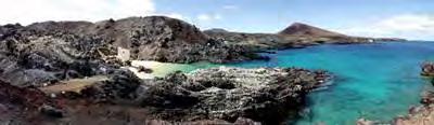
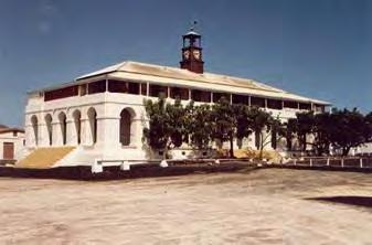
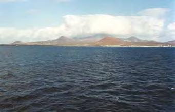
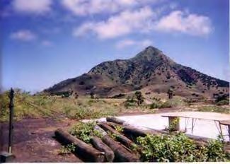
10 Origin of Ascension Island 10
11 Crustal Structure & Age From: Klingelhofer et al,

12 Persistent Ascension style features From: Klingelhofer et al,
13 The UK s Submission 13

14 The UK s Submission Ascension Island S W 14
")
15 Bathymetric anomaly Revised Anomaly Map for the Central Atlantic Bathymetric Anomaly (metres) 15

16 Natural Prolongation Ascension Fracture Zone Ascension Island B A Gratton Circe Bode Verde Fracture Zone 16

17 Bathymetric Profile across the South Atlantic Ocean A A Bathymetry: Smith, W.H.F. and Sandwell, D.T., Measured and Estimated Seafloor Topography, version 10.1,


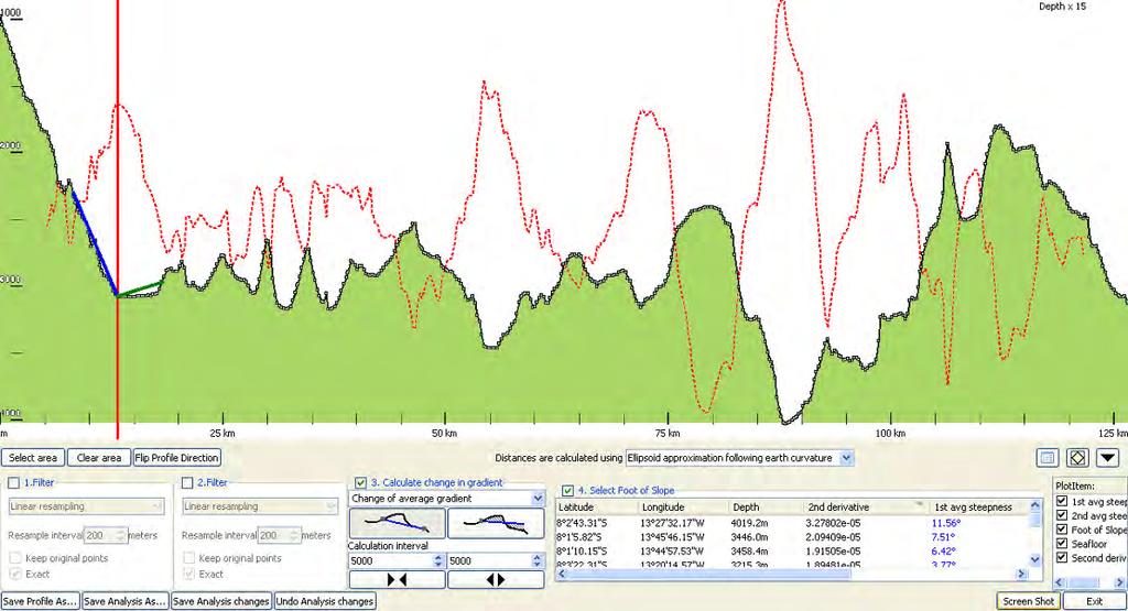
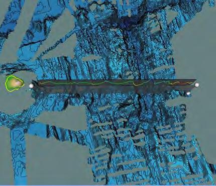
18 Ascension: base of slope/test of appurtenance Ascension Island 200M Derived from a merged grid of predicted and multibeam bathymetry. Base of slope zone 18

19 Ascension: FOS pick (7E) Derived from multibeam bathymetry alone. 19


20 Australia FOS profile 20

21 Extract from Aus recommendations 21
22 Outer Continental Shelf? Ascension Island 22
23 The Commission s View


24 The MAR as deep ocean floor Art 76.3 [The continental margin] does not include the deep ocean floor with its oceanic ridges...

25 Perspective views of Ascension
26 SC fig 19, SC GBR-ASC_PRES_002_08_12_2009 Central rift valley of MAR AI W E
27 Discussion 27
28 Island model 1: natural prolongation (geology +morphology) Island Shallow shelf FOS? Deep ocean floor Crust type B Crust type A 28
29 Island model 1a: natural prolongation (geology +morphology) Island Shallow shelf Deep ocean floor FOS? 29
30 Island model 2: surrounded by DOF Island FOS? B Shallow shelf Deep ocean floor Crust type A 30
31 Island model 3: natural prolongation Island Shallow shelf FOS? Deep ocean floor Crust type A 31
32 IIsland model 3a: natural prolongation Island Shallow shelf FOS? Deep ocean floor 32
33 Island model 4: evidence to the contrary Island Shallow shelf FOS defined by geological evidence? Deep ocean floor Crust type B Crust type A 33

34 The Ascension Island Submission Ascension Island 34
UNCLOS Article 76- Formulae and constraint lines
 UNCLOS Article 76- Formulae and constraint lines Dr Lindsay Parson (UNCLOS Group, National Oceanography Centre, UK) ABLOS TUTORIAL SESSION - Article 76 of UNCLOS 10th October 2005 IHO/IAG/IOC Advisory
ARTICLE 76: THE RIDGE ISSUE
 ARTICLE 76: THE RIDGE ISSUE by Alan EVANS 1, Chris CARLETON 2 and Lindsay PARSON 1 Address 1; Address 2; Southampton Oceanography Centre United Kingdom Hydrographic Office European Way Admiralty Way Southampton
EXECUTIVE SUMMARY A SUBMISSION OF DATA AND INFORMATION ON THE OUTER LIMITS OF THE CONTINENTAL SHELF OF THE REPUBLIC OF NIGERIA PURSUANT TO
 EXECUTIVE SUMMARY A SUBMISSION OF DATA AND INFORMATION ON THE OUTER LIMITS OF THE CONTINENTAL SHELF OF THE REPUBLIC OF NIGERIA PURSUANT TO PART VI OF AND ANNEX II TO THE UNITED NATIONS CONVENTION ON THE
Legal Interpretation of Submarine Ridges & Submarine Elevations
 Legal Interpretation of Ridges & Article 76, paragraph 6 New Knowledge and Changing Circumstances in the Law of the Sea Reykjavik, Iceland June 28, 2018 Kevin Baumert U.S. Department of State U.S. ECS
OUTER CONTINENTAL SHELF CLAIMS IN THE ARCTIC. Presentation given by Dr. Kamrul Hossain ASA University Bangladesh 15 March 2010
 OUTER CONTINENTAL SHELF CLAIMS IN THE ARCTIC Presentation given by Dr. Kamrul Hossain ASA University Bangladesh 15 March 2010 Contents Historical background of the continental shelf Concept of continental
CONFERENCE OF PARLIAMENTARIANS OF THE ARCTIC REGION. UN LOS Convention and the extended continental shelf in the Arctic
 CONFERENCE OF PARLIAMENTARIANS OF THE ARCTIC REGION UN LOS Convention and the extended continental shelf in the Arctic Presentation given by Dr. Kamrul Hossain Finnish Parliament 18 November 2009 Contents
Article 76, variations in annotation and implementation seen in submission documents for the claim of Extended Continental Shelf
 Article 76, variations in annotation and implementation seen in submission documents for the claim of Extended Continental Shelf Mr. Shin Tani Chairman, IHO/IAG Advisory Board on the Law of the Sea (ABLOS)
The french national programme for claiming continental shelf beyond 200 Miles
 The french national programme for claiming continental shelf beyond 200 Miles Using global bathymetric models in the context of an Extended Continental Shelf submission EXTRAPLAC Using Global Bathymetric
JOINT SUBMISSION TO THE COMMISSION ON THE LIMITS OF THE CONTINENTAL SHELF BY TUVALU, THE REPUBLIC OF FRANCE AND NEW ZEALAND (TOKELAU)
") JOINT SUBMISSION TO THE COMMISSION ON THE LIMITS OF THE CONTINENTAL SHELF BY TUVALU, THE REPUBLIC OF FRANCE AND NEW ZEALAND (TOKELAU) TABLE OF CONTENTS i. PREFACE... iii ii. LIST OF FIGURES... iv iii.
JOINT SUBMISSION TO THE COMMISSION ON THE LIMITS OF THE CONTINENTAL SHELF BY TUVALU, THE REPUBLIC OF FRANCE AND NEW ZEALAND (TOKELAU) TABLE OF CONTENTS i. PREFACE... iii ii. LIST OF FIGURES... iv iii.
IRELAND. PART I Executive Summary
 IRELAND Submission to the Commission on the Limits of the Continental Shelf pursuant to Article 76, paragraph 8 of the United Nations Convention on the Law of the Sea 1982 in respect of the area abutting
FOOT OF THE CONTINENTAL SLOPE IN ARTICLE 76
 FOOT OF THE CONTINENTAL SLOPE IN ARTICLE 76 Vaughan Stagpoole, Institute of Geological & Nuclear Sciences, Lower Hutt, New Zealand, v.stagpoole@gns.cri.nz Ray Wood, Institute of Geological & Nuclear Sciences,
MARINE GEOLOGY & GEOGRAPHY
 MARINE GEOLOGY & GEOGRAPHY Bathymetry BATHYMETRY BATHYMETRY THE UNDERWATER EQUIVALENT TO TOPOGRAPHY THE STUDY OF WATER DEPTH A BATHYMETRIC MAP SHOWS FLOOR RELIEF OR TERRAIN AS CONTOUR LINES Bathymetry
MAPS AND COORDINATES...
 Table of Contents 1 INTRODUCTION... 2 2 MAPS AND COORDINATES... 3 3 ADVISORY ASSISTANCE FROM COMMISSION MEMBERS... 3 4 PROVISIONS OF ARTICLE 76 INVOKED... 3 5 OUTSTANDING MARITIME DELIMITATIONS... 4 6
Map shows 3 main features of ocean floor
 Map shows 3 main features of ocean floor 2017 Pearson Education, Inc. Chapter 3 Marine Provinces 2017 Pearson Education, Inc. 1 Chapter 3 Overview The study of bathymetry determines ocean depths and ocean
BRAZILIAN SOUTHERN MARGIN: AN EXAMPLE OF THE IDENTIFICATION OF THE BASE OF THE SLOPE ON A PASSIVE CONTINENTAL MARGIN
 BRAZILIAN SOUTHERN MARGIN: AN EXAMPLE OF THE IDENTIFICATION OF THE BASE OF THE SLOPE ON A PASSIVE CONTINENTAL MARGIN Luiz Carlos Torres Brazilian Navy Hydrographic Center Izabel King Jeck Brazilian Navy
Earth s Continents and Seafloors. GEOL100 Physical Geology Ray Rector - Instructor
 Earth s Continents and Seafloors GEOL100 Physical Geology Ray Rector - Instructor OCEAN BASINS and CONTINENTAL PLATFORMS Key Concepts I. Earth s rocky surface covered by of two types of crust Dense, thin,
EXECUTIVE SUMMARY A PARTIAL SUBMISSION OF DATA AND INFORMATION ON THE OUTER LIMITS OF THE CONTINENTAL SHELF OF THE KINGDOM OF TONGA PURSUANT TO
 EXECUTIVE SUMMARY A PARTIAL SUBMISSION OF DATA AND INFORMATION ON THE OUTER LIMITS OF THE CONTINENTAL SHELF OF THE KINGDOM OF TONGA PURSUANT TO PART VI OF AND ANNEX II TO THE UNITED NATIONS CONVENTION
Bathymetry Measures the vertical distance from the ocean surface to mountains, valleys, plains, and other sea floor features
 1 2 3 4 5 6 7 8 9 10 11 CHAPTER 3 Marine Provinces Chapter Overview The study of bathymetry determines ocean depths and ocean floor topography. Echo sounding and satellites are efficient bathymetric tools.
60% water. Big Bang: 14,000 millions years ago The Earth originated about 4,500 millions years ago its orbit allows water to exist in a liquid state!
 Ch2. The Sea Floor #1 Why geology of the oceans? Marine habitats are directly shaped by geological processes The form of the coastlines The depth of the water Type of bottom (muddy, sandy, rocky) #2 Geological
Chapter Overview. Bathymetry. Measuring Bathymetry. Measuring Bathymetry
 CHAPTER 3 Marine Provinces Chapter Overview The study of bathymetry determines ocean depths and ocean floor topography. Echo sounding and satellites are efficient bathymetric tools. Most ocean floor features
The Continental Shelf North of the Faroe Islands
 Partial Submission of the Government of the Kingdom of Denmark together with the Government of the Faroes to the Commission on the Limits of the Continental Shelf The Continental Shelf North of the Faroe
Finding the continental shelf integration of geology and geophysics
 Finding the continental shelf integration of geology and geophysics R Wood Institute of Geological and Nuclear Sciences, PO Box 30-368, Lower Hutt, Telephone 64-4-570 4867, Fax 64-4-570 4803, Email r.wood@gns.cri.nz
Non-living Resources of the OCS. Harald Brekke NPD
 Non-living Resources of the OCS Harald Brekke NPD The Continental Shelf and the Area http://www.grida.no/publications/shelf-last-zone/ Outer Continental Shelf Example http://www.grida.no/publications/shelf-last-zone/
MARINE GEOLOGY & GEOGRAPHY
 MARINE GEOLOGY MARINE GEOLOGY & GEOGRAPHY Marine Geology 4 LAYERS OF THE EARTH CRUST THICKNESS: VARIES BETWEEN OCEAN & CONTINENTS 5-40 KM STATE: SOLID ELEMENTS: SILICON, ALUMINUM, CALCIUM, SODIUM, POTASSIUM
FINDING THE CONTINENTAL SHELF EXAMPLES FROM THE NEW ZEALAND REGION
 FINDING THE CONTINENTAL SHELF EXAMPLES FROM THE NEW ZEALAND REGION ABSTRACT New Zealand has nearly completed the surveying phase of its Continental Shelf Project. Some surveys have been designed to fill
A new burst of seafloor mapping and discovery driven by advances in satellite altimetry
 A new burst of seafloor mapping and discovery driven by advances in satellite altimetry! R. Dietmar Müller*, Kara J. Matthews* and David T. Sandwell^! *EarthByte Group, School of Geosciences, The University
Oceanography, An Invitation to Marine Science 9e Tom Garrison. Ocean Basins Cengage Learning. All Rights Reserved.
 Oceanography, An Invitation to Marine Science 9e Tom Garrison 4 Ocean Basins Key Concepts Tectonic forces shape the seabed The ocean floor is divided into continental margins and deep ocean basins The
ANALYSIS OF CLCS RECOMMENDATIONS IN LIGHT OF THEIR RELEVANCE TO THE DELINEATION OF A UNITED STATES EXTENDED CONTINENTAL SHELF (ECS) IN THE ARCTIC
 IN THE ARCTIC") ANALYSIS OF CLCS RECOMMENDATIONS IN LIGHT OF THEIR RELEVANCE TO THE DELINEATION OF A UNITED STATES EXTENDED CONTINENTAL SHELF (ECS) IN THE ARCTIC BY ONNI BOWEN IRISH Bachelor of Science in Foreign Service
ANALYSIS OF CLCS RECOMMENDATIONS IN LIGHT OF THEIR RELEVANCE TO THE DELINEATION OF A UNITED STATES EXTENDED CONTINENTAL SHELF (ECS) IN THE ARCTIC BY ONNI BOWEN IRISH Bachelor of Science in Foreign Service
Ocean Basins, Bathymetry and Sea Levels
 Ocean Basins, Bathymetry and Sea Levels Chapter 4 Please read chapter 5: sediments for next class and start chapter 6 on seawater for Thursday Basic concepts in Chapter 4 Bathymetry the measurement of
Ch 9.1 Notes. Objective: Be able to explain the theory of plate tectonics and be able to explain evidence that supports it.
 Ch 9.1 Notes Objective: Be able to explain the theory of plate tectonics and be able to explain evidence that supports it. Pangaea Alfred Wegener proposed that land on Earth formed a single, huge landmass.
Continental Drift. Wegener theory that the crustal plates are moving and once were a super continent called Pangaea.
 PLATE TECTONICS WHAT IS TECTONICS? Tectonism is the faulting or folding or other deformation of the outer layer of a planet. It happens very slowly, on the scale of millions of years. Tectonic activity
MAR110 Lecture #3 Ocean Bathymetry / Plate Tectonics
 1 MAR110 Lecture #3 Ocean Bathymetry / Plate Tectonics Ocean Basin Geographic Zones The geographic zones of the North Atlantic are identified in the bird s eye view of the sea floor above. Below is shown
MULTIPLE CHOICE. Choose the one alternative that best completes the statement or answers the question.
 Geology 300, Physical Geology Spring 2019 Quiz Chapter 18, Seafloor Name MULTIPLE CHOICE. Choose the one alternative that best completes the statement or answers the question. 1) Abyssal fans are made
The Ocean Floor Earth Science, 13e Chapter 13
 The Ocean Floor Earth Science, 13e Chapter 13 Stanley C. Hatfield Southwestern Illinois College The vast world ocean Earth is often referred to as the blue planet Seventy-one percent of Earth s surface
Towards establishing a stable regime for seabed jurisdiction - the role of the CLCS? Harald Brekke Former member of CLCS,
 Towards establishing a stable regime for seabed jurisdiction - the role of the CLCS? Harald Brekke Former member of CLCS, 1997-2012 Continental shelf limits Geneva Convention 1958: The continental shelf
is also considered to cope with the SCUFN action item 25/21. are also considered to cope with the SCUFN action item 27/83.
 Re: Action SCUFN 27/80, 25/21 & 27/83 Generic Terms Group (Y. Ohara, H-C. Han and V. Stagpoole) October 1, 2015 1. Introduction This action item is to cope with the old generic terms that are appeared
Geography of the world s oceans and major current systems. Lecture 2
 Geography of the world s oceans and major current systems Lecture 2 WHY is the GEOMORPHOLOGY OF THE OCEAN FLOOR important? (in the context of Oceanography) WHY is the GEOMORPHOLOGY OF THE OCEAN FLOOR important?
Marine Science and Oceanography
 Marine Science and Oceanography Marine geology- study of the ocean floor Physical oceanography- study of waves, currents, and tides Marine biology study of nature and distribution of marine organisms Chemical
Preliminary Information Indicative of the Outer Limits of the Continental Shelf Beyond 200 Nautical Miles of the People s Republic of China
 (Translation) Preliminary Information Indicative of the Outer Limits of the Continental Shelf Beyond 200 Nautical Miles of the People s Republic of China 1. The People s Republic of China ratified the
Outer Continental Shelf
 The Delimitation of the Outer Continental Shelf Presentation by Stephen Fietta Monaco, 17 October 2008 Latham & Watkins is the business name of Latham & Watkins (London) LLP, a registered limited liability
Chapter 2 Plate Tectonics and the Ocean Floor
 Chapter 2 Plate Tectonics and the Ocean Floor Matching. Match the term or person with the appropriate phrase. You may use each answer once, more than once or not at all. 1. hydrothermal vents A. convergent
8 th Grade Science Plate Tectonics and Topography Review
 8 th Grade Science Plate Tectonics and Topography Review #1 Scientists believe that the land masses of Earth were once joined together as one supercontinent called. A: Australia B: Wegner C: Pangaea D:
Updating the GEBCO Grid
 Updating the GEBCO Grid PAULINE WEATHERALL, GEBCO DIGITAL ATLAS MANAGER, BRITISH OCEANOGRAPHIC DATA CENTRE (BODC), NATIONAL OCEANOGRAPHY CENTRE (NOC), LIVERPOOL, UK. GEBCO TSCOM and SCRUM meeting, Kuala
Chapter 20. Plate Tectonics. Scientific Method. This is a repeatable measurement or experiment. One or more possible explanations to link observations
 Chapter 20 Plate Tectonics Scientific Method 1. Observation (fact) This is a repeatable measurement or experiment 2. Hypothesis One or more possible explanations to link observations 3. Testing Further
Chapter 02 The Sea Floor
 Chapter 02 The Sea Floor Multiple Choice Questions 1. One of the following is not one of the world's major ocean basins: A. Atlantic Ocean B. Arctic Ocean C. Indian Ocean D. Antarctic Ocean E. Pacific
The Ocean Floor Chapter 14. Essentials of Geology, 8e. Stan Hatfield and Ken Pinzke Southwestern Illinois College
 The Ocean Floor Chapter 14 Essentials of Geology, 8e Stan Hatfield and Ken Pinzke Southwestern Illinois College The vast world ocean Earth is often referred to as the water planet 71% of Earth s surface
Seas. A sea is a part of an ocean that is nearly surrounded by water. The Mediterranean, Arctic and Black Sea are really part of the Atlantic Ocean.
 Exploring the Ocean Since ancient times people have studied the ocean such as waters and ocean floor It provides food and services, and serves as a route for trade and travel The World s Oceans 71% of
OCN 201 Physiography of the Seafloor
 OCN 201 Physiography of the Seafloor Hypsometric Curve for Earth s solid surface Note histogram Hypsometric curve of Earth shows two modes. Hypsometric curve of Venus shows only one! Why? Ocean Depth vs.
The Two Types of Crust. Plate Tectonics. Physical Layers of the Earth. The Asthenosphere. The Lithosphere. Chemical Layers of the Earth
 Plate Tectonics A Reminder of Earth s Structure Two physical units of Earth that are important too! How the Earth Works Plate Tectonics Plate Boundaries Chemical Layers of the Earth Crust - low density
The Relevance of Hydrography to UNCLOS; an Indonesian Perspective By: Prof. Dr. Hasjim Djalal, MA*
 The Relevance of Hydrography to UNCLOS; an Indonesian Perspective By: Prof. Dr. Hasjim Djalal, MA* As I understand it, the theme of this 6 th ABLOS Conference 2010 is Contentious Issues in UNCLOS- surely
Lecture Marine Provinces
 Lecture Marine Provinces Measuring bathymetry Ocean depths and topography of ocean floor Sounding Rope/wire with heavy weight Known as lead lining Echo sounding Reflection of sound signals 1925 German
Plate Tectonics. A. Continental Drift Theory 1. Early development 2. Alfred Wegener s mechanism
 Plate Tectonics A. Continental Drift Theory 1. Early development 2. Alfred Wegener s mechanism B. Seafloor Spreading 1. Earthquakes and volcanoes 2. Seafloor maps and dates 3. Continental drift revisited
Plate Tectonics. I. The Discovery of Plate Tectonics II. A Mosaic of Plates III. Types of Plate Boundaries IV. How Plates Move
 Plate Tectonics I. The Discovery of Plate Tectonics II. A Mosaic of Plates III. Types of Plate Boundaries IV. How Plates Move I. The Discovery of Plate Tectonics A. Continental Drift (Alfred Wegener) Proposed
Sea-Floor Spreading, Subduction,& Plate Boundaries. Lecture Continental Fit 2. Similar Rocks, Ages 3. Similar Fossils 4. Widespread Glaciation
 Sea-Floor Spreading, Subduction,& Plate Boundaries Lecture 21 Prop: Test 3 Invitations Alfred Wegener s Evidence for Continental Drift 1. Continental Fit 2. Similar Rocks, Ages 3. Similar Fossils 4. Widespread
Full file at
 Essentials of Oceanography, 10e (Trujillo/Keller) Chapter 2 Plate Tectonics and the Ocean Floor Match the term with the appropriate phrase. You may use each answer once, more than once or not at all. A)
HOW TO DEFINE THE BASE OF THE SLOPE IN LOW GRADIENT PASSIVE MARGINS? BRAZILIAN CONTINENTAL SHELF PROJECT (LEPLAC)
") HOW TO DEFINE THE 1 BASE OF THE SLOPE IN LOW GRADIENT PASSIVE MARGINS? BRAZILIAN CONTINENTAL SHELF PROJECT (LEPLAC) Izabel King Jeck Commander, DHN, Brazilian Navy izabel@dhn.mar.mil.br How to apply art.76
HOW TO DEFINE THE 1 BASE OF THE SLOPE IN LOW GRADIENT PASSIVE MARGINS? BRAZILIAN CONTINENTAL SHELF PROJECT (LEPLAC) Izabel King Jeck Commander, DHN, Brazilian Navy izabel@dhn.mar.mil.br How to apply art.76
Sea-Floor Spreading, Subduction,& Plate Boundaries. Lecture 23. Geol 101 (Kite) Quiz 9, April Geol 101 (Kite) Quiz 9, April 2006
 Quiz 9, April Geol 101 (Kite) Quiz 9, April 2006") Sea-Floor Spreading, Subduction,& Plate Boundaries Lecture 23 Prop: Test 3 Invitations Geol 101 (Kite) Quiz 9, April 2005 ******************************* * You are cordially invited * Name * to attend
Sea-Floor Spreading, Subduction,& Plate Boundaries Lecture 23 Prop: Test 3 Invitations Geol 101 (Kite) Quiz 9, April 2005 ******************************* * You are cordially invited * Name * to attend
Essentials of Oceanography Eleventh Edition
 Chapter Chapter 1 2 Clickers Lecture Essentials of Oceanography Eleventh Edition Plate Tectonics and the Ocean Floor Alan P. Trujillo Harold V. Thurman Chapter Overview Much evidence supports plate tectonics
The Southern Continental Shelf of Greenland
 Partial Submission of the Government of the Kingdom of Denmark together with the Government of Greenland to the Commission on the Limits of the Continental Shelf The Southern Continental Shelf of Greenland
OCN 201 Physiography of the Seafloor
 OCN 201 Physiography of the Seafloor 1 Ocean Depth versus Continental Height Why do we have dry land? Solid surface of Earth is dominated by two levels: Land with a mean elevation of +840 m (29% of Earth
Plate Tectonics. Essentials of Geology, 11 th edition Chapter 15
 1 Plate Tectonics Essentials of Geology, 11 th edition Chapter 15 2 3 4 5 6 7 8 9 10 11 12 13 14 15 Plate Tectonics: summary in haiku form Alfred Wegener gave us Continental Drift. Fifty years later...
SOLVING THE RIDGES ENIGMA OF ARTICLE 76 OF THE UNITED NATIONS CONVENTION ON THE LAW OF THE SEA. Written by: George Taft Presented by: George Taft
 SOLVING THE RIDGES ENIGMA OF ARTICLE 76 OF THE UNITED NATIONS CONVENTION ON THE LAW OF THE SEA Written by: George Taft Presented by: George Taft (The views contained herein are those of the author and
THE MEASUREMENT AND ANALYSIS OF BATHYMETRY, MORPHOLOGY, AND SEDIMENT THICKNESS
 THE MEASUREMENT AND ANALYSIS OF BATHYMETRY, MORPHOLOGY, AND SEDIMENT THICKNESS Ron Macnab Geological Survey of Canada (Retired) OUTLINE OF PRESENTATION Principles and practice of: Echo-sounding Seismic
Before Plate Tectonics: Theory of Continental Drift
 Before Plate Tectonics: Theory of Continental Drift Predecessor to modern plate tectonics Shape and fit of the continents was the initial evidence Snider-Pelligrini (1858) Taylor (1908) Wegner (1915) Fig.
The Lithosphere and the Tectonic System. The Structure of the Earth. Temperature 3000º ºC. Mantle
 The Lithosphere and the Tectonic System Objectives: Understand the structure of the planet Earth Review the geologic timescale as a point of reference for the history of the Earth Examine the major relief
Chapter 20. Plate Tectonics
 Chapter 20 Plate Tectonics Early Evidence (Wegener) The geometric fit of the continents. The similarity in rock age groups between adjoining regions. The similarity in Paleozoic fossils between adjoining
Introduction After reviewing the classification of continental margins (not plate margins) in your textbook, answer the following questions:
 in your textbook, answer the following questions:") Investigating the continental margins of North America using GeoMapApp. This exercise is designed to familiarize you with the features of continental margins. Through the analysis of color-coded bathymetric
Investigating the continental margins of North America using GeoMapApp. This exercise is designed to familiarize you with the features of continental margins. Through the analysis of color-coded bathymetric
Unit 6: The Sea Floor
 Unit 6: The Sea Floor Turn to Page 62 in Introduction to the World s Oceans Study the bathymetric chart What features do you see? How do the Atlantic and Pacific Oceans differ? What do you think accounts
1. Name at least one place that the mid-atlantic Ridge is exposed above sea level.
 Interpreting Tectonic and Bathymetric Maps. The purpose of this lab is to provide experience interpreting the bathymetry of the seafloor in terms of tectonic and geologic settings and processes. Use the
OCEANOGRAPHY MEASURING THE DEPTHS OF THE OCEANS
 Water 2 page 1 OCEANOGRAPHY Name If all the water was drained from the ocean basins, what kind of surface would be revealed? It would not be the quiet, subdued topography as was once thought, but a surface
Earth / Environmental Science. Ch. 14 THE OCEAN FLOOR
 Earth / Environmental Science Ch. 14 THE OCEAN FLOOR The Blue Planet Nearly 70% of the Earth s surface is covered by the global ocean It was not until the 1800s that the ocean became an important focus
Isostasy, Bathymetry and the Physiography of the Ocean Floor
 Isostasy, Bathymetry and the Physiography of the Ocean Floor EPSS 15 Spring 2017 Ad art for NBC Radio, 1939 Archimedes (c. 287 BCE 212 BCE) Greek mathematician, physicist and engineer Archimedes Principle:
Seafloor Morphology. Techniques of Investigation. Bathymetry and Sediment Studies
 Seafloor Morphology I f we select a grid for the surface of the earth (i.e. 5 km 2 ) and assign it an average elevation in relation to sea level, we can construct a graph of elevation versus area of the
FEDERAL AUTHORITIES RESPONSIBLE FOR THE PREPARATION: Ministry of Foreign Affairs of the Russian Federation
 FEDERAL AUTHORITIES RESPONSIBLE FOR THE PREPARATION: Ministry of Natural Resources and Environment of the Russian Federation Federal Agency on Mineral Resources Ministry of Natural Resources and Environment
UNIT 3 GEOLOGY VOCABULARY FLASHCARDS THESE KEY VOCABULARY WORDS AND PHRASES APPEAR ON THE UNIT 3 CBA
 UNIT 3 GEOLOGY VOCABULARY FLASHCARDS THESE KEY VOCABULARY WORDS AND PHRASES APPEAR ON THE UNIT 3 CBA A map that shows Earth s Topographic Map surface topography, which is Earth s shape and features Contour
TAKE HOME EXAM 8R - Geology
 Name Period Date TAKE HOME EXAM 8R - Geology PART 1 - Multiple Choice 1. A volcanic cone made up of alternating layers of lava and rock particles is a cone. a. cinder b. lava c. shield d. composite 2.
NAME Lab TA. Introduction to Oceanography, EPSS15 Practice Lecture Exam #1, Fall 2017 Exam#
 NAME Lab TA Introduction to Oceanography, EPSS15 Practice Lecture Eam #1, Fall 2017 Eam# 654321 Instructions 1. PRINT your name and lab TA s name on BOTH the cover sheet of this eam and on the SCANTRON
CONTINENTAL SHELF SUBMISSION OF ANGOLA - EXECUTIVE SUMMARY -
 CONTINENTAL SHELF SUBMISSION OF ANGOLA - EXECUTIVE SUMMARY - INDEX List of Figures 2 List of Tables 3 1 Introduction 5 2 Provisions of Article 76 7 3 Angolan Institutions responsible for the Submission
Lab # - Ocean Bottom Topography. Background Information:
 Name Lab Grade /10 Date Period Lab # - Ocean Bottom Topography Background Information: Ocean depth varies markedly from one location to another. Over large areas water depth is less than 200m (650 ft);
PRELIMINARY INFORMATION
 PRELIMINARY INFORMATION INDICATIVE OF THE OUTER LIMITS OF THE CONTINENTAL SHELF AND DESCRIPTION OF THE STATUS OF PREPARATION OF MAKING A SUBMISSION TO THE COMMISSION ON THE LIMITS OF THE CONTINENTAL SHELF
Preliminary Information Indicative of the outer limits of the continental shelf And Description of the status of preparation of making a submission
 Preliminary Information Indicative of the outer limits of the continental shelf And Description of the status of preparation of making a submission To the Commission on the Limits of the Continental Shelf
Introduction to Oceanography. Chapter 2: Plate Tectonics Overview
 Introduction to Oceanography Chapter 2: Plate Tectonics Overview Much evidence supports plate tectonics theory. The plate tectonics model describes features and processes on Earth. Plate tectonic science
I. Earth s Layers a. Crust: Earth s outside layer. Made of mostly rock. i. Continental: er; made of mostly granite, forms the continents and shallow
 I. Earth s Layers a. Crust: Earth s outside layer. Made of mostly rock. i. Continental: er; made of mostly granite, forms the continents and shallow sea beds, floats! ii. Oceanic: er; dense rock such as
Disputes Concerning the Delimitation of the Continental Shelf beyond 200 M
 Disputes Concerning the Delimitation of the Continental Shelf beyond 200 M Professor Clive Schofield Head of Research, WMU/Sasakawa Global Ocean Institute World Maritime University Sweden and Leonardo
A) B) C) D) 4. Which diagram below best represents the pattern of magnetic orientation in the seafloor on the west (left) side of the ocean ridge?
 B) C) D) 4. Which diagram below best represents the pattern of magnetic orientation in the seafloor on the west (left) side of the ocean ridge?") 1. Crustal formation, which may cause the widening of an ocean, is most likely occurring at the boundary between the A) African Plate and the Eurasian Plate B) Pacific Plate and the Philippine Plate C)
1. Crustal formation, which may cause the widening of an ocean, is most likely occurring at the boundary between the A) African Plate and the Eurasian Plate B) Pacific Plate and the Philippine Plate C)
Challenges of Collecting Data for Article 76 in Ice Covered Waters of the Arctic
 Challenges of Collecting Data for Article 76 in Ice Covered Waters of the Arctic 5 th ABLOS Conference Monaco October 16, 2008 Richard MacDougall - Canada Jacob Verhoef - Canada Wendell Sanford - Canada
Ocean Floor. Continental Margins. Divided into 3 major regions. Continental Margins. Ocean Basins. Mid-Ocean Ridges. Include:
 Ocean Floor Divided into 3 major regions Continental Margins Ocean Basins Mid-Ocean Ridges Continental Margins Include: Continental Shelves Continental Slopes Continental Rise 1 Continental Shelves Part
Dynamic Earth Quiz. 4. The accompanying diagram shows some features of Earth s crust and upper mantle.
 DO NOT WRITE ON THIS Dynamic Earth Quiz DO NOT WRITE ON THIS 1. Base your answer(s) to the following question(s) on the diagram below. The diagram shows a model of the relationship between Earth s surface
Laboratory #7: Plate Tectonics
 Materials Needed: 1. Pencil 2. Colored Pencils 3. Metric/Standard Ruler 4. Calculator 5. Tracing Paper Laboratory #7: Plate Tectonics Plate Tectonics The Earth is composed of layers. At the center is a
MAR110 Lecture #4 Fundamentals of Plate Tectonics
 1 MAR110 Lecture #4 Fundamentals of Plate Tectonics The Ocean Sea Floor is formed Along the Mid-Ocean Ridge Spreading Centers The Ocean Sea Floor is destroyed in the Subduction Zones Figure 4.2 Convection
Foundations of Earth Science, 6e Lutgens, Tarbuck, & Tasa
 Foundations of Earth Science, 6e Lutgens, Tarbuck, & Tasa Oceans: The Last Frontier Foundations, 6e - Chapter 9 Stan Hatfield Southwestern Illinois College The vast world ocean Earth is often referred
Alfred Wegener gave us Continental Drift. Fifty years later...
 CHAPTER 2 Plate Tectonics and the Ocean Floor Plate Tectonics: summary in haiku form Alfred Wegener gave us Continental Drift. Fifty years later... Words Chapter Overview Much evidence supports plate tectonics
Marine ecosystem mapping at the Prince Edward Islands
 Marine ecosystem mapping at the Prince Edward Islands Biodiversity Planning Forum NBA special session June 2018 R Adams, C von der Meden, A Dayaram, K Sink, A Lombard, A Bosman, M Dopolo, F Fourie, L Harris,
24. Ocean Basins p
 24. Ocean Basins p. 350-372 Background The majority of the planet is covered by ocean- about %. So the majority of the Earth s crust is. This crust is hidden from view beneath the water so it is not as
Small area of the ocean that is partially surrounded by land. The Ocean Basins. Three Major Oceans. Three Major Oceans. What is a SEA?
 The Ocean Basins How Deep is the Ocean? 1 2 Three Major Oceans Three Major Oceans Pacific Atlantic the shallowest ocean (3.3km average depth) Indian second shallowest ocean (3.8km average depth) Pacific
Introduction To Plate Tectonics Evolution. (Continents, Ocean Basins, Mountains and Continental Margins)
") Introduction To Plate Tectonics Evolution (Continents, Ocean Basins, Mountains and Continental Margins) Geo 386 (Arabian Shield Course) Dr. Bassam A. A. Abuamarah Mohanna G E O 3 8 6 A R A B I A N G E
Introduction To Plate Tectonics Evolution (Continents, Ocean Basins, Mountains and Continental Margins) Geo 386 (Arabian Shield Course) Dr. Bassam A. A. Abuamarah Mohanna G E O 3 8 6 A R A B I A N G E
Chapter Two. Figure 02_02. Geography of the Ocean Basins. The Sea Floor
 Chapter Two The Sea Floor Geography of the Ocean Basins Figure 02_02 The world ocean is the predominant feature on the Earth in total area. In the Northern Hemisphere, 61% of the total area is ocean. In
Drifting Continents and Spreading Seas. The Road To Plate Tectonics
 Drifting Continents and Spreading Seas The Road To Plate Tectonics Alfred Wegener and the Continental Drift hypothesis: Up until the early 1900s, long-held tradition in the earth sciences stated that continents
ITLOS s approach to the delimitation of the continental shelf beyond 200 M in Bangladesh/Myanmar: Theoretical and practical difficulties
 ITLOS s approach to the delimitation of the continental shelf beyond 200 M in Bangladesh/Myanmar: Theoretical and practical difficulties London International Boundary Conference 18-19 April 2013 Panel
Part I. Executive Summary
 Part I. Executive Summary Partial Submission of Data and Information on the Limits of the Continental Shelf of Spain to the West of the Canary Islands, pursuant to Part VI and Annex II of United Nations