GEOMORPHIC ASSESSMENT OF THE BIG WOOD RIVER
|
|
|
- Randell O’Brien’
- 5 years ago
- Views:
Transcription
 to River Mile 100.")
1 GEOMORPHIC ASSESSMENT OF THE BIG WOO RIVER River Mile 79.5 (Glendale iversion) to River Mile (Confluence with Warms Springs Creek) Prepared for Wood River Land Trust ecember 2006
2 GEOMORPHIC ASSESSMENT OF THE BIG WOO RIVER River Mile 79.5 (Glendale iversion) to River Mile (Confluence with Warms Springs Creek) Prepared for Wood River Land Trust 119 East Buillon Street Hailey, Idaho Prepared by Cygnia Rapp Consulting Geomorphologist PO Box 2754 Hailey, Idaho (208) ecember, 2006 ii
3 Executive Summary Background This report presents the results of a qualitative geomorphic assessment of the Big Wood River from RM near Ketchum at the Warm Springs confluence to River Mile (RM) 79.5 south of Bellevue at the Glendale iversion. This 21-mile stretch of river is the study reach referred to below. The work was conducted for the Wood River Land Trust (WRLT) to assess the geomorphic context of present-day channel processes and trends in channel movement. This report draws from available work, qualitative aerial photograph analysis, limited field studies, and communication with state and city officials. Objectives of this Study The objectives of this study include the following: Evaluate the effects of land use activities on channel processes over time; Prioritize restoration and land acquisition opportunities; Provide suggestions for improving floodplain management strategies; and Recommend future work priorities. The study s findings and conclusions are summarized briefly in this Executive Summary section. Key terms, where used in the paragraphs below, are briefly explained in context, using italics. Readers of this Executive Summary are invited to use the Glossary, p. 61, for fuller definitions of unfamiliar terms. Historical Contrasts in Channel Patterns and Channel Functions The Big Wood River appears, before settlement, to have functioned predominantly as an anastomosing and meandering system, in contrast to the braiding and channel widening commonly seen in the study reach today. ( Anastomosing denotes a channel pattern with multiple co-existing channels with forested floodplain islands in between. By contrast, braided channels denote multiple channels with bare bars. Please refer to Appendix A for more information on channel patterns and their associated functions.) The study reach, before settlement, may have exhibited limited braiding in some sections of the river as it adjusted to natural fluxes in sediment and woody debris loading, but the widespread prevalence of braiding and channel widening in most of the study reach appears to be a present-day phenomenon. Over time, pre-settlement channel patterns anastomosing and meandering channel patterns have been largely replaced by braided (49%) and straight/sinuous (36% iii
4 combined) channel patterns. Some meandering sections remain today, but account for only 16% of the study reach. The transition from a dominantly anastomosing and meandering system to a straight/sinuous and braided system has evidently resulted in changes in stream power and sediment transport. Generally, pre-settlement riparian vegetation and channel patterns encouraged the attenuation of flood flows (decreased severity of flood waters), in-channel sediment storage (decreased severity of sedimentation), channel stability (decreased erratic bank erosion), and aquatic habitat diversity. By contrast, the current channel patterns generally encourage greater efficiency of sediment transport in straight/sinuous sub-reaches, and greater sediment deposition, bank erosion, and flooding in braided sub-reaches. Widespread braiding, channel widening, and channel instability appear to be the result of climatic factors, potential fluxes in sediment supply, and land use activities in upstream reaches that isolate the channel from its floodplain, eliminate or restrict in-channel sediment storage functions, and increase stream power. Braided sections of the Big Wood River respond to increases in upstream stream power and sediment transport by serving as a sediment sink, partially compensating for the loss of in-channel sediment storage functions historically present in upstream reaches. The Big Wood River also has a recent history of channel avulsion; from 1943 to 2004, eight (8) avulsions were noted in sub-reaches 4, 7, and ( Avulsion refers to the sudden abandonment of a channel for a new course.) Historical Contrasts in Stream Morphology and Habitat Conditions Changes in channel patterns are associated with changes in sub-reach morphology. ( Morphology refers to the shape or form of the particular segments of a channel.) Presettlement channel morphologies likely included free-formed and forced pool-riffle channel types, typical of anastomosing and meandering systems. In these pre-settlement settings, some braiding occurred in response to fluxes in sediment, water and woody debris inputs, but not on the widespread scale seen today. By contrast, sub-reach morphology seen today includes a spectrum of channel types, from plane bed morphology in straight and sinuous channels, forced pool-riffle morphology to a limited degree in sinuous sub-reaches, free-formed pool riffle morphology in meandering reaches, and braided morphology in braided sub-reaches. Braided sub-reaches exhibit the greatest in-channel sediment storage; straight and sinuous channels exhibit the least in-channel sediment storage functions. Entrenchment, or the degree to which a channel is incised into and thereby disconnected from its floodplain, is generally coincident with the presence of bank hardening (e.g., levees, riprap). Channel profile data from 1967 and 1994 suggest a general trend of iv
5 increased stream power north of the East Fork Road Bridge and decreased stream power and deposition south of Bullion Street Bridge. Sinuosity values from 1943 and 2004 show an overall decrease in sinuosity over time and a loss of 1.69 miles of stream length in the study reach; this does not take into consideration losses in sinuosity that occurred prior 1943 from channelization and land use activities. ( Sinuosity refers to the curvature of a channel, the higher the sinuosity, the greater the curvature of the channel.) Preliminary field surveys suggest that today s habitat conditions vary from poor to moderate, depending on the channel pattern and channel morphology of sub-reaches. Straight and sinuous sub-reaches have the lowest occurrence of pools, and braided and meandering sub-reaches have the highest occurrence of pools. Pools measured in the field were either free-formed or forced by large woody debris (LW). LW was noted for accomplishing several functions, including initiating pool scour and step formation and enhancing bank stability, bar stability, and in-channel sediment storage. LW accumulations occur most notably in the braided sections and meandering sections. The few LW accumulations present in the sinuous and straight channels account for the formation of the few pools that exist in these sub-reaches. Land use mapping by the WRLT indicates a 25% decrease in the riparian corridor from 1943 to 2004, but does not take into consideration riparian removal prior to 1943, which is likely to have been substantial. Preliminary surveys of bank-hardening activities conservatively estimate 40% of the study reach is leveed or riprapped. In the Big Wood River, bank hardening activities are typically associated with protecting the following conditions: Straight and sinuous channels from developing meanders (lateral migration); Outside edge of a meander from bank erosion; Meander translation (meander migrating downstream instead of laterally); Alluvial terraces from bank erosion; Bridge abutments; and Channel widening of banks along braided sections. Flooding and Erosion Hazards Current Management Current floodplain management does not take into full consideration the hazards posed by flooding and channel migration. Although bank-hardening activities are present throughout the study reach, they do not provide a long-term solution posed by flooding and erosion hazards. According to FEMA (1980), the defined 500-year floodplain is at risk of flooding and/or channel erosion during floods at or above the 10-year return interval due to potentially complicating factors. Complicating factors include the following: LW accumulations and log jams; v
6 LW accumulations at under-sized bridges; and Ice jams, landslides and avalanches that partially or completely block the channel. For perspective, floods at or above the 10-year return interval have occurred on average once every 5.8 years over the last 70 years. Channel migration along the Big Wood River is not limited to medium- and large-sized floods. The effective discharge for the Big Wood River effective discharge refers to the flow at which channel change occurs is the 1.5-year flood. Approximately 73% of the river s bedload is in transport during the 1.5-year flood, and 95% of the bedload is in transport during the 10-year flood return interval (King et al. 2004). According to FEMA (1980), the Big Wood River is capable of shifting laterally by as much as 200 or 300 feet within one flood. Because of this potential for channel movement within the study reach, local jurisdictions should incorporate a larger vision in regulating where development occurs within the stream corridor, and take into account trends in channel movement that result in channel migration and channel avulsion. Though altered, meandering and braided sub-reaches currently provide the best available aquatic habitat in the study reach. These areas include stretches of the Big Wood River upstream of Starweather Bridge (sub-reach 12), downstream of Starweather Bridge to River Grove Ranch (sub-reaches 14-18), downstream of the Croy Creek confluence (subreach 21), and upstream of Broadford Bridge to the end of the study reach (sub-reaches 24-29). In these areas, floodplain functions should be protected as much as possible. Restoration Priorities and Recommendations Prioritize Restoration Efforts for Greatest Biological Benefit at the Lowest Cost. Restoration efforts (and associated land acquisition efforts) may best be served by prioritizing straight and sinuous reaches that meet the following criteria: Are not entrenched; Have intact riparian cover; and Connect other braided or meandering sections of river. Examples include sub-reaches 13 (downstream of Starweather Bridge), 22 and 23 (both in the vicinity of Colorado Gulch Bridge). These reaches of river have not been affected by incision, which can be difficult to reverse, and have intact riparian corridors that can provide LW to the channel system. Targeting restoration efforts in sub-reaches like 13, 22, and 23 may provide the greatest biological benefit for the lowest cost. Other viable opportunities for restoration, enhancement, and acquisition certainly exist in other subreaches in the study reach. This report provides recommendations on the highest priority vi
7 for restoration, enhancement, and/or acquisition efforts, not the limits of where they should occur. Regulate evelopment along Braided Sub-Reaches. Local jurisdictions should consider trends in channel movement in their floodplain management strategies, specifically aggravated sedimentation occurring in substantial sections of the Big Wood River. Increased stream power and sediment transport in channelized areas increase deposition downstream in braided, meandering, and some sinuous sections, initiating channel expansion, bank erosion, and in some cases, avulsion. Limiting development in braided sub-reaches may prove to be one of the highest priorities, given the inherent instability of this channel type. In addition, deposition of materials does not occur statically deposition can migrate upstream or develop in other areas, changing sinuous sections of river into braided ones. Previously sinuous subreaches were observed developing some braiding over the period of record, making these areas more vulnerable to channel expansion and bank erosion. Local factors e.g., Glendale iversion, bridges also cause localized braiding and bank erosion. Consider Implementing a Levee-Setback Program In Appropriate Areas. Where feasible, a levee-setback program could be used to balance protection of private property with increasing geomorphic and aquatic habitat values. Ideally, a levee-setback program would occur in stretches of river with a greenbelt separating private property from the river (e.g., sub-reach 24 located upstream of Broadford Road Bridge). Plan Ahead to Optimize Future Bridge Replacements. Bridges crossing the Big Wood River should be reviewed to determine their replacement schedule; opportunities may exist in the near future for considering design options that enhance stream functions and aquatic habitat. Address ata Gaps in Future Work. ata gaps for this report should be addressed in future work. The gaps identified in this study include the following: Channel Field Studies: Additional field studies are needed for representing the variability of channel conditions for each channel pattern. Sedimentation Behind Glendale iversion: The effects of sedimentation behind the Glendale iversion should be assessed to determine whether the residents of Bellevue will eventually be affected. If sedimentation behind the Glendale iversion is migrating upstream (a common phenomenon associated with impoundments), then braiding and channel expansion may worsen within the vicinity of Bellevue. Evaluation of Fluxes in Sediment Supply: Fluxes in sediment production from the contributing watershed need to be evaluated for understanding the linkages between hill slope and channel processes, climatic events, and land use activities. Habitat Studies: In-depth habitat surveys should be conducted for developing a limiting factors analysis and evaluating fish habitat utilization. Riparian GIS Studies: Riparian conditions should be evaluated for identifying the distribution of early-, mid-, and late-seral stages in GIS, which is needed as a vii
8 component for evaluating avulsion hazards. ( GIS refers to a Geographic Information System, a way of storing, integrating and interacting with a large array of geographic data of different types. Seral refers to stages in a generally known series of ecological communities that succeed each other in a biotic community.) Finalization of Bank-Hardening Survey: The preliminary bank-hardening survey should be finalized following ground-truthing effects. Acquisition of Improved ata for Floodplain Mapping: LiAR data, an advanced optical remote sensing technology, is highly desirable for dramatically improving floodplain mapping. Observation of topographic lows (relic channels, secondary channels, swales) could be used as a component for assessing avulsion hazards and habitat conditions. Use Quantitative Measures to efine Erosion and Avulsion Hazards and evelop an Erosion Hazard Management Plan. Similar to landslide and avalanche hazard areas, the Big Wood River poses a geologic hazard to human health and safety. Erosion hazards posed by channel migration and channel avulsion are currently undefined for the Big Wood River, placing infrastructure and private property at risk. Common tools, such as Flood Insurance Rate Maps (FIRMs), are based on fixed bed hydraulics and do not characterize areas susceptible to channel erosion either within or outside of areas prone to flooding. Consequently, FIRMs are reliable for only short periods after their production and fall short in portraying geomorphic hazards that bank erosion and avulsion may pose to land and infrastructure. The costs of property lost to bank erosion are transferred to the landowner. Future investigations should include developing a Reach Analysis and Erosion Hazard Management Plan based on the methods outlined in Rapp and Abbe (2003). The principal goal of a Reach Analysis and Erosion Hazard Management Plan is to predict areas at risk for future channel erosion by delineating the Channel Migration Zone (CMZ) the area where a stream or river is susceptible to channel erosion. A Reach Analysis and Erosion Hazard Management Plan for the Big Wood River would have numerous applications for the Wood River Land Trust and local jurisdictions. As an educational tool, this study and plan would allow the public to have access to information disclosing erosion hazard risk to private property, just as FIRMs provide information on flood inundation hazards. As a regulatory tool, this study and plan could be used to define erosion hazard zones high, moderate, low which could be used to support the following regulatory objectives: irect development away from high hazard areas; efine appropriately-sized riparian setbacks; evelop strategies for mitigating channel alterations when they are necessary that balance protection of infrastructure with geomorphic and aquatic values; and evelop incentive-based strategies for moving people out of areas of the highest risk. viii
9 Contents Introduction... 1 Reach Setting... 3 Study Reach... 3 Settlement History Climate Hydrology Geology Topography Methods of Analysis for Characterization Collection and Review of Available ata Field Reconnaissance elineation of Sub-Reaches Qualitative Analysis of Historical Channel Patterns Characterization of the Big Wood River and Its Valley in the Study Reach Hydrologic Characteristics Flooding Characteristics Geomorphic Characteristics Floodplain Maps Sediment Supply Sediment Transport Flood Control Activities within the Study Reach Qualitative Analysis of Historical Channel Patterns Channel Characteristics Habitat Conditions Aquatic Habitat Riparian Habitat Beaver Conclusions and Recommendations Recommendations for Floodplain Management and Restoration Activities Recommendations for Future Work Report Limitations and Guidelines for Use Glossary References APPENIX A Channel Patterns APPENIX B Qualitative Aerial Photo Analysis of the Big Wood River Study Reach 76 APPENIX C Photo ocumentation ix
10 Tables Table 1. Upper Big Wood Valley sub-basins (Brown, 2000). The italicized tributaries drain directly into the study reach. Note the largest tributaries join the Big Wood River within the study reach (Warm Springs, Trail Creek, East Fork Wood River, and eer Creek). Table 2. List of aerial photographs used in the report. Table 3. Long-term mean monthly discharge for USGS gage , at Hailey (in cubic feet per second). Table 4. Peak flow estimates for the Big Wood River at Hailey. Table 5. Flood peaks exceeding the 10-year flood recurrence interval from 1915 to 2006 (USGS ). Floods at or above the 10-year recurrence interval have occurred on average once every 5.8 years over the last 70 years. Table 6. Approximate minimum and maximum widths of the 500-year FEMA floodplain for each sub-reach (FEMA 1998). Note FEMA floodplain widths do not include FEMA floodplain widths of tributaries. Table 7. Changes in channel patterns for the Big Wood River in the study reach from 1943 to Sub-reaches in bold indicate avulsions occurring in the photo record during one study period ( ); sub-reaches in bold and italics indicate avulsions that occurred during more than one study period ( and ). The asterisk (*) refers to land use alterations evident on the 1943 aerial photographs (e.g., removal of riparian vegetation, confinement of channel). See Appendix A for explanations of channel patterns and their associated geomorphic functions. See Appendix B for the results of the qualitative aerial photographic analysis. Table 8. Total length of current channel pattern types within the study reach of the Big Wood River. Table 9. Land use changes within the study area between 1943 and 2004 (data provided by Wood River Land Trust). x
11 Figures Figure 1. Vicinity map of the Big Wood River and the extent of the study reach. Figure 2 (6 Sheets). Big Wood River sub-reach boundaries and key features in the study area. Figure 3 (6 Sheets). Big Wood River floodplain boundaries within the study reach as mapped by FEMA. Figure 4. Median size of the bed load sample and the largest particle size in relation to discharge for the Big Wood River near the North Fork Wood River confluence (King et al 2004). Figure 5 (6 Sheets). Results of the preliminary bank hardening survey for the Big Wood River within the study reach. Figure 6. Aerial photograph timeline for the Big Wood River in the vicinity of Gimlet. Reduction in sinuosity and abandonment of secondary channels in the lower half of the reach from 1943 to 1977 are concurrent with riparian vegetation removal, road building, and encroachment from development. By 2006, all secondary channel features visible in 1943 are abandoned and are not engaged except during large-sized floods; the anastomosing/meandering system observed in 1943 is a sinuous channel in 2006 with long amplitudes, low sinuosity, and higher stream power. The flow during the 2006 photo set is estimated at 5,700 cfs, which is equivalent to 25 to 50-year flood return interval. Figure 7. Aerial photograph timeline for the Big Wood River in the vicinity of eer Creek confluence. In 1943, sub-reaches 16 and 17 exhibit the anastomosing channel pattern with multiple channels separated by vegetated floodplain islands. In 1977, secondary channels are becoming isolated from the active channel and braiding begins to occur in the main channel. By 1988, sub-reaches 16 and 17 are overwhelmed with sediment and exhibit aggravated channel expansion, unstable channel bank erosion, and extensive braiding. Two avulsions are visible from 1988 to 2004 and appear to have been initiated by the increased sediment load. The flow during the 2006 photo set is estimated at 5,700 cfs, which is equivalent to 25 to 50- year flood return interval. Figure 8. Profile of the Big Wood River channel in the study reach in 1967 and 1994 using FEMA floodplain map data (USACE 1970 and 1971, FEMA 1998). Figure 9. Sinuosity of the Big Wood River in the study area by sub-reach from 1943 to 2004 (data provided by Wood River Land Trust). xi
12 Introduction Within the context of the American West, the Wood River Valley in Blaine County, Idaho has a long history of settlement, beginning in earnest in the 1880s. Settlement of the area led to alterations of the landscape, mostly in the form of riparian removal for agricultural development, grazing within the riparian corridor, and road-building in and near the Big Wood River. Consequently, the earliest available records capture a snapshot of the Big Wood River already adjusting to land use activities that are recognized for altering geomorphic processes, promoting channel instability, and degrading aquatic habitat. The reach of the Big Wood River between Ketchum at river mile (RM) and approximately RM 79.5 south of Bellevue, exhibits a series of changes in channel patterns and channel types over the period of record (1880s to present) affecting aquatic habitat and increasing channel instability. Changes in channel patterns and channel morphology occur simultaneously with increased pressures on the stream corridor posed by historical land uses and encroachment from development. The Big Wood River poses a geologic hazard to human health and safety just as avalanches and landslides pose a geologic risk to local communities. The risk and costs of damage to private property and infrastructure from channel erosion and flood inundation have increased due to the greater numbers of people living within the stream corridor. The Big Wood River is especially prone to unanticipated channel erosion due to its legacy of glaciation and the effects of large woody debris (LW) on channel bed dynamics. Terrace and floodplain banks found within the study reach are susceptible to erosion even though their elevations may exceed 100-year or 500-year flood water surface elevations. These surfaces are composed of erodible materials (e.g., glacial outwash and alluvium), and do not pose a geologic or topographic constraint to channel movement. Additionally, stable log jams initiate aggradation of the channel bed, much like a small dam, thereby causing the channel to flood and erode greater portions of the floodplain and adjacent terraces. Management of infrastructure at risk in and adjacent to river floodplains is subject to natural resource agency concerns for habitat protection at the local, state, and federal levels. As increased pressures within the stream corridor continue to accelerate channel instability, municipalities and private landowners will need to find creative ways of protecting infrastructure from channel erosion and flooding while arresting degradational processes and enhancing geomorphic and aquatic functions. This report investigates the geomorphic context of the Big Wood River and the effects land use activities have on channel processes, using a combination of available information, limited field studies, and qualitative aerial photo analysis over time. This report discusses general trends in channel behavior and identifies opportunities for improving floodplain management and prioritizing restoration activities. Figure 1 shows a vicinity map of the Big Wood River and the limits of the study reach. The Warm Springs confluence forms the upstream limit of the study reach and the Glendale iversion south of Bellevue forms the downstream limit. 1

13 Geomorphic Assessment of the Big Wood River Figure 1. Vicinity map of the Big Wood River and the extent of the study reach. 2
14 Reach Setting Study Reach The Big Wood River watershed extends from the Smoky, Boulder, and Pioneer Mountain Ranges to the river s confluence with the Malad River; the Malad River quickly enters the Snake River near the town of Gooding. The study reach is considered to be within the Upper Big Wood basin located in the Wood River Valley and is located upstream of Magic Reservoir. Steep mountains surround the valley to the north, east, and west with elevations ranging from 5,060 feet above sea level at Glendale Road to 12,009 feet in the surrounding mountains. The contributing watershed area for the study reach is approximately 752 square miles (Frenzel 1989). Except for Horse Creek, Owl Creek, Baker Creek, and East Fork Wood River, the study reach and contributing upper watershed lie within a transitional area of two ecoregions, displaying characteristics of both the Snake River Basin/High esert and the Northern Rockies. Horse Creek, Owl Creek, Baker Creek, and East Fork Wood River flow through the North Rockies Region (Buhidar 2001). The study reach is similar to mountain streams found throughout Northern Idaho, having a coarse stream bed primarily composed of gravels and cobbles, and in the more heavily armored sub-reaches, cobbles and boulders. Limited information is available on the geomorphologic characteristics of the watershed and study reach from past work by others. This report represents a first-ever attempt to characterize the geomorphic conditions of the Big Wood River and valley within the study reach. This report assesses geomorphic conditions by delineating the study reach into sub-reaches with similar characteristics, therefore the remainder of this report discusses channel characteristics at a sub-reach level of detail. Figure 2 presents the limits of the sub-reaches within the overall study reach. 3
15 Alpine Enterprises Inc. PO Box Rivers St. East Ketchum, I Subreach 7 November H wy 7 t. L u n e ar S e g id r B k e 's Subreach 6 Subreach 5 5 y7 Hw wc M e a do Bi gw oo dr iv e r Subreach 4 rid ge ir cle B Tr a il C r ee k R iv e r r id ge Ru n B Legend Highway 75 Subreach 2 Subreach Breaks 0 Subreach 1! Subreach 3 1,000 Feet Map 1 of 6
16 Alpine Enterprises Inc. PO Box Rivers St. East Ketchum, I East Fork of the Big Wood November 2006 ad o rk R o Ea st F t R oa d Gim le B r i dg e 5 Br H wy 7 Subreach 10 lde n e ar Go idg e n E ag l Subreach 9 Subreach 8 Big W o o d R iv Subreach 11 er HY 75 Legend! Subreach 7 B ridg e Highway 75 Subreach Breaks 0 1,000 Feet Map 2 of 6
17 Alpine Enterprises Inc. PO Box Rivers St. East Ketchum, I November 2006 Subreach 16 Subreach 17 HY 75 Subreach 14 Subreach 15 eer Creek Bridge Subreach 11 Subreach 12 Subreach 13 eer Creek Starweather Bridge Legend Highway 75! Subreach Breaks 0 1,000 Feet Map 3 of 6
18 Alpine Enterprises Inc. PO Box Rivers St. East Ketchum, I November 2006 Subreach 21 U + Subreach 20 Bullion Bridge Subreach 19 Croy Creek B ig HY 75 od Wo R iv er USGS Gage Location Subreach 18 Subreach 17 W iv er Legend! B ig R ood Highway 75 Subreach Breaks 0 1,000 Feet Map 4 of 6
19 Alpine Enterprises Inc. PO Box Rivers St. East Ketchum, I November 2006 Subreach 25 HY 75 Big Wood River Broadford Rd. Bridge Subreach 24 Subreach 23 Subreach 22 Colorado Gulch Bridge Legend Highway 75! Subreach Breaks 0 1,000 Feet Subreach 21 Map 5 of 6
20 Alpine Enterprises Inc. PO Box Rivers St. East Ketchum, I November 2006 HY 75 Subreach 28 Subreach 29 Big Wood River Subreach 27 Lower Broadford Rd Bridge Subreach 26 Legend Highway 75! Subreach Breaks 0 1,000 Feet Map 6 of 6
21 Settlement History Settlement of the Wood River Valley resulted from a succession of economic pursuits ranging from fur trading, ranching, agriculture, mining, and logging to the current economy of recreational development (USACE 1970, Whitman et al. 1945). Alexander Ross led the first recorded expedition to this region in 1824 as he sought to extend his company s fur trading operation. The first permanent settlers came in 1836 concurrent with r. Spaulding s establishment of a mission near Lewiston, Idaho. As the Californian gold rush of 1849 began to taper off, miners began moving north and extracting valuable mineral deposits in many parts of Idaho, including the Big Wood River basin, attracting many prospectors and additional settlers. Conflicts with the Native Americans during the 1870s discouraged early settlement and development of the mining industry. The Wood River mining boom of 1881 followed the treaty ending the Nez Perce Indian War (USACE 1970). After 1880, settlers began clearing tracts of land for agriculture in the fertile plains and raising stock for grazing in the upper areas. By 1882, the population of the Wood River Valley is estimated at 800 people in Ketchum, 1,000 people in Hailey, and 1,500 in Bellevue (GLO 1882), not including ranchers and farmers living in the adjoining canyons (e.g., eer Creek, Croy Creek, Indian Creek areas). The railroad was extended to the mining camp at Ketchum in Irrigation developments began in the 1880s and increased rapidly in the lower valleys. A parallel economic force, although one not so prominent as the mining industry, was the feeding and shipping of sheep, starting in Between 1910 and 1920, Ketchum was one of the largest sheep shipping centers in the United States. The mining boom of the 19 th century was followed by its decline in the 20 th century, causing a population decrease that continued until about The development of the Sun Valley ski area, which began in the 1930s, has been a factor contributing to recent population growth and to the development of recreation and related activities in the area. evelopment continues at a rapid pace throughout the Wood River Valley, placing intense development pressures within the floodplain areas of the Big Wood River. Climate The climate of the upper Big Wood River basin is cold and relatively wet during the winter, and warm and dry in the summer. Countywide average monthly temperatures vary between 19 F in January and 68 F in July. For January, the mean maximum temperature is 29 F and the mean minimum is 5 F. For July, the mean maximum is 85 F and the mean minimum is 68 F. Frontal systems moving eastward from the Pacific Ocean provide the majority of precipitation to the Big Wood River basin. As these systems are lifted over the Idaho mountains, they cool and release their moisture. Therefore, precipitation generally increases with elevation. Mean annual precipitation is 17.6 in Sun Valley (averaged over ) and 15 in Hailey ( ). At higher 10
22 elevations, snow accumulates from fall through spring and the accumulated spring snowpack accounts for over half the annual precipitation. Rainstorm activity in the summer months is generally in the form of thunderstorms associated with unstable air masses. Summer rainfall is generally of short duration and may be of high intensity (FEMA 1980, Frenzel 1989, King et al. 2004). The months of least precipitation are July, August, and September. The average annual snowfall for the Big Wood River watershed is in the higher elevation areas, with an average annual snow depth of in the higher elevations, 37.0 in the middle elevations, and 6.7 in the lower elevations. Average available sunlight is 9.4 hours in the winter, 13.3 hours in the spring, 14.8 hours in the summer, and 11.1 hours in the fall (Buhidar 2001). The precipitation in the basin is sufficient to support sagebrush and native grasses on the lower mountain slopes and non-cultivated areas of the valley floor. Forest growth in the mountains, which is mostly pine, spruce and ouglas fir, is restricted to the higher elevations and the northern slopes of ridges. Cottonwoods and willows border the Big Wood River and the older irrigation ditches (Smith 1959). Hydrology The Big Wood River is the principal water body within the Big Wood River basin and runs through the central portion of the study area. The drainage area is approximately 752 square miles at the downstream end of the study reach, with the Big Wood River fed by numerous ephemeral, intermittent, and perennial streams. The Big Wood River flows generally south, southwest and joins the Malad River near the town of Gooding. From the Gooding area, the Malad River joins the Snake River. ownstream from the study reach, the Big Wood River changes from a perennial to an ephemeral system as it flows through a system of manmade canals, reservoirs (Magic Reservoir being the largest), and natural channels. Table 1 provides a list of major tributaries upstream of and within the study reach. The largest tributaries (e.g., Warms Springs Creek, Trail Creek, East Fork Wood River, and eer Creek) all drain into the Big Wood River within the study reach. Warm Springs, Trail Creek, East Fork Wood River, and eer Creek enter the study reach at RM , RM 98.7, RM 93.9, and RM respectively. 11
23 Table 1. Upper Big Wood Valley sub-basins (Brown, 2000). The italicized tributaries drain directly into the study reach. Note the largest tributaries join the Big Wood River within the study reach (Warm Springs, Trail Creek, East Fork Wood River, and eer Creek). Name Area in Miles 2 Area in Percent Above North Fork Wood River North Fork Wood River Leroux Creek Oregon Gulch Eagle Creek Fox Creek ip Creek No Name Lake Creek Adams Gulch No Name Warm Springs Creek Trail Creek Elkhorn Gulch East Fork Wood River West Gimlet East Gimlet Greenhorn Gulch Ohio Gulch Indian Creek eer Creek Geology The geologic units within the Big Wood River study reach include volcanic, glacial, and fluvial materials. Within the Wood River Valley floodplain, surface deposits are primarily unconsolidated Quaternary glacial and alluvial deposits (Luttrell and Brockway, 1984). Most of the valley fill is stream and delta clay, sand, and gravel deposited before the Wisconsin glaciation and overlain by a relatively thin sheet of coarse fluvioglacial sediments deposited during the Wisconsin stage (Smith, 1959). Terraces in the study area are composed of alluvial deposits. The unconsolidated sediments of the Quaternary sediments can be broken into two distinct groups: 1) valley fill deposits present at the lower elevations, and 2) undifferentiated slope wash present at higher elevations. The fluvioglacial sediments grade in size from boulders, cobbles, and gravel at Hailey to fine gravel, sand, and clay at the south edge of the basin. The deposit is thickest around Hailey but is thin at the southern edge of the basin. In the vicinity of the Boise baseline the average thickness is approximated at 50 ft. The fluvioglacial sediments form a symmetrical fan whose apex is just south of Bellevue. The maximum aggregate thickness of the unconsolidated sediments is unknown. Wells located in the western part of the area are over 300 feet deep without reaching the bedrock floor (Smith, 1959). 12
24 The mountains that surround the valley floor are composed of consolidated igneous and sedimentary rock. The mountains are underlain by Tertiary volcanic rocks and Pre- Cretaceous granites of the Idaho Batholith, which weather to form well-drained loamy soils. The thickness of the sedimentary and igneous rocks is approximately 32,000 ft (Umpleby and others, 1930). This complex structure has resulted from extensive folding and faulting (Luttrell and Brockway, 1984). Topography etails on the topography of the study reach are limited due to the low resolution of available topographic survey data. The most recent US Geological Survey 7.5 minute topographic maps are from 1967 (Ketchum and Hailey quads) and 1979 (Bellevue quad); the most recent topographic map of the study area is from 1994 produced in support of floodplain modeling (FEMA 1998). Elevations in the Big Wood River watershed range from the top of Hyndman Peak at 12,009 feet, to the Malad River confluence with the Snake River at approximately 2,340 feet above sea level. Elevations of the Wood River Valley floor within the study area range from approximately 5,880 feet to 5,190 feet. Several topographic features influence channel alignment. Generally, the Wood River Valley is narrow with a maximum valley width of approximately 2 miles near the southern boundary of the study area. Several valley hillside slopes within the study reach are steep and confine channel movement, including the mountains associated with ella and Carbonate Mountains, and Mount Baldy on River Right, and mountains associated with Gimlet Peak on River Left. Additionally, a large bedrock knob is located south of the Greenhorn Gulch drainage (sub-reach 15), influencing channel alignment on River Right. Portions of the study reach flow adjacent to alluvial terraces draining tributaries to the study reach. These alluvial terraces do not function as topographic or geologic constraints to channel migration due to their composition of erodible materials (unconsolidated gravels). 13
25 Methods of Analysis for Characterization This section describes the methods of analysis used to assess the study reach, including sources of data and other information. The results of the analysis are presented in the following section. Collection and Review of Available ata Historical and current conditions of the study reach are primarily based on limited field studies, available historical aerial photographs, available reports and data, and discussion with staff from the City of Bellevue and Idaho epartment of Fish and Game (IFG). Sources of information obtained and reviewed for this study include the following: Historical aerial photographs provided by the Wood River Land Trust, Blaine County Assessor s Office, U.S. Forest Service, and Bureau of Land Management; Historical survey notes from the Government Land Office (GLO) 1882 Survey; Floodplain mapping and supporting data from the Flood Insurance Studies (FIS) by the Federal Management Emergency Agency (FEMA) (USACE 1970 and 1971, FEMA 1998); aily flow records at USGS gages on the Big Wood River; Scientific reports and other literary sources listed in the references at the end of this report. Field Reconnaissance Field reconnaissance of the Big Wood River was performed on September 16, 29 and October 2, 3, and 6, Part of the reconnaissance was done in small aircraft and the rest was performed on the ground. Small aircraft reconnaissance was performed over the entire length of the study reach for observations of Large Woody ebris (LW) accumulations, log jam recruitment following the flood of record (May, 2006) and, where observable, revetment installation. Ground field reconnaissance occurred in five locations in an attempt to view a variety of channel and habitat conditions found in the study area. Field sites included downstream of the confluence of Warm Springs Creek (sub-reach 1), upstream of Starweather Bridge (sub-reach 12), upstream of Croy Bridge (sub-reach 19), downstream of Colorado Gulch Bridge (sub-reach 23), and south of istrict Canal #45 at the South end of Bellevue (sub-reach 27). Observations and measurements of the characteristics of the main and secondary channel geomorphology, habitat features, logjams, and riparian vegetation were recorded on field 14
26 sheets. Private property issues limited the observation of secondary channel and habitat conditions in many areas. Measurements were taken of main channel dimensions and features (bankfull width and depth, wetted width and depth, slope, gravel bar dimensions, and pebble counts of channel bed and bars) at regular intervals along the sub-reach. All pools and functioning LW were measured throughout the surveyed length of the sub-reach. Other conditions such as fine sediment deposition, bank characteristics and erosion, and floodplain characteristics (riparian condition, entrenchment, overbank deposits, and terrace materials) were qualitatively assessed and noted. Approximately 1,500 linear feet of channel was surveyed for each sub-reach visited in the field. elineation of Sub-Reaches The study reach was divided into a series of channel sub-reaches reflecting changes in channel pattern, dominant types of channel movement, channel bed morphology, and confinement. These factors are dependent on a wide range of variables and how they interact with one another, including, but not limited to: flow regime (discharge), geologic context, valley morphology, sediment characteristics, sediment supply, riparian vegetation, and woody debris (Rapp and Abbe 2003). Aerial photographs taken in 2004 and May, 2006 (during flood stage) were used for determining sub-reach breaks. Qualitative Analysis of Historical Channel Patterns Aerial photographs from 1943, 1976/1977, 1988, 2004, and 2006 were acquired from the Wood River Land Trust, U.S. Forest Service, Blaine County Assessor s Office, and the Bureau of Land Management. Aerial photographs taken during 2006 occur during flood stage, obstructing visibility of active channel characteristics; therefore the 2006 data set are excluded from the qualitative aerial photograph analysis (Appendix B), but used wherever possible for other purposes. The following table summarizes the coverage provided in the aerial photographs used in this study. Table 2. List of aerial photographs used in the report. Year Area of Coverage Georeferenced? Source 1943 Entire study reach Yes Wood River Land Trust (electronic copies) 1976 East Fork Wood River Confluence to Bureau of Land Management No Glendale iversion (electronic copies) 1977 Warm Springs Creek confluence to East U.S. Forest Service (electronic No Fork Wood River confluence copies) 1988 Entire study reach No Blaine County Assessor s Office (prints) 2004 Entire study reach Yes Wood River Land Trust (electronic copies) 2006 Warm Springs confluence to Bellevue Wood River Land Trust No (during flood) (electronic copies) 15
27 Georeferencing all flight lines into Geographic Information Systems (GIS) is out of the scope of this report, but would have facilitated the direct comparison of channel characteristics over time. Future work efforts are encouraged to pursue GIS-based planimetric analysis for overlaying channel positions from the historical record and measuring changes in rates of channel erosion and directions of channel movement over time. Planimetric analysis is most easily and accurately accomplished using the GIS platform because it has a number of advantages over manual methods (Gurnell et al. 1994, Rapp and Abbe 2003): Vector boundaries derived from maps and aerial photos with different scales and distortions can be imported into GIS and registered to the same base map. The process of integrating multiple images at different scales also allows the investigator to quantify any errors that may have been introduced. Although data entry in GIS can be time consuming, spatial analyses are more easily made by expanding the possible range of comparisons, predefined spatial resolutions, and indices. Besides providing a format for quantifying channel change, GIS also provides visualization capabilities, like map production and graphical outputs. The aerial photograph analysis summarized herein is considered to be a qualitative analysis due to the absence of a planimetric analysis component in this report. 16
28 Characterization of the Big Wood River and Its Valley in the Study Reach Hydrologic Characteristics Stream flow data are available for the Big Wood River from four different gage stations: USGS at Hailey ( ); USGS near Ketchum ( ); USGS near Bellevue ( ); and at Stanton Crossing near Bellevue ( , replacing which blew out in 1996). USGS at Hailey is the only gage used in this study due to its location within the study reach, accounting for all major tributaries entering the study reach and exhibiting the least discharge loss from flow diversions. USGS is located upstream of the study reach near the North Fork Wood River confluence; USGS and USGS are located downstream of flow diversions south of the study reach and exhibit flow losses, therefore these three USGS gages are excluded from the study. Mean monthly flows are reported for the Big Wood River at Hailey based on recorded flows from 1915 to 2005, summarized in Table 3. Peak flows occur in April, May, June, and July, and have a probability of occurring during these months as follows: 2.4% in April, 44% in May, 52.4% in June, and 1.2% in July. Table 3. Long-term mean monthly discharge for USGS gage , at Hailey (in cubic feet per second). Gage # Jan Feb Mar Apr May Jun Jul Aug Sep Oct Nov ec Summarized in Table 4, estimates of peak flows at different recurrence intervals above the 2-year flood have been reported by the US Geological Survey (Berenbrock 2002) and by FEMA (1998). These estimates do not incorporate the instantaneous peak flow for the flood of May 21, 2006, which appears to be the flood of record. The US Geological Survey has not officially determined the instantaneous peak flow for this flood as of this report, though provisional data estimate the mean daily discharge during the peak at 6,640 cfs (100-year flood return interval). Using methods outlined in Beard (1962), the 1- year flood is estimated at 545 cfs and the 1.5-year flood is estimated at 1,540 cfs. 17
29 Table 4. Peak flow estimates for the Big Wood River at Hailey. Recurrence Interval (years) USGS Gage at Hailey rainage Area 640 mi 2 Peak ischarge (cfs) a FEMA (1998) rainage Area 640 mi 2 Peak ischarge (cfs) Using methods outlined in Beard (1962) 500 8,270 9, , ,740 7, ,050 6,300 6, ,330-4, ,340 4,420 4, ,520-3, ,290-2, , a Peak flows estimated based on Log Pearson Type III analysis (Berenbrock, 2002). Flooding Characteristics Historical flooding within the study reach can be attributed to multiple factors. However, the overwhelming majority of historical flooding on the Big Wood River is caused by rapid snowmelt during the late spring. These floods nearly always occur during years with above average snowpack in the upper watershed, followed by warm temperatures or warm spring rain (rain-on-snow events) hastening snowmelt. All previous major floods have occurred during May or June in the Big Wood River basin (FEMA 1980). High flows occasionally occur in fall and winter in association with cyclonic storms or rain-onsnow events. Generally, streamflows drop rapidly over the summer following the disappearance of the snowpack, but increase for short periods in response to rain events. Low flows are reached in September or October and flows typically remain relatively low during winter months (King et al. 2004). Besides climate and precipitation contributing to region-wide flooding, local factors such as LW and sediment accumulations, landslides, avalanches, and ice jams may also aggravate local flooding and bank erosion. FEMA (1980) notes that debris dams exceeding 10 ft in height have occurred within the study area in the past, increasing water surface elevations upstream of the log jam and exacerbating flooding and bank erosion. In 1984 and 1985, The U.S. Army Corps of Engineers (USACE) removed LW from a 27.2 mile reach of the Big Wood River near Hailey (USACE 1984, 1985) for the purposes of channel conveyance. Landslides (especially within the vicinity of Hailey) are unpredictable, and when they partially or completely block the channel, can cause localized flooding exceeding the 100-year return interval. In addition to natural factors, man-made structures, such as bridges whose approach fills and flow capacity are undersized, may also locally increase flooding. Broadford Road Bridge in Bellevue, Star Bridge on Broadford Road, and Adams Gulch Bridge north of Ketchum are examples of under-sized bridges with the potential to exacerbate flooding during higher flows (FEMA 1980), especially if LW accumulates on the upstream side of the approach fills. 18
30 When implementing floodplain management, statistically-derived flood return intervals (Table 4) may under-represent flood and erosion hazards due to local factors that have the potential to increase local flooding and bank erosion (e.g., log jams, racking of LW on bridge abutments, landslides). The flood intervals listed in Table 4 do not account for obstructions caused by natural and man-made factors, and therefore may not reflect the true inundation and erosion hazards posed by flooding. According to FEMA (1980), the channel within the study reach is capable of shifting laterally by as much as 200 to 300 feet within one flood. Consequently, FEMA (1980) determined that all structures located within the limits of the 500-year floodplain are subject to inundation, if not at risk of channel erosion, during flood events exceeding a 10-year magnitude (see Table 5). Table 5. Flood peaks exceeding the 10-year flood recurrence interval from 1915 to 2006 (USGS ). Floods at or above the 10-year recurrence interval have occurred on average once every 5.8 years over the last 70 years. Year Flood Peak (cfs) (provisional mean daily discharge) Geomorphic Characteristics Floodplain Maps FEMA published floodplain maps for the 100-year and 500-year recurrence intervals in 1998 based on cross section data measured in 1994 covering the entire study reach. FEMA s floodplain mapping is likely out of date, given that mapping efforts pre-date channel changes that occurred during the 1997 and 2006 floods. However, the results are useful as a preliminary benchmark for determining the extent of flooding and potential erosion hazards in the study area. As previously stated, natural and man-made factors can aggravate regional flooding on a local level. Therefore, all structures within the 500-year floodplain are considered susceptible to inundation and erosion hazards during flood events exceeding the 10-year interval (FEMA 1980). For the purposes of this study, only the FEMA 500-year floodplain is measured for Table 6; in some locations the 100-year and the 500-year FEMA floodplain are identical. 19
31 The Big Wood River floodplain is relatively narrow and generally broadens in the downstream direction (see Table 6 and Figure 3). From the Warms Springs Creek confluence, the FEMA 500-year floodplain gradually broadens to an average of 1,380 feet before becoming highly confined from the East Fork Road Bridge to the Highway 75 Bridge near Golden Eagle Ranch, with an average width of approximately 170 feet. From Highway 75, the FEMA 500-year floodplain gradually expands to an average width of approximately 1,980 feet near Flying Heart Ranch before constricting to an average width of approximately 1,080 feet near the eer Creek confluence. From the eer Creek confluence, the FEMA 500-year floodplain expands in the southward direction to an average width of 2,755 feet near the end of the study reach. Table 6. Approximate minimum and maximum widths of the 500-year FEMA floodplain for each sub-reach (FEMA 1998). Note FEMA floodplain widths do not include FEMA floodplain widths of tributaries. Sub-Reach No. Min Width (ft) Max Width (ft) Floodplain Width at Bridge Constriction , , , , ft at Hwy 75 Br near Hospital , ft at Gimlet Br 8 1,000 1, ,435 1, ft at East Fork Road Br , ft at Hwy 75 Br near Golden Eagle Ranch , ,100 1, ,035 1, ,270 1, ,000 1, ,900 2, ,100 2, , , ,600 1, ,000 1, ,070 1, ,235 1, , , ,100 3, ,170 4, ,935 4, ,170 2, ,435 3,000 20
32 Alpine Enterprises Inc. PO Box Rivers St. East Ketchum, I November 2006 Subreach 7 Hwy 75 Bridge near St. Luke's Hospital 75 H wy g Bi Subreach 5 W oo d R iv e r Subreach 6 Meadow Circle Bridge Subreach 4 Tr a il C re ek Subreach 3! River Run Bridge Legend Highway 75 Subreach Breaks Subreach year 500 year 0 Subreach 1 FEMA Flood Overlay 1,000 2,000 Map 1 of 6 3,000 Feet
33 Alpine Enterprises Inc. PO Box Rivers St. East Ketchum, I East Fork of the Big Wood November 2006 Subreach 7 Subreach 10 Subreach 9 Subreach 8 R iv er Big W o o d Hwy 75 Bridge near Golden Eagle Ranch East Fork Road Bridge Gimlet Road Bridge Subreach 11! Hwy 75 Legend Highway 75 FEMA Flood Overlay Subreach Breaks 100 year 500 year 0 1,000 2,000 Map 2 of 6 3,000 Feet
34 Alpine Enterprises Inc. PO Box Rivers St. East Ketchum, I November 2006 Hwy 75 Subreach 16 Subreach 17 Subreach 14 Subreach 15 Big Wood River eer Creek Bridge Subreach 12 Subreach 13 Starweather Bridge eer Creek Subreach 11 Legend Highway 75 Subreach Breaks! FEMA Flood Overlay 100 year 500 year 0 1,000 2,000 3,000 Feet Map 3 of 6
35 Alpine Enterprises Inc. PO Box Rivers St. East Ketchum, I November 2006 Subreach 21 Subreach 20 Bullion Bridge Subreach 18 U + 5 y7 Hw Subreach 19 USGS Gage Location Croy Creek B oo ig W dr iv er! Subreach 17 Legend Highway 75 FEMA Flood Overlay Subreach Breaks 100 year 500 year 0 1,000 2,000 Map 4 of 6 3,000 Feet
36 Alpine Enterprises Inc. PO Box Rivers St. East Ketchum, I November 2006 Hwy 75 Big Wood River Subreach 25 Broadford Rd. Bridge Subreach 24 Subreach 23 Subreach 22 Big Wood River Colorado Gulch Bridge Legend Highway 75 Subreach Breaks! FEMA Flood Overlay 100 year 500 year 0 1,000 2,000 3,000 Feet Subreach 21 Map 5 of 6
37 Alpine Enterprises Inc. PO Box Rivers St. East Ketchum, I November 2006 Hwy 75 Subreach 28 Subreach 29 Big Wood River Subreach 27 Lower Broadford Rd. Bridge Subreach 26 Legend Highway 75 Subreach Breaks! FEMA Flood Overlay 100 year 500 year 0 1,000 2,000 3,000 Feet Map 6 of 6
38 Sediment Supply The character of sediment supplied to alluvial rivers including quantity, grain-size distribution, and frequency with which it is delivered is one of the primary influences that affect channel morphology (Montgomery and Buffington, 1997). Accelerated sediment production combined with impaired in-channel and floodplain sediment storage can result in accelerated channel migration and loss of aquatic habitat. Within the Upper Big Wood River basin and in the study reach, the dominant mechanisms delivering sediment to the system include landslides, avalanches, and erosion of floodplain and terrace surfaces. Previous work does not assess changes in sediment production over time, linking climate and precipitation, natural processes (e.g., wildfires), and landuse activities (e.g., road building, timber harvest, development, grazing) in the upper watershed to sediment supplied to the channel. Evaluation of sediment production over time and the relative contributions of each delivery mechanism is beyond the scope of this report. Future efforts would benefit from an evaluation of sediment production over time in order to refine our understanding of the interplay between hillslope and channel processes, climatic events, and landuse activities on channel instability and the degradation of desirable habitat characteristics. If rates of sediment production from various sources can be correlated with controlling variables such as vegetative cover or hillslope gradient, then the effects of altering these controlling variables can be estimated and used to predict the consequences of changes in climate, expansion of land-use activities, or alternative strategies for erosion control (Reid and unne 1996). Sediment Transport Sediment transport refers to the way in which stream channels convey sediment of different grain sizes over different discharges. Sediment load is the collective term referring to 1) dissolved load, consisting of material transported in solution, 2) wash load, comprising particles finer than those usually found in the bed and moving readily in suspension (generally < mm), and 3) bed material load, including all sizes of material found in appreciable quantities in the bed (generally > mm). The bed material load can be transported as bed load, when particles move by rolling, sliding, or saltating at velocities less than the surrounding flow (e.g., gravel, cobbles, boulders), or as suspended load, when particles are transported and temporarily maintained in the main body of flow by turbulent mixing processes (e.g., sand) (Knighton, 1998). From a geomorphic standpoint, bed load transport is of most interest due to its influence on changing channel form and initiating channel migration. Within the study reach, the Big Wood River can be described as a gravel-bedded river that is transport- or capacitylimited. Where finer particles suspended in flow can be transported at nearly any discharge, the transport of coarser materials (greater than mm) is a function of discharge and therefore intermittent, becoming more so as grain size increases. The 27
39 intermittency of bed load transport and the possibility of prolonged deposition mean that the residence times of coarser materials moving through drainage basins can be very large (Knighton, 1998). This becomes relevant when we view changes in sediment transport within the study reach that cause the residency times of coarser materials to change (via channelization, encroachment from development, and bank hardening activities). Previous studies investigate bed load transport on the Big Wood River 1.5 miles upstream of Ketchum at USGS gage just upstream of the North Fork Wood River confluence (Barry et al. 2004, King et al. 2004). Information collected at this site includes stream surveys, pebble counts of the substrate surface, and core samples of the substrate subsurface material over 1.5 miles of stream length. Streamflow records from 1949 to 1971 were used to estimate average annual streamflow and the 1.5-year return interval. Sediment transport measurements included 100 measurements of bed load transport and 26 measurements of suspended sediment over a range of stream discharges. King et al. (2004) found that suspended sediment accounts for the majority of material in transport with over an order of magnitude greater suspended transport than bed load transport during lower flows, and approximately six times as much as at the highest discharges. Not surprisingly, King et al. (2004) found the size of the largest particle transported in the bed load sample increases with discharge, as does the median size particle of the bed load sample. Most importantly, this study found that the effective discharge for the Big Wood River occurs at the 1.5-year return interval, which is the flow capable of moving the median diameter particles on the channel surface. The effective discharge is the flow at which bed load transport and channel adjustment (e.g., bank erosion, bar accretion) occur. King et al. (2004) also found that the 1.5-year flood, which has a 75% probability of occurring annually, is capable of transporting 73% of bedload sediment in the Big Wood River, and the 10-year flood is capable of moving 95% of bedload sediment. The results of this study suggest that although larger floods can initiate dramatic channel changes, small floods also initiate channel change and bank erosion. 28
40 Figure 4. Median size of the bed load sample and the largest particle size in relation to discharge for the Big Wood River near the North Fork Wood River confluence (King et al 2004). Flood Control Activities within the Study Reach Bank hardening activities concurrent to channelization are recognized for limiting how sediment is recruited through bank erosion, and for locally altering sediment transport whose effects are often propagated downstream. Floodplains store water during major floods, attenuating the flood peak and spreading the discharge out over a longer period of time. As a river becomes progressively more leveed and confined by development, an increasing percentage of the total discharge becomes confined to the channel. This moves discharge though the watershed at a faster rate, which translates to sharp increases in peak flows and a decrease in lag time, exacerbating flooding downstream (Mount, 1995). Marked increases in development within the floodplain areas are concurrent with flood and erosion control measures affecting channel processes and in-stream habitat. Removal 29
41 of LW, channel dredging, levee construction, and riprap installation alter geomorphic processes in the Big Wood River in many locations. In the last 20 years, Blaine County authorized at least two bar removal operations just north of Broadford Bridge due to insufficient flow capacity. The Bellevue itch Co. has frequently dredged gravel above the headgate at Howard Park. In the 1980s, the Bellevue itch Co. dredged the entire river hundreds of feet upstream and downstream from their operations, a practice that has been stopped under the guidance of IWR. Other canal companies may have had similar practices. Ranchers upstream from the Glendale Bridge frequently dredged the riverbed in the past, but IWR has since limited or eliminated such operations (per communication from Tom Blanchard, City of Bellevue, September 22, 2006). In 1969, USACE built a discontinuous series of levees between Bellevue and Ketchum in anticipation of major flooding that year. The USACE does not consider these levees to be adequate to withstand floods reaching the 100-year return interval due to insufficient freeboard, and are therefore not considered to be permanent structures (FEMA 1980). In the 1998 Fiscal Year, USACE spent $784,930 on the construction of flood control projects within the study reach (USACE 1998). Additional channel improvements, mostly riprapping of banks and installing short levees, have been made by local property owners. A preliminary survey of bank hardening activities was completed for this study using a combination of permit data from USACE (provided as latitude/longitude data) and visual inspection of oblique photography taken from small aircraft while flying the length of the study reach. Obstructions to visibility (e.g., tree cover, hillslopes blocking flight path) inhibited the completeness of the field survey. Therefore, results of this survey are considered to be preliminary and likely underestimate the total length of stream that has been altered by levee construction and riprap installment. Future work efforts should focus on ground-truthing the preliminary bank hardening survey for completeness and accuracy. Of 21 miles included in the study reach, approximately 8.3 miles or 40% of the study reach is conservatively estimated to be altered by levee construction or riprap installation (Figure 5). The majority of bank hardening in the study reach falls into one or more of six categories: 1) protection of straight channels from developing meanders (as in laterally migrating into floodplain surfaces); 2) erosion protection on the outside bank edge of a meander bend; 3) erosion protection along the downstream outside bank edge to prevent meander translation (where the meander migrates downstream instead of laterally); 4) erosion protection of historical alluvial terraces draining tributaries; 5) protection of bridge abutments; and 6) erosion control along destabilized portions of braided segments. Because most levees are built either at the margins of a pre-existing channel or on the floodplain some distance from the channel, the restriction of the floodplain limits the potential cross-sectional area for very high flows. This flow constriction, which produces higher flow velocities, is an integral part of a levee system s design. This constriction increases flow depth, stream power, and stream competence (ability to transport sediment 30
42 of larger grain sizes), preventing the buildup of sediment within the channel. The high river competence in the area immediately downstream of the leveed section can produce localized bank scouring. Farther downstream, the expansion of the channel generates a decrease in stream power and competence, leading to local sedimentation of the river channel. This loss in channel capacity can, in turn, increase localized flooding. Areas upstream of a leveed reach tend to experience a different but related problem. Leveed channels are almost always much narrower than the natural channel system. uring rising flood stage, flow in the wide natural channel is forced into these constrictions, causing the water to back up and lead to increased localized flooding upstream of the levees (Mount, 1995). Finally, levees and riprap installation are not permanent features. In the State of California, the majority of levee-related flooding and damage has been the result of levee failure, whether constructed by USACE, the Soil Conservation Service, or by private property owners (Mount 1995). Even though USACE and the Soil Conservation Service build the most durable levees, the majority of levees are typically constructed and maintained by private landowners and local flood control agencies with little oversight from government engineers. 31
43 d R iv er November 2006 Subreach 7 Hwy 75 Bridge near St. Luke's Hospital Big W o o PO Box Rivers St. East Ketchum, I Alpine Enterprises Inc. Subreach 7 Subreach 5 5 y7 Hw Subreach 6 Subreach 4 oo B ig W dr iv e r Meadow Circle Bridge Tr a il C r ee k River Run Bridge Legend! Subreach 3 Highway 75 Subreach 2 Subreach Breaks Approx. Riprap Subreach 1 0 1,000 2,000 Feet Map 1 of 6
44 Alpine Enterprises Inc. W ood PO Box Rivers St. East Ketchum, I Eas t Fork of the B ig November 2006 Subreach 11 H wy 7 5 Legend! er Subreach 9 Big W o o d R iv Gim let Road Bridge Subreach 10 Subreach 8 Subreach 7 Hwy 75 Bridge near Golden Eagle ch 7 East Fork Road B ridge Approx. Riprap Highway 75 Subreach Breaks 0 1,000 2,000 Feet Map 2 of 6
45 Alpine Enterprises Inc. PO Box Rivers St. East Ketchum, I November 2006 Hwy 75 Big Wood River Subreach 16 Subreach 17 Subreach 14 Subreach 15 eer Creek Bridge Subreach 12 Subreach 13 eer Creek Subreach 11 Starweather Bridge Legend! Approx. Riprap Highway 75 Subreach Breaks 0 1,000 2,000 Feet Map 3 of 6
46 Alpine Enterprises Inc. PO Box Rivers St. East Ketchum, I Subreach 21 November y7 Hw Subreach 20 + U er USGS Gage Location Croy Creek Legend! Subreach 17 Subreach 19 R iv Subreach 18 B ig od Wo Bullion Bridge Big W o o d R iv Approx. Riprap Highway 75 er Subreach Breaks 0 1,000 2,000 Feet Map 4 of 6
47 Alpine Enterprises Inc. PO Box Rivers St. East Ketchum, I November 2006 Hwy 75 Subreach 25 Big Wood River Broadford Road Bridge Subreach 24 Subreach 22 Subreach 23 Colorado Gulch Bridge Legend! Approx. Riprap Highway 75 Subreach 21 Subreach Breaks 0 1,000 2,000 Feet Map 5 of 6
48 Alpine Enterprises Inc. PO Box Rivers St. East Ketchum, I November 2006 Hwy 75 Subreach 28 Subreach 27 Subreach 29 Big Wood River Lower Broadford Rd. Bridge Subreach 26 Legend! Approx. Riprap Highway 75 Subreach Breaks 0 1,000 2,000 Feet Map 6 of 6
49 Qualitative Analysis of Historical Channel Patterns The importance of evaluating channel patterns over time derives from the inherent relationship of the underlying geomorphic processes to different channel patterns. Channel patterns are closely related to the amount and character of available sediment and transport capacity and, in some areas, the influence of vegetation (Leopold et al. 1995). Channel patterns for the Big Wood River include anastomosing, braided, meandering, sinuous and straight patterns; definitions and characteristics of anastomosing, braided, and meandering channel patterns are explained in Appendix A. Changes in channel patterns are indicative of changes in channel processes. For example, a downstream change in channel pattern from meandering to braided may reflect an extreme increase in sediment supply (Smith and Smith 1984). In another example, downstream channel narrowing with an increase in stable, vegetated bars can indicate either a decrease in sediment supply or a decrease in discharge (Patten 1998). redging and historical removal of wood from the Stilliguamish River was associated with a change in channel pattern from a complex anastomosing system to a single thread channel (Collins and Montgomery, 2001). Additionally, a change in channel type or sinuosity in sequential aerial photographs can indicate a significant change in discharge, sediment supply, transport capacity, riparian vegetation, or supply of woody debris. Accordingly, changes in channel pattern must be interpreted in the context of these complementary and potentially competing channel processes (Montgomery and Maconald, 2002; Rapp and Abbe, 2003). Within the study reach, changes in channel patterns generally reflect a complex river system becoming more simplified over time (see Table 7 and Appendix B). Changes in channel patterns occur in response to climatic events (floods), local land disturbance, and potentially from increased sediment production from the upper watershed. Land disturbance within the study reach primarily includes clearing of riparian vegetation, encroachment of the stream corridor, road and bridge construction within the stream corridor, bank hardening activities (e.g., levees and riprap), channelization, and removal of LW. Although the earliest available aerial photograph record (1943) corresponds to high levels of land disturbance, some sections of the river appear to have maintained a degree of predisturbance channel patterns (see Table 7 and Appendix B). These sections of river exhibit meandering and complex anastomosing channel patterns. For example, within the Gimlet area, an anastomosing channel pattern is present throughout the majority of subreach 7 in 1943 (see Figure 6). This reach is characterized by a series of vegetated floodplain islands with relatively narrow channel widths as flows are accommodated by multiple channels and channel banks are reinforced by the root systems of the riparian canopy. The main flow may avulse back and forth between these channels, but the vegetated islands provide an element of stability, supporting a system that is biologically and ecologically robust. With at least two active channels, this reach has at least twice as many pools, twice as much shoreline cover, and twice as much aquatic habitat (e.g., 38
50 spawning, rearing, and overwintering habitat for salmonids). These multi-threaded systems have greater channel bank stability (less channel bank erosion) during periods of high flows due to hydraulic forces being distributed through multiple channels instead of only one. By 1977, previous flooding initiated channel widening in the remaining anastomosing section of the sub-reach, but the river remains locationally stable. Just downstream, vegetation removal and encroachment posed by development began destabilizing the system by removing access to secondary channels previously used for flood conveyance, thus contributing to channel bank erosion and braiding downstream. By 2006, the Gimlet sub-reach is a single-threaded sinuous channel characterized by long amplitudes, partial isolation from the floodplain, partial isolation from secondary channels, losses in shoreline length and aquatic habitat, and increased susceptibility to channel bank erosion. Conversion to a sinuous channel increases stream power by decreasing sinuosity and increasing flow conveyance. Concurrently, greater stream power in upstream sub-reaches increases channel instability downstream as the channel replaces lost in-channel sediment storage functions once present in other areas. For example, some meandering and anastomosing sections of the Big Wood River became braided over time within sections of the study reach (see Figure 7). For example, widespread braiding near the eer Creek Confluence (sub-reaches 16 and 17) occurs in response to increased sediment transport from upstream sub-reaches, initiating dramatic channel widening and braided channel patterns due to increased sediment deposition. The consequences of greater sedimentation include increased flooding (as sediment deposition decreases flow capacity), accelerated bank erosion (as the channel thalweg moves unpredictably across the active channel), and expansion of the active channel. The widespread prevalence of channel widening and braiding within the study reach appears to be a modern-day phenomenon, reflecting a destabilized fluvial system. Streams in their natural state, with relatively undisturbed forested catchments and riparian zones, are likely to experience fluctuations between incision and aggradation in response to naturally occurring fluctuations in sediment supply and woody debris loading (Rapp and Abbe 2003). Braiding occurred in the main channel, but did not appear to promote the dramatic channel widening and braiding visible in the recent photo record. The following section, Channel Characteristics, compares channel widths measured in the field to those reported in the GLO survey notes. Prior to settlement, the Big Wood River experienced some braiding in the main channel in response to major fluxes in key inputs (water, sediment, and woody debris), but maintained a meandering or anastomosing pattern, with vegetated in-channel floodplain islands and a multi-channeled system. References in the GLO survey notes (1882) of sloughs associated with Big Wood River throughout the study reach support this assertion, inferring a multi-channeled system separated by vegetated floodplain islands. 39
51 Table 7. Changes in channel patterns for the Big Wood River in the study reach from 1943 to Sub-reaches in bold indicate avulsions occurring in the photo record during one study period ( ); sub-reaches in bold and italics indicate avulsions that occurred during more than one study period ( and ). The asterisk (*) refers to land use alterations evident on the 1943 aerial photographs (e.g., removal of riparian vegetation, confinement of channel). See Appendix A for explanations of channel patterns and their associated geomorphic functions. See Appendix B for the results of the qualitative aerial photographic analysis. Reach # Observed Channel Pattern Bridges 1* Sinuous Sinuous Sinuous 2* Straight Straight Straight 3* Sinuous Sinuous Sinuous River Run 4* Sinuous Sinuous Sinuous Meadow Cr 5* Meandering to Braided Braided to Sinuous Sinuous Unnamed 6* Straight to Braided Braided Braided to Sinuous Hwy 75 7 Anastomosing & Anastomosing & Anastomosing & Braided Anastomosing to Braided Braided to Sinuous Gimlet 8 Braided Braided Braided to Braided/Sinuous 9 Braided Braided to Braided/Sinuous to Braided/Sinuous Sinuous E. Fork 10* Straight Straight Straight Hwy 75 11* Sinuous Sinuous Sinuous 12 Meandering Meandering Meandering Starweather 13 Meandering to Sinuous Sinuous Sinuous 14 Meandering Meandering to Braided/Sinuous Braided/Sinuous 15 Meandering Meandering/Braided Meandering/Braided 16 Anastomosing Braided Braided eer Cr 17* Anastomsing Braided Braided 18* Sinuous Sinuous to Braided/Meandering Braided/Meandering to Meandering 19* Straight Straight Straight Buillon 20* Meandering to Straight Straight Straight 21* Sinuous to Braided Braided/Sinuous Braided/Sinuous 22* Anastomosing to Braided Braided to Braided/Sinuous Braided/Sinuous to Sinuous 23* Straight Straight Straight CO Gulch 24* Braided Braided Braided Broadford 25* Sinuous to Braided Braided Braided L. Broadford 26* Braided Braided Braided 27* Braided Braided Braided 28* Braided Braided/Meandering Braided/Meandering to Meandering 29 Anastomosing & Meandering to Braided Braided Braided 40

52 (flood) Vegetated floodplain islands Abandonment of secondary channels Avulsion Example of relic channel inundated only during medium and large flood events. Figure 6. Aerial photograph timeline for the Big Wood River in the vicinity of Gimlet. Reduction in sinuosity and abandonment of secondary channels in the lower half of the reach from 1943 to 1977 are concurrent with riparian vegetation removal, road building, and encroachment from development. By 2006, all secondary channel features visible in 1943 are abandoned and are not engaged except during large-sized floods; the anastomosing/meandering system observed in 1943 is a sinuous channel in 2006 with long amplitudes, low sinuosity, and higher stream power. The flow during the 2006 photo set is estimated at 5,700 cfs, which is equivalent to 25- to 50-year flood return interval. 41

53 Vegetated floodplain islands characteristic of anastomosing channels Avulsion Avulsion (flood) Figure 7. Aerial photograph timeline for the Big Wood River in the vicinity of eer Creek confluence. In 1943, sub-reaches 16 and 17 exhibit the anastomosing channel pattern with multiple channels separated by vegetated floodplain islands. In 1977, secondary channels are becoming isolated from the active channel and braiding begins to occur in the main channel. By 1988, sub-reaches 16 and 17 are overwhelmed with sediment and exhibit aggravated channel expansion, unstable channel bank erosion, and extensive braiding. Two avulsions are visible from 1988 to 2004 and appear to have been initiated by the increased sediment load. The flow during the 2006 photo set is estimated at 5,700 cfs, which is equivalent to 25 to 50-year flood return interval. 42
54 Channel Characteristics Reach morphology in a free-formed alluvial channel is dependent upon the ratio of sediment supply to transport capacity, as well as the influence of riparian vegetation and other boundary conditions. The study reach of the Big Wood River currently exhibits two dominant channel types, braided and plane bed morphologies, and to a lesser degree, pool-riffle morphology. Plane bed morphology is characterized by a lack of well-defined bedforms and long stretches of relatively planar channel bed punctuated by occasional channel-spanning riffles (Montgomery and Buffington, 1993). They differ from poolriffle and step-pool channels in that they lack rhythmic bedforms (e.g., depositional features such as gravel bars, scour features such as pools) and are usually armored by a bed surface layer that is coarser than the subsurface. Within the study reach, plane bed morphologies are associated with straight and sinuous channel patterns and pool-riffle morphologies are associated with meandering and anastomosing channel patterns (see Table 8). Sinuous sub-reaches also exhibit pool-riffle morphology, but on a more limited basis than in meandering sub-reaches. Morphologic conditions within each channel pattern vary in the study reach in terms of pool frequency, LW loading, entrenchment within its floodplain, encroachment from development, and other characteristics. Limited field surveys attempted to capture this variability wherever possible. Although morphologic characteristics were surveyed for each channel pattern, special focus was spent on observing the variability of straight subreaches, given the pressures land use activities place on these sub-reaches. One of the most degraded straight reaches is located upstream of the Bullion Bridge in Hailey (subreach 19), and potentially the least degraded straight reach is located downstream of the Colorado Gulch Bridge (sub-reach 23). Both sub-reaches 19 and 23 share a plane bed morphology and have relatively narrow mean bankfull widths (141 feet and 117 feet respectively). They also share a steep hillslope confining channel migration on River Right. However, these two reaches differ in the level of entrenchment, extent of riparian cover, and intensity of encroachment from development. Sub-reach 19, located in Hailey, is highly entrenched, with floodplain (now terrace) banks up to 10 feet in height; the width-to-depth (W/) ratio is 10, which is the lowest of all the surveyed reaches, implying a relatively high stream power (Knighton, 1998). The channel contains all but the largest floods; even the flood of record in May 2006 did not result in significant overbank inundation in many areas of the sub-reach. Sub-reach 19 has houses up to the bank edge with little to no riparian cover, and riprap in some areas. This reach has no pools or gravel bars, is heavily armored, and exhibits high flow velocities even during low flows. Sub-reach 23, however, is not entrenched, with floodplain banks averaging 2.8 feet in height and a W/ ratio of 38; the floodplain is probably inundated during smaller floods. This reach does not appear to have any development within at least 500 feet of the active channel, no evident bank hardening, and has a riparian corridor no less than 200 feet in width and up to 500 feet in width in many portions of the reach. Where sub-reach 19 has zero pools, a few pools were observed in sub-reach 23, all the result of LW loading 43
55 forcing their formation. The gravel bars present in sub-reach 23 are infrequent. When present, they are thin, shallow, and armored. Of the sinuous sub-reaches, sub-reach 1 in Ketchum was surveyed. Like sub-reach 23, sub-reach 1 has a relatively narrow mean bankfull width (136 feet) and is not entrenched until it transitions into sub-reach 2, which is moderately to highly entrenched. The W/ ratio is 24. Sub-reach 1 exhibits a plane bed/forced pool-riffle morphology, with few pools and nearly all forced by LW. Riprap is prevalent along portions of this reach, and floodplain bank height averages 4.4 feet on River Right, 2.4 feet on River Left. evelopment occurs up to the bank edge and directly correlates to the removal of the majority of riparian cover (less than 25% cover) on River Left. The gravel bars present in this reach are thin, shallow, and armored. Straight and sinuous channel patterns account for 36% of the study reach (11% and 25% respectively) (see Table 8). Nearly half of the study reach (48%) is braided (see Table 8). High sediment supply, lack of valley confinement, easily erodible banks, and increases in upstream transport efficiency from land use changes have favored the development of these braided subreaches as deposition initiates lateral channel shifting across the channel bed (Leopold and Wolman, 1957; Leopold et al., 1964). Within these sub-reaches, bedforms are mobile and the location of the active channel in braided reaches can change rapidly. The larger channel widths associated with the braided channel pattern imply a shallower flow depth than for an analogous confined channel (Montgomery and Buffington, 1993). These reaches are effectively transport-limited; in the Big Wood River, they act as sediment dumps, partially compensating for lost sediment storage functions in upstream subreaches. Of the braided sub-reaches, sub-reach 27 was surveyed. Characteristic of braided channel types, sub-reach 27 has the widest mean channel width and the largest W/ ratio (538 feet and 70 respectively). Gravel bars are long, wide, and have variable heights with mean dimensions 1,428 feet, 363 feet, and five feet respectively. Sub-reach 27 has the highest occurrence of pools measured in the field, most of which were free-formed, with one beaver dam-forced pool on an active side channel, and others that were LW-forced and bank-forced. Riprap occurs intermittently and corresponds to moderate entrenchment throughout the surveyed portion of the sub-reach. The mean Left Bank height is 5.2 feet and the Right Bank height is 5.2 feet with riparian cover that varies from between 50-80% to less than 25%. This sub-reach exhibits the most functioning LW of any subreach surveyed, by initiating pool formation, providing bank and bar stability, and acting as a step former. The meandering channel pattern accounts for 16% of the study reach (see Table 8) and exhibits free-formed pool-riffle morphology. Pool-riffle channels have an undulating bed that defines a sequence of bars, pools and riffles (Leopold et al., 1964). It is this lateral oscillation between bedforms that distinguishes this channel type from others discussed in this report. Pools are topographic low points within the channel and bars are the corresponding high points; riffles are the topographic cross over from pool to bar. Freeformed pool-riffle morphology requires a sufficiently large width-to-depth ratio and small 44
56 grain sizes easily scoured by the cross-sectional flow. These channels differ from braided segments in that very large W/ ratios may form braiding, rather than alternating bars (Montgomery and Buffington, 1993). Of the meandering sub-reaches in the study reach, sub-reach 12 was surveyed and is located upstream of the Starweather Bridge. Unlike sub-reaches 19, 23, and 1, sub-reach 12 has a relatively moderate mean bankfull width (203 feet) and a similar W/ ratio to sub-reach 1, equal to 25. This sub-reach exhibits the highest number of free-forming pools, and including LW-forced and boulder-forced pools, has one of the highest occurrences of pools of all the surveyed reaches. Sub-reach 12 is also one of the few subreaches supporting a variety of microenvironments with ideal spawning (gravel presence and stability), rearing (pool formation with riparian cover), and overwinter habitat (offchannel habitat). Riprap and encroachment from development occur just upstream and downstream of the meander, where the channel is moderately entrenched. The average Left Bank height is 4.8 feet and Right Bank height 3.7 feet. Gravel bars in this sub-reach average length is 292 feet, width 64 feet, and height 2.6 feet. Along the main stem, the presence of functioning LW was noted for all of the surveyed sub-reaches except for sub-reach 19 located in Hailey. External flow obstructions, such as LW and bedrock outcrops, force local flow convergence, divergence, and sediment impoundment that respectively forms pools, bars, and steps. The morphologic impact of LW depends on the amount, size, orientation, and position of the debris, as well as channel size (Bilby and Ward 1989, Montgomery et al. 1995, Bilby and Bisson 1998) and rates of debris recruitment, transport, and decay (Bryant 1980, Murphy and Koski 1989). Single logs oriented obliquely can result in scour pools and proximal sediment storage by both upstream buttressing and downstream deposition in low-energy zones. However, in larger rivers such as the Big Wood River, debris jam formation can influence channel pattern and floodplain processes in forested systems by armoring banks, developing pools, bars, and side channels and forcing bank cutting and channel avulsions (Bryant, 1980; Nakamura and Swanson 1993, Abbe and Montgomery 1996). 80% of the pools in a series of small streams in the Idaho Panhandle are associated with woody debris (Sedell et al, 1985). In particular, LW may force pool-riffle morphology in otherwise plane-bed or bedrock reaches (Montgomery et al. 1995, 1996). Consequently, plane bed reaches are considered rare in undisturbed forested environments where LW dominates the formation of pools and bars. It is important to recognize forced morphologies as a distinct channel type because interpretation of whether such obstructions govern bed morphology is crucial for understanding channel response in disturbed systems (Montgomery and Buffington 1998). Gravel bar characteristics can be used as a barometer for qualitatively understanding sediment transport and sediment storage functions in different sub-reach types. Gravel bars vary in size and frequency depending on the sediment transport characteristics of a given channel pattern. Preliminary field studies indicate that straight channels have the most limited sediment storage functions, with a near absence of gravel bars. Sinuous subreaches have limited gravel bar development, typically armored, relatively shallow and narrow. Meandering sub-reaches have the widest variety of gravel bars in terms of 45
57 dimensions, grain size of substrate, formation factors, and micro-habitat development. In braided sections, the most prevalent channel pattern in the study reach, gravel bar dimensions are typically very large with varying degrees of activity. Grain sizes for gravel bars in braided sub-reaches vary from sands to gravels and cobbles. The majority of sediment storage occurs in the braided portions of the Big Wood River. GLO survey notes (1882) suggest that channel widths of the main stem of the Big Wood River were generally much smaller around the time of major settlement activities, as flow diverged into numerous secondary channels. In Ketchum, reported channel widths for the main stem averaged 88 feet; the mean channel width for sloughs was 22 feet. Between Ketchum and Hailey, the mean channel width for the main stem was 66 feet and for sloughs was 23 feet. Between Ketchum and Hailey, the Wood River divided into different channels by small sandy islands and spreads out into a number of small channels separated by low sandy islands (GLO 1882), suggesting that portions of the main stem were braided as the river adjusted to fluxes of sediment supply from the contributing watershed. However, the degree of braiding appears to be of a smaller magnitude than observed in channel forms present today, as the channel widths from 1882 are substantially smaller than those measured in the field (in 1882, the maximum width of the main stem channel between Ketchum and Hailey was measured at 100 feet). From Hailey to Bellevue, the mean channel width increased to 137 feet and the mean channel width of sloughs increased to 29 feet. Within and south of Bellevue, the main stem mean channel width was 137 feet and 127 feet respectively, and 33 feet and 24 feet respectively for the sloughs. The widest main stem channel width was measured at 264 feet between Hailey and Bellevue, and the narrowest channel width was measured at 50 feet between Ketchum and Hailey (GLO 1882). Table 8. Total length of current channel pattern types within the study reach of the Big Wood River. Channel Pattern Length (miles) Length (% of Study Reach) Anastomosing 0 0% Meandering % Braided % Sinuous % Straight % As noted previously, topographic information is limited for the study reach. However, two separate FIS studies for the study reach provide an opportunity for comparing changes in the elevation of the channel profile over time. The cross-sectional data used for developing USACE (1970, 1971) and FEMA (1998) were used to plot channel profiles for 1967 and 1994 channels (when the data were originally collected). (See Figure 8.) Comparing these data can provide insight into changes in stream power and deposition over time as well as vertical variability of the channel bed. The bed of a channel may rise (aggrade) and fall (incise) as it adjusts to fluxes in woody debris, sediment loading, and flooding activity within the system. Activities that initiate aggradation (and therefore increase avulsion hazards) include log jam formations, dams, or landslides that impound the channel. As a channel aggrades, flooding occurs over greater areas of its floodplain, thus activating relic channels, swales, and secondary 46
58 channels. Long-term incision (caused by log jam/snag removal, channelization, or dredging) causes a channel to abandon its floodplain, which diminishes avulsion hazards. Incised channels, however, may still be unstable, since incision often initiates a period of channel widening as unstable banks collapse (Rapp and Abbe 2003). The process of incision can also be reversed from log jam formation. Figure 8 suggests that increases in stream power and down-cutting of the channel bed have occurred near and downstream of Ketchum to the East Fork Road Bridge, causing greater efficiencies in the conveyance of key inputs (water, sediment, and woody debris). Concurrently, sub-reaches downstream of Buillon Bridge have generally responded with an increase in sedimentation, decreases in stream power, and aggradation Elevation (feet) CO Gulch Buillon Br eer Cr East Fork Wood R Trail Creek Warm Springs Cr River Mile 1967 Channel Profile 1994 Channel Profile Figure 8. Profile of the Big Wood River channel in the study reach in 1967 and 1994 using FEMA floodplain map data (USACE 1970 and 1971, FEMA 1998). It should be noted that the information provided in Table 8 is qualitative: 1) the methods used for collecting cross sectional data differ between 1967 and This difference appears to have exaggerated the differences in apparent down-cutting near the Warm Springs confluence and sedimentation near the Glendale iversion; 2) Figure 8 illustrates two data sets for processes that occur over a continuum; further investigation may be warranted for determining if these two data sets capture a trend in channel evolution from 1967 and 1994, or if the relative differences are the result of a temporary change in channel profile whose correction is not captured in the available data. Even so, 47
59 the trends visible in Figure 8 are generally consistent with observations using other lines of investigation (e.g., analysis of channel patterns over time, field studies, loss of sinuosity from 1943 to 2004). Sinuosity is a ratio used for measuring a channel s curvature that is calculated by dividing the channel length by the valley length. Valley and channel lengths were digitized into GIS for the two photo series (1943 and 2004) previously available in georeferenced format from the Wood River Land Trust. In previous work, the WRLT digitized the low flow channels from the 1943 and 2004 aerial photo data sets. Sinuosity values are compared between these two data sets to determine changes in stream length over time (see Figure 9). According to the Wood River Land Trust, the study reach experienced a decrease in overall sinuosity resulting in the loss of 1.69 miles of channel length from 1943 to This decrease in sinuosity reflects an increase in stream power, loss of inchannel sediment storage functions, and loss of aquatic habitat structure in straight and sinuous sub-reaches, but does not account for losses in sinuosity that occurred prior 1943 from channelization and land use activities Sinuosity Sub-Reach Number Figure 9. Sinuosity of the Big Wood River in the study area by sub-reach from 1943 to 2004 (data provided by Wood River Land Trust). 48
60 Habitat Conditions Aquatic Habitat Aquatic habitat is integrally linked to geomorphic conditions. The study reach of the Big Wood River is characterized as a transport-limited system with low gradients and variable sub-reach morphology. Riverbed materials consist primarily of cobbles and gravels, with cobbles dominating many of the sub-reaches of the study reach. Gravels are more prevalent in the braided sections, cobbles and boulders are more prevalent in the straight and sinuous sections. Pool-riffle morphology primarily occurs in meandering sub-reaches 9, 12, 15, 18, and 28. Plane bed morphology can be found in straight sub-reaches 2, 10, 19, 20, and 23. Sinuous sub-reaches vary between plane bed and lower quality pool-riffle environments and include sub-reaches 1, 3-7, 11, 13, and 22. Braided sub-reaches account for the majority of the study reach and include sub-reaches 8, 14, 16, 17, 21, 24-27, and 29. uring low flow conditions observed in September/October 2006, the channel had an average wetted depth of 2.8 feet in the observed sub-reaches, and an average maximum pool depth of 3.7 feet at pools. Relatively deep pools are associated with eddies (circular flow), log jams, and others with extremely large boulders (e.g., 6 feet in diameter). Secondary channel habitat features were observed on a very limited basis. Future work efforts should include more thorough surveys of off-channel habitat (i.e., secondary channel areas located outside of the bankfull width of the main channel), including backwater areas, side channels, and wetland areas. Private property issues hindered surveying these features in many areas; remote sensing tools such as light detection and ranging (LiAR) could greatly enhance and facilitate the observation of secondary channel features. A more intensive habitat survey could allow for a limiting factors analysis, pinpointing the presence/absence of primary riverine features that are critical for aquatic habitat formation and maintenance as well as an assessment of fish habitat utilization. LW accumulations were noted for providing one or more of the following functions: pool scour, bank stability (single piece or debris), bar stability (single piece, bar apex jam, meander bend, channel cutoff), sediment storage, step former, and/or channel creator. Accumulations of LW are most prevalent in the braided sections, followed by the meandering sections of the study reach. Within the surveyed sub-reaches, sub-reach 27 (braided channel morphology) exhibited the highest quantity of functioning LW, with an average of 1.4 key pieces per accumulation, mean basal diameter of 2.2 feet, and mean rootwad diameter of 7.5 feet. LW accumulations are noted for initiating pool scour and bar formation, and providing bank and bar stability. Sub-reach 12 (meandering channel pattern, pool-riffle morphology) averaged 1.3 key pieces per accumulation, with a mean basal diameter of 2.25 feet and a mean rootwad diameter of 11 feet. These snags primarily forced pool scour, but also provided bank stability. Sub-reach 1 located in Ketchum (sinuous channel pattern, plane bed/pool-riffle morphology) had very few LW inputs following the flood of record (May, 2006), with an average of 1 key piece per 49
61 accumulation, mean basal diameter of 3 feet and mean rootwad diameter of 9.5 feet. LW in sub-reach 1 primarily forced pool scour, but also initiated bar apex jam development in one instance. Sub-reach 23 located south of the Colorado Gulch Bridge (straight channel pattern, plane bed morphology) also had very few functioning LW deposits with an average of 1 key pieces per accumulation, mean basal diameter of 1.9 feet, and rootwad diameter of 6.5 feet. What few pieces that exist in this reach forced the only pools present in the sub-reach, but did not provide other functions beyond pool formation. As previously noted, sub-reach 19 (located in Hailey) had no LW accumulations or gravel bar development. The overall paucity of functioning LW within the majority of surveyed sub-reaches is likely due to poor riparian conditions which limit woody debris recruitment. In-stream woody debris provides for habitat partitioning, complexity, and maintenance of aquatic habitat, particularly for salmonid fish species. Habitat partitioning and complexity increase the habitat functionality and availability, allowing a greater number of species and individuals to coexist. Therefore, in those reaches lacking woody debris or woody debris recruitment potential, availability of habitat may be reduced over time, resulting in mortality of rearing salmonid fishes (Herrera 2004). Sub-reach 1, for example, lacks instream woody debris and has correspondingly low number of pools (0), gravel bars (0), and off-channel habitat areas (0). However, small aircraft reconnaissance allowed the observation of substantial LW accumulations in sub-reaches that were not surveyed on the ground. The largest LW accumulations and log jams occur predominantly in the braided sections of the river (see Appendix C), and appears to have a positive feedback in that braided segments accommodate the deposition of LW and the deposition of LW promotes sediment deposition. The surface of gravel bars throughout the surveyed reaches are dominantly cobble/gravel, except for sub-reach 27 (braided), which is dominantly composed of gravels. These bars may reflect the depositional characteristics of the sub-reach and the high degree of bank erosion that is occurring within these sub-reaches. The largest gravel bars were noted in the braided sub-reach (27) and the most armored gravel bars were noted in the sinuous and straight sub-reaches (1 and 23 respectively). The meandering sub-reach had the greatest variety of gravel bars in terms of gravel bar dimensions and dominant surface substrate. The smallest gravel bars (mean length 19 feet, mean width 9.5 feet, mean height 9 inches) are composed of small gravels and provided excellent micro-habitat. In comparison, the larger gravel bars (mean length 429 feet, mean width 100 feet, mean height 3.6 feet) have a cobble/gravel dominant substrate. Riparian Habitat Riparian vegetation includes the trees and understory vegetation in the vicinity of the river. This vegetation plays a number of important roles in the ecology of the Big Wood River, including the following (Herrera Environmental Consultants 2004): 50
62 Stabilizes river banks and reduces erosion, thereby increasing the stability of the river channel and reducing fine sediment input to the river; Provides hydrologic structure in the floodplain that reduces flow velocities and retains flood water; Contributes LW to the river that creates fish habitat; Contributes shade over secondary channels; Contributes organic debris that supports many river food webs; Supports wildlife habitat. estabilizing factors along the channel, such as widespread removal of riparian vegetation, increase sediment yield by increasing susceptibility to floodplain bank erosion. The importance of vegetation in the fluvial environment has been well documented, especially in regard to its role in erosion control (e.g., Smith 1976; Simon and Hupp 1990; Simon et al. 1999; Abernethy and Rutherford 2000, 2001; Simon and Collinson 2002), bank stabilization (e.g., Thorne 1990, Simon and Collinson 2002), bank protection (e.g., Smith 1976, Swanson and Lienkaemper 1982), and bank accretion (e.g., Thorne 1990, Hupp 1992). For example, several studies have demonstrated that converting pasture to forest along creeks results in significant morphologic changes to the channel, including increased channel variability and widths (e.g., avies 1997; Trimble 1997; Allmendinger et al. 2000). Riparian buffers increase resistance to bank erosion and provide lateral stability by reducing near-bank velocities, reinforcing the bank material, and limiting access to grazing animals. Channel banks are more prone to erosion when the buffering effects of riparian vegetation are lost to agriculture, heavy grazing or floodplain development that extends up to the bank edge. Riparian buffers intercept and detain surface runoff, reducing the potential for erosion over and through the bank, acting as a sink for pollutants, and improving in-stream water quality. For these reasons, the existence and extent of the riparian corridor is an important indicator of channel condition, sensitivity to change and management status (Thorne, 1998; Rapp and Abbe, 2003). escriptions of current riparian conditions are therefore necessary for assessing how current and future riparian conditions may influence the channel. The Wood River Land Trust previously completed a general evaluation of changes to the riparian corridor for the study reach from 1943 to The results of this work show that the study area experienced a 25% decrease in riparian cover from 1943 to 2004 (see Table 9), but does not take into consideration loss of riparian cover prior to
63 Given the importance of riparian cover on channel morphology, aquatic habitat, and channel migration, future work efforts should include a more detailed evaluation of riparian conditions for the period of record. Future efforts would benefit from a GISbased evaluation of riparian conditions using aerial photography to identify vegetation units based on seral stage (early-, mid-, and late-seral stages) and vegetation cover from 1943 to Riparian cover plays a key role in mitigating the potential for channel avulsions (Rapp and Abbe 2003), therefore any future evaluation of erosion hazards must include a more detailed evaluation of riparian conditions. Table 9. Land use changes within the study area between 1943 and 2004 (data provided by Wood River Land Trust). Year Riparian and Associated Riparian Areas (acres) Agriculture (acres) evelopment (acres) ifference Beaver Early accounts from the 1820s describe the prolific population of beaver that inhabited the Big Wood River and its tributaries. According to Alexander Ross from 1825, In the vicinity of [the Trail Creek confluence with the Big Wood River] were the finest appearances of beaver we had yet seen. In one place we counted 148 poplar trees cut down by that animal in less than one hundred yards square. (p. 252, Spaulding 1956). Beavers are present in limited numbers within the study reach today; beaver activity (e.g., dam building and beaver cuttings) were noted in braided and meandering sub-reaches that were surveyed in the field (see Appendix C). However, beaver were once extensive throughout the study reach and exerted a substantial influence on aquatic and riparian habitats. For instance, dam building activities of beaver result in water impoundment and the removal of trees adjacent to streams, thus creating and maintaining wetlands (Finley 1937, Naiman and Melillo 1984, Naiman et al. 1994, Butler 1995). These actions not only reset the ecological development of the riparian forest, they modify habitat to the point of creating an entirely new environment. Beaver activities alter stream morphology and patterns of discharge, decrease current velocity, increase retention times of sediment and organic matter, and expand areas of flooded soil (Naiman et al. 1988, Butler 1995, Pollock et al. 1995). As beaver remove trees, insolation occurs followed by increased rates of primary production, to the point that total density and biomass of invertebrates in beaver ponds is two to five times greater than in stream riffles prior to damming (Mcowell and Naiman 1986). The interaction of beaver activity and hydrologic processes influences the successional status of riparian zones. Beaver ponds may return to stream habitat or fill with sediment to become meadows, wetlands, or bogs depending on a range of factors, including topography, soil characteristics, existing vegetation, fire and herbivory (Naiman and Melillo 1984, Naiman et al. 1988). The modification of 52
64 riparian habitat by beaver also influences wildlife community composition for salamanders, frogs, reptiles, avian and small mammals, and bats (Kelsey and West 1998). Given the striking reduction in beaver populations from trapping and from habitat loss as agricultural, industrial, and residential areas expand in the Wood River Valley, it is likely that only a fraction of the habitat and wildlife diversity that was present historically exists today. Although previous work attempts to link channel alterations to the decline of fish populations over time for the Big Wood River (e.g., Thurow 1987, Irizarry 1968), no one has apparently incorporated the loss of beaver activity in evaluating the health of the fishery. Clearly such work is beyond the scope and purpose of this report. However, beaver have historically been an integral component of the ecology of the Big Wood River, and should be considered when evaluating the protection and restoration of aquatic resources. 53
65 Conclusions and Recommendations By 1882, the population of the Wood River Valley is estimated at 800 people in Ketchum, 1,000 people in Hailey, and 1,500 in Bellevue (GLO 1882), not including ranchers and farmers living in the adjoining canyons (e.g., eer Creek, Croy Creek, Indian Creek areas). Many more people were likely living in the Wood River Valley prior to the turn of the 20 th century. By the 1940s, the period of the first aerial photographic record, the Wood River Valley had already experienced a population boom and bust from the rise and decline of mining. Prior to 1943, climatic events and land conversion, including removal of riparian vegetation, grazing and agricultural activities, road building, and bridge construction within the stream corridor initiated substantial changes to channel patterns and channel morphology. By the 1940s, portions of the Big Wood River were adjusting to encroachment of channel migration, loss of active secondary channels, flow constrictions at bridges, and channelization. According to archival information, the Big Wood River appeared to function as an anastomosing and meandering system prior to settlement. The study reach may have exhibited limited braiding in some sections of the river as it adjusted to natural fluxes in sediment and woody debris loading, but the widespread prevalence of braiding and channel widening in most of the study reach appears to be a present-day phenomenon. Over time, pre-settlement channel patterns were largely replaced by braided (49%) and straight/sinuous (36% combined) channel patterns. Some meandering sections remain, but account for only 16% of the study reach. Changes in stream power and sediment transport are reflected in the transition from a dominantly anastomosing and meandering system to a straight/sinuous and braided system. Generally, pre-settlement riparian vegetation and channel patterns encouraged the attenuation of flood flows (decreased severity of flood waters), in-channel sediment storage (decreased severity of sedimentation), channel stability (decreased erratic bank erosion), and aquatic habitat diversity. Current channel patterns generally encourage greater efficiency of sediment transport in straight/sinuous sub-reaches and greater sediment deposition, bank erosion, and flooding in braided sub-reaches. Widespread braiding, channel widening, and channel instability appear to be the result of climate and precipitation, potential fluxes in sediment supply, and land use activities in upstream reaches that isolate the channel from its floodplain, eliminate or restrict in-channel sediment storage functions, and increase stream power. Braided sections of the Big Wood River respond to increases in upstream stream power and sediment transport by serving as a sediment sink, compensating for the loss of in-channel sediment storage functions historically present in upstream reaches. The Big Wood River also has a history of channel avulsion; from 1943 to 2004, eight (8) avulsions were noted in sub-reaches 4, 7, and Changes in channel patterns reflect changes in sub-reach morphology. Pre-settlement channel morphologies likely included free-formed and forced pool-riffle channel types, typical of anastomosing and meandering systems; some braiding occurred in response to 54
66 fluxes in sediment, water and woody debris inputs, but not on the widespread scale seen today. Sub-reach morphology currently includes a spectrum of channel types, from plane bed morphology in straight and sinuous channels, forced pool-riffle morphology to a limited degree in sinuous sub-reaches, free-formed pool riffle morphology in meandering reaches, and braided morphology in braided sub-reaches. Braided sub-reaches exhibit the greatest in-channel sediment storage; straight and sinuous channels exhibit the least inchannel sediment storage functions. Entrenchment, or the degree in which a channel is disconnected from its floodplain, is generally coincident with the presence of bank hardening (e.g., levees, riprap). Channel profile data from 1967 and 1994 suggest a general trend of increased stream power over time north of the East Fork Road Bridge and decreased stream power and deposition south of Buillon Street Bridge. Sinuosity values of the study reach from 1943 and 2004 show an overall decrease in sinuosity over time and a loss of 1.69 miles of stream length; this does not take into consideration losses in sinuosity that occurred prior 1943 from channelization and land use activities. Preliminary field surveys suggest habitat conditions vary from poor to moderate, depending on the channel pattern and channel morphology of sub-reaches. Straight and sinuous sub-reaches have the lowest occurrence of pools, and braided and meandering sub-reaches have the highest occurrence of pools. Pools measured in the field were either free-formed or forced by LW. LW was noted for accomplishing several functions, including initiating pool scour and step formation and enhancing bank stability, bar stability, and in-channel sediment storage. LW accumulations occur most notably in the braided sections and meandering sections. The few LW accumulations present in the sinuous and straight channels account for the formation of the few pools that exist in these sub-reaches. Land use mapping by the WRLT indicates a 25% decrease in the riparian corridor from 1943 to 2004, but does not take into consideration riparian removal prior to 1943, which is likely to have been substantial. Preliminary surveys of bank hardening activities conservatively estimate 40% of the study reach is leveed or riprapped. In The Big Wood River, bank hardening activities are typically associated with protecting 1) straight and sinuous channels from developing meanders (lateral migration), 2) outside edge of a meander from bank erosion, 3) meander translation (meander migrating downstream instead of laterally), 4) alluvial terraces from bank erosion, 5) bridge abutments, and 6) channel widening of banks along braided sections. Current floodplain management does not take into full consideration the hazards posed by flooding and channel migration. Although bank hardening activities are present throughout the study reach, they do not provide a long-term solution posed by flooding and erosion hazards. According to FEMA (1980), the 500-year floodplain is at risk of flooding and/or channel erosion during floods at or above the 10-year return interval due to potentially complicating factors. Complicating factors include LW accumulations, LW accumulations at under-sized bridges, ice jams, landslides and avalanches that partially or completely block the channel. For perspective, floods at or above the 10-year return interval have occurred on average once every 5.8 years over the last 70 years. 55
67 Channel migration along the Big Wood River is not limited to medium- and large-sized floods. The effective discharge for the Big Wood River, or the flow at which channel change occurs, is the 1.5-year flood; approximately 73% of bedload is in transport during the 1.5-year flood and 95% of the bedload is in transport during the 10-year flood return interval (King et al. 2004). Local jurisdictions should incorporate a larger vision in regulating where development occurs within the stream corridor, accounting for trends in channel behavior and the potential for channel migration and channel avulsion. Although beyond the scope of this study, future efforts should address outstanding data gaps not adequately covered in this report: Additional field studies. Time and budget constraints did not allow for field surveys that adequately covered the range of conditions found within each category of sub-reaches (e.g., straight, sinuous, braided, meandering). Gravel bar dimensions, pool frequency, channel dimensions, floodplain characteristics, entrenchment, etc. vary within each type of sub-reach. Additional field surveys would provide data for more accurately characterizing channel conditions within the study reach. Assessment of the geomorphic effects of the Glendale iversion. The Glendale iversion functions as an impoundment similar to a small- or medium-sized dam. Impoundments encourage deposition on the upstream side of the structure and frequently form a sediment wedge that grows in the upstream direction. This common phenomenon of upstream sedimentation may effect how the City of Bellevue will need to manage floodplain development in the future. If the Glendale iversion is found to promote upstream sedimentation, then the residents of Bellevue living along the river will be affected by even greater braiding and channel expansion, and potentially channel avulsion. Assessment of sediment production. This study does not account for fluctuations in key inputs (sediment, water, and woody debris) originating from the contributing watershed, nor does it evaluate the relative contributions of sediment inputs from landslides, avalanches, and terrace and floodplain bank erosion. Future efforts would benefit from an evaluation of sediment production over time in order to refine our understanding of the interplay between hillslope and channel processes, climate and precipitation, and landuse activities on channel instability and the degradation of desirable habitat characteristics. If rates of sediment production from various sources can be correlated with controlling variables such as vegetative cover or hillslope gradient, then the effects of altering these controlling variables can be estimated and used to predict the consequences of changes in climate, expansion of land-use activities, or alternative strategies for erosion control (Reid and unne 1996). Habitat survey. Future work efforts should include more thorough surveys of off-channel habitat (i.e., secondary channel areas located outside of the bankfull width of the main channel), including backwater areas, side channels, and wetland 56
68 areas. A more intensive habitat survey could allow for a limiting factors analysis, pin-pointing the presence/absence of primary riverine features that are critical for aquatic habitat formation and maintenance as well as an assessment of fish habitat utilization. Given the importance of riparian cover on channel morphology, aquatic habitat, and channel migration, future work efforts should include a GISbased evaluation of riparian conditions using aerial photography to identify vegetation units by seral stage (early-, mid-, and late-seral stages). Riparian cover plays a key role in mitigating the potential for channel avulsions (Rapp and Abbe 2003), therefore any future evaluation of erosion hazards must include a more detailed evaluation of riparian conditions. Finalization of bank hardening survey. The preliminary bank hardening survey should be ground-truthed for accuracy and completeness. LiAR. LiAR is highly desirable, if not critical, for dramatically improving floodplain mapping of the study reach. LiAR data would allow for the observation of secondary and relic channels, swales, and topographic lows needed for assessing avulsion hazards. Currently, floodplain mapping efforts are too limited in resolution to serve this purpose and private property issues (and time and cost) make ground surveying of these features prohibitive. Reach Analysis and Erosion Hazard Management. See section Recommendations for Future Work below. Recommendations for Floodplain Management and Restoration Activities Without quantitative planimetric studies (see section below), recommendations for floodplain management and prioritization of restoration opportunities are preliminary. However, basic trends in channel behavior are evident from the qualitative aerial photographic analysis and provide the basis for the suggestions provided below: Though altered, meandering and braided sub-reaches currently provide the best available aquatic habitat in the study reach. These areas include stretches of the Big Wood River upstream of Starweather Bridge (sub-reach 12), downstream of Starweather Bridge to River Grove Ranch (sub-reaches 14-18), downstream of the Croy Creek confluence (sub-reach 21), and upstream of Broadford Bridge to the end of the study reach (sub-reaches 24-29). Floodplain functions should be protected as much as possible in these areas. Restoration (and land acquisition) efforts may best be served by prioritizing straight and sinuous reaches that are not entrenched, have intact riparian cover, and connect other braided or meandering sections of river. Examples include subreaches 13 (downstream of Starweather Bridge), 22 and 23 (in the vicinity of Colorado Gulch Bridge). These reaches of river have not been affected by 57
69 incision, which can be difficult to reverse, and have intact riparian corridors that can provide LW to the channel system. Targeting restoration efforts in subreaches like 13, 22, and 23 may provide the greatest biological benefit for the lowest cost. Other viable opportunities for restoration, enhancement, and acquisition certainly exist in other sub-reaches in the study reach. For example, constructing an Engineered Log Jam (ELJ) in a braided section of river could be designed to enhance long-term sediment storage and multiple channel development; ELJs could also be used in some locations to reconnect the river to a secondary channel that is only active during the highest flows. This report provides recommendations on the highest priority for restoration, enhancement, and/or acquisition efforts, not the limits of where they should occur. Local jurisdictions should consider trends in channel behavior in their floodplain management strategies, specifically aggravated sedimentation occurring in substantial sections of the Big Wood River. Increased stream power and sediment transport in channelized areas increases deposition in braided, meandering, and some sinuous sections, initiating channel expansion, bank erosion, and in some cases, avulsion. Limiting development in braided sub-reaches may prove to be one of the highest priorities, given the inherent instability of this channel type. In addition, deposition of materials does not occur over static geographic areas; deposition can migrate upstream or develop in other areas, changing sinuous sections of river into braided ones. Previously sinuous sub-reaches were observed developing some braiding over the period of record. Local factors (e.g., Glendale iversion, bridges) also cause localized braiding and bank erosion. Where feasible, a levee-setback program could be used to balance protection of private property with increasing geomorphic and aquatic habitat values. Ideally, a levee-setback program would occur in stretches of river with a greenbelt separating private property from the river (e.g., sub-reach 24 located upstream of Broadford Road Bridge). Bridges crossing the Big Wood River should be reviewed to determine their replacement schedule; opportunities may exist in the near future for considering design options that enhance stream functions and aquatic habitat. Recommendations for Future Work Currently, floodplain management does not incorporate erosion hazards affecting human health and safety. Common tools used to assess flood hazards, such as Flood Insurance Rate Maps (FIRMs), are based on fixed-bed hydraulics and do not characterize areas susceptible to channel erosion either within or outside of the areas prone to flooding. As a result, many floodplain and floodway boundaries on FIRMs are reliable for only short periods after their production. Given their short-term reliability and focus on inundation, FIRMs fall short in portraying the geomorphic hazards that bank erosion and channel avulsion may pose to land and infrastructure. This limits their usefulness in planning 58
70 areas that are safe for development. As a consequence, the costs of property lost to bank erosion are commonly transferred to the landowner (Rapp and Abbe 2003). WRLT is encouraged to work in cooperation with stakeholders such as the local municipalities (Blaine County, Cities of Ketchum, Hailey, and Bellevue), state agencies (e.g., Idaho epartment of Transportation), and federal agencies (e.g., FEMA) in generating a Reach Analysis and Erosion Hazard Management Plan for the study reach using the methods outlined in Rapp and Abbe (2003). The principal goal of a Reach Analysis and Erosion Hazard Management Plan is to predict areas at risk for future channel erosion by delineating the Channel Migration Zone (CMZ) the area where a stream or river is susceptible to channel erosion. CMZ delineations help reduce risks to human communities by guiding development in and along river systems away from such areas. Limiting development within CMZs also reduces the costs of repairing or replacing infrastructure and major civil works that might otherwise be threatened or damaged by channel migration. Additionally, CMZ delineations can provide guidance in reducing degradation and loss of critical aquatic and riparian habitats, helping assure that fluvial process are accommodated and that the river landscape is not permanently degraded or disconnected from the river by development (Rapp and Abbe 2003). The primary work products from a Reach Analysis and Erosion Hazard Management plan include an Erosion Hazard Map outlining high, moderate, and low hazards to channel migration, descriptions of high hazard locations, and proposed measures for protecting critical infrastructure most at risk of channel erosion. The Reach Analysis and Erosion Hazard Management Plan has numerous applications for local jurisdictions and the WRLT: Protection of Critical Infrastructure. The objectives of a Reach Analysis and Erosion Hazard Management Plan are twofold: 1) to quantitatively evaluate the erosion hazards posed by channel migration and avulsion to private property and infrastructure, 2) to investigate the feasibility of erosion protection measures that balance desirable aquatic and geomorphic processes. Local jurisdictions will be able to use the Reach Analysis and Erosion Hazard Management Plan to weigh the benefits and costs of alternatives for protecting infrastructure. Educational Tool. The public will have access to information disclosing erosion risks to their property or property they are interested in buying. FIRMs provide information to the public on the hazards of flood inundation within the 100-year and 500-year floodplain but do not describe erosion hazards, which may pose a more serious risk to human health and safety than flooding. Regulatory Tool. Local jurisdictions could use the Reach Analysis and Erosion Management Hazard Plan to make informed decisions regarding floodplain management: evelop ordinances promoting the protection of human health and safety by limiting development in high and moderate hazard areas. 59
71 Local jurisdictions around the country have passed ordinances designed to manage channel erosion hazards (e.g., King County, Washington; Pima County, Arizona; State of Vermont; State of Washington) by limiting development in high and moderate hazard areas. evelop appropriately-sized riparian setbacks specific to the Big Wood River. evelop creative strategies for mitigating channel alterations (bank hardening activities, dredging, snag removal) when necessary. For example, current regulations allow for the mitigation of bank hardening activities on private property with on-site enhancement (on-site mitigation). In some instances, on-site activities may do little within the context of the Big Wood River to have an appreciable beneficial effect. The Reach Analysis and Erosion Hazard Management Plan would offer information on where to prioritize restoration and enhancement efforts and provide the context for deciding where off-site mitigation is more beneficial. evelop incentive-based strategies for moving people out of the areas of highest risk. For example, Transfer evelopment Right strategies have sending and receiving areas where development is stimulated to move away from areas of critical concern to areas that better support greater density and development. Areas within the CMZ that are determined to be of high and moderate risk to channel erosion hazards could be included as TR sending areas with a generous 2-1 or 3-1 credit system. Report Limitations and Guidelines for Use This report was prepared for the Wood River Land Trust and should not be assumed to be a complete definition of all geomorphic conditions. Conditions within the Big Wood River may change over time as a result of climate and precipitation, sediment delivery, land use and flood management policies. This report should not be construed as a guarantee of future conditions in the Big Wood River project area. Ms. Rapp believes that the results of this study are reasonable, however fluvial geomorphology is not an exact science, and conditions and interpretations can change with time and additional or different data. Changes in fluvial conditions or their interpretation may require modifying the conclusions and recommendations section. This report was generated to meet the specific needs of the Wood River Land Trust; therefore this report may not be adequate or appropriate to apply to other projects within the same area. This report is not intended for use in engineering applications, though some of the contents may provide context to reach-scale processes occurring on a sitelevel. Interpretations of fluvial conditions are based on the results of limited field surveys and available information. Professional judgment is used to render opinions 60
72 about geomorphic conditions within the study area; actual conditions and trends in channel processes may differ from those indicated in the report. Conclusions and interpretations found in this report should not be construed as a warranty of geomorphic conditions in the project area. This report is intended to be used in its entirety and no excerpts may be taken to represent of the findings of this study. 61
73 Glossary accretion. The gradual addition of land along the edges of a channel by lateral migration (which deposits sediment carried by stream flow). active channel. The portion of a channel that is largely unvegetated, at least for some portion of the year, and inundated at times of high discharge (Montgomery and Maconald 2002). aggradation. An increase in sediment supply and/or decrease in sediment transport capacity that leads to an increase in the channel bed elevation. An increase in base level can decrease sediment transport capacity, thereby initiating aggradation. alluvial channel. A channel formed in material (sand, gravel, cobbles, or small boulders) that moves during floods. Alluvial channels convey channel bed and bank materials under present flow conditions and adjust their dimensions, shape, and gradient under the present hydrologic regime. For the most part, streamflow, sediment supply, and woody debris control how alluvial channels change over time. alluvial terrace. An abandoned floodplain, produced by past vertical instability in the fluvial system. Alluvial terraces are inactive depositional surfaces within a current hydrologic, climatic, and tectonic setting. Alluvial terraces can result from a lowering of the river s base level, from channel incision, or from changes in hydrology. alluvium. Material (sand, gravel, cobbles, or small boulders) that is deposited by flowing water. anastomosing channel. A type of alluvial channel with multiple, interconnected, coexisting channels. Anastomosing channels have vegetated islands between channels, whereas braided channels have bare bars. Two processes occur simultaneously in anastomosing channels: (1) avulsion, which creates a pattern of multiple channels; and (2) lateral migration of the individual channels that exist within the anastomosing pattern (i.e., individual meander belts). avulsion. escribed by Allen (1965 5:119) as the sudden abandonment of a part or the whole of a meander belt by a stream for some new course. Channels may avulse into an abandoned channel or create a new channel depending on the preexisting boundary conditions that initiate the avulsion. bankfull stage. The stream level that corresponds to the discharge at which channel activity (sediment transport, the formation and/or reformation of bars, the formation and/or alteration of bends and meanders, etc.) results in the normally occurring morphologic characteristics of channel (unne and Leopold 1978). bar apex jam. Bar apex jams, a principal mechanism in the formation of anastomosing channel systems in the Pacific Northwest, resemble an upstream-pointing arrowhead and 62
74 typically occur at the upstream end of mid-channel bars and forested islands; found in large channels with low to moderate gradients, they are bi-directional flow diversion structures that create forest refugia in channel migration zones and are responsible for much of the channel complexity and pool formation in these systems. base level. The elevation of the receiving water body (which controls the ultimate elevation of the stream). bedload. The portion of the total sediment load that slides and rolls along the channel bed as a layer of randomly colliding particles. Bedload typically includes sand, gravels, cobbles, and boulders. bench jam. Bench jams are typically found in small, steep channels slopes greater than 2% where large logs become wedged into the margins of a channel and create local revetments that protect floodplain deposits and vegetation; where these structures occur, wood forms the stream bank and prevents erosion of alluvium stored behind them. channel confinement. The width of the channel s valley walls relative to the width of the bankfull channel. Used to describe how much a channel can potentially shift within its valley. channelization. The artificial straightening and deepening of a stream channel to induce faster flow, to reduce flood occurrences, or to drain marshy acreage for farming. channel migration. A change in the location of a stream or river channel due to bank erosion or avulsion. channel network. The drainage system of channels that convey surface water, subsurface flow, sediment, and organic matter. channel sub-reach. A specific portion of the length of a channel that has similar physical features, such as gradient and confinement. colluvium. Angular sediment deposits found at the base of hillslopes; the product of gravity-driven mass movement from hillslope erosion. cut-off avulsion. A type of avulsion that bisects the neck of a meander and connects the apex of one meander with another downstream. Cut-off avulsions leave behind an abandoned oxbow channel or lake. failure. A mass wasting event where a bank hillslope s face destabilizes and moves downslope. flow deflection jams. Flow deflection jams are found in relatively large channels with moderate gradients. These structures form initially when large trees (key members) fall into the river and deflect flow; with time these structures become integrated into a new 63
75 river bank and are classified as bank protection or revetment types structures, as opposed to flow diversion structures. fluvial. Of, happening in, belonging to, produced by the action of, or pertaining to a river. functional wood. The stable accumulation of wood that is large enough to influence flow and sedimentation; develops from recruitment of key members (individual pieces of wood that are likely to be stable within the channel. geomorphology. The branch of geology and geography which deals with the form of the earth, the general configuration of its surface, and the changes that take place in the evolution of land forms. impoundment. A fluvial feature that is large enough to decrease channel flow velocity and initiate sedimentation. incision. A decrease in sediment supply and/or increase in sediment transport capacity that leads to a decrease in the channel bed elevation. A decrease in base level can cause headcutting that migrates upstream, thereby initiating aggradation downstream. key member. An individual piece of wood that is large enough to become stable within the channel. LiAR: A sophisticated optical remote sensing technology which uses properties of scattered light, measured by downward-looking LiAR instrumentation mounted on an airplane or satellite, to find range and characteristics data of a distant target. LiAR allows rapid identification of qualitative data about the target as well as highly accurate range and elevation data. low-flow channel. The wetted channel during periods of low precipitation, usually late summer and early fall. mass wasting. The downslope movement of material due to the influence of gravity (rather than the action of water, wind, or ice, for example). meander jam. Meander jams occur in large alluvial rivers along the outer margins of meander bends; although many of these jams are accumulations of unstable debris that were deposited in shallow portions of the channel, some are stable structures that, unlike flow deflection jams, are composed of transported debris; meander jams, a principal cause of channel avulsions in Pacific Northwest rivers (Abbe et al. 2003), establish local sub-reach scale hard points within alluvial valleys, which limit channel migration and influence meander curvature. overbank deposition. Material deposited on the floodplain during high flow events; typically include sand, silt, clay, and wood. 64
76 perennial streams. Streams that flow year-round. planform. The shape and size of channel and overbank features as viewed from above. relic channel. An abandoned channel that is not presently active. secondary channel. Any channel in the study area besides the main channel; examples of secondary channels include side channels, abandoned channels, swales, overflow channels, and relic channels. shear strength. The internal resistance to shear stress that is the sum of internal frictional resistance and cohesion. shear stress. Stress caused by forces operating parallel to each other but in opposite directions. sinuosity. Ratio used for measuring the curviness of a channel. Sinuosity is a calculated by dividing the channel length by the valley length. stream power. The amount of work (material transportation) a channel reach can accomplish, measured by flow per unit of time, where work and energy have the same units. Stream power has a number of definitions depending on the time rate at which either work is done or energy is expended. It is a useful index for describing the erosive capacity of streams, and relates to channel pattern, development of bed forms, sediment transport, and the shape of the longitudinal profile. study reach. The portion of the channel that is within the study area. supply-limited. escribes a channel with sufficient power to continue movement of the majority of materials that enter the channel reach. Steep, bedrock channels are supplylimited. swale. A vegetated ephemeral channel that may or may not correspond to a relic channel. thalweg. The line that defines the deepest part of a channel. till. Unstratified glacial drift that was deposited directly by the ice; consists of intermingled clay, sand, gravel, and/or boulders in any proportion. transport-limited. escribes a channel that tends to store a portion of the materials that enter its reach for some period of time. Channels with floodplains are transport-limited. unconsolidated material. Sediment that is loosely arranged, unstratified, or not cemented together; can occur at the surface of a channel or at depth. 65
77 References Abbe, T. B., and. R. Montgomery Large woody debris jams, channel hydraulics, and habitat formation in large rivers. Regulated Rivers: Research & Management 12: Abbe, T. B., Pess, G., Montgomery,. R., and K. L. Fetherston Integrating Engineered Log Jam Technology into River Rehabilitation. In. R. Montgomery, S. Bolton,. B. Booth, and L. Wall (eds) Restoration of Puget Sound Rivers, Abernethy, B. and I.. Rutherford The effect of riparian tree roots on the mass stability of riverbanks. Earth Surface Processes and Landforms 25(9): Abernethy, B. and I.. Rutherford The distribution and strength of riparian tree roots in relation to riverbank reinforcement. Hydrological Processes 15: Allmendinger, N. E., J. E. Pizzuto, T. E. Johnson, and W. C. Hession The influence of riparian vegetation on channel morphology and lateral migration. Eos, Transactions, American Geophysical Union 81(19):S-254. Barry, J.J., J.M. Buffington, and J.G. King A general power equation for predicting bed load transport rates in gravel bed rivers. Water Resources Research 40, W10401, doi: /2004wr Beard, L.R Statistical methods in hydrology. U.S. Army Corps of Engineers, Sacramento istrict. Sacramento, CA. Berenbrock, C Estimating the Magnitude of Peak Flows at Selected Recurrence Intervals for Streams in Idaho. Water Resources Investigations Report , Boise, Idaho: U.S. epartment of the Interior, Geological Survey. Bilby, R.E. and J.W. Ward Changes in characteristics and function of woody debris with increasing size of streams in western Washington. Transactions of the American Fisheries Society 118: Bilby, R.E. and P.A. Bisson Function and istribution of Large Woody ebris. In River Ecology and Management: Lessons from the Pacific Coastal Ecoregion, edited by R. Naimen, and R. E. Bilby, New York: Springer-Verlag. Blanchard, T Per Communication, City of Bellevue, Idaho, September 22. Brown, A.L Hydrologic Evaluation of the Big Wood River and Silver Creek Watersheds, Summary Report. Hydronetics, Hailey, Idaho. 66
78 Bryant, M Evolution of large, organic debris after timber harvest: Maybeso Creek, 1949 to USA Forest Service General Technical Report PNW-101. Pacific Northwest Forest and Range Experiment Station, Portland, Oregon. Buhidar, B.B The Big Wood River Watershed Management Plan. Idaho epartment of Environmental Quality, Twin Falls, Idaho. Butler,.R Zoogeomorphology. Cambridge University Press, Cambridge, UK. Collins, B.., and. R. Montgomery Importance of archival and process studies to characterizing pre-settlement riverine geomorphic processes and habitat in the Puget Lowland. In Geomorphic Processes and Riverine Habitat, Water Science and Application Series, edited by J. B. orava,. R. Montgomery, B. B. Palcsak, and F.A. Fitzpatrick, 4: Washington,.C.: American Geophysical Union. avies, R. J Stream channels are narrower in pasture than in forest. New Zealand Journal of Marine and Freshwater Research 31: FEMA Flood Insurance Study, Blaine County, Idaho Unincorporated Areas. Federal Emergency Management Agency. FEMA Flood Insurance Study, Blaine County, Idaho Unincorporated Areas. Federal Emergency Management Agency. Finley, W The beaver: Conserver of soil and water. Transactions of North American Wildlife Conference 2: Frenzel, S.A Water Resources of the Upper Big Wood River Basin, Idaho. Water Resources Report Investigations Report , Boise, Idaho: U.S. epartment of the Interior, Geological Survey. General Land Office Survey Notes. Gordon, N., McMahon, T. A., and B. L. Finlayson Stream Hydrology: An Introduction for Ecologists. Chichester: John Wiley & Sons. Gurnell, A. M., S. R. ownward, and R. Jones Channel planform change on the River ee meanders, Regulated Rivers: Research and Management (9): Herrera Environmental Consultants, Inc Reach Analysis and Erosion Hazard Management Plan, Cispus River from River 12.3 (Greenhorn Creek) to River Mile 17.6 (Cispus Road Bridge). Seattle, Washington. Hupp, C. R Riparian vegetation recovery patterns following stream channelization: A geomorphic perspective. Ecology 73:
79 Irizarry, R.A Federal Aid in Fish Restoration, The Effects of Stream Alteration in Idaho. Annual Progress Report, Project F 55-R-1. Idaho epartment of Fish and Game, Boise, Idaho. Kelsey, K.A. and S.. West Riparian Wildlife. In River Ecology and Management: Lessons from the Pacific Coastal Ecoregion, edited by R. Naimen, and R. E. Bilby, New York: Springer-Verlag. King, J.G., W.W. Emmett, P.J. Whiting, R.P. Kenworthy, and J.J. Barry Sediment Transport ata and Related Information for Selected Coarse-Bed Streams and Rivers in Idaho. General Technical Report RMRS-GTR-131. Fort Collins, CO: U.S. epartment of Agriculture, Forest Service, Rocky Mountain Research Station. Knighton, Fluvial Forms and Processes: A New Perspective. London: Arnold. Knighton,., and G. C. Nanson Anastomosis and the continuum of channel pattern. Earth Surface Processes and Landforms 18: Leopold, L. B., M. G. Wolman, and J. P. Miller Reprint. Fluvial Processes in Geomorphology. Cleveland: over. Original edition, San Francisco: W. H. Freeman, Leopold, L.B. and M.G. Wolman River channel patterns: braided, meandering, and straight. U.S. Geological Survey Professional Paper 282-B. Leopold, L.B., M.G. Wolman, and J.P. Miller Fluvial Process in Geomorphology. W.H. Freeman and Company. Luttrell S.P. and C.E. Brockway Impacts of individual onsite sewage disposal facilities on mountain valleys Phase II. Research Technical Completion Report WRIP/371403, Moscow, Idaho Water and Energy Resources Research Institute, University of Idaho. Mcowell,.M. and R.J. Naimen Structure and function of a benthic invertebrate stream community as influenced by beaver Castor canadensis. Oecologia 68: Montgomery,. R., and J. M. Buffington Channel classification, prediction of channel response, and assessment of channel condition. Washington State epartment of Natural Resources Report TFW-SH , Olympia, Washington. Montgomery,. R., and J. M. Buffington Channel-reach morphology in mountain drainage basins. GSA Bulletin 109(5):
80 Montgomery,. R., and J. M. Buffington Channel processes, classification, and response. In River Ecology and Management: Lessons from the Pacific Coastal Ecoregion, edited by R. Naimen, and R. E. Bilby, New York: Springer-Verlag. Montgomery,. R., and L. H. Maconald iagnostic Approach to Stream Channel Assessment and Monitoring. Journal of the American Water Resources Association 38(1):1-16. Montgomery,.R., J.M. Buffington, R.. Smith, K.M. Schmidt, and G. Pess Pool spacing in forest channels. Water Resources Research 31: Mount, J. F California Rivers and Streams the Conflict between Fluvial Process and Land Use. University of California Press, Berkeley, CA. Murphy, M.L., and K.V. Koski Input and depletion of woody debris in Alaska streams and implications for streamside management. North American Journal of Fisheries Management 9: Naimen, R.J. and J.M. Melillo. 1984, Nitrogen budget of a subarctic stream altered by beaver (Castor canadensis). Oecologia (Berlin) 62: Naimen, R.J., C.A. Johnson, and J.C. Kelley Alteration of North American streams by beaver. BioScience 38: Naimen, R.J., G. Pinay, C.A. Johnston, and J. Pastor Beaver influences on the long term biogeochemical characteristics of boreal forest drainage networks. Ecology 75: Nakamura, F. and F.J. Swanson Effects of coarse woody debris on morphology and sediment storage of a mountain stream system in western Oregon. Earth Surface Processes and Landforms 18: Patten,. T Riparian Ecosystems of Semi-Arid North America: iversity and Human Impacts. Wetlands 18(4): Pollock, M.M., R.J. Naimen, H.E. Erickson, C.A. Johnston, J. Pastor, and G. Pinay Beaver as engineers: Influences on biotic and abiotic characteristics of drainage basins. In Linking species and ecosystems, edited by C.G. Jones and J.G. Lawton, New York: Chapman & Hall. Rapp, C.F. and T.B. Abbe A Framework for elineating Channel Migration Zones. Publication Number , Washington State epartment of Ecology, Olympia, Washington: Reid, L. M., and T. unne Rapid Evaluation of Sediment Budgets. Catena Verlag, Germany. 69
81 Sedell, J.R., F.J. Swanson, and S.V. Gregory Evaluating fish response to woody debris. In Proceedings of the Pacific Northwest stream habitat workshop, edited T.J. Hassler. Humboldt State University, Arcata, California. Simon, A. and C. R. Hupp The Recovery of Alluvial Systems in Response to Imposed Channel Modifications, West Tennessee, USA. In Vegetation and Erosion, Processes and Environments, edited by J. B. Thornes, John Wiley and Sons, New York. Simon, A., and A. J. C. Collison Quantifying the mechanical and hydrologic effects of riparian vegetation on streambank stability. Earth Surface Processes and Landforms 27: Simon, A., F.. Shields, R. Ettema, C. Alonso, M. Marshall-Garsjo, A. Curini, and L. Steffen Channel erosion on the Missouri River, Montana between Fort Peck am and the North akota Border. USA-Agricultural Research Service, National Sedimentation Laboratory, Oxford, MS. Report submitted to Coordinated Resource Management Group-Lower Missouri River, Culbertson, Montana. Smith,. G Effect of vegetation on lateral migration of anastomosed channels of a glacier meltwater river. Geological Society of America Bulletin 87: Smith, N.., and. G. Smith William River: An outstanding example of channel widening and braiding caused by bed-load addition. Geology 12: Smith, R.O Ground-Water Resources of the Middle Big Wood River-Silver Creek Area Blaine County, Idaho. Geological Survey Water-Supply Paper 1478, Washington C: U.S. epartment of the Interior, Geological Survey. Spaulding, K.A (ed) The Fur Hunter of the Far West. University of Oklahoma Press, Norman, OK. Swanson, F. J. and G. W. Lienkaemper Interactions among fluvial processes, forest vegetation and aquatic ecosystems, South Fork, Hoh River, Olympic National Park. In Ecological Research in National Parks of the Pacific Northwest, edited by Starkey, Franklin and Matthews, Oregon State University Forest Research Laboratory, Corvalis, OR. Thorne, C. R Effects of vegetation on riverbank erosion and stability. In Vegetation and Erosion, Processes and Environments, edited by J. B. Thornes, John Wiley and Sons, New York.. Thurow, R.F Fishery Research, Federal Aid in Fish Restoration. Job Performance Report, Project F-73-R-9, Idaho epartment of Fish and Game. 70
82 Trimble, S. W Stream channel erosion and change resulting from riparian forests. Geology 25: Umpleby, J.B., L.G. Westgate, and C.P. Ross Geology and ore deposits of the Wood River region, Idaho. U.S. Geological Survey Bulletin B14. USACE Flood Plain Information Ketchum, Idaho and Vicinity, Big Wood River. U.S. Army Corps of Engineers, Walla Walla istrict. USACE Flood Plain Information Bellevue-Hailey, Idaho and Vicinity, Big Wood River. U.S. Army Corps of Engineers, Walla Walla istrict. USACE Annual Report of the Chief of Engineers on Civil Works Activities. U.S. epartment of the Army Corps of Engineers, Walla Walla istrict. USACE Annual Report of the Chief of Engineers on Civil Works Activities. U.S. epartment of the Army Corps of Engineers, Walla Walla istrict. USACE Report of the Secretary of the Army on Civil Works Activities for Fiscal year U.S. epartment of the Army Corps of Engineers, Walla Walla istrict. Whitman, L.W., E.A. Fournier, E.P. Boyle, and A.H. Berry Timber Management Plan, Wood River-Salon River Working Circle, Sawtooth National Forest, Region 4. U.S. Forest Service, Ketchum, Idaho. 71
83 APPENIX A Channel Patterns 71
 and are subject to frequent shifts in")
84 The following text is excerpted from Appendix A: Channel Patterns and Types of Channel Movement found in Rapp and Abbe (2003). Braided Channels Braided streams or channels consist of two or more low-flow channels divided by bars that become inundated at bankfull stage (Figure A-1) and are subject to frequent shifts in channel position. Knighton (1998) describes four conditions that favor the development of braided channels: abundant bed load (high sediment supply), erodible banks, variable discharge, and relatively high stream power. The bankfull braided channel can be identified by a more or less straight alignment (low sinuosity), although individual lowflow channels may be more sinuous. Additionally, distinctive topographic levels can be identified across the braided channel area, ranging from the most active channels to elevated, abandoned areas, the latter of which may become reoccupied and enlarged during high discharges (when rapid shifts in channel position are common) or when the active channel aggrades above relic channels. Meandering Channels It is widely believed that the relative scarcity of straight channels indicates that meandering is the natural state of most single threaded channels. Meandering channels (Figure A-2; Figure A-3) adjust according to their width-to-depth ratios: wide, shallow channels tend to have a lower sinuosity than narrow, deep ones. Chitale (1973) shows how the width-to-depth ratio of a channel can influence the distribution of erosion in meander bends, and therefore their stability and how they travel across the landscape. For 72

85 instance, Chitale asserts that because bank erosion in narrow, deep channels is concentrated at the apex of the meander bend, it causes sinuosity to increase until eventually a cut-off develops across the narrowed neck. In wide, shallow channels, on the other hand, where erosion is concentrated downstream of the meander apex, meanders tend to travel downstream instead of developing a cut-off (Knighton 1998). Additionally, meandering also occurs from local variations in erosional resistance of the bed and bank material (Mount 1995): increased bank roughness tends to diminish rates of erosion and concentrates erosion at the apex of the meander, while reduced bank roughness tends to increase rates of erosion and concentrate erosion downstream of the meander apex (Furbish 1991; Thorne and Furbish 1995). Not all meandering rivers migrate, however. Some meander patterns can remain stable for hundreds, even thousands of years (e.g., Alexander and Nunnally 1972). eeply entrenched bedrock canyons, for example, can present a meandering channel planform, and although tidal slough channels have high sinuosity values, they do not tend to migrate (Leopold et al. 1993; Collins et al. 1986) due to the stabilizing effects of vegetation and cohesive sediments. 73
 avulsion, which creates a pattern of multiple channels, and (2) lateral migration of the individual channels that exist within the")
86 Anastomosing Channels The anastomosing channel pattern typically presents a river with multiple, interconnected, coexisting channels on an alluvial plain (Figure A-4). Two processes occur simultaneously in anastomosing channels: (1) avulsion, which creates a pattern of multiple channels, and (2) lateral migration of the individual channels that exist within the anastomosing pattern (i.e., the development of individual meander belts). Each channel within an anastomosing river has a meander belt, or zone of fluvial activity, meaning the anastomosing river has multiple, coexisting meander belts. Anastomosing channel systems tend to occupy the entire valley bottom and are susceptible to significant vertical change over relatively short time frames (Abbe 2000; Makaske 2001). Although anastomosing channels can be confused with braided channels because they look similar at low-flow, the two types of channels are easily distinguished by several significant differences: (1) in an anastomosing system, avulsion cuts a new channel or reoccupies an existing channel within a vegetated floodplain, while in a braided system, large pulses of sediment deposit within the active channel itself, which causes the channel to widen and to occupy numerous channels that repeatedly diverge and converge; (2) unlike braided rivers, the individual channels within an anastomosing reach tend to be laterally stable; (3) the relative elevation of anastomosing islands is typically above bankfull stage, whereas bars in a braided channel are typically below the bankfull stage, which means that (4) an anastomosing reach retains its multi-channeled appearance at bankfull stage, whereas the number of channels in a braided reach diminish; and (5) the islands in anastomosing channels are vegetated and generally larger than the bare or lightly vegetated bars found in braided channels (Smith and Putnam 1980; Knighton and Nanson 1993; Makaske 2001). 74

87 Root cohesion from vegetation is one of several factors that plays an important role in the stability of anastomosing channels. Low stream power and cohesion of bank material in lowgradient anastomosing systems also increase lateral stability. Or looked at another way, low floodplain gradients favor channel avulsion and split flows between multiple channels, which diminishes stream power that would otherwise accelerate channel bank erosion (Makaske 2001). This means that local flow diversion associated with woody debris loading can influence development of an anastomosing channel. (Harwood and Brown 1990; Abbe and Montgomery 1996; Collins and Montgomery 2002). 75
88 APPENIX B Qualitative Aerial Photo Analysis of the Big Wood River Study Reach 76
89 Qualitative Assessment of Channel Change From 1943 to 1977 # Reach Channel Pattern RB Erosion LB Erosion Ch Widening Ch Narrowing Loss of SI 1 B1* Sinuous L H Y N N Y Y Y 2 A1* Straight L M Y N N Y Y Y Rip loss Encr 2nd Ch Loss Avul? Bridges 3 B2* Sinuous H H Y N N Y Y Y River Run 4 B3* Sinuous L L N N N Y Y N 1 Meadow Cr 5 B4* Mean to Braided H H Y N Y Y Y Y Unnamed 6 B5* Str to Braided H H Y N N Y Y Y Hwy 75 7 B6 An&An to Braided H H Y N Y Y Y Y 3 Gimlet 8 1 Braided H H Y N N Y Y Y 9 C1 Braided H H Y N N Y Y Y E. Fork 10 A2* Straight L L N N N Y Y Y Hwy B7* Sinuous L L N N N Y Y Y 12 C2 Meandering M M Y N N N N N Starweather 13 B8 Mean to Sin M M Y N Y N N N 14 2 Meandering H H Y N N Y N N 15 C3 Meandering H H Y N N N N N 16 3 Anastomosing H H Y N Y Y Y Y 1 eer Cr 17 4* Anastomosing M H Y N Y Y Y Y 1 18 C4* Sinuous L H Y N Y Y Y Y 1 19 A3* Straight L L N N N Y Y Y Buillon 20 A4* Mean to Str L L N N N Y Y N 21 5* Sin to Braided L L N N N Y Y Y 22 B9* Anast to Braided L H Y N N Y Y Y CO Gulch 23 A5* Straight L L N N N Y N N 24 6* Braided M H Y N N Y Y Y Broadford 25 7* Sin to Braided H H Y N N Y Y Y 26 8* Braided H H Y N Y Y Y Y 27 9* Braided H H Y N N Y Y Y 28 C5* Braided H H Y N N Y Y Y Mean to Braided H H Y N Y Y Y Y L. Broadford 77
90 Qualitative Assessment of Channel Change From 1977 to 1988 # Reach Channel Pattern RB Erosion LB Erosion Ch Widening Ch Narrowing Loss of SI 1 B1 Sinuous L M N N N Y Y Y 2 A1 Straight L L N N N Y Y Y Rip loss Encr 2nd Ch Loss Avul? Bridges 3 B2 Sinuous M H Y N N Y Y Y River Run 4 B3 Sinuous L L N N N Y Y Y Meadow Cr 5 B4 Br to Sin L L N Y Y N Y Y Unnamed 6 B5 Braided L L N N N N Y Y Hwy 75 7 B6 An & Braided M M N N N Y Y Y Gimlet 8 1 Braided M M N N N Y Y Y 9 C1 Br to Br/Sin H H Y N N Y Y Y E. Fork 10 A2 Straight L L N N N Y Y Y Hwy B7 Sinuous L L N N N Y Y Y 12 C2 Meandering M M Y N N N N N Starweather 13 B8 Sinuous M L Y N N N N N 14 2 Mean to Br/Sin H H Y N N Y Y Y 15 C3 Mean/Br M M Y N N N N N 16 3 Braided H H Y-blowout N N Y Y Y eer Cr 17 4 Braided H H Y-blowout N N Y Y Y 18 C4 Sin to Br/Mean L H Y N N Y Y Y 19 A3 Straight L L N N N Y Y Y Buillon 20 A4 Straight L L N N N Y Y Y 21 5 Br/Sin M M Y N N Y Y Y 22 B9 Br to Br/Sin M M Y N N Y Y Y CO Gulch 23 A5 Straight L L N N N Y N N 24 6 Braided L M Y N N Y Y Y Broadford 25 7 Braided M H Y-blowout N N Y Y Y 26 8 Braided M M Y N N Y Y Y 27 9 Braided M M Y N N Y Y Y 28 C5 Br/Mean M H Y N N Y Y Y 29 1 Braided M M Y N N Y Y Y L. Broadford 78
91 Qualitative Assessment of Channel Change From 1988 to 2004** # Reach Channel Pattern RB Erosion LB Erosion Ch Widening Ch Narrowing Loss of SI 1 B1 Sinuous L L N N N Y Y Y 2 A1 Straight L L N N N Y Y Y Rip loss Encr 2nd Ch Loss Avul? Bridges 3 B2 Sinuous L L N Y N Y Y Y River Run 4 B3 Sinuous L L N N N Y Y Y Meadow Cr 5 B4 Sinuous L L N Y N Y Y Y Unnamed 6 B5 Br to Sin L M N N N N Y Y Hwy 75 7 B6 An & Br to Sin L L N Y! N Y Y Y Gimlet 8 1 Br to Br/Sin L L N Y N Y Y Y 9 C1 Br/Sin to Sin L L N Y N Y Y Y E. Fork 10 A2 Straight L L N N N Y Y Y Hwy B7 Sinuous L L N N N Y Y Y 12 C2 Meandering L L N N N Y Y Y Starweather 13 B8 Sinuous L L N N N Y Y Y 14 2 Br/Sin L L N Y N Y Y Y 15 C3 Mean/Br L L N N N Y Y Y 16 3 Braided H-terrace L N Y! Y Y Y Y 1 eer Cr 17 4 Braided L L N N N Y Y Y 18 C4 Br/Mean to Mean L L N Y N Y Y Y 19 A3 Straight L L N N N Y Y Y Buillon 20 A4 Straight L L N N N Y Y Y 21 5 Br/Sin L L N N N Y Y Y 22 B9 Br/Sin to Sin L L N Y N Y Y Y CO Gulch 23 A5 Straight L L N N N Y N N 24 6 Braided L L N N N Y Y Y Broadford 25 7 Braided L L N Y N Y Y Y 26 8 Braided L L N N N Y Y Y 27 9 Braided L L N N N Y Y Y 28 C5 Br/Mean to Mean L L N Y N Y Y Y Braided L L N Y N Y Y Y L. Broadford 79
92 APPENIX C Photographic ocumentation 80
93 Photographic log for the Big Wood River from RM to RM Photo Photo escription Number Example of forced pool from LW in plane bed morphology located downstream of Colorado Gulch 1 Bridge (sub-reach 23). Bank erosion into overbank sands and channel gravels in sub-reach 23. Note hanging root systems, 2 which indicate unstable and rapid bank erosion. Overbank sands indicate historical frequency of flooding and connectivity with floodplain. Upstream end of bar apex jam located in sub-reach 1 in Ketchum. Note divergence of flow around 3 sizable root wad, causing slower velocities and deposition (gravel bar formation) on other side of rootwad. This photo also shows terrace erosion just downstream on River Left. 4 Landslide entering into stream corridor downstream from Colorado Gulch Bridge. Micro-habitat in the form of gravel bars composed of small gravels in meandering section of sub-reach 5 12 (upstream of Starweather Bridge). 6 Free-formed pool in sub-reach Beaver activity in the form of beaver cuttings in sub-reach 12. Riprapped bank in sub-reach 1 in Ketchum. Notice close proximity of homes with no riparian corridor 8 or stream setback. Bank erosion into bank of braided sub-reach 27. Note overbank sands indicating historical frequency 9 of flooding and connectivity to floodplain. Illegal riprap in braided sub-reach 27. This riprap is not designed to provide protection from erosion 10 hazards. Log crib located downstream of braided sub-reach 27. Key pieces within the crib interlock in such a 11 way to provide long term stability and bank protection while providing excellent aquatic habitat. Plane bed morphology present in straight sub-reach 19 in Hailey. Note lack of structure such as gravel 12 bars and pools. 13 Massive riprap (diameter six feet) downstream of meander apex in sub-reach Sizable woody debris accumulation on topographic high point of bar in braided sub-reach Beaver dam, beaver pond, and LW on side channel of sub-reach Large log jam forcing pool and secondary channel formation in braided section of study reach. Meander jam located downstream of St. Luke s Hospital. This log jam has the potential to be stable for many years and has forced the formation of deep pools and stabilized in-channel storage of sediment in adjoining gravel bar (photos 18 and 19). The meander jam provides gravel bar with 17 protection from erosion while creating and maintaining excellent aquatic habitat. Over time, the stabilized gravel bar may become a vegetated floodplain island as it continues to store additional sediment and revegetate itself. Looking at the upstream end of the meander jam shown in photo 17. The pools located on the right 18 side of the photo are over 6 feet deep with cover provide by the log jam. Looking at the downstream side of the meander jam shown in photo 17. Two key pieces initiated the 19 formation of this log jam; the mean basal diameter of the key pieces is three feet and the mean root wad diameter is 10 feet. Terrace erosion and log jam formation near the eer Creek Confluence. Note that the alluvial terraces 20 in the study reach are not geologic or topographic constraints to channel migration. 21 Log jam formation in a braided section of stream near Zinc Spur. High frequency of pool formation as the result of log jams and increased channel complexity. The 22 pools are visible as darker colored water. 81


94


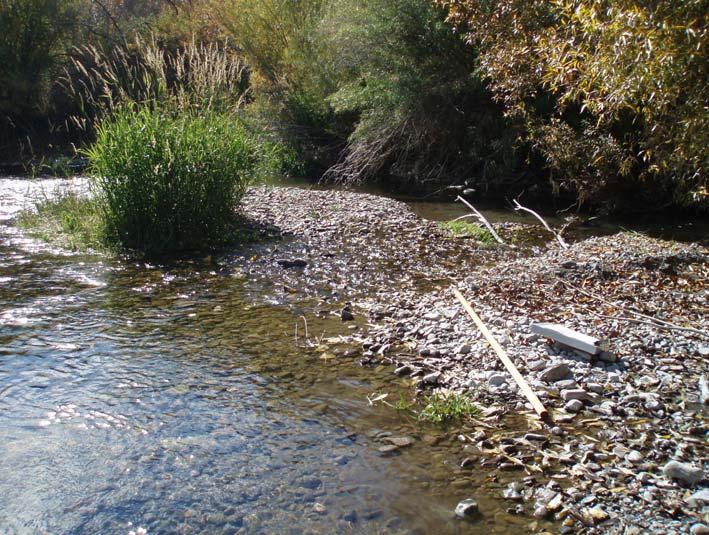
95

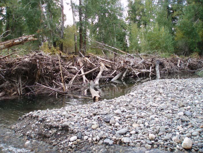
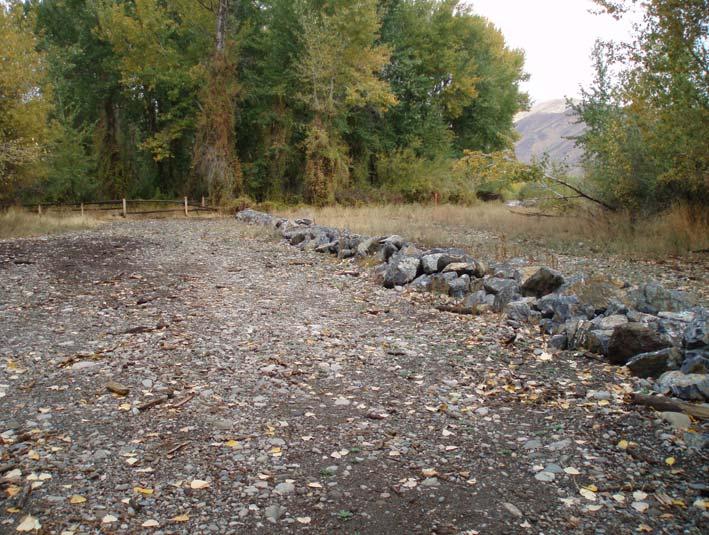

96


97


98


99
GENERAL SUMMARY BIG WOOD RIVER GEOMORPHIC ASSESSMENT BLAINE COUNTY, IDAHO
 GENERAL SUMMARY BIG WOOD RIVER GEOMORPHIC ASSESSMENT BLAINE COUNTY, IDAHO Prepared For Trout Unlimited 300 North Main Street, Hailey, Idaho, 83333 Prepared By P. O. Box 8578, 140 E. Broadway, Suite 23,
The last three sections of the main body of this report consist of:
 Threatened and Endangered Species Geological Hazards Floodplains Cultural Resources Hazardous Materials A Cost Analysis section that provides comparative conceptual-level costs follows the Environmental
1 INTRODUCTION AND MAJOR FINDINGS... 1
 Memorandum To: Lindsey Clark, Stillwater Valley Watershed Council Coordinator From: Chad Raisland, Pioneer Technical Services, Inc. and Karin Boyd, Applied Geomorphology, Inc. CC: Tanya Lester, Stillwater
ADDRESSING GEOMORPHIC AND HYDRAULIC CONTROLS IN OFF-CHANNEL HABITAT DESIGN
 ADDRESSING GEOMORPHIC AND HYDRAULIC CONTROLS IN OFF-CHANNEL HABITAT DESIGN Conor Shea - Hydrologist U.S. Fish and Wildlife Service Conservation Partnerships Program Arcata, CA Learning Objectives Examine
Stream Geomorphology. Leslie A. Morrissey UVM July 25, 2012
 Stream Geomorphology Leslie A. Morrissey UVM July 25, 2012 What Functions do Healthy Streams Provide? Flood mitigation Water supply Water quality Sediment storage and transport Habitat Recreation Transportation
Riparian Assessment. Steps in the right direction... Drainage Basin/Watershed: Start by Thinking Big. Riparian Assessment vs.
 Riparian Assessment vs. Monitoring Riparian Assessment What is a healthy stream? Determine stream/riparian health Determine change or trend, especially in response to mgmt Classification = designation
APPENDIX E. GEOMORPHOLOGICAL MONTORING REPORT Prepared by Steve Vrooman, Keystone Restoration Ecology September 2013
 APPENDIX E GEOMORPHOLOGICAL MONTORING REPORT Prepared by Steve Vrooman, Keystone Restoration Ecology September 2 Introduction Keystone Restoration Ecology (KRE) conducted geomorphological monitoring in
Aquifer an underground zone or layer of sand, gravel, or porous rock that is saturated with water.
 Aggradation raising of the streambed by deposition that occurs when the energy of the water flowing through a stream reach is insufficient to transport sediment conveyed from upstream. Alluvium a general
2. PHYSICAL SETTING FINAL GROUNDWATER MANAGEMENT PLAN. 2.1 Topography. 2.2 Climate
 FINAL GROUNDWATER MANAGEMENT PLAN 2. PHYSICAL SETTING Lassen County is a topographically diverse area at the confluence of the Cascade Range, Modoc Plateau, Sierra Nevada and Basin and Range geologic provinces.
Why Geomorphology for Fish Passage
 Channel Morphology - Stream Crossing Interactions An Overview Michael Love Michael Love & Associates mlove@h2odesigns.com (707) 476-8938 Why Geomorphology for Fish Passage 1. Understand the Scale of the
PolyMet NorthMet Project
 RS 26 Draft-01 December 8, 2005 RS26 Partridge River Level 1 Rosgen Geomorphic Survey Rosgen Classification Partridge River from Headwaters to Colby Lake Prepared for PolyMet NorthMet Project December
Step 5: Channel Bed and Planform Changes
 Step 5: Channel Bed and Planform Changes When disturbed, streams go through a series of adjustments to regain equilibrium with the flow and sediment supply of their watersheds. These adjustments often
Bank Erosion and Morphology of the Kaskaskia River
 Bank Erosion and Morphology of the Kaskaskia River US Army Corps Of Engineers St. Louis District Fayette County Soil and Water Conservation District Team Partners : Carlyle Lake Ecosystem Partnership Vicinity
Rosgen Classification Unnamed Creek South of Dunka Road
 Rosgen Classification Unnamed Creek South of Dunka Road Prepared for Poly Met Mining Inc. September 2013 Rosgen Classification Unnamed Creek South of Dunka Road Prepared for Poly Met Mining Inc. September
Historical channel change on the Upper Gila River, Arizona and New Mexico in response to anthropogenic modifications and extreme floods
 Historical channel change on the Upper Gila River, Arizona and New Mexico in response to anthropogenic modifications and extreme floods www.archives.gov www.paztcn.wr.usgs.gov wrh.noaa.gov Upper Gila River
REDWOOD VALLEY SUBAREA
 Independent Science Review Panel Conceptual Model of Watershed Hydrology, Surface Water and Groundwater Interactions and Stream Ecology for the Russian River Watershed Appendices A-1 APPENDIX A A-2 REDWOOD
Appendix E Guidance for Shallow Flooding Analyses and Mapping
 Appendix E Guidance for Shallow Flooding Analyses and Mapping E.1 Introduction Different types of shallow flooding commonly occur throughout the United States. Types of flows that result in shallow flooding
Four Mile Run Levee Corridor Stream Restoration
 Four Mile Run Levee Corridor Stream Restoration 30% Design Summary U.S. Army Corps of Engineers, Baltimore District Presentation Outline Four Mile Run 1.) Historic Perspective 2.) Existing Conditions 3.)
FINAL GEOMORPHIC ASSESSMENT REPORT BIG WOOD RIVER BLAINE COUNTY, IDAHO
 FINAL GEOMORPHIC ASSESSMENT REPORT BIG WOOD RIVER BLAINE COUNTY, IDAHO Prepared For Trout Unlimited 300 North Main Street, Hailey, Idaho, 83333 Prepared By P. O. Box 8578, 140 E. Broadway, Suite 23, Jackson,
How Do Human Impacts and Geomorphological Responses Vary with Spatial Scale in the Streams and Rivers of the Illinois Basin?
 How Do Human Impacts and Geomorphological Responses Vary with Spatial Scale in the Streams and Rivers of the Illinois Basin? Bruce Rhoads Department of Geography University of Illinois at Urbana-Champaign
GEOL 1121 Earth Processes and Environments
 GEOL 1121 Earth Processes and Environments Wondwosen Seyoum Department of Geology University of Georgia e-mail: seyoum@uga.edu G/G Bldg., Rm. No. 122 Seyoum, 2015 Chapter 6 Streams and Flooding Seyoum,
Case Study 2: Twenty-mile Creek Rock Fords
 Case Study : Twenty-mile Creek Rock Fords Location Crossing Description Washington. Okanagan National Forest. Methow Valley Ranger District. Chewuch river basin, East Chewuch Road. The Twenty-mile Creek
Conceptual Model of Stream Flow Processes for the Russian River Watershed. Chris Farrar
 Conceptual Model of Stream Flow Processes for the Russian River Watershed Chris Farrar Several features of creeks affect the interactions between surface and groundwater. This conceptual model uses the
Diagnostic Geomorphic Methods for Understanding Future Behavior of Lake Superior Streams What Have We Learned in Two Decades?
 Diagnostic Geomorphic Methods for Understanding Future Behavior of Lake Superior Streams What Have We Learned in Two Decades? Faith Fitzpatrick USGS WI Water Science Center, Middleton, WI fafitzpa@usgs.gov
3/3/2013. The hydro cycle water returns from the sea. All "toilet to tap." Introduction to Environmental Geology, 5e
 Introduction to Environmental Geology, 5e Running Water: summary in haiku form Edward A. Keller Chapter 9 Rivers and Flooding Lecture Presentation prepared by X. Mara Chen, Salisbury University The hydro
Solutions to Flooding on Pescadero Creek Road
 Hydrology Hydraulics Geomorphology Design Field Services Photo courtesy Half Moon Bay Review Solutions to Flooding on Pescadero Creek Road Prepared for: San Mateo County Resource Conservation District
DETAILED DESCRIPTION OF STREAM CONDITIONS AND HABITAT TYPES IN REACH 4, REACH 5 AND REACH 6.
 DETAILED DESCRIPTION OF STREAM CONDITIONS AND HABITAT TYPES IN REACH 4, REACH 5 AND REACH 6. The Eklutna River was divided into study reaches (figure 1) prior to this site visit. Prominent geologic or
3.0 TECHNICAL FEASIBILITY
 3.0 TECHNICAL FEASIBILITY 3.1 INTRODUCTION To enable seasonal storage and release of water from Lake Wenatchee, an impoundment structure would need to be constructed on the lake outlet channel. The structure
SECTION G SEDIMENT BUDGET
 SECTION G SEDIMENT BUDGET INTRODUCTION A sediment budget has been constructed for the for the time period 1952-2000. The purpose of the sediment budget is to determine the relative importance of different
May 7, Roger Leventhal, P.E. Marin County Public Works Laurel Collins Watershed Sciences
 May 7, 2013 Roger Leventhal, P.E. Marin County Public Works Laurel Collins Watershed Sciences Background Funded in 2009 under EPA 2100 Grant for $30k and managed by SFEP Project Goals: Update original
Restoration Goals TFG Meeting. Agenda
 San Joaquin River Restoration Program Restoration Goals TFG Meeting Reach 2B Update April 28, 2010 Agenda 1. Introductions 2. Program Restoration Goal Context 3. Program Update a) Interim Flows b) EIS/EIR
Assessment of the Hood River Delta Hood River, Oregon
 Assessment of the Hood River Delta Hood River, Oregon Pacific Northwest Waterways Association Annual Meeting October 13, 2010 Michael McElwee, Executive Director Port of Hood River Overview U.S. Army Corps
CASE STUDIES. Introduction
 Introduction The City of Winston-Salem faces the challenge of maintaining public infrastructure (e.g., water and sewer lines, storm drains, roads, culverts and bridges) while minimizing the potential impacts
Black Gore Creek 2013 Sediment Source Monitoring and TMDL Sediment Budget
 Black Gore Creek 2013 Sediment Source Monitoring and TMDL Sediment Budget Prepared for: Prepared By: - I. Introduction The Black Gore Creek Total Maximum Daily Load (TMDL) was developed in collaboration
PRELIMINARY DRAFT FOR DISCUSSION PURPOSES
 Memorandum To: David Thompson From: John Haapala CC: Dan McDonald Bob Montgomery Date: February 24, 2003 File #: 1003551 Re: Lake Wenatchee Historic Water Levels, Operation Model, and Flood Operation This
9. PROBABLE MAXIMUM PRECIPITATION AND PROBABLE MAXIMUM FLOOD
 9. PROBABLE MAXIMUM PRECIPITATION AND PROBABLE MAXIMUM FLOOD 9.1. Introduction Due to the size of Watana Dam and the economic importance of the Project to the Railbelt, the Probable Maximum Flood (PMF)
Opportunities to Improve Ecological Functions of Floodplains and Reduce Flood Risk along Major Rivers in the Puget Sound Basin
 Opportunities to Improve Ecological Functions of Floodplains and Reduce Flood Risk along Major Rivers in the Puget Sound Basin Christopher Konrad, US Geological Survey Tim Beechie, NOAA Fisheries Managing
Geomorphic Importance of Winter Peak Flows and Annual Snowmelt Hydrographs in a Sierra Nevada Boulder-Bedrock River
 Geomorphic Importance of Winter Peak Flows and Annual Snowmelt Hydrographs in a Sierra Nevada Boulder-Bedrock River Scott McBain and Bill Trush McBain & Trush, Inc. Clavey River and Cherry Creek vicinity
 Red River Flooding June 2015 Caddo and Bossier Parishes Presented by: Flood Technical Committee Where the Rain Falls Matters I-30 versus I-20 I-20 Backwater and Tributary Floods (Localized) 2016 Flood
UPPER COSUMNES RIVER FLOOD MAPPING
 UPPER COSUMNES RIVER FLOOD MAPPING DRAFT BASIC DATA NARRATIVE FLOOD INSURANCE STUDY SACRAMENTO COUTY, CALIFORNIA Community No. 060262 November 2008 Prepared By: CIVIL ENGINEERING SOLUTIONS, INC. 1325 Howe
Do you think sediment transport is a concern?
 STREAM RESTORATION FRAMEWORK AND SEDIMENT TRANSPORT BASICS Pete Klingeman 1 What is Your Restoration Project Like? k? Do you think sediment transport is a concern? East Fork Lewis River, WA Tidal creek,
Identifying, Understanding and Addressing Flood-Related Hazards
 Identifying, Understanding and Addressing Flood-Related Hazards Julie Moore, P.E. July 9, 2012 Agenda Traditional approach to river management Understanding flood-related hazards Common flood and flood
Vermont Stream Geomorphic Assessment. Appendix E. River Corridor Delineation Process. VT Agency of Natural Resources. April, E0 - April, 2004
 Vermont Stream Geomorphic Assessment Appendix E River Corridor Delineation Process Vermont Agency of Natural Resources - E0 - River Corridor Delineation Process Purpose A stream and river corridor delineation
Unconventional Wisdom and the Effects of Dams on Downstream Coarse Sediment Supply. Byron Amerson, Jay Stallman, John Wooster, and Derek Booth
 Unconventional Wisdom and the Effects of Dams on Downstream Coarse Sediment Supply 3 February 2009 Byron Amerson, Jay Stallman, John Wooster, and Derek Booth Sultan River, WA OBJECTIVE Consider the landscape
Fish Passage at Road Crossings
 Fish Passage at Road Crossings 1 Crossing Design Workshop Outline 1:00 to 2:00 Intro, Design Overview, Channel Width 2:00 to 2:15 Break 2:15 to 3:15 No-Slope, Stream Simulation Design 3:15 to 3:30 Break
Gateway Trail Project
 Gateway Trail Project Debris Flow Hazard Assessment By: Juan de la Fuente April 30, 2010 Background- On April 22, 2010, the Shasta-Trinity National Forest (Mt. Shasta-McCloud Unit) requested a geologic
Summary of Hydraulic and Sediment-transport. Analysis of Residual Sediment: Alternatives for the San Clemente Dam Removal/Retrofit Project,
 Appendix N SUMMARY OF HYDRAULIC AND SEDIMENT-TRANSPORT ANALYSIS OF RESIDUAL SEDIMENT: ALTERNATIVES FOR THE SAN CLEMENTE DAM REMOVAL/RETROFIT PROJECT, CALIFORNIA the San Clemente Dam Removal/Retrofit Project,
3.11 Floodplains Existing Conditions
 Other stormwater control practices may be needed to mitigate water quality impacts. In addition to detention facilities, other practices such as vegetated basins/buffers, infiltration basins, and bioswales
Chapter 3 Erosion in the Las Vegas Wash
 Chapter 3 Erosion in the Las Vegas Wash Introduction As described in Chapter 1, the Las Vegas Wash (Wash) has experienced considerable change as a result of development of the Las Vegas Valley (Valley).
NATURAL RIVER. Karima Attia Nile Research Institute
 NATURAL RIVER CHARACTERISTICS Karima Attia Nile Research Institute NATURAL RIVER DEFINITION NATURAL RIVER DEFINITION Is natural stream of water that flows in channels with ih more or less defined banks.
Laboratory Exercise #3 The Hydrologic Cycle and Running Water Processes
 Laboratory Exercise #3 The Hydrologic Cycle and Running Water Processes page - 1 Section A - The Hydrologic Cycle Figure 1 illustrates the hydrologic cycle which quantifies how water is cycled throughout
River Response. Sediment Water Wood. Confinement. Bank material. Channel morphology. Valley slope. Riparian vegetation.
 River Response River Response Sediment Water Wood Confinement Valley slope Channel morphology Bank material Flow obstructions Riparian vegetation climate catchment vegetation hydrological regime channel
ES 105 Surface Processes I. Hydrologic cycle A. Distribution % in oceans 2. >3% surface water a. +99% surface water in glaciers b.
 ES 105 Surface Processes I. Hydrologic cycle A. Distribution 1. +97% in oceans 2. >3% surface water a. +99% surface water in glaciers b. >1/3% liquid, fresh water in streams and lakes~1/10,000 of water
CR AAO Bridge. Dead River Flood & Natural Channel Design. Mitch Koetje Water Resources Division UP District
 CR AAO Bridge Dead River Flood & Natural Channel Design Mitch Koetje Water Resources Division UP District Old County Road AAO Bridge Map courtesy of Marquette County Silver Lake Basin McClure Basin
Sixteen Mile Creek Tributaries Meander Belt Width Assessment November 2009
 SIXTEEN MILE CREEK TRIBUTARIES THE CATHOLIC CEMETERIES OF THE DIOCESE OF HAMILTON -MEANDER BELT WIDTH ASSESSMENT - Report to: Attention: From: Director of Cemeteries Catholic Cemeteries of the Diocese
WATER ON AND UNDER GROUND. Objectives. The Hydrologic Cycle
 WATER ON AND UNDER GROUND Objectives Define and describe the hydrologic cycle. Identify the basic characteristics of streams. Define drainage basin. Describe how floods occur and what factors may make
Rapid Geomorphic Assessments: RGA s
 Establishing Current Reference Conditions Rates and concentrations of suspended-sediment transport vary over time and space due to factors such as precipitation characteristics and discharge, geology,
Implementing a Project with 319 Funds: The Spring Brook Meander Project. Leslie A. Berns
 Implementing a Project with 319 Funds: The Spring Brook Meander Project Leslie A. Berns "...to acquire... and hold lands... for the purpose of protecting and preserving the flora, fauna and scenic beauties...
4.17 Spain. Catalonia
 4.17 Spain Catalonia In Spain, inundation studies are the responsibility of the respective Hydrographic Confederations of each river basin (River Basin Authorities). The actual status of inundation studies
Swift Creek Sediment Management Action Plan (SCSMAP)
") Swift Creek Sediment Management Action Plan (SCSMAP) PHASE 2 PROJECT PLAN PROPOSAL Whatcom County Public Works Department 322 N. Commercial Street, Suite 210 Bellingham, WA 98225 (360) 676-6692 June 2013
Swift Creek Sediment Management Action Plan (SCSMAP) PHASE 2 PROJECT PLAN PROPOSAL Whatcom County Public Works Department 322 N. Commercial Street, Suite 210 Bellingham, WA 98225 (360) 676-6692 June 2013
SELBY CREEK STREAM HABITAT RESTORATION AND RIPARIAN REVEGETATION PROJECT: GEOMORPHIC ANALYSIS AND REVIEW
 SELBY CREEK STREAM HABITAT RESTORATION AND RIPARIAN REVEGETATION PROJECT: GEOMORPHIC ANALYSIS AND REVIEW Submitted to Bioengineering Institute P.O. Box 1554 Laytonville, CA 95454 By Matthew O Connor, PhD,
Illinois State Water Survey Division
 Illinois State Water Survey Division SURFACE WATER SECTION SWS Miscellaneous Publication 108 SEDIMENT YIELD AND ACCUMULATION IN THE LOWER CACHE RIVER by Misganaw Demissie Champaign, Illinois June 1989
PENNSYLVANIA DEPARTMENT OF TRANSPORTATION ENGINEERING DISTRICT 3-0
 PENNSYLVANIA DEPARTMENT OF TRANSPORTATION ENGINEERING DISTRICT 3-0 LYCOMING COUNTY S.R.15, SECTION C41 FINAL HYDROLOGIC AND HYDRAULIC REPORT STEAM VALLEY RUN STREAM RELOCATION DATE: June, 2006 REVISED:
Summary. Streams and Drainage Systems
 Streams and Drainage Systems Summary Streams are part of the hydrologic cycle and the chief means by which water returns from the land to the sea. They help shape the Earth s surface and transport sediment
PHYSICAL GEOGRAPHY. By Brett Lucas
 PHYSICAL GEOGRAPHY By Brett Lucas FLUVIAL PROCESSES Fluvial Processes The Impact of Fluvial Processes on the Landscape Streams and Stream Systems Stream Channels Structural Relationships The Shaping and
STREAM SYSTEMS and FLOODS
 STREAM SYSTEMS and FLOODS The Hydrologic Cycle Precipitation Evaporation Infiltration Runoff Transpiration Earth s Water and the Hydrologic Cycle The Hydrologic Cycle The Hydrologic Cycle Oceans not filling
Precipitation Evaporation Infiltration Earth s Water and the Hydrologic Cycle. Runoff Transpiration
 STREAM SYSTEMS and FLOODS The Hydrologic Cycle Precipitation Evaporation Infiltration Earth s Water and the Hydrologic Cycle Runoff Transpiration The Hydrologic Cycle The Hydrologic Cycle Oceans not filling
Squaw Creek. General Information
 General Information is a tributary to the Salmon River. It enters the north side of the river about 0 miles downstream of North Fork, Idaho. The study reach is about a 30 ft length of stream about 2 miles
Dolores River Watershed Study
 CHAPTER 4: RIVER AND FLOODPLAIN ISSUES The Dolores River falls into a category of streams in Colorado that share some unique characteristics. Like some other mountain streams in the state, it has a steep
Ways To Identify Background Verses Accelerated Erosion
 Ways To Identify Background Verses Accelerated Erosion Establish Background Condition From Old Ground Photos, Aerial Photos, and Maps Compare Rate Over Time At the Same Location, or for Reaches Channel
Fluvial Driven Alluvial Fans
 Fluvial Driven Alluvial Fans Restoration Project Evaluations - Examples from the Russian and Napa River Watersheds Mia Docto Masters Thesis UC Berkeley 1. Basic Fan Description 2. Fluvial Driven Fan Characteristics
LOMR SUBMITTAL LOWER NEHALEM RIVER TILLAMOOK COUNTY, OREGON
 LOMR SUBMITTAL LOWER NEHALEM RIVER TILLAMOOK COUNTY, OREGON Prepared for: TILLAMOOK COUNTY DEPARTMENT OF COMMUNITY DEVELOPMENT 1510-B THIRD STREET TILLAMOOK, OR 97141 Prepared by: 10300 SW GREENBURG ROAD,
60 PERCENT DESIGN REPORT HABITAT RESTORATION OF THE CHELAN RIVER REACH 4 AND TAILRACE
 60 PERCENT DESIGN REPORT HABITAT RESTORATION OF THE CHELAN RIVER REACH 4 AND TAILRACE Prepared for Public Utility District Number 1 of Chelan County 327 North Wenatchee Avenue Wenatchee, Washington 98801
OBJECTIVES. Fluvial Geomorphology? STREAM CLASSIFICATION & RIVER ASSESSMENT
 STREAM CLASSIFICATION & RIVER ASSESSMENT Greg Babbit Graduate Research Assistant Dept. Forestry, Wildlife & Fisheries Seneca Creek, Monongahela National Forest, West Virginia OBJECTIVES Introduce basic
Overview of fluvial and geotechnical processes for TMDL assessment
 Overview of fluvial and geotechnical processes for TMDL assessment Christian F Lenhart, Assistant Prof, MSU Research Assoc., U of M Biosystems Engineering Fluvial processes in a glaciated landscape Martin
Project (Project No. US-CA-62-2) Maintenance Inspection and Reports (Subtask 14.1) Inspection Report No.2
 Maintenance Inspection and Reports (Subtask 14.1) Inspection Report No.2") MEMORANDUM TO: FROM: Jim Well, Ducks Unlimited Mike Harvey, PhD, PG SUBJECT: M&T/ Llano Seco Fish Screen Project (Project No. US-CA-62-2) Maintenance Inspection and Reports (Subtask 14.1) Inspection Report
MEMORANDUM TO: FROM: Jim Well, Ducks Unlimited Mike Harvey, PhD, PG SUBJECT: M&T/ Llano Seco Fish Screen Project (Project No. US-CA-62-2) Maintenance Inspection and Reports (Subtask 14.1) Inspection Report
3.3 CLIMATE, GEOLOGY, TOPOGRAPHY, AND SOILS CLIMATE GEOLOGY TOPOGRAPHY
 3.3 CLIMATE, GEOLOGY, TOPOGRAPHY, AND SOILS This section describes the climate, geology, topography, and soil resource characteristics of the Yolo Bypass Wildlife Area (Wildlife Area). Agricultural soil
Kaskaskia Morphology Study Headwaters to Lake Shelbyville
 Kaskaskia Morphology Study Headwaters to Lake Shelbyville KWA Mini Summit 5 March 2012 1 Kaskaskia Morphology Study Headwaters to Lake Shelbyville Conducted by U.S. Army Corps of Engineers, St. Louis District
Wetland & Floodplain Functional Assessments and Mapping To Protect and Restore Riverine Systems in Vermont. Mike Kline and Laura Lapierre Vermont DEC
 Wetland & Floodplain Functional Assessments and Mapping To Protect and Restore Riverine Systems in Vermont Mike Kline and Laura Lapierre Vermont DEC NWI+ Hydro-Geomorphic Characterization of Wetlands and
Sediment Deposition LET THE RIVER RUN T E A C H E R. Activity Overview. Activity at a Glance. Time Required. Level of Complexity.
 Activity at a Glance Grade: 6 9 Subject: Science Category: Physical Science, Earth Science Topic: Deposition, River Systems Time Required Two 45-minute periods Level of Complexity Medium Materials* TI-73
Missouri River Basin Water Management
 Missouri River Basin Water Management US Army Corps of Engineers Missouri River Navigator s Meeting February 12, 2014 Bill Doan, P.E. Missouri River Basin Water Management US Army Corps of Engineers BUILDING
Annotated Bibliography of River Avulsions Pat Dryer Geography 364 5/14/2007
 Annotated Bibliography of River Avulsions Pat Dryer Geography 364 5/14/2007 1 Table of Contents Introduction 2 Annotations I. River avulsions and their deposits 2 II. Channel avulsion on alluvial fans
STUDY GUIDE FOR CONTENT MASTERY. Surface Water Movement
 Surface Water SECTION 9.1 Surface Water Movement In your textbook, read about surface water and the way in which it moves sediment. Complete each statement. 1. An excessive amount of water flowing downslope
Limitation to qualitative stability indicators. the real world is a continuum, not a dichotomy ~ 100 % 30 % ~ 100 % ~ 40 %
 Stream Stability Assessment & BEHI Surveys Joe Rathbun MDEQ Water Resources Division rathbunj@michigan.gov 517--373 517 373--8868 Stability Stream can transport its water and sediment inputs without changing
3.12 Geology and Topography Affected Environment
 3 Affected Environment and Environmental Consequences 3.12 Geology and Topography 3.12.1 Affected Environment 3.12.1.1 Earthquakes Sterling Highway MP 45 60 Project Draft SEIS The Kenai Peninsula is predisposed
Avoiding Geohazards in the Mid-Atlantic Highlands by Using Natural Stream Principles
 Avoiding Geohazards in the Mid-Atlantic Highlands by Using Natural Stream Principles J. Steven Kite, WVU Neal Carte, WVDOT Will Harman, Michael Baker Corp. Donald D. Gray, WVU Photo: W. Gillespie North
Upper Truckee River Restoration Lake Tahoe, California Presented by Brendan Belby Sacramento, California
 Upper Truckee River Restoration Lake Tahoe, California Presented by Brendan Belby Sacramento, California Mike Rudd (Project Manager), Charley Miller & Chad Krofta Declines in Tahoe s Water Clarity The
Technical Memorandum. To: From: Copies: Date: 10/19/2017. Subject: Project No.: Greg Laird, Courtney Moore. Kevin Pilgrim and Travis Stroth
 Technical Memorandum To: From: Greg Laird, Courtney Moore Kevin Pilgrim and Travis Stroth 5777 Central Avenue Suite 228 Boulder, CO 80301 www.otak.com Copies: [Electronic submittal] Date: 10/19/2017 Subject:
Surface Water and Stream Development
 Surface Water and Stream Development Surface Water The moment a raindrop falls to earth it begins its return to the sea. Once water reaches Earth s surface it may evaporate back into the atmosphere, soak
GLG362/GLG598 Geomorphology K. Whipple October, 2009 I. Characteristics of Alluvial Channels
 I. Characteristics of Alluvial Channels Self-formed morphology set by entrainment, transport, and deposition They move unconsolidated sedimentary materials present in the valley fill flood plain/bank flow
mountain rivers fixed channel boundaries (bedrock banks and bed) high transport capacity low storage input output
 high transport capacity low storage input output") mountain rivers fixed channel boundaries (bedrock banks and bed) high transport capacity low storage input output strong interaction between streams & hillslopes Sediment Budgets for Mountain Rivers Little
mountain rivers fixed channel boundaries (bedrock banks and bed) high transport capacity low storage input output strong interaction between streams & hillslopes Sediment Budgets for Mountain Rivers Little
Dams, sediment, and channel changes and why you should care
 Dams, sediment, and channel changes and why you should care Gordon E. Grant USDA Forest Service PNW Research Station Corvallis, Oregon Dam effects on river regimes FLOW (Q) SEDIMENT (Qs) TEMP CHEMISTRY
HYDROLOGY AND HYDRAULICS MUSKEG RIVER BRIDGE
 PUBLIC WORKS CANADA HYDROLOGY AND HYDRAULICS MUSKEG RIVER BRIDGE KILOMETRE 207.9, LIARD HIGKWAY December 1978 I I f I I I I # Bolter Parish Trimble Ltd. ONLIULTINO Public Works, Canada, 9925-109 Street,
11/12/2014. Running Water. Introduction. Water on Earth. The Hydrologic Cycle. Fluid Flow
 Introduction Mercury, Venus, Earth and Mars share a similar history, but Earth is the only terrestrial planet with abundant water! Mercury is too small and hot Venus has a runaway green house effect so
Running Water Earth - Chapter 16 Stan Hatfield Southwestern Illinois College
 Running Water Earth - Chapter 16 Stan Hatfield Southwestern Illinois College Hydrologic Cycle The hydrologic cycle is a summary of the circulation of Earth s water supply. Processes involved in the hydrologic
Carmel River Bank Stabilization at Rancho San Carlos Road Project Description and Work Plan March 2018
 Carmel River Bank Stabilization at Rancho San Carlos Road Project Description and Work Plan March 2018 EXISTING CONDITION The proposed Carmel River Bank Stabilization at Rancho San Carlos Road Project
Why Stabilizing the Stream As-Is is Not Enough
 Why Stabilizing the Stream As-Is is Not Enough Several examples of alternatives to the County s design approach have been suggested. A common theme of these proposals is a less comprehensive effort focusing
Executive Summary. Water Quantity
 Executive Summary Stakeholders in the Rock-Glade Watershed have taken the initiative to proceed with watershed planning as provided by the State of Washington under the Watershed Management Act (Chapter
Fluvial Geomorphic Guidelines
 Fluvial Geomorphic Guidelines FACT SHEET I: GEOMORPHOLOGICAL HAZARDS CONFINED AND UNCONFINED WATERCOURSES Channel migration and erosion can create substantial risk to inappropriately located infrastructure
Elevation (ft) Slope ( ) County CONDITION CATEGORY. Parameter Natural Condition Slightly impacted Moderately Impacted Heavily Impacted
 Slope ( ) County CONDITION CATEGORY. Parameter Natural Condition Slightly impacted Moderately Impacted Heavily Impacted") Version: 8/25/14 Meadow Name Date : / / MM DD YYYY GPS Location:. N. W GPS Datum (e.g., WGS 84, NAD 27) Elevation (ft) Slope ( ) County Watershed (HUC8) Landowner USGS Quad Name Observers: 7.5 or 15 (circle
Version: 8/25/14 Meadow Name Date : / / MM DD YYYY GPS Location:. N. W GPS Datum (e.g., WGS 84, NAD 27) Elevation (ft) Slope ( ) County Watershed (HUC8) Landowner USGS Quad Name Observers: 7.5 or 15 (circle