East Asia. Mongolia, China, Taiwan, the Koreas, and Japan
|
|
|
- Ashlee Holland
- 5 years ago
- Views:
Transcription

1 East Asia Mongolia, China, Taiwan, the Koreas, and Japan
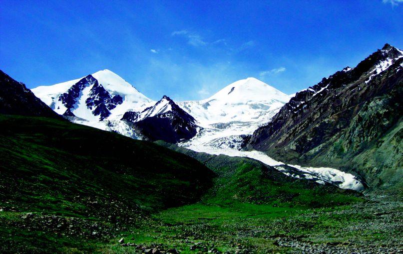
2 Major Geographic Characteristics of East Asia East Asia is the most populous region in the world China is the most populous country, and the oldest continuous national culture One of the world s earliest culture hearths Population concentrations in the East, situated in river basins East Asia is an emerging center of political power Experienced colonization, and internal and international conflict China and Japan have been rivals from time to time Mountains are important in Asia because they influence: Population patterns Movement of people and goods Climate
")
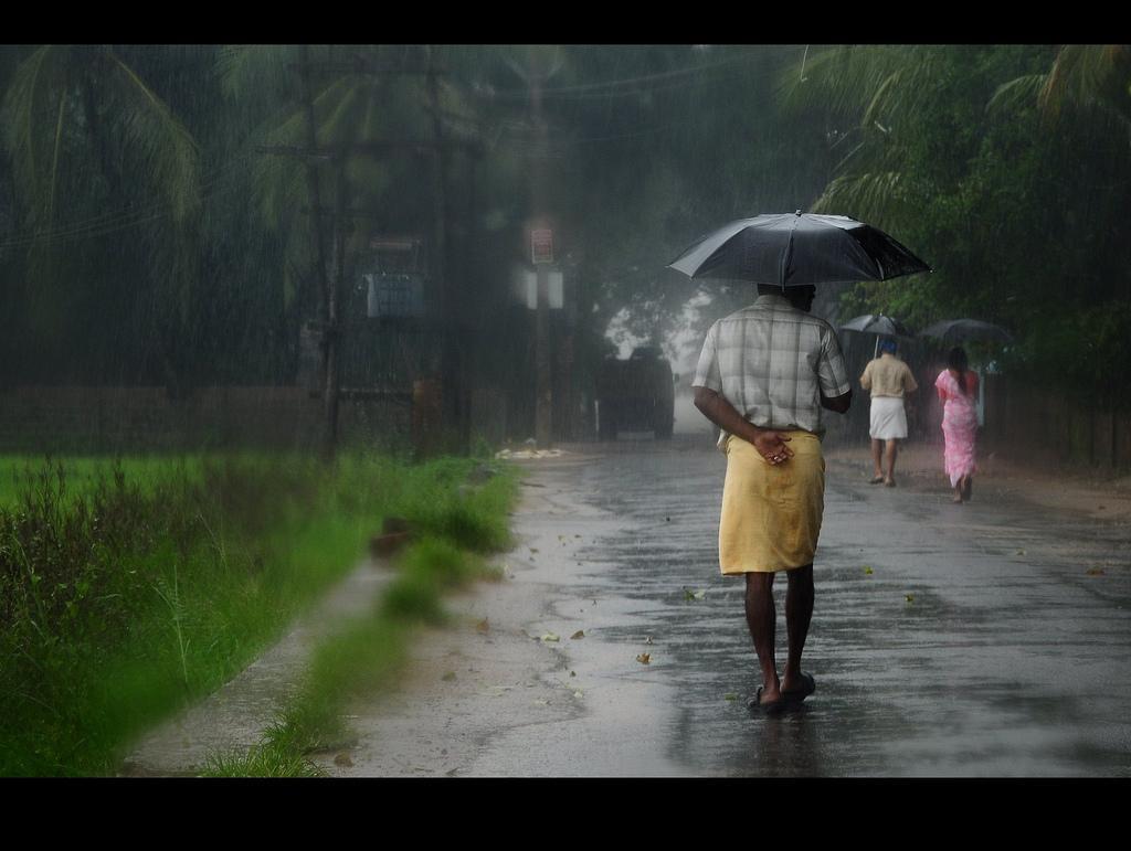
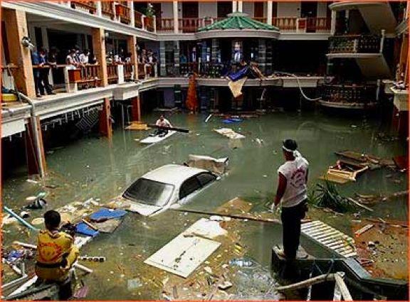
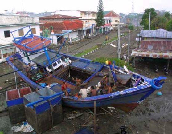
3 The Ring of Fire An arc where the Pacific, Philippine, and Eurasian tectonic plates meet Circle of volcanoes bordering the Pacific Ocean Plate movement generates violent earthquakes and volcanic eruptions Tsunamis = undersea earthquakes that cause huge tidal waves that get higher as it approaches the coast Known Hazards in the area Earthquakes, Typhoons, Floods Volcanic Activity (Japan) Drought
4 Monsoons = the movement of two large air masses that meet and causes prevailing winds and seasonal weather patterns a. Economy depends on the monsoons b. Qin Lin Mountains weakens effect of the monsoons c. Summer (April - October) i. Blows Southeast to Northeast ii. Brings heat and humidity, intense downpours d. Winter (November - March) i. Cold, arctic air dust clouds from Gobi and snow in Japan and Korean Peninsula ii. Blows Northwest to Southeast
5
6

7 Climate and Vegetation of Asia
8 1) Asia has varied climate regions a) North and West = dry highlands and grasslands b) South and East = humid, temperate forest 2) Shaped by latitude and physical landscape a) Zones of Latitude - Part of Asia is in the low latitude and part of the mid latitude b) Elevation - Mountainous regions in Asia have colder climates c) Topography - Mountains block rainfall causing deserts on one side
9 1) Mid-latitude a) Southeastern Quarter i) Taiwan, the Koreas, parts of China and Japan ii) Humid and subtropical warm hot summers, heavy rains from Pacific monsoons b) Northeastern Quarter i) Northern Korea and Japan ii) Cooler, humid continental climate summer warm and winters cold and snowy
 Gobi and Taklimakan Deserts i) Often cold and windy c) Grasses and sparse trees natural")
10 1) Deserts and Steppe Climates a) Moisture blocked by mountain - rain shadow i) Extreme temperatures b) Gobi and Taklimakan Deserts i) Often cold and windy c) Grasses and sparse trees natural vegetation
 Small alpine meadows lower mountain slopes d) Above timberlane mosses and colorful")
11 1) Highland Climate a) Changes with elevation b) Plateau of Tibet cold (higher elevation c) Small alpine meadows lower mountain slopes d) Above timberlane mosses and colorful lichens
12 Natural Resources Major natural resources of East Asia Petroleum, coal, natural gas, and iron ore Unevenly distributed China has widest range of minerals 10% of China agriculturally viable vs 25% of South Korea agriculturally viable Coal found in NE China, Korean peninsula and Mongolia South China Sea and Taklimakan Desert = largest oils deposits North and South Korea have plentiful gold and silver reserves Natural forests Bamboo in the warmer areas (food source for the Giant Panda and Red Panda) Mulberry trees home to silk worms and used for tea production
13 China
14 China s Plateaus, Basins and Deserts Plateau of Tibet (Plateau of Xizang) Southwest, highest Mongolian Plateau North, grassy pastures Tarim Basin Flat wasteland = deserts and salt marshes Between Kunlun and Tian Shan Mts. Taklimakan Desert West of Tarim Dry and sandy Sichuan Basin Between the Plateau of Tibet and North China Plain Mild climate and long growing season Important agricultural area

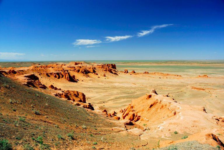
15 Gobi Desert 1. Largest desert in Asia 1.1. Covers more than 5,000 miles from northwest China into Mongolia 2. Located in northeast - southern Mongolia to North/Central China 3. Extreme climate = difficult to survive 3.1. Frequent dust storms 3.2. During winter months, temperatures can drop to -40 F 3.3. During summer months, temperatures can reach 122 F
16 Chinese Mountain Ranges Pamirs Western China Includes the Kunlun Shan and Tian Shan Mountains (Shan is Chinese for mountains) Altay Northern China Border between China and Mongolia Changhai Located in Manchuria Extends to Korean Peninsula
")
17 Kunlun Shan Located in Western China The source of both the Yellow and Yangtze Rivers Bends to become Qin Ling Mountains Crosses Central China (west to east)
18
19
20 Major Rivers China s river systems provide crop irrigation, hydroelectric power, and transportation Amur River Starts in the Great Khingan Mountains in Northern China Empties into the Sea of Japan Border between China and Russia. Yellow River Huang He = China s Sorrow, Northern China Yellow loess = yellowish-brown topsoil blown by wind from western deserts Yangtze River Chang Jiang, Central China Asia s longest river (major transportation) Spectacular gorges Three Gorges Dam West River XiJiang River, Southern China Key river system Guangzhou and Macau ports, huge fertile delta
21
22
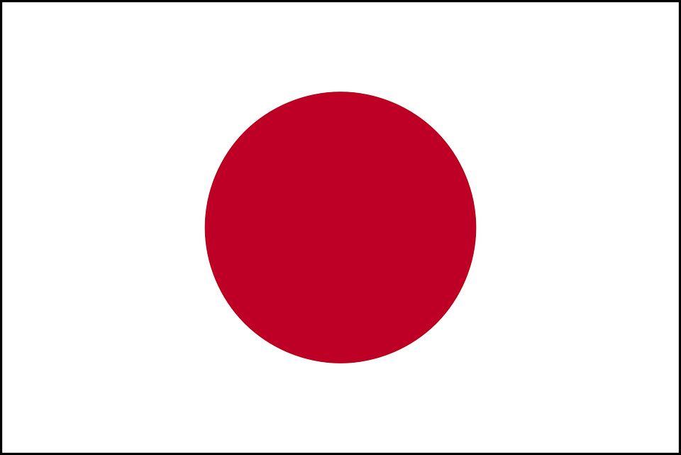
23 Japan
24 Archipelago = island chain 4 Main mountainous islands (1000s of smaller) Honshu - largest island (central) Hokkaido = North Kyushu and Shikoku = South Ocean Currents shapes Japan s climate Japan or Kuroshio Current warm water, flows northward on the South/SE coast Kuril or Oyashio Current flows SW from Bering Sea, harsh cold winters Typhoons = violent storms

25 Mount Fujiyama Mount Fuji Cone shaped volcano (dormant) Central Plains - Honshu Island Important spiritual symbol

26 The Koreas
27
28 The Korean Peninsula Mountains and coastal plain Southeast of the Manchurian Plain Separates the Sea of Japan and Yellow Sea Han River South Korea Flows through Seoul Amnok (Yalu) River North Korea Flows west and creates border with China
South, Southeast, and East Asia. Physical Geography
 South, Southeast, and East Asia Physical Geography Mountains v Mountains are important in Asia because they influence: A. Population patterns B. Movement of people and goods C. Climate Mountains v The
Physical Geography of East Asia
 Physical Geography of East Asia Satellite View of China Landforms of China China s Geography China Miles 0 250 500 1,000 1,500 2,000 United States 3 rd largest country in the world. Comparable to the US
Presentation Plus! Glencoe World Geography Copyright by The McGraw-Hill Companies, Inc. Developed by FSCreations, Inc., Cincinnati, Ohio 45202
 Presentation Plus! Glencoe World Geography Copyright by The McGraw-Hill Companies, Inc. Developed by FSCreations, Inc., Cincinnati, Ohio 45202 Send all inquiries to: GLENCOE DIVISION Glencoe/McGraw-Hill
Tropical Moist Rainforest
 Tropical or Lowlatitude Climates: Controlled by equatorial tropical air masses Tropical Moist Rainforest Rainfall is heavy in all months - more than 250 cm. (100 in.). Common temperatures of 27 C (80 F)
The Impact of Geography in South and East Asia
 The Impact of Geography in South and East Asia Gobi desert, Mongolia Essential Question: How does geography impact the distribution of population throughout South and East Asia? I CAN Explain how geography
The Impact of Geography in South and East Asia
 The Impact of Geography in South and East Asia Gobi desert, Mongolia Essential Question: How does the geography of SE Asia impact trade and the distribution of population throughout the region? (AKS #52a)
The Impact of Geography in South and East Asia
 The Impact of Geography in South and East Asia Gobi desert, Mongolia Essential Question: How does the geography of SE Asia impact trade and the distribution of population throughout the region? (AKS #52a)
Chapter 21 Southwest Asia: Harsh & Arid Lands
 Name Hour Chapter 21 Southwest Asia: Harsh & Arid Lands Essential Question: How has the physical geography of Asia influenced the development of these regions (i.e. history, population distribution, &
GLOBAL CLIMATES FOCUS
 which you will learn more about in Chapter 6. Refer to the climate map and chart on pages 28-29 as you read the rest of this chapter. FOCUS GLOBAL CLIMATES What are the major influences on climate? Where
Ganbat.B, Agro meteorology Section
 NATIONAL AGENCY FOR METEOROLOGY, HYDROLOGY AND ENVIRONMENT MONITORING OF MONGOLIA Ganbat.B, Agro meteorology Section OF INSTITUTE OF METEOROLOGY AND HYDROLOGY 2009 YEAR Location Climate Northern Asia,
Unit 2. United States Physical Geography
 Unit 2 United States Physical Geography Physical Geography U.S. extends from the Atlantic to Pacific U.S. is the 3rd largest country U.S. has fertile soils, vast forests, and variety of minerals All major
Long-Term Trend of Summer Rainfall at Selected Stations in the Republic of Korea
 Long-Term Trend of Summer Rainfall at Selected Stations in the Republic of Korea Il-Kon Kim Professor, Department of Region Information Rafique Ahmed Professor, Geography and Earth Science Silla University
Ancient China UNIT 4 GEOGRAPHY CHALLENGE. 1 Unit 4 Geography Challenge. Teachers Curriculum Institute
 UNIT 4 GEOGRAPHY CHALLENGE Ancient China N W E S 0 250 500 miles 0 250 500 kilometers Albers Conic Equal-Area Projection AW_ISN_U04_01 Ancient China Second Proof TCI18 108 1 Unit 4 Geography Challenge
Chapter 1 Section 2. Land, Water, and Climate
 Chapter 1 Section 2 Land, Water, and Climate Vocabulary 1. Landforms- natural features of the Earth s land surface 2. Elevation- height above sea level 3. Relief- changes in height 4. Core- most inner
Ancient China. Teachers Curriculum Institute Geography and the Early Settlement of China 1. AW_ISN_U04_01 Ancient China Second Proof TCI18 108
 G e o g r a p h y C h a l l e n g e Ancient China N W E S 0 250 500 miles 0 250 500 kilometers Albers Conic Equal-Area Projection AW_ISN_U04_01 Ancient China Second Proof TCI18 108 Teachers Curriculum
What is the largest country in the world? Russia
 What is the largest country in the world? #1 Russia CSCOPE 2007 2 Russia Dimensions #2-3 Spans 11 Time Zones From East to West: Gulf of Finland to Alaska From North to South: Above the Arctic Circle to
Sec$on 1: Geography and Early China. How does China s geography affect the culture?
 Sec$on 1: Geography and Early China How does China s geography affect the culture? Con$nents of the World Label the continents. Where is China located? Where is China located? In your groups, begin filling
forest tropical jungle swamp marsh prairie savanna pampas Different Ecosystems (rainforest)
") Different Ecosystems forest A region of land that is covered with many trees and shrubs. tropical jungle (rainforest) swamp A region with dense trees and a variety of plant life. It has a tropical climate.
Different Ecosystems forest A region of land that is covered with many trees and shrubs. tropical jungle (rainforest) swamp A region with dense trees and a variety of plant life. It has a tropical climate.
World Geography Chapter 3
 World Geography Chapter 3 Section 1 A. Introduction a. Weather b. Climate c. Both weather and climate are influenced by i. direct sunlight. ii. iii. iv. the features of the earth s surface. B. The Greenhouse
3) What is the difference between latitude and longitude and what is their affect on local and world weather and climate?
 What is the difference between latitude and longitude and what is their affect on local and world weather and climate?") www.discoveryeducation.com 1) Describe the difference between climate and weather citing an example of each. Describe how water (ocean, lake, river) has a local effect on weather and climate and provide
www.discoveryeducation.com 1) Describe the difference between climate and weather citing an example of each. Describe how water (ocean, lake, river) has a local effect on weather and climate and provide
Physical Geography. Ariel view of the Amazon Rainforest. A Look at the Seven Continents
 Physical Geography In this unit you will learn about general physical geography. The study of the Earth s surface features provides the setting for the human-environmental interactions and for the human
Module 11: Meteorology Topic 3 Content: Climate Zones Notes
 Introduction Latitude is such an important climate factor that you can make generalizations about a location's climate based on its latitude. Areas near the equator or the low latitudes are generally hot
Physical Geography. China, Mongolia, and Taiwan: Physical-Political. Define. Read to Discover. Locate. 1. What are the physical features.
 Physical Geography Read to Discover Define. 1. What are the physical features dikes Himalayas Gobi, arable -MOlln-t-E--Verest. North China Plain. Huang He of China, Mongolia, and Taiwan? Locate 2. What
Energy Systems, Structures and Processes Essential Standard: Analyze patterns of global climate change over time Learning Objective: Differentiate
 Energy Systems, Structures and Processes Essential Standard: Analyze patterns of global climate change over time Learning Objective: Differentiate between weather and climate Global Climate Focus Question
The United States & Canada. A Regional Study of Anglo America
 A Regional Study of Anglo America Landform Regions of the United States & Canada world leaders in agricultural and industrial production because of... VAST LANDS stretch from the Atlantic Ocean on the
UNIT4. Ancient China. Geography and the Early Settlement of China. Three Chinese Philosophies The First Emperor of China
 UNIT4 Ancient China Lesson 19 Lesson 20 Lesson 21 Lesson 22 Lesson 23 Lesson 24 Geography and the Early Settlement of China The Shang Dynasty Three Chinese Philosophies The First Emperor of China The Han
Keys to Climate Climate Classification Low Latitude Climates Midlatitude Climates High Latitude Climates Highland Climates Our Changing Climate
 Climate Global Climates Keys to Climate Climate Classification Low Latitude Climates Midlatitude Climates High Latitude Climates Highland Climates Our Changing Climate Keys to Climate Climate the average
Terms. divide headwaters tributary fall line fishery
 Chapter 5 Preview Section 1 The Land Objectives Identify some key similarities and differences in the physical geography of the United States and Canada. Explain why rivers have played such an important
UNIT 11 SOUTH ASIA SG 1 - PHYSICAL GEOGRAPHY & THE ENVIRONMENT
 UNIT 11 SOUTH ASIA SG 1 - PHYSICAL GEOGRAPHY & THE ENVIRONMENT I. PHYSICAL GEOGRAPHY TAKE OUT YOUR PHYSICAL MAP OF SOUTH ASIA A. The Himalayan Mountains form the northern boundary of the region (color
(version 3) I. HumAN -Environment Interaction
 I. HumAN -Environment Interaction") (version 3) I. HumAN -Environment Interaction A. Landforms 1. Earth s topography is made up of many different types of landforms. 2. While the planet is covered primarily with water, the four major types
(version 3) I. HumAN -Environment Interaction A. Landforms 1. Earth s topography is made up of many different types of landforms. 2. While the planet is covered primarily with water, the four major types
Mount Everest and the Gobi Desert
 Mount Everest and the Gobi Desert 1 Mount Everest is part of the mountain chain known as the Himalaya. Adventurers from all over the world come to try to climb it. Mount Everest is the highest mountain
Chapter 6, Part Colonizers arriving in North America found extremely landscapes. It looked different to region showing great.
 Social Studies 9 Unit 1 Worksheet Chapter 6, Part 1. 1. Colonizers arriving in North America found extremely landscapes. It looked different to region showing great. 2. The Earth is years old and is composed
Chapter 3: Study Guide
 Chapter 3: Study Guide Multiple Choice 1. Places located in high latitudes have a. a very warm climate. b. the same weather as places in other latitudes. c. a mix of extremely hot and extremely cold weather.
Physical Geography of the United States and Canada Chapter 5 A Land of Contrasts
 Physical Geography of the United States and Canada Chapter 5 A Land of Contrasts Land Area Together the U.S. and Canada cover more than 7 million square miles. In total area, Canada ranks 2 nd and the
CH. 3: Climate and Vegetation
 CH. 3: Climate and Vegetation GROUP WORK RUBRIC Score of 50 (5): Superior - 100% A 5 is superior work, and has completed all requirements of the assignments, it is in order and its presentation is almost
Landforms and Bodies of Water
 Chapter 5, Section 1 For use with textbook pages 115 120. The Land Terms to Know divide A high point or ridge that determines the direction that rivers flow (page 118) headwaters The source waters of a
Chapter 2 Planet Earth
 Chapter 2 Planet Earth Section Notes Earth and the Sun s Energy Water on Earth The Land Close-up The Water Cycle World Almanac Major Eruptions in the Ring of Fire Quick Facts Chapter 2 Visual Summary Video
WHAT CAN MAPS TELL US ABOUT THE GEOGRAPHY OF ANCIENT GREECE? MAP TYPE 1: CLIMATE MAPS
 WHAT CAN MAPS TELL US ABOUT THE GEOGRAPHY OF ANCIENT GREECE? MAP TYPE 1: CLIMATE MAPS MAP TYPE 2: PHYSICAL AND/OR TOPOGRAPHICAL MAPS MAP TYPE 3: POLITICAL MAPS TYPE 4: RESOURCE & TRADE MAPS Descriptions
Terms to Know. divide headwaters tributary fall line fishery
 Chapter Objectives Describe the dominant landforms and natural resources of the United States and Canada. Discuss climate and vegetation in the United States and Canada. Section 1 The Land Section Objectives
ENVE203 Environmental Engineering Ecology (Oct 15, 2012)
") ENVE203 Environmental Engineering Ecology (Oct 15, 2012) Elif Soyer Ecosystem and Physical Environment Atmosphere, Ocean, Weather & Climate, Internal Planetary Processes Atmospheric Circulation Different
ENVE203 Environmental Engineering Ecology (Oct 15, 2012) Elif Soyer Ecosystem and Physical Environment Atmosphere, Ocean, Weather & Climate, Internal Planetary Processes Atmospheric Circulation Different
1 What Is Climate? TAKE A LOOK 2. Explain Why do areas near the equator tend to have high temperatures?
 CHAPTER 17 1 What Is Climate? SECTION Climate BEFORE YOU READ After you read this section, you should be able to answer these questions: What is climate? What factors affect climate? How do climates differ
EQ: Discuss main geographic landforms of the U.S. & Canada and examine varied landforms in relation to their lifestyles.
 EQ: Discuss main geographic landforms of the U.S. & Canada and examine varied landforms in relation to their lifestyles. Places & Terms for Discussion Appalachian Mountains Great Plains Canadian Shield
Contents. Section 1: Climate Factors. Section 2: Climate Types. Section 3: Climate Effects
 Contents Section 1: Climate Factors 1. Weather or Climate?.... 2 2. Elements of Climate.... 4 3. Factors Affecting Climate.... 10 4. Comparing Climates.... 15 5. Quiz 1.... 20 Section 2: Climate Types
Weather Atmospheric condition in one place during a limited period of time Climate Weather patterns that an area typically experiences over a long
 Weather Atmospheric condition in one place during a limited period of time Climate Weather patterns that an area typically experiences over a long period of time Many factors influence weather & climate
Explain the impact of location, climate, natural resources, and population distribution on Europe. a. Compare how the location, climate, and natural
 SS6G10 Explain the impact of location, climate, natural resources, and population distribution on Europe. a. Compare how the location, climate, and natural resources of Germany, the United Kingdom and
Formative Test. 4 th Grading in Science VII
 Formative Test 4 th Grading in Science VII I. Latitude and Longitude 1. It is an imaginary line that divides the northern and southern hemispheres. A. Latitude B. Equator C. Longitude D. Tropic of Cancer
Thursday, April 27, 17
 Thursday, April 27, 17 Geography of Southeast Asia Objec-ve: Understand the geographical differences between the mainland region and the insular region of Southeast Asia. Do Now: What is the capital of
Prentice Hall EARTH SCIENCE
 Prentice Hall EARTH SCIENCE Tarbuck Lutgens Chapter 21 Climate 21.1 Factors That Affect Climate Factors That Affect Climate Latitude As latitude increases, the intensity of solar energy decreases. The
Weather Atmospheric condition in one place during a limited period of time Climate Weather patterns that an area typically experiences over a long
 Weather Atmospheric condition in one place during a limited period of time Climate Weather patterns that an area typically experiences over a long period of time Many factors influence weather & climate
Chapter 3 Section 3 World Climate Regions In-Depth Resources: Unit 1
 Guided Reading A. Determining Cause and Effect Use the organizer below to show the two most important causes of climate. 1. 2. Climate B. Making Comparisons Use the chart below to compare the different
Our climate system is based on the location of hot and cold air mass regions and the atmospheric circulation created by trade winds and westerlies.
 CLIMATE REGIONS Have you ever wondered why one area of the world is a desert, another a grassland, and another a rainforest? Or have you wondered why are there different types of forests and deserts with
Bell Work. REVIEW: Our Planet Earth Page 29 Document A & B Questions
 9.12.16 Bell Work REVIEW: Our Planet Earth Page 29 Document A & B Questions Intro to Climate & Weather https://www.youtube.com/watch?v=vhgyoa70q7y Weather vs. Climate Video Climate & Weather 3.1 Weather
Factors That Affect Climate
 Factors That Affect Climate Factors That Affect Climate Latitude As latitude (horizontal lines) increases, the intensity of solar energy decreases. The tropical zone is between the tropic of Cancer and
Elements of weather and climate Temperature Range of temperature Seasonal temperature pattern Rainfall
 Climate Earth Science Chapter 20 Pages 560-573 Elements of weather and climate Temperature Range of temperature Seasonal temperature pattern Rainfall Overall rainfall Seasonal distribution of rainfall
4th Grade Social Studies First Nine Weeks
 4th Grade Social Studies First Nine Weeks Multiple Choice Identify the choice that best completes the statement or answers the question. 1 Name the mountains that are located in the eastern United States.
1 What Is Climate? TAKE A LOOK 2. Explain Why do areas near the equator tend to have high temperatures?
 CHAPTER 17 1 What Is Climate? SECTION Climate BEFORE YOU READ After you read this section, you should be able to answer these questions: What is climate? What factors affect climate? How do climates differ
Seasons, Global Wind and Climate Study Guide
 Seasons, Global Wind and Climate Study Guide Seasons 1. Know what is responsible for the change in seasons on Earth. 2. Be able to determine seasons in the northern and southern hemispheres given the position
Social Studies. Chapter 2 Canada s Physical Landscape
 Social Studies Chapter 2 Canada s Physical Landscape Introduction Canada s geography its landforms and climate - has a great impact on Canadians sense of identity. Planet Earth The earth is divided into
STUDY GUIDE. The Land. Physical Features. Australia. Oceania. Chapter 32, Section 1. New Zealand Antarctica. Terms to Know DRAWING FROM EXPERIENCE
 For use with textbook pages 793 798. The Land Terms to Know artesian well A well from which pressurized water flows to the surface (page 794) coral The limestone skeletons of tiny sea animals (page 795)
Name Date Class. well as the inland, found near the Tropics. 4. In the, or the regions near the Equator, you may find a lush
 WATER, CLIMATE, AND VEGETATION Vocabulary Activity DIRECTIONS: Fill in the Blanks Select a term from below to complete each of the following sentences. CHAPTER 1. The constant movement of water, a process
Name Class Date. 2. What is the average weather condition in an area over a long period of time called? a. winter b. temperature c. climate d.
 Skills Worksheet Directed Reading B Section: What Is Climate? CLIMATE VS. WEATHER 1. What kind of conditions vary from day to day? a. climate b. weather c. latitude d. biome 2. What is the average weather
What a Hurricane Needs to Develop
 Massive Storms! Hurricanes What a Hurricane Needs to Develop Warm tropical water - at least 80 F High Humidity Light wind Low Pressure Area Form between 5 and 20 latitude Hurricane Ingredients Hurricane
Climate and the Atmosphere
 Climate and Biomes Climate Objectives: Understand how weather is affected by: 1. Variations in the amount of incoming solar radiation 2. The earth s annual path around the sun 3. The earth s daily rotation
Chapter 1 Study Guide
 Chapter 1 Study Guide Reminders: Vocabulary quiz and test will be on Tuesday, September 6th. Complete study guide and bring completed to school Friday, September 2nd. You are NOT required to print the
Climates of Earth. Lesson Outline LESSON 1. A. What is climate? 1. is the long-term average weather conditions that occur in a particular region.
 Lesson Outline LESSON 1 A. What is climate? 1. is the long-term average weather conditions that occur in a particular region. 2. Climate depends on how average weather conditions throughout the year. B.
Prentice Hall EARTH SCIENCE
 Prentice Hall EARTH SCIENCE Tarbuck Lutgens Chapter 21 Climate 21.1 Factors That Affect Climate Factors That Affect Climate Latitude As latitude increases, the intensity of solar energy decreases. The
 Page 1 of 5 Home research global climate enso effects Research Effects of El Niño on world weather Precipitation Temperature Tropical Cyclones El Niño affects the weather in large parts of the world. The
16 Global Climate. Learning Goals. Summary. After studying this chapter, students should be able to:
 16 Global Climate Learning Goals After studying this chapter, students should be able to: 1. associate the world s six major vegetation biomes to climate (pp. 406 408); 2. describe methods for classifying
Guided Reading Activity
 Guided Reading Activity Lesson 1 Physical Features Essential Question: How does geography influence the way people live? A Vast Land Directions: Read the lesson and use your text to decide whether each
9/20/2015. Ancient China. Outcome: Geography & Culture
 Ancient China Outcome: Geography & Culture 1 Constructive Response Question 1. Describe China s geography and give examples as to how the Chinese adapted to it? 2 What will we learn? 1. Geography of China
netw rks Guided Reading Activity Essential Question: How does geography influence the way people live? Earth's Physical Geography
 Guided Reading Activity Lesson 1 Earth and the Sun Essential Question: How does geography influence the way people live? Looking at Earth Directions: What are the layers that make up Earth? Use your textbook
CLIMATE. SECTION 14.1 Defining Climate
 Date Period Name CLIMATE SECTION.1 Defining Climate In your textbook, read about climate and different types of climate data. Put a check ( ) next to the types of data that describe climate. 1. annual
Climate. What is climate? STUDY GUIDE FOR CONTENT MASTERY. Name Class Date
 Climate SECTION 14.1 What is climate? In your textbook, read about climate and different types of climate data. Put a check ( ) next to the types of data that describe climate. 1. annual wind speed 4.
What a Hurricane Needs to Develop
 Weather Weather is the current atmospheric conditions, such as air temperature, wind speed, wind direction, cloud cover, precipitation, relative humidity, air pressure, etc. 8.10B: global patterns of atmospheric
Chapter 2: Physical Geography
 Chapter 2: Physical Geography Pg. 39-68 Learning Goals for Chp2: q q q q q Explain how the Earth moves in space and why seasons change. Outline the factors that influence climate and recognize different
National Wildland Significant Fire Potential Outlook
 National Wildland Significant Fire Potential Outlook National Interagency Fire Center Predictive Services Issued: September, 2007 Wildland Fire Outlook September through December 2007 Significant fire
GEOGRAPHY. H.C.G. - Paper 2
 CLASS IX GEOGRAPHY H.C.G. - Paper 2 (Two hours) Answers to this Paper must be written on the answer sheet provided separately. You will not be allowed to write during the first 15 minutes. This time is
Australia and New Zealand: Powerpoint
 Australia and New Zealand: Powerpoint Physical Geography Australia and New Zealand are between the Indian and Pacific Oceans. Australia s seasons are opposite of the United States due to their location.
remain on the trees all year long) Example: Beaverlodge, Alberta, Canada
 Example: Beaverlodge, Alberta, Canada") Coniferous Forest Temperature: -40 C to 20 C, average summer temperature is 10 C Precipitation: 300 to 900 millimeters of rain per year Vegetation: Coniferous-evergreen trees (trees that produce cones
Coniferous Forest Temperature: -40 C to 20 C, average summer temperature is 10 C Precipitation: 300 to 900 millimeters of rain per year Vegetation: Coniferous-evergreen trees (trees that produce cones
Dr. M.K.K. Arya Model School Class-V, Social Science Assignment Ch-1, Globe The Model of the Earth Answer the following:- Q.1.
 Class-V, Social Science Assignment Ch-1, Globe The Model of the Earth - Q.1. What are the disadvantages/demerits of a globe? Ans. Some disadvantages of globe are: a) It is difficult to carry. b) It cannot
Tropical Climates Zone
 Tropical Climates Zone RAIN FOREST CENTRAL AFRICA, SOUTH AMERICA (AMAZON), CENTRAL AMERICA, S.E. ASIA HUMID/WARM ANNUAL RAINFALL 200 CM TYPE #1: TROPICAL DESERT N. AFRICA (SAHARA) & S.W. ASIA < 25 CM
How strong does wind have to be to topple a garbage can?
 How strong does wind have to be to topple a garbage can? Imagine winds powerful enough to pick up a truck and toss it the length of a football field. Winds of this extreme sometimes happen in a tornado.
Grade 7 History Mr. Norton
 Grade 7 History Mr. Norton Section 1: Thinking Geographically Section 2: Land and Climates of the United States Section 3: The Tools of History Section 4: Economics and Other Social Sciences Grade 7 History
CANADA S LANDFORM REGIONS
 CANADA S LANDFORM REGIONS Canada s Regions Canada is divided into Eight major regions. A Region is an area that is defined on the basis of the presence or absence of certain characteristics: Age of rock
Biosphere Organization
 Biosphere Organization What is a biome? Biomes refer to a large region or area characterized by the following: 1. A particular climate pattern of the annual temperature and precipitation distribution,
Fig Major air masses of the world
 Fig. 9.3 Major air masses of the world CLASSIFICATION FOUR BASIC CATEGORIES OF AIR MASSES: POLAR - P ARCTIC - A TROPICAL - T EQUATORIAL - E TWO DESIGNATIONS OF SURFACE IN SOURCE REGION MARITIME - m. CONTINENTAL
Adopt a Drifter Lesson Plan by Mary Cook, Middle School Science Teacher, Ahlf Jr. High School, Searcy, Arkansas
 Adopt a Drifter Lesson Plan by Mary Cook, Middle School Science Teacher, Ahlf Jr. High School, Searcy, Arkansas Do Ocean Surface Currents Influence Climate? Objectives Students will construct climographs
Weather & Ocean Currents
 Weather & Ocean Currents Earth is heated unevenly Causes: Earth is round Earth is tilted on an axis Earth s orbit is eliptical Effects: Convection = vertical circular currents caused by temperature differences
Chapter 1. Global agroclimatic patterns
 14 CROPWATCH BULLETIN FEBRUARY 2018 Chapter 1. Global agroclimatic patterns Chapter 1 describes the CropWatch Agroclimatic Indicators (CWAIs) rainfall (RAIN), temperature (TEMP), and radiation (RADPAR),
Weather and Climate Summary and Forecast November 2017 Report
 Weather and Climate Summary and Forecast November 2017 Report Gregory V. Jones Linfield College November 7, 2017 Summary: October was relatively cool and wet north, while warm and very dry south. Dry conditions
Global Weather Trade Winds etc.notebook February 17, 2017
 Global Weather 1 north pole northern hemisphere equator southern hemisphere south pole 2 We have seasons because of the Earth's tilt The seasons are opposite in the northern and southern hemispheres winter
Weather and Climate Summary and Forecast Winter
 Weather and Climate Summary and Forecast Winter 2016-17 Gregory V. Jones Southern Oregon University February 7, 2017 What a difference from last year at this time. Temperatures in January and February
CLIMATE. UNIT TWO March 2019
 CLIMATE UNIT TWO March 2019 OUTCOME 9.2.1Demonstrate an understanding of the basic features of Canada s landscape and climate. identify and locate major climatic regions of Canada explain the characteristics
FLOODING. Flood any relatively high stream flow overtopping the natural or artificial banks in a water system.
 CATASTROPHIC EVENTS FLOODING Flood any relatively high stream flow overtopping the natural or artificial banks in a water system. Common Causes: Long-lasting rainfall over a broad area Locally intense
Mid-latitude Cyclones & Air Masses
 Lab 9 Mid-latitude Cyclones & Air Masses This lab will introduce students to the patterns of surface winds around the center of a midlatitude cyclone of low pressure. The types of weather associated with
Climate.tgt, Version: 1 1
 Name: Key Concepts Choose the letter of the best answer. (5 points each) 1. 2. 3. 4. 5. 6. 7. 8. 9. 10. Date: A city located in the middle of North America experiences extreme temperature changes during
National Wildland Significant Fire Potential Outlook
 National Wildland Significant Fire Potential Outlook National Interagency Fire Center Predictive Services Issued: April 1, 2008 Next Issue: May 1, 2008 Wildland Fire Outlook April 2008 through July 2008
The Global Scope of Climate. The Global Scope of Climate. Keys to Climate. Chapter 8
 The Global Scope of Climate Chapter 8 The Global Scope of Climate In its most general sense, climate is the average weather of a region, but except where conditions change very little during the course
California: Land and People Lesson 1: Locating California
 California: Land and People Lesson 1: Locating California Hemisphere One half of the earth or another sphere Video on Hemispheres click here Relative location Where a place is compared to one or more other
AIR MASSES SOURCE REGION CHARACTERISTICS Continental Arctic (ca) Greenland, Antarctica, Highest latitudes of Asia and North America
 Greenland, Antarctica, Highest latitudes of Asia and North America") GEOGRAPHY CLIMATOLOGY AIRMASS, FRONT AND TEMPERATE CYCLONE AIRMASS A large body of air having little horizontal variation in temperature and moisture is called an airmass. Airmass acquires its properties
GEOGRAPHY CLIMATOLOGY AIRMASS, FRONT AND TEMPERATE CYCLONE AIRMASS A large body of air having little horizontal variation in temperature and moisture is called an airmass. Airmass acquires its properties