Pan-Arctic Digital Elevation Model - International Collaboration in Generation of ArcticDEM
|
|
|
- Violet Edwards
- 6 years ago
- Views:
Transcription


1 Pan-Arctic Digital Elevation Model - International Collaboration in Generation of ArcticDEM ESRI International Users Conference, June 30, 2016 Tracy Fuller, USGS Pan-Arctic DEM Technical Lead, Alaska Mapping Initiative Program Manager


2 Pan-Arctic Digital Elevation Map Arctic Council Initiative, U.S. Chairmanship , Sponsored under Address the Impacts of Climate Change banner Proposal Accepted by Arctic Council Spring 2015 Improve public access to high resolution Arctic elevation data Single point of access Arctic Spatial Data Infrastructure, representing the national mapping agencies of the eight Arctic nations, coordinate international support to the project Arctic Council Conservation of Flora and Fauna Working Group (CAFF) to monitor progress USGS Associate Director and current Arctic SDI Chair Kevin Gallagher given oversight responsibility June 2015 Arctic SDI approves initial investigations into inventorying and harmonizing Arctic elevation
3 Pan-Arctic Digital Elevation Map Initial Concept and Investigations Integrate data from individual Arctic Nations into a single resolution and format Inventoried available data sets from Canada, Denmark/Greenland, Finland, Iceland, Norway, Sweden, Russia, and United States Wide variety of ages, resolutions, technologies Polar Geospatial Center ArcticDEM Product Announced by U.S. President September 2015 Unique solution to the original initiative Funded by National Science Foundation, source imagery provided under National Geospatial Intelligence Agency s DigitalGlobe imagery license
 (graphics from MIT")
4 Digital Elevation Model A Digital Elevation Model, or DEM, is a digital representation of terrain One common DEM structure is a regular grid of elevation heights The ground distance between points is called DEM density or resolution (examples: 1000m, 100m, 30m, 10m, 5m, 2m lower resolution means more detail) (graphics from MIT Libraries)
 and Digital Terrain Model (DTM) DSM shows tops of")

5 Digital Elevation Model Subtypes Digital Surface Model (DSM) and Digital Terrain Model (DTM) DSM shows tops of trees and structures, DTM removes cover to show bare earth Both are important for modeling and mapping applications


6 PGC Arctic Elevation Data PGC has branded its product ArcticDEM 2m elevation data is being created for the first time over the entire Arctic 60-degrees and north, and for all of Alaska, Greenland, and the Russian Kamchatka Peninsula DSM product is automatically derived from satellite optical imagery All the data will be available to the public for free, unrestricted use


7 The ArcticDEM Paul Morin Polar Geospatial Center University of Minnesota Ellef Ringers Island, Nunavut
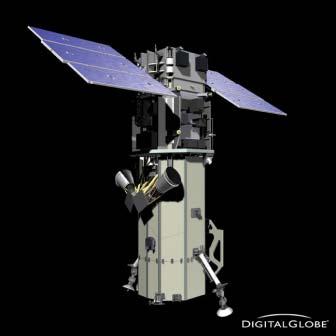
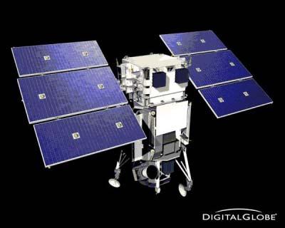
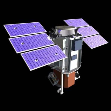

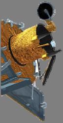

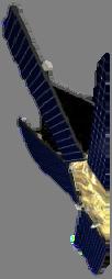

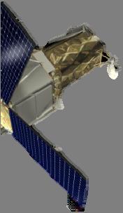

8 The DigitalGlobe Satellite Constellation WorldView-2 GeoEye QuickBird IKONOS WorldView-3 WorldView-1

 - Can")

9 SETSM: Surface Extraction with TIN-Based Search-space Minimization - Stereoscopic Terrain Modeling Software - Fully Automated - Uses no A Priori Information (no seed DEM required) - Can run on any High Performance Computer - Self-contained C programming language - Open Source release in near future

10 Blue Waters System Overview


11 hardware & infrastructure What the Sub-meter Polar Imagery Collection Looks Like Polar Geospatial Center Servers at OIT data center wrapped for cooling


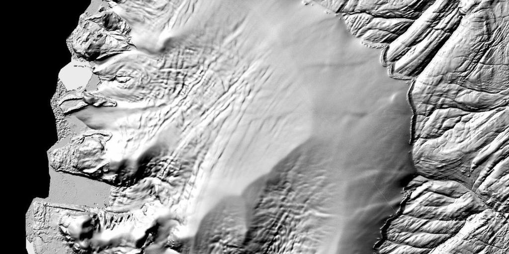


12 Novaya Zemlya, Russia Made from DigitalGlobe Imagery
13 The Limitations of this Strategy ArcticDEM is a Digital Surface Model. Bare ground is not possible. This is optical imagery from orbit. There will be holes from clouds and other atmospheric obstructions. Collection continues while the sun is 7 o above the horizon so imagery is a mix of seasons and years. There is competition for the DG constellation in Alaska and elsewhere.
14 The Strengths of this Strategy NGA and DigitalGlobe have high collection capacity at high latitudes. Holes can be filled when identified. Collection is constant while the sun is 7 o above the horizon. The collection is time-dependent. Imagery is a mix of seasons and years. New imagery can be processed as it is tasked. As ground control improves the accuracy can be improved. ArcticDEM is a Digital Surface Model. Canopy can be measured.

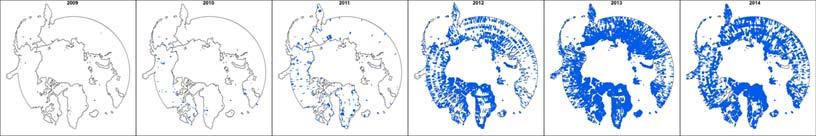
15 Stereo Coverage by Year

16 April 2016 Gaps in Coverage - not meeting 20% or less Cloud Cover
17 USGS USGS and Arctic SDI Support of PGC ArcticDEM Coordinate international support to Polar Geospatial Center Organize a series of workshops with Arctic nation mapping representatives and Polar Geospatial Center (2 workshops held to date) Interface between Arctic SDI nations and PGC Produce progress reports for CAFF and Arctic Council Coordinate international requirements gathering activities Arctic SDI Arctic nations have provided control data (control points, lidar, linear elevation models) and GIS data (shorelines) to improve ArcticDEM Arctic nations reviewed early data samples and reported issues to PGC, algorithm adjusted accordingly Some Arctic nations will edit PGC data as needed and create an improved national product for public release after ArcticDEM is delivered (Canada, Greenland, Iceland, Svalbard Norway, Aleutians)
18 Pan-Arctic DEM Workshops Workshop I held in Waterloo, Canada October 2015 Workshop II held in St. Paul, Minnesota at Polar Geospatial Center April 2016 Attendees: Elevation experts and Arctic SDI National Contact Points from Arctic nations, PGC technical experts and managers, NSF and NGA program managers, ESRI Lessons Learned - Some known issues with the data (cloud cover, data voids, snow cover) - Alaska will be delivered summer Remainder of Arctic will be complete by summer NGA is tasking DigitalGlobe satellites to fill any gaps in imagery - Auto-correlation processing algorithm is stable - PGC will deliver the individual strips of data and mosaic product - ESRI considering distribution through ESRI ImageService - PGC not currently funded past initial ArcticDEM delivery - PGC recently funded to create Antarctic DEM
19 Workshop II Lessons Learned Tentative Schedule: Alaska in summer 2016 Remainder by summer Iceland - Greenland - Sweden, Norway, Finland - Canada - Russia
20 Workshop II Lessons Learned Source Imagery Status - PGC accepts images with up to 20% cloud cover - Snow-season imagery dominates the collection (best opportunity for cloud free images) - Intense satellite tasking ongoing to fill any remaining holes in coverage (PGC assumes they will have full coverage for 2017 Arctic DEM release) - NGA will task repeat scenes over areas with poorest quality imagery after gaps are filled
21 Workshop II Lessons Learned Deliverables - PGC will deliver all 17km x 120km imagery strips for download (many strips will have repeat coverage) - PGC will create a final mosaic for download: merge strips into larger collections, provide 1km x 1km tiles, polar geographic projection, geotiff format - ESRI will offer image service of all the data; data currently stored on the Amazon cloud (in discussions with Amazon to make permanent)
22 Workshop II Lessons Learned Data Errors Observed - Some void areas in data: clouds, shadows in canyons, high reflectance on some water bodies - Land surface showing over shallow water, over some lakes with high reflectance - Snow cover - Walls at strip edges (strips autocorrelated independently)
23 Workshop II Lessons Learned Conceptual Data Distribution through University of Minnesota, ESRI ImageService, and Arctic SDI Portal PGC Storage of Strips and Mosaic ESRI Image Service Public Download Amazon Storage of PGC and Arctic Nation Data Arctic SDI Portal Arctic Nation Data
24 Arctic SDI Suggested MOSAIC Implementation Rules In priority order: No voids No snow No leaves Most current scene available Complete tiles But don t patch with other data sets (GIMP, Aster, etc) Use scenes that require smallest size of void patches as possible Similar source date over similar Land Cover/Land Use (For glacial monitoring you wouldn t want to use multiple years) Ensure that historical versions are always available
25 Three Recommendations to Arctic SDI Board 1) Endorse PGC ArcticDEM as 1 st Generation Pan-Arctic DEM Solution Formally announce support for this solution to Arctic Council 2) Arctic Countries Support PGC Gen1 Effort Countries that have the capacity and authority, not mandatory Provide control data, shorelines, data review and comment 3) Consider 2 nd Generation Pan-Arctic DEM using Arctic Nation Data Will require significant effort from Arctic SDI Technical Committee Several countries need to complete collection efforts (3-4 years) or complete editing of PGC ArcticDEM data Investigate after final delivery of ArcticDEM in summer of Arctic SDI Board will formally vote on recommendations at June meeting - Several have voiced approval for Recommendations 1 and 2 - Need to weigh Recommendation 3 against other Arctic SDI objectives (wait on Board vote before starting any preliminary investigations)


26 ESRI ARCTIC EXPLORER (Image Service PGC ArcticDEM)


27 + 27 April 2016 Alaska IfSAR Satus IfSAR is available or inwork for 69% of Alaska In FY15 partner agencies contributed $7.6M FY16 contributions to date total $6.0M Agencies seeking EOY funds to complete NE Completing IfSAR collection for all cells above 65-degrees north is a goal during the Arctic Council Chairmanship


28 ESRI IfSAR EXPLORER (Image Service AK IfSAR Data)
29
Pan-Arctic Digital Elevation Map (Pan-Arctic DEM)
") Memorandum to CAFF Board 07/28/2017 BACKGROUND: Pan-Arctic Digital Elevation Map (Pan-Arctic DEM) ArcticDEM is a National Geospatial-Intelligence Agency (NGA)-National Science Foundation (NSF) publicprivate
Memorandum to CAFF Board 07/28/2017 BACKGROUND: Pan-Arctic Digital Elevation Map (Pan-Arctic DEM) ArcticDEM is a National Geospatial-Intelligence Agency (NGA)-National Science Foundation (NSF) publicprivate
Tracy Fuller U. S. Geological Survey. February 24, 2016
 U. S. Geological Survey Arctic Elevation Data Involvement Statewide Alaska IfSAR Radar Collection Program Pan-Arctic Digital Elevation Map International Coordination Tracy Fuller U. S. Geological Survey
Introduction. Elevation Data Strategy. Status and Next Steps
 1 2 Introduction Elevation Data Strategy Status and Next Steps 3 Canada is the 2nd largest country in the world - 9.9 million sq km Surrounded by 3 oceans with 202 000 km of coastline Population over 35
Arctic Spatial Data Infrastructure (Arctic SDI)
") Arctic Spatial Data Infrastructure (Arctic SDI) Arvo KOKKONEN, Jani KYLMÄAHO and Heli URSIN, Finland Key words: SDI, Arctic, Geoportal SUMMARY Understanding and responding to the impacts of climate change
Arctic Spatial Data Infrastructure (Arctic SDI) Arvo KOKKONEN, Jani KYLMÄAHO and Heli URSIN, Finland Key words: SDI, Arctic, Geoportal SUMMARY Understanding and responding to the impacts of climate change
Arctic Spatial Data Infrastructure Enabling Access to Arctic Location-Based Information
 Arctic Spatial Data Infrastructure Enabling Access to Arctic Location-Based Information Arctic SDI Side Event Co-Chairs: Arvo Kokkonen Arctic SDI Board Chair & Director General, National Land Survey of
8 th Arctic Regional Hydrographic Commission Meeting September 2018, Longyearbyen, Svalbard Norway
 8 th Arctic Regional Hydrographic Commission Meeting 11-13 September 2018, Longyearbyen, Svalbard Norway Status Report of the Arctic Regional Marine Spatial Data Infrastructures Working Group (ARMSDIWG)
Enabling Access to Arctic Location Based Information - the Arctic SDI
 Enabling Access to Arctic Location Based Information - the Arctic SDI Jani Kylmäaho Head of Arctic SDI Geoportal WG National Land Survey of Finland SAO Chair, WG Chairs and Executive Secretaries meeting
Enabling Access to Arctic Location Based Information
 Enabling Access to Arctic Location Based Information Kevin Gallagher Arctic SDI Board Chair, United States Geological Survey Alaska Surveying and Mapping Conference, GeoJam 15 February 2017 What is Arctic
Enabling Access to Arctic Location Based Information
 Enabling Access to Arctic Location Based Information Jani Kylmäaho Arctic SDI Geoportal WG Lead National Land Survey of Finland INSPIRE Conference 29 September 2016 http://wallpaper.imcphoto.net/animals/polar
To: Ross Martin, Lisa Stapleton From: Brad Lind Subject: Joint Funding Agreement with USGS for 2012 Imagery Date: March 14, 2012.
 To: Ross Martin, Lisa Stapleton From: Brad Lind Subject: Joint Funding Agreement with USGS for 2012 Imagery Date: March 14, 2012 Attached are two copies of the Joint Funding Agreement (JFA) between SanGIS
Use of Elevation Data in NOAA Coastal Mapping Shoreline Products. Coastal GeoTools April 1, 2015
 Use of Elevation Data in NOAA Coastal Mapping Shoreline Products Coastal GeoTools April 1, 2015 - NOAA s Coastal Mapping Program & CUSP - Shoreline Uses, Delineation Issues, Definitions - Current Extraction
The 3D Elevation Program: Overview. Jason Stoker USGS National Geospatial Program ESRI 2015 UC
 + The 3D Elevation Program: Overview Jason Stoker USGS National Geospatial Program ESRI 2015 UC + 2 A little history USGS has a long, proud tradition of mapmaking (2009) + 3 The changing times Mapping
The Arctic SDI - A circumpolar initiative -
 Arctic The Arctic - A circumpolar initiative - ULI, Uppsala October 4, 2011 www. arctic-sdi.org Owe Palmér Martin Skedsmo Project Management Group Lantmäteriet Norwegian Mapping Authority October 2011
Arctic Spatial Data Infrastructure (SDI) - Pan-Arctic Cooperation among Ten Mapping Agencies (Skedsmo, Palmer, Taylor, Gudmundsson)
 - Pan-Arctic Cooperation among Ten Mapping Agencies (Skedsmo, Palmer, Taylor, Gudmundsson)") Arctic Arctic Spatial Data Infrastructure () - Pan-Arctic Cooperation among Ten Mapping Agencies (Skedsmo, Palmer, Taylor, Gudmundsson) G 13 2012, Quebec, Canada May 14, 2012 www. arctic-sdi.org Owe Bengt
Arctic Arctic Spatial Data Infrastructure () - Pan-Arctic Cooperation among Ten Mapping Agencies (Skedsmo, Palmer, Taylor, Gudmundsson) G 13 2012, Quebec, Canada May 14, 2012 www. arctic-sdi.org Owe Bengt
ARCTIC SPATIAL DATA INFRASTRUCTURE
 CAFF Strategy Series No. 1 January 2011 ARCTIC SPATIAL DATA INFRASTRUCTURE CONCEPT PAPER ARCTIC COUNCIL Acknowledgements The Conservation of Arctic Flora and Fauna (CAFF) is a Working Group of the Arctic
Open Geospatial Consortium activities in the Maritime domain
 Open Geospatial Consortium activities in the Maritime domain Scott Simmons Executive Director, Standards Program General Maritime efforts participants Alliance partners IHO ISO / TC 211 Members Danish
ELEVATION IS FOUNDATIONAL. A DEM that is inaccurate or of poor resolution will pass those characteristics onto other data layers
 ELEVATION IS FOUNDATIONAL A DEM that is inaccurate or of poor resolution will pass those characteristics onto other data layers THE DEM IS FOUNDATIONAL TO ALL GIS (Geospatial Information System) LAYERS
GeoSUR SRTM 30-m / TPS
 GeoSUR SRTM 30-m / TPS Wm Matthew Cushing (USGS) 16 May 2013 U.S. Department of the Interior U.S. Geological Survey SRTM Mission Shuttle Radar Topography Mission (SRTM) Space Shuttle Endeavour during the
Work Package 7: Improving and harmonizing biodiversity monitoring workshop report
 Work Package 7: Improving and harmonizing biodiversity monitoring workshop report International Network for Terrestrial Research and Monitoring in the Arctic (INTERACT) Aarhus University, Copenhagen, Denmark
Spatial Data Infrastructure Concepts and Components. Douglas Nebert U.S. Federal Geographic Data Committee Secretariat
 Spatial Data Infrastructure Concepts and Components Douglas Nebert U.S. Federal Geographic Data Committee Secretariat August 2009 What is a Spatial Data Infrastructure (SDI)? The SDI provides a basis for
U.S. Geological Survey Agency Briefing for MAPPS Mark L. DeMulder Director, National Geospatial Program. March 12, 2013
 + U.S. Geological Survey Agency Briefing for MAPPS Mark L. DeMulder Director, National Geospatial Program March 12, 2013 + 3D Elevation Program (3DEP) National Leadership The National Enhanced Elevation
World Meterological Organization Polar Space Task Group
 World Meterological Organization Polar Space Task Group Jerry L. Mullins Coordinator, USGS Antarctic, Arctic and Canadian Programs Reston, VA, USA 30 September 2011 1. USGS Landsat Program 11/06 7/07 4/08
Development of an International Arctic Observations Assessment Framework
 Development of an International Arctic Observations Assessment Framework Dr. Steven Lev, Dr. Jason Gallo Briefing for the Sustaining Arctic Observing Networks (SAON) April 7, 2017 International Partners
A Governance Framework for Geographic Data, Services, and Applications. Colin MacDonald Esri UC 2017
 A Governance Framework for Geographic Data, Services, and Applications Colin MacDonald Esri UC 2017 Some Context Nova Scotia, Canada Population ~1,000,000 Photos copyright Province of Nova Scotia Geomatics
The Global Land Cover Facility
 The Global Land Cover Facility REASoN Activities John Townshend, Principal Investigator Joseph JaJa, Co-Principal Investigator Paul Davis, Science Manager University of Maryland January 2004 The GLCF The
MAPPS/USGS Liaison Meeting U.S. Department of the Interior U.S. Geological Survey
 MAPPS/USGS Liaison Meeting U.S. Department of the Interior U.S. Geological Survey Kevin Gallagher, Associate Director, Core Science Systems Greg Stensaas, Earth Resources and Observation Science Center
International Arctic Systems for Observing the Atmosphere IPY Activity 196 Taneil Uttal NOAA Earth Systems Laboratory.
 International Arctic Systems for Observing the Atmosphere IPY Activity 196 Taneil Uttal NOAA Earth Systems Laboratory www.iasoa.org http://ipy.arcticportal.org/ IASOA Beginnings Lots of high level governments
QUESTIONNAIRE THE CURRENT STATUS OF MAPPING IN THE WORLD
 QUESTIONNAIRE ON THE CURRENT STATUS OF MAPPING IN THE WORLD The questionnaire is intended to take stock of the current status of mapping in the world. The information collected will eventually be used
Arctic Adaptation Research Considerations and Challenges
 Arctic Adaptation Research Considerations and Challenges Dr Grete K. Hovelsrud, Research Director CICERO- Center for International Climate and Environmental Research Oslo, Norway Many Strong Voices Stakeholder
Pan-Arctic Digital Elevation Model (DEM)
") Pan-Arctic Digital Elevation Model (DEM) Tazio Strozzi and Maurizio Santoro Gamma Remote Sensing, Gümligen, Switzerland Annett Bartsch et al. Institute of Photogrammetry and Remote Sensing, TU Wien, Austria
Pan-Arctic Digital Elevation Model (DEM) Tazio Strozzi and Maurizio Santoro Gamma Remote Sensing, Gümligen, Switzerland Annett Bartsch et al. Institute of Photogrammetry and Remote Sensing, TU Wien, Austria
Group on Earth Observations (GEO) Cold Regions Work Plan Item WA-01-C3
 Cold Regions Work Plan Item WA-01-C3") EC Panel of Experts on Polar Observations, Research and Services Group on Earth Observations (GEO) Cold Regions Work Plan Item WA-01-C3 Barbara J. Ryan Secretariat Director Lanzhou, China 13 March 2013
EC Panel of Experts on Polar Observations, Research and Services Group on Earth Observations (GEO) Cold Regions Work Plan Item WA-01-C3 Barbara J. Ryan Secretariat Director Lanzhou, China 13 March 2013
NEEA Refresh aka 3D Nation Requirements and Benefits Study. Allyson Jason, Carol Ostergren, Xan Fredericks and Lou Driber November 9, 2017
 + NEEA Refresh aka 3D Nation Requirements and Benefits Study Allyson Jason, Carol Ostergren, Xan Fredericks and Lou Driber November 9, 2017 + 2 Study Context Background The National Enhanced Elevation
All presentations from the Arctic Council's Senior Arctic Official's meeting in Haparanda, Sweden, November
 Arctic Council Open Access Repository Arctic Council http://www.arctic-council.org/ 1.8 Sweden Chairmanship I (May 2011 - May 2013) 3. SAO Meeting, 14-15 Nov 2012, Haparanda, Sweden All presentations from
US National Spatial Data Infrastructure A Spatial Framework for Governance and Policy Development to Enable a Location-Based Digital Ecosystem
 GeoPlatform Workshop 7 Dec 2016, Department of the Interior Washington, D.C. US National Spatial Infrastructure A Spatial Framework for Governance and Policy Development to Enable a Location-Based Digital
Services Requirements Paper Executive Council Panel of Experts on Polar & High Mountain Observations, Research, and Services
 Services Requirements Paper Executive Council Panel of Experts on Polar & High Mountain Observations, Research, and Services Aimee M. Devaris Regional Director U.S. National Oceanic and Atmospheric Administration
Office of Technology Partnerships GIS Collaboration
 Office of Technology Partnerships GIS Collaboration State GIS Update April 21, 2017 Mark Holmes, GISP Outline MGF Upgrade Project Census Programs Imagery Update LiDAR Update Open Discussion 2 MGF Background
East View Geospatial Products and Services
 East View Geospatial Products and Services Sevastopol, Ukraine 1:100,000 vector data Map Sourcing East View Geospatial (EVG) delivers a comprehensive suite of map sourcing and services at various scales
Imagery and the Location-enabled Platform in State and Local Government
 Imagery and the Location-enabled Platform in State and Local Government Fred Limp, Director, CAST Jim Farley, Vice President, Leica Geosystems Oracle Spatial Users Group Denver, March 10, 2005 TM TM Discussion
ARCTIC SPATIAL DATA INFRASTRUCTURE (Arctic SDI)
") May 2011 ARCTIC SPATIAL DATA INFRASTRUCTURE (Arctic SDI) PROJECT PLAN version 1 Participating organisations National Land Survey of Sweden Norwegian Mapping and Cadastre Authority National Land Survey
May 2011 ARCTIC SPATIAL DATA INFRASTRUCTURE (Arctic SDI) PROJECT PLAN version 1 Participating organisations National Land Survey of Sweden Norwegian Mapping and Cadastre Authority National Land Survey
A Service Architecture for Processing Big Earth Data in the Cloud with Geospatial Analytics and Machine Learning
 A Service Architecture for Processing Big Earth Data in the Cloud with Geospatial Analytics and Machine Learning WOLFGANG GLATZ & THOMAS BAHR 1 Abstract: The Geospatial Services Framework (GSF) brings
Presented by: Ki r k Cont r ucci, CP Ayres Associates. Andy Faust, GISP North Central Wisconsin Regional Planning Commission.
 Andy Faust, GISP North Central Wisconsin Regional Planning Commission Presented by: Ki r k Cont r ucci, CP Ayres Associates Zach Nienow Ayres Associates Adam Derringer, GISP Ayres Associates Type questions
GEOMATICS AND DISASTER MANAGEMENT: Early Impact assessment in Haiti
 GEOMATICS AND DISASTER MANAGEMENT: Early Impact assessment in Haiti We will talk about... Post-disaster response: the main questions to be answered Post-disaster rapid mapping: the role of Geomatics The
LiDAR User Data Needs Survey Results
 LiDAR User Data Needs Survey Results June 2012 Introduction The Minnesota Geospatial Information Office (MnGeo) is working with the Minnesota Department of Natural Resources (DNR) to develop a data distribution
Sources of Imagery and GIS Data Layers (Last updated October 2005)
") Sources of Imagery and GIS Data Layers (Last updated October 2005) The question of where to find data is one often asked by beginners in precision agriculture and other geospatial projects. The following
Sources of Imagery and GIS Data Layers (Last updated October 2005) The question of where to find data is one often asked by beginners in precision agriculture and other geospatial projects. The following
Digital Elevation Models (DEM) / DTM
 / DTM") Digital Elevation Models (DEM) / DTM Uses in remote sensing: queries and analysis, 3D visualisation, classification input Fogo Island, Cape Verde Republic ASTER DEM / image Banks Peninsula, Christchurch,
Digital Elevation Models (DEM) / DTM Uses in remote sensing: queries and analysis, 3D visualisation, classification input Fogo Island, Cape Verde Republic ASTER DEM / image Banks Peninsula, Christchurch,
GIS Changing the World GIS Day November 15, 2017
 + GIS Changing the World GIS Day November 15, 2017 + Growing Up On The Farm 3 Geographic Information in DNR A 75 year history of mapping and GIS. Forest type map from 1944. State of Washington - Division
SYNERGY OF SATELLITE REMOTE SENSING AND SENSOR NETWORKS ON GEO GRID
 SYNERGY OF SATELLITE REMOTE SENSING AND SENSOR NETWORKS ON GEO GRID National Institute of Advanced Industrial Science and Technology, Japan Yoshio Tanaka (on behalf of AIST GEO Grid team) Contents Brief
HISTORY OF GIS AND ESRI
 HISTORY OF GIS AND ESRI First Developed by Dr. Roger Tomlinson in Canada 1960 (CGIS Canadian geographic system) The system was designed to inventory land use and assist in the management of natural resources
The Canadian Ceoscience Knowledge Network. - A Collaborative Effort for Unified Access to Ceoscience Data
 The Canadian Ceoscience Knowledge Network - A Collaborative Effort for Unified Access to Ceoscience Data The Canadian Geoscience Knowledge Network A Collaborative Effort for Unified Access to Geoscience
Observation (EO) & Geomatics in Canada
 & Geomatics in Canada") Innovating to Increase the Impact of Earth Observation (EO) & Geomatics in Canada Natural Resources Canada February 25, 2014 Prashant Shukle, Director General Canada Centre for Mapping and Earth Observation
Innovating to Increase the Impact of Earth Observation (EO) & Geomatics in Canada Natural Resources Canada February 25, 2014 Prashant Shukle, Director General Canada Centre for Mapping and Earth Observation
The general procedure for estimating 24-hour PMP includes the following steps:
 14th Conference on Applied Climatology Abstract # 71520 Using PRISM Climate Grids and GIS for Extreme Precipitation Mapping George H. Taylor and Christopher Daly Oregon State University Corvallis Oregon
Working with ArcGIS Online
 Esri International User Conference San Diego, CA Technical Workshops July 12, 2011 Working with ArcGIS Online Bern Szukalski, Deane Kensok Topics for this Session ArcGIS Online Overview ArcGIS Online Content
2013 Indiana GIS Conference. Mini-Workshop. (9:00 am 10:30 am)
") Indiana GIS LiDAR Applications 2013 Indiana GIS Conference Mini-Workshop May 7, 2013 (9:00 am 10:30 am) Topics Workshop Overview 1. Indiana Statewide Ortho-LiDAR Program Overview and Status (Phil Worrall)
Indiana GIS LiDAR Applications 2013 Indiana GIS Conference Mini-Workshop May 7, 2013 (9:00 am 10:30 am) Topics Workshop Overview 1. Indiana Statewide Ortho-LiDAR Program Overview and Status (Phil Worrall)
Workshops funded by the Minnesota Environment and Natural Resources Trust Fund
 Workshops funded by the Minnesota Environment and Natural Resources Trust Fund Conservation Applications of LiDAR Data Workshops funded by: Minnesota Environment and Natural Resources Trust Fund Presented
ACCURACY ASSESSMENT OF ASTER GLOBAL DEM OVER TURKEY
 ACCURACY ASSESSMENT OF ASTER GLOBAL DEM OVER TURKEY E. Sertel a a ITU, Civil Engineering Faculty, Geomatic Engineering Department, 34469 Maslak Istanbul, Turkey sertele@itu.edu.tr Commission IV, WG IV/6
Roadmap to interoperability of geoinformation
 Roadmap to interoperability of geoinformation and services in Europe Paul Smits, Alessandro Annoni European Commission Joint Research Centre Institute for Environment and Sustainability paul.smits@jrc.it
Major Opportunities in Spatial Data Infrastructure Communities
 Major Opportunities in Spatial Data Infrastructure Communities Bas Kok President GSDI June 17 th 2008 FIG Working Week: Integrating Generations 14-19 June 2008 Stockholm, Sweden http://www.gsdi.org 1 GSDI
SPOT DEM Product Description
 SPOT DEM Product Description Version 1.1 - May 1 st, 2004 This edition supersedes previous versions Acronyms DIMAP DTED DXF HRS JPEG, JPG DEM SRTM SVG Tiff - GeoTiff XML Digital Image MAP encapsulation
Positioning the Pacific: NOAA s Geospatial Activities. Juliana Blackwell, Director NOAA s National Geodetic Survey March 6, 2012
 Positioning the Pacific: NOAA s Geospatial Activities Juliana Blackwell, Director NOAA s National Geodetic Survey March 6, 2012 A Common Problem of the Early 19 th Century 1807 President Thomas Jefferson
ArcGIS Enterprise: Administration Workflows STUDENT EDITION
 ArcGIS Enterprise: Administration Workflows STUDENT EDITION Copyright 2019 Esri All rights reserved. Course version 1.1. Version release date April 2019. Printed in the United States of America. The information
State GIS Officer/GIS Data
 State GIS Officer/GIS Data This Act creates the position of state Geographic Information Systems (GIS) officer. The Act: requires the state GIS officer to adopt or veto the GIS data standards and a statewide
Philippines NSDI Foundation Data Program. Andrew Bashfield
 Philippines NSDI Foundation Data Program Andrew Bashfield 1 Overview Part 1: Building the NSDI Framework Part 2: Collecting Foundation Datasets 2 Building the NSDI Framework Background & NDSI Overview
Mapping Coastal Change Using LiDAR and Multispectral Imagery
 Mapping Coastal Change Using LiDAR and Multispectral Imagery Contributor: Patrick Collins, Technical Solutions Engineer Presented by TABLE OF CONTENTS Introduction... 1 Coastal Change... 1 Mapping Coastal
Kansas Next Generation 911 Data Remediation Program. Esri Imagery Forum June 26, 2016
 Kansas Next Generation 911 Data Remediation Program Esri Imagery Forum June 26, 2016 Kansas NextGen 911 Project Overview Development of statewide Emergency Services IP Network (ESINet) GIS database development,
Emergency Planning. for the. Democratic National. Convention. imaging notes // Spring 2009 //
 Emergency Planning for the Democratic National Convention The DRAPP Demonstrates Partnership among Local, Regional, State, Utility and Federal Governments 14 imaging notes // Spring 2009 // www.imagingnotes.com
Report on the UNGEGN liaison with the Scientific Committee on Antarctic Research *
 UNITED NATIONS Working Paper GROUP OF EXPERTS ON No. 63 GEOGRAPHICAL NAMES Twenty-fifth session Nairobi, 5 12 May 2009 Item 6 of the provisional agenda Reports of the liaison officers and international
Exploitation of ground based GPS for Climate and Numerical Weather Prediction applications COST action 716
 Exploitation of ground based GPS for Climate and Numerical Weather Prediction applications COST action 716 COST Objectives and status of COST 716 Overview of work packages / projects Near real-time demonstration
MISSOURI LiDAR Stakeholders Meeting
 MISSOURI LiDAR Stakeholders Meeting East-West Gateway June 18, 2010 Tim Haithcoat Missouri GIO Enhanced Elevation Data What s different about it? Business requirements are changing.fast New data collection
What s New in Topographic Information - USGS National Map
 + What s New in Topographic Information - USGS National Map SARGIS Workshop November 14, 2016 Rob Dollison, 703-648-5724 rdollison@usgs.gov + USGS 2 National Geospatial Program The National Geospatial
ArcGIS for INSPIRE. Marten Hogeweg
 ArcGIS for INSPIRE Marten Hogeweg Please Take Our Survey on the App Download the Esri Events app and find your event Select the session you attended Scroll down to find the feedback section Complete answers
Building a 4-D Weather Data Cube for the NextGen Initial Operating Capability (IOC)
") Building a 4-D Weather Data Cube for the NextGen Initial Operating Capability (IOC) Friends/Partners in Aviation Weather Vision Forum July 15, 2008 Bruce Lambert - DoD Tom Ryan FAA Jason Tuell NWS 1 Overview
Building a 4-D Weather Data Cube for the NextGen Initial Operating Capability (IOC) Friends/Partners in Aviation Weather Vision Forum July 15, 2008 Bruce Lambert - DoD Tom Ryan FAA Jason Tuell NWS 1 Overview
CAS GE 365 Introduction to Geographical Information Systems. The Applications of GIS are endless
 Spring 2007 CAS GE 365 Introduction to Geographical Information Systems Boston University Department of Geography and Environment The Applications of GIS are endless images from www.esri.com CAS GE 365
CHAPTER 22 GEOGRAPHIC INFORMATION SYSTEMS
 CHAPTER 22 GEOGRAPHIC INFORMATION SYSTEMS PURPOSE: This chapter establishes the administration and use of to improve the quality and accessibility of Department s spatial information and support graphical
IAEG-SDGs WGGI Task Team Dec. 7, 2017, New York
 IAEG-SDGs WGGI Task Team Dec. 7, 2017, New York Contents What are G/A data? Role of G/A data Utilization Recommendations Outlook National Geospatial Data for SDGs Official data products generated by authoritative
GIS APPLICATIONS IN SOIL SURVEY UPDATES
 GIS APPLICATIONS IN SOIL SURVEY UPDATES ABSTRACT Recent computer hardware and GIS software developments provide new methods that can be used to update existing digital soil surveys. Multi-perspective visualization
Time Series Analysis with SAR & Optical Satellite Data
 Time Series Analysis with SAR & Optical Satellite Data Thomas Bahr ESRI European User Conference Thursday October 2015 harris.com Motivation Changes in land surface characteristics mirror a multitude of
FINDINGS OF THE ARCTIC METEOROLOGY SUMMIT
 FINDINGS OF THE ARCTIC METEOROLOGY SUMMIT 2018 WWW.FMI.FI CHAIR S SUMMARY: 1 2 3 We need to be curious to explore the known unknowns. Meteorology is an elemental part of international collaboration in
Forest Service. Geospatial Management. Presented by: Carl Zulick, USFS Geospatial Information Officer. April 1, 2014
 Forest Service Geospatial Management Presented by: Carl Zulick, USFS Geospatial Information Officer April 1, 2014 USFS Mission "Caring for the Land and Serving People" The mission of the USDA Forest Service
CONFERENCE STATEMENT
 Final draft CONFERENCE STATEMENT We, the elected representatives of Canada, Denmark/Greenland, the European Parliament, Finland, Iceland, Norway, Russia, Sweden and the United States of America; In collaboration
10/13/2011. Introduction. Introduction to GPS and GIS Workshop. Schedule. What We Will Cover
 Introduction Introduction to GPS and GIS Workshop Institute for Social and Environmental Research Nepal October 13 October 15, 2011 Alex Zvoleff azvoleff@mail.sdsu.edu http://rohan.sdsu.edu/~zvoleff Instructor:
Brazil Paper for the. Second Preparatory Meeting of the Proposed United Nations Committee of Experts on Global Geographic Information Management
 Brazil Paper for the Second Preparatory Meeting of the Proposed United Nations Committee of Experts on Global Geographic Information Management on Data Integration Introduction The quick development of
DRAPE 2014 Digital Elevation Model
 DRAPE 2014 Digital Elevation Model User Guide Spatial Data Infrastructure Mapping and Information Resources Branch Corporate Management and Information Division Ministry of Natural Resources and Forestry
NATIONAL MAPPING EFFORTS: THE PHILIPPINES
 NATIONAL MAPPING EFFORTS: THE PHILIPPINES Dr. RIJALDIA N. SANTOS DENR National Mapping and Resource Information Authority (NAMRIA) May 30, 2018 Land Cover/Land Use Changes (LC/LUC) and Its Impacts on Environment
U s i n g t h e E S A / E U M E T C A S T N a v i g a t o r s
 U s i n g t h e E S A / E U M E T C A S T N a v i g a t o r s Copernicus User Uptake Information Sessions Copernicus EU Copernicus EU Copernicus EU www.copernicus.eu I N T R O D U C T I O N O F U S E C
Investigation of Arctic ice cover variance using XX century historical ice charts information and last decades microwave data
 Investigation of Arctic ice cover variance using XX century historical ice charts information and last decades microwave data Vasily Smolyanitsky, Arctic and Antarctic Research Institute & JCOMM Expert
1 st Newsletter. IPA Task Force on Remote Sensing of Permafrost
 1 st Newsletter IPA Task Force on Remote Sensing of Permafrost Co Chairs: Guido Grosse (UAF; ffgg1@uaf.edu) & Claude Duguay (University of Waterloo; crduguay@uwaterloo.ca) http://www.permafrostwatch.org/news/ipa_taskforce_remotesensing.html
REPORT ON INVESTMENTS
 REPORT ON INVESTMENTS D.T2.3.3 Investments for technical equipment for the implementation of Web-GIS platform in Mantova 1 Local support group designing Mantova Web-GIS platform. Picture by Maria Giulia
Effective Utilization of Synthetic Aperture Radar (SAR) Imagery in Rapid Damage Assessment
 Imagery in Rapid Damage Assessment") Effective Utilization of Synthetic Aperture Radar (SAR) Imagery in Rapid Damage Assessment Case Study Pakistan Floods SUPARCO M. Maisam Raza, Ahmad H. Rabbani SEQUENCE Flood Monitoring using Satellite
Effective Utilization of Synthetic Aperture Radar (SAR) Imagery in Rapid Damage Assessment Case Study Pakistan Floods SUPARCO M. Maisam Raza, Ahmad H. Rabbani SEQUENCE Flood Monitoring using Satellite
Welcome to NR502 GIS Applications in Natural Resources. You can take this course for 1 or 2 credits. There is also an option for 3 credits.
 Welcome to NR502 GIS Applications in Natural Resources. You can take this course for 1 or 2 credits. There is also an option for 3 credits. The 1st credit consists of a series of readings, demonstration,
ARCTICDEM. 2m Topography and Surface Change Detection over the Arctic CLAIRE PORTER POLAR GEOSPATIAL CENTER BLUE WATERS SYMPOSIUM 2018
 ARCTICDEM 2m Topography and Surface Change Detection over the Arctic CLAIRE PORTER POLAR GEOSPATIAL CENTER Source: Polar Geospatial Center COMPONENTS PROJECT GOAL Produce a 2m posting publicly available
Using PRISM Climate Grids and GIS for Extreme Precipitation Mapping
 Using PRISM Climate Grids and GIS for Extreme Precipitation Mapping George H. Taylor, State Climatologist Oregon Climate Service 316 Strand Ag Hall Oregon State University Corvallis OR 97331-2209 Tel:
Lidar-derived Hydrography as a Source for the National Hydrography Dataset
 Lidar-derived Hydrography as a Source for the National Hydrography Dataset Lidar-Derived Hydrography, Bathymetry, and Topobathymetry in the National Hydrography Dataset and 3-Dimensional Elevation Program
Floating Ice: Progress in Addressing Science Goals
 Polar Floating Ice: Progress in Addressing Science Goals Stephen Howell 1, Leif Toudal Pedersen 2 and Roberto Saldo 3 1 Environment Canada, Climate Research Division, Toronto, Canada 2 Danish Meteorological
GIS-T 2010 Building a Successful Geospatial Data Sharing Framework: A Ohio DOT Success Story
 GIS-T 2010 Building a Successful Geospatial Data Sharing Framework: A Ohio DOT Success Story ODOT District 2 GIS John Puente District 1 GIS Coordinator\ Planning Administrator 2 Interoperability 3 District
Canadian Board of Examiners for Professional Surveyors Core Syllabus Item C 5: GEOSPATIAL INFORMATION SYSTEMS
 Study Guide: Canadian Board of Examiners for Professional Surveyors Core Syllabus Item C 5: GEOSPATIAL INFORMATION SYSTEMS This guide presents some study questions with specific referral to the essential
STATE-WIDE HIGH-DENSITY LIDAR IS NOW AVAILABLE GEIGER-MODE LIDAR AND THE MULTI-USE BENEFITS
 Place image here (13.33 x 3.5 ) STATE-WIDE HIGH-DENSITY LIDAR IS NOW AVAILABLE GEIGER-MODE LIDAR AND THE MULTI-USE BENEFITS SCOTT BENNETT Director of Strategic Growth - Geospatial Solutions scott.a.bennett@harris.com
Digital Elevation Models (DEM) / DTM
 / DTM") Digital Elevation Models (DEM) / DTM Uses in remote sensing: queries and analysis, 3D visualisation, layers in classification Fogo Island, Cape Verde Republic ASTER DEM / image Banks Peninsula, Christchurch,
Digital Elevation Models (DEM) / DTM Uses in remote sensing: queries and analysis, 3D visualisation, layers in classification Fogo Island, Cape Verde Republic ASTER DEM / image Banks Peninsula, Christchurch,
Resolution XIII.23. Wetlands in the Arctic and sub-arctic
 13th Meeting of the Conference of the Contracting Parties to the Ramsar Convention on Wetlands Wetlands for a Sustainable Urban Future Dubai, United Arab Emirates, 21-29 October 2018 Resolution XIII.23
Introduction to the 176A labs and ArcGIS Purpose of the labs
 Introduction to the 176A labs and ArcGIS Purpose of the labs Acknowledgement: Slides by David Maidment, U Texas-Austin and Francisco Olivera (TAMU) Hands-on experience with a leading software package Introduction
GIS Workshop Data Collection Techniques
 GIS Workshop Data Collection Techniques NOFNEC Conference 2016 Presented by: Matawa First Nations Management Jennifer Duncan and Charlene Wagenaar, Geomatics Technicians, Four Rivers Department QA #: FRG