Use of Elevation Data in NOAA Coastal Mapping Shoreline Products. Coastal GeoTools April 1, 2015
|
|
|
- Ginger Norris
- 5 years ago
- Views:
Transcription
1 Use of Elevation Data in NOAA Coastal Mapping Shoreline Products Coastal GeoTools April 1, 2015
2 - NOAA s Coastal Mapping Program & CUSP - Shoreline Uses, Delineation Issues, Definitions - Current Extraction Techniques for CMP and CUSP - CUSP - LiDAR - IfSAR - Data Distribution


3 Congressional mandate (1807) to conduct shoreline surveys of coastal regions of the United States and its possessions for demarcating the nation s legal coastline. Shoreline Mapping Coastal Mapping Program (CMP) Goal: Provide the Nation With Accurate, Consistent, Upto-Date National Shoreline Current Primary Sources: Digital Cameras Lidar High Resolution Satellites
4 Coastal Mapping Program Socio-Economic Scoping Study (Applications, Customers, and the Natural Benefits) Navigation safety Shoreline modification Environmental protection (including precise coordinates of sensitive and protected areas) GIS applications in coastal zone management On-shore development Recreation Fish habitat mapping Energy exploration, development and production Underwater exploration and construction Offshore aquaculture Planning and response to natural disasters and environmental emergencies Coastal and ocean jurisdiction mapping and dispute prevention and resolution Marine spatial planning Legal and insurance applications Homeland and port security Monitoring sea level change Scientific research National and international standards Archaeology and cultural heritage Military activities


5 Issues Delineating a Consistent Shoreline The Coastal Environment: a margin of continuous change. Shorelines vary due to: -wave energy -wave periods -tidal cycles -atmospheric conditions -anthropogenic influences Shoreline change can vary dramatically or negligibly and in no uniform pattern, at temporal scales of daily, seasonally, and decadal. Several definitions of shoreline


6 Numerous Proxies Used Define Shoreline Mean High Water Line Mean Lower Low Water Line High Water Line Average High Water Line Instantaneous Line Wet/Dry Line Foredune Foot Beach Crest Beach Toe Erosion Scarp Storm Debris Line Bluff line/cliff Top Base of Bluff/Cliff Vegetation Line Dune Line

7 2004 Committee on National Needs for Coastal Mapping and Charting, Mapping Science Committee, National Research Council Recommendations To achieve national consistency: Define their shorelines in terms of a tidal datum Use NOAA s National Geodetic Survey shoreline definition of Mean High Water where legislation or usage does not preclude it


8 Current National Geodetic Survey Shoreline Mapping Photogrammetic Surveys: Stereoscopic National Geodetic Survey extracts and attributes shoreline from tide-coordinated stereo photographs (including commercial satellite) in a softcopy environment. Tide/time windows are established for tide-coordinated photographs based on NOS tolerance guidelines. This leads to instances where the land/water interface does not match perfectly with the tidal datum during the acquisition of imagery. Therefore, the majority of NOS shoreline is digitized by visually interpreting a mean high water tidal datum in a stereoscopic environment.

9 Current National Geodetic Survey Shoreline Mapping Photogrammetic Surveys: Automated Feature Extraction of Near Infrared ERDAS IMAGINE Image Segmentation Software Packages: ERDAS IMAGINE ENVI Feature Extraction ESRI Quantum GIS


10 Automated Feature Extraction Vectors Clean, edit, and attribute vectors Vectors verified with independent imagery (stereo or mono)


11 Current National Geodetic Survey Shoreline Mapping Lidar Shoreline Extraction Edit Lidar Point Cloud VDatum Contour Shoreline from DEM Quality Control & Feature Attribution

12 Vertical Datum Transformation Roadmap

13 Current VDatum Availability (April 2015) FY16 - Update SF Bay Model FY19 - Update West Coast Model Dec 1014 East Coast Updated
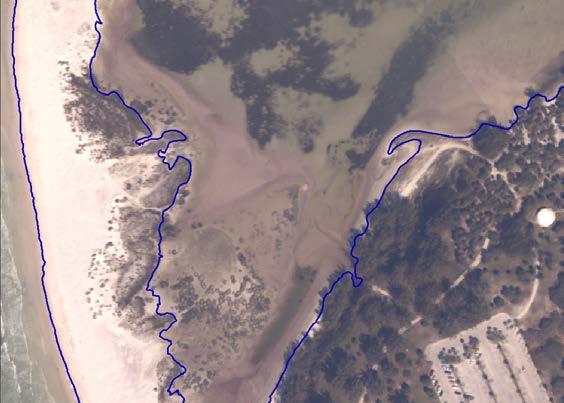
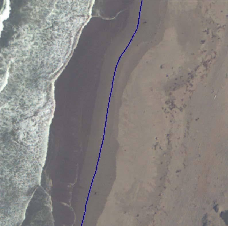
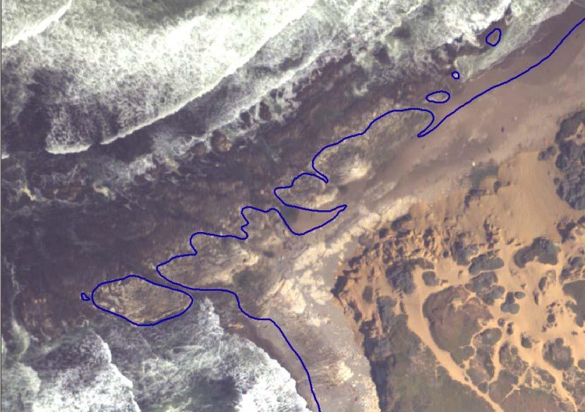
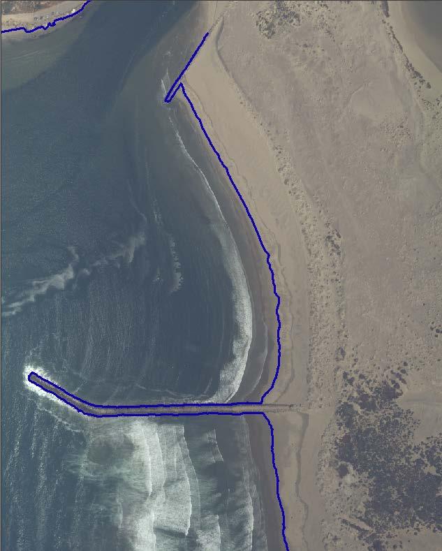
14 Lidar-derived Shorelines on Varying Coastline Features

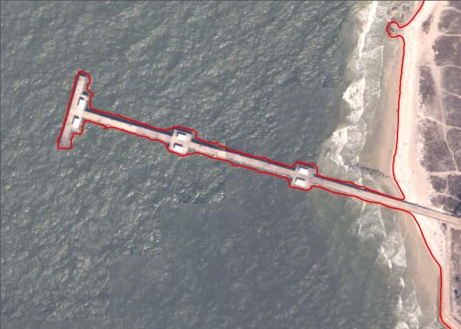
15 FL1418 FL Keys Intracoastal

16 Topo-bathy Florida Keys Intracoastal
17 Elements of National Shoreline and CUSP National Shoreline Accurate tidal referenced shoreline and other features Supports Nautical charting applications generally at 1:24,000 scale Discrete geographic area and dates Completion Report documenting the process. CUSP Tidal referenced shoreline Primarily for GIS base map applications ranging in scale from 1:1,000 to 1:24,000 Includes only shoreline Less stringent acquisition requirements Continuous Limited Project Completion Reports
 Attributed shoreline features Referenced to Mean High Water datum where applicable Includes NOAA and non- NOAA")
18 Continually Updated Shoreline Product To provide the most current shoreline representation Designed to deliver continuous shoreline with frequent updates Employ state-of-the-art technologies (multi-sensor and multi-scale) Attributed shoreline features Referenced to Mean High Water datum where applicable Includes NOAA and non- NOAA contemporary sources

19 Need for a Continually Updated Shoreline Product Full Photogrammetric Surveys Take Approximately 2 Years to Complete Full Photogrammetric Surveys focus on navigational significant areas for nautical charting applications Funded to yearly map ~3% of U.S. Shoreline No continuous U.S. shoreline exist that is: Attributed Referenced to a tidal datum Maintained Up to Date

20 Percentage of CUSP completed by State

21 Current Lidar Derived Coastline

22 CUSP Data Source Data Retrieval Date: 03/29/2015

23 Age of NOAA Shoreline in California (2015)

24 Current IfSAR Derived Coastline Alaska IfSAR DEM Data hosted by GINA

25 IfSAR Derived Shoreline Selawik Lake, AK Scale 1:10,000 Alaska IfSAR DEM - July 2012 DigitalGlobe WorldView 02 - May 21, 2014

26 Map Once, Use Many Times

27 NOAA Shoreline Data Explorer

28 Digital Coast
29 Conclusions The Integrated Ocean and Coastal Mapping (IOCM) coastal geospatial data, including elevation data, promotes the 2004 Committee on National Needs for Coastal Mapping and Charting, Mapping Science Committee, National Research Council Recommendations to achieve national shoreline consistency. The Continually Updated Shoreline Product (CUSP) uses IOCM coastal geospatial data to provide an updated shoreline for integration into products such as the NOAA Environmental Sensitivity Index Maps and USGS National Hydrography Datasets to help achieve a consistent up-to-date national shoreline in various products. Contact Info: ngs.shoreline@noaa.gov Phone:
Tracy Fuller U. S. Geological Survey. February 24, 2016
 U. S. Geological Survey Arctic Elevation Data Involvement Statewide Alaska IfSAR Radar Collection Program Pan-Arctic Digital Elevation Map International Coordination Tracy Fuller U. S. Geological Survey
Modeling Coastal Change Using GIS Technology
 Emily Scott NRS 509 Final Report December 5, 2013 Modeling Coastal Change Using GIS Technology In the past few decades, coastal communities around the world are being threatened by accelerating rates of
Applications of GIS in assessing Coastal Change Rachel Hehre November 30, 2004 NRS 509 OVERVIEW
 Applications of GIS in assessing Coastal Change Rachel Hehre November 30, 2004 NRS 509 OVERVIEW ITRODUCTION Due to the dynamic nature of coastal systems, representing coastal change with precision and
Bathymetry Data and Models: Best Practices
 Bathymetry Data and Models: Best Practices Barry Eakins & Lisa Taylor The NOAA National Geophysical Data Center Over 600 data types - from the core of the Earth to the surface of the Sun NGDC Bathymetry
Mapping Coastal Change Using LiDAR and Multispectral Imagery
 Mapping Coastal Change Using LiDAR and Multispectral Imagery Contributor: Patrick Collins, Technical Solutions Engineer Presented by TABLE OF CONTENTS Introduction... 1 Coastal Change... 1 Mapping Coastal
Sea Level Rise and the Scarborough Marsh Scarborough Land Trust Annual Meeting April 24, 2018
 Sea Level Rise and the Scarborough Marsh Scarborough Land Trust Annual Meeting April 24, 2018 Peter A. Slovinsky, Marine Geologist Maine Geological Survey Funded by: 50% 40% Figure modified from Griggs,
LEADS. The Essential Elements of a 3-D Geographic Coordinate
 The Essential Elements of a 3-D Geographic Coordinate John W. Dix 13 September 2005 ESRI Homeland Security GIS Summit - Denver, CO John.W.Dix@nga.mil NATIONAL GEOSPATIAL-INTELLIGENCE AGENCY Overview is
NEEA Refresh aka 3D Nation Requirements and Benefits Study. Allyson Jason, Carol Ostergren, Xan Fredericks and Lou Driber November 9, 2017
 + NEEA Refresh aka 3D Nation Requirements and Benefits Study Allyson Jason, Carol Ostergren, Xan Fredericks and Lou Driber November 9, 2017 + 2 Study Context Background The National Enhanced Elevation
NOAA Nautical Charts and Coastal and Marine Spatial Planning. Meredith Westington Chief Geographer NOAA/NOS/Office of Coast Survey
 NOAA Nautical Charts and Coastal and Marine Spatial Planning Meredith Westington Chief Geographer NOAA/NOS/Office of Coast Survey Ocean Policy Task Force What is CMSP? A comprehensive, adaptive, integrated,
Themes for Geomatics Conference. Geodesy Themes
 Themes for Geomatics Conference Geodesy Themes Geodynamics o Modeling the Deformation of the Earth s Crust o Recent Advances in Geometric Approaches to Deformation Analysis o Monitoring Systems (Sensors
Using Remote Piloted Aircraft for Seawall Condition Assessment
 Using Remote Piloted Aircraft for Seawall Condition Assessment Moreton Bay Regional Council Shamim Yazdani Senior Engineer - Stormwater Planning DJI Industries Phantom FC-40 remotely-piloted aircraft 1
IWG-OCM Update For NCSS
 IWG-OCM Update For NCSS Data Supporting Science and Sound Decision-Making Ashley Chappell January 9, 2018 NOAA IOCM Coordination Team Members National Environmental Satellite, Data and Information Service:
Fugro Geospatial: Turning Spatial Data into Knowledge
 Fugro Geospatial: Turning Spatial Data into Knowledge 2016 Fugro Geospatial, GIS and Consultants Locations Variety of Collection Platforms Traditional Mapping Traditional Mapping Imagery Photogrammetric
Joint Hydrographic Center, National Oceanic and Atmospheric Administration, Durham, NH 03824, USA
 Future directions in hydrography using satellite-derived bathymetry Shachak Pe eri 1, Christopher Parrish 2, 3, Lee Alexander 1, Chukwuma Azuike 1, Andrew Armstrong 1,3 and Maryellen Sault 2 1 Center for
The Use of Geographic Information Systems to Assess Change in Salt Marsh Ecosystems Under Rising Sea Level Scenarios.
 The Use of Geographic Information Systems to Assess Change in Salt Marsh Ecosystems Under Rising Sea Level Scenarios Robert Hancock The ecological challenges presented by global climate change are vast,
Integrating new coastline information and geographically coordinated coastal geomorphology data
 Integrating new coastline information and geographically coordinated coastal geomorphology data NOAA Contemporary Shoreline DOE Coastal Geomorphology Cynthia Miller Corbett Jeff Simley 1 National Hydrography
GIS and Remote Sensing
 Spring School Land use and the vulnerability of socio-ecosystems to climate change: remote sensing and modelling techniques GIS and Remote Sensing Katerina Tzavella Project Researcher PhD candidate Technology
Pan-Arctic Digital Elevation Model - International Collaboration in Generation of ArcticDEM
 Pan-Arctic Digital Elevation Model - International Collaboration in Generation of ArcticDEM ESRI International Users Conference, June 30, 2016 Tracy Fuller, USGS Pan-Arctic DEM Technical Lead, Alaska Mapping
MISSOURI LiDAR Stakeholders Meeting
 MISSOURI LiDAR Stakeholders Meeting East-West Gateway June 18, 2010 Tim Haithcoat Missouri GIO Enhanced Elevation Data What s different about it? Business requirements are changing.fast New data collection
Marine Geomorphology as a Determinant for Essential Life Habitat III
 Marine Geomorphology as a Determinant for Essential Life Habitat III marinecoastalgis.net/aag08 10:10 Dawn Wright, Oregon 10:30 Will McClintock, California 10:50 Daniel Sampson, Massachusetts 11:10 Gary
PHOTOGRAMMETRY AND GIS TECHNOL 1 OGIES FOR MONITORING COASTAL EROSION ALONG DAR ES SALAAM COASTLINE. By: Z.Y Masele, S.D Mayunga1.
 PHOTOGRAMMETRY AND GIS TECHNOL 1 OGIES FOR MONITORING COASTAL EROSION ALONG DAR ES SALAAM COASTLINE. By: Z.Y Masele, S.D Mayunga1 Abstract Dar Es salaam coastline is seriously suffering from coastal soil
Specification & Content of Marine Reference Information
 Specification & Content of Marine Reference Information By Mike Osborne and James Rapaport SeaZone Solutions Limited CONTENTS 1. History of Marine Data 2. User Requirements 3. Geographic Content 4. SeaZone
TOWARDS CLIMATE-RESILIENT COASTAL MANAGEMENT: OPPORTUNITIES FOR IMPROVED ICZM IN BELIZE
 TOWARDS CLIMATE-RESILIENT COASTAL MANAGEMENT: OPPORTUNITIES FOR IMPROVED ICZM IN BELIZE CHANTALLE SAMUELS Coastal Zone Management Authority and Institute The Caribbean Community Climate Change Centre VULNERABILITY
MARINE SPATIAL PLANNING & MARINE CADASTRE: CHALLENGES AND ISSUES
 MARINE SPATIAL PLANNING & MARINE CADASTRE: CHALLENGES AND ISSUES Roger Longhorn Secretary General, GSDI Association rlonghorn@gsdi.org Member, IHO Marine SDI Working Group ral@alum.mit.edu Member, UNESCO
A Boundary Delineation System for the Bureau of Ocean Energy Management
 A Boundary Delineation System for the Bureau of Ocean Energy Management Doug Vandegraft Chief, Mapping and Boundary Branch BOEM Coastal Geotools - 2015 Outline Introduction BOEM Marine Cadastre Background
Abstract. Introduction
 Southern California Aquaculture Site Assessment Model Caitlyn Raines University of Redlands Master of Science in Geographic Information Systems Program Abstract The Southern California Aquaculture Site
Statewide Topographic Mapping Program
 Statewide Topographic Mapping Program February 28, 2018 www.dotd.la.gov Outline Purpose of the Statewide Topographic Mapping Program History Breakdown of R.S. 48:36 - Topographic Mapping Statewide Topographic
NOAA s National Ocean Service. Center for Operational Oceanographic Products and Services
 NOAA s National Ocean Service Center for Operational Oceanographic Products and Services Richard Edwing, CO-OPS Acting Director January 27, 2010 Outline CO-OPS Overview Programs Observing Systems PORTS
What s New in Topographic Information - USGS National Map
 + What s New in Topographic Information - USGS National Map SARGIS Workshop November 14, 2016 Rob Dollison, 703-648-5724 rdollison@usgs.gov + USGS 2 National Geospatial Program The National Geospatial
REGIONAL SEDIMENT MANAGEMENT: A GIS APPROACH TO SPATIAL DATA ANALYSIS. Lynn Copeland Hardegree, Jennifer M. Wozencraft 1, Rose Dopsovic 2 INTRODUCTION
 REGIONAL SEDIMENT MANAGEMENT: A GIS APPROACH TO SPATIAL DATA ANALYSIS Lynn Copeland Hardegree, Jennifer M. Wozencraft 1, Rose Dopsovic 2 ABSTRACT: Regional sediment management (RSM) requires the capability
Options in Capacity Building. Underpinning the Blue Economy. Slide 1/78. Derrick R. Peyton. 14 th MACHC Meeting. IIC Technologies. December 9-13, 2013
 Options in Capacity Building Underpinning the Blue Economy Derrick R. Peyton IIC Technologies 14 th MACHC Meeting December 9-13, 2013 Slide 1/78 Overview Blue Economy Defined Challenges (SDI, MSDI, Standards)
Characterization of the Nigerian Shoreline using Publicly-Available Satellite Imagery
 University of New Hampshire University of New Hampshire Scholars' Repository Center for Coastal and Ocean Mapping Center for Coastal and Ocean Mapping 1-2014 Characterization of the Nigerian Shoreline
Coastal Zone Mapping and Imaging Lidar (CZMIL)
") Coastal Zone Mapping (CZMIL) Shallow Survey 2012 Wellington, New Zealand Christopher L. Macon U.S. Army Corps of Engineers, Mobile District Joint Airborne Lidar Bathymetry Technical Center of expertise
Coastal Zone Mapping (CZMIL) Shallow Survey 2012 Wellington, New Zealand Christopher L. Macon U.S. Army Corps of Engineers, Mobile District Joint Airborne Lidar Bathymetry Technical Center of expertise
- West Africa. Abuja, Nigeria May Fredericton Canada Heeswijk The Netherlands Washington DC United States Adelaide Australia
 A Case Study in Land and Sea Data Interoperability Patricia GASPAR(Netherlands), Andrew HOGGARTH(Canade), Gordon JOHNSTON(UK), Charles de JONG(Netherlands) - West Africa Abuja, Nigeria - 6-10 May 2013
Marine Spatial Planning: A Tool for Implementing Ecosystem-Based Management
 Marine Spatial Planning: A Tool for Implementing Ecosystem-Based Management Steven Murawski, Ph.D., Ecosystem Goal Team Lead National Oceanic and Atmospheric Administration NOAA November 16, 2009 1 To
Marine Spatial Data for Marine Spatial Planning. Ocean Leadership 2010 Public Policy Forum
 Marine Spatial Data for Marine Spatial Planning Ocean Leadership 2010 Public Policy Forum March 10, 2010 Edward Saade President, Fugro EarthData, Inc 1 Marine Spatial Data What is Marine Spatial Data?
Southern Florida to Cape Hatteras Spring Season Preview 2018 UPDATE ON U.S. EAST COAST GULF STREAM CONDITIONS
 Southern Florida to Cape Hatteras Spring Season Preview 2018 UPDATE ON U.S. EAST COAST GULF STREAM CONDITIONS By ROFFS Gregory J. Gawlikowski ROFFS continues its spring preview series by providing an overall
The 3D Elevation Program: Overview. Jason Stoker USGS National Geospatial Program ESRI 2015 UC
 + The 3D Elevation Program: Overview Jason Stoker USGS National Geospatial Program ESRI 2015 UC + 2 A little history USGS has a long, proud tradition of mapmaking (2009) + 3 The changing times Mapping
NOAA Inundation Dashboard
 NOAA Inundation Dashboard Audra Luscher & Paul Fanelli NOS Center for Operational Oceanographic Products & Services (CO-OPS) Hampton Roads Sea Level Rise/Flooding Adaptation Forum July 29, 2016 http://tidesandcurrents.noaa.gov/inundationdb/newyork.html
Great Lakes Update. Geospatial Technologies for Great Lakes Water Management. Volume 149 October 4, US Army Corps of Engineers Detroit District
 Volume 149 October 4, 2002 US Army Corps of Engineers Detroit District Great Lakes Update Geospatial Technologies for Great Lakes Water Management The U.S. Army Corps of Engineers (USACE) serves an important
Draft for Discussion 11/11/2016
 Coastal Risk Consulting (CRC) Climate Vulnerability Assessment for Village of Key Biscayne Deliverable 1.1 in Statement of Work. Preliminary Vulnerability Assessment Identifying Flood Hotspots Introduction...
Summary Description Municipality of Anchorage. Anchorage Coastal Resource Atlas Project
 Summary Description Municipality of Anchorage Anchorage Coastal Resource Atlas Project By: Thede Tobish, MOA Planner; and Charlie Barnwell, MOA GIS Manager Introduction Local governments often struggle
Shoreline Mapping & Erosion Patterns. Julia Knisel Julia Knisel Coastal Shoreline & Floodplain Manager
 Shoreline Mapping & Erosion Patterns Along the Massachusetts Coast Julia Knisel Julia Knisel Coastal Shoreline & Floodplain Manager CZM Shoreline Change Project Timeline 1989: produced coast wide maps
BANGLADESH SURVEY OF BANGLADESH PREMISES
 BANGLADESH SURVEY OF BANGLADESH PREMISES Survey of Bangladesh (SOB) is the National Mapping organization of Bangladesh SOB is carrying out all Geodetic activities of Bangladesh SOB is responsible for taking
Underwater Parks: Three Case Studies, and a Primer on Marine Boundary Issues. Robert E. Johnson Leland F. Thormahlen
 Robert E. Johnson Leland F. Thormahlen Underwater Parks: Three Case Studies, and a Primer on Marine Boundary Issues Unlike boundaries on land, most marine boundaries are not marked with monuments or fences.
Monitoring Near-Shore Bathymetry Using a Multi- Image Satellite-Derived Bathymetry Approach
 University of New Hampshire University of New Hampshire Scholars' Repository Center for Coastal and Ocean Mapping Center for Coastal and Ocean Mapping 3-2015 Monitoring Near-Shore Bathymetry Using a Multi-
Quantifying effects of oil on coastal dune vegetation. Thomas Miller and Elise Gornish Biological Science, Florida State University
 Quantifying effects of oil on coastal dune vegetation Thomas Miller and Elise Gornish Biological Science, Florida State University Natural History of Barrier Islands in the Northern Gulf Make up ~70% of
USGS Hydrography Overview. May 9, 2018
 + 1 USGS Hydrography Overview May 9, 2018 + 2 The National Geospatial Program Provides the geospatial baseline of the Nation s topography, natural landscape and built environment through The National Map,
Summary Visualizations for Coastal Spatial Temporal Dynamics
 Summary Visualizations for Coastal Spatial Temporal Dynamics October 24 2011 Providence, RI Sidharth Thakur 1, Laura Tateosian 2, Helena Mitasova, Eric Hardin, and Margery Overton 1. sthakur@renci.org,
Coastal Response Research Center. Nancy Kinner University of New Hampshire (UNH) Michele Jacobi NOAA ORR. September 27, 2007
 Michele Jacobi NOAA ORR. September 27, 2007") Coastal Response Research Center Nancy Kinner University of New Hampshire (UNH) Michele Jacobi NOAA ORR September 27, 2007 1 Coastal Response Research Center (CRRC) CRRC is partnership between NOAA s Office
Coastal Response Research Center Nancy Kinner University of New Hampshire (UNH) Michele Jacobi NOAA ORR September 27, 2007 1 Coastal Response Research Center (CRRC) CRRC is partnership between NOAA s Office
Economic and Social Council 10 July 2013
 ADVANCE UNEDITED VERSION UNITED NATIONS E/C.20/2013/10/Add.1 Economic and Social Council 10 July 2013 Committee of Experts on Global Geospatial Information Management Third session Cambridge, United Kingdom
Positioning the Pacific: NOAA s Geospatial Activities. Juliana Blackwell, Director NOAA s National Geodetic Survey March 6, 2012
 Positioning the Pacific: NOAA s Geospatial Activities Juliana Blackwell, Director NOAA s National Geodetic Survey March 6, 2012 A Common Problem of the Early 19 th Century 1807 President Thomas Jefferson
Environmental Response Management Application
 Environmental Response Management Application Coastal Response Research Center Nancy Kinner, Michele Jacobi, Rob Braswell, Kurt Schwehr & Amy Merten RRT III May 14, 2008 1 Talk Outline Overview of Center
Boundary Expansion of Thunder Bay National Marine Sanctuary; Correction and Expansion of Fagatele Bay National Marine
 This document is scheduled to be published in the Federal Register on 12/23/2015 and available online at http://federalregister.gov/a/2015-32265, and on FDsys.gov Billing Code 3510-NK-P DEPARTMENT OF COMMERCE
3D Elevation Program The Industry Perspective. Amar Nayegandhi, CP, CMS, GISP Vice President, Dewberry Engineers Inc.
 3D Elevation Program The Industry Perspective Amar Nayegandhi, CP, CMS, GISP Vice President, Dewberry Engineers Inc. Dewberry s Geospatial and Technology Services (GTS) Industry-recognized thought leaders,
Efficiencies in Data Acquisition and Transformation
 Efficiencies in Data Acquisition and Transformation Andrew LEYZACK Canada Key words: Hydrography, IHO S-57, Nautical Chart SUMMARY For many hydrographic offices, the introduction of electronic nautical
Modeling Storm Surge for Emergency Management
 Modeling Storm Surge for Emergency Management Study Area: Guam is the southern-most island of the Mariana Archipelago and is located at 13 28 N, 144 47 E. It has a total area of 541.3 sq. km. and the highest
Coastal Barrier Island Network (CBIN): Management strategies for the future
: Management strategies for the future") Coastal Barrier Island Network (CBIN): Management strategies for the future Heather Joesting*, Amy Williams**, Rusty Feagin**, and William K. Smith* *Department of Biology, Wake Forest University, Winston
Coastal Barrier Island Network (CBIN): Management strategies for the future Heather Joesting*, Amy Williams**, Rusty Feagin**, and William K. Smith* *Department of Biology, Wake Forest University, Winston
Location: Jacksonville, FL December 11, 2012
 Technical Update Meeting Northeast Florida Surge Study Location: Jacksonville, FL December 11, 2012 Agenda 2:00 2:15 Welcome/Introductions Tucker Mahoney, FEMA Region IV Michael DelCharco, BakerAECOM 2:15
Current and Future Technology Applications for Coastal Zone Management. Bruce K. Carlisle, Acting Director Office of Coastal Zone Management
 Current and Future Technology Applications for Coastal Zone Management Bruce K. Carlisle, Acting Director Office of Coastal Zone Management The Massachusetts Coastal Zone Management Program Approved in
U.S. Geological Survey Agency Briefing for MAPPS Mark L. DeMulder Director, National Geospatial Program. March 12, 2013
 + U.S. Geological Survey Agency Briefing for MAPPS Mark L. DeMulder Director, National Geospatial Program March 12, 2013 + 3D Elevation Program (3DEP) National Leadership The National Enhanced Elevation
Capturing a Holistic Understanding of a Large Marine Ecosystem The NOAA Gulf of Mexico Data Atlas
 Capturing a Holistic Understanding of a Large Marine Ecosystem The NOAA Gulf of Mexico Data Atlas NODC / National Coastal Data Development Center gulfalas.noaa.gov Need: data that contribute to long-term
INTEGRATION OF HYDROGRAPHIC AND TOPOGRAPHIC DATA FOR COASTAL GIS SOLUTIONS
 Integration of data for coastal GIS INTEGRATION OF HYDROGRAPHIC AND TOPOGRAPHIC DATA FOR COASTAL GIS SOLUTIONS Igor KARNIČNIK (Geodetic Institute of Slovenia, Jamova 2, Ljubljana, Slovenia; igor.karnicnik@geod-is.si)
Dorset MSP Evidence Base 18 th February Ness Smith C-SCOPE Project Officer
 Dorset MSP Evidence Base 18 th February 2011 Ness Smith C-SCOPE Project Officer Sectoral Topic Papers MMA Description document gives an overview of the area, it s physical and human influences 20 Topic
NGGPS Community Sea Ice Model Recommendation Workshop. Rebecca Heim / Gene Petrescu NOAA/NWS Alaska Region
 NGGPS Community Sea Ice Model Recommendation Workshop Rebecca Heim / Gene Petrescu NOAA/NWS Alaska Region NWS Alaska Region Ice Services Excerpts from NOAAs Arctic Action Plan NOAA s National Weather Service
Developing Coastal Erosion Hazard Area Maps for Lakes Ontario and Erie New York State Department of Environmental Conservation (DEC)
") ASFPM 2012 Annual Conference Developing Coastal Erosion Hazard Area Maps for Lakes Ontario and Erie New York State Department of Environmental Conservation (DEC) Jeff Burm, CFM Elena Drei-Horgan, PhD,
ASFPM 2012 Annual Conference Developing Coastal Erosion Hazard Area Maps for Lakes Ontario and Erie New York State Department of Environmental Conservation (DEC) Jeff Burm, CFM Elena Drei-Horgan, PhD,
Esri UC Talking Points. Harmful Algae Blooms (HABs) Rapid growth, blooming of toxin producing algae
 Rapid growth, blooming of toxin producing algae") Esri UC Talking Points Harmful Algae Blooms (HABs) Rapid growth, blooming of toxin producing algae They exist on every coast Freshwater and marine species Commented [1]: Combine for talk HAB-OFS produces
Esri UC Talking Points Harmful Algae Blooms (HABs) Rapid growth, blooming of toxin producing algae They exist on every coast Freshwater and marine species Commented [1]: Combine for talk HAB-OFS produces
Coast Survey Providing Improved Access to Maritime Navigation Products and Services
 Coast Survey Providing Improved Access to Maritime Navigation Products and Services Kurt A. Nelson, Branch Chief CGTP Leland Snyder, Branch Chief FADS Office of Coast Survey Agenda Current Coast Survey
A Boundary Delineation System for the Bureau of Ocean Energy Management
 A Boundary Delineation System for the Bureau of Ocean Energy Management Doug Vandegraft Chief, Mapping and Boundary Branch BOEM Esri Ocean GIS Forum - 2015 Outline Introduction BOEM Marine Cadastre Background
CANADIAN HYDROGRAPHIC SERVICE
 CANADIAN HYDROGRAPHIC SERVICE Surveying and Charting Canada s Waters Since 1883 Ilulisat Maritime Workshop 2017 The Importance and Need for Hydrography Denis Hains, Hydrographer General of Canada & Director
Design and Implementation of a NOAA/NOS Cook Inlet and Shelikof Straits Circulation Modeling System
 Design and Implementation of a NOAA/NOS Cook Inlet and Shelikof Straits Circulation Modeling System Presented at a NOAA/AEA Stakeholders Meeting, August 24, 2011, Anchorage Alaska Richard Patchen and Lyon
Miami-Dade County Technical Update Meeting South Florida Coastal Study. May 11, 2016
 Miami-Dade County Technical Update Meeting South Florida Coastal Study May 11, 2016 Welcome and Introductions FEMA Region IV Christina Lindemer Technical Lead Production and Technical Services (PTS) Contractor
Alaska ShoreZone Coastal Habitat Mapping Program
 Alaska ShoreZone Coastal Habitat Mapping Program Auke Bay Laboratories Alaska Fisheries Science Center Mandy Lindeberg Coastal Issues in Alaska Resource development Coastal development Climate change Loss
MONITORING AND MODELING NATURAL AND ANTHROPOGENIC TERRAIN CHANGE
 MONITORING AND MODELING NATURAL AND ANTHROPOGENIC TERRAIN CHANGE Spatial analysis and simulations of impact on landscape processess Helena MITASOVA, Russell S. HARMON, David BERNSTEIN, Jaroslav HOFIERKA,
Preliminary Data Release for the Humboldt Bay Sea Level Rise Vulnerability Assessment: Humboldt Bay Sea Level Rise Inundation Mapping
 Preliminary Data Release for the Humboldt Bay Sea Level Rise Vulnerability Assessment: Humboldt Bay Sea Level Rise Inundation Mapping Prepared by: Jeff Anderson, Northern Hydrology & Engineering (jeff@northernhydrology.com)
GIS Changing the World GIS Day November 15, 2017
 + GIS Changing the World GIS Day November 15, 2017 + Growing Up On The Farm 3 Geographic Information in DNR A 75 year history of mapping and GIS. Forest type map from 1944. State of Washington - Division
Preliminary Vulnerability Assessment of Coastal Flooding Threats - Taylor County, Florida
 Preliminary Vulnerability Assessment of Coastal Flooding Threats - Taylor County, Florida North Central Florida Regional Planning Council Northeast Florida Regional Council April 28, 2016 BACKGROUND This
Observations on CSDI/MGDI Data Themes
 Observations on CSDI/MGDI Data Themes Roger Longhorn Secretary-General, GSDI Association - rlonghorn@gsdi.org Member, IHO Marine SDI Working Group ral@alum.mit.edu Member, UNESCO IOC IODE International
ICAN Great Lakes 2010 Workshop
 ICAN Great Lakes 2010 Workshop Chris Cortina Maryland s Chesapeake & Coastal Program MD Department of Natural Resources Maryland s Coastal Atlas: What is it? The Coastal Atlas is an online mapping and
The Integration of Land and Marine Spatial Data Set As Part of Indonesian Spatial Data Infrastructure Development
 UNITED NATIONS E/CONF.97/6/IP. 46 ECONOMIC AND SOCIAL COUNCIL Seventeenth United Nations Regional Cartographic Conference for Asia and the Pacific Bangkok, 18-22 September 2006 Item 7 of the provisional
Geospatial Decision Support Tools for Planning of Marine Protected Areas in California
 Geospatial Decision Support Tools for Planning of Marine Protected Areas in California WILL MCCLINTOCK (UNIVERSITY OF CALIFORNIA SANTA BARBARA), MATT MERRIFIELD (THE NATURE CONSERVANCY), SOPHIE DE BEUKELAER
Evaluation of Storm Tide Measurements at Panama City Beach, FL
 Evaluation of Storm Tide Measurements at Panama City Beach, FL 1993-2007 Prepared by Mark E. Leadon Beaches and Shores Resource Center Florida State University May 2009 Prepared for Florida Department
Integrated application of Land Surveying and Mappipng. Data on Web-GIS
 Integrated application of Land Surveying and Mappipng Data on Web-GIS Abstract The data system of the land surveying and drawing is the core of the land information system. It includes the following contents:
ELEVATION IS FOUNDATIONAL. A DEM that is inaccurate or of poor resolution will pass those characteristics onto other data layers
 ELEVATION IS FOUNDATIONAL A DEM that is inaccurate or of poor resolution will pass those characteristics onto other data layers THE DEM IS FOUNDATIONAL TO ALL GIS (Geospatial Information System) LAYERS
The Coast: Beaches and Shoreline Processes
 1 2 3 4 5 6 7 8 9 The Coast: es and Shoreline Processes Trujillo & Thurman, Chapter 10 Oceanography 101 Chapter Objectives Recognize the various landforms characteristic of beaches and coastal regions.
Analysis of Shoreline Change in Connecticut 100 Years of Erosion and Accretion
 Analysis of Shoreline Change in Connecticut 100 Years of Erosion and Accretion Joel Stocker UConn Extension Kevin O Brien CT DEEP OLISP Juliana Barrett Connecticut Sea Grant Bruce Hyde UConn Extension
Mapping Maine s Working Waterfront: for Our Heritage and Economy
 Mapping Maine s Working Waterfront: for Our Heritage and Economy Abstract Mapping Maine s Working Waterfronts is a collaborative project led by the Island Institute that inventories the state s current
GERSVIEW: A New Database for Web Mapping
 GERSVIEW: A New Database for Web Mapping William J. Hernández, M.S. Graduate Student Department of Marine Sciences-UPRM Fernando Gilbes, Ph.D. Associate Professor Department of Geology-UPRM Overview Introduction
The Coast: Beaches and Shoreline Processes Trujillo & Thurman, Chapter 10
 The Coast: es and Shoreline Processes Trujillo & Thurman, Chapter 10 Oceanography 101 Chapter Objectives Recognize the various landforms characteristic of beaches and coastal regions. Identify seasonal
INSTITUTE OF AERONAUTICAL ENGINEERING (Autonomous) Dundigal, Hyderabad
 Dundigal, Hyderabad") INSTITUTE OF AERONAUTICAL ENGINEERING (Autonomous) Dundigal, Hyderabad -00 0 CIVIL ENGINEERING TUTORIAL QUESTION BANK Course Name : Remote Sensing and GIS Course Code : A00 Class : IV B. Tech I Semester
INSTITUTE OF AERONAUTICAL ENGINEERING (Autonomous) Dundigal, Hyderabad -00 0 CIVIL ENGINEERING TUTORIAL QUESTION BANK Course Name : Remote Sensing and GIS Course Code : A00 Class : IV B. Tech I Semester
Shoreline Evolution: City of Hampton, Virginia Chesapeake Bay, Back River, and Hampton River Shorelines
 Shoreline Evolution: City of Hampton, Virginia Chesapeake Bay, Back River, and Hampton River Shorelines Virginia Insitute of Marine Science College of William & Mary Gloucester Point, Virginia September
BURGAS CASE STUDY: LAND-SEA INTERACTIONS. Dr. Margarita Stancheva
 BURGAS CASE STUDY: LAND-SEA INTERACTIONS Dr. Margarita Stancheva Name of presentation NEED FOR COHERENCE BETWEEN LAND AND SEA ACTIVITIES Name presenter Burgas is the fourth largest city in Bulgaria and
West Florida Shelf and Tampa Bay Responses to Hurricane Irma: What Happened and Why
 West Florida Shelf and Tampa Bay Responses to Hurricane Irma: What Happened and Why R.H. Weisberg Y. Liu J. Chen College of Marine Science University of South Florida St. Petersburg, FL SECOORA Webinar
Maritime Spatial Planning Framework Directive Supported by INSPIRE
 Maritime Spatial Planning Framework Directive Supported by INSPIRE Andrej Abramić, Vanda Nunes de Lima, Paul Smits, Emanuele Bigagli, Chris Schubert European Commission Joint Research Centre Institute
Southwestern Ontario Orthophotography Project (SWOOP) 2015 Digital Elevation Model
 2015 Digital Elevation Model") Southwestern Ontario Orthophotography Project (SWOOP) 2015 Digital Elevation Model User Guide Provincial Mapping Unit Mapping and Information Resources Branch Corporate Management and Information Division
Southwestern Ontario Orthophotography Project (SWOOP) 2015 Digital Elevation Model User Guide Provincial Mapping Unit Mapping and Information Resources Branch Corporate Management and Information Division
TRB First International Conference on Surface Transportation Resilience
 TRB First International Conference on Surface Transportation Resilience Applying the Sea-Level Scenario Sketch Planning Tool to Enhance the Resilience of Long-Range Transportation Plans: Lessons Learned
Analysis of Tides and Storm Surge from Observational Records in the Delaware Inland Bays
 Analysis of Tides and Storm Surge from Observational Records in the Delaware Inland Bays John Callahan Delaware Geological Survey Coastal GeoTools Conference March 30 April 2, 2015 Charleston, SC Outline
Marine Debris in the Gulf of Mexico
 Marine Debris in the Gulf of Mexico Peter Murphy NOAA Marine Debris Program / Genwest Biloxi, Mississippi October 25, 2009 Outline 1. Project Background 2. Process 3. 2006-2007 Alabama, Mississippi 4.
Phillip Island Nature Parks Coastal Process Study 8 October 2014
 Phillip Island Nature Parks Coastal Process Study 8 October 2014 Project Overview Coastal Geology Basaltic and fragmented lavas, granite at Pyramid Rock and Cape Woolamai Weathered basalt (>10m thick)
Rising Sea Levels: Time for Proactive Action in Florida and the Caribbean?
 Rising Sea Levels: Time for Proactive Action in Florida and the Caribbean? Dr. Alan Fyall and Dr. Thomas Wahl National Center for Integrated Coastal Research, University of Central Florida Dr. Roberta