GIS and Remote Sensing
|
|
|
- Jonah Thompson
- 5 years ago
- Views:
Transcription


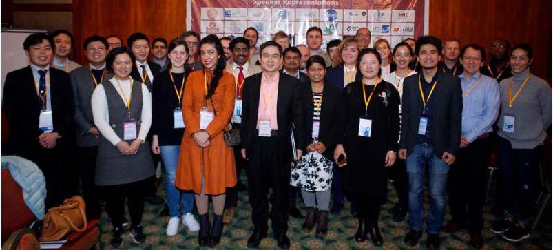
1 th International Conference on GIS and Remote Sensing September 19-20, 2019 Rome, Italy SCIENTIF IC P ROGRA M
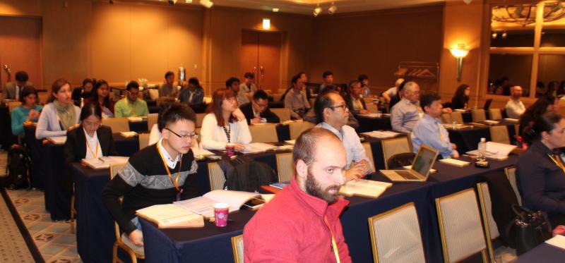
2 SCIENTIFIC PROGRAM Thursday, 19 th September DAY 1 Thursday, 19 th September 08:30-09:00 Registrations 09:00-09:30 Introduction 09:30-09:50 COFFEE BREAK 09:50-11:50 Meeting Hall 01 KEYNOTE LECTURES MEETING HALL 01 MEETING HALL 02 11:50-13:10 Talks On: Remote Sensing and GIS Geological remote sensing Satellite remote sensing Global positioning system Remote sensing in atmospheric modeling Talks On: GIS Techniques and Technology Raster-to-vector translation Projections coordinate systems, and registration Data representation Data capture Resources assessment 13:10-13:15 GROUP PHOTO 13:15-14:00 LUNCH BREAK MEETING HALL 01 MEETING HALL 02 14:00-16:00 Talks On: Remote Sensing in Urban Environment Emerging imaging and sensing technology Digital image processing Remote sensing of clouds and atmosphere Weather forecasting High performance computing in geoscience Talks On: Web GIS and Web Mapping Real-time and 3D with ArcGIS Mobile mapping Static web maps Traffic congestion maps 3D modeling from remotely sensed data 16:00-16:20 COFFEE BREAK MEETING HALL 01 (16:20-17:00) MEETING HALL 01 (17:00-18:00) Young Researchers Workshop
3 SCIENTIFIC PROGRAM Friday, 20 th September DAY 2 Friday, 20 th September 09:00-10:30 Meeting Hall 01 KEYNOTE LECTURES 10:30-10:50 COFFEE BREAK MEETING HALL 01 MEETING HALL 02 10:50-12:50 Talks On: Global Navigation Satellite System Global positioning system (GPS) Global system for mobile communications (GSM) Big data processing Navigation and communication Talks On: GIS & RS Applications in Forestry Land management Agriculture Deforestation Biodiversity conservation 12:50-13:35 LUNCH BREAK MEETING HALL 01 MEETING HALL 02 13:35-15:55 Talks On: Cartographic Modeling Decision support modeling Analysis of mapped data Talks On: Implications of GIS in Society GIS social practice GIS & RS in climate change 15:55-16:15 COFFEE BREAK MEETING HALL 01 (16:15-17:00) MEETING HALL 01 (17:00-18:00) Poster Presentations Workshop
4 PAST AFFILIATES Victor Puchkov Nikolaevich, Russian Academy of Sciences, Russia Agustin Fernandez Eguiarte, Universidad Nacional Autonoma de Mexico, Judit Rubio Delgado, University of Extremadura, Spain Andris Klepers, Vidzeme University of Applied Sciences, Latvia PAST AFFILIATES Valentina Janev, University of Belgrade, Serbia Waqas Wajid, Hochschule Anhalt, Bernburg (Saale), Germany Katerina Mekhlis, NeoCityLab, Netherlands Gloria Bordogna, CNR IREA, Milano, Italy Dietrich Heintz, Cropix, Thalwil, Switzerland Leanne Sulewski, United States Department of Defense, USA Andrews Kwasi Afforo Odoom, Losamills Consult Limited, Ghana Napoleon Kurantin, Ghana Institute of Management and Public Administration, Ghana


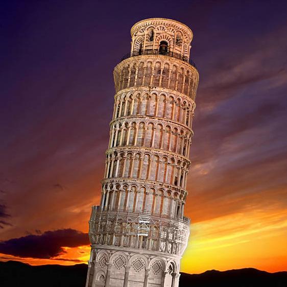


5 G er To w La ke in g an Le Pi sa ar da of G d da la n ar eo n th Pa n n- A t an m ru Fo C ge ast lo el S an Ro m s lp A A m al fi st Co a Rome Attractions Colosseum


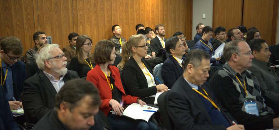
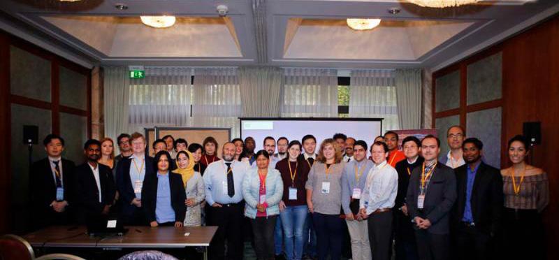
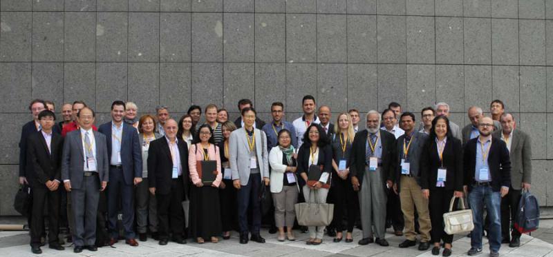

6 Glimpses of GIS CONGRESS CONFERENCES

7 Scientific Program 4 th International Conference on GIS and Remote Sensing September27-28, 2018 Berlin, Germany UK: Conference Series LLC Ltd 47 Churchfield Road, London, W3 6AY Toll Free: Page 7
8 DAY-1 September 27, 2018 Meeting Hall: Bismarck Registrations Opening Ceremony Keynote Forum Introduction Title: Applications of GIS and remote sensing in lansdlide hazard assessment Wendy Zhou, Colorado School of Mines, USA Networking & Refreshments Sessions: GIS and Remote Sensing Geodynamics Spatial Analysis With GIS Global Navigation Satellite System (GNSS) GIS & RS in Climate Change Remote Sensing in Urban Environment Chair: Agustin Fernandez Eguiarte, Universidad Nacional Autonoma de Mexico, Mexico Co-Chair: Waqas Wajid, Hochschule Anhalt, Bernburg (Saale), Germany Introduction Title: Selection of an appropriate height system for geomatics Petr Vanicek, University of New Brunswick, Canada Title: A service enabled visualization for conveying spatial information by summarizing temporal point data Leanne Sulewski, United States Department of Defense, USA Title: Deep learning based on U-Net architectures for lithological classification using multi-sensor data Yuanze Chen, Technical University of Munich, Germnay Group Photo Lunch Break Title: Synthesising information in remote sensing images based on an adaptive accumulation of evidence Gloria Bordogna, CNR IREA, Milano, Italy Title: Coupling deep learning and GIS for forest damage assessment based on high-resolution remote sensing data Zayd Mahmoud Hamdi, Technical University of Munich, Germany Title: Using Sentinel 2A images to analyze temporal variation of estimated chlorophyll content in olive groves and its relationship to phenological stages Judit Rubio Delgado, University of Extremadura, Spain Title: Sentinel-1 SAR data for agricultural applications Dietrich Heintz, Cropix, Thalwil, Switzerland Page 8
9 Networking & Refreshments Title: Spatio-temporal analysis of landuse change using Landstat 5 TM and stochastic gradient boosting in periurban areas of Yogyakarta, Indonesia Sintha Prima Widowati Gunawan, Osaka University, Japan Title: Spatial analysis of tourism places in post-soviet contexts: Tourist destinations of Baltic states Andris Klepers, Vidzeme University of Applied Sciences, Latvia Title: Use of geo-spatial techniques to estimate the efficiency of public transport service in an urban area Salman Zubair, University of Karachi, Pakistan Panel Discussion Keynote Forum DAY-2 September 28, 2018 Meeting Hall: Bismarck Title: International Terrestrial Reference Frame (ITRF) and global geodynamics Victor Puchkov Nikolaevich, Russian Academy of Sciences, Russia Networking & Refreshments Sessions: GIS Techniques and Technologies Geostatistics Disaster assessment and management GIS in renewable energy sources GIS in Mapping Seismology and Geodesy Chair: Leanne Sulewski, United States Department of Defense, USA Co-Chair: Andris Klepers, Vidzeme University of Applied Sciences, Latvia Co-Chair: Katerina Mekhlis, NeoCityLab, Netherlands Introduction Title: Quantification of the impacts of tropical cyclones on the coasts of the Gulf of Mexico, the Western Caribbean Sea and on the urban, semi-urban and rural localities of Mexico Agustin Fernandez Eguiarte, Universidad Nacional Autonoma de Mexico, Mexico Title: Adopting the linked data approach for spatio-temporal analysis: Opportunities and challenges Valentina Janev, University of Belgrade, Serbia Page 9
10 Title: Spatial and sensible planning of chaotic metropolitan city through GIS and remote sensing Waqas Wajid, Hochschule Anhalt, Bernburg (Saale), Germany Group Photo Lunch Break Title: A geospatial study on coastal erosion in Krishna-Godavari delta region, Andhra Pradesh, India Peddada Jagadeeswara Rao, Andhra University, India Title: Using GIS to develop vulnerability index map for Bassetlaw District Council Andrews Kwasi Afforo Odoom, Losamills Consult Limited, Ghana Title: New approache to data visualisation, automated object recognition and urban management based on laser scanning and photo panoramas Katerina Mekhlis, NeoCityLab, Netherlands Title: Developing a prototype of geo-spatial system for the implementation of One District, One Factory policy in support of regional economic development and poverty alleviation programmes in Ghana Napoleon Kurantin, Ghana Institute of Management and Public Administration, Ghana Networking & Refreshments Title: Object-based forest cover change mapping using remote sensing in Nuristan province, Afghanistan Shogufa Popal, Kabul University, Afghanistan Title: Earthquake risk assessment of Blida (Algeria) using GIS Khalida Tadjer, University of Blida, Algeria Poster Presentations Panel Discussion Awards & Closing Ceremony Page 10
Coastal Zones & Ocean Science
 4 th International Conference on Coastal Zones & Ocean Science Theme: Discovering the Innovative methods for the betterment of Coastal and Ocean science Dates: May 15-16, 2019 Venue: https://coastalzonemanagement.conferenceseries.com/
Themes for Geomatics Conference. Geodesy Themes
 Themes for Geomatics Conference Geodesy Themes Geodynamics o Modeling the Deformation of the Earth s Crust o Recent Advances in Geometric Approaches to Deformation Analysis o Monitoring Systems (Sensors
GenEd Courses offered by Dept. of Geography, Presidency University
 GenEd Courses offered by Dept. of Geography, Presidency University (All the Courses are offered to both Science and Humanities Students) Semester Course No. Course Name Maximum No. of Students (originally
The UN-GGIM: Europe core data initiative to encourage Geographic information supporting Sustainable Development Goals Dominique Laurent, France
 INSPIRE conference Strasbourg 6 September 2017 The UN-GGIM: Europe core data initiative to encourage Geographic information supporting Sustainable Development Goals Dominique Laurent, France Introduction
SDG s and the role of Earth Observation
 SDG s and the role of Earth Observation Christian Heipke IPI - Institute for Photogrammetry and GeoInformation Leibniz Universität Hannover Germany Secretary General, ISPRS 1. No Poverty 2. Zero Hunger
GEOMATICS. Shaping our world. A company of
 GEOMATICS Shaping our world A company of OUR EXPERTISE Geomatics Geomatics plays a mayor role in hydropower, land and water resources, urban development, transport & mobility, renewable energy, and infrastructure
European Space Agency
 Guidelines - Guidelines how/when to interact during the WebEx session: - Due to the number of attendees, please keep always your webcam and microphone switched-off - You can use anytime the chat to all
GIS and Remote Sensing
 Spring School Land use and the vulnerability of socio-ecosystems to climate change: remote sensing and modelling techniques GIS and Remote Sensing Katerina Tzavella Project Researcher PhD candidate Technology
Land Administration and Cadastre
 Geomatics play a major role in hydropower, land and water resources and other infrastructure projects. Lahmeyer International s (LI) worldwide projects require a wide range of approaches to the integration
MONITORING AND MODELING NATURAL AND ANTHROPOGENIC TERRAIN CHANGE
 MONITORING AND MODELING NATURAL AND ANTHROPOGENIC TERRAIN CHANGE Spatial analysis and simulations of impact on landscape processess Helena MITASOVA, Russell S. HARMON, David BERNSTEIN, Jaroslav HOFIERKA,
SIRGAS: Basis for Geosciences, Geodata, and Navigation in Latin America
 SIRGAS: Basis for Geosciences, Geodata, and Navigation in Latin America Claudio Brunini President of SIRGAS Universidad Nacional de La Plata, Argentina María Virginia Mackern President of SIRGAS/WG-I:
Georeferencing and Satellite Image Support: Lessons learned, Challenges and Opportunities
 Georeferencing and Satellite Image Support: Lessons learned, Challenges and Opportunities Shirish Ravan shirish.ravan@unoosa.org UN-SPIDER United Nations Office for Outer Space Affairs (UNOOSA) UN-SPIDER
Year 7 Geography. ü BBC Bitesize: Map and Atlas Skills https://www.bbc.com/education/topics/zm38q6f
 Year 7 Year 7 Geography ü Mapping and map skills (continents, compass directions, grid references) ü Tourism in the UK ü Rivers (Water cycle, river landforms) ü Population (push and pull factors, population
8/28/2011. Contents. Lecture 1: Introduction to GIS. Dr. Bo Wu Learning Outcomes. Map A Geographic Language.
 Contents Lecture 1: Introduction to GIS Dr. Bo Wu lsbowu@polyu.edu.hk Department of Land Surveying & Geo-Informatics The Hong Kong Polytechnic University 1. Learning outcomes 2. GIS definition 3. GIS examples
Manual of Digital Earth
 V8.0 March 27, 2018 International Society for Digital Earth Manual of Digital Earth (Tentative Title) OUTLINE Foreword Chapter 1 Understanding Digital Earth 1.1 Origins and Precursors of Digital Earth
Esri India User Conference
 Esri India User Conference The Leela Ambience Convention Hotel, Delhi January 19 20, 2017 Keynote Speaker Jack Dangermond Founder and President, Esri Inc. Register Today esriindia.com/indiauc About Esri
Excel Geomatics. Rajesh Paul Excel Geomatics Pvt. Ltd., Noida February, 2015 India Geospatial Forum, Hyderabad
 Excel Geomatics Geo-marketing for Product Sales and Customer Services Rajesh Paul Excel Geomatics Pvt. Ltd., Noida 10-12 February, 2015 India Geospatial Forum, Hyderabad Presentation Outline About Excel
PHARM CHEM 2018 PHARMACEUTICAL CHEMISTRY AND DRUG DESIGN. Exceeding the Vision in Drug and Pharmaceutical Chemistry. Media Partners & Collaborators
 15+ Interactive Sessions 10+ Keynote Lectures 40+ Scientific Sessions 3+ Workshops 30+ Posters B2B Meetings PHARM CHEM 2018 20 th World Conference on PHARMACEUTICAL CHEMISTRY AND DRUG DESIGN September
2 nd Semester. Core Courses. C 2.1 City and Metropolitan Planning. Module 1: Urban Structure and Growth Implications
 2 nd Semester Core Courses C 2.1 City and Metropolitan Planning Module 1: Urban Structure and Growth Implications Growth of cities; cities as engine of growth; urban sprawl; land value, economic attributes
What are the social, technical, environmental and economic benefits and opportunities of accessing and sharing geodetic data?
 What are the social, technical, environmental and economic benefits and opportunities of accessing and sharing geodetic data? Graeme Blick Group Manager Positioning and Resilience Land Information New
INDONESIA S S UPDATE: GEOSPATIAL INFORMATION FOR SUSTAINABLE DEVELOPMENT RELATED TO INA SDI Dr. Asep Karsidi, M.Sc
 INDONESIA S S UPDATE: GEOSPATIAL INFORMATION FOR SUSTAINABLE DEVELOPMENT RELATED TO INA SDI Dr. Asep Karsidi, M.Sc GEOSPATIAL INFORMATION AGENCY 08 August, 2012 OUTLINE 1. Transformation Bakosurtanal into
27 28 June Bruges, BELGIUM
 27 28 June 2017 - Bruges, BELGIUM MultiTemp 2017 Technical Programme Gabrielle De Lannoy, Else Swinnen Overview Programme Tuesday 27/06 Wednesday 28/06 Thursday 29/06 8:30 Registration 8:00 Registration
Conference at a Glance
 Conference at a Glance 8:30 AM MONDAY ROOM 333 ROOM 327/328 ROOM 238 ROOM 296/298 WELCOME and KEYNOTE SPEAKER MICHAEL MILASKA 10 AM BREAK 10:30 AM Web Applications I 12 PM 1:30 PM Intro to R Data Science
Global Chemistry Congress. June 10-12, 2019 Rome, Italy
 June 10-12, 2019 Rome, Italy Global Chemistry Congress Phronesis, LLC, 919 North Market Street, Suite 950 Wilmington, Delaware 19801 USA Email: gcc@phronesisonline.net, gcc@phronesisonline.us Tel: +1 (302)
Space Application in Support of Land Management for SDG Implementation
 Space Application in Support of Land Management for SDG Implementation Regional Expert Workshop on Land Accounting for SDG Monitoring and Reporting 26 September 2017 Space Application Section Information
Report of the Regional Committee of UN-GGIM for Asia and the Pacific (UN-GGIM-AP)
") Report of the Regional Committee of UN-GGIM for Asia and the Pacific (UN-GGIM-AP) At the Eighth Session of UN-GGIM UN Headquarters, New York, 1 3 August 2018 About UN-GGIM-AP One of the five regional committees
Report of the Regional Committee of UN-GGIM for Asia and the Pacific (UN-GGIM-AP) At the Eighth Session of UN-GGIM UN Headquarters, New York, 1 3 August 2018 About UN-GGIM-AP One of the five regional committees
Greening of Arctic: Knowledge and Uncertainties
 Greening of Arctic: Knowledge and Uncertainties Jiong Jia, Hesong Wang Chinese Academy of Science jiong@tea.ac.cn Howie Epstein Skip Walker Moscow, January 28, 2008 Global Warming and Its Impact IMPACTS
Remote Sensing and EO activities at the University of Turku
 Remote Sensing and EO activities at the University of Turku Niina Käyhkö Associate Professor Department of Geography and Geology GEO meeting/syke May 23rd, 2018 Geospatial competence at the University
Tentative Program. GIS & Remote Sensing. ***For available speaker slots***
 conferenceseries.com 3 rd World Congress on Tentative Program GIS & Remote Sensing September 20-21, 2017 Charlotte, North Carolina USA An insight into the accelerating innovations in the field of GIS and
Status and Challenges on Geo-DRM Information Systems in Tonga
 Name: Mafua- i-vai utukakau Maka Status and Challenges on Geo-DRM Information Systems in Tonga 1 Roles and Relationships Land and Geographic Information Systems (LGIS) Unit: Establish updated high-resolution
INDIANA ACADEMIC STANDARDS FOR SOCIAL STUDIES, WORLD GEOGRAPHY. PAGE(S) WHERE TAUGHT (If submission is not a book, cite appropriate location(s))
 WHERE TAUGHT (If submission is not a book, cite appropriate location(s))") Prentice Hall: The Cultural Landscape, An Introduction to Human Geography 2002 Indiana Academic Standards for Social Studies, World Geography (Grades 9-12) STANDARD 1: THE WORLD IN SPATIAL TERMS Students
Prentice Hall: The Cultural Landscape, An Introduction to Human Geography 2002 Indiana Academic Standards for Social Studies, World Geography (Grades 9-12) STANDARD 1: THE WORLD IN SPATIAL TERMS Students
Spatial Data Analysis with ArcGIS Desktop: From Basic to Advance
 Spatial Data Analysis with ArcGIS Desktop: From Basic to Advance 1. Course overview Modern environmental, energy as well as resource modeling and planning require huge amount of geographically located
Advanced Image Analysis in Disaster Response
 Advanced Image Analysis in Disaster Response Creating Geographic Knowledge Thomas Harris ITT The information contained in this document pertains to software products and services that are subject to the
Liana Talaue McManus. Division of Marine Affairs and Policy Rosenstiel School of Marine & Atmospheric Science University of Miami
 Liana Talaue McManus Division of Marine Affairs and Policy Rosenstiel School of Marine & Atmospheric Science University of Miami Outline 1. Coasts as vulnerable & resilient social ecological systems 2.
EU collaborations with NASA LCLUC Program & Current Priorities
 & Current Priorities ioannis Manakos, Dr. Centre for Research and Technology Hellas Information Technologies Institute Visual Analytics, Virtual & Augmented Reality Laboratory European Association of Remote
- World-wide cities are growing at a rate of 2% annually (UN 1999). - (60,3%) will reside in urban areas in 2030.
. - (60,3%) will reside in urban areas in 2030.") THE EFFECTIVENESS OF NEW TECHNOLOGIES FOR URBAN LAND MANAGEMENT BAHAAEDDINE I. AL HADDAD Centro de Política de Suelo y Valoraciones Universidad Politécnica de Cataluña Barcelona, España www.upc.es/cpsv
THE EFFECTIVENESS OF NEW TECHNOLOGIES FOR URBAN LAND MANAGEMENT BAHAAEDDINE I. AL HADDAD Centro de Política de Suelo y Valoraciones Universidad Politécnica de Cataluña Barcelona, España www.upc.es/cpsv
Yrd. Doç. Dr. Saygın ABDİKAN Öğretim Yılı Güz Dönemi
 Yabancı Dil III (YDL285) Introduction to Geomatics Yrd. Doç. Dr. Saygın ABDİKAN 2017-2018 Öğretim Yılı Güz Dönemi 1 géomatique Geo (Earth) + informatics Geodesy + Geoinformatics Geomatics: The mathematics
Introduction to GIS. Dr. M.S. Ganesh Prasad
 Introduction to GIS Dr. M.S. Ganesh Prasad Department of Civil Engineering The National Institute of Engineering, MYSORE ganeshprasad.nie@gmail.com 9449153758 Geographic Information System (GIS) Information
World Geography. WG.1.1 Explain Earth s grid system and be able to locate places using degrees of latitude and longitude.
 Standard 1: The World in Spatial Terms Students will use maps, globes, atlases, and grid-referenced technologies, such as remote sensing, Geographic Information Systems (GIS), and Global Positioning Systems
Applying Hazard Maps to Urban Planning
 Applying Hazard Maps to Urban Planning September 10th, 2014 SAKAI Yuko Disaster Management Expert JICA Study Team for the Metro Cebu Roadmap Study on the Sustainable Urban Development 1 Contents 1. Outline
ENV208/ENV508 Applied GIS. Week 1: What is GIS?
 ENV208/ENV508 Applied GIS Week 1: What is GIS? 1 WHAT IS GIS? A GIS integrates hardware, software, and data for capturing, managing, analyzing, and displaying all forms of geographically referenced information.
WP4: COASTAL PROCESSES
 WP4: COASTAL PROCESSES Coordinator: G. EBERHARDS Faculty of Geography and Earth Sciences, University of Latvia Daugavpils, 2008 Goal: The objective of this study is analysis of coastal changes and forecast
Future Proofing the Provision of Geoinformation: Emerging Technologies
 Future Proofing the Provision of Geoinformation: Emerging Technologies An Exchange Forum with the Geospatial Industry William Cartwright Chair JBGIS Second High Level Forum on Global Geospatial Information
Space Applications for Disaster Risk Reduction and Sustainable Development
 Space Applications for Disaster Risk Reduction and Sustainable Development Space Applications Section (SAS) ICT and Disaster Risk Reduction Division (IDD) UNESCAP Contents I. RESAP Activities 2016-2017
Urban Geo-Informatics John W Z Shi
 Urban Geo-Informatics John W Z Shi Urban Geo-Informatics studies the regularity, structure, behavior and interaction of natural and artificial systems in the urban context, aiming at improving the living
Challenges and Issues for Regional Geoportal on Disaster Data Sharing - from Perspective of China
 The 3 rd UN-GGIM-AP Plenary Meeting Challenges and Issues for Regional Geoportal on Disaster Data Sharing - from Perspective of China ZHOU Xu, Vice Chair of WG2 National Geomatics Center of China Outline
Operational Aspects of GNSS CORS What is a GNSS CORS system used for?
 Please insert a picture (Insert, Picture, from file). Size according to grey field (10 cm x 25.4 cm). Scale picture: highlight, pull corner point Cut picture: highlight, choose the cutting icon from the
An analysis of Agile conferences papers: a snapshot of the GI&GIS research in Europe
 An analysis of Agile conferences papers: a snapshot of the GI&GIS research in Europe Pasquale Di Donato, Mauro Salvemini University of Rome La Sapienza Piazza Borghese 9 00186 Roma, Italy pasquale.didonato@uniroma1.it,
Creating synergies between Statistical and Geospatial information for better policy outputs: The case of Mexico
 Creating synergies between Statistical and Geospatial information for better policy outputs: The case of Mexico Geospatial & Statistics Integration for Informed Decision Making Geospatial World Forum 2017
Visualization tools for coastal climate change vulnerability assessment and adaptation guidelines: a case study in Cartagena, Colombia
 Visualization tools for coastal climate change vulnerability assessment and adaptation guidelines: a case study in Cartagena, Colombia Vivian Ochoa, Paula Cristina Sierra-Correa, Venus Rocha, Francisco
Welcome. C o n n e c t i n g
 Welcome C o n n e c t i n g YOU D i s c i p l i n e s Why is This Meeting......So Important Now? OUR WORLD Is Increasingly Challenged The Evidence Is Clear We Need Better Understanding and More Collaboration
VGIscience Summer School Interpretation, Visualisation and Social Computing of Volunteered Geographic Information (VGI)
") VGIscience Summer School Interpretation, Visualisation and Social Computing of Volunteered Geographic Information (VGI) TU Dresden, 11.-15. September 2017 Welcome PhD students working on research topics
VGIscience Summer School Interpretation, Visualisation and Social Computing of Volunteered Geographic Information (VGI) TU Dresden, 11.-15. September 2017 Welcome PhD students working on research topics
Monitoring Urban Space Expansion Using Remote Sensing Data in Ha Long City, Quang Ninh Province in Vietnam
 Monitoring Urban Space Expansion Using Remote Sensing Data in Ha Long City, Quang Ninh Province in Vietnam MY Vo Chi, LAN Pham Thi, SON Tong Si, Viet Key words: VSW index, urban expansion, supervised classification.
I. PRACTICAL GEOGRAPHY A. Maps. B. Scale and measurement. C. Map reading and interpretation; D. Interpretation of statistical data;
 TOPICS/CONTENTS/NOTES OBJECTIVES I. PRACTICAL GEOGRAPHY A. Maps Ai define and identify different types and uses of maps B. Scale and measurement distances, areas reduction and enlargement, directions,
17 18 October Optimizing Geosciences and Engineering to Maximize Colombia s Offshore Potential OUTLINE OF SESSIONS AND TECHNICAL CONTENT
 17 18 October 2018 Optimizing Geosciences and Engineering to Maximize Colombia s Offshore Potential OUTLINE OF SESSIONS AND TECHNICAL CONTENT SEA OFFSHORE 2018 In 2018, SEA Offshore celebrates its third
Raising awareness about advantages of standardization of geographical names / Des avantages de la normalisation
 Madagascar, 2013 Raising awareness about advantages of standardization of geographical names / Des avantages de la normalisation Helen Kerfoot Past Chair, UNGEGN (2002-2012) (Natural Resources Canada)
1. Demand for property on the coast
 1. Demand for property on the coast Key message Irrespective of density and location, population in Europe in general tends to concentrate in coastal areas. Detailed spatial elaboration of processes shows
MAPPING LAND USE/ LAND COVER OF WEST GODAVARI DISTRICT USING NDVI TECHNIQUES AND GIS Anusha. B 1, Sridhar. P 2
 MAPPING LAND USE/ LAND COVER OF WEST GODAVARI DISTRICT USING NDVI TECHNIQUES AND GIS Anusha. B 1, Sridhar. P 2 1 M. Tech. Student, Department of Geoinformatics, SVECW, Bhimavaram, A.P, India 2 Assistant
SCIENTIFIC PROGRAM. Overall Program Oral Presentations and Posters Student Consortium Plenary Speakers
 206 SCIENTIFIC PROGRAM Overall Program Oral Presentations and Posters Student Consortium Plenary Speakers Overall Program 207 208 Oral Presentations and Posters Monday, 11 July, 2016 08:30-12:00 Faculty
Geodesy. orientation. shape. gravity field
 Geodesy noun Science of measuring the shape, orientation and gravity field of the Earth and how it changes over time. shape orientation gravity field Positioning has always been important Downstream applications
VISUALIZATION URBAN SPATIAL GROWTH OF DESERT CITIES FROM SATELLITE IMAGERY: A PRELIMINARY STUDY
 CO-439 VISUALIZATION URBAN SPATIAL GROWTH OF DESERT CITIES FROM SATELLITE IMAGERY: A PRELIMINARY STUDY YANG X. Florida State University, TALLAHASSEE, FLORIDA, UNITED STATES ABSTRACT Desert cities, particularly
Outline. Remote Sensing, GIS and DEM Applications for Flood Monitoring. Introduction. Satellites and their Sensors used for Flood Mapping
 Outline Remote Sensing, GIS and DEM Applications for Flood Monitoring Prof. D. Nagesh Kumar Chairman, Centre for Earth Sciences Professor, Dept. of Civil Engg. Indian Institute of Science Bangalore 560
Spanish national plan for land observation: new collaborative production system in Europe
 ADVANCE UNEDITED VERSION UNITED NATIONS E/CONF.103/5/Add.1 Economic and Social Affairs 9 July 2013 Tenth United Nations Regional Cartographic Conference for the Americas New York, 19-23, August 2013 Item
Building Institutional Capacity for Multi-Hazard Early Warning in Asia and the Pacific Subtitle
 Building Institutional Capacity for Multi-Hazard Early Warning in Asia and the Pacific Subtitle Title Keran Wang Chief, Space Applications Section ICT and Disaster Risk Reduction Division 22 May 2018 Pillar
M11/3/GEOGR/HP2/ENG/TZ0/XX/Q GEOGRAPHY HIGHER LEVEL PAPER 2. Friday 6 May 2011 (morning) 2 hours INSTRUCTIONS TO CANDIDATES
 2 hours INSTRUCTIONS TO CANDIDATES") M11/3/GEOGR/HP2/ENG/TZ0/XX/Q 22115202 GEOGRAPHY HIGHER LEVEL PAPER 2 Friday 6 May 2011 (morning) 2 hours INSTRUCTIONS TO CANDIDATES Do not open this examination paper until instructed to do so. Answer
M11/3/GEOGR/HP2/ENG/TZ0/XX/Q 22115202 GEOGRAPHY HIGHER LEVEL PAPER 2 Friday 6 May 2011 (morning) 2 hours INSTRUCTIONS TO CANDIDATES Do not open this examination paper until instructed to do so. Answer
Modernization of National Geodetic Datum in China *
 UNITED NATIONS E/CONF.102/IP.16 ECONOMIC AND SOCIAL COUNCIL Nineteenth United Nations Regional Cartographic Conference for Asia and the Pacific Bangkok, 29 October 1 November 2012 Item 6(b) of the provisional
Identifying Audit, Evidence Methodology and Audit Design Matrix (ADM)
") 11 Identifying Audit, Evidence Methodology and Audit Design Matrix (ADM) 27/10/2012 Exercise XXX 2 LEARNING OBJECTIVES At the end of this session participants will be able to: 1. Identify types and sources
11 Identifying Audit, Evidence Methodology and Audit Design Matrix (ADM) 27/10/2012 Exercise XXX 2 LEARNING OBJECTIVES At the end of this session participants will be able to: 1. Identify types and sources
EUMETSAT. A global operational satellite agency at the heart of Europe. Presentation for the Spanish Industry Day Madrid, 15 March 2012
 EUMETSAT A global operational satellite agency at the heart of Europe Presentation for the Spanish Industry Day Madrid, Angiolo Rolli EUMETSAT Director of Administration EUMETSAT objectives The primary
Geospatial Information and Services for Disasters (GIS4D)
") Geospatial Information and Services for Disasters (GIS4D) 31 July 2017 Tae Hyung KIM ICT and Disaster Risk Reduction Division (IDD) UNESCAP 1 About ESCAP Who is ESCAP? United Nations Economic and Social
Geospatial Information and Services for Disasters (GIS4D) 31 July 2017 Tae Hyung KIM ICT and Disaster Risk Reduction Division (IDD) UNESCAP 1 About ESCAP Who is ESCAP? United Nations Economic and Social
Observation (EO) & Geomatics in Canada
 & Geomatics in Canada") Innovating to Increase the Impact of Earth Observation (EO) & Geomatics in Canada Natural Resources Canada February 25, 2014 Prashant Shukle, Director General Canada Centre for Mapping and Earth Observation
Innovating to Increase the Impact of Earth Observation (EO) & Geomatics in Canada Natural Resources Canada February 25, 2014 Prashant Shukle, Director General Canada Centre for Mapping and Earth Observation
Copernicus Overview. Major Emergency Management Conference Athlone 2017
 Copernicus Overview Major Emergency Management Conference Athlone 2017 Copernicus is a European programme implemented by the European Commission. The services address six thematic areas: land, marine,
Urban remote sensing: from local to global and back
 Urban remote sensing: from local to global and back Paolo Gamba University of Pavia, Italy A few words about Pavia Historical University (1361) in a nice town slide 3 Geoscience and Remote Sensing Society
DOWNLOAD OR READ : GIS BASED FLOOD LOSS ESTIMATION MODELING IN JAPAN PDF EBOOK EPUB MOBI
 DOWNLOAD OR READ : GIS BASED FLOOD LOSS ESTIMATION MODELING IN JAPAN PDF EBOOK EPUB MOBI Page 1 Page 2 gis based flood loss estimation modeling in japan gis based flood loss pdf gis based flood loss estimation
Geospatial Enabling Resilient Development. Latin America Geospatial Forum Río de Janeiro September 2013
 Geospatial Enabling Resilient Development Latin America Geospatial Forum Río de Janeiro September 2013 Presentation Index INEGI /SNIEG Geostatistical Frame - Georeferenciation Issues Legal Framework Mexican
enny Mills chool of Civil ngineering & eosciences ewcastle University
 Future of Surveying: Educating the future geospatial expert A Newcastle University perspective enny Mills chool of Civil ngineering & eosciences ewcastle University Future of surveying: Do we still need
Advancing Geoscientific Capability. Geological Survey of Finland
 Advancing Geoscientific Capability Geological Survey of Finland GTK in brief The Geological Survey of Finland (GTK) is one of the largest European centres of excellence in assessment, research and the
Geospatial Information Management in the Americas: Lessons for the Post-2015 development agenda
 Geospatial Information Management in the Americas: Lessons for the Post-2015 development agenda Rolando Ocampo President, UN-GGIM: Americas October 2014 The integration of statistical and geographical
Part : General Situation of Surveying and Mapping. The Development of Surveying and Mapping in China. The contents
 The Development of Surveying and Mapping in China Dr. Ping Xiao China.P.R The contents Part : General Situation of Surveying and Mapping 1. The legal systems of surveying and mapping 2. The technologies
Landuse/Landcover Change Detection in Umshing- Mawkynroh of East Khasi Hills District, Meghalaya Using Spatial Information Technology
 International Journal of Scientific and Research Publications, Volume 6, Issue 1, January 2016 197 Landuse/Landcover Change Detection in Umshing- Mawkynroh of East Khasi Hills District, Meghalaya Using
CS 350 A Computing Perspective on GIS
 CS 350 A Computing Perspective on GIS What is GIS? Definitions A powerful set of tools for collecting, storing, retrieving at will, transforming and displaying spatial data from the real world (Burrough,
International Workshop on the Northern Eurasia High Mountain Ecosystems.
 International Workshop on the Northern Eurasia High Mountain Ecosystems B.Moldobekov, H.Echtler HEchtler http://www.caiag.kg Bishkek, Kyrgyzstan September 8-15, 2009 GFZ: Focus on Central Asia 1992 Space
INTERNATIONAL JOURNAL OF GEOMATICS AND GEOSCIENCES Volume 2, No 1, 2011
 INTERNATIONAL JOURNAL OF GEOMATICS AND GEOSCIENCES Volume 2, No 1, 2011 Copyright 2010 All rights reserved Integrated Publishing services Research article ISSN 0976 4380 Spatio-Temporal changes of Land
Applied Geoscience and Technology Division SOPAC. Joy Papao, Risk Information Systems Officer
 Joy Papao, Risk Information Systems Officer Secretariat of the Pacific Community SPC 22 Pacific Island States Head office in Noumea, New Caledonia 2 Regional offices (Pohnpei and Honiara) 600 staff 9 Technical
Paper Two - Optional Themes for Standard and Higher Level
 Paper Two - Optional Themes for Standard and Higher Level Timing: Approximately 40 minutes for each question (each is worth 20 marks). Choice: Higher Level candidates must answer three questions and Standard
GIS in Weather and Society
 GIS in Weather and Society Olga Wilhelmi Institute for the Study of Society and Environment National Center for Atmospheric Research WAS*IS November 8, 2005 Boulder, Colorado Presentation Outline GIS basic
The Integrated Ge spatial Information Framework to the strengthening of NSDI, Mongolia
 Young Geospatial Professionals Summit 21 NOV 2018 The Integrated Ge spatial Information Framework to the strengthening of NSDI, Mongolia BAYARMAA ENKHTUR Geospatial information and technology department
GEOGRAPHIC INFORMATION SYSTEMS Session 8
 GEOGRAPHIC INFORMATION SYSTEMS Session 8 Introduction Geography underpins all activities associated with a census Census geography is essential to plan and manage fieldwork as well as to report results
Sub-regional Training on development of Geo-referenced Disaster Risk Management Information Systems for SAARC countries
 Sub-regional Training on development of Geo-referenced Disaster Risk Management Information Systems for SAARC countries Jointly organized by Economic and Social Commission for Asia and the Pacific and
VNREDSat-1. Vietnam Natural Resources, Environment and Disaster monitoring Satellite. Lai Anh Khoi SPACE TECHNOLOGY INSTITUTE
 VNREDSat-1 Vietnam Natural Resources, Environment and Disaster monitoring Satellite Lai Anh Khoi SPACE TECHNOLOGY INSTITUTE JPTM2014 Yangon, Nov. 19-21, 2014 General information (1) Project Owner: Vietnam
FIG Asia Pacific Capacity Development Network
 FIG Asia Pacific Capacity Development Network Report to the 41th General Assembly FIG Congress 2018, Istanbul - Turkey Rob Sarib Chair FIG Asia Pacific Capacity Development Network (AP CDN) Story of the
GEOGRAPHY (GEOGRPHY) Geography (GEOGRPHY) 1
 Geography (GEOGRPHY) 1") Geography (GEOGRPHY) 1 GEOGRAPHY (GEOGRPHY) GEOGRPHY 1040 Planet Earth 4 Credits The features of the natural environment (lithosphere, atmosphere and hydrosphere); their character, distribution, origin
Geography (GEOGRPHY) 1 GEOGRAPHY (GEOGRPHY) GEOGRPHY 1040 Planet Earth 4 Credits The features of the natural environment (lithosphere, atmosphere and hydrosphere); their character, distribution, origin
EuroGEOSS Protected Areas Pilot
 EuroGEOSS Protected Areas Pilot Max Craglia European Commission Joint Research Centre Part 1: the present MyNatura2000 Mobile app. Awareness raising & volunteered data collection. Natura2000 covers 18%
Dar es Salaam - Reality Check Workshop
 Dar es Salaam - Reality Check Workshop hosted by GIZ and Dar es Salaam City Council Introduction: Key Urban Characteristics of Dar es Salaam Challenges and Opportunities for Resilient Development in the
Great Lakes Information Network GIS (Queryable by topic, geography, organization, and upload date 73 layers as of October, 2009)
") Google Earth Files for the Great Lakes and Beyond GLOS Mapping Workshop Alpena, Michigan November 9, 2009 David Hart GIS Specialist University of Wisconsin Sea Grant Institute GREAT LAKES Great Lakes Information
Google Earth Files for the Great Lakes and Beyond GLOS Mapping Workshop Alpena, Michigan November 9, 2009 David Hart GIS Specialist University of Wisconsin Sea Grant Institute GREAT LAKES Great Lakes Information
"GIS-Sofia" Ltd. geospatial data integration in SOFCAR geographic information system and providing services March 2018, Sofia
 "GIS-Sofia" Ltd. geospatial data integration in SOFCAR geographic information system and providing services Geographical Information System Sofia " Ltd....the beginning... Established in 1999, as a Sofia
Geography (GEOG) Introduction to Geography Global Change and Natural Disasters and Environmental Change
 Introduction to Geography Global Change and Natural Disasters and Environmental Change") Geography (GEOG) Head of Department: Professor Jeffrey P. Osleeb Department Office: Room 422, Philip E. Austin Building For major requirements, see the College of Liberal Arts and Sciences section of this
Geography (GEOG) Head of Department: Professor Jeffrey P. Osleeb Department Office: Room 422, Philip E. Austin Building For major requirements, see the College of Liberal Arts and Sciences section of this
Spatial Data Science. Soumya K Ghosh
 Workshop on Data Science and Machine Learning (DSML 17) ISI Kolkata, March 28-31, 2017 Spatial Data Science Soumya K Ghosh Professor Department of Computer Science and Engineering Indian Institute of Technology,
Physical Geography: Patterns, Processes, and Interactions, Grade 11, University/College Expectations
 Geographic Foundations: Space and Systems SSV.01 explain major theories of the origin and internal structure of the earth; Page 1 SSV.02 demonstrate an understanding of the principal features of the earth
GIS = Geographic Information Systems;
 What is GIS GIS = Geographic Information Systems; What Information are we talking about? Information about anything that has a place (e.g. locations of features, address of people) on Earth s surface,
Disaster Management in Republic of Korea
 The Third UN-GGIM-AP Plenary Meeting Disaster Management in Republic of Korea ~Coordination among NGIA & Other Related Organizations and Recommendations~ Bali Indonesia 10 November 2014 Sanghoon Lee, Ph.D.