Raising awareness about advantages of standardization of geographical names / Des avantages de la normalisation
|
|
|
- Jack Hines
- 5 years ago
- Views:
Transcription
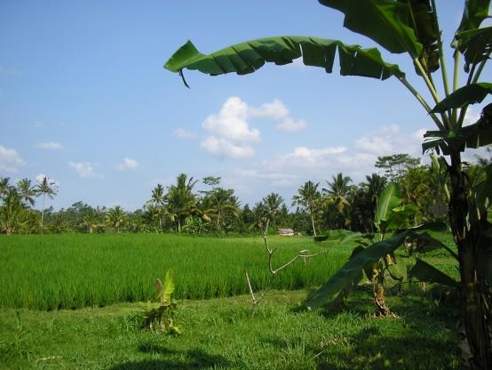
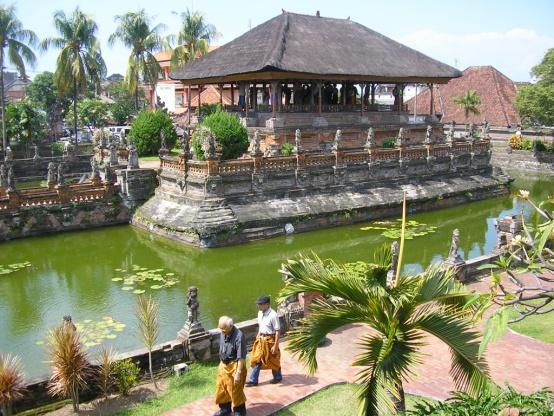
1 Madagascar, 2013 Raising awareness about advantages of standardization of geographical names / Des avantages de la normalisation Helen Kerfoot Past Chair, UNGEGN ( ) (Natural Resources Canada)


2 What is important?
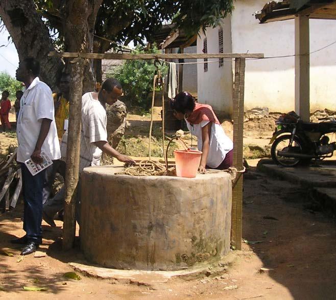
3 Need to understand What is our focus? Communication through names What are we naming? Why we standardize geographical names? Help managers appreciate the significance of standardization Benefits: technical, economic, social, cultural Toponyms so much part of other issues (e.g. NSDI) Specific to Africa

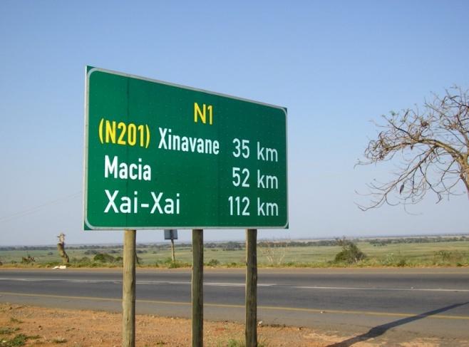
4 Referring to places and features By latitude and longitude or other world rectangular grid (military/ civilian) By description 18 km NW of Antananarivo administrative capital of particular region at crossing point of two roads as particular activity centre - market town By number. e.g. lake 1, lake 2, etc. By name! in combination with locational information


5 Communication problems if no names thematic maps, air photos... Land use


6 ... satellite images Geographical names needed to identify, describe, analyse


7 Using names... People use names in everyday discussion Names are used in books, atlases, school texts, maps, road signs, timetables, media... paper, digital, on physical objects People search for other information and link information often through names... indexes, gazetteers, on Google, Google Earth paper, on-line, through databases
8 What types of places/features? Populated places / administrative areas / geographical features Land / water Offshore features water / underwater? Names within urban areas? streets; buildings; parks? Changing or temporary features? open water areas in sea ice; dunes; winds?
9 Standardization UNGEGN Glossary: standardization, geographical names The prescription by a names authority of one or more particular names, together with their precise written form, for application to a specific geographical feature, as well as the conditions for their use. Authority apply some official status to names written form how name is applied how used romanization (?)


10 Aiming to avoid Standardization means - Duplication of names Poorly recorded names Confused applications Absence of quick and easy access to data


11
12 So... Logical and most useful if: Spellings are clear, consistent, unambiguous A name is clearly tied to a location Difficulties with what names are correct are sorted out These names are recorded, stored and are easily available to governments and the public Everybody can use the same set of names to communicate standardization

13 Practical aspects of names standardization? Useful in addressing emergency situations Include in predictions and modelling Everyone can benefit... many applications Publicizing names through Google Integrate with NSDI GIS opportunities - Africa

")

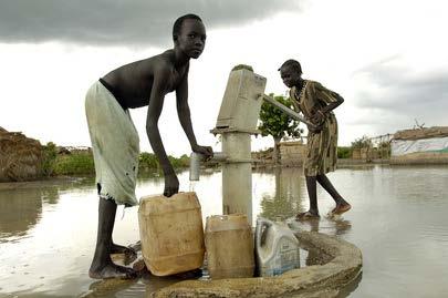
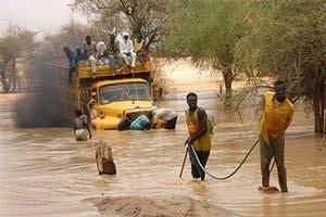
14 Hurricane Isaac Gulf of Mexico August 2012 Value of standardized street names for evacuation planning Following Katrina (7 years ago) details of streets and buildings... for shelter provision, for tracking family members


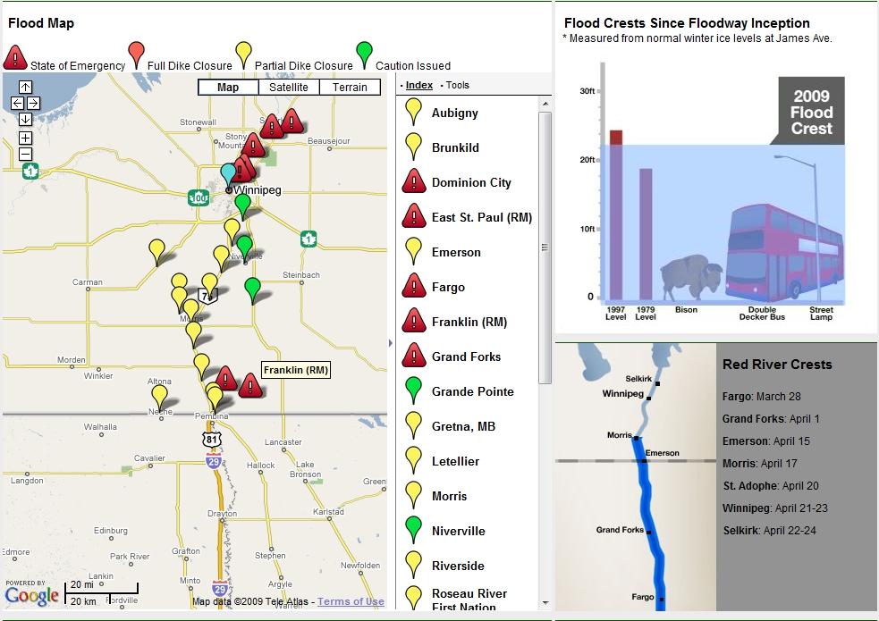
15 Red River floods Canada/US

16 Benefits of standardized names? UNGEGN brochure several languages Advantages of clarity and consistency Technical benefits Economic benefits Social benefits Cultural benefits


17 Benefits of standardized names?

18 Technical benefits Production of maps and atlases GIS and spatial data infrastructures Search tools on the Web UNGEGN brochure: Geographical names as vital keys for accessing information in our globalized and digital world Have a names register that can be used consistently Onboard navigation systems; unique Internet addresses; presentation of data analysis

19 Economic benefits Government using one standard registry of names Transportation services, delivery and postal services loss of time and materials without clear names references Developing national planning strategies; routing in trade and commerce; urban and regional planning; encouraging tourism; promotion of countries by the media

20 Social benefits Expression of our identity and standardized names help in effective communication Reference points in laws and regulations of society Exact and available toponyms are essential in emergency services humanitarian aid, search and rescue, warning of natural disasters Environmental management; modelling for climate change vulnerability

21 Cultural benefits An important part of our language and heritage Recording names helps to preserve our heritage Toponyms provide a link to our history Oral tradition today the recording of toponyms becomes essential for future generations Census data clear names essential Of note: 1988, Québec, Canada training course recognizing toponyms as a national treasure could the development of a standardization process UNESCO intangible cultural heritage support would


22 Benefits example of UNOCHA United Nations Office for the Coordination of Humanitarian Affairs (OCHA) Earthquake in Pakistan, 2005 Problem of delays in providing assistance to remote villages Difficult to obtain - standardized names, coordinates of villages, gazetteers, population statistics, maps Java, Indonesia, earthquake, 2006 Aid progressed rapidly maps, standardized names integrated into GIS, easily available Need for cooperation and move towards a global toponymic database


23 Benefits: example of urban naming China growth of cities new urban areas more than 20,000 new urban names needed every year (training to 400 people in a year to improve city name planning) Problems in towns with no street names? Development of GIS for service infrastructure (road, rail, water, sewer, electric power, gas lines) World Bank help for addressing in Africa
24 Benefits of standardized names distribution by: Google / Google Earth Influence on globalization Internet Google / Google Earth UNGEGN - collaborate with Google Use toponyms correctly Of economic interest for every country to publicize their toponyms (standardized) via Google Millions of internet users can access the data
25 National spatial data infrastructures SDI, NSDI, GSDI... for government, public Growth in use of geo-referenced data for GIS and as a tool to support other activities Use of geo-information in industry, transportation, banking, communication... Climate change, natural disasters, natural resource management, sustainable development common issues requiring regional / global handling To tackle challenges of Africa... the need is to unite the disjointed efforts and work towards a common cause for the overall benefit of the region (7 th Africa Geospatial Forum, Ghana)

26 Geographical names in NSDI Quality data Authoritative sources Standards for content and format Free or low cost Redistribute or licence
27 Geographical names in SDI Vital locational component for inclusion in all georeferenced data Pali Lehohla (S. Africa) re statistics/census and names Direct and intuitive point of access Help integrate data sets to provide powerful decision-making tools Necessary for presenting practical results of spatial data analysis and interpretation, planning and provision of emergency and humanitarian aid
28 Entry to spatially organized data postal data census map bases?? NSDI Query mining sites electric lines buildings By using a name
29


30 I N D O N E S I A


31 GIS and SDI on the upswing These are all examples of the recognition of information technology as an enabling tool. New business opportunities are arising. With geospatial activity centred round land information, the geospatial industry is growing. Consistent and accurate geographical names are so basic to these developments being effective.


32 GIS... new opportunities Rwanda teachers getting GIS training National Land Use and Development Master Plan Ghana map food crops to help farmers plan production and resource allocation Gambia data collection and processing for effective disease surveillance Kenya Virtual Kenya to help access datasets for decision-making, development and education Egypt 4500 digital village maps to help alleviate poverty Nigeria study of crime patterns in Lagos state: GIS for public safety Namibia integrated employment information system + Africa Water Atlas
")
33 Outstanding questions Duplication of names in an area Confusion of address for emergency services led to wasted time and loss of life Delivery services More efficient with clear and unambiguous place names savings of time and money Name changes Lack of information causes confusion in communication (e.g. airline/railway/bus timetables)
34 In concluding Names are vital elements in accessing our digital world and also in preserving our cultures standardized spelling and application are key to easy, quick and accurate referencing providing benefits for all users - in government, science, education, public a process needs establishing in each country to ensure standardized name information is available nationally and internationally standardized names are key to SDI
35
36 Where are all the Gas Stations? 2008 Hurricane Season Lessons Learned Workshop Louisiana s Geospatial Response to Hurricanes Gustav and Ike January 29, 2009 State Library of Louisiana

37 Hurricane Gustav 2008 Nearly 2 million people evacuated from south Louisiana in the days before Gustav 34 parishes were declared disaster areas on September 2 48 deaths in the state of Louisiana 1.5 million people were without power in Louisiana on September 1

38 Louisiana EOC needs information on the availability of fuel for the public Citizens enter open gas station addresses into La.gov website LA gov. is using internet to call gas stations Believe there is an official source for gas stations Yes, LA Agriculture and Forestry s Weights and Measures have official list in their main building. but they have no power Eventually list is obtained LA gov. to geocode (find geographic location for specific address) ~ 3400 gas stations on September 4 for a meeting on the 5 th
 Highways 123 Highway 10 instead of 123 State Hwy 10 (standard is 123")
39 Non-standard addresses cause delays Spelling variance and errors Wrong zip code - street name and zip code do not match Wrong prefix/suffix Street instead of Road missing N,S, W, E prefix abbreviation boulevard: boul\blvd Wrong town given New streets/addresses Multiple names (Florida Bl/ US 190) Highways 123 Highway 10 instead of 123 State Hwy 10 (standard is 123 Hwy 10)
40 Louisiana: lessons learned in 2008 Data Ownership Agencies with data useful in emergencies need to identify those sources, maintain them, and make them available. Location Accuracy GPS locations should be gathered for as many critical databases as possible. These locations need to be maintained by the agencies that own the data. Data Quality QA, QC should be a constant commitment. Prior to hurricane season each agency should ensure the quality of their data. Data Access Web Services make an excellent means for sharing and distributing data. These assets should be prepositioned before hurricane season. During emergency operation everyone needs to be on the same page!
41
Standardization of geographical names and raising awareness of its advantages
 Brazil, 2017 Standardization of geographical names and raising awareness of its advantages Helen Kerfoot (Canada) Past Chair, UNGEGN (2002-2012) Need to understand What is our focus? Communication through
Standardization of geographical names and raising awareness of its advantages
 Philippines, 2018 Standardization of geographical names and raising awareness of its advantages Helen Kerfoot (Canada) Past Chair, UNGEGN (2002-2012) Need to understand What is our focus? Communication
Helen Kerfoot. Former Chair, UNGEGN / Emeritus Scientist, Natural Resources Canada
 Geographic names authorities, standardization and international cooperation Helen Kerfoot Former Chair, UNGEGN / Emeritus Scientist, Natural Resources Canada BGN at 100 years In recognition of international
Economic and Social Council
 United Nations Economic and Social Council Distr.: General 23 May 2012 Original: English E/CONF.101/100 Tenth United Nations Conference on the Standardization of Geographical Names New York, 31 July 9
United Nations Group Of Experts On Geographical Names
 Rudolph MATINDAS, Indonesia or William WATT, Australia Key words: place names, UNGEGN SUMMARY UNGEGN Discussing the strategic aims of UNGEGN and its divisional structure, future direction, and the benefits
CENSUS MAPPING WITH GIS IN NAMIBIA. BY Mrs. Ottilie Mwazi Central Bureau of Statistics Tel: October 2007
 CENSUS MAPPING WITH GIS IN NAMIBIA BY Mrs. Ottilie Mwazi Central Bureau of Statistics E-mail: omwazi@npc.gov.na Tel: + 264 61 283 4060 October 2007 Content of Presentation HISTORICAL BACKGROUND OF CENSUS
GIS = Geographic Information Systems;
 What is GIS GIS = Geographic Information Systems; What Information are we talking about? Information about anything that has a place (e.g. locations of features, address of people) on Earth s surface,
Government GIS and its Application for Decision Support
 Government GIS and its Application for Decision Support Zhang Qingpu (Chinese Academy of Surveying and Mapping, Email: zhangqp@casm.ac.cn) Abstract: Application of GIS in government agencies is called
Techniques for Science Teachers: Using GIS in Science Classrooms.
 Techniques for Science Teachers: Using GIS in Science Classrooms. After ESRI, 2008 GIS A Geographic Information System A collection of computer hardware, software, and geographic data used together for
Brazil Paper for the. Second Preparatory Meeting of the Proposed United Nations Committee of Experts on Global Geographic Information Management
 Brazil Paper for the Second Preparatory Meeting of the Proposed United Nations Committee of Experts on Global Geographic Information Management on Data Integration Introduction The quick development of
GEOGRAPHIC INFORMATION SYSTEMS Session 8
 GEOGRAPHIC INFORMATION SYSTEMS Session 8 Introduction Geography underpins all activities associated with a census Census geography is essential to plan and manage fieldwork as well as to report results
Geographical Names Activities in Africa The Gaborone Action Plan
 United Nations Group of Experts on Geographical Names Geographical Names Activities in Africa The Gaborone Action Plan 6 th Meeting of the Committee of Director -Generals of National Statistics Offices
The Use of Geographic Information Systems (GIS) by Local Governments. Giving municipal decision-makers the power to make better decisions
 by Local Governments. Giving municipal decision-makers the power to make better decisions") The Use of Geographic Information Systems (GIS) by Local Governments Giving municipal decision-makers the power to make better decisions Case Study: Examples of GIS Usage by Local Governments in North
The Use of Geographic Information Systems (GIS) by Local Governments Giving municipal decision-makers the power to make better decisions Case Study: Examples of GIS Usage by Local Governments in North
GIS (GEOGRAPHICAL INFORMATION SYSTEMS) AS A FACILITATION TOOL FOR SUSTAINABLE DEVELOPMENT IN AFRICA
 AS A FACILITATION TOOL FOR SUSTAINABLE DEVELOPMENT IN AFRICA") GIS (GEOGRAPHICAL INFORMATION SYSTEMS) AS A FACILITATION TOOL FOR SUSTAINABLE DEVELOPMENT IN AFRICA a presentation by Elizabeth Hicken GDEST Conference on Geospatial Sciences for Sustainable Development
GIS (GEOGRAPHICAL INFORMATION SYSTEMS) AS A FACILITATION TOOL FOR SUSTAINABLE DEVELOPMENT IN AFRICA a presentation by Elizabeth Hicken GDEST Conference on Geospatial Sciences for Sustainable Development
Georeferencing and Satellite Image Support: Lessons learned, Challenges and Opportunities
 Georeferencing and Satellite Image Support: Lessons learned, Challenges and Opportunities Shirish Ravan shirish.ravan@unoosa.org UN-SPIDER United Nations Office for Outer Space Affairs (UNOOSA) UN-SPIDER
Declaration Population and culture
 Declaration Population and culture The ministers of the parties to the Alpine Convention regard the socio-economic and socio-cultural aspects mentioned in Article 2, Paragraph 2, Item a., as being central
GIS Geographical Information Systems. GIS Management
 GIS Geographical Information Systems GIS Management Difficulties on establishing a GIS Funding GIS Determining Project Standards Data Gathering Map Development Recruiting GIS Professionals Educating Staff
Preparing for fieldwork: what should we collect and what forms should we use?
 Brazil, 2017 Preparing for fieldwork: what should we collect and what forms should we use? Helen Kerfoot Canada UNGEGN Fieldwork Many different approaches to fieldwork Aims of field collection To verify
International Journal of Scientific & Engineering Research, Volume 6, Issue 11, November ISSN
 International Journal of Scientific & Engineering Research, Volume 6, Issue 11, November-2015 42 Geospatial Mapping of Fish Farms in Anambra State Using GIS Approach Ojiako, J.C., Okafor, C. M., Igbokwe,
IMPLEMENTING GOVERNMENT-WIDE ENTERPRISE GIS; THE FEDERATED MODEL
 IMPLEMENTING GOVERNMENT-WIDE ENTERPRISE GIS; THE FEDERATED MODEL James E. Mitchell, Ph. D. IT GIS Manager Louisiana Department of Transportation and Development presented at the ESRI International Users
Spatially Enabled Society
 International Seminar on Land Administration Trends and Issues in Asia and the Pacific Region Spatially Enabled Society Abbas Rajabifard Vice Chair PCGIAP-WG3 Vice-President (President Elect), GSDI Association
Disaster Management in Mongolia
 The Third UN-GGIM-AP Plenary Meeting Disaster Management in Mongolia ~Coordination among NGIA & Other Related Organizations and Recommendations~ Bali Indonesia 10 November 2014 Khurelshagai Ayurzana, Director
Global Geospatial Information Management Country Report Finland. Submitted by Director General Jarmo Ratia, National Land Survey
 Global Geospatial Information Management Country Report Finland Submitted by Director General Jarmo Ratia, National Land Survey Global Geospatial Information Management Country Report Finland Background
NSDI as a tool for Secure land tenure
 NSDI as a tool for Secure land tenure General Overview To look at the progress in SDI development and its application in policy formulation and impact on land tenure. INTEGRATION OF INFORMATION POLICIES
Compact guides GISCO. Geographic information system of the Commission
 Compact guides GISCO Geographic information system of the Commission What is GISCO? GISCO, the Geographic Information System of the COmmission, is a permanent service of Eurostat that fulfils the requirements
Copernicus Overview. Major Emergency Management Conference Athlone 2017
 Copernicus Overview Major Emergency Management Conference Athlone 2017 Copernicus is a European programme implemented by the European Commission. The services address six thematic areas: land, marine,
Your web browser (Safari 7) is out of date. For more security, comfort and the best experience on this site: Update your browser Ignore
 is out of date. For more security, comfort and the best experience on this site: Update your browser Ignore") Your web browser (Safari 7) is out of date. For more security, comfort and the best experience on this site: Update your browser Ignore GIS ( GEO GRAPHIC INFO RMATIO N SYSTEM) geospatial information system
Your web browser (Safari 7) is out of date. For more security, comfort and the best experience on this site: Update your browser Ignore GIS ( GEO GRAPHIC INFO RMATIO N SYSTEM) geospatial information system
Systems (GIS) - with a focus on.
 - with a focus on.") Introduction to Geographic Information Systems (GIS) - with a focus on localizing the MDGs Carmelle J. Terborgh, Ph.D. ESRI www.esri.com Flying Blind Jul 24th 2003 The Economist We Live in Two Worlds Natural
Introduction to Geographic Information Systems (GIS) - with a focus on localizing the MDGs Carmelle J. Terborgh, Ph.D. ESRI www.esri.com Flying Blind Jul 24th 2003 The Economist We Live in Two Worlds Natural
THE 3D SIMULATION INFORMATION SYSTEM FOR ASSESSING THE FLOODING LOST IN KEELUNG RIVER BASIN
 THE 3D SIMULATION INFORMATION SYSTEM FOR ASSESSING THE FLOODING LOST IN KEELUNG RIVER BASIN Kuo-Chung Wen *, Tsung-Hsing Huang ** * Associate Professor, Chinese Culture University, Taipei **Master, Chinese
Prentice Hall. World Explorer: People, Places, Cultures Grade 7. Oklahoma Priority Academic Student Skills (PASS) for Grade 7 World Geography
 for Grade 7 World Geography") Prentice Hall World Explorer: People, Places, Cultures 2007 Grade 7 C O R R E L A T E D T O for Grade 7 1. Locate, gather, analyze, and apply information from primary and secondary sources. WORLD GEOGRAPHY
Prentice Hall World Explorer: People, Places, Cultures 2007 Grade 7 C O R R E L A T E D T O for Grade 7 1. Locate, gather, analyze, and apply information from primary and secondary sources. WORLD GEOGRAPHY
Integrated Geodatabase Model for effective planning of District -Hamirpur
 Integrated Geodatabase Model for effective planning of District -Hamirpur Developed by District Administration,Hamirpur in collaboration with Centre for Geoinformatics Research and Training, CSK HPAU,Palampur
Methodological issues in the development of accessibility measures to services: challenges and possible solutions in the Canadian context
 Methodological issues in the development of accessibility measures to services: challenges and possible solutions in the Canadian context Alessandro Alasia 1, Frédéric Bédard 2, and Julie Bélanger 1 (1)
Oman NSDI Supporting Economic Development. Saud Al-Nofli Director of Spatial Data Directorate General of NSDI, NCSI
 Oman NSDI Supporting Economic Development 2017 Saud Al-Nofli Director of Spatial Data Directorate General of NSDI, NCSI "It s critical to make correct decisions the first time to optimize the Investments
Rural Louisiana. A quarterly publication of the Louisiana Tech Rural Development Center
 Rural Louisiana A quarterly publication of the Louisiana Tech Rural Development Center Volume 4, No. 1, Fall 2009 Editor: Aaron K. Lusby Director, Asst. Professor Newsletter design: Stephanie Tidwell Student
The National Spatial Strategy
 Purpose of this Consultation Paper This paper seeks the views of a wide range of bodies, interests and members of the public on the issues which the National Spatial Strategy should address. These views
Pikes Lane Primary School. Geography Statement of Practice
 Pikes Lane Primary School Geography Statement of Practice Subject Leader: Mrs Cawley Subject Link Governor: Mr Scholar & Mrs Azad Last Updated: September 2016 Review Date: September 2017 Aims and objectives
Cartographic and Geospatial Futures
 Cartographic and Geospatial Futures 1. Web Cartography, WebGIS, & Virtual Globes--New Roles for Maps, GIS, and GIS professionals 2. Map Mashups, the Neo Neo-geography Movement, & Crowd-sourcing Geospatial
Turkey National Report
 UNITED NATIONS Working Paper GROUP OF EXPERTS ON No. 26 GEOGRAPHICAL NAMES Twenty-third Session Vienna, 28 March 4 April 2006 Item 5 of the Provisional Agenda: Reports of the division Turkey National Report
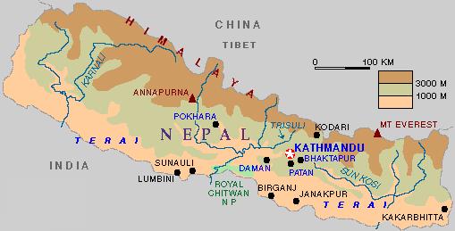
Challenges and Potentials of Place Based Information Management in Nepal"
 Nineteenth United Nations Regional Cartographic Conference for Asia and the Pacific, Bangkok, Thailand, 29 October 1 November 2012 Challenges and Potentials of Place Based Information Management in Nepal"
ENV208/ENV508 Applied GIS. Week 1: What is GIS?
 ENV208/ENV508 Applied GIS Week 1: What is GIS? 1 WHAT IS GIS? A GIS integrates hardware, software, and data for capturing, managing, analyzing, and displaying all forms of geographically referenced information.
Second Administrative Level Boundaries (SALB) initiative & geographic names in cartography. Geospatial Information Section
 initiative & geographic names in cartography. Geospatial Information Section") Second Administrative Level Boundaries (SALB) initiative & geographic names in cartography Geospatial Information Section Introduction Goals Global agenda How does SALB work? Latest News on geographic
Second Administrative Level Boundaries (SALB) initiative & geographic names in cartography Geospatial Information Section Introduction Goals Global agenda How does SALB work? Latest News on geographic
1The Many Uses of GIS
 1The Many Uses of GIS BUILDING EUROPEAN SPATIAL DATA INFRASTRUCTURES In April 2006, Esri president Jack Dangermond gave a presentation on the INSPIRE Directive at the European Union (EU) Interparliamentary
Tools to Assess Local Health Needs. Richard Leadbeater, Esri NACo 2011 Healthy Counties Forum December 1, 2011
 Tools to Assess Local Health Needs Richard Leadbeater, Esri NACo 2011 Healthy Counties Forum December 1, 2011 Richard Leadbeater currently holds the position of Industry Solutions Manager with Esri. He
Geography Curriculum. Key Stage 1
 Geography Curriculum Key Stage 1 Year 1 In the first term, students explore a variety of maps of the local environment, including the Academy grounds. They use a paper location to plan a route. They also
GEOGRAPHY POLICY STATEMENT. The study of geography helps our pupils to make sense of the world around them.
 GEOGRAPHY POLICY STATEMENT We believe that the study of geography is concerned with people, place, space and the environment and explores the relationships between the earth and its peoples. The study
A Broad View of Geospatial Technology & Systems
 A Broad View of Geospatial Technology & Systems Pete Large Vice President, Trimble On the shoulders of giants 1 Since their time, our ability to generate geospatial information has grown exponentially
Country Report on SDI Activities in Singapore *
 UNITED NATIONS E/CONF.100/CRP.9 ECONOMIC AND SOCIAL COUNCIL Eighteenth United Nations Regional Cartographic Conference for Asia and the Pacific Bangkok, 26-29 October 2009 Item 7(a) of the provisional
GIS Monroe Geographic Information System March 14, 2018
 GIS Monroe Geographic Information System March 14, 2018 Goals Maintain Enterprise/County-wide geo-database Increase spatial accuracy of data Build and acquire more data layers Increase use of GIS; as another
Esri and GIS Education
 Esri and GIS Education Organizations Esri Users 1,200 National Government Agencies 11,500 States & Regional Agencies 30,800 Cities & Local Governments 32,000 Businesses 8,500 Utilities 12,600 NGOs 11,000
Toponymy workshop of Tunis: A road map to orient the activities of the national committee of toponymy
 UNITED NATIONS GROUP OF EXPERTS WORKING PAPER ON GEOGRAPHICAL NAMES NO. 33/8 Twenty-ninth session Bangkok, Thailand, 25 29 April 2016 Item 8 of the Provisional Agenda Activities relating to the Working
Grade 4 Benchmarks. Benchmark Concepts Skills Essential Question(s)
") **Be aware of the use of and & or in the benchmark language related to Canada and Mexico; sometimes students may look at the US and one of our neighboring countries and other times students need to study
**Be aware of the use of and & or in the benchmark language related to Canada and Mexico; sometimes students may look at the US and one of our neighboring countries and other times students need to study
United Nations, UNGEGN, and support for national geographical names standardization programmes
 Philippines, 2018 United Nations, UNGEGN, and support for national geographical names standardization programmes Helen Kerfoot, UNGEGN Cecille Blake, UNGEGN Secretariat What is important to know? Background
Your web browser (Safari 7) is out of date. For more security, comfort and. the best experience on this site: Update your browser Ignore
 is out of date. For more security, comfort and. the best experience on this site: Update your browser Ignore") Your web browser (Safari 7) is out of date. For more security, comfort and Activityengage the best experience on this site: Update your browser Ignore Introduction to GIS What is a geographic information
Your web browser (Safari 7) is out of date. For more security, comfort and Activityengage the best experience on this site: Update your browser Ignore Introduction to GIS What is a geographic information
COUNTY SPATIAL DATA INFRASTRUCTURE PRESENTATION: BY: GEOFREY CHERUIYOT NAIROBI CITY COUNTY
 . COUNTY SPATIAL DATA INFRASTRUCTURE PRESENTATION: BY: GEOFREY CHERUIYOT NAIROBI CITY COUNTY FRAMEWORK FOR AN INTEGRATED SPATIAL DATA INFRASTRUCTURE County GIS GIS : A computer based information system
MALDIVES. Regional Expert Workshop On Land Accounting For SDG Monitoring & Reporting (25-27 th Sept 2017) - Fathimath Shanna, Aishath Aniya -
 - Fathimath Shanna, Aishath Aniya -") MALDIVES Regional Expert Workshop On Land Accounting For SDG Monitoring & Reporting (25-27 th Sept 2017) - Fathimath Shanna, Aishath Aniya - ABOUT MALDIVES Approximately 860 km long and 120 km wide Consists
MALDIVES Regional Expert Workshop On Land Accounting For SDG Monitoring & Reporting (25-27 th Sept 2017) - Fathimath Shanna, Aishath Aniya - ABOUT MALDIVES Approximately 860 km long and 120 km wide Consists
REGIONAL SDI DEVELOPMENT
 REGIONAL SDI DEVELOPMENT Abbas Rajabifard 1 and Ian P. Williamson 2 1 Deputy Director and Senior Research Fellow Email: abbas.r@unimelb.edu.au 2 Director, Professor of Surveying and Land Information, Email:
WMO Public Weather Services: Enhanced Communication Skills for Improved Service Delivery. by S.W. Muchemi (WMO)
") WMO Public Weather Services: Enhanced Communication Skills for Improved Service Delivery by S.W. Muchemi (WMO) Functions of the Public Weather Services (PWS) programme of WMO To strengthen the capabilities
WMO Public Weather Services: Enhanced Communication Skills for Improved Service Delivery by S.W. Muchemi (WMO) Functions of the Public Weather Services (PWS) programme of WMO To strengthen the capabilities
Resolutions from the Tenth United Nations Conference on the Standardization of Geographical Names, 2012, New York*
 UNITED NATIONS GROUP OF EXPERTS ON GEOGRAPHICAL NAMES Twenty-eighth session New York, 28 April 2 May 2014 GEGN/28/9 English Resolutions from the Tenth United Nations Conference on the Standardization of
INDIANA ACADEMIC STANDARDS FOR SOCIAL STUDIES, WORLD GEOGRAPHY. PAGE(S) WHERE TAUGHT (If submission is not a book, cite appropriate location(s))
 WHERE TAUGHT (If submission is not a book, cite appropriate location(s))") Prentice Hall: The Cultural Landscape, An Introduction to Human Geography 2002 Indiana Academic Standards for Social Studies, World Geography (Grades 9-12) STANDARD 1: THE WORLD IN SPATIAL TERMS Students
Prentice Hall: The Cultural Landscape, An Introduction to Human Geography 2002 Indiana Academic Standards for Social Studies, World Geography (Grades 9-12) STANDARD 1: THE WORLD IN SPATIAL TERMS Students
Geography for the 2020 Round of Census
 Boundaries Key Census Data EA Id Population Male Female EA Id Area EA Id Num HH Avg HH size Geography for the 2020 Round of Census Linda Peters, Esri lpeters@esri.com Integration of Statistical and Geospatial
COURSE INTRODUCTION & COURSE OVERVIEW
 week 1 COURSE INTRODUCTION & COURSE OVERVIEW topics of the week Instructor introduction Students introductions Course logistics Course objectives Definition of GIS The story of GIS introductions Who am
Understanding China Census Data with GIS By Shuming Bao and Susan Haynie China Data Center, University of Michigan
 Understanding China Census Data with GIS By Shuming Bao and Susan Haynie China Data Center, University of Michigan The Census data for China provides comprehensive demographic and business information
Land Accounts - The Canadian Experience
 Land Accounts - The Canadian Experience Development of a Geospatial database to measure the effect of human activity on the environment Who is doing Land Accounts Statistics Canada (national) Component
Geospatial natural disaster management
 Geospatial natural disaster management disasters happen. are you ready? Natural disasters can strike almost anywhere at any time, with no regard to a municipality s financial resources. These extraordinarily
National Cartographic Center
 National Cartographic Center NCC activities and accomplishments Activities of national organizations, institutions and universities in field of geomatics Large scale maps Medium scale maps Small scale
The Integration of Land and Marine Spatial Data Set As Part of Indonesian Spatial Data Infrastructure Development
 UNITED NATIONS E/CONF.97/6/IP. 46 ECONOMIC AND SOCIAL COUNCIL Seventeenth United Nations Regional Cartographic Conference for Asia and the Pacific Bangkok, 18-22 September 2006 Item 7 of the provisional
Ministry of ICT of I.R.IRAN
 The ECO 8/6 mill km 2 10 Slamic countries ~330 mill people Oil, Gas, Industries,Tourism 2 Issue transformation in last decade Problem solving needs more integrated approach More interaction &complexity
World Geography. WG.1.1 Explain Earth s grid system and be able to locate places using degrees of latitude and longitude.
 Standard 1: The World in Spatial Terms Students will use maps, globes, atlases, and grid-referenced technologies, such as remote sensing, Geographic Information Systems (GIS), and Global Positioning Systems
UN GGIM and National SDI Strategy
 MSDI Open Forum on 26 th January 2016 Contributing to the successful delivery of MSDI UN GGIM and National SDI Strategy Hiroshi Murakami Deputy Administrator Geospatial Information Authority of Japan Geospatial
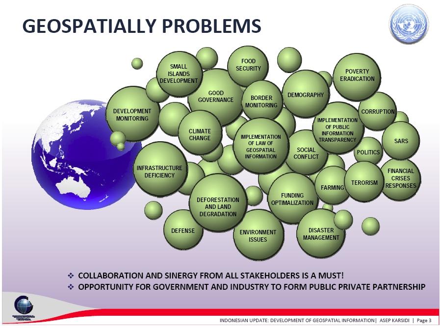
INDONESIA S S UPDATE: GEOSPATIAL INFORMATION FOR SUSTAINABLE DEVELOPMENT RELATED TO INA SDI Dr. Asep Karsidi, M.Sc
 INDONESIA S S UPDATE: GEOSPATIAL INFORMATION FOR SUSTAINABLE DEVELOPMENT RELATED TO INA SDI Dr. Asep Karsidi, M.Sc GEOSPATIAL INFORMATION AGENCY 08 August, 2012 OUTLINE 1. Transformation Bakosurtanal into
Qatar s Nation-Wide GIS Cooperation on Local and Regional Levels
 Qatar s Nation-Wide GIS Cooperation on Local and Regional Levels Dr. Mohammad Abd El-Wahab Hamouda GIS Consultant & Chairman of GIS Coordinators Group The Center for GIS State of Qatar Second High Level
SDI Development in Georgia. Mari Khardziani Head of International Relations Unit National Agency of Public Registry
 SDI Development in Georgia Mari Khardziani Head of International Relations Unit National Agency of Public Registry Kehl, Germany September 5, 2017 2 National Agency of Public Registry Legal Entity of Public
GIS Workshop Data Collection Techniques
 GIS Workshop Data Collection Techniques NOFNEC Conference 2016 Presented by: Matawa First Nations Management Jennifer Duncan and Charlene Wagenaar, Geomatics Technicians, Four Rivers Department QA #: FRG
Status and Challenges on Geo-DRM Information Systems in Tonga
 Name: Mafua- i-vai utukakau Maka Status and Challenges on Geo-DRM Information Systems in Tonga 1 Roles and Relationships Land and Geographic Information Systems (LGIS) Unit: Establish updated high-resolution
INTRODUCTION TO GEOGRAPHIC INFORMATION SYSTEM By Reshma H. Patil
 INTRODUCTION TO GEOGRAPHIC INFORMATION SYSTEM By Reshma H. Patil ABSTRACT:- The geographical information system (GIS) is Computer system for capturing, storing, querying analyzing, and displaying geospatial
Exploit your geodata to enable smart cities and countries
 Exploit your geodata to enable smart cities and countries Carsten Rönsdorf, Head of Advisory Services Middle East Practice Manager Future Cities, standards and 3D 24 November 2014 Importance of Standards
CLLD Cooperation OFFER
 Title of the proposed project (English) CLLD Cooperation OFFER PARKS PROTECTION III - Management, Protection and Economic Development in Protected Areas Type of project (select as many as you want) Cooperation
Internet GIS Sites. 2 OakMapper webgis Application
 Internet GIS Sites # Name URL Description 1 City of Sugar Land http://www.sugarlandtx.gov/index.htm It is a city in Texas with 65,000 Residents. The City of Sugar Land, Texas, provides ArcIMS-based maps
The Global Statistical Geospatial Framework and the Global Fundamental Geospatial Themes
 The Global Statistical Geospatial Framework and the Global Fundamental Geospatial Themes Sub-regional workshop on integration of administrative data, big data and geospatial information for the compilation
Enhancing Louisiana s GNIS
 Enhancing Louisiana s GNIS An Outreach Effort Between USGS and the Louisiana Geographic Information Center Louisiana Remote Sensing and GIS Workshop Lafayette, LA April 28, 2010 Louisiana Geographic Information
Coastal Viewer Mapping Application:
 Coastal Viewer Mapping Application: MAPPING OF COASTAL PUBLIC PROPERTY, THE COASTAL PROTECTION ZONE BOUNDARIES AND AUDITING OF STRUCTURES ON THE COASTAL PUBLIC PROPERTY 15 May 2014 INTEGRATED COASTAL MANAGEMENT
Use of Geospatial data for disaster managements
 Use of Geospatial data for disaster managements Source: http://alertsystemsgroup.com Instructor : Professor Dr. Yuji Murayama Teaching Assistant : Manjula Ranagalage What is GIS? A powerful set of tools
African requirements for SDI standardization Antony Cooper Operating Unit Fellow Built Environment CSIR PO Box 395, Pretoria, 0001, South Africa
 ISO/TC 211 workshop on spatial data infrastructures (SDIs) African requirements for SDI standardization Antony Cooper Operating Unit Fellow Built Environment CSIR PO Box 395, Pretoria, 0001, South Africa
Evaluating e-government : implementing GIS services in Municipality
 Evaluating e-government : implementing GIS services in Municipality Municipality of Thessaloniki - G.I.S. Unit Misirloglou Symeon Head of the GIS Unit ESRI UC - 2016 The GIS Section - subset of the department
Indicator: Proportion of the rural population who live within 2 km of an all-season road
 Goal: 9 Build resilient infrastructure, promote inclusive and sustainable industrialization and foster innovation Target: 9.1 Develop quality, reliable, sustainable and resilient infrastructure, including
Aboriginal communities strengthen governance with location-based tools in the 21st century
 Aboriginal communities strengthen governance with location-based tools in the 21st century Today, Aboriginal communities are taking advantage of the geomatics technologies that underpin popular online
Belfairs Academy GEOGRAPHY Fundamentals Map
 YEAR 12 Fundamentals Unit 1 Contemporary Urban Places Urbanisation Urbanisation and its importance in human affairs. Global patterns of urbanisation since 1945. Urbanisation, suburbanisation, counter-urbanisation,
2018 NASCIO Award Submission Category: Cross-Boundary Collaboration and Partnerships. Project Title: Tennessee Wildfires: A Coordinated GIS Response
 2018 NASCIO Award Submission Category: Cross-Boundary Collaboration and Partnerships Project Title: Tennessee Wildfires: A Coordinated GIS Response Sevier County, Tennessee State of Tennessee, Emergency
The Role of the Louisiana Geographic Information Center in the Response to Hurricane Katrina
 The Role of the Louisiana Geographic Information Center in the Response to Hurricane Katrina By: Jared Chapiewsky & Laura Brown For: URPL 969- GIS Applications in Response to Hurricane Katrina Date: March
LandScan Global Population Database
 LandScan Global Population Database The World s Finest Population Distribution Data Uncommon information. Extraordinary places. LandScan Global Population Database East View Cartographic is now offering
GEO Geohazards Community of Practice
 GEO Geohazards Community of Practice 1) Co-Chair of GHCP With input from: Stuart Marsh, GHCP Co-Chair Francesco Gaetani, GEO Secretariat and many GHCP contributors 1) Nevada Bureau of Mines and Geology
Excel Geomatics. Rajesh Paul Excel Geomatics Pvt. Ltd., Noida February, 2015 India Geospatial Forum, Hyderabad
 Excel Geomatics Geo-marketing for Product Sales and Customer Services Rajesh Paul Excel Geomatics Pvt. Ltd., Noida 10-12 February, 2015 India Geospatial Forum, Hyderabad Presentation Outline About Excel
Country Report On Sdi Activities In Singapore ( )
") UNITED NATIONS E/CONF.102/IP.4 ECONOMIC AND SOCIAL COUNCIL Nineteenth United Nations Regional Cartographic Conference for Asia and the Pacific Bangkok, 29 October 1 November 2012 Item 6(b) of the provisional
UNITED NATIONS E/CONF.102/IP.4 ECONOMIC AND SOCIAL COUNCIL Nineteenth United Nations Regional Cartographic Conference for Asia and the Pacific Bangkok, 29 October 1 November 2012 Item 6(b) of the provisional
CLICK HERE TO KNOW MORE
 CLICK HERE TO KNOW MORE GeoSpace for Singapore s Whole-of-Government Data Sharing Asia GeoSpatial Forum 17 19 Oct 2011 Lee Kim Haw Singapore Land Authority Introducing Singapore Land Authority Limited
CLIMATE CHANGE ADAPTATION BY MEANS OF PUBLIC PRIVATE PARTNERSHIP TO ESTABLISH EARLY WARNING SYSTEM
 CLIMATE CHANGE ADAPTATION BY MEANS OF PUBLIC PRIVATE PARTNERSHIP TO ESTABLISH EARLY WARNING SYSTEM By: Dr Mamadou Lamine BAH, National Director Direction Nationale de la Meteorologie (DNM), Guinea President,
Economic and Social Council
 United Nations Economic and Social Council Distr.: General 2 July 2012 E/C.20/2012/10/Add.1 Original: English Committee of Experts on Global Geospatial Information Management Second session New York, 13-15
E/CONF.105/115/CRP.115***
 E/CONF.105/115/CRP.115*** 30 June 2017 Original: English 11 th United Nations Conference on the Standardization of Geographical Names New York, 8-17 August 2017 Item 9a) of the provisional agenda* National
NSDI Policy Framework of Japan - Roles of the Private Sector in SDI -
 NSDI Policy Framework of Japan - Roles of the Private Sector in SDI - Hiroshi Murakami (GSI) Geospatial World Forum 2012 Amsterdam Background Survey Act (1949) mandates the (GSI) to develop and provide
The Efforts of Building GIS Infrastructure in a Newly Independent State: The case of Timor Leste *
 UNITED NATIONS E/CONF.100/IP.12 ECONOMIC AND SOCIAL COUNCIL Eighteenth United Nations Regional Cartographic Conference for Asia and the Pacific Bangkok, 26-29 October 2009 Item 7(b) of the provisional
INSPIRE Basics. Vlado Cetl European Commission Joint Research Centre. https://ec.europa.eu/jrc/
 INSPIRE Basics Vlado Cetl European Commission Joint Research Centre https://ec.europa.eu/jrc/ Serving society Stimulating innovation Supporting legislation Outline SDI? Why European SDI? INSPIRE Policy