Research on Lightning Nowcasting and Warning System and Its Application
|
|
|
- Angela White
- 5 years ago
- Views:
Transcription
1 Research on Lightning Nowcasting and Warning System and Its Application Wen Yao Chinese Academy of Meteorological Sciences Beijing, China
2 CONTENTS Lightning Hazards System Introduction System Application Future Work 2

3 Lightning hazards 3
4 Lightning hazards Fatalities Injuries About 1000 people, on average, have been dead or injured by lightning strikes every year in China. 4

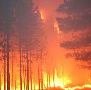


5 Lightning-attributed Forest fire 5

6 Oil depot Explosion 6

7 Power failures 7


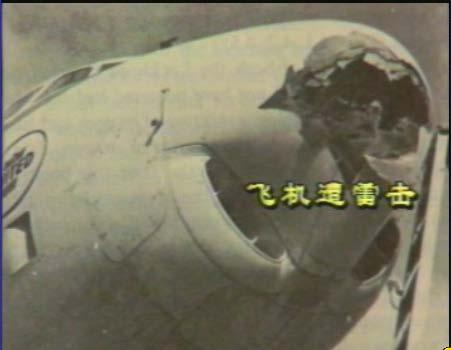
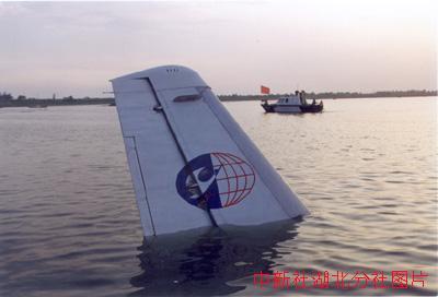
8 Lightning hazards Traffic Loss Aviation Loss 8
9 Lightning hazards Others, 2% Tree, 1.80% Building and structures, 7.80% Electric power equipment, 24.80% Loss types of lightning-caused objects Microelectronics devices, 34.50% Factory equipment, 6% Home and office appliances, 23.10% 9
10 CONTENTS Lightning Hazards System Introduction System Application Future Work 10

11 System Introduction The Lightning Nowcasting and Warning System (CAMS_LNWS) was developed by Chinese Academy of Meteorological Sciences (CAMS). The system proposed a lightning characteristic diagnose and nowcasting scheme in typical regions, and adopted a multi-data, multi-parameter and multialgorithm lightning nowcasting method. The CAMS_LNWS work 24 hours every day and renew the warning products every 15 minutes automatically, which can realize 0-1 hours, 1 1 km of lightning forecasting. 11


12 System Introduction Method Analyze the lightning activity in different areas of China Obtain the relationship of the lightning frequency and location with the radar, satellite and other observations during a thunderstorm Establish the diagnostic indicators of lightning forecasting analysis of lightning spacetime distribution characteristics analysis of lightning between and satellite data Characteristics of lightning activity at different stages. (Lightning Initiation development Ending) analysis of lightning between and Radar Data analysis of lightning between and Surface Electric Field Data 12


 of satellite Electromagnetic")
13 System Introduction Diagnostic Indicators Height of Radar strong echoes Maximum thickness of 35dBz Proportion of radar strong echoes Distribution of vertical velocity Horizontal gradient of composite reflectivity Maximum reflectivity within 14km around first stroke of stratiform CG Echo volume per flash Volume per frequency Black-Body Temperature(TBB) of satellite Electromagnetic signal threshold 13
14 Concerns: Lightning Initiation Lightning Ending Stratiform Regions Lightning 14


15 Key Method Lightning Initiation- Echo top height of 40dBz -10 stratification height Thunderstorm Non-Thunderstorm Echo top heights of dBz and -10 stratification height in different isolated cells Thunderstorm Non-Thunderstorm Echo top heights of dBz and 0 stratification height in different isolated cells 15
16 Key Method Lightning Initiation- P value should be used for subsidiary discrimination P= Volume (Reflectivity 40dBz and Height 0 height) Volume (Reflectivity 25dBz and Height 0 height) 100% P>5% Echo top of 40dBz 0 height No Non-thunderstorm First lightning Yes Echo top of 40dBz -10 height No p 5% And Keep above for two radar scan time Yes Yes No Thunderstorm, Lightning will occur in 15 minutes 16
17 Key Method Lightning Ending 1 Volume / Volume 18 < 1% 2 Volume (Reflectivity 30dBz and Height -15 height) <230km 3 3 Echo top height of 40dBz < -20 height We can combine the conditions of 1, 2, 3 to forecast lightning ending. 17


18 Key Method Stratiform regions Lightning Most researches aimed at the lightning activity in the convective region Higher fault alarm rate in statiform region Statiform regions lightning some statiform region with higher reflectivity are corresponding to the weak lightning activity 18
19 Key Method Maximum reflectivity above first stroke point of stratiform CG Maximum reflectivity within 14 km around first strok point of stratiform CG 10 9 Height of maximum reflectivity within 14 km around first stroke point of stratiform CG Cloud-to-ground lightning (flashes) Height (km) Cloud-to-ground lightning (flashes) Reflectivity (dbz) Analyze the Height and maximum reflectivity of stratiform CGs strike the ground at or near the edge of a region, and refer to the distinguish method of stratiform and convective region proposed by Steiner et al. (1995), and later improved by Biggerstaff and Listemaa, zhong, Xiao et al (2007), We adopt identify algorithm to forecast the lightning activity in the stratiform and convective regions. 19


20 10:00-15:00 Jun 29,2015 Observation After using the identify method Before using the identify method
 Technology (?) Product (?) Evaluate (?")
21 Technology Design Scheme Input Data (?) Technology (?) Product (?) Evaluate (?) 21
22 Technology Input建立了均 Data Multi-source observation data: sounding data, satellite, radar, lightning, surface electric field data and so on.(from large temporal spatial scale to small temporal spatial scale) Large temporal -spatial scale Synoptic Situation Statistical analysis of archival data. Lightning occurrence probability in 0-24 h based on synoptic situation forecasting products Sounding Data Temporal Resolution: 12 h Spatial Resolution: 200km 200 km Parameters: several instability parameters Products: Lightning occurrence probability in this region during 0~12 h Integrated Forecasting Technology Model Products Satellite Data Input: Sounding Data Temporal Resolution: 12h Spatial Resolution: 200 km 200 km Model: 2D Electrification-Discharge Thunderstorm Model Product: Lightning occurrence probability in this region during 0~12 h Temporal Resolution: 30min-1h Spatial Resolution: km Parameters: TBB et. al. Product: Lightning occurrence probability in each grid during 0~2 h Radar Data Temporal Resolution: 6 min Spatial Resolution: 1 km 1 km Parameters: Echo Intensity and its Variability Rate, Echo Tops et. al. Product: Lightning occurrence probability in each grid during 0~2 h Small temporal -spatial scale Surface Electric Field Data Lightning Detection Data To identify and track lightning activity area with real-time data from lightning location system. To forecast potential lightning activity area Observation by single station or network. Real-time detection of ground electric field and lightning activity. To forecast lightning occurrence probability in the vicinal region 22

23 Technology Technology The system was designed in framework and modularization. Based on algorithm of area identification, tracing and extrapolation algorithm and decision trees algorithm Considering different data situation, the system can not only use single data application module to produce forecasting result for different temporal and special scales, but also synthesis different application module to generate products through weight combination method. Forecasting Products for Different Temporal and Special Scales Model Forecasting Application Module Sounding Data Application Module Satellite Data Application Module Radar Data Application Module Ground Electric Field Data Application Module Lightning Data Application Module Decision Tree Region recognition, tracing, extrapolation Synthesis Forecast -ing Module Lightning Occurrence Probability Moving Trend of Lightning Activity Area Lightning Occurrence Probability of Key Area Potential Forecasting for Lightning Activity Voice alarm 23


, Fault Alarm Rate (FAR) and Threat Score (Ts).")

24 Technology Product In order to meet the different needs of public meteorological service and special meteorological service, three kinds of Lightning nowcasting and warning products were showed. In order to make an objective assessment of result, we also evaluate the accuracy of the warning products by Probability of Detection (POD), Fault Alarm Rate (FAR) and Threat Score (Ts). Lightning Occurrence Probability Lightning Occurrence Probability of Key Area Moving Trend of Lightning Activity Area Evalution of pruducts in real time 24
25 CONTENTS Lightning Hazards System Introduction System Application Future Work 25

26 CAMS_LNWS Application Tianjin: 11:00-20:00, June 16, Severe weather hit Tianjin, with thunder storms, heavy rainfall and strong winds. Mean value Sample number Forecast results in 15minutes intervals Case of Tianjin POD 0.81 FAR 0.67 TS 0.31 Evaluation results 36 26

27 CAMS_LNWS Application Guangdong:16:00-23:45, July 18, Case of Guangdong in Southern China 27

28 CAMS_LNWS Application Case of Henan in central of China 28

29 CAMS_LNWS Application 0~15min 15~30min Key Region 30~45min 45~60min Moving trend Case of Shanghai during the World Expo


30 CAMS_LNWS Application Public services Lightning nowcasting and warning products Application for public meteorological service Special service forestry Electric power Tourism Telecom Application in forestry department Application in electric power department 30
31 CONTENTS Lightning Hazards System Introduction System Application Future Work 31
32 Future Work 0~2h lightning nowcasting : Regional lightning nowcasting index and algorithm should be improved further to decrease FAR. 0~ 6h lightning short-term forecast: Developing the coupling of charge-discharge model of thunderclouds with meso-scale model to develop a 0~6 hour numerical forecasting method. 32
33 Future Work Lightning nowcasting and warning system 2h 2h 6h 18h Lightning numerical Prediction system 6h 6h 18h 18h Lightning potential forecasting system 33

34 34
Research on Experiment of Lightning Nowcasting and Warning System in Electric Power Department of HeNan
 Research on Experiment of Lightning Nowcasting and Warning System in Electric Power Department of HeNan Ning Zhou 1) 周宁 Zhe LI 1) 李哲 Wen YAO 2) 姚雯 Qing MENG 2) 孟青 1) State Grid Henan Electric Power Research
RESEARCH ON EXPERIMENT AND EVALUATION OF LIGHTNING NOWCASTING AND WARNING SYSTEM
 RESEARCH ON EXPERIMENT AND EVALUATION OF LIGHTNING NOWCASTING AND WARNING SYSTEM Qing MENG Ying MA Wen YAO Yuheng SHI Weitao LU Yijun ZHANG Laboratory of Lightning Physics and Protection Engineering, Chinese
Research on Jumps Characteristic of Lightning Activities in. a Hailstorm
 Research on Jumps Characteristic of Lightning Activities in a Hailstorm YAO Wen, MA Ying, MENG Qing (Chinese Academy of Meteorological Sciences, Beijing, China) 1. INTRODUCTION In hail cloud, there exist
Xinhua Liu National Meteorological Center (NMC) of China Meteorological Administration (CMA)
 of China Meteorological Administration (CMA)") The short-time forecasting and nowcasting technology of severe convective weather for aviation meteorological services in China Xinhua Liu National Meteorological Center (NMC) of China Meteorological Administration
The short-time forecasting and nowcasting technology of severe convective weather for aviation meteorological services in China Xinhua Liu National Meteorological Center (NMC) of China Meteorological Administration
Nowcasting techniques in use for severe weather operation in NMC/CMA
 WWRP NMRWG Buenos Aires Aug 2017 Nowcasting techniques in use for severe weather operation in NMC/CMA Jianjie WANG National Meteorological Center, CMA Cascading Weather Forecasting Process --- different
DISTRIBUTION AND DIURNAL VARIATION OF WARM-SEASON SHORT-DURATION HEAVY RAINFALL IN RELATION TO THE MCSS IN CHINA
 3 DISTRIBUTION AND DIURNAL VARIATION OF WARM-SEASON SHORT-DURATION HEAVY RAINFALL IN RELATION TO THE MCSS IN CHINA Jiong Chen 1, Yongguang Zheng 1*, Xiaoling Zhang 1, Peijun Zhu 2 1 National Meteorological
Techniques of Severe Convective Weather Comprehensive Monitoring
 Techniques of Severe Convective Weather Comprehensive Monitoring Yongguang Zheng, Lin Yinjing, Zhu Wenjian, Lan Yu, Tang Wenyuan, Zhang Xiaoling, Mao Dongyan, Zhou Qingliang, Zhang Zhigang Severe Weather
Lightning Detection Systems
 Lightning Detection Systems Roger Carter, Spectrum Manager, UK Met Office ITU/WMO SEMINAR ON USE OF RADIO SPECTRUM FOR METEOROLOGY. 16 18 September 2009 Lightning Detection Systems Table of Contents Introduction
Communicating uncertainty from short-term to seasonal forecasting
 Communicating uncertainty from short-term to seasonal forecasting MAYBE NO YES Jay Trobec KELO-TV Sioux Falls, South Dakota USA TV weather in the US Most TV weather presenters have university degrees and
Research on Lightning Warning with SAFIR Lightning Observation and Meteorological detection Data in Beijing-Hebei Areas
 Research on Lightning Warning with SAFIR Lightning Observation and Meteorological detection Data in Beijing-Hebei Areas Meng Qing 1 Zhang Yijun 1 Yao Wen 1 Zhu Xiaoyan 1 He Ping 1 Lv Weitao 1 Ding Haifang
Figure 5: Comparison between SAFIR warning and radar-based hail detection for the hail event of June 8, 2003.
 SAFIR WARNING : Expected risk Radar-based Probability of Hail 0915 0930 0945 1000 Figure 5: Comparison between SAFIR warning and radar-based hail detection for the hail event of June 8, 2003. Lightning
Performance of TANC (Taiwan Auto- Nowcaster) for 2014 Warm-Season Afternoon Thunderstorm
 for 2014 Warm-Season Afternoon Thunderstorm") Performance of TANC (Taiwan Auto- Nowcaster) for 2014 Warm-Season Afternoon Thunderstorm Wei-Peng Huang, Hui-Ling Chang, Yu-Shuang Tang, Chia-Jung Wu, Chia-Rong Chen Meteorological Satellite Center, Central
Performance of TANC (Taiwan Auto- Nowcaster) for 2014 Warm-Season Afternoon Thunderstorm Wei-Peng Huang, Hui-Ling Chang, Yu-Shuang Tang, Chia-Jung Wu, Chia-Rong Chen Meteorological Satellite Center, Central
Verification and performance measures of Meteorological Services to Air Traffic Management (MSTA)
") Verification and performance measures of Meteorological Services to Air Traffic Management (MSTA) Background Information on the accuracy, reliability and relevance of products is provided in terms of verification
Verification and performance measures of Meteorological Services to Air Traffic Management (MSTA) Background Information on the accuracy, reliability and relevance of products is provided in terms of verification
Thunderstorm Forecasting and Warnings in the US: Applications to the Veneto Region
 Thunderstorm Forecasting and Warnings in the US: Applications to the Veneto Region Bill Conway Vice President Weather Decision Technologies Norman, Oklahoma, USA Andrea Rossa ARPAV Lead Scientist Centre
2014 海峽兩岸暨香港地區航空氣象技術講座
 2014 海峽兩岸暨香港地區航空氣象技術講座 P W Li Vice chair Hong Kong Meteorological Society Senior Scientific Officer, Hong Kong Observatory pwli@hko.gov.hk www.meteorology.org.hk GUANGZHOU FIR HK FIR TAIPEI FIR About 276,000
LECTURE #15: Thunderstorms & Lightning Hazards
 GEOL 0820 Ramsey Natural Disasters Spring, 2018 LECTURE #15: Thunderstorms & Lightning Hazards Date: 1 March 2018 (lecturer: Dr. Shawn Wright) I. Severe Weather Hazards focus for next few weeks o somewhat
CLIMATE CHANGE ADAPTATION BY MEANS OF PUBLIC PRIVATE PARTNERSHIP TO ESTABLISH EARLY WARNING SYSTEM
 CLIMATE CHANGE ADAPTATION BY MEANS OF PUBLIC PRIVATE PARTNERSHIP TO ESTABLISH EARLY WARNING SYSTEM By: Dr Mamadou Lamine BAH, National Director Direction Nationale de la Meteorologie (DNM), Guinea President,
CHARACTERISATION OF STORM SEVERITY BY USE OF SELECTED CONVECTIVE CELL PARAMETERS DERIVED FROM SATELLITE DATA
 CHARACTERISATION OF STORM SEVERITY BY USE OF SELECTED CONVECTIVE CELL PARAMETERS DERIVED FROM SATELLITE DATA Piotr Struzik Institute of Meteorology and Water Management, Satellite Remote Sensing Centre
Vaisala s NLDN and GLD360 performance improvements and aviation applications. Nick Demetriades Head of Airports Vaisala 2015 Fall FPAW
 Vaisala s NLDN and GLD360 performance improvements and aviation applications Nick Demetriades Head of Airports Vaisala 2015 Fall FPAW Introduction Continuous CONUS Data Since 1989 The U.S. National Lightning
Update on CoSPA Storm Forecasts
 Update on CoSPA Storm Forecasts Haig August 2, 2011 This work was sponsored by the Federal Aviation Administration under Air Force Contract No. FA8721-05-C-0002. Opinions, interpretations, conclusions,
1.29 LIFE CYCLE OF CONVECTIVE CELLS WITH RAPID SCAN SATELLITE AND RADAR DATA IN THE EASTERN ALPINE REGION
 1.29 LIFE CYCLE OF CONVECTIVE CELLS WITH RAPID SCAN SATELLITE AND RADAR DATA IN THE EASTERN ALPINE REGION Friedrich Wölfelmaier 1, Veronika Zwatz-Meise 2 1 ZAMG, Regional center Styria, Graz, Austria,
SWAN The Operational System for Nowcasting and Very-short Range Forecast in CMA
 SWAN The Operational System for Nowcasting and Very-short Range Forecast in CMA National Meteorological Center (NMC) China Meteorological Administration (CMA) Mao Dongyan, Zheng Yuanyuan, Zhou Kanghui
Small- and large-current cloud-to-ground lightning over southern China
 2014 International Conference on Lightning Protection (ICLP), Shanghai, China Small- and large-current cloud-to-ground lightning over southern China Dong Zheng, Yijun Zhang, Qing Meng State Key Laboratory
Description of the case study
 Description of the case study During the night and early morning of the 14 th of July 011 the significant cloud layer expanding in the West of the country and slowly moving East produced precipitation
Unique Vaisala Global Lightning Dataset GLD360 TM
 Unique Vaisala Global Lightning Dataset GLD360 TM / THE ONLY LIGHTNING DETECTION NETWORK CAPABLE OF DELIVERING HIGH-QUALITY DATA ANYWHERE IN THE WORLD GLD360 provides high-quality lightning data anywhere
Vaisala Blitzdetektion. Michael Kalkum
 Vaisala Blitzdetektion Michael Kalkum 12.11.2013 What Is Lightning? Lightning is a transient, high-current electrical discharge Lightning stroke is typically 30.000 C Lightning takes the path of least
Guidance on Aeronautical Meteorological Observer Competency Standards
 Guidance on Aeronautical Meteorological Observer Competency Standards The following guidance is supplementary to the AMP competency Standards endorsed by Cg-16 in Geneva in May 2011. Format of the Descriptions
RDT-CW: TOWARD A MULTIDIMENSIONAL DESCRIPTION OF CONVECTION
 RDT-CW: TOWARD A MULTIDIMENSIONAL DESCRIPTION OF CONVECTION Jean-Marc Moisselin, Frederic Autonès Météo-France, DPREVI/PI, 42 avenue G. Coriolis 31057 Toulouse, France Abstract RDT-CW (Rapid Development
Satellite-based Convection Nowcasting and Aviation Turbulence Applications
 Satellite-based Convection Nowcasting and Aviation Turbulence Applications Kristopher Bedka Cooperative Institute for Meteorological Satellite Studies (CIMSS), University of Wisconsin-Madison In collaboration
Improving real time observation and nowcasting RDT. E de Coning, M Gijben, B Maseko and L van Hemert Nowcasting and Very Short Range Forecasting
 Improving real time observation and nowcasting RDT E de Coning, M Gijben, B Maseko and L van Hemert Nowcasting and Very Short Range Forecasting Introduction Satellite Application Facilities (SAFs) are
Reprint 797. Development of a Thunderstorm. P.W. Li
 Reprint 797 Development of a Thunderstorm Nowcasting System in Support of Air Traffic Management P.W. Li AMS Aviation, Range, Aerospace Meteorology Special Symposium on Weather-Air Traffic Management Integration,
Instituto de Pesquisas Meteorológicas - IPMet Universidade Estadual Paulista - Unesp
 IPMET WEB GIS APPLICATION FOR SEVERE WEATHER ALERT AND DECISION SUPPORT Jaqueline Murakami Kokitsu Instituto de Pesquisas Meteorológicas - IPMet Universidade Estadual Paulista - Unesp IPMet/Unesp Meteorological
Civil protection. (public, government and local authorities institutions)
") 23 Civil protection (public, government and local authorities institutions) Overview Statistics from the Centre for Research on the Epidemiology of Disasters (CRED) at the University of Leuven, Belgium,
23 Civil protection (public, government and local authorities institutions) Overview Statistics from the Centre for Research on the Epidemiology of Disasters (CRED) at the University of Leuven, Belgium,
W.H. Leung, W.M. Ma and H.K. Yeung Hong Kong Observatory, Hong Kong, China
 322 THE APPLICATION OF LIGHTNING DENSITY MAP IN THE ANALYSIS OF A SEVERE RAINSTORM CASE IN HONG KONG W.H. Leung, W.M. Ma and H.K. Yeung Hong Kong Observatory, Hong Kong, China 1. INTRODUCTION On 22 July
Activities and Outlook related to Disaster Reduction in CMA
 Activities and Outlook related to Disaster Reduction in CMA WANG Bangzhong China Meteorological Administration March 15-17 2006 ADENDA Situation about MD and related disasters in CHINA Guidance for MD/RD
Use of lightning data to improve observations for aeronautical activities
 Use of lightning data to improve observations for aeronautical activities Françoise Honoré Jean-Marc Yvagnes Patrick Thomas Météo_France Toulouse France I Introduction Aeronautical activities are very
Convection Nowcasting Products Available at the Army Test and Evaluation Command (ATEC) Ranges
 Ranges") Convection Nowcasting Products Available at the Army Test and Evaluation Command (ATEC) Ranges Cathy Kessinger National Center for Atmospheric Research (NCAR), Boulder, CO with contributions from: Wiebke
Convection Nowcasting Products Available at the Army Test and Evaluation Command (ATEC) Ranges Cathy Kessinger National Center for Atmospheric Research (NCAR), Boulder, CO with contributions from: Wiebke
0-6 hour Weather Forecast Guidance at The Weather Company. Steven Honey, Joseph Koval, Cathryn Meyer, Peter Neilley The Weather Company
 1 0-6 hour Weather Forecast Guidance at The Weather Company Steven Honey, Joseph Koval, Cathryn Meyer, Peter Neilley The Weather Company TWC Forecasts: Widespread Adoption 2 0-6 Hour Forecast Details 3
Unique Vaisala Global Lightning Dataset GLD360 TM
 Unique Vaisala Global Lightning Dataset GLD360 TM / THE ONLY LIGHTNING DETECTION NETWORK CAPABLE OF DELIVERING SUCH HIGH-QUALITY DATA ANYWHERE IN THE WORLD GLD360 provides high-quality lightning data anywhere
Emerging Needs, Challenges and Response Strategy
 Emerging Needs, Challenges and Response Strategy Development of Integrated Observing Systems in China JIAO Meiyan Deputy Administrator China Meteorological Administration September 2011 Geneva Outline
Strategic Radar Enhancement Project (SREP) Forecast Demonstration Project (FDP) The future is here and now
 Forecast Demonstration Project (FDP) The future is here and now") Strategic Radar Enhancement Project (SREP) Forecast Demonstration Project (FDP) The future is here and now Michael Berechree National Manager Aviation Weather Services Australian Bureau of Meteorology
Strategic Radar Enhancement Project (SREP) Forecast Demonstration Project (FDP) The future is here and now Michael Berechree National Manager Aviation Weather Services Australian Bureau of Meteorology
Vertically Integrated Ice A New Lightning Nowcasting Tool. Matt Mosier. NOAA/NWS Fort Worth, TX
 P686 Vertically Integrated Ice A New Lightning Nowcasting Tool Matt Mosier NOAA/NWS Fort Worth, TX 1. BACKGROUND AND METHODOLOGY Lightning is a frequent and dangerous phenomenon, especially in the summer
Nowcasting thunderstorms for aeronautical end-users
 Nowcasting thunderstorms for aeronautical end-users Jean-Marc Moisselin Météo-France, Nowcasting Department co-authors: Céline Jauffret (Météo-France) Overview Introduction SAT RADAR NWP image crédit:
CLASSIFICATION OF CONVECTIVE AND STRATIFORM CELLS IN METEOROLOGICAL RADAR IMAGES USING SVM BASED ON A TEXTURAL ANALYSIS
 CLASSIFICATION OF CONVECTIVE AND STRATIFORM CELLS IN METEOROLOGICAL RADAR IMAGES USING SVM BASED ON A TEXTURAL ANALYSIS Abdenasser Djafri 1 and Boualem Haddad 2 1,2 Department of Telecommunication, University
TIFS DEVELOPMENTS INSPIRED BY THE B08 FDP. John Bally, A. J. Bannister, and D. Scurrah Bureau of Meteorology, Melbourne, Victoria, Australia
 P13B.11 TIFS DEVELOPMENTS INSPIRED BY THE B08 FDP John Bally, A. J. Bannister, and D. Scurrah Bureau of Meteorology, Melbourne, Victoria, Australia 1. INTRODUCTION This paper describes the developments
Seamless nowcasting. Open issues
 Federal Department of Home Affairs FDHA Federal Office of Meteorology and Climatology MeteoSwiss Seamless nowcasting INCA Open issues Pierre Eckert Matteo Buzzi, Marco Sassi, Guido della Bruna, Marco Gaia
DETECTION AND FORECASTING - THE CZECH EXPERIENCE
 1 STORM RAINFALL DETECTION AND FORECASTING - THE CZECH EXPERIENCE J. Danhelka * Czech Hydrometeorological Institute, Prague, Czech Republic Abstract Contribution presents the state of the art of operational
Aurora Bell*, Alan Seed, Ross Bunn, Bureau of Meteorology, Melbourne, Australia
 15B.1 RADAR RAINFALL ESTIMATES AND NOWCASTS: THE CHALLENGING ROAD FROM RESEARCH TO WARNINGS Aurora Bell*, Alan Seed, Ross Bunn, Bureau of Meteorology, Melbourne, Australia 1. Introduction Warnings are
Long term analysis of convective storm tracks based on C-band radar reflectivity measurements
 Long term analysis of convective storm tracks based on C-band radar reflectivity measurements Edouard Goudenhoofdt, Maarten Reyniers and Laurent Delobbe Royal Meteorological Institute of Belgium, 1180
MSG FOR NOWCASTING - EXPERIENCES OVER SOUTHERN AFRICA
 MSG FOR NOWCASTING - EXPERIENCES OVER SOUTHERN AFRICA Estelle de Coning and Marianne König South African Weather Service, Private Bag X097, Pretoria 0001, South Africa EUMETSAT, Am Kavalleriesand 31, D-64295
Concurrent Upward Lightning Flashes from Two Towers
 ATMOSPHERIC AND OCEANIC SCIENCE LETTERS, 2014, VOL. 7, NO. 3, 260 264 Concurrent Upward Lightning Flashes from Two Towers JIANG Ru-Bin 1, 2, SUN Zhu-Ling 1, and WU Zhi-Jun 1 1 Key Laboratory of Middle
VAISALA GLOBAL LIGHTNING DATASET GLD360
 VAISALA GLOBAL LIGHTNING DATASET GLD360 Technology, operations, and applications overview JULY 2009 MIke Grogan Application Services Manager Observation Services Nick Demetriades Applications Manager,
Cb-LIKE: thunderstorm forecasts up to 6 hrs with fuzzy logic
 Cb-LIKE: thunderstorm forecasts up to 6 hrs with fuzzy logic Martin Köhler DLR Oberpfaffenhofen 15th EMS/12th ECAM 07 11 September, Sofia, Bulgaria Long-term forecasts of thunderstorms why? -> Thunderstorms
Page 1/8 Long duration validation of PGE11. SAF - Nowcasting Product Assessment Review Worshop (Madrid ctober 2005
 Page 1/8 Plan Research activity (visiting scientist: Oleksiy Kryvobok) Use of other PGEs and HRVis for RDT improvement Tuning PGE11 satellite-based discrimination using SEVIRI data Long duration validation
Satellite-based thunderstorm tracking, monitoring and nowcasting over South Africa
 Satellite-based thunderstorm tracking, monitoring and nowcasting over South Africa Caroline Forster 1, Estelle de Coning 2, Sebastian Diebel 1, Tobias Zinner 3 EUMETSAT Meteorological Satellite Conference
Aviation Hazards: Thunderstorms and Deep Convection
 Aviation Hazards: Thunderstorms and Deep Convection TREND Diagnosis of thunderstorm hazards using imagery Contents Satellite imagery Visible, infrared, water vapour Basic cloud identification Identifying
III. Section 3.3 Vertical air motion can cause severe storms
 III. Section 3.3 Vertical air motion can cause severe storms http://www.youtube.com/watch?v=nxwbr60tflg&feature=relmfu A. Thunderstorms form from rising moist air Electrical charges build up near the tops
Deep Thunder. Local Area Precision Forecasting for Weather-Sensitive Business Operations (e.g. Electric Utility)
") 1 Deep Thunder Local Area Precision Forecasting for Weather-Sensitive Business Operations (e.g. Electric Utility) Dipl. Ing. Helmut Ludwar Chief Technologist Wien, im Oktober 2010 Forecasts for Weather-Sensitive
1 Deep Thunder Local Area Precision Forecasting for Weather-Sensitive Business Operations (e.g. Electric Utility) Dipl. Ing. Helmut Ludwar Chief Technologist Wien, im Oktober 2010 Forecasts for Weather-Sensitive
PAGASA s Expectations of New-generation Satellites for Hazard Monitoring
 Country Report Philippines PAGASA s Expectations of New-generation Satellites for Hazard Monitoring VICENTE P. PALCON, JR. (Assistant Weather Services Chief) Weather Division- PAGASA DOST Email: vppalconjr@pagasa.dost.gov.ph
3 Severe Weather. Critical Thinking
 CHAPTER 2 3 Severe Weather SECTION Understanding Weather BEFORE YOU READ After you read this section, you should be able to answer these questions: What are some types of severe weather? How can you stay
THE IMPACT OF WEATHER
 The United States is the most severe weather prone country in the world. Each year, people in this country cope with an average of 10,000 thunderstorms, 5,000 floods, 1,200 tornadoes and two landfalling
"Experiences with use of EUMETSAT MPEF GII product for convection/storm nowcasting"
 "Experiences with use of EUMETSAT MPEF GII product for convection/storm nowcasting" Marianne König 1, Monika Pajek 2, Piotr Struzik 2 1) EUMETSAT 2) Institute of Meteorology and Water Management, Kraków,
Regional Flash Flood Guidance and Early Warning System
 WMO Training for Trainers Workshop on Integrated approach to flash flood and flood risk management 24-28 October 2010 Kathmandu, Nepal Regional Flash Flood Guidance and Early Warning System Dr. W. E. Grabs
Study of thunderstorm characteristic with SAFIR lightning and electric field meter observations in Beijing Areas
 2006 19th International Lightning Detection Conference 24-25 April Tucson, Arizona, USA 1st International Lightning Meteorology Conference 26-27 April Tucson, Arizona, USA Study of thunderstorm characteristic
LIGHTNING WARNING STATION OPERATIONAL SYSTEM FOR ADVANCED LIGHTNING WARNING. P.Richard, DIMENSIONS,
 LIGHTNING WARNING STATION OPERATIONAL SYSTEM FOR ADVANCED LIGHTNING WARNING P.Richard, DIMENSIONS, 91194 Saint Aubin Cedex, France I INTRODUCTION Efficiency and Safety are determinant factors in many different
Introduction to Meteorology and Weather Forecasting
 Introduction to Meteorology and Weather Forecasting ENVI1400 : Meteorology and Forecasting : lecture 1 2 040909 ENVI1400 : Meteorology and Forecasting : lecture 1 3 040914 ENVI1400 : Meteorology and Forecasting
Probabilistic Quantitative Precipitation Forecasts for Tropical Cyclone Rainfall
 Probabilistic Quantitative Precipitation Forecasts for Tropical Cyclone Rainfall WOO WANG CHUN HONG KONG OBSERVATORY IWTCLP-III, JEJU 10, DEC 2014 Scales of Atmospheric Systems Advection-Based Nowcasting
Warning procedures for extreme events in the Emilia-Romagna Region
 Warning procedures for extreme events in the Emilia-Romagna Region Anna Fornasiero, Miria Celano, Roberta Amorati, Virginia Poli and Pier Paolo Alberoni Arpa Emilia-Romagna Hydro-Meteo-Climate Service,
National Public Weather and Warning Services in the Swaziland Meteorological Service Dennis S.Mkhonta /
 National Public Weather and Warning Services in the Swaziland Meteorological Service Dennis S.Mkhonta dennis.mkhonta@gmail.com / dennis@swazimet.gov.sz Introduction Swaziland s geographical position exposes
National Convective Weather Forecasts Cindy Mueller
 National Convective Weather Forecasts Cindy Mueller National Center for Atmospheric Research Research Applications Program National Forecast Demonstration 2-4-6 hr Convection Forecasts Collaborative forecast
ADL110B ADL120 ADL130 ADL140 How to use radar and strike images. Version
 ADL110B ADL120 ADL130 ADL140 How to use radar and strike images Version 1.00 22.08.2016 How to use radar and strike images 1 / 12 Revision 1.00-22.08.2016 WARNING: Like any information of the ADL in flight
J8.4 NOWCASTING OCEANIC CONVECTION FOR AVIATION USING RANDOM FOREST CLASSIFICATION
 J8.4 NOWCASTING OCEANIC CONVECTION FOR AVIATION USING RANDOM FOREST CLASSIFICATION Huaqing Cai*, Cathy Kessinger, David Ahijevych, John Williams, Nancy Rehak, Daniel Megenhardt and Matthias Steiner National
Report on the U.S. NLDN System-wide Upgrade. Vaisala's U.S. National Lightning Detection Network
 Michael J. Grogan Product Manager, Network Data and Software Vaisala Tucson, USA Vaisala's U.S. National Lightning Detection Network Report on the 2002-2003 U.S. NLDN System-wide Upgrade Two years ago,
Localized Aviation Model Output Statistics Program (LAMP): Improvements to convective forecasts in response to user feedback
: Improvements to convective forecasts in response to user feedback") Localized Aviation Model Output Statistics Program (LAMP): Improvements to convective forecasts in response to user feedback Judy E. Ghirardelli National Weather Service Meteorological Development Laboratory
Localized Aviation Model Output Statistics Program (LAMP): Improvements to convective forecasts in response to user feedback Judy E. Ghirardelli National Weather Service Meteorological Development Laboratory
WEATHER AND CLIMATE EXTREMES MONITORING BASED ON SATELLITE OBSERVATION : INDONESIA PERSPECTIVE RIRIS ADRIYANTO
 WEATHER AND CLIMATE EXTREMES MONITORING BASED ON SATELLITE OBSERVATION : INDONESIA PERSPECTIVE RIRIS ADRIYANTO INDONESIA AGENCY FOR METEOROLOGY, CLIMATOLOGY AND GEOPHYSICS (BM KG) 1. INTRODUCTION - BMKG
High-Resolution Mesoscale Analysis Data from the South China Heavy Rainfall Experiment (SCHeREX): Data Generation and Quality Evaluation
: Data Generation and Quality Evaluation") 478 ACTA METEOROLOGICA SINICA VOL.25 High-Resolution Mesoscale Analysis Data from the South China Heavy Rainfall Experiment (SCHeREX): Data Generation and Quality Evaluation NI Yunqi 1 ( ), CUI Chunguang
478 ACTA METEOROLOGICA SINICA VOL.25 High-Resolution Mesoscale Analysis Data from the South China Heavy Rainfall Experiment (SCHeREX): Data Generation and Quality Evaluation NI Yunqi 1 ( ), CUI Chunguang
Weather Radar and A3 Introduction
 Weather Radar and A3 Introduction The term RADAR is an acronym formed from the term Radio Detection and Ranging. Nikola Tesla (of electric car fame) suggested in 1900 that moving targets should be observable
BY REAL-TIME ClassZR. Jeong-Hee Kim 1, Dong-In Lee* 2, Min Jang 2, Kil-Jong Seo 2, Geun-Ok Lee 2 and Kyung-Eak Kim 3 1.
 P2.6 IMPROVEMENT OF ACCURACY OF RADAR RAINFALL RATE BY REAL-TIME ClassZR Jeong-Hee Kim 1, Dong-In Lee* 2, Min Jang 2, Kil-Jong Seo 2, Geun-Ok Lee 2 and Kyung-Eak Kim 3 1 Korea Meteorological Administration,
Performance of a Probabilistic Cloud-to-Ground Lightning Prediction Algorithm
 Performance of a Probabilistic Cloud-to-Ground Lightning Prediction Algorithm John Cintineo 1,2,3 * Valliappa Lakshmanan 1,2, Travis Smith 1,2 Abstract A probabilistic cloud- to- ground lightning algorithm
Radar and Lightning Observations of a Supercell Storm on 13 June 2014 from STORM973*
 Radar and Lightning Observations of a Supercell Storm on 13 June 2014 from STORM973* Dongxia Liu, Xiushu Qie, Yu Wang Dongfang Wang Institute of Atmospheric Physics, CAS, Beijing, China, 100029 liudx@mail.iap.ac.cn
NOWCASTING PRODUCTS BASED ON MTSAT-1R RAPID SCAN OBSERVATION. In response to CGMS Action 38.33
 CGMS-39, JMA-WP-08 Prepared by JMA Agenda Item: G.II/8 Discussed in WG II NOWCASTING PRODUCTS BASED ON MTSAT-1R RAPID SCAN OBSERVATION In response to CGMS Action 38.33 This document reports on JMA s MTSAT-1R
Investigation of Supercells in China : Environmental and Storm Characteristics
 11A.6 Investigation of Supercells in China : Environmental and Storm Characteristics Xiaoding Yu Xiuming Wang Juan Zhao Haiyan Fei ( China Meteorological Administration Training Center) Abstract Based
Road weather forecasts and MDSS in Slovakia
 ID: 0030 Road weather forecasts and MDSS in Slovakia M. Benko Slovak Hydrometeorological Institute (SHMI), Jeséniova 17, 83315 Bratislava, Slovakia Corresponding author s E-mail: martin.benko@shmu.sk ABSTRACT
Utilising Radar and Satellite Based Nowcasting Tools for Aviation Purposes in South Africa. Erik Becker
 Utilising Radar and Satellite Based Nowcasting Tools for Aviation Purposes in South Africa Erik Becker Morné Gijben, Mary-Jane Bopape, Stephanie Landman South African Weather Service: Nowcasting and Very
WMO Aeronautical Meteorology Scientific Conference 2017
 Session 1 Science underpinning meteorological observations, forecasts, advisories and warnings 1.6 Observation, nowcast and forecast of future needs 1.6.1 Advances in observing methods and use of observations
Early detection of thunderstorms using satellite, radar and
 Federal Department of Home of Home Affairs Affairs FDHA FDHA Federal Office of of Meteorology and and Climatology MeteoSwiss Early detection of thunderstorms using satellite, radar and Observing convection
New Meteorological Services Supporting ATM
 New Meteorological Services Supporting ATM Meteorological Services in the Terminal Area (MSTA)...providing MET services to support a move from Air Traffic Control (ATC) to more integrated and collaborative
Aviation Hazards: Thunderstorms and Deep Convection
 Aviation Hazards: Thunderstorms and Deep Convection TREND Empirical thunderstorm forecasting techniques Contents Necessary conditions for convection: Instability Low-level moisture Trigger mechanism Forecasting
MSC Monitoring Renewal Project. CMOS 2012 Montreal, Quebec Thursday, May 31 Martin Elie on behalf of Dave Wartman
 MSC Monitoring Renewal Project CMOS 2012 Montreal, Quebec Thursday, May 31 Martin Elie on behalf of Dave Wartman Presentation Overview Context Monitoring Renewal Components Conclusions Q & A Page 2 Context
Correlation between Lightning Impacts and Outages of Transmission Lines. H-D. BETZ Nowcast GmbH Munich Germany
 CIGRE C4 Colloquium on Power Quality and Lightning Sarajevo, Bosnia and Herzegovina, 13 16 May, 2012 Paper 01. Correlation between Lightning Impacts and Outages of Transmission Lines I. UGLEŠIĆ V. MILARDIĆ
ACTIVITY. Weather Radar Investigation. Additional Activities
 ACTIVITY Introduction Approach Activity Weather Radar Investigation Radar is an important weather observing tool 1. Construct a Radar Screen slide chart by used to locate areas of precipitation and to
Preliminary assessment of socio-economic benefits from CMA Meteorological Satellite Programmes. Dr. ZHENG Guoguang / YANG Jun
 Preliminary assessment of socio-economic benefits from CMA Meteorological Satellite Programmes Dr. ZHENG Guoguang / YANG Jun China Meteorological Administration CMA report to CM-12 WMO HQ, June 21, 2014
Smart use of Geographic Information System (GIS) platform for delivering weather information and nowcasting services
 platform for delivering weather information and nowcasting services") Smart use of Geographic Information System (GIS) platform for delivering weather information and nowcasting services C. K. Pan Hong Kong Observatory Hong Kong, China It is a world of beauty Source: Image
Smart use of Geographic Information System (GIS) platform for delivering weather information and nowcasting services C. K. Pan Hong Kong Observatory Hong Kong, China It is a world of beauty Source: Image
GPS Meteorology at Japan Meteorological Agency
 GPS Meteorology at Japan Meteorological Agency Masahito Ishihara Japan Meteorological Agency CIMO Expert Team on Remote Sensing Upper-Air Technology and Techniques 14-17 March, 2005 Geneva, Switzerland
Hail nowcast exploiting radar and satellite observations
 Federal Department of Home Affairs FDHA Federal Office of Meteorology and Climatology MeteoSwiss Hail nowcast exploiting radar and satellite observations Ulrich Hamann, Elena Leonarduzzi, Kristopher Bedka,
Regional Hazardous Weather Advisory Centres (RHWACs)
") Regional Hazardous Weather Advisory Centres (RHWACs) The following outlines the criteria for the selection of RHWACs based on operational and functional requirements 1. Basic Principles The RHWAC must:
Regional Hazardous Weather Advisory Centres (RHWACs) The following outlines the criteria for the selection of RHWACs based on operational and functional requirements 1. Basic Principles The RHWAC must:
South African Weather Service. Description of Public Weather and Warning Services. Tshepho Ngobeni. 18 November 2013
 South African Weather Service Description of Public Weather and Warning Services Tshepho Ngobeni 18 November 2013 SAWS-SWFDP_PRES_18-22_Nov_2013 1 Outline Forecasting Descriptions and Processes Severe
Thunderstorm Downburst Prediction: An Integrated Remote Sensing Approach. Ken Pryor Center for Satellite Applications and Research (NOAA/NESDIS)
") Thunderstorm Downburst Prediction: An Integrated Remote Sensing Approach Ken Pryor Center for Satellite Applications and Research (NOAA/NESDIS) Topics of Discussion Thunderstorm Life Cycle Thunderstorm
Thunderstorm Downburst Prediction: An Integrated Remote Sensing Approach Ken Pryor Center for Satellite Applications and Research (NOAA/NESDIS) Topics of Discussion Thunderstorm Life Cycle Thunderstorm
16 September 2005 Northern Pennsylvania Supercell Thunderstorm by Richard H. Grumm National Weather Service Office State College, PA 16803
 16 September 2005 Northern Pennsylvania Supercell Thunderstorm by Richard H. Grumm National Weather Service Office State College, PA 16803 1. INTRODUCTION During the afternoon hours of 16 September 2005,
Lightning in Florida. Henry E. Fuelberg Department of Meteorology Florida State University
 Lightning in Florida Henry E. Fuelberg Department of Meteorology Florida State University Lightning Facts ~ 20 million cloud to ground flashes in U.S. each year Half have more than one strike point 30