Fifth Annual Water Quality Forum Ottawa County Michigan November 1, 2010
|
|
|
- Berenice Fleming
- 6 years ago
- Views:
Transcription


1 Fifth Annual Water Quality Forum Ottawa County Michigan November 1, 2010 David C. Rockwell Center of Excellence for Great Lakes and Human Health Dr. David J. Schwab NOAA Great Lakes Environmental Research Laboratory Sonia Joseph Joshi Center of Excellence for Great Lakes and Human Health Dr. Shannon Briggs Michigan Dept. of Natural Resources and the Environment Adam Mednick Wisconsin Dept. of Natural Resources

2 Ottawa County Beach Forecasting Model Talk Outline Status of Beach Water Quality Forecasting Need for Statistical Models Deterministic Models Combined Forecast Models Future Plans Beach Water Quality Forecasting


3 Federal Collaboration on Beach Health in the Great Lakes Remediation, Decision Support, & Environmental Research BEACH HEALTH INTERAGENCY COORDINATION TEAM Beach Water Quality Forecasting Coordinator Operational Forecasting & Research Monitoring & Modeling Research
4 NOAA S Oceans and Human Health Initiative s Goal Lead the development of early warning systems Forecast threats Predict long-term risks to human health throughout U.S. coastal and Great Lakes waters.
5 USGS Ocean Research Priority Plan Science-based information Methods for beach water closure advisory decisions Source tracking Understanding physical processes affecting beach contaminants Mitigate bacterial contamination restoring beach water quality to protect the public.
6 USEPA's Great Lakes Healthy Communities and Ecosystems Goal Protect, sustain, or restore the health of people, communities, and ecosystems using integrated comprehensive approaches and partnerships.

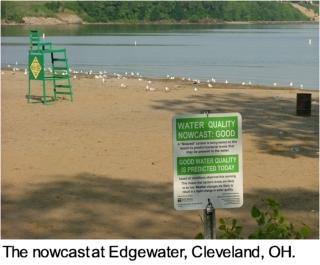
7 Decision Support Systems for Beach Water Quality Management Being Applied in Many Geographical Areas Using USEPA GLRI Funding Red Flags NOAA Blue Push Pins NOAA-NWS CEGLHH/CILER Green Flags USGS Orange Push Pins NOAA-GLERL CEGLHH/CILER Yellow Light Bulbs USEPA Yellow Pins WDNR Nowcast Models Using EPA s Virtual Beach Software


8 Forecast Decision Support Systems Grand Haven Beach Forecast Development Partnership Ottawa County Health Department Coastal Western Michigan Annual public Water Quality Forums Outreach Data sharing Research Forecasts Informing Swimmers


9 Recreational Water Illness Salmonella C. botulinum enterococci Campylobacter C. perfringens E. coli

10

11 WATER WAS BAD YESTERDAY DON T KNOW ABOUT TODAY COME BACK TOMORROW

12 THE NEXT DAY IF YOU SWAM YESTERDAY, YOU RE OKAY, WATER WAS FINE! TODAY PROBABLY OKAY TOO BUT - WE WON T SAMPLE AGAIN UNTIL NEXT WEEK

 Type II (false non-exceedance)")
13 Persistence Model Standard monitoring approach Collect/ transport water quality samples hour lab analysis Often not reflective of current conditions Type I Errors (false exceedance) Type II (false non-exceedance) Quanti-tray enumeration

14

15 Rainfall Models Advisories posted after significant- or threshold rainfall events Often not reflective of E. coli concentrations Sampson, R.W., et al "The effects of rainfall on Escherichia coli and total coliform levels at 15 Lake Superior recreational beaches." Water Resources Management 20:

16 The Public Demands Action! Protect Swimmer Health


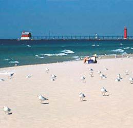
17 Great Lakes Beach Act Beaches 79 Source Ohio USGS Source MI in Pictures Source PA DNRC


18 Source USGS Great Lakes Beach Visualization and Analysis Tool Sheridan Haack USGS Michigan


19
20 Statistical Beach Quality Modeling Approach GLCFS Boundary Conditions - Currents and temperatures -Waves - Meteorology Schwab Hydrology (Tributary Flow) - USGS Streamflow -GLERL Models Croley, Phanikumar Pathogen Loading - Tributaries - Shoreline NPS - Reuspension Haack, Whitman, Phanikumar, McLellan Nearshore Hydrodynamics and Waves - POMGL -NearCOM? Beletsky, Schwab, Bravo, Wu Near Field Mixing - Needs loadings and ambient conditions Roberts, Frick Statistical Modeling Approach - Identification of parameters - Virtual Beach Bacterial Transport and Fate - Same grid as hydrodynamics? - Needs pathogen loading, near field mixing & hydrodynamics - Lagrangian/ Eulerian? Phanikumar, Roberts, Frick, Whitman Ge, Rockwell, Whitman Beach Quality Forecast - Risk analysis? - GUI/Communications Ge, Rockwell, Whitman
 + (ϐ k *X k ) + ε Explanatory variables E. coli concentration")
21 Multiple Linear Regression (MLR) Models Y = ϐ 0 + (ϐ 1 *X 1 ) + (ϐ 2 *X 2 ) + (ϐ k *X k ) + ε Explanatory variables E. coli concentration

22 e.g. X 1 = Rainfall Source: NWS


23 X 2 = Turbidity (NTU)

24 X 3 = Wave Height Source: Source: USGS Ohio Racine Water Health Science Department Center

25 X 4 = Stream Flow

26 X 5 = Sky Conditions Source: NOAA

27 X 6 = Wind Speed*Direction Source: NOAA
28 Where are MLR models used? Research Sites MLR models have been developed for R&D and Sanitary Survey purposes at a number of sites around the Great Lakes Operational Nowcasts Only 9 beaches have used MLR models as the basis for swim advisories --


29
30 Predictive Modeling Refine and evaluate procedures for building water quality models used for notification and advisories/closures Virtual Beach Software for Statistical Modeling Model Builder for developing multiple linear regression models for indicator prediction and Beach Advisor for providing user friendly beach advisory decision support for non technical users

31

32 NOAA Center of Excellence for Great Lakes and Human Health Develop sustainable forecasting tools to minimize risk to human health in coastal environments. Identify sources and causes Water Quality Beach closures Harmful Algal Blooms

33 Beach Forecasting Research Influence of winds and waves on fate and transport of pollutants Grand River: largest tributary of Lk Michigan Study Location- Grand Haven area, Michigan Agricultural and urban loadings Recreational river Beaches along shoreline Grand River

34 NOAA develops Great Lakes algal bloom forecasts TRAVERSE CITY, Mich. - An experimental system that uses satellite data and computer modeling will help forecast the direction and intensity of ugly, smelly algae blobs in the Great Lakes. Chicago Tribune 9/17/2009.
35 Factors Affecting Lake Circulation Wind stress Bottom topography Earth s rotation Temperature gradients Numerical Model

36 Hydrodynamic Models Three-dimensional models of nearshore flow and E. coli transport Process-based, deterministic Computationally expensive Source: NOAA GLERL

37 X = Nearshore Current Grand River Plume (4/20/10) Grand Haven State Park, Michigan Source: NOAA GLERL
38 X = Nearshore Current Grand River Plume (4/20/10) Grand Haven State Park, Michigan Source: NOAA GLERL

39

40 Great Lakes Coastal Forecasting System: - Five separate models based on POM with 2-5 km horizontal resolution and 20 sigma layers - Provides nowcasts and forecasts of water level, currents, temperature, and waves (GL wave model) - Runs automatically 4 times per day for nowcasts, 2 times per day for forecasts (out to 60 hrs)


41 Web site: 48 hr Forecast: /ghf


42 Grand River Plume Aerial Photography and Model Simulations June 2, 2007 June 10, 2007 June 6, 2007 June 20, 2007


43 Sulfur Hexaflouride Tracer Measurements Compared to Aerial Photography 6/22/2006 8/8/2006
44 Deterministic Beach Quality Modeling Approach GLCFS Boundary Conditions - Currents and temperatures -Waves - Meteorology Schwab Hydrology (Tributary Flow) - USGS Streamflow -GLERL Models Croley, Phanikumar Pathogen Loading - Tributaries - Shoreline NPS - Reuspension Haack, Whitman, Phanikumar, McLellan Nearshore Hydrodynamics and Waves - POMGL -NearCOM? Beletsky, Schwab, Bravo, Wu Near Field Mixing - Needs loadings and ambient conditions Roberts, Frick Bacterial Transport and Fate - Same grid as hydrodynamics? - Needs pathogen loading, near field mixing & hydrodynamics - Lagrangian/ Eulerian? Phanikumar, Roberts, Frick, Whitman Beach Quality Model - Probabilistic? - GUI/Communications Ge, Rockwell, Whitman
45 Predictive Variables for Statistical Beach Forecasting Models (Mednick, 2009: Accessing Online Data for Building and Evaluating Real-Time Models to Predict Beach Water Quality) Near Shore Conditions - Wave height * - Turbidity - Lake current speed and direction * - Water temperature * - Lake level * Weather Conditions - Antecedent rainfall * - Wind speed and direction * - Air temperature * - Sunlight * Onshore Conditions - Number of bathers - Presence of algae - Number of gulls Watershed Conditions - Stream flow * * Available from GLCFS
46 Combined Beach Quality Modeling Approach GLCFS Boundary Conditions - Currents and temperatures -Waves - Meteorology Schwab Hydrology (Tributary Flow) - USGS Streamflow -GLERL Models Croley, Phanikumar Pathogen Loading - Tributaries - Shoreline NPS - Reuspension Haack, Whitman, Phanikumar, McLellan Nearshore Hydrodynamics and Waves - POMGL -NearCOM? Beletsky, Schwab, Bravo, Wu Near Field Mixing - Needs loadings and ambient conditions Roberts, Frick Statistical Modeling Approach - Identification of parameters - Virtual Beach Bacterial Transport and Fate - Same grid as hydrodynamics? - Needs pathogen loading, near field mixing & hydrodynamics - Lagrangian/ Eulerian? Phanikumar, Roberts, Frick, Whitman Ge, Rockwell, Whitman Beach Quality Forecast - Risk analysis? - GUI/Communications Ge, Rockwell, Whitman

47
48 Grand Haven State Park Beach Ottawa Co. Michigan Data from VB2 MLR Model : Log10(E. coli)=const + Coef1 x Var1+ + Coef3 x Var3 Variable Coefficient Std. Error t Statistic p Value Intercept OSC WSP3HrAve M DP24Hr R-square = 30.0% Adj. R-square = 28.2% N=115 OSC0 On Shore Current (positive East) at time of Sampling WSP3HrM Muskegon Wind Speed Ave. of Sample & preceding 2 Hrs DP24Hr Dew Point Average of Sample Time and preceding 23 Hours OSC0 + coefficient => onshore current increases E. coli conc. WSP3HrM + coefficient => higher wind speeds increase E. coli conc. DP24Hr + coefficient => solar radiation attenuation increases E. coli conc.
49 North Beach Park Beach Ottawa County Michigan Data from VB2 MLR model: Log10(E. coli)=const + Coef1 * Var1 + + Coef6 * Var6 Variable Coefficient Std Error t Statistic p Value (Intercept) [GRD1d] 1/ WVH Year TP24Hr M DP24Hr M R-square =39.6% Adj. R-square =37.0% N=125 [GRD1d] 1/2 Sq Rt (Grand R. Flow at Grand Rapids 1 Day prior Sampling) WVH0 Wave Height at time of Sampling Year Calendar Year (not Julian Date) TP24 M Total Precipitation Measured at Muskegon for 24 hours DP24 M Dew Point Measured at Muskegon averaged over 24 hours [GRD1d] 1/2 + coefficient => more runoff increase E. coli conc. WVH0 + coefficient => larger waves increase E. coli conc. DATE - coefficient => E. coli conc. declining at NBPB over time. TP24Hr M + coefficient => more rainfall increases E. coli conc. DP24Hr M + coefficient => solar radiation attenuation increases E. coli conc.
50 WEIBULL Distribution Alpha=0.86 Beta=30 % E. coli (> or = 200) =3% North Beach Park Beach E. coli PDF (X) Typical E. coli distribution Histogram with 100 Bins Non-negative lower bound = Weibull Distribution Green Curve 400 X Histogram Weibull
51 Key Variables For High E. coli Measurements North Beach Park Beach Key Individual parameters: (1) Onshore current (OSC), (2) Along shore winds (ASW) (3) Air temperature at time of sampling (AT0) (4) Dew point averaged over 24 hours, and (5) Air temperature averaged over 24 hours (AT24) Key Interaction parameters: (1) Onshore current (OSC) and Air Temperature (AT0) (2) OSC and Cube of 3 Hour Average of Wind Speed (3) ASW0 at sampling time and AT24 (4) Wave Height at sampling time and AT24
52 Predicted versus Measurements for Binary E. coli Model High predictions for E.coli measurements below Michigan Standard of 300 counts/100 ml
53 Results Operational Forecast threshold values for North Beach Park Beach not found. Use Binary Logistic Regression to refine Binary E. Coli MLR approach Test procedure at Beaches having more high E.coli values

54
55 Future Coordination Activities GLRI Beach Model Grantees 1. Erie County NY Department of Health 2. Chicago Park District IL 3. Michigan State University 4. Michigan Dept. Natural Resources and Environment 5. Wisconsin Dept. Natural Resources 6. Regional Science Consortium Erie PA 7. Northeast Ohio Regional Sewer District


56 Acknowledgements NOAA Great Lakes Regional Collaboration Team Acknowledgement Dr. M.S. Phanikumar, Michigan State University Dr. R. L. Whitman, U.S. Geological Survey Dr. J.B. Rose, Michigan State University Richard Wagenmaker, National Weather Service, White Lake & USEPA and USGS Great Lakes Beach Interagency Team Members Michigan Department of Environmental Quality Ottawa County Health Department (End User) Funding from OHHI through NOAA GLERL Center of Excellence for Great Lakes and Human Health Grant Project Number F


57 Questions? Photo Credits David Schwab
Virtual Beach 3.0 Training
 Virtual Beach 3.0 Training Chicago Park District Office Thursday, March 2, 2017 ELISABETH SCHLAUDT, VIRTUAL BEACH OUTREACH COORDINATOR SONYA CARLSON, VIRTUAL BEACH OUTREACH EDUCATOR WISCONSIN SEA GRANT
Avoiding Nutrient Applications During Critical Periods with a Real-time Decision Support Tool: Wisconsin s Runoff Risk Advisory Forecast (RRAF)
") Avoiding Nutrient Applications During Critical Periods with a Real-time Decision Support Tool: Wisconsin s Runoff Risk Advisory Forecast (RRAF) Dustin Goering National Weather Service 27 Feb 2015 Overview
Avoiding Nutrient Applications During Critical Periods with a Real-time Decision Support Tool: Wisconsin s Runoff Risk Advisory Forecast (RRAF) Dustin Goering National Weather Service 27 Feb 2015 Overview
Water Pollution Studies for the Lower Grand River, Michigan
 Water Pollution Studies for the Lower Grand River, Michigan Dr. Joan B. Rose rosejo@msu.edu Dr. Phanikumar Mantha phani@msu.edu Rebecca Ives, Shikha Singh and Theng Theng Fong and Chao Peng Grand River,
Virtual Beach Building a GBM Model
 Virtual Beach 3.0.6 Building a GBM Model Building, Evaluating and Validating Anytime Nowcast Models In this module you will learn how to: A. Build and evaluate an anytime GBM model B. Optimize a GBM model
UNDERSTANDING AND FORECASTING METEOTSUNAMI IN THE GREAT LAKES
 UNDERSTANDING AND FORECASTING METEOTSUNAMI IN THE GREAT LAKES Fellow: Adam Bechle Principal Investigators: Allen Burton (UM-CILER), Chin Wu (UM-CILER) NOAA Technical Contacts: Eric Anderson (NOAA-GLERL)
Great Lakes Information Network GIS (Queryable by topic, geography, organization, and upload date 73 layers as of October, 2009)
") Google Earth Files for the Great Lakes and Beyond GLOS Mapping Workshop Alpena, Michigan November 9, 2009 David Hart GIS Specialist University of Wisconsin Sea Grant Institute GREAT LAKES Great Lakes Information
Google Earth Files for the Great Lakes and Beyond GLOS Mapping Workshop Alpena, Michigan November 9, 2009 David Hart GIS Specialist University of Wisconsin Sea Grant Institute GREAT LAKES Great Lakes Information
Quantifying i the GLRI Metric for Annual Sediment Deposition in Great Lakes Harbors:
 USACE 516(e) Annual Meeting Ann Arbor, MI (May 15, 2013) Quantifying i the GLRI Metric for Annual Sediment Deposition in Great Lakes Harbors: A Pilot Evaluation for Toledo Harbor Todd Redder Joe DePinto
Chapter 2: Description of Planning Area
 2020 Facilities Plan Facilities Plan Report Chapter 2: Description of Planning Area 2.1 Introduction This chapter describes Milwaukee Metropolitan Sewerage District s (MMSD) planning area and existing
Services for Inland Marine Data Integration. USGS Center for Integrated
 Services for Inland Marine Data Integration USGS Center for Integrated Data Analytics Outline GeoDataPortal Tools Coastal Use Cases Beach hhealth lthmodeling Distributed Rainfall Analysis for Integration
Climate Change and Stormwater. Daniel Brown, Research Associate, GLISA
 Climate Change and Stormwater Daniel Brown, Research Associate, GLISA Global Trends and Regional Trends Global trends are more certain than regional trends. Natural variability plays a larger role at the
Application of an Enhanced, Fine-Scale SWAT Model to Target Land Management Practices for Maximizing Pollutant Reduction and Conservation Benefits
 Application of an Enhanced, Fine-Scale SWAT Model to Target Land Management Practices for Maximizing Pollutant Reduction and Conservation Benefits Amanda Flynn, Todd Redder, Joe DePinto, Derek Schlea Brian
Nowcasting for the London Olympics 2012 Brian Golding, Susan Ballard, Nigel Roberts & Ken Mylne Met Office, UK. Crown copyright Met Office
 Nowcasting for the London Olympics 2012 Brian Golding, Susan Ballard, Nigel Roberts & Ken Mylne Met Office, UK Outline Context MOGREPS-UK AQUM Weymouth Bay models Summary Forecasting System Generic Products
Rainfall-River Forecasting: Overview of NOAA s Role, Responsibilities, and Services
 Dr. Thomas Graziano Chief Hydrologic Services Division NWS Headquarters Steve Buan Service Coordination Hydrologist NWS North Central River Forecast Center Rainfall-River Forecasting: Overview of NOAA
Ellen L. Mecray NOAA Regional Climate Services Director, Eastern Region Taunton, MA
 Ellen L. Mecray NOAA Regional Climate Services Director, Eastern Region Taunton, MA Regions of the US National Climate Assessment What we Observe: Climate changes and impacts Extreme precipitation and
Doug Kluck NOAA Kansas City, MO National Center for Environmental Information (NCEI) National Integrated Drought Information System (NIDIS)
 National Integrated Drought Information System (NIDIS)") National Integrated Drought Information System (NIDIS) for the Missouri River Basin Drought Early Warning Information System (DEWS) & Runoff Trends in the Missouri Basin & Latest Flood Outlook Doug Kluck
National Integrated Drought Information System (NIDIS) for the Missouri River Basin Drought Early Warning Information System (DEWS) & Runoff Trends in the Missouri Basin & Latest Flood Outlook Doug Kluck
The Lake Superior water monitoring and information system
 Michigan Technological University Digital Commons @ Michigan Tech Michigan Tech Research Institute Publications Michigan Tech Research Institute 1-28-2012 The Lake Superior water monitoring and information
The U.S. National Integrated Drought Information System. Roger S. Pulwarty National Oceanic and Atmospheric Administration USA
 The U.S. National Integrated Drought Information System Roger S. Pulwarty National Oceanic and Atmospheric Administration USA Drought: Weather-climate continuum and adaptation deficits 2010 2011 2012 2015
Overview of Methods. Terrestrial areas that are most important for conservation Conservation
 Overview of Methods The goal of the Western Lake Erie Coastal Conservation Vision project (WLECCV) is to define where we should be working locally to optimally achieve regional conservation impact. The
David R. Vallee Hydrologist-in-Charge NOAA/NWS Northeast River Forecast Center
 David R. Vallee Hydrologist-in-Charge NOAA/NWS Northeast River Forecast Center Record flooding along the Shawsheen River during the 2006 Mother s Day Floods Calibrate and implement a variety of hydrologic
Egypt-NOAA Cooperation: Advancing our Environmental Science, Technology, and Education
 Egypt-NOAA Cooperation: Advancing our Environmental Science, Technology, and Education T. G. Onsager NOAA Space Weather Prediction Center and NWS International Activities Office (one-year detail) Terry.Onsager@noaa.gov
C o p e r n i c u s E m e r g e n c y M a n a g e m e n t S e r v i c e f o r e c a s t i n g f l o o d s
 C o p e r n i c u s E m e r g e n c y M a n a g e m e n t S e r v i c e f o r e c a s t i n g f l o o d s Copernicus & Copernicus Services Copernicus EU Copernicus EU Copernicus EU www.copernicus.eu W
GIS-Based Sediment Quality Database for the St. Louis River Area of Concern (AOC): Overview Presentations and Demonstration
: Overview Presentations and Demonstration") GIS-Based Sediment Quality Database for the St. Louis River Area of Concern (AOC): Overview Presentations and Demonstration Judy L. Crane 1 and Dawn E. Smorong 2 1 Minnesota Pollution Control Agency, St.
GIS-Based Sediment Quality Database for the St. Louis River Area of Concern (AOC): Overview Presentations and Demonstration Judy L. Crane 1 and Dawn E. Smorong 2 1 Minnesota Pollution Control Agency, St.
Delaware River Flood Advisory Committee
 Delaware River Flood Advisory Committee A Partnership to Support Flood Mitigation Alan Tamm Pennsylvania Emergency Management Agency Bureau of Recovery and Mitigation atamm@state.pa.us Peter Gabrielsen
A case study of bacteria source tracking in the North Shore Channel
 A case study of bacteria source tracking in the North Shore Channel R. Gore1, G. K. Rijal1, M. Byappanahalli2, R. Whitman2, T. C. Granato1, C. O'Connor1; 1Metropolitan Water Reclama?on District of Greater
Detroit 516 Activities
 Detroit 516 Activities Dam Capacity Study Sediment Workshop in Traverse City START 2.0 Saginaw River Study Dam Capacity Study A progress report Outline Study Objective (Why are we doing this?) Reservoir
NOAA Operational Forecast System Gulf of Mexico, Demonstration since Sep 1999; Operational since Sep 2004:
 NOAA Operational Forecast System Gulf of Mexico, Demonstration since Sep 1999; Operational since Sep 2004: An Operational forecast of impact: 0-3 days and a prediction of likelihood of a bloom for mgmt
Great Lakes Regional Collaboration and U.S. GEOSS/IOOS/GLOS Initiative Focus on the Huron to Erie Corridor
 Great Lakes Regional Collaboration and U.S. GEOSS/IOOS/GLOS Initiative Focus on the Huron to Erie Corridor USEPA Grosse Ile Lab October 17, 2005 Great Lakes Interagency Task Force Draft Plan calls for
Real-Time Flood Forecasting Modeling in Nashville, TN utilizing HEC-RTS
 Real-Time Flood Forecasting Modeling in Nashville, TN utilizing HEC-RTS Brantley Thames, P.E. Hydraulic Engineer, Water Resources Section Nashville District, USACE August 24, 2017 US Army Corps of Engineers
Doug Kluck Regional Climate Services Director Kansas City, MO
 Climate Resilience and Information: Opportunities with Tribes and the National Oceanic and Atmospheric Administration (NOAA) and Partners National Congress of American Indians Annual Convention (October
Accessing and Using National Long Term Ecological Research (LTER) Climate and Hydrology Data from ClimDB and HydroDB: A Tutorial
 Climate and Hydrology Data from ClimDB and HydroDB: A Tutorial") Accessing and Using National Long Term Ecological Research (LTER) Climate and Hydrology Data from ClimDB and HydroDB: A Tutorial Gordon M. Heisler USDA Forest Service, Syracuse, NY Gary Fisher U.S. Geological
Accessing and Using National Long Term Ecological Research (LTER) Climate and Hydrology Data from ClimDB and HydroDB: A Tutorial Gordon M. Heisler USDA Forest Service, Syracuse, NY Gary Fisher U.S. Geological
The Delaware Environmental Monitoring & Analysis Center
 The Delaware Environmental Monitoring & Analysis Center Tina Callahan Delaware Estuary Science & Environmental Summit 2013 January 27-30, 2013 What is DEMAC? Delaware Environmental Monitoring & Analysis
Hyperlocal Marine Weather: What s Happening?
 Hyperlocal Marine Weather: What s Happening? André van der Westhuysen 1,2 and Jeff McQueen 1 1 NOAA / National Weather Service National Centers for Environmental Prediction 2 I.M Systems Group, Rockville
NOAA s Capabilities in Wind Energy
 NCAR-Xcel-NOAA Meeting May 11-12, 2010 Boulder, CO NOAA s Capabilities in Wind Energy Melinda Marquis, Ph.D. NOAA Earth System Research Laboratory Outline NOAA has a potential role in improving wind forecasting
New NOAA Precipitation-Frequency Atlas for Wisconsin
 New NOAA Precipitation-Frequency Atlas for Wisconsin #215966 Presentation to the Milwaukee Metropolitan Sewerage District Technical Advisory Team January 16, 2014 Michael G. Hahn, P.E., P.H. SEWRPC Chief
National Weather Service. Harold H. Opitz Hydrologist in Charge
 National Weather Service Harold H. Opitz Hydrologist in Charge Goals Organization Role of the River Forecast Center Describe Forecast System & Tools Other Details NWS River Forecast Centers Northwest River
GLERL Coupled Ice-Ocean Modeling and Forecasting
 GLERL Coupled Ice-Ocean Modeling and Forecasting Jia Wang Ice Climatologist NOAA Great Lake Environmental Research Laboratory, Ann Arbor, Michigan Jia.wang@noaa.gov Haoguo Hu, Ayumi Manome, and Xuezhi
Coastal Response Research Center. Nancy Kinner University of New Hampshire (UNH) Michele Jacobi NOAA ORR. September 27, 2007
 Michele Jacobi NOAA ORR. September 27, 2007") Coastal Response Research Center Nancy Kinner University of New Hampshire (UNH) Michele Jacobi NOAA ORR September 27, 2007 1 Coastal Response Research Center (CRRC) CRRC is partnership between NOAA s Office
Coastal Response Research Center Nancy Kinner University of New Hampshire (UNH) Michele Jacobi NOAA ORR September 27, 2007 1 Coastal Response Research Center (CRRC) CRRC is partnership between NOAA s Office
Chapter 3 - White Oak River Subbasin Includes Bogue Sound and the Newport River
 Chapter 3 - White Oak River Subbasin 03-05-03 Includes Bogue Sound and the Newport River 3.1 Water Quality Overview Subbasin 03-05-03 at a Glance Land and Water Area (sq. mi.) Total area: 228 Land area:
NATIONAL WATER RESOURCES OUTLOOK
 NATIONAL WATER RESOURCES OUTLOOK American Meteorological Society Annual Meeting 24 th Hydrology Conference 9.2 James Noel Service Coordination Hydrologist National Weather Service-Ohio River Forecast Center
Development And Testing Of Data Driven Nowcasting Models Of Beach Water Quality
 City University of New York (CUNY) CUNY Academic Works International Conference on Hydroinformatics 8-1-2014 Development And Testing Of Data Driven Nowcasting Models Of Beach Water Quality Jainy Mavani
CoCoRaHS. Community Collaborative Rain, Hail, & Snow Network. Ashley Wolf Meteorologist NWS Green Bay Northeast Wisconsin CoCoRaHS Coordinator
 CoCoRaHS Community Collaborative Rain, Hail, & Snow Network Ashley Wolf Meteorologist NWS Green Bay Northeast Wisconsin CoCoRaHS Coordinator What is CoCoRaHS Who, What, Where and Whys of CoCoRaHS What?
Phase One Development of a Comprehensive GIS for the Mentor Marsh and its Proximal Watershed
 FINAL REPORT Phase One Development of a Comprehensive GIS for the Mentor Marsh and its Proximal Watershed Lake Erie Protection Fund SG 120-99 Ohio State University Research Foundation RF 738027 December
Land Use Methods & Metrics Development Outcome
 Quarterly Progress Meeting November 15, 2018 Land Use Methods & Metrics Development Outcome Peter Claggett, USGS LUWG Coordinator Through the Chesapeake Bay Watershed Agreement, the Chesapeake Bay Program
Darren Wright Maritime Services Program Manager Center for Operational Oceanographic Products and Services (CO-OPS)
") Darren Wright Maritime Services Program Manager Center for Operational Oceanographic Products and Services (CO-OPS) Center for Operational Oceanographic Products and Services (CO-OPS) National Water Level
Darren Wright Maritime Services Program Manager Center for Operational Oceanographic Products and Services (CO-OPS) Center for Operational Oceanographic Products and Services (CO-OPS) National Water Level
Flash Flood Guidance System On-going Enhancements
 Flash Flood Guidance System On-going Enhancements Hydrologic Research Center, USA Technical Developer SAOFFG Steering Committee Meeting 1 10-12 July 2017 Jakarta, INDONESIA Theresa M. Modrick Hansen, PhD
Urban Integrated Services and Multi-Hazard Early Warning Systems
 WMO for UN New Urban Agenda Urban Integrated Services and Multi-Hazard Early Warning Systems Gregory R. Carmichael WMO WMO Priority: Urbanization - Research and services for megacities and large urban
Water & Climate; Floods & Droughts (The yin & yang of water availablilty) Water & Climate; Floods & Droughts (The yin & yang of water availablilty)
 Water & Climate; Floods & Droughts (The yin & yang of water availablilty)") (Acknowledgment: This presentation was developed in collaboration with ESA, NEON and NCEAS, federal agencies and academic team members from minority serving institutions.) Water & Climate; Floods & Droughts
(Acknowledgment: This presentation was developed in collaboration with ESA, NEON and NCEAS, federal agencies and academic team members from minority serving institutions.) Water & Climate; Floods & Droughts
Robert Shedd Northeast River Forecast Center National Weather Service Taunton, Massachusetts, USA
 Robert Shedd Northeast River Forecast Center National Weather Service Taunton, Massachusetts, USA Outline River Forecast Centers FEWS Implementation Status Forcing Data Ensemble Forecasting The Northeast
Hurricane Matthew Threats and Impacts Briefing for Eastern NC
 Hurricane Matthew Threats and Impacts Briefing for Eastern NC October 6 th, 2016 Date/Time Created: 10/6/2016, Noon EDT National Weather Service Newport/Morehead City, NC Hurricane Matthew Key Points Changes
Introduction: The Gulf of Mexico Alliance. The Gulf GAME project MERMAid and PHINS Results & Conclusions What s next? Examples
 AAG Las Vegas March 25, 2009 Introduction: Ocean governance and Ecosystem-Based Management The Gulf of Mexico Alliance Habitat Identification and Characterization The Gulf GAME project MERMAid and PHINS
Climate Change Impacts on Great Lakes Water Levels. Andrew Gronewold, Ph.D., P.E.
 Climate Change Impacts on Great Lakes Water Levels Andrew Gronewold, Ph.D., P.E. drew.gronewold@noaa.gov Great Lakes Environmental Research Laboratory National Oceanic and Atmospheric Administration The
Flooding in Western North Carolina: Some Spatial, Hydrologic, and Seasonal Characteristics CAUTION!! Outline. Basic Flood Facts.
 Flooding in Western North Carolina: Some Spatial, Hydrologic, and Seasonal Characteristics J. Greg Dobson CAUTION!! National Environmental Modeling and Analysis Center RENCI at UNC-Asheville Engagement
12/07/2017. Flash Flood Warning Service, an advanced approach towards flood resilient cities Floodplain Management Association Conference, Newcastle
 12/07/2017 Worldwide problem: Flash Floods Flash Floods are a Global Problem Flash Flood Warning Service, an advanced approach towards flood resilient cities Floodplain Management Association Conference,
The Kentucky Mesonet: Entering a New Phase
 The Kentucky Mesonet: Entering a New Phase Stuart A. Foster State Climatologist Kentucky Climate Center Western Kentucky University KCJEA Winter Conference Lexington, Kentucky February 9, 2017 Kentucky
Typical Hydrologic Period Report (Final)
") (DELCORA) (Final) November 2015 (Updated April 2016) CSO Long-Term Control Plant Update REVISION CONTROL REV. NO. DATE ISSUED PREPARED BY DESCRIPTION OF CHANGES 1 4/26/16 Greeley and Hansen Pg. 1-3,
(DELCORA) (Final) November 2015 (Updated April 2016) CSO Long-Term Control Plant Update REVISION CONTROL REV. NO. DATE ISSUED PREPARED BY DESCRIPTION OF CHANGES 1 4/26/16 Greeley and Hansen Pg. 1-3,
China-U.S. Collaboration on Rapid Urbanization. Jonathan Fink Vice President for Research and Economic Affairs Arizona State University August, 2004
 China-U.S. Collaboration on Rapid Urbanization Jonathan Fink Vice President for Research and Economic Affairs Arizona State University August, 2004 Why have an urban system science research agenda? More
Daily Operations Briefing. Wednesday, November 8, :30 a.m. EST
 Daily Operations Briefing Wednesday, November 8, 2017 8:30 a.m. EST Significant Activity Nov 7-8 Significant Events: Tropical Cyclones Harvey, Irma, and Maria Tropical Activity: Atlantic Tropical Storm
Guide to Hydrologic Information on the Web
 NOAA s National Weather Service Guide to Hydrologic Information on the Web Colorado River at Lees Ferry Photo: courtesy Tim Helble Your gateway to web resources provided through NOAA s Advanced Hydrologic
DEPARTMENT OF GEOLOGY AND MINERAL INDUSTRIES WAYS & MEANS SUBCOMMITTEE ON NATURAL RESOURCES MARCH 2, 2017
 DEPARTMENT OF GEOLOGY AND MINERAL INDUSTRIES WAYS & MEANS SUBCOMMITTEE ON NATURAL RESOURCES MARCH 2, 2017 1 ABOUT DOGAMI AGENCY MISSION, VISION & GOALS 2 Lidar image of a stream network along the Umpqua
Mid-West Heavy rains 18 April 2013
 Abstract: Mid-West Heavy rains 18 April 2013 By Richard H. Grumm and Charles Ross National Weather Service State College, PA The relatively wet conditions during the first 16 days of April 2013 set the
Climates of NYS. Definitions. Climate Regions of NYS. Storm Tracks. Climate Controls 10/13/2011. Characteristics of NYS s Climates
 Definitions Climates of NYS Prof. Anthony Grande 2011 Weather and Climate Weather the state of the atmosphere at one point in time. The elements of weather are temperature, air pressure, wind and moisture.
Who cares about S2S research to improve forecasts?
 Who cares about S2S research to improve forecasts? Ali Stevens, Annarita Mariotti, Dan Barrie, Emily Read Climate Program Office Contact: alison.stevens@noaa.gov 16th Annual CPASW May 22-24, 2018 **Any
Wisconsin Coastal Atlas Building the Coastal Spatial Data Infrastructure to Promote Hazard Resilience on the Great Lakes
 Wisconsin Coastal Atlas Building the Coastal Spatial Data Infrastructure to Promote Hazard Resilience on the Great Lakes David Hart GIS Specialist University of Wisconsin Sea Grant Institute ASPRS - Great
Current Water Conditions in Massachusetts January 11, 2008
 Current Water Conditions in Massachusetts January 11, 2008 December precipitation was above normal December streamflows were below normal and normal December ground-water levels were below normal and normal
United States Multi-Hazard Early Warning System
 United States Multi-Hazard Early Warning System Saving Lives Through Partnership Lynn Maximuk National Weather Service Director, Central Region Kansas City, Missouri America s s Weather Enterprise: Protecting
JMA Contribution to SWFDDP in RAV. (Submitted by Yuki Honda and Masayuki Kyouda, Japan Meteorological Agency) Summary and purpose of document
 Summary and purpose of document") WORLD METEOROLOGICAL ORGANIZATION COMMISSION FOR BASIC SYSTEMS OPAG on DPFS DPFS/RAV-SWFDDP-RSMT Doc. 7.1(1) (28.X.2010) SEVERE WEATHER FORECASTING AND DISASTER RISK REDUCTION DEMONSTRATION PROJECT (SWFDDP)
WORLD METEOROLOGICAL ORGANIZATION COMMISSION FOR BASIC SYSTEMS OPAG on DPFS DPFS/RAV-SWFDDP-RSMT Doc. 7.1(1) (28.X.2010) SEVERE WEATHER FORECASTING AND DISASTER RISK REDUCTION DEMONSTRATION PROJECT (SWFDDP)
HAB Forecaster. For info on HABs in the Pacific Northwest see:
 HAB Forecaster BACKGROUND In this activity, students can take on the role as a resource manager or scientist, tasked with deciding if razor clam harvesters should go out onto the beach to harvest razor
Memo. I. Executive Summary. II. ALERT Data Source. III. General System-Wide Reporting Summary. Date: January 26, 2009 To: From: Subject:
 Memo Date: January 26, 2009 To: From: Subject: Kevin Stewart Markus Ritsch 2010 Annual Legacy ALERT Data Analysis Summary Report I. Executive Summary The Urban Drainage and Flood Control District (District)
NRC Workshop - Probabilistic Flood Hazard Assessment Jan 2013
 Regional Precipitation-Frequency Analysis And Extreme Storms Including PMP Current State of Understanding/Practice Mel Schaefer Ph.D. P.E. MGS Engineering Consultants, Inc. Olympia, WA NRC Workshop - Probabilistic
NOAA s National Ocean Service. Center for Operational Oceanographic Products and Services
 NOAA s National Ocean Service Center for Operational Oceanographic Products and Services Richard Edwing, CO-OPS Acting Director January 27, 2010 Outline CO-OPS Overview Programs Observing Systems PORTS
What is CERA? Coastal Emergency Risks Assessment
 What is CERA? Coastal Emergency Risks Assessment Visualization tool using OGC standards Displays the outputs from the ADCIRC storm surge model or other coastal models Represents the maps on interactive
MICHIGAN GEOLOGICAL SURVEY Coastal Navigator Training St. Joseph, Michigan What do we know about anthropogenic impact(s) to Lake Michigan shorelines?
 to Lake Michigan shorelines?") MICHIGAN GEOLOGICAL SURVEY Coastal Navigator Training St. Joseph, Michigan What do we know about anthropogenic impact(s) to Lake Michigan shorelines? Review of a 12 year shoreline study and today, what
MICHIGAN GEOLOGICAL SURVEY Coastal Navigator Training St. Joseph, Michigan What do we know about anthropogenic impact(s) to Lake Michigan shorelines? Review of a 12 year shoreline study and today, what
CLIMATE CHANGE ADAPTATION BY MEANS OF PUBLIC PRIVATE PARTNERSHIP TO ESTABLISH EARLY WARNING SYSTEM
 CLIMATE CHANGE ADAPTATION BY MEANS OF PUBLIC PRIVATE PARTNERSHIP TO ESTABLISH EARLY WARNING SYSTEM By: Dr Mamadou Lamine BAH, National Director Direction Nationale de la Meteorologie (DNM), Guinea President,
Environmental Response Management Application
 Environmental Response Management Application Coastal Response Research Center Nancy Kinner, Michele Jacobi, Rob Braswell, Kurt Schwehr & Amy Merten RRT III May 14, 2008 1 Talk Outline Overview of Center
Evaluating Physical, Chemical, and Biological Impacts from the Savannah Harbor Expansion Project Cooperative Agreement Number W912HZ
 Evaluating Physical, Chemical, and Biological Impacts from the Savannah Harbor Expansion Project Cooperative Agreement Number W912HZ-13-2-0013 FY 2016 - First Quarterly Report January 1, 2016 Submitted
The Great Lakes Coalition is an organization of shoreline property owners on the Great Lakes dedicated to improving the quality of life for both it s
 The Great Lakes Coalition is an organization of shoreline property owners on the Great Lakes dedicated to improving the quality of life for both it s s membership and the public at large. Facts about Section
Regional-scale understanding of the geologic character and sand resources of the Atlantic inner continental shelf, Maine to Virginia
 Regional-scale understanding of the geologic character and sand resources of the Atlantic inner continental shelf, Maine to Virginia Workshop on Dredging, Beach Nourishment and Bird Conservation Atlantic
Speakers: NWS Buffalo Dan Kelly and Sarah Jamison, NERFC Jeane Wallace. NWS Flood Services for the Black River Basin
 Speakers: NWS Buffalo Dan Kelly and Sarah Jamison, NERFC Jeane Wallace NWS Flood Services for the Black River Basin National Weather Service Who We Are The National Oceanic and Atmospheric Administration
Emerging Needs, Challenges and Response Strategy
 Emerging Needs, Challenges and Response Strategy Development of Integrated Observing Systems in China JIAO Meiyan Deputy Administrator China Meteorological Administration September 2011 Geneva Outline
Development and Land Use Change in the Central Potomac River Watershed. Rebecca Posa. GIS for Water Resources, Fall 2014 University of Texas
 Development and Land Use Change in the Central Potomac River Watershed Rebecca Posa GIS for Water Resources, Fall 2014 University of Texas December 5, 2014 Table of Contents I. Introduction and Motivation..4
USGS Flood Inundation Mapping of the Suncook River in Chichester, Epsom, Pembroke and Allenstown, New Hampshire
 USGS Flood Inundation Mapping of the Suncook River in Chichester, Epsom, Pembroke and Allenstown, New Hampshire NH Water & Watershed Conference Robert Flynn, USGS NH-VT Water Science Center March 23, 2012
An Overview of Operations at the West Gulf River Forecast Center Gregory Waller Service Coordination Hydrologist NWS - West Gulf River Forecast Center
 National Weather Service West Gulf River Forecast Center An Overview of Operations at the West Gulf River Forecast Center Gregory Waller Service Coordination Hydrologist NWS - West Gulf River Forecast
EARLY WARNING IN SOUTHERN AFRICA:
 EARLY WARNING IN SOUTHERN AFRICA: Enhancing the Meteorological Early Warning System Eugene Poolman South African Weather Service OUTLINE OF PRESENTATION Impact of Climate Change Meteorological Early Warning
Applications/Users for Improved S2S Forecasts
 Applications/Users for Improved S2S Forecasts Nolan Doesken Colorado Climate Center Colorado State University WSWC Precipitation Forecasting Workshop June 7-9, 2016 San Diego, CA First -- A short background
Be relevant and effective thinking beyond accuracy and timeliness
 The Fourth Technical Conference on the Management of Meteorological and Hydrological Services in WMO RA II (Asia) Be relevant and effective thinking beyond accuracy and timeliness C. Y. LAM Hong Kong Observatory
Relationship between rainfall and beach bacterial concentrations on Santa Monica Bay beaches
 85 IWA Publishing 2003 Journal of Water and Health 01.2 2003 Relationship between rainfall and beach bacterial concentrations on Santa Monica Bay beaches Drew Ackerman and Stephen B. Weisberg ABSTRACT
Daily Operations Briefing. Thursday, July 6, :30 a.m. EDT
 Daily Operations Briefing Thursday, July 6, 2017 8:30 a.m. EDT Significant Activity July 5-6 Significant Events: None Tropical Activity: Atlantic Tropical Depression Four Eastern Pacific Disturbance 1:
Alexandra Carvalho, Ph.D., GISP Kathy Fitzpatrick, P.E.
 Coastal Data Organization for Project Management and Coastal Planning Martin County, Florida Alexandra Carvalho, Ph.D., GISP Kathy Fitzpatrick, P.E. Outline County Coastal Programs Coastal Geodatabase
Hot Weather Response Plan
 City of Greater Sudbury Hot Weather Response Plan For Public Release Version 1.3 July 2007 May 2009 Revised: May 2010 TABLE OF CONTENTS Introduction... 3 Essential Components... 4 Objectives... 4 Roles
The Coastal Change Analysis Program and the Land Cover Atlas. Rebecca Love NOAA Office for Coastal Management
 The Coastal Change Analysis Program and the Land Cover Atlas Rebecca Love NOAA Office for Coastal Management Natural Infrastructure = Greater Resilience NOAA C-CAP Regional Land Cover and Change coast.noaa.gov/digitalcoast/data/ccapregional
Forecasting Flood Risk at the Flood Forecasting Centre, UK. Delft-FEWS User Days David Price
 Forecasting Flood Risk at the Flood Forecasting Centre, UK Delft-FEWS User Days 2012 David Price Overview of the Flood Forecasting Centre (FFC) What is the FFC? Partnership between the Met Office and Environment
Tropical Update. 11 AM EDT Tuesday, October 9, 2018 Hurricane Michael, Tropical Storm Leslie, Tropical Storm Nadine
 Tropical Update 11 AM EDT Tuesday, October 9, 2018 Hurricane Michael, Tropical Storm Leslie, Tropical Storm Nadine This update is intended for government and emergency response officials, and is provided
Graphics Improvement
 Meteorological Model Ensemble Forecast System (MMEFS) (0 7 Day Potential River Levels) Graphics Improvement Robert Shedd Service Coordination Hydrologist NOAA/NWS Middle Atlantic River Forecast Center
CHAPTER 13 WEATHER ANALYSIS AND FORECASTING MULTIPLE CHOICE QUESTIONS
 CHAPTER 13 WEATHER ANALYSIS AND FORECASTING MULTIPLE CHOICE QUESTIONS 1. The atmosphere is a continuous fluid that envelops the globe, so that weather observation, analysis, and forecasting require international
Definitions Weather and Climate Climates of NYS Weather Climate 2012 Characteristics of Climate Regions of NYS NYS s Climates 1.
 Definitions Climates of NYS Prof. Anthony Grande 2012 Weather and Climate Weather the state of the atmosphere at one point in time. The elements of weather are temperature, t air pressure, wind and moisture.
Historical and Projected Future Climatic Trends in the Great Lakes Region
 Historical and Projected Future Climatic Trends in the Great Lakes Region Jeffrey A. Andresen Dept. of Geography, Environment, and Spatial Sciences Michigan State University Outline Historical Trends Climatic
MONITORING AND RESEARCH DEPARTMENT
 MONITORING AND RESEARCH DEPARTMENT REPORT NO. 10-17 MICROBIOLOGICAL REPORT OF BYPASS SAMPLES IN 2009 March 2010 Metropolitan Water Reclamation District of Greater Chicago 100 East Erie Street Chicago,
NWS SERFC Hydrologic Vulnerability Assessment. Monday, March 9 th, 2015 NOAA, National Weather Service Southeast River Forecast Center
 NWS SERFC Hydrologic Vulnerability Assessment Monday, March 9 th, 2015 NOAA, National Weather Service Southeast River Forecast Center Current Weather Map Today s weather map shows a blossoming system in
North Central U.S. Climate Summary and Outlook Webinar July 21, 2016
 North Central U.S. Climate Summary and Outlook Webinar July 21, 2016 Stuart Foster State Climatologist for Kentucky Department of Geography and Geology Western Kentucky University Stuart.foster@wku.edu
End of Ozone Season Report
 End of Ozone Season Report Central Ohio: April 1 through October 31, 2016 The Mid-Ohio Regional Planning Commission (MORPC) is part of a network of agencies across the country that issues daily air quality