Generating and Using Meteorological Data in AERMOD
|
|
|
- Kimberly Williams
- 6 years ago
- Views:
Transcription


")
1 Generating and Using Meteorological Data in AERMOD June 26, 2012 Prepared by: George J. Schewe, CCM, QEP BREEZE Software Merit Drive Suite 900 Dallas, TX (972) breeze-software.com


2 Meteorology in Transportation ti Hot Spot Modeling AERMOD mentioned in Section 3.6 Focus here on AERMOD input files Section Incorporating Meteorological Data From where do the data come?
3 What is AERMOD? A steady-state plume model that incorporates air dispersion based on planetary boundary layer turbulence structure and scaling concepts, including treatment of both surface and elevated sources, and both simple and complex terrain. Support Center for Regulatory Air Models -


4
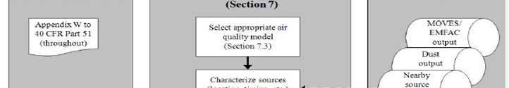
5 Hot-Spot t Modeling Process 1. Determine need for analysis 2. Determine approach, models, data 3. Estimate on-road motor vehicle emissions 4. Estimate emissions from road dust, construction, other sources 5. Select AQ model, meteorology, roadway configurations, receptors, background concentrations 6. Calculate l design values, compare to NAAQS, and determine conformity 7. Consider mitigation or control measures and repeat
6
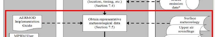
7 Meteorological Data for AERMOD Finding representative meteorological data NWS, FAA, SCRAM, onsite Surface and upper air data AERSURFACE for albedo, Bowen ratio, surface roughness AERMET preprocessor
8 Selecting Meteorology for Project-Level Hot-Spot Analysis Surface met data NWS, Onsite, other Offsite met data minimum five years Onsite met data minimum one year Upper air met data Surface characteristics, land use Population data used for urban-rural Representative of the project area?
9 Representativeness ti of Meteorology for Hot-Spot Analysis Proximity of project to met data site Similarity of land use and surface characteristics Time period of data Similarity of terrain features Climate similarities


10 Airport vs Site LULC
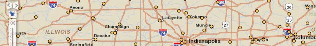
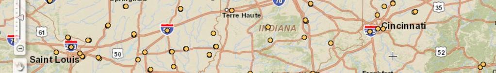
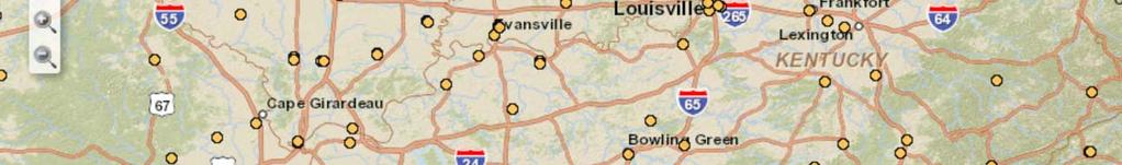
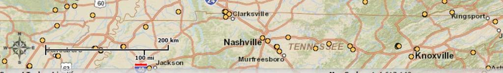
11 Surface Data National Weather Service Data is typical TD-3505 format (Integrated Hourly Surface Data) obtained from National Climatic Data Center in Asheville or ftp://ftp3.ncdc.noaa.gov/pub/data/noaa Minute data obtained from NOAA at ftp://ftp.ncdc.noaa.gov/pub/data/asos-onemin noaa Verify station location at
12 / / d /
13 / / d o/
14 Station ti Location


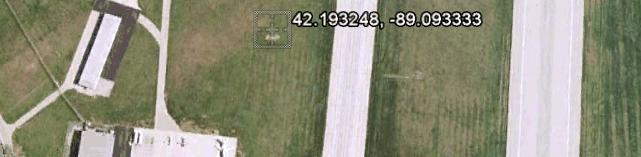

15 Station Location Google Earth Bing
16 Upper Air Data National Weather Service Data is typical FSL Format (Forecast Systems Laboratory) obtained from NOAA online at Verify station location at
17 Upper Air Observation sites


18 Upper Air Station Location Google Earth Bing
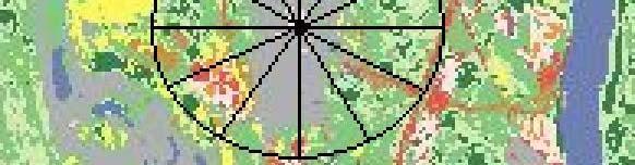
19 Land Use From the USGS Seamless Server at Currently only NLCD92 format


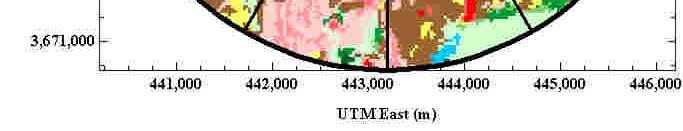
20 R i f L d U Review of Land Use Facility Landuse
21 AERSURFACE Output t Season Sect Alb Bo Zo SITE_CHAR SITE_CHAR SITE_CHAR SITE_CHAR SITE_CHAR SITE_CHAR SITE_CHAR SITE_CHAR SITE_CHAR SITE_CHAR SITE_CHAR SITE_CHAR SITE_CHAR SITE_CHAR SITE_CHAR SITE_CHAR SITE_CHAR SITE_CHAR Alb albedo is the amount of solar radiation reflected by the surface Bo Bowen ratio is the ratio of sensible to latent heat Zo surface roughness length is related to the land use which interrupts smooth-flowing winds at the surface

22 AERMET Processing Stage 1 and Raw Sounding File AERMET QA Raw Surface File AERMET QA MERGE Raw Manual/AERMET On-site File QA Stage 3 Surface Upper 1-min data AERMINUTE Explicit Land Use Analysis Bowen ratio, roughness, albedo
23 Features of AERMET Processes one minute and hourly surface observations, twice-daily upper air soundings, and on-site measurements: AERMINUTE processes one minute u and AERMET processes in three stages Stage 1: Extracts/processes data a from AERMINUTE, archived data files and performs quality assessment (QA) Stage 2: Merges all data from Stage 1 and stores these data together in a single file Stage 3: Reads merged meteorological data and estimates boundary layer parameters for use by AERMOD
24 Surface Turbulence Parameters AERMET computes turbulence parameters for use in AERMOD Sensible heat flux Surface friction velocity Convective velocity scale Convective boundary layer height Vertical potential temperature gradient Stable boundary layer height Monin-Obukhov length

25 Processed Met Data Met Data File using PCRAMMET Surface Met Data File using AERMET
26 Questions/Discussion? George J. Schewe, CCM, QEP (859) com
AERMOD Sensitivity to AERSURFACE Moisture Conditions and Temporal Resolution. Paper No Prepared By:
 AERMOD Sensitivity to AERSURFACE Moisture Conditions and Temporal Resolution Paper No. 33252 Prepared By: Anthony J Schroeder, CCM Managing Consultant TRINITY CONSULTANTS 7330 Woodland Drive Suite 225
Sensitivity of AERMOD to AERMINUTE- Generated Meteorology
 Sensitivity of AERMOD to AERMINUTE- Generated Meteorology Paper No 22-A-42-AWMA Prepared By: George J. Schewe, CCM, QEP Principal Consultant Abhishek Bhat, PhD Consultant TRINITY CONSULTANTS 77 Dixie Highway
Sensitivity of AERSURFACE Results to Study Area and Location. Paper 2009-A-127-AWMA
 Sensitivity of AERSURFACE Results to Study Area and Location Paper 2009-A-127-AWMA Prepared by: Anthony J. Schroeder, CCM Senior Consultant George J. Schewe, CCM, QEP Principal Consultant Trinity Consultants
AERMOD Technical Forum
 AERMOD Technical Forum Roger W. Brode MACTEC Federal Programs, Inc. Research Triangle Park, NC EPA R/S/L Modelers Workshop San Diego, California May 16, 2006 Presentation Outline Brief History of AERMOD
Worldwide Data Quality Effects on PBL Short-Range Regulatory Air Dispersion Models
 Worldwide Data Quality Effects on PBL Short-Range Regulatory Air Dispersion Models Jesse L. Thé 1, Russell Lee 2, Roger W. Brode 3 1 Lakes Environmental Software, -2 Philip St, Waterloo, ON, N2L 5J2, Canada
AERSURFACE Update. Clint Tillerson, Roger Brode. U.S. EPA / OAQPS / Air Quality Modeling Group
 AERSURFACE Update Clint Tillerson, Roger Brode U.S. EPA / OAQPS / Air Quality Modeling Group Regional/State/Local Modeler s Workshop September 25, 2017 Purpose of AERSURFACE Estimate values for surface
Air Dispersion Modeling Appendix
 Air Dispersion Modeling Appendix Prepared by: Lindsey Sears January 15, 2016 1. Introduction The Oxnard area of Ventura County is one of California s highest-producing strawberry regions. Many of the strawberry
Gridded Met. Data Workgroup
 Gridded Met. Data Workgroup R/S/L Modelers Workshop New Orleans, LA Dennis Atkinson May 17, 2005 Outline Background Gridded Met. Data Project (CALPUFF & AERMOD) Gridded Met. Data Workgroup New Developments
Using Prognostic Model-Generated Meteorological Output in the AERMOD Dispersion Model: An Illustrative Application in Philadelphia, PA
 TECHNICAL PAPER ISSN:1047-3289 J. Air & Waste Manage. Assoc. 57:586 595 DOI:10.3155/1047-3289.57.5.586 Copyright 2007 Air & Waste Management Association Using Prognostic Model-Generated Meteorological
1.18 EVALUATION OF THE CALINE4 AND CAR-FMI MODELS AGAINST THE DATA FROM A ROADSIDE MEASUREMENT CAMPAIGN
 .8 EVALUATION OF THE CALINE4 AND CAR-FMI MODELS AGAINST THE DATA FROM A ROADSIDE MEASUREMENT CAMPAIGN Joseph Levitin, Jari Härkönen, Jaakko Kukkonen and Juha Nikmo Israel Meteorological Service (IMS),
POLLUTION DISPERSION MODELING AT CHANIA, GREECE, UNDER VARIOUS METEOROLOGICAL CONDITIONS
 POLLUTION DISPERSION MODELING AT CHANIA, GREECE, UNDER VARIOUS METEOROLOGICAL CONDITIONS K. PHILIPPOPOULOS 1, D. DELIGIORGI 1, G. KARVOUNIS 1 and M. TZANAKOU 2 1 Department of Physics National and Kapodistrian
SOME CHARACTERISTICS OF ATMOSPHERIC BOUNDARY LAYER OVER MAKASSAR
 SPERMONDE (28) 4(): -6 ISSN: 246-56 EISSN: 264-549 SOME CHARACTERISTICS OF ATMOSPHERIC BOUNDARY LAYER OVER MAKASSAR ABSTRACT. Alimuddin Hamzah Assegaf *, Wasir Samad 2, Sakka Submitted: 4 January 28 Accepted:
1.14 A NEW MODEL VALIDATION DATABASE FOR EVALUATING AERMOD, NRPB R91 AND ADMS USING KRYPTON-85 DATA FROM BNFL SELLAFIELD
 1.14 A NEW MODEL VALIDATION DATABASE FOR EVALUATING AERMOD, NRPB R91 AND ADMS USING KRYPTON-85 DATA FROM BNFL SELLAFIELD Richard Hill 1, John Taylor 1, Ian Lowles 1, Kathryn Emmerson 1 and Tim Parker 2
Nicolas Duchene 1, James Smith 1 and Ian Fuller 2
 A METHODOLOGY FOR THE CREATION OF METEOROLOGICAL DATASETS FOR LOCAL AIR QUALITY MODELLING AT AIRPORTS Nicolas Duchene 1, James Smith 1 and Ian Fuller 2 1 ENVISA, Paris, France 2 EUROCONTROL Experimental
MMIF-processed WRF data for AERMOD Case Study: North ID mountain terrain
 MMIF-processed WRF data for AERMOD Case Study: North ID mountain terrain Tom Swain and Pao Baylon IDEQ Outline Study Area Moyie Springs Sandpoint Part 1: Meteorological Data Analyses Part 2: Modeling Assessment
The following files are available for the EPRI Kincaid Run Data Set:
 November 4, 2011 The following files are available for the EPRI Kincaid Run Data Set: Informational Files KincaidDiscussion.pdf: This file [42KB] Logic Behind Kincaid SF6-Arcs.pdf: This file describes
Urban Forest Effects-Dry Deposition (UFORE D) Model Enhancements. Satoshi Hirabayashi
 Model Enhancements. Satoshi Hirabayashi") Urban Forest Effects-Dry Deposition (UFORE D) Model Enhancements Satoshi Hirabayashi The Davey Institute, The Davey Tree Expert Company, Syracuse, New York 13210, USA Surface Weather Data NOAA Integrated
Urban Forest Effects-Dry Deposition (UFORE D) Model Enhancements Satoshi Hirabayashi The Davey Institute, The Davey Tree Expert Company, Syracuse, New York 13210, USA Surface Weather Data NOAA Integrated
Department of Meteorology University of Nairobi. Laboratory Manual. Micrometeorology and Air pollution SMR 407. Prof. Nzioka John Muthama
 Department of Meteorology University of Nairobi Laboratory Manual Micrometeorology and Air pollution SMR 407 Prof. Nioka John Muthama Signature Date December 04 Version Lab : Introduction to the operations
Wind Resource Analysis
 Wind Resource Analysis An Introductory Overview MGA/NWCC Midwestern Wind Energy: Moving It to Markets July 30, 2008 Detroit, Michigan Mark Ahlstrom 1 WindLogics Background Founded 1989 - supercomputing
Air Pollution Meteorology
 Air Pollution Meteorology Government Pilots Utilities Public Farmers Severe Weather Storm / Hurricane Frost / Freeze Significant Weather Fog / Haze / Cloud Precipitation High Resolution Weather & Dispersion
May 3, :41 AOGS - AS 9in x 6in b951-v16-ch13 LAND SURFACE ENERGY BUDGET OVER THE TIBETAN PLATEAU BASED ON SATELLITE REMOTE SENSING DATA
 Advances in Geosciences Vol. 16: Atmospheric Science (2008) Eds. Jai Ho Oh et al. c World Scientific Publishing Company LAND SURFACE ENERGY BUDGET OVER THE TIBETAN PLATEAU BASED ON SATELLITE REMOTE SENSING
5. General Circulation Models
 5. General Circulation Models I. 3-D Climate Models (General Circulation Models) To include the full three-dimensional aspect of climate, including the calculation of the dynamical transports, requires
Wind Assessment & Forecasting
 Wind Assessment & Forecasting GCEP Energy Workshop Stanford University April 26, 2004 Mark Ahlstrom CEO, WindLogics Inc. mark@windlogics.com WindLogics Background Founders from supercomputing industry
Progress in implementing one-way and two-way ROMS+ICE coupling. with atmospheric models over an Arctic polynya
 Progress in implementing one-way and two-way ROMS+ICE coupling with atmospheric models over an Arctic polynya Alastair D. Jenkins 1, W. Paul Budgell 2 1, Chris Moore 3, and Anne D. Sandvik 1 1 Bjerknes
Near Real-Time Runoff Estimation Using Spatially Distributed Radar Rainfall Data. Jennifer Hadley 22 April 2003
 Near Real-Time Runoff Estimation Using Spatially Distributed Radar Rainfall Data Jennifer Hadley 22 April 2003 Introduction Water availability has become a major issue in Texas in the last several years,
5B.1 DEVELOPING A REFERENCE CROP EVAPOTRANSPIRATION CLIMATOLOGY FOR THE SOUTHEASTERN UNITED STATES USING THE FAO PENMAN-MONTEITH ESTIMATION TECHNIQUE
 DEVELOPING A REFERENCE CROP EVAPOTRANSPIRATION CLIMATOLOGY FOR THE SOUTHEASTERN UNITED STATES USING THE FAO PENMAN-MONTEITH ESTIMATION TECHNIQUE Heather A. Dinon*, Ryan P. Boyles, and Gail G. Wilkerson
Air Quality Simulation of Traffic Related Emissions: Application of Fine-Scaled Dispersion Modelling
 Air Quality Simulation of Traffic Related Emissions: Application of Fine-Scaled Dispersion Modelling M. Shekarrizfard, M. Hatzopoulou Dep. of Civil Engineering and Applied Mechanics, McGill University
The Ocean-Atmosphere System II: Oceanic Heat Budget
 The Ocean-Atmosphere System II: Oceanic Heat Budget C. Chen General Physical Oceanography MAR 555 School for Marine Sciences and Technology Umass-Dartmouth MAR 555 Lecture 2: The Oceanic Heat Budget Q
BOUNDARY LAYER STRUCTURE SPECIFICATION
 August 2017 P09/01X/17 BOUNDARY LAYER STRUCTURE SPECIFICATION CERC In this document ADMS refers to ADMS 5.2, ADMS-Roads 4.1, ADMS-Urban 4.1 and ADMS-Airport 4.1. Where information refers to a subset of
Boundary Layer Parametrization for Atmospheric Diffusion Models by Meteorological Measurements at Ground Level.
 IL NUOVO CIMENTO VOL. 17 C, N. 2 Marzo-Aprile 1994 Boundary Layer Parametrization for Atmospheric Diffusion Models by Meteorological Measurements at Ground Level. R. BELLASIO('), G. LANZANI('), M. TAMPONI(2)
Symbology Modification for Climate Studies. Rich Baldwin (NCDC/NOAA) Glen Reid (IMSG)
 Glen Reid (IMSG)") Symbology Modification for Climate Studies Rich Baldwin (NCDC/NOAA) Glen Reid (IMSG) June 3, 2005 Abstract The National Climatic Data Center archives worldwide weather data from the present date back to
Symbology Modification for Climate Studies Rich Baldwin (NCDC/NOAA) Glen Reid (IMSG) June 3, 2005 Abstract The National Climatic Data Center archives worldwide weather data from the present date back to
A Subgrid Surface Scheme for the Analysis of the Urban Heat Island of Rome
 A Subgrid Surface Scheme for the Analysis of the Urban Heat Island of Rome Antonio Cantelli, Paolo Monti, Giovanni Leuzzi Dipartimento di Idraulica, Trasporti e Strade Summary Analysis of the atmospheric
Mesoscale meteorological models. Claire L. Vincent, Caroline Draxl and Joakim R. Nielsen
 Mesoscale meteorological models Claire L. Vincent, Caroline Draxl and Joakim R. Nielsen Outline Mesoscale and synoptic scale meteorology Meteorological models Dynamics Parametrizations and interactions
Energy balance and melting of a glacier surface
 Energy balance and melting of a glacier surface Vatnajökull 1997 and 1998 Sverrir Gudmundsson May 1999 Department of Electromagnetic Systems Technical University of Denmark Science Institute University
1. Weather and climate.
 Lecture 31. Introduction to climate and climate change. Part 1. Objectives: 1. Weather and climate. 2. Earth s radiation budget. 3. Clouds and radiation field. Readings: Turco: p. 320-349; Brimblecombe:
Seasonal Variations of the Urban Heat Island Effect:
 Seasonal Variations of the Urban Heat Island Effect: Examining the Differences in Temperature Between the City of Philadelphia and its Outlying Suburbs By: Frank Vecchio 1 P a g e We re calling for a high
Land Data Assimilation at NCEP NLDAS Project Overview, ECMWF HEPEX 2004
 Dag.Lohmann@noaa.gov, Land Data Assimilation at NCEP NLDAS Project Overview, ECMWF HEPEX 2004 Land Data Assimilation at NCEP: Strategic Lessons Learned from the North American Land Data Assimilation System
A Case Study of Sulfur Dioxide in Muscatine, Iowa and the Ability for AERMOD to Predict NAAQS Violations
 A Case Study of Sulfur Dioxide in Muscatine, Iowa and the Ability for AERMOD to Predict NAAQS Violations Presented by Charlene Becka Air Quality Engineer NAAQS SO 2 Standards Respiratory irritant in sensitive
CALPUFF Modeling Analysis of the Sulfur Dioxide Impacts due to Emissions from the Portland Generating Station
 CALPUFF 1992-1993 Modeling Analysis of the Sulfur Dioxide Impacts due to Emissions from the Portland Generating Station February 25, 2010 Bureau of Technical Services New Jersey Dept. of Environmental
Developments in ADMS-Airport and its Applications to Heathrow Airport. IAE (Institute of Aviation and the Environment) Cambridge, June
 Cambridge, June") Developments in ADMS-Airport and its Applications to Heathrow Airport David Carruthers Cambridge Environmental Research Consultants IAE (Institute of Aviation and the Environment) Cambridge, June 23 28
Developments in ADMS-Airport and its Applications to Heathrow Airport David Carruthers Cambridge Environmental Research Consultants IAE (Institute of Aviation and the Environment) Cambridge, June 23 28
Speedwell High Resolution WRF Forecasts. Application
 Speedwell High Resolution WRF Forecasts Speedwell weather are providers of high quality weather data and forecasts for many markets. Historically we have provided forecasts which use a statistical bias
Environmental Fluid Dynamics
 Environmental Fluid Dynamics ME EN 7710 Spring 2015 Instructor: E.R. Pardyjak University of Utah Department of Mechanical Engineering Definitions Environmental Fluid Mechanics principles that govern transport,
WATER AND ENERGY BALANCE ESTIMATION IN PUERTO RICO USING SATELLITE REMOTE SENSING
 WATER AND ENERGY BALANCE ESTIMATION IN PUERTO RICO USING SATELLITE REMOTE SENSING Eric. W. Harmsen, Ariel Mercado Vargas, Pedro Tosado Cruz, Jonellys M Maldonado Morales and Angel O. Ortiz Lozada OCTAVA
Lecture 3a: Surface Energy Balance
 Lecture 3a: Surface Energy Balance Instructor: Prof. Johnny Luo http://www.sci.ccny.cuny.edu/~luo Surface Energy Balance 1. Factors affecting surface energy balance 2. Surface heat storage 3. Surface
METRIC tm. Mapping Evapotranspiration at high Resolution with Internalized Calibration. Shifa Dinesh
 METRIC tm Mapping Evapotranspiration at high Resolution with Internalized Calibration Shifa Dinesh Outline Introduction Background of METRIC tm Surface Energy Balance Image Processing Estimation of Energy
Coupling of atmospheric and ocean/sea ice models over Arctic continental shelf areas. University of Bergen, Bergen, Norway
 Coupling of atmospheric and ocean/sea ice models over Arctic continental shelf areas Alastair D. Jenkins 1, W. Paul Budgell 2,1, Chris Moore 3, and Anne D. Sandvik 1 1 Bjerknes Centre for Climate Research
Gridding of precipitation and air temperature observations in Belgium. Michel Journée Royal Meteorological Institute of Belgium (RMI)
") Gridding of precipitation and air temperature observations in Belgium Michel Journée Royal Meteorological Institute of Belgium (RMI) Gridding of meteorological data A variety of hydrologic, ecological,
Gridding of precipitation and air temperature observations in Belgium Michel Journée Royal Meteorological Institute of Belgium (RMI) Gridding of meteorological data A variety of hydrologic, ecological,
A Cloud-Based Flood Warning System For Forecasting Impacts to Transportation Infrastructure Systems
 A Cloud-Based Flood Warning System For Forecasting Impacts to Transportation Infrastructure Systems Jon Goodall Associate Professor, Civil and Environmental Engineering Associate Director, Link Lab April
MPAS Atmospheric Boundary Layer Simulation under Selected Stability Conditions: Evaluation using the SWIFT dataset
 MPAS Atmospheric Boundary Layer Simulation under Selected Stability Conditions: Evaluation using the SWIFT dataset Rao Kotamarthi, Yan Feng, and Jiali Wang Argonne National Laboratory & MMC Team Motivation:
ATMOSPHERIC CIRCULATION AND WIND
 ATMOSPHERIC CIRCULATION AND WIND The source of water for precipitation is the moisture laden air masses that circulate through the atmosphere. Atmospheric circulation is affected by the location on the
dated : 15 June 2015 Figure 1. Geographic localization of the Metropolitan Regions of São Paulo and Rio de Janeiro Cities.
 PROGRAM MCITY BRAZIL Amauri Pereira de Oliveira 1, Edson Pereira Marques Filho 2, Mauricio Jonas Ferreira 1, Jacyra Soares 1, Georgia Codato 1, Marija Božnar 3, Primož Mlakar 3, Boštjan Grašič 3, Eduardo
MESOSCALE MODELLING OVER AREAS CONTAINING HEAT ISLANDS. Marke Hongisto Finnish Meteorological Institute, P.O.Box 503, Helsinki
 MESOSCALE MODELLING OVER AREAS CONTAINING HEAT ISLANDS Marke Hongisto Finnish Meteorological Institute, P.O.Box 503, 00101 Helsinki INTRODUCTION Urban heat islands have been suspected as being partially
Wind Resource Assessment Practical Guidance for Developing A Successful Wind Project
 December 11, 2012 Wind Resource Assessment Practical Guidance for Developing A Successful Wind Project Michael C Brower, PhD Chief Technical Officer Presented at: What We Do AWS Truepower partners with
Glaciology HEAT BUDGET AND RADIATION
 HEAT BUDGET AND RADIATION A Heat Budget 1 Black body radiation Definition. A perfect black body is defined as a body that absorbs all radiation that falls on it. The intensity of radiation emitted by a
Dispersion for point sources CE 524 February
 Dispersion for point sources CE 524 February 2011 1 Concentration Air pollution law in most industrial countries based on concentration of contaminants NAAQS in US Need method dto predict concentrations
Creating Meteorology for CMAQ
 Creating Meteorology for CMAQ Tanya L. Otte* Atmospheric Sciences Modeling Division NOAA Air Resources Laboratory Research Triangle Park, NC * On assignment to the National Exposure Research Laboratory,
Identification of pollution dispersion patterns in complex terrain using AERMOD modeling system
 Issue 3, Volume 3, 2009 143 Identification of pollution dispersion patterns in complex terrain using AERMOD modeling system Despina Deligiorgi, Kostas Philippopoulos, George Karvounis and Magdalini Tzanakou
George Mason University Department of Civil, Environmental and Infrastructure Engineering. Dr. Celso Ferreira Prepared by Lora Baumgartner
 George Mason University Department of Civil, Environmental and Infrastructure Engineering Dr. Celso Ferreira Prepared by Lora Baumgartner Exercise Topic: Downloading Spatial Data Objectives: a) Become
2. REGIONAL DISPERSION
 Real-time Transport and Dispersion from Illinois Nuclear Power Plants Thomas E. Bellinger, CCM Illinois Emergency Management Agency Springfield, Illinois 1. INTRODUCTION Meteorological data routinely used
A study of the variation of urban mixed layer heights
 ARTICLE IN PRESS Atmospheric Environment ] (]]]]) ]]] ]]] www.elsevier.com/locate/atmosenv A study of the variation of urban mixed layer heights Matthew Simpson a,, Sethu Raman a, Julie K. Lundquist b,
Sensitivity Analysis of WRF Forecasts in Arizona During the Monsoon Season Case Study: August 2, 2005 to August 3, 2005
 Sensitivity Analysis of WRF Forecasts in Arizona During the Monsoon Season Case Study: August 2, 2005 to August 3, 2005 Christopher L. Castro and Stephen Bieda III University of Arizona Susanne Grossman-Clarke
Estimation of Wavelet Based Spatially Enhanced Evapotranspiration Using Energy Balance Approach
 Estimation of Wavelet Based Spatially Enhanced Evapotranspiration Using Energy Balance Approach Dr.Gowri 1 Dr.Thirumalaivasan 2 1 Associate Professor, Jerusalem College of Engineering, Department of Civil
Climate Variables for Energy: WP2
 Climate Variables for Energy: WP2 Phil Jones CRU, UEA, Norwich, UK Within ECEM, WP2 provides climate data for numerous variables to feed into WP3, where ESCIIs will be used to produce energy-relevant series
Motivation & Goal. We investigate a way to generate PDFs from a single deterministic run
 Motivation & Goal Numerical weather prediction is limited by errors in initial conditions, model imperfections, and nonlinearity. Ensembles of an NWP model provide forecast probability density functions
British Columbia Ministry of Environment Environmental Protection Division Environmental Quality Branch Air Protection Section
 GUIDELINES FOR AIR QUALITY DISPERSION MODELLING IN BRITISH COLUMBIA British Columbia Ministry of Environment Environmental Protection Division Environmental Quality Branch Air Protection Section Victoria,
IMPACT OF LAND USE CHANGE ON WEATHER RESEARCH AND FORECASTING (WRF) OUTPUT: A CASE STUDY FOR THE PHILIPPINES
 OUTPUT: A CASE STUDY FOR THE PHILIPPINES") IMPACT OF LAND USE CHANGE ON WEATHER RESEARCH AND FORECASTING (WRF) OUTPUT: A CASE STUDY FOR THE PHILIPPINES Robert B. Badrina 1 Jay Samuel L. Combinido 2 Gay Jane P. Perez 2 1 Philippine Atmospheric Geophysical
IMPACT OF LAND USE CHANGE ON WEATHER RESEARCH AND FORECASTING (WRF) OUTPUT: A CASE STUDY FOR THE PHILIPPINES Robert B. Badrina 1 Jay Samuel L. Combinido 2 Gay Jane P. Perez 2 1 Philippine Atmospheric Geophysical
Abstract. Introduction
 Evaluation of the ISCST2 model with measurements of SO^ concentrations in the greater Cape Town region D.A. Dracoulides, R.K. Dutkiewicz Energy Research Institute, University of Cape Town, P.O. Box 207,
Local Meteorology. Changes In Geometry
 Energy Balance Climate Local Meteorology Surface Mass And Energy Exchange Net Mass Balance Dynamic Response Effect on Landscape Changes In Geometry Water Flow Climate Local Meteorology Surface Mass And
Areas of the World with high Insolation
 Areas of the World with high Insolation 22 /43 Africa Annual Average Global Horizontal Solar Radiation Map 19 Jul 2006 A map depicting model estimates of monthly average daily total radiation using inputs
SuperPack North America
 SuperPack North America Speedwell SuperPack makes available an unprecedented range of quality historical weather data, and weather data feeds for a single annual fee. SuperPack dramatically simplifies
Determining correction factors for seasonal and regional variability in
 Determining correction factors for seasonal and regional variability in the tracer ratio method: The seasonal variability in the ΔCFC-12:ΔCO and ΔCFC-11:ΔCO enhancement ratios, observed during a three
The PRECIS Regional Climate Model
 The PRECIS Regional Climate Model General overview (1) The regional climate model (RCM) within PRECIS is a model of the atmosphere and land surface, of limited area and high resolution and locatable over
NOAA Surface Weather Program
 NOAA Surface Weather Program Maintenance Decision Support System Stakeholder Meeting #9 Jim O Sullivan NOAA Surface Weather Program Manager NWS Office of Climate, Water, and Weather Services September
THE INFLUENCE OF HIGHLY RESOLVED SEA SURFACE TEMPERATURES ON METEOROLOGICAL SIMULATIONS OFF THE SOUTHEAST US COAST
 THE INFLUENCE OF HIGHLY RESOLVED SEA SURFACE TEMPERATURES ON METEOROLOGICAL SIMULATIONS OFF THE SOUTHEAST US COAST Peter Childs, Sethu Raman, and Ryan Boyles State Climate Office of North Carolina and
STANDARD OPERATING PROCEDURES
 PAGE: 1 of 5 CONTENTS 1.0 SCOPE AND APPLICATION 2.0 METHOD SUMMARY 3.0 SAMPLE PRESERVATION, CONTAINERS, HANDLING, AND STORAGE 4.0 INTERFERENCE AND POTENTIAL PROBLEMS 5.0 EQUIPMENT/APPARATUS 6.0 REAGENTS
COLOBOC Project Status
 Federal Department of Home Affairs FDHA Federal Office of Meteorology and Climatology MeteoSwiss COLOBOC Project Status Jean-Marie Bettems / MeteoSwiss COLOBOC/SOILVEG Workshop Langen, February 28th, 2011
THE MET INPUT MODULE
 August 2017 P05/01S/17 THE MET INPUT MODULE The Met. Office (D J Thomson) and CERC In this document ADMS refers to ADMS 5.2, ADMS-Roads 4.1, ADMS-Urban 4.1 and ADMS-Airport 4.1. Where information refers
J17.3 Impact Assessment on Local Meteorology due to the Land Use Changes During Urban Development in Seoul
 J17.3 Impact Assessment on Local Meteorology due to the Land Use Changes During Urban Development in Seoul Hae-Jung Koo *, Kyu Rang Kim, Young-Jean Choi, Tae Heon Kwon, Yeon-Hee Kim, and Chee-Young Choi
Abstract. 1 Introduction
 Urban air pollution forecast based on the Gaussian and regression models M. Zickus', K. Kvietkus^ ' Vilnius University, Sauletekio 9, 2600 Vilnius, Lithuania * Institute of Physics, A. Gostauto 12, 2600
DSJRA-55 Product Users Handbook. Climate Prediction Division Global Environment and Marine Department Japan Meteorological Agency July 2017
 DSJRA-55 Product Users Handbook Climate Prediction Division Global Environment and Marine Department Japan Meteorological Agency July 2017 Change record Version Date Remarks 1.0 13 July 2017 First version
Warming Earth and its Atmosphere The Diurnal and Seasonal Cycles
 Warming Earth and its Atmosphere The Diurnal and Seasonal Cycles Or, what happens to the energy received from the sun? First We Need to Understand The Ways in Which Heat Can be Transferred in the Atmosphere
Atmospheric Processes
 Atmospheric Processes Atmospheric prognostic variables Wind Temperature Humidity Cloud Water/Ice Atmospheric processes Mixing Radiation Condensation/ Evaporation Precipitation Surface exchanges Friction
Environmental quality modeling
 Environmental quality modeling Air quality management modeling AIRQUIS Water quality management modeling WATERQUIS N:\adm\arkiv\overhead\2006\CEE\Yale-9.ppt 1 An Integrated Air Quality Managament System
Evaluation of nonlocal and local planetary boundary layer schemes in the WRF model
 Evaluation of nonlocal and local planetary boundary layer schemes in the WRF model Bo Xie,Jimmy C. H. Fung,Allen Chan,and Alexis Lau Received 31 October 2011; revised 13 May 2012; accepted 14 May 2012;
An intercomparison model study of Lake Valkea-Kotinen (in a framework of LakeMIP)
") Third Workshop on Parameterization of Lakes in Numerical Weather Prediction and Climate Modelling Finnish Meteorological Insitute, Helsinki, September 18-20 2012 An intercomparison model study of Lake
Third Workshop on Parameterization of Lakes in Numerical Weather Prediction and Climate Modelling Finnish Meteorological Insitute, Helsinki, September 18-20 2012 An intercomparison model study of Lake
Presented by Jerry A. Gomez, P.E. National Hydropower Association Northeast Regional Meeting - September 17, 2009
 Presented by Jerry A. Gomez, P.E. National Hydropower Association Northeast Regional Meeting - September 17, 2009 Defining Probable Maximum Precipitation (PMP) PMP is the theoretically greatest depth of
East Penn School District Curriculum and Instruction
 East Penn School District Curriculum and Instruction Curriculum for: Meteorology Course(s): Meteorology Grades: 10-12 Department: Science Length of Period (average minutes): 42 Periods per cycle: 6 Length
MODELING AND AMBIENT MONITORING OF AIR TOXICS IN CORPUS CHRISTI, TEXAS
 MODELING AND AMBIENT MONITORING OF AIR TOXICS IN CORPUS CHRISTI, TEXAS Gary McGaughey, Elena McDonald-Buller, Yosuke Kimura, Hyun-Suk Kim, and David T. Allen* Center for Energy and Environmental Resources,
London Heathrow Field Site Metadata
 London Heathrow Field Site Metadata Field Site Information Name: Heathrow src_id (Station ID number): 708 Geographic Area: Greater London Latitude (decimal ): 51.479 Longitude (decimal ): -0.449 OS Grid
a geophysical grid, constructed using gridded terrain and land cover data (obtained from GeoGratis Government of Canada); and
; and") 1.0 INTRODUCTION The following is a summary of model inputs and odour modelling results conducted for the purpose of assessing potential odour impacts from a private organics management facility located
1.0 INTRODUCTION The following is a summary of model inputs and odour modelling results conducted for the purpose of assessing potential odour impacts from a private organics management facility located
Ensemble Trajectories and Moisture Quantification for the Hurricane Joaquin (2015) Event
 Event") Ensemble Trajectories and Moisture Quantification for the Hurricane Joaquin (2015) Event Chasity Henson and Patrick Market Atmospheric Sciences, School of Natural Resources University of Missouri 19 September
Ensemble Trajectories and Moisture Quantification for the Hurricane Joaquin (2015) Event Chasity Henson and Patrick Market Atmospheric Sciences, School of Natural Resources University of Missouri 19 September
Observations from Plant City Municipal Airport during the time period of interest are summarized below:
 December 3, 2014 James A. Murman Barr, Murman & Tonelli 201 East Kennedy Boulevard Suite 1700 Tampa, FL 33602 RE: Case No. 166221; BMT Matter No.: 001.001007 Location of Interest: 1101 Victoria Street,
Evapotranspiration: Theory and Applications
 Evapotranspiration: Theory and Applications Lu Zhang ( 张橹 ) CSIRO Land and Water Evaporation: part of our everyday life Evapotranspiration Global Land: P = 800 mm Q = 315 mm E = 485 mm Evapotranspiration
Remote sensing data assimilation in WRF-UCM mesoscale model: Madrid case study
 Air Pollution XVIII 15 Remote sensing data assimilation in WRF-UCM mesoscale model: case study R. San José 1, J. L. Pérez 1, J. L. Morant 1 & R. M. González 2 1 Environmental Software and Modelling Group,
The Atmosphere. Topic 3: Global Cycles and Physical Systems. Topic 3: Global Cycles and Physical Systems. Topic 3: Global Cycles and Physical Systems
 The Atmosphere 1 How big is the atmosphere? Why is it cold in Geneva? Why do mountaineers need oxygen on Everest? 2 A relatively thin layer of gas over the Earths surface Earth s radius ~ 6400km Atmospheric
Insolation and Temperature variation. The Sun & Insolation. The Sun (cont.) The Sun
 The Sun") Insolation and Temperature variation Atmosphere: blanket of air surrounding earth Without our atmosphere: cold, quiet, cratered place Dynamic: currents and circulation cells June 23, 2008 Atmosphere important
Insolation and Temperature variation Atmosphere: blanket of air surrounding earth Without our atmosphere: cold, quiet, cratered place Dynamic: currents and circulation cells June 23, 2008 Atmosphere important
Validation Results of a Spatially Fine-Scale Air Temperature Statistical Model in New York City
 Validation Results of a Spatially Fine-Scale Air Temperature Statistical Model in New York City Brian Vant-Hull, Maryam Karimi, Awalou Sossa, Louis Waxman, Estatio Guiterrez, Sarah Johnson*, Rouzbeh Nazari
SAMPLE. SITE SPECIFIC WEATHER ANALYSIS Rainfall Report. Bevens Engineering, Inc. Susan M. Benedict REFERENCE:
 SAMPLE SITE SPECIFIC WEATHER ANALYSIS Rainfall Report PREPARED FOR: Bevens Engineering, Inc. Susan M. Benedict REFERENCE: DUBOWSKI RESIDENCE / FILE# 11511033 CompuWeather Sample Report Please note that
The Kentucky Mesonet: Entering a New Phase
 The Kentucky Mesonet: Entering a New Phase Stuart A. Foster State Climatologist Kentucky Climate Center Western Kentucky University KCJEA Winter Conference Lexington, Kentucky February 9, 2017 Kentucky
ATMOSPHERIC ENERGY and GLOBAL TEMPERATURES. Physical Geography (Geog. 300) Prof. Hugh Howard American River College
 Prof. Hugh Howard American River College") ATMOSPHERIC ENERGY and GLOBAL TEMPERATURES Physical Geography (Geog. 300) Prof. Hugh Howard American River College RADIATION FROM the SUN SOLAR RADIATION Primarily shortwave (UV-SIR) Insolation Incoming
ATMOSPHERIC ENERGY and GLOBAL TEMPERATURES Physical Geography (Geog. 300) Prof. Hugh Howard American River College RADIATION FROM the SUN SOLAR RADIATION Primarily shortwave (UV-SIR) Insolation Incoming