Modeling in aquatic environment
|
|
|
- Roger Hamilton
- 5 years ago
- Views:
Transcription
1 Modeling in aquatic environment Lecture 0 Data assimilation and data fusion in models Timo Huttula, Akiko Mano and Takauki Shuku Timo.huttula@environment.fi Timo Huttula, Finnish Environment Institute
 User and")


2 Hdrological expertise in Finland Hdrological Modeling and Forecasting Sstem (4/4) User and operator interface (mobile) HYDROLOGICAL MODELING AND FORECASTING SYSTEM Public www Water situation description River discharges are low throughout the countr River discharges have decreased during sunn and dr period. Onl light rains are forecasted so discharges will sta low 2


3 Hdrological expertise in Finland Weather radar observations and nowcasts (/) Weather radar and LAPS in WSFS Weather radar Hourl radar data in 2x2km grid Used for 2 das in model Underestimates large rainfalls Corrected manuall against rain gauges Radar nowcasting 3hrs in Southern Finland Ensamble of 50 members LAPS Combines information from weather radar, automatic real-time rain gauges, road weather measurements, Will probabl be used in WSFS as a weather radar replacement in near future 33


4 Hdrological expertise in Finland Realtime and historical hdrometeorological and nutrients observations (/4) Observation networks Automatic realtime precipitation -hour measurements from 00 stations 380 discharge stations 220 with dail measurements 60 external stations with usuall dail measurements 660 water level stations 400 with dail measurements 260 external stations with usuall dail measurements Snow courses 40 montl measurements Water qualit measurements Snoptic weather stations, 50 dail measurements Other weather stations, 200 dail measurements
 Areal snow water equivalents are calculated for approximatel 0 areas Snow courses are 2-4 km long routes through")
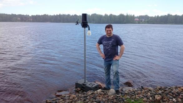
5 Hdrological expertise in Finland Realtime and historical hdrometeorological and nutrients observations (2/4) Measuring the snow water equivalent Snow water equivalent is measured b snow course measurements About 40 snow courses in Finland (less than what is shown at the map) Areal snow water equivalents are calculated for approximatel 0 areas Snow courses are 2-4 km long routes through various terrains 80 depth measurements 8 manual weightings Measurements are made once or twice a month


 Measuring the")
6 Hdrological expertise in Finland Realtime and historical hdrometeorological and nutrients observations (3/4) Measuring the snow water equivalent
7 Hdrological expertise in Finland Realtime and historical hdrometeorological and nutrients observations (4/4) Meteorological institute Local environmental agencies SYKE s automated measurement devices (water level, ) Hdropower companies Water suppl companies Sweden s SMHI FTP SMS GPRS http / https GSM Report form Realtime hdrometeorological data lines during normal da, man more during flood situations 22 lines / second are saved to database, on average Datacontrol SYKE Hdrological modelling and forecasting sstem Volunteer observers Cellular modem Other outside observers Traditional / snail mail 7

8 Hdrological expertise in Finland Data assimilation and control (/6) Manual measurements - Manual river discharge measurement - Manual precipitation observations - Snow line measurements Automatic observations - Automatic river water level observation - Automatic precipitation observations - Snow depth from automatic stations Derived results / algorithmic data - Weather radar precipitation - Wind corrected precipitation observations - Near-bcomplemented precipitation observations - Satellite value for snow water equivalent - Interpolated snow water equivalent Simulations - Areal precipitation - Runoff, discharge, water level, soil moisture, - Areal precipitation corrected to match water balance - Snow water equivalent, snow depth, ground frost depth - Ice thickness Observed data Calculated data
 snow water equivalent (over 50 stations) SnowCoverArea satellite data flood cover area (experimental) Corrects inputs of the model (dail precipitation and temperature)")
9 Hdrological expertise in Finland Data assimilation and control (2/6) Data assimilation algorithm To estimate the state of the hdrological sstem toda Assimilation observations of: discharge and water levels (over 400 stations) snow water equivalent (over 50 stations) SnowCoverArea satellite data flood cover area (experimental) Corrects inputs of the model (dail precipitation and temperature) Simulation is corrected to agree with observations on a -2 ear long period backward Expected result of the data assimilation: hdrological storages (snow, soil moisture, etc.) are more correct


10 Hdrological expertise in Finland Data assimilation and control (3/6) Example: forecast gone wrong when data is not filtered


11 Hdrological expertise in Finland Data assimilation and control (4/6) Example: forecast gone wrong when data is not filtered


12 Hdrological expertise in Finland Data assimilation and control (5/6) Data transfers in Watershed Simulation and Forecasting Sstem WWW server Mother Computer http User interface Weather and sea forecasts Weather radar Other data ftp ftp rsnc ftp HYDRO Computer A Computer Computer Computer A Computer A Computer A A L rsnc Data fetching Computer database connections HYDROTEMPO METEO HYDROFLOOD
 U_FO O_AO (accept observ.) O_FO D_AO (accept observ.) D_FO S_AO (accept observ.) S_FO U_FO (fetch observ.")
 ACCEPTABLE O_AO REVISED O_AO SUSPICIOUS O_TR NULL O_TR D_RF (read flag) ACCEPTABLE D_AO")
 PASS D_TS FAIL D_FO S_TR (test rejection) PASS S_TS FAIL D_FO O_TS (test suspicion) PASS O_AO FAIL S_AO D_TS (test suspicion) PASS")
13 Hdrological expertise in Finland Data assimilation and control (6/6) State: UNKNOWN (at the beginning) Data Control State Machine State: OK State: DISCARD State: SUSPICION U_AO (accept observ.) U_FO O_AO (accept observ.) O_FO D_AO (accept observ.) D_FO S_AO (accept observ.) S_FO U_FO (fetch observ.) U_RF O_FO (fetch observ.) O_RF D_FO (fetch observ.) D_RF S_FO (fetch observ.) S_RF U_RF (read flag) ACCEPTABL. U_AO REVISED O_AO SUSPICIOUS U_AO NULL O_AO O_RF (read flag) ACCEPTABLE O_AO REVISED O_AO SUSPICIOUS O_TR NULL O_TR D_RF (read flag) ACCEPTABLE D_AO REVISED O_AO SUSPICIOUS D_TR NULL D_TR S_RF (read flag) ACCEPTABLE S_AO REVISED O_AO SUSPICIOUS S_TR NULL S_TR O_TR (test rejection) PASS O_TS FAIL D_FO D_TR (test rejection) PASS D_TS FAIL D_FO S_TR (test rejection) PASS S_TS FAIL D_FO O_TS (test suspicion) PASS O_AO FAIL S_AO D_TS (test suspicion) PASS O_AO FAIL S_AO S_TS (test suspicion) PASS O_AO FAIL S_AO
 Coupled simulations between air flow and water flow are recommended Time consuming Complex (Confusing) (http://www.ems.okaama-u.ac.")
14 Wind data assimilation to Coherens (Shuku&Suito) Local wind fields strongl impact on water current fields (Suito et al., 204) Coupled simulations between air flow and water flow are recommended Time consuming Complex (Confusing) ( How should we deal with the dilemma?

15 5
16 Data and methods Models COHERENS V2(Luten, 20) Open boundar conditions at 3 river mouths: River discharge (observation extracted from Hertta data base of the Finnish Environmental Administration ) Temperature (model results provided b VEMALA*) Total suspended sediment (observation interpolated b linear function) Surface data Meteorological data such as wind speed and direction, air temperature, humidit, cloud coverage and air pressure. (observation provided b Finnish Meteorological Institute) *VEMALA: the water qualit component of the Watershed Simulation and Forecasting Sstem (Vehviläinen B et al., 2005) of the Finnish Environment Institute. This sstem simulates variables such as the transport of total phosphorus and nitrogen and suspended solids in land area, rivers and lakes. (Huttunen I. et al., 2008). Huttunen I, Huttunen M, Tattari S, Vehviläinen B Large scale phosphorus load modelling in Finland. In Northern Hdrolog and its Global Role, Volume 2, Sveinsson ÓGB, Garðarsson SM, Gunnlaugsdóttir S (eds). XXV Nordic Hdrological Conference NHP Report No. 50. Icelandic Hdrological Committee: Rekjavik; Vehviläinen B, Huttunen M, Huttunen I Hdrological forecasting and real time monitoring in Finland: The watershed simulation and forecasting sstem (WSFS). In Innovation, Advances and Implementation of Flood Forecasting Technolog, Conference Papers, Tromsø, Norwa, 7 9 October 2005.
17 Taneli Duunari-Töntekijäinen, SYKE Objective Aim:sensitivit test of assimilation Total Suspended Sediment. River discharge Temperature As much as possible 0 das interval 20 das interval 30 das interval No assimilation Meteorological data SPM(no biomass) 0 times 2 times 3 times 5 times 6 times Model Model Model Model Model 7

18 /30/206 Huttula Finnish Environment Institute, SYKE 8
.Vehviläinen B, Huttunen M, Huttunen I. 2005.")
19 Taneli Duunari-Töntekijäinen, SYKE Target area Stud area Eurajoki(out) Phäjoki(in) Ylaneenjoki(in) (Reports of Finnish Environment Institute, 2008) Reports of Finnish Environment Institute 5/2008, 73 p. URN:ISBN: ISBN: (PDF).Vehviläinen B, Huttunen M, Huttunen I Hdrological forecasting and real time monitoring in Finland: The watershed simulation and forecasting sstem (WSFS). In Innovation, Advances and Implementation of Flood Forecasting Technolog, Conference Papers, Tromsø, Norwa, 7 9 October

20 /30/206 Huttula Finnish Environment Institute, SYKE 20
21 Turbidir TSM Model 06 No biomass Amap Model08 0das Model09 20das Model0 30das Model None 6/ 6/8 6/8 6/2 6/26 7/6
22 Results

23 /30/206 Huttula Finnish Environment Institute, SYKE 23

24 /30/206 Huttula Finnish Environment Institute, SYKE 24
25 Observation Station Meteorological data wind direction, wind speed, temperature, humidit Palokkajärvi Tuomiojärvi


26 Observation Station Palokka Ranta-Niemela Kaijala Laajavuori JEnergia Lehtisaari
27 Temporal Modeling Auto-Regressive (AR) Model n m i i n i n v a n a i v n :n th time-series data : i th AR coefficient : white noise m : autoregressive order <Yule-Walker method> m m m m m m C C C a a a C C C C C C C C C ˆ ˆ ˆ ˆ ˆ ˆ ˆ ˆ ˆ ˆ ˆ ˆ i Ĉ : auto-correlation function i a : AR coefficient
28 Spatial Modeling
29 Ordinar Kriging ) ( ) ( ) ( 0 ) ( ) ( ) ( ) ( ) ( ) ( ) ( ) ( ) ( w w w n n n n n n n n Sstem equation 0 ) ~ i( n : Unknown value (wind speed and wind direction) : Known value (wind speed and wind direction) : Mean value : Variogram (auto correlation function) i w : Weight
30 Interpolated data Y (m) Y (m) Y (m) X (m) X (m) X (m) st August 20 th August 30 th August Y (m) Y (m) X (m) X (m) 0 th September 20 th September
31 Estimated local wind field Y (m) X (m)
Operational water balance model for Siilinjärvi mine
 Operational water balance model for Siilinjärvi mine Vesa Kolhinen, Tiia Vento, Juho Jakkila, Markus Huttunen, Marie Korppoo, Bertel Vehviläinen Finnish Environment Institute (SYKE) Freshwater Centre/Watershed
Modeling in aquatic environment
 Modeling in aquatic environment Lecture 2 Catchment models Timo Huttula timo.huttula@environment.fi www.syke.fi/jyvaskyla http://www.jyvaskyla.fi/international 16.11.2016 Timo Huttula, Finnish Environment
Watershed simulation and forecasting system with a GIS-oriented user interface
 HydroGIS 96: Application of Geographic Information Systems in Hydrology and Water Resources Management (Proceedings of the Vienna Conference, April 1996). IAHS Publ. no. 235, 1996. 493 Watershed simulation
Modelling snow water equivalent and depth in Watershed Simulation and Forecasting System at SYKE
 Modelling snow water equivalent and depth in Watershed Simulation and Forecasting System at SYKE Vesa Kolhinen Finnish Environment Institute Pyry-seminar 2.11.2015 WSFS Watershed Simulation and Forecasting
CARFFG System Development and Theoretical Background
 CARFFG Steering Committee Meeting 15 SEPTEMBER 2015 Astana, KAZAKHSTAN CARFFG System Development and Theoretical Background Theresa M. Modrick, PhD Hydrologic Research Center Key Technical Components -
Application and verification of ECMWF products at the Finnish Meteorological Institute
 Application and verification of ECMWF products 2010 2011 at the Finnish Meteorological Institute by Juhana Hyrkkènen, Ari-Juhani Punkka, Henri Nyman and Janne Kauhanen 1. Summary of major highlights ECMWF
Flash flood forecasting and warning infrastructures of National Meteorology and Hydrological Services of Cambodia
 Development and Implementation of the South East Asia Flash Flood Guidance System (SEAFFGS) Ha Noi, Viet Nam, 20-23 November 2017 Flash flood forecasting and warning infrastructures of National Meteorology
Central Asia Regional Flash Flood Guidance System 4-6 October Hydrologic Research Center A Nonprofit, Public-Benefit Corporation
 http://www.hrcwater.org Central Asia Regional Flash Flood Guidance System 4-6 October 2016 Hydrologic Research Center A Nonprofit, Public-Benefit Corporation FFGS Snow Components Snow Accumulation and
Operational Perspectives on Hydrologic Model Data Assimilation
 Operational Perspectives on Hydrologic Model Data Assimilation Rob Hartman Hydrologist in Charge NOAA / National Weather Service California-Nevada River Forecast Center Sacramento, CA USA Outline Operational
The MRC Mekong Flood Forecasting and MRC Flash Flood Guidance Systems
 MEKONG RIVER COMMISSION The MRC Mekong Flood Forecasting and MRC Flash Flood Guidance Systems NGUYEN TIEN KIEN Regional Flood Management and Mitigation Centre Phnom Penh, Cambodia Outline 1. Operational
EFFICIENCY OF THE INTEGRATED RESERVOIR OPERATION FOR FLOOD CONTROL IN THE UPPER TONE RIVER OF JAPAN CONSIDERING SPATIAL DISTRIBUTION OF RAINFALL
 EFFICIENCY OF THE INTEGRATED RESERVOIR OPERATION FOR FLOOD CONTROL IN THE UPPER TONE RIVER OF JAPAN CONSIDERING SPATIAL DISTRIBUTION OF RAINFALL Dawen YANG, Eik Chay LOW and Toshio KOIKE Department of
Satellite data for hydrological forecasting
 Satellite data for hydrological forecasting Current use at ECMWF and perspective Shopping list! Our current tools does not allow direct use, but could be modified Christel Prudhomme Christel.prudhomme@ecmwf.int
MODELING PRECIPITATION OVER COMPLEX TERRAIN IN ICELAND
 MODELING PRECIPITATION OVER COMPLEX TERRAIN IN ICELAND Philippe Crochet 1, Tómas Jóhannesson 1, Oddur Sigurðsson 2, Helgi Björnsson 3 and Finnur Pálsson 3 1 Icelandic Meteorological Office, Bústadavegur
WELCOME to METIER: Course 6 Remote Sensing of the Hydrosphere, 3 7 November, 2008, Helsinki
 WELCOME to METIER: Course 6 Remote Sensing of the Hydrosphere, 3 7 November, 2008, Helsinki Marie Curie Series of Events METIER = METhods of Interdisciplinar Environmental Research Course 1: Remote Sensing
The use of earth observation technology to improve the characterization of ice and snow
 The use of earth observation technology to improve the characterization of ice and snow Swedish Meteorological and Hydrological Institute (SMHI) Outline: EO and ice/snow CryoLand North Hydrology EO in
HISTORY OF HEAVY RAINFALL DISASTER INFORMATION IN JAPAN
 transmission, for a state-of-the-art review. In addition, issues expected to arise in the future are discussed. HISTORY OF HEAVY RAINFALL DISASTER INFORMATION IN JAPAN Progress of Rainfall Observation
Near Real-Time Runoff Estimation Using Spatially Distributed Radar Rainfall Data. Jennifer Hadley 22 April 2003
 Near Real-Time Runoff Estimation Using Spatially Distributed Radar Rainfall Data Jennifer Hadley 22 April 2003 Introduction Water availability has become a major issue in Texas in the last several years,
Drought Monitoring with Hydrological Modelling
 st Joint EARS/JRC International Drought Workshop, Ljubljana,.-5. September 009 Drought Monitoring with Hydrological Modelling Stefan Niemeyer IES - Institute for Environment and Sustainability Ispra -
Flash Flood Guidance System On-going Enhancements
 Flash Flood Guidance System On-going Enhancements Hydrologic Research Center, USA Technical Developer SAOFFG Steering Committee Meeting 1 10-12 July 2017 Jakarta, INDONESIA Theresa M. Modrick Hansen, PhD
Hydrologic Overview & Quantities
 Hydrologic Overview & Quantities It is important to understand the big picture when attempting to forecast. This includes the interactive components and hydrologic quantities. Hydrologic Cycle The complexity
GIS Techniques for Floodplain Delineation. Dean Djokic
 GIS Techniques for Floodplain Delineation Dean Djokic (ddjokic@esri.com) Content What is a floodplain? How to get a floodplain? What can GIS do for floodplain modeling? Simple GIS techniques for floodplain
FLORA: FLood estimation and forecast in complex Orographic areas for Risk mitigation in the Alpine space
 Natural Risk Management in a changing climate: Experiences in Adaptation Strategies from some European Projekts Milano - December 14 th, 2011 FLORA: FLood estimation and forecast in complex Orographic
Progress Report 1 nr 3 (August 2012)
") Regional Association VI (RA VI) (Europe) Working Group on Climate and Hydrology (WG/CH) Task Team on Flood Forecasting and Warning (TT/FFW) Progress Report 1 nr 3 (August 2012) 1 General issues The RA
Regional Association VI (RA VI) (Europe) Working Group on Climate and Hydrology (WG/CH) Task Team on Flood Forecasting and Warning (TT/FFW) Progress Report 1 nr 3 (August 2012) 1 General issues The RA
Rainfall-runoff modelling using merged rainfall from radar and raingauge measurements
 Rainfall-runoff modelling using merged rainfall from radar and raingauge measurements Nergui Nanding, Miguel Angel Rico-Ramirez and Dawei Han Department of Civil Engineering, University of Bristol Queens
Basins-Level Heavy Rainfall and Flood Analyses
 Basins-Level Heavy Rainfall and Flood Analyses Peng Gao, Greg Carbone, and Junyu Lu Department of Geography, University of South Carolina (gaop@mailbox.sc.edu, carbone@mailbox.sc.edu, jlu@email.sc.edu)
III. Publication III. c 2004 Authors
 III Publication III J-P. Kärnä, J. Pulliainen, K. Luojus, N. Patrikainen, M. Hallikainen, S. Metsämäki, and M. Huttunen. 2004. Mapping of snow covered area using combined SAR and optical data. In: Proceedings
QPE and QPF in the Bureau of Meteorology
 QPE and QPF in the Bureau of Meteorology Current and future real-time rainfall products Carlos Velasco (BoM) Alan Seed (BoM) and Luigi Renzullo (CSIRO) OzEWEX 2016, 14-15 December 2016, Canberra Why do
Uncertainty in the SWAT Model Simulations due to Different Spatial Resolution of Gridded Precipitation Data
 Uncertainty in the SWAT Model Simulations due to Different Spatial Resolution of Gridded Precipitation Data Vamsi Krishna Vema 1, Jobin Thomas 2, Jayaprathiga Mahalingam 1, P. Athira 4, Cicily Kurian 1,
Open Source ENKI: Dynamic Environmental Model Framework. A possible pre-processor for WRF-Hydro?
 Open Source ENKI: Dynamic Environmental Model Framework A possible pre-processor for WRF-Hydro? 1st European Fully Coupled AtmosphericHydrological Modeling and WRF-Hydro Users workshop. University of Calabria.
Remote sensing of snow at SYKE Sari Metsämäki
 Remote sensing of snow at SYKE 2011-01-21 Sari Metsämäki Activities in different projects Snow extent product in ESA DUE-project GlobSnow Long term datasets (15-30 years) on Snow Extent (SE) and Snow Water
Plan for operational nowcasting system implementation in Pulkovo airport (St. Petersburg, Russia)
") Plan for operational nowcasting system implementation in Pulkovo airport (St. Petersburg, Russia) Pulkovo airport (St. Petersburg, Russia) is one of the biggest airports in the Russian Federation (150
Plan for operational nowcasting system implementation in Pulkovo airport (St. Petersburg, Russia) Pulkovo airport (St. Petersburg, Russia) is one of the biggest airports in the Russian Federation (150
Global Flash Flood Guidance System Status and Outlook
 Global Flash Flood Guidance System Status and Outlook HYDROLOGIC RESEARCH CENTER San Diego, CA 92130 http://www.hrcwater.org Initial Planning Meeting on the WMO HydroSOS, Entebbe, Uganda 26-28 September
Regional Flash Flood Guidance and Early Warning System
 WMO Training for Trainers Workshop on Integrated approach to flash flood and flood risk management 24-28 October 2010 Kathmandu, Nepal Regional Flash Flood Guidance and Early Warning System Dr. W. E. Grabs
MODERN TECHNOLOGIES IN HYDRO-METEOROLOGICAL INFORMATION SYSTEMS
 MODERN TECHNOLOGIES IN HYDRO-METEOROLOGICAL INFORMATION SYSTEMS MARK HEGGLI, INNOVATIVE HYDROLOGY CONSULTING METEOROLOGIST/HYDROLOGIST TO THE WORLD BANK AREAS OF TECHNOLOGY ADVANCEMENT RECENT TECHNOLOGY
INCA-CE achievements and status
 INCA-CE achievements and status Franziska Strauss Yong Wang Alexander Kann Benedikt Bica Ingo Meirold-Mautner INCA Central Europe Integrated nowcasting for the Central European area This project is implemented
The Importance of Snowmelt Runoff Modeling for Sustainable Development and Disaster Prevention
 The Importance of Snowmelt Runoff Modeling for Sustainable Development and Disaster Prevention Muzafar Malikov Space Research Centre Academy of Sciences Republic of Uzbekistan Water H 2 O Gas - Water Vapor
Haiti and Dominican Republic Flash Flood Initial Planning Meeting
 Dr Rochelle Graham Climate Scientist Haiti and Dominican Republic Flash Flood Initial Planning Meeting September 7 th to 9 th, 2016 Hydrologic Research Center http://www.hrcwater.org Haiti and Dominican
The indicator can be used for awareness raising, evaluation of occurred droughts, forecasting future drought risks and management purposes.
 INDICATOR FACT SHEET SSPI: Standardized SnowPack Index Indicator definition The availability of water in rivers, lakes and ground is mainly related to precipitation. However, in the cold climate when precipitation
Error Propagation from Radar Rainfall Nowcasting Fields to a Fully-Distributed Flood Forecasting Model
 Error Propagation from Radar Rainfall Nowcasting Fields to a Fully-Distributed Flood Forecasting Model Enrique R. Vivoni 1, Dara Entekhabi 2 and Ross N. Hoffman 3 1. Department of Earth and Environmental
Challenges in providing effective flood forecasts and warnings
 Challenges in providing effective flood forecasts and warnings National Centre for Flood Research Inaugural Symposium Justin Robinson Bureau of Meteorology October 2018 Zero Lives Lost A key responsibility
The National Operational Hydrologic Remote Sensing Center Operational Snow Analysis
 The National Operational Hydrologic Remote Sensing Center Operational Snow Analysis World Meteorological Organization Global Cryosphere Watch Snow-Watch Workshop Session 3: Snow Analysis Products Andrew
New applications using real-time observations and ECMWF model data
 New applications using real-time observations and ECMWF model data 12 th Workshop on Meteorological Operational Systems Wim van den Berg [senior meteorological researcher, project coordinator] Overview
Abebe Sine Gebregiorgis, PhD Postdoc researcher. University of Oklahoma School of Civil Engineering and Environmental Science
 Abebe Sine Gebregiorgis, PhD Postdoc researcher University of Oklahoma School of Civil Engineering and Environmental Science November, 2014 MAKING SATELLITE PRECIPITATION PRODUCTS WORK FOR HYDROLOGIC APPLICATION
Improving Reservoir Management Using the Storm Precipitation Analysis System (SPAS) and NEXRAD Weather Radar
 and NEXRAD Weather Radar") Improving Reservoir Management Using the Storm Precipitation Analysis System (SPAS) and NEXRAD Weather Radar Bill D. Kappel, Applied Weather Associates, LLC, Monument, CO Edward M. Tomlinson, Ph.D., Applied
Improving Reservoir Management Using the Storm Precipitation Analysis System (SPAS) and NEXRAD Weather Radar Bill D. Kappel, Applied Weather Associates, LLC, Monument, CO Edward M. Tomlinson, Ph.D., Applied
An Overview of Operations at the West Gulf River Forecast Center Gregory Waller Service Coordination Hydrologist NWS - West Gulf River Forecast Center
 National Weather Service West Gulf River Forecast Center An Overview of Operations at the West Gulf River Forecast Center Gregory Waller Service Coordination Hydrologist NWS - West Gulf River Forecast
Visualising and communicating probabilistic flow forecasts in The Netherlands
 Visualising and communicating probabilistic flow forecasts in The Netherlands Eric Sprokkereef Centre for Water Management Division Crisis Management & Information Supply 2-2-2009 Content The basins Forecasting
2015 Fall Conditions Report
 2015 Fall Conditions Report Prepared by: Hydrologic Forecast Centre Date: December 21 st, 2015 Table of Contents Table of Figures... ii EXECUTIVE SUMMARY... 1 BACKGROUND... 2 SUMMER AND FALL PRECIPITATION...
INTRODUCTION TO HEC-HMS
 INTRODUCTION TO HEC-HMS Hydrologic Engineering Center- Hydrologic Modeling System US Army Corps of Engineers Hydrologic Engineering Center HEC-HMS Uses Schematics Enter properties: watershed, rivers (reaches),
Radar-raingauge data combination techniques: A revision and analysis of their suitability for urban hydrology
 9th International Conference on Urban Drainage Modelling Belgrade 2012 Radar-raingauge data combination techniques: A revision and analysis of their suitability for urban hydrology L. Wang, S. Ochoa, N.
Hydrologic Forecast Centre Manitoba Infrastructure, Winnipeg, Manitoba. FEBRUARY OUTLOOK REPORT FOR MANITOBA February 23, 2018
 Page 1 of 17 Hydrologic Forecast Centre Manitoba Infrastructure, Winnipeg, Manitoba FEBRUARY OUTLOOK REPORT FOR MANITOBA February 23, 2018 Overview The February Outlook Report prepared by the Hydrologic
H SAF SATELLITE APPLICATION FACILITY ON SUPPORT TO OPERATIONAL HYDROLOGY AND WATER MANAGEMENT EUMETSAT NETWORK OF SATELLITE APPLICATION FACILITIES
 H SAF SATELLITE APPLICATION FACILITY ON SUPPORT TO OPERATIONAL HYDROLOGY AND WATER MANAGEMENT EUMETSAT NETWORK OF SATELLITE APPLICATION FACILITIES H-SAF: SATELLITE PRODUCTS FOR OPERATIONAL HYDROLOGY H-SAF
Speakers: NWS Buffalo Dan Kelly and Sarah Jamison, NERFC Jeane Wallace. NWS Flood Services for the Black River Basin
 Speakers: NWS Buffalo Dan Kelly and Sarah Jamison, NERFC Jeane Wallace NWS Flood Services for the Black River Basin National Weather Service Who We Are The National Oceanic and Atmospheric Administration
Flash Flood Guidance: SARFFG modeling system
 Flash Flood Guidance: SARFFG modeling system Eugene Poolman Chief Forecasting: Disaster Risk Reduction RSMC Pretoria FCAST-PRES-20141021-001.1 Flash Floods vs. River Floods River floods are caused by heavy
Towards a probabilistic hydrological forecasting and data assimilation system. Henrik Madsen DHI, Denmark
 Towards a probabilistic hydrological forecasting and data assimilation system Henrik Madsen DHI, Denmark Outline Hydrological forecasting Data assimilation framework Data assimilation experiments Concluding
NASA Flood Monitoring and Mapping Tools
 National Aeronautics and Space Administration ARSET Applied Remote Sensing Training http://arset.gsfc.nasa.gov @NASAARSET NASA Flood Monitoring and Mapping Tools www.nasa.gov Outline Overview of Flood
Gridding of precipitation and air temperature observations in Belgium. Michel Journée Royal Meteorological Institute of Belgium (RMI)
") Gridding of precipitation and air temperature observations in Belgium Michel Journée Royal Meteorological Institute of Belgium (RMI) Gridding of meteorological data A variety of hydrologic, ecological,
Gridding of precipitation and air temperature observations in Belgium Michel Journée Royal Meteorological Institute of Belgium (RMI) Gridding of meteorological data A variety of hydrologic, ecological,
The Hydrologic Cycle: How Do River Forecast Centers Measure the Parts?
 The Hydrologic Cycle: How Do River Forecast Centers Measure the Parts? Greg Story Meteorologist National Weather Service Fort Worth, TX Overview n Introduction What is the mission of an RFC? n The Hydrologic
WMO RA VI Hydrological Forum. H-SAF: from products to end users
 WMO RA VI Hydrological Forum Oslo, 20 September 2016 H-SAF: from products to end users Lt. Col. Francesco Zauli ITAF-COMet H-SAF Project Manager 1 H-SAF Objectives Satellite Application Facility in Support
Application and verification of ECMWF products 2017
 Application and verification of ECMWF products 2017 Finnish Meteorological Institute compiled by Weather and Safety Centre with help of several experts 1. Summary of major highlights FMI s forecasts are
National Report on Weather Forecasting Service
 MINISTRY OF WATER RESOURCES AND METEOROLOGY DEPARTMENT OF METEOROLOGY, CAMBODIA National Report on Weather Forecasting Service Tokyo, 11-15 March 2014 Department of Meteorology, Cambodia Presentation Outline
Application and verification of ECMWF products 2016
 Application and verification of ECMWF products 2016 Icelandic Meteorological Office (www.vedur.is) Bolli Pálmason and Guðrún Nína Petersen 1. Summary of major highlights Medium range weather forecasts
DETECTION AND FORECASTING - THE CZECH EXPERIENCE
 1 STORM RAINFALL DETECTION AND FORECASTING - THE CZECH EXPERIENCE J. Danhelka * Czech Hydrometeorological Institute, Prague, Czech Republic Abstract Contribution presents the state of the art of operational
REQUIREMENTS FOR WEATHER RADAR DATA. Review of the current and likely future hydrological requirements for Weather Radar data
 WORLD METEOROLOGICAL ORGANIZATION COMMISSION FOR BASIC SYSTEMS OPEN PROGRAMME AREA GROUP ON INTEGRATED OBSERVING SYSTEMS WORKSHOP ON RADAR DATA EXCHANGE EXETER, UK, 24-26 APRIL 2013 CBS/OPAG-IOS/WxR_EXCHANGE/2.3
Speedwell High Resolution WRF Forecasts. Application
 Speedwell High Resolution WRF Forecasts Speedwell weather are providers of high quality weather data and forecasts for many markets. Historically we have provided forecasts which use a statistical bias
Modelling and Data Assimilation Needs for improving the representation of Cold Processes at ECMWF
 Modelling and Data Assimilation Needs for improving the representation of Cold Processes at ECMWF presented by Gianpaolo Balsamo with contributions from Patricia de Rosnay, Richard Forbes, Anton Beljaars,
Introduction to Weather Analytics & User Guide to ProWxAlerts. August 2017 Prepared for:
 Introduction to Weather Analytics & User Guide to ProWxAlerts August 2017 Prepared for: Weather Analytics is a leading data and analytics company based in Washington, DC and Dover, New Hampshire that offers
Application and verification of ECMWF products 2015
 Application and verification of ECMWF products 2015 Instituto Português do Mar e da Atmosfera, I.P. 1. Summary of major highlights At Instituto Português do Mar e da Atmosfera (IPMA) ECMWF products are
2017 Fall Conditions Report
 2017 Fall Conditions Report Prepared by: Hydrologic Forecast Centre Date: November 15, 2017 Table of Contents TABLE OF FIGURES... ii EXECUTIVE SUMMARY... 1 BACKGROUND... 4 SUMMER AND FALL PRECIPITATION...
The development of a Kriging based Gauge and Radar merged product for real-time rainfall accumulation estimation
 The development of a Kriging based Gauge and Radar merged product for real-time rainfall accumulation estimation Sharon Jewell and Katie Norman Met Office, FitzRoy Road, Exeter, UK (Dated: 16th July 2014)
Emerging Needs, Challenges and Response Strategy
 Emerging Needs, Challenges and Response Strategy Development of Integrated Observing Systems in China JIAO Meiyan Deputy Administrator China Meteorological Administration September 2011 Geneva Outline
USE OF SATELLITE INFORMATION IN THE HUNGARIAN NOWCASTING SYSTEM
 USE OF SATELLITE INFORMATION IN THE HUNGARIAN NOWCASTING SYSTEM Mária Putsay, Zsófia Kocsis and Ildikó Szenyán Hungarian Meteorological Service, Kitaibel Pál u. 1, H-1024, Budapest, Hungary Abstract The
IAMCO-YOPP. Italian Antarctic Meteo-Climatological Observatory at MZS, Victoria Land and at Concordia.
 IAMCO-YOPP Italian Antarctic Meteo-Climatological Observatory at MZS, Victoria Land and at Concordia http://www.climantartide.it Principal investigator Paolo Grigioni paolo.grigioni@enea.it ENEA Areas
MTO s Road Weather Information System (RWIS)
") MTO s Road Weather Information System (RWIS) Ontario Good Roads Association Managing Winter Operations Workshop October 19, 2017 Overview of MTO s Road Weather Information Station (RWIS) RWIS for Winter
MTO s Road Weather Information System (RWIS) Ontario Good Roads Association Managing Winter Operations Workshop October 19, 2017 Overview of MTO s Road Weather Information Station (RWIS) RWIS for Winter
Role of Arc GIS in developing Real Time and Forecasting Water Resource System ANMOL BHARDWAJ 1, ANIL VYAS 2 1
 Role of Arc GIS in developing Real Time and Forecasting Water Resource System ANMOL BHARDWAJ 1, ANIL VYAS 2 1 Project Associate, Indian Institute of Technology Roorkee 2 ADE National Hydrology Project,
Comparison of rainfall distribution method
 Team 6 Comparison of rainfall distribution method In this section different methods of rainfall distribution are compared. METEO-France is the French meteorological agency, a public administrative institution
National Weather Service Flood Forecast Needs: Improved Rainfall Estimates
 National Weather Service Flood Forecast Needs: Improved Rainfall Estimates Weather Forecast Offices Cleveland and Northern Indiana Ohio River Forecast Center Presenter: Sarah Jamison, Service Hydrologist
Haiti-Dominican Republic Flash Flood Guidance (HDRFFG) System: Development of System Products
 System: Development of System Products") Haiti-Dominican Republic Flash Flood Guidance (HDRFFG) System: Development of System Products Theresa M. Modrick, PhD Hydrologic Research Center HDRFFG Initial Planning Meeting 07-09 Sep 2015 Santo Domingo,
Haiti-Dominican Republic Flash Flood Guidance (HDRFFG) System: Development of System Products Theresa M. Modrick, PhD Hydrologic Research Center HDRFFG Initial Planning Meeting 07-09 Sep 2015 Santo Domingo,
Appendix D. Model Setup, Calibration, and Validation
 . Model Setup, Calibration, and Validation Lower Grand River Watershed TMDL January 1 1. Model Selection and Setup The Loading Simulation Program in C++ (LSPC) was selected to address the modeling needs
Merced Irrigation District Hydrologic and Hydraulic Operations (MIDH2O) Model
 Model") Merced Irrigation District Hydrologic and Hydraulic Operations (MIDH2O) Model September 05, 2018 Marco Bell, Merced Irrigation District Bibek Joshi, Dewberry Objective Introduce HEC-RTS Benefits of MIDH2O
Merced Irrigation District Hydrologic and Hydraulic Operations (MIDH2O) Model September 05, 2018 Marco Bell, Merced Irrigation District Bibek Joshi, Dewberry Objective Introduce HEC-RTS Benefits of MIDH2O
Modelling snow accumulation and snow melt in a continuous hydrological model for real-time flood forecasting
 IOP Conference Series: Earth and Environmental Science Modelling snow accumulation and snow melt in a continuous hydrological model for real-time flood forecasting To cite this article: Ph Stanzel et al
HYDROLOGICAL MODELING APPLICATIONS OF HIGH RESOLUTION RAIN RADAR
 HYDROLOGICAL MODELING APPLICATIONS OF HIGH RESOLUTION RAIN RADAR Luke Sutherland-Stacey, Paul Shucksmith and Geoff Austin Physics Department, University of Auckland ABSTRACT In many hydrological modelling
Hydrologic Forecast Centre Manitoba Infrastructure, Winnipeg, Manitoba. MARCH OUTLOOK REPORT FOR MANITOBA March 23, 2018
 Page 1 of 21 Hydrologic Forecast Centre Manitoba Infrastructure, Winnipeg, Manitoba MARCH OUTLOOK REPORT FOR MANITOBA March 23, 2018 Overview The March Outlook Report prepared by the Hydrologic Forecast
Detailed Storm Rainfall Analysis for Hurricane Ivan Flooding in Georgia Using the Storm Precipitation Analysis System (SPAS) and NEXRAD Weather Radar
 and NEXRAD Weather Radar") Detailed Storm Rainfall Analysis for Hurricane Ivan Flooding in Georgia Using the Storm Precipitation Analysis System (SPAS) and NEXRAD Weather Radar Ed Tomlinson, PhD and Bill Kappel Applied Weather Associates
Detailed Storm Rainfall Analysis for Hurricane Ivan Flooding in Georgia Using the Storm Precipitation Analysis System (SPAS) and NEXRAD Weather Radar Ed Tomlinson, PhD and Bill Kappel Applied Weather Associates
Presentation of met.no s experience and expertise related to high resolution reanalysis
 Presentation of met.no s experience and expertise related to high resolution reanalysis Oyvind Saetra, Ole Einar Tveito, Harald Schyberg and Lars Anders Breivik Norwegian Meteorological Institute Daily
Graduate Courses Meteorology / Atmospheric Science UNC Charlotte
 Graduate Courses Meteorology / Atmospheric Science UNC Charlotte In order to inform prospective M.S. Earth Science students as to what graduate-level courses are offered across the broad disciplines of
CLIMATE CHANGE ADAPTATION BY MEANS OF PUBLIC PRIVATE PARTNERSHIP TO ESTABLISH EARLY WARNING SYSTEM
 CLIMATE CHANGE ADAPTATION BY MEANS OF PUBLIC PRIVATE PARTNERSHIP TO ESTABLISH EARLY WARNING SYSTEM By: Dr Mamadou Lamine BAH, National Director Direction Nationale de la Meteorologie (DNM), Guinea President,
KINEROS2/AGWA. Fig. 1. Schematic view (Woolhiser et al., 1990).
.") KINEROS2/AGWA Introduction Kineros2 (KINematic runoff and EROSion) (K2) model was originated at the USDA-ARS in late 1960s and released until 1990 (Smith et al., 1995; Woolhiser et al., 1990). The spatial
KINEROS2/AGWA Introduction Kineros2 (KINematic runoff and EROSion) (K2) model was originated at the USDA-ARS in late 1960s and released until 1990 (Smith et al., 1995; Woolhiser et al., 1990). The spatial
MANAGEMENT OF THE NIEMEN RIVER BASIN WITH ACCOUNT OF ADAPTATION TO CLIMATE CHANGE. Hydro-meteorological Monitoring System
 MANAGEMENT OF THE NIEMEN RIVER BASIN WITH ACCOUNT OF ADAPTATION TO CLIMATE CHANGE Hydro-meteorological Monitoring System Draft Interim Report Milestone 1 Giovanni Crema 18 October 2012 Scope of work assessment
The Australian Operational Daily Rain Gauge Analysis
 The Australian Operational Daily Rain Gauge Analysis Beth Ebert and Gary Weymouth Bureau of Meteorology Research Centre, Melbourne, Australia e.ebert@bom.gov.au Daily rainfall data and analysis procedure
Lecture 6: Precipitation Averages and Interception
 Lecture 6: Precipitation Averages and Interception Key Questions 1. How much and when does Whatcom County receive rain? 2. Where online can you find rainfall data for the state? 3. How is rainfall averaged
Operational use of ensemble hydrometeorological forecasts at EDF (french producer of energy)
") Operational use of ensemble hydrometeorological forecasts at EDF (french producer of energy) M. Le Lay, P. Bernard, J. Gailhard, R. Garçon, T. Mathevet & EDF forecasters matthieu.le-lay@edf.fr SBRH Conference
Operational use of ensemble hydrometeorological forecasts at EDF (french producer of energy) M. Le Lay, P. Bernard, J. Gailhard, R. Garçon, T. Mathevet & EDF forecasters matthieu.le-lay@edf.fr SBRH Conference
Uncertainty analysis of nonpoint source pollution modeling:
 2013 SWAT Conference Uncertainty analysis of nonpoint source pollution modeling: An important implication for Soil and Water Assessment Tool Professor Zhenyao Shen 2013-07-17 Toulouse Contents 1 2 3 4
Landslide monitoring system in Iceland. Harpa Grímsdóttir Jón Kristinn Helgason NVE, Oslo, October
 Landslide monitoring system in Iceland Harpa Grímsdóttir Jón Kristinn Helgason NVE, Oslo, October 26 2016 History Avalanches and landslides have caused extensive damages and loss of human lives in Iceland
Analysis of real-time prairie drought monitoring and forecasting system. Lei Wen and Charles A. Lin
 Analysis of real-time prairie drought monitoring and forecasting system Lei Wen and Charles A. Lin Back ground information A real-time drought monitoring and seasonal prediction system has been developed
The Canadian Land Data Assimilation System (CaLDAS)
") The Canadian Land Data Assimilation System (CaLDAS) Marco L. Carrera, Stéphane Bélair, Bernard Bilodeau and Sheena Solomon Meteorological Research Division, Environment Canada Dorval, QC, Canada 2 nd Workshop
The Canadian Land Data Assimilation System (CaLDAS) Marco L. Carrera, Stéphane Bélair, Bernard Bilodeau and Sheena Solomon Meteorological Research Division, Environment Canada Dorval, QC, Canada 2 nd Workshop
Experiences of using ECV datasets in ECMWF reanalyses including CCI applications. David Tan and colleagues ECMWF, Reading, UK
 Experiences of using ECV datasets in ECMWF reanalyses including CCI applications David Tan and colleagues ECMWF, Reading, UK Slide 1 Main points Experience shows benefit of integrated & iterative approach
Data recovery and rescue at FMI
 Data recovery and rescue at FMI 8th Seminar for Homogenization and Quality Control of Climatological Databases 12-14 May 2014, Budapest EUMETNET DARE meeting 13 May 2014 Anna Frey Finnish Meteorological
Overview of Data for CREST Model
 Overview of Data for CREST Model Xianwu Xue April 2 nd 2012 CREST V2.0 CREST V2.0 Real-Time Mode Forcasting Mode Data Assimilation Precipitation PET DEM, FDR, FAC, Slope Observed Discharge a-priori parameter
SNOW MAP SYSTEM FOR NORWAY. Majorstua, N-0301 Oslo, Norway. 2 Norwegian Meteorological Institute (met.no), Box 43 Blindern, N-0313
, Box 43 Blindern, N-0313") SNOW MAP SYSTEM FOR NORWAY Rune Engeset 1, Ole Einar Tveito 2, Eli Alfnes 1, Zelalem Mengistu 1, Hans- Christian Udnæs 1, Ketil Isaksen 2, and Eirik J. Førland 2 1 Norwegian Water Resources and Energy
SNOW MAP SYSTEM FOR NORWAY Rune Engeset 1, Ole Einar Tveito 2, Eli Alfnes 1, Zelalem Mengistu 1, Hans- Christian Udnæs 1, Ketil Isaksen 2, and Eirik J. Førland 2 1 Norwegian Water Resources and Energy
1 Introduction. Station Type No. Synoptic/GTS 17 Principal 172 Ordinary 546 Precipitation
 Use of Automatic Weather Stations in Ethiopia Dula Shanko National Meteorological Agency(NMA), Addis Ababa, Ethiopia Phone: +251116639662, Mob +251911208024 Fax +251116625292, Email: Du_shanko@yahoo.com