Identification of Convective Hotspots in Mountainous Terrain
|
|
|
- Kristian Marshall
- 5 years ago
- Views:
Transcription


1 Identification of Convective Hotspots in Mountainous Terrain Martin Hagen, Leslie Grebe, Joël van Baelen, Evelyne Richard DLR Oberpfaffenhofen, Germany Université de Clermont-Ferrand, France Observatoire Midi-Pyrénées, Toulouse, France


2 COPS International field campaign in summer 2007 within the frame of the priority program 1167 of the German Science Foundation (DFG) Quantitative Precipitation Forecast Convective and Orographically-induced Precipitation Study 2
 is polarimetric X-band (r = 20 km) two mobile DOW s deployment of DLR polarimetric C-band Doppler radar POLDIRAD POLDIRAD Türkheim Montancy F/CH Albis CH 3")
3 Radar coverage Neuheilenbach Frankfurt COPS objectives require good radar coverage, polarimetric preferred several operational radars in the region all are Doppler radars none of them (except Montancy) is polarimetric X-band (r = 20 km) two mobile DOW s deployment of DLR polarimetric C-band Doppler radar POLDIRAD POLDIRAD Türkheim Montancy F/CH Albis CH 3


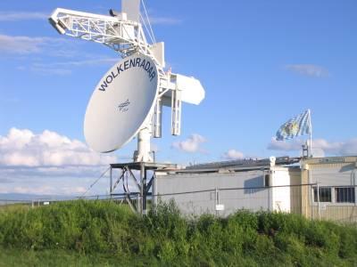
4 Deployment of DLR C-band polarimetric weather radar POLDIRAD at Waltenheim sur Zorn, Alsace, France Photo: A. Behrendt 4
 number of 15 minute radar images where reflectivity was 46 dbz or higher per pixel (out of total app.")
5 Climatology of Convection in the COPS region Distribution of occurrence of air-mass convection (radar , May-August) number of 15 minute radar images where reflectivity was 46 dbz or higher per pixel (out of total app radar images) 5

6 Orographic Effects on the Life Cycle of Convection One of the main objectives of COPS is to study the orographic effect on the initiation and life cycle of convective precipitation. R. Banta,
7 POLDIRAD observations during IOP 15 (daytime) 12 Aug UTC every 10 minutes 7

8 POLDIRAD observations during IOP 15 (daytime) 12 Aug UTC 13 Aug UTC every 10 minutes 8


9 Cell Tracking IOP 15 using POLDIRAD Observations 12 Aug UTC 13 Aug UTC cell tracks cell tracks first occurrence first occurrence 9


10 First Occurrence of Small Cells on some other Days Ridge and upslope days: June 8, 9, 10; Aug. 12, 23, 24 Lee days: June 5; July 18; Aug. 3, 6, 13, 17 Bischenberg X-band radar 10


")


11 X-Band Radar Bischenberg (30 km south of POLDIRAD) POLDIRAD every 10 minutes X-Band every 1 min August

 and rain")
12 MesoNH Simulations 12. Aug UTC 13. Aug UTC wind field (1000m MSL) and rain rate 12


13 Northern crosssection MesoNH Simulations 12. Aug UTC 13. Aug UTC U-component reflectivity Southern crosssection 13


 winds Nancy")
14 Wind Direction and Initiation of Cells Wind from 12 UTC soundings - Nancy and Stuttgart hpa and 700 hpa (crest height) (1500 m above) Ridge initiation related to weaker winds, and flow perpendicular or parallel to the Vosges Vosges Lee initiation related to higher south-westerly (or NE, NW) winds Nancy Stuttgart 14
15 Flow over Mountains Froude Number indicates whether flow is over mountains or flow is diverted around mountains. U Fr NH Theory: Fr < 1 around mountains Fr > 1 flow over mountains Aug12 Aug13 Froude Number U = characteristic flow speed N = Brunt-Väisälä-Frequency H = Height of obstacle Brunt-Vaisala Frequency Nancy Stuttgart 12 UTC sounding 850 hpa How representative is the Nancy or Stuttgart sounding? 15
 12 Aug. 13 Aug.")

16 Conclusions Major difference caused by the wind profile (stability is of minor role) 12 Aug. 13 Aug. weak winds perpendicular or strong winds from south-west parallel to Vosges around and over mountains Models are able to simulate the situation and can provide additional information about the background fields of observed situation 16

17 17
COSMO model simulations for COPS, 15 July 2007 (IOP 8b)
") COSMO model simulations for COPS, 15 July 2007 (IOP 8b) Jörg Trentmann, Björn Brötz, Heini Wernli Institute for Atmospheric Physics Johannes Gutenberg University Mainz OUTLINE The Convective and Orographically-
COSMO model simulations for COPS, 15 July 2007 (IOP 8b) Jörg Trentmann, Björn Brötz, Heini Wernli Institute for Atmospheric Physics Johannes Gutenberg University Mainz OUTLINE The Convective and Orographically-
Convection Initiation in COPS: Radar Climatology and 6 August 2007 Case Study
 Convection Initiation in COPS: Radar Climatology and 6 August 2007 Case Study Tammy M. Weckwerth 1*, Lindsay J. Bennett 2, James W. Wilson 1, Joël Van Baelen 3, Martin Hagen 4, Tracy J. Emerson 1 and Leslie
Detailed flow, hydrometeor and lightning characteristics of an isolated, hail producing thunderstorm during COPS
 Detailed flow, hydrometeor and lightning characteristics of an isolated, hail producing thunderstorm during COPS, Martin Hagen, Hartmut Höller, Hans Volkert Institut für Physik der Atmosphäre, DLR Oberpfaffenhofen
Convective Structures in Clear-Air Echoes seen by a Weather Radar
 Convective Structures in Clear-Air Echoes seen by a Weather Radar Martin Hagen Deutsches Zentrum für Luft- und Raumfahrt Oberpfaffenhofen, Germany Weather Radar Weather radar are normally used to locate
Report of the COPS WG on CI summarising COPS results presented at the ICAM 2009 in Rastatt, Germany. Compiled by Ulrich Corsmeier, IMK-KIT
 Report of the COPS WG on CI summarising COPS results presented at the ICAM 2009 in Rastatt, Germany Compiled by Ulrich Corsmeier, IMK-KIT August 2009 The scientic goals of the COPS working group on convection
Protocol of the 1 st COPS Meeting
 Protocol of the 1 st COPS Meeting Meeting Dates: September 13-14, 2004 Preparation date: September 30, 2004 Place: University of Hohenheim Authors: Volker Wulfmeyer and Andreas Behrendt, IPM, UHOH List
MATERHORN Field Campaign
 High Resolution Modeling for MATERHORN Field Campaign Applications to Synoptically Driven Flow Zachariah Silver, Reneta Dimitrova, and Tamás Zsedrovits Overview Adjusted WRF model setup Application to
Convergence zone development in complex terrain during the Convective and Orographically-induced Precipitation Study (COPS)
") Convergence zone development in complex terrain during the Convective and Orographically-induced Precipitation Study (COPS) Tracy Hertneky 1 and Tammy M. Weckwerth 1 1 National Center for Atmospheric Research
Convergence zone development in complex terrain during the Convective and Orographically-induced Precipitation Study (COPS) Tracy Hertneky 1 and Tammy M. Weckwerth 1 1 National Center for Atmospheric Research
Status-quo of COPS Scientific Preparation, Candidate Instrumentation, Workshop Overview
 Status-quo of COPS Scientific Preparation, Candidate Instrumentation, Workshop Overview Andreas Behrendt, Volker Wulfmeyer Institut für Physik und Meteorologie (IPM), Universität Hohenheim, Stuttgart Christoph
On the relationship between water vapour field evolution and the life cycle of precipitation systems
 Quarterly Journal of the Royal Meteorological Society Q. J. R. Meteorol. Soc. (2011) On the relationship between water vapour field evolution and the life cycle of precipitation systems J. Van Baelen,
TWO CASES OF HEAVY RAIN ON THE MEDITERRANEAN SIDE OF THE ALPS IN MAP. Robert Houze 1 and Socorro Medina University of Washington
 1.1 TWO CASES OF HEAVY RAIN ON THE MEDITERRANEAN SIDE OF THE ALPS IN MAP Robert Houze 1 and Socorro Medina University of Washington Matthias Steiner Princeton University 1. INTRODUCTION The Mesoscale Alpine
COPS - FRANCE. Proposal funded by ANR, CNES, LEFE/INSU & FINANCIAL SUPPORT: ~700 k k
 COPS - FRANCE Proposal funded by ANR, CNES, LEFE/INSU & Météo-France FINANCIAL SUPPORT: ~700 k k + 24 months of post-doc secured through ANR + 2 x 24 months of post-doc requested from INSU/CNRS PARTICIPANTS
Small scale topography influence on the formation of three convective systems observed during COPS over the Vosges Mountains
 Meteorologische Zeitschrift, Vol. 22, No. 4, 395 411 (published online June 2013) Ó by Gebrüder Borntraeger 2013 Open Access Article Small scale topography influence on the formation of three convective
Observational analysis of storms and flooding events in the Pacific Northwest. Introduction
 Observational analysis of storms and flooding events in the Pacific Northwest Jake Crouch UNCA ATMS Class of 2007 April 18, 2009 Cloud and Precipitation Processes and Patterns Group Introduction Average
Influence of the wind profile on the initiation of convection in mountainous terrain
 Quarterly Journal of the Royal Meteorological Society Q. J. R. Meteorol. Soc. 137: 224 235, January 2011 Influence of the wind profile on the initiation of convection in mountainous terrain Martin Hagen,
Rain heterogeneity studies and specific Z-R relationships determination with x-band and k-band radars to improve rain rate retrieval
 Rain heterogeneity studies and specific Z-R relationships determination with x-band and k-band radars to improve rain rate retrieval J. Van Baelen 1,2, F. Tridon 1,2 and Y. Pointin 1,2 1 Clermont Université,
Lessons learnt from field experiments: Inspection of the ALPEX-PYREX-MAP-COPS chain Atlanta/Boulder 19 Jan 2010
 Lessons learnt from field experiments: Inspection of the ALPEX-PYREX-MAP-COPS chain Atlanta/Boulder 19 Jan 2010 Hans Volkert Deutsches Zentrum für Luft- und Raumfahrt (DLR) Institut für Physik der Atmosphäre
WWRP RDP COPS Coordination Structure Science Questions Status Outlook
 WWRP RDP COPS Volker Wulfmeyer Institute of Physics and Meteorology University of Hohenheim Stuttgart, Germany, the COPS International Science Steering Committee, and the D-PHASE Steering Committee Coordination
COPS Status. Volker Wulfmeyer and Andreas Behrendt Institute of Physics and Meteorology (IPM) University of Hohenheim, Stuttgart, Germany
 University of Hohenheim, Stuttgart, Germany") COPS Status Volker Wulfmeyer and Andreas Behrendt Institute of Physics and Meteorology (IPM) University of Hohenheim, Stuttgart, Germany and the COPS ISSC and WG Chairs With updates. AB, 11 October 2006
COPS Status Volker Wulfmeyer and Andreas Behrendt Institute of Physics and Meteorology (IPM) University of Hohenheim, Stuttgart, Germany and the COPS ISSC and WG Chairs With updates. AB, 11 October 2006
Real-Time Assimilation of Observations of Key Prognostic Variables Including the Development of Advanced Observation Operators (RAPTOR)
") Real-Time Assimilation of Observations of Key Prognostic Variables Including the Development of Advanced Observation Operators (RAPTOR) Volker Wulfmeyer and Hans-Stefan Bauer Institute of Physics and Meteorology
Real-Time Assimilation of Observations of Key Prognostic Variables Including the Development of Advanced Observation Operators (RAPTOR) Volker Wulfmeyer and Hans-Stefan Bauer Institute of Physics and Meteorology
AN ANALYSIS OF A SHALLOW COLD FRONT AND WAVE INTERACTIONS FROM THE PLOWS FIELD CAMPAIGN
 AN ANALYSIS OF A SHALLOW COLD FRONT AND WAVE INTERACTIONS FROM THE PLOWS FIELD CAMPAIGN P.105 Carter Hulsey and Kevin Knupp Severe Weather Institute and Radar & Lightning Laboratories, University of Alabama
Cb-LIKE: thunderstorm forecasts up to 6 hrs with fuzzy logic
 Cb-LIKE: thunderstorm forecasts up to 6 hrs with fuzzy logic Martin Köhler DLR Oberpfaffenhofen 15th EMS/12th ECAM 07 11 September, Sofia, Bulgaria Long-term forecasts of thunderstorms why? -> Thunderstorms
L. McMurdie, R. Houze, J. Zagrodnik, W. Petersen, M. Schwaller
 L. McMurdie, R. Houze, J. Zagrodnik, W. Petersen, M. Schwaller International Atmospheric Rivers Conference, San Diego, CA, 9 August 2016 Goals of OLYMPEX Validate GPM satellite radar and passive microwave
5B.5 Intercomparison of simulations using 4 WRF microphysical schemes with dual-polarization data for a German squall line
 5B.5 Intercomparison of simulations using 4 WRF microphysical schemes with dual-polarization data for a German squall line William A. Gallus, Jr. 1 Monika Pfeifer 2 1 Iowa State University 2 DLR Institute
First Results of COPS
 First Results of COPS Prof. Dr. Volker Wulfmeyer Institute of Physics and Meteorology University of Hohenheim, Stuttgart, Germany, the COPS ISSC, and the D-PHASE SC COPS design First highlights g COPS/D-PHASE
P.083 SEVERE WEATHER EVENTS DETECTED BY PUERTO RICO S TROPINET DUAL-POLARIZED DOPPLER X-BAND RADARS NETWORK
 P.083 SEVERE WEATHER EVENTS DETECTED BY PUERTO RICO S TROPINET DUAL-POLARIZED DOPPLER X-BAND RADARS NETWORK Leyda León, José Colom, Carlos Wah University of Puerto Rico, Mayagüez Campus, Mayagüez, PR 1.
Mid-Atlantic Severe Weather Event of 23 June 2015
 Mid-Atlantic Severe Weather Event of 23 June 2015 By Richard H. Grumm National Weather Service State College, PA 1. Overview A widespread severe weather event occurred in the eastern United States on 23
1 August 2006 An Investigation of a Bow Echo along the Wasatch Front. Randy Graham and Chris Gibson 6 April 2007
 1 August 2006 An Investigation of a Bow Echo along the Wasatch Front Randy Graham and Chris Gibson 6 April 2007 Overview Environment review Review of terrain-induced discrete propagation Bow Echo interactions
ERAD Wind-field observations with the operational Doppler radar network in Germany. Proceedings of ERAD (2002): c Copernicus GmbH 2002
: c Copernicus GmbH 2002") Proceedings of ERAD (2002): 195 199 c Copernicus GmbH 2002 ERAD 2002 Wind-field observations with the operational Doppler radar network in Germany M. Hagen 1, K. Friedrich 1, and J. Seltmann 2 1 Institut
Proceedings of ERAD (2002): 195 199 c Copernicus GmbH 2002 ERAD 2002 Wind-field observations with the operational Doppler radar network in Germany M. Hagen 1, K. Friedrich 1, and J. Seltmann 2 1 Institut
A RADAR-BASED CLIMATOLOGY OF HIGH PRECIPITATION EVENTS IN THE EUROPEAN ALPS:
 2.6 A RADAR-BASED CLIMATOLOGY OF HIGH PRECIPITATION EVENTS IN THE EUROPEAN ALPS: 2000-2007 James V. Rudolph*, K. Friedrich, Department of Atmospheric and Oceanic Sciences, University of Colorado at Boulder,
Winter and summer weather studies using high resolution radar data
 Winter and summer weather studies using high resolution radar data Tim Böhme 1 1 Deutscher Wetterdienst, Frankfurter Str. 135, 63067 Offenbach am Main, Germany (Dated: 29 August 2014) Tim Böhme 1. Introduction
Utilising Radar and Satellite Based Nowcasting Tools for Aviation Purposes in South Africa. Erik Becker
 Utilising Radar and Satellite Based Nowcasting Tools for Aviation Purposes in South Africa Erik Becker Morné Gijben, Mary-Jane Bopape, Stephanie Landman South African Weather Service: Nowcasting and Very
CONVECTIVE CLOUD MICROPHYSICS IN A HIGH-RESOLUTION NWP MODEL
 CONVECTIVE CLOUD MICROPHYSICS IN A HIGH-RESOLUTION NWP MODEL J. Trentmann 1, A. Seifert 2, H. Wernli 1 1 Institute for Atmospheric Physics, Johannes Gutenberg University Mainz, Germany 2 German Weather
Indiana County Flash Flood of 22 June 2017
 Indiana County Flash Flood of 22 June 2017 By Richard H. Grumm National Weather Service State College, PA 1. Overview Slow moving thunderstorms brought 3 to 4 inches of rainfall to Indiana County, PA during
9A.2 Real-time multiple-doppler wind fields from RHYTMME and ARAMIS radars with implications for data assimilation within AROME for southeast France
 9A.2 Real-time multiple-doppler wind fields from RHYTMME and ARAMIS radars with implications for data assimilation within AROME for southeast France Jeffrey Beck Olivier Bousquet Mathieu Nuret Météo France,
Predictability of precipitation determined by convection-permitting ensemble modeling
 Predictability of precipitation determined by convection-permitting ensemble modeling Christian Keil and George C.Craig Meteorologisches Institut, Ludwig-Maximilians-Universität, München Motivation 1.Predictability,
DLR Falcon Dropsonde Operation in T-PARC and Analysis of the Environment Surrounding Typhoons
 DLR Falcon Dropsonde Operation in T-PARC and Analysis of the Environment Surrounding Typhoons Kotaro Bessho 1, Tetsuo Nakazawa 1 and Martin Weissmann 2 1 Meteorological Research Institute, Japan Meteorological
Institute of Environmental Research and Sustainable Development, National Observatory of Athens, Athens, Greece, 2
 Comparison of rainfall microphysics estimates from a dualpolarization X-band radar with a 2D video disdrometer, a Parsivel disdrometer and a K-band Micro Rain Radar Anagnostou, Marios N. 1,4, John Kalogiros
A REVIEW OF OUR UNDERSTANDING OF THE AEROSOL CLOUD INTERACTION FROM THE PERSPECTIVE OF A BIN RESOLVED CLOUD SCALE MODELLING
 JP3.4 A REVIEW OF OUR UNDERSTANDING OF THE AEROSOL CLOUD INTERACTION FROM THE PERSPECTIVE OF A BIN RESOLVED CLOUD SCALE MODELLING Andrea I. Flossmann and W. Wobrock Clermont University, Aubière, France
Low-end derecho of 19 August 2017
 Low-end derecho of 19 August 2017 By Richard H. Grumm and Charles Ross National Weather Service State College, PA 1. Overview A cluster of thunderstorms developed in eastern Ohio around 1800 UTC on 19
First THORPEX International Science Symposium, Montreal
 Courtesy of Mel Shapiro Ladies and Gentlemen, The Rossby wave train you can find in the Thorpex Science Plan reached Europe on August 11, 2002. An upper level trough induced the development of a low pressure
Evolution of radar and lightning parameters in summer thunderstorms
 Evolution of radar and lightning parameters in summer thunderstorms rms Rigo,, T., Argemí,, O., Bech,, J., and Pineda, N. Servei Meteorològic de Catalunya, c/berlín 38-46 Barcelona 08029, SPAIN E-mail:
The Long-lived eastern US tornadic supercell of 20 July 2017
 1. Overview The Long-lived eastern US tornadic supercell of 20 July 2017 By Richard H. Grumm and Elissa A Smith National Weather Service State College, PA A long lived supercell developed near the eastern
Description of the case study
 Description of the case study During the night and early morning of the 14 th of July 011 the significant cloud layer expanding in the West of the country and slowly moving East produced precipitation
Convection-Resolving Model Simulations: Process-Based Comparison of LM Results with Observations
 Convection-Resolving Model Simulations: Process-Based Comparison of LM Results with Observations Jörg Trentmann, Britta Wecker, Marcus Paulat, Heini Wernli, Ulrich Corsmeier, Jan Handwerker Goal Improve
OROGRAPHIC PRECIPITATION MECHANISMS: NEW DATA FROM THE MESOSCALE ALPINE PROGRAMME
 OROGRAPHIC PRECIPITATION MECHANISMS: NEW DATA FROM THE MESOSCALE ALPINE PROGRAMME Robert A. Houze, Jr.,* Socorro Medina, and Sandra E. Yuter Department of Atmospheric Sciences, University of Washington,
Pennsylvania Severe Weather of September 2016
 Pennsylvania Severe Weather of September 2016 By Richard H. Grumm National Weather Service State College, PA 1. Overview September 2016 was a relatively quiet month for severe weather across most of the
Understanding and forecasting extreme weather events in Andes lee side: The Relampago opportunity
 Understanding and forecasting extreme weather events in Andes lee side: The Relampago opportunity Ariane Frassoni Center for Weather Forecasting and Climate Studies National Institute for Space Research
Large hail in Estonia on 12th August 2015
 Large hail in Estonia on 12th August 2015 Taimi Paljak, Velle Toll, Tanel Voormansik, Estonian Weather Service Introduction Hail is not as common in Northern Europe as in the rest of Europe due to the
Ki-Hong Min 1*, Seonhee Choo 2, and Gyuwon Lee 1, and Kyung-Eak Kim 1,3
 Ki-Hong Min 1*, Seonhee Choo 2, and Gyuwon Lee 1, and Kyung-Eak Kim 1,3 1 School of Earth System Sciences, Major in Atmospheric Science, Kyungpook National University, Daegu, South Korea 2 Forecast Technology
Q U A R T E R L Y J O U R N A L R O Y A L M E T E O R O L O G I C A L S O C I E T Y
 Q U A R T E R L Y J O U R N A L O F T H E R O Y A L M E T E O R O L O G I C A L S O C I E T Y Vol. 19 JANUARY 3 Part B (MAP) No. 5 Q. J. R. Meteorol. Soc. (3), 19, pp. 35 371 doi: 1.15/qj..13 Air motions
Orographically enhanced heavy rainfall of 23 May 2010 By Richard H. Grumm National Weather Service Office State College, PA 16803
 Orographically enhanced heavy rainfall of 23 May 2010 By Richard H. Grumm National Weather Service Office State College, PA 16803 1. INTRODUCTION During the overnight hours and into the early morning of
Characterizing the Structure of Hurricane Karl (2010): Doppler Radar and WRF
: Doppler Radar and WRF") Characterizing the Structure of Hurricane Karl (2010): Doppler Radar and WRF Jennifer DeHart and Robert Houze Atmospheric Physics and Chemistry Seminar 5.9.16 NASA grants: NNX13AG71G / NNX12AJ82G Orographic
Characterizing the Structure of Hurricane Karl (2010): Doppler Radar and WRF Jennifer DeHart and Robert Houze Atmospheric Physics and Chemistry Seminar 5.9.16 NASA grants: NNX13AG71G / NNX12AJ82G Orographic
TIME EVOLUTION OF A STORM FROM X-POL IN SÃO PAULO: 225 A ZH-ZDR AND TITAN METRICS COMPARISON
 TIME EVOLUTION OF A STORM FROM X-POL IN SÃO PAULO: 225 A ZH-ZDR AND TITAN METRICS COMPARISON * Roberto V Calheiros 1 ; Ana M Gomes 2 ; Maria A Lima 1 ; Carlos F de Angelis 3 ; Jojhy Sakuragi 4 (1) Voluntary
Downslope windstorm in High Tatras 19 November high resolution study by André Simon, Jozef Vivoda SHMÚ
 Downslope windstorm in High Tatras 19 November 2004 high resolution study by André Simon, Jozef Vivoda SHMÚ Impact of the 19 November windstorm Southern part of High- and Low Tatras: 120 km2 of forest
2016 INTERNATIONAL ATMOSPHERIC RIVERS CONFERENCE SAN DIEGO, CA 8-11 August 2016
 ATMOSPHERIC RIVERS AND ENHANCED INTEGRATED VAPOR TRANSPORT EPISODES: THEIR ROLE IN DAMAGING FRONTAL PASSAGES IN SOUTHERN CALIFORNIA WITH AN EMPHASIS ON STRONG WINDS 2016 INTERNATIONAL ATMOSPHERIC RIVERS
High resolution precipitation analysis and forecast validation over complex terrain using an inverse VERA approach
 4 th International Verification Methods Workshop Helsinki, Finland, 8-10 June 2009 High resolution precipitation analysis and forecast validation over complex terrain using an inverse VERA approach Benedikt
Hail frequency in central Europe estimated from radar data - and the relation to orographic / atmospheric characteristics
 Hail frequency in central Europe estimated from radar data - and the relation to orographic / atmospheric characteristics Michael Kunz, Elody Fluck, Sven Baumstark, Jan Wandel, Stefan Ritz, Peter Geissbuehler,
Report of the 3rd COPS & GOP Workshop held on April 10 and 11 at University of Hohenheim
 Report of the 3rd COPS & GOP Workshop held on April 10 and 11 at University of Hohenheim 62 persons participated in the 3rd COPS & GOP Workshop The list of participants and copies of all presentations
The Severe Weather Event of 7 August 2013 By Richard H. Grumm and Bruce Budd National Weather Service State College, PA 1. INTRODUCTION and Overview
 The Severe Weather Event of 7 August 2013 By Richard H. Grumm and Bruce Budd National Weather Service State College, PA 1. INTRODUCTION and Overview A fast moving short-wave (Fig. 1) with -1σ 500 hpa height
Simulations of Convergence Lines
 Simulations of Convergence Lines with Convection using COSMO-DE Markus Übel and Andreas Bott (University of Bonn) --- COSMO User Seminar 2011 --- Outline Motivation Definition of convergence lines Simulation
Figure 1: Tephigram for radiosonde launched from Bath at 1100 UTC on 15 June 2005 (IOP 1). The CAPE and CIN are shaded dark and light gray,
. The CAPE and CIN are shaded dark and light gray,") Figure 1: Tephigram for radiosonde launched from Bath at 1100 UTC on 1 June 200 (IOP 1). The CAPE and CIN are shaded dark and light gray, respectively; the thin solid line partially bounding these areas
Figure 1: Tephigram for radiosonde launched from Bath at 1100 UTC on 1 June 200 (IOP 1). The CAPE and CIN are shaded dark and light gray, respectively; the thin solid line partially bounding these areas
DEVELOPMENT OF CELL-TRACKING ALGORITHM IN THE CZECH HYDROMETEOROLOGICAL INSTITUTE
 DEVELOPMENT OF CELL-TRACKING ALGORITHM IN THE CZECH HYDROMETEOROLOGICAL INSTITUTE H. Kyznarová 1 and P. Novák 2 1 Charles University, Faculty of Mathematics and Physics, kyznarova@chmi.cz 2 Czech Hydrometeorological
Tropical Waves. John Cangialosi and Lixion Avila National Hurricane Center. WMO Region IV Tropical Cyclone Workshop
 Tropical Waves John Cangialosi and Lixion Avila National Hurricane Center WMO Region IV Tropical Cyclone Workshop Outline Basic definition Schematic diagrams/interactions Operational products/forecasts
Mechanisms and prediction of precipitation over complex terrain
 Mechanisms and prediction of precipitation over complex terrain S. Wassermann, M. Kunz, Ch. Kottmeier Institut für Meteorologie und Klimaforschung, Universität Karlsruhe (TH) / International PhD-students
Exploring Gravity Wave Dynamics, Sources, and Predictability in DeepWave
 Exploring Gravity Wave Dynamics, Sources, and Predictability in DeepWave James D. Doyle 1, Stephen D. Eckermann 2, Eric Hendricks 1, Qingfang Jiang 1, P. Alex Reinecke 1, Carolyn A. Reynolds 1, David C.
Proposal Requesting to use NSF Facilities for Education. Project: TOM: Teaching flow Over Mountains
 Proposal Requesting to use NSF Facilities for Education Project: TOM: Teaching flow Over Mountains Requestor: Drs. Katja Friedrich & Julie Lundquist Department of Atmospheric and Ocean Sciences University
Charles A. Doswell III, Harold E. Brooks, and Robert A. Maddox
 Charles A. Doswell III, Harold E. Brooks, and Robert A. Maddox Flash floods account for the greatest number of fatalities among convective storm-related events but it still remains difficult to forecast
Near Real-time Cloud Classification, Mesoscale Winds, and Convective Initiation Fields from MSG Data
 Near Real-time Cloud Classification, Mesoscale Winds, and Convective Initiation Fields from MSG Data Wayne Feltz *, J. Mecikalski, and K. Bedka * Cooperative Institute of Meteorological Satellite Studies
Dynamics and microphysics of orographic precipitation during MAP IOP3
 Q. J. R. Meteorol. Soc. (2005), 131, pp. 2795 2819 doi: 10.1256/qj.04.79 Dynamics and microphysics of orographic precipitation during MAP IOP3 By OLIVIER PUJOL, JEAN-FRANCOIS GEORGIS, MICHEL CHONG and
Heavy rains and precipitable water anomalies August 2010 By Richard H. Grumm And Jason Krekeler National Weather Service State College, PA 16803
 Heavy rains and precipitable water anomalies 17-19 August 2010 By Richard H. Grumm And Jason Krekeler National Weather Service State College, PA 16803 1. INTRODUCTION Heavy rain fell over the Gulf States,
Convective Initiation by Topographically Induced Convergence Forcing over the Dabie Mountains on 24 June 2010
 ADVANCES IN ATMOSPHERIC SCIENCES, VOL. 33, OCTOBER 2016, 1 17 Convective Initiation by Topographically Induced Convergence Forcing over the Dabie Mountains on 24 June 2010 Qiwei WANG 1, Ming XUE 1,2, and
Predecessor Rain Events: A Literature Review. By: Tony Viramontez
 Predecessor Rain Events: A Literature Review By: Tony Viramontez Introduction Predecessor Rain Event (PRE): meso- and subsynopticscale regions of high-impact heavy rainfall that occur well in advance of
Supplementary Figure 1. Summer mesoscale convective systems rainfall climatology and trends. Mesoscale convective system (MCS) (a) mean total
 (a) mean total") Supplementary Figure 1. Summer mesoscale convective systems rainfall climatology and trends. Mesoscale convective system (MCS) (a) mean total rainfall and (b) total rainfall trend from 1979-2014. Total
Supplementary Figure 1. Summer mesoscale convective systems rainfall climatology and trends. Mesoscale convective system (MCS) (a) mean total rainfall and (b) total rainfall trend from 1979-2014. Total
Simon Tschannett*, B. Bica, B. Chimani, M. Dorninger, W. Gepp, S. Schneider, R. Steinacker University of Vienna Vienna, Austria
 7.31 VERA AS AN OPERATIONAL NOWCASTING TOOL Simon Tschannett*, B. Bica, B. Chimani, M. Dorninger, W. Gepp, S. Schneider, R. Steinacker University of Vienna Vienna, Austria M. Kerschbaum Austro Control,
The relation between airflow and orographic precipitation on the southern side of the Alps as revealed by weather radar
 Quarterly Journal of the Royal Meteorological Society Q. J. R. Meteorol. Soc. 136: 222 238, January 2010 Part A The relation between airflow and orographic precipitation on the southern side of the Alps
The 2009 Hurricane Season Overview
 The 2009 Hurricane Season Overview Jae-Kyung Schemm Gerry Bell Climate Prediction Center NOAA/ NWS/ NCEP 1 Overview outline 1. Current status for the Atlantic, Eastern Pacific and Western Pacific basins
Long Term Renewables Forecast Hauser Plads 10, 4 DK-1127 Copenhagen K Denmark
 Area: Germany Client: xxx Issued: 08:00 UTC 26.08.2016 Next update: 02.09.2016 Overview During 27-29 Aug a low pressure is passing south of UK towards southern Scandinavia and the connected fronts are
Heavy Rainfall Event of June 2013
 Heavy Rainfall Event of 10-11 June 2013 By Richard H. Grumm National Weather Service State College, PA 1. Overview A 500 hpa short-wave moved over the eastern United States (Fig. 1) brought a surge of
NEW SCHEME TO IMPROVE THE DETECTION OF RAINY CLOUDS IN PUERTO RICO
 NEW SCHEME TO IMPROVE THE DETECTION OF RAINY CLOUDS IN PUERTO RICO Joan Manuel Castro Sánchez Advisor Dr. Nazario Ramirez UPRM NOAA CREST PRYSIG 2016 October 7, 2016 Introduction A cloud rainfall event
The HIAPER Cloud Radar Performance and Observations During Winter Storm Observations of a Nor easter
 The HIAPER Cloud Radar Performance and Observations During Winter Storm Observations of a Nor easter S. Ellis 1*, R. Rauber 2, P. Tsai 1, J. Emmett 1, E. Loew 1, C. Burghart 1, M. Dixon 1, J. Vivekanandan
Simulating orographic precipitation: Sensitivity to physics parameterizations and model numerics
 Simulating orographic precipitation: Sensitivity to physics parameterizations and model numerics 2nd COPS-Meeting, 27 June 2005 Günther Zängl Overview A highly idealized test of numerical model errors
Application and verification of ECMWF products 2011
 Application and verification of ECMWF products 2011 National Meteorological Administration 1. Summary of major highlights Medium range weather forecasts are primarily based on the results of ECMWF and
High Resolution Numerical Weather Prediction for High Impact and Extreme Weather Events in 2014 across Southern California
 High Resolution Numerical Weather Prediction for High Impact and Extreme Weather Events in 2014 across Southern California Alex Tardy Alexander.Tardy@noaa.gov NWS San Diego Warning Coordination Meteorologist
Severe Weather Event of 13 July 2014
 Severe Weather Event of 13 July 2014 By Richard H. Grumm and Elyse M. Colbert National Weather Service State College, PA 1. Overview Severe weather affected the eastern United States (Fig. 1) from northwestern
Extreme precipitation events in the. southeast U.S.
 Extreme precipitation events in the Southeast US A preliminary investigation of operational forecast challenges related to moisture sources and transport TN flooding May 2010 Asheville, NC 2004 State Climate
P PRELIMINARY ANALYSIS OF THE 10 JUNE 2010 SUPERCELLS INTERCEPTED BY VORTEX2 NEAR LAST CHANCE, COLORADO
 P12.164 PRELIMINARY ANALYSIS OF THE 10 JUNE 2010 SUPERCELLS INTERCEPTED BY VORTEX2 NEAR LAST CHANCE, COLORADO 1. INTRODUCTION An outstanding question in the field of severe storms research is why some
Contributions of DLR to DEEPWAVE-NZ
 Contributions of DLR to DEEPWAVE-NZ Hans Schlager, Markus Rapp, Bernd Kaifler, Andreas Dörnbrack DLR Oberpfaffenhofen Institut für Physik der Atmosphäre DLR contribution integrated in the BMBF Research
Precipitation processes in the Middle East
 Precipitation processes in the Middle East J. Evans a, R. Smith a and R.Oglesby b a Dept. Geology & Geophysics, Yale University, Connecticut, USA. b Global Hydrology and Climate Center, NASA, Alabama,
Progress in Latent Heat Nudging Real Case Studies
 Progress in Latent Heat Nudging Real Case Studies RADVOR-OP, supported by LAWA Stefan Klink FE 12 Data Assimilation stefan.klink@dwd.de 24.09.2003-1 - Progress in Latent Heat Nudging Real Case Studies
Impacts of the April 2013 Mean trough over central North America
 Impacts of the April 2013 Mean trough over central North America By Richard H. Grumm National Weather Service State College, PA Abstract: The mean 500 hpa flow over North America featured a trough over
 Identification of Predictors for Nowcasting Heavy Rainfall In Taiwan --------------------- Part II: Storm Characteristics and Nowcasting Applications Challenges in Developing Nowcasting Applications for
P4.10. Kenichi Kusunoki 1 * and Wataru Mashiko 1 1. Meteorological Research Institute, Japan
 P4. DOPPLER RADAR INVESTIGATIONS OF THE INNER CORE OF TYPHOON SONGDA (24) Polygonal / elliptical eyewalls, eye contraction, and small-scale spiral bands. Kenichi Kusunoki * and Wataru Mashiko Meteorological
Orographic Modification of Convection and Flow Kinematics by the Oregon Coast Range and Cascades during IMPROVE-2
 3894 M O N T H L Y W E A T H E R R E V I E W VOLUME 136 Orographic Modification of Convection and Flow Kinematics by the Oregon Coast Range and Cascades during IMPROVE-2 BRIAN A. COLLE AND YANLUAN LIN
CLOUD AND PRECIPITATION PROCESSES OBSERVED IN THE DECEMBER 2001 STORM STUDIED OVER THE OREGON CASCADES IN IMPROVE
 7.2 CLOUD AND PRECIPITATION PROCESSES OBSERVED IN THE 13-14 DECEMBER 2001 STORM STUDIED OVER THE OREGON CASCADES IN IMPROVE Christopher P. Woods, Mark T. Stoelinga, John D. Locatelli, Peter V. Hobbs *
Multiscale Analyses of Inland Tropical Cyclone Midlatitude Jet Interactions: Camille (1969) and Danny (1997)
 and Danny (1997)") Multiscale Analyses of Inland Tropical Cyclone Midlatitude Jet Interactions: Camille (1969) and Danny (1997) Matthew Potter, Lance Bosart, and Daniel Keyser Department of Atmospheric and Environmental
Multiscale Analyses of Inland Tropical Cyclone Midlatitude Jet Interactions: Camille (1969) and Danny (1997) Matthew Potter, Lance Bosart, and Daniel Keyser Department of Atmospheric and Environmental
From research to peer-review publication: a Northern Gulf Coast sea breeze study
 From research to peer-review publication: a Northern Gulf Coast sea breeze study Chris Hill, Pat Fitzpatrick*, James Corbin, Yee Lau, and Sachin Bhate * speaker Geosystems Research Institute, Stennis Space
30th Conference on Hurricanes and Tropical Meteorology, April 2012, Ponte Vedra Beach, Florida
 Characteristics of Extreme Summer Convection in the Tropical Americas Manuel ld D. Zuluaga and Robert ta A. Houze Jr. University of Washington 30th Conference on Hurricanes and Tropical Meteorology, 15
Characterizing the diurnal cycle of precipitation over complex Alpine orography using fourdimensional
 Characterizing the diurnal cycle of precipitation over complex Alpine orography using fourdimensional radar observations Pradeep V. Mandapaka 1, Urs Germann 1, Luca Panziera 1 1 MeteoSwiss, Locarno Monti,
Investigation of the Arizona Severe Weather Event of August 8 th, 1997
 Investigation of the Arizona Severe Weather Event of August 8 th, 1997 Tim Hollfelder May 10 th, 2006 Abstract Synoptic scale forcings were very weak for these thunderstorms on August 7-8, 1997 over the