The Severe Weather Event of 7 August 2013 By Richard H. Grumm and Bruce Budd National Weather Service State College, PA 1. INTRODUCTION and Overview
|
|
|
- Harry Dickerson
- 5 years ago
- Views:
Transcription
 with -1σ 500 hpa height anomalies and a modest 250 hpa jet (Fig. 2) produced a severe weather event over eastern Ohio and western Pennsylvania.")
1 The Severe Weather Event of 7 August 2013 By Richard H. Grumm and Bruce Budd National Weather Service State College, PA 1. INTRODUCTION and Overview A fast moving short-wave (Fig. 1) with -1σ 500 hpa height anomalies and a modest 250 hpa jet (Fig. 2) produced a severe weather event over eastern Ohio and western Pennsylvania. It will be shown that a bow echo developed in northwestern Pennsylvania and moved southeastward across the State and produced the majority of the severe reports. To the southwest, supercells produced a mix of hail and wind reports and one confirmed EF0 tornado. The one short-lived EF0 tornado was observed in Quemahoning, Jenner and Lincoln Townships in Somerset County, Pennsylvania, south of the bow echo track. The bow echo, which produced many of the wind reports is one of many such systems be observed over recent years which at times dominate severe events (Grumm and Colbert 2012). These distinct systems and their ability to persist, Figure 3. Storm reports for the 24 hour period ending at 1200 UTC 8 August Data from the Storm Prediction Center and severe weather is color coded by type as in the key on the lower left of the image. producing significant number of severe reports and semi-linear features in SPC storm reports (Grumm and Colbert 2013) has been observed repetitively in central Pennsylvania. There is some potential here in understanding how these systems develop and if they can persist to improve warnings related to these systems. The short-wave and strong 250 hpa jet (Fig. 2) cause high precipitable water air to surge into eastern Ohio and western Pennsylvania (Fig. 4) with modest 850 hpa winds (Fig. 5). The lowlevel moisture and the cold air in the approaching trough (Fig. 1) produced a surge of high convective available potential energy (CAPE: Fig. 6) over portions of eastern Ohio and western Pennsylvania. Though not shown, there was some modest cold air damming over eastern Pennsylvania and thus relative stable air to the east. Over most of Pennsylvania the low-level air was relatively dry which may have contributed to the production of a cold pool and subsequent bow echo evolution.
2 The infrared satellite imagery shows the cold clouds and lightning with the bowing system over western Pennsylvania at 2002 UTC (Fig. 7). Note the lack of cold clouds and relatively warm cloud tops in central and eastern Pennsylvania associated with the low-clouds caught in the inversion (not shown) associated with the cold air damming. The bow echo did not penetrate deeply into the cold air and the satellite imagery suggests few traces of it after 2325 UTC as the cold cloud shield expanded to the southwest with the stronger convection in that region, close to the location of the lone tornado. KCCX radar shows the early stages of the bow echo over western Pennsylvania (Fig. 8) with the enhanced reflectivity and high winds over northwestern Pennsylvania. There were few returns in the cool stable air over central and eastern Pennsylvania. From a velocity perspective, KCCX had a great viewing angle of this storm as the motion was nearly down-radial. Peak winds were over 50kts in the 0.5 degree velocity at 2018 UTC. The cold tops on satellite implied that the convection had already produced a substantial anvil cloud (Fig. 8). Though not shown, the CC data implied hail and rain in the storm. The winds peaked over 60kts at 2050 UTC as the bow moved toward Clearfield County (Fig. 8 lower). The ZH and V both looked impressive on radar as the storm entered Clearfield County shortly before 2104 UTC (Fig. 9). The convection continued eastward but the winds weakened as the convection began to ingest the warm stable air to the south and east (Fig. 9-lower). The southern flank of the bow was able to begin to ingest warm air to the south and west (Fig. 10) and the southern flank of the bow began to intensify around 2343 UTC, the system persisted (not shown) nearly 2 more hours and accounted for a significant percentage of the severe weather reports from western Pennsylvania into southeastern Pennsylvania (Fig. 3). A around 2200 UTC a supercell thunderstorm developed in the warm humid air over western Pennsylvania. The storm had strong outbound winds (Fig. 11) in the hook region of the storm as viewed on KPBZ radar. This storm moved into Somerset County around 2254 UTC (not shown) and tracked across the County over the next 30 minutes. This storm was the storm which likely produced the tornado near Raphton, Pennsylvania at about the time of the 2303 UTC image (Fig. 11-lower). Another supercell developed north of this storm (Fig. 12) and as viewed on KCCX the storm had strong returns at lower levels (Fig. 12-upper left) and a 3-body scattering signal in the CC data (Fig. 12-lower right)1. The deep blues on the southwest edge of the storm showed the signal for a 3-body scattering and implied some larger hail. This signal persisted for about 9 volume scans indicating a very strong updraft core. The signal peaked between 2109 (not shown) and 2118 UTC (Fig. 13). The hail signal in the storm was visible through about 2224 UTC. This storm too had rotation in both the storm relative velocity (SRM: not shown) and base velocity data. No SRM data was shown here. Not surprisingly the rotating storms in southwestern Pennsylvania produced reports of large hail, wind damage, and one confirmed EF0 tornado. 2. Summary The combination of cold air damming to the east and an approaching short-wave to the west (Fig. 1 & 2) produced a severe weather event in western Pennsylvania. The surge of high PW air and the arrival of high CAPE with the moisture served as fuel for the convection. The strong jet 1 All images use here were 4 panels most images had the dual-pol data removed to match the text.
3 aloft (Fig. 2) and the short-wave likely played a role in the favorable large scale environment and the lift. Many of the cells which developed in southwestern Pennsylvania quickly showed signs of rotation, like the result of the shear and the low-level frontal boundary associated with the cold air damming over central and eastern Pennsylvania. The northern edge of the severe weather, primarily wind damage, was associated with a bow echo. This system weakened as it ingested the cooler drier air to the east. As it moved farther south it was able to ingest some warm moist air and thus resurged. Farther south, the storms developed strong updrafts, developed rotation and showed signs (Fig. 12 & 13) that the updrafts produced large hail. The CC data clearly showed a supercell which had a three body scattering for a prolonged period spanning over 45 minutes. The two stronger supercells produced hail, wind, damage, and the southern supercell likely produced the EF0 tornado in Somerset County. It is interesting to note that the tornado occurred to the lee of the higher terrain to the west implying vortex stretching may have played a role in the tornadoes evolution. 3. Acknowledgements National Weather Service employees who worked the event, gathered and archived data. Spotters for reports and information on the storms.
 and height anomalies in 2 hour increments from a)")
4 Figure 2. 13km RAP 500 hpa heights (m) and height anomalies in 2 hour increments from a) 1400 UTC 8 June 2013 through f) 0000 UTC 8 June Return to text.
")
5 Figure 2. As in Figure 2 except for 250 hpa winds (kts) and wind anomalies. Return to text.
6 Figure 4. As in Figure 2 except for precipitable water (mm) and zoomed over Pennsylvania. Return to text.
7 Figure 5. As in Figure 4 except for 850 hpa winds and wind anomalies. Return to text.
8 Figure 6. As in Figure 5 except for surface based convective available potential energy. Return to text.


9 Figure 7. GOES ITR and 1-minute lightning data at 2002, 2155 and 2325 UTC. Return to text.

 2050 UTC 7 August 2013.")
10 Figure 8. KCC radar showing 0.5 degree horizontal reflectivity and base velocity at (top) 2018 and (bottom) 2050 UTC 7 August Return to text.


11 Figure 9. As in Figure 8 except for 2104 UTC and 2238 UTC. Return to text.


12 Figure 10. As in Figure 9 except for August and 0006 UTC 8 August Return to text.


13 Figure 11. As in Figure 10 except KBPZ radar at 2214 and 2303 UTC. Return to text.

14 Figure 11. KCCX radar showing 0.5 degree slices at 2055 UTC, clockwise from top left horizontal reflectivity, velocity, correlation coefficient (CC), and specific differential phase (KDP). Return to text.

15 Figure 13. As in Figure 12 except valid at 2118 UTC. Return to text.
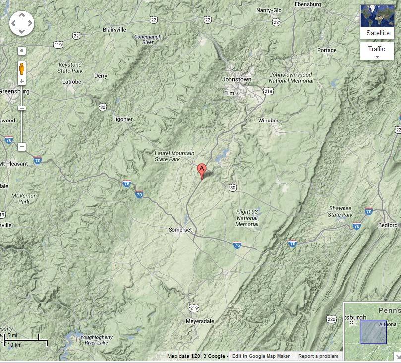
16 Appendices Tornado PNS and MAP of where tornado was observed NOUS41 KCTP PNSCTP PAZ PUBLIC INFORMATION STATEMENT NATIONAL WEATHER SERVICE STATE COLLEGE PA 249 PM EDT FRI AUG TORNADO CONFIRMED 2 MILES EAST OF RALPHTON IN SOMERSET COUNTY PENNSYLVANIA... LOCATION...2 MILES EAST OF RALPHTON IN SOMERSET COUNTY PENNSYLVANIA DATE...AUGUST ESTIMATED TIME...APPROXIMATELY 720 PM EDT MAXIMUM EF-SCALE RATING...EF0 ESTIMATED MAXIMUM WIND SPEED MPH MAXIMUM PATH WIDTH...75 YARDS PATH LENGTH MILE FATALITIES...0 INJURIES...0 * THE INFORMATION IN THIS STATEMENT IS PRELIMINARY AND SUBJECT TO CHANGE PENDING FINAL REVIEW OF THE EVENT(S) AND PUBLICATION IN NWS STORM DATA....SUMMARY... THE NATIONAL WEATHER SERVICE IN STATE COLLEGE PA HAS CONFIRMED A TORNADO 2 MILES EAST OF RALPHTON IN SOMERSET COUNTY PENNSYLVANIA ON 08/07/13. A STORM SURVEY WAS CONDUCTED IN QUEMAHONING TOWNSHIP SOMERSET COUNTY. THE TORNADO TOUCHED DOWN 2 MILES EAST OF RALPHTON NEAR HORNER CHURCH ROAD. MINOR DAMAGE OCCURRED TO ONE HOME AND ONE BARN ROOF WAS PARTIALLY BLOWN OFF TREES WERE ALSO DOWNED OR DAMAGED. THANK YOU TO THE SOMERSET COUNTY EMERGENCY MANAGER AND THE STOYSTOWN FIRE DEPARTMENT FOR THEIR ASSISTANCE DURING THE SURVEY. THIS INFORMATION CAN ALSO BE FOUND ON OUR WEBSITE AT WEATHER.GOV/CTP. FOR REFERENCE...THE ENHANCED FUJITA SCALE CLASSIFIES TORNADOES INTO THE FOLLOWING CATEGORIES: EF0...WIND SPEEDS 65 TO 85 MPH. EF1...WIND SPEEDS 86 TO 110 MPH. EF2...WIND SPEEDS 111 TO 135 MPH. EF3...WIND SPEEDS 136 TO 165 MPH. EF4...WIND SPEEDS 166 TO 200 MPH. EF5...WIND SPEEDS GREATER THAN 200 MPH. $$ BUDD/COLBERT
17
Severe Weather Event of 13 July 2014
 Severe Weather Event of 13 July 2014 By Richard H. Grumm and Elyse M. Colbert National Weather Service State College, PA 1. Overview Severe weather affected the eastern United States (Fig. 1) from northwestern
Low-end derecho of 19 August 2017
 Low-end derecho of 19 August 2017 By Richard H. Grumm and Charles Ross National Weather Service State College, PA 1. Overview A cluster of thunderstorms developed in eastern Ohio around 1800 UTC on 19
Isolated severe weather and cold air damming 9 November 2005 By Richard H. Grumm National Weather Service Office State College, PA 16801
 Isolated severe weather and cold air damming 9 November 2005 By Richard H. Grumm National Weather Service Office State College, PA 16801 1. INTRODUCTION Two lines of convection moved over the State of
Mid Atlantic Severe Event of 1 May 2017 Central Pennsylvania QLCS event By Richard H. Grumm National Weather Service, State College, PA 16803
 1. Overview Mid Atlantic Severe Event of 1 May 2017 Central Pennsylvania QLCS event By Richard H. Grumm National Weather Service, State College, PA 16803 A strong upper-level wave (Fig.1) moving into a
Severe Weather with a strong cold front: 2-3 April 2006 By Richard H. Grumm National Weather Service Office State College, PA 16803
 Severe Weather with a strong cold front: 2-3 April 2006 By Richard H. Grumm National Weather Service Office State College, PA 16803 1. INTRODUCTION A strong cold front brought severe weather to much of
16 September 2005 Northern Pennsylvania Supercell Thunderstorm by Richard H. Grumm National Weather Service Office State College, PA 16803
 16 September 2005 Northern Pennsylvania Supercell Thunderstorm by Richard H. Grumm National Weather Service Office State College, PA 16803 1. INTRODUCTION During the afternoon hours of 16 September 2005,
Mid-Atlantic Severe Weather Event of 23 June 2015
 Mid-Atlantic Severe Weather Event of 23 June 2015 By Richard H. Grumm National Weather Service State College, PA 1. Overview A widespread severe weather event occurred in the eastern United States on 23
Flooding and Severe weather of 27 June 2013
 Flooding and Severe weather of 27 June 2013 By Richard H. Grumm National Weather Service State College, PA 1. Overview Flooding and severe weather affected Pennsylvania on 27 June 2013 (Fig 1). The severe
The Long-lived eastern US tornadic supercell of 20 July 2017
 1. Overview The Long-lived eastern US tornadic supercell of 20 July 2017 By Richard H. Grumm and Elissa A Smith National Weather Service State College, PA A long lived supercell developed near the eastern
Pennsylvania Severe Weather of September 2016
 Pennsylvania Severe Weather of September 2016 By Richard H. Grumm National Weather Service State College, PA 1. Overview September 2016 was a relatively quiet month for severe weather across most of the
Northeastern United States Snowstorm of 9 February 2017
 Northeastern United States Snowstorm of 9 February 2017 By Richard H. Grumm and Charles Ross National Weather Service State College, PA 1. Overview A strong shortwave produced a stripe of precipitation
Indiana County Flash Flood of 22 June 2017
 Indiana County Flash Flood of 22 June 2017 By Richard H. Grumm National Weather Service State College, PA 1. Overview Slow moving thunderstorms brought 3 to 4 inches of rainfall to Indiana County, PA during
1. INTRODUCTION * Figure 1. National Weather Service Storm Prediction Center (SPC) storm reports for December 1, 2006.
 storm reports for December 1, 2006.") P1.14 FORECAST ISSUES RELATED TO THE UNPRECEDENTED SEVERE AND HIGH WIND EVENT OF DECEMBER 2006 by Greg A. DeVoir* and Richard H. Grumm National Weather Service Office State College, PA 16803 1. INTRODUCTION
P1.14 FORECAST ISSUES RELATED TO THE UNPRECEDENTED SEVERE AND HIGH WIND EVENT OF DECEMBER 2006 by Greg A. DeVoir* and Richard H. Grumm National Weather Service Office State College, PA 16803 1. INTRODUCTION
Minor Winter Flooding Event in northwestern Pennsylvania January 2017
 1. Overview Minor Winter Flooding Event in northwestern Pennsylvania 12-13 January 2017 By Richard H. Grumm National Weather Service State College, PA A combination of snow melt, frozen ground, and areas
Tornadogenesis in Supercells: The Three Main Ingredients. Ted Funk
 Tornadogenesis in Supercells: The Three Main Ingredients Ted Funk NWS Louisville, KY Spring 2002 Environmental Parameters Supercells occur within environments exhibiting several wellknown characteristics
...TORNADO CONFIRMED NEAR SANFORD...BROADWAY...HOLLY SPRINGS AND RALEIGH IN LEE AND WAKE COUNTIES COUNTY NORTH CAROLINA...
 ...TORNADO CONFIRMED NEAR SANFORD...BROADWAY...HOLLY SPRINGS AND RALEIGH IN LEE AND WAKE COUNTIES COUNTY NORTH CAROLINA... LOCATION...SANFORD...BROADWAY...HOLLY SPRINGS AND RALEIGH IN LEE AND WAKE COUNTIES
Deep Cyclone and rapid moving severe weather event of 5-6 June 2010 By Richard H. Grumm National Weather Service Office State College, PA 16803
 Deep Cyclone and rapid moving severe weather event of 5-6 June 2010 By Richard H. Grumm National Weather Service Office State College, PA 16803 1. INTRODUCTION A rapidly deepening surface cyclone raced
2 July 2013 Flash Flood Event
 2 July 2013 Flash Flood Event By Richard H. Grumm and Charles Ross National Weather Service State College, PA 1. Overview A retrograding 500 hpa cyclone and anticyclone (Fig. 1) set up deep southerly flow
End of heat-event severe event of 7 July 2012
 End of heat-event severe event of 7 July 2012 Richard H. Grumm And Elyse Colbert National Weather Service Office State College, PA 16803 1. Overview A widespread severe weather event affected Pennsylvania
Thanksgiving Snow and Arctic Front 25 November 2005 By Richard H. Grumm National Weather Service State College, PA 16801
 Thanksgiving Snow and Arctic Front 25 November 2005 By Richard H. Grumm National Weather Service State College, PA 16801 1. INTRODUCTION An approaching arctic front brought light snow to most of western
Cold frontal Rainband and Mid-Atlantic Severe Weather Event 28 September 2006 by Richard H. Grumm And Ron Holmes
 Cold frontal Rainband and Mid-Atlantic Severe Weather Event 28 September 2006 by Richard H. Grumm And Ron Holmes 1. INTRODUCTION A strong cold front moved across central Pennsylvania and the Mid-Atlantic
1st Tornado Photograph
 Lecture 26 Part II Tornados Environment Storm Structure Life Cycle Source of Spin Forecasting Climatology Damage Marilee Thomas of Beaver City, NE took this photograph of her daughter Audra about two miles
Multi-day severe event of May 2013
 Abstract: Multi-day severe event of 18-22 May 2013 By Richard H. Grumm and Charles Ross National Weather Service State College, PA A relatively slow moving Trough over the western United States and a ridge
Impacts of the April 2013 Mean trough over central North America
 Impacts of the April 2013 Mean trough over central North America By Richard H. Grumm National Weather Service State College, PA Abstract: The mean 500 hpa flow over North America featured a trough over
Mesoscale Convective System and heat episode July 2005 by Richard H. Grumm and Mathew Steinbugl
 Mesoscale Convective System and heat episode 25-27 July 2005 by Richard H. Grumm and Mathew Steinbugl 1. INTRODUCTION A strong upper-level ridge brought unseasonably high temperatures to the Midwest and
Mid-Atlantic Severe Event of 1 June 2012
 Mid-Atlantic Severe Event of 1 June 2012 1. Introduction An unseasonably deep midtropospheric ridge (Fig. 1) brought a strong cold front into the Mid-Atlantic region on 1 June 2012. A surge of warm moist
Heavy Rainfall Event of June 2013
 Heavy Rainfall Event of 10-11 June 2013 By Richard H. Grumm National Weather Service State College, PA 1. Overview A 500 hpa short-wave moved over the eastern United States (Fig. 1) brought a surge of
PUBLIC INFORMATION STATEMENT...UPDATED FATALITY INFO NATIONAL WEATHER SERVICE RALEIGH NC 435 PM EDT MON APR
 PUBLIC INFORMATION STATEMENT...UPDATED FATALITY INFO NATIONAL WEATHER SERVICE RALEIGH NC 435 PM EDT MON APR 18 2011...MULTIPLE TORNADOES CONFIRMED ON APRIL 16 2011......TORNADO CONFIRMED NEAR WAYSIDE TO
The Oakfield, Wisconsin, Tornado from July Brett Berenz Student at the University of Wisconsin
 The Oakfield, Wisconsin, Tornado from 18-19 July 1996 Brett Berenz Student at the University of Wisconsin Abstract On July 18 th, 1996 an F5 tornado affected the region of Oakfield, Wisconsin. Leading
National Weather Service-Pennsylvania State University Weather Events
 National Weather Service-Pennsylvania State University Weather Events Heavy rainfall of 23 November 2011 by Richard H. Grumm National Weather Service State College PA 16803 Abstract:. A fast moving mid-tropospheric
Chapter 14 Thunderstorm Fundamentals
 Chapter overview: Thunderstorm appearance Thunderstorm cells and evolution Thunderstorm types and organization o Single cell thunderstorms o Multicell thunderstorms o Orographic thunderstorms o Severe
National Weather Service-Pennsylvania State University Weather Events
 National Weather Service-Pennsylvania State University Weather Events Historic Ohio Valley January Severe weather and Tornado Event by Richard H. Grumm National Weather Service State College PA 16803 and
National Weather Service-Pennsylvania State University Weather Events
 National Weather Service-Pennsylvania State University Weather Events Eastern United States Winter Storm and Severe Event of 28-29 February 2012 by Richard H. Grumm National Weather Service State College
ATS 351, Spring 2010 Lab #11 Severe Weather 54 points
 ATS 351, Spring 2010 Lab #11 Severe Weather 54 points Question 1 (10 points): Thunderstorm development a) Sketch and describe the stages of development of a single cell thunderstorm. About how long does
Weather Systems III: Thunderstorms and Twisters
 Weather Systems III: Thunderstorms and Twisters Review 1. Definition of airmasses? Bergeron classification of air masses 2. Surface weather analysis: Station model, wind speed code, present weather 3.
DEPARTMENT OF EARTH & CLIMATE SCIENCES NAME SAN FRANCISCO STATE UNIVERSITY Fall ERTH FINAL EXAMINATION KEY 200 pts
 DEPARTMENT OF EARTH & CLIMATE SCIENCES NAME SAN FRANCISCO STATE UNIVERSITY Fall 2016 Part 1. Weather Map Interpretation ERTH 365.02 FINAL EXAMINATION KEY 200 pts Questions 1 through 9 refer to Figure 1,
Mid-Atlantic Derecho event of 29 June 2012
 Mid-Atlantic Derecho event of 29 June 2012 Richard H. Grumm Charles H. Ross And Elyse Colbert National Weather Service Office State College, PA 16803 1. Overview An area of convection developed over eastern
Multiscale Analyses of Inland Tropical Cyclone Midlatitude Jet Interactions: Camille (1969) and Danny (1997)
 and Danny (1997)") Multiscale Analyses of Inland Tropical Cyclone Midlatitude Jet Interactions: Camille (1969) and Danny (1997) Matthew Potter, Lance Bosart, and Daniel Keyser Department of Atmospheric and Environmental
Multiscale Analyses of Inland Tropical Cyclone Midlatitude Jet Interactions: Camille (1969) and Danny (1997) Matthew Potter, Lance Bosart, and Daniel Keyser Department of Atmospheric and Environmental
NWS-PSU Case Study Site 2010 Severe Weather Case
 NWS-PSU Case Study Site 2010 Severe Weather Case New Years Eve Severe Weather Event of 31 December 2010 by Richard H. Grumm National Weather Service State College PA 16083 Abstract: A surge of warm humid
Heavy rains and precipitable water anomalies August 2010 By Richard H. Grumm And Jason Krekeler National Weather Service State College, PA 16803
 Heavy rains and precipitable water anomalies 17-19 August 2010 By Richard H. Grumm And Jason Krekeler National Weather Service State College, PA 16803 1. INTRODUCTION Heavy rain fell over the Gulf States,
April 13, 2006: Analysis of the Severe Thunderstorms that produced Hail in Southern Wisconsin
 April 13, 2006: Analysis of the Severe Thunderstorms that produced Hail in Southern Wisconsin Danielle Triolo UW Madison Undergraduate 453 Case Study May 5, 2009 ABSTRACT On April 13, 2006 the states of
Anthony A. Rockwood Robert A. Maddox
 Anthony A. Rockwood Robert A. Maddox An unusually intense MCS produced large hail and wind damage in northeast Kansas and northern Missouri during the predawn hours of June 7 th, 1982. Takes a look at
Mid Atlantic Heavy rainfall event 1. Overview 2. Methods and Data 3. Pattern
 1. Overview Mid Atlantic Heavy rainfall event With an inertial gravity wave? By Richard H. Grumm National Weather Service, State College, PA 16803 Contributions from the Albany MAP An unseasonably strong
Summary of November Central U.S. Winter Storm By Christopher Hedge
 Summary of November 12-13 2010 Central U.S. Winter Storm By Christopher Hedge Event Overview The first significant snowfall of the 2010-2011 season affected portions of the plains and upper Mississippi
Tornadoes forecasting, dynamics and genesis. Mteor 417 Iowa State University Week 12 Bill Gallus
 Tornadoes forecasting, dynamics and genesis Mteor 417 Iowa State University Week 12 Bill Gallus Tools to diagnose severe weather risks Definition of tornado: A vortex (rapidly rotating column of air) associated
Weather Systems. The air around high-pressure weather systems tends to swirl in a clockwise direction, and usually brings clear skies.
 Weather Systems A weather system is a set of temperature, wind, pressure, and moisture conditions for a certain region that moves as a unit for a period of several days. Low-pressure weather systems form
Test Form: A Key Final Exam: Spring 2011
 Test Form: A Key Final Exam: Spring 2011 Instructions: Write your name (last name and first name) on your bubble sheet. Write your student identification number on the bubble sheet, and carefully and completely
Chapter 3 Convective Dynamics Part VI. Supercell Storms. Supercell Photos
 Chapter 3 Convective Dynamics Part VI. Supercell Storms Photographs Todd Lindley (This part contains materials taken from UCAR MCS training module) Supercell Photos 1 Introduction A supercel storm is defined
Meteorology Lecture 18
 Meteorology Lecture 18 Robert Fovell rfovell@albany.edu 1 Important notes These slides show some figures and videos prepared by Robert G. Fovell (RGF) for his Meteorology course, published by The Great
A summary of the heat episodes of June 2017
 A summary of the heat episodes of June 2017 By Richard H. Grumm and Elissa A. Smith National Weather Service State College, PA 1. Overview Over 1800 record high temperatures were set or tied during the
Foundations of Earth Science, 6e Lutgens, Tarbuck, & Tasa
 Foundations of Earth Science, 6e Lutgens, Tarbuck, & Tasa Weather Patterns and Severe Weather Foundations, 6e - Chapter 14 Stan Hatfield Southwestern Illinois College Air masses Characteristics Large body
P10.2 SUBTLE RADAR SIGNATURES IN THE WEST BROOKFIELD, MA TORNADO OF 23 JULY 2002
 P10.2 SUBTLE RADAR SIGNATURES IN THE WEST BROOKFIELD, MA TORNADO OF 23 JULY 2002 Glenn A. Field and David R. Vallee NOAA/National Weather Service Forecast Office, Taunton, MA 1. INTRODUCTION Tornadic storms
13.5 DOPPLER RADAR ANALYSIS OF THE 28 APRIL 2002 LA PLATA, MD TORNADIC SUPERCELL
 13.5 DOPPLER RADAR ANALYSIS OF THE 28 APRIL 2002 LA PLATA, MD TORNADIC SUPERCELL David R. Manning* and Steven M. Zubrick NOAA/National Weather Service, Sterling, Virginia 1. Introduction A severe weather
Hurricane Harvey the Name says it all. by Richard H. Grumm and Charles Ross National Weather Service office State College, PA
 Hurricane Harvey the Name says it all by Richard H. Grumm and Charles Ross National Weather Service office State College, PA 16803. 1. Overview Hurricane Harvey crossed the Texas coast (Fig. 1) as a category
The Pennsylvania Observer
 The Pennsylvania Observer October 1, 2015 September 2015 - Pennsylvania Weather Recap By: Quinn Lease The month of September will be remembered for its above normal temperatures and dry conditions that
Module 11: Meteorology Topic 6 Content: Severe Weather Notes
 Severe weather can pose a risk to you and your property. Meteorologists monitor extreme weather to inform the public about dangerous atmospheric conditions. Thunderstorms, hurricanes, and tornadoes are
Mature Tornado. Tornado funnel and debris cloud. Mature Tornado
 Mature Tornado Tornado funnel and debris cloud 43 Mature Tornado 44 Tornado in Final Rope Stage 45 Source of Spin 46 Source of Spin Updraft Stretches Rotating Column 47 Simulation of Tornado Formation
Heavy Rainfall and Flooding of 23 July 2009 By Richard H. Grumm And Ron Holmes National Weather Service Office State College, PA 16803
 Heavy Rainfall and Flooding of 23 July 2009 By Richard H. Grumm And Ron Holmes National Weather Service Office State College, PA 16803 1. INTRODUCTION Heavy rains fall over Pennsylvania and eastern New
10/21/2012. Chapter 10 Thunderstorms. Part II. Growth and Development of ordinary Cell Thunderstorms Thunderstorm Electrification.
 Chapter 10 Thunderstorms Part I Growth and Development of ordinary Cell Thunderstorms Thunderstorm Electrification Tornadoes Part II Simplified model depicting the life cycle of an ordinary thunderstorm
Thunderstorms. Ordinary Cell Thunderstorms. Ordinary Cell Thunderstorms. Ordinary Cell Thunderstorms 5/2/11
 A storm containing lightning and thunder; convective storms Chapter 14 Severe thunderstorms: At least one: large hail wind gusts greater than or equal to 50 kt Tornado 1 2 Ordinary Cell Ordinary Cell AKA
Severe Thunderstorms. MET 200 Lecture 24 Flooding in Hawaii and Intro to Severe Thunderstorms. MET 200 Lecture 24 Severe Thunderstorms.
 MET 200 Lecture 24 Severe Thunderstorms Damage Swath 1 2 MET 200 Lecture 24 Flooding in Hawaii and Intro to Severe Thunderstorms Severe Thunderstorms Kona Lows Cause more flash floods in Hawaii than any
MET Lecture 34 Downbursts
 MET 4300 Lecture 34 Downbursts Downbursts A strong downdraft that originates within the lower part of a cumulus cloud or thunderstorms and spreads out at the surface Downbursts do not require strong thunderstorms
Tornadoes. tornado: a violently rotating column of air
 Tornadoes tornado: a violently rotating column of air Tornadoes What is the typical size of a tornado? What are typical wind speeds for a tornado? Five-stage life cycle of a tornado Dust Swirl Stage Tornado
Advanced Spotter Training Lesson 4: The Nature of Thunderstorms
 Advanced Spotter Training 2009 Lesson 4: The Nature of Thunderstorms From Last Time We discussed the different ways to make air rise. We discussed convection, convergence, and the different kinds of fronts.
Tornadoes forecasting, dynamics and genesis. Mteor 417 Iowa State University Week 12 Bill Gallus
 Tornadoes forecasting, dynamics and genesis Mteor 417 Iowa State University Week 12 Bill Gallus Tools to diagnose severe weather risks Definition of tornado: A vortex (rapidly rotating column of air) associated
26 July 2012 Derecho Events
 1. Overview 26 July 2012 Derecho Events By Richard H. Grumm And Charles H. Ross National Weather Service State College, PA 16803 On 26 July 2012 two lines of thunderstorms (Fig. 1) brought severe weather
August 2006 Summary. August 1-5
 Ashley Brooks (765) 494-6574 Sep 8, 2006 http://www.iclimate.org August 1-5 August 2006 Summary The heat wave that started during the end of July continued into the beginning parts of August with temperatures
Eastern Derecho June 2013-Draft
 Abstract: Eastern Derecho 12-13 June 2013-Draft Richard H. Grumm National Weather Service Office State College, PA 16803 A strong mid-tropospheric short-wave coming over a sharp 500 hpa ridge produced
09 December 2005 snow event by Richard H. Grumm National Weather Service Office State College, PA 16803
 09 December 2005 snow event by Richard H. Grumm National Weather Service Office State College, PA 16803 1. INTRODUCTION A winter storm produced heavy snow over a large portion of Pennsylvania on 8-9 December
Mid-Atlantic Ice Storm 4 March 2015
 1. Overview Mid-Atlantic Ice Storm 4 March 2015 By Richard H. Grumm National Weather Service State College, PA A large 500 hpa ridge over the southern United States (Fig. 1a-e)) built into the Mid-Atlantic
Heat wave ending severe events of July 2010 By Richard H. Grumm National Weather Service Office State College, PA 16803
 Heat wave ending severe events of 23-25 July 2010 By Richard H. Grumm National Weather Service Office State College, PA 16803 1. INTRODUCTION A strong subtropical ridge (Fig. 1a) dominated the eastern
3 Severe Weather. Critical Thinking
 CHAPTER 2 3 Severe Weather SECTION Understanding Weather BEFORE YOU READ After you read this section, you should be able to answer these questions: What are some types of severe weather? How can you stay
Warm Episode of December 2015:
 Warm Episode of 11-16 December 2015: Record Warmth over Mid-Atlantic Region By Richard H. Grumm National Weather Service State College, PA 1. Overview A strong 500 hpa ridge over the eastern United States
1 of 7 Thunderstorm Notes by Paul Sirvatka College of DuPage Meteorology. Thunderstorms
 1 of 7 Thunderstorm Notes by Paul Sirvatka College of DuPage Meteorology Thunderstorms There are three types of thunderstorms: single-cell (or air mass) multicell (cluster or squall line) supercell Although
May 16, 2009 (Part II) - A Mesoscale and Radar Perspective of the Tornadic Supercells. Michael L. Jurewicz, Sr. WFO BGM
 - A Mesoscale and Radar Perspective of the Tornadic Supercells. Michael L. Jurewicz, Sr. WFO BGM") May 16, 2009 (Part II) - A Mesoscale and Radar Perspective of the Tornadic Supercells Michael L. Jurewicz, Sr. WFO BGM Mesoscale Boundary Assistance A pre-frontal trough formed across Western NY / PA early
May 16, 2009 (Part II) - A Mesoscale and Radar Perspective of the Tornadic Supercells Michael L. Jurewicz, Sr. WFO BGM Mesoscale Boundary Assistance A pre-frontal trough formed across Western NY / PA early
The Pennsylvania Observer
 The Pennsylvania Observer April 2, 2009 March 2009 Pennsylvania Weather Recap Prepared by Curt Harpster For the month of March the saying, In like a lion and out like a lamb really fit the pattern quite
P10.4 EXAMINATION OF TORNADIC AND NON-TORNADIC SUPERCELLS IN SOUTHWEST VIRGINIA ON 28 APRIL 2002
 P10.4 EXAMINATION OF TORNADIC AND NON-TORNADIC SUPERCELLS IN SOUTHWEST VIRGINIA ON 28 APRIL 2002 Steve Keighton*, Kenneth Kostura, and Chris Liscinsky NOAA/National Weather Service Blacksburg, VA 1. INTRODUCTION
MET Lecture 29 Tornadoes IV
 MET 4300 Lecture 29 Tornadoes IV Outline Definition, life cycle, & climatology of tornadoes Tornado formation within supercells Tornado formation within nonsupercell thunderstorms Fujita scale Tornado
P12.7 MESOCYCLONE AND RFD INDUCED DAMAGING WINDS OBSERVED IN THE 27 MAY 2004 SOUTHWEST OHIO SUPERCELL
 P12.7 MESOCYCLONE AND RFD INDUCED DAMAGING WINDS OBSERVED IN THE 27 MAY 2004 SOUTHWEST OHIO SUPERCELL John T. DiStefano* National Weather Service Office, Wilmington, Ohio 1. INTRODUCTION During the early
Orographically enhanced heavy rainfall of 23 May 2010 By Richard H. Grumm National Weather Service Office State College, PA 16803
 Orographically enhanced heavy rainfall of 23 May 2010 By Richard H. Grumm National Weather Service Office State College, PA 16803 1. INTRODUCTION During the overnight hours and into the early morning of
The Jarrell Tornado of May 27, 1997
 The Jarrell Tornado of May 27, 1997 ANDREW MANKOWSKI University of Wisconsin Madison Atmospheric and Oceanic Sciences ABSTRACT A tornado outbreak occurred over Central Texas on May 27, 1997. This outbreak
Severe Thunderstorm Forecasting and Climatology in Arizona. Ken Drozd Warning Coordination Meteorologist NOAA/NWS Tucson, AZ
 Severe Thunderstorm Forecasting and Climatology in Arizona Ken Drozd Warning Coordination Meteorologist NOAA/NWS Tucson, AZ THUNDERSTORM FORMATION All thunderstorms result from the same necessary conditions
HAZARDOUS WEATHER 1. Dr. Julie Laity Geography 266
 HAZARDOUS WEATHER 1 Dr. Julie Laity Geography 266 Violent Weather Thunderstorms Atmospheric turbulence Lightning and thunder Hail Derechos Tornadoes Tornado measurement and science Tropical Cyclones Hurricanes
Pre-Christmas Warm-up December 2013-Draft
 Pre-Christmas Warm-up 21-23 December 2013-Draft By Richard H. Grumm National Weather Service State College, PA 1. Overview A large ridge over the west-central Atlantic (Fig.1) and trough moving into eastern
Southern Heavy rain and floods of 8-10 March 2016 by Richard H. Grumm National Weather Service State College, PA 16803
 Southern Heavy rain and floods of 8-10 March 2016 by Richard H. Grumm National Weather Service State College, PA 16803 1. Introduction Heavy rains (Fig. 1) produced record flooding in northeastern Texas
1. Which weather map symbol is associated with extremely low air pressure? A) B) C) D) 2. The diagram below represents a weather instrument.
 B) C) D) 2. The diagram below represents a weather instrument.") 1. Which weather map symbol is associated with extremely low air pressure? 2. The diagram below represents a weather instrument. Which weather variable was this instrument designed to measure? A) air pressure
1. Which weather map symbol is associated with extremely low air pressure? 2. The diagram below represents a weather instrument. Which weather variable was this instrument designed to measure? A) air pressure
Weather Patterns and Severe Storms
 Weather Patterns and Severe Storms 20.1 Air Masses Air Masses and Weather Air Masses An air mass is an immense body of air that is characterized by similar temperatures and amounts of moisture at any given
Severe Thunderstorms
 Lecture 26 Severe Thunderstorms NWS Criteria Environment Structure Climatology 1 Severe Thunderstorms NWS Criteria Environment Structure Climatology 2 Severe Thunderstorms: NWS Criteria NWS Criteria: to
Winter Storm of 15 December 2005 By Richard H. Grumm National Weather Service Office State College, PA 16803
 Winter Storm of 15 December 2005 By Richard H. Grumm National Weather Service Office State College, PA 16803 1. INTRODUCTION A complex winter storm brought snow, sleet, and freezing rain to central Pennsylvania.
P3.17 THE DEVELOPMENT OF MULTIPLE LOW-LEVEL MESOCYCLONES WITHIN A SUPERCELL. Joshua M. Boustead *1 NOAA/NWS Weather Forecast Office, Topeka, KS
 P3.17 THE DEVELOPMENT OF MULTIPLE LOW-LEVEL MESOCYCLONES WITHIN A SUPERCELL Joshua M. Boustead *1 NOAA/NWS Weather Forecast Office, Topeka, KS Philip N. Schumacher NOAA/NWS Weather Forecaster Office, Sioux
Final Exam Clicker Questions ATOC 1050 Spring 2011 Chapter 16: Mountain Snowstorms
 Final Exam Clicker Questions ATOC 1050 Spring 2011 Chapter 16: Mountain Snowstorms True or false: Mean annual snowfall in the western United States always increases from south to north. Total precipitation
Ch. 3: Weather Patterns
 Ch. 3: Weather Patterns Sect. 1: Air Mass & Fronts Sect. 2: Storms Sect. 3: Predicting the Weather Sect. 4: Weather forecasters use advanced technologies Ch. 3 Weather Fronts and Storms Objective(s) 7.E.1.3
Section 13-1: Thunderstorms
 Section 13-1: Thunderstorms Chapter 13 Main Idea: The intensity and duration of thunderstorms depend on the local conditions that create them. Air-mass thunderstorm Mountain thunderstorm Sea-breeze thunderstorm
Chapter 3 Convective Dynamics 3.4. Bright Bands, Bow Echoes and Mesoscale Convective Complexes
 Chapter 3 Convective Dynamics 3.4. Bright Bands, Bow Echoes and Mesoscale Convective Complexes Photographs Todd Lindley Bright band associated with stratiform precipitation in a squall line system 1 Bright
Chapter 21. Weather Patterns and Severe Storms
 Chapter 21 Weather Patterns and Severe Storms 20.1 Air Masses Air Masses and Weather Air Masses An air mass is an immense body of air that is characterized by similar temperatures and amounts of moisture
Charles A. Doswell III, Harold E. Brooks, and Robert A. Maddox
 Charles A. Doswell III, Harold E. Brooks, and Robert A. Maddox Flash floods account for the greatest number of fatalities among convective storm-related events but it still remains difficult to forecast
Hurricanes. April 14, 2009
 Tropical Weather & Hurricanes Chapter 15 April 14, 2009 Tropical meteorology Tropics characterized by seasonal wet and drier periods- wet when sun is nearly overhead at noon and inter-tropical convergence
P8.14 CLASSIC AND HP MINI-SUPERCELLS IN SOUTHEAST OREGON AND SOUTHWEST IDAHO ON 3 MAY
 P8.14 CLASSIC AND HP MINI-SUPERCELLS IN SOUTHEAST OREGON AND SOUTHWEST IDAHO ON 3 MAY 2009 Stephen S. Parker* National Weather Service, Boise, ID 1. INTRODUCTION During the early afternoon hours of 3 May
Early May Cut-off low and Mid-Atlantic rains
 Abstract: Early May Cut-off low and Mid-Atlantic rains By Richard H. Grumm National Weather Service State College, PA A deep 500 hpa cutoff developed in the southern Plains on 3 May 2013. It produced a
4/29/2011. Mid-latitude cyclones form along a
 Chapter 10: Cyclones: East of the Rocky Mountain Extratropical Cyclones Environment prior to the development of the Cyclone Initial Development of the Extratropical Cyclone Early Weather Along the Fronts