COSMOS India Workshop. 12 th - 13 th June 2017, IISc Bengaluru, India. Contact:
|
|
|
- Esther Meagan Matthews
- 5 years ago
- Views:
Transcription


1 COSMOS-UK: A New Field-scale National Soil Moisture Measurement Network Jonathan Evans, Ross Morrison, Matt Fry, Olivia Hitt, James Blake, Hollie Cooper, Lucy Ball, Dan Rylett, Richie Ellis, Pete Scarlett, Helen Vincent and David Boorman. Centre for Hydrology & Ecology, Wallingford, Oxon., UK COSMOS India Workshop 12 th - 13 th June 2017, IISc Bengaluru, India Contact: JGE@ceh.ac.uk


2 Introduction COSMOS-UK Station Sensors How COSMOS works Correction of Neutron Counts COSMOS Footprint Comparison with point SM sensors Comparison with land surface models (JULES) and Remote Sensing SM products ASCAT and SCATSAR


3 Scientific Rationale
 point soil moisture sensor (bottom left)")
 or COSMOS Probe field scale measurement Above:")

4 Point sensor to field scale SM: COSMOS Acclima Time Domain Transmissometry (TDT) point soil moisture sensor (bottom left) & Soil heat flux plate (top right) Cosmic Ray soil moisture Sensor (CRS) or COSMOS Probe field scale measurement Above: Phenocam photo from Berambadi Eddy Covariance flux tower & COSMOS site, Karnataka, India Shows COSMOS footprint or measurement area
5 Cosmic Rays and Soil Moisture (1) A cascade of high-energy (~1 GeV) secondary neutrons are produced by primary cosmic ray protons entering the earth s magnetosphere (2) High-energy secondary neutrons collide with nuclei in the atmosphere evaporating fast neutrons (~1MeV) these are scattered in the air and ground, loosing energy to become thermal (0.025 ev) or epithermal neutrons (> 0.5 ev) From Zreda et. al. Hydrol. Earth Syst. Sci., 16, , doi: /hess
 by surrounding nuclei. BF 3 or He 3 gas discharge tube (a.k.a. cosmic ray soil moisture probe) detects reduction in fast neutrons as soil moisture increases (more H).")
6 The COsmic-ray Soil Moisture Observing System Naturally occurring high energy neutrons generated by cosmic rays, are at equilibrium above the surface: the balance of supply of fast neutrons and their moderation (thermalisation) by surrounding nuclei. BF 3 or He 3 gas discharge tube (a.k.a. cosmic ray soil moisture probe) detects reduction in fast neutrons as soil moisture increases (more H). atoms). Courtesy of: Marek Zreda, Jim Shuttleworth, Xubin Zeng, Chris Zweck and Ty Ferre Cosmic Ray Soil Moisture Probe (Hydroinnova CRS-2000/B) at Hollin Hill, N. Yorks.
 Variations in the intensity of incoming cosmic ray generated fast neutrons.")
7 Correction of Neutron Counts SM is calculated from CRS counts after absolutely essential correction of neutron counts for: 1) Changes in Air Pressure 2) Variations in the intensity of incoming cosmic ray generated fast neutrons. 3) Changes in atmospheric water vapour (Relative Humidity)
8 Corrections to Neutron Counts Raw neutron counts (N raw ) and the correction factors applied (F p, F Q, F C, black lines) to obtain corrected counts (N corr ) for CHIMN. Relevant variables (p, Q, C) are also shown in each case (green lines, right-hand axes). The temporal resolution of the data is 60 min. Evans et.al. (2016) Hydrololgical Processess
9 COSMOS Measurement area (modelled) COSMOS integrates soil moisture over >200 m radius Footprint is mostly independent of soil moisture Footprint increases with altitude (decreasing pressure) By Marek Zreda
10 Calibration of Static COSMOS Sites
11 Measurement depth (modelled) COSMOS integrates soil moisture from the surface to a depth of cm depending on the soil moisture content 86% of neutrons from within 70 cm soil depth for very dry conditions In very wet soils only neutrons from the top 12 cm reach detector neutron source soil depths are independent of altitude (pressure) By Marek Zreda

12 Current network UK wide coverage Varying spatial density Range of climate, land cover, soils, geology, topography Simple grassland Build on existing research / networks WADDESDON Pragmatic approach Installed Total 41

13

14
15 IMKO PICO-Profile Soil Moisture Profile probe with three sensors at 15 cm, 40 cm and 65 cm. Installed in access tube and is sensitive over a radius of around 10 cm Not calibrated to the site specific soil type, but rely on generic calibration information. Air gaps around the installation tube can have a detrimental effect on instrument accuracy. Sensor faults due to water damage! No longer installed on new stations!
 TDT = time domain transmissometry, using very high frequency around")

16 TDT Point Soil Moisture Sensor Model: Acclima Digital SDI-12 TDT Soil Moisture Sensor, Acclima Inc., USA (with precision soil temperature) TDT = time domain transmissometry, using very high frequency around 2GHz New TDR-315 model for 2017, see Blonquist, J.M., Jones, S.B., Robinson, D.A., A time domain transmission sensor with TDR performance characteristics. Journal of Hydrology 314,


17 Phase 1 Installation Works Acclima TDT & Soil heat flux plate Gill Metpak OTT Pluvio II install at SHEEP Hukseflux STP01 soil temperature profile IMKO installation, CHIMN Chimney Meadows, Bampton, Oxfordshire (CHIMN)

18 COSMOS Data Daily averages (lines) and 6-h running means (shading) of COSMOS soil moisture content and modelled effective measurement depth
19 Other soil moisture sensors (1) Daily data from Rothamsted
. The resolution of the data is daily. Dashed lines are 1:1; solid lines are linear regressions through the data.")
20 COSMOS & ASCAT SM Indices Soil moisture indices from COSMOS and ASCAT data for Chimney Meadows and Sheepdrove Organic Farm (August 2011-December 2013). The resolution of the data is daily. Dashed lines are 1:1; solid lines are linear regressions through the data.
21 SCATSAR_SWI Derived Using Both Sentinel-1 and ASCAT 2015
22 CRS SM compared with JULES VWC from CRS probes compared to 10 cm SM from the JULES model for Chimney Meadows and Sheepdrove Organic Farm J. G. Evans et. al., Soil water content in southern England derived from a cosmic-ray soil moisture observing system COSMOS- UK Hydrological Processes

23 Questions?
 at 10 cm, and soil moisture profile for sense check. High accuracy, low maintenance weighing rain gauge.")
24 Sensors Goal is to measure water and energy balances research grade weather station, 4-component radiometer, heat flux plates and soil temperature profile Point soil moisture sensors (x2) at 10 cm, and soil moisture profile for sense check. High accuracy, low maintenance weighing rain gauge. All sensors logged on a Campbell CR3000 with GPRS telemetry.

25 Weighing Rain gauge: The OTT Pluvio² Measures quantity and intensity of solid and liquid precipitation. On-board processing algorithms account for spurious changes due to temperature, wind speed, and evaporation from the collecting bucket Requires manual emptying of bucket once or twice per year. Low maintenance, self-diagnostics

26 Completed Phase 1 Sites Waddesdon Manor Farm, Buckinghamshire (WADDN) Note: only moderated CRS-1000 tube installed Sheepdrove Organic Farm, Lambourn, West Berkshire (SHEEP)
 for CHIMN. Relevant variables (p, Q, C) are also shown in each case (green lines, right-hand axes). The temporal resolution of the data is 60 min.")
27 Corrections to Neutron Counts Raw neutron counts (N raw ) and the correction factors applied (F p, F Q, F C, black lines) to obtain corrected counts (N corr ) for CHIMN. Relevant variables (p, Q, C) are also shown in each case (green lines, right-hand axes). The temporal resolution of the data is 60 min.


28 Data Flows Automated telemetry of data in real-time Automated calibration & quality control Data continuously archived to CEH Oracle database Data requests currently served manually

29 Data Assimilation: COSMIC The variable measurement depth of the Cosmic-ray Soil Moisture Sensor compared to the constant soil moisture depth layers in land surface models (LSM) could be a disadvantage. But by using the predicted soil moisture from the LSM to predict the expected neutron count circumvents this issue. The COsmic-ray Soil Moisture Interaction Code (COSMIC 1 ) provides an analytical model to predict neutron counts from the LSM, allowing data assimilation of measured counts. 1.Shuttleworth et.al. 2013, HESS

30 Site selection current potential sites


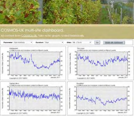
31 Web resources
Variations in soil moisture: circle, 200 m radius
 Variations in soil moisture: circle, 200 m radius San Pedro, 5 March 2010 0 5 10 Depth, cm 15 20 25 30 5 10 15 20 25 30 35 Soil moisture, m 3 /m 3 Zreda et al., 2012, HESS Disc. 9, 4505-4551. Depth, cm
Assimilation of satellite derived soil moisture for weather forecasting
 Assimilation of satellite derived soil moisture for weather forecasting www.cawcr.gov.au Imtiaz Dharssi and Peter Steinle February 2011 SMOS/SMAP workshop, Monash University Summary In preparation of the
Series tore word. Acknowledgements
 Series tore word p. xi Preface p. xiii Acknowledgements p. xv Disclaimer p. xvii Introduction p. 1 The instrumental age p. 2 Measurements and the climate record p. 2 Clouds and rainfall p. 3 Standardisation
Probing soil moisture
 Probing soil moisture by cosmic ray induced neutron showers U. Schmidt AG Dubbers Ruprecht-Karls-Universität Heidelberg 19. März 2014 in collaboration with: Martin Schrön Helmholtz Center for Environmental
Detector Sensitivity
 Monte-Carlo Simulations on the Detector Sensitivity to Cosmic-Ray nduced Neutron Showers U. Schmidt AG Dubbers Physikalisches Institut Ruprecht-Karls-Universität Heidelberg COSMOS Workshop, 7th of May
Michael de Podesta. A Global Land-Surface Climate Reference Network: Technical Reflections. AOPC Exeter 30 th March 2017
 A Global Land-Surface Climate Reference Network: Technical Reflections Thank you! To Michael Palleckiand Mark Hall from US CRN for extended conversations AOPC Exeter 30 th March 2017 Michael de Podesta
HOW WELL COSMIC RAY PROBES MEASURE THE WIDE AREA SNOW WATER EQUIVALENT?
 HOW WELL COSMIC RAY PROBES MEASURE THE WIDE AREA SNOW WATER EQUIVALENT? ZUHAL AKYUREK, GOKBEN DEMIR, MUSTAFA BERK DUYGU Middle East Technical University, Civil Engineering Department, Water Resources Laboratory
SEVAN particle detector at Zagreb Astronomical Observatory: 10 years of operation
 SEVAN particle detector at Zagreb Astronomical Observatory: 10 years of operation F. Šterc ¹, D. Roša ¹, D. Maričić ¹, D. Hržina ¹, I. Romštajn ¹, A. Chilingarian ², T. Karapetyan ², D. Cafuta ³ and M.
F O U N D A T I O N A L C O U R S E
 F O U N D A T I O N A L C O U R S E December 6, 2018 Satellite Foundational Course for JPSS (SatFC-J) F O U N D A T I O N A L C O U R S E Introduction to Microwave Remote Sensing (with a focus on passive
Flux Tower Data Quality Analysis in the North American Monsoon Region
 Flux Tower Data Quality Analysis in the North American Monsoon Region 1. Motivation The area of focus in this study is mainly Arizona, due to data richness and availability. Monsoon rains in Arizona usually
Memo. I. Executive Summary. II. ALERT Data Source. III. General System-Wide Reporting Summary. Date: January 26, 2009 To: From: Subject:
 Memo Date: January 26, 2009 To: From: Subject: Kevin Stewart Markus Ritsch 2010 Annual Legacy ALERT Data Analysis Summary Report I. Executive Summary The Urban Drainage and Flood Control District (District)
Seasonal and interannual relations between precipitation, soil moisture and vegetation in the North American monsoon region
 Seasonal and interannual relations between precipitation, soil moisture and vegetation in the North American monsoon region Luis A. Mendez-Barroso 1, Enrique R. Vivoni 1, Christopher J. Watts 2 and Julio
EUMETSAT LSA-SAF EVAPOTRANSPIRATION PRODUCTS STATUS AND PERSPECTIVES
 EUMETSAT LSA-SAF EVAPOTRANSPIRATION PRODUCTS STATUS AND PERSPECTIVES Arboleda, N. Ghilain, F. Gellens-Meulenberghs Royal Meteorological Institute, Avenue Circulaire, 3, B-1180 Bruxelles, BELGIUM Corresponding
FLORA: FLood estimation and forecast in complex Orographic areas for Risk mitigation in the Alpine space
 Natural Risk Management in a changing climate: Experiences in Adaptation Strategies from some European Projekts Milano - December 14 th, 2011 FLORA: FLood estimation and forecast in complex Orographic
Chiang Rai Province CC Threat overview AAS1109 Mekong ARCC
 Chiang Rai Province CC Threat overview AAS1109 Mekong ARCC This threat overview relies on projections of future climate change in the Mekong Basin for the period 2045-2069 compared to a baseline of 1980-2005.
A TEST OF THE PRECIPITATION AMOUNT AND INTENSITY MEASUREMENTS WITH THE OTT PLUVIO
 A TEST OF THE PRECIPITATION AMOUNT AND INTENSITY MEASUREMENTS WITH THE OTT PLUVIO Wiel M.F. Wauben, Instrumental Department, Royal Netherlands Meteorological Institute (KNMI) P.O. Box 201, 3730 AE De Bilt,
N ew York State Agricultural Experiment S tation vnrfx* NYSAES I Publications I Latest Press Releases
 N ew York State Agricultural Experiment S tation vnrfx* NYSAES I Publications I Latest Press Releases CORNELL U N I V E R S I T Y GENEVA NEW YORK. 100 Years of New York Weather August 16th, 2000 CONTACT:
The assimilation of AMSU and SSM/I brightness temperatures in clear skies at the Meteorological Service of Canada
 The assimilation of AMSU and SSM/I brightness temperatures in clear skies at the Meteorological Service of Canada Abstract David Anselmo and Godelieve Deblonde Meteorological Service of Canada, Dorval,
HY-2A Satellite User s Guide
 National Satellite Ocean Application Service 2013-5-16 Document Change Record Revision Date Changed Pages/Paragraphs Edit Description i Contents 1 Introduction to HY-2 Satellite... 1 2 HY-2 satellite data
and soils characterizing would be defined.
 Working out of the basic network for monitoring of natural and climatic processes in Siberia M.V. Kabanov, V.V. Zuev, V.А. Krutikov Institute of Monitoring of Climatic and Ecological Systems SB RAS, Tomsk,
Footprint diameter for a cosmic-ray soil moisture probe: Theory and Monte Carlo simulations
 J_ID: WRCR Customer A_ID: WRCR2187 Cadmus Art: WRCR2187 Ed. Ref. No.: Date: 26-March-13 Stage: Page: 1 ID: jw3b2server Time: 14:8 I Path: //xinchnasjn/1journals/wiley/3b2/wrcr/vol/1311/appfile/jw-wrcr1311
Meteorological Instruments for Solar Energy
 Meteorological Instruments for Solar Energy gillinstruments.com Gill Instruments has been designing and manufacturing professional use compact weather stations and ultrasonic wind speed and direction sensors
Development of Innovative Technology to Provide Low-Cost Surface Atmospheric Observations in Data-sparse Regions
 Development of Innovative Technology to Provide Low-Cost Surface Atmospheric Observations in Data-sparse Regions Paul Kucera and Martin Steinson University Corporation for Atmospheric Research/COMET 3D-Printed
SMAP and SMOS Integrated Soil Moisture Validation. T. J. Jackson USDA ARS
 SMAP and SMOS Integrated Soil Moisture Validation T. J. Jackson USDA ARS Perspective Linkage of SMOS and SMAP soil moisture calibration and validation will have short and long term benefits for both missions.
Status and Perspectives of the LAGO Project
 Status and Perspectives of the LAGO Project 5 th Workshop on Air Shower Detection at High Altitude Paris, France Édgar F. Carrera ecarrera@usfq.edu.ec (for the LAGO Collaboration) Universidad San Francisco
2012 Rainfall, Runoff, Water Level & Temperature Beebe Lake Wright County, MN (# )
") www.fixmylake.com 18029 83 rd Avenue North Maple Grove, MN 55311 mail@freshwatersci.com (651) 336-8696 2012 Rainfall, Runoff, Water Level & Temperature Beebe Lake Wright County, MN (#86-0023) Prepared
www.fixmylake.com 18029 83 rd Avenue North Maple Grove, MN 55311 mail@freshwatersci.com (651) 336-8696 2012 Rainfall, Runoff, Water Level & Temperature Beebe Lake Wright County, MN (#86-0023) Prepared
NIDIS Intermountain West Drought Early Warning System August 8, 2017
 NIDIS Drought and Water Assessment 8/8/17, 4:43 PM NIDIS Intermountain West Drought Early Warning System August 8, 2017 Precipitation The images above use daily precipitation statistics from NWS COOP,
Land Data Assimilation for operational weather forecasting
 Land Data Assimilation for operational weather forecasting Brett Candy Richard Renshaw, JuHyoung Lee & Imtiaz Dharssi * *Centre Australian Weather and Climate Research Contents An overview of the Current
Opportunities provided by fine-scale meteorological sensor array
 Opportunities provided by fine-scale meteorological sensor array R.M. Randall, C.M Hocut, D.K. Knapp, B.T. MacCall, & J.A. Smith MSA Program Overview Army Challenge Research gaps exist which challenge
Sensor Guide WS100 Radar Precipitation Sensor
 Abbeon Cal, Inc., 1363 Donlon Street Unit 1, Ventura, CA 93003-8387 - 800-922-0977 www.abbeon.com - E-mail: abbeoncal@abbeon.com Sensor Guide WS100 Radar Precipitation Sensor October 2017 Sensor Guide:
Observing Weather: Making the Invisible Visible. Dr. Michael J. Passow
 Observing Weather: Making the Invisible Visible Dr. Michael J. Passow What Is Weather? Weather refers to the conditions of the atmosphere at a certain place and time. Weather differs from Climate, which
New soil physical properties implemented in the Unified Model
 New soil physical properties implemented in the Unified Model Imtiaz Dharssi 1, Pier Luigi Vidale 3, Anne Verhoef 3, Bruce Macpherson 1, Clive Jones 1 and Martin Best 2 1 Met Office (Exeter, UK) 2 Met
IMPACT OF GROUND-BASED GPS PRECIPITABLE WATER VAPOR AND COSMIC GPS REFRACTIVITY PROFILE ON HURRICANE DEAN FORECAST. (a) (b) (c)
 (b) (c)") 9B.3 IMPACT OF GROUND-BASED GPS PRECIPITABLE WATER VAPOR AND COSMIC GPS REFRACTIVITY PROFILE ON HURRICANE DEAN FORECAST Tetsuya Iwabuchi *, J. J. Braun, and T. Van Hove UCAR, Boulder, Colorado 1. INTRODUCTION
9B.3 IMPACT OF GROUND-BASED GPS PRECIPITABLE WATER VAPOR AND COSMIC GPS REFRACTIVITY PROFILE ON HURRICANE DEAN FORECAST Tetsuya Iwabuchi *, J. J. Braun, and T. Van Hove UCAR, Boulder, Colorado 1. INTRODUCTION
Assimilation of ASCAT soil wetness
 EWGLAM, October 2010 Assimilation of ASCAT soil wetness Bruce Macpherson, on behalf of Imtiaz Dharssi, Keir Bovis and Clive Jones Contents This presentation covers the following areas ASCAT soil wetness
CSSP14, Sinaia, 25 th July, Space-atmospheric interactions of ultra-high energy. cosmic rays. Gina Isar
 CSSP14, Sinaia, 25 th July, 2014 Space-atmospheric interactions of ultra-high energy Gina Isar isar@spacescience.ro cosmic rays Outline Outline Cosmic rays: particles from outer space Earth is subject
Weather and climate outlooks for crop estimates
 Weather and climate outlooks for crop estimates CELC meeting 2016-04-21 ARC ISCW Observed weather data Modeled weather data Short-range forecasts Seasonal forecasts Climate change scenario data Introduction
Monitoring daily evapotranspiration in the Alps exploiting Sentinel-2 and meteorological data
 Monitoring daily evapotranspiration in the Alps exploiting Sentinel-2 and meteorological data M. Castelli, S. Asam, A. Jacob, M. Zebisch, and C. Notarnicola Institute for Earth Observation, Eurac Research,
Status and Perspectives of the LAGO Project
 Status and Perspectives of the LAGO Project 5 th Workshop on Air Shower Detection at High Altitude Paris, France Édgar F. Carrera ecarrera@usfq.edu.ec (for the LAGO Collaboration) Universidad San Francisco
Energy Systems, Structures and Processes Essential Standard: Analyze patterns of global climate change over time Learning Objective: Differentiate
 Energy Systems, Structures and Processes Essential Standard: Analyze patterns of global climate change over time Learning Objective: Differentiate between weather and climate Global Climate Focus Question
CGMS Baseline. Sustained contributions to the Global Observing System. Endorsed by CGMS-46 in Bengaluru, June 2018
 CGMS Baseline Sustained contributions to the Global Observing System Best Practices for Achieving User Readiness for New Meteorological Satellites Endorsed by CGMS-46 in Bengaluru, June 2018 CGMS/DOC/18/1028862,
P2.1 DIRECT OBSERVATION OF THE EVAPORATION OF INTERCEPTED WATER OVER AN OLD-GROWTH FOREST IN THE EASTERN AMAZON REGION
 P2.1 DIRECT OBSERVATION OF THE EVAPORATION OF INTERCEPTED WATER OVER AN OLD-GROWTH FOREST IN THE EASTERN AMAZON REGION Matthew J. Czikowsky (1)*, David R. Fitzjarrald (1), Osvaldo L. L. Moraes (2), Ricardo
Remote and Autonomous Measurements of Precipitation in Antarctica
 Remote and Autonomous Measurements of Precipitation in Antarctica Mark W. Seefeldt 1 Scott D. Landolt 2 and Andrew J. Monaghan 2 1 Cooperative Institute for Research in Environmental Sciences (CIRES) University
Polar Weather Prediction
 Polar Weather Prediction David H. Bromwich Session V YOPP Modelling Component Tuesday 14 July 2015 A special thanks to the following contributors: Kevin W. Manning, Jordan G. Powers, Keith M. Hines, Dan
Temperature (T) degrees Celsius ( o C) arbitrary scale from 0 o C at melting point of ice to 100 o C at boiling point of water Also (Kelvin, K) = o C
 degrees Celsius ( o C) arbitrary scale from 0 o C at melting point of ice to 100 o C at boiling point of water Also (Kelvin, K) = o C") 1 2 3 4 Temperature (T) degrees Celsius ( o C) arbitrary scale from 0 o C at melting point of ice to 100 o C at boiling point of water Also (Kelvin, K) = o C plus 273.15 0 K is absolute zero, the minimum
1 2 3 4 Temperature (T) degrees Celsius ( o C) arbitrary scale from 0 o C at melting point of ice to 100 o C at boiling point of water Also (Kelvin, K) = o C plus 273.15 0 K is absolute zero, the minimum
NIDIS Intermountain West Drought Early Warning System July 18, 2017
 NIDIS Drought and Water Assessment NIDIS Intermountain West Drought Early Warning System July 18, 2017 Precipitation The images above use daily precipitation statistics from NWS COOP, CoCoRaHS, and CoAgMet
Cosmic-ray soil water monitoring: the development, status & potential of the COSMOS- India network
 Csmic-ray sil water mnitring: the develpment, status & ptential f the COSMOS- India netwrk Rss Mrrisn, J. G. Evans, S. S. Angadi, L. Ball, T. Chakrabrty, H. Cper, M. Fry, G. Geet, M. Gswami, N. Ganeshi,
Amita Mehta and Ana Prados
 Building Capacity in Utilizing NASA Remote Sensing Observations in SWAT for Water Resources and Agricultural Management Applications Amita Mehta and Ana Prados NASA - University of Maryland Baltimore County
A Century of Meteorological Observations at Fort Valley Experimental Forest: A Cooperative Observer Program Success Story
 A Century of Meteorological Observations at Fort Valley Experimental Forest: A Cooperative Observer Program Success Story Daniel P. Huebner and Susan D. Olberding, U.S. Forest Service, Rocky Mountain Research
Mapping Evapotranspiration and Drought at Local to Continental Scales Using Thermal Remote Sensing
 Mapping Evapotranspiration and Drought at Local to Continental Scales Using Thermal Remote Sensing M.C. Anderson, W.P. Kustas USDA-ARS, Hydrology and Remote Sensing Laboratory J.M Norman University of
A FIELD STUDY TO CHARACTERISE THE MEASUREMENT OF PRECIPITATION USING DIFFERENT TYPES OF SENSOR. Judith Agnew 1 and Mike Brettle 2
 A FIELD STUDY TO CHARACTERISE THE MEASUREMENT OF PRECIPITATION USING DIFFERENT TYPES OF SENSOR Judith Agnew 1 and Mike Brettle 2 1 STFC Rutherford Appleton Laboratory, Harwell Oxford, Didcot, Oxfordshire,
ReFH2 Technical Note: Applying ReFH2 FEH13 in small clay catchments
 ReFH2 Technical Note: Applying ReFH2 FEH13 in small clay catchments Contents 1 The issue 2 Identifying problem clay catchments and correcting BFIHOST Appendix 1 What is an appropriate value of BFI for
3.2 Wind direction / wind velocity
 3.2 Wind direction / wind velocity The direction from which air moves to is called the wind direction, and the distance air moves per unit time is the wind velocity. Wind has to be measured not only as
Precipitation. Standardized Precipitation Index. NIDIS Intermountain West Drought Early Warning System September 5, 2017
 9/6/2017 NIDIS Drought and Water Assessment NIDIS Intermountain West Drought Early Warning System September 5, 2017 Precipitation The images above use daily precipitation statistics from NWS COOP, CoCoRaHS,
BETWIXT Built EnvironmenT: Weather scenarios for investigation of Impacts and extremes. BETWIXT Technical Briefing Note 7 Version 1, May 2006
 BETIXT Building Knowledge for a Changing Climate BETWIXT Built EnvironmenT: Weather scenarios for investigation of Impacts and extremes BETWIXT Technical Briefing Note 7 Version 1, May 2006 THE CRU HOURLY
Meteorological Service
 Meteorological Service The Meteorological Service in Oman was established in 1973. Oman joined ICAO in 1973 Oman joined WMO in 1975. Meteorological Service is under the framework of the Directorate General
Multiple Choice Identify the choice that best completes the statement or answers the question.
 CH.15 practice TEST Multiple Choice Identify the choice that best completes the statement or answers the question. 1) The short-term state of the atmosphere is called a) climate. c) water cycle. b) weather.
SASKATOON STATION
 Day Max Max 191-1 Temperature Degree-days Precipitation Min Min 191-1 Mean Mean 191-1 Growing Heating Cooling 1 1 Geonor Weighing Gauge Notes Preliminary OCTOBER 17 Snow-on- Ground 9h Max ½ hr Min ½ hr
REQUIREMENTS FOR WEATHER RADAR DATA. Review of the current and likely future hydrological requirements for Weather Radar data
 WORLD METEOROLOGICAL ORGANIZATION COMMISSION FOR BASIC SYSTEMS OPEN PROGRAMME AREA GROUP ON INTEGRATED OBSERVING SYSTEMS WORKSHOP ON RADAR DATA EXCHANGE EXETER, UK, 24-26 APRIL 2013 CBS/OPAG-IOS/WxR_EXCHANGE/2.3
IMPACT OF CLIMATE CHANGE OVER THE ARABIAN PENINSULA
 IMPACT OF CLIMATE CHANGE OVER THE ARABIAN PENINSULA By: Talal Alharbi June, 29 2017 1 Motivation: In arid and semi-arid regions of the world the demand for fresh water resources is increasing due to: increasing
[Martin,5(5): May 2018] ISSN DOI /zenodo Impact Factor
![[Martin,5(5): May 2018] ISSN DOI /zenodo Impact Factor](/thumbs/95/125098251.jpg "[Martin,5(5): May 2018] ISSN DOI /zenodo Impact Factor") GLOBAL JOURNAL OF ENGINEERING SCIENCE AND RESEARCHES STUDY OF NEUTRON, GAMMA RAYS AND RADON GAS CORRELATION WITH MEASUREMENTS NEAR GROUND LEVEL IN SÃO JOSE DOS CAMPOS, SP, BRAZIL Inácio Malmonge Martin
GLOBAL JOURNAL OF ENGINEERING SCIENCE AND RESEARCHES STUDY OF NEUTRON, GAMMA RAYS AND RADON GAS CORRELATION WITH MEASUREMENTS NEAR GROUND LEVEL IN SÃO JOSE DOS CAMPOS, SP, BRAZIL Inácio Malmonge Martin
Mesoscale meteorological models. Claire L. Vincent, Caroline Draxl and Joakim R. Nielsen
 Mesoscale meteorological models Claire L. Vincent, Caroline Draxl and Joakim R. Nielsen Outline Mesoscale and synoptic scale meteorology Meteorological models Dynamics Parametrizations and interactions
8-km Historical Datasets for FPA
 Program for Climate, Ecosystem and Fire Applications 8-km Historical Datasets for FPA Project Report John T. Abatzoglou Timothy J. Brown Division of Atmospheric Sciences. CEFA Report 09-04 June 2009 8-km
Flux Tower Data Quality Analysis. Dea Doklestic
 Flux Tower Data Quality Analysis Dea Doklestic Motivation North American Monsoon (NAM) Seasonal large scale reversal of atmospheric circulation Occurs during the summer months due to a large temperature
) was measured using net radiometers. Soil heat flux (Q g
 was measured using net radiometers. Soil heat flux (Q g") Paper 4 of 18 Determination of Surface Fluxes Using a Bowen Ratio System V. C. K. Kakane* and E. K. Agyei Physics Department, University of Ghana, Legon, Ghana * Corresponding author, Email: vckakane@ug.edu.gh
Paper 4 of 18 Determination of Surface Fluxes Using a Bowen Ratio System V. C. K. Kakane* and E. K. Agyei Physics Department, University of Ghana, Legon, Ghana * Corresponding author, Email: vckakane@ug.edu.gh
Advanced Hydrology. (Web course)
") Advanced Hydrology (Web course) Subhankar Karmakar Assistant Professor Centre for Environmental Science and Engineering (CESE) Indian Institute of Technology Bombay Powai, Mumbai 400 076 Email: skarmakar@iitb.ac.in
Advanced Hydrology (Web course) Subhankar Karmakar Assistant Professor Centre for Environmental Science and Engineering (CESE) Indian Institute of Technology Bombay Powai, Mumbai 400 076 Email: skarmakar@iitb.ac.in
One of the coldest places in the country - Peter Sinks yet again sets this year s coldest temperature record for the contiguous United States.
 One of the coldest places in the country - Peter Sinks yet again sets this year s coldest temperature record for the contiguous United States. In the early morning of February 22, 2010 the temperature
Table of Contents. Chapter: Atmosphere. Section 1: Earth's Atmosphere. Section 2: Energy Transfer in the Atmosphere. Section 3: Air Movement
 Table of Contents Chapter: Atmosphere Section 1: Earth's Atmosphere Section 2: Energy Transfer in the Atmosphere Section 3: Air Movement Table of Contents Chapter: Atmosphere Section 2: Energy Transfer
ECMWF. ECMWF Land Surface Analysis: Current status and developments. P. de Rosnay M. Drusch, K. Scipal, D. Vasiljevic G. Balsamo, J.
 Land Surface Analysis: Current status and developments P. de Rosnay M. Drusch, K. Scipal, D. Vasiljevic G. Balsamo, J. Muñoz Sabater 2 nd Workshop on Remote Sensing and Modeling of Surface Properties,
Winter Precipitation Measured with a new Heated Tipping Bucket Gauge. John Kochendorfer 1 Mark Hall 1 Timothy Wilson 1
 Winter Precipitation Measured with a new Heated Tipping Bucket Gauge John Kochendorfer 1 Mark Hall 1 Timothy Wilson 1 1 Atmospheric Turbulence and Diffusion Division, NOAA, P.O. Box 2456, Oak Ridge, TN
Lecture 5: Precipitation
 Lecture 5: Precipitation Key Questions 1. What physical concepts control the formation of precipitation (air pressure, expanding gases and cooling, and vapor pressure)? 2. What are some air mass lifting
Regional Flash Flood Guidance and Early Warning System
 WMO Training for Trainers Workshop on Integrated approach to flash flood and flood risk management 24-28 October 2010 Kathmandu, Nepal Regional Flash Flood Guidance and Early Warning System Dr. W. E. Grabs
The Effects of Atmospheric Variations on the High Energy Radiation Environment at the Surface of Mars
 The Effects of Atmospheric Variations on the High Energy Radiation Environment at the Surface of Mars A. Keating, Laboratório de Instrumentação e Física Experimental de Partículas, Lisbon, Portugal (keating@lip.pt)
Intercomparision of snowfall measured by weighing and tipping bucket precipitation gauges at Jumla Airport, Nepal
 Intercomparision of snowfall measured by weighing and tipping bucket precipitation gauges at Jumla Airport, Nepal Department of Hydrology and Meteorology, Nepal Ministry of Environment, Science and Technology
Development of the Canadian Precipitation Analysis (CaPA) and the Canadian Land Data Assimilation System (CaLDAS)
 and the Canadian Land Data Assimilation System (CaLDAS)") Development of the Canadian Precipitation Analysis (CaPA) and the Canadian Land Data Assimilation System (CaLDAS) Marco L. Carrera, Vincent Fortin and Stéphane Bélair Meteorological Research Division Environment
Development of the Canadian Precipitation Analysis (CaPA) and the Canadian Land Data Assimilation System (CaLDAS) Marco L. Carrera, Vincent Fortin and Stéphane Bélair Meteorological Research Division Environment
NATIONAL HYDROPOWER ASSOCIATION MEETING. December 3, 2008 Birmingham Alabama. Roger McNeil Service Hydrologist NWS Birmingham Alabama
 NATIONAL HYDROPOWER ASSOCIATION MEETING December 3, 2008 Birmingham Alabama Roger McNeil Service Hydrologist NWS Birmingham Alabama There are three commonly described types of Drought: Meteorological drought
Database of Ground Level Enhancements (GLE) of high energy solar proton events
 of high energy solar proton events") Database of Ground Level Enhancements (GLE) of high energy solar proton events Sodankylä Geophysical Observatory and ReSoLVE Center of Excellence, University of Oulu, Finland E-mail: ilya.usoskin@oulu.fi
Database of Ground Level Enhancements (GLE) of high energy solar proton events Sodankylä Geophysical Observatory and ReSoLVE Center of Excellence, University of Oulu, Finland E-mail: ilya.usoskin@oulu.fi
WUFI Workshop at NTNU /SINTEF Fundamentals
 WUFI Workshop at NTNU /SINTEF 2008 Fundamentals Contents: From steady-state to transient Heat storage and -transport Moisture storage and -transport Calculation of coupled transport Model limitations 2
Introduction to SMAP. ARSET Applied Remote Sensing Training. Jul. 20,
 National Aeronautics and Space Administration ARSET Applied Remote Sensing Training http://arset.gsfc.nasa.gov @NASAARSET Introduction to SMAP Jul. 20, 2016 www.nasa.gov Outline 1. Mission objectives 2.
UWM Field Station meteorological data
 University of Wisconsin Milwaukee UWM Digital Commons Field Station Bulletins UWM Field Station Spring 992 UWM Field Station meteorological data James W. Popp University of Wisconsin - Milwaukee Follow
Climatic Change Implications for Hydrologic Systems in the Sierra Nevada
 Climatic Change Implications for Hydrologic Systems in the Sierra Nevada Part Two: The HSPF Model: Basis For Watershed Yield Calculator Part two presents an an overview of why the hydrologic yield calculator
NIDIS Intermountain West Drought Early Warning System December 18, 2018
 NIDIS Intermountain West Drought Early Warning System December 18, 2018 Precipitation The images above use daily precipitation statistics from NWS COOP, CoCoRaHS, and CoAgMet stations. From top to bottom,
Developments at DWD: Integrated water vapour (IWV) from ground-based GPS
 from ground-based GPS") 1 Working Group on Data Assimilation 2 Developments at DWD: Integrated water vapour (IWV) from ground-based Christoph Schraff, Maria Tomassini, and Klaus Stephan Deutscher Wetterdienst, Frankfurter Strasse
1 Working Group on Data Assimilation 2 Developments at DWD: Integrated water vapour (IWV) from ground-based Christoph Schraff, Maria Tomassini, and Klaus Stephan Deutscher Wetterdienst, Frankfurter Strasse
Drought Monitoring with Hydrological Modelling
 st Joint EARS/JRC International Drought Workshop, Ljubljana,.-5. September 009 Drought Monitoring with Hydrological Modelling Stefan Niemeyer IES - Institute for Environment and Sustainability Ispra -
La circulation atmosphérique dans le sud du Portugal et l'effet du réservoir d'alqueva. Cas d étude ALEX 2014
 8th Meso-NH user's meeting La circulation atmosphérique dans le sud du Portugal et l'effet du réservoir d'alqueva. Cas d étude ALEX 2014, Carlos Policarpo et Miguel Potes Instituto de Ciências da Terra
The Documentation of Extreme Hydrometeorlogical Events: Two Case Studies in Utah, Water Year 2005
 The Documentation of Extreme Hydrometeorlogical Events: Two Case Studies in Utah, Water Year 2005 Tim Bardsley1*, Mark Losleben2, Randy Julander1 1. USDA, NRCS, Snow Survey Program, Salt Lake City, Utah.
WegenerNet: A new climate station network in Eastern Styria/Austria for monitoring weather and climate at 1 km-scale resolution
 Session GI 2 Atmosphere, Ocean, Meteorological Instruments and Ocean Observatory Instrumentation ; EGU General Assembly 2008; 13-18 Apr 2008, Vienna, Austria. WegenerNet: A new climate station network
MTO s Road Weather Information System (RWIS)
") MTO s Road Weather Information System (RWIS) Ontario Good Roads Association Managing Winter Operations Workshop October 19, 2017 Overview of MTO s Road Weather Information Station (RWIS) RWIS for Winter
MTO s Road Weather Information System (RWIS) Ontario Good Roads Association Managing Winter Operations Workshop October 19, 2017 Overview of MTO s Road Weather Information Station (RWIS) RWIS for Winter
Name Class Date. 3. In what part of the water cycle do clouds form? a. precipitation b. evaporation c. condensation d. runoff
 Skills Worksheet Directed Reading B Section: Water in the Air 1. What do we call the condition of the atmosphere at a certain time and place? a. the water cycle b. weather c. climate d. precipitation THE
A real-time procedure for adjusting radar data using raingauge information II: Initial performance of the PMM procedure
 A real-time procedure for adjusting radar data using raingauge information II: Initial performance of the PMM procedure C. G. Collier 1, J. Black 1,2, J. Powell 2, R. Mason 2 l National Centre for Atmospheric
BETWIXT Built EnvironmenT: Weather scenarios for investigation of Impacts and extremes. BETWIXT Technical Briefing Note 1 Version 2, February 2004
 Building Knowledge for a Changing Climate BETWIXT Built EnvironmenT: Weather scenarios for investigation of Impacts and extremes BETWIXT Technical Briefing Note 1 Version 2, February 2004 THE CRU DAILY
above the land to be warmer, causing convection currents because of the difference in air pressure.
 Name Date Period Earth Science Unit Test Review Sheet Directions: Use my web site and/or your lab book to help to answer the following questions. 1. What type of weather does a low pressure system bring?
Regional offline land surface simulations over eastern Canada using CLASS. Diana Verseghy Climate Research Division Environment Canada
 Regional offline land surface simulations over eastern Canada using CLASS Diana Verseghy Climate Research Division Environment Canada The Canadian Land Surface Scheme (CLASS) Originally developed for the
MODULE 8 LECTURE NOTES 2 REMOTE SENSING APPLICATIONS IN RAINFALL-RUNOFF MODELLING
 MODULE 8 LECTURE NOTES 2 REMOTE SENSING APPLICATIONS IN RAINFALL-RUNOFF MODELLING 1. Introduction The most common application of the remote sensing techniques in the rainfall-runoff studies is the estimation
Precipitation processes in the Middle East
 Precipitation processes in the Middle East J. Evans a, R. Smith a and R.Oglesby b a Dept. Geology & Geophysics, Yale University, Connecticut, USA. b Global Hydrology and Climate Center, NASA, Alabama,
5. General Circulation Models
 5. General Circulation Models I. 3-D Climate Models (General Circulation Models) To include the full three-dimensional aspect of climate, including the calculation of the dynamical transports, requires
Figure 4: Elements of weather, traditional instruments used to measure them and the measurement units. cumulus)
") Weather is the detailed conditions on a daily or perhaps weekly basis: it refers to many elements of the weather, all of which can be measured and forecasts made, such as wind direction and speed and the
Weather is the detailed conditions on a daily or perhaps weekly basis: it refers to many elements of the weather, all of which can be measured and forecasts made, such as wind direction and speed and the
Towards global water and energy balance monitoring using GCOM-W1 in the Australian Murray-Darling basin
 FY2013 Progress Report To: the Japan Aerospace Exploration Agency Project title: Towards global water and energy balance monitoring using GCOM-W1 in the Australian Murray-Darling basin Specification No:
ESTIMATING SNOWMELT CONTRIBUTION FROM THE GANGOTRI GLACIER CATCHMENT INTO THE BHAGIRATHI RIVER, INDIA ABSTRACT INTRODUCTION
 ESTIMATING SNOWMELT CONTRIBUTION FROM THE GANGOTRI GLACIER CATCHMENT INTO THE BHAGIRATHI RIVER, INDIA Rodney M. Chai 1, Leigh A. Stearns 2, C. J. van der Veen 1 ABSTRACT The Bhagirathi River emerges from
VIC Hydrology Model Training Workshop Part II: Building a model
 VIC Hydrology Model Training Workshop Part II: Building a model 11-12 Oct 2011 Centro de Cambio Global Pontificia Universidad Católica de Chile Ed Maurer Civil Engineering Department Santa Clara University
THE INTERNATIONAL REVIEW OF WEATHER, CLIMATE AND HYDROLOGY TECHNOLOGIES AND SERVICES
 THE INTERNATIONAL REVIEW OF WEATHER, CLIMATE AND HYDROLOGY TECHNOLOGIES AND SERVICES Meteorological T E C H N O L O G Y I N T E R N A T I O N A L THE GREATEST SHOW YET! FULL METEOROLOGICAL TECHNOLOGY WORLD