Downhole Navigation for Oil & Gas Drilling
|
|
|
- Aubrey Freeman
- 5 years ago
- Views:
Transcription

1 Downhole Navigation for Oil & Gas Drilling Martin E. Poitzsch Research Director, Sensor Physics Schlumberger-Doll Research, Cambridge, MA A Division of Schlumberger Ltd.

2 Outline Importance of Accurate Directional Drilling Basic D & I Methods Hardware Requirements GeoSteering the Well (Drilling Kinematics)

3 Oil Well Drilling
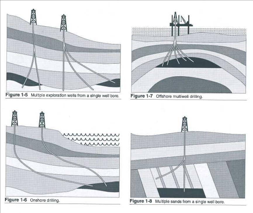
4

5
")
6 Extended Reach Drilling (ERD)

7 Wytch Farm ERD

8 Hibernia Platform, E. Canada Gravity Base Structure Platform Weight million tonnes Platform Height metres Drilling Derricks - 72m high Hp Mud System MPa (7500psi) pumps downrated to 41.4MPa (6000psi) Top Drive-Varco TDS rated for 83 kn-m

9 Hibernia Field, E. Canada

10 Hibernia Field, E. Canada
 wells.")
11 Drill dozens of wells off a single platform, whilst avoiding collisions with previous (producing) wells. 15 Hatim A 11/16/2011
12 Analysis Methods Subject (proposed) Well Object (offset) Well Closest Approach Horizontal Plane 16 Initials

13 19 Initials Separation Factor = 1


14 Geometrical Well Plan
15 What is Wellbore Surveying? Statement of the position (North, East and Down coordinates) of a wellbore relative to a given reference point. Reference point might be the wellhead, a defined point on a drilling platform or a defined point in an oilfield.
16 Why Do We Care About Wellbore Surveying? Need to steer wells to geologic targets Avoid other wells Respect lease lines Record well position for future use Collision avoidance while drilling subsequent wells Blowout contingency

17 MD = Measure Depth TVD = True Vertical Depth Basic D&I Concepts Bit Depth Hole Depth Driller s Depth Survey Depth / Sensor offset TD = Total Depth

18 Inclination 1. The angle between Tool Axis and Gravity vector. 2. Measured by Tri-Accelerometers in MWD Tools (in degrees.) Highest inclination: 158 degrees 27 D&M Learning Centres Oct 8 th, 2002
.")
19 Tri-Axial Accelerometers Tri-Axial Accelerometers Each of the 3 accelerometer sensors reads some value of the Vector G. Together, they are called the orthogonal set. The sum of the 3 measurements equals total Vector g (GFH). 28 D&M Learning Center October 8 th, 2002
 3. Troublesome Measurement 4.")
20 Azimuth 1. The angle between North Reference and a horizontal projection of current survey position (Tool Axis Vector) 2. Measured by Tri-Axial Magnetometers in MWD Tools (in degrees.) 3. Troublesome Measurement 4. True North/Magnetic North/Grid North 29 D&M Learning Center October 8 th, 2002
.")
21 Tri-Axial Magnetometers 1. Each of the 3 magnetometer sensors reads some value of the Vector H. 2. Together, they are called the orthogonal set. 3. The sum of the 3 measurements equals total Vector H (HFH). 30 D&M Learning Center October 8 th, 2002
22 Survey Calculation Methods 1. Tangential 2. Average angle 3. Radius of curvature 4. Minimum curvature Page <32> DOX Team Knowledge Sharing
23 Minimum Curvature Method Page <37> DOX Team Knowledge Sharing Assumption: The Curve between two survey stations is smooth line on a sphere. Feature: Using a ratio factor defined by the curvature of the wellbore section DLS is constant through any section BR and TR are not constant. Most accurate and common method used today (IDEAL,MAXWELL,DOX)
24 Minimum Curvature Method Dogleg is calculated using the following formula: DL = cos -1 [cos(i 2 - I 1 ) - sin I 1 sin I 2 (1 - cos (A 2 - A 1 ))] (small angles, where DL < , it is customary to set RF = 1) Page <38> DOX Team Knowledge Sharing

25
26

27 Measurement While Drilling (MWD)


28 MWD History

29 Power Turbo-Alternator

30

31 Mud-Pulse Siren
32 Mud-Pulse Siren


33 Mud-Pulse Transmission Example


")


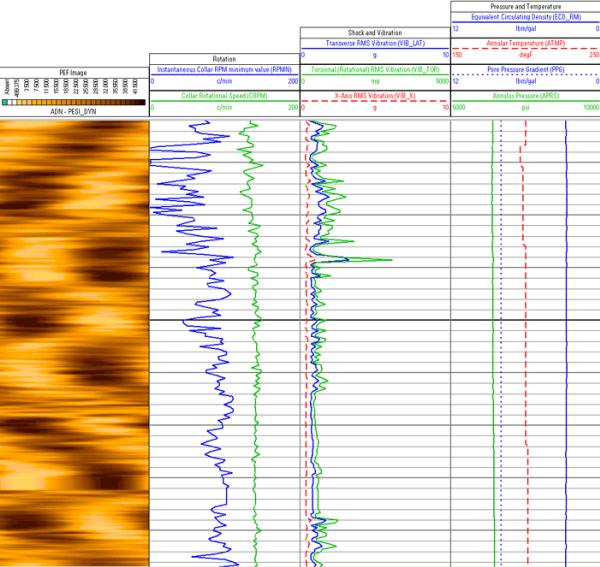
34 MWD Tool Specifications Available sizes 6¾, 8¼, 9, 9½ Power Supply Turbine power Operating frequencies 0.25 Hz 24 Hz GR real-time rate update period 3 seconds (min.) GR recording rate 3 seconds (min.) Continuous D&I/toolface RT update period 3 seconds (min.) Continuous D&I recording rate 3 seconds (min.) Shock sensor update period 3 seconds
35 Powerpulse Survey accuracy
36 Gyroscopic Tools Gyro Theory Balanced spinning mass Free to rotate on one or more axis Is resistant to external forces Two types of tools 1. Free Gyro Tool aligned to a specific heading and variation from this heading, corrected for drift is measured 2. Earth Rate Gyro Speed of earths rotation measured and processed to a specific azimuth 50 D&M Learning Center October 8 th, 2002

37 Gyro MWD Tools Enhanced Directional Control: Since Gyro-Guide is not subject to magnetic interference, it can run below the MWD sensor section close to the bit offering optimum directional control.

38 GeoSteering the Well Trajectory Pay zones are first identified in vertical exploration wells An induction-type tool is mounted on the drill-string behind the bit Near-horizontal well is drilled toward target bed Resistivity log is recorded while drilling and data is sent uphole in real time Actual log is compared to computed logs modeled for several well placement scenarios Well path adjusted accordingly to keep it within pay zone Target bed Well path kept within pay-zone
39 Periscope Directional Resistivity Tool R3 T5 T3 T1 R1 R2 T6 T2 T4 R4 ARC array ARC resistivities Directional Antennas T6 transverse transmitter R3 and R4, 45 tilted receivers Deeper Measurements spacing up to 96 at three frequencies: 100 khz, 400 khz, 2 MHz
40 Periscope Directional Resistivity Tool Azimuthal and deep boundary mapping technology» Detects and maps a boundary up to 15 ft while drilling» Deep distance-to-boundary provides early warning» 360 o directional sensitivity provides best steering direction» Determines the boundary s orientation in real time Simplified responses and interpretation:» Individual TR pair: provides a response sensitive to dip & anisotropy» Symmetrized TR pair: provides directional measurements insensitive to dip & anisotropy Real-time interpretation & decisions
41 Symmetrization of Directional Measurements Individual TR Sensitive to dip and anisotropy! 2 m R h =4 m m R v =20 m 1 m Symmetric TR Pair + Insensitive to dip and anisotropy! (b) 2 Ohm-m m R h =4 Ohm-m m 1 Ohm-m m R v =20 Ohm-m m Simplified response and interpretation!
42 Model-Based Parametric Inversion for Real-Time Interpretation Model-based parametric inversion Point-by-point 3 layer model inversion Distances h u, h d Resistivities R h, R v, R u and R d 1-5 sec per point Allow lateral variation of resistivity & dip Automated selection of the simplest model that fits the data Interactive model refinement if needed R u R h, R v R l h u h l


43 PeriScope Case History from Alaska Objective: Maximize horizontal length Challenges: Thin bed reservoir Complex geology 6,500-ft lateral section Planned well path OSC


44 The Results 10ft 6678 ft
45 Steering Decisions Planned well path 13,100 ft Approaching top of sand due to dip change

46 Steering Decisions Planned well path 13,100 ft Approaching top of sand due to dip change Instructions Result: Steers to rig: down Steer and down stays to in stay sand in sand
47 Steering Decisions Planned well path 13,100 ft Approaching top of sand due to dip change Result: Steers down and stays in sand
48 Steering Decisions Planned well path 13,369 ft Approaching bottom of sand due to dip change
49 Steering Decisions Planned well path 13,369 ft Approaching bottom of sand due to dip change Instructions Result: Steers to rig: up and Steer stays up to in stay sand in sand
50 Steering Decisions Planned well path 13,369 ft Approaching bottom of sand due to dip change Result: Steers up and stays in sand
 9000 10000 11000 12000 13000 14000")
51 Client Benefits Planned well path 93% in pay compared to typical 50-60% Production 60% higher than expected Client booked 5 million bbl of reserves 5 days of drilling time saved (by avoiding side-tracking)


52 Thank You!
X,800. X,850 ft. X,900 ft. X,950 ft. X,000 ft. GeoSphere. Reservoir Mapping-While-Drilling Service
 X,800 X,850 ft X,900 ft X,950 ft X,000 ft GeoSphere Reservoir Mapping-While-Drilling Service Discover reservoir mapping-while-drilling...... and reveal subsurface beddings and fluid contacts at the reservoir
MicroScope. Resistivity- and imagingwhile-drilling
 MicroScope Resistivity- and imagingwhile-drilling service MicroScope Magnify your reservoir Multidepth laterolog resistivity Multidepth borehole images Mud resistivity Azimuthal gamma ray Bit resistivity
Advances in Geosteering
 Advances in Geosteering SMART4D While Drilling Geosteering Marcellus Case Study Joint Presentation: Feb 27 th 2014, Houston, TX Rocky Mottahedeh, P.Geol. P.Eng. EOW Report University_31_18_2H Advances
The SPE Foundation through member donations and a contribution from Offshore Europe
 Primary funding is provided by The SPE Foundation through member donations and a contribution from Offshore Europe The Society is grateful to those companies that allow their professionals to serve as
geovision Resistivity imaging for productive drilling
 geovision Resistivity imaging for productive drilling geovision Resistivity imaging while drilling helps position wells in the best place in the reservoir in less time. Real-time resistivity measurements
Predicting the path ahead
 Predicting the path ahead Horizontal drilling has become a routine procedure in many parts of the world and is particularly popular in the Middle East. Despite increasing familiarity with the techniques,
Heterogeneity Type Porosity. Connected Conductive Spot. Fracture Connected. Conductive Spot. Isolated Conductive Spot. Matrix.
 Porosity Histogram Porosity Contribution 1.3.3.3 Connected 9.8 ohm.m U R D 9 18 7. 5.25 4.38 3.5 2.63 1.75 48 Heterogeneity Distribution Image Orientation, L U 27 36.4.3 X,X72.5 Depth, ft.3 1 Isolated.3
Directional Drilling. History
 Directional Drilling Directional drilling is the science of deviating a well bore along a planned course to a subsurface target whose location is a given lateral distance and direction from the vertical.
Precise well placement in the Cygnus gas field. Ian Dredge ENGIE E&P UK Limited
 Precise well placement in the Cygnus gas field Ian Dredge ENGIE E&P UK Limited Executive summary The Lower Leman reservoir in the Cygnus gas field is highly layered with low vertical permeability The use
Shale Gas; Wellbore Positioning Challenges
 Shale Gas; Wellbore Positioning Challenges Pete Clark, Directional Drilling Advisor ISCWSA, Copenhagen, 3/4/11 Shale Gas; Wellbore Positioning Challenges Why is it important to us? Emerging trend in drilling
Horizontal Drilling Pilot In a Shallow Heavy Oil Reservoir in Northwestern Romania. Authors: John Lavelle, Amin Yaghoobi
 Horizontal Drilling Pilot In a Shallow Heavy Oil Reservoir in Northwestern Romania Authors: John Lavelle, Amin Yaghoobi About Suplac Oil Field Discovered 1958 Oil Density 960 kg/m3 (16 API) Viscosity 2300
AADE-03-NTCE-19. The key to this increasingly complex and costly process is Survey Management.
 AADE-03-NTCE-19 Survey Management Provides A Safer Drilling Environment With Reduced Drilling Costs Roger Miller, Mike Terpening, Greg Conran, Schlumberger Copyright 2003 AADE Technical Conference This
This paper was prepared for presentation at the Unconventional Resources Technology Conference held in San Antonio, Texas, USA, July 2015.
 URTeC: 2173526 Enhanced Wellbore Placement Accuracy Using Geomagnetic In-Field Referencing and Multi-Station Correction Stefan Maus, Magnetic Variation Services, Shawn DeVerse, Surcon. Copyright 2015,
New downhole technologies helped develop horizontal thin sand
 Reprinted from: June 2005 issue, pgs 25-33. Used with permission. DRILLING AND COMPLETION TECHNOLOGY SPECIAL FOCUS New downhole technologies helped develop horizontal thin sand Completion of Well Ewan-YH
DEVEX Moving in the Right Direction; Realising Upside Potential in a Mature Field Using Real Time 3D Geo-Steering Technology
 DEVEX 2010 Moving in the Right Direction; Realising Upside Potential in a Mature Field Using Real Time 3D Geo-Steering Technology Authors: Lisa Chisholm, Chevron Upstream Europe David Holbrough, Baker
ARES ENERGY, LTD. SDI Survey Report. Fuhrman-Mascho Andrews County, Texas (Grid North) University 13 #2H VH - Job # KW-204.
 University 13 #2H VH - Job # KW-204.") ARES ENERGY, LTD. Fuhrman-Mascho Andrews County, Texas (Grid North) University 13 #2H VH - Job #320214-KW-204 Survey: Gyro SDI Survey Report 17 February, 2014 SDI SDI Survey Report Company: ARES ENERGY,
ARES ENERGY, LTD. Fuhrman-Mascho Andrews County, Texas (Grid North) University 13 #2H VH - Job #320214-KW-204 Survey: Gyro SDI Survey Report 17 February, 2014 SDI SDI Survey Report Company: ARES ENERGY,
1st SPWLA India Regional Conference Formation Evaluation in Horizontal Wells
 GOING BEYOND GEOMETRICAL DRILLING : A REVIEW OF THE CONTRIBUTION OF LWD MEASUREMENTS TO THE IMPROVEMENT OF WELL PLACEMENT. Jacques R. Tabanou, Jean Michel Denichou, Jack Horkowitz, Dzevat Omeragic, John
Horizontal well Development strategy
 Horizontal well Development strategy Pakawas Mangkang Team Member Yoseph Partono Stephan Otero Duangdao Chutanukarn Warin Lobtong Suarporn Ketpreechasawat B8/32 Asset, Thailand Chiangmai, 11 th Nov-13
MODERN AZIMUTHAL RESISTIVITY TOOLS AND THEIR APPLICATION TO MATURE FIELD DEVELOPMENT
 MODERN AZIMUTHAL RESISTIVITY TOOLS AND THEIR APPLICATION TO MATURE FIELD DEVELOPMENT Mike Dautel, Jason Pitcher, and Michael Bittar, Halliburton Copyright 2011, held jointly by the Society of Petrophysicists
FIELD COPY ONLY (NOT DEFINITIVE) Depth Reference : GROUND LEVEL
 Depth Reference : GROUND LEVEL") Company: SEQUITUR Lease/ UNIVERSITY LUCY / API: 42-235-36007 Rig Name: INTEGRITY 3 State/County: TEXAS/IRION VS-Azi: 0.00 Degrees Latitude: 31.10156, Longitude: -101.20634 North = True North +0.45 degs
Company: SEQUITUR Lease/ UNIVERSITY LUCY / API: 42-235-36007 Rig Name: INTEGRITY 3 State/County: TEXAS/IRION VS-Azi: 0.00 Degrees Latitude: 31.10156, Longitude: -101.20634 North = True North +0.45 degs
Report Date: ST. ANDREWS Rig: H&P 629 Operator: Lat/Long: 6.67 East Vertical Section Azimuth: Magnetic Declination: 0.00 North Reference: True North
 Directional Company: AIM Report Date: 11/12/14 12:35:51 HP 629 Location: ST. ANDREWS ST. ANDREWS Rig: H&P 629 Operator: ISYS TOOLS State: TEXAS Lat/Long: 32 22 0.84" N 102 25 0.89" E County: ANDREWS Magnetic
El Paso E & P Company, L.P. SDI Standard Survey Report
 El Paso E & P Company, L.P. Irion County, TX (NAD27 TC) OH - Job #32D0312379 Survey: MWD 08 June, 2012 Local Co-ordinate Reference: Site Project Irion County, TX (NAD27 TC) Map System: Geo Datum: Map Zone:
SDI Standard Survey Report
 BHP Billiton Petroleum Crockett County, Texas (NAD 83 TXC) OH - Job #32D0712949 : MWD 24 August, 2012 Local Co-ordinate Reference: Well MD Reference: Wellbore: OH - Job #32D0712949 Calculation Method:
GEOSTEERING Scope of work, project management and geosteering scenarios
 GEOSTEERING Scope of work, project management and geosteering scenarios Chinook Consulting Services Office: 403 242 1522 742 Memorial Drive NW Calgary, Alberta T2N 3C7 reports@chinookconsulting.ca www.chinookconsulting.ca
Sperry Drilling New LWD Technology. Mike Dautel Petrophysics Manager Asia Pacific
 Sperry Drilling New LWD Technology Mike Dautel Petrophysics Manager Asia Pacific Complete LWD Formation Evaluation Azimuthal Gamma Ray Directional Sensors Multi-Depth Resistivity Imaging Azimuthal Density
Diamondback E&P LLC. Standard Survey Report. Andrews County, Tx UL Tawny Unit 8-12 #3LS OH. Design: OH
 Diamondback E&P LLC Andrews County, Tx 42-003-46363 OH Design: OH Standard Report 21 May, 2015 Report Local Co-ordinate Reference: Well Calculation Method: Minimum Curvature Project Andrews County, Tx
Introduction to Formation Evaluation Abiodun Matthew Amao
 Introduction to Formation Evaluation By Abiodun Matthew Amao Monday, September 09, 2013 Well Logging PGE 492 1 Lecture Outline What is formation evaluation? Why do we evaluate formation? What do we evaluate?
FS Original Hole Ft April 26, 2016
 Oilfield Services, Central U.S. Land PathFinder A Schlumberger Company Drilling Group Geo Market Area: South East Texas Basin 3600 BriarPark Houston, Texas 77042 Phone : (713) 789-9600 (Main) Fax : (713)
National Oilwell Varco Survey Report
 Note: KOP @ 8,995' per e-mail dated 08/20/2015 from Operator. The vertical portion of well is plugged off from TD to KOP. OXY USA Andrews County University DC 1H Surveys: 131`MD - 12280`MD National Oilwell
Somenath Kar*, Krishnendu Ghosh*, Arnab Ghosh*, Koushik Sikdar*, Udit Kumar Guru*, Priyanka Bhattacharya*, K.M Sundaram**, G M Chavan**
 P-419 Summary Characterizing the Clay Particle distribution in Deepwater Channel Levee Complex using Borehole Micro Image and Multi Triaxial Induction Measurement: A Case Studies from Eastern Offshore
Elk River Resources, LLC Andrews County, TX Sec 24, Blk 12, University Land Survey Wapiti H Wellbore #1 Survey: MWD Surveys (QES) QES Survey Re
 QES Survey Re") Elk River Resources, LLC Andrews County, TX Sec 24, Blk 12, University Land Survey Wapiti 12-24 1H Wellbore #1 Survey: MWD Surveys (QES) QES Survey Report 08 February, 2017 QES Directional Drilling, LLC
Elk River Resources, LLC Andrews County, TX Sec 24, Blk 12, University Land Survey Wapiti 12-24 1H Wellbore #1 Survey: MWD Surveys (QES) QES Survey Report 08 February, 2017 QES Directional Drilling, LLC
Fluids, Hole Cleaning and Tripping Optimization
 Fluids, Hole Cleaning and Tripping Optimization Overview Hole cleaning in highly deviated wells is probably one of the most misunderstood concepts. Primarily, relying on Plastic Viscosity and Yield Point
Generalized mathematical model of a linear single-axis accelerometer as an integral part of the inclinometer
 Generalized mathematical model of a linear single-axis accelerometer as an integral part of the inclinometer A. N. Krasnov 1, G. Y. Kolovertnov 2, V. E. Lyalin 3 1, 2 Ufa State Petroleum Technological
Identified a possible new offset location where the customer is currently exploring drill options.
 GroundMetrics was hired to conduct a Full-Field Resistivity Survey for an oil and gas producer that needed to make crucial decisions to drive profitability at the location. The results saved them hundreds
GeoSteering
 GeoSteering GeoSteering Significance The geosteering uses real-time geological parameters to clarify various uncertainties and effectively control the landing and direction of the well trajectory, and
Forge Energy. Andrews County, TX. Slot: No. 4426H Facility: Well: Andrews County, TX (NAD 83 / Grid) Wellbore: (UL 13 Dover) Sec 26, Blk 13, USLS
 Wellbore: (UL 13 Dover) Sec 26, Blk 13, USLS") Location: Forge Energy Andrews County, TX Slot: H&P 461 Field: Andrews County, TX (NAD 83 / Grid) Well: No. 4426H Facility: (UL 13 Dover) Sec 26, Blk 13, USLS Wellbore: Plot reference wellpath is True
Location: Forge Energy Andrews County, TX Slot: H&P 461 Field: Andrews County, TX (NAD 83 / Grid) Well: No. 4426H Facility: (UL 13 Dover) Sec 26, Blk 13, USLS Wellbore: Plot reference wellpath is True
SlimPulse FS Original Hole Ft August 12, 2017
 Oilfield Services, Central U.S. Land Schlumberger Drilling and Measurements Drilling Group Geo Market Area: South West Texas Basin 7220 W I-H 20 Midland, Texas 79706 Phone : (432) 742-5400 (Main) Fax :(432)
SDI Standard Survey Report
 BHP Billiton Petroleum Crockett County, Texas (NAD 83 TXC) OH - Job #32D0512661 Design: Actual 03 July, 2012 Local Co-ordinate Reference: Site MD Reference: Wellbore: OH - Job #32D0512661 Calculation Method:
National Oilwell Varco Survey Report
 Elevation Resources Andrews County University 1-26 Unit 5H Surveys: 271`MD - 7076`MD Survey Date: Monday, July 04, 2016 National Oilwell Varco Survey Report Sunday, July 10, 2016 UWI No. 42-003-47118 Surface
El Paso E & P Company, L.P. SDI Standard Survey Report
 El Paso E & P Company, L.P. Reagan County, TX (NAD27 TC) OH - Job #32D0112012 : MWD 2nd ST SDI Standard Report 05 March, 2012 SDI Standard Report Local Co-ordinate Reference: Site MD Reference: Wellbore:
SPWLA-INDIA 3rd Annual Logging Symposium, Mumbai, India Nov 25-26, 2011
 GEOSTEERING TECHNOLOGY SHOWS THE NEW DIRECTION FOR MAJOR PRODUCTION ENHANCEMENT IN WESTERN ONSHORE, INDIA: AN EXCEPTIONAL SUCCESS-STORY FROM ONGC AHMEDABAD ASSET Arvind Vilasrao Sapkal*, Chandan Jyoti
Abstract. 1. Introduction. Geophysics Engineer-Schlumberger 2. M.Sc. Petroleum-PEMEX 3,4 Geologists-PEMEX
 IBP3018 MINIMIZING DRILLING RISKS FOR EXPLORATION WELL IN DEEP WATER USING SEISMIC WHILE DRILLING TECHNOLOGY Sanchez Adrian 1, Mora Alfonso 2 Aguilera Leonardo 3, Gaitan Rito 4 Copyright 2010, Brazilian
Crane County, TX Sec. 37, Block 31, University Lands Survey University Lands A 37 #1H. Wellbore #1. Survey: MWD
 Crane County, TX Sec. 37, Block 31, University Lands Wellbore #1 : MWD 16 May, 2012 Date: 1/12/12 Railroad Commission of Texas Oil and Gas Division 1701 North Congress Avenue Austin, Texas 78711 Attention:
True 3D measurements for enhanced reservoir quantification. Rt Scanner
 True 3D measurements for enhanced reservoir quantification Rt Scanner Rt Scanner measurements in three dimensions at multiple depths of investigation (DOIs) quantify even low-resistivity laminated pay
Petrophysical Data and Open Hole Logging Operations Basics COPYRIGHT. Introduction to Petrophysical Data and Open Hole Logging Operations Basics
 Learning Objectives Petrophysical Data and Open Hole Logging Operations Basics Introduction to Petrophysical Data and Open Hole Logging Operations Basics By the end of this lesson, you will be able to:
The Deployment of an Azimuthal Resistivity Tool for Geosteering - A Case Study from the Foinaven Field (North Sea)*
*") The Deployment of an Azimuthal Resistivity Tool for Geosteering - A Case Study from the Foinaven Field (North Sea)* Martin Bedrock 1 and Darren Moody 1 Search and Discovery Article #40540 (2010) Posted
The Deployment of an Azimuthal Resistivity Tool for Geosteering - A Case Study from the Foinaven Field (North Sea)* Martin Bedrock 1 and Darren Moody 1 Search and Discovery Article #40540 (2010) Posted
M.M.Panigrahi*, S.R.Meena, Rudal Singh, B.C.Sethy, R.D.Chourasiya, S.K.Verma. ONGC Ltd., India; Pallav Chakraborty, Schlumberger, India Geomarket.
 P - 35 Improved Hydrocarbon Recovery from Carbonate Reservoir of Mumbai High North Field by Geological Steering Based on Real Time LWD (Logging While Drilling) Data- A Case Study. M.M.Panigrahi*, S.R.Meena,
SELECTED PAPERS AND PUBLICATIONS
 SELECTED PAPERS AND PUBLICATIONS SPE 153580: Milestone in Production Using Proactive Azimuthal Deep- Resistivity Sensor Combined with Advanced Geosteering Techniques: Tarapoa Block, Ecuador. Alex Guevara,
True North Directional Services Inc. Survey Report
 Anglian Oil Company Ltd. Northern Lights AA Pad AA16, Slot #09 MWD Run #4 Job No. AB-CD-12345678 Date: 11 January 2013 True North Directional Services Inc. KellyDown - Version: 3.00.00.04 Project Northern
Corporate Houston, TX... (713)
") Allied Wireline Services and Horizontal Wireline Services are proud to announce that we are now one company, dedicated to providing you the highest value wireline services and built on the commitment to
Allied Wireline Services and Horizontal Wireline Services are proud to announce that we are now one company, dedicated to providing you the highest value wireline services and built on the commitment to
The State of the Industry of Drillbit Geomechanics
 The State of the Industry of Drillbit Geomechanics Value Proposition of Drillbit Geomechanics In Situ Rock Properties Along All Wells allows Operators to Optimize Completion Designs Improved completion
Applying Stimulation Technology to Improve Production in Mature Assets. Society of Petroleum Engineers
 Applying Stimulation Technology to Improve Production in Mature Assets Alexandr Mocanu Well Production Services, Schlumberger Visegrád, 19 November 2015 Society of Petroleum Engineers 1 Agenda Formation
Multi-target wells: a new concept to improve well economics
 Multi-target wells: a new concept to improve well economics OMV AG, Vienna, Austria ABSTRACT: The Vienna Basin is a sedimentary basin more than 10 km in thickness and composed of more than a dozen hydrocarbon
Shale Development and Hydraulic Fracturing or Frac ing (Fracking) What is it?
 What is it?") P E T R O L E U M E N G I N E E R I N G D E P A R T M E N T Shale Development and Hydraulic Fracturing or Frac ing (Fracking) What is it? Dr. Will Fleckenstein, PE Colorado School of Mines 1 Who is involved
P E T R O L E U M E N G I N E E R I N G D E P A R T M E N T Shale Development and Hydraulic Fracturing or Frac ing (Fracking) What is it? Dr. Will Fleckenstein, PE Colorado School of Mines 1 Who is involved
PRESENTATION TITLE. Anti-Collision Best Practices Developed for Horizontal Drilling Across Preexisting. Erin Britton & Rachel Grande
 1 PRESENTATION TITLE Industry Steering Committee on Wellbore Survey Accuracy Developed for Horizontal Drilling Across Preexisting Wellbore Horizontal Positioning Technical Wellbores Section Erin Britton
True North Directional Services Inc. Survey Report
 AA Pad AA16, Slot #09 MWD Run #4 Job No. AB-CD-12345678 Date: 11 January 2013 True North Directional Services Inc. Report 17 August 2015 Surface Coordinates: 6,789,330.21 N, 572,493.04 E (61 14' 00.2426"
Rocsol D-Series Technology
 Rocsol D-Series Technology D-ROCK October 25, 2017 Rocsol Technologies Inc. Challenges of Horizontal Well Logging Conventional logging and rock mechanical testing are expensive (logging cost and rig time)
Regulatory Report (Grid North)
") Forge Energy Winkler County, TX (NAD 27 TC) UL 20 Tensleep #1H OH Survey: SDI Keeper Gyro Drop Regulatory Report (Grid North) 06 December, 2016 Regulatory Report (Grid North) Company: Forge Energy Local
Forge Energy Winkler County, TX (NAD 27 TC) UL 20 Tensleep #1H OH Survey: SDI Keeper Gyro Drop Regulatory Report (Grid North) 06 December, 2016 Regulatory Report (Grid North) Company: Forge Energy Local
Exploration, Drilling & Production
 Nontechnical Guide to PETMOLEUM Geology, Exploration, Drilling & Production Third Edition Norman J. Hyne, Ph.D. Contents Preface *i Introduction 1 The Nature of Gas and Oil 1 Petroleum 1 The Chemistry
Effect on SAGD Performance of Horizontal Well Orientation with Respect to Inclined Shale Layers and Point Bars*
 Effect on SAGD Performance of Horizontal Well Orientation with Respect to Inclined Shale Layers and Point Bars* Amir Zamani 1 and Ron Zakariasen 1 Search and Discovery Article #41334 (2014) Posted May
New MWD, LWD Services Help Drillers Keep Bit In Formation s Sweet Spot
 NOVEMBER 2013 The Better Business Publication Serving the Exploration / Drilling / Production Industry New MWD, LWD Services Help Drillers Keep Bit In Formation s Sweet Spot By Randy Brown, Les Honeyman,
Title: Application and use of near-wellbore mechanical rock property information to model stimulation and completion operations
 SPE OKC Oil and Gas Symposium March 27-31, 2017 Best of OKC Session Chairperson: Matthew Mower, Chaparral Energy Title: Application and use of near-wellbore mechanical rock property information to model
ACCURATE HORIZONTAL WELL PLACEMENT THROUGH EVALUATION OF MULTIPLE LWD IMAGES WITH GEOLOGICAL MODELING.
 ACCURATE HORIZONTAL WELL PLACEMENT THROUGH EVALUATION OF MULTIPLE LWD IMAGES WITH GEOLOGICAL MODELING. Mark Bacciarelli, Giorgio Nardi; Baker Hughes INTEQ, A. A. Al-Hajari, and S. Ma, Saudi Aramco Copyright
SEG/San Antonio 2007 Annual Meeting
 Characterization and remoal of errors due to magnetic anomalies in directional drilling Nathan Hancock * and Yaoguo Li Center for Graity, Electrical, and Magnetic studies, Department of Geophysics, Colorado
J.V. Herwanger* (Ikon Science), A. Bottrill (Ikon Science) & P. Popov (Ikon Science)
, A. Bottrill (Ikon Science) & P. Popov (Ikon Science)") 29829. One 4D geomechanical model and its many applications J.V. Herwanger* (Ikon Science), A. Bottrill (Ikon Science) & P. Popov (Ikon Science) Main objectives (i) Field case study demonstrating application
29829. One 4D geomechanical model and its many applications J.V. Herwanger* (Ikon Science), A. Bottrill (Ikon Science) & P. Popov (Ikon Science) Main objectives (i) Field case study demonstrating application
COPYRIGHT PETROSKILLS LLC
 RESISTIVITY LOGGING TOOLS AND INTERPRETATION CORE LEARNING OBJECTIVES The Resistivity Logging Tools By the end of this lesson, you will be able to: Explain the tool physics and applications of resistivity
Produce arrays of semi-permanent deep access holes for a variety of investigations (climatological, geological, glaciological, biological)
") CTDI Coiled Tubing Drill for Ice An Exploration Tool for Polar Sciences The CTDI drilling system uses a high-pressure pump and coiled tubing to deliver fluid to a steerable downhole hydraulic motor that
CTDI Coiled Tubing Drill for Ice An Exploration Tool for Polar Sciences The CTDI drilling system uses a high-pressure pump and coiled tubing to deliver fluid to a steerable downhole hydraulic motor that
 Apache Corporation Reagan County, TX (NAD27 TC) University 2303 E OH - Job #1114-MPH-1347 Survey: SDI MWD #1 Regulatory Report (Grid North) 14 January, 2015 Regulatory Report (Grid North) Company: Apache
MULTI-DISCIPLINARY TEAMWORK DELIVERS OUTSTANDING KRECHBA HORIZONTAL WELL PERFORMANCE
 6 JOURNEES SCIENTIFIQUES ET TECHNIQUES Hôtel Hilton, 20 to 22 june 2004, Algiers, Algeria MULTI-DISCIPLINARY TEAMWORK DELIVERS OUTSTANDING KRECHBA HORIZONTAL WELL PERFORMANCE FOSTER, L. AIDOO, A. TOURQUI,
AADE Mid Continent Chapter. Bakken Shale Resource Play. Revisited. January 14, 2009 Jim Thompson
 AADE Mid Continent Chapter Bakken Shale Resource Play Revisited January 14, 2009 Jim Thompson Marathon 2007 History One Year Ago Today Re-entered basin in May 2006 Hit the ground running with two conventional
Antelope Hills Directionally Drilled Water Well. Theresa Jehn-Dellaport Jehn Water Consultants, Inc.
 Antelope Hills Directionally Drilled Water Well Theresa Jehn-Dellaport Directional Well Applications Deep Bedrock Aquifers Proven Oil field technology Initial Analysis indicates up to 4 times the production
Error and Ellipses of Uncertainty Analysis in Far North
 Error and Ellipses of Uncertainty Analysis in Far North Shaine Muhammadali Petroleum Engineering Submission date: June 2017 Supervisor: Sigbjørn Sangesland, IGP Co-supervisor: Bjorn Berchan, IGP Norwegian
Company: HighMount Exploration & Production Site: University Unit Well: #11-3H Project: Crockett County, Texas (NAD 27) Rig Name: Nabors M17
 Rig Name: Nabors M17") Rig Name: Nabors M17 G T M s to North True North: 0.35 Magnetic North: 6.36 Magnetic Field Strength: 47821.6snT Dip Angle: 59.31 Date: 12/04/2013 Model: WMM_2010 ANNOTATIONS MD Inc Azi TVD VSect Departure
Rig Name: Nabors M17 G T M s to North True North: 0.35 Magnetic North: 6.36 Magnetic Field Strength: 47821.6snT Dip Angle: 59.31 Date: 12/04/2013 Model: WMM_2010 ANNOTATIONS MD Inc Azi TVD VSect Departure
Calculating Method for the Axial Force of Washover String During Extracting Casing in Directional Well
 Advances in Petroleum Exploration and Development Vol. 9, No., 05, pp. 86-9 DOI:0.3968/6634 ISSN 95-54X [Print] ISSN 95-5438 [Online] www.cscanada.net www.cscanada.org Calculating Method for the Axial
Development of a Borehole Gravity Meter for Mining Applications
 Ground and Borehole Geophysical Methods Paper 111 Development of a Borehole Gravity Meter for Mining Applications Seigel, H. O. [1], Nind, C. [1], Lachapelle, R. [1], Chouteau, M. [2], Giroux, B. [2] 1.
The Evolution of Drilling Techniques at the Camden Gas Project. Chris Holmes and Jon Black AGL 27 th June 2007
 The Evolution of Drilling Techniques at the Camden Gas Project Chris Holmes and Jon Black AGL 27 th June 2007 1 Camden Gas Project Status AGL acquired operatorship from Sydney Gas February 2006 106 production
Characterizing, Simulating, and Eliminating Vibration Induced Counts in Measurement While Drilling Gamma Ray Detectors. authors
 Abstract: Characterizing, Simulating, and Eliminating Vibration Induced Counts in Measurement While Drilling Gamma Ray Detectors authors K. Kimmich and C. Grodsinsky 1 A Measurement While Drilling (MWD)
Sensors Fusion for Mobile Robotics localization. M. De Cecco - Robotics Perception and Action
 Sensors Fusion for Mobile Robotics localization 1 Until now we ve presented the main principles and features of incremental and absolute (environment referred localization systems) could you summarize
Seismic Guided Drilling: Near Real Time 3D Updating of Subsurface Images and Pore Pressure Model
 IPTC 16575 Seismic Guided Drilling: Near Real Time 3D Updating of Subsurface Images and Pore Pressure Model Chuck Peng, John Dai and Sherman Yang, Schlumberger WesternGeco Copyright 2013, International
Shear wave statics in 3D-3C : An alternate approach
 P-157 C. B. Yadava*, M Singh, Kuldeep Prakash, Kunal Niyogi GEOPIC, Oil & Natural Gas Corporation Ltd, Dehradun Summary 3D-3C data was acquired in Sayan-Tadkeshwar area of Cambay basin to bring out sand
UNIVERSITY OF CALGARY. Reduction of Wellbore Positional Uncertainty During Directional Drilling. Zahra Hadavand A THESIS
 UNIVERSITY OF CALGARY Reduction of Wellbore Positional Uncertainty During Directional Drilling by Zahra Hadavand A THESIS SUBMITTED TO THE FACULTY OF GRADUATE STUDIES IN PARTIAL FULFILMENT OF THE REQUIREMENTS
Microdeformation: combining direct fracture height measurement with microseismic response Natalia Verkhovtseva, Greg Stanley
 Microdeformation: combining direct fracture height measurement with microseismic response Natalia Verkhovtseva, Greg Stanley Principal Geophysicist Pinnacle a Halliburton service Outline Introduction Microseismic
EOS 350 MIDTERM OCT 4, 2013 STUDENT NAME: TEAM #:
 EOS 350 MIDTERM OCT 4, 2013 STUDENT NAME: TEAM #: Some equations which may, or may not, be useful: Distance from sensor to a dipole z ~ x ½, Distance to line of dipoles z ~ 0.75x ½ B = μh, M = κh Seismic
Advances in Reservoir Development Using Extra-Deep Azimuthal Resistivity*
 Advances in Reservoir Development Using Extra-Deep Azimuthal Resistivity* Marie Kjølleberg 2, Jose Eustaquio Barbosa 1, Luiz Loures 2, Patricia Swalf Pearson 2, Beatriz Morani 2, Richard Tilsley 3, Andreas
NOTICE CONCERNING COPYRIGHT RESTRICTIONS
 NOTICE CONCERNING COPYRIGHT RESTRICTIONS This document may contain copyrighted materials. These materials have been made available for use in research, teaching, and private study, but may not be used
 NABORS DRILLING TENOLOGIES USA, INC. 515 West Greens Road Houston, TX 77067 Phone: 281.874.0035 Fax: 281.872.5205 Friday, June 30, 2017 Railroad Commission of Texas Oil and Gas Division PO Box 12967 Capitol
Introduction to Oil&Gas Well Drilling
 Introduction to Oil&Gas Well Drilling Drilling Introduction to Oil&Gas Well Drilling The term drilling indicates the whole complex of operations necessary to construct wells of circular section applying
National Oilwell Varco Survey Report
 Conoco Phillips Andrews County University Andrews 3604HL Surveys: 192`MD - 1369`MD Survey Date: Friday, January 22, 2016 National Oilwell Varco Survey Report Monday, January 25, 2016 UWI No. 42-003-47296
Optimal Nonlinear Control in MWD assisted Directional Drilling Process
 Optimal Nonlinear Control in MWD assisted Directional Drilling Process Amir Rouzgard and Kourosh Heidari Shirazi Abstract In the present work an algorithm is proposed for automatic guidance of bit in directional
MT Prospecting. Map Resistivity. Determine Formations. Determine Structure. Targeted Drilling
 MT Prospecting Map Resistivity Determine Formations Determine Structure Targeted Drilling Cross-sectional interpretation before and after an MT survey of a mineral exploration prospect containing volcanic
Estimation of Pore Pressure from Well logs: A theoretical analysis and Case Study from an Offshore Basin, North Sea
 P-217 Estimation of Pore Pressure from Well logs: A theoretical analysis and Case Study from an Offshore Basin, North Sea Pritam Bera Final Year, M.Sc.Tech. (Applied Geophysics) Summary This paper concerns
GEOSTEERING SERVICES. Geosteering Technologies develops the software for geosteering in real-time and provides technical support in this areas.
 Компания «Геонавигационные Технологии» занимается производством программного обеспечения для сопровождения наклоннонаправленного бурения скважин, а также оказывает консультационные услуги в данной области.
Cracking the carbonate code
 Cracking the carbonate code Carbonate reservoirs are the most complex reservoirs in existence, and the Middle East is the place to find them. The complexity and unpredictability of carbonates has frequently
FIELD-STUDY OF INTEGRATED FORMATION EVALUATION IN THINLY LAMINATED RESERVOIRS
 FIELD-STUDY OF INTEGRATED FORMATION EVALUATION IN THINLY LAMINATED RESERVOIRS Kamlesh Saxena (Reliance Industries Ltd.) and Theodore Klimentos (Schlumberger) Copyright 2004, held jointly by the Society
ractical Geomechanics for Oil & Gas Industry
 P ractical Geomechanics for Oil & Gas Industry Practical Geomechanics for Oil and Gas Industry The integrity of the wellbore plays an important role in petroleum operations including drilling, completion
Cornish Institute of Engineers Conference th October 2013
 Wellbore Stability and Real Time Drilling Optimisation: Delivered Worldwide from Cornwall Sarah Marks Cornish Institute of Engineers Conference 2013 11 th October 2013 GeoScience Limited, Falmouth Business
RAILROAD COMMISSION OF TEXAS OIL WELL POTENTIAL TEST, COMPLETION OR RECOMPLETION REPORT, AND LOG
 RAILROAD COMMISSION OF TEXAS 1701 N. Congress P.O. Box 12967 Austin, Texas 78701-2967 Status: Form W-2 OIL WELL POTENTIAL TEST, COMPLETION OR RECOMPLETION REPORT, AND LOG Date: Tracking.: Approved 01/05/2016
Modeling Tools for Drilling, Reservoir Navigation, and Formation Evaluation
 Modeling Tools for Drilling, Reservoir Navigation, and Formation Evaluation Sushant DUTTA Fei LE Alexandre BESPALOV Arcady REIDERMAN Michael RABINOVICH Drilling & Evaluation Research, Baker Hughes, 2001
Kentucky Geological Survey Marvin Blan #1 Hancock County, Kentucky Geologic Review. J. Richard Bowersox David A. Williams Kentucky Geological Survey
 Kentucky Geological Survey Marvin Blan #1 Hancock County, Kentucky Geologic Review J. Richard Bowersox David A. Williams Kentucky Geological Survey KYCCS Western Kentucky Project Review Lexington, Kentucky
Technology. configured through the instructor application.
 dewjournal.com Fig.9 Hardware layout alternative 3 (Drillers cabin mock-up) projectors to view 3D or 2D data visualization of the processes in the well bore. The hardware configuration can be changed to