geovision Resistivity imaging for productive drilling
|
|
|
- Ambrose Patrick
- 6 years ago
- Views:
Transcription
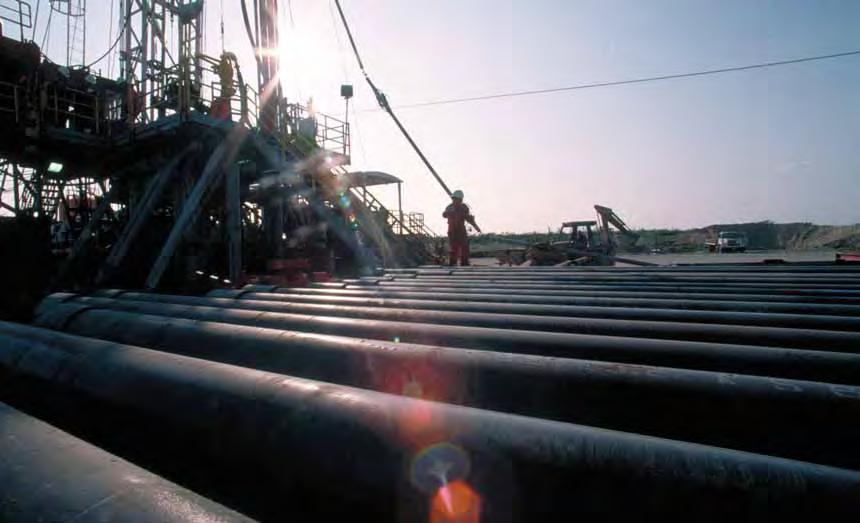
1 geovision Resistivity imaging for productive drilling

2 geovision Resistivity imaging while drilling helps position wells in the best place in the reservoir in less time. Real-time resistivity measurements from the geovision* imagingwhile-drilling service make drilling more productive by saving rig time and reducing costs. The high resolution of geovision images reveals formation structure and geological features, allowing wells to be steered to the best place in the reservoir to enhance production and ROI. Multiple depths of investigation permit detailed geological analysis to pinpoint reserves and optimize completion designs and stimulation strategies. Welcome to productive drilling*. FLEXIBLE BHA CONFIGURATIONS Resistivity measurements from the geovision imaging-while-drilling service can detect and image thin-bed resistivities in conductive BENEFITS Cuts costs by providing key inputs for optimizing completion design and stimulation strategy Identifies thin bed pay zones in conductive mud environments Facilitates putting horizontal wells in the best place within a reservoir by showing wellbore location relative to structure Saves rig time by acquiring data while drilling Provides accurate resistivity measurements in high-resistivity formations


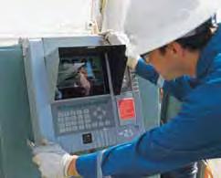
3 mud environments. This information provides the detailed geological analysis required for geosteering precision in wellbores as small as in. The geovision downhole tool can be configured to make up to five resistivity measurements. Three azimuthally focused 1-in button electrodes, spaced longitudinally along the axis of the tool, provide multiple depths of investigation that permit quantification of invasion profiles. An integral, cylindrical electrode delivers a high-resolution, lateral resistivity referred to as ring resistivity. A bit resistivity measurement allows real-time coring and casing point selection in both conductive and resistive mud environments. Placement of the geovision tool in a BHA can be directly above the bit, near the bit, or above other components allowing broad flexibility in BHA configuration. In addition to five resistivity measurements, the geovision tool acquires azimuthal gamma ray data, torsional and lateral shock records, and temperature measurements. REAL-TIME IMAGING AND DIP CALCULATION FOR ENHANCED WELL PLACEMENT The azimuthally acquired electrode measurements are displayed as fullbore images in real time to graphically describe formation resistivity. Advanced built-in processing allows structural dip to be calculated downhole and transmitted to the surface in real time. This provides information about formation structure and other geological features, which aids precise placement of a wellbore within a reservoir. All data acquired are stored in memory and can be sent to the surface in real time or downloaded when the tool is returned to the surface. Advanced processing and interpretation can be done at the computing center by the same analyst who interprets FMI* Fullbore Formation MicroImager images. Gamma Ray 0 (gapi) 150 ROP (ft/h) -5 (º) 95 Events Gamma Ray 0 (gapi) 150 ROP (ft/h) -5 (º) 95 Events Static geovision Image MD 1 : 60 Dynamic geovision Image Dynamic FMI Image MD 1 : 20 Static geovision Image Dynamic geovision Image Dynamic FMI Image Bed boundary Concretion Concretion fractures Longitudinal induced conductive fracture fracture (natural) Concretions Partially healed fracture fracture (healed) The consistency of these geovision and FMI images, acquired over the same intervals in Barnett shale, demonstrates the ability of geovision imaging while drilling to provide the resistivity measurements required for detailed geological analysis. Put wells in the best place with high-resolution multidepth geovision resistivity measurements.


4 Reach TD in less time with productive drilling ACQUISITION OF HIGH-RESOLUTION BOREHOLE IMAGES WHILE DRILLING SAVES RIG TIME AND REDUCES COSTS The high-resolution borehole images provided by the geovision service facilitate detailed geological and geomechanical analyses in conductive mud environments. By providing the measurements required to identify natural fractures contributing to well productivity and both the natural and induced fractures necessary to understand the orientation of formation stresses around the borehole geovision imaging delivers key information for devising successful completion strategies. Because geovision resistivity imaging can be combined with other services, the need for an additional logging run can be eliminated, resulting in rig time savings and reduced drilling costs. RESISTIVITY IMAGING-WHILEDRILLING IDENTIFIES FRACTURES IN BARNETT SHALE In an 81 2-in well drilled in the Texas Barnett shale, geovision borehole images were used to successfully identify faults, open and healed fractures, structural and stratigraphic dip magnitudes and directions, and minimum and maximum stress orientations. A drillpipe-conveyed FMI imager was also run in the horizontal section of this well for comparison. The consistency in interpretation of the FMI and geovision images provided the validation and confidence necessary to run geovision services in future Barnett shale wells. Quality images provided by the geovision service can help pinpoint reserves in the diverse shale gas plays found in the continental United States. Niobrara Gammon Bakken Excello/Mulky New Albany Antrim Green River Cane Creek Monterey Devonian/Ohio McClure Floyd and Conasauga Lewis and Mancos Palo Duro Barnett and Woodford Caney and Woodford Woodford Barnett Fayetteville
5 Resistivity imaging-while-drilling service geovision Resistivity Specifications General Specifications geovision675* system geovision825* system Collar dimensions Nominal diameter 6.75 in 8.25 in Maximum diameter 7.75 in 9.5 in Upper head connection 5 1 /2 FH box 6 5 /8 in FH box Lower head connection 4 1 /2 Reg pin 6 5 /8 in Reg box Operating temperature Standard configuration 300 degf [150 degc] 300 degf [150 degc] High-temperature configuration N/A N/A Tool length and weight Length ft [3.08 m] ft [3.88 m] Weight 1,200 lbm [544.3 kg] 2,400 lbm [1,088.6 kg] Mechanical Specifications Dogleg severity Rotary mode 8 /100 ft 7 /100 ft Sliding mode 16 /100 ft 13 /100 ft Bending strength ratio (BSR) Upper connection BSR Lower connection BSR Equivalent bending stiffness 10 ft of ft of Average inertia 84 in in 4 Axial and rotational load Maximum weight on bit 71,000,000/L lbf 164,000,000/L lbf Maximum jarring load 330,000 lbf 640,000 lbf Maximum rotary torque 16,000 ft.lbf 23,000 ft.lbf Hydraulics Maximum external pressure 18,000 psi 15,000 psi Standard flow range 0 to 800 galus/min 0 to 1,200 galus/min Pressure drop constant (C) 135, ,000 Measurement Performance Resistivity Bit and ring Azimuthal button electrode Range 0.2 to 20,000 ohm.m 0.2 to 20,000 ohm.m Accuracy 0.1 to 250 ohm.m ± 5% ± 5% 250 to 500 ohm.m ± 10% ± 10% 500 to 5,000 ohm.m ± 20% ± 20% Noise floor 0.2 ms 0.2 ms Resistivity response Bit Ring Deep Medium Shallow Vertical resolution 12 to 24 in 2 to 3 in 2 to 3 in 2 to 3 in 2 to 3 in Depth of investigation 12 in 7 in 5 in 3 in 1 in Resistivity environments Water-base mud Because geovision resistivity is a laterolog measurement, the geovision tool should be run under conditions where R xo is less than or approximately equal to R t to ensure that the tool is sensitive to R t when there is significant invasion. Oil-base mud Correlation with bit resistivity only Gamma ray Range 0 to 250 gapi Accuracy ± 7% Statistical resolution ± 3 gapi at 100 gapi and 100 ft/h Vertical resolution 1.5 in L is the distance in ft between the stabilizer above the tool and the stabilizer below it. APPLICATIONS Real-time image and dip calculation to help position wells in the best place in the reservoir Real-time geostopping for coring and casing point selection in both oil- and water-base muds High-resolution imaging for fracture identification and complex interpretations Invasion profile analysis Thin bed analysis FEATURES Three azimuthally focused electrode resistivity measurements High-resolution focused ring resistivity At-the-bit resistivity Azimuthal gamma ray High-resolution multidepth resistivity image with full coverage Enhanced resolution image processing Combinable with all other Schlumberger drilling and measurement services Runnable directly above the bit for enhanced geosteering Resistivity measurements to 20,000 ohm.m

6 geovision Resistivity imaging provides multiple depths of investigation for productive drilling. *Mark of Schlumberger Copyright 2007 Schlumberger. All rights reserved. 07-DR-122
MicroScope. Resistivity- and imagingwhile-drilling
 MicroScope Resistivity- and imagingwhile-drilling service MicroScope Magnify your reservoir Multidepth laterolog resistivity Multidepth borehole images Mud resistivity Azimuthal gamma ray Bit resistivity
Heterogeneity Type Porosity. Connected Conductive Spot. Fracture Connected. Conductive Spot. Isolated Conductive Spot. Matrix.
 Porosity Histogram Porosity Contribution 1.3.3.3 Connected 9.8 ohm.m U R D 9 18 7. 5.25 4.38 3.5 2.63 1.75 48 Heterogeneity Distribution Image Orientation, L U 27 36.4.3 X,X72.5 Depth, ft.3 1 Isolated.3
X,800. X,850 ft. X,900 ft. X,950 ft. X,000 ft. GeoSphere. Reservoir Mapping-While-Drilling Service
 X,800 X,850 ft X,900 ft X,950 ft X,000 ft GeoSphere Reservoir Mapping-While-Drilling Service Discover reservoir mapping-while-drilling...... and reveal subsurface beddings and fluid contacts at the reservoir
True 3D measurements for enhanced reservoir quantification. Rt Scanner
 True 3D measurements for enhanced reservoir quantification Rt Scanner Rt Scanner measurements in three dimensions at multiple depths of investigation (DOIs) quantify even low-resistivity laminated pay
New downhole technologies helped develop horizontal thin sand
 Reprinted from: June 2005 issue, pgs 25-33. Used with permission. DRILLING AND COMPLETION TECHNOLOGY SPECIAL FOCUS New downhole technologies helped develop horizontal thin sand Completion of Well Ewan-YH
Downhole Navigation for Oil & Gas Drilling
 Downhole Navigation for Oil & Gas Drilling Martin E. Poitzsch Research Director, Sensor Physics Schlumberger-Doll Research, Cambridge, MA A Division of Schlumberger Ltd. Outline Importance of Accurate
Cracking the carbonate code
 Cracking the carbonate code Carbonate reservoirs are the most complex reservoirs in existence, and the Middle East is the place to find them. The complexity and unpredictability of carbonates has frequently
Quanta Geo. Photorealistic reservoir geology service
 Quanta Geo Photorealistic reservoir geology service Quanta Geo Photorealistic reservoir geology service Photorealistic core image Applications High-resolution quantified imaging Boreholes with nonconductive
New MWD, LWD Services Help Drillers Keep Bit In Formation s Sweet Spot
 NOVEMBER 2013 The Better Business Publication Serving the Exploration / Drilling / Production Industry New MWD, LWD Services Help Drillers Keep Bit In Formation s Sweet Spot By Randy Brown, Les Honeyman,
Bakken and Three Forks Logging Acquisition for Reservoir Characterization and Completion Optimization
 Bakken and Three Forks Logging Acquisition for Reservoir Characterization and Completion Optimization Ernest Gomez (egomez@denver.oilfield.slb.com), Peter Hook, Peter S. Kaufman and Stephen D. Sturm Acknowledgements
Corporate Houston, TX... (713)
") Allied Wireline Services and Horizontal Wireline Services are proud to announce that we are now one company, dedicated to providing you the highest value wireline services and built on the commitment to
Allied Wireline Services and Horizontal Wireline Services are proud to announce that we are now one company, dedicated to providing you the highest value wireline services and built on the commitment to
Predicting the path ahead
 Predicting the path ahead Horizontal drilling has become a routine procedure in many parts of the world and is particularly popular in the Middle East. Despite increasing familiarity with the techniques,
DESIGN OF AN ULTRA-SPEED LAB-SCALE DRILLING RIG FOR SIMULATION OF HIGH SPEED DRILLING OPERATIONS IN HARD ROCKS. *V. Rasouli, B.
 DESIGN OF AN ULTRA-SPEED LAB-SCALE DRILLING RIG FOR SIMULATION OF HIGH SPEED DRILLING OPERATIONS IN HARD ROCKS *V. Rasouli, B. Evans Department of Petroleum Engineering, Curtin University ARRC Building,
DEVEX Moving in the Right Direction; Realising Upside Potential in a Mature Field Using Real Time 3D Geo-Steering Technology
 DEVEX 2010 Moving in the Right Direction; Realising Upside Potential in a Mature Field Using Real Time 3D Geo-Steering Technology Authors: Lisa Chisholm, Chevron Upstream Europe David Holbrough, Baker
Well Evaluation. An Integrated Well-Evaluation Process for Shale Gas Reservoirs
 Well Evaluation An Integrated Well-Evaluation Process for Shale Gas Reservoirs APPLICATION Gas shale analysis for unconventional wells BENEFITS Optimized stimulation by thorough study and planning Increased
Evaluating Horizontal Cased Wells for Completion Design
 Evaluating Horizontal Cased Wells for Completion Design Dallas SPE 4/20/2016 Rick Reischman Schlumberger Houston Unconventional Domain Evaluating Horizontal Cased Wells for Completion Design Introduction
Directional Drilling. History
 Directional Drilling Directional drilling is the science of deviating a well bore along a planned course to a subsurface target whose location is a given lateral distance and direction from the vertical.
ECS Elemental Capture Spectroscopy Sonde. Fast, accurate lithology evaluation
 ECS Elemental Capture Spectroscopy Sonde Fast, accurate lithology evaluation Applications n Identify carbonate, gypsum, and anhydrite; quartz, feldspar, and mica; pyrite, siderite, coal, and salt fractions
Shale Development and Hydraulic Fracturing or Frac ing (Fracking) What is it?
 What is it?") P E T R O L E U M E N G I N E E R I N G D E P A R T M E N T Shale Development and Hydraulic Fracturing or Frac ing (Fracking) What is it? Dr. Will Fleckenstein, PE Colorado School of Mines 1 Who is involved
P E T R O L E U M E N G I N E E R I N G D E P A R T M E N T Shale Development and Hydraulic Fracturing or Frac ing (Fracking) What is it? Dr. Will Fleckenstein, PE Colorado School of Mines 1 Who is involved
Sperry Drilling New LWD Technology. Mike Dautel Petrophysics Manager Asia Pacific
 Sperry Drilling New LWD Technology Mike Dautel Petrophysics Manager Asia Pacific Complete LWD Formation Evaluation Azimuthal Gamma Ray Directional Sensors Multi-Depth Resistivity Imaging Azimuthal Density
AADE 2009NTCE DEVELOPMENT AND TESTING OF HIGH DOGLEG ROTARY STEERABLE SYSTEM
 2009 NATIONAL TECHNICAL CONFERENCE & EXHIBITION, NEW ORLEANS, LOUISIANA AADE 2009NTCE-14-06 DEVELOPMENT AND TESTING OF HIGH DOGLEG ROTARY STEERABLE SYSTEM AUTHOR(S) & AFFILIATIONS: SONNY BRYAN, JOE COX,
and a contribution from Offshore Europe
 Primary funding is provided by The SPE Foundation through member donations and a contribution from Offshore Europe The Society is grateful to those companies that allow their professionals to serve as
Petrophysical Data and Open Hole Logging Operations Basics COPYRIGHT. Introduction to Petrophysical Data and Open Hole Logging Operations Basics
 Learning Objectives Petrophysical Data and Open Hole Logging Operations Basics Introduction to Petrophysical Data and Open Hole Logging Operations Basics By the end of this lesson, you will be able to:
An Integrated Petrophysical Approach for Shale Gas Reservoirs
 An Integrated Petrophysical Approach for Shale Gas Reservoirs Richard Arnold & Matt Bratovich Baker Hughes Reservoir Development Services 1 2014 B A K E R H U G H E S I N C O R P O R A TED. A LL R I G
Characterization of Fractures from Borehole Images. Sandeep Mukherjee- Halliburton
 Characterization of Fractures from Borehole Images Sandeep Mukherjee- Halliburton Summary Characterization of fractures is an important aspect of formation evaluation. Fractures, when present could alter
Precise well placement in the Cygnus gas field. Ian Dredge ENGIE E&P UK Limited
 Precise well placement in the Cygnus gas field Ian Dredge ENGIE E&P UK Limited Executive summary The Lower Leman reservoir in the Cygnus gas field is highly layered with low vertical permeability The use
Introduction to Formation Evaluation Abiodun Matthew Amao
 Introduction to Formation Evaluation By Abiodun Matthew Amao Monday, September 09, 2013 Well Logging PGE 492 1 Lecture Outline What is formation evaluation? Why do we evaluate formation? What do we evaluate?
What Can Microseismic Tell Us About Hydraulic Fracturing?
 What Can Microseismic Tell Us About Hydraulic Fracturing? Shawn Maxwell May 2015 Microseismic Geomechanics: Increased understanding; reduced risk 1 Outline Microseismic Introduction Microseismic in Unconventional
The State of the Industry of Drillbit Geomechanics
 The State of the Industry of Drillbit Geomechanics Value Proposition of Drillbit Geomechanics In Situ Rock Properties Along All Wells allows Operators to Optimize Completion Designs Improved completion
Shale gas developments: enabled by technology
 Shale gas developments: enabled by technology Andrew Jennings * reviews some exploration and development technologies employed by Schlumberger that have supported the economic production of shale gas in
Torque and drag modelling for Redhill South-1 in the Northern Perth Basin, Australia
 Petroleum and Mineral Resources 97 Torque and drag modelling for Redhill South-1 in the Northern Perth Basin, Australia S. Smith & V. Rasouli Department of Petroleum Engineering, Curtin University, Australia
Advances in Geosteering
 Advances in Geosteering SMART4D While Drilling Geosteering Marcellus Case Study Joint Presentation: Feb 27 th 2014, Houston, TX Rocky Mottahedeh, P.Geol. P.Eng. EOW Report University_31_18_2H Advances
An Open Air Museum. Success breeds Success. Depth Imaging; Microseismics; Dip analysis. The King of Giant Fields WESTERN NEWFOUNDLAND:
 VOL. 7, NO. 4 2010 GEOSCIENCE & TECHNOLOGY EXPLAINED GEO EXPRO VOL. 7, NO. 4 2010 Success breeds Success geoexpro.com Country Profile: Senegal Ocean Bottom Node Seismic WESTERN NEWFOUNDLAND: An Open Air
Shale Gas; Wellbore Positioning Challenges
 Shale Gas; Wellbore Positioning Challenges Pete Clark, Directional Drilling Advisor ISCWSA, Copenhagen, 3/4/11 Shale Gas; Wellbore Positioning Challenges Why is it important to us? Emerging trend in drilling
Resistivity While Drilling Images from the String
 Resistivity While Drilling Images from the String Steve Bonner Mark Fredette John Lovell Bernard Montaron Richard Rosthal Jacques Tabanou Peter Wu Sugar Land, Texas, USA Brian Clark Ridgefield, Connecticut,
Petroleum Geology of Shale Gas & Tight Oil and How To Do It: Drill and Frack a Horizontal Well
 US Association for Energy Economics National Capital Area Chapter Petroleum Geology of Shale Gas & Tight Oil and How To Do It: Drill and Frack a Horizontal Well Robert Kleinberg Schlumberger Cambridge,
Exploration / Appraisal of Shales. Petrophysics Technical Manager Unconventional Resources
 Exploration / Appraisal of Shales Rick Lewis Petrophysics Technical Manager Unconventional Resources Organic Shale Factors Controlling Gas Reservoir Quality Conventional sandstone Mineral framework Gas
Title: Application and use of near-wellbore mechanical rock property information to model stimulation and completion operations
 SPE OKC Oil and Gas Symposium March 27-31, 2017 Best of OKC Session Chairperson: Matthew Mower, Chaparral Energy Title: Application and use of near-wellbore mechanical rock property information to model
The Bakken. A Non-Shale Shale Play. August 2010
 The Bakken A Non-Shale Shale Play August 2010 ConocoPhillips Unconventional Resource Experience in North America CBM San Juan Drunkards Wash Uinta Powder River Horseshoe Canyon Manville Shale Barnett Haynesville
1 General introduction
 1 General introduction 1.1 Oil well drilling system Oil and other hydrocarbons are the primary source of global energy. However, the exploration of these hydrocarbons presents a myriad of challenges resulting
AADE Mid Continent Chapter. Bakken Shale Resource Play. Revisited. January 14, 2009 Jim Thompson
 AADE Mid Continent Chapter Bakken Shale Resource Play Revisited January 14, 2009 Jim Thompson Marathon 2007 History One Year Ago Today Re-entered basin in May 2006 Hit the ground running with two conventional
Western Kentucky CO 2 Storage Test
 Western Kentucky CO 2 Storage Test Principal Investigators: Rick Bowersox - Lexington Dave Williams - Henderson KGS First Friday Seminar Lexington, Kentucky March 4, 2011 The project proceeded in two phases:
ACCURATE HORIZONTAL WELL PLACEMENT THROUGH EVALUATION OF MULTIPLE LWD IMAGES WITH GEOLOGICAL MODELING.
 ACCURATE HORIZONTAL WELL PLACEMENT THROUGH EVALUATION OF MULTIPLE LWD IMAGES WITH GEOLOGICAL MODELING. Mark Bacciarelli, Giorgio Nardi; Baker Hughes INTEQ, A. A. Al-Hajari, and S. Ma, Saudi Aramco Copyright
The role of seismic in unconventional reservoir development
 The role of seismic in unconventional reservoir development Mike Perz Director, Technology & Innovation, Multi-client, Onshore February 23, 2018 Outline Introduction Seismic s adaptation to the unconventional
INTRODUCTION TO LOGGING TOOLS
 BY: MUHAMMAD ZAHID INTRODUCTION TO LOGGING TOOLS 1- SPONTANEOUS POTENTIAL (SP) The Spontaneous potential survey, (sp) was one of the first measurements, which was carried out, in a well bore. The SP log
Imaging: Getting the Picture Downhole
 Imaging: Getting the Picture Downhole Geologists and petrophysicists use image logs to visualize rocks in situ and determine structural geometry and formation properties. Image data help them analyze reservoir
NORTH AMERICAN ANALOGUES AND STRATEGIES FOR SUCCESS IN DEVELOPING SHALE GAS PLAYS IN EUROPE Unconventional Gas Shale in Poland: A Look at the Science
 NORTH AMERICAN ANALOGUES AND STRATEGIES FOR SUCCESS IN DEVELOPING SHALE GAS PLAYS IN EUROPE Unconventional Gas Shale in Poland: A Look at the Science Presented by Adam Collamore Co-authors: Martha Guidry,
GeoSteering
 GeoSteering GeoSteering Significance The geosteering uses real-time geological parameters to clarify various uncertainties and effectively control the landing and direction of the well trajectory, and
Abstract. 1. Introduction. Geophysics Engineer-Schlumberger 2. M.Sc. Petroleum-PEMEX 3,4 Geologists-PEMEX
 IBP3018 MINIMIZING DRILLING RISKS FOR EXPLORATION WELL IN DEEP WATER USING SEISMIC WHILE DRILLING TECHNOLOGY Sanchez Adrian 1, Mora Alfonso 2 Aguilera Leonardo 3, Gaitan Rito 4 Copyright 2010, Brazilian
RPSEA Research Project Overview
 RPSEA Research Project Overview September 28, 2011 PTTC/DOE/RSPEA Gas Shales Workshop Charlotte Schroeder Secure Energy for America Secure Energy for America RPSEA A non profit corporation formed by a
Detection of Structural Elements Using Borehole Imagery Techniques, A Case Study From Krishna-Godavari Basin, India
 5th Conference & Exposition on Petroleum Geophysics, Hyderabad-2004, India PP 135-139 Detection of Structural Elements Using Borehole Imagery Techniques, A Case Study From Krishna-Godavari Basin, India
Rocsol D-Series Technology
 Rocsol D-Series Technology D-ROCK October 25, 2017 Rocsol Technologies Inc. Challenges of Horizontal Well Logging Conventional logging and rock mechanical testing are expensive (logging cost and rig time)
Formation Evaluation: Logs and cores
 These powerpoint files were produced for the Earth History class at the Free University Berlin, Department of Geological Sciences The copyright for texts, graphical elements, and images lies with C. Heubeck,
Considerations for Infill Well Development in Low Permeability Reservoirs
 Considerations for Infill Well Development in Low Permeability Reservoirs George Waters Technical Manager Unconventional Completions September 9, 2014 Topics Continuous Improvement in Field Development
Cornish Institute of Engineers Conference th October 2013
 Wellbore Stability and Real Time Drilling Optimisation: Delivered Worldwide from Cornwall Sarah Marks Cornish Institute of Engineers Conference 2013 11 th October 2013 GeoScience Limited, Falmouth Business
Fundamentals Of Petroleum Engineering FORMATION EVALUATION
 Fundamentals Of Petroleum Engineering FORMATION EVALUATION Mohd Fauzi Hamid Wan Rosli Wan Sulaiman Department of Petroleum Engineering Faculty of Petroleum & Renewable Engineering Universiti Technologi
Kentucky Geological Survey Marvin Blan #1 Hancock County, Kentucky Geologic Review. J. Richard Bowersox David A. Williams Kentucky Geological Survey
 Kentucky Geological Survey Marvin Blan #1 Hancock County, Kentucky Geologic Review J. Richard Bowersox David A. Williams Kentucky Geological Survey KYCCS Western Kentucky Project Review Lexington, Kentucky
Kent F. Perry. Gas Technology Institute Des Plaines, Illinois. Paper Presented October 6, th World Gas Conference Buenos Aires, Argentina
 New Albany Shale Gas Research Project Kent F. Perry Gas Technology Institute Des Plaines, Illinois U.S.A. Paper Presented October 6, 2009 24 th World Gas Conference Buenos Aires, Argentina Topics New Albany
Introduction to Oil&Gas Well Drilling
 Introduction to Oil&Gas Well Drilling Drilling Introduction to Oil&Gas Well Drilling The term drilling indicates the whole complex of operations necessary to construct wells of circular section applying
Drill Cuttings Analysis: How to Determine the Geology of a Formation and Reservoir
 Drill Cuttings Analysis: How to Determine the Geology of a Formation and Reservoir Chuck Stringer ASA Manager Southern Region 2015 TECH MKT_2014-BD-REG-1673 1 The one item that has lacked serious consideration
Hostile downhole conditions present complex challenges
 Haynesville Shale Hostile downhole conditions present complex challenges Solving challenges. conservative estimates show 168 trillion cubic feet of natural gas Haynesville formation The Haynesville shale
Geology of the Louisiana Haynesville Shale Play
 Annual Institute on Mineral Law Volume 56 The 56th Annual Institute on Mineral Law Article 6 4-2-2009 Geology of the Louisiana Haynesville Shale Play Louis Gilbert Follow this and additional works at:
Somenath Kar*, Krishnendu Ghosh*, Arnab Ghosh*, Koushik Sikdar*, Udit Kumar Guru*, Priyanka Bhattacharya*, K.M Sundaram**, G M Chavan**
 P-419 Summary Characterizing the Clay Particle distribution in Deepwater Channel Levee Complex using Borehole Micro Image and Multi Triaxial Induction Measurement: A Case Studies from Eastern Offshore
U.S. Shale Gas in 2030
 Oilfield Breakfast Forum October, 2014 U.S. Shale Gas in 2030 Scott W. Tinker Bureau of Economic Geology The University of Texas at Austin, Austin BCF/Day Global Natural Gas Production 350.0 300.0 Total
Rotary Steerable System Technology Case Studies in the Canadian Foothills: A Challenging Drilling Environment
 AADE-07-NTCE-71 Rotary Steerable System Technology Case Studies in the Canadian Foothills: A Challenging Drilling Environment Essam Adly, Schlumberger Copyright 2007, AADE This paper was prepared for presentation
Geomechanical controls on fault and fracture distribution with application to structural permeability and hydraulic stimulation
 CSPG Luncheon Calgary February 5 th 2015 Geomechanical controls on fault and fracture distribution with application to structural permeability and hydraulic stimulation Scott Mildren - Ikon Science Australian
NOTICE CONCERNING COPYRIGHT RESTRICTIONS
 NOTICE CONCERNING COPYRIGHT RESTRICTIONS This document may contain copyrighted materials. These materials have been made available for use in research, teaching, and private study, but may not be used
Shale Gas Plays Screening Criteria A Sweet Spot Evaluation Methodology
 Well Placement and Fracturing Optimization Research Team, TTU Shale Gas Plays Screening Criteria A Sweet Spot Evaluation Methodology Ahmed Alzahabi, PhD Candidate A. Algarhy, M. Soliman, R. Bateman, and
GeoFlex. Quantitative cuttings analysis and imaging service
 GeoFlex Quantitative cuttings analysis and imaging service Bring the cuttings characterization lab to the field with the GeoFlex* quantitative cuttings analysis and imaging service from Geoservices, a
M.M.Panigrahi*, S.R.Meena, Rudal Singh, B.C.Sethy, R.D.Chourasiya, S.K.Verma. ONGC Ltd., India; Pallav Chakraborty, Schlumberger, India Geomarket.
 P - 35 Improved Hydrocarbon Recovery from Carbonate Reservoir of Mumbai High North Field by Geological Steering Based on Real Time LWD (Logging While Drilling) Data- A Case Study. M.M.Panigrahi*, S.R.Meena,
SPWLA-INDIA 3rd Annual Logging Symposium, Mumbai, India Nov 25-26, 2011
 GEOSTEERING TECHNOLOGY SHOWS THE NEW DIRECTION FOR MAJOR PRODUCTION ENHANCEMENT IN WESTERN ONSHORE, INDIA: AN EXCEPTIONAL SUCCESS-STORY FROM ONGC AHMEDABAD ASSET Arvind Vilasrao Sapkal*, Chandan Jyoti
SELECTED PAPERS AND PUBLICATIONS
 SELECTED PAPERS AND PUBLICATIONS SPE 153580: Milestone in Production Using Proactive Azimuthal Deep- Resistivity Sensor Combined with Advanced Geosteering Techniques: Tarapoa Block, Ecuador. Alex Guevara,
Seismic Guided Drilling: Near Real Time 3D Updating of Subsurface Images and Pore Pressure Model
 IPTC 16575 Seismic Guided Drilling: Near Real Time 3D Updating of Subsurface Images and Pore Pressure Model Chuck Peng, John Dai and Sherman Yang, Schlumberger WesternGeco Copyright 2013, International
1st SPWLA India Regional Conference Formation Evaluation in Horizontal Wells
 GOING BEYOND GEOMETRICAL DRILLING : A REVIEW OF THE CONTRIBUTION OF LWD MEASUREMENTS TO THE IMPROVEMENT OF WELL PLACEMENT. Jacques R. Tabanou, Jean Michel Denichou, Jack Horkowitz, Dzevat Omeragic, John
New Frontier Advanced Multiclient Data Offshore Uruguay. Advanced data interpretation to empower your decision making in the upcoming bid round
 New Frontier Advanced Multiclient Data Offshore Uruguay Advanced data interpretation to empower your decision making in the upcoming bid round Multiclient data interpretation provides key deliverables
Applying Stimulation Technology to Improve Production in Mature Assets. Society of Petroleum Engineers
 Applying Stimulation Technology to Improve Production in Mature Assets Alexandr Mocanu Well Production Services, Schlumberger Visegrád, 19 November 2015 Society of Petroleum Engineers 1 Agenda Formation
Raptor A New High-Technology, High-Value. Dr. Darryl Trcka Senior Research Scientist Raptor Interpretive Product Manager
 Raptor A New High-Technology, High-Value Pulsed Neutron Measurement from Weatherford Dr. Darryl Trcka Senior Research Scientist Raptor Interpretive Product Manager 2012 Weatherford. All rights reserved.
Formation Resistivity Measurements Through Casing In The Wells of Bombay Offshore Basin
 5th Conference & Exposition on Petroleum Geophysics, Hyderabad-2004, India PP 101-105 Formation Resistivity Measurements Through Casing In The Wells of Bombay Offshore Basin B. V. Jacob, Naresh Kumar,
Barnett Shale Showcases Tight-Gas Development
 BARNETT SHALE Barnett Shale Showcases Tight-Gas Development Joel Parshall, JPT Features Editor Horizontal drilling and continuing advances in hydraulic fracturing have made the Barnett Shale formation
Microseismic Aids In Fracturing Shale By Adam Baig, Sheri Bowman and Katie Jeziorski
 AUGUST 2014 The Better Business Publication Serving the Exploration / Drilling / Production Industry Microseismic Aids In Fracturing Shale By Adam Baig, Sheri Bowman and Katie Jeziorski KINGSTON, ONTARIO
Wellsite Consulting Services Diversified Well Logging LLC. All Rights Reserved.
 Wellsite Consulting Services We are CUSTOMER FOCUSED: We seek to exceed customer expectations by providing solutions that improve their drilling, completions, and production economics OUR CORE VALUES DEFINE
Core Technology for Evaluating the Bakken
 Core Technology for Evaluating the Bakken Fundamentals for Reservoir Quality Assessment and Completion Analysis John Kieschnick and Roberto Suarez-Rivera TerraTek 1 Topics Covered Core Technology Changes
Shale Natural Resources. Stephen Ingram, North America Technology Manager, Halliburton
 Shale Natural Resources Stephen Ingram, North America Technology Manager, Halliburton The development of shale natural resources has had a sudden and dramatic effect on the US and Canadian economies. The
The Deployment of an Azimuthal Resistivity Tool for Geosteering - A Case Study from the Foinaven Field (North Sea)*
*") The Deployment of an Azimuthal Resistivity Tool for Geosteering - A Case Study from the Foinaven Field (North Sea)* Martin Bedrock 1 and Darren Moody 1 Search and Discovery Article #40540 (2010) Posted
The Deployment of an Azimuthal Resistivity Tool for Geosteering - A Case Study from the Foinaven Field (North Sea)* Martin Bedrock 1 and Darren Moody 1 Search and Discovery Article #40540 (2010) Posted
Well Logging. Salam Al Rbeawi 2011
 Well Logging Salam Al Rbeawi 2011 Well Logging: Is a technique used for formation evaluation to determine the size of the reservoir and the amount of oil and gas in place. The following parameters can
FRACTURE CHARACTERIZATION FROM CORE TO DISCRETE FRACTURE NETWORK MODEL DOUG BEARINGER, CHELSEY HILLIER
 FRACTURE CHARACTERIZATION FROM CORE TO DISCRETE FRACTURE NETWORK MODEL DOUG BEARINGER, CHELSEY HILLIER SHALE CHALLENGES Simple models versus observations of complex fracture networks A good earth model
ractical Geomechanics for Oil & Gas Industry
 P ractical Geomechanics for Oil & Gas Industry Practical Geomechanics for Oil and Gas Industry The integrity of the wellbore plays an important role in petroleum operations including drilling, completion
Comprehensive Wellbore Stability Analysis Utilizing Quantitative Risk Assessment
 Comprehensive Wellbore Stability Analysis Utilizing Quantitative Risk Assessment Daniel Moos 1 Pavel Peska 1 Thomas Finkbeiner 1 Mark Zoback 2 1 GeoMechanics International, Palo Alto, CA 94303 2 Stanford
Horizontal well Development strategy
 Horizontal well Development strategy Pakawas Mangkang Team Member Yoseph Partono Stephan Otero Duangdao Chutanukarn Warin Lobtong Suarporn Ketpreechasawat B8/32 Asset, Thailand Chiangmai, 11 th Nov-13
Technology of Production from Shale
 Technology of Production from Shale Doug Bentley, European Unconventional, Schlumberger May 29 th, 2012 Johannesburg, South Africa What are Unconventional Reservoirs Shale both Gas & Oil Coal Bed Methane
The SPE Foundation through member donations and a contribution from Offshore Europe
 Primary funding is provided by The SPE Foundation through member donations and a contribution from Offshore Europe The Society is grateful to those companies that allow their professionals to serve as
Microseismic Monitoring Shale Gas Plays: Advances in the Understanding of Hydraulic Fracturing 20 MAR 16 HANNAH CHITTENDEN
 Microseismic Monitoring Shale Gas Plays: Advances in the Understanding of Hydraulic Fracturing 20 MAR 16 HANNAH CHITTENDEN Introduction Early days: Microseismic monitoring has been around since the early
Practical Application of Directional Drilling at Takigami Geothermal Field
 Proceedings World Geothermal Congress 2005 Antalya, Turkey, 24-29 April 2005 Practical Application of Directional Drilling at Takigami Geothermal Field Hisashi Jotaki 1 and Keisuke Ushijima 2 1 Idemitsu
Integrated Fracture Identification with Z-VSP and Borehole Images: A study from Cambay Basin
 P-124 Integrated Fracture Identification with Z-VSP and Borehole Images: A study from Cambay Basin Sattwati Dey, Jubilant Energy; Chandramani Shrivastva, Schlumberger; Sreemanti Gijare*, Schlumberger;
Antelope Hills Directionally Drilled Water Well. Theresa Jehn-Dellaport Jehn Water Consultants, Inc.
 Antelope Hills Directionally Drilled Water Well Theresa Jehn-Dellaport Directional Well Applications Deep Bedrock Aquifers Proven Oil field technology Initial Analysis indicates up to 4 times the production
Microseismicity applications in hydraulic fracturing monitoring
 Available online atwww.scholarsresearchlibrary.com Archives of Applied Science Research, 2016, 8 (4):13-19 (http://scholarsresearchlibrary.com/archive.html) ISSN 0975-508X CODEN (USA) AASRC9 Microseismicity
Implementing and Monitoring a Geomechanical Model for Wellbore Stability in an Area of High Geological Complexity
 AADE-10-DF-HO-15 Implementing and Monitoring a Geomechanical Model for Wellbore Stability in an Area of High Geological Complexity J. G. Vargas, Halliburton; J. Mateus, Halliburton; A. Jaramillo, Halliburton;
MODERN AZIMUTHAL RESISTIVITY TOOLS AND THEIR APPLICATION TO MATURE FIELD DEVELOPMENT
 MODERN AZIMUTHAL RESISTIVITY TOOLS AND THEIR APPLICATION TO MATURE FIELD DEVELOPMENT Mike Dautel, Jason Pitcher, and Michael Bittar, Halliburton Copyright 2011, held jointly by the Society of Petrophysicists
SPE MS Mississippi Canyon Gulf of Mexico Frac Pack Case Histories and the Importance of Proppant Tracing and Gravel Pack Logging
 SPE-181658-MS Mississippi Canyon Gulf of Mexico Frac Pack Case Histories and the Importance of Proppant Tracing and Gravel Pack Logging Jack Sanford, SPE Agenda Introduction Case History Summary Location
Microseismic Monitoring of a Multi-Stage Frac In the Bakken Formation, SE Saskatchewan
 Microseismic Monitoring of a Multi-Stage Frac In the Bakken Formation, SE Saskatchewan Summary Rob Kendall* Petrobank Energy and Resources Ltd., Calgary. Alberta kendall@petrobank.com Downhole microseismic