.. nearly all water comes from the oceans, is drawn into the clouds and returns to us as rain or snow.
|
|
|
- Jessica Knight
- 5 years ago
- Views:
Transcription

1
2 .. nearly all water comes from the oceans, is drawn into the clouds and returns to us as rain or snow.
3 ER IS VITAL Your life depends on water-one of the simplest of chemical compounds. With water there is life, industry, progress. Without water, the Earth would be a barren, lifeless planet. Water satisfies your thirst. You use it in cooking your food. You bathe in it-wash your clothes. You may use water in heating your house. The factory that made your car uses water to cool its giant boilers. And the plants and animals that you use for food depend every bit upon water for their life as you do for yours. Irrigation and livestock watering systems then are important not only to the farmer, but also to the city man, whose food supply comes from the farm. If there are five people in your family. you need about 250 gallons of water at your house every day-an average of 50 gallons per person. Industrial plants use huge quantities of water. For example, it takes 65,000 gallons to produce a ton of finished steel, and 600,000 gallons to make one ton of synthetic rubber. And more and more farmers are irrigating crops and installing up-to-date water systems in house and barn alike. Adding up the home. industrial and farm use of water in this country. the total comes to an amazing 1583 gallons per person per day. And with our population growing. industries expanding. and farm use of water increasing rapidly. this figure is rising sharply. 2
4 his is a brief story about water and the ways in which the Delaware Geological Survey helps insure that you will always have a plentiful supply of this precious natural resource"

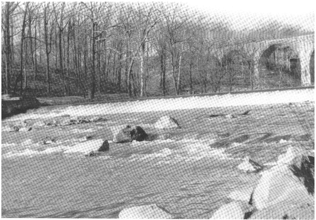
5 -U.. S. Soil Conservation Service Photo Farmers have a vital interest in a plentiful water supply for such uses as irrigating farm crops. -Sky Photos Delaware's fast expanding industrial centers need huge volumes of fresh water for their operations.
6 SUPPLY OF PURE WATER IS LIMITED With all of the water in the ocean, and all that falls on the land in the form of rain and snow, you would think that water supply would never be a problem, no matter how large our population should grow, industries expand, or no matter how much water should be used in agriculture. Yet we are faced with a problem of supply of pure, fresh water. Oceans cover more than 70 per cent of the surface of the earth, so they are our largest natural reservoirs. But we cannot drink ocean water because of the salt it contains. Neither can ocean water be used in irrigation. Some factories do use it for cooling purposes, however. Scientists are working on the problem of converting sea water into fresh water, but methods developed so far are very costly. So we must look for natural supplies of fresh water to fill our needs-streams, lakes, ponds, and underground reservoirs. Delaware receives about 43 inches of rain each year. Much of this is needed right where it falls, to provide a drink for thirsty, growing crops and forest trees. We catch and hold a small portion of the run-off water in reservoirs, artificial lakes, and farm ponds. But it would be impossible to save all of it. Much of the water that falls as rain runs into rivers, and eventually finds its way back to the ocean where it came from. Some is lost through evaporation, particularly in the hot, dry summer months. Some is held in natura/lakes and ponds. Still more seeps into the ground where it is stored in natural, underground reservoirs made up of sand, gravel, and other rock materials. Streams and underground reservoirs are our two major sources of fresh water. In order to know how much fresh water is available. we must keep rec.. ords on streamflow and ground..water supplies. This is a continuous lob. It is the primary task of the Del" aware Geological Survey.
7
8 WHAT THE E L ICAl SURVEY DOES Locating and developing economical supplies of pure water involves the sciences of geology, geophysics, hydrology, mineralogy and paleontology. Sands, gravels and other rock materials serve as ground-water reservoirs. Open spaces between the grains of these materials provide storage space for water. Where are these natural reservoirs? How large are they? How deep? How much water do they contain? At what rate will they yield it? Where is the best place to drill a well? To find answers to these questions requires field and laboratory investigation. This is the job of your state Geological Survey. Take for example, the task of determining how extensive a particular underground reservoir is. The sand brought up by the drill may contain fossils of plants or animals which lived millions of years ago. If the sand brought up in other drillings over an area contains the same kinds of fossils, this would indicate the extent of the reservoir. Identifying the fossils is a specialized job in the field of paleontology. Someone on the Survey staff must be acquainted with this science if it is to efficiently serve the citizens of Delaware. On the other hand, suppose the sand contains no fossils. It is still possible to measure the extent of the reservoir by comparing the mineral content of drill samples over an area. Identifying and interpreting minerals in terms of their relationship to water supplies is another specialized job, this time for a mineralogist. And it is important that somebody on the staff of the Survey be familiar with this particular branch of science. These established sciences, as well as new techniques and new equipment are employed in the continuous study of Delaware's water resources. The Survey is now using a combination electric and gamma ray logger to determine the presence and thickness of sands in drill holes, which in turn, may indicate the presence and extent of an underground reservoir. As additional tools and techniques are developed. the Survey will use them in its search for new sources of supply of the state's most important renewable natural resource-water.

9 Fossils Aid the Geologist in Identifying Strata SPORE PINE POLLEN FORAMINIFERA
10 l E SURVEY C PERAlES WI H HER GR UPS In addition to the work described so far, the Delaware Geological Survey cooperates with other groups and agencies in studies and in providing services and making recommendations. Studies of ground-water reservoirs and streams to determine "safe yield" are conducted in cooperation with the U. S. Geological Survey. Pump tests are made; rates of ground-water infiltration and water losses through evaporation are determined. With this information, it is possible to answer questions that a community might have such as: how much water can be developed safely and under what conditions? How far apart should wells be spaced to avoid shortages? How much water can be taken from streams? How large should storage reservoirs be? Legal problems involved in water resources development sometimes are as complicated as the physical problems of finding the water. What are the rights of the downstream farmer when his upstream neighbor literally dries up a creek in irrigating his land? What are the rights of property owners when their wells dry up after a new factory begins pumping water from the ground nearby? The Delaware Water Resources Study Committee is studying these and other problems in an effort to plan for the equitable administration of the State's water resources, which would consider not only the needs and interests of cities, towns, industries and agriculture, but those of navigation, recreation, fish and wildlife as well. The Delaware Geological Survey is cooperating with this committee by supplying information about water resources and other facts related to the geology of the state. As a means of safe-guarding the Delaware River against excessive salinity, the State Geologist serves as representative to the River Master, appointed by the U. S. Supreme Court to watch over conditions in the river as they are influenced by the water supply of New York City, Pennsylvania and New Jersey. The Survey also studies rock, sand and gravel deposits to determine whether or not they are suitable for highway building purposes. These studies have shown that there are considerable amounts of these materials in Delaware and that productive new quarries could be opened.

11 Surveys help locate sand and gravel deposits. Many towns in Delaware are outgrowing their present water supplies and water storage facilities.
12 SERVICES T THE PE PLE OF DELA ARE The services of the Geological Survey to the people of Delaware are of three main types-consultation. reports. and educational talks and discussions. CONSULTATION ON WATER SUPPLIES AND OTHER GEOLOGICAL PROBLEMS: The Survey staff is available for consultation on any water or geological problem you may have. The Survey has data on most areas of the state, and this information is available free. To get information, write, phone, or better still, visit the Survey office at the University of Delaware in Newark. Your state geologist will discuss the data with you and will make an interpretation of the available information as it relates to your problem. REPORTS. MAPS. AND OTHER PUBLISHED MATERIAL RELATED TO THE GEOLOGY Of DELAWARE: These publications are available without charge: Bulletin No.1 Ground-Water Problems in HiCjhway Construction and Maintenance. by William C. Rasmussen and Leon B. HaiCjler *Bullefin No.2 GeoloCjy and Ground-Water Resources of the Newark Area. Delaware. By Johan J. Groot and William C. Rasmussen, 1954 *Bulletin No. 3 Marine Upper CretaceoLls formations of the Chesapeake and Delaware Canal. by Johan J. Groot, Donna M. Organist. and Horace G. Richards, 1954 Bulletin No.4 Preliminary Report on the Geology and Ground-Water Resources of Delaware, by I. W. Marine and William C. Rasmussen, 1955 *Bulletin No.5 Sedimentary Petrology of the Cretaceous Sediments of Northern Delaware in Relation to Paleogeographie: Problems, by Johan J. Groot, 1955
13 *Water Level Report No.7 Water Levels and Artesian Pres sures in Delaware-1952, by I. W. Marine, 1954 *Water Level Report No.2 Water Levels and Artesian Pres sures in Delaware-1953, by D. H. Boggess and O. J. Cos leery, 1954 *Water Level Report No.3 Water levels and Artesian Pres sures in Delaware-1954, by D. H. Boggess and O. J. Cos kery, 1'955 Water Level Report No.4 Water levels and Artesian Pres sures in Delaware-1955, by O. J. Coskery, 1956 *First Annual Report, 7957 J952 Second Annual Report, *Third Annua' Report, (included in Bulletin No. 3l *On file in the Delaware Geological Survey office, but not available for general distribution. Additional publications are being prepared, including a report on the water resources of northern Delaware, a report on the geology and ground-water resources of Sussex County, and a special report for the State Highway Department on rock, sand and gravel resources. TALKS AND DISCUSSIONS ON WATER RESOURCES AND RELATED PROBLEMS: Members of the Survey staff freguently are invited to give talks to service clubs and other groups about the water resources of Delaware. These invitations usually are accepted in the spirit of bringing about a better understanding of the problems related to Delaware's water supply.
14 TEAMWORK AND THE JOB AHEAD Delaware is going through a period of rapid population growth and industrial expansion. This will mean increasingly better living for the citizens of the state. But it also means that problems will arise, some of them related to water supply. Ultimately these problems will have to be solved if the people of Delaware are to enjoy to the fullest, the better living that an expanding economy can afford. Solving these problems will take teamwork-cooperative planning and effort by cities and town, industries, agriculture, public institutions, and state government. Your Delaware Geological Survey, as a member of this team, already is at work on some of these problems, as it studies the state's water resources and makes recommendations for their efficient and economical development. Delaware Geological Survey University of Delaware Newark. Delaware Telephone: ENdicott Extension 342 Members of the Delaware Geological Commission John R. Ennis, Odessa John R. Hitchens, Georgetown Clayton M. Hoff, Wilmington John A. Perkins, Newark Preston Ward, Dover Staff of the Delaware Geological Survey John J. Groot, State Geologist Richard F. Ward, Geologist Robert M. Germeroth, Geologist Marilyn D. Maisano, Part Time Geologist Phyllis M. Ranier, Secretary
15 designed by Pamphlets, Inc. cover picture by Lambert's Studio
Geology and Natural Resources
 Geology and Natural Resources Brought to you by: Western Michigan University Department of Geosciences and The Michigan Geological Repository for Research and Education s K-12 Outreach Program Core Kids
In the space provided, write the letter of the description that best matches the term or phrase. a. any form of water that falls to Earth s
 Skills Worksheet Concept Review In the space provided, write the letter of the description that best matches the term or phrase. 1. condensation 2. floodplain 3. watershed 4. tributary 5. evapotranspiration
CREDENTIALS. HERBERT E. JOHNSTON 185 Manville Hill Rd, Unit 203 Cumberland, Rhode Island (401)
") CREDENTIALS HERBERT E. JOHNSTON 185 Manville Hill Rd, Unit 203 Cumberland, Rhode Island 02864-3617 (401) 658 4747 e-mail: hjohns1931@aol.com OCCUPATION: Hydrogeologist POSITIONS: o Groundwater consultant
CREDENTIALS HERBERT E. JOHNSTON 185 Manville Hill Rd, Unit 203 Cumberland, Rhode Island 02864-3617 (401) 658 4747 e-mail: hjohns1931@aol.com OCCUPATION: Hydrogeologist POSITIONS: o Groundwater consultant
ADVENTURES IN WATER DEVELOPED BY LOUISVILLE WATER COMPANY
 ADVENTURES IN WATER DEVELOPED BY LOUISVILLE WATER COMPANY Tunneling for Water explains the science behind a first-of-its-kind project in the world! Louisville Water Company is the first water utility
Directed Reading. Section: Types of Maps
 Skills Worksheet Directed Reading Section: Types of Maps 1. What are some of the characteristics of an area shown on maps used by Earth scientists? a. types of animals, types of plants, types of minerals
Name: Period: Date: ID: A. Circle the choice that best completes the statement or answers the question and write the letter on the blank.
 Name: Period: _ Date: _ ID: A Unit 7 Practice Circle the choice that best completes the statement or answers the question and write the letter on the blank. 1. What term describes the movement of rock
Earth s Structure and Natural Processes Practice Test
 Name: Earth s Structure and Natural Processes Practice Test Section: Directions: For each of the questions or incomplete statements below, choose the best of the answer choices given and write your answer
The Niagara Escarpment extends from western New York, through the GTA all the way up to Manitoulin Island and into Michigan and Wisconsin.
 is southern Ontario s most prominent topographic feature, extending more than 500 kilometres from western New York, through Niagara Falls and the western part of the Greater Toronto Area (GTA), and north
Lab 9: Petroleum and groundwater
 Geology 101 Name(s): Lab 9: Petroleum and groundwater Petroleum (oil) is a multi-component liquid refined to generate different hydrocarbons, such as heptane (a component of gasoline) and waxes. For the
Initial Borehole Drilling and Testing in or Near Ignace
 JUNE 2016 PRELIMINARY ASSESSMENT OF POTENTIAL SUITABILITY Initial Borehole Drilling and Testing in or Near Ignace DRAFT FOR DISCUSSION WITH COMMUNITIES In 2010, the Nuclear Waste Management Organization
What can I do with a major in Earth Information Science?
 Lewis-Clark State College offers a Bachelor of Arts or Science Degree in Earth Information Science through the Natural Sciences and Mathematics Division. You can learn more about the Natural Sciences and
6.E E Rock Cycle/Weathering/Soil
 Name: Date: 1. A lake is surrounded by hills covered with trees and shrubs. Which statement correctly describes how a change to the plants in this area will affect this environment? A. Adding plants to
Licensed Science Officer Benchmark
 POSITION EVALUATION RATIONALE POSITION TITLE Senior Project Geologist MINISTRY AND DIVISION Energy, Mines and Petroleum Resources: Geological Division BRANCH AND SECTION Mineral Resources UNIT OR PROGRAM
Earth: The Water Planet
 Earth: The Water Planet Water is essential for living things to grow, reproduce, and carry out important processes. About 97% of Earth s water is salt water found in the ocean, while the other 3% is fresh
Origin of the Atmosphere. Note: No free oxygen at this point!!! (A) (B)
 (B)") Origin of the Atmosphere (A) During the early stages of segregation within Earth (A), gaseous materials escaped from Earth s interior. A process called volcanic outgassing An atmosphere gradually evolved,
Origin of the Atmosphere (A) During the early stages of segregation within Earth (A), gaseous materials escaped from Earth s interior. A process called volcanic outgassing An atmosphere gradually evolved,
Land and Water Study Guide
 Land and Water Study Guide Answer Key Part 1 States of Matter 1. What are the three states of matter for water? Give several examples for each. Solid Ice cube (non water examples = candy bar and a log).
Changes in Texas Ecoregions Copy the questions and answers
 Changes in Texas Ecoregions Copy the questions and answers 1. What are some kinds of damage that hurricanes cause? Roads and bridges might be washed away. Trees and power lines can be knocked down. Area
Grade Five Social Studies Assessment Regions/Native Americans
 Name Grade Five Social Studies Assessment Regions/Native Americans Use the map below to answer questions 1 and 2 1. (Geo 1) For this location give the name of the city found there. 38 N, 100 W a. Scottsbluff
The map shows ocean currents in the northern Atlantic Ocean. Which location most likely has the warmest climate?
 6 th Grade Final Exam Study Guide 1. Use the map below to answer this question. The map shows ocean currents in the northern Atlantic Ocean. Which location most likely has the warmest climate? 2. Daylight
Thermal / Solar. When air is warmed it... Rises. Solar Energy. Evaporation. Condensation Forms Clouds
 Thermal / Solar Light from the Sun is transformed into what type of energy when it hits Earth's surface? Rises When air is warmed it... Solar Energy Water moves through the water cycle using what type
Initial Borehole Drilling and Testing in Central Huron,
 JULY 2016 PRELIMINARY ASSESSMENT OF POTENTIAL SUITABILITY Initial Borehole Drilling and Testing in Central Huron, Huron-Kinloss and South Bruce DRAFT FOR DISCUSSION WITH COMMUNITIES In 2012, at the request
LESSON 2. Speeding in Space. Literacy Article 2A. Name. Date
 Literacy Article 2A Name Date LESSON 2 Speeding in Space The solar system is composed of many things. It includes our star, the Sun, the planets and their moons, comets, and asteroids. All of these objects
Initial Borehole Drilling in the Hornepayne and Manitouwadge Area
 MAY 2017 PRELIMINARY ASSESSMENT OF POTENTIAL SUITABILITY Initial Borehole Drilling in the Hornepayne and Manitouwadge Area In 2010, the Nuclear Waste Management Organization (NWMO) began technical and
What is a water table? What is an aquifer? What is the difference between a spring and a well?
 CHAPTER 11 3 Water Underground SECTION The Flow of Fresh Water BEFORE YOU READ After you read this section, you should be able to answer these questions: What is a water table? What is an aquifer? What
Cuyama Basin North Fork Vineyard
 Cuyama Basin North Fork Vineyard Company Background plus Data Insights to Support GSP Development for the Cuyama Basin Presented by Grapevine Capital Partners and Cleath-Harris Geologists April 26th, 2018
A Drop in the Bucket How many of these drops can you find in this activity book. Write the number you find in the big drop above.
 Pinellas County Utilities Water Resources Activity Book A Drop in the Bucket How many of these drops can you find in this activity book. Write the number you find in the big drop above. What is Water?
Conceptual Understandings for K-2 Teachers
 AFK12SE/NGSS Strand Disciplinary Core Ideas ESS1: Earth s Place in the Universe What is the universe, and what is Earth s place in it? ESS1. A: The Universe and Its Stars What is the universe, and what
Explain the impact of location, climate, natural resources, and population distribution on Europe. a. Compare how the location, climate, and natural
 SS6G10 Explain the impact of location, climate, natural resources, and population distribution on Europe. a. Compare how the location, climate, and natural resources of Germany, the United Kingdom and
Bellringer. A Wonderful Home. Our Planet Earth
 A Wonderful Home Earth is a wonderful home for living organisms. A great variety of organisms live here. They benefit from abundant water, a thick atmosphere, and Earth s suitable distance from the Sun.
1. In the block diagram shown here, which is the oldest rock unit?
 Pre/Post GCI Name (print) 1. In the block diagram shown here, which is the oldest rock unit? 2. Referring to the same diagram as the previous question, which of the labeled rock units is the youngest?
Changes to Land 5.7B. landforms: features on the surface of Earth such as mountains, hills, dunes, oceans and rivers
 All the landforms on Earth have changed over time and continue to change. Many of the changes were caused by wind, moving water, and moving ice. Mountains have grown and shrunk. Rivers have cut away land
Most people used to live like this
 Urbanization Most people used to live like this Increasingly people live like this. For the first time in history, there are now more urban residents than rural residents. Land Cover & Land Use Land cover
Prof. Stephen A. Nelson EENS 111. Groundwater
 Page 1 of 8 Prof. Stephen A. Nelson EENS 111 Tulane University Physical Geology This page last updated on 20-Oct-2003 is water that exists in the pore spaces and fractures in rock and sediment beneath
Factors Affecting Human Settlement
 Factors Affecting Human Settlement Physical Factors One of the most basic factors affecting settlement patterns is the physical geography of the land. Climate is key, because if a place is too dry, too
Think about the landforms where you live. How do you think they have changed over time? How do you think they will change in the future?
 reflect All the landforms on Earth have changed over time and continue to change. Many of the changes were caused by wind, moving water, and moving ice. Mountains have grown and shrunk. Rivers have cut
Geology Merit Badge Workbook
 Merit Badge Workbook This workbook can help you but you still need to read the merit badge pamphlet. This Workbook can help you organize your thoughts as you prepare to meet with your merit badge counselor.
Learning Objectives: I can identify and interpret river flows and directions.
 Learning Objectives: I can identify and interpret river flows and directions. Bellringer Review: Check for Understanding Questions: 1 2 What Are The Key Parts Of A River s Anatomy? In your data notebooks
Description DESCRIPTION
 DESCRIPTION The location of the Upper James Watershed is located in northeastern South Dakota as well as southeastern North Dakota. It includes the following counties located in North Dakota Barnes, Dickey,
BOY SCOUTS GEOLOGY MERIT BADGE
 Requirements highlighted in yellow will be covered at the club show. Merit Badge Counselors will be on-hand. Please bring your own paperwork. Children under 12 and scouts in uniform are admitted to the
LBJWC - Sinkhole Lesson
 LBJWC - Sinkhole Lesson Concept Caves and sinkholes are major openings in the ground that recharge water to the Edwards Aquifer. Objective - Students will: 1) identify a sinkhole, cave, fracture, fault,
1 Earth s Oceans. TAKE A LOOK 2. Identify What are the five main oceans?
 CHAPTER 13 1 Earth s Oceans SECTION Exploring the Oceans BEFORE YOU READ After you read this section, you should be able to answer these questions: What affects the salinity of ocean water? What affects
Your web browser (Safari 7) is out of date. For more security, comfort and the best experience on this site: Update your browser Ignore
 is out of date. For more security, comfort and the best experience on this site: Update your browser Ignore") Your web browser (Safari 7) is out of date. For more security, comfort and the best experience on this site: Update your browser Ignore BEDRO CK For the complete encyclopedic entry with media resources,
Your web browser (Safari 7) is out of date. For more security, comfort and the best experience on this site: Update your browser Ignore BEDRO CK For the complete encyclopedic entry with media resources,
The Cycling of Matter. Day 1
 The Cycling of Matter Day 1 Objective I will learn the rock cycle is the series of processes in which rock changes from one form to another. I will learn in the water cycle, water condenses, precipitates
 12 10 8 6 4 2 0 40-50 50-60 60-70 70-80 80-90 90-100 Fresh Water What we will cover The Hydrologic Cycle River systems Floods Groundwater Caves and Karst Topography Hot springs Distribution of water in
Our Planet Earth. I nteractions of Earth Systems
 CHAPTER 3 LESSON 2 Our Planet Earth I nteractions of Earth Systems Key Concepts How does the water cycle show interactions of Earth systems? How does weather show interactions of Earth systems? How does
Modeling the Interconnection between Surface and Groundwater
 Modeling the Interconnection between Surface and Groundwater Andrew Warnock- GetWet, Colorado State University GetWet.Colostate.edu Three Explorations 1. Model two fundamentally different types of streams.
SILT FENCE EFFECTIVENESS
 SILT FENCE EFFECTIVENESS Michelle G. Holloway, Department of Earth Sciences, University of South Alabama, Mobile, AL 36688. E-mail: MLG@jaguar1.usouthal.edu. Sediment is the number one pollutant in Dog
1 Water Beneath the Surface
 CHAPTER 16 1 Water Beneath the Surface SECTION Groundwater KEY IDEAS As you read this section, keep these questions in mind: What are two properties of aquifers? How is the water table related to the land
Glacial Deposition and Groundwater in Dutchess County
 Glacial Deposition and Groundwater in Dutchess County Name: Period: Thousands of years ago an enormous ice sheet blanketed the Hudson Valley in what was called the Wisconsinan Glaciation. The ice reshaped
1- Water on Earth 2- Oceans and seas / continental waters 3- Uses, risks and problems of water
 Contents: I- Relief 1- Structure of the Earth and relief formation 2- Shaping of relief 3- Types of relief II- Water 1- Water on Earth 2- Oceans and seas / continental waters 3- Uses, risks and problems
Chapter 2 Planet Earth
 Chapter 2 Planet Earth Section Notes Earth and the Sun s Energy Water on Earth The Land Close-up The Water Cycle World Almanac Major Eruptions in the Ring of Fire Quick Facts Chapter 2 Visual Summary Video
South Carolina Standards & Learning Science Grade: 3 - Adopted: 2014
 Main Criteria: South Carolina Standards & Learning Secondary Criteria: Subjects: Science, Social Studies Grade: 3 Correlation Options: Show Correlated South Carolina Standards & Learning Science Grade:
Materials needed: ISNs (students & teacher), document camera, self-reflection pages, corrected tests
, document camera, self-reflection pages, corrected tests") Science April 6-10 L.HE.05.11 Explain that the traits of an individual are influenced by both the environment and the genetics of the individual. L.HE.05.12 Distinguish between inherited and acquired traits.
Science April 6-10 L.HE.05.11 Explain that the traits of an individual are influenced by both the environment and the genetics of the individual. L.HE.05.12 Distinguish between inherited and acquired traits.
U.S. ARMY CORPS OF ENGINEERS
 CORPS FACTS Regulating Mississippi River Navigation Pools U.S. ARMY CORPS OF ENGINEERS BUILDING STRONG Historical Background Federal improvements in the interest of navigation on the Mississippi River
Unit E: Planet Earth. Topic 2: The Rock Cycle and Characteristics of Rocks
 Unit E: Planet Earth Topic 2: The Rock Cycle and Characteristics of Rocks 1 2.1 Three Classes of Rocks: Igneous, Sedimentary, and Metamorphic A. How Rocks Are Formed B. Types of Rock 1. All rocks can be
4th Grade. Earth Systems.
 1 4th Grade Earth Systems 2015 11 10 www.njctl.org 2 Earth Systems Click on the topic to go to that section Earth's Systems Mechanical Weathering Chemical Weathering Erosion Biogeology 3 Earth's Systems
BUFFALO RIVER COALITION PO Box 101, Jasper, AR (870)
") BUFFALO RIVER COALITION PO Box 101, Jasper, AR 72641 (870) 446-5783 buffalowatershed@gmail.com Presentation before Arkansas Pollution Control and Ecology Commission, April 29, 2016 by Richard Mays on behalf
BUFFALO RIVER COALITION PO Box 101, Jasper, AR 72641 (870) 446-5783 buffalowatershed@gmail.com Presentation before Arkansas Pollution Control and Ecology Commission, April 29, 2016 by Richard Mays on behalf
Reservoirs and Production
 Lesson Plan Page 1 Topic: Reservoirs and production Topic Overview: Porosity refers to the percentage of holes (pores) in the rock. Permeability is the ability of fluids to travel through porous rocks.
4th Grade. Slide 1 / 101. Slide 2 / 101. Slide 3 / 101. Earth Systems. Earth Systems Earth's Systems. Mechanical Weathering
 Slide 1 / 101 Slide 2 / 101 4th Grade Earth Systems 2015-11-10 www.njctl.org Earth Systems Slide 3 / 101 Click on the topic to go to that section Earth's Systems Mechanical Weathering Chemical Weathering
SCI-4 Pinchbeck_Seccia_SOLReview_Science4_Quiz4 Exam not valid for Paper Pencil Test Sessions
 SCI-4 Pinchbeck_Seccia_SOLReview_Science4_Quiz4 Exam not valid for Paper Pencil Test Sessions [Exam ID:17CCKZ 1 Look at the weather map above to answer the following question. Which of the following two
Result of Field Geological Survey and Ground Truth for the Analysis Date: 2007/7/5 Location (UTM) Elev Geological Unit Point No. NT-02 VSW Index 260,7
 Elev Geological Unit Point No. NT-02 VSW Index 260,7") Date: Point No. 2007/7/5 NT-01 Result of Field Geological Survey and Ground Truth for the Analysis Location (UTM) Topography of granite hill in flat land Lithology: Medium grained hornblende granite. Topography:
Date: Point No. 2007/7/5 NT-01 Result of Field Geological Survey and Ground Truth for the Analysis Location (UTM) Topography of granite hill in flat land Lithology: Medium grained hornblende granite. Topography:
CSO Climate Data Rescue Project Formal Statistics Liaison Group June 12th, 2018
 CSO Climate Data Rescue Project Formal Statistics Liaison Group June 12th, 2018 Dimitri Cernize and Paul McElvaney Environment Statistics and Accounts Presentation Structure Background to Data Rescue Project
Weathering and Erosion
 Have you ever looked at the land around you and wondered how it was shaped? The geologic features that help define the world are still being shaped by the natural processes of weathering, erosion, and
BUILDING STRUCTURES ON OR NEAR STEEP SLOPES
 BUILDING STRUCTURES ON OR NEAR STEEP SLOPES Benefits of Building Structures on or Near Steep Slopes Why would you ever do this? In some instances, it is the steep slope that people want to be near. Like
MIDDLE SCHOOL SCIENCE LABORATORY 1ST SEMESTER
 Name: Date: Teacher: MR. ALBERT HERNANDEZ Grade: 1 A I. Read the text below and answer the questions that follows. A) Phases of the moon. As the moon orbits around Earth, different parts of it appear to
How Power is Restored After a Severe Storm. Presented by Stacy Shaw, Safety Director & Nolan Hartzler, GIS Mapping Technician
 How Power is Restored After a Severe Storm Presented by Stacy Shaw, Safety Director & Nolan Hartzler, GIS Mapping Technician Hurricanes, ice storms, tornadoes One inch of ice on a single span of electric
Our Planet Earth. How can you describe Earth?
 Name Our Planet Earth How can you describe Earth? Date Before You Read Before you read the chapter, think about what you know about the planet Earth Record three things that you already know about Earth
netw rks Guided Reading Activity Essential Question: How does geography influence the way people live? Earth's Physical Geography
 Guided Reading Activity Lesson 1 Earth and the Sun Essential Question: How does geography influence the way people live? Looking at Earth Directions: What are the layers that make up Earth? Use your textbook
LECTURE NOTE ENGINEERING SURVEYING
 LECTURE NOTE ENGINEERING SURVEYING LECTURE 1 Introduction: Surveying is defined as taking a general view of, by observation and measurement determining the boundaries, size, position, quantity, condition,
V Q \ = 7]Z 4IVL 126 Unit 5
![V Q \ = 7]Z 4IVL 126 Unit 5](/thumbs/77/75709676.jpg "V Q \ = 7]Z 4IVL 126 Unit 5") 126 Unit 5 Is it cold and windy? Or is it a sunny day? Is it raining cats and dogs? Or can we go out to play? I will learn to talk about seasons and weather plant life environments caring for the earth
126 Unit 5 Is it cold and windy? Or is it a sunny day? Is it raining cats and dogs? Or can we go out to play? I will learn to talk about seasons and weather plant life environments caring for the earth
2nd Grade. Earth's Water. Slide 1 / 111 Slide 2 / 111. Slide 3 / 111. Slide 4 / 111. Slide 5 (Answer) / 111. Slide 5 / 111. Role of Water on Earth
 / 111. Slide 5 / 111. Role of Water on Earth") Slide 1 / 111 Slide 2 / 111 2nd Grade Role of Water on Earth 2015-11-20 www.njctl.org Slide 3 / 111 Slide 4 / 111 Table of Contents: The Role of Water on Earth Earth's Water The Use of Maps Click on the
Slide 1 / 111 Slide 2 / 111 2nd Grade Role of Water on Earth 2015-11-20 www.njctl.org Slide 3 / 111 Slide 4 / 111 Table of Contents: The Role of Water on Earth Earth's Water The Use of Maps Click on the
Royal International School. Revision Booklet FINAL EXAMINATION. 2nd Semester Science - Grade 3A. Name: Prepared by: Ms.
 Royal International School Revision Booklet FINAL EXAMINATION 2nd Semester 2016-2017 Science - Grade 3A Name: Prepared by: Ms. Marvy 1 TABLE OF CONTENTS TOPIC Page How Does Earth s Surface Change Slowly?
TUNKHANNOCK AREA SCHOOL DISTRICT SCIENCE CURRIULUM GRADE 2
 TUNKHANNOCK AREA SCHOOL DISTRICT SCIENCE CURRIULUM GRADE 2 Chapter 4 (How Living Things Grow and Change) 3.1.2.C.2. Explain that living things can only survive if their needs are being met. 3.1.2.A.3.
EARTH SCIENCE 11 CHAPTER 9 NOTES WATER MOVING UNDERGROUND
 EARTH SCIENCE 11 CHAPTER 9 NOTES WATER MOVING UNDERGROUND KEY A. ALL THE WORLD S WATER 1. The world has an estimated one and one third thousand million cubic kilometers of water. 2. The earth s water is
Catastrophic Events Impact on Ecosystems
 Catastrophic Events Impact on Ecosystems Hurricanes Hurricanes An intense, rotating oceanic weather system with sustained winds of at least 74 mph and a welldefined eye Conditions for formation: Warm water
Assessment of Lake Forest Lake Sediment Trapping Efficiency and Capacity. Marlon R. Cook Groundwater Assessment Program Geological Survey of Alabama
 Assessment of Lake Forest Lake Sediment Trapping Efficiency and Capacity Marlon R. Cook Groundwater Assessment Program Geological Survey of Alabama Impacts of the Lake at Lake Forest on the connectivity
Follow this and additional works at: Part of the Geology Commons
 Western Michigan University ScholarWorks at WMU Michigan Geological Repository for Research and Education Geosciences 2016 Geology of Michigan William B. Harrison III Michigan Geological Repository for
Key Stage 3 - Volcano Fracking
 After the meeting Come out of your role. Write your own summary of the dilemmas facing the council, and recommend whether or not they should allow fracking to take place. Pupil worksheet is short for hydraulic
Environmental Science Institute The University of Texas - Austin
 Environmental Science Institute The University of Texas - Austin Geologic Wonders of Central Texas Dr. Leon Long This file contains suggestions for how to incorporate the material from this CDROM into
Evaluating Wildlife Habitats
 Lesson C5 4 Evaluating Wildlife Habitats Unit C. Animal Wildlife Management Problem Area 5. Game Animals Management Lesson 4. Evaluating Wildlife Habitats New Mexico Content Standard: Pathway Strand: Natural
NJ Community Collaborative Rain, Hail and Snow Network
 NJ Community Collaborative Rain, Hail and Snow Network Mathieu Gerbush NJ Assistant State Climatologist/Climate Services Co-CoCoRaHS Coordinator NJ Agricultural Experiment Station School of Environmental
TAKE A LOOK 3. Complete Carbon dioxide in the air is used for. The Cycles of Matter continued
 CHAPTER 2 1 The Cycles of Matter SECTION Cycles in Nature BEFORE YOU READ After you read this section, you should be able to answer these questions: Why does matter need to be recycled? How are water,
Tell me what the word aggregate means and at least three things aggregate is used to make.
 Lesson Plan Scout s Geology Objective: After today s lesson, you will be able to Tell me what the word aggregate means and at least three things aggregate is used to make. List the steps in the mining
South Carolina Standards & Learning Science Grade: 1 - Adopted: 2014
 Main Criteria: South Carolina Standards & Learning Secondary Criteria: Subjects: Science, Social Studies Grade: 1 Correlation Options: Show Correlated South Carolina Standards & Learning Science Grade:
Understanding Oceans, Gulfs & Tides
 SCS-2005-13 Water and Me Series Understanding s, Gulfs & Tides Monty C. Dozier Assistant Professor and Extension Water Resources Specialist The dictionary defines the ocean as the whole body of saltwater
Weather and climate. reflect. what do you think? look out!
 reflect You re going on vacation in a week and you have to start thinking about what clothes you re going to pack for your trip. You ve read the weather reports for your vacation spot, but you know that
Science 20. Unit C: The Changing Earth. Assignment Booklet C3
 Science 20 Unit C: The Changing Earth Assignment Booklet C3 FOR TEACHER S USE ONLY Summary Teacher s Comments Chapter 3 Assignment Total Possible Marks 45 Your Mark Science 20 Unit C: The Changing Earth
Avon Community School Corporation
 The Home, School and Neighborhoods Introduction At the first grade level, students develop thinking and decision-making skills through active participation as members of their school and neighborhood.
Name Date Class. well as the inland, found near the Tropics. 4. In the, or the regions near the Equator, you may find a lush
 WATER, CLIMATE, AND VEGETATION Vocabulary Activity DIRECTIONS: Fill in the Blanks Select a term from below to complete each of the following sentences. CHAPTER 1. The constant movement of water, a process
A PowerPoint has also been developed for use with this lesson plan
 Unit B: Components of Soil Lesson 3: Understanding the Properties of Rocks Student Learning Objectives: Instruction in this lesson should result in the students achieving the following objectives: 1. Identify
Hurricanes. Where's the Really Bad Weather 1. What: Rotating wind/rain storm Winds from 75 to 200 mph As big as 600 miles wide
 Where's the Really Bad Weather 1 Hurricanes What: Rotating wind/rain storm Winds from 75 to 200 mph As big as 600 miles wide Where: Start over oceans, fizzle out over land Investigation 1 What is Weather?
EPS 50 - Lab 10: Groundwater Flow and Glaciers
 Name: EPS 50 - Lab 10: Groundwater Flow and Glaciers Part 1: Groundwater Flow Part 2: Darcy s Law Part 3: Glacial Deposits and Flow -Chapter 17, p. 478-492: Hydrology of Groundwater -Chapter 17, p. 485-486:
How Do Human Impacts and Geomorphological Responses Vary with Spatial Scale in the Streams and Rivers of the Illinois Basin?
 How Do Human Impacts and Geomorphological Responses Vary with Spatial Scale in the Streams and Rivers of the Illinois Basin? Bruce Rhoads Department of Geography University of Illinois at Urbana-Champaign
1. Base your answer to the following question on The diagram below represents a part of the crystal structure of the mineral kaolinite.
 1. Base your answer to the following question on The diagram below represents a part of the crystal structure of the mineral kaolinite. An arrangement of atoms such as the one shown in the diagram determines
Tales of the Past. Source: Sci-ber Text with the Utah State Office of Education
 Tales of the Past Source: Sci-ber Text with the Utah State Office of Education http://www.uen.org/core/science/sciber/trb4/downloads/literacy4.pdf Do you like mystery and intrigue? Do you like to do detective
GOAL 7 AREAS SUBJECT TO NATURAL DISASTERS AND HAZARDS. To protect life and property from natural disasters and hazards.
 GOAL 7 AREAS SUBJECT TO NATURAL DISASTERS AND HAZARDS A. GOALS: To protect life and property from natural disasters and hazards. B. POLICIES: 1. Floodplains shall be maintained as natural drainage-ways.
6.1 Water. The Water Cycle
 6.1 Water The Water Cycle Water constantly moves among the oceans, the atmosphere, the solid Earth, and the biosphere. This unending circulation of Earth s water supply is the water cycle. The Water Cycle
Rate the Volcanic effects above. Justify your answer.
 Tsunami Composite The displacement of water can generate huge waves travelling up to 600kph. On reaching shallow coastal areas these rapidly grow in height and power. Floods Shield Composite Volcanic eruptions
student pretest Stewardship Project middle school (Grades 7-8)
") student pretest Stewardship Project middle school (Grades 7-8) 1. True or False. Solar energy is radiant energy carried through the sun s heat and light. 2. Yes or No. Does solar energy dissipate as it
student pretest Stewardship Project middle school (Grades 7-8) 1. True or False. Solar energy is radiant energy carried through the sun s heat and light. 2. Yes or No. Does solar energy dissipate as it
The Sun and Water Cycle
 The last time you took a shower, did you think about where the water came from? Sure, it came out of the showerhead, but what about before that? The water you used to wash could have spent time in the