Ice core drilling and subglacial lake studies on the temperate ice caps in Iceland
|
|
|
- Ginger Miles
- 5 years ago
- Views:
Transcription

1 Ice core drilling and subglacial lake studies on the temperate ice caps in Iceland Iceland astride the Mid-Atlantic ridge Astrobiology Winter School University of Hawaii, Jan. 25 Lecture # 36 Ice drilling projects in Iceland Thorsteinn Thorsteinsson (thor@os.is) National Energy Authority

2 Ice cover during the late glacial period.

3 Combination of hot spot volcanism, spreading on the Mid-Atlantic ridge and glaciation leads to unusual geology.

 and ridges.")
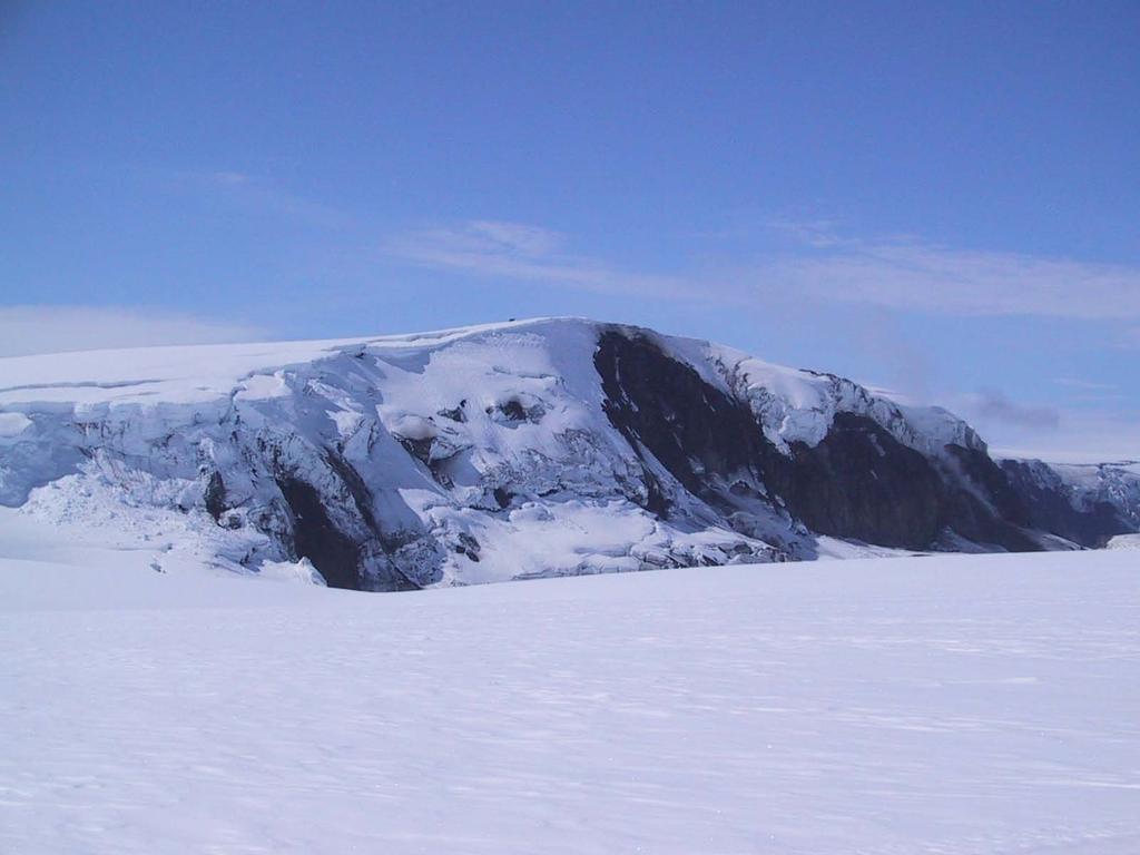
4 From Thordarson and Höskuldsson (23). Subglacial volcanism beneath an ice sheet creates unusual landforms: Tuyas (tablemountains) and ridges. Herðubreið, N-Iceland


5 Submarine eruptions create similar formations. Surtsey eruption, S. of Iceland, Biologicial colonization monitored from the beginning

6 Recent subglacial eruption in Grímsvötn, Vatnajökull ice cap.

7 Jökulsárgljúfur canyons, N. Iceland: Formed in a catastrophic flood from Vatnajökull 25 years ago.


8 Icelandic analogs to hillside gullies on Mars Mars Mars Iceland Iceland Iceland

9 Temperate ice caps cover >1% of Iceland Hofsjökull, 89 km 2 Langjökull 92 km 2 Vatnajökull 8 km 2 Max. thickness: 95 m Mýrdalsjökull 55 km 2 - Dynamic ice caps in a maritime climate. - High accumulation rates (2-4 m w.eq. yr -1 ) - Extensive melting during summer, except at highest elevations (> 18 m) - Mass balance of ice caps negative since : A 415 m ice core was drilled on the NW-part of Vatnajökull Activities not continued at that time, drill was discarded.
10 Mass balance of Hofsjökull Ice Cap 4 2 m H2O Winter balance Summer balance Net balance Cumulative mass balance

11 Climate, Water, Energy: A research project investigating the effect of climate change on energy production in the Nordic countries Temperature increase C CWE uses IPCC data to create scenarios for temperature and precipitation change in the Nordic region in the future
12 Modelled change in volume of Hofsjökull ice cap 2-22, using four different dt and dp scenarios. Modelled glacial meltwater discharge (run-off) 2-22.


13 SINCE 21: NEW EFFORTS IN ICE CORING AND DRILL DESIGN 1 m ice core drilled at Hofsjökull summit,179 m above sea level, using a German-built shallow drill. - What kind of drill design is suitable for coring in temperate ice? - Can annual layers be identified in the cores? - Can climate records be retrieved from the temperate ice caps? m 4-43 m m
14 Polar ice: Temperature below melting point, borehole dry (Deep coring: Liquid dumped in hole, to prevent closure) Temperate ice: At melting point throughout! Meltwater (and rain) seeps down into snow and firn, and is present in small veins on crystal boundaries below the firn-ice boundary! Water table in ice cap!.9 Density [g/cm ] Firn-ice boundary (! =.83 g/cm 3 ) Ice becomes impermeable Drill hole water-filled below firn-ice boundary! Depth [m] Hofsjökull density profile

15 Shallow ice core drill built at the Alfred Wegener Institute in Germany 1 m Antitorque Motor Hatches Core barrel Dry hole: Chips fall through hatches and are collected in upper part of barrel. Core length ~ 1 m. This system does not work well in a water-filled hole, where: Drill head - Motor must be water-protected - Travel time up & down in water column must be >.5 m/s - Chips chamber must be designed in a different way
 1..8.6 Hofsjökull water table.4.2. 2 4 6 8 1 12 Depth (m) Core length in each drilling run increases with new system!")
16 A different design was tested with success on the ice shelf covering the Grímsvötn subglacial lake in Grímsvötn water table Core length drilled in each run Hofsjökull 21 Grímsvötn 22 Core length (m) Hofsjökull water table Depth (m) Core length in each drilling run increases with new system!
17 δ 18 O = 18 O/ 16 O sample - 18 O/ 16 O SMOW 18 O/ 16 O SMOW x 1 LOCATION ALT T m δ 18 O SMOW. Reykjavík 14 m 4.4 C - 8. Hofsjökull, Iceland 18 m ~ - 6 C Greenland summit 32 m - 32 C - 35.
![Hofsjökull δ 18 O profile (-2 m) 21 5 2 Depth [m] 1 1999 Summer](/docs-images/81/84588660/images/18-0.jpg "surface 1998 15 1997 Summer surfaces determined from: 2-16 -14-12 -1!")
![18 O [ ] 1996 - annual mass balance measurements - dust measurements](/docs-images/81/84588660/images/18-1.jpg "on core Identification of annual layers from δ 18 O data not")
18 Hofsjökull δ 18 O profile (-2 m) Depth [m] Summer surface Summer surfaces determined from: ! 18 O [ ] annual mass balance measurements - dust measurements on core Identification of annual layers from δ 18 O data not straightforward!
19 Na + Cl - SO 4 2- Ca ++ NO Marine aerosol dominates. Washout occurs during first melting season! Meltlayer % x1 DEP conductivity -6 (µs/m) 15 2


20 Lava fields and sandy deserts in the interior are snow covered in winter, but snowfree 2-3 months during summer: Windblown dust covers ice caps in late summer! (Ó. Arnalds et al. 1997)
21 Temperature, stratigraphy and dust concentration in a 15 m snow core at drill site May F D_pi [m] F F G F summer surface G H G F F G G 21 summer surface T [ C] Ryk 1 cm [ppmv] Dust [ppmv]

 1986 1985 1984 1983?")
22 Hekla 17. janúar Dustpeaks allow identification of annual layers Volcanic ash layers provide reference horizons D_pi (m) ? Hekla 17. ágúst 198 Grímsvötn eruption November 2 24 Dust concentration (ppmv)
23 Hofsjökull 21: Dust concentration and oxygen isotopes
 5 Comparison with the precipitation record from Hveravellir weather station (65 m a.s.l.), 35 km west of drilling site. Measured annual layer thicknesses.")
24 2 D?pi (m) Net accumulation from ice core Accumulation - yearly mass balance measurements Hveravellir precipitation ?ykkt árlags (m) 5 Comparison with the precipitation record from Hveravellir weather station (65 m a.s.l.), 35 km west of drilling site. Measured annual layer thicknesses. Correction for density differences and plastic thinning of layers with depth yields net mass balance at drilling site
25 ! 18 O [ ] - Hofsjökull ice core Mean annual temperature (Sept-Aug) - Hveravellir! 18 O values - Hofsjökull ice core Hveravellir mean temperature [ C ] Year (September-August)! 18 O [ ] - Hofsjökull ice core ! 18 O =.37 * T [ ] r 2 =.29 Mean annual values of δ 18 O in ice core correlate with mean annual temperature at Hveravellir Mean annual T (Sept-Aug), Hveravellir [ C ]
26 How many annual layers are preserved in the Icelandic ice caps? Sandwich model simple model that describes the thinning of annual layers with depth. Assumes vertical strain rate constant throughout ice sheet.! y H t(y) = H ë H ln H y ë H y H Change in annual layer thickness (λ) with depth ë = y y ë H H x λ Η λ
27 y Dansgaard-Johnsen model: More sophisticated model that does not assume constant vertical strain rate. Melting at the bed can be assumed in model y h! v " y! y! v " y! y Sandwich model: Vertical strain rate constant from surface to bedrock (unrealistic in lower part) Dansgaard-Johnsen model: Vertical strain rate constant down to distance h above bed, but decreases linearly with depth to below h.

28 Results for Hofsjökull summit (H = 3 m, λ H = 3.6 m ice) 5 year record could be retrieved, and annual layers still detectable at 27 m! x h y t k a h k a y k t H y h a kh y k a k kh a kh H k a k kh k a k kh t!! + " " " " # $ % % % % & ' + ( + " # $ % & ' =!! " " " " " # $ % % % % % & ' + ( " " # $ % % & ' + + ( " " # $ % % & ' + + = ' ' ' ln !!!!! " # $ $ $ $ $ % & + '!! " # $ $ % & + + '!! " # $ $ % & + + = ln 2 1 ' a kh h k a k kh a kh H k a k kh k a k kh t Age vs depth relationship according to the Dansgaard-Johnsen model
 Model results at 7 m depth: 11 years old ice Annual layers 17 cm thick Depth (m) 2 4 Bár!")
29 Bárðarbunga, NW Vatnajökull (2 m a.s.l.) Model results at 7 m depth: 11 years old ice Annual layers 17 cm thick Depth (m) 2 4 Bár! arbunga Depth (m) Bár!arbunga Age (yr) Annual layer thickness (m)
30 - New drill being built in Iceland, operational in 25. The drill could be made available for coring efforts on temperate or polythermal ice caps elsewhere (Svalbard, Scandinavia, Patagonia) - Ice cores from temperate ice caps in Iceland can be accurately dated - Proxy records for precipitation and temperature can be obtained - A 5 year record could be retrieved with a 3 m drilling at the summit of Hofsjökull - A record covering historical time in Iceland (87 AD present) could be retrieved with a deep drilling (>7 m) in the ice-filled caldera at Bárðarbunga, Vatnajökull ice cap
31 * The Grímsvötn volcanic caldera beneath the Vatnajökull ice cap: Powerful geothermal system, frequent eruptions. Steady melting of ice from below, up to 3 m thick ice shelf covers a subglacial lake that empties out in jökulhlaups every few years. 115 m kjarni Vatnajökull (8 km 2 ) * Drilling site in Grímsvötn 22


32 Lake Vostok: The largest of ~7 subglacial lakes beneath the Antarctic ice cap Flat ice sheet surface above lake Plans to sample the lake under development. Lake Vostok possibly hosts microbial life, isolated from other life on Earth over millions of years. Webpage: Subglacial Antarctic Lake Exploration:


33 Vostok core reaches 42, years back in time. Drilling was stopped 15 m above the subglacial lake, after drilling 7 m into ice accreted to the base of the ice sheet. Microbes were found in the accreted ice. Kerosene was used as a drilling fluid, and hence biological contamination cannot be ruled out.
: Microscopic liquid veins on the boundary between three crystals in deep Antarctic ice are microbial habitats!")
34 Recent hypothesis (P.B. Price): Microscopic liquid veins on the boundary between three crystals in deep Antarctic ice are microbial habitats! Psychrophilic bacteria can move in the veins and obtain energy and carbon from ions in solution.

35 * Grímsvötn 22: Vatnajökull (8 km 2 ) Core drilling to 115 m and hot water drilling through 28 m thick ice shelf to sample the subglacial lake for a biological study. 115 m kjarni * Drilling site in Grímsvötn 22
 2 1999 1998 1997 1996 1995 1994?")


36 Dýpi (m) No dustpeak No dustpeak 1 15 Dust concentration (ppmv) ? ? Hekla 2 Hekla 1991 Hekla cm Hofsjökull ice core 43 m 65 m 81 m 1 m 33 annual layers identified with dust measurements Rapid crystal growth! 3 year old crystals at 1 m equal in diameter to 1, year old crystals at 285 m depth in the Greenland ice sheet.

: ~ 1-5 mm 2 /yr ~ 1-3 mm 2 /yr")


37 Growth rates in top 1 m: Comparison of Hofsjökull / Vatnajökull data with polar locations. East Antarctica (T = - 55 C): Greenland summit (T = -32 C): ~ 1-5 mm 2 /yr ~ 1-3 mm 2 /yr Grímsvötn: Hofsjökull/Vatnajökull (T = C): ~ 1 2 mm 2 /yr The effect of high concentrations of dust on crystal growth appears similar in both polar and temperate ice! 67 m Within dust layer 95 m Dust: 1 5 µm 98 m
 Brian Lanoil (UC Riverside) Th. Thorsteinsson (NEA / U.")
38 22: Hot water drilling into the Grímsvötn subglacial lake Investigators: Eric Gaidos (U. of Hawaii) Brian Lanoil (UC Riverside) Th. Thorsteinsson (NEA / U. of Iceland)
39 Grímsvötn Caldera Lake Altitude = 14 m Volume of ~1-5 km 3 Depth of 15 m Ice cover of 25 m Glacial drainage basin of 3 km MW over 1 km 2 Episodic drainage (1 km 1 4 m 3 sec -1 )
40
41 Project Goals 1) Determine if there is an active microbial community in the lake 2) Identify dominant lineages/species using molecular techniques 3) Assay community potential to fix carbon and nitrogen

42

43 DAPI CELL COUNTS M a i n T i t l e 1. E E + 7 I c e C o r e S n o w B o r e h o l e A B o r e h o l e B L a k e s e d i m e n t A L a k e s e d i m e n t B L a k e s e d i m e n t C 1. E + 6 B o r e h o l e B 2 B o r e h o l e C a f t e r p e n e t r a t i o n c e l l s / m l 1. E + 5 L a k e W L a k e W L a k e W J a c u z z i a t e r A a t e r B a t e r C 1. E + 4 J a c u z z i V e n t 1. E + 3 R o w 6
44 1. E E E E + 7 c e l l s / g r a m 1. E E E + 4 G r i s m - O c e a n O c e a n L a c u s - F o r e s t F o r e s t M a r i n e A g s o i l s v o t n > 2 < 2 t r i n e s o i l > 1 s o i l < 1 s e d i m e m m m m n t s source: Whitman et al. (1998)
45 Main results of 22 pilot study on Grímsvötn subglacial lake: - Microorganisms in lake water and bottom sediment - DNA analysis indicates that the lake community is distinct from communities in the snow and ice - Gene sequences highly similar to known psychrophilic organisms Paper on results can be downloaded at:
.")
46 Future work: We hope to carry out a 4 year program sampling the Grímsvötn lake and the nearby Skaftá cauldrons (beneath 5 m thick ice cover). A new hot water drill has been built in Iceland for this purpose.
Ice on Earth: An overview and examples on physical properties
 Ice on Earth: An overview and examples on physical properties - Ice on Earth during the Pleistocene - Present-day polar and temperate ice masses - Transformation of snow to ice - Mass balance, ice deformation,
Waterways from glaciers to coastal waters in Iceland. Jórunn Harðardóttir, IMO Nordic WFD conference September 26, 2012
 Waterways from glaciers to coastal waters in Iceland Jórunn Harðardóttir, IMO Nordic WFD conference September 26, 2012 What to include and what not to include? Hydrology of Iceland Much on glaciers and
Paleoceanography Spring 2008
 MIT OpenCourseWare http://ocw.mit.edu 12.740 Paleoceanography Spring 2008 For information about citing these materials or our Terms of Use, visit: http://ocw.mit.edu/terms. PALEOCEANOGRAPHY 12.740 SPRING
Ice Cap Glaciers in the Arctic Region. John Evans Glacier, Ellesmere Island (Robert Bingham, U. Aberdeen)
") Ice Cap Glaciers in the Arctic Region John Evans Glacier, Ellesmere Island (Robert Bingham, U. Aberdeen) Iceland Svalbard Ellesmere and Baffin Islands Severny and Anzhu Islands Topics: Temperate vs non-temperate
Ice Cap Glaciers in the Arctic Region John Evans Glacier, Ellesmere Island (Robert Bingham, U. Aberdeen) Iceland Svalbard Ellesmere and Baffin Islands Severny and Anzhu Islands Topics: Temperate vs non-temperate
The impact of climate change on glaciers and glacial runoff in the Nordic countries
 The impact of climate change on glaciers and glacial runoff in the Nordic countries Tómas Jóhannesson, Guðfinna Aðalgeirsdóttir, Andreas Ahlstrøm, Liss M. Andreassen, Stein Beldring, Helgi Björnsson, Philippe
Any Questions? Glacier
 Geology of the Hawaiian Islands Class 25 13 April 2004 Any Questions? Earth Systems Today CD Click on Weather and Climate Look at the sections on El Niño Ozone Hole Glaciers Why do we care? They help control
Glaciers. Geology of the Hawaiian Islands. Any Questions? Earth Systems Today CD. Class April Why do we care?
 Geology of the Hawaiian Islands Class 25 13 April 2004 Any Questions? Earth Systems Today CD Click on Weather and Climate Look at the sections on El Niño Ozone Hole Glaciers Why do we care? They help control
Glacier Hydrology. Why should you care?
 Glacier Hydrology Why should you care? Climate Local Meteorology Surface Mass And Energy Exchange Net Mass Balance Dynamic Response Effect on Landscape Changes In Geometry Water Flow PRACTICAL MATTERS:
A) B) C) D) 4. Which diagram below best represents the pattern of magnetic orientation in the seafloor on the west (left) side of the ocean ridge?
 B) C) D) 4. Which diagram below best represents the pattern of magnetic orientation in the seafloor on the west (left) side of the ocean ridge?") 1. Crustal formation, which may cause the widening of an ocean, is most likely occurring at the boundary between the A) African Plate and the Eurasian Plate B) Pacific Plate and the Philippine Plate C)
1. Crustal formation, which may cause the widening of an ocean, is most likely occurring at the boundary between the A) African Plate and the Eurasian Plate B) Pacific Plate and the Philippine Plate C)
Outline 24: The Holocene Record
 Outline 24: The Holocene Record Climate Change in the Late Cenozoic New York Harbor in an ice-free world (= Eocene sea level) Kenneth Miller, Rutgers University An Ice-Free World: eastern U.S. shoreline
Climate Change. Unit 3
 Climate Change Unit 3 Aims Is global warming a recent short term phenomenon or should it be seen as part of long term climate change? What evidence is there of long-, medium-, and short- term climate change?
/ Past and Present Climate
 MIT OpenCourseWare http://ocw.mit.edu 12.842 / 12.301 Past and Present Climate Fall 2008 For information about citing these materials or our Terms of Use, visit: http://ocw.mit.edu/terms. Ice Sheet Paleoclimatology
Lecture 21: Glaciers and Paleoclimate Read: Chapter 15 Homework due Thursday Nov. 12. What we ll learn today:! Learning Objectives (LO)
") Learning Objectives (LO) Lecture 21: Glaciers and Paleoclimate Read: Chapter 15 Homework due Thursday Nov. 12 What we ll learn today:! 1. 1. Glaciers and where they occur! 2. 2. Compare depositional and
Learning Objectives (LO) Lecture 21: Glaciers and Paleoclimate Read: Chapter 15 Homework due Thursday Nov. 12 What we ll learn today:! 1. 1. Glaciers and where they occur! 2. 2. Compare depositional and
Practice Questions: Plate Tectonics
 Practice Questions: Plate Tectonics 1. Base your answer to the following question on The block diagram below shows the boundary between two tectonic plates. Which type of plate boundary is shown? A) divergent
How do glaciers form?
 Glaciers What is a Glacier? A large mass of moving ice that exists year round is called a glacier. Glaciers are formed when snowfall exceeds snow melt year after year Snow and ice remain on the ground
Energy Systems, Structures and Processes Essential Standard: Analyze patterns of global climate change over time Learning Objective: Differentiate
 Energy Systems, Structures and Processes Essential Standard: Analyze patterns of global climate change over time Learning Objective: Differentiate between weather and climate Global Climate Focus Question
CORRELATION OF CLIMATIC AND SOLAR VARIATIONS OVER THE PAST 500 YEARS AND PREDICTING GLOBAL CLIMATE CHANGES FROM RECURRING CLIMATE CYCLES
 Easterbrook, D.J., 2008, Correlation of climatic and solar variations over the past 500 years and predicting global climate changes from recurring climate cycles: International Geological Congress, Oslo,
Social Studies. Chapter 2 Canada s Physical Landscape
 Social Studies Chapter 2 Canada s Physical Landscape Introduction Canada s geography its landforms and climate - has a great impact on Canadians sense of identity. Planet Earth The earth is divided into
Supplementary Materials for
 advances.sciencemag.org/cgi/content/full/3/12/e1701169/dc1 Supplementary Materials for Abrupt shift in the observed runoff from the southwestern Greenland ice sheet Andreas P. Ahlstrøm, Dorthe Petersen,
The footprints of climate change within the geologic record show clearly that
 The footprints of climate change within the geologic record show clearly that Climate change throughout Earth history warms suddenly and cools slowly in erratic sequences that are not cyclic The footprints
Climate and Environment
 Climate and Environment Oxygen Isotope Fractionation and Measuring Ancient Temperatures Oxygen Isotope Ratio Cycles Oxygen isotope ratio cycles are cyclical variations in the ratio of the mass of oxygen
Global climate change
 Global climate change What is climate change? This winter was really cold! Temp difference ( C): Jan 2004 vs. Jan 2002-2003 Make your own maps at: http://www.giss.nasa.gov/data/update/gistemp/maps/ 1 What
Circulation and thermodynamics in a subglacial geothermal lake under the Western Skaftá cauldron of the Vatnajökull ice cap, Iceland
 Click Here for Full Article GEOPHYSICAL RESEARCH LETTERS, VOL. 34, L19502, doi:10.1029/2007gl030686, 2007 Circulation and thermodynamics in a subglacial geothermal lake under the Western Skaftá cauldron
Brita Horlings
 Knut Christianson Brita Horlings brita2@uw.edu https://courses.washington.edu/ess431/ Natural Occurrences of Ice: Distribution and environmental factors of seasonal snow, sea ice, glaciers and permafrost
Glaciers and Ice Ages
 ES 106 Glaciers and Ice Ages I. Glacier thick mass of ice accumulated over years, decades, centuries A. Function of recrystallization of fallen snow B. Types 1. alpine valley: a. high elevations worldwide
Supplemental Information for. Thompson, L.G., et al. Ice Core Records of Climate Variability on the Third Pole
 1 1 2 3 4 5 6 7 8 Supplemental Information for Thompson, L.G., et al. Ice Core Records of Climate Variability on the Third Pole with Emphasis on the Guliya ice cap, western Kunlun Mountains 9 10 11 12
STA4000 Final Report - Detailed Analysis Investigation on Iceland Population Growth and Climate Change
 STA4000 Final Report - Detailed Analysis Investigation on Iceland Population Growth and Climate Change CHEN Jian Supervisor: Professor Jeffrey S. Rosenthal December 16, 2009 1 Introduction This paper is
Glacial Modification of Terrain
 Glacial Modification Part I Stupendous glaciers and crystal snowflakes -- every form of animate or inanimate existence leaves its impress upon the soul of man. 1 -Orison Swett Marden Glacial Modification
(version 3) I. HumAN -Environment Interaction
 I. HumAN -Environment Interaction") (version 3) I. HumAN -Environment Interaction A. Landforms 1. Earth s topography is made up of many different types of landforms. 2. While the planet is covered primarily with water, the four major types
(version 3) I. HumAN -Environment Interaction A. Landforms 1. Earth s topography is made up of many different types of landforms. 2. While the planet is covered primarily with water, the four major types
1. Deglacial climate changes
 Review 3 Major Topics Deglacial climate changes (last 21,000 years) Millennial oscillations (thousands of years) Historical Climate Change (last 1000 years) Climate Changes Since the 1800s Climate Change
Dating of Greenland ice cores by microparticle concentration analyses. C. U. Hammer
 Dating of Greenland ice cores by microparticle concentration analyses C. U. Hammer Abstract. Seasonal variations of microparticle concentration in 6000 samples were compared with S( 18 0) and gross ^-activity
On Notation Thermodynamics of Glaciers. Types of Glaciers. Why we care. McCarthy Summer School
 On Notation Thermodynamics of Glaciers McCarthy Summer School Andy Aschwanden Geophysical nstitute University of Alaska Fairbanks, USA (hopefully) consistent with Continuum Mechanics (Truffer) with lots
Lecture Outlines PowerPoint. Chapter 6 Earth Science 11e Tarbuck/Lutgens
 Lecture Outlines PowerPoint Chapter 6 Earth Science 11e Tarbuck/Lutgens 2006 Pearson Prentice Hall This work is protected by United States copyright laws and is provided solely for the use of instructors
Loess and dust. Jonathan A. Holmes Environmental Change Research Centre
 Loess and dust Jonathan A. Holmes Environmental Change Research Centre Why is dust important? Mineral dust is an important constituent of the solid load in Earth's atmosphere, the total atmospheric aerosol
LAB J - WORLD CLIMATE ZONES
 Introduction LAB J - WORLD CLIMATE ZONES The objective of this lab is to familiarize the student with the various climates around the world and the climate controls that influence these climates. Students
Climate Change in the Northeast: Past, Present, and Future
 Climate Change in the Northeast: Past, Present, and Future Dr. Cameron Wake Institute for the Study of Earth, Oceans, and Space (EOS) University of New Hampshire 62nd Annual Meeting of the Northeastern
Lecture 10 Glaciers and glaciation
 Lecture 10 Glaciers and glaciation Outline Importance of ice to people! Basics of glaciers formation, classification, mechanisms of movement Glacial landscapes erosion and deposition by glaciers and the
NSF: Natural and Anthropogenic Climate Impacts as Evidenced in Ice Cores
 LIVE INTERACTIVE LEARNING @ YOUR DESKTOP NSF: Natural and Anthropogenic Climate Impacts as Evidenced in Ice Cores Presented by: Dr. Joseph McConnell and Linda Morris May 2, 2012 Natural and Anthropogenic
Grade 8 Science. Unit 1: Water Systems on Earth Chapter 1
 Grade 8 Science Unit 1: Water Systems on Earth Chapter 1 Effects of Water? Churchill River Large Ocean Wave How do you use water? House Hold Use Personal Use Recreational Activities Water Distribution
Prentice Hall EARTH SCIENCE
 Prentice Hall EARTH SCIENCE Tarbuck Lutgens Chapter 21 Climate 21.1 Factors That Affect Climate Factors That Affect Climate Latitude As latitude increases, the intensity of solar energy decreases. The
Meltdown Evidence of Climate Change from Polar Science. Eric Wolff
 Meltdown Evidence of Climate Change from Polar Science Eric Wolff (ewwo@bas.ac.uk) Why are the polar regions important for climate? Heat engine Why are the polar regions important for climate? Heat engine
Rapid climate change in ice cores
 Rapid climate change in ice cores Liz Thomas British Antarctic Survey Overview Introduction to ice cores Evidence of rapid climate change in the Greenland ice cores DO events Younger Dryas 8.2 kyr cold
Prentice Hall EARTH SCIENCE
 Prentice Hall EARTH SCIENCE Tarbuck Lutgens Chapter 21 Climate 21.1 Factors That Affect Climate Factors That Affect Climate Latitude As latitude increases, the intensity of solar energy decreases. The
Rapid evolution of a proglacial coastal lake
 Rapid evolution of a proglacial coastal lake 20 th and 21 th century changes in Jökulsárlón at Breiðamerkursandur, Vatnajökull, Iceland 1 Sverrir Guðmundsson 1 Helgi Björnsson 1 Finnur Pálsson 2 Etienne
ICE CORES AND CLIMATE
 ICE CORES AND CLIMATE Media Either Hype Complex, Slow Events. Introduction to Glaciology Þröstur Þorsteinsson ThrosturTh@hi.is CLIMATE RECORDS Throstur Thorsteinsson ThrosturTh@hi.is Environment and Natural
A journey through the earth history of Australia s Coastal Wilderness Part 3 The backdrop - a 70 million year old plain
 A journey through the earth history of Australia s Coastal Wilderness Part 3 The backdrop - a 70 million year old plain Monaro Plain 3. The Cretaceous Plain The western horizon behind Moruya is dominated
Activity 2.2: Recognizing Change (Observation vs. Inference)
") Activity 2.2: Recognizing Change (Observation vs. Inference) Teacher Notes: Evidence for Climate Change PowerPoint Slide 1 Slide 2 Introduction Image 1 (Namib Desert, Namibia) The sun is on the horizon
Activity 2.2: Recognizing Change (Observation vs. Inference) Teacher Notes: Evidence for Climate Change PowerPoint Slide 1 Slide 2 Introduction Image 1 (Namib Desert, Namibia) The sun is on the horizon
Thermodynamics of Glaciers
 Thermodynamics of Glaciers McCarthy Summer School, June 2010 Andy Aschwanden Arctic Region Supercomputing Center University of Alaska Fairbanks, USA McCarthy Summer School, June 2010 1 / 34 On Notation
IMPULSIVE NITRATE DEPOSITION EVENTS IN POLAR ICE THE RESULT OF SOLAR PROTON EVENTS. D. F. Smart and M. A. Shea SYNOPSIS
 IMPULSIVE NITRATE DEPOSITION EVENTS IN POLAR ICE THE RESULT OF SOLAR PROTON EVENTS D. F. Smart and M. A. Shea Emeritus at AFRL (RVBXS), Bedford, MA, 01731, USA SYNOPSIS The endothermic chemical reaction
Glaciology (as opposed to Glacial Geology) Why important? What are glaciers? How do they work?
 Why important? What are glaciers? How do they work?") Glaciology (as opposed to Glacial Geology) Why important? What are glaciers? How do they work? Glaciers are important because of their role in creating glacial landscapes (erosional and depositional features).
Glaciology (as opposed to Glacial Geology) Why important? What are glaciers? How do they work? Glaciers are important because of their role in creating glacial landscapes (erosional and depositional features).
Assessment of possible jôkulhlaups from Lake Demmevatn in Norway
 The Eslrciui's of flu' Extremes: Eflraortlinarv Floods (Proceedings of ;i svinposinm held ill Reykjavik. Iceland. July 2000). IAliSPubl.no. 271. 2002. 31 Assessment of possible jôkulhlaups from Lake Demmevatn
Ch 17 Plate Tectonics Big Idea: Most geologic activity occurs at the boundaries between plates.
 Ch 17 Plate Tectonics Big Idea: Most geologic activity occurs at the boundaries between plates. 17.1 Drifting Continents 17.2 Seafloor Spreading 17.3 Plate Boundaries 17.4 Causes of Plate Motions Learning
Processes affecting continental shelves
 Marine Sediments Continental Shelves Processes affecting continental shelves 1. Glaciation 2. Sea-level change (±130 m during continental glaciation) 3. Waves and currents 4. Sedimentation 5. Carbonate
Welcome to ATMS 111 Global Warming.
 Welcome to ATMS 111 Global Warming http://www.atmos.washington.edu/2010q1/111 Isotopic Evidence 16 O isotopes "light 18 O isotopes "heavy" Evaporation favors light Rain favors heavy Cloud above ice is
Subglacial Access Working Group Access Drilling Priorities in Subglacial Aquatic Environments
 Subglacial Access Working Group Access Drilling Priorities in Subglacial Aquatic Environments 1) Summary: Subglacial hydrodynamics are an important yet poorly understood factor in ice sheet dynamics in
I. Earth s Layers a. Crust: Earth s outside layer. Made of mostly rock. i. Continental: er; made of mostly granite, forms the continents and shallow
 I. Earth s Layers a. Crust: Earth s outside layer. Made of mostly rock. i. Continental: er; made of mostly granite, forms the continents and shallow sea beds, floats! ii. Oceanic: er; dense rock such as
Energy balance and melting of a glacier surface
 Energy balance and melting of a glacier surface Vatnajökull 1997 and 1998 Sverrir Gudmundsson May 1999 Department of Electromagnetic Systems Technical University of Denmark Science Institute University
WHAT IS THE EARTH MADE OF? LITHOSPHERE AND HYDROSPHERE
 UNIT 8 WHAT IS THE EARTH MADE OF? LITHOSPHERE AND HYDROSPHERE TABLE OF CONTENTS 1 THE STRUCTURE OF THE EARTH... 2 2 THE FORMATION OF THE RELIEF: INTERNAL AND EXTERNAL FORCES.... 2 2.1 Internal forces:
World Geography Chapter 3
 World Geography Chapter 3 Section 1 A. Introduction a. Weather b. Climate c. Both weather and climate are influenced by i. direct sunlight. ii. iii. iv. the features of the earth s surface. B. The Greenhouse
Natural and anthropogenic climate change Lessons from ice cores
 Natural and anthropogenic climate change Lessons from ice cores Eric Wolff British Antarctic Survey, Cambridge ewwo@bas.ac.uk ASE Annual Conference 2011; ESTA/ESEU lecture Outline What is British Antarctic
Chapter 5: Glaciers and Deserts
 I. Glaciers and Glaciation Chapter 5: Glaciers and Deserts A. A thick mass of ice that forms over land from the compaction and recrystallization of snow and shows evidence of past or present flow B. Types
Continental Drift. & Plate Tectonics
 Continental Drift & Plate Tectonics Alfred Wegener, a German scientist, proposed the hypothesis of CONTINENTAL DRIFT, in 1912. Hypothesis stated: All Earth s continents were once a single landmass (Pangaea)
Chapter 1 Section 2. Land, Water, and Climate
 Chapter 1 Section 2 Land, Water, and Climate Vocabulary 1. Landforms- natural features of the Earth s land surface 2. Elevation- height above sea level 3. Relief- changes in height 4. Core- most inner
Glaciological Models in Focus
 Department of Probability and Statistics, University of Sheffield British Antarctic Survey, Cambridge Quantifying Uncertainty on Chronologies for Palaeoclimate Reconstruction from Ice Cores Glaciological
Land Surface Sea Ice Land Ice. (from Our Changing Planet)
") Lecture 5: Land Surface and Cryosphere (Outline) Land Surface Sea Ice Land Ice (from Our Changing Planet) Earth s s Climate System Solar forcing Atmosphere Ocean Land Solid Earth Energy, Water, and Biochemistry
Lecture 5: Land Surface and Cryosphere (Outline) Land Surface Sea Ice Land Ice (from Our Changing Planet) Earth s s Climate System Solar forcing Atmosphere Ocean Land Solid Earth Energy, Water, and Biochemistry
NATS 101 Section 13: Lecture 32. Paleoclimate
 NATS 101 Section 13: Lecture 32 Paleoclimate Natural changes in the Earth s climate also occur at much longer timescales The study of prehistoric climates and their variability is called paleoclimate.
Earth s Climate System. Surface Albedo. Climate Roles of Land Surface. Lecture 5: Land Surface and Cryosphere (Outline) Land Surface Sea Ice Land Ice
 Land Surface Sea Ice Land Ice") Lecture 5: Land Surface and Cryosphere (Outline) Earth s Climate System Solar forcing Land Surface Sea Ice Land Ice Atmosphere Ocean Land Solid Earth Energy, Water, and Biochemistry Cycles (from Our Changing
Lecture 5: Land Surface and Cryosphere (Outline) Earth s Climate System Solar forcing Land Surface Sea Ice Land Ice Atmosphere Ocean Land Solid Earth Energy, Water, and Biochemistry Cycles (from Our Changing
Chapter 15 Millennial Oscillations in Climate
 Chapter 15 Millennial Oscillations in Climate This chapter includes millennial oscillations during glaciations, millennial oscillations during the last 8000 years, causes of millennial-scale oscillations,
6. What has been the most effective erosive agent in the climate system? a. Water b. Ice c. Wind
 Multiple Choice. 1. Heinrich Events a. Show increased abundance of warm-water species of planktic foraminifera b. Show greater intensity since the last deglaciation c. Show increased accumulation of ice-rafted
Sustainable Energy Science and Engineering Center GEOTHERMAL ENERGY. Sustainable Energy Sources. Source:
 Sustainable Energy Sources GEOTHERMAL ENERGY Earth s Temperature Profile GEOTHERMAL ENERGY Plate Tectonics Earth's crust is broken into huge plates that move apart or push together at about the rate our
Earthquakes. Earthquakes are caused by a sudden release of energy
 Earthquakes Earthquakes are caused by a sudden release of energy The amount of energy released determines the magnitude of the earthquake Seismic waves carry the energy away from its origin Fig. 18.1 Origin
Glaciers. (Shaping Earth s Surface, Part 6) Science 330 Summer 2005
 Science 330 Summer 2005") Glaciers (Shaping Earth s Surface, Part 6) Science 330 Summer 2005 1 Glaciers Glaciers are parts of two basic cycles Hydrologic cycle Rock cycle Glacier a thick mass of ice that originates on land from
Glaciers (Shaping Earth s Surface, Part 6) Science 330 Summer 2005 1 Glaciers Glaciers are parts of two basic cycles Hydrologic cycle Rock cycle Glacier a thick mass of ice that originates on land from
A new deep ice core from Akademii Nauk ice cap, Severnaya Zemlya, Eurasian Arctic: first results
 A new deep ice core from Akademii Nauk ice cap, Severnaya Zemlya, Eurasian Arctic: first results DIEDRICH FRITZSCHE 1, FRANK WILHELMS 2, LEV M. SAVATYUGIN 3, JEAN FRANCIS PINGLOT 4, HANNO MEYER 1, HANS-WOLFGANG
Factors That Affect Climate
 Factors That Affect Climate Factors That Affect Climate Latitude As latitude (horizontal lines) increases, the intensity of solar energy decreases. The tropical zone is between the tropic of Cancer and
Prentice Hall EARTH SCIENCE
 Prentice Hall EARTH SCIENCE Tarbuck Lutgens Chapter 7 Glaciers, Desert, and Wind 7.1 Glaciers Types of Glaciers A glacier is a thick ice mass that forms above the snowline over hundreds or thousands of
TAKE HOME EXAM 8R - Geology
 Name Period Date TAKE HOME EXAM 8R - Geology PART 1 - Multiple Choice 1. A volcanic cone made up of alternating layers of lava and rock particles is a cone. a. cinder b. lava c. shield d. composite 2.
Introduction to Global Warming
 Introduction to Global Warming Cryosphere (including sea level) and its modelling Ralf GREVE Institute of Low Temperature Science Hokkaido University Sapporo, 2010.09.14 http://wwwice.lowtem.hokudai.ac.jp/~greve/
Orbital-Scale Interactions in the Climate System. Speaker:
 Orbital-Scale Interactions in the Climate System Speaker: Introduction First, many orbital-scale response are examined.then return to the problem of interactions between atmospheric CO 2 and the ice sheets
GEOSCIENCE 105 THE DYNAMIC EARTH FIRST ONE-HOUR EXAMINATION. Tuesday, October 20, 1998 NAME STUDENT #
 GEOSCIENCE 105 THE DYNAMIC EARTH FIRST ONE-HOUR EXAMINATION Tuesday, October 20, 1998 NAME STUDENT # Instructions: 1. Answer all questions legibly. 2. Put your name and student number on this front page.
Climate change and adaptation of the aviation community
 Climate change and adaptation of the aviation community Sigrún Karlsdóttir, Halldór Björnsson, Trausti Jónsson Icelandic Meteorological Office International Air Safety & Climate Change conference EASA
ATOC OUR CHANGING ENVIRONMENT
 ATOC 1060-002 OUR CHANGING ENVIRONMENT Class 22 (Chp 15, Chp 14 Pages 288-290) Objectives of Today s Class Chp 15 Global Warming, Part 1: Recent and Future Climate: Recent climate: The Holocene Climate
Watch for Week 8/9 Review Assessment
 Wednesday, October 25, 2017 Exam 2 results, key is posted on the main course website. Please check to make sure there are no errors in the scoring of the Scantron portion of the exam (note the scantron
Chapter 2: Physical Geography
 Chapter 2: Physical Geography Pg. 39-68 Learning Goals for Chp2: q q q q q Explain how the Earth moves in space and why seasons change. Outline the factors that influence climate and recognize different
Climate Change 2007: The Physical Science Basis
 Climate Change 2007: The Physical Science Basis Working Group I Contribution to the IPCC Fourth Assessment Report Presented by R.K. Pachauri, IPCC Chair and Bubu Jallow, WG 1 Vice Chair Nairobi, 6 February
Thomas P. Phillips CIRES Prof K. Steffen, L. Colgan PhD ABD, D. McGrath MA
 Thomas P. Phillips CIRES Prof K. Steffen, L. Colgan PhD ABD, D. McGrath MA Problem: we know very little about the processes happening within the Greenland Ice Sheet. What is the velocity at the base? What
We re living in the Ice Age!
 Chapter 18. Coping with the Weather: Causes and Consequences of Naturally Induce Climate Change 지구시스템의이해 We re living in the Ice Age! 1 Phanerozoic Climate 서늘해지고 더웠고 따뜻했고 3 Climate Rollercoaster 4 2 Time
Today we will discuss global climate: how it has changed in the past, and how the current status and possible future look.
 Global Climate Change Today we will discuss global climate: how it has changed in the past, and how the current status and possible future look. If you live in an area such as the Mississippi delta (pictured)
Name. 4. The diagram below shows a soil profile formed in an area of granite bedrock. Four different soil horizons, A, B, C, and D, are shown.
 Name 1. In the cross section of the hill shown below, which rock units are probably most resistant to weathering? 4. The diagram below shows a soil profile formed in an area of granite bedrock. Four different
Glaciers Earth 9th Edition Chapter 18 Glaciers: summary in haiku form Key Concepts Glaciers Glaciers Glaciers Glaciers
 1 2 3 4 5 6 7 8 9 10 11 12 13 14 Earth 9 th Edition Chapter 18 : summary in haiku form Ten thousand years thence big glaciers began to melt - called "global warming." Key Concepts and types of glaciers.
Chapter 9 Notes: Ice and Glaciers, Wind and Deserts
 Chapter 9 Notes: Ice and Glaciers, Wind and Deserts *Glaciers and Glacial Features glacier is a mass of ice that moves over land under its own weight through the action of gravity Glacier Formation must
Changing Hydrology under a Changing Climate for a Coastal Plain Watershed
 Changing Hydrology under a Changing Climate for a Coastal Plain Watershed David Bosch USDA-ARS, Tifton, GA Jeff Arnold ARS Temple, TX and Peter Allen Baylor University, TX SEWRU Objectives 1. Project changes
The ocean s overall role in climate
 The ocean s overall role in climate - moderates climate in time (diurnally, annually) - redistributes heat spatially in the largescale ocean circulation - lower albedo (sea ice higher albedo) - dry atmosphere
Annual September Arctic Sea ice extent
 Annual September Arctic Sea ice extent 1979-2012 Annual September Arctic Sea ice extent 1979-2012 Notes: The month of September has the minimum sea ice cover each year. Passive microwave instruments on
Today s Lecture: Land, biosphere, cryosphere (All that stuff we don t have equations for... )
") Today s Lecture: Land, biosphere, cryosphere (All that stuff we don t have equations for... ) 4 Land, biosphere, cryosphere 1. Introduction 2. Atmosphere 3. Ocean 4. Land, biosphere, cryosphere 4.1 Land
Today s Lecture: Land, biosphere, cryosphere (All that stuff we don t have equations for... ) 4 Land, biosphere, cryosphere 1. Introduction 2. Atmosphere 3. Ocean 4. Land, biosphere, cryosphere 4.1 Land
Response of Hofsjökull and southern Vatnajökull, Iceland, to climate change
 JOURNAL OF GEOPHYSICAL RESEARCH, VOL. 111,, doi:10.1029/2005jf000388, 2006 Response of Hofsjökull and southern Vatnajökull, Iceland, to climate change G. A*algeirsdóttir, 1,2 T. Jóhannesson, 3 H. Björnsson,
1. Introduction 2. Ocean circulation a) Temperature, salinity, density b) Thermohaline circulation c) Wind-driven surface currents d) Circulation and
 Temperature, salinity, density b) Thermohaline circulation c) Wind-driven surface currents d) Circulation and") 1. Introduction 2. Ocean circulation a) Temperature, salinity, density b) Thermohaline circulation c) Wind-driven surface currents d) Circulation and climate change e) Oceanic water residence times 3.
1. Introduction 2. Ocean circulation a) Temperature, salinity, density b) Thermohaline circulation c) Wind-driven surface currents d) Circulation and climate change e) Oceanic water residence times 3.
Chapter outline. Reference 12/13/2016
 Chapter 2. observation CC EST 5103 Climate Change Science Rezaul Karim Environmental Science & Technology Jessore University of science & Technology Chapter outline Temperature in the instrumental record
2/23/2009. Visualizing Earth Science. Chapter Overview. Deserts and Drylands. Glaciers and Ice Sheets
 Visualizing Earth Science By Z. Merali and B. F. Skinner Chapter 6 Deserts, Glaciers and Ice Sheets Chapter Overview Deserts and Drylands Glaciers and Ice Sheets Deserts Geography Categorization of deserts
POLAR WEEKEND SUBGLACIAL LAKES
 POLAR WEEKEND SUBGLACIAL LAKES TOPIC: AN Unknown Subglacial World CHRISTOPHER SHUMAN, UNIVERSITY OF ADRIENNE BLOCK, LDEO MARYLAND BALTIMORE COUNTY'S GODDARD EARTH SCIENCE AND TECHNOLOGY CENTER PROJECT
Ice core-based climate research in Denmark
 June 16, 2009 Ice core-based climate research in Denmark Sune Olander Rasmussen Center coordinator and postdoc Centre for Ice and Climate Niels Bohr Institute University of Copenhagen Temperature and CO